PolSARpro v4.03 Forest Applications
|
|
|
- Madlyn Dickerson
- 6 years ago
- Views:
Transcription
1 PolSARpro v4.03 Forest Applications Laurent Ferro-Famil Lecture on polarimetric SAR Theory and applications to agriculture & vegetation Thursday 19 April, morning

2 Pol-InSAR Tutorial Forest Application
3 PolSARpro v4.0 SOFTWARE GIMP Google Earth Viewer Display Tools PDF About PolSARpro NEST SRTM PolSARproSIM Ground Small Veg Forest Tutorial on POLSAR and POLinSAR Help Files


4 Lecture Notes Recent Advances in Radar Polarimetry and Polarimetric SAR Interferometry W.M. Boerner 31 pages Basic Concepts in Radar Polarimetry W.M. Boerner 100 pages Advanced Concepts E. Pottier, J.S. Lee, L. Ferro-Famil 65 pages POL-InSAR Training Course S.R. Cloude 44 pages PCT Training Course S.R. Cloude 55 pages

5 Do It Yourself Do It Yourself
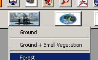
6 PolSARpro v4.0 SOFTWARE PolSARproSIM Ground Small Veg Forest


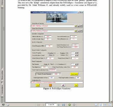
7 PolSARpro v3.31 SOFTWARE PolSARproSim is a rapid, coherent, fully polarimetric and interferometric SAR simulation of forest.


8 PolSARpro SIM The SAR image is evaluated as a coherent sum of scattering events from small elements of the scene Direct-Ground, Direct-Volume and Ground-Volume contributions are included, with both trees and short vegetation comprising Volume terms. DECIDUOUS GV DG DV PINE RANDOM HEDGE Given the map of tree locations and dimensions a grid of points is used to sample the attenuation of the coherent wave in 3D
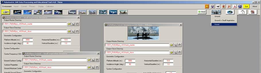

9 PolSARpro Simulators PolSARproSIM
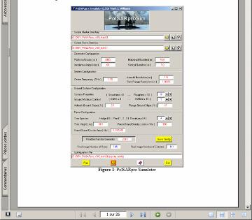
10 PolSARpro Simulators Pol-InSAR Data Geometric configuration Platform altitude : 3000m Incidence angle: 45 Horizontal Baseline : 10m Vertical Baseline : 0m System Configuration Frequency : 1.5 GHz Azimuth resolution : m Range resolution : m Ground Surface Configuration Surface properties : 0 (smoothest) Ground moisture Content : 0 (driest) Azimuth / Range ground slope : 0 % Forest configuration Tree Species : 0 (hedge) Tree Height: 10m Forest stand density : 0.2 Forest Stand Circular Area : 1 Ha


11 PolSARpro Simulators DATA_MASTERDIR DATA_SLAVEDIR config.txt s11.bin, s12.bin s21.bin, s22.bin config.txt s11.bin, s12.bin s21.bin, s22.bin flat_earth.bin kz.bin

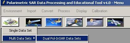
12 PolSARpro v4.0 SOFTWARE PolSARpro Full Software Single Data Set Multi Data Sets Spaceborne Sensors: ALOS, ENVISAT RADARSAT2, TerraSar, SIR-C Airborne Sensors: AIRSAR, Convair, EMISAR ESAR, PISAR, RAMSES PolSARpro Multi Data Sets package
13 MAIN MENU
14 MAIN MENU Environment Display Import Data Process Data Convert Data
15 ENVIRONNEMENT Environment Display Import Data Calibration Assessment Process Data Convert Data
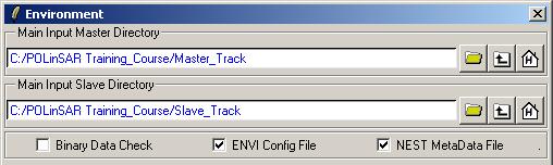
16 ENVIRONNEMENT Configure Data Main Directories location Input Master Directory: C:/POLinSAR_Training_Course/Master_Track Input Slave Directory: C:/POLinSAR_Training_Course/Slave_Track
17 ENVIRONNEMENT Configure Data Main Directory location Automatic Data Check (Null or NaN) Configuration File (ENVI) Image Display Size setting
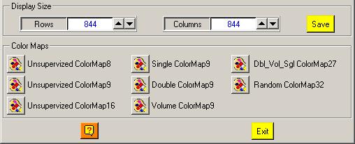


18 ENVIRONNEMENT Color Palette Edition & Modification
19 PROCESS DATA [S2] - MENU
20 PROCESS DATA [S2] - MENU


21 ELEMENTS Do it Yourself: Select some elements, set the parameters and view the corresponding BMP files (select BMP).


22 ELEMENTS DATA_MASTERDIR config.txt s11.bin, s12.bin s21.bin, s22.bin Axy.bin, Ixy.bin Ixy_db.bin sxy_pha.bin Axy.bmp, Ixy.bmp Ixy_db.bmp sxy_pha.bmp
23 PROCESS DATA [S2] - MENU

24 RAW INTERFEROGRAM Do it Yourself: Select polarization channels, set the parameters and view the corresponding BMP files. Note: The Output Directory is automatically set to: MasterDir_SlaveDir

25 RAW INTERFEROGRAM DATA_MASTERDIR_SLAVEDIR config.txt interferogram_xx_xx.bin interferogram_xx_xx.bmp
26 PROCESS DATA [S2] - MENU


27 FLAT EARTH REMOVAL Do it Yourself: Enter Flat Earth file name, set the parameters and run the function. Note: The Input Slave Directory is automatically set to: SlaveDir_FER
28 FLAT EARTH REMOVAL DATA_SLAVEDIR config.txt s11.bin, s12.bin s21.bin, s22.bin DATA_SLAVEDIR_FER config.txt s11.bin, s12.bin s21.bin, s22.bin

29 RAW INTERFEROGRAM Do it Yourself: Select polarization channels, set the parameters and view the corresponding BMP files. Note: The Output Directory is automatically set to: MasterDir_SlaveDir_FER

30 RAW INTERFEROGRAM DATA_MASTERDIR_SLAVEDIR_FER config.txt interferogram_xx_xx.bin interferogram_xx_xx.bmp
31 PROCESS DATA [S2] - MENU

, set the parameters")

32 COHERENCE ESTIMATION Do it Yourself: Select polarization channels (linear, circular, pauli), set the parameters (Box Car = 11x11) and view the corresponding BMP files (select BMP).


33 COHERENCE ESTIMATION DATA_MASTERDIR_SLAVEDIR_FER config.txt cmplx_coh_xx.bin cmplx_coh_xx_mod.bmp cmplx_coh_xx_pha.bmp
34 PROCESS DATA [S2] - MENU
35 HEIGHT ESTIMATION INVERSION PROCEDURES


36 HEIGHT ESTIMATION INVERSION PROCEDURES INVERSION PROCEDURES DEM Differencing Algorithm Coherence Amplitude Inversion Procedure Ground Phase Estimation RVOG Inversion Procedure


37 VOLUME COHERENCE MODEL Modeling z Parameter Estimation z h v h v 0 0 Simplifications : Only 2 significant mechanisms Low density medium No refraction
38 VOLUME COHERENCE MODEL γ VOL = j 0 e φ h v 0 f ( z )e h v 0 jk z z f ( z )dz dz φ0 k z = Topographic Phase 4π θ λ sin( θ 0 ) Vertical Wavenumber POLARIZATION INDEPENDENT
39 VOLUME COHERENCE MODEL γ VOL = j 0 e φ h v 0 f ( z )e h v 0 jk z z f ( z )dz dz Vertical Structure function f ( z ) = e σ z cos( θ Case of Uniform Random Layer θ 0 σ Incidence Angle Extinction Coefficient 0 ) POLARIZATION INDEPENDENT
40 RVOG COHERENCE MODEL (Random Volume Over Ground) 2 Layer Combined Surface and random Volume Scattering µ ( w) = γ ( w) jφ VOL e 0 γ + = 1 + µµ ( w) ( w) Surface Scattering Contribution Volume Scattering Contribution B. Treuhaft (2000), S.R. Cloude (2003) POLARIZATION DEPENDENT G / V ratio
41 FOREST HEIGHT ESTIMATION w v Polarisation Channel corresponding to Volume Scattering γ jφ0 ( w v ) a = e γ VOL µ a0 2HV w s Polarisation Channel corresponding to Surface Scattering γ ( w ) s = e jφ γ + µ 1 + µ ( w s ) ( w ) 0 VOL j s a µ a e φ 0 HH-VV
42 FOREST HEIGHT ESTIMATION γ γ ( w ) v ( w ) s = = e e jφ 0 jφ 0 γ VOL γ VOL + µ 1 + µ ( w s ) ( w ) s a φ0 h v σ µ = [ Model] 1 γ γ ( w v ) ( ) w s 4 Parameters 4 Observables INVERSION


43 HEIGHT ESTIMATION INVERSION PROCEDURES DATA_MASTERDIR_SLAVEDIR_FER config.txt DEM_diff_heights.bin, Coh_heights.bin Ground_phase.bin, Ground_phase_median.bin RVOG_phase_heights.bin, RVOG_heights.bin DEM_diff_heights.bmp, Coh_heights.bmp Ground_phase.bmp, Ground_phase_median.bmp RVOG_phase_heights.bmp, RVOG_heights.bmp 2HV Do it Yourself: Set the parameters (Median Size = 21, Factor = 0.4) and view the corresponding BMP files. HH-VV


44 HEIGHT ESTIMATION INVERSION PROCEDURES DEM_diff_heights Coh_heights Ground_phase Ground_phase_median RVOG_phase_heights RVOG_heights
45 PROCESS DATA [S2] - MENU

46 HEIGHT ESTIMATION INVERSION PROCEDURES Do it Yourself: Select a BMP file Select a BIN file Select Input Data Format Select Show Select Area SAVE PLOT
47 HEIGHT ESTIMATION INVERSION PROCEDURES DEM_diff_heights Coh_heights RVOG_heights
48 PROCESS DATA [S2] - MENU
 Set Min / Max Values")
49 HEIGHT ESTIMATION INVERSION PROCEDURES Do it Yourself: Select a BMP file Select a BIN file Select Input Data Format Select Pixel Select Show Select Representation X Range / Y Range = 200pix XY Range = 30 pix (3D) Set Min / Max Values PLOT
50 HEIGHT ESTIMATION INVERSION PROCEDURES DEM_diff_heights Coh_heights RVOG_heights
51 Polarization Coherence Tomography Tutorial
52 PolSARpro v4.0 SOFTWARE GIMP Google Earth Viewer Display Tools PDF About PolSARpro NEST SRTM PolSARproSIM Ground Small Veg Forest Tutorial on POLSAR and POLinSAR Help Files


53 Lecture Notes Recent Advances in Radar Polarimetry and Polarimetric SAR Interferometry W.M. Boerner 31 pages Basic Concepts in Radar Polarimetry W.M. Boerner 100 pages Advanced Concepts E. Pottier, J.S. Lee, L. Ferro-Famil 65 pages POL-InSAR Training Course S.R. Cloude 44 pages PCT Training Course S.R. Cloude 55 pages

54 Do It Yourself Do It Yourself
55 VOLUME COHERENCE MODEL γ VOL = j 0 e φ h v 0 f ( z )e h v 0 jk z z f ( z )dz dz Vertical Structure function f ( z ) = e σ z cos( θ Case of Uniform Random Layer θ 0 σ Incidence Angle Extinction Coefficient 0 )
 and h (height) 0 Techniques for the reconstruction of: f ( z ) (Vertical Structure Function)")
56 VOLUME COHERENCE MODEL γ VOL = j 0 e φ h v 0 f ( z )e h v 0 jk z z f ( z )dz dz Assuming we know the estimates of: φ (topographic phase) and h (height) 0 Techniques for the reconstruction of: f ( z ) (Vertical Structure Function) v
57 POLARIMETRIC COHERENCE TOMOGRAPHY f ( ) z L Develop in a Fourier-Legendre series on [-1, +1] P n ( f ( a z n L z L ) = anpn ( zl ) n 2n + 1 = 2 ) 1 1 f ( z L )P Legendre Polynomials n ( z L )dz L a n
58 POLARIMETRIC COHERENCE TOMOGRAPHY Calculate Legendre Spectrum for polarization w Select an arbitrary polarization scattering mechanisms: w w γ ~ j ˆ φ0 kˆ v ( w) γ = γ ( w) e e j ( ) Re γ â20 = ( ~ γ ) f 0 = a 20 f 2 f 2 ( ~ γ ) = ja f Im( ~ γ ) Re = Im Reconstruct normalized vertical structure fˆ â 10 ( w,z) ( 1 â ( w) ) 1 10 = j ( w) 1 â20 = z ĥ ĥ v v ~ f 1 f 0 With: 0 < z < ĥv
59 PROCESS DATA [S2] - MENU

 and view the corresponding BMP")
60 POLARIMETRIC COHERENCE TOMOGRAPHY PCT Parameters Estimation Do it Yourself: Set the parameters (Window Size = 11, Epsilon = 0.8) and view the corresponding BMP files.
61 POLARIMETRIC COHERENCE TOMOGRAPHY PCT Parameters Estimation DATA_MASTERDIR_SLAVEDIR_FER config.txt cmplx_coh_pctgamhi.bin, cmplx_coh_pctgamlo.bin PCT_TopoPhase.bin, PCT_Kv.bin, PCT_Height.bin cmplx_coh_pctgamhi_mod.bmp, cmplx_coh_pctgamhi_pha.bmp, cmplx_coh_pctgamlo_mod.bmp, cmplx_coh_pctgamlo_pha.bmp, PCT_TopoPhase.bmp, PCT_Kv.bmp, PCT_Height.bmp Do it Yourself: Set the parameters (Window Size = 11, Epsilon = 0.8) and view the corresponding BMP files.


62 POLARIMETRIC COHERENCE TOMOGRAPHY PCT Parameters Estimation Optimal PolInSAR Coherences Topographic Phase Normalized Baseline Kv Estimated Height


63 POLARIMETRIC COHERENCE TOMOGRAPHY PCT Engine Do it Yourself: Select a Polarimetric channel, run and view the corresponding BMP files.


64 POLARIMETRIC COHERENCE TOMOGRAPHY PCT Engine DATA_MASTERDIR_SLAVEDIR_FER config.txt PCT_f0.bin, PCT_f1.bin, PCT_f2.bin, PCT_a10.bin, PCT_a20.bin PCT_a10.bmp, PCT_a20.bmp Legendre Coefficients a10 and a20

65 POLARIMETRIC COHERENCE TOMOGRAPHY PCT Engine Do it Yourself: Select the Hist function Legendre Functions f0, f1 and f2


66 POLARIMETRIC COHERENCE TOMOGRAPHY PCT Engine Do it Yourself: Select the Display PCT function
67 Questions?


68 ALOS / PALSAR Pol-InSAR DataSets
69 BASELINE CALCULATOR TOOL PALSAR Data Level Read orbit Position and Velocity vectors (28 SVs) from L1.1 product header 2. Interpolate the 2 ALOS orbits 3. Align the time reference between the orbits 4. Read timing and geometry information from the SAR scene 5. Calculate perpendicular baseline 1 28 SVs perpendicular baseline ALOS orbit SAR scene 4

70 BASELINE CALCULATOR TOOL PALSAR Data Level 1.1 INTERFEROMETRIC BASELINE TOOL Check the Pol-InSAR application feasibility Generate Flat-Earth and Vertical Wavenumber Provide coarse co-registration SLC #1 SLC #2


71 PolSARpro v4.0 SOFTWARE ALOS : Advanced Land Observing Satellite PALSAR : Phase Array L-Band SAR
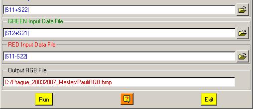
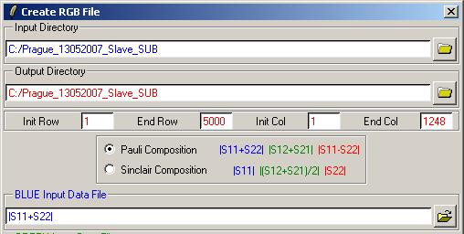
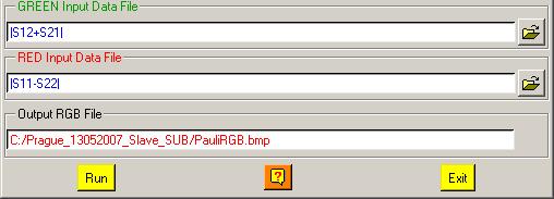
72 PROCESSING CHAIN Configuration Data Import Input Data File: Spaceborne Sensors Extract Raw Data Data already extracted Data Process Flat Earth Estimation Baseline Estimation Flat Earth Estimation Spectral Estimation Tools Sub Data Extraction Complex Coherence Estimation Coarse Co-Registration Flat Earth Estimation Spectral Estimation Complex Coherence Estimation Flat Earth Removal Complex Coherence Estimation
73 PROCESSING CHAIN Configuration Data Process Flat Earth Estimation Baseline Estimation Flat Earth Estimation Spectral Estimation Tools Sub Data Extraction Complex Coherence Estimation Coarse Co-Registration Flat Earth Estimation Spectral Estimation Complex Coherence Estimation Flat Earth Removal Complex Coherence Estimation

74 MAIN MENU

75 ENVIRONNEMENT Configure Data Main Directories location Input Master Directory: C:/ Prague_280307_Master Input Slave Directory: C:/ Prague_130507_Slave
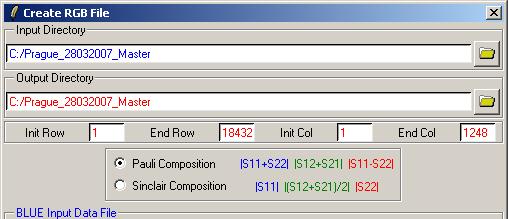
76 DISPLAY
77 DISPLAY Master Pauli Image Slave Pauli Image
78 PROCESSING CHAIN Configuration Data Process Flat Earth Estimation Baseline Estimation Flat Earth Estimation Spectral Estimation Tools Sub Data Extraction Complex Coherence Estimation Coarse Co-Registration Flat Earth Estimation Spectral Estimation Complex Coherence Estimation Flat Earth Removal Complex Coherence Estimation
79 PROCESS DATA Environment Display Import Data Calibration Assessment Process Data Convert Data
80 PROCESS DATA [S2] - MENU


81 BASELINE ESTIMATION Do it Yourself: Run the Baseline Estimation Select some auxiliary parameters and view the corresponding BMP files.


82 BASELINE ESTIMATION kz kz Radar Incidence Angle
83 BASELINE ESTIMATION Master Pauli Image Flat Earth
84 PROCESSING CHAIN Configuration Data Process Flat Earth Estimation Baseline Estimation Flat Earth Estimation Spectral Estimation Tools Sub Data Extraction Complex Coherence Estimation Coarse Co-Registration Flat Earth Estimation Spectral Estimation Complex Coherence Estimation Flat Earth Removal Complex Coherence Estimation
85 PROCESS DATA [S2] - MENU

86 SPECTRAL ESTIMATION Do it Yourself: Select the polarization channel Set the Analysis Window size Set the output format View the corresponding BMP files.
87 SPECTRAL ESTIMATION Master Pauli Image Flat Earth FFT


88 SPECTRAL ESTIMATION Flat Earth Flat Earth FFT
89 PROCESSING CHAIN Configuration Data Process Flat Earth Estimation Baseline Estimation Flat Earth Estimation Spectral Estimation Tools Sub Data Extraction Complex Coherence Estimation Coarse Co-Registration Flat Earth Estimation Spectral Estimation Complex Coherence Estimation Flat Earth Removal Complex Coherence Estimation
90 TOOLS Do it Yourself: Init Row = 1 End Row = 5000 Init Col = 1 End Col = 1248 MASTER DIR config.txt Fully Polarimetric Data Files MASTER DIR_SUB config.txt Fully Polarimetric Data Files

91 TOOLS Do it Yourself: Init Row = 1 End Row = 5000 Init Col = 1 End Col = 1248 SLAVE DIR config.txt Fully Polarimetric Data Files SLAVE DIR_SUB config.txt Fully Polarimetric Data Files


92 TOOLS Do it Yourself: Init Row = 1 End Row = 5000 Init Col = 1 End Col = 1248 SLAVE DIR flat_earth.bin flat_earth.bin SLAVE DIR_SUB flat_earth.bin

93 ENVIRONNEMENT Configure Data Main Directories location Input Master Directory: C:/ Prague_280307_Master_SUB_SUB Input Slave Directory: C:/ Prague_130507_Slave_SUB_SUB
94 DISPLAY
95 DISPLAY
96 DISPLAY Master Pauli Image Slave Pauli Image
97 PROCESSING CHAIN Configuration Data Process Flat Earth Estimation Baseline Estimation Flat Earth Estimation Spectral Estimation Tools Sub Data Extraction Complex Coherence Estimation Coarse Co-Registration Flat Earth Estimation Spectral Estimation Complex Coherence Estimation Flat Earth Removal Complex Coherence Estimation
98 PROCESS DATA [S2] - MENU

 Select BMP and Averaging")
 View the corresponding BMP")
99 COMPLEX COHERENCE ESTIMATION Do it Yourself: Select the polarization channel Set the Analysis Window size (7) Select BMP and Averaging Set the Analysis Averaging Window size (7) View the corresponding BMP files.


100 COMPLEX COHERENCE ESTIMATION cmplx_coh_avg_vv_mod cmplx_coh_avg_vv_pha
101 COMPLEX COHERENCE ESTIMATION Master Pauli Image Slave Pauli Image


102 COMPLEX COHERENCE ESTIMATION Master Pauli Image Slave Pauli Image SHIFT
103 PROCESSING CHAIN Configuration Data Process Flat Earth Estimation Baseline Estimation Flat Earth Estimation Spectral Estimation Tools Sub Data Extraction Complex Coherence Estimation Coarse Co-Registration Flat Earth Estimation Spectral Estimation Complex Coherence Estimation Flat Earth Removal Complex Coherence Estimation
104 PROCESS DATA [S2] - MENU


105 BASIC COARSE COREGISTRATION Do it Yourself: Set the Analysis Window size Row = 1024 Col = 256 SLAVE DIR_SUB config.txt Fully Polarimetric Data Files SLAVE DIR_SUB_COR config.txt Fully Polarimetric Data Files
106 BASIC COARSE COREGISTRATION Master Pauli Image Slave Pauli Image
107 PROCESSING CHAIN Configuration Data Process Flat Earth Estimation Baseline Estimation Flat Earth Estimation Spectral Estimation Tools Sub Data Extraction Complex Coherence Estimation Coarse Co-Registration Flat Earth Estimation Spectral Estimation Complex Coherence Estimation Flat Earth Removal Complex Coherence Estimation
108 PROCESS DATA [S2] - MENU

109 SPECTRAL ESTIMATION Do it Yourself: Select the polarization channel Set the Analysis Window size Row = 1024 Col = 256 Set the output format View the corresponding BMP files.


110 SPECTRAL ESTIMATION Flat Earth Flat Earth FFT
111 PROCESSING CHAIN Configuration Data Process Flat Earth Estimation Baseline Estimation Flat Earth Estimation Spectral Estimation Tools Sub Data Extraction Complex Coherence Estimation Coarse Co-Registration Flat Earth Estimation Spectral Estimation Complex Coherence Estimation Flat Earth Removal Complex Coherence Estimation
112 PROCESS DATA [S2] - MENU
113 COMPLEX COHERENCE ESTIMATION Do it Yourself: Select the polarization channel Set the Analysis Window size (7) Select BMP and Averaging Set the Analysis Averaging Window size (7) View the corresponding BMP files.

114 COMPLEX COHERENCE ESTIMATION cmplx_coh_avg_vv_mod cmplx_coh_avg_vv_pha
115 COMPLEX COHERENCE ESTIMATION cmplx_coh_avg_vv_pha Flat Earth FFT
116 PROCESSING CHAIN Configuration Data Process Flat Earth Estimation Baseline Estimation Flat Earth Estimation Spectral Estimation Tools Sub Data Extraction Complex Coherence Estimation Coarse Co-Registration Flat Earth Estimation Spectral Estimation Complex Coherence Estimation Flat Earth Removal Complex Coherence Estimation


117 PROCESS DATA [S2] - MENU


118 FLAT EARTH REMOVAL Do it Yourself: Enter the 2D Flat Earth file Select conjugate SLAVE DIR_SUB_COR config.txt Fully Polarimetric Data Files SLAVE DIR_SUB_COR_FER config.txt Fully Polarimetric Data Files
119 PROCESSING CHAIN Configuration Data Process Flat Earth Estimation Baseline Estimation Flat Earth Estimation Spectral Estimation Tools Sub Data Extraction Complex Coherence Estimation Coarse Co-Registration Flat Earth Estimation Spectral Estimation Complex Coherence Estimation Flat Earth Removal Complex Coherence Estimation
120 COMPLEX COHERENCE ESTIMATION Do it Yourself: Select the polarization channel Set the Analysis Window size (7) Select BMP and Averaging Set the Analysis Averaging Window size (7) View the corresponding BMP files.
121 COMPLEX COHERENCE ESTIMATION cmplx_coh_avg_vv_mod cmplx_coh_avg_vv_pha

122 COMPLEX COHERENCE ESTIMATION cmplx_coh_avg_vv_pha cmplx_coh_avg_vv_pha

123 CONCLUSION Master Pauli Image cmplx_coh_avg_vv_mod?
124 CONCLUSION T* POLSAR IMAGES I1 = w 1 k and 1 I T* 2 = w 2 k 2 ( w, ) With: Complex Unitary Vectors 1 w 2 * I1I 2 γ ( w 1,w 2 ) = = I I I I 1 * 1 2 * 2 w [ Ω ] T* w 1 12 w 2 T* 1[ T1 ] w 1 w 2[ T2 ] w T* 2 COMPLEX POLARIMETRIC INTERFEROMETRIC COHERENCE γ = γ SNR γ spatial γ temporal γ polar 46 days
 (2010) Pol InSAR")
125 TanDEM-X TerraSAR X (1 & 2) (2010) Pol InSAR Sensors
126 TanDEM-L DESDynl Monitoring the Earth s Dynamics with Pol-InSAR Courtesy of Pr. A. Moreira POLINSAR09

127 Questions?
Forest Retrievals. using SAR Polarimetry. (Practical Session D3P2a)
") Forest Retrievals using SAR Polarimetry (Practical Session D3P2a) Laurent FERRO-FAMIL - Eric POTTIER University of Rennes 1 Pol-InSAR Practical Forest Application PolSARpro SIM PolSARproSim is a rapid,
Forest Retrievals using SAR Polarimetry (Practical Session D3P2a) Laurent FERRO-FAMIL - Eric POTTIER University of Rennes 1 Pol-InSAR Practical Forest Application PolSARpro SIM PolSARproSim is a rapid,
Do It Yourself 8. Polarization Coherence Tomography (P.C.T) Training Course
 Training Course") Do It Yourself 8 Polarization Coherence Tomography (P.C.T) Training Course 1 Objectives To provide a self taught introduction to Polarization Coherence Tomography (PCT) processing techniques to enable
Do It Yourself 8 Polarization Coherence Tomography (P.C.T) Training Course 1 Objectives To provide a self taught introduction to Polarization Coherence Tomography (PCT) processing techniques to enable
Software Tool PolSARpro v3.0
 Software Tool PolSARpro v3.0 Eric POTTIER Tuesday 4 September, Lecture D2L5-2 04/09/07 Lecture D2L5 part 2 Software Tool : PolSARpro v3.0 Eric POTTIER 1 CONTEXT The initiative development of PolSARpro
Eric Pottier, Laurent Ferro-Famil, Sophie Allain, Stéphane Méric. Irena Hajnsek, Kostas Papathanassiou, Alberto Moreira,
 PolSARpro v4.0 Software and ALOS-PALSAR Pol-SAR Data Processing Eric Pottier, Laurent Ferro-Famil, Sophie Allain, Stéphane Méric Shane Cloude, Irena Hajnsek, Kostas Papathanassiou, Alberto Moreira, Mark
Coherence Based Polarimetric SAR Tomography
 I J C T A, 9(3), 2016, pp. 133-141 International Science Press Coherence Based Polarimetric SAR Tomography P. Saranya*, and K. Vani** Abstract: Synthetic Aperture Radar (SAR) three dimensional image provides
An Overview of the PolSARpro v3.0 Software The Educational Toolbox for Polarimetric and Interferometric Polarimetric SAR Data Processing
 An Overview of the PolSARpro v3.0 Software The Educational Toolbox for Polarimetric and Interferometric Polarimetric SAR Data Processing Eric Pottier, Laurent Ferro-Famil, Sophie Allain Shane Cloude, Irena
PolSARpro v4.0 Main Window
 PolSARpro v4.0 Main Window Figure n 1 : PolSARpro v4.0 Main Window Description: The PolSARpro v4.0 Software proposes a new interface based on a full-screen main window as shown in Figure n 1. Minimizing
Po P ls l A S Rpro v5.0. Pr P actic i al E. E. Po P ttie i r E.Pottier (2013)
") PolSARprov5.0 Practical E. Pottier General Presentation of PolSARpro v5.0 Software SOFTWARE DIRECTORY STRUCTURE PolSARpro_v5.0.tcl is the executable file that launches the POLSARPRO user interface DATA
PolSARprov5.0 Practical E. Pottier General Presentation of PolSARpro v5.0 Software SOFTWARE DIRECTORY STRUCTURE PolSARpro_v5.0.tcl is the executable file that launches the POLSARPRO user interface DATA
Tree Height Estimation Methodology With Xband and P-band InSAR Data. Lijun Lu Guoman Huang Qiwei Li CASM
 Tree Height Estimation Methodology With Xband and P-band InSAR Data Lijun Lu Guoman Huang Qiwei Li CASM Outline CASMSAR dataset and test area Height Estimation with RVoG method Height Estimation with dual-band
Interferometric processing. Rüdiger Gens
 Rüdiger Gens Why InSAR processing? extracting three-dimensional information out of a radar image pair covering the same area digital elevation model change detection 2 Processing chain 3 Processing chain
Interferometry Tutorial with RADARSAT-2 Issued March 2014 Last Update November 2017
 Sentinel-1 Toolbox with RADARSAT-2 Issued March 2014 Last Update November 2017 Luis Veci Copyright 2015 Array Systems Computing Inc. http://www.array.ca/ http://step.esa.int with RADARSAT-2 The goal of
GIS. PDF created with pdffactory Pro trial version ... SPIRIT. *
 Vol8, No 4, Winter 07 Iranian Remote Sensing & - * // // RVOG /4 / 7/4 99754 * 0887708 Email aghababaee@mailkntuacir PDF created with pdffactory Pro trial version wwwpdffactorycom Treuhaft and Cloude,
Sentinel-1 Toolbox. Interferometry Tutorial Issued March 2015 Updated August Luis Veci
 Sentinel-1 Toolbox Interferometry Tutorial Issued March 2015 Updated August 2016 Luis Veci Copyright 2015 Array Systems Computing Inc. http://www.array.ca/ http://step.esa.int Interferometry Tutorial The
SAR IMAGE PROCESSING FOR CROP MONITORING
 SAR IMAGE PROCESSING FOR CROP MONITORING Anne Orban, Dominique Derauw, and Christian Barbier Centre Spatial de Liège Université de Liège cbarbier@ulg.ac.be Agriculture and Vegetation at a Local Scale Habay-La-Neuve,
In addition, the image registration and geocoding functionality is also available as a separate GEO package.
 GAMMA Software information: GAMMA Software supports the entire processing from SAR raw data to products such as digital elevation models, displacement maps and landuse maps. The software is grouped into
SAR Interferometry. Dr. Rudi Gens. Alaska SAR Facility
 SAR Interferometry Dr. Rudi Gens Alaska SAR Facility 2 Outline! Relevant terms! Geometry! What does InSAR do?! Why does InSAR work?! Processing chain " Data sets " Coregistration " Interferogram generation
AN APPROACH TO DETERMINE THE MAXIMUM ACCEPTABLE DISTORTION LEVEL IN POLARIMETRIC CALIBRATION FOR POL-INSAR APPLICATIONS
 AN APPROACH O DEERMINE HE MAXIMUM ACCEPABLE DISORION LEEL IN POLARIMERIC CALIBRAION FOR POL-INSAR APPLICAIONS Yong-sheng Zhou (1,,3), Wen Hong (1,), Fang Cao (1,) (1) Institute of Electronics, Chinese
FOREST HEIGHT ESTIMATION FROM INDREX-II L-BAND POLARIMETRIC INSAR DATA
 FOREST HEIGHT ESTIMATION FROM INDREX-II L-BAND POLARIMETRIC INSAR DATA Q. Zhang a, *, J.B. Mercer a, S.R. Cloude b a Intermap Technologies Corp., #12, 555-4 th Avenue SW, Calgary, AB, Canada T2P 3E7 -
InSAR Operational and Processing Steps for DEM Generation
 InSAR Operational and Processing Steps for DEM Generation By F. I. Okeke Department of Geoinformatics and Surveying, University of Nigeria, Enugu Campus Tel: 2-80-5627286 Email:francisokeke@yahoo.com Promoting
Sentinel-1 Toolbox. TOPS Interferometry Tutorial Issued May 2014
 Sentinel-1 Toolbox TOPS Interferometry Tutorial Issued May 2014 Copyright 2015 Array Systems Computing Inc. http://www.array.ca/ https://sentinel.esa.int/web/sentinel/toolboxes Interferometry Tutorial
DINSAR: Differential SAR Interferometry
 DINSAR: Differential SAR Interferometry Fabio Rocca 1 SAR interferometric phase: ground motion contribution If a scatterer on the ground slightly changes its relative position in the time interval between
Polarimetric Radar Remote Sensing
 Proceedings of ISAP2007, Niigata, Japan 1A2 Polarimetric Radar Remote Sensing Yoshio Yamaguchi Department of Information Engineering, Niigata University Ikarashi 2-8050, Niigata, 950-2181, Japan yamaguch@ie.niigata-u.ac.jp
POLSARpro v3.0: THE VERSATILE EDUCATIONAL TOOLBOX FOR POLARIMETRIC AND INTERFEROMETRIC SAR DATA PROCESSING
 POLSARpro v3.0: THE VERSATILE EDUCATIONAL TOOLBOX FOR POLARIMETRIC AND INTERFEROMETRIC SAR DATA PROCESSING Eric Pottier (1), Laurent Ferro-Famil (1), Sophie Allain (1), Shane Cloude (2), Irena Hajnsek
The 2017 InSAR package also provides support for the generation of interferograms for: PALSAR-2, TanDEM-X
 Technical Specifications InSAR The Interferometric SAR (InSAR) package can be used to generate topographic products to characterize digital surface models (DSMs) or deformation products which identify
STUDIES OF PHASE CENTER AND EXTINCTION COEFFICIENT OF BOREAL FOREST USING X- AND L-BAND POLARIMETRIC INTERFEROMETRY COMBINED WITH LIDAR MEASUREMENTS
 STUDIES OF PHASE CENTER AND EXTINCTION COEFFICIENT OF BOREAL FOREST USING X- AND L-BAND POLARIMETRIC INTERFEROMETRY COMBINED WITH LIDAR MEASUREMENTS Jaan Praks, Martti Hallikainen, and Xiaowei Yu Department
Signal Processing Laboratory
 C.S.L Liege Science Park Avenue du Pré-Aily B-4031 ANGLEUR Belgium Tel: +32.4.382.46.00 Fax: +32.4.367.56.13 Signal Processing Laboratory Anne Orban VITO June 16, 2011 C. Barbier : the team Remote Sensing
FIRST RESULTS OF THE ALOS PALSAR VERIFICATION PROCESSOR
 FIRST RESULTS OF THE ALOS PALSAR VERIFICATION PROCESSOR P. Pasquali (1), A. Monti Guarnieri (2), D. D Aria (3), L. Costa (3), D. Small (4), M. Jehle (4) and B. Rosich (5) (1) sarmap s.a., Cascine di Barico,
TanDEM-X Pol-InSAR Inversion for Mangroves of East Africa
 TanDEM-X Pol-InSAR Inversion for Mangroves of East Africa Seung-Kuk Lee, Temilola Fatoyinbo, David Lagomasino, Batuhan Osmanoglu, Carl Trettin, Marc Simard NASA/Goddard Space Flight Center Biospheric Sciences
Mission Status and Data Availability: TanDEM-X
 Mission Status and Data Availability: TanDEM-X Irena Hajnsek, Thomas Busche, Alberto Moreira & TanDEM-X Team Microwaves and Radar Institute, German Aerospace Center irena.hajnsek@dlr.de 26-Jan-2009 Outline
MULTI-BASELINE POLINSAR INVERSION AND SIMULATION OF INTERFEROMETRIC WAVENUMBER FOR FOREST HEIGHT RETRIEVAL USING SPACEBORNE SAR DATA
 MULTI-BASELINE POLINSAR INVERSION AND SIMULATION OF INTERFEROMETRIC WAVENUMBER FOR FOREST HEIGHT RETRIEVAL USING SPACEBORNE SAR KRISHNAKALI GHOSH March, 2018 SUPERVISORS: Mr. Shashi Kumar Dr. Valentyn
INTERFEROMETRIC MULTI-CHROMATIC ANALYSIS OF HIGH RESOLUTION X-BAND DATA
 INTERFEROMETRIC MULTI-CHROMATIC ANALYSIS OF HIGH RESOLUTION X-BAND DATA F. Bovenga (1), V. M. Giacovazzo (1), A. Refice (1), D.O. Nitti (2), N. Veneziani (1) (1) CNR-ISSIA, via Amendola 122 D, 70126 Bari,
Chalmers Publication Library
 Chalmers Publication Library Two-Level Forest Model Inversion of Interferometric TanDEM-X Data This document has been downloaded from Chalmers Publication Library (CPL). It is the author s version of a
DIGITAL ELEVATION MODEL GENERATION FROM INTERFEROMETRIC SYNTHETIC APERTURE RADAR USING MULTI-SCALE METHOD
 DIGITAL ELEVATION MODEL GENERATION FROM INTERFEROMETRIC SYNTHETIC APERTURE RADAR USING MULTI-SCALE METHOD Jung Hum Yu 1, Linlin Ge, Chris Rizos School of Surveying and Spatial Information Systems University
Interferometric Evaluation of Sentinel-1A TOPS data
 Interferometric Evaluation of Sentinel-1A TOPS data N. Yague-Martinez, F. Rodriguez Gonzalez, R. Brcic, R. Shau Remote Sensing Technology Institute. DLR, Germany ESTEC/Contract No. 4000111074/14/NL/MP/lf
Exploiting the High Dimensionality of Polarimetric Interferometric Synthetic Aperture Radar Observations
 Exploiting the High Dimensionality of Polarimetric Interferometric Synthetic Aperture Radar Observations Robert Riley rriley@sandia.gov R. Derek West rdwest@sandia.gov SAND2017 11133 C This work was supported
InSAR DEM; why it is better?
 InSAR DEM; why it is better? What is a DEM? Digital Elevation Model (DEM) refers to the process of demonstrating terrain elevation characteristics in 3-D space, but very often it specifically means the
ALOS PALSAR VERIFICATION PROCESSOR
 ALOS PALSAR VERIFICATION PROCESSOR P. Pasquali (1), A. Monti Guarnieri (2), D. D Aria (3), L. Costa (3), D. Small (4), M. Jehle (4) and B. Rosich (5) (1) sarmap s.a., Cascine di Barico, 6989 Purasca, Switzerland,
Operational process interferometric for the generation of a digital model of ground Applied to the couple of images ERS-1 ERS-2 to the area of Algiers
 Operational process interferometric for the generation of a digital model of ground Applied to the couple of images ERS-1 ERS-2 to the area of Algiers F. Hocine, M.Ouarzeddine, A. elhadj-aissa,, M. elhadj-aissa,,
MODELLING OF THE SCATTERING BY A SMOOTH DIELECTRIC CYLINDER: STUDY OF THE COMPLEX SCATTERING MATRIX
 MODELLING OF THE SCATTERING BY A SMOOTH DIELECTRIC CYLINDER: STUDY OF THE COMPLEX SCATTERING MATRIX L Thirion 1, C Dahon 2,3, A Lefevre 4, I Chênerie 1, L Ferro-Famil 2, C Titin-Schnaider 3 1 AD2M, Université
ADVANCED CONCEPTS IN POLARIMETRY PART 2 (Polarimetric Target Classification) 1 INTRODUCTION
 1 INTRODUCTION") ADVANCED CONCEPTS IN POLARIMETRY PART 2 (Polarimetric Target Classification) Eric POTTIER (1), Jong-Sen LEE (2), Laurent FERRO-FAMIL (1) (1) I.E.T.R UMR CNRS 6164 University of Rennes1 Image and Remote
ADVANCED CONCEPTS IN POLARIMETRY PART 2 (Polarimetric Target Classification) Eric POTTIER (1), Jong-Sen LEE (2), Laurent FERRO-FAMIL (1) (1) I.E.T.R UMR CNRS 6164 University of Rennes1 Image and Remote
A Correlation Test: What were the interferometric observation conditions?
 A Correlation Test: What were the interferometric observation conditions? Correlation in Practical Systems For Single-Pass Two-Aperture Interferometer Systems System noise and baseline/volumetric decorrelation
Brix workshop. Mauro Mariotti d Alessandro, Stefano Tebaldini ESRIN
 Brix workshop Mauro Mariotti d Alessandro, Stefano Tebaldini 3-5-218 ESRIN Dipartimento di Elettronica, Informazione e Bioingegneria Politecnico di Milano Outline A. SAR Tomography 1. How does it work?
Repeat-pass SAR Interferometry Experiments with Gaofen-3: A Case Study of Ningbo Area
 Repeat-pass SAR Interferometry Experiments with Gaofen-3: A Case Study of Ningbo Area Tao Zhang, Xiaolei Lv, Bing Han, Bin Lei and Jun Hong Key Laboratory of Technology in Geo-spatial Information Processing
RESOLUTION enhancement is achieved by combining two
 IEEE GEOSCIENCE AND REMOTE SENSING LETTERS, VOL. 3, NO. 1, JANUARY 2006 135 Range Resolution Improvement of Airborne SAR Images Stéphane Guillaso, Member, IEEE, Andreas Reigber, Member, IEEE, Laurent Ferro-Famil,
Interferometry Module for Digital Elevation Model Generation
 Interferometry Module for Digital Elevation Model Generation In order to fully exploit processes of the Interferometry Module for Digital Elevation Model generation, the European Space Agency (ESA) has
Processing and Analysis of ALOS/Palsar Imagery
 Processing and Analysis of ALOS/Palsar Imagery Yrjö Rauste, Anne Lönnqvist, and Heikki Ahola Kaukokartoituspäivät 6.11.2006 NewSAR Project The newest generation of space borne SAR sensors have polarimetric
PSI Precision, accuracy and validation aspects
 PSI Precision, accuracy and validation aspects Urs Wegmüller Charles Werner Gamma Remote Sensing AG, Gümligen, Switzerland, wegmuller@gamma-rs.ch Contents Aim is to obtain a deeper understanding of what
ADVANCED CONCEPTS IN POLARIMETRIC SAR IMAGE ANALYSIS A TUTORIAL REVIEW
 ADVANCED CONCEPTS IN POLARIMETRIC SAR IMAGE ANALYSIS A TUTORIAL REVIEW ABSTRACT Eric POTTIER (), Jong-Sen LEE (2), Laurent FERRO-FAMIL () () : I.E.T.R UMR CNRS 664, University of Rennes Image and Remote
A Hybrid Entropy Decomposition and Support Vector Machine Method for Agricultural Crop Type Classification
 PIERS ONLINE, VOL. 3, NO. 5, 2007 620 A Hybrid Entropy Decomposition and Support Vector Machine Method for Agricultural Crop Type Classification Chue-Poh Tan 1, Hong-Tat Ewe 2, and Hean-Teik Chuah 1 1
Lateral Ground Movement Estimation from Space borne Radar by Differential Interferometry.
 Lateral Ground Movement Estimation from Space borne Radar by Differential Interferometry. Abstract S.Sircar 1, 2, C.Randell 1, D.Power 1, J.Youden 1, E.Gill 2 and P.Han 1 Remote Sensing Group C-CORE 1
ALOS PALSAR SCANSAR INTERFEROMETRY AND ITS APPLICATION IN WENCHUAN EARTHQUAKE
 ALOS PALSAR SCANSAR INTERFEROMETRY AND ITS APPLICATION IN WENCHUAN EARTHQUAKE Cunren Liang (1) (2), Qiming Zeng (1) (2), Jianying Jia (1) (2), Jian Jiao (1) (2), Xiai Cui (1) (2) (1) (2), Xiao Zhou (1)
Do It Yourself 2. Representations of polarimetric information
 Do It Yourself 2 Representations of polarimetric information The objectives of this second Do It Yourself concern the representation of the polarimetric properties of scatterers or media. 1. COLOR CODED
Pine Forest Height Inversion Using Single-Pass X-Band PolInSAR Data
 IEEE TRANSACTIONS ON GEOSCIENCE AND REMOTE SENSING, VOL. 46, NO. 1, JANUARY 2008 59 Pine Forest Height Inversion Using Single-Pass X-Band PolInSAR Data Franck Garestier, Pascale C. Dubois-Fernandez, Senior
CLASSIFICATION OF EARTH TERRAIN COVERS USING THE MODIFIED FOUR- COMPONENT SCATTERING POWER DECOMPOSITION,
 CLASSIFICATION OF EARTH TERRAIN COVERS USING THE MODIFIED FOUR- COMPONENT SCATTERING POWER DECOMPOSITION, Boularbah Souissi (1), Mounira Ouarzeddine (1),, Aichouche Belhadj-Aissa (1) USTHB, F.E.I, BP N
TanDEM-X Interferometric Processing Chain and SAR Products. Thomas Fritz H. Breit, M. Eineder, M. Lachaise & ITP Development Team
 TanDEM-X Interferometric Processing Chain and SAR Products Thomas Fritz H. Breit, M. Eineder, M. Lachaise & ITP Development Team TanDEM-X Science Meeting Nov. 2008 From Acquisitions to Products - The TanDEM-X
Motion compensation and the orbit restitution
 InSA R Contents Introduction and objectives Pi-SAR Motion compensation and the orbit restitution InSAR algorithm DEM generation Evaluation Conclusion and future work Introduction and Objectives L-band
SARscape. Table of Contents. Preface 1. Overview 3. Basic Module 5. Focusing Module 11. Gamma and Gaussian Filtering Module 11
 Table of Contents Preface 1 Overview 3 Basic Module 5 Focusing Module 11 Gamma and Gaussian Filtering Module 11 Interferometry Module 13 ScanSAR Interferometry Module 18 Polarimetry and Polarimetric Interferometry
Interferometric Processing of TanDEM-X. Images for Forest Height Estimation
 Interferometric Processing of TanDEM-X Images for Forest Height Estimation Daniel Molina Hurtado Department of Radio Science and Engineering School of Electrical Engineering Aalto University A final project
Synthetic Aperture Radar (SAR) Polarimetry for Wetland Mapping & Change Detection
 Polarimetry for Wetland Mapping & Change Detection") Synthetic Aperture Radar (SAR) Polarimetry for Wetland Mapping & Change Detection Jennifer M. Corcoran, M.S. Remote Sensing & Geospatial Analysis Laboratory Natural Resource Science & Management PhD Program
Synthetic Aperture Radar (SAR) Polarimetry for Wetland Mapping & Change Detection Jennifer M. Corcoran, M.S. Remote Sensing & Geospatial Analysis Laboratory Natural Resource Science & Management PhD Program
Synthetic Aperture Radar Interferometry (InSAR)
") CEE 6100 / CSS 6600 Remote Sensing Fundamentals 1 Synthetic Aperture Radar Interferometry (InSAR) Adapted from and the ESA Interferometric SAR overview by Rocca et al. http://earth.esa.int/workshops/ers97/program-details/speeches/rocca-et-al/
CEE 6100 / CSS 6600 Remote Sensing Fundamentals 1 Synthetic Aperture Radar Interferometry (InSAR) Adapted from and the ESA Interferometric SAR overview by Rocca et al. http://earth.esa.int/workshops/ers97/program-details/speeches/rocca-et-al/
Individual Interferograms to Stacks
 Individual Interferograms to Stacks Piyush Agram Jet Propulsion Laboratory Aug 1, 2016 @UNAVCO Thanks to my colleagues from JPL, Caltech, Stanford University and from all over the world for providing images
SNAP-Sentinel-1 in a Nutshell
 SNAP-Sentinel-1 in a Nutshell Dr. Andrea Minchella 21-22/01/2016 ESA SNAP-Sentinel-1 Training Course Satellite Applications Catapult - Electron Building, Harwell, Oxfordshire What is SNAP? Credit: SNAP
Concept and methodology of SAR Interferometry technique
 Concept and methodology of SAR Interferometry technique March 2016 Differen;al SAR Interferometry Young s double slit experiment - Construc;ve interference (bright) - Destruc;ve interference (dark) http://media-2.web.britannica.com/eb-media/96/96596-004-1d8e9f0f.jpg
NEST 4C-1.1: an ESA toolbox for scientific exploitation of SAR data
 NEST 4C-1.1: an ESA toolbox for scientific exploitation of SAR data Andrea Minchella RSAC c/o European Space Agency ESRIN EO Science, Applications and New Technologies Department Exploitation & Services
Interferometric SAR Processing
 Documentation - Theory Interferometric SAR Processing Version 1.0 November 2007 GAMMA Remote Sensing AG, Worbstrasse 225, CH-3073 Gümligen, Switzerland tel: +41-31-951 70 05, fax: +41-31-951 70 08, email:
Ice surface velocities using SAR
 Ice surface velocities using SAR Thomas Schellenberger, PhD ESA Cryosphere Remote Sensing Training Course 2018 UNIS Longyearbyen, Svalbard 12 th June 2018 thomas.schellenberger@geo.uio.no Outline Synthetic
Flood detection using radar data Basic principles
 Flood detection using radar data Basic principles André Twele, Sandro Martinis and Jan-Peter Mund German Remote Sensing Data Center (DFD) 1 Overview Introduction Basic principles of flood detection using
InSAR Processing. Sentinel 1 data Case study of subsidence in Mexico city. Marie-Pierre Doin, Cécile Lasserre, Raphaël Grandin, Erwan Pathier
 1 InSAR Processing Sentinel 1 data Case study of subsidence in Mexico city Marie-Pierre Doin, Cécile Lasserre, Raphaël Grandin, Erwan Pathier NSBAS processing chain (based on ROI_PAC): ROI-PAC: Rosen et
Interferometric coherence optimization
 Interferometric coherence optimization using the polarimetric signatures Boularbah Souissi, Mounira Ouarzeddine, Aichouche Belhadj-Aissa Department of telecommunication Faculty of Electronics and Computing,
Individual Interferograms to Stacks!
 Individual Interferograms to Stacks! Piyush Agram! Jet Propulsion Laboratory!! Jun 29, 2015! @UNAVCO! Thanks to my colleagues from JPL, Caltech, Stanford University and from all over the world for providing
SEA SURFACE SPEED FROM TERRASAR-X ATI DATA
 SEA SURFACE SPEED FROM TERRASAR-X ATI DATA Matteo Soccorsi (1) and Susanne Lehner (1) (1) German Aerospace Center, Remote Sensing Technology Institute, 82234 Weßling, Germany, Email: matteo.soccorsi@dlr.de
MULTI-TEMPORAL SAR DATA FILTERING FOR LAND APPLICATIONS. I i is the estimate of the local mean backscattering
 MULTI-TEMPORAL SAR DATA FILTERING FOR LAND APPLICATIONS Urs Wegmüller (1), Maurizio Santoro (1), and Charles Werner (1) (1) Gamma Remote Sensing AG, Worbstrasse 225, CH-3073 Gümligen, Switzerland http://www.gamma-rs.ch,
IMPROVEMENT OF VEGETATION PARAMETER RETRIEVAL FROM POLARIMETRIC SAR INTERFEROMETRY USING A SIMPLE POLARIMETRIC SCATTERING MODEL
 IMPROVEMENT OF VEGETATION PARAMETER RETRIEVAL FROM POLARIMETRIC SAR INTERFEROMETRY USING A SIMPLE POLARIMETRIC SCATTERING MODEL Maxim Neumann 1, Laurent Ferro-Famil 1, and Andreas Reigber 2 1 SAPHIR Team,
Memorandum. Clint Slatton Prof. Brian Evans Term project idea for Multidimensional Signal Processing (EE381k)
") Memorandum From: To: Subject: Date : Clint Slatton Prof. Brian Evans Term project idea for Multidimensional Signal Processing (EE381k) 16-Sep-98 Project title: Minimizing segmentation discontinuities in
Memorandum From: To: Subject: Date : Clint Slatton Prof. Brian Evans Term project idea for Multidimensional Signal Processing (EE381k) 16-Sep-98 Project title: Minimizing segmentation discontinuities in
fraction of Nyquist
 differentiator 4 2.1.2.3.4.5.6.7.8.9 1 1 1/integrator 5.1.2.3.4.5.6.7.8.9 1 1 gain.5.1.2.3.4.5.6.7.8.9 1 fraction of Nyquist Figure 1. (top) Transfer functions of differential operators (dotted ideal derivative,
RADARGRAMMETRY AND INTERFEROMETRY SAR FOR DEM GENERATION
 RADARGRAMMETRY AND INTERFEROMETRY SAR FOR DEM GENERATION Jung Hum Yu 1, Xiaojing Li, Linlin Ge, and Hsing-Chung Chang School of Surveying and Spatial Information Systems University of New South Wales,
SAR Polarimetry Workstation
 Technical Specifications SAR Polarimetry Workstation The SAR Polarimetry Workstation provides a complete set of tools and applications designed specifically for the processing and analysis of Polarimetric
First TOPSAR image and interferometry results with TerraSAR-X
 First TOPSAR image and interferometry results with TerraSAR-X A. Meta, P. Prats, U. Steinbrecher, R. Scheiber, J. Mittermayer DLR Folie 1 A. Meta - 29.11.2007 Introduction Outline TOPSAR acquisition mode
TECHNICAL SPECIFICATIONS AND ARCHITECTURE DESIGN
 POLSARPRO V4.0 TECHNICAL SPECIFICATIONS AND ARCHITECTURE DESIGN 1 INTRODUCTION This document is dedicated to a basic presentation of the PolSARpro v4.0 Software technical specifications, architecture design
Four-component Scattering Power Decomposition with Rotation of Coherency Matrix
 1 Four-component Scattering Power Decomposition with Rotation of Coherency Matrix Yoshio Yamaguchi, Fellow, IEEE, Akinobu Sato, Wolfgang Martin Boerner, Life Fellow, IEEE, Ryoichi Sato, Member, IEEE, and
ADVANCED CONCEPTS IN POLARIMETRY PART 2 (Polarimetric Target Classification) 1 INTRODUCTION
 1 INTRODUCTION") ADVANCED CONCEPTS IN POLARIMETRY PART 2 (Polarimetric Target Classification) Eric POTTIER (1), Jong-Sen LEE (2), Laurent FERRO-FAMIL (1) (1) I.E.T.R UMR CNRS 6164 University of Rennes1 Image and Remote
ADVANCED CONCEPTS IN POLARIMETRY PART 2 (Polarimetric Target Classification) Eric POTTIER (1), Jong-Sen LEE (2), Laurent FERRO-FAMIL (1) (1) I.E.T.R UMR CNRS 6164 University of Rennes1 Image and Remote
AN IMPROVED SAR RADIOMETRIC TERRAIN COR- RECTION METHOD AND ITS APPLICATION IN PO- LARIMETRIC SAR TERRAIN EFFECT REDUCTION
 Progress In Electromagnetics Research B, Vol. 54, 107 128, 2013 AN IMPROVED SAR RADIOMETRIC TERRAIN COR- RECTION METHOD AND ITS APPLICATION IN PO- LARIMETRIC SAR TERRAIN EFFECT REDUCTION Peng Wang 1, 2,
SNAP-Sentinel-1 in a Nutshell
 SNAP-Sentinel-1 in a Nutshell Dr. Andrea Minchella 1 st ESA Advanced Training Course on Remote Sensing of the Cryosphere 13 September 2016, University of Leeds, Leeds, UK What is SNAP? Credit: SNAP The
SAR Polarimetry Workstation
 SAR Polarimetry Workstation The PCI Geomatics SAR Polarimetry Workstation provides a complete set of tools and applications designed specifically for the processing and analysis of Polarimetric SAR (POLSAR)
Polarimetric SAR tomography of tropical forests using P-Band TropiSAR data
 Polarimetric SAR tomography of tropical forests using P-Band TropiSAR data Yue Huang, Laurent Ferro-Famil, Cedric Lardeux SAPHIR team, IETR University of Rennes 1, France 19/01/2011 Objectives Global objectives:
Target recognition by means of spaceborne C-band SAR data
 Target recognition by means of spaceborne C-band SAR data Daniele Perissin, Claudio Prati Dipartimento di Elettronica e Informazione POLIMI - Politecnico di Milano Milano, Italy daniele.perissin@polimi.it
Differential Interferometry and Geocoding Software DIFF&GEO
 Documentation User s Guide Differential Interferometry and Geocoding Software DIFF&GEO Geocoding and Image Registration Version 1.6 May 2011 GAMMA Remote Sensing AG, Worbstrasse 225, CH-3073 Gümligen,
GAMMA Software. Introduction:
 v1.1, 1-Dec-2017 page 1 GAMMA Software Introduction: GAMMA Software supports the entire processing chain from SAR raw data to products such as digital elevation models, displacement maps and landuse maps.
ALOS PALSAR. Orthorectification Tutorial Issued March 2015 Updated August Luis Veci
 ALOS PALSAR Orthorectification Tutorial Issued March 2015 Updated August 2016 Luis Veci Copyright 2015 Array Systems Computing Inc. http://www.array.ca/ http://step.esa.int ALOS PALSAR Orthorectification
On the Implementation of a Vegetation Baseline for ALOS/PALSAR
 On the Implementation of a Vegetation Baseline for ALOS/PALSAR Paul Siqueira (UMass ), Scott Hensley, Robert Treuhaft, Bruce Chapman, Ernesto Rodriguez JPL Open issues from May 2003 baseline effect on
Forest Vertical Parameter Estimation Using PolInSAR Imagery Based on Radiometric Correction
 International Journal of Geo-Information Article Forest Vertical Parameter Estimation Using PolInSAR Imagery Based on Radiometric Correction Yu Zhang 1, Chu He 1,2, *, Xin Xu 1 and Dong Chen 3 1 Signal
Airborne Differential SAR Interferometry: First Results at L-Band
 1516 IEEE TRANSACTIONS ON GEOSCIENCE AND REMOTE SENSING, VOL. 41, NO. 6, JUNE 2003 Airborne Differential SAR Interferometry: First Results at L-Band Andreas Reigber, Member, IEEE, and Rolf Scheiber Abstract
Sentinel-1 Toolbox. Offset Tracking Tutorial Issued August Jun Lu Luis Veci
 Sentinel-1 Toolbox Offset Tracking Tutorial Issued August 2016 Jun Lu Luis Veci Copyright 2016 Array Systems Computing Inc. http://www.array.ca/ http://step.esa.int Offset Tracking Tutorial The goal of
IMPROVING DEMS USING SAR INTERFEROMETRY. University of British Columbia. ABSTRACT
 IMPROVING DEMS USING SAR INTERFEROMETRY Michael Seymour and Ian Cumming University of British Columbia 2356 Main Mall, Vancouver, B.C.,Canada V6T 1Z4 ph: +1-604-822-4988 fax: +1-604-822-5949 mseymour@mda.ca,
InSAR Data Coherence Estimation Using 2D Fast Fourier Transform
 InSAR Data Coherence Estimation Using 2D Fast Fourier Transform Andrey V. Sosnovsky 1, Viktor G. Kobernichenko 1, Nina S. Vinogradova 1, Odhuu Tsogtbaatar 1,2 1 Ural Federal University, Yekaterinburg,
IDENTIFICATION OF THE LOCATION PHASE SCREEN OF ERS-ENVISAT PERMANENT SCATTERERS
 IDENTIFICATION OF THE LOCATION PHASE SCREEN OF ERS-ENVISAT PERMANENT SCATTERERS M. Arrigoni (1), C. Colesanti (1), A. Ferretti (2), D. Perissin (1), C. Prati (1), F. Rocca (1) (1) Dipartimento di Elettronica
SENTINEL-1 PRECISE ORBIT CALIBRATION AND VALIDATION
 SENTINEL-1 PRECISE ORBIT CALIBRATION AND VALIDATION Andrea Monti Guarnieri, Simone Mancon, and Stefano Tebaldini Politecnico di Milano, Italy ABSTRACT In this paper, we propose a model-based procedure
Terrain correction. Backward geocoding. Terrain correction and ortho-rectification. Why geometric terrain correction? Rüdiger Gens
 Terrain correction and ortho-rectification Terrain correction Rüdiger Gens Why geometric terrain correction? Backward geocoding remove effects of side looking geometry of SAR images necessary step to allow
ALOS-2 PALSAR-2 support in GAMMA Software
 ALOS-2 PALSAR-2 support in GAMMA Software Urs Wegmüller, Charles Werner, Andreas Wiesmann, Gamma Remote Sensing AG CH-3073 Gümligen, http://www.gamma-rs.ch 11-Sep-2014 1. Introduction JAXA has made available
Practical work on SAR Interferometry Data Processing using DORIS Software Y.S. Rao CSRE, IIT Bombay
 Practical work on SAR Interferometry Data Processing using DORIS Software Y.S. Rao CSRE, IIT Bombay ysrao@csre.iitb.ac.in Tools : DORIS (Delft Object-Oriented Radar Interferometric Software) is freely