arxiv: v1 [cs.cv] 8 Dec 2016
|
|
|
- Daniela Williamson
- 5 years ago
- Views:
Transcription


1 Predicting Ground-Level Scene Layout from Aerial Imagery Menghua Zhai Zachary Bessinger Scott Workman Nathan Jacobs Computer Science, University of Kentucky {ted, zach, scott, arxiv: v1 [cs.cv] 8 Dec 2016 Abstract We introduce a novel strategy for learning to extract semantically meaningful features from aerial imagery. Instead of manually labeling the aerial imagery, we propose to predict (noisy) semantic features automatically extracted from co-located ground imagery. Our network architecture takes an aerial image as input, extracts features using a convolutional neural network, and then applies an adaptive transformation to map these features into the ground-level perspective. We use an end-to-end learning approach to minimize the difference between the semantic segmentation extracted directly from the ground image and the semantic segmentation predicted solely based on the aerial image. We show that a model learned using this strategy, with no additional training, is already capable of rough semantic labeling of aerial imagery. Furthermore, we demonstrate that by finetuning this model we can achieve more accurate semantic segmentation than two baseline initialization strategies. We use our network to address the task of estimating the geolocation and geoorientation of a ground image. Finally, we show how features extracted from an aerial image can be used to hallucinate a plausible ground-level panorama. 1. Introduction Learning-based methods for pixel-level labeling of aerial imagery have long relied on manually annotated training data. Unfortunately, such data is expensive to create. Furthermore, its value is limited because a method trained on one dataset will typically not perform well when applied to another source of aerial imagery. The difficulty in obtaining datasets of sufficient scale for all modalities has hampered progress in applying deep learning techniques to aerial imagery. There have been a few notable exceptions [21, 23], but these have all used fairly coarse grained semantic classes, covered a small spatial area, and are limited to modalities in which human annotators are able to manually assign labels. We propose a novel strategy for obtaining semantic la- Label Cross Entropy Loss Transfer Semantics Extract Transform Figure 1. We learn to predict the ground-image segmentation directly from an aerial image of the same location, thereby transferring the semantics from the ground to the aerial image domain. bels for aerial image segmentation. See Figure 1 for a schematic overview of the approach. Our idea is to use existing methods for semantic image segmentation, which are tailored for ground images, and apply these to a large dataset of geo-tagged ground images. We use these semantically labeled images as a form of weak supervision and attempt to predict these semantic labels from an aerial image centered around the location of the ground image. We do not use a parametric transformation between the aerial and ground-level viewpoints. Instead, we use a dense representation, similar in spirit to the general representation, dubbed filter flow, described by Seitz and Baker [26]. There has been significant interest recently in predicting ground image features from aerial imagery for the task of 1
2 ground image geolocalization [33]. Our work is unique in that it is the first to attempt to predict a dense pixel-level segmentation of the ground image. We demonstrate the value of this approach in several ways. Main Contributions: The main contributions of this work are: (1) a novel convolutional neural network (CNN) architecture that relates the appearance of a aerial image appearance to the semantic layout of a ground image of the same location, (2) demonstrating the value of our training strategy for pre-training a CNN to understand aerial imagery, (3) extensions of the proposed technique to the tasks of ground image localization, orientation estimation, and synthesis, and (4) an extensive evaluation of each of these techniques on large, real-wold datasets. Together these represent an important step in enabling deep learning techniques to be extended to the domain of aerial image understanding. 2. Related Work Learning Viewpoint Transformations Many methods have been proposed to represent the relationship between the appearance of two viewpoints. Seitz and Baker [26] model image transformations using a space-variant linear filter, similar to a convolution but varying per-pixel. They highlight that a linear transformation of a vectorized representation of all the pixels in an image is very general; it can represent all standard parametric transformations, such as similarity, affine, perspective, and more. More recently, Jaderberg et al. [12] describe an end-to-end learnable module for neural networks, the spatial transformer, which allows explicit spatial transformations (e.g. scaling, cropping, rotation, non-rigid deformation) of feature maps within the network that are conditioned on individual data samples. Practically, including a spatial transformer allows a network to select regions of interest from an input and transform them to a canonical pose. Similarly, Tinghui et al. [34] address the problem of novel view synthesis. They observe that the visual appearance of different views is highly correlated and propose a CNN architecture for estimating appearance flows, a representation of which pixels in the input image can be used for reconstruction. Relating Aerial and Ground-Level Viewpoints Several methods have been recently proposed to jointly reason about co-located aerial and ground image pairs. Luo et al. [19] demonstrate that aerial imagery can aid in recognizing the visual content of a geo-tagged ground image. Máttyus et al. [20] perform joint inference over monocular aerial imagery and stereo ground images for fine-grained road segmentation. Wegner et al. [30] build a map of street trees. Given the horizon line and the camera intrinsics, Ghouaiel and Lefèvre [7] transform geo-tagged groundlevel panoramas to a top-down view to enable comparisons with aerial imagery for the task of change detection. Recent work on cross-view image geolocalization [17, 18, 32, 33] has shown that convolutional neural networks are capable of extracting features from aerial imagery that can be matched to features extracted from ground imagery. Vo et al. [29] extend this line of work, demonstrating improved geolocalization performance by applying an auxiliary loss function to regress the ground-level camera orientation with respect to the aerial image. To our knowledge, our work is the first work to explore predicting the semantic layout of a ground image from an aerial image. Semantic Segmentation of Aerial/Satellite Imagery There is a long tradition of using computer vision techniques for aerial and satellite image understanding [10, 31, 4]. Historically these two domains were distinct. Satellite imagery was typically lower-resolution, from a strictly topdown view, and with a diversity of spectral bands. Aerial imagery was typically higher-resolution, with a greater diversity of viewing angles, but with only RGB and NIR sensors. Recently these two domains have converged; we will use the term aerial imagery as we are primarily working with high-resolution RGB imagery. However, our approach could be applied to many types of aerial and satellite imagery. Kluckner et al. [16] address the task of semantic segmentation using a random forest to combine color and height information. More recent work has explored the use of CNNs for aerial image understanding. Mnih and Hinton propose a CNN for detecting roads in aerial imagery [21] using GIS data as ground truth. They extend their approach to handle omission noise and misregistration between the imagery and the labels [22]. These approaches require either extensive pixel-level manual annotation or existing GIS data. Our work is the first to demonstrate the ability to transfer a dense pixel-level labeling of ground imagery to aerial imagery. Visual Domain Adaptation Domain adaptation addresses the misalignment of source and target domains [6]. A significant amount of work has explored domain adaptation for visual recognition [24]. Jhuo et al. [13] propose a low-rank reconstruction approach where the source features are transformed to an intermediate representation in which they can be linearly reconstructed by the target samples. Our work is most similar to that of Sun et al. [28], who propose a method for transferring scene categorizations and attributes from ground images to aerial imagery. Similar to our approach, they learn a transformation matrix which minimizes the distance between a source feature and the target feature. Our work differs in several ways: 1) we carry out the linear transformation not only in the semantic di-

3 interpolate to size 17 x 17 x channels aerial image aerial label VGG16 A T S 512 (i, j, y, x) transformation matrix F Figure 2. A visual overview of our network architecture. We extract features from an aerial image using the VGG16 architecture and form a hypercolumn using the PixelNet approach. These features are processed by three networks that consist of 1 1 convolutions: network A converts the hypercolumn into semantic features; network S extracts useful features from the aerial image for controlling the transformation; and network F defines the transformation between viewpoints. The transformation is applied, T, to the aerial semantic features to create a ground-level semantic labeling. mensions but also in the spatial dimensions, 2) we constrain the transformation matrix such that the semantic meaning of the source feature and the target feature remains the same, 3) our transformation matrix is input dependent, and 4) we learn the transformation matrix as well as the source feature at the same time, in an end-by-end manner, which simplifies training. 3. Cross-view Supervised Training We propose a novel training strategy for learning to extract useful features from aerial imagery. The idea is to predict the semantic scene layout, L g, of a ground image, I g, using only an aligned aerial image, I a, from the same location. This strategy leverages existing methods for ground image understanding at training time, but does not require any ground imagery at testing time. We represent semantic scene layout, L g, as a pixel-level probability distribution over classes, such as road, vegetation, and building. We construct a training pair by collecting a georegistered ground panorama and an aerial image of the same location, orienting the panorama to the aerial image (panoramas are originally aligned with the road direction), and then extracting the semantic scene layout, L g, of the panorama using an off-the-shelf method [2] with four semantic classes. We then use an end-to-end training strategy to learn to extract pixel-level features from the aerial image and transform them to the ground-level viewpoint Network Architecture Our proposed network architecture is composed of four modules. A convolutional neural network (CNN), L a = A(I a ; Θ A ), is used to extract semantic labels from the aerial imagery. Another CNN, S(I a ; Θ S ), uses features extracted from aerial imagery to help estimate the transformation matrix, M = F (x r, y r, i c, j c, S(I a ; Θ S ); Θ F ), based on aerial image features and the pixel location in the respective images. Finally, we have a transformation module, L g = T (L a, M), that converts from the aerial viewpoint to the ground-level using the estimated transformation matrix, M. There are many choices for these components, and the remainder of this section describes the particular choices we made for this study. See Figure 2 for a visual overview of the architecture. Aerial Image Feature Extraction For A(I a ; Θ A ), we use the VGG16 [27] base architecture and convert it to a pixel-level labeling method using the PixelNet approach [3]. The core idea is to interpolate intermediate feature maps of the base network to a uniform size, then concatenate them along the channels dimension to form a hypercolumn. In our experiments, we form the hypercolumn from conv-{1 2, 2 2, 3 3, 4 3 } of the VGG16 network. The hypercolumn, which is now , is followed by three 1 1 convolutional layers, with 512, 512, and 4 output channels respectively. The first two 1 1 convolutions have ReLU activations, the final is linear. We designate the output of the final convolution as L a = A(I a ; Θ A ). The


, we carry out the transformation on the logits of l a, f a, and add a bias")
 the transformation does not depend on the content of the aerial image and (2) the number of parameters scales quadratically with the number of pixels in")

![maps. More precisely, each element M rc = F (x r, y r, i c, j c, S(I a ; Θ S )), where (i c, j c ) [0, 1], is the aerial image pixel of the corresponding element, (y r, x r ) [0, 1] is the ground](/docs-images/84/89142732/images/4-5.jpg "image pixel of the corresponding element. We now define the architecture of the transformation estimation neural network, F.")
) = e F r,c c e F, r,c F r,c = F (i, j, y, x, S(I a ; Θ S )), and i = c/w a /h a, j = mod(c, w a )/w a, y = r/w g /h g, x = mod(r, w g )/w g.")
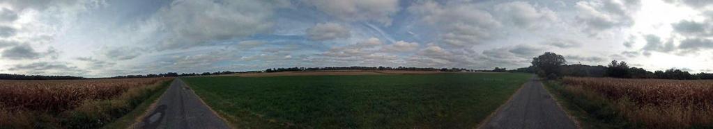
4 output of this stage is transformed from a aerial viewpoint to a ground viewpoint by final stage of the network. Cross-view Semantic Transformation We represent the transformation between the aerial and ground-level viewpoints as a linear operation applied channel-wise to L a. To transform from the h a w a 4 aerial label, L a, to the h g w g 4 ground label, L g, we need to estimate a h g w g h a w a matrix, M. Given M, the transformation process is as follows: reshape the aerial label, L a, into a h a w a 4 matrix, l a ; multiply it by M to get l g ; then reshape l g to the size of the ground label, L g, to form our estimate of the ground label, L g. We constrain M such that the sum of each row is unit. To account for the expected layout of the scene, and to handle the sky class (which is not visible from the aerial image), we carry out the transformation on the logits of l a, f a, and add a bias term, b to get the logits of l g, f g : f g = Mf a + b. There are many ways of representing the transformation matrix, M. The naïve approach is to treat M as a matrix of learnable variables. However, this approach has two downsides: (1) the transformation does not depend on the content of the aerial image and (2) the number of parameters scales quadratically with the number of pixels in L a and L g. We represent each element, M rc, in the transformation matrix, M, as the output of a neural network, F, which is conditioned on the aerial image, I a, and the location in the input and output feature maps. More precisely, each element M rc = F (x r, y r, i c, j c, S(I a ; Θ S )), where (i c, j c ) [0, 1], is the aerial image pixel of the corresponding element, (y r, x r ) [0, 1] is the ground image pixel of the corresponding element. We now define the architecture of the transformation estimation neural network, F. The value of the transformation matrix at location (r, c) is computed through a neural network, F, followed by a softmax function to normalize the impact of all pixels sampled from the aerial image: where: M rc = F (r, c, S(I a ; Θ S )) = e F r,c c e F, r,c F r,c = F (i, j, y, x, S(I a ; Θ S )), and i = c/w a /h a, j = mod(c, w a )/w a, y = r/w g /h g, x = mod(r, w g )/w g. The base network, F, is a multi-layer perceptron, with ReLU activation functions, that takes as input a 293- element vector. The network has three layers, with 128, 64 and 1 output channels respectively (refer to the lower part of Figure 2). The naïve approach can be considered a special case of this representation where we ignore the aerial Figure 3. Examples of aligned aerial/ground image pairs from our dataset. (row 1) In the aerial images, north is the up direction. In the ground images, north is the central column. (row 2-4) Image dependent receptive fields estimated by our algorithm as follows: 1) fix ground locations (y, x) (locations in squares); 2) select all (i, j) (locations in contours) with high F (i, j, y, x, S(I a; Θ S)) values. Corresponding fields between the aerial image and the ground image are shown in the same color. image and use a one-hot encoding representation of rows and columns. As described above, there are two main advantages of our approach of representing the transformation matrix: a reduction in the number of parameters when M is large and the ability to adapt to different aerial image layouts. An additional benefit is that if we change the resolution of our input and output feature maps it is easy to create a new transformation matrix, M, without needing to resort to interpolation Dataset We collect our training and testing dataset from the CVUSA dataset [33]. CVUSA contains approximately 1.5 million geo-tagged pairs of ground and aerial images from across the United States. We use the Google Street View panoramas of CVUSA as our ground images. For each panorama, we also download an aerial image at zoom level 19 from Microsoft Bing Maps in the same location. We filter out panoramas with no available corresponding aerial imagery. Using the camera s extrinsic information, we then warp the panoramas to align with the aerial images. We also crop the panoramas vertically to reduce the portion of the sky and ground pixels. In total, we collected 35,532 image pairs for training and 8,884 image pairs for testing. Some examples aerial/ground image pairs in our dataset are shown Figure 3.
![3.3. Implementation Details We implemented the proposed architecture using Google s TensorFlow framework [1]. We train our networks for 10 epochs with the Adam optimizer [15].](/docs-images/84/89142732/images/5-0.jpg "We enable batch normalization [11] with decay 0.9 in all convolutional and fully-connected layers (except for the output layers) to accelerate the training process.")
, we first compute for the ground semantic pixel label: I g L g, using SegNet [2].")


 weakly supervised semantic learning, 2) aerial imagery labeling, 3)")


![The method we use, SegNet [2], was trained on mostly urban scenes, but many of our images are from rural and suburban areas.](/docs-images/84/89142732/images/5-8.jpg "The end result is that certain classes are often mislabeled in the ground imagery, including dirt and building.")

5 3.3. Implementation Details We implemented the proposed architecture using Google s TensorFlow framework [1]. We train our networks for 10 epochs with the Adam optimizer [15]. We enable batch normalization [11] with decay 0.9 in all convolutional and fully-connected layers (except for the output layers) to accelerate the training process. Our implementation is available at crossnet. The training procedure is as follows: for a given cross-view image pair, (I a, I g ), we first compute for the ground semantic pixel label: I g L g, using SegNet [2]. We then minimize the cross entropy between L g and T (A(I a ; Θ A ); Θ T ) with respect to the model parameters, Θ A and Θ T. The resulting architecture requires a significant amount of memory to output the full final feature map, which would normally result in very small batch sizes for GPU training. Due to the PixelNet approach of using interpolation to scale the feature maps, we are able to perform sparse training. Instead of outputting the full-size feature map, we only extract a dense grid of points, the resulting feature map is Despite this, at testing time, we can provide an aerial image and generate a full-resolution, semantically meaningful feature map. 4. Evaluation and Applications In this section, we will show that our network architecture can be used in four different tasks: 1) weakly supervised semantic learning, 2) aerial imagery labeling, 3) orientation regression and geocalibration, and 4) cross-view image synthesis. Additional qualitative results and the complete network structure used for cross-view image synthesis can be found in our supplemental materials Weakly Supervised Learning We trained our full network architecture (with randomly initialized weights) to predict ground-level semantic labeling using the dataset described in Section 3.2. Figure 4 shows example output, L a, from the aerial image understanding CNN. This demonstrates that the resulting network has learned to extract semantic features from an aerial image, all without any manual annotated aerial imagery. While these results are compelling, they could be better with a higher quality ground-image segmentation method. The method we use, SegNet [2], was trained on mostly urban scenes, but many of our images are from rural and suburban areas. The end result is that certain classes are often mislabeled in the ground imagery, including dirt and building. In addition, because the panoramas and aerial images were not captured at the same time, we are unable to accurately model transient objects, such as vehicles and pedestrians. All these factors make the dataset very challenging for Figure 4. Example outputs from our weakly supervised learning method on test images. For each aerial image (top), we show the pixel-level labeling inferred by our model, which uses only noisy ground image segmentation as labels. We visualize three classes: road (red), vegetation (green), and man-made (blue). training. Given these limitations, it is, perhaps, surprising that the resulting aerial image segmentation method works so well. In the following section, we show using this network as a starting point for strongly supervised aerial image segmentation outperforms two standard initialization methods Cross-view for Pre-training We evaluate our proposed technique as a pre-training strategy for the task of semantic-pixel labeling of aerial imagery. Starting from the optimal weights from the previous section, we finetune and evaluate using the ISPRS dataset [25]. This dataset contains 33 true orthophotos captured over Vaihingen, Germany. The ground sampling distance is 9 cm/px and there are over 168 million pixels in total. Ground truth is provided for 16 photos; each pixel is assigned one of six categories: Impervious surfaces, Building, Low vegetation, Tree, Car, and Clutter/background. Image Processing Compared to the Bing Maps imagery we used for pre-training, images in the ISPRS dataset are at a different spatial scale and the color channels represent different frequency bands (the R channel is actually a near infrared channel). To ensure that the pre-trained network weights are appropriate for the new dataset, we adjusted the scale and color channels as follows. We first resize the IS- PRS images to the equivalent of Bing Maps zoom level 19. R We then label a pixel as vegetation if R+G+B is greater than 0.4. For each pixel labeled as vegetation, we halve the R channel intensity and swap the R and G channels. The resulting images, shown in Figure 5, are much closer in appearance to the Bing Maps imagery than the raw imagery. Evaluation Protocol We split the 16 annotated images into training (images 5, 7, 11, 13, 15, 17, and 21), validation sets (images 1 and 3) and testing (images 23, 26, 28, 30, 32, 37, and 40). From each set we extracted a set of subwindows (respectively 82, 12, and 34 from
![1 0.9 0.8 Ours Random VGG16 0.7 0.6 Figure 5. An example from the ISPRS dataset [25].](/docs-images/84/89142732/images/6-0.jpg "(left) Near infrared image; (middle) The same image after pre-processing; (right) Ground-truth annotation of the image. training, validation, and testing respectively).")

6 Ours Random VGG Figure 5. An example from the ISPRS dataset [25]. (left) Near infrared image; (middle) The same image after pre-processing; (right) Ground-truth annotation of the image. training, validation, and testing respectively). We then compared performance with different numbers of training images: 1, 2, 7, 20, 54, and 82. We evaluated the performance in terms of the average precision for all pixels. We ignore the Cluster/background pixels because of the low number of assigned pixels. Training and Testing We used the same architecture with the aerial feature extractor, A(I a ; Θ A ), defined in Section 3.1, to do the semantic labeling on ISPRS. During training, we use the Adam optimizer to minimize the cross entropy between the network outputs and the labels. We use a batch size of 8, randomly sample 1,000 pixels per image for sparse training, and train the network till convergence. We run the validation set every 1,000 training iterations and save the optimal network weights for testing. During testing, we sample all pixels on the image to generate the dense labeling. We experiment using three different initializations of the VGG16 convolutional layers and finetune the remaining layers of the network: 1) Ours: initialize with model pretrained using our framework; 2) Random: initialize using Xavier initialization [8]; 3) VGG16: initialize with model pre-trained on ImageNet. Since the VGG16 model we used in this experiment is trained without batch normalization, it may be less competitive. To achieve a fair comparison, we turned off batch normalization in this experiment and re-trained the network for 15 epochs to get the pre-trained model. Our results (Figure 6) show that finetuning from the VGG16 model performs poorly on the aerial image labeling task. We think that the patterns it learned mostly from the ground image may hinder pattern learning for aerial imagery. Our method outperforms both of the other initialization strategies. We also present the prediction precision per class in Table 1. We highlight that our method does better especially on the Building, Low Vegetation, and Tree classes, which can also be found in pre-training annotations Cross-view for Geocalibration We show how the ground-level feature maps we estimate from aerial imagery can be used to estimate the orientation Figure 6. Performance comparison of different initialization methods on the ISPRS segmentation task. The x-axis is the number of training images and the y-axis is average precision. Table 1. Per-Class Precision on the ISPRS Segmentation Task Class Imp. Bldg Low. Tree Car Init. Number of training samples Ours Random VGG Ours Random VGG Ours Random VGG Ours Random VGG Ours Random VGG Figure 8. Histogram of the orientation errors on the CVUSA dataset. and location of a ground image. We show quantitative results for the orientation estimation task and qualitative results for simultaneous orientation and location estimation. We use the following datasets for all experiments:
")

, vegetation (green),")

 and the optimal prediction")


.")


![Cityscapes: The Cityscapes dataset [5] is a recently released benchmark](/docs-images/84/89142732/images/7-15.jpg "dataset designed to support the task of urban scene understanding through")


7 Figure 7. Qualitative results of orientation predictions on Cityscapes dataset (top) and CVUSA (bottom). The Ig, Lg and Lg0 are stacked vertically on the left side of the aerial image. We visualize three classes on the labels: road (red), vegetation (green), and man-made (blue). The discrete PDFs of the ground camera orientation are visualized with red arrows, whose lengths indicate the magnitudes. In the CVUSA results, the ground truth (green) and the optimal prediction (blue) are also shown with the orientation PDF. The last prediction result is a typical failure case of our method, where the scene is symmetric from the aerial point of view. CVUSA: We use the test set introduced in Section 3.2 to create this dataset, it has two parts for orientation estimation and geocalibration, respectively. For the orientation regression task, we rotate the aerial image to a random angle. For the fine-grained geocalibration experiment, we center-crop the aerial image around a random x, y offset, then rotate the image to a random angle. In both experiments, the heading direction of the ground images are the same. We center crop a cutout from each ground image as the query image. Fine-grained Geocalibration For this task, we assume that we know the focal length of the camera and have a rough estimate of the camera location (i.e., with 100 meters). We extract aerial images from the area around our rough estimate and extract the corresponding ground-level feature maps. We apply our orientation estimation procedure to each feature map. The result is a distribution over orientations for each location. Figure 9 shows several example results, including the most likely direction for each location, as well as the most likely location and orientation pair. Cityscapes: The Cityscapes dataset [5] is a recently released benchmark dataset designed to support the task of urban scene understanding through semantic pixel labeling. It consists of stereo video from 50 different cities and fine pixel-level annotations for 5,000 frames and coarse pixel-level annotations for 20,000 frames Synthesizing Ground Images from Aerial Images Orientation Estimation For this task, we assume the location and focal length of the ground image, Ig, is known but the orientation is not. The intuition behind our method is that the semantic labeling of the ground image will be most similar to the feature map of the aerial image at the actual orientation. For a query ground image, Ig, the first step is to download the corresponding aerial image, Ia. We then infer the semantic labeling of the query image, Ig Lg, and predict the ground image label from the aerial image using our learned network, Ia Lg0. We assign an energy to each possible orientation by computing the cross entropy between Lg and Lg0 in a sliding window fashion across all possible orientations. We select the orientation with the lowest energy. We present sample results in Figure 7 and a histogram of the orientation errors on the CVUSA dataset in Figure 8. We propose a novel application to infer a ground image by using features extracted from our network. We begin by describing our network structure and then show qualitative results for different generated ground-level scenes. Our network architecture is based on the deep, directed generative model proposed by Kim et al. [14]. Their model consists of two parts: a deep generator, G, which generates images that try to minimize a deep energy model, E. A low energy implies the image is real and high energy implies the image is fake. The architecture and training methods are inspired by generative adversarial networks [9], however it provides a energy-based formulation of the discriminator to address common instabilities of adversarial training. A complete description of the architecture used to design the deep generator and deep energy model is provided in our supplemental materials. We begin by extracting an cross-view feature map, f, that has been learned to relate an aerial and ground image pair. The generator is given f along with random noise, z, as input. The generator outputs a panorama, Ig, that represents the predicted ground image. The cross-view feature, predicted panorama, and the ground truth panorama, Ig, are
 From top to bottom are the Ig, Lg, and Lg0 respectively.")
.")


, and our prediction of the ground scene layout (bottom-right), which")


, its corresponding ground-level panorama")
)")
.")
![Batch normalization [11] is applied in every layer of both models, except for](/docs-images/84/89142732/images/8-16.jpg "the final layers.")


8 Figure 9. Fine-grained geocalibration results on CVUSA. (left) From top to bottom are the Ig, Lg, and Lg0 respectively. We visualize three classes on the labels: road (red), vegetation (green), and man-made (blue). (right) Orientation flow map (red), where the arrow direction indicates the optimal direction at that location and length indicates the magnitude. We also show the optimal prediction and the ground-truth frustums in blue and green respectively. update of the energy model. Both the generator and energy model are optimized using the Adam optimizer, with moment parameters β1 = 0.5 and β2 = We train using batch sizes of 32 for 30 epochs. Example outputs generated by our network are shown in Figure 10. Each row contains an aerial image (left), its respective ground panorama (top-right), and our prediction of the ground scene layout (bottom-right), which would ideally be the same as its above image. The network has learned the most common features, such as roads and their orientations, as well as trees and grass. However, it has difficulty hallucinating buildings and the sky, which is likely caused by highly variable appearance factors. We note that the resolution of the synthesized groundlevel panoramas is much lower than the original panorama, however adversarial generation of high-resolution images is an active area of research. We expect that in the near future we will be able to use our learned features in a similar manner to generate full-resolution panoramas. Additionally, algorithmic improvements to our ground image segmentation method would provide more photo-realistic predictions. 5. Conclusion Figure 10. Synthesized ground-level views. Each row shows an aerial image (left), its corresponding ground-level panorama (topright), and predicted ground-level panorama (bottom-right). then passed into the energy model which returns an energy function, EΘ (f, Ig )) = X T 1 T T f f b f log(1 + ewi Ig +bi ), σ2 i similar to the free energy of a Gaussian Restricted Boltzmann Machine (RBM). Batch normalization [11] is applied in every layer of both models, except for the final layers. ReLU activations are used throughout the generator and Leaky ReLU, with leak parameter α = 0.2, are used in the energy model. The models are updated in an alternating fashion, where the generator is updated twice for every We introduced a novel strategy for using automatically labeled ground images as a form of weak supervision for learning to understand aerial images. The key is to simultaneously learn to extract features from the aerial image and learn to map from the aerial to the ground image. We demonstrated that by using this process we are able to automatically extract semantically meaningful features from aerial imagery, refine these to obtain more accurate pixellevel labeling of aerial imagery, estimate the location and orientation of a ground image, and synthesize novel groundlevel views. The proposed technique is equally applicable to other forms of imagery, including NIR, multispectral, and hyperspectral. For future work, we plan to explore richer ground image annotation methods to explore the limits of what is predictable about a ground-level view from an aerial view.
9 Acknowledgements We gratefully acknowledge the support of NSF CA- REER grant (IIS ), a Google Faculty Research Award, and an AWS Research Education grant. References [1] M. Abadi, A. Agarwal, P. Barham, E. Brevdo, Z. Chen, C. Citro, G. S. Corrado, A. Davis, J. Dean, M. Devin, et al. Tensorflow: Large-scale machine learning on heterogeneous distributed systems. arxiv preprint arxiv: , [2] V. Badrinarayanan, A. Kendall, and R. Cipolla. Segnet: A deep convolutional encoder-decoder architecture for image segmentation. arxiv preprint arxiv: , , 5 [3] A. Bansal, X. Chen, B. Russell, A. Gupta, and D. Ramanan. Pixelnet: Towards a General Pixel-level Architecture. arxiv preprint arxiv: , [4] G. Cheng and J. Han. A survey on object detection in optical remote sensing images. CoRR, abs/ , [5] M. Cordts, M. Omran, S. Ramos, T. Rehfeld, M. Enzweiler, R. Benenson, U. Franke, S. Roth, and B. Schiele. The cityscapes dataset for semantic urban scene understanding. In CVPR, [6] H. Daume III and D. Marcu. Domain adaptation for statistical classifiers. Journal of Artificial Intelligence Research, 26: , [7] N. Ghouaiel and S. Lefèvre. Coupling ground-level panoramas and aerial imagery for change detection. Geo-spatial Information Science, 19(3): , [8] X. Glorot and Y. Bengio. Understanding the difficulty of training deep feedforward neural networks. In Aistats, volume 9, pages , [9] I. Goodfellow, J. Pouget-Abadie, M. Mirza, B. Xu, D. Warde-Farley, S. Ozair, A. Courville, and Y. Bengio. Generative adversarial nets. In NIPS, pages , [10] A. Huertas and R. Nevatia. Detecting buildings in aerial images. Computer Vision, Graphics, and Image Processing, 41: , [11] S. Ioffe and C. Szegedy. Batch normalization: Accelerating deep network training by reducing internal covariate shift. arxiv preprint arxiv: , , 8 [12] M. Jaderberg, K. Simonyan, A. Zisserman, et al. Spatial transformer networks. In NIPS, pages , [13] I.-H. Jhuo, D. Liu, D. Lee, and S.-F. Chang. Robust visual domain adaptation with low-rank reconstruction. In CVPR, [14] T. Kim and Y. Bengio. Deep directed generative models with energy-based probability estimation. arxiv preprint arxiv: , [15] D. Kingma and J. Ba. Adam: A method for stochastic optimization. arxiv preprint arxiv: , [16] S. Kluckner, T. Mauthner, P. M. Roth, and H. Bischof. Semantic classification in aerial imagery by integrating appearance and height information. In ACCV, [17] T.-Y. Lin, S. Belongie, and J. Hays. Cross-view image geolocalization. In CVPR, [18] T.-Y. Lin, Y. Cui, S. Belongie, and J. Hays. Learning deep representations for ground-to-aerial geolocalization. In CVPR, [19] J. Luo, J. Yu, D. Joshi, and W. Hao. Event recognition: viewing the world with a third eye. In ACM Conference on Multimedia, [20] G. Máttyus, S. Wang, S. Fidler, and R. Urtasun. Hd maps: Fine-grained road segmentation by parsing ground and aerial images. In CVPR, pages , [21] V. Mnih and G. E. Hinton. Learning to detect roads in highresolution aerial images. In ECCV, , 2 [22] V. Mnih and G. E. Hinton. Learning to label aerial images from noisy data. In ICML, [23] S. Paisitkriangkrai, J. Sherrah, P. Janney, V.-D. Hengel, et al. Effective semantic pixel labelling with convolutional networks and conditional random fields. In IEEE/ISPRS Workshop: Looking From Above: When Earth Observation Meets Vision, [24] V. M. Patel, R. Gopalan, R. Li, and R. Chellappa. Visual domain adaptation: A survey of recent advances. IEEE Signal Processing Magazine, 32(3):53 69, [25] F. Rottensteiner, G. Sohn, M. Gerke, and J. D. Wegner. Isprs test project on urban classification and 3d building reconstruction. Commission III-Photogrammetric Computer Vision and Image Analysis, Working Group III/4-3D Scene Analysis, pages 1 17, , 6 [26] S. M. Seitz and S. Baker. Filter flow. In ICCV, , 2 [27] K. Simonyan and A. Zisserman. Very deep convolutional networks for large-scale image recognition. arxiv preprint arxiv: , [28] H. Sun, S. Liu, S. Zhou, and H. Zou. Unsupervised crossview semantic transfer for remote sensing image classification. IEEE Geoscience and Remote Sensing Letters, 13(1):13 17, [29] N. N. Vo and J. Hays. Localizing and orienting street views using overhead imagery. In ECCV, pages Springer, [30] J. D. Wegner, S. Branson, D. Hall, K. Schindler, and P. Perona. Cataloging public objects using aerial and street-level images-urban trees. In CVPR, pages , [31] W. Willuhn and F. Ade. A rule-based system for house reconstruction from aerial images. In ICPR, [32] S. Workman and N. Jacobs. On the location dependence of convolutional neural network features. In IEEE/ISPRS Workshop: Looking From Above: When Earth Observation Meets Vision, [33] S. Workman, R. Souvenir, and N. Jacobs. Wide-area image geolocalization with aerial reference imagery. In ICCV, , 2, 4 [34] T. Zhou, S. Tulsiani, W. Sun, J. Malik, and A. A. Efros. View synthesis by appearance flow. arxiv preprint arxiv: ,


 reshape Transformation matrix elements of locations: { (i, j, y, x) i, j }")
 transformation matrix, M; (right-top) An alternative visualization, M, of the")

10 Appendix The appendix contains additional details and qualitative results from our experiments. Figure 11 demonstrates how we visualize the transformation matrix in different ways. Figure 12 shows randomly selected qualitative results from our weakly supervised learning task. Figure 13 shows additional fine-grained geocalibration results. Table 2 and Table 3 describe the complete network structure for the ground image synthesis application and additional qualitative results are shown in Figure 14. reshape (y, x) reshape Transformation matrix elements of locations: { (i, j, y, x) i, j } (i, j) Figure 11. Visualization of the transformation matrix. (left) transformation matrix, M; (right-top) An alternative visualization, M, of the transformation matrix. M contains h g w g cells (square heat maps). Each cell, m yx, is reshaped to size h a w a, from one row of M that corresponds to locations, {(i, j, y, x) i, j}. We also present the aerial image (overlapped with m yx) and the ground image to illustrate how the hot spot of m yx corresponds to the location, (y, x), on the ground image.


11 Figure 12. Randomly selected test image results from our weakly supervised learning method. The left column shows the aerial image (top) and the corresponding pixel-level labeling (bottom); The right column shows the ground image (top) of the same location and its pixel-level labeling (bottom) inferred by our model from the aerial image pixel-level labeling. We visualize three classes: road (red), vegetation (green), and man-made (blue).


12 Figure 13. Additional fine-grained geocalibration results. (left) Visualized from top to bottom are Ig, Lg, and Lg0 respectively. We visualize three classes: road (red), vegetation (green), and man-made (blue). (right) Orientation flow map (red), where the arrow direction indicates the optimal direction at that location and length indicates the magnitude. We also show the optimal prediction and the ground-truth frustums in blue and green respectively.


13 Table 2. Deep generator network architecture. All deconvolutions use a stride of 2. f is the extracted cross-view feature, and z is Gaussian noise. Input Input Shape f z Table 3. Deep energy network architecture. All 3 3 convolutions use a stride of 2. If = G(f, z), where G is the deep generator and f, z are its parameters. Operation Output Shape Input Input Shape Operation Output Shape 1 1 conv. concat. 5 5 deconv. 5 5 deconv. 5 5 deconv. 1 1 conv. 1 1 conv If conv. 3 3 conv. 3 3 conv. concat. 1 1 conv. 1 1 conv. energy term f Figure 14. Randomly sampled test image results for synthesizing ground-level views. Each row shows an aerial image (left), its corresponding ground-level panorama (top-right), and predicted ground-level panorama (bottom-right).
Predicting Ground-Level Scene Layout from Aerial Imagery
 Predicting Ground-Level Scene Layout from Aerial Imagery Menghua Zhai ted@cs.uky.edu Zachary Bessinger Scott Workman zach@cs.uky.edu scott@cs.uky.edu Computer Science, University of Kentucky Nathan Jacobs
Predicting ground-level scene Layout from Aerial imagery. Muhammad Hasan Maqbool
 Predicting ground-level scene Layout from Aerial imagery Muhammad Hasan Maqbool Objective Given the overhead image predict its ground level semantic segmentation Predicted ground level labeling Overhead/Aerial
arxiv: v1 [cs.cv] 20 Dec 2016
![arxiv: v1 [cs.cv] 20 Dec 2016](/thumbs/73/68905842.jpg "arxiv: v1 [cs.cv] 20 Dec 2016") End-to-End Pedestrian Collision Warning System based on a Convolutional Neural Network with Semantic Segmentation arxiv:1612.06558v1 [cs.cv] 20 Dec 2016 Heechul Jung heechul@dgist.ac.kr Min-Kook Choi mkchoi@dgist.ac.kr
End-to-End Pedestrian Collision Warning System based on a Convolutional Neural Network with Semantic Segmentation arxiv:1612.06558v1 [cs.cv] 20 Dec 2016 Heechul Jung heechul@dgist.ac.kr Min-Kook Choi mkchoi@dgist.ac.kr
Recovering Realistic Texture in Image Super-resolution by Deep Spatial Feature Transform. Xintao Wang Ke Yu Chao Dong Chen Change Loy
 Recovering Realistic Texture in Image Super-resolution by Deep Spatial Feature Transform Xintao Wang Ke Yu Chao Dong Chen Change Loy Problem enlarge 4 times Low-resolution image High-resolution image Previous
Synscapes A photorealistic syntehtic dataset for street scene parsing Jonas Unger Department of Science and Technology Linköpings Universitet.
 Synscapes A photorealistic syntehtic dataset for street scene parsing Jonas Unger Department of Science and Technology Linköpings Universitet 7D Labs VINNOVA https://7dlabs.com Photo-realistic image synthesis
arxiv: v1 [cs.cv] 9 Aug 2017
![arxiv: v1 [cs.cv] 9 Aug 2017](/thumbs/83/88730580.jpg "arxiv: v1 [cs.cv] 9 Aug 2017") A Unified Model for Near and Remote Sensing Scott Workman 1 Menghua Zhai 1 David J. Crandall 2 Nathan Jacobs 1 scott@cs.uky.edu ted@cs.uky.edu djcran@indiana.edu jacobs@cs.uky.edu 1 University of Kentucky
A Unified Model for Near and Remote Sensing Scott Workman 1 Menghua Zhai 1 David J. Crandall 2 Nathan Jacobs 1 scott@cs.uky.edu ted@cs.uky.edu djcran@indiana.edu jacobs@cs.uky.edu 1 University of Kentucky
Encoder-Decoder Networks for Semantic Segmentation. Sachin Mehta
 Encoder-Decoder Networks for Semantic Segmentation Sachin Mehta Outline > Overview of Semantic Segmentation > Encoder-Decoder Networks > Results What is Semantic Segmentation? Input: RGB Image Output:
A Unified Model for Near and Remote Sensing
 A Unified Model for Near and Remote Sensing Scott Workman 1 Menghua Zhai 1 David J. Crandall 2 Nathan Jacobs 1 scott@cs.uky.edu ted@cs.uky.edu djcran@indiana.edu jacobs@cs.uky.edu 1 University of Kentucky
arxiv: v1 [cs.cv] 5 Jul 2017
![arxiv: v1 [cs.cv] 5 Jul 2017](/thumbs/95/123923253.jpg "arxiv: v1 [cs.cv] 5 Jul 2017") AlignGAN: Learning to Align Cross- Images with Conditional Generative Adversarial Networks Xudong Mao Department of Computer Science City University of Hong Kong xudonmao@gmail.com Qing Li Department of
AlignGAN: Learning to Align Cross- Images with Conditional Generative Adversarial Networks Xudong Mao Department of Computer Science City University of Hong Kong xudonmao@gmail.com Qing Li Department of
ECCV Presented by: Boris Ivanovic and Yolanda Wang CS 331B - November 16, 2016
 ECCV 2016 Presented by: Boris Ivanovic and Yolanda Wang CS 331B - November 16, 2016 Fundamental Question What is a good vector representation of an object? Something that can be easily predicted from 2D
Structured Prediction using Convolutional Neural Networks
 Overview Structured Prediction using Convolutional Neural Networks Bohyung Han bhhan@postech.ac.kr Computer Vision Lab. Convolutional Neural Networks (CNNs) Structured predictions for low level computer
arxiv: v1 [cs.cv] 1 Nov 2018
![arxiv: v1 [cs.cv] 1 Nov 2018](/thumbs/89/100791471.jpg "arxiv: v1 [cs.cv] 1 Nov 2018") Examining Performance of Sketch-to-Image Translation Models with Multiclass Automatically Generated Paired Training Data Dichao Hu College of Computing, Georgia Institute of Technology, 801 Atlantic Dr
Examining Performance of Sketch-to-Image Translation Models with Multiclass Automatically Generated Paired Training Data Dichao Hu College of Computing, Georgia Institute of Technology, 801 Atlantic Dr
Deep Tracking: Biologically Inspired Tracking with Deep Convolutional Networks
 Deep Tracking: Biologically Inspired Tracking with Deep Convolutional Networks Si Chen The George Washington University sichen@gwmail.gwu.edu Meera Hahn Emory University mhahn7@emory.edu Mentor: Afshin
One Network to Solve Them All Solving Linear Inverse Problems using Deep Projection Models
 One Network to Solve Them All Solving Linear Inverse Problems using Deep Projection Models [Supplemental Materials] 1. Network Architecture b ref b ref +1 We now describe the architecture of the networks
Show, Discriminate, and Tell: A Discriminatory Image Captioning Model with Deep Neural Networks
 Show, Discriminate, and Tell: A Discriminatory Image Captioning Model with Deep Neural Networks Zelun Luo Department of Computer Science Stanford University zelunluo@stanford.edu Te-Lin Wu Department of
An Exploration of Computer Vision Techniques for Bird Species Classification
 An Exploration of Computer Vision Techniques for Bird Species Classification Anne L. Alter, Karen M. Wang December 15, 2017 Abstract Bird classification, a fine-grained categorization task, is a complex
A MULTI-RESOLUTION FUSION MODEL INCORPORATING COLOR AND ELEVATION FOR SEMANTIC SEGMENTATION
 A MULTI-RESOLUTION FUSION MODEL INCORPORATING COLOR AND ELEVATION FOR SEMANTIC SEGMENTATION Wenkai Zhang a, b, Hai Huang c, *, Matthias Schmitz c, Xian Sun a, Hongqi Wang a, Helmut Mayer c a Key Laboratory
Supplementary Material: Unsupervised Domain Adaptation for Face Recognition in Unlabeled Videos
 Supplementary Material: Unsupervised Domain Adaptation for Face Recognition in Unlabeled Videos Kihyuk Sohn 1 Sifei Liu 2 Guangyu Zhong 3 Xiang Yu 1 Ming-Hsuan Yang 2 Manmohan Chandraker 1,4 1 NEC Labs
Channel Locality Block: A Variant of Squeeze-and-Excitation
 Channel Locality Block: A Variant of Squeeze-and-Excitation 1 st Huayu Li Northern Arizona University Flagstaff, United State Northern Arizona University hl459@nau.edu arxiv:1901.01493v1 [cs.lg] 6 Jan
Lecture 7: Semantic Segmentation
 Semantic Segmentation CSED703R: Deep Learning for Visual Recognition (207F) Segmenting images based on its semantic notion Lecture 7: Semantic Segmentation Bohyung Han Computer Vision Lab. bhhanpostech.ac.kr
Learning visual odometry with a convolutional network
 Learning visual odometry with a convolutional network Kishore Konda 1, Roland Memisevic 2 1 Goethe University Frankfurt 2 University of Montreal konda.kishorereddy@gmail.com, roland.memisevic@gmail.com
Human Pose Estimation with Deep Learning. Wei Yang
 Human Pose Estimation with Deep Learning Wei Yang Applications Understand Activities Family Robots American Heist (2014) - The Bank Robbery Scene 2 What do we need to know to recognize a crime scene? 3
Proceedings of the International MultiConference of Engineers and Computer Scientists 2018 Vol I IMECS 2018, March 14-16, 2018, Hong Kong
 , March 14-16, 2018, Hong Kong , March 14-16, 2018, Hong Kong , March 14-16, 2018, Hong Kong , March 14-16, 2018, Hong Kong TABLE I CLASSIFICATION ACCURACY OF DIFFERENT PRE-TRAINED MODELS ON THE TEST DATA
Deep Learning. Vladimir Golkov Technical University of Munich Computer Vision Group
 Deep Learning Vladimir Golkov Technical University of Munich Computer Vision Group 1D Input, 1D Output target input 2 2D Input, 1D Output: Data Distribution Complexity Imagine many dimensions (data occupies
Real-Time Depth Estimation from 2D Images
 Real-Time Depth Estimation from 2D Images Jack Zhu Ralph Ma jackzhu@stanford.edu ralphma@stanford.edu. Abstract ages. We explore the differences in training on an untrained network, and on a network pre-trained
Content-Based Image Recovery
 Content-Based Image Recovery Hong-Yu Zhou and Jianxin Wu National Key Laboratory for Novel Software Technology Nanjing University, China zhouhy@lamda.nju.edu.cn wujx2001@nju.edu.cn Abstract. We propose
arxiv: v1 [cs.cv] 16 Nov 2015
![arxiv: v1 [cs.cv] 16 Nov 2015](/thumbs/85/92600288.jpg "arxiv: v1 [cs.cv] 16 Nov 2015") Coarse-to-fine Face Alignment with Multi-Scale Local Patch Regression Zhiao Huang hza@megvii.com Erjin Zhou zej@megvii.com Zhimin Cao czm@megvii.com arxiv:1511.04901v1 [cs.cv] 16 Nov 2015 Abstract Facial
Coarse-to-fine Face Alignment with Multi-Scale Local Patch Regression Zhiao Huang hza@megvii.com Erjin Zhou zej@megvii.com Zhimin Cao czm@megvii.com arxiv:1511.04901v1 [cs.cv] 16 Nov 2015 Abstract Facial
Depth from Stereo. Dominic Cheng February 7, 2018
 Depth from Stereo Dominic Cheng February 7, 2018 Agenda 1. Introduction to stereo 2. Efficient Deep Learning for Stereo Matching (W. Luo, A. Schwing, and R. Urtasun. In CVPR 2016.) 3. Cascade Residual
3D Densely Convolutional Networks for Volumetric Segmentation. Toan Duc Bui, Jitae Shin, and Taesup Moon
 3D Densely Convolutional Networks for Volumetric Segmentation Toan Duc Bui, Jitae Shin, and Taesup Moon School of Electronic and Electrical Engineering, Sungkyunkwan University, Republic of Korea arxiv:1709.03199v2
A Deep Learning Approach to Vehicle Speed Estimation
 A Deep Learning Approach to Vehicle Speed Estimation Benjamin Penchas bpenchas@stanford.edu Tobin Bell tbell@stanford.edu Marco Monteiro marcorm@stanford.edu ABSTRACT Given car dashboard video footage,
RSRN: Rich Side-output Residual Network for Medial Axis Detection
 RSRN: Rich Side-output Residual Network for Medial Axis Detection Chang Liu, Wei Ke, Jianbin Jiao, and Qixiang Ye University of Chinese Academy of Sciences, Beijing, China {liuchang615, kewei11}@mails.ucas.ac.cn,
REGION AVERAGE POOLING FOR CONTEXT-AWARE OBJECT DETECTION
 REGION AVERAGE POOLING FOR CONTEXT-AWARE OBJECT DETECTION Kingsley Kuan 1, Gaurav Manek 1, Jie Lin 1, Yuan Fang 1, Vijay Chandrasekhar 1,2 Institute for Infocomm Research, A*STAR, Singapore 1 Nanyang Technological
MoFA: Model-based Deep Convolutional Face Autoencoder for Unsupervised Monocular Reconstruction
 MoFA: Model-based Deep Convolutional Face Autoencoder for Unsupervised Monocular Reconstruction Ayush Tewari Michael Zollhofer Hyeongwoo Kim Pablo Garrido Florian Bernard Patrick Perez Christian Theobalt
Supplementary: Cross-modal Deep Variational Hand Pose Estimation
 Supplementary: Cross-modal Deep Variational Hand Pose Estimation Adrian Spurr, Jie Song, Seonwook Park, Otmar Hilliges ETH Zurich {spurra,jsong,spark,otmarh}@inf.ethz.ch Encoder/Decoder Linear(512) Table
Lab meeting (Paper review session) Stacked Generative Adversarial Networks
 Stacked Generative Adversarial Networks") Lab meeting (Paper review session) Stacked Generative Adversarial Networks 2017. 02. 01. Saehoon Kim (Ph. D. candidate) Machine Learning Group Papers to be covered Stacked Generative Adversarial Networks
Lab meeting (Paper review session) Stacked Generative Adversarial Networks 2017. 02. 01. Saehoon Kim (Ph. D. candidate) Machine Learning Group Papers to be covered Stacked Generative Adversarial Networks
Amodal and Panoptic Segmentation. Stephanie Liu, Andrew Zhou
 Amodal and Panoptic Segmentation Stephanie Liu, Andrew Zhou This lecture: 1. 2. 3. 4. Semantic Amodal Segmentation Cityscapes Dataset ADE20K Dataset Panoptic Segmentation Semantic Amodal Segmentation Yan
Deep Learning For Video Classification. Presented by Natalie Carlebach & Gil Sharon
 Deep Learning For Video Classification Presented by Natalie Carlebach & Gil Sharon Overview Of Presentation Motivation Challenges of video classification Common datasets 4 different methods presented in
Paper Motivation. Fixed geometric structures of CNN models. CNNs are inherently limited to model geometric transformations
 Paper Motivation Fixed geometric structures of CNN models CNNs are inherently limited to model geometric transformations Higher-level features combine lower-level features at fixed positions as a weighted
Where s Waldo? A Deep Learning approach to Template Matching
 Where s Waldo? A Deep Learning approach to Template Matching Thomas Hossler Department of Geological Sciences Stanford University thossler@stanford.edu Abstract We propose a new approach to Template Matching
arxiv: v1 [cs.cv] 29 Sep 2016
![arxiv: v1 [cs.cv] 29 Sep 2016](/thumbs/76/73787064.jpg "arxiv: v1 [cs.cv] 29 Sep 2016") arxiv:1609.09545v1 [cs.cv] 29 Sep 2016 Two-stage Convolutional Part Heatmap Regression for the 1st 3D Face Alignment in the Wild (3DFAW) Challenge Adrian Bulat and Georgios Tzimiropoulos Computer Vision
arxiv:1609.09545v1 [cs.cv] 29 Sep 2016 Two-stage Convolutional Part Heatmap Regression for the 1st 3D Face Alignment in the Wild (3DFAW) Challenge Adrian Bulat and Georgios Tzimiropoulos Computer Vision
DOMAIN-ADAPTIVE GENERATIVE ADVERSARIAL NETWORKS FOR SKETCH-TO-PHOTO INVERSION
 DOMAIN-ADAPTIVE GENERATIVE ADVERSARIAL NETWORKS FOR SKETCH-TO-PHOTO INVERSION Yen-Cheng Liu 1, Wei-Chen Chiu 2, Sheng-De Wang 1, and Yu-Chiang Frank Wang 1 1 Graduate Institute of Electrical Engineering,
MOTION ESTIMATION USING CONVOLUTIONAL NEURAL NETWORKS. Mustafa Ozan Tezcan
 MOTION ESTIMATION USING CONVOLUTIONAL NEURAL NETWORKS Mustafa Ozan Tezcan Boston University Department of Electrical and Computer Engineering 8 Saint Mary s Street Boston, MA 2215 www.bu.edu/ece Dec. 19,
GENERATIVE ADVERSARIAL NETWORK-BASED VIR-
 GENERATIVE ADVERSARIAL NETWORK-BASED VIR- TUAL TRY-ON WITH CLOTHING REGION Shizuma Kubo, Yusuke Iwasawa, and Yutaka Matsuo The University of Tokyo Bunkyo-ku, Japan {kubo, iwasawa, matsuo}@weblab.t.u-tokyo.ac.jp
A FRAMEWORK OF EXTRACTING MULTI-SCALE FEATURES USING MULTIPLE CONVOLUTIONAL NEURAL NETWORKS. Kuan-Chuan Peng and Tsuhan Chen
 A FRAMEWORK OF EXTRACTING MULTI-SCALE FEATURES USING MULTIPLE CONVOLUTIONAL NEURAL NETWORKS Kuan-Chuan Peng and Tsuhan Chen School of Electrical and Computer Engineering, Cornell University, Ithaca, NY
Real-time convolutional networks for sonar image classification in low-power embedded systems
 Real-time convolutional networks for sonar image classification in low-power embedded systems Matias Valdenegro-Toro Ocean Systems Laboratory - School of Engineering & Physical Sciences Heriot-Watt University,
Deep Supervision with Shape Concepts for Occlusion-Aware 3D Object Parsing
 Deep Supervision with Shape Concepts for Occlusion-Aware 3D Object Parsing Supplementary Material Introduction In this supplementary material, Section 2 details the 3D annotation for CAD models and real
APPLICATION OF SOFTMAX REGRESSION AND ITS VALIDATION FOR SPECTRAL-BASED LAND COVER MAPPING
 APPLICATION OF SOFTMAX REGRESSION AND ITS VALIDATION FOR SPECTRAL-BASED LAND COVER MAPPING J. Wolfe a, X. Jin a, T. Bahr b, N. Holzer b, * a Harris Corporation, Broomfield, Colorado, U.S.A. (jwolfe05,
Multi-Glance Attention Models For Image Classification
 Multi-Glance Attention Models For Image Classification Chinmay Duvedi Stanford University Stanford, CA cduvedi@stanford.edu Pararth Shah Stanford University Stanford, CA pararth@stanford.edu Abstract We
Cross-domain Deep Encoding for 3D Voxels and 2D Images
 Cross-domain Deep Encoding for 3D Voxels and 2D Images Jingwei Ji Stanford University jingweij@stanford.edu Danyang Wang Stanford University danyangw@stanford.edu 1. Introduction 3D reconstruction is one
Semi Supervised Semantic Segmentation Using Generative Adversarial Network
 Semi Supervised Semantic Segmentation Using Generative Adversarial Network Nasim Souly Concetto Spampinato Mubarak Shah nsouly@eecs.ucf.edu cspampin@dieei.unict.it shah@crcv.ucf.edu Abstract Unlabeled
Research on Pruning Convolutional Neural Network, Autoencoder and Capsule Network
 Research on Pruning Convolutional Neural Network, Autoencoder and Capsule Network Tianyu Wang Australia National University, Colledge of Engineering and Computer Science u@anu.edu.au Abstract. Some tasks,
Photo-realistic Renderings for Machines Seong-heum Kim
 Photo-realistic Renderings for Machines 20105034 Seong-heum Kim CS580 Student Presentations 2016.04.28 Photo-realistic Renderings for Machines Scene radiances Model descriptions (Light, Shape, Material,
Deep Learning with Tensorflow AlexNet
 Machine Learning and Computer Vision Group Deep Learning with Tensorflow http://cvml.ist.ac.at/courses/dlwt_w17/ AlexNet Krizhevsky, Alex, Ilya Sutskever, and Geoffrey E. Hinton, "Imagenet classification
String distance for automatic image classification
 String distance for automatic image classification Nguyen Hong Thinh*, Le Vu Ha*, Barat Cecile** and Ducottet Christophe** *University of Engineering and Technology, Vietnam National University of HaNoi,
Real-time Hand Tracking under Occlusion from an Egocentric RGB-D Sensor Supplemental Document
 Real-time Hand Tracking under Occlusion from an Egocentric RGB-D Sensor Supplemental Document Franziska Mueller 1,2 Dushyant Mehta 1,2 Oleksandr Sotnychenko 1 Srinath Sridhar 1 Dan Casas 3 Christian Theobalt
arxiv: v1 [cs.cv] 16 Jul 2017
![arxiv: v1 [cs.cv] 16 Jul 2017](/thumbs/85/91311140.jpg "arxiv: v1 [cs.cv] 16 Jul 2017") enerative adversarial network based on resnet for conditional image restoration Paper: jc*-**-**-****: enerative Adversarial Network based on Resnet for Conditional Image Restoration Meng Wang, Huafeng
enerative adversarial network based on resnet for conditional image restoration Paper: jc*-**-**-****: enerative Adversarial Network based on Resnet for Conditional Image Restoration Meng Wang, Huafeng
EnhanceNet: Single Image Super-Resolution Through Automated Texture Synthesis Supplementary
 EnhanceNet: Single Image Super-Resolution Through Automated Texture Synthesis Supplementary Mehdi S. M. Sajjadi Bernhard Schölkopf Michael Hirsch Max Planck Institute for Intelligent Systems Spemanstr.
arxiv: v1 [cs.lg] 12 Jul 2018
![arxiv: v1 [cs.lg] 12 Jul 2018](/thumbs/81/84726020.jpg "arxiv: v1 [cs.lg] 12 Jul 2018") arxiv:1807.04585v1 [cs.lg] 12 Jul 2018 Deep Learning for Imbalance Data Classification using Class Expert Generative Adversarial Network Fanny a, Tjeng Wawan Cenggoro a,b a Computer Science Department,
arxiv:1807.04585v1 [cs.lg] 12 Jul 2018 Deep Learning for Imbalance Data Classification using Class Expert Generative Adversarial Network Fanny a, Tjeng Wawan Cenggoro a,b a Computer Science Department,
arxiv: v1 [cs.cv] 17 Nov 2016
![arxiv: v1 [cs.cv] 17 Nov 2016](/thumbs/86/93859848.jpg "arxiv: v1 [cs.cv] 17 Nov 2016") Inverting The Generator Of A Generative Adversarial Network arxiv:1611.05644v1 [cs.cv] 17 Nov 2016 Antonia Creswell BICV Group Bioengineering Imperial College London ac2211@ic.ac.uk Abstract Anil Anthony
Inverting The Generator Of A Generative Adversarial Network arxiv:1611.05644v1 [cs.cv] 17 Nov 2016 Antonia Creswell BICV Group Bioengineering Imperial College London ac2211@ic.ac.uk Abstract Anil Anthony
DOMAIN-ADAPTIVE GENERATIVE ADVERSARIAL NETWORKS FOR SKETCH-TO-PHOTO INVERSION
 2017 IEEE INTERNATIONAL WORKSHOP ON MACHINE LEARNING FOR SIGNAL PROCESSING, SEPT. 25 28, 2017, TOKYO, JAPAN DOMAIN-ADAPTIVE GENERATIVE ADVERSARIAL NETWORKS FOR SKETCH-TO-PHOTO INVERSION Yen-Cheng Liu 1,
Cost-alleviative Learning for Deep Convolutional Neural Network-based Facial Part Labeling
 [DOI: 10.2197/ipsjtcva.7.99] Express Paper Cost-alleviative Learning for Deep Convolutional Neural Network-based Facial Part Labeling Takayoshi Yamashita 1,a) Takaya Nakamura 1 Hiroshi Fukui 1,b) Yuji
Supplementary material for Analyzing Filters Toward Efficient ConvNet
 Supplementary material for Analyzing Filters Toward Efficient Net Takumi Kobayashi National Institute of Advanced Industrial Science and Technology, Japan takumi.kobayashi@aist.go.jp A. Orthonormal Steerable
Deep Supervision with Shape Concepts for Occlusion-Aware 3D Object Parsing Supplementary Material
 Deep Supervision with Shape Concepts for Occlusion-Aware 3D Object Parsing Supplementary Material Chi Li, M. Zeeshan Zia 2, Quoc-Huy Tran 2, Xiang Yu 2, Gregory D. Hager, and Manmohan Chandraker 2 Johns
arxiv: v1 [cs.cv] 8 May 2018
![arxiv: v1 [cs.cv] 8 May 2018](/thumbs/83/87299988.jpg "arxiv: v1 [cs.cv] 8 May 2018") arxiv:1805.03189v1 [cs.cv] 8 May 2018 Learning image-to-image translation using paired and unpaired training samples Soumya Tripathy 1, Juho Kannala 2, and Esa Rahtu 1 1 Tampere University of Technology
arxiv:1805.03189v1 [cs.cv] 8 May 2018 Learning image-to-image translation using paired and unpaired training samples Soumya Tripathy 1, Juho Kannala 2, and Esa Rahtu 1 1 Tampere University of Technology
AdaDepth: Unsupervised Content Congruent Adaptation for Depth Estimation
 AdaDepth: Unsupervised Content Congruent Adaptation for Depth Estimation Introduction Supplementary material In the supplementary material, we present additional qualitative results of the proposed AdaDepth
Single Image Depth Estimation via Deep Learning
 Single Image Depth Estimation via Deep Learning Wei Song Stanford University Stanford, CA Abstract The goal of the project is to apply direct supervised deep learning to the problem of monocular depth
Direct Multi-Scale Dual-Stream Network for Pedestrian Detection Sang-Il Jung and Ki-Sang Hong Image Information Processing Lab.
 [ICIP 2017] Direct Multi-Scale Dual-Stream Network for Pedestrian Detection Sang-Il Jung and Ki-Sang Hong Image Information Processing Lab., POSTECH Pedestrian Detection Goal To draw bounding boxes that
arxiv: v2 [cs.cv] 14 May 2018
![arxiv: v2 [cs.cv] 14 May 2018](/thumbs/79/79495201.jpg "arxiv: v2 [cs.cv] 14 May 2018") ContextVP: Fully Context-Aware Video Prediction Wonmin Byeon 1234, Qin Wang 1, Rupesh Kumar Srivastava 3, and Petros Koumoutsakos 1 arxiv:1710.08518v2 [cs.cv] 14 May 2018 Abstract Video prediction models
ContextVP: Fully Context-Aware Video Prediction Wonmin Byeon 1234, Qin Wang 1, Rupesh Kumar Srivastava 3, and Petros Koumoutsakos 1 arxiv:1710.08518v2 [cs.cv] 14 May 2018 Abstract Video prediction models
Dynamic Routing Between Capsules
 Report Explainable Machine Learning Dynamic Routing Between Capsules Author: Michael Dorkenwald Supervisor: Dr. Ullrich Köthe 28. Juni 2018 Inhaltsverzeichnis 1 Introduction 2 2 Motivation 2 3 CapusleNet
Recurrent Transformer Networks for Semantic Correspondence
 Neural Information Processing Systems (NeurIPS) 2018 Recurrent Transformer Networks for Semantic Correspondence Seungryong Kim 1, Stepthen Lin 2, Sangryul Jeon 1, Dongbo Min 3, Kwanghoon Sohn 1 Dec. 05,
Capsule Networks. Eric Mintun
 Capsule Networks Eric Mintun Motivation An improvement* to regular Convolutional Neural Networks. Two goals: Replace max-pooling operation with something more intuitive. Keep more info about an activated
Deep learning for dense per-pixel prediction. Chunhua Shen The University of Adelaide, Australia
 Deep learning for dense per-pixel prediction Chunhua Shen The University of Adelaide, Australia Image understanding Classification error Convolution Neural Networks 0.3 0.2 0.1 Image Classification [Krizhevsky
Neural Networks with Input Specified Thresholds
 Neural Networks with Input Specified Thresholds Fei Liu Stanford University liufei@stanford.edu Junyang Qian Stanford University junyangq@stanford.edu Abstract In this project report, we propose a method
Rotation Invariance Neural Network
 Rotation Invariance Neural Network Shiyuan Li Abstract Rotation invariance and translate invariance have great values in image recognition. In this paper, we bring a new architecture in convolutional neural
Urban Scene Segmentation, Recognition and Remodeling. Part III. Jinglu Wang 11/24/2016 ACCV 2016 TUTORIAL
 Part III Jinglu Wang Urban Scene Segmentation, Recognition and Remodeling 102 Outline Introduction Related work Approaches Conclusion and future work o o - - ) 11/7/16 103 Introduction Motivation Motivation
ASCII Art Synthesis with Convolutional Networks
 ASCII Art Synthesis with Convolutional Networks Osamu Akiyama Faculty of Medicine, Osaka University oakiyama1986@gmail.com 1 Introduction ASCII art is a type of graphic art that presents a picture with
arxiv: v1 [cs.cv] 28 Mar 2017
![arxiv: v1 [cs.cv] 28 Mar 2017](/thumbs/72/66990460.jpg "arxiv: v1 [cs.cv] 28 Mar 2017") Semi and Weakly Supervised Semantic Segmentation Using Generative Adversarial Network arxiv:1703.09695v1 [cs.cv] 28 Mar 2017 Nasim Souly Center for Research in Computer Vision(CRCV) University of Central
Semi and Weakly Supervised Semantic Segmentation Using Generative Adversarial Network arxiv:1703.09695v1 [cs.cv] 28 Mar 2017 Nasim Souly Center for Research in Computer Vision(CRCV) University of Central
Human Detection and Tracking for Video Surveillance: A Cognitive Science Approach
 Human Detection and Tracking for Video Surveillance: A Cognitive Science Approach Vandit Gajjar gajjar.vandit.381@ldce.ac.in Ayesha Gurnani gurnani.ayesha.52@ldce.ac.in Yash Khandhediya khandhediya.yash.364@ldce.ac.in
Inverting The Generator Of A Generative Adversarial Network
 1 Inverting The Generator Of A Generative Adversarial Network Antonia Creswell and Anil A Bharath, Imperial College London arxiv:1802.05701v1 [cs.cv] 15 Feb 2018 Abstract Generative adversarial networks
COMP 551 Applied Machine Learning Lecture 16: Deep Learning
 COMP 551 Applied Machine Learning Lecture 16: Deep Learning Instructor: Ryan Lowe (ryan.lowe@cs.mcgill.ca) Slides mostly by: Class web page: www.cs.mcgill.ca/~hvanho2/comp551 Unless otherwise noted, all
Paired 3D Model Generation with Conditional Generative Adversarial Networks
 Accepted to 3D Reconstruction in the Wild Workshop European Conference on Computer Vision (ECCV) 2018 Paired 3D Model Generation with Conditional Generative Adversarial Networks Cihan Öngün Alptekin Temizel
JOINT DETECTION AND SEGMENTATION WITH DEEP HIERARCHICAL NETWORKS. Zhao Chen Machine Learning Intern, NVIDIA
 JOINT DETECTION AND SEGMENTATION WITH DEEP HIERARCHICAL NETWORKS Zhao Chen Machine Learning Intern, NVIDIA ABOUT ME 5th year PhD student in physics @ Stanford by day, deep learning computer vision scientist
Convolutional Networks in Scene Labelling
 Convolutional Networks in Scene Labelling Ashwin Paranjape Stanford ashwinpp@stanford.edu Ayesha Mudassir Stanford aysh@stanford.edu Abstract This project tries to address a well known problem of multi-class
Visual Recommender System with Adversarial Generator-Encoder Networks
 Visual Recommender System with Adversarial Generator-Encoder Networks Bowen Yao Stanford University 450 Serra Mall, Stanford, CA 94305 boweny@stanford.edu Yilin Chen Stanford University 450 Serra Mall
arxiv: v2 [cs.cv] 16 Dec 2017
![arxiv: v2 [cs.cv] 16 Dec 2017](/thumbs/81/83456103.jpg "arxiv: v2 [cs.cv] 16 Dec 2017") CycleGAN, a Master of Steganography Casey Chu Stanford University caseychu@stanford.edu Andrey Zhmoginov Google Inc. azhmogin@google.com Mark Sandler Google Inc. sandler@google.com arxiv:1712.02950v2 [cs.cv]
CycleGAN, a Master of Steganography Casey Chu Stanford University caseychu@stanford.edu Andrey Zhmoginov Google Inc. azhmogin@google.com Mark Sandler Google Inc. sandler@google.com arxiv:1712.02950v2 [cs.cv]
CSE 559A: Computer Vision
 CSE 559A: Computer Vision Fall 2018: T-R: 11:30-1pm @ Lopata 101 Instructor: Ayan Chakrabarti (ayan@wustl.edu). Course Staff: Zhihao Xia, Charlie Wu, Han Liu http://www.cse.wustl.edu/~ayan/courses/cse559a/
Holistic 3D Scene Parsing and Reconstruction from a Single RGB Image. Supplementary Material
 Holistic 3D Scene Parsing and Reconstruction from a Single RGB Image Supplementary Material Siyuan Huang 1,2, Siyuan Qi 1,2, Yixin Zhu 1,2, Yinxue Xiao 1, Yuanlu Xu 1,2, and Song-Chun Zhu 1,2 1 University
COMP9444 Neural Networks and Deep Learning 7. Image Processing. COMP9444 c Alan Blair, 2017
 COMP9444 Neural Networks and Deep Learning 7. Image Processing COMP9444 17s2 Image Processing 1 Outline Image Datasets and Tasks Convolution in Detail AlexNet Weight Initialization Batch Normalization
Disguised Face Identification (DFI) with Facial KeyPoints using Spatial Fusion Convolutional Network. Nathan Sun CIS601
 with Facial KeyPoints using Spatial Fusion Convolutional Network. Nathan Sun CIS601") Disguised Face Identification (DFI) with Facial KeyPoints using Spatial Fusion Convolutional Network Nathan Sun CIS601 Introduction Face ID is complicated by alterations to an individual s appearance Beard,
Disguised Face Identification (DFI) with Facial KeyPoints using Spatial Fusion Convolutional Network Nathan Sun CIS601 Introduction Face ID is complicated by alterations to an individual s appearance Beard,
Convolutional Neural Networks. Computer Vision Jia-Bin Huang, Virginia Tech
 Convolutional Neural Networks Computer Vision Jia-Bin Huang, Virginia Tech Today s class Overview Convolutional Neural Network (CNN) Training CNN Understanding and Visualizing CNN Image Categorization:
Deconvolutions in Convolutional Neural Networks
 Overview Deconvolutions in Convolutional Neural Networks Bohyung Han bhhan@postech.ac.kr Computer Vision Lab. Convolutional Neural Networks (CNNs) Deconvolutions in CNNs Applications Network visualization
Stacked Denoising Autoencoders for Face Pose Normalization
 Stacked Denoising Autoencoders for Face Pose Normalization Yoonseop Kang 1, Kang-Tae Lee 2,JihyunEun 2, Sung Eun Park 2 and Seungjin Choi 1 1 Department of Computer Science and Engineering Pohang University
Convolution Neural Networks for Chinese Handwriting Recognition
 Convolution Neural Networks for Chinese Handwriting Recognition Xu Chen Stanford University 450 Serra Mall, Stanford, CA 94305 xchen91@stanford.edu Abstract Convolutional neural networks have been proven
[Supplementary Material] Improving Occlusion and Hard Negative Handling for Single-Stage Pedestrian Detectors
![[Supplementary Material] Improving Occlusion and Hard Negative Handling for Single-Stage Pedestrian Detectors](/thumbs/89/97941029.jpg "[Supplementary Material] Improving Occlusion and Hard Negative Handling for Single-Stage Pedestrian Detectors") [Supplementary Material] Improving Occlusion and Hard Negative Handling for Single-Stage Pedestrian Detectors Junhyug Noh Soochan Lee Beomsu Kim Gunhee Kim Department of Computer Science and Engineering
[Supplementary Material] Improving Occlusion and Hard Negative Handling for Single-Stage Pedestrian Detectors Junhyug Noh Soochan Lee Beomsu Kim Gunhee Kim Department of Computer Science and Engineering
Object Geolocation from Crowdsourced Street Level Imagery
 Object Geolocation from Crowdsourced Street Level Imagery Vladimir A. Krylov and Rozenn Dahyot ADAPT Centre, School of Computer Science and Statistics, Trinity College Dublin, Dublin, Ireland {vladimir.krylov,rozenn.dahyot}@tcd.ie
An Empirical Study of Generative Adversarial Networks for Computer Vision Tasks
 An Empirical Study of Generative Adversarial Networks for Computer Vision Tasks Report for Undergraduate Project - CS396A Vinayak Tantia (Roll No: 14805) Guide: Prof Gaurav Sharma CSE, IIT Kanpur, India
Convolution Neural Network for Traditional Chinese Calligraphy Recognition
 Convolution Neural Network for Traditional Chinese Calligraphy Recognition Boqi Li Mechanical Engineering Stanford University boqili@stanford.edu Abstract script. Fig. 1 shows examples of the same TCC
DCGANs for image super-resolution, denoising and debluring
 DCGANs for image super-resolution, denoising and debluring Qiaojing Yan Stanford University Electrical Engineering qiaojing@stanford.edu Wei Wang Stanford University Electrical Engineering wwang23@stanford.edu
Supplementary Material for Zoom and Learn: Generalizing Deep Stereo Matching to Novel Domains
 Supplementary Material for Zoom and Learn: Generalizing Deep Stereo Matching to Novel Domains Jiahao Pang 1 Wenxiu Sun 1 Chengxi Yang 1 Jimmy Ren 1 Ruichao Xiao 1 Jin Zeng 1 Liang Lin 1,2 1 SenseTime Research
Machine Learning. Deep Learning. Eric Xing (and Pengtao Xie) , Fall Lecture 8, October 6, Eric CMU,
 , Fall Lecture 8, October 6, Eric CMU,") Machine Learning 10-701, Fall 2015 Deep Learning Eric Xing (and Pengtao Xie) Lecture 8, October 6, 2015 Eric Xing @ CMU, 2015 1 A perennial challenge in computer vision: feature engineering SIFT Spin image
Machine Learning 10-701, Fall 2015 Deep Learning Eric Xing (and Pengtao Xie) Lecture 8, October 6, 2015 Eric Xing @ CMU, 2015 1 A perennial challenge in computer vision: feature engineering SIFT Spin image