POSITIONING IN REAL-TIME PUBLIC TRANSPORT NAVIGATION
|
|
|
- Annice Gaines
- 6 years ago
- Views:
Transcription
 Dipl.-Ing. Gunther Dürrschmidt (TU Dresden) Prof. Dr.-Ing. Oliver Michler (TU Dresden) Dr.-Ing. Georg Förster (Fraunhofer IVI)")
1 POSITIONING IN REAL-TIME PUBLIC TRANSPORT NAVIGATION DRESDEN Comparison Of Vehicle-based And Smart-phone Generated Acceleration Data To Determine Motion States Of Passengers Dipl.-Ing. Ina Partzsch (Fraunhofer IVI) Dipl.-Ing. Gunther Dürrschmidt (TU Dresden) Prof. Dr.-Ing. Oliver Michler (TU Dresden) Dr.-Ing. Georg Förster (Fraunhofer IVI)
2 Overview Motivation: Enhance positioning in difficult urban mobility scenarios Theory: From raw data to signal features of motion states Application: Recognizing vehicle data in smartphone data Outlook: Recognizing all motion states of passengers


3 Motivation EU-Project SMART-WAY: Problem Airport Dresden?? Fraunhofer IVI, Zeunerstrasse 38
4 Motivation EU-Project SMART-WAY: Solution Project Goals Proper navigation in public transport like a car navigation considering current events and delays Continous guidance to a final destination even with breaks by the user Application of Satellite Navigation Systems as a basis technology plus ITCS and current smartphone-localisation standards


5 Motivation Urban Canyons, Tunnels and Shielded Vehicles Tunnel, shielded vehicle source: Urban Canyons source: Metro source:

6 Motivation Smartphone Sensors Source:
7 Overview Motivation: Enhance positioning in difficult urban mobility scenarios Theory: From raw data to signal features of motion states Application: Recognizing vehicle data in smartphone data Outlook: Recognizing all motion states of passengers
8 From Rawdata to Signal Features of Motion States General Data collection Data preproccessing Feature generation Feature extraction Signal classification
9 From Rawdata to Signal Features of Motion States Data Preprocessing Determine sample rates of signals to be compared for a defined period Interpolate smartphone signal to retrieve a time-equidistant data set Re-sample the smartphone signal at the sample rate of the vehicle measurement system Use a low-pass filter in order to avoid frequencies introduced by the re-sampling process
10 From Rawdata to Signal Features of Motion States Feature Generation Time-Domain statistical metrics correlation metrics signal characteristics Frequency-Domain key coefficents energy entropy Cepstral-Domain
11 From Rawdata to Signal Features of Motion States Signal classification statistical approaches probabilistic approaches geometric approaches decision trees hidden Markov models artificial neural networks
12 Overview Motivation: Enhance positioning in difficult urban mobility scenarios Theory: From raw data to signal features of motion states Application: Recognizing vehicle data in smartphone data Outlook: Recognizing all motion states of passengers
13 Recognizing Vehicle Signals in Smartphone Data Ground truth: Vehicle Signals 0-6 Hz Primary ride: wheel-surface contact, motion relative to the surface 6-30 Hz Secondary ride: motion of sub elements of the vehicle, thereof: 0-15 Hz: vibration of longitudinal acceleration Hz: vibration of lateral acceleration Hz Higher modes of vehicle sub elements In-Vehicle Frequency Ranges for Road vehicles, adapted from [Harrison 2004]


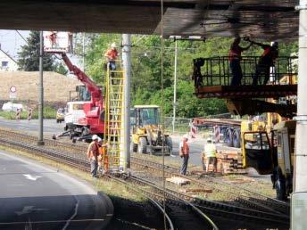
14 Recognizing Vehicle Signals in Smartphone Data Measurement Tram Dresden (TU Dresden) x 4 x 3 x 2 x 1 photo: Klaus Habermann


15 Recognizing Vehicle Signals in Smartphone Data Using Smartphones as Vehicle Acceleration Sensors Motorola DEFY HTC Wildfire
16 Recognizing Vehicle Signals in Smartphone Data Time Patterns in Tram and Smartphone Data (I): Stops uncalibrated MT accelerations in m/s x MT y MT z MT uncalibrated SP accelerations in m/s 2 SP orientation does not equal MT orientation x SP y SP z SP measurement index (200 Hz) time measurement index (interpolated, 200 Hz) time


17 Recognizing Vehicle Signals in Smartphone Data Time Patterns in Tram and Smartphone Data (II): Bends Time: Smartphone 1 Time: Measurement tram Time: Smartphone 2


18 Recognizing Vehicle Signals in Smartphone Data Time Patterns in Tram and Smartphone Data (III): Switches Time: Smartphone 1 Time: Measurement tram Time: Smartphone 2
19 Recognizing Vehicle Signals in Smartphone Data Frequency Analysis in Tram and Smartphone Data (FFT) stops

")
20 Recognizing Vehicle Signals in Smartphone Data Frequency Analysis in Tram and Smartphone Data (FFT) stops


 for x, y,")
 for x-axis")
21 Recognizing Vehicle Signals in Smartphone Data Frequency Analysis in Tram and Smartphone Data (STFT) drive stop drive stop drive Time (s) stop drive stop Time (s) drive stop Frequency (Hz) for x, y, z-axis Measurement tram data Frequency (Hz) for x-axis Smartphone 1, x-axis
22 Overview Motivation: Enhance positioning in difficult urban mobility scenarios Theory: From raw data to signal features of motion states Application: Recognizing vehicle data in smartphone data Outlook: Recognizing all motion states of passengers
23 Summary and Outlook Smartphone sensors may deliver valuable data on vehicle movements Sensor data may be analyzed and classified in various ways in time/frequency domain Next steps: Define signal features Reduce signal features to important ones Test classifiers Human movements on top of vehicle movements
24 POSITIONING IN REAL-TIME PUBLIC TRANSPORT NAVIGATION DRESDEN Comparison Of Vehicle-based And Smart-phone Generated Acceleration Data To Determine Motion States Of Passengers Dipl.-Ing. Ina Partzsch (Fraunhofer IVI) Dipl.-Ing. Gunther Dürrschmidt (TU Dresden) Prof. Dr.-Ing. Oliver Michler (TU Dresden) Dr.-Ing. Georg Förster (Fraunhofer IVI)
Tracking driver actions and guiding phone usage for safer driving. Hongyu Li Jan 25, 2018
 Tracking driver actions and guiding phone usage for safer driving Hongyu Li Jan 25, 2018 1 Smart devices risks and opportunities Phone in use 14% Other distractions 86% Distraction-Affected Fatalities
NEW INDICATORS OF RIDING COMFORT BASED ON VEHICLE DYNAMICS. Pertti Virtala & Juho Meriläinen
 NEW INDICATORS OF RIDING COMFORT BASED ON VEHICLE DYNAMICS Pertti Virtala & Juho Meriläinen CONTENT Background Problem statement Methods Results Conclusions 2 BACKGROUND & PROBLEM Longitudinal unevenness
AN APPROACH TO DEVELOPING A REFERENCE PROFILER
 AN APPROACH TO DEVELOPING A REFERENCE PROFILER John B. Ferris TREY Associate SMITH Professor Graduate Mechanical Research Engineering Assistant Virginia Tech RPUG October Meeting 08 October 28, 2008 Overview
Real-time Image-based Reconstruction of Pipes Using Omnidirectional Cameras
 Real-time Image-based Reconstruction of Pipes Using Omnidirectional Cameras Dipl. Inf. Sandro Esquivel Prof. Dr.-Ing. Reinhard Koch Multimedia Information Processing Christian-Albrechts-University of Kiel
RECOGNITION OF DRIVING MANEUVERS BASED ACCELEROMETER SENSOR
 International Journal of Civil Engineering and Technology (IJCIET) Volume 9, Issue 11, November 2018, pp. 1542 1547, Article ID: IJCIET_09_11_149 Available online at http://www.iaeme.com/ijciet/issues.asp?jtype=ijciet&vtype=9&itype=11
Accelerometer Gesture Recognition
 Accelerometer Gesture Recognition Michael Xie xie@cs.stanford.edu David Pan napdivad@stanford.edu December 12, 2014 Abstract Our goal is to make gesture-based input for smartphones and smartwatches accurate
Development of a Spatial Track Module in SIMPACK and Application to a Simple Roller Coaster Example
 SIMPACK User Meeting 2004 Wartburg, Eisenach, November 2004 Development of a Spatial Track Module in SIMPACK and Application to a Simple Roller Coaster Example Klaus Schott, Jakub Tobolář klaus.schott@dlr.de,
Evaluation of a laser-based reference system for ADAS
 23 rd ITS World Congress, Melbourne, Australia, 10 14 October 2016 Paper number ITS- EU-TP0045 Evaluation of a laser-based reference system for ADAS N. Steinhardt 1*, S. Kaufmann 2, S. Rebhan 1, U. Lages
Comparison of map matching algorithms with floating car data (GPS)
") Tanzeel Ur Rehman KHAN Comparison of map matching algorithms with floating car data (GPS) Duration of the Thesis: 6 months Completion: December 2012 Tutor: Dipl.-Ing. Jürgen Schweitzer Examiner: Prof.
Tanzeel Ur Rehman KHAN Comparison of map matching algorithms with floating car data (GPS) Duration of the Thesis: 6 months Completion: December 2012 Tutor: Dipl.-Ing. Jürgen Schweitzer Examiner: Prof.
Correcting INS Drift in Terrain Surface Measurements. Heather Chemistruck Ph.D. Student Mechanical Engineering Vehicle Terrain Performance Lab
 Correcting INS Drift in Terrain Surface Measurements Ph.D. Student Mechanical Engineering Vehicle Terrain Performance Lab October 25, 2010 Outline Laboratory Overview Vehicle Terrain Measurement System
Attack Resilient State Estimation for Vehicular Systems
 December 15 th 2013. T-SET Final Report Attack Resilient State Estimation for Vehicular Systems Nicola Bezzo (nicbezzo@seas.upenn.edu) Prof. Insup Lee (lee@cis.upenn.edu) PRECISE Center University of Pennsylvania
Motivation. Problem: With our linear methods, we can train the weights but not the basis functions: Activator Trainable weight. Fixed basis function
 Neural Networks Motivation Problem: With our linear methods, we can train the weights but not the basis functions: Activator Trainable weight Fixed basis function Flashback: Linear regression Flashback:
Traffic Flow Prediction Based on the location of Big Data. Xijun Zhang, Zhanting Yuan
 5th International Conference on Civil Engineering and Transportation (ICCET 205) Traffic Flow Prediction Based on the location of Big Data Xijun Zhang, Zhanting Yuan Lanzhou Univ Technol, Coll Elect &
HOW TO USE TECHNOLOGY TO UNDERSTAND HUMAN MOBILITY IN CITIES? Stefan Seer Mobility Department Dynamic Transportation Systems
 HOW TO USE TECHNOLOGY TO UNDERSTAND HUMAN MOBILITY IN CITIES? Stefan Seer Mobility Department Dynamic Transportation Systems Sustainable transport planning requires a deep understanding on human mobility
Laserscanner Based Cooperative Pre-Data-Fusion
 Laserscanner Based Cooperative Pre-Data-Fusion 63 Laserscanner Based Cooperative Pre-Data-Fusion F. Ahlers, Ch. Stimming, Ibeo Automobile Sensor GmbH Abstract The Cooperative Pre-Data-Fusion is a novel
Thales on the Transportation market
 thalesgroup.com Group - Civil Aerospace - Defence Aerospace Space - Transportation - Defence - Security Thales on the Transportation market Thales is a global player with a record of success in the field
> Acoustical feedback in the form of a beep with increasing urgency with decreasing distance to an obstacle
 PARKING ASSIST TESTING THE MEASURABLE DIFFERENCE. > Creation of complex 2-dimensional objects > Online distance calculations between moving and stationary objects > Creation of Automatic Points of Interest
Hanover Traffic Control Centre a combination of various technologies
 main menu VISUM-online traffic management for the EXPO 2000 based on a traffic model Martin Fellendorf, Klaus Nökel (PTV AG, Karlsruhe, Germany) Norbert Handke (move GmbH, Hannover, Germany) Hanover Traffic
A SIMPLE HIERARCHICAL ACTIVITY RECOGNITION SYSTEM USING A GRAVITY SENSOR AND ACCELEROMETER ON A SMARTPHONE
 International Journal of Technology (2016) 5: 831-839 ISSN 2086-9614 IJTech 2016 A SIMPLE HIERARCHICAL ACTIVITY RECOGNITION SYSTEM USING A GRAVITY SENSOR AND ACCELEROMETER ON A SMARTPHONE Alvin Prayuda
Intelligent Outdoor Navigation of a Mobile Robot Platform Using a Low Cost High Precision RTK-GPS and Obstacle Avoidance System
 Intelligent Outdoor Navigation of a Mobile Robot Platform Using a Low Cost High Precision RTK-GPS and Obstacle Avoidance System Under supervision of: Prof. Dr. -Ing. Klaus-Dieter Kuhnert Dipl.-Inform.
Star rating driver safety behavior by the use of smart technologies
 RoundTable Use of technology and its impact on road safety New York, June 14, 2016 Star rating driver safety behavior by the use of smart technologies George Yannis, Professor National Technical University
SELECTION OF WHEEL CHASSIS FOR MOBILE ROBOTS IN COURSE OF PRODUCTION PROCESSES AUTOMATIZATION
 6th INTERNATIONAL MULTIDISCIPLINARY CONFERENCE SELECTION OF WHEEL CHASSIS FOR MOBILE ROBOTS IN COURSE OF PRODUCTION PROCESSES AUTOMATIZATION Ing. Ladislav Kárník, CSc., Technical University of Ostrava,
Cyber-physical intrusion detection on a robotic vehicle
 WIFS 2015 The 7th IEEE International Workshop on Information Forensics and Security Rome, Italy, 16-19 November, 2015 Cyber-physical intrusion detection on a robotic vehicle Tuan Vuong, George Loukas and
When Good Becomes Evil: Keystroke Inference with Smartwatch
 When Good Becomes Evil: Keystroke Inference with Smartwatch Xiangyu Liu, Zhe Zhou, Wenrui Diao, Zhou Li, Kehuan Zhang The Chinese University of Hong Kong 1 Do You Want to Have a Try? 2 Smartwatch is Popular
Location-Based Web Services for Car Infotainment
 Location-Based Web Services for Car Infotainment Susanne Boll University of Oldenburg & OFFIS Institute for Information Technology 01.07.2009 1st tubs.city Symposium, Braunschweig 52 16 30"N 10 31 43"E
Removing Drift from Inertial Navigation System Measurements RPUG Robert Binns Mechanical Engineering Vehicle Terrain Performance Lab
 Removing Drift from Inertial Navigation System Measurements RPUG 2009 Mechanical Engineering Vehicle Terrain Performance Lab December 10, 2009 Outline Laboratory Overview Vehicle Terrain Measurement System
OPTIMIZING 3D SURFACE CHARACTERISTICS DATA COLLECTION BY RE-USING THE DATA FOR PROJECT LEVEL ROAD DESIGN
 OPTIMIZING 3D SURFACE CHARACTERISTICS DATA COLLECTION BY RE-USING THE DATA FOR PROJECT LEVEL ROAD DESIGN Benoit Petitclerc, P.E. John Laurent, M. Sc Richard Habel, M. Sc., Pavemetrics Systems Inc., Canada
An Introduction to Pattern Recognition
 An Introduction to Pattern Recognition Speaker : Wei lun Chao Advisor : Prof. Jian-jiun Ding DISP Lab Graduate Institute of Communication Engineering 1 Abstract Not a new research field Wide range included
Probabilistic Sensor Models for Virtual Validation Use Cases and Benefits
 Probabilistic Sensor Models for Virtual Validation Use Cases and Benefits Dr. Robin Schubert Co-Founder & CEO BASELABS GmbH 2 BASELABS enables data fusion results. 3 Who we are What we do We partner Data
Tyre Models in Vehicle System Dynamics: RMOD-K and SIMPACK
 Tyre Models in Vehicle System Dynamics: RMOD-K and SIMPACK Dipl-Ing. A. Fandre gedas Prof. Dr.-Ing. Ch. Oertel / gedas SIMPACK User Meeting 2001, Bad Ischl (Austria) 13-14 th November 2001 Bad Ischl, 13
ROAD SURFACE STRUCTURE MONITORING AND ANALYSIS USING HIGH PRECISION GPS MOBILE MEASUREMENT SYSTEMS (MMS)
") ROAD SURFACE STRUCTURE MONITORING AND ANALYSIS USING HIGH PRECISION GPS MOBILE MEASUREMENT SYSTEMS (MMS) Bonifacio R. Prieto PASCO Philippines Corporation, Pasig City, 1605, Philippines Email: bonifacio_prieto@pascoph.com
ROAD SURFACE STRUCTURE MONITORING AND ANALYSIS USING HIGH PRECISION GPS MOBILE MEASUREMENT SYSTEMS (MMS) Bonifacio R. Prieto PASCO Philippines Corporation, Pasig City, 1605, Philippines Email: bonifacio_prieto@pascoph.com
Sensor-based Positioning System that Exploits Spatio-Temporal Regularity of Human Mobility
 Sensor-based Positioning System that Exploits Spatio-Temporal Regularity of Human Mobility Takuya Watanabe, Mitsuaki Akiyama and Tatsuya Mori Waseda University NTT Secure Platform Labs 1 Unsolicited marketing
A global decentralized control strategy for urban vehicle platooning relying solely on monocular vision
 IROS09 A global decentralized control strategy for urban vehicle platooning relying solely on monocular vision Avanzini Pierre, Thuilot Benoit, Eric Royer, LASMEA, UMR 6602 du CNRS Clermont-Ferrand, France
Margarita Grinvald. Gesture recognition for Smartphones/Wearables
 Margarita Grinvald Gesture recognition for Smartphones/Wearables Gestures hands, face, body movements non-verbal communication human interaction 2 Gesture recognition interface with computers increase
Algorithms for Constructing Vehicle Trajectories in Urban Networks Using Inertial Sensors Data from Mobile Devices
 Old Dominion University ODU Digital Commons Modeling, Simulation & Visualization Engineering Theses & Dissertations Modeling, Simulation & Visualization Engineering Summer 2017 Algorithms for Constructing
MATLAB Expo 2014 Verkehrszeichenerkennung in Fahrerassistenzsystemen Continental
 Senses for Safety. Driver assistance systems help save lives. MATLAB Expo 2014 Verkehrszeichenerkennung in Fahrerassistenzsystemen MATLAB @ Continental http://www.continental-automotive.com/ Chassis &
Inferring Maps from GPS Data
 Inferring Maps from GPS Data 1. Why infer maps from GPS traces? 2. Biagioni/Eriksson algorithm 3. Evaluation metrics 4. Similar approaches: satellite images, map update 5. Lab 4 1 2 3 OpenStreetMap Licensed
Robust Algorithms for Estimating Vehicle Movement from Motion Sensors within Smartphones
 Old Dominion University ODU Digital Commons Modeling, Simulation & Visualization Engineering Theses & Dissertations Modeling, Simulation & Visualization Engineering Summer 8-2016 Robust Algorithms for
Cloud Networked Robotics and Acceleration Based Sensing
 robotics/2012-12-14 Cloud Networked Robotics and Acceleration Based Sensing Miwako Doi, Toshiba Corporation Tokyo, Japan Robotics DTF, OMG Dec. 11, 2012 1 2012 Toshiba Corporation Mega Trends 2012 Toshiba
Vehicle Localization. Hannah Rae Kerner 21 April 2015
 Vehicle Localization Hannah Rae Kerner 21 April 2015 Spotted in Mtn View: Google Car Why precision localization? in order for a robot to follow a road, it needs to know where the road is to stay in a particular
Motion Estimation for Video Coding Standards
 Motion Estimation for Video Coding Standards Prof. Ja-Ling Wu Department of Computer Science and Information Engineering National Taiwan University Introduction of Motion Estimation The goal of video compression
A novel approach to classify human-motion in smart phone using 2d-projection method
 A novel approach to classify human-motion in smart phone using 2d-projection method 1 Yi Suk Kwon, 1 Yeon Sik Noh, 1 Ja Woong Yoon, 1 Sung Bin Park, 1 Hyung Ro Yoon 1 Department of Biomedical Engineering
Exploring Pavement Texture and Surface Friction Using Soft Computing Techniques
 Exploring Pavement Texture and Surface Friction Using Soft Computing Techniques Students: Guangwei Yang, You Zhan, Ace Fei, Allen Zhang PIs: Joshua Q. Li & Kelvin C.P. Wang School of Civil and Environmental
Non-rigid body Object Tracking using Fuzzy Neural System based on Multiple ROIs and Adaptive Motion Frame Method
 Proceedings of the 2009 IEEE International Conference on Systems, Man, and Cybernetics San Antonio, TX, USA - October 2009 Non-rigid body Object Tracking using Fuzzy Neural System based on Multiple ROIs
IP-S2 HD HD IP-S2. 3D Mobile Mapping System. 3D Mobile Mapping System
 HD HD 3D Mobile Mapping System 3D Mobile Mapping System Capture Geo-referenced, Time-Stamped Point Clouds and Imagery 3D Scanning of Roadside Features 360º Camera for Spherical Image Capture Dual Frequency
GYROPHONE RECOGNIZING SPEECH FROM GYROSCOPE SIGNALS. Yan Michalevsky (1), Gabi Nakibly (2) and Dan Boneh (1)
, Gabi Nakibly (2) and Dan Boneh (1)") GYROPHONE RECOGNIZING SPEECH FROM GYROSCOPE SIGNALS Yan Michalevsky (1), Gabi Nakibly (2) and Dan Boneh (1) (1) Stanford University (2) National Research and Simulation Center, Rafael Ltd. 0 MICROPHONE
GYROPHONE RECOGNIZING SPEECH FROM GYROSCOPE SIGNALS Yan Michalevsky (1), Gabi Nakibly (2) and Dan Boneh (1) (1) Stanford University (2) National Research and Simulation Center, Rafael Ltd. 0 MICROPHONE
Evaluating the Performance of a Vehicle Pose Measurement System
 Evaluating the Performance of a Vehicle Pose Measurement System Harry Scott Sandor Szabo National Institute of Standards and Technology Abstract A method is presented for evaluating the performance of
Measuring the World: Designing Robust Vehicle Localization for Autonomous Driving. Frank Schuster, Dr. Martin Haueis
 Measuring the World: Designing Robust Vehicle Localization for Autonomous Driving Frank Schuster, Dr. Martin Haueis Agenda Motivation: Why measure the world for autonomous driving? Map Content: What do
Simulation of Aircraft Encounters with Perturbed Vortices Considering Unsteady Aerodynamic Effects
 Simulation of Aircraft Encounters with Perturbed Vortices Considering Unsteady Aerodynamic Effects Berlin Institute of Technology Institute of Aeronautics and Astronautics, Flight Mechanics, Flight Control
Computational Imaging for Self-Driving Vehicles
 CVPR 2018 Computational Imaging for Self-Driving Vehicles Jan Kautz--------Ramesh Raskar--------Achuta Kadambi--------Guy Satat Computational Imaging for Self-Driving Vehicles Jan Kautz--------Ramesh Raskar--------Achuta
Automotive Thermal Management for Full Vehicles
 Automotive Thermal Management for Full Vehicles Concerning the thermal behavior of automotive vehicles it is pursued to accomplish simulations for the full complexity of a vehicle's geometry and transport
Neural Networks Terrain Classification using Inertial Measurement Unit for an Autonomous Vehicle
 SICE Annual Conference 2008 August 20-22, 2008, The University Electro-Communications, Japan Neural Networks Terrain Classification using Inertial Measurement Unit for an Autonomous Vehicle Rukwan Jitpakdee
W4. Perception & Situation Awareness & Decision making
 W4. Perception & Situation Awareness & Decision making Robot Perception for Dynamic environments: Outline & DP-Grids concept Dynamic Probabilistic Grids Bayesian Occupancy Filter concept Dynamic Probabilistic
Rail defect diagnosis using smartphones and drones by: Borna Tech.
 UIC Digital Awards 2016 Rail defect diagnosis using smartphones and drones by: Borna Tech. Borna Tech 1 Agenda Borna Tech 2 Introduction 2 Introduction Condition monitoring of rail tracks is an important
Leading new ICT, Connecting to the Smart Future
 Leading new ICT, Connecting to the Smart Future Rachad NASSAR, Ph.D. Business Development and Marketing Manager Enterprise Transport Sector Traffic Lab Seminar Friday 24.11.2017 Helsinki, Finland Constantly
Smartphone sensing. 10 November 2014
 Smartphone sensing 10 November 2014 Urban Noise Pollution Example project: http://noisetube.net Started at the Sony Computer Science Lab in Paris and currently hosted by the Vrije Universiteit Brussel.
Earthquake Waveform Recognition Olivia Grubert and Bridget Vuong Department of Computer Science, Stanford University
 Earthquake Waveform Recognition Olivia Grubert and Bridget Vuong Department of Computer Science, Stanford University Abstract When people think of applying machine learning to earthquake data, most seek
Vehicle Trust Management for Connected Vehicles
 Vehicle Trust Management for Connected Vehicles FINAL RESEARCH REPORT Insup Lee (PI), Nicola Bezzo, Jian Chang Contract No. DTRT12GUTG11 DISCLAIMER The contents of this report reflect the views of the
Mobile and Ubiquitous Computing: Mobile Sensing
 Mobile and Ubiquitous Computing: Mobile Sensing Master studies, Winter 2015/2016 Dr Veljko Pejović Veljko.Pejovic@fri.uni-lj.si Based on: Mobile and Ubiquitous Computing Mirco Musolesi, University of Birmingham,
Automated calibration of a tractor transmission control unit
 Group H - Mobile Hydraulics Paper H-3 399 Automated calibration of a tractor transmission control unit Dipl.-Ing. Christopher Körtgen Institut für Maschinenelemente und Maschinengestaltung, RWTH Aachen,
2. Basic Task of Pattern Classification
 2. Basic Task of Pattern Classification Definition of the Task Informal Definition: Telling things apart 3 Definition: http://www.webopedia.com/term/p/pattern_recognition.html pattern recognition Last
On Dynamics of Radial Elastic Wheelsets
 VSDIA 2000, 7 th Mini Conference, Budapest, 6 8 November On Dynamics of Radial Elastic Wheelsets H. Claus Contents: Motivation Model Development and Simulation Results Parameter Optimization Additional
The Design of Road Evaluation and Monitoring System based on Geographical Information System
 The Design of Road Evaluation and Monitoring System based on Geographical Information System Ary Setyawan 1,*, Muhammad Farid Al Alimi 2, Dewi Handayani 2, Agus Sumarsono 1 1 Roadmate Research Group, Universitas
Improving the Effectiveness of Smart Work Zone Technologies ICT R27-155
 Improving the Effectiveness of Smart Work Zone Technologies ICT R27-155 Paul Lorton, IDOT Yanning Li, Juan Carlos Martinez Mori, and Prof. Dan Work (UIUC) 1 Outline Background on smart work zones Evaluation
Syllabus for Ph.D Entrance Test, RGPV. Common for CSE/IT/CA
 Syllabus for Ph.D Entrance Test, RGPV. Common for CSE/IT/CA Algorithms: Algorithms and complexity; Combinatorics and graph theory; Geometric Algorithms, Parallel and Distributed Algorithms, Randomized
Introduction to Massive Data Interpretation
 Introduction to Massive Data Interpretation JERKER HAMMARBERG JAKOB FREDSLUND THE ALEXANDRA INSTITUTE 2013 2/12 Introduction Cases C1. Bird Vocalization Recognition C2. Body Movement Classification C3.
OPEN SIMULATION INTERFACE. INTRODUCTION AND OVERVIEW.
 OPEN SIMULATION INTERFACE. INTRODUCTION AND OVERVIEW. DIFFERENTIATION OF SIMULATION DATA INTERFACES. Odometry / Dynamics Interface Open Interface (OSI) Map Interface Dynamics Model Map Model Vehicle Dynamics
A multilevel simulation framework for highly automated harvest processes enabled by environmental sensor systems
 A multilevel simulation framework for highly automated harvest processes enabled by environmental sensor systems Jannik Redenius, M.Sc., Matthias Dingwerth, M.Sc., Prof. Dr. Arno Ruckelshausen, Faculty
LPR and Traffic Analytics cameras installation guide. Technical Manual
 LPR and Traffic Analytics cameras installation guide Technical Manual p. 2 of 19 Purpose This document is addressed to clients and installers, and its purpose is to explain the hardware and installation
Analyzing the Relationship Between Head Pose and Gaze to Model Driver Visual Attention
 Analyzing the Relationship Between Head Pose and Gaze to Model Driver Visual Attention Sumit Jha and Carlos Busso Multimodal Signal Processing (MSP) Laboratory Department of Electrical Engineering, The
COMPANION FINAL EVENT 14 TH & 15 TH September 2016
 COMPANION FINAL EVENT 14 TH & 15 TH September 2016 Update on recent developments related to Connected and Automated Driving Myriam COULON CANTUER Smart Mobility & Living Communication Networks, Content
Embedded Systems Projects
 Embedded Systems Projects I. Embedded based ANDROID Mobile Systems 1. Health Assessment Monitoring using Embedded sensor data for Mobile Apps (IEEE 2. Precise pressure indication using simultaneous Electro
Camera Drones Lecture 2 Control and Sensors
 Camera Drones Lecture 2 Control and Sensors Ass.Prof. Friedrich Fraundorfer WS 2017 1 Outline Quadrotor control principles Sensors 2 Quadrotor control - Hovering Hovering means quadrotor needs to hold
Troubleshooting in navigation system 2
 Page 1 of 7 Pin assignments, functions etc. apply to vehicles of the series E38 and E39 with navigation system 2 (as from production break PU 97) Introduction The navigation system is a dynamic system
Comparison of integrated GPS-IMU aided by map matching and stand-alone GPS aided by map matching for urban and suburban areas
 Comparison of integrated GPS-IMU aided by map matching and stand-alone GPS aided by map matching for urban and suburban areas Yashar Balazadegan Sarvrood and Md. Nurul Amin, Milan Horemuz Dept. of Geodesy
Real Time Recognition of Non-Driving Related Tasks in the Context of Highly Automated Driving
 Real Time Recognition of Non-Driving Related Tasks in the Context of Highly Automated Driving S. Enhuber 1, T. Pech 1, B. Wandtner 2, G. Schmidt 2, G. Wanielik 1 1 Professorship of Communications Engineering
Simulation: A Must for Autonomous Driving
 Simulation: A Must for Autonomous Driving NVIDIA GTC 2018 (SILICON VALLEY) / Talk ID: S8859 Rohit Ramanna Business Development Manager Smart Virtual Prototyping, ESI North America Rodolphe Tchalekian EMEA
Automation functions and their licensing
 08/17 Automation functions and their licensing ArtemiS SUITE is a multi-functional software application supporting you efficiently and comprehensively in many areas of sound and vibration analysis. As
EU Project BONVOYAGE: A distributed approach to intermodal route planning
 HoPE final conference: The Next Generation of Route Planners Brussels, 9 May 2017 EU Project BONVOYAGE: A distributed approach to intermodal route planning Dag Kjenstad, SINTEF Digital PROJECT OVERVIEW
WEEKS 1-2 MECHANISMS
 References WEEKS 1-2 MECHANISMS (METU, Department of Mechanical Engineering) Text Book: Mechanisms Web Page: http://www.me.metu.edu.tr/people/eres/me301/in dex.ht Analitik Çözümlü Örneklerle Mekanizma
Development of Vehicle Characteristics Using MSC.ADAMS Simulation Including Chassis Controllers
 Development of Vehicle Characteristics Using MSC.ADAMS Simulation Including Chassis Controllers Dr.-Ing. Harald Wilhelm, Simulation Handling & Ride Audi AG Thomas Kriegel, Audi AG, Head Simulation Handling
ESTIMATING PARAMETERS FOR MODIFIED GREENSHIELD S MODEL AT FREEWAY SECTIONS FROM FIELD OBSERVATIONS
 0 ESTIMATING PARAMETERS FOR MODIFIED GREENSHIELD S MODEL AT FREEWAY SECTIONS FROM FIELD OBSERVATIONS Omor Sharif University of South Carolina Department of Civil and Environmental Engineering 00 Main Street
SIMULATION TESTS ON SHAPING THE WORKING WIDTH OF THE CONCRETE PROTECTIVE SYSTEMS
 Journal of KONES Powertrain and Transport, Vol. 7, No. 00 SIMULATION TESTS ON SHAPING THE WORKING WIDTH OF THE CONCRETE PROTECTIVE SYSTEMS Wac aw Borkowski, Zdzis aw Hryciów, Piotr Rybak, Józef Wysocki
RIDE WITH TRANSLOC ANDROID USER GUIDE
 RIDE WITH TRANSLOC ANDROID USER GUIDE PURPOSE: The following guide will give a in-depth overview of how to best use the TransLoc Rider application, and how to utilize the OnDemand demand-response service
All rights reserved. ITS at ETSI. Presented by Luis Jorge Romero on behalf of ETSI TC ITS
 http://eustandards.in/ ITS at ETSI Presented by Luis Jorge Romero on behalf of ETSI TC ITS 2 All rights reserved ITS: a definition ITS means applying Information and Communications Technologies (ICT) to
Re-use of FOT Data to Assess the Frequency and Impact of Distracted Driving Andreas Landau Dr. Barbara Metz Dr. Volker Hargutt Alexandra Neukum
 Re-use of FOT Data to Assess the Frequency and Impact of Distracted Driving Andreas Landau Dr. Barbara Metz Dr. Volker Hargutt Alexandra Neukum Naturalistic Driving Research Symposium Blacksburg, Virginia,
Appearance-based Visual Localisation in Outdoor Environments with an Omnidirectional Camera
 52. Internationales Wissenschaftliches Kolloquium Technische Universität Ilmenau 10. - 13. September 2007 M. Schenderlein / K. Debes / A. Koenig / H.-M. Gross Appearance-based Visual Localisation in Outdoor
Sensor Fusion: Potential, Challenges and Applications. Presented by KVH Industries and Geodetics, Inc. December 2016
 Sensor Fusion: Potential, Challenges and Applications Presented by KVH Industries and Geodetics, Inc. December 2016 1 KVH Industries Overview Innovative technology company 600 employees worldwide Focused
Transforming Transport Infrastructure with GPU- Accelerated Machine Learning Yang Lu and Shaun Howell
 Transforming Transport Infrastructure with GPU- Accelerated Machine Learning Yang Lu and Shaun Howell 11 th Oct 2018 2 Contents Our Vision Of Smarter Transport Company introduction and journey so far Advanced
Localization and Map Building
 Localization and Map Building Noise and aliasing; odometric position estimation To localize or not to localize Belief representation Map representation Probabilistic map-based localization Other examples
Bus Stop Beacons: Transit Wayfinding for People with Visual Impairments
 Bus Stop Beacons: Transit Wayfinding for People with Visual Impairments Michael J. Walk Texas A&M Transportation Institute, Associate Research Scientist, Austin, TX Randy Frazier Houston METRO, Chief Technology
Learning Driving Styles for Autonomous Vehicles for Demonstration
 Learning Driving Styles for Autonomous Vehicles for Demonstration Markus Kuderer, Shilpa Gulati, Wolfram Burgard Presented by: Marko Ilievski Agenda 1. Problem definition 2. Background a. Important vocabulary
EMBEDDED MAJOR PROJECTS LIST
 CODE PROJECT TITLE APPLICATION TECHNOLOGY /CORE KTEMB 01 KTEMB 02 KTEMB 03 A Location Aided Flooding Mechanism In Community Based Iot Networks An Iot Based Fire Alarming And Authentication System For Workhouse
Mobile 3D laser scanning technology application in the surveying of urban underground rail transit
 IOP Conference Series: Earth and Environmental Science PAPER OPEN ACCESS Mobile 3D laser scanning technology application in the surveying of urban underground rail transit To cite this article: Youmei
NAVIGATION* Basic Navigation Operation. Learn how to enter a destination and operate the navigation system.
 * Learn how to enter a destination and operate the navigation system. NAVIGATION Basic Navigation Operation A real-time navigation system uses GPS and a map database to show your current location and help
Overview. Background. Intelligence at the Edge. Learning at the Edge: Challenges and Brainstorming. Amazon Alexa Smart Home!
 Overview Background Intelligence at the Edge Samsung Research Learning at the Edge: Challenges and Brainstorming Amazon Alexa Smart Home! Background Ph.D. at UW CSE RFID, Mobile, Sensors, Data Nokia Research
Connected Car. Dr. Sania Irwin. Head of Systems & Applications May 27, Nokia Solutions and Networks 2014 For internal use
 Connected Car Dr. Sania Irwin Head of Systems & Applications May 27, 2015 1 Nokia Solutions and Networks 2014 For internal use Agenda Introduction Industry Landscape Industry Architecture & Implications
Research on resonance vibration simulation method of high-speed railway vehicle carbody Yi-Zhao NIEa, Jing Zengb, Fan-Song LIc
 International Industrial Informatics and Computer Engineering Conference (IIICEC 215) Research on resonance vibration simulation method of high-speed railway vehicle carbody Yi-Zhao NIEa, Jing Zengb, Fan-Song
Real Time Multi-Sensor Data Acquisition and Processing for a Road Mapping System
 Real Time Multi-Sensor Data Acquisition and Processing for a Road Mapping System by Xiang Luo A thesis submitted for the degree of Master of Engineering (Research) Faculty of Engineering and Information
FULLY AUTOMATIC ROUGHNESS MEASUREMENT "IN MINIATURE"
 FULLY AUTOMATIC ROUGHNESS MEASUREMENT "IN MINIATURE" Klingelnberg now has a new roughness probe that is capable of measuring gear teeth with a module as small as 0.9 mm for carrying out surface measurements