ITS488 Geographic Informa5on System
|
|
|
- Shawn Underwood
- 5 years ago
- Views:
Transcription


1 ITS488 Geographic Informa5on System 11-1 Open source GIS Teerayut Horanont, PhD Sirindhorn Interna5onal Ins5tute of Technology (SIIT) Thammasat University E: 10/29/14 ITS488 1
2 Today outline 1. The Open Source Geospa5al Founda5on 2. Open Source License 3. Free and Open Source SoRware for Geospa5al (FOSS4G ) 4. Openstreetmap 10/29/14 ITS488 2
3 Source Data Open Standards Educa5on

4 Open Source Geospa5al Founda5on The Open Source Geospa5al Founda5on (OSGeo), is a non- profit non- governmental organiza5on whose mission is to support and promote the collabora5ve development of open geospa5al technologies and data. 10/29/14 ITS488 4
5 OSGeo an organiza5on of developers and users dedicated to furthering the goal of open source developing and suppor5ng major libraries, client applica5ons, and server technologies 10/29/14 ITS488 5
6 OSGeo s Mission Support and promote the highest quality Open Source Geospa5al SoRware
7 OSGeo's Goals Provide resources for FOSS4G projects: Infrastructure Legal frame Financial support Promote free and open spa/al data Create and maintain a quality brand Create and promote free curriculua Promote and contribute to standards
8 OSGeo Activities On a global scale: Provide mature sorware solu5ons Support FOSS4G, an interna5onal open source conference for geospa5al applica5on (2013: UK, 2014: USA) Support local ac5vi5es and capaci5es Local open source conference for geospa5al applica5on (i.e. FOSS4G- SEA) Local chapters (India,...) Facilitate inter- project communica5on Build a solid market for businesses and users Interface with industry and business Support the educa/on of domain experts not «brand- specialists»...
9 FOSS4G Projects Mapbender UMN Mapserver Quantum GIS OSSIM MapBuilder Map Guide OS GRASS GIS gvsig desktop GIS OpenLayers deegree FDO GDAL/OGR GeoServer web mapping GEOS GeoTools GeoNetwork MetaCRS PostGIS Project in incubation metadata libraries

10 Several projects can communicate with each other and other geographical tools. 10/29/14 ITS488 10
11 To the Heart of the Mader 1. Licensees are free to use open source sorware for any purpose whatsoever. 2. Licensees are free to make copies of open source sorware and to distribute them without payment of royal5es to a licensor. 3. Licensees are free to create deriva5ve works of open source sorware and to distribute them without payment of royal5es to a licensor. 4. Licensees are free to access and use the source code of open source sorware. 5. Licensees are free to combine open source and other sorware. 10/29/14 ITS488 11

12 Intellectual Property 10/29/14 ITS488 12
13 The Clever Bit What if you were to Explicitly license your source code to anyone who wants it, in such a way that they have the right to do whatever they want with it Turns the no5on of copyright on it s head! copyler Thus: Open source sorware is not given away rather, it is controlled via a license agreement under copyright law 10/29/14 ITS488 13
14 Two types of licenses Academic or A=ribu/on Licenses goal: a commons of code for all to use for any purpose you can do anything with the code, up to and including incorpora5ng it into closed/proprietary programs code can escape the commons but, you must give credit the original authors example licenses: BSD, MIT, Apache Reciprocal Licenses goal: a commons of code for all to share and share- alike deriva5ves must be under the same license code and deriva5ves cannot escape the commons considered viral, as can infect other code you introduce example licenses: GPL 10/29/14 ITS488 14
15 License Shopping OSI The Open Source Ini/a/ve non- profit organiza5on owns the Open Source Defini5on (10 basic tenets) cer5fies licenses as open source currently ~50 licenses listed The open source community does not need any more licenses! Use an OSI one do not write your own! You shouldn t have to struggle through learning the legal nuances You won t have to hire a lawyer Allow the community to sedle on a base set of common license (moral: it s all about reuse and coopera5ve development ) hdp://opensource.org/ 10/29/14 ITS488 15
16 Tools and Libraries A few libraries that are the founda5on of many Open Source and commercial Geospa5al SoRware Packages GDAL (Raster) and OGR (Vector) Geospa5al Data Abstrac5on Library / OpenGIS Simple Features Reference Implementa5on Tools for reading, wri5ng and processing of raster and vector data sets - > formats Important base for many Desktop GIS systems e.g. ArcGIS OGR extends MapServer formatsoracle Spa5al, ESRI Geodatabase (MDB), TIGER, MapInfo PROJ4 is a library for cartographic projec/on rou/nes stand alone projec5on u5lity proj libraries for more than 2500 projec5ons (e.g. EPSG list) GeoTools is an open source Java GIS toolkit GeoTools is a library for cartographic projec5on rou5nes Similar usage as OGR and GDAL for Java based projects Udig and GeoServer are based on GeoTools 10/29/14 ITS488 16


17 OpenStreetMap Community Meets Cartography Andy Robinson
18 Why? Exis5ng Data not Free & Open Ar5ficially S5fles Innova5on Data as a Sta5c Snapshot Near Real- Time data use not possible Real- Time data Interac5ve data edi5ng by users the next step
19 Quote 1 If you don t make [lower- resolu5on mapping data] publicly available, there will be people with their cars and GPS devices, driving around with their laptops.. They will be cataloguing every lane, and enjoying it, driving 4 4s behind your farm at the dead of night. There will, if necessary, be a grass- roots remapping. Tim Berners- Lee
20 Quote 2 You could have a community capability where you took the GPS data of people driving around and started to see, oh, there s a new road that we don t have, a new route.. And so that data eventually should just come from the community with the right sorware infrastructure. Bill Gates
21 How? Provide an Open Plaworm OSM Users may freely input and extract data Raw sources for OSM Basemap GPS track logs. Movement Breadcrumbs Exis5ng Free Data Sources (eg TIGER/LINE) Historical Maps Out of Copyright mapping Users Create Basemap from Raw Sources Via Online and Offline Edi5ng SoRware
22 Building Blocks Minimal Data Set for Maximum Flexibility Nodes Segments Ways/Areas Tags Metadata as key/value pairs Full User History and Rollback ability


23 + Fancy a Go?
24
25 West Midlands
26

27
28 Rendering Data

29 Rendering stage 1

30 Rendering stage 2
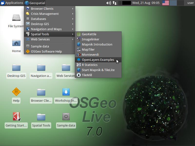
31 OSGEO Live DVD originally compiled by Cameron Shorter, and one of the coordinators of the OSGeo- Live Project. a bootable DVD, based on the Xubuntu linux distribu5on, pre- installed and pre- configured with close to 50 of the best GeoSpa5al Open Source applica5ons along with sample datasets. OSGeo- Live can also be run from a USB flash drive, installed into a Virtual Machine, or installed onto your hard drive.
32
33 web mapping UMN MapServer GeoMajas MapFish OpenLayers Mapbender Quantum GIS MapServer Mapnik ZOO Project deegree OSGeo Live DVD Quantum GIS GRASS GIS Geopublisher OpenStreetMap MapGuide OS GeoServer deegree GIS FDO GeoTools GMT KOSMO GeoKettle Desktop GIS GEOS OSSIM udig gvsig GDAL/OGR Viking Metadata GeoNetwork Application Server MetaCRS SpatialLite PostGIS Libraries

34 FOSS4G- Asia 2014, Bangkok, Thailand, 2-5 December hdp:// asia.org/2014/ 10/29/14 ITS488 34
35 Open for ques5ons 10/29/14 ITS488 35
Open Source Software Solutions
 Open Source Software Solutions Ned Horning horning@amnh.org http://biodiversityinformatics.amnh.org 1 Overview Introduction to open source software Geospatial software options Open Source Geospatial Foundation
Introduction to Open Source GIS
 Introduction to Open Source GIS a practical overview Michael Gerlek Karsten Vennemann Aaron Racicot Dane Springmeyer Cascadia Users of Geospatial Open Source Cascadia Chapter of the Open Source Geospatial
Implementing Web GIS Solutions
 Implementing Web GIS Solutions using open source software Karsten Vennemann Seattle Talk Overview Talk Overview Why and What What is Open Source (GIS)? Why use it? Application Components Overview of Web
EWRG-CES. Bharath Setturu EWRG, CES, IISc
 Bharath Setturu EWRG, CES, IISc What is Free and Open Source? Free and Open source describes a broad general type of free software license that makes source code available to the general public with no
Developing a Free and Open Source Software based Spatial Data Infrastructure. Jeroen Ticheler
 Developing a Free and Open Source Software based Spatial Data Infrastructure Jeroen Ticheler 1 License This work is licensed under the Creative Commons Attribution-NonCommercial-ShareAlike 2.5 License.
Web Map Servers. Mark de Blois. Septembre 2016
 Web Map Servers Mark de Blois Septembre 2016 Learning Objectives After this lecture you will be able to understand web map servers as used in Web-GIS applications Introduction A Web Map Server is a computer
Using the Network Common Data Form for storage of atmospheric data
 Using the Network Common Data Form for storage of atmospheric data Maarten Plieger Royal Netherlands Meteorological Institute The NetCDF4 data format (Network Common Data Form) is used within the ADAGUC
GIS Sys tem. Images. Image Processing. Statistical Reports. System. Maps. Map Digitizing. Statistical. Analysis System Spatial Data Base.
 Images Maps Map Digitizing System Image Processing System Statistical Analysis System Statistical Reports Geographic Analysis System Spatial Data Base Attribute Data Base Database Management System GIS
OSGeo Web Mapping Typification: GeoMajas, Mapbender, MapFish and OpenLayers. Christoph Baudson Arnulf Christl FOSS4G 2010 Barcelona
 OSGeo Web Mapping Typification: GeoMajas, Mapbender, MapFish and OpenLayers Christoph Baudson Arnulf Christl FOSS4G 2010 Barcelona Disclaimer All information contained in this presentation has been compiled
InCLUDE Data Exchange. Julia Harrell, GISP GIS Coordinator, NC DENR
 InCLUDE Data Exchange Julia Harrell, GISP GIS Coordinator, NC DENR Julia.harrell@ncdenr.gov InCLUDE Project Partners NC Department of Environment & Natural Resources: The State of NC s lead environmental
Who are we? Randal Hale. Nathan Saylor. GIS Coordinator for Hardin Co. Owner of North River Geographic Systems. Consultant. Owner of Saylor Mapping
 Who are we? Nathan Saylor Randal Hale GIS Coordinator for Hardin Co. Owner of North River Geographic Systems Owner of Saylor Mapping Consultant Been doing GIS since 2005 Been in the GIS Industry 20 something
GeoNode Intro & Demo
 GeoNode Intro & Demo Cristiano Giovando - Global Facility for Disaster Reduction and Recovery, World Bank Paolo Corti - Center for Geographic Analysis, Harvard University Dynamic Mapping of Secondary Cities
County of Los Angeles. Chief Information Office Preferred Technologies for Geographic Information Systems (GIS) Version 2 May 2015
 Version 2 May 2015") County of Los Angeles Chief Information Office Preferred Technologies for Geographic Information Systems (GIS) Version 2 May 2015 CIO Preferred Technologies for GIS This document lists the preferred Geographic
County of Los Angeles Chief Information Office Preferred Technologies for Geographic Information Systems (GIS) Version 2 May 2015 CIO Preferred Technologies for GIS This document lists the preferred Geographic
Free and Open Source Geospa0al So2ware and Data. Ioannis Kokkinidis Geospa0al and Environmental Analysis PhD program
 Free and Open Source Geospa0al So2ware and Data Ioannis Kokkinidis Geospa0al and Environmental Analysis PhD program So2ware and Data Licenses Proprietary Limited Distribu0on Limited Use End User License
Open source technologies and INSPIRE network services in Slovak environmental agency
 Open source technologies and INSPIRE network services in Slovak environmental agency Peter Mozolík, Martin Koška, Marek Žiačik, Martin Tuchyňa Slovak Environmental Agency (SEA) SEA role within slovak SDI
1.0 General AUTODESK S ENTRY INTO OPEN SOURCE QUESTIONS AND ANSWERS FOR CUSTOMERS MARCH 2006 UPDATE UPDATES IN BLUE
 AUTODESK S ENTRY INTO OPEN SOURCE QUESTIONS AND ANSWERS FOR CUSTOMERS MARCH 2006 UPDATE UPDATES IN BLUE 1.0 General 1.1 What s the background? In late 2005, several groups, developers and individuals joined
ArcGIS Online. The Road Ahead Geoff Mortson
 ArcGIS Online The Road Ahead Geoff Mortson gmortson@esricanada.com ArcGIS Online Easily create and share maps Delivered as intelligent maps Access on virtually any device anyone, anywhere Compliments and
Open Source Geospatial. The One True Path to Enlightenment
 Open Source Geospatial The One True Path to Enlightenment HUP! I had the opportunity to spend a few hours walking about Delft yesterday, and I kept coming across the same phrase, over and over. "hup holland
Gli ultimi sviluppi di GRASS
 Gli ultimi sviluppi di GRASS Settimo Meeting degli utenti italiani di GRASS Genova, 23-24 Feb 2006 M. Neteler and GRASS Development Team neteler at itc it http://mpa.itc.it - http://grass.itc.it ITC-irst,
IMPLEMENTING THE WASCAL DATA INFRASTRUCTURE (WADI)
") IMPLEMENTING THE WASCAL DATA INFRASTRUCTURE (WADI) Ralf Kunkel, Antonio Rogmann, Jürgen Sorg, Huaping Wang Helmholtz Open Science Webinare zu Forschungsdaten, 2015-03- 11 What is WASCAL? West African Science
IMPLEMENTING THE WASCAL DATA INFRASTRUCTURE (WADI) Ralf Kunkel, Antonio Rogmann, Jürgen Sorg, Huaping Wang Helmholtz Open Science Webinare zu Forschungsdaten, 2015-03- 11 What is WASCAL? West African Science
InCLUDE Data Exchange. Julia Harrell, GISP GIS Coordinator, NC DENR
 InCLUDE Data Exchange Julia Harrell, GISP GIS Coordinator, NC DENR Julia.harrell@ncdenr.gov InCLUDE Project Partners NC Department of Environment & Natural Resources: The State of NC s lead environmental
A Survey of Open Source Geospatial Software Bob Bruce, P.Eng Mapping and Geomatics Branch, Manitoba Conservation
 A Survey of Open Source Geospatial Software Bob Bruce, P.Eng Mapping and Geomatics Branch, Manitoba Conservation WWW.HWPS.CA Bob.Bruce@gov.mb.ca MUUG Meeting Tuesday, 11 September 2007 access this presentation
By Robert Slivinsky 1
 By Robert Slivinsky 1 Tell HC Mobile Application SQL Server 2008 GeoServer GeoExt- Open Layers 2 3 Desktop Splash Page 2 sec GPS/Location Approval 4 Homepage Meat - Form Categories from EOCcalls 5 Description
Practical introduction to GRASS and related software for beginners
 Sydney, Australia 20-23 Oct. 2009 Practical introduction to GRASS and related software for beginners Marco Ciolli, Clara Tattoni and Paolo Zatelli Department of Civil and Environmental Engineering University
Beyond PostGIS. New developments in Open Source Spatial Databases. Karsten Vennemann. Seattle
 New developments in Open Source Spatial Databases Karsten Vennemann Seattle Talk Overview Intro Relational Databases PostGIS JASPA INGRES Geospatial MySQL Spatial Support HatBox a user space extension
QGIS Plugins FOSS4G From Must-Haves to insider Sourcepole AG, Switzerland
 FOSS4G 2015 From Must-Haves to insider tips @PirminKalberer Sourcepole AG, Switzerland www.sourcepole.com About Sourcepole > QGIS > > > > Core dev. & Project Steering Commitee QGIS Server, Printing, Plugins,
The Office for Outer Space Affairs bringing space- based tools and applica:ons at the heart of the 2030 Agenda for Sustainable Development
 The Office for Outer Space Affairs bringing space- based tools and applica:ons at the heart of the 2030 Agenda for Sustainable Development SIMONETTA DI PIPPO, DIRECTOR United Nations Office for Outer Space
EDINA Workshop: Creating a Campus Map and Displaying it in OpenLayers
 Contents Introduction... 2 What steps are involved?... 3 Before you start... 4 Create your campus map... 5 1. Load the basemap data into ArcMap... 5 2. Set up Symbology and Labels of Layers... 6 Improve
Free and Open Source Desktop GIS Projects and Software: An Analysis
 Free and Open Source Desktop GIS Projects and Software: An Analysis Stefan Steiniger, University of Calgary, Canada Swiss NSF Project: PAGEVIS-LD Email: ssteinig@ucalgary.ca 15.07.2009 1 OrbisGIS MapWindow
Lecture note on the history and principles of geo-webservices
 A SHORT INTRODUCTION TO GEO-WEBSERVICES Lecture note on the history and principles of geo-webservices Barend Köbben Version 1.0 February 24, 2010 Contents 1 From monolithic to distributed GIS architectures
A comparison of GIS Mobile Applications. Miguel Montesinos & Javier Carrasco
 A comparison of GIS Mobile Applications Miguel Montesinos & Javier Carrasco mmontesinos/jcarrasco@prodevelop.es Agenda 1. 2. 3. 4. 5. 6. 7. Introduction Products Platforms Open source analysis Feature
GeoNetwork: metadata and cataloging French (GeoSource) and Swiss (geocat.ch) experiences
 and Swiss (geocat.ch) experiences") GeoNetwork: metadata and cataloging French (GeoSource) and Swiss (geocat.ch) experiences camptocamp SA / 12. mars 2009 / www.camptocamp.com / info@camptocamp.com Camptocamp, a Franco-Swiss company A Franco-Swiss
GeoNetwork: metadata and cataloging French (GeoSource) and Swiss (geocat.ch) experiences camptocamp SA / 12. mars 2009 / www.camptocamp.com / info@camptocamp.com Camptocamp, a Franco-Swiss company A Franco-Swiss
Web 2.0 and Geospatial Convergence
 6 th Annual GIS Day @ KU Symposium Web 2.0 and Geospatial Convergence Geoff Zeiss, Director of Technology 1 Worldwide Challenges 2 Global Climate Change The Norwegian Nobel Committee THE NOBEL PEACE PRIZE
OPEN SOURCE SOLUTIONS FOR SURVEYORS
 2 nd Sabah International Surveyors Congress 11 th 12 th March 2014 OPEN SOURCE SOLUTIONS FOR SURVEYORS Presented By : Sr Alexander Chong Director, Jurukur Antarabangsa The Benefits Of Closed Proprietary
Outline. The Collaborative Research Platform for Data Curation and Repositories: CKAN For ANGIS Data Portal. Open Access & Open Data.
 Outline The Collaborative Research Platform for Data Curation and Repositories: CKAN For ANGIS Data Portal Open Access & Open Data ANGIS data portal New developed features Future works Hsiung-Ming Liao,
Open Source Software: What and Why?
 ESRI and Open Source A Love Story Presented by Bates Rambow Open Source Software: What and Why? What Software that has its source code published for anyone to inspect the source code. Generally released
pgrouting extends the postgis/postgresql geospatial database to provide geospatial routing and other network analysis functionality.
 Workshop: 1 pgrouting extends the postgis/postgresql geospatial database to provide geospatial routing and other network analysis functionality. Attendee s previous knowledge: SQL (PostgreSQL, PostGIS)
Development and Integration of an Offline and Open Source Alternative Mapping Solution
 Development and Integration of an Offline and Open Source Alternative Mapping Solution Antoine Abélard Spécinov, Angers, France Keywords: Abstract: DotSpatial, Open Source GIS, C#,.NET, OpenStreetMap.
Neo4j. Spatial. Peter Neubauer Neo Technology. GIS for the rest of us.
 Neo4j Spatial GIS for the rest of us Peter Neubauer Neo Technology #neo4j @peterneubauer peter@neotechnology.com Data size NOSQL data models Key-value stores Bigtable clones Document databases Graph databases
This document does not represent a commitment to implement any portion of this specification in any company s products.
 Copyright Notice Copyright 2003 Harvard University The companies and organizations listed above have granted the Open GIS Consortium, Inc. (OGC) a nonexclusive, royalty-free, paid up, worldwide license
QGIS Tutorials Documentation
 QGIS Tutorials Documentation Release 0.1 Nathaniel Roth November 30, 2016 Contents 1 Installation 3 1.1 Basic Installation............................................. 3 1.2 Advanced Installation..........................................
Compass INSPIRE Services. Compass INSPIRE Services. White Paper Compass Informatics Limited Block 8, Blackrock Business
 Compass INSPIRE Services White Paper 2010 Compass INSPIRE Services Compass Informatics Limited Block 8, Blackrock Business Park, Carysfort Avenue, Blackrock, County Dublin, Ireland Contact Us: +353 1 2104580
Web Mapping Illustrated: Using Open Source GIS Toolkits By Tyler Mitchell READ ONLINE
 Web Mapping Illustrated: Using Open Source GIS Toolkits By Tyler Mitchell READ ONLINE If you are searched for a ebook Web Mapping Illustrated: Using Open Source GIS Toolkits by Tyler Mitchell in pdf format,
GeoNode Integration with SDIs and Community Mapping
 GeoNode Integration with SDIs and Community Mapping Salvador Bayarri sbayarri@gmail.com World Bank Consultant Contents Accessing other SDI services Catalog harvesting through Geonetwork Cascading external
Peer Participation and Software
 Peer Participation and Software Booth, David R. Published by The MIT Press Booth, R.. Peer Participation and Software: What Mozilla Has to Teach Government. Cambridge: The MIT Press, 2010. Project MUSE.,
The Butterfly Effect. A proposal for distribution and management for butterfly data programs. Dave Waetjen SESYNC Butterfly Workshop May 10, 2012
 The Butterfly Effect A proposal for distribution and management for butterfly data programs Dave Waetjen SESYNC Butterfly Workshop May 10, 2012 http://butterfly.ucdavis.edu Citizen Science based Observation
Development of a Software Framework for Remote Sensing Data Processing. Leland Pierce March 30, 2015
 Development of a Software Framework for Remote Sensing Data Processing Leland Pierce March 30, 2015 Overview What is Remote Sensing? Why develop a new library? What is Remote Sensing? Airplanes and Satellites
Spa$al Analysis and Modeling (GIST 4302/5302) Guofeng Cao Department of Geosciences Texas Tech University
 Guofeng Cao Department of Geosciences Texas Tech University") Spa$al Analysis and Modeling (GIST 432/532) Guofeng Cao Department of Geosciences Texas Tech University Representa$on of Spa$al Data Representa$on of Spa$al Data Models Object- based model: treats the
Spa$al Analysis and Modeling (GIST 432/532) Guofeng Cao Department of Geosciences Texas Tech University Representa$on of Spa$al Data Representa$on of Spa$al Data Models Object- based model: treats the
SEXTANTE, a free platform for geospatial analysis
 SEXTANTE, a free platform for geospatial analysis Olaya, Victor May 20, 2009 1 Introduction The SEXTANTE project 1 aims to create a platform for the development of geoalgorithms that makes it easy both
Welcome to the Introduction to Mapbender
 0 Welcome to the Introduction to Mapbender Author: Astrid Emde Author: Christoph Baudson Version: 1.0 License: Creative Commons Date: 2010-08-30 1 Table of Contents 1 Project Overview 2 1.1 Geoportal Framework
MOBILE LOCATION-BASED APPS. Lecture in University of Tartu Jaak Laineste,
 MOBILE LOCATION-BASED APPS Lecture in University of Tartu Jaak Laineste, 13.10.2011 Part 1 LOCATION-BASED SERVICE OVERVIEW Background GIS/LBS experience 15 years in GIS/mapping, 10 years in LBS Mobile
Open Source. Dr Mike Smith. Kingston University London. #kingstongis
 Open Source #kingstongis Dr Mike Smith Kingston University London http://cdn.coresites.factorymedia.com/mpora_new/wp-content/uploads/2015/03/beer.jpg https://upload.wikimedia.org/wikipedia/commons/1/13/%22gera%c3%a7%c3%a3o_%c3%a0_rasca%22_demonstration.jpg
Cloud Standards Coordina.on
 Cloud Standards Coordina.on A collabora.ve snapshot on Cloud Standards E. Darmois CSC Workshop, 11 December 2013 ETSI 2013. All rights reserved The Context EC Cloud Strategy (09/2012) Faster adopdon of
Large-scale Testbed and Cyber Range Organiza6on and Design
 CYBER RANGE ORGANIZATION AND DESIGN Large-scale Testbed and Cyber Range Organiza6on and Design Razvan Beuran, Ken-ichi Chinen Outline 1. Mo9va9on & overview 2. Making use of StarBED 3. Case studies 4.
Session 7.3: Special interest points in the realisation of databases
 Session 7.3: Special interest points in the realisation of databases V1 Pier-Giorgio Zaccheddu Federal Agency for Cartography and Geodesy (BKG) Richard-Strauss-Allee 11 60598 Frankfurt am Main Tel.: +49
Oracle Spatial Users Conference
 April 2006 April 27, 2006 Tampa Convention Center Tampa, Florida, USA April 2006 Michael Smith Physical Scientist Remote Sensing/GIS Center of Expertise Army Corps of Engineers Engineer Research & Development
PostGIS: future developments
 PostGIS: future developments What is PostGIS GPL PostgreSQL extension for Geographic Objects Types Operators Functions Indexes Standard interfaces Extension API Current features OpenGIS Simple Features
Interna'onal Community for Open and Interoperable AR content and experiences
 where professionals get the latest information about standards for AR Interna'onal Community for Open and Interoperable AR content and experiences Summary Report of Fourth Mee'ng Oct 24-25 2011 At- a-
Providing Interoperability Using the Open GeoServices REST Specification
 2013 Esri International User Conference July 8 12, 2013 San Diego, California Technical Workshop Providing Interoperability Using the Open GeoServices REST Specification Satish Sankaran Kevin Sigwart What
FDO Data Access Technology at a Glance
 Autodesk Geospatial FDO Data Access Technology at a Glance Work seamlessly with your geospatial data whatever the format 1 The Challenge The growing need for openness and interoperability between traditional
Georeferencing in QGIS
 Georeferencing in QGIS Introduction Georeferencing is one of the most useful tools for historians. Historic cartographic data can be digitized (scanned, downloaded) and assigned coordinate data on a modern
Editing In Arcgis Desktop 10 Manual READ ONLINE
 Editing In Arcgis Desktop 10 Manual READ ONLINE Feature Service Editing using ArcGIS Desktop - Feature Service Editing using ArcGIS Desktop. In this video, ArcGIS Server product manager Ismael Chivite
Leveraging OGC Standards on ArcGIS Server
 Leveraging OGC Standards on ArcGIS Server Satish Sankaran Interoperability and Standards Team James Michel III ESRI Intel Team ArcGIS Server Complete Interoperable Server-Based GIS Desktop Explorer Web
UPENET (UPGRADE European NETwork) CEPIS NEWS. 2 Editorial Social Networks Problems of Security and Data Privacy Statement
 CEPIS NEWS. 2 Editorial Social Networks Problems of Security and Data Privacy Statement") UPGRADE is the European Journal for the Informatics Professional, published bimonthly at Publisher UPGRADE is published on behalf of CEPIS (Council of European Professional
UPGRADE is the European Journal for the Informatics Professional, published bimonthly at Publisher UPGRADE is published on behalf of CEPIS (Council of European Professional
gvsig Lecture 3 gvsig: an advanced GIS client
 gvsig Lecture 3 gvsig: an advanced GIS client INDEX What is gvsig Features Supported formats Main Functions Developers guide to gvsig Internal organization Object model Used libraries Plugins The future
Introduc)on to Computer Networks
on to Computer Networks") Introduc)on to Computer Networks COSC 4377 Lecture 3 Spring 2012 January 25, 2012 Announcements Four HW0 s)ll missing HW1 due this week Start working on HW2 and HW3 Re- assess if you found HW0/HW1 challenging
Introduc)on to Computer Networks COSC 4377 Lecture 3 Spring 2012 January 25, 2012 Announcements Four HW0 s)ll missing HW1 due this week Start working on HW2 and HW3 Re- assess if you found HW0/HW1 challenging
An Introduction to GIS for developers
 An Introduction to GIS for developers Part 4: GIS Sharing Canserina Kurnia & Tom Shippee Agenda Web GIS ArcGIS Online Cloud-based ArcGIS Server ArcGIS Server on-premises ArcGIS a complete platform discover,
COSC 310: So*ware Engineering. Dr. Bowen Hui University of Bri>sh Columbia Okanagan
 COSC 310: So*ware Engineering Dr. Bowen Hui University of Bri>sh Columbia Okanagan 1 Admin A2 is up Don t forget to keep doing peer evalua>ons Deadline can be extended but shortens A3 >meframe Labs This
OAKLAND COUNTY, MICHIGAN GEOSPATIAL DATA ACCESS, DISTRIBUTION AND USE
 OAKLAND COUNTY, MICHIGAN GEOSPATIAL DATA ACCESS, DISTRIBUTION AND USE The following Geospatial Data Access, Distribution, and Use standard is designed to assist County employees and other approved users
Leveraging OGC Services in ArcGIS Server. Satish Sankaran, Esri Yingqi Tang, Esri
 Leveraging OGC Services in ArcGIS Server Satish Sankaran, Esri Yingqi Tang, Esri GIS Creating and Managing Geo Information Products - Proprietary - Open Specifications - Standards Dissemination of Geo
GIS Exercise - spring 2011
 GIS Exercise - spring 2011 Maria Antonia Brovelli Laura Carcano, Sara Lucca, Marco Minghini, Luana Valentini Introduction to a MapServer-based webgis I. Introduction of webgis exercise and an overview
This document outlines the changes in platform and functionality in the ArcGIS 10.0 and the upcoming ArcGIS 10.1 releases.
 DEPRECATION PLAN FOR ARCGIS 10.0 AND ARCGIS 10.1 We assess the required platforms and functionality of the ArcGIS platform at each release to account for changes in technologies and markets. As a result,
ArcGIS Runtime: Styling Maps. Ralf Gottschalk, Daniel Lee, Lucas Danzinger
 ArcGIS Runtime: Styling Maps Ralf Gottschalk, Daniel Lee, Lucas Danzinger Map Styling What is this session about? Creating beautiful functional maps for your Runtime Apps - Not about cartography It is
GEOFidelis Program Update
 GEOFidelis Program Update JSEM & Geospatial Conference Columbus, OH 22 May 2007 Organization Secretary of the Navy CNO CMC GEOFidelis Program Office MCI NCR MCI East MCRD ERR MCI West MCRD WRR MCI Mid
Introduction to Autodesk MapGuide EnterpriseChapter1:
 Chapter 1 Introduction to Autodesk MapGuide EnterpriseChapter1: In this chapter, you review the high-level key components that comprise Autodesk MapGuide Enterprise. The Autodesk MapGuide Studio, an integral
OS OpenData masterclass 2013 Cartographic Design workshop
 OS OpenData masterclass 2013 Cartographic Design workshop 1 Quantum GIS Quantum GIS (QGIS) is a user-friendly Open Source Geographic Information System (GIS,) licensed under the GNU General Public License.
Building Applications with the ArcGIS Runtime SDK for WPF
 Esri International User Conference San Diego, California Technical Workshops 24 th July 2012 Building Applications with the ArcGIS Runtime SDK for WPF Euan Cameron & Paul Pilkington Agenda Introduction
FDO Data Access Technology How to add new data sources with Third Party and Open Source FDO Providers
 AUTODESK GEOSPATIAL WHITE PAPER FDO Data Access Technology How to add new data sources with Third Party and Open Source FDO Providers Work seamlessly with your geospatial data whatever the format Autodesk
Introduction to Autodesk MapGuide EnterpriseChapter1:
 Chapter 1 Introduction to Autodesk MapGuide EnterpriseChapter1: In this chapter, you review the high-level key components that make up Autodesk MapGuide Enterprise. The Autodesk MapGuide Studio, an integral
Introduction to Geodatabase and Spatial Management in ArcGIS. Craig Gillgrass Esri
 Introduction to Geodatabase and Spatial Management in ArcGIS Craig Gillgrass Esri Session Path The Geodatabase - What is it? - Why use it? - What types are there? - What can I do with it? Query Layers
World Bank s Approach to Facilitate Implementa7on of Energy Management Systems
 World Bank s Approach to Facilitate Implementa7on of Energy Management Systems Session 1: Energy management Programs and Suppor5ng Policy Packages Ins5tute for Industrial Produc5vity Interna5onal Workshop
Introduc)on to Compu)ng. Heng Sovannarith
on to Compu)ng. Heng Sovannarith") Introduc)on to Compu)ng Heng Sovannarith heng_sovannarith@yahoo.com Introduc)on Computers play an increasingly important and nearly indispensable role in everyday life. Computers are used all over the
Introduc)on to Compu)ng Heng Sovannarith heng_sovannarith@yahoo.com Introduc)on Computers play an increasingly important and nearly indispensable role in everyday life. Computers are used all over the
5/23/18. Atomized individual items vs. Organized collec=ons (1/2) Atomized individual items vs. Organized collec=ons (2/2)
 Atomized individual items vs. Organized collec=ons (2/2)") Archival Prac+ce involves Cura+on; Trying to minimize the impact of ruling narra+ves- Archival Prac+ce involves Cura+on; Trying to minimize the impact of ruling narra+ves Howard Besser Moving Image Archiving
Archival Prac+ce involves Cura+on; Trying to minimize the impact of ruling narra+ves- Archival Prac+ce involves Cura+on; Trying to minimize the impact of ruling narra+ves Howard Besser Moving Image Archiving
Free and Open Source Geospatial Tools for Environmental Modeling and Management
 International Congress on Environmental Modelling and Software Brigham Young University BYU ScholarsArchive 3rd International Congress on Environmental Modelling and Software - Burlington, Vermont, USA
Streamlining Editing Workflows. Amber Bethell
 Streamlining Editing Workflows Amber Bethell Workflow for solving geographic problems Ask a question Create or acquire data Validate and update data Analyze data Create cartographic product Act upon knowledge
Risk Habitat Megacity
 Contact Internet: Coordination: Data management: www.risk-habitat-megacity.ufz.de Dr. Dirk Heinrichs [dirk.heinrichs@ufz.de] Dr. Kerstin Krellenberg [kerstin.krellenberg@ufz.de] Christian Gadge [christian.gadge@ufz.de]
Developing an Advanced Document Based Map Server *
 Proceedings of the 8 th International Conference on Applied Informatics Eger, Hungary, January 27 30, 2010. Vol. 1. pp. 337 344. Developing an Advanced Document Based Map Server * Roberto Giachetta a,
Searching and Downloading OpenStreetMap Data
 Searching and Downloading OpenStreetMap Data QGIS Tutorials and Tips Author Ujaval Gandhi http://www.spatialthoughts.com This work is licensed under a Creative Commons Attribution 4.0 International License.
GeoNetwork User Manual
 GeoNetwork User Manual Release 2.10.4-0 GeoNetwork December 08, 2017 Contents 1 Preface 3 1.1 About this Project............................................ 3 1.2 License Information...........................................
Trimble GeoCollector for ArcGIS: An Introduction. Morgan Zhang (Esri), Matthew Morris (Trimble)
, Matthew Morris (Trimble)") Trimble GeoCollector for ArcGIS: An Introduction Morgan Zhang (Esri), Matthew Morris (Trimble) Overview Introduction to mobile GIS Overview of ArcGIS for Windows Mobile Overview of Trimble Positions software
Trimble GeoCollector for ArcGIS: An Introduction Morgan Zhang (Esri), Matthew Morris (Trimble) Overview Introduction to mobile GIS Overview of ArcGIS for Windows Mobile Overview of Trimble Positions software
Map Direct Lite. Quick Start Guide: Map Layers 5/14/2018
 Map Direct Lite Quick Start Guide: Map Layers 5/14/2018 Contents Quick Start Guide: Map Layers... 1 Map Layers in Map Direct Lite.... 3 What is a Basemap Layer?... 4 Change the Basemap Using the Basemap
SDI Tecnological Components and Standards
 SDI Tecnological Components and Standards Salvador Bayarri sbayarri@gmail.com World Bank Consultant Contents The SDI architecture model Software components: the SDI stack Basic services Metadata SDI access
udig User friendly Desktop Internet GIS Final Report
 udig User friendly Desktop Internet GIS Final Report Submitted To: Program Manager GeoConnections Victoria, BC, Canada Submitted By: Jody Garnett Refractions Research Inc. Suite 400 1207 Douglas Street
Windows ULV FAQ. For Mosquito & Vector Control GENERAL
 Windows ULV FAQ For Mosquito & Vector Control GENERAL What is Windows ULV? Windows ULV is office and mobile software for planning, collecting, managing, and reporting on truck spraying activities. The
GeoNetwork User Manual
 GeoNetwork User Manual Release 2.10.4-0 GeoNetwork December 22, 2014 Contents 1 Preface 3 1.1 About this Project..................................... 3 1.2 License Information....................................
Vector Pyramids: A Multi-scale Vector Rendering and Processing Algorithm
 Vector Pyramids: A Multi-scale Vector Rendering and Processing Algorithm Mohammed Rashad 1, KS Rajan 2 Lab for Spatial Informatics International Institute of Information Technology Hyderabad, India 1 mohammed.rashad@research.iiit.ac.in,
MOBILE LOCATION-BASED APPS. Lecture in University of Tartu Jaak Laineste,
 MOBILE LOCATION-BASED APPS Lecture in University of Tartu Jaak Laineste, 16.10.2012 Part 1 LOCATION-BASED SERVICE OVERVIEW Jaak Laineste GIS/LBS experience 17 years in GIS/mapping, 12 years in LBS Mobile
ACCESS Health Indonesia. ACCESS Global Mee.ng February 10-13, 2014 Goa, India
 ACCESS Health Indonesia ACCESS Global Mee.ng February 10-13, 2014 Goa, India 1 CONTENTS 1. ACCESS Health Interna.onal 2. Sustainable ehealth Ecosystem 3. 4. 5. 6. 7. ACCESS Mission and Sustainable ehealth
In billion people on earth 5 billion use a mobile phone 7 billion mobile subscrip<ons
 Clearer language, greater efficiency and effectiveness 17 20 September The mobile future: plain language on a mobile web, Plain English Foundation Dublin l 19 September 2015 The world is going mobile In
Introduction to QGIS: Student Workbook
 2016 Introduction to QGIS: Student Workbook Created by: MARK DE BLOIS, CEO / FOUNDER, UPANDE LIMITED WITH SUPPORT FROM THE WORLD BANK AND THE UK DEPARTMENT FOR INTERNATIONAL DEVELOPMENT (DFID) Module 3: