3D ponttechnológia használata napjainkban október. 10. Tatabány, Mérnöki továbbképzés Zeke Zsolt Mérnök üzletkötő
|
|
|
- Melvyn Garey Reed
- 5 years ago
- Views:
Transcription

1 3D ponttechnológia használata napjainkban október. 10. Tatabány, Mérnöki továbbképzés Zeke Zsolt Mérnök üzletkötő

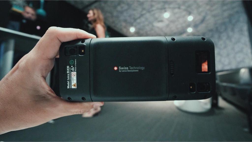
2 Leica BLK3D NEW based on photogrametry
3 Leica HDS Termékportfólió
4 BLK360 RTC360 P40/50 Type/class of device BLK360 RTC360 P-Series Imaging Scanner Documentation «image first» 3D Laser Scanner Reality Capture «scan first» Survey-grade Scanner «High Definition Surveying» Target users AEC professionals 3D data experts Surveyors Skill level Low Medium High Main use Indoor indoor/outdoor outdoor Typical project sizes Small Medium/Large Large Main Characteristic Simplicity & Portability Performance & Productivity Versatility & Precision
5 Relative Positioning Hardware Features BLK360 RTC360 P-Series Imaging Speed < 1min < 1min > 6min ScanSpeed pts/sec pts/sec pts sec Level of Detail (Max Resolution) Low 10m) Medium 10m) High 10m) Env. Robustness IP54 / open mirror IP54 / closed mirror IP54 / closed mirror Temp Range +5 to to to +50 Range (typical/max) Short (20/60m) Medium (40/130m) Long (70-270/1000m) 3D data quality Good Better Best Field Registration SW based VIS based Surveying Procedures

6 Leica BLK360 Scanner 360 Laser class 1 Single-Button IMU Internal memory 360 W-Lan antenna Panoramic Camera w LED flash Thermal Camera Battery compartment LED light guide

7 Leica BLK360 Technikai információk - Scanning 300 Teljes scan (65 Mio Pts) m HighRes: 5 x 5 mm Medium: 10 x 10 mm 360 LowRes: 15 x 15 mm Mérési tartomány 0.5 to 60 m Tartományi pontossága < 4 15m Laser class 1

8 TruRTC Technology Inside RTC360

9 Agenda 3D data creation HDR Image collection Visual Inertial System LWPO concept and Cyclone FIELD 360 The Power of Cyclone REGISTER 360
10 3D laser scanning

11 3D laser scanning Fast: up to 2 Mio points per second EDM. High dynamic: more measured points on critical surfaces. Precise: data quality in short range.
12 3D laser scanning. Fast. Resolution Meas. rate Max range Scan duration Scan + Images 3mm@10m 2 Mhz 65 m 01:51 min < 3 min 6mm@10m 1 Mhz 130 m 00:51 min 1:51 min 12mm@10m 0.5 Mhz 130 m 00:26 min 1:26 min 100 Hz rotation frequency for El axis optimized aerodynamics

13 3D laser scanning. High Dynamic. RTC360 measures each point emitting a double pulse.


14 3D laser scanning. Precise. Distance object scanner: 5.5m. Slice thickness: 2cm Distance object scanner: 12.5m. Slice thickness: 3cm


15 3D laser scanning. Precise. Distance object scanner: 23.5m. Slice thickness: 5cm Distance object scanner: 2m. Slice thickness: 5cm
16 HDR spherical images

17 HDR spherical images Fast: less then 1 minute to collect HDR full dome, independent from light conditions. High dynamic: from bright sunlight to darkness, without user settings. Colour fidelity: the colours are represented as they are.
18 HDR spherical images. Fast. 3 Cameras x 12 Mpixel x 12 positions x 5 Exposure brackets = < 1 minute Images are: Collected Processed Calibrated Colour corrected HDR merged (LWPO) Stored


19 HDR spherical images. High Dynamic.
20 VIS Visual Inertial System
21 Visual Inertial System VIS delivers the delta pose between two consecutive setups, in real time VIS is based on 5 cameras and one IMU No user interaction is needed, auto start&stop VIS is robust to most of the handling and environmental conditions


22 Visual Inertial System VIS image Point cloud
23 Visual Inertial System original 3D points derived from pointcloud new 3D points created by forward intersection from multiple scanner positions
24 Visual Inertial System original 3D points derived from pointcloud new 3D points created by forward intersection from multiple scanner positions

25 Visual Inertial System

26 Double scan FILTER- funcion
27 LWPO concept and Cyclone FIELD 360


28 Cyclone FIELD 360. Workflow overview.


 3DReshaper")
29 MAKE MODEL, ANALYSIS, REPORT Leica Cyclone (Basic, Modeller, moduls) Leica Cyclone Register 360 (point cloud registration) Leica CloudWorx Plugin (for AutoCAD, Revit, Microstation, ) 3DReshaper (TIN, Texture, Inspection, )

30 Leica CloudWorx Plugin (for AutoCAD, Revit, Microstation, )

31 Leica Cyclone (Basic, Modeller, moduls)

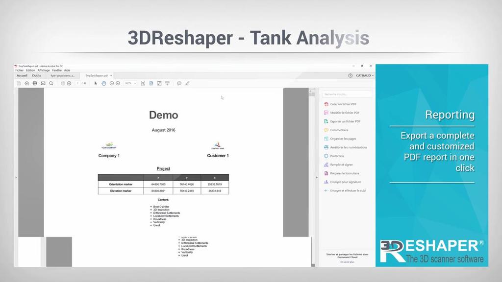
32 3DReshaper (TIN, Texture, Inspection, )

33 KÖSZÖNÖM A FIGYELMET!!
Leica BLK360 Questions & Answers. Vers
 Questions & Answers Vers. 11.01.2017 What is it? 2 What is it? 3 What is it? Calibrated full spherical image, LED flash support 4 What is it? 5 A new, simple way to capture reality Speed On-the-fly image
Reality Capture using: RPAS Technologies & Image Laser Scanners
 Reality Capture using: RPAS Technologies & Image Laser Scanners by Johan Erasmus (RPAS Technologies) & Barend Bornman (Image Laser Scanners) from Aciel Geomatics Laser Scanners High-Definition Surveying
BIM & Digital Transformation Scotland Live 2018 Capturing 3D Reality at the push of a button
 BIM & Digital Transformation Scotland Live 2018 Capturing 3D Reality at the push of a button Gary Kelly Country Manager Scotland Leica Geosystems @LeicaScot Capturing 3D Reality at the push of a button
Simplicity is the new black: The BLK360 story
 Simplicity is the new black: The BLK360 story Vanda KADLECIKOVA Leica Geosystems Heerbrugg, Switzerland E-mail: vanda.kadlecikova@leica-geosystems.com Abstract Meet the game changer. The new Leica BLK360
Rapid Building information modeling. Ivar Oveland 2013
 Rapid Building information modeling Ivar Oveland 2013 Case study How can I rapidly create a building information model? Today: Different methods are used today to establish a building information model
Leica Pegasus: Backpack
 Leica Pegasus: Backpack Fast Acquisition Accurate data Indoor/Outdoor projects Pegasus:Backpack Simple workflow Everything, Everywhere 1 Leica Pegasus: Backpack Award Winning System Remarks Multiple Award
CR Kennedy has established itself as one of the largest and most successful suppliers of Leica Geosystems survey equipment in the world.
 C.R. Kennedy was founded in 1934 by Clement Robertson Kennedy, importing photographic and optical products. In 1954 we became the first distributor in the world for Pentax - and today still the oldest.
Leica Geosystems Release Notes
 Leica Geosystems Product Leica Cyclone REGISTER 360 version 1.5.0 Date 20 August 2018 From HDS Software Product Management Table of Contents WHAT S NEW... 3 Support for the new Leica RTC360 scanner...
Leica Cyclone 5.4 Technical Specifications
 Leica Cyclone 5.4 Technical Specifications HDS Scanner control and operation Scan Scan Scan Register Model Survey Viewer Acquire and display image Acquire image at specified resolution (high, medium, low)
3D Laser Scanner VS1000 User Manual
 3D Laser Scanner VS1000 User Manual 1 VS1000 Introduction SMART MAX GEOSYSTEMS CO., LTD VS1000 3D Laser Scanner based on pulses ranging principle, could quick acquire massive point cloud data from the
White Paper. Inside Trimble TX6 and TX8 Color Acquisition. Prepared by Gregg Jackson and Gregory Lepere. ABSTRACT
 White Paper Inside Trimble TX6 and TX8 Color Acquisition Prepared by Gregg Jackson and Gregory Lepere www.trimble.com/3dscanning ABSTRACT With the release of the new Trimble TX6 and TX8, Trimble introduced
POINT CLOUD based REVERSE ENGINEERING. Young-Ho Chai, Ph.D
 POINT CLOUD based REVERSE ENGINEERING Young-Ho Chai, Ph.D 3D Spatial Survey Workflow Hardware Requirements Phase Based Laser Scanner: -Leica ScanStation P20 x 1EA -Usage: Short-range, ~80m Time of Flight
Introducing. GeoSLAM. The experts in go anywhere 3D mobile mapping technology. The Company. The Technology. The Applications. Strategic Partnerships
 Introducing GeoSLAM The experts in go anywhere 3D mobile mapping technology The Company The Technology The Applications Strategic Partnerships The Company Multipurpose Presentation Template 2 About Us
Leica ScanStation C5 Scalable Laser Scanner
 Leica ScanStation C5 Scalable Laser Scanner Leica ScanStation C5 Scalable from the Start Companies entering into laser scanning are often faced with inflexible and complex situations and would like a scalable
Leica ScanStation C10 The All-in-One Laser Scanner for Any Application
 The All-in-One Laser Scanner for Any Application Versatility, Productivity, Value Many organizations interested in laser scanning to diversify and/or improve current business have been waiting for a scanner
Increase Field Survey Efficiency by Merging Technologies in NOVA MultiStation. Vincent Lui Leica Geosystems Ltd
 Increase Field Survey Efficiency by Merging Technologies in NOVA MultiStation Vincent Lui Leica Geosystems Ltd Advantages of Laser Scanning Advantages of TPS Measurements Advantages of Imaging Advantages
Figure 1: Mobile mapping project location in New York City.
 Using Mobile LiDAR to Deliver Survey Accurate Data This presentation will take the attendees though the process of controlling and delivering survey grade LiDAR data for use in CADD, Modeling, and GIS
Jeffrey A. Schepers P.S. EIT Geospatial Services Holland Engineering Inc. 220 Hoover Blvd, Suite 2, Holland, MI Desk
 Jeffrey A. Schepers P.S. EIT Geospatial Services Holland Engineering Inc. 220 Hoover Blvd, Suite 2, Holland, MI 49423 616-594-5127 Desk 616-322-1724 Cell 616-392-5938 Office Mobile LiDAR - Laser Scanning
USE THE 3D LASER SCANNING FOR DOCUMENTATION THE RIGA CATHEDRAL IN LATVIA
 USE THE 3D LASER SCANNING FOR DOCUMENTATION THE RIGA CATHEDRAL IN LATVIA Maris Kalinka, Elina Rutkovska, Department of Geomatic, Riga Technical University, Azenes 16-109, Riga, Latvia, geomatika@geomatika.lv
Leica Geosystems QuickStart Guide
 Leica Geosystems QuickStart Guide Product Leica Cyclone REGISTER 360 1.4.1 Date 3 January 2018 From HDS Software Product Management Contents Introduction... 2 Installation... 3 Licensing Setup... 4 Basic
QuickStart Guide: Leica Cyclone REGISTER 360
 Leica Geosystems QuickStart Guide: Cyclone REGISTER 360 Product Leica Cyclone REGISTER 360 1.4 Date 17 October 2017 From HDS Software Product Management Contents Introduction... 2 Installation... 3 Licensing
3D Laser Scanning Technology. Fast, Safe, Accurate. Rugged hardware and powerful software combined with streamlined survey workflow
 3D Laser Scanning Technology Fast, Safe, Accurate Rugged hardware and powerful software combined with streamlined survey workflow Maptek specialises in the research, development and application of 3D laser
Terrestrial 3D laser scanning Practical aspects
 Terrestrial 3D laser scanning Practical aspects ISPRS WG VI/5&SC Summer School 2007 by Gregor Bilban 3D laser scanning Benefits Lower data collection costs Reduction or elimination of re-visits More accurate
Leica High-Definition Surveying Systems. Leica HDS3000. The Industry Standard for High-Definition Surveying
 Leica High-Definition Surveying Systems Leica HDS3000 The Industry Standard for High-Definition Surveying HDS High-Definition Surveying TM : Laser Scanning Redefined High-Definition Surveying, or HDS,
The Leica HDS Family. The Right Tool for the Job HDS3000 HDS2500 HDS4500. Cyclone & CloudWorx. Press the QuickScan button to define the field-of-view.
 HDS2500 High accuracy scanner, ideal for fixed or raised installations when leveled tripod mounting is not practical, or areas with less stringent field-of-view requirements. The Leica HDS Family Time-of-flight
LOAM: LiDAR Odometry and Mapping in Real Time
 LOAM: LiDAR Odometry and Mapping in Real Time Aayush Dwivedi (14006), Akshay Sharma (14062), Mandeep Singh (14363) Indian Institute of Technology Kanpur 1 Abstract This project deals with online simultaneous
REGISTRATION, VISUALISATION, MODELLING & QUERY TOOLS
 REGISTRATION, VISUALISATION, MODELLING & QUERY TOOLS BASIC 3D navigation, Pan, Zoom, Rotate 3D mouse support Panoramic view mode Align to surface view mode Cloud Level of Detail for fast visualisation
Real-time Image-based Reconstruction of Pipes Using Omnidirectional Cameras
 Real-time Image-based Reconstruction of Pipes Using Omnidirectional Cameras Dipl. Inf. Sandro Esquivel Prof. Dr.-Ing. Reinhard Koch Multimedia Information Processing Christian-Albrechts-University of Kiel
3D IN GIS. 1. Presentation of the results of the scientific and technical contents
 G. Nagy, A. Szepes 3D in GIS 3D IN GIS NAGY Gábor, assistant professor, University of West Hungary, Faculty of Geoinformatics, Department of GIS, ng@geo.info.hu SZEPES András, associate professor, University
Boresight alignment method for mobile laser scanning systems
 Boresight alignment method for mobile laser scanning systems P. Rieger, N. Studnicka, M. Pfennigbauer RIEGL Laser Measurement Systems GmbH A-3580 Horn, Austria Contents A new principle of boresight alignment
Trimble Mobile Mapping Portfolio
 Jörg Amend Sales Account Manager SEPTEMBER 20 2017 Trimble Mobile Mapping Portfolio Current challenges and trends Multible Sensors connecting to one Echosystem Trimble RealWorks Trimble Edgewise TBC Pathfinder
Laser Scanning. 3D Model is not existing and is required for: studies revamping maintenance HSE integration in another 3D model archiving
 Laser Scanning Laser Scanning Laser scanning is used whenever: 3D Model is not existing and is required for: studies revamping maintenance HSE integration in another 3D model archiving 2 Object acquisition
Marc De Bruyne 3D Design Improvement Leader, DOW Chemical
 Marc De Bruyne 3D Design Improvement Leader, DOW Chemical John Foster Director, Profox Companies DOW Chemical Terneuzen in the Netherlands Globally, second largest DOW site after Freeport US. Producing
Leveraging Point Clouds to Produce Accurate As-Built Models. Sonia Delgadillo
 Leveraging Point Clouds to Produce Accurate As-Built Models Sonia Delgadillo Time What is CADWorx fieldpipe? Easy customization Comprehensive specs Short learning curve AutoCAD -based CADWorx Plant Design
Most as-built information is still manually collected. Today s Design Market
 Agenda 1. Overview of 3D laser scanning 2. HDS 3D Laser scanning applications Leica ScanStation2 True Color Scan 3. Demonstration of HDS & Trueview 4. Questions and Answers The advanced 3D Laser Scanning
NEW APPROACH FOR SAFE, FAST AND ACCURATE SURVEY OF DEEP MINE SHAFTS
 NEW APPROACH FOR SAFE, FAST AND ACCURATE SURVEY OF DEEP MINE SHAFTS by Norbert Benecke & Peter Cain DMT GmbH &Co. KG, Germany / DMT Geosciences, Canada Kinemattic Shaft Survey 2013 Page 1 Who is DMT? is
The Most Comprehensive Solution for Indoor Mapping Applications
 The Most Comprehensive Solution for Indoor Mapping Applications TRIMBLE INDOOR MOBILE MAPPING SOLUTION TRIMBLE INDOOR MOBILE MAPPING SOLUTION (TIMMS): HIGH EFFICIENCY, MAXIMUM FLEXIBILITY, ALL-IN-ONE PACKAGE
RIEGL VMX-450. Mobile Laser Scanning. Compact Mobile Laser Scanning System. visit our website
 Compact Mobile Laser Scanning System RIEGL VMX-450 2 RIEGL VQ-450 scanners smoothly integrated with IMU/GNSS unit very high measurement rate up to 1.1 million meas./sec scanning rate up to 400 lines/sec
With FARO PointSense for Revit. Jörg Braunes Platform Owner Software Chris Palmer Sales Engineer 1
 From Point Clouds to BIM Models With FARO PointSense for Revit Jörg Braunes Platform Owner Software Chris Palmer Sales Engineer 1 Agenda Scan to BIM with Revit PointClouds in Revit Advanced Workflow with
THE RANGER-UAV FEATURES
 THE RANGER-UAV The Ranger Series Ranger-UAV is designed for the most demanding mapping applications, no compromises made. With a 9 meter laser range, this system produces photorealistic 3D point clouds
Leica Cyclone and Leica CloudWorx Technical Specifications
 Leica Cyclone and Leica CloudWorx Technical Specifications Valid as of August 2018 leica-geosystems.com Key 1 These types can be created using best-fit methods 2 As delivered in database, cannot modify
Towards Optimal 3D Point Clouds
 By Andreas Nüchter, Jan Elseberg and Dorit Borrmann, Germany feature Automation in 3D Mobile Laser Scanning Towards Optimal 3D Point Clouds Motivated by the increasing need for rapid characterisation of
Leica Geosystems Regional Public Safety Conference. Joshua Rayburn Consolidated Forensic Laboratory, Washington DC Present Date:
 Leica Geosystems Regional Public Safety Conference Joshua Rayburn Consolidated Forensic Laboratory, Washington DC Present Date: 04.15.15 2 What is a Pegasus? Portable survey-grade mobile mapping solution
Leica DISTO S910 Measure point data and create plans
 Leica DISTO S910 Measure point data and create plans The world s first Measure anything from anywhere with P2P Technology It s been over 20 years since Leica Geosystems launched the first hand-held laser
SPS ZOOM D Laser Scanner SPS ZOOM 300
 3D Laser Scanner 3D Laser Scanner A 3D laser scanner is a device that collects precise spatial data of objects or environments. The collected point cloud data can then be used to construct digital three
Leica Cyclone 9.1 and Leica CloudWorx Technical Specifications
 Leica 9.1 and Leica CloudWorx Technical Specifications Leica 9.1 Technical Specifications REGISTRATION, VISUALIZATION, MODELING & QUERY TOOLS 3D navigation Panoramic view mode Cloud Level of Detail for
Copyright ZEB-CAM User Guide 2018 GeoSLAM Ltd. All rights reserved.
 GeoSLAM ZEB-CAM UserGuide GeoSLAM.com Copyright ZEB-CAM User Guide 2018 GeoSLAM Ltd. All rights reserved. 2018 GeoSLAM Ltd 1 ZEB-CAM User Guide v3.0.0 CONTENTS Introduction... 5 1.1 Specification... 5
INVESTIGATION ON LASER SCANNERS *
 IWAA2004, CERN, Geneva, 4-7 October 2004 INVESTIGATION ON LASER SCANNERS * Brian Fuss, Catherine Le Cocq, Robert Ruland Stanford Linear Accelerator Center, Stanford, CA, USA Rudolf Staiger Essen University,
Trimble Geospatial Division Integrated Solutions for Geomatics professions. Volker Zirn Regional Sales Representative
 Trimble Geospatial Division Integrated Solutions for Geomatics professions Volker Zirn Regional Sales Representative 1 Agenda Trimble GeoSpatial Division Airborne System Solutions Trimble Inpho Software
Geosmart Asia Automated Scan Data Registration for Improving TLS Data Acquisition Efficiency. Thomas Gaisecker. April, 2018
 Geosmart Asia 2018 Automated Scan Data Registration for Improving TLS Data Acquisition Efficiency Thomas Gaisecker April, 2018 Content RIEGL VZ-400i/VZ-2000i key facts Hardware/Firmeware Architecture Onboard
3D Technologies for Nuclear Safeguards Verification. E. Wolfart, JRC-ITU-Ispra IPNDV WG3 Meeting May 2016, Ispra Italy
 3D Technologies for Nuclear Safeguards Verification E. Wolfart, JRC-ITU-Ispra IPNDV WG3 Meeting 12-13 May 2016, Ispra Italy Objectives Nuclear safeguards verification systems based on 3D imaging for: Design
ROAD-SCANNER COMPACT APPLICATION FIELDS MAIN FEATURES
 ROAD-SCANNER COMPACT Mobile Mapping System by GEXCEL & SITECO collaboration A smaller mobile system for asset management and cartography suited for ZOLLER & FRÖHLICH PROFILER 9012 laser scanner. 2 + 3
Adam Hammet & Anthony McClaren. Getting to know the Trimble SX10 Scanning Total Station - Inside and Out ISV Regional Conference 2017: Moama, NSW
 Adam Hammet & Anthony McClaren Getting to know the Trimble SX10 Scanning Total Station - Inside and Out ISV Regional Conference 2017: Moama, NSW Contents Difference between scanner and a Total station
Geosystems Monday Hands-on Sessions
 Geosystems Monday Hands-on Sessions 1110: HDS University - Leica ScanStation P30/40 (and C10 & P20) Operation and Surveying Workflows (CEU eligible nominal fees will apply) The all new Leica ScanStation
/thermal-imaging THERMAL IMAGING THERMAL IMAGING
 1.800.323.0244 EDARLEY.COM/THERMAL-IMAGING BATTERIES THERMAL IMAGERS Shop TRUCK CHARGERS /thermal-imaging FLIR K45, K55 AND K65 CAMERA KITS NOW WITH FSX FSX real time digital processing results in ultra
Mobile Mapping with the Road-Scanner in France Hi-grade 1:200 scale mapping
 FARO USER CONFERENCE APRIL 27-28 2014 Mobile Mapping with the Road-Scanner in France Hi-grade 1:200 scale mapping 03/04/2014 ing. Augusto Burchi burchi@sitecoinf.it Siteco's profile Founded in 2000 as
IMPROVEMENT OF AIRCRAFT MECHANICAL DAMAGE INSPECTION WITH ADVANCED 3D IMAGING TECHNOLOGIES
 IMPROVEMENT OF AIRCRAFT MECHANICAL DAMAGE INSPECTION WITH ADVANCED 3D IMAGING TECHNOLOGIES MARK MAIZONNASSE 60TH A4A NDT FORUM SEPTEMBER 2017, FORT LAUDERDALE, FL, USA BRIDGING PHYSICAL AND DIGITAL WORLDS
ENY-C2005 Geoinformation in Environmental Modeling Lecture 4b: Laser scanning
 1 ENY-C2005 Geoinformation in Environmental Modeling Lecture 4b: Laser scanning Petri Rönnholm Aalto University 2 Learning objectives To recognize applications of laser scanning To understand principles
Leica Geosystems HDS. Cyclone External Camera Workflow-Nodal Ninja bracket. High-Definition Surveying. Version 1
 Cyclone External Camera Workflow-Nodal Ninja bracket Version 1 Objective: Creation of high quality images (cube maps) that can easily be textured mapped into a point cloud in Cyclone Concept: After scanning,
Trimble RealWorks. What s new in version 9.0
 Trimble RealWorks What s new in version 9.0 Trimble RealWorks v9.0 What s new Over 40 new features and enhancements Navigation and visualization improvements SketchUp interoperability Additional 3 rd party
OLERDOLA S CAVE, CATALONIA, PAST AND PRESENT: A VIRTUAL REALITY RECONSTRUCTION FROM TERRESTRIAL LASER SCANNER AND GIS DATA
 LM VC OLERDOLA S CAVE, CATALONIA, PAST AND PRESENT: A RECONSTRUCTION FROM TERRESTRIAL AND GIS DATA B. Pucci a, A. Marambio a a Virtual City Modelling Lab, Politecnical University of Catalonia, 08012 Barcelona,
RIEGL VMX-250. Mobile Laser Scanning. Compact Mobile Laser Scanning System. visit our website
 Compact Mobile Laser Scanning System RIEGL VMX-250 The RIEGL VMX-250 is an extremely compact and user-friendly Mobile Laser Scanning System. 2 RIEGL VQ-250 scanners smoothly integrated with IMU/GNSS unit
Freestyle 3D. Features and applications. Dr. Daniel Döring Team Lead Product Development Freestyle 1
 Freestyle 3D Features and applications Dr. Daniel Döring Team Lead Product Development Freestyle 1 3D scanning Building works: How to record data? How to check what has been built? How to fit in new parts?
HANDHELD MOBILE MAPPING / 3D LASER MAPPING SOLUTIONS. ZEB Family Brochure. geoslam.com
 HANDHELD MOBILE MAPPING / 3D LASER MAPPING SOLUTIONS ZEB Family Brochure geoslam.com NEW Long range, greater intensity, UAV ready HANDHELD BACKPACK UAV Effortless Data Capture Your tool to capture, view
Overview of the Trimble TX5 Laser Scanner
 Overview of the Trimble TX5 Laser Scanner Trimble TX5 Revolutionary and versatile scanning solution Compact / Lightweight Efficient Economical Ease of Use Small and Compact Smallest and most compact 3D
Trimble VISION Positions from Pictures
 Trimble VISION Positions from Pictures This session will cover What Is Trimble VISION? Trimble VISION Portfolio What Do you Need? How Does It Work & How Accurate Is It? Applications Resources Trimble VISION
China Dongguan Office: Jinsha Admin. Distric, Chang An Town, Dongguan, China China Tel: (86) China Fax: (86)
 China Fax: (86)") Hong Kong Office: Flat 2, 10/F, Fuk Hong Industrial Building, 60-62B Tong Mi Road, Mongkok, Kowloon, Hong Kong H.K. Tel: (852) 3188 2335 H.K. Fax: (852) 3188 4883 China Dongguan Office: Jinsha Admin. Distric,
Hong Kong Office: Flat 2, 10/F, Fuk Hong Industrial Building, 60-62B Tong Mi Road, Mongkok, Kowloon, Hong Kong H.K. Tel: (852) 3188 2335 H.K. Fax: (852) 3188 4883 China Dongguan Office: Jinsha Admin. Distric,
Workshop. Dr. Denis Wohlfeld Innovation Manager P l a n t S i m u l a t i o n U s e r C o n f e r e n c e
 Workshop 3D Laser Scan PlantSimulation Dr. Denis Wohlfeld Innovation Manager 2 0 1 6 P l a n t S i m u l a t i o n U s e r C o n f e r e n c e GLOBAL FARO SITES W o r l d l e a d e r i n c o m p u t e
Cyclone Tips and Tricks. Hexagon Geosystems Track June 2012
 Cyclone Tips and Tricks Hexagon Geosystems Track June 2012 Built-in Hotkeys Enhanced Working Format Open GL Modes There are some very powerful built-in viewing hotkeys in Cyclone. Here are some of them:
Trimble GeoSpatial Products
 Expanding Solutions for Photogrammetric and Remote Sensing Professionals 55 th Photogrammetric Week in Stuttgart September 7 th 2015 Tobias Heuchel, Trimble Stuttgart, Germany Trimble GeoSpatial Products
RIEGL VZ-400i. Digital Information in 3D Innovations and Best Practises. 4th to 5th of November, Prince Philip House, London
 RIEGL VZ-400i Digital Information in 3D Innovations and Best Practises 4th to 5th of November, Prince Philip House, London London Thames Sunset panorama by Diliff - CC BY 3.0 continuous developments on
2/19/2018. Who are we? Who am I? What is Scanning? How does scanning work? How does scanning work? Scanning for Today s Surveyors
 2/19/2018 Who are we? Scanning for Today s Surveyors Survey, GIS, and Construction dealer Founded in 1988 Employee Owned Headquartered in Bismarck, ND States covered: ND, SD, MN, MT, WY, CO, UT, ID, WA,
Leica Cyclone 9.1 and Leica CloudWorx Technical Specifications
 Leica 9.1 and Leica CloudWorx Technical Specifications Leica 9.1 Technical Specifications REGISTRATION, VISUALISATION, MODELLING & QUERY TOOLS 3D navigation, including 3D mouse support Panoramic view mode
Rigorous Scan Data Adjustment for kinematic LIDAR systems
 Rigorous Scan Data Adjustment for kinematic LIDAR systems Paul Swatschina Riegl Laser Measurement Systems ELMF Amsterdam, The Netherlands 13 November 2013 www.riegl.com Contents why kinematic scan data
Comparative study on the differences between the mobile mapping backpack systems ROBIN- 3D Laser Mapping, and Pegasus- Leica Geosystems.
 3 th Bachelor Real Estate, Land Surveying Measuring Methods III Comparative study on the differences between the mobile mapping backpack systems ROBIN- 3D Laser Mapping, and Pegasus- Leica Geosystems.
MODERN TECHNOLOGY FOR LAND LEVELLING, BASED ON A 3D SCANNER
 MODERN TECHNOLOGY FOR LAND LEVELLING, BASED ON A 3D SCANNER Abstract: Soil levelling becomes of high importance, in modern and intensive agriculture conditions. Its effects are found in providing optimal
Real world data collecting tools. Company Introduction. C2L equipment.co,.ltd
 Company Introduction C2L equipment.co,.ltd www.c2l-equipment.com Company Status Business Areas Company name C2L equipment.co,.ltd Address CEO Unit 603, Samwhan HIPEX B, Pangyo Station RD 230, Bundang,
Leica DISTO S910 Measure point data and create plans
 Leica DISTO S910 Measure point data and create plans The world s first Measure anything from anywhere with P2P Technology It s been over 20 years since Leica Geosystems launched the first hand-held laser
Leica s Pinpoint EDM Technology with Modified Signal Processing and Novel Optomechanical Features
 Leica s Pinpoint EDM Technology with Modified Signal Processing and Novel Optomechanical Features Fadi A Bayoud Ph.D. Geomatics Engineering Contents Leica s Total Stations and Telescope ATR PS Leica s
White Paper. Inside Trimble TX6 and TX8 Deep Dive into Lightning Technology. Prepared by Gregg Jackson and Gregory Lepere ABSTRACT
 White Paper Inside Trimble TX6 and TX8 Deep Dive into Lightning Technology Prepared by Gregg Jackson and Gregory Lepere ABSTRACT With the introduction of next generation Trimble Lightning technology, users
Leica Cyclone and Leica CloudWorx Technical Specifications
 Leica Cyclone and Leica CloudWorx Technical Specifications Valid as of December 2017 leica-geosystems.com REGISTRATION, VISUALISATION, MODELLING & QUERY TOOLS 3D navigation, Pan, Zoom, Rotate / 3D mouse
Basic Configuration Package
 Basic Configuration Package Scanner Basic Configuration for Part-No. HW-VZ4000-01-000-00 3D Laser Scanner (Part-No. HW-VZ4000-00-000-00) - laser transmitter & receiver front end - motorized mirror scanning
3D Laser Scanning Technology. Rugged hardware and powerful software combined with streamlined survey workflow
 3D Laser Scanning Technology Rugged hardware and powerful software combined with streamlined survey workflow I-Site XR3 laser scanner The Maptek I-Site XR3 laser scanner represents the latest laser imaging
NEW RIEGL. Triple Scanner Mobile Mapping System Specifically Designed for Rail Application. Typical Applications
 NEW RIEGL VMX -RAIL 3 MHz pulse repetition rate, and 750 lines per second resulting in up to 7000 pts/m 2 in 3m range at 80 km/h platform speed 420m 3 MHz optional The is a fully integrated Mobile Laser
A 3D Scanner Based Technology for Land Levelling
 A 3D Scanner Based Technology for Land Levelling Kunal Chakraborti, Rupam Ghosh Student, Dept of Civil Engineering, Modern Institute of Engineering & Technology, Bandel, Hooghly, West Bengal, India ABSTRACT:
HOW TO RECONSTRUCT DAMAGED PARTS BASED ON PRECISE AND (PARTLY-)AUTOMATISED SCAN METHODS
AUTOMATISED SCAN METHODS") HOW TO RECONSTRUCT DAMAGED PARTS BASED ON PRECISE AND (PARTLY-)AUTOMATISED SCAN METHODS cirp GmbH 3D models features spare part identification load simulation mesh repair search in data bases machine learning
HOW TO RECONSTRUCT DAMAGED PARTS BASED ON PRECISE AND (PARTLY-)AUTOMATISED SCAN METHODS cirp GmbH 3D models features spare part identification load simulation mesh repair search in data bases machine learning
Leica Geosystems Release Notes
 Leica Geosystems Release Notes Product Cyclone REGISTER 360 Version 1.4 Date 17 th October 2017 From HDS Software Product Management Contents INTRODUCTION...2 FEATURES...2 COMPUTER SPECIFICATIONS...2 Minimum
TAKING LIDAR SUBSEA. Adam Lowry, Nov 2016
 TAKING LIDAR SUBSEA Adam Lowry, Nov 2016 3D AT DEPTH Based in the technology hub of Boulder, Colorado, 3D at Depth is dedicated to the development of underwater laser measurement sensors and software Patented
See more with the NEW testo 880 thermal imager
 Committing to the future See more with the NEW testo 880 thermal imager NEW! SEE MORE......OFFER MORE. Infrared radiation cannot be seen by the human eye. All objects whose temperature is above absolute
3D Industrial plants. Documentation
 3D Industrial plants Documentation Published by: FARO Europe GmbH & Co. KG, Lingwiesenstrasse 11/2, D-70825 Korntal-Münchingen, Tel: +49 7150 9797-0, Fax: +49 7150 9797-44, info@faroeurope.com, www.faro.com
Artec Leo. A smart professional 3D scanner for a next-generation user experience
 Artec Leo A smart professional 3D scanner for a next-generation user experience Industrial design and manufacturing / Healthcare VR / E-commerce / Science and education Forensics / Art and design Easy
LiDAR & Orthophoto Data Report
 LiDAR & Orthophoto Data Report Tofino Flood Plain Mapping Data collected and prepared for: District of Tofino, BC 121 3 rd Street Tofino, BC V0R 2Z0 Eagle Mapping Ltd. #201 2071 Kingsway Ave Port Coquitlam,
KRISTAPS KLAVA - HEAD OF LASER SCANNING DEPARTMENT AT MERKO 3D LASER SCANNING POSSIBILITIES IN REAL ESTATE
 KRISTAPS KLAVA - HEAD OF LASER SCANNING DEPARTMENT AT MERKO 3D LASER SCANNING POSSIBILITIES IN REAL ESTATE Overview 1. What is laser scanning; 2. Technology; 3. End results of laser scanning; 4. Applications;
A Tutorial Guide to Tribology Plug-in
 Supplementary Material A Tutorial Guide to Tribology Plug-in Tribology An ImageJ Plugin for surface topography analysis of laser textured surfaces. General Description This plugin presents an easy-to-use
ROAD SURFACE STRUCTURE MONITORING AND ANALYSIS USING HIGH PRECISION GPS MOBILE MEASUREMENT SYSTEMS (MMS)
") ROAD SURFACE STRUCTURE MONITORING AND ANALYSIS USING HIGH PRECISION GPS MOBILE MEASUREMENT SYSTEMS (MMS) Bonifacio R. Prieto PASCO Philippines Corporation, Pasig City, 1605, Philippines Email: bonifacio_prieto@pascoph.com
ROAD SURFACE STRUCTURE MONITORING AND ANALYSIS USING HIGH PRECISION GPS MOBILE MEASUREMENT SYSTEMS (MMS) Bonifacio R. Prieto PASCO Philippines Corporation, Pasig City, 1605, Philippines Email: bonifacio_prieto@pascoph.com
IP-S2 HD HD IP-S2. 3D Mobile Mapping System. 3D Mobile Mapping System
 HD HD 3D Mobile Mapping System 3D Mobile Mapping System Capture Geo-referenced, Time-Stamped Point Clouds and Imagery 3D Scanning of Roadside Features 360º Camera for Spherical Image Capture Dual Frequency
Computer Vision. 3D acquisition
 è Computer 3D acquisition Acknowledgement Courtesy of Prof. Luc Van Gool 3D acquisition taxonomy s image cannot currently be displayed. 3D acquisition methods Thi passive active uni-directional multi-directional
Lidar Sensors, Today & Tomorrow. Christian Sevcik RIEGL Laser Measurement Systems
 Lidar Sensors, Today & Tomorrow Christian Sevcik RIEGL Laser Measurement Systems o o o o Online Waveform technology Stand alone operation no field computer required Remote control through wireless network
The Most User-Friendly 3D scanner
 The Most User-Friendly 3D scanner The Solutionix C500 is optimized for scanning small- to medium-sized objects. With dual 5.0MP cameras, the C500 provides excellent data quality at a high resolution. In
Fusion of laser scanning and Photogrammetric data for the documentation and VR visualization of an archaeological tomb complex
 Presented at the FIG Congress 2018, May 6-11, 2018 in Istanbul, Turkey Fusion of laser scanning and Photogrammetric data for the documentation and VR visualization of an archaeological tomb complex E.