Extend GIS. The Reach. Of Your GIS. Chris Cappelli Nathan Bennett
|
|
|
- Hugh Woods
- 5 years ago
- Views:
Transcription


1 Extend The Reach GIS Of Your GIS Chris Cappelli Nathan Bennett
2 Where do your co-workers, managers, customers, and citizens go when they want to find or make a map?


3 GIS is a practical system for problem solving Supporting individuals, groups, and organizations Integrating and synthesizing information from many sources Facilitating communication and collaboration Breaking down barriers between institutions, disciplines, and cultures

4 Many people want your authoritative knowledge Co-workers Executives & decision makers Customers Citizens

5 But they don t know how to get it Co-workers Executives & decision makers Customers Citizens
6 They use different devices and apps Websites Smartphones & tablets Viewers Desktops Other mobile devices

7 The Internet is the common denominator Websites Smartphones & tablets Viewers Desktops Other mobile devices


8

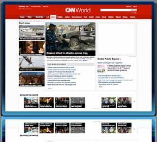
9 For search and questions

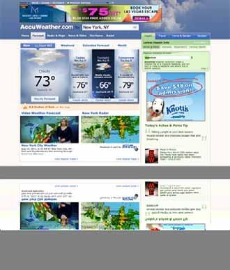

10 For news and weather

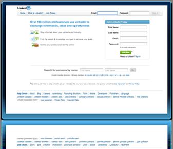
11 For friends and professional connections
12 Characteristics of great web destinations Reliable and trusted Reflect current events Present interesting and relevant content Designed with the user in mind Uncluttered and easy to use Dynamic content changes over time Resulting in them becoming well known and popular
13 Where do your co-workers, managers, customers, and citizens go when they want to find or make a map?
14
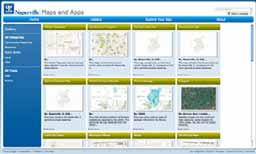
15 Create a destination for them maps.<your_org>
16 Best practices Using Desktop, Server, and Online Create a destination Create and share interesting maps Enable self-service mapping Support many kinds of devices Use the cloud
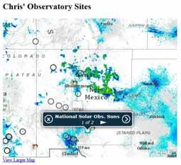
17 Great mapping destinations Demonstration

18 Two great destinations maps.<your_org> gis.<your_org>


19 ArcGIS A complete system for geographic information Web Cloud Online Mobile Enterprise Desktop
20 Agenda Intro to ArcGIS Online Creating a destination Adding interesting content.... Break.... Registering your map services Same map everywhere Enabling self-service mapping Preview of what s to come Wrap-up and next steps
21 ArcGIS Online A brief overview


22 ArcGIS Online is a new GIS pattern An open platform for maps and geographic information Cloud/Web Desktop Server Intelligent web maps


23 ArcGIS Online provides the capabilities to... arcgis.com Organize and share your authoritative content Make it easy for anyone to make and use maps Leverage enterprise cloud computing from Esri


24 Easy to create and share intelligent web maps Intelligent maps Services and data Supporting Visualization Editing Pop-ups Time Accessibility
25 Intelligent web maps can be used everywhere Enhancing access and collaboration Any Device Smartphones Social media Tablets Websites Desktop One Map ArcGIS Online Browsers

26 ArcGIS Online unlocks an organization s geospatial assets Making them easily accessible and integrated Policy makers Managers Knowledge workers Citizens Catalog Groups
27 ArcGIS Online Demonstration


28 ArcGIS Online Search & access authoritative & ready-to-use content Create intelligent web maps Upload & style geographic datasets Interact with these maps on any device Embed them in websites, blogs, and custom apps Share, store & manage maps and data Collaborate using groups
29 ArcGIS includes a growing collection of basemaps & content Ready to use, authoritative, and beautiful Landsat Services Imagery World Ocean Map Census World Street Map National Geographic World Map World Topographic Map

30 Community Maps Program esri.com/communitymaps
31 ArcGIS Online is evolving rapidly Becoming a complete online geospatial platform Integration with 10.1 Hosting and Portals for Organizations Catalog and Group-Based Sharing Basemaps Viewers and Web Maps Open Data and Application Mapping 2010 Q3, 2011 Q4, 2011 Q2, 2012
32 Best practices Using Desktop, Server, and Online Create a destination Add useful and interesting maps Enable self-service mapping Support many kinds of devices Use the cloud

33 Simple and clean public map gallery Co-workers Executives & decision makers maps.<your_org> Customers Citizens

34 Comprehensive gallery of your GIS resources Co-workers Executives & decision makers gis.<your_org> Customers Citizens
35 Create the destination
36 Free template for your public maps gallery esri.com/publicmapstemplate
37 Create the destination Demonstration
38 Steps to deploy the template Download Configure Test Deploy


39 Free web tools WebMatrix from Microsoft microsoft.com/webmatrix
40 Add useful and interesting maps
41 In ter est ing adjective : attracting your attention and making you want to learn more about something or to be involved in something : not dull or boring Merriam-Webster Dictionary


42 Ideas for keeping your destination interesting Showcase your organization s services Stay tuned to current events Apply local knowledge Add/remove content frequently
43 Add useful and interesting maps Demonstration
44 Adding interesting content Finding existing maps Making new maps - Importing data from shapefiles - Importing data from spreadsheets (CSV files)


45 Groups for organizing and sharing maps


46 Configuring the template adding group ID Demonstrated how to get the group id and add it to the configuration file

47 Adding shapefiles to your map

48 Mapping information from spreadsheets

49 Adding information from GPX files

50 Agenda Intro to ArcGIS Online Creating a destination Adding interesting content.... Break.... Registering your map services Same map everywhere Enabling self-service mapping Preview of what s to come Wrap-up and next steps


51 ArcGIS for Home Use For personal, non-commercial use ArcGIS for Desktop Basic (ArcView) & Extensions Web training & installation support $100 USD/year
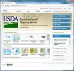
52 Adding GIS services
53 An open platform for mapping Policy makers Managers Knowledge workers Citizens Catalog Groups Integrating and synthesizing information from many sources
54 Adding GIS services Demonstration
55 Connect to GIS services using their URL

 ArcGIS")
56 Register map services in ArcGIS Online KML OGC (WMS) ArcGIS Server Services

57 Metadata is important
58 Same map everywhere
59 Intelligent web maps can be used everywhere... Enhancing access and collaboration Any Device Smartphones Social media Tablets Websites Desktop One Map ArcGIS Online Browsers
60 Embed map into website Demonstration


61 Embedded into web pages and blogs


62 Using maps on tablets and smartphones Use the web/mobile browser Use the free ArcGIS app Build/use a custom app
63 Use map on smartphone and tablets Demonstration


64 ArcGIS for tablets and smartphones Apple ios Microsoft Windows Phone 7 Google Android (Coming in Q3, 2011) Ready to use applications available on app stores


65 ArcGIS SDKs for tablets and smartphones For developing your own custom applications
66 Use social media Demonstration


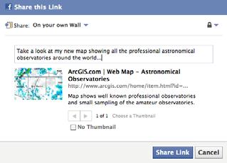
67 Publicize your maps using social media Proactively notify people about your new maps
68 Self-service mapping


69 Empowering people to make their own maps Look I made this map Your maps, a browser or smartphone, and their ideas
70 Who in your organization wants to make a map?
71 Self-service mapping Demonstration
72 Getting started is easy Start with people you know are already interested. Work with your website administrator. Make maps for your website. Hold a lunchtime brown bag seminar. Record a few training videos.
73 Preview ArcGIS Online Premium and ArcGIS 10.1
74 ArcGIS A complete system for geographic information Cloud Web Online Mobile Enterprise Desktop


75 ArcGIS supports multiple implementation patterns Working independently and as an integrated system Desktop Server Cloud/Web GIS
76 ArcGIS is advancing rapidly Introducing many new capabilities Geospatial Platform Geoservices Facility Management Discovery Hosting Web Based Content Transparency Open Data Crowdsourcing Place Based The Web Science Workflow Sharing Cloud 3D User Experience Portals GIS Solutions Social Networks Standards Very Large Spatial Databases Location Based Services Common Infrastructure Data Management Access Citizen Engagement VGI Data Quality Visualization Networks Temporal Templates Integration of Imagery and Remote Sensing Mapping Security Education Applications Generalization Mobility betacommunity.esri.com Improving quality, performance, and usability
77 Advances geographic science New analytic tools providing new insights Multi-scale spatial auto correlation Empirical Bayesian kriging Areal interpolation ¼ Mile ½ Mile 1 Mile Grouping analysis Space/Time cluster Exploratory regression Fast drive-time analysis Geodesic buffers V 1 V 2 V 3 V V 1 V 2 V 3 V V 1 =f(v 2 )+f(v 3 )+f(v ) Creating better understanding
78 Advances mapping and editing workflows Increasing productivity Dynamic legends Map automation with Python Temporal support Better labeling Rule-based generalization Improved templatebased editing Before Editor Tom Bill Joe Feature edit tracking After Improving visualization


")

79 Improves database management Works directly with standard spatial databases Enhanced geodatabase Native SQL access Admin Tools Schema Updates SQL Server Oracle Postgres DB2 NETEZZA (New) DBMS ArcGIS GDB Open API File GDB Making management and access simple
80 Improves image integration and exploitation Supporting visualization, analysis, management, and dissemination Fast visualization Analysis Highly accurate measurement Advanced processing Integrates video (FMV) Any imagery Dynamic mosaicking Massively Scalable Automatic enhancement Simplifies workflows and automates processing


81 Supports lidar Transforms lidar data into useful information products Rasters TINs LAS files Dynamic On-the-fly integration Point Clouds Supporting improved visualization and analysis


82 Expands 3D GIS Improving modeling, analysis, and visualization Buffers Performance 3D editing Lidar support Supporting urban planning, facility management, landscape planning, and more
83 3D GIS will be advancing dramatically Adding content generation and design tools Content creation Analysis Editing Rules Design Visualization CityEngine Geodatabase Integrating GIS, urban design, and advanced visualization


 ios")


84 ArcGIS supports all popular mobile devices Ruggedized devices, smartphones, and tablets Windows (Phone/Mobile) ios Android ArcPad ArcGIS Connecting with field-workers and citizens Supporting you anytime you are not at your desk
85 ArcGIS Runtime A new lightweight platform for developers Easy to deploy Fast & powerful Small footprint Windows/Linux 64-bit native (& 32) WPF/Java/Qt Runtime ArcGIS Local data Supports connected and disconnected environments


86 ArcGIS server is improving Enhancing the architecture and adding capabilities Standards support WMS WCS Improved performance Web printing Easy install/admin Simple service creation Native 64-bit Strong Linux Highly scalable WFS KML HTML JSON REST WPS WMTS Server On-the-fly symbology Improved APIs & web apps APIs Templates Mobile Viewers Server Server Providing a more open and productive platform
87 Web applications are an important part of ArcGIS Many web viewers and APIs Flex Silverlight JavaScript Explorer SharePoint Easily configured and deployed


")
88 ArcGIS simplifies sharing your work Maps, data, tools, and models Packages Server Desktop Services Online (Cloud) Automating the process of creating services
89 Sharing your work Demonstration


90 ArcGIS 10.1 Improves the system Cloud Web Open Data Crowd Sourcing Place Based Workflow Mobile Science The Web User Experience Geospatial Platform Sharing Cloud Social Networks Portals GIS Solutions Geoservices Desktop Crowdsourcing Very Large Spatial Databases Facility Management Standards VGI Data Quality Visualization 3D Location Based Services Networks Temporal Templates Common Infrastructure Integration of Imagery and Remote Sensing Discovery Data Management Content Science Mapping Standards Applications Hosting 10.1 Access Transparency Mobility Security Generalization Web Based Education Citizen Engagement Online Enterprise 2012 betacommunity.esri.com


91 ArcGIS Online is evolving rapidly Becoming a complete online geospatial platform Integration with 10.1 Hosting and Portals for Organizations Catalog and Group-Based Sharing Basemaps Viewers and Web Maps Open Data and Application Mapping 2010 Q3, 2011 Q4, 2011 Q2, 2012 Extending and expanding your GIS


92 ArcGIS Online can be configured for your organization Bringing together your geographic assets Groups Catalog Hosting ArcGIS Online


93 ArcGIS Online Premium Demonstration


94 Wrap-Up Questions & Answers


95 Create a destination filled with interesting content maps.<your_org>
96 Provide access to your knowledge Co-workers Executives & decision makers Customers Citizens
97 Supporting many different devices and apps Websites Smartphones & tablets Viewers Desktops Other mobile devices


98 Enabling you to better Share your GIS knowledge Empower your co-workers Engage the public Support better decision making
99 Extend The Reach GIS Of Your GIS
Tom Brenneman. Good morning and welcome, introductions and thank you for being here.
 Welcome Tom Brenneman Good morning and welcome, introductions and thank you for being here. This is a best practices seminar. We're going to be sharing with you what we found to be best practices that
ArcGIS Online. The Road Ahead Geoff Mortson
 ArcGIS Online The Road Ahead Geoff Mortson gmortson@esricanada.com ArcGIS Online Easily create and share maps Delivered as intelligent maps Access on virtually any device anyone, anywhere Compliments and
An Introduction to GIS for developers
 An Introduction to GIS for developers Part 4: GIS Sharing Canserina Kurnia & Tom Shippee Agenda Web GIS ArcGIS Online Cloud-based ArcGIS Server ArcGIS Server on-premises ArcGIS a complete platform discover,
What s New in ArcGIS Server 10
 What s New in ArcGIS Server 10 Derek Law ArcGIS Server Product Management What s s new in ArcGIS Server 10? Agenda Highlights: Enhanced Web mapping More powerful server-based analysis Geo-collaboration
ICIT. Brian Hiller ESRI Account Manger. What s new in ArcGIS 10
 ICIT Brian Hiller ESRI Account Manger What s new in ArcGIS 10 ArcGIS 10 Fast Easy Powerful Everywhere late June 2010 ArcGIS System for Geographic Information Desktop Server Mobile Online A System A Complete
What s New in Desktop 10.1
 What s New in Desktop 10.1 Damian Spangrud Esri Redlands Trip Down Memory Lane ArcGIS A Complete System for Geographic Information Cloud Web Online Mobile Enterprise Desktop Sharing Information sharing
EUCOM/AFRICOM DEFENSE USER GROUP MEETING MARCH 2010 STUTTGART WELCOME!
 EUCOM/AFRICOM DEFENSE USER GROUP MEETING 23-25 MARCH 2010 STUTTGART WELCOME! AGENDA March 23, Tuesday 0800-0900 Registration 0900-0915 Welcome and Introductions 0915-1000 Getting Started with ArcGIS Server
IMAGERY FOR ARCGIS. Manage and Understand Your Imagery. Credit: Image courtesy of DigitalGlobe
 IMAGERY FOR ARCGIS Manage and Understand Your Imagery Credit: Image courtesy of DigitalGlobe 2 ARCGIS IS AN IMAGERY PLATFORM Empowering you to make informed decisions from imagery and remotely sensed data
Managing Imagery and Raster Data using Mosaic Datasets
 Esri European User Conference October 15-17, 2012 Oslo, Norway Hosted by Esri Official Distributor Managing Imagery and Raster Data using Mosaic Datasets Peter Becker ArcGIS is a Comprehensive Imagery
Understanding ArcGIS Online - why organizations should embrace the cloud now
 Understanding ArcGIS Online - why organizations should embrace the cloud now Presented to: GeoAlberta - workshop Presented by: David Parry September 25, 2013 Today s Agenda Introduction - Why the Cloud?
ArcGIS 10.1 for Desktop Artie Robinson
 ArcGIS 10.1 for Desktop Artie Robinson ArcGIS A Complete System for Geographic Information Cloud Web Online Mobile Enterprise Desktop Name Change Name Prior to 10.1 ArcGIS Desktop ArcInfo ArcEditor ArcView
Advances in GIS help create Smarter Communities
 Advances in GIS help create Smarter Communities POP(ovich) Quiz Who is a Desktop User? Who is an ArcGIS Online User? Who is a ArcGIS Server Admin? Who is a Programmer? Who works with or for a government
Using ArcGIS for Server. Javier Abadía, Esri España Peter McDaid, Esri UK
 Using ArcGIS for Server Javier Abadía, Esri España Peter McDaid, Esri UK 1. Intro 2. ArcGIS for Server = Geospatial Apps Server 3. Map Services Publishing Flow Apps 4. Spatial Functionality Services Publishing
Providing Interoperability Using the Open GeoServices REST Specification
 2013 Esri International User Conference July 8 12, 2013 San Diego, California Technical Workshop Providing Interoperability Using the Open GeoServices REST Specification Satish Sankaran Kevin Sigwart What
ESRI Technology Update. Joe Holubar Larry Young
 ESRI Technology Update Joe Holubar Larry Young Continued Improvement Improving Quality and Extending and Refining Functionality First Half of 2009: Minor Update Release (ArcGIS 9.3.1) ArcGIS Explorer Fall
What is coming in. ArcGIS Server 10. Ismael Chivite ArcGIS Server Product Manager James Cardona Technical Marketing
 What is coming in ArcGIS Server 10 Ismael Chivite ArcGIS Server Product Manager James Cardona Technical Marketing ArcGIS Server is a complete server based GIS Delivering GIS with powerful services and
Getting Started with ArcGIS for Server. Charmel Menzel and Ken Gorton
 Getting Started with ArcGIS for Server Charmel Menzel and Ken Gorton Agenda What is ArcGIS for Server? Types of Web services Publishing resources onto the Web Clients to ArcGIS for Server Editions and
ArcGIS for Server Michele Lundeen
 ArcGIS for Server 10.1 Michele Lundeen Summary Vision Installation and Configuration Architecture Publishing Functional Enhancements Cloud Migration and Best Practices Powerful GIS capabilities Delivered
Introduction to ArcGIS Server Architecture and Services. Amr Wahba
 Introduction to ArcGIS Server 10.1 - Architecture and Services Amr Wahba awahba@esri.com Agenda Architecture Features Publishing Security Cloud Powerful GIS capabilities Delivered as Web services To help
3D in the ArcGIS Platform. Chris Andrews
 3D in the ArcGIS Platform Chris Andrews Geospatial 3D is already all around us 3D is expanding the GIS community s opportunity to provide value 3D City & Infrastructure Models Generated 3D features Photogrammetrc
ArcGIS Enterprise: An Introduction. Philip Heede
 Enterprise: An Introduction Philip Heede Online Enterprise Hosted by Esri (SaaS) - Upgraded automatically (by Esri) - Esri controls SLA Core Web GIS functionality (Apps, visualization, smart mapping, analysis
Dynamic Situational Awareness. Through Developer Applications
 Dynamic Situational Awareness Through Developer Applications Mission Focused Applications Building Apps to support operations Agile Simple High-Performance Defense Developers GIS Simplifies Working With
ArcGIS Viewer for Microsoft Silverlight An Introduction
 Esri International User Conference San Diego, CA Technical Workshops July 12, 2011 ArcGIS Viewer for Microsoft Silverlight An Introduction Art Haddad, Rich Zwaap, and Derek Law Agenda Background Product
ArcGIS 9.2 Works as a Complete System
 ArcGIS 9.2 Works as a Complete System A New Way to Manage and Disseminate Geographic Knowledge Author/Serve/Use Maps Data Models Globes Metadata Use Desktop Explorer Web Map Viewer Mobile Open APIs Enterprise
Leveraging OGC Services in ArcGIS Server. Satish Sankaran, Esri Yingqi Tang, Esri
 Leveraging OGC Services in ArcGIS Server Satish Sankaran, Esri Yingqi Tang, Esri GIS Creating and Managing Geo Information Products - Proprietary - Open Specifications - Standards Dissemination of Geo
Using Collector for ArcGIS and Operations Dashboard for ArcGIS. Mike Sweeney Esri-Charlotte
 Using Collector for ArcGIS and Operations Dashboard for ArcGIS Mike Sweeney Esri-Charlotte Agenda The ArcGIS Platform Desktop Web Device Portal Cloud Server Online Content and Services On-Premises Available
Working with the ArcGIS Viewer for Flex Application Builder
 Working with the ArcGIS Viewer for Flex Application Builder Esri Canada User Conference St. John s November 15, 2012 Presented By: Greg Yetman gyetman@esri.ca Agenda This seminar is designed to help you
Introduction to ArcGIS Server 10.1
 Introduction to ArcGIS Server 10.1 E-Learning for the GIS Professional Any Time, Any Place! geospatialtraining.com Module Outline What is ArcGIS Server? GIS Resources and Services ArcGIS Server Components
Free to download and distribute from
 Topics for this session Introduction Overview of features Using ArcGIS Explorer effectively Customization New features & capabilities Demonstrations *Note: Explorer 1200 What is ArcGIS Explorer GIS for
Best Practices for Designing Effective Map Services
 2013 Esri International User Conference July 8 12, 2013 San Diego, California Technical Workshop Best Practices for Designing Effective Map Services Ty Fitzpatrick Tanu Hoque What s in this session Map
Web Mapping Applications with ArcGIS. Bernie Szukalski Derek Law
 Web Mapping Applications with ArcGIS Bernie Szukalski Derek Law Agenda Web Mapping and Map Services Fundamentals ArcGIS Web Mapping Applications - Hosted online - Hosted on-premise Summary Web Application
Scientific and Multidimensional Raster Support in ArcGIS
 Scientific and Multidimensional Raster Support in ArcGIS Sudhir Raj Shrestha sshrestha@esri.com Brief breakdown Scientific Multidimensional data Ingesting Scientific MultiDim Data in ArcGIS Ingesting and
DATA SHARING AND DISCOVERY WITH ARCGIS SERVER GEOPORTAL EXTENSION. Clive Reece, Ph.D. ESRI Geoportal/SDI Solutions Team
 DATA SHARING AND DISCOVERY WITH ARCGIS SERVER GEOPORTAL EXTENSION Clive Reece, Ph.D. ESRI Geoportal/SDI Solutions Team Geoportal Extension for ArcGIS Server Context within an Enterprise Spatial Data Infrastructure
ArcGIS Hub: Open data best practices. Graham Hudgins, esri product engineer
 ArcGIS Hub: Open data best practices Graham Hudgins, esri product engineer Agenda Overview of open data in the ArcGIS Hub Example sites - Hubs Around the World Storymap Making a good site map Preparing
Getting Started with ArcGIS Runtime SDK for Qt. Thomas Dunn & Nandini Rao
 Getting Started with ArcGIS Runtime SDK for Qt Thomas Dunn & Nandini Rao Agenda Getting Started Creating the Map Geocoding and Routing Geoprocessing Message Processing Work Offline The Next Release ArcGIS
PRODUCT BROCHURE ERDAS APOLLO MANAGING AND SERVING GEOSPATIAL INFORMATION
 PRODUCT BROCHURE ERDAS APOLLO MANAGING AND SERVING GEOSPATIAL INFORMATION ERDAS APOLLO Do you have large volumes of geospatial information, regularly updated data stores, and a distributed user base? Do
ERDAS IMAGINE THE WORLD S MOST WIDELY-USED REMOTE SENSING SOFTWARE PACKAGE
 PRODUCT BROCHURE ERDAS IMAGINE THE WORLD S MOST WIDELY-USED REMOTE SENSING SOFTWARE PACKAGE 1 ERDAS IMAGINE The world s most widely-used remote sensing software package 2 ERDAS IMAGINE The world s most
Web GIS: Principles and Applications. Pinde Fu, Ph.D. Project Lead / Senior Developer Professional Services Division
 Web GIS: Principles and Applications Pinde Fu, Ph.D. pfu@esri.com Project Lead / Senior Developer Professional Services Division 2 Web GIS: Principles and Applications Pinde Fu & Jiulin Sun Web GIS course
ArcGIS for Mobile Devices: An Overview. Jeff Shaner Bonnie Stayer
 ArcGIS for Mobile Devices: An Overview Jeff Shaner Bonnie Stayer Agenda Esri Positioning and Key Benefits Your Mobility Strategy Q & A Positioning and Benefits Key Benefits of Mobile Solutions Leverage
Creating Transparency, Openness and Trust: Modern Approach to Redistricting
 Creating Transparency, Openness and Trust: Modern Approach to Redistricting Richard Leadbeater, Esri Jerry Howe, Utah Legislature Larry Boden, Esri NCSL Legislative Summit Sunday, Aug. 6 11:15 am-12:15
A Developers Guide To Mobile GIS. David Cardella, Jeff Shaner
 A Developers Guide To Mobile GIS David Cardella, Jeff Shaner What is mobile GIS? Extends the reach of ArcGIS from the office to the field With a mobile GIS solution you can: - Carry your maps to the field
ArcGIS Online: Best Practices for High-Demand Web Applications. Kelly Gerrow-Wilcox Bonnie Stayer Beth Romero
 ArcGIS Online: Best Practices for High-Demand Web Applications Kelly Gerrow-Wilcox Bonnie Stayer Beth Romero Agenda Communicating with Maps Who do you build your apps for? Layer Types Scalability and Response
What s s Coming in ArcGIS 10 Desktop
 What s s Coming in ArcGIS 10 Desktop Damian Spangrud ArcGIS Product Manager, ESRI dspangrud@esri.com (or at least turn to silent) ArcGIS 10 A Simple & Pervasive System for Using Maps & Geographic Information
Paul Hardy. We Live in a Rapidly Changing World. Mobile Mapping: Collect, Manage, Produce, Share. MMT Krakow, Many Forces Are Converging
 Mobile Mapping: Collect, Manage, Produce, Share MMT Krakow, 2011 Paul Hardy We Live in a Rapidly Changing World Increasingly Driven by Population Growth & Human Action Impacting Environment Society Economy
Sharing 3D Content on the Web
 Sharing 3D Content on the Web Nathan Shephard, Gert van Maren Why 3D GIS? Because our world is 3D Improve understanding 3D is easy for everyone to understand Better communication 3D makes it easier to
Interoperability and Standards Supports in ArcGIS
 Esri International User Conference San Diego, California Technical Workshops July 26, 2012 Interoperability and Standards Supports in ArcGIS Satish Sankaran, Esri Yingqi Tang, Esri Agenda Esri s participation
Desktop. ArcGIS Server. ArcGIS
 Getting Started with ArcGIS Server Nakul Bhatia and David Crosby ESRI Charlotte 1 Agenda g Overview of ArcGIS Server 9.3.1 Working with GIS Services Using g Web GIS Service Clients ArcGIS Online Map Caching
County of Los Angeles. Chief Information Office Preferred Technologies for Geographic Information Systems (GIS) Version 2 May 2015
 Version 2 May 2015") County of Los Angeles Chief Information Office Preferred Technologies for Geographic Information Systems (GIS) Version 2 May 2015 CIO Preferred Technologies for GIS This document lists the preferred Geographic
County of Los Angeles Chief Information Office Preferred Technologies for Geographic Information Systems (GIS) Version 2 May 2015 CIO Preferred Technologies for GIS This document lists the preferred Geographic
Achieving Interoperability Using Open Standards
 FedGIS Conference February 24 25, 2016 Washington, DC Achieving Interoperability Using Open Standards Satish Sankaran Marten Hogeweg Agenda Understanding Interoperability What, Why and How? ArcGIS Platform
ERDAS APOLLO v2013. What s New. SMARTERDECISIONS
 ERDAS APOLLO v2013 What s New. SMARTERDECISIONS 1 ERDAS APOLLO v2013 ERDAS APOLLO Professional: includes all the functionality of ERDAS APOLLO Advantage. In addition, it provides server side geoprocessing
Raster Serving with ArcGIS
 Raster Serving with ArcGIS Agenda Introduction to server technology Workflow considerations ESRI raster serving technology ArcGIS Server Basic (ArcSDE) ArcGIS Server Standard/Advanced Web Services ArcGIS
ERDAS APOLLO Managing and Serving Geospatial Information
 ERDAS APOLLO Managing and Serving Geospatial Information ERDAS APOLLO Do you have large volumes of geospatial information, regularly updated data stores, and a distributed user base? Do you need a single,
ArcGIS Runtime SDKs Building Offline Apps. Nick Furness
 ArcGIS Runtime SDKs Building Offline Apps Nick Furness Agenda The basics - Considerations - Building blocks - Service types New! Offline maps New! Preplanned workflow What we are covering and what not
ArcGIS Online: Managing Data. Jeremy Bartley Sentha Sivabalan
 ArcGIS Online: Managing Data Jeremy Bartley (jbartley@esri.com) Sentha Sivabalan (ssivabalan@esri.com) Agenda Creating and managing content like Apps, Maps, Scenes and Layers in ArcGIS Today s Topics:
ArcGIS Online workshop Shane Clarke John Sharrard. Central Oregon GIS User Group Meeting Bend, OR January 23, 2013
 ArcGIS Online workshop Shane Clarke John Sharrard Central Oregon GIS User Group Meeting Bend, OR January 23, 2013 Introduction i. What is ArcGIS Online? ii. Exploring ArcGIS Online Transform your Organization
ArcGIS Runtime SDK for Qt: Building Apps. Koushik Hajra and Lucas Danzinger
 ArcGIS Runtime SDK for Qt: Building Apps Koushik Hajra and Lucas Danzinger Cross-platform apps Agenda for today Intro to Qt Framework and ArcGIS Runtime SDK for Qt App design patterns with this SDK SDK
An Introduction to Data Interoperability
 Esri International User Conference San Diego, California 2012 Technical Workshops July 24/25 An Introduction to Data Interoperability Bruce Harold - Esri Dale Lutz Safe Software Background Why Data Interoperability?
ArcGIS Enterprise: Portal Administration BILL MAJOR CRAIG CLEVELAND
 ArcGIS Enterprise: Portal Administration BILL MAJOR CRAIG CLEVELAND Agenda Welcome & Introduction to ArcGIS Enterprise Portal for ArcGIS - Basic Configuration - Advanced Configuration - Deploying Apps
Web AppBuilder for ArcGIS: JavaScript Apps Made Easy
 Web AppBuilder for ArcGIS: JavaScript Apps Made Easy Ryan Sellman @rcsellman Agenda Product overview Web AppBuilder for ArcGIS tour Customization Community and Resources Summary The ArcGIS Platform enables
Esri Maps for SharePoint
 Esri International User Conference San Diego, California Technical Workshops July, 2012 Esri Maps for SharePoint Art Haddad Nathan Bennett Agenda Location Analytics - Esri Maps for SharePoint - Overview
Does Your Data Have Harmony. Dan Stone
 Does Your Data Have Harmony Dan Stone Agenda Introduction Configuration Patterns Implementation Approaches Your Feedback ArcGIS for Local Government Esri solutions for local government customers Series
Creating Web Mapping Applications. Nikki Golding
 Creating Web Mapping Applications Nikki Golding Agenda Web Mapping and Map Services Fundamentals ArcGIS Web Mapping Applications - ArcGIS.com Viewer - ArcGIS Explorer Online - ArcGIS Viewer for Flex -
Building Apps with the ArcGIS Runtime SDK for ios
 Building Apps with the ArcGIS Runtime SDK for ios Nick Furness @geeknixta ArcGIS Runtime SDKs 10.2 Released! Runtime platforms OS X Desktop Desktop Client Windows Store QT ios.net JavaSE Mobile Android
Getting Started with the ArcGIS API for JavaScript. Julie Powell, Paul Hann
 Getting Started with the ArcGIS API for JavaScript Julie Powell, Paul Hann Esri Developer Summit Berlin November 19 2012 Getting Started with the ArcGIS API for JavaScript ArcGIS for Server Is a Platform
What s New in ArcGIS 10.4 for Server
 What s New in ArcGIS 10.4 for Server Derek Law, Esri Jan 19, 2016 Esri Southwest User Conference Agenda Product story GIS Server Sharing content from ArcGIS Pro Portal for ArcGIS Client Apps Summary Strongly
ERDAS IMAGINE THE WORLD S MOST WIDELY-USED REMOTE SENSING SOFTWARE PACKAGE
 PRODUCT BROCHURE ERDAS IMAGINE THE WORLD S MOST WIDELY-USED REMOTE SENSING SOFTWARE PACKAGE 1 ERDAS IMAGINE The world s most widely-used remote sensing software package 2 ERDAS IMAGINE The Theworld s world
Imagery and Raster Data in ArcGIS. Abhilash and Abhijit
 Imagery and Raster Data in ArcGIS Abhilash and Abhijit Agenda Imagery in ArcGIS Mosaic datasets Raster processing ArcGIS is a Comprehensive Imagery System Integrating All Types, Sources, and Sensor Models
Leveraging OGC Services in ArcGIS Server
 Esri International User Conference San Diego, CA Technical Workshops Jul.14 th 2011 Leveraging OGC Services in ArcGIS Server Satish Sankaran Yingqi Tang Agenda Interoperability
Learning What s New in ArcGIS 10.1 for Server: Administration
 Esri Mid-Atlantic User Conference December 11-12th, 2012 Baltimore, MD Learning What s New in ArcGIS 10.1 for Server: Administration Derek Law Product Manager Esri - Redlands ArcGIS for Server Delivering
SDI SOLUTIONS FOR INSPIRE: TECHNOLOGIES SUPPORTING A FRAMEWORK OF COOPERATION
 SDI SOLUTIONS FOR INSPIRE: TECHNOLOGIES SUPPORTING A FRAMEWORK OF COOPERATION Roberto Lucchi 1, Marten Hogeweg 1, Guenther Pichler 2 1 Esri, Redlands, CA, USA 2 Esri Kranzberg, Germany 1 Vision INSPIRE
Creating Mosaic Datasets and Publishing Image Services using Python
 Creating Mosaic Datasets and Publishing Image Services using Python Jie Zhang, Jamie Drisdelle Session Offering ID: 305 Overview Introduction to mosaic dataset Raster product for sensor imagery Automatic
ArcGIS Enterprise: Architecture & Deployment. Anthony Myers
 ArcGIS Enterprise: Architecture & Deployment Anthony Myers 1 2 3 4 5 Web GIS Overview of ArcGIS Enterprise Federation & Hosted Server Deployment Patterns Implementation 1 Web GIS ArcGIS Enabling GIS for
Esri Developer Summit in Europe Building Applications with ArcGIS Runtime SDK for Java
 Esri Developer Summit in Europe Building Applications with ArcGIS Runtime SDK for Java Mark Baird Mike Branscomb Agenda Introduction SDK Building the Map Editing Querying Data Geoprocessing Asynchronous
ArcGIS Enterprise: An Introduction. David Thom Solution Engineer State Government
 ArcGIS Enterprise: An Introduction David Thom Solution Engineer State Government What is ArcGIS Enterprise? ArcGIS Enterprise is server software that allows you to use infrastructure you manage to implement
Best Practices for Creating Web Maps. Brian Chong Justin Fan
 Best Practices for Creating Web Maps Brian Chong Justin Fan Agenda Overview of web maps Designing maps for the web Develop effective web maps What is a Web Map? Contains one or more GIS services Integrated
ESRI Software Evolution
 ArcGIS Jan Šlahař About ESRI ESRI - Environmental Systems Research Institute Founded in 1969, Redlands, California In 2002 Esri had approximately a 36 percent share of the GIS software market worldwide
Web AppBuilder Presented by
 Web AppBuilder Presented by Agenda Product overview Web AppBuilder for ArcGIS tour What s new in the ArcGIS Online June 2016 update Customization Community and Resources Summary The ArcGIS Platform enables
Geospatial Enterprise Search. June
 Geospatial Enterprise Search June 2013 www.voyagersearch.com www.voyagersearch.com/demo The Problem: Data Not Found The National Geospatial-Intelligence Agency is the primary source of geospatial intelligence
ArcGIS GeoEvent Server: Making 3D Scenes Come Alive with Real-Time Data
 ArcGIS GeoEvent Server: Making 3D Scenes Come Alive with Real-Time Data Morakot Pilouk, Ph.D. Senior Software Developer, Esri mpilouk@esri.com @mpesri Agenda 1 2 3 4 5 6 3D for ArcGIS Real-Time GIS Static
ArcGIS Runtime SDK for WPF
 Esri Developer Summit in Europe November 9 th Rotterdam ArcGIS Runtime SDK for WPF Mike Branscomb Mark Baird Agenda Introduction SDK Building the Map Query Spatial Analysis Editing and Geometry Programming
The ArcGIS Platform for Managing, Processing, and Sharing UAV Data
 The ArcGIS Platform for Managing, Processing, and Sharing UAV Data Cody Benkelman, Technical Product Manager - Imagery David Gadsden, Nonprofit Program Manager Esri Advancing GIS Strong and Growing..Serving
BROWSER. LuciadRIA DATA SHEET
 BROWSER LuciadRIA DATA SHEET V2017 V2017.0 DATA SHEET LuciadRIA is the answer to today s demands for powerful, lightweight applications in the browser. Driven by today s most advanced web technologies,
Developing Qt Apps with the Runtime SDK
 Developing Qt Apps with the Runtime SDK Thomas Dunn and Michael Tims Esri UC 2014 Technical Workshop Agenda Getting Started Creating the Map Geocoding and Routing Geoprocessing Message Processing Work
Best Practices for Designing Effective Map Services
 FedGIS Conference February 24 25, 2016 Washington, DC Best Practices for Designing Effective Map Services James Tedrick, Esri Matt Sokol, MD Dept. of Information Technology Web Mapping & Service Types
Using Imagery for Intelligence Analysis
 2013 Esri International User Conference July 8 12, 2013 San Diego, California Technical Workshop Using Imagery for Intelligence Analysis Renee Bernstein Natalie Campos Esri UC2013. Technical Workshop.
Esri Support for Geospatial Standards
 APRIL 2017 ArcGIS Is Open and Interoperable Esri Support for Geospatial Standards Copyright 2017 Esri All rights reserved. Printed in the United States of America. The information contained in this document
ArcGIS for Mobile An Introduction. Bonnie Stayer
 ArcGIS for Mobile An Introduction Bonnie Stayer Benefits of mobile GIS? Accessibility Timely Decisionmaking Efficiency and Accuracy Rapid Data Collection Types of mobile solutions? Apps & APIs Functionality
Publishing Story Maps with ArcGIS
 Publishing Story Maps with ArcGIS Agenda This seminar is designed to help you understand: 1) Introducing story maps 2) Creating story maps using templates 3) Hosting story maps with ArcGIS Online Introducing
How to become an INSPIRE node and fully exploit the investments made?
 How to become an INSPIRE node and fully exploit the investments made? Solution patterns for consumers: end users & developers (2/2) Roberto Lucchi 22 June 2010, Krakow 1 Geoportal extension Enabling discovery
Leveraging OGC Services in ArcGIS Server. Satish Sankaran Yingqi Tang
 Leveraging OGC Services in ArcGIS Server Satish Sankaran ssankaran@esri.com Yingqi Tang ytang@esri.com Agenda Interoperability Enablers OGC and esri OGC Web Services ArcGIS and OGC Web Services - @ version
Portal for ArcGIS. Matthias Schenker, Esri Switzerland
 Portal for ArcGIS Matthias Schenker, Esri Switzerland Empower people to use and create maps More apps Operations Dashboard for ArcGIS Collector for ArcGIS Maps everywhere Organize your maps and apps enable
Configuring ArcGIS Enterprise in Disconnected Environments
 Configuring ArcGIS Enterprise in Disconnected Environments BILL MAJOR Disconnected Environments Not everyone has internet access? How many of you run disconnected today, i.e. no internet access? Many customers
Overview of Server Technologies. Katja Krivoruchko ESRI
 Overview of Server Technologies Katja Krivoruchko ESRI Agenda Introduction to Server Technology Workflow Considerations ESRI Server Technology ArcSDE ArcGIS Server ArcGIS Image Server File Server Implementation
GEOSPATIAL ERDAS APOLLO. Your Geospatial Business System for Managing and Serving Information
 GEOSPATIAL ERDAS APOLLO Your Geospatial Business System for Managing and Serving Information ERDAS APOLLO Do you have large volumes of data, a geographicallydistributed user base and rapidly changing
Addressing Geospatial Big Data Management and Distribution Challenges ERDAS APOLLO & ECW
 Addressing Geospatial Big Data Management and Distribution Challenges ERDAS APOLLO & ECW Nouman Ahmed GeoSystems-Me (Hexagon Geospatial / ERDAS Regional Partner) Enterprise Solutions Architect Hexagon
INSPIRE: The ESRI Vision. Tina Hahn, GIS Consultant, ESRI(UK) Miguel Paredes, GIS Consultant, ESRI(UK)
 Miguel Paredes, GIS Consultant, ESRI(UK)") INSPIRE: The ESRI Vision Tina Hahn, GIS Consultant, ESRI(UK) Miguel Paredes, GIS Consultant, ESRI(UK) Overview Who are we? Introduction to ESRI Inc. and ESRI(UK) Presenters ArcGIS The ESRI Solution to
INSPIRE: The ESRI Vision Tina Hahn, GIS Consultant, ESRI(UK) Miguel Paredes, GIS Consultant, ESRI(UK) Overview Who are we? Introduction to ESRI Inc. and ESRI(UK) Presenters ArcGIS The ESRI Solution to
Accessing OGC Services To access OGC WMS and WFS open the service in the directory that you want to consume, and click on either WMS or WFS.
 Using Web Services Web Services Overview This user guide contains instructions on how to consume a range of services through a range of both web based and desktop GIS applications. Web services are a live
Configuring the ArcGIS for Local Government Solution
 Configuring the ArcGIS for Local Government Solution Lindsay Thomas Steve Grise Scott Oppmann Esri UC 2015 Technical Workshop Agenda Introduction Configuration Patterns Implementation Approaches Your Feedback
Modernizing California State Highway Right of Way Records with GIS. Caltrans District 4 Oakland, CA
 Modernizing California State Highway Right of Way Records with GIS Caltrans District 4 Oakland, CA About Us Kirsten Lawrence (GISP), Senior Geospatial Analyst on staff augmentation contract with Caltrans
Interoperability with ArcGIS
 Interoperability with ArcGIS Satish Sankaran Marten Hogeweg Agenda Understanding Interoperability What, Why and How? ArcGIS Platform An Open Platform Supporting Interoperability Examples from the real