Leveraging OGC Services in ArcGIS Server. Satish Sankaran, Esri Yingqi Tang, Esri
|
|
|
- Jody Chapman
- 6 years ago
- Views:
Transcription


1 Leveraging OGC Services in ArcGIS Server Satish Sankaran, Esri Yingqi Tang, Esri
2 GIS Creating and Managing Geo Information Products - Proprietary - Open Specifications - Standards Dissemination of Geo Products - Proprietary - Open Specifications - Standards


3 ArcGIS A Complete System Easier More Powerful and Everywhere Cloud Mobile Web Discover Create Manage Visualize Analyze Collaborate Enterprise Local Desktop
4 ArcGIS is Open & Interoperable Using Standards to Integrate with Any System Standards Open API s OGC WWW CAD KML WCS ISO WFS SOAP INSPIRE GDB Share Point Flex Silverlight REST SQL WMS Java Any Application GeoServices REST API REST API Open Data Access


5 Interoperability Enablers Standards used in creation of Geo Information products - Data: - Simple Features Model, - WKT, WKB, Spatial Types, GML, netcdf, - Metadata: - ISO 19139, FGDC, Standards used for Dissemination - File Based - Simple Features Access, - On Demand Services - OGC Web Services - WMS, WFS, WCS, CS-W, WMTS, WPS,
6 Simple Features Simple Feature specification defines: - Data access model - Database schema - Geometry model for points, lines, polygons - Well-Known data formats for geometry and spatial reference ISO and OGC specifications for simple feature access Feature Table Feature Tables contain rows (features) sharing common properties (Feature Attributes) area1 area2 yellow green Geometry is a Feature Attribute. 12 area3 Blue Feature 13 area4 red Geometry Feature Attribute
7 Simple Features Simple Feature specification - Common Architecture - Geometry Model - Well Known Text Representation for Geometry - Well Known Binary Representation for Geometry - Well Known Text Representation for Spatial reference Systems - - Part 2 SQL Option - Database schema to support feature tables, Geometry, and Spatial Reference - SQL Geometry Type - SQL routines for constructing / obtaining a geometry object given its WKT, WKB representations - SQL Operations on Type Geometry -
8 GML GML or Geography Markup Language is an XML based encoding Standard for geographic information developed by the Open Geospatial Consortium (OGC). GML Profiles Point profile, Simple Features Profile - Simple Feature profile - Initially motivated to help WFS use of GML 3 - Constrains the many optional elements of GML schema - Provides 3 levels of compliancy: Level 0, 1 and 2 GML Application Schemas OSMasterMap, CityGML, WaterML, O&M, Top10NL,.
9 Interoperability Enablers Standards used in creation of Geo Information products - Data: - Simple Features Model, - WKT, WKB, Spatial Types, GML, netcdf, - Metadata: - ISO 19139, FGDC, Standards used for Dissemination - File Based - Simple Features Access, - On Demand Services - OGC Web Services - WMS, WFS, WCS, CS-W, WMTS, WPS,
10 Metadata standards - Provide resource producers an idea of the metadata they should collect - Provide consistent terminology for global search - Provide an understanding of data around the Globe and across information communities
11 ArcGIS 10 Metadata support Make metadata easier Complete support for FGDC and many ISO metadata standards - Content Standard for Digital Geospatial Metadata Metadata Services Implementation Specification for and Feature Cataloguing Methodology Support profiles of ISO metadata standards - North American Profile - INSPIRE Auto update of metadata per the data s intrinsic properties Validation - standards based metadata Extensible to support emerging profiles Templates supporting auto fill common metadata elements Provide methods for updating multiple metadata records (change address/phone number for example)

12 ArcGIS 10.1 Metadata Support - Server

13 ArcGIS 10.1 Metadata Support - Server apserver/info/metadata


14 Interoperability Enablers Standards used in creation of Geo Information products - Data: - Simple Features Model, - WKT, WKB, Spatial Types, GML, netcdf, - Metadata: - ISO 19139, FGDC, Standards used for Dissemination - On Demand Services - OGC Web Services - WMS, WFS, WCS, CS-W, WMTS, WPS,
15 Services Oriented Architecture (SOA) Interconnected Interoperable Integrative Dynamic Discovery Service View Service Download Service Metadata Spatial Data Loosely Coupled and Orchestrated Services
16 Types of ArcGIS Services Map View or query a 2D map on the server Geocode Perform address matching on the server Geometry Provides basic geometric operations for use by web service clients ( ex. simplify, buffer, difference, trim, ) Geoprocessing Run a geo processing tool or model on the server and get the results back Image Provide access to raster data though a Web service Feature Provide access to feature querying and editing
17 The Esri Ecosystem Esri Clients ArcGIS Server ArcGIS Desktop JavaScript API Flex API Silverlight API ArcGIS Online ArcGIS for Windows Phone Map Service Tiled Map Service Image Service Feature Service Geoprocessing Service ArcGIS for ios/android
18 Beyond the Esri ecosystem Non-Esri Clients ArcGIS Server gvsig udig Quantum GIS Gaia Map Service Google Earth GIS Cloud OpenLayers Tiled Map Service Image Service Feature Service Geoprocessing Service GeoNode GeoCommons

19 Leverage the OGC Services in ArcGIS Server Non-Esri Clients ArcGIS Server gvsig udig OGC Services Quantum GIS Gaia WMS Map Service Google Earth GIS Cloud OpenLayers WMTS WCS WFS WPS Tiled Map Service Image Service Feature Service Geoprocessing Service GeoNode KML GeoCommons
20 Inheritance ArcGIS Server Cartography OGC Services Security Framework Performance & Scalability Authoring, Publishing & Sharing WMS WMTS WCS WFS WPS Map Service Tiled Map Service Image Service Feature Service Geoprocessing Service KML
21 Cartography? Symbolize map in ArcMap vs. SLD Why does GeoCat Bridge exist?
22 Security HTTP Basic/Digest Authentication Token based Authentication
23 Performance and Scalability
24 Performance and Scalability
25 Authoring & Publishing Data packing and publishing Cache management Model Builder
26 Difference ArcGIS Server Interfaces Transfer protocols Encoding Clients WMS WMTS WCS OGC Services Map Service Tiled Map Service Image Service WFS WPS Feature Service Geoprocessing Service KML
27 Difference Interfaces ArcGIS Server OGC Services OGC (ISO) Specifications ArcGIS Server Services SOAP API & GeoService REST API Transfer protocol OGC RESTful SOAP & REST Encoding XML (GML, SLD, FE, etc.) SOAP XML & GeoService REST JSON Clients OGC compliant clients Esri products (ArcGIS Desktop, Esri WebAPI, ArcGIS.com),

28 OGC Services

29 Quantum GIS
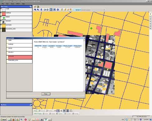
30 Gaia

31 Gaia WFST Editing
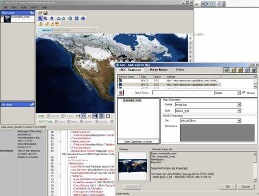
32 Gaia WMTS
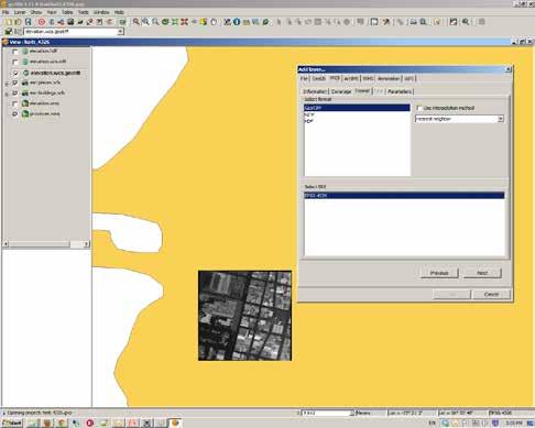
33 gvsig WCS
34 udig

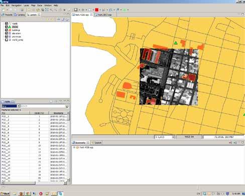
35 OpenLayers WFST Editing
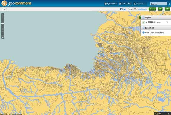
36 GeoCommons
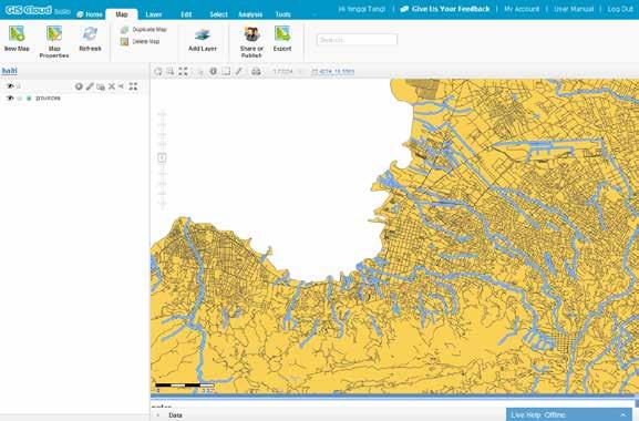
37 GIS Cloud
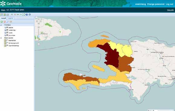
38 GeoNode


39 Publishing OGC Services Satish Sankaran Yingqi Tang
40 Dynamic Rendering WMS SLD Satish Sankaran Yingqi Tang
41 Dynamic Rendering WMS SLD Non-Esri Clients udig GetStyles, GetMap ArcGIS Server OGC Services Quantum GIS OpenLayers OpenGeo Styler WMS SLD Filter Map Service Image Service
42 OpenLayers WFST Editing Satish Sankaran Yingqi Tang
43 Feature Editing WFST Non-Esri Clients Gaia GetFeature ArcGIS Server OGC Services Quantum GIS OpenLayers WFST Filter Map Service GeoData Service

44 Geoprocessing in Quantum GIS Satish Sankaran Yingqi Tang
45 Web Geoprocessing - WPS Non-Esri Clients ArcGIS Server GetCapabilities, DescribeProcess OGC Services udig Quantum GIS WPS WMS GP Service Map Service OpenLayers
46 OGC / ISO standards support ( ArcGIS 10.1) WMS + SLD + Filter Encoding Support + Time Support WFS + Transactions + Filter Encoding Support WCS +GeoTiff, NITF, HDF, JPEG, JPEG2000, PNG WMTS + REST & KVP Encoding WPS + Synchronous + Asynchronous + Data and Services as inputs CSW + OGC Core + ISO ebrim
47 ArcGIS Support for OGC Web services Server - ArcGIS Server - Esri Geoportal Server - Client - Desktop Applications - API s - Viewers -.. More Information ESRI Web Site : White papers, Product Support Matrix, OGC compliancy -
48 GIS Creating and Managing Geo Information Products - Proprietary - Open Specifications - Standards Shapefiles Open FGDB Api Dissemination of Geo Products - Proprietary - Open Specifications - Standards Geoservices REST Specification Geoservices REST Specification
49 Questions?
Interoperability and Standards Supports in ArcGIS
 Esri International User Conference San Diego, California Technical Workshops July 26, 2012 Interoperability and Standards Supports in ArcGIS Satish Sankaran, Esri Yingqi Tang, Esri Agenda Esri s participation
Leveraging OGC Services in ArcGIS Server. Satish Sankaran Yingqi Tang
 Leveraging OGC Services in ArcGIS Server Satish Sankaran ssankaran@esri.com Yingqi Tang ytang@esri.com Agenda Interoperability Enablers OGC and esri OGC Web Services ArcGIS and OGC Web Services - @ version
Leveraging OGC Services in ArcGIS Server
 Esri International User Conference San Diego, CA Technical Workshops Jul.14 th 2011 Leveraging OGC Services in ArcGIS Server Satish Sankaran Yingqi Tang Agenda Interoperability
Providing Interoperability Using the Open GeoServices REST Specification
 2013 Esri International User Conference July 8 12, 2013 San Diego, California Technical Workshop Providing Interoperability Using the Open GeoServices REST Specification Satish Sankaran Kevin Sigwart What
Achieving Interoperability using the ArcGIS Platform. Satish Sankaran Roberto Lucchi
 Achieving Interoperability using the ArcGIS Platform Satish Sankaran Roberto Lucchi Thank you Please fill out the session survey in your mobile app Select [Achieving Interoperability using the ArcGIS Platform]
Leveraging OGC Standards on ArcGIS Server
 Leveraging OGC Standards on ArcGIS Server Satish Sankaran Interoperability and Standards Team James Michel III ESRI Intel Team ArcGIS Server Complete Interoperable Server-Based GIS Desktop Explorer Web
SDI SOLUTIONS FOR INSPIRE: TECHNOLOGIES SUPPORTING A FRAMEWORK OF COOPERATION
 SDI SOLUTIONS FOR INSPIRE: TECHNOLOGIES SUPPORTING A FRAMEWORK OF COOPERATION Roberto Lucchi 1, Marten Hogeweg 1, Guenther Pichler 2 1 Esri, Redlands, CA, USA 2 Esri Kranzberg, Germany 1 Vision INSPIRE
How to become an INSPIRE node and fully exploit the investments made?
 How to become an INSPIRE node and fully exploit the investments made? Solution patterns for consumers: end users & developers (2/2) Roberto Lucchi 22 June 2010, Krakow 1 Geoportal extension Enabling discovery
Achieving Interoperability Using Open Standards
 FedGIS Conference February 24 25, 2016 Washington, DC Achieving Interoperability Using Open Standards Satish Sankaran Marten Hogeweg Agenda Understanding Interoperability What, Why and How? ArcGIS Platform
Getting Started with ArcGIS for Server. Charmel Menzel and Ken Gorton
 Getting Started with ArcGIS for Server Charmel Menzel and Ken Gorton Agenda What is ArcGIS for Server? Types of Web services Publishing resources onto the Web Clients to ArcGIS for Server Editions and
Interoperability with ArcGIS
 Interoperability with ArcGIS Satish Sankaran Marten Hogeweg Agenda Understanding Interoperability What, Why and How? ArcGIS Platform An Open Platform Supporting Interoperability Examples from the real
Esri Support for Geospatial Standards
 APRIL 2017 ArcGIS Is Open and Interoperable Esri Support for Geospatial Standards Copyright 2017 Esri All rights reserved. Printed in the United States of America. The information contained in this document
INSPIRE: The ESRI Vision. Tina Hahn, GIS Consultant, ESRI(UK) Miguel Paredes, GIS Consultant, ESRI(UK)
 Miguel Paredes, GIS Consultant, ESRI(UK)") INSPIRE: The ESRI Vision Tina Hahn, GIS Consultant, ESRI(UK) Miguel Paredes, GIS Consultant, ESRI(UK) Overview Who are we? Introduction to ESRI Inc. and ESRI(UK) Presenters ArcGIS The ESRI Solution to
INSPIRE: The ESRI Vision Tina Hahn, GIS Consultant, ESRI(UK) Miguel Paredes, GIS Consultant, ESRI(UK) Overview Who are we? Introduction to ESRI Inc. and ESRI(UK) Presenters ArcGIS The ESRI Solution to
DATA SHARING AND DISCOVERY WITH ARCGIS SERVER GEOPORTAL EXTENSION. Clive Reece, Ph.D. ESRI Geoportal/SDI Solutions Team
 DATA SHARING AND DISCOVERY WITH ARCGIS SERVER GEOPORTAL EXTENSION Clive Reece, Ph.D. ESRI Geoportal/SDI Solutions Team Geoportal Extension for ArcGIS Server Context within an Enterprise Spatial Data Infrastructure
Web Map Servers. Mark de Blois. Septembre 2016
 Web Map Servers Mark de Blois Septembre 2016 Learning Objectives After this lecture you will be able to understand web map servers as used in Web-GIS applications Introduction A Web Map Server is a computer
What s New in ArcGIS Server 10
 What s New in ArcGIS Server 10 Derek Law ArcGIS Server Product Management What s s new in ArcGIS Server 10? Agenda Highlights: Enhanced Web mapping More powerful server-based analysis Geo-collaboration
International Organization for Standardization Technical Committee 211 (ISO/TC211)
") Esri Support for Geospatial Standards: Open Geospatial Consortium (OGC) International Organization for Standardization Technical Committee 211 (ISO/TC211) An Esri White Paper April 2015 Copyright 2015
Esri Support for Geospatial Standards: Open Geospatial Consortium (OGC) International Organization for Standardization Technical Committee 211 (ISO/TC211) An Esri White Paper April 2015 Copyright 2015
ArcGIS Online. The Road Ahead Geoff Mortson
 ArcGIS Online The Road Ahead Geoff Mortson gmortson@esricanada.com ArcGIS Online Easily create and share maps Delivered as intelligent maps Access on virtually any device anyone, anywhere Compliments and
SDI Tecnological Components and Standards
 SDI Tecnological Components and Standards Salvador Bayarri sbayarri@gmail.com World Bank Consultant Contents The SDI architecture model Software components: the SDI stack Basic services Metadata SDI access
EUCOM/AFRICOM DEFENSE USER GROUP MEETING MARCH 2010 STUTTGART WELCOME!
 EUCOM/AFRICOM DEFENSE USER GROUP MEETING 23-25 MARCH 2010 STUTTGART WELCOME! AGENDA March 23, Tuesday 0800-0900 Registration 0900-0915 Welcome and Introductions 0915-1000 Getting Started with ArcGIS Server
ArcGIS 9.2 Works as a Complete System
 ArcGIS 9.2 Works as a Complete System A New Way to Manage and Disseminate Geographic Knowledge Author/Serve/Use Maps Data Models Globes Metadata Use Desktop Explorer Web Map Viewer Mobile Open APIs Enterprise
SuperGIS Server 3.2 Value Edition Specification
 SuperGIS Server 3.2 Value Edition Specification 20140826 Specification 1. All of the services support SOAP (Simple Object Access Protocol). 2. Use map file created by SuperGIS Desktop as map services SuperGIS
Scientific and Multidimensional Raster Support in ArcGIS
 Scientific and Multidimensional Raster Support in ArcGIS Sudhir Raj Shrestha sshrestha@esri.com Brief breakdown Scientific Multidimensional data Ingesting Scientific MultiDim Data in ArcGIS Ingesting and
Managing Image Data on the ArcGIS Platform Options and Recommended Approaches
 Managing Image Data on the ArcGIS Platform Options and Recommended Approaches Peter Becker Petroleum requirements for imagery and raster Traditional solutions and issues Overview of ArcGIS imaging capabilities
Working with the ArcGIS Viewer for Flex Application Builder
 Working with the ArcGIS Viewer for Flex Application Builder Esri Canada User Conference St. John s November 15, 2012 Presented By: Greg Yetman gyetman@esri.ca Agenda This seminar is designed to help you
Using ArcGIS for Server. Javier Abadía, Esri España Peter McDaid, Esri UK
 Using ArcGIS for Server Javier Abadía, Esri España Peter McDaid, Esri UK 1. Intro 2. ArcGIS for Server = Geospatial Apps Server 3. Map Services Publishing Flow Apps 4. Spatial Functionality Services Publishing
Introduction to ArcGIS Server 10.1
 Introduction to ArcGIS Server 10.1 E-Learning for the GIS Professional Any Time, Any Place! geospatialtraining.com Module Outline What is ArcGIS Server? GIS Resources and Services ArcGIS Server Components
PRODUCT BROCHURE ERDAS APOLLO MANAGING AND SERVING GEOSPATIAL INFORMATION
 PRODUCT BROCHURE ERDAS APOLLO MANAGING AND SERVING GEOSPATIAL INFORMATION ERDAS APOLLO Do you have large volumes of geospatial information, regularly updated data stores, and a distributed user base? Do
Adopting the Appropriate GIS Web Service Technologies
 Adopting the Appropriate GIS Web Service Technologies Bo Guo, PE, PhD GIS/IT Integration Consultant Gistic Research Inc. UT & AZ Jake Payne Database Administrator & Architect State of Utah Department of
Desktop. ArcGIS Server. ArcGIS
 Getting Started with ArcGIS Server Nakul Bhatia and David Crosby ESRI Charlotte 1 Agenda g Overview of ArcGIS Server 9.3.1 Working with GIS Services Using g Web GIS Service Clients ArcGIS Online Map Caching
Leveraging metadata standards in ArcGIS to support Interoperability. Aleta Vienneau and Marten Hogeweg
 Leveraging metadata standards in ArcGIS to support Interoperability Aleta Vienneau and Marten Hogeweg Leveraging metadata standards in ArcGIS to support Interoperability Overview of metadata standards
ERDAS APOLLO Managing and Serving Geospatial Information
 ERDAS APOLLO Managing and Serving Geospatial Information ERDAS APOLLO Do you have large volumes of geospatial information, regularly updated data stores, and a distributed user base? Do you need a single,
Introduction to ArcGIS Server Architecture and Services. Amr Wahba
 Introduction to ArcGIS Server 10.1 - Architecture and Services Amr Wahba awahba@esri.com Agenda Architecture Features Publishing Security Cloud Powerful GIS capabilities Delivered as Web services To help
Esri Support for Geospatial Standards: OGC and ISO/TC211. An Esri White Paper May 2015
 Esri Support for Geospatial Standards: OGC and ISO/TC211 An Esri White Paper May 2015 Copyright 2015 Esri All rights reserved. Printed in the United States of America. The information contained in this
Carmenta Server Product Description
 White paper Carmenta Server Product Description Carmenta AB, Tel +46-31-775 57 00, www.carmenta.com P315 121RD, 2010 Carmenta reserves the right to change the specifications at any time and without notice.
Dynamic Situational Awareness. Through Developer Applications
 Dynamic Situational Awareness Through Developer Applications Mission Focused Applications Building Apps to support operations Agile Simple High-Performance Defense Developers GIS Simplifies Working With
Developing a Free and Open Source Software based Spatial Data Infrastructure. Jeroen Ticheler
 Developing a Free and Open Source Software based Spatial Data Infrastructure Jeroen Ticheler 1 License This work is licensed under the Creative Commons Attribution-NonCommercial-ShareAlike 2.5 License.
ArcGIS for Server Michele Lundeen
 ArcGIS for Server 10.1 Michele Lundeen Summary Vision Installation and Configuration Architecture Publishing Functional Enhancements Cloud Migration and Best Practices Powerful GIS capabilities Delivered
Integrated Map Tool. Overview, Current Status, and Things to Come
 Integrated Map Tool Overview, Current Status, and Things to Come Integrated Mapping and Analysis Tool (IMAT) map widget Integrated Mapping Tool IMAT Reusable components for portrayal, query, analysis,
GENeric European Sustainable Information Space for Environment.
 GENeric European Sustainable Information Space for Environment http://www.genesis-fp7.eu/ Outline Introduction The GENESIS FP7 project The GENESIS solution s architecture GENESIS experience with INSPIRE
Understanding and Using Metadata in ArcGIS. Adam Martin Marten Hogeweg Aleta Vienneau
 Understanding and Using Metadata in ArcGIS Adam Martin Marten Hogeweg Aleta Vienneau Adam Martin National Government Account Management R&D Open Data Marten Hogeweg National Government Professional Services
Lecture note on the history and principles of geo-webservices
 A SHORT INTRODUCTION TO GEO-WEBSERVICES Lecture note on the history and principles of geo-webservices Barend Köbben Version 1.0 February 24, 2010 Contents 1 From monolithic to distributed GIS architectures
Extend GIS. The Reach. Of Your GIS. Chris Cappelli Nathan Bennett
 Extend The Reach GIS Of Your GIS Chris Cappelli Nathan Bennett Where do your co-workers, managers, customers, and citizens go when they want to find or make a map? GIS is a practical system for problem
County of Los Angeles. Chief Information Office Preferred Technologies for Geographic Information Systems (GIS) Version 2 May 2015
 Version 2 May 2015") County of Los Angeles Chief Information Office Preferred Technologies for Geographic Information Systems (GIS) Version 2 May 2015 CIO Preferred Technologies for GIS This document lists the preferred Geographic
County of Los Angeles Chief Information Office Preferred Technologies for Geographic Information Systems (GIS) Version 2 May 2015 CIO Preferred Technologies for GIS This document lists the preferred Geographic
The GeoPortal Cookbook Tutorial
 The GeoPortal Cookbook Tutorial Wim Hugo SAEON/ SAEOS SCOPE OF DISCUSSION Background and Additional Resources Context and Concepts The Main Components of a GeoPortal Architecture Implementation Options
Serving Imagery with ArcGIS Server 10.1
 Serving Imagery with ArcGIS Server 10.1 Presented by: André Piasta apiasta@esri.ca Esri Canada Users Conference Calgary, AB 28 May 2013 Today s Agenda ArcGIS server and image services Publishing of imagery
Discovery and Access of Geospatial Resources Using GIS Portal Toolkit Marten Hogeweg Product Manager GIS Portal Toolkit
 Discovery and Access of Geospatial Resources Using GIS Portal Toolkit Marten Hogeweg Product Manager GIS Portal Toolkit Outline Elements of Spatial Data Infrastructures Current trends Position of GIS portals
Interactive Web Mapping: Overview
 Interactive Web Mapping: Overview Overview of how geospatial data is formatted requested supplied consumed by/for web technologies 2 Definitions Analysis exploring and modeling geospatial phenomena Mapping
GeoNode Integration with SDIs and Community Mapping
 GeoNode Integration with SDIs and Community Mapping Salvador Bayarri sbayarri@gmail.com World Bank Consultant Contents Accessing other SDI services Catalog harvesting through Geonetwork Cascading external
Esri Geoportal Server
 Esri Geoportal Server Implementing a Spatial Data Infrastructure @martenhogeweg Esri Geoportal Server Extending ArcGIS to enable discovery and use of geospatial resources in heterogeneous environments
An Introduction to GIS for developers
 An Introduction to GIS for developers Part 4: GIS Sharing Canserina Kurnia & Tom Shippee Agenda Web GIS ArcGIS Online Cloud-based ArcGIS Server ArcGIS Server on-premises ArcGIS a complete platform discover,
Using the Network Common Data Form for storage of atmospheric data
 Using the Network Common Data Form for storage of atmospheric data Maarten Plieger Royal Netherlands Meteorological Institute The NetCDF4 data format (Network Common Data Form) is used within the ADAGUC
GEOSPATIAL ERDAS APOLLO. Your Geospatial Business System for Managing and Serving Information
 GEOSPATIAL ERDAS APOLLO Your Geospatial Business System for Managing and Serving Information ERDAS APOLLO Do you have large volumes of data, a geographicallydistributed user base and rapidly changing
Getting Started with the ArcGIS Server JavaScript API
 Getting Started with the ArcGIS Server JavaScript API Agenda Introduction ArcGIS Server services and mashups REST API Services Directory JavaScript API ArcGIS Server Resource Center Dojo Maps, layers,
Accessing OGC Services To access OGC WMS and WFS open the service in the directory that you want to consume, and click on either WMS or WFS.
 Using Web Services Web Services Overview This user guide contains instructions on how to consume a range of services through a range of both web based and desktop GIS applications. Web services are a live
Regarding the quality attributes, the architecture of the system must be:
 The SDSS System Overview This chapter gives an overview of the software architecture of the RiskChanges SDSS system. One of the objectives within the project is the development of a SDSS system for probabilistic
Getting Started with the ArcGIS API for JavaScript. Julie Powell, Paul Hann
 Getting Started with the ArcGIS API for JavaScript Julie Powell, Paul Hann Esri Developer Summit Berlin November 19 2012 Getting Started with the ArcGIS API for JavaScript ArcGIS for Server Is a Platform
Web Mapping Applications with ArcGIS. Bernie Szukalski Derek Law
 Web Mapping Applications with ArcGIS Bernie Szukalski Derek Law Agenda Web Mapping and Map Services Fundamentals ArcGIS Web Mapping Applications - Hosted online - Hosted on-premise Summary Web Application
Marushka Server. Product Specification
 Introductory Information Product Marushka Server represents a new generation of tools (devices) for publication and use of GIS data in the Internet and intranet. It is built on component technology in.net
Understanding and Working with the OGC Geopackage. Keith Ryden Lance Shipman
 Understanding and Working with the OGC Geopackage Keith Ryden Lance Shipman Introduction - Introduction to Simple Features - What is the GeoPackage? - Esri Support - Looking ahead Geographic Things 3 Why
IT Infrastructure for BIM and GIS 3D Data, Semantics, and Workflows
 IT Infrastructure for BIM and GIS 3D Data, Semantics, and Workflows Hans Viehmann Product Manager EMEA ORACLE Corporation November 23, 2017 @SpatialHannes Safe Harbor Statement The following is intended
Learning What s New in ArcGIS 10.1 for Server: Administration
 Esri Mid-Atlantic User Conference December 11-12th, 2012 Baltimore, MD Learning What s New in ArcGIS 10.1 for Server: Administration Derek Law Product Manager Esri - Redlands ArcGIS for Server Delivering
Agenda. Introduction. Supported Formats. Creating a Custom REST Service. What s Next
 Using the ArcGIS Server REST API Jeremy Bartley Keyur Shah Agenda Introduction Design and Concepts Supported Formats REST API Admin Creating a Custom REST Service What s New (Since 9.3) What s Next Conclusion
ArcGIS Viewer for Microsoft Silverlight An Introduction
 Esri International User Conference San Diego, CA Technical Workshops July 12, 2011 ArcGIS Viewer for Microsoft Silverlight An Introduction Art Haddad, Rich Zwaap, and Derek Law Agenda Background Product
Addressing Geospatial Big Data Management and Distribution Challenges ERDAS APOLLO & ECW
 Addressing Geospatial Big Data Management and Distribution Challenges ERDAS APOLLO & ECW Nouman Ahmed GeoSystems-Me (Hexagon Geospatial / ERDAS Regional Partner) Enterprise Solutions Architect Hexagon
Open source technologies and INSPIRE network services in Slovak environmental agency
 Open source technologies and INSPIRE network services in Slovak environmental agency Peter Mozolík, Martin Koška, Marek Žiačik, Martin Tuchyňa Slovak Environmental Agency (SEA) SEA role within slovak SDI
The French Geoportal : linking discovery and view network services. INSPIRE Conference Krakow
 The French Geoportal : linking discovery and view network services ( BRGM ) D.Richard (IGN) F. Robida Context of the French Geoportal The governance mechanism Transversal organisation based on the Ministry
ESRI Technology Update. Joe Holubar Larry Young
 ESRI Technology Update Joe Holubar Larry Young Continued Improvement Improving Quality and Extending and Refining Functionality First Half of 2009: Minor Update Release (ArcGIS 9.3.1) ArcGIS Explorer Fall
GeoServer, The Open Source Solution for the interoperable management of geospatial data
 GeoServer, The Open Source Solution for the interoperable management of geospatial data Ing. Andrea Aime, GeoSolutions Ing. Simone Giannecchini, GeoSolutions Outline Who is GeoSolutions? Quick intro to
Creating Mosaic Datasets and Publishing Image Services using Python
 Creating Mosaic Datasets and Publishing Image Services using Python Jie Zhang, Jamie Drisdelle Session Offering ID: 305 Overview Introduction to mosaic dataset Raster product for sensor imagery Automatic
Leveraging metadata standards in ArcGIS to support Interoperability. David Danko and Aleta Vienneau
 Leveraging metadata standards in ArcGIS to support Interoperability David Danko and Aleta Vienneau Leveraging Metadata Standards in ArcGIS for Interoperability Why metadata and metadata standards? Overview
ArcGIS Online: Managing Data. Jeremy Bartley Sentha Sivabalan
 ArcGIS Online: Managing Data Jeremy Bartley (jbartley@esri.com) Sentha Sivabalan (ssivabalan@esri.com) Agenda Creating and managing content like Apps, Maps, Scenes and Layers in ArcGIS Today s Topics:
IMAGERY FOR ARCGIS. Manage and Understand Your Imagery. Credit: Image courtesy of DigitalGlobe
 IMAGERY FOR ARCGIS Manage and Understand Your Imagery Credit: Image courtesy of DigitalGlobe 2 ARCGIS IS AN IMAGERY PLATFORM Empowering you to make informed decisions from imagery and remotely sensed data
What is coming in. ArcGIS Server 10. Ismael Chivite ArcGIS Server Product Manager James Cardona Technical Marketing
 What is coming in ArcGIS Server 10 Ismael Chivite ArcGIS Server Product Manager James Cardona Technical Marketing ArcGIS Server is a complete server based GIS Delivering GIS with powerful services and
Web Services for Geospatial Mobile AR
 Web Services for Geospatial Mobile AR Introduction Christine Perey PEREY Research & Consulting cperey@perey.com Many popular mobile applications already use the smartphone s built-in sensors and receivers
Understanding and using Metadata across the ArcGIS Platform. Aleta Vienneau Marten Hogeweg
 Understanding and using Metadata across the ArcGIS Platform Aleta Vienneau Marten Hogeweg Understanding and using Metadata across the ArcGIS Platform Metadata fundamentals ArcGIS platform Road ahead Metadata
The Butterfly Effect. A proposal for distribution and management for butterfly data programs. Dave Waetjen SESYNC Butterfly Workshop May 10, 2012
 The Butterfly Effect A proposal for distribution and management for butterfly data programs Dave Waetjen SESYNC Butterfly Workshop May 10, 2012 http://butterfly.ucdavis.edu Citizen Science based Observation
Standards, GML and AIXM. Dr. David Burggraf Vice President Galdos Systems Inc
 Standards, and AIXM Dr. David Burggraf Vice President Galdos Systems Inc Copyright Galdos Systems Inc. May 6, 2010 Geography Markup Language: What is it? A modeling language for geographic features A set
Working with Feature Layers. Russell Brennan Gary MacDougall
 Working with Feature Layers Russell Brennan Gary MacDougall Working with Feature Layers Session will focus on feature access and editing Highlight new features added over the last few releases Agenda Introduction
GeoServices REST API SWG response to justification comments for No-Votes
 Open Geospatial Consortium Date: 2013-05-10 Reference number of this document: OGC 13-031r1 Category: Technical Note Editor: Clemens Portele, Satish Sankaran GeoServices REST API SWG response to justification
Service Oriented Architecture For GIS Applications
 The 12 th International Conference of International Association for Computer Methods and Advances in Geomechanics (IACMAG) 1-6 October, 2008 Goa, India Service Oriented Architecture For GIS Applications
Advanced Standard Basic Notes
 9.3 Functionality Matrix Data Management Scalable Geodatabase Access Full Geodatabase Support Create Geodatabases Load Spatial Data into Geodatabases Manage Geodatabases One-Way Replication Two-Way Replication
Web GIS: Principles and Applications. Pinde Fu, Ph.D. Project Lead / Senior Developer Professional Services Division
 Web GIS: Principles and Applications Pinde Fu, Ph.D. pfu@esri.com Project Lead / Senior Developer Professional Services Division 2 Web GIS: Principles and Applications Pinde Fu & Jiulin Sun Web GIS course
Development of Java Plug-In for Geoserver to Read GeoRaster Data. 1. Baskar Dhanapal CoreLogic Global Services Private Limited, Bangalore
 Development of Java Plug-In for Geoserver to Read GeoRaster Data 1. Baskar Dhanapal CoreLogic Global Services Private Limited, Bangalore 2. Bruce Thelen CoreLogic Spatial Solutions, Austin, USA 3. Perumal
INTEGRATION OF DISASTER EVENT DATA INTO SPATIAL DATA INFRASTRUCTURES
 INTEGRATION OF DISASTER EVENT DATA INTO SPATIAL DATA INFRASTRUCTURES B. Stollberg a, *, T. De Groeve a, A. Hirner a, L. Vernaccini a, S. Paris a a Joint Research Centre of the European Commission, Institute
PRODUCT DESCRIPTION. ERDAS APOLLO 2014 Product Features and Comparisons
 PRODUCT DESCRIPTION ERDAS APOLLO 2014 Product Features and Comparisons ERDAS APOLLO is an enterprise-class, comprehensive data management, analysis, and delivery system enabling an organization to catalog,
Tom Brenneman. Good morning and welcome, introductions and thank you for being here.
 Welcome Tom Brenneman Good morning and welcome, introductions and thank you for being here. This is a best practices seminar. We're going to be sharing with you what we found to be best practices that
SEXTANT 1. Purpose of the Application
 SEXTANT 1. Purpose of the Application Sextant has been used in the domains of Earth Observation and Environment by presenting its browsing and visualization capabilities using a number of link geospatial
SMARTERDECISIONS. Geospatial Portal 2013 Open Interoperable GIS/Imagery Services with ERDAS Apollo 2013 and ERDAS Imagine 2013
 Geospatial Portal 2013 Open Interoperable GIS/Imagery Services with ERDAS Apollo 2013 and ERDAS Imagine 2013 Carahsoft Intergraph Government Solutions SMARTERDECISIONS Geospatial Portal 2013 Geospatial
ESRI & Interoperability. David Danko ISO TC 211 Metadata Project Leader OGC Metadata WG Chair ESRI Senior Consultant GIS Standards
 ESRI & Interoperability David Danko ISO TC 211 Metadata Project Leader OGC Metadata WG Chair ESRI Senior Consultant GIS Standards ddanko@esri.com GIS has always required Interoperability Social Factors
FDO Data Access Technology at a Glance
 Autodesk Geospatial FDO Data Access Technology at a Glance Work seamlessly with your geospatial data whatever the format 1 The Challenge The growing need for openness and interoperability between traditional
ICIT. Brian Hiller ESRI Account Manger. What s new in ArcGIS 10
 ICIT Brian Hiller ESRI Account Manger What s new in ArcGIS 10 ArcGIS 10 Fast Easy Powerful Everywhere late June 2010 ArcGIS System for Geographic Information Desktop Server Mobile Online A System A Complete
ArcGIS Enterprise: An Introduction. Philip Heede
 Enterprise: An Introduction Philip Heede Online Enterprise Hosted by Esri (SaaS) - Upgraded automatically (by Esri) - Esri controls SLA Core Web GIS functionality (Apps, visualization, smart mapping, analysis
GML, WFS and SVG: A New Frontier of Internet GIS
 GML, WFS and SVG: A New Frontier of Internet GIS Zhong-Ren Peng Director Center for Advanced Spatial Information Research Associate Professor Department of Urban Planning University of Wisconsin-Milwaukee
Implementing Web GIS Solutions
 Implementing Web GIS Solutions using open source software Karsten Vennemann Seattle Talk Overview Talk Overview Why and What What is Open Source (GIS)? Why use it? Application Components Overview of Web
An Introduction to Data Interoperability
 Esri International User Conference San Diego, California 2012 Technical Workshops July 24/25 An Introduction to Data Interoperability Bruce Harold - Esri Dale Lutz Safe Software Background Why Data Interoperability?
A Framework of Feature-Level Transportation Geospatial Data Sharing Systems
 A Framework of Feature-Level Transportation Geospatial Data Sharing Systems Zhong-Ren Peng, Ph.D. Director Center for Advanced Spatial Information Research Associate Professor Department of Urban Planning
An Open Source Software approach to Spatial Data Infraestructures.
 Second Part INSPIRE and SDI: heterogeneous GI accessing solution An Open Source Software approach to Spatial Data Infraestructures. Study of different scenarios Second Part: INDEX I. Intro: SDI: Beginings,
Project Deliverable. Report on 4 D models in World Wide Web of all test areas
 Project Deliverable Number D4.2 Title Month Report on 4 D models in World Wide Web of all test areas M33 Language English Revisions record Rev. N. Author Notes Date 0 Gabriele Guidi Document framework
PRODUCT DESCRIPTION ERDAS APOLLO 2018 PRODUCT FEATURES AND COMPARISONS
 PRODUCT DESCRIPTION ERDAS APOLLO 2018 PRODUCT FEATURES AND COMPARISONS ERDAS APOLLO ERDAS APOLLO is an enterprise-class, comprehensive data management, analysis, and delivery system enabling an organization