METRIC AND QUALITATIVE EVALUATION OF QUICKBIRD ORTHOIMAGES FOR A LARGE SCALE GEODATABASE CREATION
|
|
|
- Anissa Carpenter
- 5 years ago
- Views:
Transcription


1 METRIC AND QUALITATIVE EVALUATION OF QUICKBIRD ORTHOIMAGES FOR A LARGE SCALE GEODATABASE CREATION Maurizio Barbarella, Michela Zanni DISTART Università di Bologna maurizio.barbarella@mail.ing.unibo.it, michela.zanni@mail.ing.unibo.it 8 th Bilateral Geodetic Meeting Poland-Italy Wrocław (Poland), June 2006
2 PRELIMINARY REMARKS PREVIOUS RESEARCHES demonstrated that high resolution satellite imagery, such as QuickBird or Ikonos, could get to accuracy suitable to map updating up to 1:5000 scale, depending, basicly, on geometric correction model for orthorectification number, distribution and accuracy of Ground Control Points (GCPs) over the scene accuracy of DTM.but. geometric accuracy, even if evaluated over a large number of Check Points, is not sufficient to guarantee a correct detection and interpretation of objects in the image 8 th Bilateral Geodetic Meeting Poland-Italy Wrocław (Poland), June
3 TOPICS PURPOSE EVALUATION ON DIFFERENT TEST SITES OF THE EFFECTIVE USE OF ORTHOIMAGES FOR CREATION OR UPDATING OF LARGE SCALE STRUCTURED GEODATABASE, PARTICULARLY ADDRESSED TO BUILDING DETECTION METHOD IMAGE ANALYSIS AND ENHANCEMENT VECTORIZATION OF TEST SITES COMPARISON AMONG DIFFERENT VECTORIZATIONS GROUND INSPECTION AND RECONAISSANCE FIELD SURVEYS 8 th Bilateral Geodetic Meeting Poland-Italy Wrocław (Poland), June
4 LARGE SCALE GEODATABASE Regione Emilia-Romagna, first in Italy, started a project for a 1:5000 GeoDataBase creation, that implies the updating of topographic data (i.e. raster Technical Map) of the whole region, their complete vectorization and the structuring of the data on the basis of national standards for GeoDataBase. Three steps for the GeoDataBase creation: modalità A, modalità B, modalità C. MODALITÀ C from 1:5000 analogic map to raster map from raster map to vector map updating of vector map using high resolution satellita data (QuickBird) and integration with local data creation of a structured object-geodatabase MAP BECOMES A PRODUCT OF THE GEODATABASE 8 th Bilateral Geodetic Meeting Poland-Italy Wrocław (Poland), June
5 LARGE SCALE GEODATABASE CONTENTS OF GEODATABASE Objects of reality (buildings, road, rivers ) Networks (road, drainage, electrical.) Altimetry (contour lines, points) Names Graphic elements for representation ORGANIZATION OF GEODATABASE CLASSES (road circulation area, pedestrian passage area, wet area, building, bridge.) OBJECTS Alfa-numerical component Table 1 (attributes) format class_name Lines: Table contour 2 lines, networks, linear vegetation. ASCII files (attributes) XML files LAYERS set of objects from one or more classes with homogeneous spatial representation Geometrical component Geometrical component File of format geometrical primitives (polygons, lines, ESRI points) shape files Polygons: general land cover Points: sparse points, poles, pylons.. 8 th Bilateral Geodetic Meeting Poland-Italy Wrocław (Poland), June
6 LARGE SCALE GEODATABASE TOLERANCES The DataBase geometrical component partially comes from the vectorization of Technical Map and must be useful to produce new maps of differents themes at a scale 1:5000. For this reason, it must respect the rules for numerical maps at this scale. Particularly, in the frame of the use of high resolution QuickBird images for the map updating, it must respect more strict tolerances than those required for quick updating of Technical Map. Positional tolerance for traditional Technical Map: 0.4 mm * scale = 2 m at 1:5000 scale Positional tolerance for quick updating of traditional Technical Map: 0.8 mm * scale = 4 m at 1:5000 scale Positional tolerance for quick updating of Technical Map through satellite orthoimages: 3 m 8 th Bilateral Geodetic Meeting Poland-Italy Wrocław (Poland), June

,")
7 TEST SITE LOCATION Castenaso Bologna, Northern Italy 8 th Bilateral Geodetic Meeting Poland-Italy Wrocław (Poland), June

8 QUICKBIRD IMAGE IMAGE METADATA ACQUISITION DATE CLOUD COVER 0% PAN RESOLUTION 0.62 meters ENVIRONMENTAL QUALITY 90 - Excellent OFF-NADIR 6 SUN AZIMUTH 140 SUN ELEVATION 62 IMAGE PRICE 8th Bilateral Geodetic Meeting Poland-Italy BASIC (1 PAN layer + 4 MS layers) 4800 ORTHORECTIFICATION + DATAFUSION 2400 Wrocław (Poland), June


9 QUICKBIRD ORTHOIMAGES GSD 70 cm UTM ED50 6 PANCHROMATIC ORTHOIMAGES Gauss-Boaga National Grid System Cut along Technical Scale Map 1:5000 (CTR5) extents Certified Accuracy: <± 4 m compared with CTR 1:5000 from CTR 1:5000 UTM ED50 DTM Geometric correction model:? GCP:? Software:? 8 th Bilateral Geodetic Meeting Poland-Italy Wrocław (Poland), June
, 22-24 June 2006")
10 IMAGE ENHANCEMENT RESAMPLING: Nearest Neighbor RESAMPLING: Bilinear Interpolation High Pass Filter Edge Sharpening 3 3 8th Bilateral Geodetic Meeting Poland-Italy Wrocław (Poland), June


11 SHADOWS High Pass Filter Edge Sharpening 3 3 Root Enhancement SUN AZIMUTH SUN ELEVATION th Bilateral Geodetic Meeting Poland-Italy Wrocław (Poland), June


12 IMAGE VECTORIZATION 1 PANCHROMATIC IMAGE 2 industrial areas 43 buildings 1 urban area 40 buildings Scale 1:500 1:300 8th Bilateral Geodetic Meeting Poland-Italy Wrocław (Poland), June

, 22-24 June")
13 IMAGE VECTORIZATION 2 PANCHROMATIC IMAGE + COLOUR 2 industrial areas 43 buildings 1 urban area 39 buildings Scale 1:500 1:300 8th Bilateral Geodetic Meeting Poland-Italy Wrocław (Poland), June


,")
14 COMPARISON OF VECTORIZATION INDUSTRIAL BUILDINGS - SIMPLE GEOMETRY 1.44 m 1.03m PAN IMAGE PAN + COLOUR 8 th Bilateral Geodetic Meeting Poland-Italy Wrocław (Poland), June


,")
15 COMPARISON OF VECTORIZATION INDUSTRIAL BUILDINGS COMPLEX GEOMETRY PAN IMAGE PAN + COLOUR 8 th Bilateral Geodetic Meeting Poland-Italy Wrocław (Poland), June

,")
16 QUALITATIVE ACCURACY INDUSTRIAL BUILDINGS 8 th Bilateral Geodetic Meeting Poland-Italy Wrocław (Poland), June


17 COMPARISON OF VECTORIZATION URBAN BUILDINGS SIMPLE GEOMETRY 1.49 cm 46 cm PAN IMAGE PAN + COLOUR 8 th Bilateral Geodetic Meeting Poland-Italy Wrocław (Poland), June

, 22-24 June")
18 COMPARISON OF VECTORIZATION URBAN BUILDINGS COMPLEX GEOMETRY PAN IMAGE PAN + COLOUR 8 th Bilateral Geodetic Meeting Poland-Italy Wrocław (Poland), June
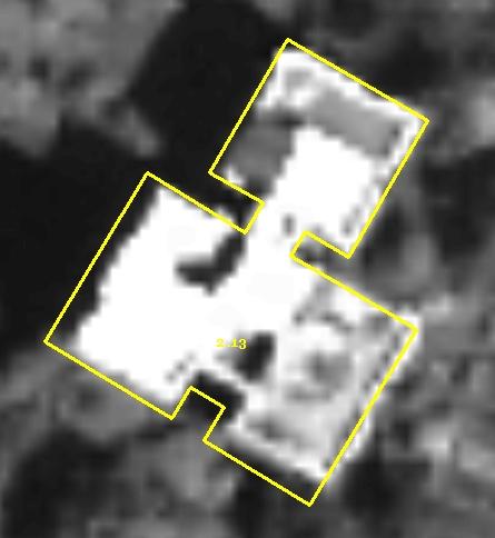
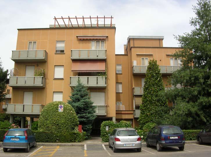
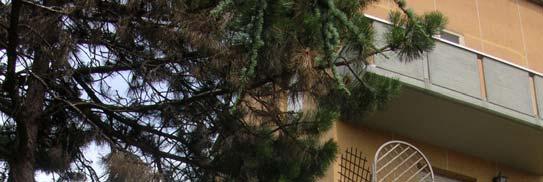
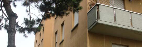
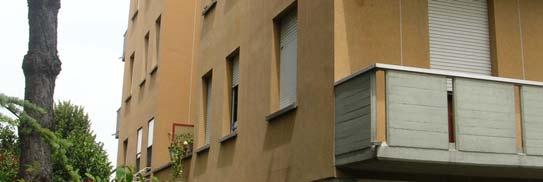

19 GROUND INSPECTION URBAN BUILDINGS 8 th Bilateral Geodetic Meeting Poland-Italy Wrocław (Poland), June
20 COMPARISON OF VECTORIZATION PAN IMAGE PAN +COLOUR Urban Industrial Urban Industrial Number of buildings SHAPE DIFFERENCES Number of buildings 25 Urban Industrial % Number of buildings % COMPARISON BETWEEN COORDINATES OF CORNERS Number of points Urban 226 Industrial 342 D_EST D_NORD Delta D_EST D_NORD Delta (m) (m) (m) (m) (m) (m) Mean RMS Max Min th Bilateral Geodetic Meeting Poland-Italy Wrocław (Poland), June


21 IMAGE VECTORIZATION 3 VECTORIZATION REPEATABILITY PAN IMAGE VECT 1 VECT 2 Urban Industrial Urban Industrial Number of buildings SHAPE DIFFERENCES Urban Industrial Number of buildings % Number of buildings % VECT1 VECT2 VECT1 VECT2 8 th Bilateral Geodetic Meeting Poland-Italy Wrocław (Poland), June

22 FIELD SURVEY Field survey in the industrial area INSTRUMENT: SmartStation Leica (Total station + GPS) SURVEY METHOD: Position of two GPS receivers on S1 and S2 station from Network RTK Bearing of second station to the first one Survey by total station and traverses from second station SURVEYED POINTS: buildings corners, without prism S1, GPS coordinates 1 SURVEY COORDINATES: WGS84-ITRF2000 COORDINATES TRANSFORMATION: from WGS84-ITRF2000 to WGS84-IGMI95 from WGS84-IGMI95 to GaussBoaga S2, GPS coordinates 2 8 th Bilateral Geodetic Meeting Poland-Italy Wrocław (Poland), June
, 22-24 June")
23 GROUND SURVEYS Stations Surveyed points 8 th Bilateral Geodetic Meeting Poland-Italy Wrocław (Poland), June
24 METRIC ACCURACY Comparison between coordinates of surveyed points and coordinates of correspondent vectorized corners PAN IMAGE PAN +COLOUR Delta EST (m) Delta NORD (m) Delta (m) Delta EST (m) Delta NORD (m) Delta (m) Mean RMS Max Min th Bilateral Geodetic Meeting Poland-Italy Wrocław (Poland), June
25 CONCLUSIONS Geocoding and orthoprojection of supplied orthoimages result correct Analysis of geometrical accuracy proved that orthoimages could be used for 1:5000 1:10000 technical scale map updating: accuracy is always whithin fixed tolerances the use of panchromatic images is not sufficient for a correct detection and interpretation of objects and their shape: the use of projected orthoimages generated by data fusion is very expensive but it is not possible a correct photointerpretation process without the information from colour field survey and integration can be performed in an economic and accurate mode through the combined use of GNSS receivers and total station, using NRTK network 8 th Bilateral Geodetic Meeting Poland-Italy Wrocław (Poland), June
ATOMI Automatic road centreline extraction
 ATOMI input and output data Ortho images DTM/DSM 2D inaccurate structured road vector data ATOMI Automatic road centreline extraction 3D accurate structured road vector data Classification of roads according
High resolution satellite images orthoprojection using dense DEM
 See discussions, stats, and author profiles for this publication at: https://www.researchgate.net/publication/252229019 High resolution satellite images orthoprojection using dense DEM Article in Proceedings
Geometric Correction of Imagery
 Geometric Correction of Imagery Geometric Correction of Imagery Present by: Dr.Weerakaset Suanpaga D.Eng(RS&GIS) The intent is to compensate for the distortions introduced by a variety of factors, so that
MASI: Modules for Aerial and Satellite Imagery
 MASI: Modules for Aerial and Satellite Imagery Product Descriptions and Typical Applied Cases Dr. Jinghui Yang jhyang@vip.163.com Sept. 18, 2017 File Version: v1.0 VisionOnSky Co., Ltd. Contents 1 Descriptions
DIGITAL TERRAIN MODEL COMPARISON BASED ON THE DIRECT SATELLITE MEASUREMENT AND DIRECT TACHEOMETRIC MEASUREMENT
 DIGITAL TERRAIN MODEL COMPARISON BASED ON THE DIRECT SATELLITE MEASUREMENT AND DIRECT TACHEOMETRIC MEASUREMENT 1. SUMMARY Katarzyna Pająk, katarzyna.pajak@uwm.edu.pl Terrain Models are used in many engineering
Geometric Rectification of Remote Sensing Images
 Geometric Rectification of Remote Sensing Images Airborne TerrestriaL Applications Sensor (ATLAS) Nine flight paths were recorded over the city of Providence. 1 True color ATLAS image (bands 4, 2, 1 in
Geometric Accuracy Evaluation, DEM Generation and Validation for SPOT-5 Level 1B Stereo Scene
 Geometric Accuracy Evaluation, DEM Generation and Validation for SPOT-5 Level 1B Stereo Scene Buyuksalih, G.*, Oruc, M.*, Topan, H.*,.*, Jacobsen, K.** * Karaelmas University Zonguldak, Turkey **University
SPOT-1 stereo images taken from different orbits with one month difference
 DSM Generation Almost all HR sensors are stereo capable. Some can produce even triplettes within the same strip (facilitating multi-image matching). Mostly SPOT (1-5) used for stereo and Ikonos (in spite
Overview. Image Geometric Correction. LA502 Special Studies Remote Sensing. Why Geometric Correction?
 LA502 Special Studies Remote Sensing Image Geometric Correction Department of Landscape Architecture Faculty of Environmental Design King AbdulAziz University Room 103 Overview Image rectification Geometric
Drone2Map for ArcGIS: Bring Drone Imagery into ArcGIS. Will
 Drone2Map for ArcGIS: Bring Drone Imagery into ArcGIS Will Meyers @MeyersMaps A New Window on the World Personal Mapping for Micro-Geographies Accurate High Quality Simple Low-Cost Drone2Map for ArcGIS
Files Used in this Tutorial
 RPC Orthorectification Tutorial In this tutorial, you will use ground control points (GCPs), an orthorectified reference image, and a digital elevation model (DEM) to orthorectify an OrbView-3 scene that
General GPS TPS ROB X POLE VOL RDN RPL Jobs management System settings (units, precision, parameters, etc.)
") XPAD Survey Modules XPAD Survey GPS TPS XPOLE General GPS TPS ROB XPOLE VOL RDN RPL Jobs management System settings (units, precision, parameters, etc.) Instruments GPS GPS TPS ROB XPOLE VOL RDN RPL Instrument
XPAD Survey Modules XPAD Survey GPS TPS XPOLE General GPS TPS ROB XPOLE VOL RDN RPL Jobs management System settings (units, precision, parameters, etc.) Instruments GPS GPS TPS ROB XPOLE VOL RDN RPL Instrument
Integration of raster and vector data for 3D city modelling URMO3D Orfeo Project OR/02/02 Dennis Devriendt Prof. Rudi Goossens
 Integration of raster and vector data for 3D city modelling URMO3D Orfeo Project OR/02/02 Dennis Devriendt Prof. Rudi Goossens 1 Presentation overview URMO3D In one sentence Objectives Study areas Methodology
ENVI Automated Image Registration Solutions
 ENVI Automated Image Registration Solutions Xiaoying Jin Harris Corporation Table of Contents Introduction... 3 Overview... 4 Image Registration Engine... 6 Image Registration Workflow... 8 Technical Guide...
Training i Course Remote Sensing Basic Theory & Image Processing Methods September 2011
 Training i Course Remote Sensing Basic Theory & Image Processing Methods 19 23 September 2011 Geometric Operations Michiel Damen (September 2011) damen@itc.nl ITC FACULTY OF GEO-INFORMATION SCIENCE AND
FIELD-BASED CLASSIFICATION OF AGRICULTURAL CROPS USING MULTI-SCALE IMAGES
 FIELD-BASED CLASSIFICATION OF AGRICULTURAL CROPS USING MULTI-SCALE IMAGES A. OZDARICI a, M. TURKER b a Middle East Technical University (METU), Graduate School of Natural and Applied Sciences, Geodetic
Exercise 1: Introduction to ILWIS with the Riskcity dataset
 Exercise 1: Introduction to ILWIS with the Riskcity dataset Expected time: 2.5 hour Data: data from subdirectory: CENN_DVD\ILWIS_ExerciseData\IntroRiskCity Objectives: After this exercise you will be able
TrueOrtho with 3D Feature Extraction
 TrueOrtho with 3D Feature Extraction PCI Geomatics has entered into a partnership with IAVO to distribute its 3D Feature Extraction (3DFE) software. This software package compliments the TrueOrtho workflow
Files Used in this Tutorial
 RPC Orthorectification Tutorial In this tutorial, you will use ground control points (GCPs), an orthorectified reference image, and a digital elevation model (DEM) to orthorectify an OrbView-3 scene that
RASTER ANALYSIS GIS Analysis Fall 2013
 RASTER ANALYSIS GIS Analysis Fall 2013 Raster Data The Basics Raster Data Format Matrix of cells (pixels) organized into rows and columns (grid); each cell contains a value representing information. What
Purpose: To explore the raster grid and vector map element concepts in GIS.
 GIS INTRODUCTION TO RASTER GRIDS AND VECTOR MAP ELEMENTS c:wou:nssi:vecrasex.wpd Purpose: To explore the raster grid and vector map element concepts in GIS. PART A. RASTER GRID NETWORKS Task A- Examine
2. POINT CLOUD DATA PROCESSING
 Point Cloud Generation from suas-mounted iphone Imagery: Performance Analysis A. D. Ladai, J. Miller Towill, Inc., 2300 Clayton Road, Suite 1200, Concord, CA 94520-2176, USA - (andras.ladai, jeffrey.miller)@towill.com
BATHYMETRIC EXTRACTION USING WORLDVIEW-2 HIGH RESOLUTION IMAGES
 BATHYMETRIC EXTRACTION USING WORLDVIEW-2 HIGH RESOLUTION IMAGES M. Deidda a, G. Sanna a a DICAAR, Dept. of Civil and Environmental Engineering and Architecture. University of Cagliari, 09123 Cagliari,
Mountain mapping and DSM generation using high resolution satellite image data
 Mountain mapping and DSM generation using high resolution satellite image data Mountain Mapping and Visualization Lenk, Switzerland, February 2008 K. Wolff, A. Grün Institut für Geodesie und Photogrammetrie
University of Technology Building & Construction Department / Remote Sensing & GIS lecture
 5. Corrections 5.1 Introduction 5.2 Radiometric Correction 5.3 Geometric corrections 5.3.1 Systematic distortions 5.3.2 Nonsystematic distortions 5.4 Image Rectification 5.5 Ground Control Points (GCPs)
Section 5 Orthoimage generation
 Section 5 Orthoimage generation Emmanuel Baltsavias Orthoimage Generation Older sensor models methods: Kratky s Polynomial Mapping Functions (PMFs) Relief corrected affine transformation - Project GCPs
RASTER ANALYSIS GIS Analysis Winter 2016
 RASTER ANALYSIS GIS Analysis Winter 2016 Raster Data The Basics Raster Data Format Matrix of cells (pixels) organized into rows and columns (grid); each cell contains a value representing information.
GIS data input. In the early days of GIS 1980s and early 1990s. We used canned datasets for teaching (from USA)
") GIS data input GIS is the automated : acquisition - input management analysis display of spatial data In the early days of GIS 1980s and early 1990s There were no or little GIS data We used canned datasets
GIS data input GIS is the automated : acquisition - input management analysis display of spatial data In the early days of GIS 1980s and early 1990s There were no or little GIS data We used canned datasets
Managing Imagery and Raster Data Using Mosaic Datasets
 2013 Esri International User Conference July 8 12, 2013 San Diego, California Technical Workshop Managing Imagery and Raster Data Using Mosaic Datasets Hong Xu, Prashant Mangtani Esri UC2013. Technical
Automatic DEM Extraction
 Technical Specifications Automatic DEM Extraction The Automatic DEM Extraction module allows you to create Digital Elevation Models (DEMs) from stereo airphotos, stereo images and RADAR data. Image correlation
DIGITAL SURFACE MODELS OF CITY AREAS BY VERY HIGH RESOLUTION SPACE IMAGERY
 DIGITAL SURFACE MODELS OF CITY AREAS BY VERY HIGH RESOLUTION SPACE IMAGERY Jacobsen, K. University of Hannover, Institute of Photogrammetry and Geoinformation, Nienburger Str.1, D30167 Hannover phone +49
USING UNMANNED AERIAL VEHICLE (DRONE/FLYCAM) TECHNOLOGY IN SURVEY WORK OF PORTCOAST
 TECHNOLOGY IN SURVEY WORK OF PORTCOAST") USING UNMANNED AERIAL VEHICLE (DRONE/FLYCAM) TECHNOLOGY IN SURVEY WORK OF PORTCOAST 1. Capturing aerial images by using Drone Taking images by drones is currently applied in many fields especially in topographic
USING UNMANNED AERIAL VEHICLE (DRONE/FLYCAM) TECHNOLOGY IN SURVEY WORK OF PORTCOAST 1. Capturing aerial images by using Drone Taking images by drones is currently applied in many fields especially in topographic
Terrain Modeling and Mapping for Telecom Network Installation Using Scanning Technology. Maziana Muhamad
 Terrain Modeling and Mapping for Telecom Network Installation Using Scanning Technology Maziana Muhamad Summarising LiDAR (Airborne Laser Scanning) LiDAR is a reliable survey technique, capable of: acquiring
Exercise #5b - Geometric Correction of Image Data
 Exercise #5b - Geometric Correction of Image Data 5.6 Geocoding or Registration of geometrically uncorrected image data 5.7 Resampling 5.8 The Ukrainian coordinate system 5.9 Selecting Ground Control Points
Real Geodetic Map (Map without Projection) Abstract Keywords: 1. Introduction
 Abstract Keywords: 1. Introduction") Real ( without Projection) Ahmad Shaker 1 Abdullah Saad 1 Abdurrahman Arafa 2* 1.Surveying Dep., Shoubra Faculty of Engineering, Benha University, Egypt 2.Manager of Surveying Dep. in Horse Company. Egypt
Real ( without Projection) Ahmad Shaker 1 Abdullah Saad 1 Abdurrahman Arafa 2* 1.Surveying Dep., Shoubra Faculty of Engineering, Benha University, Egypt 2.Manager of Surveying Dep. in Horse Company. Egypt
Managing Image Data on the ArcGIS Platform Options and Recommended Approaches
 Managing Image Data on the ArcGIS Platform Options and Recommended Approaches Peter Becker Petroleum requirements for imagery and raster Traditional solutions and issues Overview of ArcGIS imaging capabilities
Files Used in this Tutorial
 Generate Point Clouds and DSM Tutorial This tutorial shows how to generate point clouds and a digital surface model (DSM) from IKONOS satellite stereo imagery. You will view the resulting point clouds
Alaska Department of Transportation Roads to Resources Project LiDAR & Imagery Quality Assurance Report Juneau Access South Corridor
 Alaska Department of Transportation Roads to Resources Project LiDAR & Imagery Quality Assurance Report Juneau Access South Corridor Written by Rick Guritz Alaska Satellite Facility Nov. 24, 2015 Contents
Figure 1: Mobile mapping project location in New York City.
 Using Mobile LiDAR to Deliver Survey Accurate Data This presentation will take the attendees though the process of controlling and delivering survey grade LiDAR data for use in CADD, Modeling, and GIS
COMBINING HIGH RESOLUTION SATELLITE IMAGERY AND AIRBORNE LASER SCANNING DATA FOR GENERATING BARELAND DEM IN URBAN AREAS
 COMBINING HIGH RESOLUTION SATELLITE IMAGERY AND AIRBORNE LASER SCANNING DATA FOR GENERATING BARELAND IN URBAN AREAS Guo Tao *, Yoshifumi Yasuoka Institute of Industrial Science, University of Tokyo, 4-6-1
L7 Raster Algorithms
 L7 Raster Algorithms NGEN6(TEK23) Algorithms in Geographical Information Systems by: Abdulghani Hasan, updated Nov 216 by Per-Ola Olsson Background Store and analyze the geographic information: Raster
Leica Photogrammetry Suite Automatic Terrain Extraction
 Leica Photogrammetry Suite Automatic Terrain Extraction Copyright 2006 Leica Geosystems Geospatial Imaging, LLC All rights reserved. Printed in the United States of America. The information contained in
A Method to Create a Single Photon LiDAR based Hydro-flattened DEM
 A Method to Create a Single Photon LiDAR based Hydro-flattened DEM Sagar Deshpande 1 and Alper Yilmaz 2 1 Surveying Engineering, Ferris State University 2 Department of Civil, Environmental, and Geodetic
NEXTMap World 30 Digital Surface Model
 NEXTMap World 30 Digital Surface Model Intermap Technologies, Inc. 8310 South Valley Highway, Suite 400 Englewood, CO 80112 083013v3 NEXTMap World 30 (top) provides an improvement in vertical accuracy
Topic 5: Raster and Vector Data Models
 Geography 38/42:286 GIS 1 Topic 5: Raster and Vector Data Models Chapters 3 & 4: Chang (Chapter 4: DeMers) 1 The Nature of Geographic Data Most features or phenomena occur as either: discrete entities
DETECTION OF CHANGES IN ISTANBUL AREA WITH MEDIUM AND HIGH RESOLUTION SPACE IMAGES
 DETECTION OF CHANGES IN ISTANBUL AREA WITH MEDIUM AND HIGH RESOLUTION SPACE IMAGES S. Bayburt*, G.Büyüksalih*, I. Baz*, K. Jacobsen**, T. Kersten *** * BIMTAS, Tophanelioglu Cad. ISKI Hizmet Binasi No:62
OPTIMIZED PATCH BACKPROJECTION IN ORTHORECTIFICATION FOR HIGH RESOLUTION SATELLITE IMAGES
 OPTIMIZED PATCH BACKPROJECTION IN ORTHORECTIFICATION FOR HIGH RESOLUTION SATELLITE IMAGES Liang-Chien Chen *, Tee-Ann Teo, Jiann-Yeou Rau Center for Space and Remote Sensing Research, National Central
By Colin Childs, ESRI Education Services. Catalog
 s resolve many traditional raster management issues By Colin Childs, ESRI Education Services Source images ArcGIS 10 introduces Catalog Mosaicked images Sources, mosaic methods, and functions are used
Presented at the FIG Congress 2018, May 6-11, 2018 in Istanbul, Turkey
 Presented at the FIG Congress 2018, May 6-11, 2018 in Istanbul, Turkey Evangelos MALTEZOS, Charalabos IOANNIDIS, Anastasios DOULAMIS and Nikolaos DOULAMIS Laboratory of Photogrammetry, School of Rural
SimActive and PhaseOne Workflow case study. By François Riendeau and Dr. Yuri Raizman Revision 1.0
 SimActive and PhaseOne Workflow case study By François Riendeau and Dr. Yuri Raizman Revision 1.0 Contents 1. Introduction... 2 1.1. Simactive... 2 1.2. PhaseOne Industrial... 2 2. Testing Procedure...
3D recording of archaeological excavation
 5 th International Conference Remote Sensing in Archaeology The Age of Sensing 13-15 October 2014 - Duke University 3D recording of archaeological excavation Stefano Campana UNIVERSITY of CAMBRIDGE Faculty
QUALITY CONTROL METHOD FOR FILTERING IN AERIAL LIDAR SURVEY
 QUALITY CONTROL METHOD FOR FILTERING IN AERIAL LIDAR SURVEY Y. Yokoo a, *, T. Ooishi a, a Kokusai Kogyo CO., LTD.,Base Information Group, 2-24-1 Harumicho Fuchu-shi, Tokyo, 183-0057, JAPAN - (yasuhiro_yokoo,
The use of different data sets in 3-D modelling
 The use of different data sets in 3-D modelling Ahmed M. HAMRUNI June, 2014 Presentation outlines Introduction Aims and objectives Test site and data Technology: Pictometry and UltraCamD Results and analysis
Aerial and Mobile LiDAR Data Fusion
 Creating Value Delivering Solutions Aerial and Mobile LiDAR Data Fusion Dr. Srini Dharmapuri, CP, PMP What You Will Learn About LiDAR Fusion Mobile and Aerial LiDAR Technology Components & Parameters Project
ACCURACY OF DIGITAL ORTHOPHOTOS FROM HIGH RESOLUTION SPACE IMAGERY
 ACCURACY OF DIGITAL ORTHOPHOTOS FROM HIGH RESOLUTION SPACE IMAGERY Jacobsen, K.*, Passini, R. ** * University of Hannover, Germany ** BAE Systems ADR, Pennsauken, NJ, USA acobsen@ipi.uni-hannover.de rpassini@adrinc.com
Orthorectification Using Rational Polynomials
 R P C O R T H O Tutorial Orthorectification Using Rational Polynomials Orthorectification Using Rational Polynomials with TNTmips page 1 Before Getting Started You can orthorectify images that have a mathematical
Fig 1. Geometry of DGPS
 CARRYING DGPS SURVEY AND PREPARATION OF DIGITAL ELEVATION MODEL Tarun Nehra Assistant Professor Department of Civil Engineering, Quantum School of Technology, Roorkee Abstract This work presents a report
Georeferencing in ArcGIS
 Georeferencing in ArcGIS Georeferencing In order to position images on the surface of the earth, they need to be georeferenced. Images are georeferenced by linking unreferenced features in the image with
Specify Projection Customizing Projection Changing Projection
 Specify Projection Customizing Projection Changing Projection Click the Projection button FYI: To select zone pls. see in next slide From the View Menu, Choose Properties If a projection has already been
Photogrammetric Techniques for Cadastral Map Renewal
 Rami AL-RUZOUQ and Petya DIMITROVA, Jordan Key words: Cadastral Maps, Photogrammetry, Orthophoto, Registration Transformation Functions, Data Fusion. SUMMARY Cadastral mapping in Jordan started the early
Comparison of Image Orientation by IKONOS, QuickBird and OrbView-3
 Comparison of Image Orientation by IKONOS, QuickBird and OrbView-3 K. Jacobsen University of Hannover, Germany Keywords: Orientation, Mathematical Models, IKONOS, QuickBird, OrbView-3 ABSTRACT: The generation
Quality Assurance and Quality Control Procedures for Survey-Grade Mobile Mapping Systems
 Quality Assurance and Quality Control Procedures for Survey-Grade Mobile Mapping Systems Latin America Geospatial Forum November, 2015 Agenda 1. Who is Teledyne Optech 2. The Lynx Mobile Mapper 3. Mobile
Orthorectification Using Rational Polynomials
 R P C O R T H O Tutorial Orthorectification Using Rational Polynomials Orthorectification Using Rational Polynomials with TNTmips page 1 Before Getting Started You can orthorectify certain types of satellite
High Resolution Digital Elevation Model (HRDEM) CanElevation Series Product Specifications. Edition
 CanElevation Series Product Specifications. Edition") High Resolution Digital Elevation Model (HRDEM) CanElevation Series Product Specifications Edition 1.1 2017-08-17 Government of Canada Natural Resources Canada Telephone: +01-819-564-4857 / 1-800-661-2638
High Resolution Digital Elevation Model (HRDEM) CanElevation Series Product Specifications Edition 1.1 2017-08-17 Government of Canada Natural Resources Canada Telephone: +01-819-564-4857 / 1-800-661-2638
Automatic DEM Extraction
 Automatic DEM Extraction The Automatic DEM Extraction module allows you to create Digital Elevation Models (DEMs) from stereo airphotos, stereo images and RADAR data. Image correlation is used to extract
New Requirements for the Relief in the Topographic Databases of the Institut Cartogràfic de Catalunya
 New Requirements for the Relief in the Topographic Databases of the Institut Cartogràfic de Catalunya Blanca Baella, Maria Pla Institut Cartogràfic de Catalunya, Barcelona, Spain Abstract Since 1983 the
SPAR, ELMF 2013, Amsterdam. Laser Scanning on the UK Highways Agency Network. Hamish Grierson Blom Uk
 SPAR, ELMF 2013, Amsterdam Laser Scanning on the UK Highways Agency Network Hamish Grierson Blom Uk www.blomasa.com www.blom-uk.co.uk Blom UK Part of the Blom Group Blom Group - Europe s largest aerial
APPLICATION OF HIGH-RESOLUTION SATELLITE IMAGES IN FORESTRY AND HABITAT MAPPING - EVALUATION OF IKONOS IMAGES THROUGH A HUNGARIAN CASE STUDY
 ISPRS SIPT IGU UCI CIG ACSG Table of contents Table des matières Authors index Index des auteurs Search Recherches Exit Sortir APPLICATION OF HIGH-RESOLUTION SATELLITE IMAGES IN FORESTRY AND HABITAT MAPPING
NEXTMap World 10 Digital Elevation Model
 NEXTMap Digital Elevation Model Intermap Technologies, Inc. 8310 South Valley Highway, Suite 400 Englewood, CO 80112 10012015 NEXTMap (top) provides an improvement in vertical accuracy and brings out greater
New! Analysis Ready Data Tools Add-on package for image preprocessing for multi-temporal analysis. Example of satellite imagery time series of Canada
 Highlights New! Analysis Ready Data Tools Add-on package for image preprocessing for multi-temporal analysis Rigorous scientific preprocessing Example of satellite imagery time series of Canada A new industry
Automatic DEM Extraction
 Technical Specifications Automatic DEM Extraction The Automatic DEM Extraction module allows you to create Digital Elevation Models (DEMs) from stereo airphotos, stereo images and RADAR data. Image correlation
Digital photogrammetry project with very high-resolution stereo pairs acquired by DigitalGlobe, Inc. satellite Worldview-2
 White PAPER Greater area of the City of La Paz, Bolivia Digital photogrammetry project with very high-resolution stereo pairs acquired by DigitalGlobe, Inc. satellite Worldview-2 By: Engineers Nelson Mattie,
High resolution survey and orthophoto project of the Dosso-Gaya region in the Republic of Niger. by Tim Leary, Woolpert Inc.
 High resolution survey and orthophoto project of the Dosso-Gaya region in the Republic of Niger by Tim Leary, Woolpert Inc. Geospatial Solutions Photogrammetry & Remote Sensing LiDAR Professional Surveying
2010 LiDAR Project. GIS User Group Meeting June 30, 2010
 2010 LiDAR Project GIS User Group Meeting June 30, 2010 LiDAR = Light Detection and Ranging Technology that utilizes lasers to determine the distance to an object or surface Measures the time delay between
GEOBIA for ArcGIS (presentation) Jacek Urbanski
 Jacek Urbanski") GEOBIA for ArcGIS (presentation) Jacek Urbanski INTEGRATION OF GEOBIA WITH GIS FOR SEMI-AUTOMATIC LAND COVER MAPPING FROM LANDSAT 8 IMAGERY Presented at 5th GEOBIA conference 21 24 May in Thessaloniki.
GEOBIA for ArcGIS (presentation) Jacek Urbanski INTEGRATION OF GEOBIA WITH GIS FOR SEMI-AUTOMATIC LAND COVER MAPPING FROM LANDSAT 8 IMAGERY Presented at 5th GEOBIA conference 21 24 May in Thessaloniki.
Leica System 1200 Software Integrated Software for GPS1200 and TPS1200
 Leica System 1200 Software Integrated Software for GPS1200 and TPS1200 Leica System 1200 Software System 1200 software includes SmartWorx the onboard TPS, GPS and RX1250 software and the Leica Geo Office
N.J.P.L.S. An Introduction to LiDAR Concepts and Applications
 N.J.P.L.S. An Introduction to LiDAR Concepts and Applications Presentation Outline LIDAR Data Capture Advantages of Lidar Technology Basics Intensity and Multiple Returns Lidar Accuracy Airborne Laser
URBAN ATLAS DLR PROCESSING CHAIN FOR ORTHORECTIFICATION OF PRISM AND AVNIR-2 IMAGES AND TERRASAR-X AS POSSIBLE GCP SOURCE
 URBAN ATLAS DLR PROCESSING CHAIN FOR ORTHORECTIFICATION OF PRISM AND AVNIR-2 IMAGES AND TERRASAR-X AS POSSIBLE GCP SOURCE Mathias Schneider 1, Rupert Müller 1, Thomas Krauss 1, Peter Reinartz 1, Bianca
CHAPTER 2 GEOREFERENCING AND SHAPEFILE CREATION
 CHAPTER 2 GEOREFERENCING AND SHAPEFILE CREATION Georeferencing is the process of assigning real-world coordinates to each pixel of the raster. These coordinates are obtained by doing field surveys - collecting
Using Imagery for Intelligence Analysis
 2013 Esri International User Conference July 8 12, 2013 San Diego, California Technical Workshop Using Imagery for Intelligence Analysis Renee Bernstein Natalie Campos Esri UC2013. Technical Workshop.
I. An Intro to ArcMap Version 9.3 and 10. 1) Arc Map is basically a build your own Google map
 Arc Map is basically a build your own Google map") I. An Intro to ArcMap Version 9.3 and 10 What is Arc Map? 1) Arc Map is basically a build your own Google map a. Display and manage geo-spatial data (maps, images, points that have a geographic location)
I. An Intro to ArcMap Version 9.3 and 10 What is Arc Map? 1) Arc Map is basically a build your own Google map a. Display and manage geo-spatial data (maps, images, points that have a geographic location)
EVALUATION OF WORLDVIEW-1 STEREO SCENES AND RELATED 3D PRODUCTS
 EVALUATION OF WORLDVIEW-1 STEREO SCENES AND RELATED 3D PRODUCTS Daniela POLI, Kirsten WOLFF, Armin GRUEN Swiss Federal Institute of Technology Institute of Geodesy and Photogrammetry Wolfgang-Pauli-Strasse
ACCURACY COMPARISON OF VHR SYSTEMATIC-ORTHO SATELLITE IMAGERIES AGAINST VHR ORTHORECTIFIED IMAGERIES USING GCP
 ACCURACY COMPARISON OF VHR SYSTEMATIC-ORTHO SATELLITE IMAGERIES AGAINST VHR ORTHORECTIFIED IMAGERIES USING GCP E. Widyaningrum a, M. Fajari a, J. Octariady a * a Geospatial Information Agency (BIG), Cibinong,
+50,000 Archived GCPs. The Most Comprehensive Ground Control Points Solution. Make Geospatial Data More Accurate
 The Most Comprehensive Ground Control Points Solution Make Geospatial Data More Accurate +50,000 Archived GCPs www.compassdatainc.com +1 (303) 627-4058 solutions@compassdatainc.com HOW GCPs Are Created?
GEOMETRIC AND MAPPING POTENTIAL OF WORLDVIEW-1 IMAGES
 GEOMETRIC AND MAPPING POTENTIAL OF WORLDVIEW-1 IMAGES G. Buyuksalih*, I. Baz*, S. Bayburt*, K. Jacobsen**, M. Alkan *** * BIMTAS, Tophanelioglu Cad. ISKI Hizmet Binasi No:62 K.3-4 34460 Altunizade-Istanbul,
TxDOT Survey Manual. Manual Notice Archive. by Texas Department of Transportation (512) - all rights reserved
 - all rights reserved") TxDOT Survey Manual Manual Notice Archive by Texas Department of Transportation (512) - all rights reserved Manual Notice 2011-1 From: Manual: Judy Skeen, P. E., Director, Technology Services Division
TxDOT Survey Manual Manual Notice Archive by Texas Department of Transportation (512) - all rights reserved Manual Notice 2011-1 From: Manual: Judy Skeen, P. E., Director, Technology Services Division
KEY WORDS: IKONOS, Orthophotos, Relief Displacement, Affine Transformation
 GRATIO OF DIGITAL ORTHOPHOTOS FROM IKOOS GO IMAGS Liang-Chien Chen and Chiu-Yueh Lo Center for Space and Remote Sensing Research. ational Central University Tel: 886-3-47151 xt.76 Fax: 886-3-455535 lcchen@csrsr.ncu.edu.tw
IMAGINE Objective. The Future of Feature Extraction, Update & Change Mapping
 IMAGINE ive The Future of Feature Extraction, Update & Change Mapping IMAGINE ive provides object based multi-scale image classification and feature extraction capabilities to reliably build and maintain
An Introduction to Lidar & Forestry May 2013
 An Introduction to Lidar & Forestry May 2013 Introduction to Lidar & Forestry Lidar technology Derivatives from point clouds Applied to forestry Publish & Share Futures Lidar Light Detection And Ranging
The GIS Spatial Data Model
 The GIS Spatial Data Model Introduction: Spatial data are what drive a GIS. Every piece of functionality that makes a GIS separate from another analytical environment is rooted in the spatially explicit
Lecture 4: Digital Elevation Models
 Lecture 4: Digital Elevation Models GEOG413/613 Dr. Anthony Jjumba 1 Digital Terrain Modeling Terms: DEM, DTM, DTEM, DSM, DHM not synonyms. The concepts they illustrate are different Digital Terrain Modeling
PDHonline Course L154G (5 PDH) Data in GIS. Instructor: Steve Ramroop, Ph.D. PDH Online PDH Center
 Data in GIS. Instructor: Steve Ramroop, Ph.D. PDH Online PDH Center") PDHonline Course L154G (5 PDH) Data in GIS Instructor: Steve Ramroop, Ph.D. 2012 PDH Online PDH Center 5272 Meadow Estates Drive Fairfax, VA 22030-6658 Phone & Fax: 703-988-0088 www.pdhonline.org www.pdhcenter.com
PDHonline Course L154G (5 PDH) Data in GIS Instructor: Steve Ramroop, Ph.D. 2012 PDH Online PDH Center 5272 Meadow Estates Drive Fairfax, VA 22030-6658 Phone & Fax: 703-988-0088 www.pdhonline.org www.pdhcenter.com
Producing Ortho Imagery In ArcGIS. Hong Xu, Mingzhen Chen, Ringu Nalankal
 Producing Ortho Imagery In ArcGIS Hong Xu, Mingzhen Chen, Ringu Nalankal Agenda Ortho imagery in GIS ArcGIS ortho mapping solution Workflows - Satellite imagery - Digital aerial imagery - Scanned imagery
IMPROVING 2D CHANGE DETECTION BY USING AVAILABLE 3D DATA
 IMPROVING 2D CHANGE DETECTION BY USING AVAILABLE 3D DATA C.J. van der Sande a, *, M. Zanoni b, B.G.H. Gorte a a Optical and Laser Remote Sensing, Department of Earth Observation and Space systems, Delft
REFINEMENT OF DIGITAL SURFACE MODELS THROUGH CONSTRAINED CONNECTIVITY PARTITIONING OF OPTICAL IMAGERY
 REFINEMENT OF DIGITAL SURFACE MODELS THROUGH CONSTRAINED CONNECTIVITY PARTITIONING OF OPTICAL IMAGERY D. Poli a, P. Soille a a European Commission Joint Research Center, via Fermi 2749, 21027 Ispra (VA),
EVALUATION OF THE THEMATIC INFORMATION CONTENT OF THE ASTER-VNIR IMAGERY IN URBAN AREAS BY CLASSIFICATION TECHNIQUES
 EVALUATION OF THE THEMATIC INFORMATION CONTENT OF THE ASTER-VNIR IMAGERY IN URBAN AREAS BY CLASSIFICATION TECHNIQUES T. G. Panagou a *, G. Ch. Miliaresis a a TEI, Dpt. of Topography, 3 P.Drakou Str., Thiva,
Contents of Lecture. Surface (Terrain) Data Models. Terrain Surface Representation. Sampling in Surface Model DEM
 Data Models. Terrain Surface Representation. Sampling in Surface Model DEM") Lecture 13: Advanced Data Models: Terrain mapping and Analysis Contents of Lecture Surface Data Models DEM GRID Model TIN Model Visibility Analysis Geography 373 Spring, 2006 Changjoo Kim 11/29/2006 1
Lecture 13: Advanced Data Models: Terrain mapping and Analysis Contents of Lecture Surface Data Models DEM GRID Model TIN Model Visibility Analysis Geography 373 Spring, 2006 Changjoo Kim 11/29/2006 1
Terrain correction. Backward geocoding. Terrain correction and ortho-rectification. Why geometric terrain correction? Rüdiger Gens
 Terrain correction and ortho-rectification Terrain correction Rüdiger Gens Why geometric terrain correction? Backward geocoding remove effects of side looking geometry of SAR images necessary step to allow
GOVERNMENT GAZETTE REPUBLIC OF NAMIBIA
 GOVERNMENT GAZETTE OF THE REPUBLIC OF NAMIBIA N$7.20 WINDHOEK - 7 October 2016 No. 6145 CONTENTS Page GENERAL NOTICE No. 406 Namibia Statistics Agency: Data quality standard for the purchase, capture,
AUTOMATIC CLASSIFICATION METHODS OF HIGH-RESOLUTION SATELLITE IMAGES: THE PRINCIPAL COMPONENT ANALYSIS APPLIED TO THE SAMPLE TRAINING SET
 AUTOMATIC CLASSIFICATION METHODS OF HIGH-RESOLUTION SATELLITE IMAGES: THE PRINCIPAL COMPONENT ANALYSIS APPLIED TO THE SAMPLE TRAINING SET A.Bernardini, E. S. Malinverni, P. Zingaretti, A. Mancini DARDUS-Università