LifeWatch/EnvEurope User Forum Use Case Ecology
|
|
|
- Augustus Moore
- 6 years ago
- Views:
Transcription
 Wouter Los (LifeWatch)")
1 LifeWatch/EnvEurope User Forum Use Case Ecology User Forum Barcelona, March 2012 Michael Mirtl (EAA, Environment Agency Austria) Wouter Los (LifeWatch)


2 Infrastructure for Biodiversity and Ecosystem Research


3 The biodiversity systemis complex and cannot be described by the simple sum of its components and relations Experimentation on a few parameters is not enough: Limitations to scaling up results for understanding systemproperties LifeWatch adds a new technology to support the generation and analysis of large-scale data-sets on biodiversity. Find patterns and learn processes.
4 Architecture Users Composition E-Infrastructure Collaboration Common Exploratory Environment Collaborative Virtual Organisations Semantic metadata framework and workflow development Analysis and processing Integration of resources Documented, shared workflows Grid computation Resources Data; Statistical Software; Distributed Computing Power


5 Data from various origins sampled and in real time In different spatial and temporal scales

6 EXTERNAL LIAISONS
7 Towards an ideal EUDAT usecase Choice of a REAL workflow currently elaborated by the LIFE+ project EnvEurope based on the sites network of LTER-Europe Type of data: biodiversity data PLUS data on drivers of biodiversity REAL institutions, 70 sites across Europe, existing data and accessory data gathered in the field Use of best available and acceptable technology (not necessariyl state of the art) Compliance with metadata standards (e.g. EML, INSPIRE) 7

 challenging")


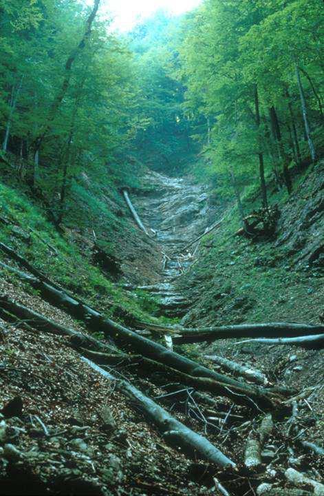
8 Typical scope and design of ecosystem research sites (LTER-Europe example) challenging Information Management Input Ecosystem Change Output primary production population ecology organic matter inorganic inputs PLUS: main drivers disturbances biodiversity (implicitly)


9

10 Challenge for MORIS: topics, space &... time Gases Aerosoles Deposition Wet Dry Wind Precipitation Temperatur e Tree response Epiphyte response Tree bioelements Litter fall Understory veg. Weathering Soil water Soil (litter, humus, minerals) Decomposition mineralization Root uptake Throughfall Surface water Deer, birds Groundwate r Runoff

11 Challenges Complex data sets Different spatial, temporal, and thematic resolution of the observations need for a flexible entry and management of the data Long project duration Changes in observation methods, staff, project aims, etc. need for flexible data structures need for safeguarding the reusability and interpretability of the data in the long term perspective Meta data Staff, project, methods, documents, etc. need for the link between data and metadata to ensure the long term reusability of the data 11
12 Observation An observation is gaining information on the... STATUS OF a PROPERTY OF a MEDIUM(object) AT a certain LOCATION (object) AT given TIME(s) Observed by someone/-what by use of a specific METHOD Reported by use of and refering to related STANDARDS (unit, reference list) In addition: Method provides certain quality of information (accuracy, applicability constraints = primary metainformation) Status observed by an observer acting in the context of a project, pulling individual measurements together Observation specified by other secondary metadata
13 Current situation Relational database (Oracle, PostgreSQL, ) Relational database (Microsoft Access) Spreadsheet (Microsoft Excel, etc.) Spatial Data Files (ESRI Shape File, etc.) Spatial Database (PostGIS, GeoDB, etc.) Structured text files (txt, csv, etc.) Data Management Unstrucutured Text Files (docs, pdfs, etc. Non digitised Data (field records, etc.) Data in proprietary Format (Logger formats, etc.) OGC Spatial Services (WFS, WMS, WCS) Sensor Web Enablement (SWE) Metadata Services (CSW, proprietary)
14 Current situation & challenges Places of data storage Handling data requests Challenges Distributed data sources Heterogeneous data access Heterogeneous data management solutions Heterogeneous data models Complex domain ecosystem monitoring


 OGC")
15 DATA: Data sharing Discover available dataset series, datasets and services: a catalogue service allows the user to view and query related meta-data. View available datasets: an online data access client allows the user to view data (WMS layers or tabular). Download available datasets: an online data access client allows the user to download data Data files OGC spatial services (WFS, WCS) OGC Sensor Web (SOS) Linked Data
16 Vector of sites Harvesting Information form LTER Sites using OGC Services Area GeoPortal DB (optional) WMS WFS KML GML XML OpenLayers GetFeature or GetMap GetCapabilities URL Line for each vectors MetaData of Sites (InfoBase) DataSet Request (GetObservation, GetInformation, ) CSW GetCapabilities URL (+ Geography information) View + Download Service MetaData of Dataset (EML/Community profile) 1. Dataset Title 2. Dataset Identifier 3. Dataset Creator 13. Dataset OnLine Distribution 22. Dataset legal Community MD profile 13. Dataset OnLine Distribution
17 EnvEurope System Architecture for the LifeWatch/LTER sites use case Thessaurus & Ref. lists Data access service INSPIRE ILTER Metadata repository Catalogue service Generic data cache Data access service Any data provider Data access service
18 Key links with the LifeWatch reference model Wouter Los & Michael Mirtl
19 Expectations references to envisaged benefits from EUDAT according to revised introductory presentations

20 some mornings I d like to do some cosy data modelling Thanks for your attention Further information:
When using this architecture for accessing distributed services, however, query broker and/or caches are recommendable for performance reasons.
 Integration of semantics, data and geospatial information for LTER Abstract The long term ecological monitoring and research network (LTER) in Europe[1] provides a vast amount of data with regard to drivers
INSPIRE: The ESRI Vision. Tina Hahn, GIS Consultant, ESRI(UK) Miguel Paredes, GIS Consultant, ESRI(UK)
 Miguel Paredes, GIS Consultant, ESRI(UK)") INSPIRE: The ESRI Vision Tina Hahn, GIS Consultant, ESRI(UK) Miguel Paredes, GIS Consultant, ESRI(UK) Overview Who are we? Introduction to ESRI Inc. and ESRI(UK) Presenters ArcGIS The ESRI Solution to
INSPIRE: The ESRI Vision Tina Hahn, GIS Consultant, ESRI(UK) Miguel Paredes, GIS Consultant, ESRI(UK) Overview Who are we? Introduction to ESRI Inc. and ESRI(UK) Presenters ArcGIS The ESRI Solution to
The GeoPortal Cookbook Tutorial
 The GeoPortal Cookbook Tutorial Wim Hugo SAEON/ SAEOS SCOPE OF DISCUSSION Background and Additional Resources Context and Concepts The Main Components of a GeoPortal Architecture Implementation Options
Web Map Servers. Mark de Blois. Septembre 2016
 Web Map Servers Mark de Blois Septembre 2016 Learning Objectives After this lecture you will be able to understand web map servers as used in Web-GIS applications Introduction A Web Map Server is a computer
Leveraging OGC Services in ArcGIS Server. Satish Sankaran, Esri Yingqi Tang, Esri
 Leveraging OGC Services in ArcGIS Server Satish Sankaran, Esri Yingqi Tang, Esri GIS Creating and Managing Geo Information Products - Proprietary - Open Specifications - Standards Dissemination of Geo
Extension of INSPIRE Download Services TG for Observation Data
 Extension of INSPIRE Download Services TG for Observation Data Simon Jirka (52 North) 14 th June 2014, MIG Workshop on WCS-based INSPIRE Download Services Agenda Motivation Sensor Web Proposed Update for
Introduction to INSPIRE. Network Services
 Introduction to INSPIRE. Network Services European Commission Joint Research Centre Institute for Environment and Sustainability Digital Earth and Reference Data Unit www.jrc.ec.europa.eu Serving society
Harvard Hypermap: An Open Source Framework for Making the World's Geospatial Information more Accessible
 American Association of Geographers Boston, Massachusetts April, 2017 Harvard Hypermap: An Open Source Framework for Making the World's Geospatial Information more Accessible Benjamin Lewis, Paolo Corti,
The French Geoportal : linking discovery and view network services. INSPIRE Conference Krakow
 The French Geoportal : linking discovery and view network services ( BRGM ) D.Richard (IGN) F. Robida Context of the French Geoportal The governance mechanism Transversal organisation based on the Ministry
Relation between Geospatial information projects related to GBIF
 Relation between Geospatial information projects related to GBIF Synthesys 3.6-Synthesys 3.7-GBIF.DE- BioGeomancer The most up to date work can always be found at: http://www.biogeografia.com/synthesys
INTEGRATION OF DISASTER EVENT DATA INTO SPATIAL DATA INFRASTRUCTURES
 INTEGRATION OF DISASTER EVENT DATA INTO SPATIAL DATA INFRASTRUCTURES B. Stollberg a, *, T. De Groeve a, A. Hirner a, L. Vernaccini a, S. Paris a a Joint Research Centre of the European Commission, Institute
Spatial Data on the Web
 Spatial Data on the Web Tools and guidance for data providers The European Commission s science and knowledge service W3C Data on the Web Best Practices 35 W3C/OGC Spatial Data on the Web Best Practices
Compass INSPIRE Services. Compass INSPIRE Services. White Paper Compass Informatics Limited Block 8, Blackrock Business
 Compass INSPIRE Services White Paper 2010 Compass INSPIRE Services Compass Informatics Limited Block 8, Blackrock Business Park, Carysfort Avenue, Blackrock, County Dublin, Ireland Contact Us: +353 1 2104580
Esri Support for Geospatial Standards
 APRIL 2017 ArcGIS Is Open and Interoperable Esri Support for Geospatial Standards Copyright 2017 Esri All rights reserved. Printed in the United States of America. The information contained in this document
PortalU, a Tool to Support the Implementation of the Shared Environmental Information System (SEIS) in Germany
 in Germany") European conference of the Czech Presidency of the Council of the EU TOWARDS eenvironment Opportunities of SEIS and SISE: Integrating Environmental Knowledge in Europe http:/www.e-envi2009.org/proceedings/
European conference of the Czech Presidency of the Council of the EU TOWARDS eenvironment Opportunities of SEIS and SISE: Integrating Environmental Knowledge in Europe http:/www.e-envi2009.org/proceedings/
INSPIRE Geoportal Rich user experience across member states services
 INSPIRE Geoportal Rich user experience across member states services developed under a contract with the EC (JRC) Diomede ILLUZZI 1 Nicola LUNANOVA 1 Torsten FRIEBE 2 1 Planetek Italia s.r.l Via Masaua
SAFER the GIGAS Effect
 SAFER the GIGAS Effect How INSPIRE, GMES and GEOSS are influencing EC projects Arnaud Cauchy 23/06/2010 Agenda GIGAS Project Summary SAFER Project Summary SAFER Original Approach GIGAS Influences SAFER
Leveraging OGC Services in ArcGIS Server. Satish Sankaran Yingqi Tang
 Leveraging OGC Services in ArcGIS Server Satish Sankaran ssankaran@esri.com Yingqi Tang ytang@esri.com Agenda Interoperability Enablers OGC and esri OGC Web Services ArcGIS and OGC Web Services - @ version
Leveraging OGC Standards on ArcGIS Server
 Leveraging OGC Standards on ArcGIS Server Satish Sankaran Interoperability and Standards Team James Michel III ESRI Intel Team ArcGIS Server Complete Interoperable Server-Based GIS Desktop Explorer Web
SDI Tecnological Components and Standards
 SDI Tecnological Components and Standards Salvador Bayarri sbayarri@gmail.com World Bank Consultant Contents The SDI architecture model Software components: the SDI stack Basic services Metadata SDI access
METAINFORMATION INFRASTRUCTURE FOR GEOSPATIAL INFORMATION
 2010/2 PAGES 1 7 RECEIVED 15. 6. 2009 ACCEPTED 2. 3. 2010 T. KLIMENT METAINFORMATION INFRASTRUCTURE FOR GEOSPATIAL INFORMATION ABSTRACT Tomáš KLIMENT email: tomas.kliment@stuba.sk Research field: Spatial
International Organization for Standardization Technical Committee 211 (ISO/TC211)
") Esri Support for Geospatial Standards: Open Geospatial Consortium (OGC) International Organization for Standardization Technical Committee 211 (ISO/TC211) An Esri White Paper April 2015 Copyright 2015
Esri Support for Geospatial Standards: Open Geospatial Consortium (OGC) International Organization for Standardization Technical Committee 211 (ISO/TC211) An Esri White Paper April 2015 Copyright 2015
Setting up the Ihlet Social Cadastre
 Setting up the Ihlet Social Cadastre Ihlet KHT Dr. Attila Molnár, GI consultant Bela Jarolics Rome, Italy TOPICS Goal of the project Architecture Database Solution Standards, communication Metadata Security
Jeffery S. Horsburgh. Utah Water Research Laboratory Utah State University
 Advancing a Services Oriented Architecture for Sharing Hydrologic Data Jeffery S. Horsburgh Utah Water Research Laboratory Utah State University D.G. Tarboton, D.R. Maidment, I. Zaslavsky, D.P. Ames, J.L.
Proposed update of Technical Guidance for INSPIRE Download services based on SOS
 Proposed update of Technical Guidance for INSPIRE Download services based on SOS Organised by: Simon Jirka, Alexander Kotsev, Michael Lutz Dr. Simon Jirka (jirka@52north.org) 52 North GmbH Workshop - The
SEXTANT 1. Purpose of the Application
 SEXTANT 1. Purpose of the Application Sextant has been used in the domains of Earth Observation and Environment by presenting its browsing and visualization capabilities using a number of link geospatial
DanubeGIS User Manual Document number: Version: 1 Date: 11-Nov-2016
 DanubeGIS User Manual Document number: Version: 1 Date: 11-Nov-2016 Imprint Published by: ICPDR International Commission for the Protection of the Danube River ICPDR 2016 Contact ICPDR Secretariat Vienna
The Scottish Spatial Data Infrastructure (SSDI)
") The Scottish Spatial Data Infrastructure (SSDI) INSPIRE Conference Istanbul Monday 25 th June 2012 15:55 Geoportals and registries II Tim Duffy BGS Edinburgh (trd@bgs.ac.uk) Shona Nicol Alex Ramage NERC
The Scottish Spatial Data Infrastructure (SSDI) INSPIRE Conference Istanbul Monday 25 th June 2012 15:55 Geoportals and registries II Tim Duffy BGS Edinburgh (trd@bgs.ac.uk) Shona Nicol Alex Ramage NERC
Interactive Web Mapping: Overview
 Interactive Web Mapping: Overview Overview of how geospatial data is formatted requested supplied consumed by/for web technologies 2 Definitions Analysis exploring and modeling geospatial phenomena Mapping
SDI SOLUTIONS FOR INSPIRE: TECHNOLOGIES SUPPORTING A FRAMEWORK OF COOPERATION
 SDI SOLUTIONS FOR INSPIRE: TECHNOLOGIES SUPPORTING A FRAMEWORK OF COOPERATION Roberto Lucchi 1, Marten Hogeweg 1, Guenther Pichler 2 1 Esri, Redlands, CA, USA 2 Esri Kranzberg, Germany 1 Vision INSPIRE
Using the OGC SOS as INSPIRE Download Service for Observation Data
 Using the OGC SOS as INSPIRE Download Service for Observation Data Simon Jirka (52 North) Alexander Kotsev (JRC) Michael Lutz (JRC) Matthes Rieke (52 North) Robin Smith (JRC) Paul Smits (JRC) 18 th June
SII Law Organization Coordination activities Examples of good practices Education Technical matters Success stories Challenges
 SII Law Organization Coordination activities Examples of good practices Education Technical matters Success stories Challenges INSPIRE transposed by the legal act on Spatial Information Infrastructure
Validation experience
 Validation experience Paloma Abad Head of SDI Department SDI Workshop 26-06-2018 INSPIRE KEN INSPIRE KEN, june 2018 1 Points 1. Introduction 2. Interoperability 3. Geoportal Thematic Viewer 4. Conclusions
Open source technologies and INSPIRE network services in Slovak environmental agency
 Open source technologies and INSPIRE network services in Slovak environmental agency Peter Mozolík, Martin Koška, Marek Žiačik, Martin Tuchyňa Slovak Environmental Agency (SEA) SEA role within slovak SDI
Consolidation Team INSPIRE Annex I data specifications testing Call for Participation
 INSPIRE Infrastructure for Spatial Information in Europe Technical documents Consolidation Team INSPIRE Annex I data specifications testing Call for Participation Title INSPIRE Annex I data specifications
Achieving Interoperability using the ArcGIS Platform. Satish Sankaran Roberto Lucchi
 Achieving Interoperability using the ArcGIS Platform Satish Sankaran Roberto Lucchi Thank you Please fill out the session survey in your mobile app Select [Achieving Interoperability using the ArcGIS Platform]
INSPIRE & Linked Data: Bridging the Gap Part II: Tools for linked INSPIRE data
 Making the Web an Exploratory Place for Geospatial Knowledge INSPIRE & Linked Data: Bridging the Gap Part II: Tools for linked INSPIRE data Michalis Alexakis Spiros Athanasiou Nikos Georgomanolis Giorgos
Statistical Viewer. Coping with the Complexity
 Statistical Viewer Coping with the Complexity Overview What s DataCove and Ghosting EuroStat as a Data Resource DataCove Statistical Viewer The Way from Here to There Conclusions What We Do Data Modelling:
Interoperability and Standards Supports in ArcGIS
 Esri International User Conference San Diego, California Technical Workshops July 26, 2012 Interoperability and Standards Supports in ArcGIS Satish Sankaran, Esri Yingqi Tang, Esri Agenda Esri s participation
INSPIRE tools What's new?
 INSPIRE tools What's new? Michael Lutz INSPIRE Conference, Antwerp 18 September 2018 Joint Research Centre The European Commission s science and knowledge service INSPIRE reference validator Why a reference
A5.2-D3 [3.5] Workflow Design and Construction Service Component Specification. Eva Klien (FHG), Christine Giger (ETHZ), Dániel Kristóf (FOMI)
![A5.2-D3 [3.5] Workflow Design and Construction Service Component Specification. Eva Klien (FHG), Christine Giger (ETHZ), Dániel Kristóf (FOMI)](/thumbs/90/102649368.jpg "A5.2-D3 [3.5] Workflow Design and Construction Service Component Specification. Eva Klien (FHG), Christine Giger (ETHZ), Dániel Kristóf (FOMI)") Title: A5.2-D3 [3.0] A Lightweight Introduction to the HUMBOLDT Framework V3.0 Author(s)/Organisation(s): Daniel Fitzner (FhG), Thorsten Reitz (FhG) Working Group: Architecture Team / WP5 References: A5.2-D3
Title: A5.2-D3 [3.0] A Lightweight Introduction to the HUMBOLDT Framework V3.0 Author(s)/Organisation(s): Daniel Fitzner (FhG), Thorsten Reitz (FhG) Working Group: Architecture Team / WP5 References: A5.2-D3
Enabling Efficient Discovery of and Access to Spatial Data Services. CHARVAT, Karel, et al. Abstract
 Article Enabling Efficient Discovery of and Access to Spatial Data Services CHARVAT, Karel, et al. Abstract Spatial data represent valuable information and a basis for decision making processes in society.
IT Infrastructure for BIM and GIS 3D Data, Semantics, and Workflows
 IT Infrastructure for BIM and GIS 3D Data, Semantics, and Workflows Hans Viehmann Product Manager EMEA ORACLE Corporation November 23, 2017 @SpatialHannes Safe Harbor Statement The following is intended
INSPIRE & Environment Data in the EU
 INSPIRE & Environment Data in the EU Andrea Perego Research Data infrastructures for Environmental related Societal Challenges Workshop @ pre-rda P6 Workshops, Paris 22 September 2015 INSPIRE in a nutshell
ARCHITECTURE OF SPATIAL DATA INFRASTRUCTURE (SDI) (DRAFT)
 (DRAFT)") ARCHITECTURE OF SPATIAL DATA INFRASTRUCTURE (SDI) (DRAFT) Author: Carlo Cipolloni September 20, 2018 Version 1.0 A SDI platform to support the SEIS in the ENP South region Introduction Based on the Contribution
ARCHITECTURE OF SPATIAL DATA INFRASTRUCTURE (SDI) (DRAFT) Author: Carlo Cipolloni September 20, 2018 Version 1.0 A SDI platform to support the SEIS in the ENP South region Introduction Based on the Contribution
How to become an INSPIRE node and fully exploit the investments made?
 How to become an INSPIRE node and fully exploit the investments made? Solution patterns for consumers: end users & developers (2/2) Roberto Lucchi 22 June 2010, Krakow 1 Geoportal extension Enabling discovery
The Butterfly Effect. A proposal for distribution and management for butterfly data programs. Dave Waetjen SESYNC Butterfly Workshop May 10, 2012
 The Butterfly Effect A proposal for distribution and management for butterfly data programs Dave Waetjen SESYNC Butterfly Workshop May 10, 2012 http://butterfly.ucdavis.edu Citizen Science based Observation
Esri Support for Geospatial Standards: OGC and ISO/TC211. An Esri White Paper May 2015
 Esri Support for Geospatial Standards: OGC and ISO/TC211 An Esri White Paper May 2015 Copyright 2015 Esri All rights reserved. Printed in the United States of America. The information contained in this
Developing data catalogue extensions for metadata harvesting in GIS
 University of Bergen Department of Informatics Developing data catalogue extensions for metadata harvesting in GIS Author: André Mossige Long master thesis June 2018 Acknowledgements I would like to thank
The federal geo-platform:
 The federal geo-platform: Targeting the statistical community Nathalie Delattre (IGN Belgium), Pierre Jamagne (Statistics Belgium), Ann Crabbé (KULeuven/SADL) INSPIRE Conference, Strasbourg 6-8 septembre
Spatial Data on the Web
 Spatial Data on the Web Tools and guidance for data providers Clemens Portele, Andreas Zahnen, Michael Lutz, Alexander Kotsev The European Commission s science and knowledge service Joint Research Centre
EUDAT B2FIND A Cross-Discipline Metadata Service and Discovery Portal
 EUDAT B2FIND A Cross-Discipline Metadata Service and Discovery Portal Heinrich Widmann, DKRZ DI4R 2016, Krakow, 28 September 2016 www.eudat.eu EUDAT receives funding from the European Union's Horizon 2020
Initial Operating Capability & The INSPIRE Community Geoportal
 INSPIRE Conference, Rotterdam, 15 19 June 2009 1 Infrastructure for Spatial Information in the European Community Initial Operating Capability & The INSPIRE Community Geoportal EC INSPIRE GEOPORTAL TEAM
Metadata for Data Discovery: The NERC Data Catalogue Service. Steve Donegan
 Metadata for Data Discovery: The NERC Data Catalogue Service Steve Donegan Introduction NERC, Science and Data Centres NERC Discovery Metadata The Data Catalogue Service NERC Data Services Case study:
The geospatial metadata catalogue. FOSS4G Barcelona. Jeroen Ticheler. Founder and chair. Director
 The geospatial metadata catalogue FOSS4G2010 - Barcelona Jeroen Ticheler Director Founder and chair GeoNetwork opensource Dutch National Geo Registry FAO GeoNetwork SwissTopo geocat.ch GeoNetwork history
Florida Coastal Everglades LTER Program
 Florida Coastal Everglades LTER Program Metadata Workshop April 13, 2007 Linda Powell, FCE Information Manager Workshop Objectives I. Short Introduction to the FCE Metadata Policy What needs to be submitted
Automatic Creation of INSPIRE Meta-information from SWE Services
 S@NY Automatic Creation of INSPIRE Meta-information from SWE Services Désirée Hilbring, Fraunhofer IITB hilbring@iitb.fraunhofer.de Agile 2009 Challenges in Geospatial Data Harmonization, Hanover Copyright
Welcome. to Pre-bid meeting. Karnataka State Spatial Data Infrastructure (KSSDI) Project, KSCST, Bangalore.
 Project, KSCST, Bangalore.") Welcome to Pre-bid meeting Karnataka State Spatial Data Infrastructure (KSSDI) Project, KSCST, Bangalore. DEVELOPMENT OF KARNATAKA STATE SPATIAL DATA INFRASTRUCTURE (KSSDI) PROJECT Objective: To develop
Welcome to Pre-bid meeting Karnataka State Spatial Data Infrastructure (KSSDI) Project, KSCST, Bangalore. DEVELOPMENT OF KARNATAKA STATE SPATIAL DATA INFRASTRUCTURE (KSSDI) PROJECT Objective: To develop
Quality Assured (QA) data
 data") Quality Assured (QA) data Towards DOI quality of data generated at the UFZ Mark Frenzel (Ecologist) & Thomas Schnicke (IT) DataCite / Helmholtz Open Science Workshop Leipzig, 12.01.2016 QA + DOI: Best
Quality Assured (QA) data Towards DOI quality of data generated at the UFZ Mark Frenzel (Ecologist) & Thomas Schnicke (IT) DataCite / Helmholtz Open Science Workshop Leipzig, 12.01.2016 QA + DOI: Best
ArcGIS Open Data. Matt Bullock
 ArcGIS Open Data Matt Bullock Why does open data matter? transparency accountability open data participation innovation economic development but is it accessible? FOIA requests FTP websites ArcGIS Open
Metadata - Inspire content - registration - services
 Metadata - Inspire content - registration - services Nordic Forum for Geostatistics Sept 2007 Arvid Lillethun, Norwegian Mapping and Cadaster Authority Web map service (WMS) Web feature service (WFS) Web
GENeric European Sustainable Information Space for Environment.
 GENeric European Sustainable Information Space for Environment http://www.genesis-fp7.eu/ Outline Introduction The GENESIS FP7 project The GENESIS solution s architecture GENESIS experience with INSPIRE
Oceanic Observatory for the Iberian Shelf
 Oceanic Observatory for the Iberian Shelf B.Vila Barcelona, 26th September 2016 Objectives: The Project Improve the oceanic observation at the North Western Iberian coast (meteorological, oceanographical
Increasing dataset quality metadata presence: Quality focused metadata editor and catalogue queriables.
 Increasing dataset quality metadata presence: Quality focused metadata editor and catalogue queriables. Alaitz Zabala (UAB), Joan Masó (CREAF), Lucy Bastin (ASTON), Fabrizio Papeschi (CNR), Eva Sevillano
GeoDCAT-AP Representing geographic metadata by using the "DCAT application profile for data portals in Europe"
 GeoDCAT-AP Representing geographic metadata by using the "DCAT application profile for data portals in Europe" Andrea Perego, Vlado Cetl, Anders Friis-Christensen, Michael Lutz, Lorena Hernandez Joint
GeoPortal 4 Everybody
 GeoPortal 4 Everybody Karel Charvát, Jáchym Čepický, Štěpán Kafka, Premysl Vohnout, Martin Vlk Czech Centre for Science and Society Help Service Remote Sensing DT Member What is GeoPortal GeoPortal is
Leveraging metadata standards in ArcGIS to support Interoperability. Aleta Vienneau and Marten Hogeweg
 Leveraging metadata standards in ArcGIS to support Interoperability Aleta Vienneau and Marten Hogeweg Leveraging metadata standards in ArcGIS to support Interoperability Overview of metadata standards
Discovery and Access of Geospatial Resources Using GIS Portal Toolkit Marten Hogeweg Product Manager GIS Portal Toolkit
 Discovery and Access of Geospatial Resources Using GIS Portal Toolkit Marten Hogeweg Product Manager GIS Portal Toolkit Outline Elements of Spatial Data Infrastructures Current trends Position of GIS portals
C3S Data Portal: Setting the scene
 C3S Data Portal: Setting the scene Baudouin Raoult Baudouin.raoult@ecmwf.int Funded by the European Union Implemented by Evaluation & QC function from European commission e.g.,fp7 Space call Selected set
Basic Principles of MedWIS - WISE interoperability
 Co-ordination committee seminar of the national focal points Basic Principles of MedWIS - WISE interoperability Eduardo García ADASA Sistemas Nice - France Agenda WISE vs MedWIS WISE WISE DS WISE vs WISE
EUDAT-B2FIND A FAIR and Interdisciplinary Discovery Portal for Research Data
 EUDAT-B2FIND A FAIR and Interdisciplinary Discovery Portal for Research Data Heinrich Widmann, DKRZ Claudia Martens, DKRZ Open Science Days, Berlin, 17 October 2017 www.eudat.eu EUDAT receives funding
Wade Sheldon. Georgia Coastal Ecosystems LTER University of Georgia
 Wade Sheldon Georgia Coastal Ecosystems LTER University of Georgia email: sheldon@uga.edu Regardless of Q/A procedures, data quality issues guaranteed with environmental sensor data Without good Q/C data
OGC Collaborative Platform Undercover
 OGC Collaborative Platform Undercover AGU Fall Meeting 2012 Dec 7, 2012 Greg Buehler; David Arctur; Luis E. Bermudez Open Geospatial Consortium 475 volunteer organizations 4307 Users 60 Standards 2 OGC
INSPIRE overview and possible applications for IED and E-PRTR e- Reporting Alexander Kotsev
 INSPIRE overview and possible applications for IED and E-PRTR e- Reporting Alexander Kotsev www.jrc.ec.europa.eu Serving society Stimulating innovation Supporting legislation The European data puzzle 24
A service oriented approach for geographical data sharing
 I3E 2005 Conference October 28-30, 2005" A service oriented approach for geographical data sharing Authors L. Vaccari 1, A. Ivanyuckovich 2, and M. Marchese 2 1 Autonomous Province of Trento, Trento, Italy
The GIGAS Methodology
 The GIGAS Methodology Pier Giorgio Marchetti European Space Agency Earth Observation Programme Ground Segment Department pier.giorgio.marchetti@esa.int GIGAS Objectives GIGAS has the goal to promote the
Standards, standardisation & INSPIRE Status, issues, opportunities
 Standards, standardisation & INSPIRE Status, issues, opportunities INSPIRE Coordination Team 6 th MIG meeting, 13-14 June 2017 Joint Research Centre The European Commission's science and knowledge service
International Civil Aviation Organization THE SECOND MEETING OF SYSTEM WIDE INFORMATION MANAGEMENT TASK FORCE (SWIM TF/2)
") SWIM TF/2 IP/09 Agenda Item 4 09-12/04/18 International Civil Aviation Organization THE SECOND MEETING OF SYSTEM WIDE INFORMATION MANAGEMENT TASK FORCE (SWIM TF/2) Bangkok, Thailand, 09 12 April 2018 Agenda
SWIM TF/2 IP/09 Agenda Item 4 09-12/04/18 International Civil Aviation Organization THE SECOND MEETING OF SYSTEM WIDE INFORMATION MANAGEMENT TASK FORCE (SWIM TF/2) Bangkok, Thailand, 09 12 April 2018 Agenda
Testing - an essential aspect of establishing an SDI
 Testing - an essential aspect of establishing an SDI Clemens Portele, Anders Östman, Michael Koutroumpas, Xin He, Janne Kovanen, Markus Schneider, Andriani Skopeliti INSPIRE Conference 2011 30 June 2011
ArcGIS 9.2 Works as a Complete System
 ArcGIS 9.2 Works as a Complete System A New Way to Manage and Disseminate Geographic Knowledge Author/Serve/Use Maps Data Models Globes Metadata Use Desktop Explorer Web Map Viewer Mobile Open APIs Enterprise
INSPIRE Biodiversity Mashup
 INSPIRE Biodiversity Mashup Current Status 1 Kathi Schleidt Katharina.Schleidt@umweltbundesamt.at Martin Koška martin.koska@sazp.sk Peter Mozolík peter.mozolik@sazp.sk Barbara Pratschner - babsip@mac.com
DATA SHARING AND DISCOVERY WITH ARCGIS SERVER GEOPORTAL EXTENSION. Clive Reece, Ph.D. ESRI Geoportal/SDI Solutions Team
 DATA SHARING AND DISCOVERY WITH ARCGIS SERVER GEOPORTAL EXTENSION Clive Reece, Ph.D. ESRI Geoportal/SDI Solutions Team Geoportal Extension for ArcGIS Server Context within an Enterprise Spatial Data Infrastructure
The Semantic Sensor Network Ontology A Generic Language to Describe Sensor Assets
 Ben Ridge Road Weather Station, South Esk River Catchment, Tasmania The Semantic Sensor Network Ontology A Generic Language to Describe Sensor Assets Holger Neuhaus Michael Compton Commonwealth Scientific
Serving Large-Scale Coverages - How to Tame an Elephant
 Serving Large-Scale s - How to Tame an Elephant OGC Workshop 2 INSPIRE Conference Edinburgh, 29-jun-2011 Peter Baumann Jacobs University rasdaman GmbH OGC WCS.SWG chair OGC spec editor Sensor & Image Data
INSPIRE Download Service
 The OGC SOS as INSPIRE Download Service for (meteorological) l) Observation Data Simon Jirka (52 North) 29 th October 2014 5th Workshop on the use of GIS/OGC standards in meteorology Offenbach (Germany)
Introduction to SDIs (Spatial Data Infrastructure)
") www.grid.unep.ch Regional training workshop on geographical information system for energy planning Introduction to SDIs (Spatial Data Infrastructure) Dakar, 12 August 2014 Gregory Giuliani Andrea de Bono,
www.grid.unep.ch Regional training workshop on geographical information system for energy planning Introduction to SDIs (Spatial Data Infrastructure) Dakar, 12 August 2014 Gregory Giuliani Andrea de Bono,
The European Commission s science and knowledge service. Joint Research Centre
 The European Commission s science and knowledge service Joint Research Centre GeoDCAT-AP The story so far Andrea Perego, Antonio Rotundo, Lieven Raes GeoDCAT-AP Webinar 6 June 2018 What is GeoDCAT-AP Geospatial
INSPIRE Geoportal. Jens STUTTE 1, Nicola LUNANOVA 1, Jens FITZKE 2, Torsten FRIEBE 2
 INSPIRE Geoportal The developments made towards the INSPIRE Geoportal at European Level - an overview. Jens STUTTE 1, Nicola LUNANOVA 1, Jens FITZKE 2, Torsten FRIEBE 2 1 Planetek Italia s.r.l Via Masaua
Standards, GML and AIXM. Dr. David Burggraf Vice President Galdos Systems Inc
 Standards, and AIXM Dr. David Burggraf Vice President Galdos Systems Inc Copyright Galdos Systems Inc. May 6, 2010 Geography Markup Language: What is it? A modeling language for geographic features A set
Developing a Free and Open Source Software based Spatial Data Infrastructure. Jeroen Ticheler
 Developing a Free and Open Source Software based Spatial Data Infrastructure Jeroen Ticheler 1 License This work is licensed under the Creative Commons Attribution-NonCommercial-ShareAlike 2.5 License.
DATA VALIDATION AGAINST SCHEMA AND SOURCE DATA
 DATA VALIDATION AGAINST SCHEMA AND SOURCE DATA didier.bouteloup@ign.fr; dominique.laurent@ign.fr 3 June 2016 ign.fr Context IGN has performed data validation twice On test INSPIRE data (2013-2014) On ELF
Suggestions for writing Abstract Test Suites (ATS) for INSPIRE conformance testing for Metadata and Network Services
 for INSPIRE conformance testing for Metadata and Network Services") Suggestions for writing Abstract Test Suites (ATS) for INSPIRE conformance testing for Metadata and Network Services MIWP-5 Workshop 02. December 2014 Sven Böhme, Federal Agency for Cartography and Geodesy
Suggestions for writing Abstract Test Suites (ATS) for INSPIRE conformance testing for Metadata and Network Services MIWP-5 Workshop 02. December 2014 Sven Böhme, Federal Agency for Cartography and Geodesy
INSPIRE Conference Automatic metadata generation for the Web geo-resources
 INSPIRE Conference 2011 Automatic metadata generation for the Web geo-resources B. Borjas, A.J. Florczyk, F.J. López-Pellicer, J. Nogueras-Iso, F.J. Zarazaga-Soria June 28, 2011. Edinburgh Advanced Information
OpenData and INSPIRE with GeoServer, GeoNetwork and MapStore: lessons learned from real-world use cases
 OpenData and INSPIRE with GeoServer, GeoNetwork and MapStore: lessons learned from real-world use cases Ing. Simone Giannecchini, GeoSolutions Silvana Griffa, CSI Piemonte Giovanni Menduni, City of Florence
Catalog-driven, Reproducible Workflows for Ocean Science
 Catalog-driven, Reproducible Workflows for Ocean Science Rich Signell, USGS, Woods Hole, MA, USA Filipe Fernandes, Centro Universidade Monte Serrat, Santos, Brazil. 2015 Boston Light Swim, Aug 15, 7:00am
Web Service Interface. Dr. Simon Jirka
 1 Web Service Interface Standards Dr. Simon Jirka Overview 2 Providing Access to Observation Data OGC Sensor Observation Service Controlling Sensors OGC Sensor Planning Service Event Notification SOS 3
INSPIRE on tools workshop
 INSPIRE on tools workshop Geoportal, Registry, Validator Robert Tomas, Michael Lutz, Lorena Hernandez, Marco Minghini, Daniele Francioli, Emanuela Epure The European Commission s science and knowledge
Achieving Interoperability Using Open Standards
 FedGIS Conference February 24 25, 2016 Washington, DC Achieving Interoperability Using Open Standards Satish Sankaran Marten Hogeweg Agenda Understanding Interoperability What, Why and How? ArcGIS Platform
INSPIRE Coverage Types
 INSPIRE Infrastructure for Spatial Information in Europe INSPIRE Coverage Types Title Status Creator Date 2012-06-15 Subject Publisher Type Description Contributor Format Source Rights Identifier Language
GeoNode Integration with SDIs and Community Mapping
 GeoNode Integration with SDIs and Community Mapping Salvador Bayarri sbayarri@gmail.com World Bank Consultant Contents Accessing other SDI services Catalog harvesting through Geonetwork Cascading external