Web GIS: Principles and Applications. Pinde Fu, Ph.D. Project Lead / Senior Developer Professional Services Division
|
|
|
- Ashlyn Sharp
- 6 years ago
- Views:
Transcription


1 Web GIS: Principles and Applications Pinde Fu, Ph.D. Project Lead / Senior Developer Professional Services Division


2 2 Web GIS: Principles and Applications Pinde Fu & Jiulin Sun Web GIS course Henan University, China Principles Applications Technologies
3 Contents Introduction Technical evolutions Applications Demos: - ArcGIS.com - EPHT - EJScreen - Cluster mapping - MWRD Incident reporting - ArcGIS for ios - Spatial analysis online
4 The Web has changed everything USPS Washington Post / Newsweek Blockbuster v.s. Netflix New and more efficient business models have emerged, making previous models increasingly obsolete. How does it affect you?


5 GIS is no exception CGIS Internet Roger Tomlinson Father of GIS 1990 WWW Tim Berners-Lee Father of the Web URL, HTTP, HTML 1993 Web GIS Xerox PARC Viewer Global reach; large number of users; better cross-platform; low cost; easy to use; diverse applications


 Data")
 Presentation")
6 Basic System Architecture GIS database server GIS server Web server Internet HTTP Request HTTP Response Client (Web browser, desktop, or mobile) Data tier Logical tier (i.e., middle tier) Presentation tier URL HTTP HTML
7 Evolutions From Web sites to Web services From SOAP to REST Web Services extended by browser side APIs From 3 tiers to n-tiers From local to the cloud From one way to two ways From wired to wireless More than just mapping


8 From Web sites to Web services ArcGIS Server 2D Map 3D maps Image Geometry Feature Search Tracking Routing Geoprocessing Catalog Internet
9
10 From web services to browser side APIs Server side Map making and other processes Receive requests and send responses Scope of Web services Internet Send requests and receive responses Display maps, interact with users Browser side Scope of browser-side APIs ArcGIS API for JavaScript, Flex, Silverlight
11 From 3 tiers to n-tiers Web resource 1 Most of today s Web GIS applications are mashups Web resource 3 Web resource 2 Mashup Web server 1 Web resource 4 Web browser Impacts on NSDI, app dev, research

12 Mashup


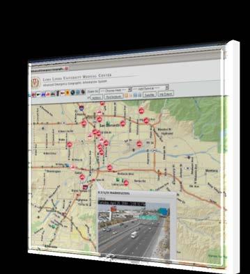

13 Internet
14 Geoparsing, screenscraping The internet is your geodatabase 14
15 Design pattern Web GIS application = basemaps + operational layers + tools 15


16 Geoportal & Cloud GIS, hubs of today s Web GIS Geoplatform NSDI


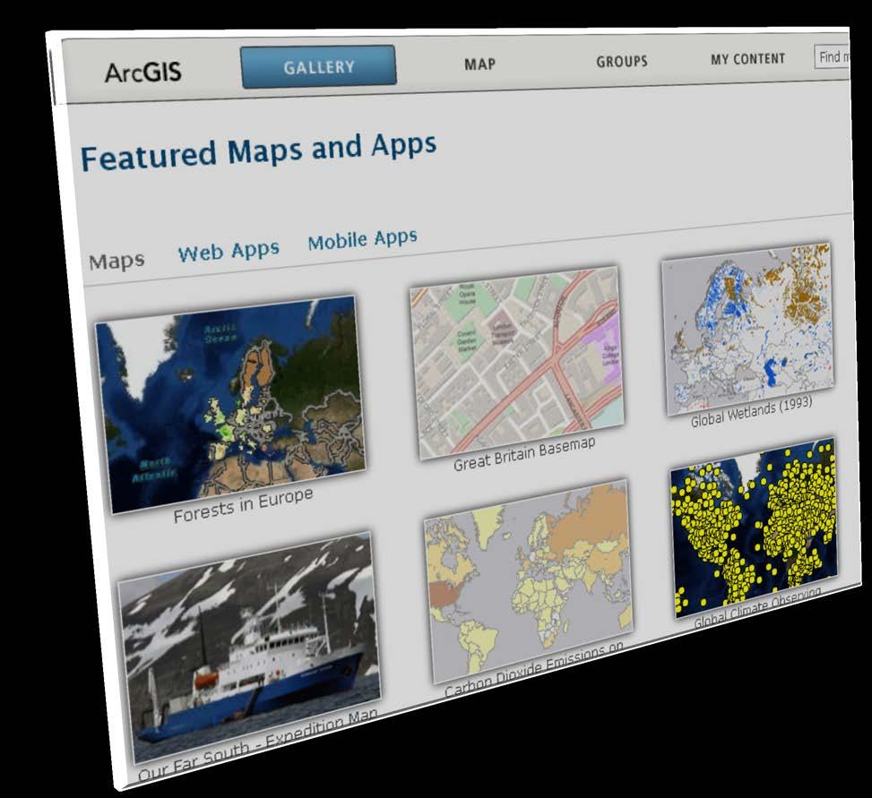
17 Cloud GIS Upload data to ArcGIS Online Demo


18 Cloud GIS Publish to ArcGIS Online
19 Lots of applications e-government - Public information service - Two way communication - Operation and decision support e-business - Advertisement - Customer service - Business analysis and decision support e-science daily life: the 4 th R.
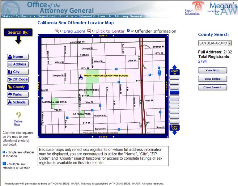
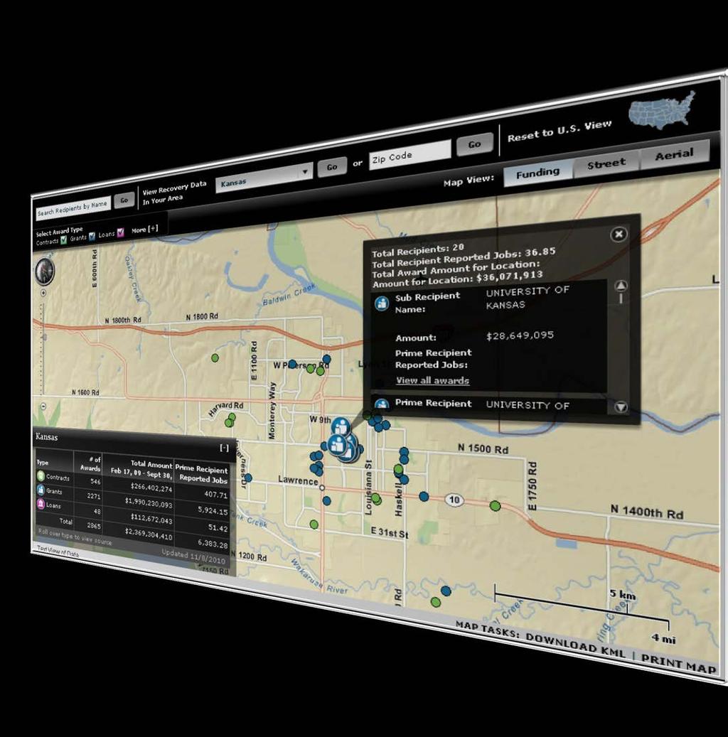


20 Public information service Online, not in line
21 Demos Environmental Public Health Tracking prototype Harvard cluster mapping prototype EPA Environmental Justice Screening tool Florida EPHT.
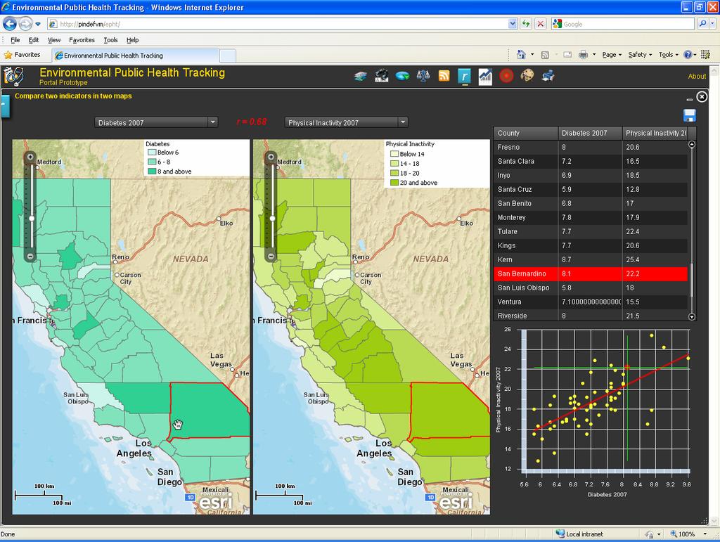
22 EPHT


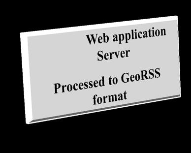
23 Reverse information flow & VGI Mapping the spatialtemporal patterns of VGI, tweets, YouTube, Flickr. ArcGIS Server feature service


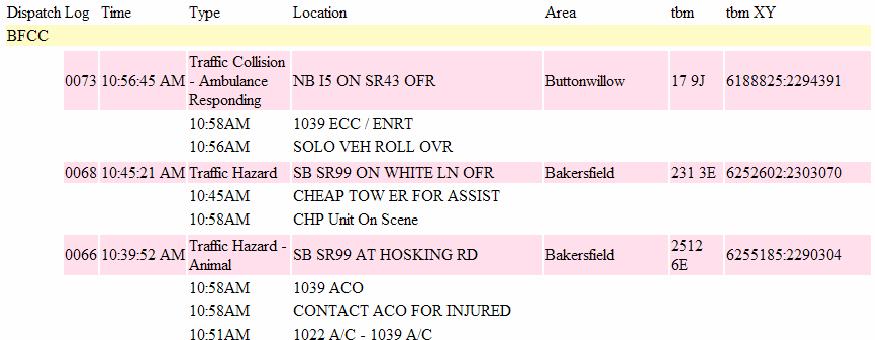
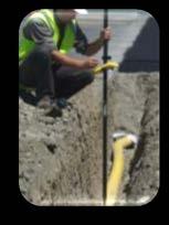
24 eplanning and incident reporting Demo: MWRD

25 From wired to wireless Post PC era Mobile GIS Web GIS Important client for Web GIS Application dev paths Native application based Browser based


26 Browser-based approach ArcGIS API for JavaScript - ios Still have access to GPS & other positioning technologies via HTML 5


27 Native application based approach Esri products Java Windows Mobile.NET Mobile Objective C Silverlight Applications & SDKs
28 Demos ArcGIS.com on ipad ArcGIS for ios (my maps, data uploaded, web editting ) 28


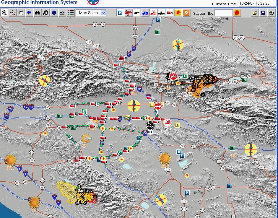
29 More than just mapping Pennsylvania Radio Network Outage Management 29


30 Map algebra If one or more towers are down, Where & who will be affected? ArcGIS Flex Viewer
31 Demos Geospatial analysis online - Publish a geoprocessing service - Use it via JavaScript and ArcGIS Flex Viewer


32 User Experience Design Principles 1. Make it fast. Don t make me wait 2. Make it simple. Don t make think 3. Make it enjoyable. Let me have fun! ArcGIS APIs for JavaScript Flex and Silverlight ArcGIS Explorer


33 Technologies ArcGIS.com Catalog Geoportal Author with ArcGIS Desktop Publish Server ArcGIS Server, ArcGIS.com Cloud Connect and use Client ArcGIS.com, ArcGIS Explorer, ArcGIS Flex Viewer, ArcGIS for ios/android Web APIs, Mobile APIs,
34 Web GIS Course Lectures Labs GIS in the Web era Cloud GIS Web Services Overview Web Services optimization Web Services Standards Geospatial mashup (I) Geospatial mashup (II) ArcGIS API for JavaScript (I) Build a Web GIS application Using ArcGIS Online Publish and use your own map service Optimize your map services Animate your space-temporal data Use ArcGIS Viewer for Flex Configure ArcGIS Viewer for Flex Build a Web GIS application using JavaScript (I) ArcGIS API for JavaScript (II) Build a Web GIS application using JavaScript (II) Volunteered Geographic Information and Map social media data Wed Editing Publish and use feature services; GIS Analysis on the Web Publish and use geoprocessing services Mobile GIS; Use ArcGIS for ios and Android; Web GIS Applications in e-bus & e-gov Application case studies Web GIS Frontiers and Prospects Preview the next release of ArcGIS Server Student final project presentation
35 Technologies covered 1. ArcGIS.com (with free account ) 2. ArcGIS Server - local or in Amazon cloud - One server shared by multiple users 3. ArcGIS Viewer for Flex (free 4. ArcGIS API for JavaScript (free) 5. ArcGIS for ios and Android (free) 6. ArcSDE + Postgres (or SQL Express ) 7. ArcGIS Model Builder or Python


36 Challenges, science, research areas Security Reliability Scalability Privacy Data quality and uncertainty Standards and Interoperability Semantic interoperability Copyright Business models Dynamic Demography


37 Questions? Pinde Fu Adding Web GIS to your curriculum!
An Introduction to GIS for developers
 An Introduction to GIS for developers Part 4: GIS Sharing Canserina Kurnia & Tom Shippee Agenda Web GIS ArcGIS Online Cloud-based ArcGIS Server ArcGIS Server on-premises ArcGIS a complete platform discover,
Introduction to ArcGIS Server Architecture and Services. Amr Wahba
 Introduction to ArcGIS Server 10.1 - Architecture and Services Amr Wahba awahba@esri.com Agenda Architecture Features Publishing Security Cloud Powerful GIS capabilities Delivered as Web services To help
Getting Started with ArcGIS for Server. Charmel Menzel and Ken Gorton
 Getting Started with ArcGIS for Server Charmel Menzel and Ken Gorton Agenda What is ArcGIS for Server? Types of Web services Publishing resources onto the Web Clients to ArcGIS for Server Editions and
What s New in ArcGIS Server 10
 What s New in ArcGIS Server 10 Derek Law ArcGIS Server Product Management What s s new in ArcGIS Server 10? Agenda Highlights: Enhanced Web mapping More powerful server-based analysis Geo-collaboration
ICIT. Brian Hiller ESRI Account Manger. What s new in ArcGIS 10
 ICIT Brian Hiller ESRI Account Manger What s new in ArcGIS 10 ArcGIS 10 Fast Easy Powerful Everywhere late June 2010 ArcGIS System for Geographic Information Desktop Server Mobile Online A System A Complete
Working with the ArcGIS Viewer for Flex Application Builder
 Working with the ArcGIS Viewer for Flex Application Builder Esri Canada User Conference St. John s November 15, 2012 Presented By: Greg Yetman gyetman@esri.ca Agenda This seminar is designed to help you
ArcGIS Online. The Road Ahead Geoff Mortson
 ArcGIS Online The Road Ahead Geoff Mortson gmortson@esricanada.com ArcGIS Online Easily create and share maps Delivered as intelligent maps Access on virtually any device anyone, anywhere Compliments and
DATA SHARING AND DISCOVERY WITH ARCGIS SERVER GEOPORTAL EXTENSION. Clive Reece, Ph.D. ESRI Geoportal/SDI Solutions Team
 DATA SHARING AND DISCOVERY WITH ARCGIS SERVER GEOPORTAL EXTENSION Clive Reece, Ph.D. ESRI Geoportal/SDI Solutions Team Geoportal Extension for ArcGIS Server Context within an Enterprise Spatial Data Infrastructure
ArcGIS for Server Michele Lundeen
 ArcGIS for Server 10.1 Michele Lundeen Summary Vision Installation and Configuration Architecture Publishing Functional Enhancements Cloud Migration and Best Practices Powerful GIS capabilities Delivered
ArcGIS Viewer for Microsoft Silverlight An Introduction
 Esri International User Conference San Diego, CA Technical Workshops July 12, 2011 ArcGIS Viewer for Microsoft Silverlight An Introduction Art Haddad, Rich Zwaap, and Derek Law Agenda Background Product
Using ArcGIS for Server. Javier Abadía, Esri España Peter McDaid, Esri UK
 Using ArcGIS for Server Javier Abadía, Esri España Peter McDaid, Esri UK 1. Intro 2. ArcGIS for Server = Geospatial Apps Server 3. Map Services Publishing Flow Apps 4. Spatial Functionality Services Publishing
Extend GIS. The Reach. Of Your GIS. Chris Cappelli Nathan Bennett
 Extend The Reach GIS Of Your GIS Chris Cappelli Nathan Bennett Where do your co-workers, managers, customers, and citizens go when they want to find or make a map? GIS is a practical system for problem
Best Practices for Designing Effective Map Services
 2013 Esri International User Conference July 8 12, 2013 San Diego, California Technical Workshop Best Practices for Designing Effective Map Services Ty Fitzpatrick Tanu Hoque What s in this session Map
Building Applications with ArcGIS Runtime SDK for ios - Part I. Divesh Goyal Mark Dostal
 Building Applications with ArcGIS Runtime SDK for ios - Part I Divesh Goyal Mark Dostal Agenda The ArcGIS System Using the Runtime SDK for ios - Display Maps - Perform Analysis - Visualize Results Q&A
Leveraging OGC Services in ArcGIS Server. Satish Sankaran, Esri Yingqi Tang, Esri
 Leveraging OGC Services in ArcGIS Server Satish Sankaran, Esri Yingqi Tang, Esri GIS Creating and Managing Geo Information Products - Proprietary - Open Specifications - Standards Dissemination of Geo
Providing Interoperability Using the Open GeoServices REST Specification
 2013 Esri International User Conference July 8 12, 2013 San Diego, California Technical Workshop Providing Interoperability Using the Open GeoServices REST Specification Satish Sankaran Kevin Sigwart What
Tom Brenneman. Good morning and welcome, introductions and thank you for being here.
 Welcome Tom Brenneman Good morning and welcome, introductions and thank you for being here. This is a best practices seminar. We're going to be sharing with you what we found to be best practices that
ESRI Software Evolution
 ArcGIS Jan Šlahař About ESRI ESRI - Environmental Systems Research Institute Founded in 1969, Redlands, California In 2002 Esri had approximately a 36 percent share of the GIS software market worldwide
How to become an INSPIRE node and fully exploit the investments made?
 How to become an INSPIRE node and fully exploit the investments made? Solution patterns for consumers: end users & developers (2/2) Roberto Lucchi 22 June 2010, Krakow 1 Geoportal extension Enabling discovery
Creating Web Mapping Applications. Nikki Golding
 Creating Web Mapping Applications Nikki Golding Agenda Web Mapping and Map Services Fundamentals ArcGIS Web Mapping Applications - ArcGIS.com Viewer - ArcGIS Explorer Online - ArcGIS Viewer for Flex -
ArcGIS SDK for Windows Phone and ArcGIS for SharePoint. Jo Fraley Nikki Golding
 ArcGIS SDK for Windows Phone and ArcGIS for SharePoint Jo Fraley Nikki Golding ArcGIS for SharePoint Agenda Welcome / Introductions ArcGIS for SharePoint Demo - Working with the product Road map ArcGIS
Web Mapping Applications with ArcGIS. Bernie Szukalski Derek Law
 Web Mapping Applications with ArcGIS Bernie Szukalski Derek Law Agenda Web Mapping and Map Services Fundamentals ArcGIS Web Mapping Applications - Hosted online - Hosted on-premise Summary Web Application
Esri Developer Summit in Europe Building Applications with ArcGIS Runtime SDK for Java
 Esri Developer Summit in Europe Building Applications with ArcGIS Runtime SDK for Java Mark Baird Mike Branscomb Agenda Introduction SDK Building the Map Editing Querying Data Geoprocessing Asynchronous
ArcGIS Runtime SDK for WPF
 Esri Developer Summit in Europe November 9 th Rotterdam ArcGIS Runtime SDK for WPF Mike Branscomb Mark Baird Agenda Introduction SDK Building the Map Query Spatial Analysis Editing and Geometry Programming
SDI SOLUTIONS FOR INSPIRE: TECHNOLOGIES SUPPORTING A FRAMEWORK OF COOPERATION
 SDI SOLUTIONS FOR INSPIRE: TECHNOLOGIES SUPPORTING A FRAMEWORK OF COOPERATION Roberto Lucchi 1, Marten Hogeweg 1, Guenther Pichler 2 1 Esri, Redlands, CA, USA 2 Esri Kranzberg, Germany 1 Vision INSPIRE
ArcGIS GeoEvent Server: Making 3D Scenes Come Alive with Real-Time Data
 ArcGIS GeoEvent Server: Making 3D Scenes Come Alive with Real-Time Data Morakot Pilouk, Ph.D. Senior Software Developer, Esri mpilouk@esri.com @mpesri Agenda 1 2 3 4 5 6 3D for ArcGIS Real-Time GIS Static
Building Applications with the ArcGIS Runtime SDK for WPF
 Esri International User Conference San Diego, California Technical Workshops 24 th July 2012 Building Applications with the ArcGIS Runtime SDK for WPF Euan Cameron & Paul Pilkington Agenda Introduction
A Developers Guide To Mobile GIS. David Cardella, Jeff Shaner
 A Developers Guide To Mobile GIS David Cardella, Jeff Shaner What is mobile GIS? Extends the reach of ArcGIS from the office to the field With a mobile GIS solution you can: - Carry your maps to the field
Learning What s New in ArcGIS 10.1 for Server: Administration
 Esri Mid-Atlantic User Conference December 11-12th, 2012 Baltimore, MD Learning What s New in ArcGIS 10.1 for Server: Administration Derek Law Product Manager Esri - Redlands ArcGIS for Server Delivering
Software and Migration Services FAQ for more information (available from Electronic Data Solutions ). Some implementation will be required, including
. Some implementation will be required, including") Sales and Marketing What is the target audience for FieldSeeker GIS for Mosquito Control? It is hoped that FieldSeeker GIS for Mosquito Control will serve the needs of small, medium, and large enterprise
Sales and Marketing What is the target audience for FieldSeeker GIS for Mosquito Control? It is hoped that FieldSeeker GIS for Mosquito Control will serve the needs of small, medium, and large enterprise
What is coming in. ArcGIS Server 10. Ismael Chivite ArcGIS Server Product Manager James Cardona Technical Marketing
 What is coming in ArcGIS Server 10 Ismael Chivite ArcGIS Server Product Manager James Cardona Technical Marketing ArcGIS Server is a complete server based GIS Delivering GIS with powerful services and
Interactive webmaps with ArcGIS. Kristel Meikas, AlphaGIS
 Interactive webmaps with ArcGIS Kristel Meikas, AlphaGIS Agenda Overview of ArcGIS tools and resources Introduction to ArcGIS APIs In depth with Flex maps In depth with JavaScript maps ArcGIS Server Publish
ArcGIS 9.2 Works as a Complete System
 ArcGIS 9.2 Works as a Complete System A New Way to Manage and Disseminate Geographic Knowledge Author/Serve/Use Maps Data Models Globes Metadata Use Desktop Explorer Web Map Viewer Mobile Open APIs Enterprise
Esri Geoportal Server
 Esri Geoportal Server Implementing a Spatial Data Infrastructure @martenhogeweg Esri Geoportal Server Extending ArcGIS to enable discovery and use of geospatial resources in heterogeneous environments
ArcGIS Enterprise: Architecture & Deployment. Anthony Myers
 ArcGIS Enterprise: Architecture & Deployment Anthony Myers 1 2 3 4 5 Web GIS Overview of ArcGIS Enterprise Federation & Hosted Server Deployment Patterns Implementation 1 Web GIS ArcGIS Enabling GIS for
Building Apps with the ArcGIS Runtime SDK for ios
 Building Apps with the ArcGIS Runtime SDK for ios Nick Furness @geeknixta ArcGIS Runtime SDKs 10.2 Released! Runtime platforms OS X Desktop Desktop Client Windows Store QT ios.net JavaSE Mobile Android
Real-Time GIS: Leveraging Stream Services
 Real-Time GIS: Leveraging Stream Services Mark Bramer Senior Technical Analyst Esri Professional Services mbramer@esri.com RJ Sunderman Product Engineer GeoEvent Extension Product Team rsunderman@esri.com
Managing Image Data on the ArcGIS Platform Options and Recommended Approaches
 Managing Image Data on the ArcGIS Platform Options and Recommended Approaches Peter Becker Petroleum requirements for imagery and raster Traditional solutions and issues Overview of ArcGIS imaging capabilities
ArcGIS Enterprise: Sharing Imagery. Zikang Zhou Imagery and Raster team
 ArcGIS Enterprise: Sharing Imagery Zikang Zhou Imagery and Raster team ArcGIS Enterprise: Sharing Imagery PowerPoint slides will be available online. Send me an E-mail if you need it faster: zzhou@esri.com
Developing Real-Time Web Mapping Applications
 Developing Real-Time Web Mapping Applications Adam Mollenkopf, Solutions Product Manager Morakot Pilouk, Senior Software Consultant Hanoch Kalmanovich, Tracking Development Lead Agenda Real-Time Web Mapping
Introduction to ArcGIS Server 10.1
 Introduction to ArcGIS Server 10.1 E-Learning for the GIS Professional Any Time, Any Place! geospatialtraining.com Module Outline What is ArcGIS Server? GIS Resources and Services ArcGIS Server Components
Developing Cross-Platform Native Apps with AppStudio for ArcGIS. Jo Fraley Erwin Soekianto
 Developing Cross-Platform Native Apps with AppStudio for ArcGIS Jo Fraley Erwin Soekianto AppStudio for ArcGIS ios Android Linux 1App Windows Mac What is AppStudio for ArcGIS? A suite of productivity tools
Author. Publish. Use
 Building Mashups Using the ArcGIS Web APIs Heather Gonzago Garima Vyas Agenda g Overview: Web Maps Overview: ArcGIS API for REST ArcGIS API for JavaScript p Google Maps Extension Bing Maps Extension ArcGIS
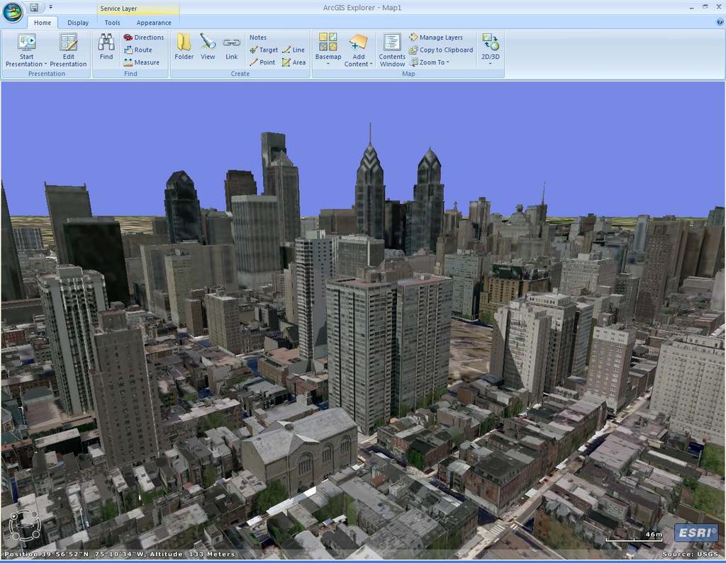
3D in the ArcGIS Platform. Chris Andrews
 3D in the ArcGIS Platform Chris Andrews Geospatial 3D is already all around us 3D is expanding the GIS community s opportunity to provide value 3D City & Infrastructure Models Generated 3D features Photogrammetrc
Getting Started with the ArcGIS API for JavaScript. Julie Powell, Paul Hann
 Getting Started with the ArcGIS API for JavaScript Julie Powell, Paul Hann Esri Developer Summit Berlin November 19 2012 Getting Started with the ArcGIS API for JavaScript ArcGIS for Server Is a Platform
Geog 469 GIS Workshop. System Requirements
 Geog 469 GIS Workshop System Requirements Outline 1. What are some fundamental issues associated with system requirements? 2. What are your GIS data requirements? 3. What are your GIS software requirements?
Mobile Technology Delivering GIS To
 Mobile Technology Delivering GIS To Staff At All Levels Of Your Organization Darren Mackiewicz, GISP Principal Information Management Specialist CDM Smith NEURISA October 15, 2012 Changes & Choices
ArcGIS for Developers: An Introduction. Moey Min Ken
 ArcGIS for Developers: An Introduction Moey Min Ken AGENDA Is development right for me? Building Apps on the ArcGIS platform Rest API & Web API Native SDKs Configurable Apps and Builders Extending the
Web AppBuilder for ArcGIS: JavaScript Apps Made Easy
 Web AppBuilder for ArcGIS: JavaScript Apps Made Easy Ryan Sellman @rcsellman Agenda Product overview Web AppBuilder for ArcGIS tour Customization Community and Resources Summary The ArcGIS Platform enables
Getting Started with the ArcGIS Server JavaScript API
 Getting Started with the ArcGIS Server JavaScript API Agenda Introduction ArcGIS Server services and mashups REST API Services Directory JavaScript API ArcGIS Server Resource Center Dojo Maps, layers,
Esri Maps for SharePoint
 Esri International User Conference San Diego, California Technical Workshops July, 2012 Esri Maps for SharePoint Art Haddad Nathan Bennett Agenda Location Analytics - Esri Maps for SharePoint - Overview
Developers Road Map to ArcGIS Desktop and ArcGIS Engine
 Developers Road Map to ArcGIS Desktop and ArcGIS Engine Core ArcObjects Desktop Team ESRI Developer Summit 2008 1 Agenda Dev Summit ArcGIS Developer Opportunities Desktop 9.3 SDK Engine 9.3 SDK Explorer
Implementing Security for ArcGIS Server Java Solutions
 Implementing Security for ArcGIS Server Java Solutions Shreyas Shinde Jay Theodore ESRI Developer Summit 2008 1 Schedule 75 minute session 60 65 minute lecture 10 15 minutes Q & A following the lecture
Open File Explorer Start Pro with SanFran project Open Locator in SanFran project Open Browser and AGOL with RouteExample Web map.
 Open File Explorer Start Pro with SanFran project Open Locator in SanFran project Open Browser and AGOL with RouteExample Web map. Open Browser with this: http://nadev.arcgis.com/arcgis/samples/easyvrp/easyvrp.html
Desktop. ArcGIS Server. ArcGIS
 Getting Started with ArcGIS Server Nakul Bhatia and David Crosby ESRI Charlotte 1 Agenda g Overview of ArcGIS Server 9.3.1 Working with GIS Services Using g Web GIS Service Clients ArcGIS Online Map Caching
Designing and Using Cached Map Services
 Esri International User Conference San Diego, California Technical Workshops July 2012 Designing and Using Cached Map Services Sterling Quinn Eric Rodenberg What we will cover Session Topics - Map cache
Introduction to Web AppBuilder for ArcGIS: JavaScript Apps Made Easy
 Introduction to Web AppBuilder for ArcGIS: JavaScript Apps Made Easy Jianxia Song & Derek Law July 21, 2015 Agenda Product overview Web AppBuilder for ArcGIS tour What s New July 2015 ArcGIS Online update
Creating Mosaic Datasets and Publishing Image Services using Python
 Creating Mosaic Datasets and Publishing Image Services using Python Jie Zhang, Jamie Drisdelle Session Offering ID: 305 Overview Introduction to mosaic dataset Raster product for sensor imagery Automatic
ArcGIS for Mobile An Introduction. Bonnie Stayer
 ArcGIS for Mobile An Introduction Bonnie Stayer Benefits of mobile GIS? Accessibility Timely Decisionmaking Efficiency and Accuracy Rapid Data Collection Types of mobile solutions? Apps & APIs Functionality
Web App Builder: Code-free Development. Adam Ziegler, Esri-Northeast, Local Government Team
 Web App Builder: Code-free Development Adam Ziegler, aziegler@esri.com Esri-Northeast, Local Government Team Agenda Product overview Web AppBuilder for ArcGIS tour Adding Custom Widgets Community and Resources
INTERNET GIS. Course Overview. Schedule. Instructor. Lab Instructor. Prerequisites. Urban Planning 794 Monday s 5:30-8:10pm SARUP 158
 INTERNET GIS Urban Planning 794 Monday s 5:30-8:10pm SARUP 158 Schedule Class/Lab - Mondays 5:30pm - 8:10pm Office Hours - By Appointment Mid-Term - 11/9/2015 Final - 12/14/2015 12/21/2015 Instructor Paul
Introduction to ArcGIS API for Flex. Bjorn Svensson Lloyd Heberlie
 Introduction to ArcGIS API for Flex Bjorn Svensson Lloyd Heberlie Agenda API Introduction Getting started API concepts and examples Getting more information API Introduction ArcGIS 10 A Complete System
ESRI Technology Update. Joe Holubar Larry Young
 ESRI Technology Update Joe Holubar Larry Young Continued Improvement Improving Quality and Extending and Refining Functionality First Half of 2009: Minor Update Release (ArcGIS 9.3.1) ArcGIS Explorer Fall
ArcGIS Enterprise: An Introduction. Philip Heede
 Enterprise: An Introduction Philip Heede Online Enterprise Hosted by Esri (SaaS) - Upgraded automatically (by Esri) - Esri controls SLA Core Web GIS functionality (Apps, visualization, smart mapping, analysis
Best Practices for Creating Web Maps. Brian Chong Justin Fan
 Best Practices for Creating Web Maps Brian Chong Justin Fan Agenda Overview of web maps Designing maps for the web Develop effective web maps What is a Web Map? Contains one or more GIS services Integrated
University of Maryland at College Park Department of Geographical Sciences GEOG 477/ GEOG777: Mobile GIS Development
 University of Maryland at College Park Department of Geographical Sciences GEOG 477/ GEOG777: Mobile GIS Development Instructor: Dr. Ruibo Han Office: LeFrak Hall (LEF) 1111B Email: ruibo@umd.edu (preferred)
Leveraging OGC Services in ArcGIS Server
 Esri International User Conference San Diego, CA Technical Workshops Jul.14 th 2011 Leveraging OGC Services in ArcGIS Server Satish Sankaran Yingqi Tang Agenda Interoperability
City of Mobile GIS Web Mapping Applications: New Technology, New Expectations
 City of Mobile GIS Web Mapping Applications: New Technology, New Expectations Presenters : Scott Kearney GIS Manager Patricia Creamer GIS Analyst Background: GIS Department Developing web mapping apps
Developing Qt Apps with the Runtime SDK
 Developing Qt Apps with the Runtime SDK Thomas Dunn and Michael Tims Esri UC 2014 Technical Workshop Agenda Getting Started Creating the Map Geocoding and Routing Geoprocessing Message Processing Work
This document outlines the changes in platform and functionality in the ArcGIS 10.0 and the upcoming ArcGIS 10.1 releases.
 DEPRECATION PLAN FOR ARCGIS 10.0 AND ARCGIS 10.1 We assess the required platforms and functionality of the ArcGIS platform at each release to account for changes in technologies and markets. As a result,
County of Los Angeles. Chief Information Office Preferred Technologies for Geographic Information Systems (GIS) Version 2 May 2015
 Version 2 May 2015") County of Los Angeles Chief Information Office Preferred Technologies for Geographic Information Systems (GIS) Version 2 May 2015 CIO Preferred Technologies for GIS This document lists the preferred Geographic
County of Los Angeles Chief Information Office Preferred Technologies for Geographic Information Systems (GIS) Version 2 May 2015 CIO Preferred Technologies for GIS This document lists the preferred Geographic
No Programming Required Create web apps rapidly with Web AppBuilder for ArcGIS
 No Programming Required Create web apps rapidly with Web AppBuilder for ArcGIS By Derek Law, Esri Product Manager, ArcGIS for Server Do you want to build web mapping applications you can run on desktop,
Interoperability and Standards Supports in ArcGIS
 Esri International User Conference San Diego, California Technical Workshops July 26, 2012 Interoperability and Standards Supports in ArcGIS Satish Sankaran, Esri Yingqi Tang, Esri Agenda Esri s participation
ArcGIS API for Silverlight An Introduction
 Esri Middle East and Africa User Conference December 10 12 Abu Dhabi, UAE ArcGIS API for Silverlight An Introduction Jo Fraley Agenda Silverlight platform API Overview Building Apps Road Ahead ArcGIS is
ArcGIS Runtime SDK for.net Getting Started. Jo Fraley
 ArcGIS Runtime SDK for.net Getting Started Jo Fraley Agenda What is the ArcGIS Runtime? What s new for ArcGIS developers? ArcGIS Runtime SDK 10.2 for WPF ArcGIS Runtime SDK for.net Building Windows Store
Product-Specific Terms of Use
 Product-Specific Terms of Use SOFTWARE The following list identifies additional terms of use that apply to specific SoftwareProducts. Each Product listing identifies one or more footnotes that apply to
Advances in GIS help create Smarter Communities
 Advances in GIS help create Smarter Communities POP(ovich) Quiz Who is a Desktop User? Who is an ArcGIS Online User? Who is a ArcGIS Server Admin? Who is a Programmer? Who works with or for a government
Scientific and Multidimensional Raster Support in ArcGIS
 Scientific and Multidimensional Raster Support in ArcGIS Sudhir Raj Shrestha sshrestha@esri.com Brief breakdown Scientific Multidimensional data Ingesting Scientific MultiDim Data in ArcGIS Ingesting and
Enterprise Geographic Information Servers. Dr David Maguire Director of Products Kevin Daugherty ESRI
 Enterprise Geographic Information Servers Dr David Maguire Director of Products Kevin Daugherty ESRI Outline Introduction Enterprise GIS vs. Spatially-enabled IS Architectures for building Enterprise GIS
Agenda. Introduction. Supported Formats. Creating a Custom REST Service. What s Next
 Using the ArcGIS Server REST API Jeremy Bartley Keyur Shah Agenda Introduction Design and Concepts Supported Formats REST API Admin Creating a Custom REST Service What s New (Since 9.3) What s Next Conclusion
EUCOM/AFRICOM DEFENSE USER GROUP MEETING MARCH 2010 STUTTGART WELCOME!
 EUCOM/AFRICOM DEFENSE USER GROUP MEETING 23-25 MARCH 2010 STUTTGART WELCOME! AGENDA March 23, Tuesday 0800-0900 Registration 0900-0915 Welcome and Introductions 0915-1000 Getting Started with ArcGIS Server
Lab 7: Silverlight API
 Lab 7: Silverlight API Due Date: 02/07/2014 Overview Microsoft Silverlight is a development platform for creating engaging, interactive user experiences for Web, desktop, and mobile applications when online
NATIONAL GEOPORTAL USER GUIDE
 NATIONAL GEOPORTAL USER GUIDE National Spatial Data Management Division January 2016 TABLE OF CONTENTS GENERAL OVERVIEW... 1 ABOUT THIS MANUAL... 2 ACCESSING THE GEOPORTAL... 3 ADDING DATA TO THE GEOPORTAL...
The Reykjavik GIS project
 The Reykjavik GIS project Jörgen Þormóðsson - Manager of LUKR Stefán Guðlaugsson - GIS-manager of Samsýn City of Reykjavik Department of Environment and Planning Division of Geodesy and Geoinformatics
ArcGIS Viewer for Flex An Introduction
 2013 Esri International User Conference July 8 12, 2013 San Diego, California Technical Workshop ArcGIS Viewer for Flex An Introduction Bjorn Svensson and Heather Gonzago @Bjorn_Svensson @hgonzago Esri
Building Mashups Using the ArcGIS APIs for FLEX and JavaScript. Shannon Brown Lee Bock
 Building Mashups Using the ArcGIS APIs for FLEX and JavaScript Shannon Brown Lee Bock Agenda Introduction Mashups State of the Web Client ArcGIS Javascript API ArcGIS API for FLEX What is a mashup? What
S s y t s em e s s Ar A ch c i h tec e t c ur u e e De D s e i s gn g, n C o C n o f n igu g r u at a ion o, n a n a d n D p e l p oy o m y en e t
 Systems Architecture Design, Configuration, and Deployment Tom Pattison and Michael Young Version 3.1 Agenda What is System Architecture? Design - System Architecture Business Data Application Technology
Introduction to ArcGIS Online and Story Maps
 Introduction to ArcGIS Online and Story Maps Presented by the University of Connecticut s Center for Land Use Education and Research (CLEAR) CLEAR 1 Welcome! Instructor Introductions Course logistics Student
Help Me! A Consumer Product Assistance Application
 Grand Valley State University ScholarWorks@GVSU Technical Library School of Computing and Information Systems 2016 Help Me! A Consumer Product Assistance Application Ryan Kingsley Grand Valley State University
ArcGIS Online: Managing Data. Jeremy Bartley Sentha Sivabalan
 ArcGIS Online: Managing Data Jeremy Bartley (jbartley@esri.com) Sentha Sivabalan (ssivabalan@esri.com) Agenda Creating and managing content like Apps, Maps, Scenes and Layers in ArcGIS Today s Topics:
INSPIRE: The ESRI Vision. Tina Hahn, GIS Consultant, ESRI(UK) Miguel Paredes, GIS Consultant, ESRI(UK)
 Miguel Paredes, GIS Consultant, ESRI(UK)") INSPIRE: The ESRI Vision Tina Hahn, GIS Consultant, ESRI(UK) Miguel Paredes, GIS Consultant, ESRI(UK) Overview Who are we? Introduction to ESRI Inc. and ESRI(UK) Presenters ArcGIS The ESRI Solution to
INSPIRE: The ESRI Vision Tina Hahn, GIS Consultant, ESRI(UK) Miguel Paredes, GIS Consultant, ESRI(UK) Overview Who are we? Introduction to ESRI Inc. and ESRI(UK) Presenters ArcGIS The ESRI Solution to
Accessing OGC Services To access OGC WMS and WFS open the service in the directory that you want to consume, and click on either WMS or WFS.
 Using Web Services Web Services Overview This user guide contains instructions on how to consume a range of services through a range of both web based and desktop GIS applications. Web services are a live
Paul Hardy. We Live in a Rapidly Changing World. Mobile Mapping: Collect, Manage, Produce, Share. MMT Krakow, Many Forces Are Converging
 Mobile Mapping: Collect, Manage, Produce, Share MMT Krakow, 2011 Paul Hardy We Live in a Rapidly Changing World Increasingly Driven by Population Growth & Human Action Impacting Environment Society Economy
An introduction to ArcGIS Runtime
 2013 Europe, Middle East, and Africa User Conference October 23-25 Munich, Germany An introduction to ArcGIS Runtime Christine Brunner Lars Schmitz Welcome! Christine Brunner, Germany - Software Developer
ArcGIS Viewer for Silverlight Advanced Topics
 Esri International User Conference San Diego, California Technical Workshops July 26, 2012 ArcGIS Viewer for Silverlight Advanced Topics Rich Zwaap Agenda Add-ins overview Tools Behaviors Controls Layouts
Introducing Survey123 For ArcGIS
 FedGIS Conference February 24 25, 2016 Washington, DC Introducing Survey123 For ArcGIS James Tedrick, Esri Jawameer Kakakhan, UN OCHA Configurable Solutions That Work Together Vizualize Collect Navigator
ArcGIS Runtime SDK for Java: A Beginner s Guide. Mark Baird JC Malott
 ArcGIS Runtime SDK for Java: A Beginner s Guide Mark Baird JC Malott Outline Intro to ArcGIS Runtime SDKs Get started: download and install the SDK Tour of the functionality of the API Basics of building
Project: Configure ArcGIS Server 10 using Microsoft Server 2008 Failover Cluster
 July 25, 2012 Project: Configure ArcGIS Server 10 using Microsoft Server 2008 Failover Cluster Presented by Philip Dunn, Senior Consultant / Solution Architect POWER Engineers Established 1976 100% employee
TORRENT ARCGIS DEVELOPERS FOR VBA USER MANUAL E-PUB
 26 April, 2018 TORRENT ARCGIS DEVELOPERS FOR VBA USER MANUAL E-PUB Document Filetype: PDF 411.2 KB 0 TORRENT ARCGIS DEVELOPERS FOR VBA USER MANUAL E-PUB This service pack should be installed as the ArcGIS
It s under the liberal Apache 2.0 license, so it s usable in both free and commercial applications.
 1 2 3 So, what is Cesium? To put it succinctly, Cesium is an open-source JavaScript library for creating 3D globes and 2D maps. Cesium is used in many fields, such as geospatial, aerospace, sports, environmental