Enterprise Geographic Information Servers. Dr David Maguire Director of Products Kevin Daugherty ESRI
|
|
|
- Buddy Alexander
- 5 years ago
- Views:
Transcription

1 Enterprise Geographic Information Servers Dr David Maguire Director of Products Kevin Daugherty ESRI
2 Outline Introduction Enterprise GIS vs. Spatially-enabled IS Architectures for building Enterprise GIS Enterprise Geographic Information Servers Examples Conclusions
3 Introduction
4 GIS is Evolving From Projects and Workgroups to Enterprises Information Systems
5 Information System Set of resources useful information through management and analysis of data in accordance with defined procedures Support the missions of an organization Users Information System Interface Data Information system
6 Enterprise GIS Characteristics GIS is key to business operations Mission-critical Decision support More planning, integration, testing and support than traditional GIS Mainstream IT Deploy and manage like other IT Customer IT clients select and deliver
7 Enterprise GIS Characteristics Integration with other enterprise systems Middleware, Enterprise Service Buses, etc. Central management and serving Embed within other business solutions May be complex to deploy and support Business driven service level agreements
8 Enterprise Success Factors Solid workflow, architecture and application designs Well defined infrastructure requirements Knowledgeable, highly-skilled teams Enterprise-wide standards and governance processes Qualified business partners skilled in developing enterprise GIS solutions Good tuning tools and methods Robust services and support capabilities and the best GIS technology available
9 Enterprise GIS vs. Spatially-enabled IS
10 Two Enterprise Information System Approaches Enterprise GIS (noun) Core technology Geo-centric workflows Advanced applications Data creation and maintenance, analysis and modeling IT-based Examples Network maintenance, asset management, facility siting, corridor analysis Run by GIS and IT professionals Spatially-enable IS (verb) Applications of spatial reference Line of business-centric workflows Simple applications Data exploitation, routing, geocoding IT-based Examples Field-force automation, executive information system, customer care, store locators Run by IT professionals
11 Geographic Information System (GIS) Generic platform for working with geographic information Schema-driven information model Tools for editing, mapping, analysis End-user interface with scripting Application programming interface This supports Ad-hoc integration of information from different sources Transactions against a shared database End-user system configuration and programming High-level platform for the development of geo-spatial applications

12 Three Components of GIS Geoprocessing Models Maps and Globes Datasets Data Models Metadata Documents


13 Analysis Field GIS Query Mapping
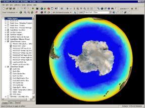
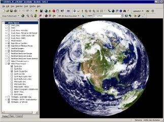
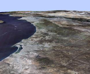
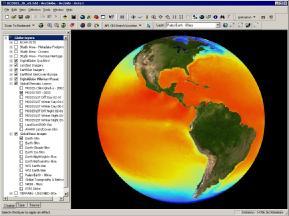


14 Visualization Very Fast Seamless Continuous Pan & Zoom... Images, Terrain, and Vectors
15 Geoprocessing Data + Function = Data Command & Dialog Window

16 Data Management Data and Maps Metadata Models Web Services Schemas
17 Enterprise Architecture Desktop B r o w s e r Clients Application Servers GIS ERP Web Server CRM CIS SFA Data Servers
18 City and County of San Francisco Enterprise GIS Mayor s Office Public Works City Planning Building Inspection SF Public Utilities Commission Real Estate Assessor/Recorder Treasurer/Tax Collector Economic & Community Development Recreation & Parks Dept. of Environment Zoo Human Services Children, Youth, Families Dept. of Public Health SF Police/Fire Emergency Services
19
20 Role of DBMS Centralized data repository Avoid redundancy and duplication Facilitate data sharing Multi-user editing of large databases DBMS backup and recovery Security Availability Support for advanced geographic data types Limitations of SQL Performance and scalability (esp. complex operations / information models) Support for poorly structured / distributed data types Integration of heterogeneous data
21 Spatial Enabling of Enterprise DBMS-centric Web Services-centric centric Application Server (Enterprise Integration) SQL SAP Siebel ArcGIS Spatial Types and Functions Enterprise Systems Spatial Servers
22
23
24
25
26 Geographic Information Systems (GIS) GIS is like other Enterprise Information Technology Systems Architecture Interfaces Development tools Deployment strategies Standards Cost
27 Standards for GIS Information Technology Standards DBMS: RDBMS & SQL Web Services: J2EE,.NET, XML/SOAP Computing Platforms: Windows, Unix Development Languages: C++, Java, Visual Basic,.NET (C#, etc.) Domain Standards Industry, ISO, Military, OGC standards Data and Metadata formats Web Service APIs User Community/Org. Standards
28 Architectures for Building Enterprise GIS
29 N-Tier Architecture Single Tier Three Tier Client Presentation Presentation Business Logic Data Management Application Server Business Logic Data Server Data Management
30 Enterprise GIS Architecture Clients Desktop Web Mobile Servers GIS Web Data Network LAN / WAN Internet LAN WAN Server LAN LAN Multipurpose DBMS
31 Enterprise GIS Architecture Clients Web Applications Thin Clients Custom Desktops Embedded Generic Desktops Workstations Enterprise Application Servers / Services GIS Server Data Server Web Server Data DBMS
32 Enterprise Geographic Information Server Thin and Thick Clients Network Enterprise Geographic Information Server Server Manager Server Worker Containers

33 Enterprise GI Server Standard Networks EGIS
34 Technology Components Clients GIS Applications Network Web Apps Application Server Web Application Server ArcGIS Server ArcSDE Data Server DBMS
35
36 EGIS Characteristics Full GIS functionality Information model Geoprocessing Data management Server-centric Distributed processing Centralized Federated / web services Client-server IT standards-based Development Communications Data management Interoperability Low cost of maintenance/ upgrade Easy scalability
37 Examples
38 Pierce County Increased GIS Capacity and Security, Reduced Costs Business Challenge: Existing UNIX systems too costly to maintain Reduce database redundancy and consolidate data store Reduce points of failure to mitigate OS reliability and security issues Upgrade to latest GIS release and meet increased server demand Tight budgets Solution: Server Consolidation 4 IBM Bladecenters Software: Upgrade to new GIS release Streamlined licensing New HW Leasing Lower TCO, $753K Business Benefits: Projected $2.9M cost savings from hardware consolidation and new leasing agreement Significantly reduced administrative complexity, 27 servers reduced to 13, 98 CPU, added failover and more storage Better management of server software resources, better security of database and web services inside the firewall, and streamlined GIS software license management and cost.
 Integrate with corporate")
39 Centerpoint Energy Drives Business and Achieves Greater Value with GIS Business Challenge: Strategic direction in question Return to core business functions Focus on assets with immediate positive cash flow Tight budgets Demand cost efficiency with improved performance Solution: GIS Software Deployment Implement in all CP distribution companies (electric & gas) Integrate with corporate systems, Filenet,, SAP, etc Spatially-enable mission-critical applications: SCADA, mobile operations, pole management Business Benefits: Investment in GIS shifting from tactical (some ROI, specific business unit benefit, executive support ) to strategic (substantial ROI, companywide benefit, executive ownership) Strategic GIS use drives business modeling of asset management, business risk, product demand prediction; new distribution optimization tool, Itron LD-Pro IT discipline for rapid strategic value : don t build in-house, buy proven solutions, must integrate

40 Geospatial One-stop II Moving into IT Mainstream Business Challenge: Continue momentum of e-gov e initiatives Lack of data major constraint on GIS use in government Major duplication and redundancy Need to invest in secure IT-based platform infrastructure Solution: Combined GIS and IT platform ESRI GIS IBM Websphere Portal Google Search Engine Business Benefits: Reduce redundant investments in geo-spatial data and facilitate data acquisition Greatly expand use of geo-spatial information into wider e-government community through easy, fast and familiar geoportal Move from geo-centric to IT-centric platform ESRI Geo- portal Toolkit IBM Websphere Application Server Google Search Engine
41 Conclusions GIS is moving into Enterprises Geo-centric Business-centric GIS are Information Systems Enterprise Geographic Information Servers New class of GIS server Full GIS capabilities Built on IT platforms and standards Several case studies already available
42 Questions
ArcGIS 9.2 Works as a Complete System
 ArcGIS 9.2 Works as a Complete System A New Way to Manage and Disseminate Geographic Knowledge Author/Serve/Use Maps Data Models Globes Metadata Use Desktop Explorer Web Map Viewer Mobile Open APIs Enterprise
Enterprise Architecture Deployment Options. Mark Causley Sandy Milliken Sue Martin
 Enterprise Architecture Deployment Options Mark Causley Sandy Milliken Sue Martin GIS is Being Implemented in Many Settings Organization Business to Business Department Workgroup GIS is Moving to the Enterprise
Lesson 12: ArcGIS Server Capabilities
 GEOG 482 / 582 : GIS Data Management Lesson 12: ArcGIS Server Capabilities Overview Learning Objective Questions: 1. What are the ArcGIS Server Services? 2. How is ArcGIS Server packaged? 3. What are three
The Oracle Enterprise Geodatabase (EGDB) Charlie Crocker Farallon Geographics, Inc.
 Charlie Crocker Farallon Geographics, Inc.") The Oracle Enterprise Geodatabase (EGDB) Charlie Crocker Farallon Geographics, Inc. www.fargeo.com Norcal URISA Chapter Meeting 2/9/2005 Todays Goals Enterprise geodatabase defined Roles Oracle can play
The Oracle Enterprise Geodatabase (EGDB) Charlie Crocker Farallon Geographics, Inc. www.fargeo.com Norcal URISA Chapter Meeting 2/9/2005 Todays Goals Enterprise geodatabase defined Roles Oracle can play
S s y t s em e s s Ar A ch c i h tec e t c ur u e e De D s e i s gn g, n C o C n o f n igu g r u at a ion o, n a n a d n D p e l p oy o m y en e t
 Systems Architecture Design, Configuration, and Deployment Tom Pattison and Michael Young Version 3.1 Agenda What is System Architecture? Design - System Architecture Business Data Application Technology
An Introduction to GIS for developers
 An Introduction to GIS for developers Part 4: GIS Sharing Canserina Kurnia & Tom Shippee Agenda Web GIS ArcGIS Online Cloud-based ArcGIS Server ArcGIS Server on-premises ArcGIS a complete platform discover,
Planning Enterprise Geodatabase Solutions
 Esri Middle East and Africa User Conference December 10 12 Abu Dhabi, UAE Planning Enterprise Geodatabase Solutions Pete Fitts Agenda Overview Database Design Data Maintenance Infrastructure Design and
Geospatial Enterprise Search. June
 Geospatial Enterprise Search June 2013 www.voyagersearch.com www.voyagersearch.com/demo The Problem: Data Not Found The National Geospatial-Intelligence Agency is the primary source of geospatial intelligence
Quick Start Guides 1
 1 Core products and components ArcGIS for Desktop........................................... 3 ArcGIS for Server............................................ 5 ArcGIS Engine Developer Kit and ArcGIS Engine................................
Trimble GeoCollector for ArcGIS: An Introduction. Morgan Zhang (Esri), Matthew Morris (Trimble)
, Matthew Morris (Trimble)") Trimble GeoCollector for ArcGIS: An Introduction Morgan Zhang (Esri), Matthew Morris (Trimble) Overview Introduction to mobile GIS Overview of ArcGIS for Windows Mobile Overview of Trimble Positions software
Trimble GeoCollector for ArcGIS: An Introduction Morgan Zhang (Esri), Matthew Morris (Trimble) Overview Introduction to mobile GIS Overview of ArcGIS for Windows Mobile Overview of Trimble Positions software
Subject: Migration Information for ArcIMS, ArcSDE, and ArcGIS Server Users
 December 12, 2006 Subject: Migration Information for ArcIMS, ArcSDE, and ArcGIS Server Users Summary This document provides information about how we are migrating your licenses and maintenance for ESRI
Enterprise GIS Architecture
 Enterprise GIS Architecture Sandy Milliken (Enterprise Systems Architect) Ty Fabling (Enterprise Systems Architect) 19 February, 2009 FedUC 2009 1 Enterprise GIS Architecture ESRI Enterprise Consulting
ESRI Mobile GIS Solutions Overview. Justin Fan
 ESRI Mobile GIS Solutions Overview Justin Fan Agenda Mobile GIS challenges ESRI Mobile GIS solutions ArcPad ArcGIS Mobile ArcGIS Engine Selecting a mobile GIS solution Q & A Objective To help you select
ITP 140 Mobile Technologies. Databases Client/Server
 ITP 140 Mobile Technologies Databases Client/Server Databases Data: recorded facts and figures Information: knowledge derived from data Databases record data, but they do so in such a way that we can produce
Oktober 2018 Dell Tech. Forum München
 Oktober 2018 Dell Tech. Forum München Virtustream Digital Transformation & SAP Jan Büsen Client Solutions Executive, Virtustream The Business Agenda: Digital IT = Competitive Advantage Business Driven
Architecting ArcGIS Server Solutions for Performance and Scalability
 Architecting ArcGIS Server Solutions for Performance and Scalability Dave Wrazien Eric Miller ESRI Developer Summit 2008 1 Schedule 75 minute session 60 65 minute lecture 10 15 minutes Q & A following
Raster Serving with ArcGIS
 Raster Serving with ArcGIS Agenda Introduction to server technology Workflow considerations ESRI raster serving technology ArcGIS Server Basic (ArcSDE) ArcGIS Server Standard/Advanced Web Services ArcGIS
Software and Migration Services FAQ for more information (available from Electronic Data Solutions ). Some implementation will be required, including
. Some implementation will be required, including") Sales and Marketing What is the target audience for FieldSeeker GIS for Mosquito Control? It is hoped that FieldSeeker GIS for Mosquito Control will serve the needs of small, medium, and large enterprise
Sales and Marketing What is the target audience for FieldSeeker GIS for Mosquito Control? It is hoped that FieldSeeker GIS for Mosquito Control will serve the needs of small, medium, and large enterprise
County of Los Angeles. Chief Information Office Preferred Technologies for Geographic Information Systems (GIS) Version 2 May 2015
 Version 2 May 2015") County of Los Angeles Chief Information Office Preferred Technologies for Geographic Information Systems (GIS) Version 2 May 2015 CIO Preferred Technologies for GIS This document lists the preferred Geographic
County of Los Angeles Chief Information Office Preferred Technologies for Geographic Information Systems (GIS) Version 2 May 2015 CIO Preferred Technologies for GIS This document lists the preferred Geographic
Introduction to Geodatabase and Spatial Management in ArcGIS. Craig Gillgrass Esri
 Introduction to Geodatabase and Spatial Management in ArcGIS Craig Gillgrass Esri Session Path The Geodatabase - What is it? - Why use it? - What types are there? - What can I do with it? Query Layers
ESRI Software Evolution
 ArcGIS Jan Šlahař About ESRI ESRI - Environmental Systems Research Institute Founded in 1969, Redlands, California In 2002 Esri had approximately a 36 percent share of the GIS software market worldwide
<Insert Picture Here> Enterprise Data Management using Grid Technology
 Enterprise Data using Grid Technology Kriangsak Tiawsirisup Sales Consulting Manager Oracle Corporation (Thailand) 3 Related Data Centre Trends. Service Oriented Architecture Flexibility
Providing Interoperability Using the Open GeoServices REST Specification
 2013 Esri International User Conference July 8 12, 2013 San Diego, California Technical Workshop Providing Interoperability Using the Open GeoServices REST Specification Satish Sankaran Kevin Sigwart What
Improving Blade Economics with Virtualization
 Improving Blade Economics with Virtualization John Kennedy Senior Systems Engineer VMware, Inc. jkennedy@vmware.com The agenda Description of Virtualization VMware Products Benefits of virtualization Overview
Microsoft SharePoint Server 2013 Plan, Configure & Manage
 Microsoft SharePoint Server 2013 Plan, Configure & Manage Course 20331-20332B 5 Days Instructor-led, Hands on Course Information This five day instructor-led course omits the overlap and redundancy that
Vblock Infrastructure Packages: Accelerating Deployment of the Private Cloud
 Vblock Infrastructure Packages: Accelerating Deployment of the Private Cloud Roberto Missana - Channel Product Sales Specialist Data Center, Cisco 1 IT is undergoing a transformation Enterprise IT solutions
ArcGIS Enterprise: Architecture & Deployment. Anthony Myers
 ArcGIS Enterprise: Architecture & Deployment Anthony Myers 1 2 3 4 5 Web GIS Overview of ArcGIS Enterprise Federation & Hosted Server Deployment Patterns Implementation 1 Web GIS ArcGIS Enabling GIS for
Virtualizing the SAP Infrastructure through Grid Technology. WHITE PAPER March 2007
 Virtualizing the SAP Infrastructure through Grid Technology WHITE PAPER March 2007 TABLE OF CONTENTS TABLE OF CONTENTS 2 Introduction 3 The Complexity of the SAP Landscape 3 Specific Pain Areas 4 Virtualizing
Troubleshooting Performance Issues with Enterprise Geodatabases. Ben Lin, Nana Dei, Jim McAbee
 Troubleshooting Performance Issues with Enterprise Geodatabases Ben Lin, Nana Dei, Jim McAbee blin@esri.com ndei@esri.com jmcabee@esri.com Workshop Agenda Performance Troubleshooting (Then & Now) Real-World
Introduction to Federation Server
 Introduction to Federation Server Alex Lee IBM Information Integration Solutions Manager of Technical Presales Asia Pacific 2006 IBM Corporation WebSphere Federation Server Federation overview Tooling
Accelerate Your Enterprise Private Cloud Initiative
 Cisco Cloud Comprehensive, enterprise cloud enablement services help you realize a secure, agile, and highly automated infrastructure-as-a-service (IaaS) environment for cost-effective, rapid IT service
GEOSPATIAL ERDAS APOLLO. Your Geospatial Business System for Managing and Serving Information
 GEOSPATIAL ERDAS APOLLO Your Geospatial Business System for Managing and Serving Information ERDAS APOLLO Do you have large volumes of data, a geographicallydistributed user base and rapidly changing
CenturyLink for Microsoft
 Strategic Partner Alliances CenturyLink for Microsoft EMPOWER REACH AGILITY 2017 CenturyLink. All Rights Reserved. The CenturyLink mark, pathways logo and certain CenturyLink product names are the property
FlexPod Data Center Solution. Presented by: Bernd Dultinger Date: December 1 st 2011
 FlexPod Data Center Solution Presented by: Bernd Dultinger Date: December 1 st 2011 What are we asked to do? Budgets go further and business goes faster Data Centers are at a Critical Juncture Empowered
Database Systems: Design, Implementation, and Management Tenth Edition. Chapter 1 Database Systems
 Database Systems: Design, Implementation, and Management Tenth Edition Chapter 1 Database Systems Objectives In this chapter, you will learn: The difference between data and information What a database
IBM Spatially Enables Enterprise With ESRI ArcGIS Server
 IBM Spatially Enables Enterprise With ESRI ArcGIS Server This article cannot be reproduced in whole or in part without prior permission from IBM Corporation. Copyright IBM Corp. 2005. All Rights Reserved.
Optimizing Pulse Secure Access Suite with Pulse Secure Virtual Application Delivery Controller solution
 DATASHEET Optimizing Pulse Secure Access Suite with Pulse Secure Virtual Application Delivery Controller solution Features & Benefits Best-in-class VPN and vadc solutions A single point of access for all
Advanced Solutions of Microsoft SharePoint Server 2013 Course Contact Hours
 Advanced Solutions of Microsoft SharePoint Server 2013 Course 20332 36 Contact Hours Course Overview This course examines how to plan, configure, and manage a Microsoft SharePoint Server 2013 environment.
Editing Versioned Geodatabases : An Introduction
 Esri International User Conference San Diego, California Technical Workshops July 24, 2012 Editing Versioned Geodatabases : An Introduction Cheryl Cleghorn Shawn Thorne Assumptions: Basic knowledge of
Managing Image Data on the ArcGIS Platform Options and Recommended Approaches
 Managing Image Data on the ArcGIS Platform Options and Recommended Approaches Peter Becker Petroleum requirements for imagery and raster Traditional solutions and issues Overview of ArcGIS imaging capabilities
What s s Coming in ArcGIS 10 Desktop
 What s s Coming in ArcGIS 10 Desktop Damian Spangrud ArcGIS Product Manager, ESRI dspangrud@esri.com (or at least turn to silent) ArcGIS 10 A Simple & Pervasive System for Using Maps & Geographic Information
ArcSDE 8.1 Questions and Answers
 ArcSDE 8.1 Questions and Answers 1. What is ArcSDE 8.1? ESRI ArcSDE software is the GIS gateway that facilitates managing spatial data in a database management system (DBMS). ArcSDE allows you to manage
Esri s ArcGIS Enterprise. Today s Topics. ArcGIS Enterprise. IT4GIS Keith T. Weber, GISP GIS Director ISU GIS Training and Research Center
 Esri s ArcGIS Enterprise IT4GIS Keith T. Weber, GISP GIS Director ISU GIS Training and Research Center Today s Topics Part 1: ArcGIS Enterprise architecture Part 2: Storing and serving data for the enterprise
Now you can Microsoft Visual Studio 2010 with MSDN
 Now you can Microsoft Visual Studio 2010 with MSDN gives your development teams the advanced functionality, superior benefits, and convenient access to the latest tools and resources they need to cost-effectively
ArcGIS for Server Michele Lundeen
 ArcGIS for Server 10.1 Michele Lundeen Summary Vision Installation and Configuration Architecture Publishing Functional Enhancements Cloud Migration and Best Practices Powerful GIS capabilities Delivered
ICIT. Brian Hiller ESRI Account Manger. What s new in ArcGIS 10
 ICIT Brian Hiller ESRI Account Manger What s new in ArcGIS 10 ArcGIS 10 Fast Easy Powerful Everywhere late June 2010 ArcGIS System for Geographic Information Desktop Server Mobile Online A System A Complete
Stellar performance for a virtualized world
 IBM Systems and Technology IBM System Storage Stellar performance for a virtualized world IBM storage systems leverage VMware technology 2 Stellar performance for a virtualized world Highlights Leverages
GEOFidelis Program Update
 GEOFidelis Program Update JSEM & Geospatial Conference Columbus, OH 22 May 2007 Organization Secretary of the Navy CNO CMC GEOFidelis Program Office MCI NCR MCI East MCRD ERR MCI West MCRD WRR MCI Mid
Introduction to ArcGIS Server 10.1
 Introduction to ArcGIS Server 10.1 E-Learning for the GIS Professional Any Time, Any Place! geospatialtraining.com Module Outline What is ArcGIS Server? GIS Resources and Services ArcGIS Server Components
Introduction to ArcSDE 8. John Calkins
 Introduction to ArcSDE 8 John Calkins Why are you here? Introduction to ArcSDE? What is a GeoDatabase? Existing SDE user? Existing ArcInfo user? Technical details on implementation? Just confused... ArcSDE
To Current And Beyond: Highlights of Virginia Beach s 10.2 Upgrade And ArcGIS Online Implementation From A Systems Analyst Perspective
 To Current And Beyond: Highlights of Virginia Beach s 10.2 Upgrade And ArcGIS Online Implementation From A Systems Analyst Perspective Dave Arnold, Systems Analyst Sridhar Katragadda, Systems Analyst Objective
ArcGIS Enterprise: Performance and Scalability Best Practices. Darren Baird, PE, Esri
 ArcGIS Enterprise: Performance and Scalability Best Practices Darren Baird, PE, Esri dbaird@esri.com What is ArcGIS Enterprise What s Included with ArcGIS Enterprise ArcGIS Server the core web services
A Developers Guide To Mobile GIS. David Cardella, Jeff Shaner
 A Developers Guide To Mobile GIS David Cardella, Jeff Shaner What is mobile GIS? Extends the reach of ArcGIS from the office to the field With a mobile GIS solution you can: - Carry your maps to the field
Meltem Özturan misprivate.boun.edu.tr/ozturan/mis515
 Meltem Özturan misprivate.boun.edu.tr/ozturan/mis515 1 2 1 Selecting the Best Alternative Major Activities in the Analysis Phase Gather information Define system requirements Prototype for feasibility
IBM SmartCloud Resilience offers cloud-based services to support a more rapid, reliable and cost-effective enterprise-wide resiliency.
 Arjan Mooldijk 27 September 2012 Choice and control developing resilient cloud strategies IBM SmartCloud Resilience offers cloud-based services to support a more rapid, reliable and cost-effective enterprise-wide
Esri s Spatial Database Engine. Today s Topics. ArcSDE. A spatial database engine that works on
 Esri s Spatial Database Engine IT4GIS Keith T. Weber, GISP GIS Director ISU GIS Training and Research Center Today s Topics Part 1: What is ArcSDE? Why use ArcSDE? ArcSDE Data Structure How is data stored
QM Chapter 1 Database Fundamentals Version 10 th Ed. Prepared by Dr Kamel Rouibah / Dept QM & IS
 QM 433 - Chapter 1 Database Fundamentals Version 10 th Ed Prepared by Dr Kamel Rouibah / Dept QM & IS www.cba.edu.kw/krouibah Dr K. Rouibah / dept QM & IS Chapter 1 (433) Database fundamentals 1 Objectives
ArcGIS Server Success Stories. Danny Krouk 2008 ESRI Regional User Group Sacramento, CA
 ArcGIS Server Success Stories Danny Krouk 2008 ESRI Regional User Group Sacramento, CA Agenda ArcGIS Server State of California, Resources Agency Responding to the Southern California Fires Bond Accountability
Rich Web Application Development Solution. Simplifying & Accelerating WebSphere Portal Development & Deployment
 Rich Web Application Development Solution Simplifying & Accelerating WebSphere Portal Development & Deployment Rich Web Application Development 2 Richer= Application aspect is more application features
Building and Deploying Enterprise ArcGIS Server Solutions (Best Practices) Wittaker Mathot Developer Summit
 Wittaker Mathot Developer Summit") Building and Deploying Enterprise ArcGIS Server Solutions (Best Practices) Wittaker Mathot Developer Summit 2007 1 Presentation Goals See real world, Enterprise implementations of ArcGIS Server presented
Building and Deploying Enterprise ArcGIS Server Solutions (Best Practices) Wittaker Mathot Developer Summit 2007 1 Presentation Goals See real world, Enterprise implementations of ArcGIS Server presented
Advanced Solutions of Microsoft SharePoint 2013
 Course 20332A :Advanced Solutions of Microsoft SharePoint 2013 Page 1 of 9 Advanced Solutions of Microsoft SharePoint 2013 Course 20332A: 4 days; Instructor-Led About the Course This four-day course examines
USING GIS TO TRANSFORM YOUR ORGANIZATION. Reengineering a GIS Department. TRA Adopts a Business Solution Approach ESRI UC 2017
 USING GIS TO TRANSFORM YOUR ORGANIZATION Reengineering a GIS Department TRA Adopts a Business Solution Approach ESRI UC 2017 Glenn Clingenpeel, Bob Ayensu Outline 1. History of TRA 2. Overview 3. Approach
20331B: Core Solutions of Microsoft SharePoint Server 2013
 20331B: Core Solutions of Microsoft SharePoint Server 2013 Course Details Course Code: Duration: Notes: 20331B 5 days This course syllabus should be used to determine whether the course is appropriate
Co-creation for Success
 SAP SAPPHIRE NOW 2018 Orlando, June 5-7, 2018 Human Centric Innovation Co-creation for Success 0 2018 FUJITSU Fujitsu Hybrid IT Conduit for Digital Transformation Orlando, June 5-7, 2018 Human Centric
Service Oriented Architecture
 Service Oriented Architecture Web Services Security and Management Web Services for non-traditional Types of Data What are Web Services? Applications that accept XML-formatted requests from other systems
April Power Systems Roadshow
 April 2008 Power Systems Roadshow The IBM Systems family BladeCenter Simplify Datacenter complexity. System z The flagship for IBM Systems innovation and the heart of a highly secure, resilient and integrated
Jim Mains Director of Business Strategy and Media Services Media Solutions Group, EMC Corporation
 Media Asset Management Databases The Heart of the System and Critical Decisions and Steps for Success Jim Mains Director of Business Strategy and Media Services Media Solutions Group, EMC Corporation Agenda
Planning an Enterprise Geodatabase. John Alsup Sr. Systems Engineer Jeff DeWeese Enterprise Solutions Architect
 John Alsup Sr. Systems Engineer Jeff DeWeese Enterprise Solutions Architect Agenda Overview Database Design Data Maintenance System Architecture Data Distribution Learn the key planning phases and components
[TITLE] Virtualization 360: Microsoft Virtualization Strategy, Products, and Solutions for the New Economy
![[TITLE] Virtualization 360: Microsoft Virtualization Strategy, Products, and Solutions for the New Economy](/thumbs/85/92753915.jpg "[TITLE] Virtualization 360: Microsoft Virtualization Strategy, Products, and Solutions for the New Economy") [TITLE] Virtualization 360: Microsoft Virtualization Strategy, Products, and Solutions for the New Economy Mounir Chaaban & Riaz Salim Account Technology Strategist Microsoft Corporation Microsoft s Vision
[TITLE] Virtualization 360: Microsoft Virtualization Strategy, Products, and Solutions for the New Economy Mounir Chaaban & Riaz Salim Account Technology Strategist Microsoft Corporation Microsoft s Vision
Total Cost of Ownership: Benefits of ECM in the OpenText Cloud
 Total Cost of Ownership: Benefits of ECM in the OpenText Cloud OpenText Managed Services brings together the power of an enterprise cloud platform with the technical skills and business experience required
VDI What is it? Virtual Desktop Infrastructure in Plain Vanilla. Clifford Gabriel Data Center and Virtualization Trends and Technologies Inc.
 VDI What is it? Virtual Desktop Infrastructure in Plain Vanilla Clifford Gabriel Data Center and Virtualization Trends and Technologies Inc. Trends and Technologies Inc. Gold Partner - Cisco Enterprise
STORAGE CONSOLIDATION WITH IP STORAGE. David Dale, NetApp
 STORAGE CONSOLIDATION WITH IP STORAGE David Dale, NetApp SNIA Legal Notice The material contained in this tutorial is copyrighted by the SNIA. Member companies and individuals may use this material in
Branch Office Data Consolidation
 Branch Office Data Consolidation A New Paradigm in Data Protection Published: February 2004 Abstract Many companies today face the growing challenge of protecting rapidly proliferating data dispersed throughout
Microsoft Core Solutions of Microsoft SharePoint Server 2013
 1800 ULEARN (853 276) www.ddls.com.au Microsoft 20331 - Core Solutions of Microsoft SharePoint Server 2013 Length 5 days Price $4290.00 (inc GST) Version B Overview This course will provide you with the
Microsoft SQL Server on Stratus ftserver Systems
 W H I T E P A P E R Microsoft SQL Server on Stratus ftserver Systems Security, scalability and reliability at its best Uptime that approaches six nines Significant cost savings for your business Only from
Automating ArcGIS Deployments Using Chef
 Automating ArcGIS Deployments Using Chef Cherry Lin (clin@esri.com) Bill Major (bmajor@esri.com) David Cordes (dcordes@esri.com) Slides: http://bit.ly/2uieg0p Overview What, Why, When? Esri s Chef Cookbooks
INSPIRE: The ESRI Vision. Tina Hahn, GIS Consultant, ESRI(UK) Miguel Paredes, GIS Consultant, ESRI(UK)
 Miguel Paredes, GIS Consultant, ESRI(UK)") INSPIRE: The ESRI Vision Tina Hahn, GIS Consultant, ESRI(UK) Miguel Paredes, GIS Consultant, ESRI(UK) Overview Who are we? Introduction to ESRI Inc. and ESRI(UK) Presenters ArcGIS The ESRI Solution to
INSPIRE: The ESRI Vision Tina Hahn, GIS Consultant, ESRI(UK) Miguel Paredes, GIS Consultant, ESRI(UK) Overview Who are we? Introduction to ESRI Inc. and ESRI(UK) Presenters ArcGIS The ESRI Solution to
Taking your next integration or BPM project to the cloud WebSphere Integration User Group, 12 July 2012 IBM Hursley
 Mark Tomlinson CTO, Cloud Computing, IBM UK & Ireland Taking your next integration or BPM project to the cloud WebSphere Integration User Group, 12 July 2012 IBM Hursley Today s organizations strive to
GET MORE VIRTUAL WITH DELL AND VMWARE vsphere 4
 GET MORE VIRTUAL WITH DELL AND VMWARE vsphere 4 PowerEdge Virtualization-Optimized Servers EqualLogic PS Series Virtualized iscsi SANs VMware vsphere Andrew Gilman, Global Enterprise Solutions Marketing,
DATACENTER SERVICES DATACENTER
 SERVICES SOLUTION SUMMARY ALL CHANGE React, grow and innovate faster with Computacenter s agile infrastructure services Customers expect an always-on, superfast response. Businesses need to release new
Understanding and Using Metadata in ArcGIS. Adam Martin Marten Hogeweg Aleta Vienneau
 Understanding and Using Metadata in ArcGIS Adam Martin Marten Hogeweg Aleta Vienneau Adam Martin National Government Account Management R&D Open Data Marten Hogeweg National Government Professional Services
Powering Transformation With Cisco
 Shape Your Business For the Future: Powering Transformation With Cisco Enabling Data Center Evolution Towards Cloud Computing Yudi Wiradarma TSO Lead, PT NetApp Indonesia Agenda The Challenge Cloud infrastructure
PRODUCT BROCHURE ERDAS APOLLO MANAGING AND SERVING GEOSPATIAL INFORMATION
 PRODUCT BROCHURE ERDAS APOLLO MANAGING AND SERVING GEOSPATIAL INFORMATION ERDAS APOLLO Do you have large volumes of geospatial information, regularly updated data stores, and a distributed user base? Do
Stir It Up: Achieving GIS Interoperability
 Stir It Up: Achieving GIS Interoperability City of Tacoma, Washington, USA Mike Murnane, Community & Economic Development John Shell, Public Works 2006 ESRI International User Conference - August 9, 8:30
Understanding VDI End-to-End
 Understanding VDI End-to-End Cloud Client-Computing Dario Gnaccarini Sales Engineer Cloud client-computing Matteo Mazzari Principal Consultant Services Compute continues to change 3 Billion people worldwide
2013 AWS Worldwide Public Sector Summit Washington, D.C.
 Washington, D.C. Web Mapping and Security A View From Esri Bonnie Stayer Solutions Engineer Dan O Leary Director, D.C. Software Development Center Introduction Cloud security affected by many moving parts
Metadata Architectures
 Metadata Architectures Evaluating Metadata Architectures Introduction The IT world has practiced metadata management in one form or another for more than twenty years. IT has developed three models for
Developing and Sustaining your Enterprise GIS Design
 Developing and Sustaining your Enterprise GIS Design Dave Peters ESRI Systems Integration 1of 51 Overview System Architecture Design Process Enterprise GIS Evolution GIS Software and Migration Roadmap
AtoS IT Solutions and Services. Microsoft Solutions Summit 2012
 Microsoft Solutions Summit 2012 1 Building Private Cloud with Microsoft Solution 2 Building Private Cloud with Microsoft Solution Atos integration Establish a new strategic IT partnership From July 2011
ERDAS APOLLO Managing and Serving Geospatial Information
 ERDAS APOLLO Managing and Serving Geospatial Information ERDAS APOLLO Do you have large volumes of geospatial information, regularly updated data stores, and a distributed user base? Do you need a single,
Advanced Solutions of Microsoft SharePoint Server 2013
 Course Duration: 4 Days + 1 day Self Study Course Pre-requisites: Before attending this course, students must have: Completed Course 20331: Core Solutions of Microsoft SharePoint Server 2013, successful
Geog 469 GIS Workshop. System Requirements
 Geog 469 GIS Workshop System Requirements Outline 1. What are some fundamental issues associated with system requirements? 2. What are your GIS data requirements? 3. What are your GIS software requirements?
SQL Server SQL Server 2008 and 2008 R2. SQL Server SQL Server 2014 Currently supporting all versions July 9, 2019 July 9, 2024
 Current support level End Mainstream End Extended SQL Server 2005 SQL Server 2008 and 2008 R2 SQL Server 2012 SQL Server 2005 SP4 is in extended support, which ends on April 12, 2016 SQL Server 2008 and
ArcGIS Server Architecture Considerations. Andrew Sakowicz
 ArcGIS Server Architecture Considerations Andrew Sakowicz Introduction Andrew Sakowicz - Esri Professional Services - asakowicz@esri.com 2 Audience Audience - System Architects - Project Managers - Developers
Vblock Architecture Accelerating Deployment of the Private Cloud
 Vblock Architecture Accelerating Deployment of the Private Cloud René Raeber Technical Solutions Architect Datacenter rraeber@cisco.com 1 Vblock Frequently Asked Questions 2 What is a Vblock? It is a product
DATA SHARING AND DISCOVERY WITH ARCGIS SERVER GEOPORTAL EXTENSION. Clive Reece, Ph.D. ESRI Geoportal/SDI Solutions Team
 DATA SHARING AND DISCOVERY WITH ARCGIS SERVER GEOPORTAL EXTENSION Clive Reece, Ph.D. ESRI Geoportal/SDI Solutions Team Geoportal Extension for ArcGIS Server Context within an Enterprise Spatial Data Infrastructure
Title DC Automation: It s a MARVEL!
 Title DC Automation: It s a MARVEL! Name Nikos D. Anagnostatos Position Network Consultant, Network Solutions Division Classification ISO 27001: Public Data Center Evolution 2 Space Hellas - All Rights
SIMPLIFY, AUTOMATE & TRANSFORM YOUR BUSINESS
 SIMPLIFY, AUTOMATE & TRANSFORM YOUR BUSINESS June 2012 WHAT S HAPPENING IN YOUR WORLD 2 YOUR CHALLENGES TODAY Business Challenges Operational Challenges Financial Challenges Speed to Deliver SLAs & High
CA ERwin Data Modeler
 PRODUCT BRIEF: CA ERWIN DATA MODELER CA ERwin Data Modeler CA ERWIN DATA MODELER (CA ERWIN DM) IS AN INDUSTRY-LEADING DATA MODELING SOLUTION THAT ENABLES YOU TO CREATE AND MAINTAIN DATABASES, DATA WAREHOUSES
ArcGIS Enterprise: Architecting Your Deployment
 ArcGIS Enterprise: Architecting Your Deployment ArcGIS Enterprise ESRI USER CONFERENCE 2017 1 Assumptions and Prerequisites This document assumes you are a system architect or an IT administrator (or work