HMA for Science - Evolution. Final Presentation
|
|
|
- Angelica Barrett
- 5 years ago
- Views:
Transcription
1 HMA for Science - Evolution Final Presentation Y. Coene, Spacebel s.a. Tri Tran Minh, Spacebel s.a. Minh Nguyen Quang, Spacebel s.a. 16 October 2014 ESRIN, Frascati Page 1
2 Outline Introduction Science Services Integration OpenSearch Other SSE Portal Conclusion and Future Work Demo Page 2

3 Introduction - What is HMA A collaborative project started in Europe and Canada by the Ground Segment Coordination Body (GSCB) in 2005 with the objective to: Guarantee a seamless and harmonised access to heterogeneous EO datasets from multiple mission ground segments, including national missions and ESA missions. Standardise the ground segment interfaces of the satellite missions for easier access to EO data. Provide interoperability for coordinated data access enabling the interactions with services or Value Adders and EO Contributing Missions. Page 3
4 Introduction HMA for Science FedEO Contributions to standardisation Identity Management specification Metadata specification Product discovery specification Collection discovery specification Ordering specifications Processing specifications Feasibility Analysis specification FedEO is a system providing a brokered discovery (and access) capability to European (and Canadian) EO missions data based on HMA interfaces Page 4
5 Architecture Page 5
6 Architecture Main results: Service endpoints for external clients Option 1: OpenSearch Dataset Series, Dataset Discovery and download: OpenSearch Gateway Option 2: OGC Dataset Series Discovery OGC Dataset Discovery OGC Ordering (incl. OGC ) Portal clients Page 6
7 Outline Introduction Science Services Integration OpenSearch Other SSE Portal Future Work Demo Page 7
8 Architecture OpenSearch Interface Dataset series, dataset (and services) discovery Applied for heterogeneous metadata: EOP O&M (OGC r3 and r4) metadata DC or ISO metadata RDF metadata ISO19139 metadata (as per OGC r1 and OGC r2) Interface : OpenSearch OGC r8 Geo and Time Extension OGC r4 Extension for Earth Observation Aligned with OASIS searchretrieve 1.0 conventions OpenSearch SRU Extension RESTful interface being prepared. Page 8
9 OASIS Search Web Services (SWS): SearchRetrieve searchretrieve <<Part 1>> Abstract Protocol Definition <<Part 7>> Explain <<Part 2>> Binding for SRU 1.2 <<Part3>> Binding for SRU 2.0 <<Part 4>> Binding for OpenSearch Page 9
10 OpenSearch Specification Tree searchretrieve <<Part 1>> Abstract Protocol Definition <<Part 7>> Explain <<Part 2>> Binding for SRU 1.2 <<Part3>> Binding for SRU 2.0 <<Part 4>> Binding for OpenSearch SRU Extension Parameter Extensiion <<OGC r8>> Geo and Time Extensions <<OGC r4>> EO Extension Page 10
11 Architecture - OSDD Recursive or multi-step search: Step 1: return dataset series metadata and OSDD to be used for dataset search inside the dataset series Step 2: return dataset (i.e. product/granule) metadata Approach: RFC 6573, The Item and Collection Link Relations. <Url> for step 1: Response: <dc:identifier> in response identifies dataset series (OGC ) <link rel="search" href=".." <Url> for step 2: type="application/opensearchdescription+xml"/> {eo:parentidentifier} identifies dataset series to be searched. Page 11
12 Use Case 1 : (One-Step) Search HTTP GET OpenSearch Description Document ID HTTP Response ID HTTP GET Request parentidentifier = name = frascati startdate = T00:00:00Z Spatial Extent Temporal Extent Metadata Link [Search Link] [Data Link] Spatial Extent Temporal Extent Metadata Link [Search Link] [Data Link] HTTP GET parentidentifier=eop%3aegeos%3aegeos%23ikonos&startdate= T00:00:00Z&cloudCover=10]&endDate= T00:00:00Z&name=frascati&radius=1000 Page 12
13 Use Case 2 : Two-step search HTTP GET Parent OSDD Child OSDD HTTP GET Request HTTP GET Request HTTP Response Parent ATOM Feed HTTP Response Child ATOM Feed Atom Entry 1 Atom Entry 2 Atom Entry 1 Atom Entry 2 Metadata Link Metadata Link Metadata Link Metadata Link Search Link Search Link [Data Link] [Data Link] Spatial extent Spatial extent Spatial extent Spatial extent Temporal extent Temporal extent Temporal extent Temporal extent Page 13
14 FedEO Two-step Search Search Client FedEO Partner Mission GS Collection Partner Mission Mission Catalogs GS GS Step 1: Collection Search Get OSDD OSDD for collection search Perform collection search Atom response with collections and link to OSDD for each Create OSDD based on backend capabilities. Collect responses and # of results from backend collection catalog(s). Compute first/next/previous/last links. Partner Mission GS Granule Partner Mission Mission Catalogs GS GS Return matching collections and number of hits Step 2: Granule Search Extract location of OSDD from Atom response Get OSDD for granule search Perform granule search Atom response with granules and link to thumbnail, browse, product Create OSDD based on backend capabilities. Note that atom:link may contain non-fedeo address. Return matching granules and number of hits Page 14
15 Two-Step Search Dataset Series (Collections) Described with Collection Metadata Searchable Collections Collections with metadata Collections that are searchable Collection with collection metadata but not searchable (e.g. GSCDA) Collection supporting 2-step Search Searchable Collection not yet described with collection metadata (e.g. Copernicus, ASF, ) Page 15
16 Architecture - Dataset Series Dataset Series hierarchy: Top-level: parallel search in 4 (TBC) catalogs Search inside a selected dataset series (eo:parentidentifier). Page 16
17 EOP:ASF EOP:VITO:VGT_S10 ATS_TOA_1P MSG_SEVIRI Dataset Series metadata EOP:ESA:FEDEO:COLLECTIONS EOP:ESA:GPOD-EO : : : : Dataset metadata EOP:VITO:VGT_S10 MSG_SEVIRI Metadata Legend: ISO OGC RDF Page 17
18 Architecture Dataset Series Search target: {eo:parentidentifier} Can be used in dataset series search and in dataset search. Default value is EOP:ESA:FEDEO Can be logical name for one or more endpoints No new naming conventions: CDS EO-DAIL collection identifiers kept. urn:ogc: optional VA4, GPOD, M2CS and CWIC collection identifiers kept. Allows for same collection identifier in two catalogs (use prefix) parentidentifier = EOP:ESA:GPOD-EO:ASA_IM 0P Page 18
19 Architecture Dataset Series EOP:ESA:FEDEO EOP:ESA:FEDEO:COLLECTIONS EOP:ESA:GPOD-EO EOP:ESA:EO-VIRTUAL-ARCHIVE4 EOP:VITO:VGT_S10 EOP:ASF EOP:SPOT:ALL MSG_SEVIRI ATS_TOA_1P ASA_IM 0P Queryables in OSDD differ per dataset series: fier={eo:parentidentifier} fier=eop:esa:fedeo:collections fier=eop:dlr:eoweb:geohazard.supersite.terrasar-x_ssc Page 19
 Draft with known issues (See conclusion) and competing with WADL (http://www.w3.")
20 Parameter Extension (*) Additional constraints on input parameters (in OSDD): For example (OGC Connector): fier=eop:dlr:eoweb:geohazard.supersite.terrasar-x_ssc (*) Draft with known issues (See conclusion) and competing with WADL ( and RAML (RESTful API Modeling Language) etc. and partly overlapping with searchretrieve Explain (OASIS) capabilities. Page 20
21 Architecture - Queryables Queryables differ per dataset series: «time» and «geo» namespace OGC r8 «eo» namespace OGC r4 Mapping to dataset series metadata ISO19139 (step 1) {eo:parentidentifier}, {eo:organisationname}, {eo:producttype}, {eo:instrument}, {eo:platform} Mapping to dataset metadata OGC r4 (step 2) «dc» namespace 35 queryables e.g. {eo:instrument}, {eo:cloudcover}, E.g. {dc:title}, {dc:type} (service, collection,..), {dc:publisher},.. «semantic» namespace {semantic:classifiedas} : search dataset series with (SKOS) concept URI Page 21
22 Architecture - Queryables dc:type allows for searches for dataset series, datasets or services e.g. in ISO AP, I15 EP catalogs. Both dc:type and eo:parentidentifier have expected defaults. Page 22
23 Architecture - Parameters url= httpaccept=application/atom%2bxml& query={searchterms?}& recordschema={sru:recordschema?}& startrecord={startindex?}& maximumrecords={count?}& bbox={geo:box}& Parameter conventions: searchretrieve: Part 3. searchretrieve Operation: APD Binding for SRU 2.0, Version 1.0, OASIS Standard, 30 January 2013 searchretrieve: Part 4. APD Binding for OpenSearch Version 1.0, OASIS Standard, 30 January 2013 OpenSearch Extensions SRU 1.0 Draft 1 OGC r8, OpenSearch Geo and Time Extensions Page 23
24 OpenSearch (Example with Gazetteer) Parameters: Request: Media type: Atom httpaccept Collection: IKONOS {eo:parentidentifier} Less than 10% cloud cover {eo:cloudcover} Area of interest: 1 km from Frascati {geo:name},{geo:radius} Time frame: {time:*} er=eop%3aegeos%3aegeos%23ikonos&startdate= T00:00:00Z&cloudCover=10]&endDate= T00:00:00Z&name=frascati&radius=1000 Use as client. Page 24


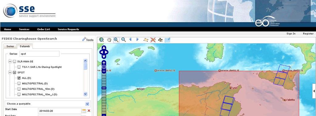
25 OpenSearch (Example Google Maps) Page 25
26 OpenSearch (Example - Firefox) Same result visualised directly by Firefox Web Browser Page 26
27 Architecture - Responses OGC r4 is flexible: Metadata can be embedded or be external (atom:link). FedEO Client can select recordschema (and Media Type): {sru:recordschema} : allows client to decide which metadata is to be embedded as foreign markup (iso, om, om11, dc). Give me the best metadata you have: «server-choice» By default, atom:link are included instead. Page 27
28 Architecture - Responses Access to other media types and metadata formats (atom:summary) Page 28
29 Responses - HATEOAS Hypermedia as the Engine of Application State Standardised Media types Standardised Link Relations <link rel= > (RFC 5988) first, previous, self, next and last : Navigation search : Two step search enclosure : Product download payment : Product order page (future work - TBC) Page 29


30 Responses Media RSS Use of Media RSS as per OGC r4 Access to cloud mask, thumbnail, browse image Page 30


31 Responses Media RSS FedEO Media RSS understood by third party applications Page 31
 Page")
32 Architecture - Responses Improved Atom response in case of ISO collection metadata with semantic annotations (OGC r2) Page 32
33 Architecture - Exceptions Exception handling: HTTP error codes as per OGC r8 ows:exceptionreport as per OGC r9 (OGC Web Services Common Standard) Page 33
34 Architecture - Explain Explain OASIS SearchRetrieve (Part 7) Provides additional metadata about endpoint E.g. response schemas Possible values for parameters e.g. {eo:parentidentifier} Default values for search parameters etc. Available at Page 34
35 Documents - Client Partner Guide Audience: Client developers, service consumers General description of the FedEO environment and its relation to other systems Details about the FedEO query interface based on OpenSearch (e.g., principles, the search parameters, search response format, etc...) Description of two cases: one starting from a dataset series catalogue, and a second one accessing immediately the dataset catalogue Details on the catalogue connectors and how their corresponding dataset series and dataset metadata can be discovered Page 35
36 Documents Software Configuration File Software Configuration File Target audience: administrator OpenSearch Gateway. Page 36
37 Software Configuration Endpoint configuration done via configuration file(s) <dcat:dataset>.. </dcat:dataset> <dcat:dataset>.. </dcat:dataset> <dcat:dataset>.. </dcat:dataset> <dcat:dataset>.. </dcat:dataset> CSW Capabilities File (OGC ) OSDD <url> </url> CSW Capabilities File (OGC ) OSDD <url> </url> CSW Capabilities File (CWIC) Page 37
.")
38 Documents Software Configuration Endpoint configuration done via configuration file: dc:identifier, accessurl, type (protocol). Page 38
39 Documents Software Configuration Note: File format to change in next release Page 39


40 Deployment (*) (*) (*) include series metadata Page 40
41 Deployment Architecture Connectors implemented supporting: OGC (CSW EOP EP) OGC (OpenSearch) OGC (CSW ISO AP) OGC (CSW CIM EP) OGC (CSW I15 EP) CWIC (CSW) ASF (API) Page 41
42 Science Services Integrated (Oct. 2014) Dataset Series / Collection Search OSDD ISO RDF FedEO OpenSearch OSDD OSDD OSDD OSDD OSDD OSDD ISO ISO ISO I15 (2) REF (3) GPOD (4) VA4 (5) synch (gscda) ISO ISO synch (cwic) synch/convert (fedeo) IDN ECHO (6) OSDD is collection-specific. Page 42
43 Science Services Integrated (Oct. 2014) Dataset / Product Search OSDD EOP O&M ISO DC RDF FedEO OpenSearch EOP O&M CDS DAIL SMOS M2CS GPOD VA4 DISS HARM EOP O&M (tar) ISO DC FedEO CCM CWIC VITO DLR EUM CNES ASF ECHO CCM SPIRIT SPOT CHARTER OSDD is collection-specific. Page 43

44 Science Services - examples Alaska Satellite Facility m%2bxml&parentidentifier=eop:asf&startdate= T11:59:59Z&endDate= T11:59:59Z&maximumRecords=10&frame=[290,310] Page 44
45 Science Services - examples NASA ECHO tion/atom%2bxml&parentidentifier=eop:nasa:echo&query =vegetation 1_STD_FRAME_L0&bbox=-80.0,- 90.0,80.0,90.0&startPage=1&maximumRecords=10 Page 45
46 Science Services - examples CNES SPIRIT, Disasters Charter catalogs OP:CNES:SPIRIT&query=Russia OP:CNES:CHARTER&query=Germany ESA DISSHARM Landsat 5 etc. =LANDSAT_5_TM&startDate= T00:00:00Z&endDate= T00:00:00Z Page 46

47 Science Service - DISSHARM Page 47

")
48 Science Services - Metrics Collections accessible through FedEO (26/09/2014) Page 48
49 Outline Overall Architecture Science Services Integration OpenSearch Other SSE Portal Conclusion and Future Work Demo Page 49
50 Discovery and Ordering Gateway Page 50
51 Discovery and Ordering Gateway OGC and integration: VITO DLR 1 VITO collection added to OGC and OpenSearch 23 DLR collections added to OGC and OpenSearch OGC integration (DLR test server). EUMETSAT 13 Collections added to OGC and OpenSearch Page 51
52 Outline Introduction Science Services Integration OpenSearch Other SSE Portal Conclusion and Future Work Demo Page 52

53 SSE Portal Instance of DAIL/SSE Portal with additional «clients» Output of Evolution framecontract Page 53
")

54 SSE Portal OGC Client Pre-existing client (DAIL/SSE) HMA-SE collections added to CDS EO-DAIL collection list... Page 54

55 SSE Portal - Ordering Page 55


56 SSE Portal OGC OpenSearch Client New HMA-SE client. Main purpose: test client for FEDEO Gateway Page 56


57 SSE Portal Page 57


58 SSE Portal CWIC product search Page 58


59 SSE Portal ASF Product Search Page 59
60 Outline Introduction Science Services Integration OpenSearch Other SSE Portal Conclusion and Future Work Demo Page 60
61 Conclusion Synergies with HMA-S FedEO OpenSearch implementation pre-dated HMA-S specifications and provided inputs/feedback to HMA-S Tasks 3 and 4 (generalisation, ISO19139, MediaRSS, etc.). FedEO OpenSearch implementation more general than HMA-S OpenSearch specification. FedEO implementation exploits OGC r4 EOP O&M specification (Task 3): CDS EO-DAIL, M2CS, ASF product metadata in EOP O&M available now. G-POD, SMOS, VA4 available on test platform. FedEO implementation relies on software components from HMA-S and raised NCR against these components. I15 EP Catalog Implementation (Task 5) OGC r8 Catalog Implementation (Task 3) Page 61
.")

62 FedEO Components OpenSearch Gateway Being reused in ESA CDS v3 (OpenSearch to OGC ). Open-Source Components available at: Documentation available on ESA HMA Wiki. Page 62
63 Conclusion I/F Architecture exploits OGC r4 flexibility: Mapping to EOP O&M Metadata (OGC r4) Mapping to ISO19139 Metadata Two-step and/or one step approach Heterogeneous metadata types either: Embedded also ngeo approach By reference (atom:link) CEOS Recommendation. Complemented with existing OpenSearch extensions: "sru" "semantics" Can be extended with additional media types (RSS, SRU, RDF, HTML, JSON ) Can be extended with additional link types (HATEOAS), e.g. for ordering, metadata editing,... Page 63
64 Conclusion - Issues Implementation/Specification Issues <atom:link rel= alternate type= gml+xml href= /> Links to metadata record of a certain type. No media types defined to distinguish EOP O&M 1.0 (OGC r3) from EOP O&M 1.1 Solution such as OGC (Addition of a profile parameter to GML MIME type) is needed. Parameter extension Should allow <Parameter/> in global scope: to allow for shared Parameter definitions for multiple <Url>. name attribute should be optional and value attribute should be mandatory. Is currently the opposite. Should allow to define a default value. Page 64
65 Conclusion - Issues Implementation/Specification Issues OGC r4 has all its queryables under eo: namespace. Some should be dc: instead. Conformance Testing Conformance Tests from HMA-S for OpenSearch Procedural Not Tester-friendly: unsupported optional parameters flagged as errors. Interpretation of empty BBOX should be a point. Flag error if EOP O&M not embedded inside response: fails if a derived type (opt:, sar: etc.) or if included as atom:links or if other metadata type (ISO, ) Who should contact whom when backend-systems not operational or failing. Page 65
66 Future work Outline Metadata completion Proposed interface changes CNES RESTo query analyzer integration Interface harmonisation (homogeneous metadata formats) RESTful and Linked Data interfaces Page 66

67 Future work Collection Metadata Much remaining work to populate Dataset Series metadata catalogs. E.g. additional metadata in EOP:ESA:FEDEO:COLLECTIONS R&parentIdentifier=EOP:ESA:FEDEO:COLLECTIONS&type=col lection Has positive effect on #collections that support 2-STEP search in FedEO. 511 Page 67
68 Future work Interface changes: Implement additional CEOS OpenSearch recommendations Improve compliance with INSPIRE Download Service Technical Guidance. Harmonise Atom response messages from different backends Have 2 nd -step OSDD link point to FEDEO in all cases. Start counting results from 1 in all cases. Support ISO and EOP O&M metadata format for more backends (GPOD, VA4 etc.) Page 68
69 Future work Interface changes (cont d): Replace dc:subject by eo:parentidentifier consistently. Reduce supported parameters for dataset search in principal OSDD to those required by CEOS. Refine OSDD generated for OGC Connector: e.g. different parameters in case of Optical or Radar collection. Requires this to be discoverable on CDS side. Support «virtual collections» and efficient parallel search with correct paging for product search. Integration with Ordering via HATEOAS Could more seamlessly integrate OpenSearch Gateway with HMA OGC ordering Page 69
70 Query Analyzer Integration Integration with CNES RESTo Query Analyzer. Simplied OSDD understood by Web Browser search I/F <?xml version="1.0" encoding="utf-8"?> <OpenSearchDescription xmlns=" xmlns:dc=" xmlns:eo=" xmlns:geo=" xmlns:semantic=" /opensearch/extensions/semantic/1.0/" xmlns:sru=" xmlns:time=" <ShortName>FEDEO</ShortName> <Url template=" ataset&query={searchterms?}&startrecord={startindex?}&maximumrecords={count? } &recordschema={sru:recordschema?}" type="application/atom+xml"/> </OpenSearchDescription> Page 70
71 Query Analyzer Integration Gateway obtains platform, instrument and the other parameters from the CNES RESTo Query Analyzer Search Terms FedEO Gateway (P3) List of OpenSearch parameters RESTo Query Resolver (P7) Example: Search Terms: Images acquired today by Spot HRV List of OpenSearch parameters returned by RESTo Query Analyzer: "eo:platformshortname":"spot% "eo:instrument":"hrv%" "time:start":" t00:00:00 "time:end":" t23:59:59" Page 71
72 Query Analyzer Integration Integration with CNES RESTo Query Analyzer: type=dataset&query=images acquired today by Spot HRV acquired yesterday by radarsat sar Page 72


73 Future work - Harmonisation Harmonisation Collection Metadata format (OGC r1) Harmonisation Product Metadata format (OGC r4) Page 73
74 Future work - Harmonisation Harmonise Collection Metadata Format ion/atom%2bxml&query=mer_frs_1p CURRENT NEW Page 74


75 Future work - Harmonisation Harmonise Product Metadata Format ntidentifier=mer_frs_1p&startdate= t00:00:00z&enddate= T00:00:00Z NEW CURRENT Page 75
76 Future Work Faceted Search Faceted Search allowing users to explore a collection of information by applying multiple filters (*) E.g. provide links to (dataset series) results per group (e.g. FedEO, CWIC, ECHO, VA4, GPOD, CSCDA etc.) or other classification. In roadmap of CNES and NASA implementations (Source: WGISS #38 Moscow) Can be integrated in Atom-based responses using rel=: Advertise number of items (if known): thr:count=123 ( Other approaches at and Addressed in OASIS searchretrieve specifications. (*) Page 76
77 Future Work FedEO Dataset Series Server / ISO support Current implementation HMA-S (Task 5) I15 EP Implementation with OpenSearch front-end. Possible alternative Derived from HMA-S (Task 3) EOP O&M Catalog Server. Advantages: Lightweight/fast. More native OpenSearch and scalable. Based on SolR/Lucene -> generate Parameter extension / facet information - from index. Less dependent on metadata format, e.g. future support for ISO and -3. Page 77
78 Future work - Semantic Annotations HTML Microdata: Recommended by CEOS. May be indexed by major search engines: Google, Yahoo, Bing Support in HTML response of FedEO OpenSearch Gateway </li> <li itemscope itemtype=' <span itemprop='alternatename'>doi: /ornldaac/1</span> <span itemprop='version' >1</span> <span itemprop='provider' >ORNL_DAAC</span> <div itemprop='description' >ABSTRACT: USGS 15 minute stream flow data for Kings Creek on the Konza Prairie</div> <span itemprop='temporal' > T00:00:00Z/</span> <span itemprop='spatial' > </span> Page 78
79 Future work Additional RESTful binding RESTful requests: Resources Description../series - GET Dataset series search../series/{id} - GET Dataset series with given ID../series/{id}/datasets - GET Dataset search../ series/{id}/datasets/{id} - GET Dataset with given ID Response type controlled by: Explicit parameter: httpaccept (current implementation) Resource extension:.atom,.rss,.rdf (CEOS Best Practice) Content negotiation: Atom or RSS or RDF or HTML etc... (Linked Data requirement) Page 79


80 Future work Linked Data Open Linked Data: Additional media types: RDF media type for dataset series. Make available FedEO metadata to the Linked Open Data (LOD) community. W3C RDF, DCAT, LDP 1.0 ESA FedEO Page 80
81 Future work Linked Data CEOS? eo:instrument eo:platform URI isni.org? organisation URI GEMET keyword URI loc.gov Language URI ESA FedEO dataset series dataset URI NASA KMS Keyword Mgt System loc.gov Country URI ESA RARE Multidomain thesaurus Page 81
82 Outline Introduction Science Services Integration OpenSearch Other SSE Portal Conclusion and Future Work Demo Page 82

83 FedEO Demo Examples of two-step approach: collections and granule search Page 83

84 FedEO Demo Page 84

85 Additional information Further reading: ESA_TM-21_Heterogeneous_Missions_Accessibility Page 85
86 Spare slides Page 86
 Test file fedeo-public.")
87 FedEO Client Applications News reader: SharpReader ( Test file fedeo-public.opml Page 87


88 FedEO Client Applications CNES Mapshup Client GSCB Federation Pilot #3 (June 2014) Page 88


89 FedEO Client Applications Android App SmartHMA Page 89


90 FedEO Client Applications Android App Proof of Concept Page 90
91 ISO Metadata Landscape Page 91
Federated Earth Observation (FedEO) OpenSearch Status
 OpenSearch Status") Federated Earth Observation (FedEO) OpenSearch Status CEOS WGISS Meeting #38 29 September 3 October, 2014 Moscow, Russia Hosted by Roscosmos and JSC RSS M.Albani, P.Mougnaud, A.Della Vecchia (ESA) Yves
Federated Earth Observation (FedEO) OpenSearch Status CEOS WGISS Meeting #38 29 September 3 October, 2014 Moscow, Russia Hosted by Roscosmos and JSC RSS M.Albani, P.Mougnaud, A.Della Vecchia (ESA) Yves
esrin FedEO FEDEO CLIENT PARTNER GUIDE Prepared by Yves Coene Reference HMASE-SPB-D Issue 1 Revision 0 Document Type TN Distribution
 esrin FedEO Prepared by Yves Coene Reference HMASE-SPB-D3200.4 Issue 1 Revision 0 Status Issued Document Type TN Distribution The copyright of this document is vested in the European Space Agency. This
HMA Standardisation Status
 HMA Standardisation Status GSCB Meeting, 18-19 June 2009, Frascati P.G. Marchetti, ESA Y. Coene, SPACEBEL GSCB Meeting, 18 June 2009 Slide 1 Overview Context and Objectives Evolution of specifications
Hypermedia Web API for enhanced Heterogeneous Missions Accessibility
 Hypermedia Web API for enhanced Heterogeneous Missions Accessibility Y. Coene, Spacebel s.a. Frascati, June 30, 2015 Page 1 Outline Architecture trends REST Hypermedia API Aspects of Hypermedia API REST:
esrin FedEO FEDEO DATA PARTNER GUIDE
 esrin FedEO Prepared by Yves Coene Reference PDGS-FedEO-SPB-TN-15-0001 Issue 1 Revision 0 Date of Issue 22/04/2015 Status Document Type TN Distribution The copyright of this document is vested in the European
OpenSearch GeoSpatial-Time and! Earth Observation Extensions!
 OpenSearch GeoSpatial-Time and! Earth Observation Extensions! Heterogeneous Mission Accessibility for Science HMA-S Kick-Off Meeting Thursday, January 24, 2013 Fabrice Brito (on behalf of P. Gonçalves)
Linking and Finding Earth Observation (EO) Data on the Web
 Data on the Web") Linking and Finding Earth Observation (EO) Data on the Web MACS-G20 Workshop: Linked Open Data in Agriculture Berlin, September 27-28, 2017 Dr. Uwe Voges u.voges@conterra.de Introduction Earth Observation
Linking and Finding Earth Observation (EO) Data on the Web MACS-G20 Workshop: Linked Open Data in Agriculture Berlin, September 27-28, 2017 Dr. Uwe Voges u.voges@conterra.de Introduction Earth Observation
SmartHMA Introduction of SmartHMA project objectives
 SmartHMA Introduction of SmartHMA project objectives Daniel Zinkiewicz (daniel.zinkiewicz@wasat.pl) Wasat Sp. z o.o. Slide 1 SmartHMA SmartHMA SmartHMA mobile platform for deployment of HMA standardised
CWIC Data Partner s Guide (OpenSearch) Approval Date:
 Approval Date:") CEOS CWIC Project CWIC Data Partner s Guide (OpenSearch) Approval Date: 2017-05-09 Publication Date: 2017-05-10 Reference number of this Document: CWIC-DOC-14-001r010 Document version: V1.0 Category: CWIC
CEOS CWIC Project CWIC Data Partner s Guide (OpenSearch) Approval Date: 2017-05-09 Publication Date: 2017-05-10 Reference number of this Document: CWIC-DOC-14-001r010 Document version: V1.0 Category: CWIC
CEOS OpenSearch. Best Practice Document. Version 1.2. CEOS Document [CEOS-OPENSEARCH-BP-V1.2]
![CEOS OpenSearch. Best Practice Document. Version 1.2. CEOS Document [CEOS-OPENSEARCH-BP-V1.2]](/thumbs/87/96803429.jpg "CEOS OpenSearch. Best Practice Document. Version 1.2. CEOS Document [CEOS-OPENSEARCH-BP-V1.2]") CEOS OpenSearch Best Practice Document Version 1.2 CEOS Document [CEOS-OPENSEARCH-BP-V1.2] 1 Revision History Date Version Sections affected Changes 2014-12-17 1.0(draft) All Draft release for public comment
CEOS OpenSearch Best Practice Document Version 1.2 CEOS Document [CEOS-OPENSEARCH-BP-V1.2] 1 Revision History Date Version Sections affected Changes 2014-12-17 1.0(draft) All Draft release for public comment
Heterogeneous Missions Accessibility: Interoperability for Earth Observation
 Heterogeneous Missions Accessibility: Interoperability for Earth Observation Pier Giorgio Marchetti - European Space Agency pier.giorgio.marchetti@esa.int Slide 1 EO missions Earth Explorer Global Challenges
(Geo)DCAT-AP Status, Usage, Implementation Guidelines, Extensions
DCAT-AP Status, Usage, Implementation Guidelines, Extensions") (Geo)DCAT-AP Status, Usage, Implementation Guidelines, Extensions HMA-AWG Meeting ESRIN (Room D) 20. May 2016 Uwe Voges (con terra GmbH) GeoDCAT-AP European Data Portal European Data Portal (EDP): central
(Geo)DCAT-AP Status, Usage, Implementation Guidelines, Extensions HMA-AWG Meeting ESRIN (Room D) 20. May 2016 Uwe Voges (con terra GmbH) GeoDCAT-AP European Data Portal European Data Portal (EDP): central
CWIC Client Partner Guide (OpenSearch)
") CEOS CWIC Project CWIC Client Partner Guide (OpenSearch) Approval Date: 2017-05-09 Publication Date: 2017-05-10 Reference number of this Document: CWIC-DOC-14-001r010 Document version: V1.1 Category: CWIC
CEOS CWIC Project CWIC Client Partner Guide (OpenSearch) Approval Date: 2017-05-09 Publication Date: 2017-05-10 Reference number of this Document: CWIC-DOC-14-001r010 Document version: V1.1 Category: CWIC
Earth Data discovery OpenSearch Best Practices
 Earth Data discovery OpenSearch Best Practices Earth Data discovery from a historical perspective Earth science data abound in cyberspace, yet many of them are so- called dark data, i.e., difficult or
WGISS Connected Data Assets Client Partner Guide (OpenSearch)
") CEOS Working Group on Information Systems and Services WGISS Connected Data Assets Client Partner Guide (OpenSearch) Publication Date: 2019-02-xx Document version: V1.0 Category: WGISS Technical Document
CEOS Working Group on Information Systems and Services WGISS Connected Data Assets Client Partner Guide (OpenSearch) Publication Date: 2019-02-xx Document version: V1.0 Category: WGISS Technical Document
Introduction to Prod-Trees
 European Geosciences Union General Assembly 2014 Prod Trees Bernard Valentin Vienna Austria 29 April 2014 Outline 2 Background Prod-Trees Project RARE Project and Platform Status Future Background (ESA)
Spatial Data on the Web
 Spatial Data on the Web Tools and guidance for data providers The European Commission s science and knowledge service W3C Data on the Web Best Practices 35 W3C/OGC Spatial Data on the Web Best Practices
Big Data Earth Observation Standardization elements Codrina Ilie TERRASIGNA TF7/SG5
 Big Data Earth Observation Standardization elements Codrina Ilie TERRASIGNA TF7/SG5 1 Earth Observation standardization intro 2 directions: 1. standardization of the Ground Segment Services: Heterogeneous
The GIGAS Methodology
 The GIGAS Methodology Pier Giorgio Marchetti European Space Agency Earth Observation Programme Ground Segment Department pier.giorgio.marchetti@esa.int GIGAS Objectives GIGAS has the goal to promote the
Implementation and Use of OGC/HMA/WMO/ISO & Inspire Standards in EUMETSAT EO Portal
 Third Workshop on the use of GIS/OGC Standards in Meteorology 15-17 November 2010 at the Met Office, Exeter, UK Implementation and Use of OGC/HMA/WMO/ISO & Inspire Standards in EUMETSAT EO Portal Uwe Voges
GSCB-Workshop on Ground Segment Evolution Strategy
 GSCB-Workshop on Ground Segment Evolution Strategy N. Hanowski, EOP-G, Ground Segment and Operations Department, nicolaus.hanowski@esa.int 24 September 2015 ESA UNCLASSIFIED For Official Use - Slide 1
SEXTANT 1. Purpose of the Application
 SEXTANT 1. Purpose of the Application Sextant has been used in the domains of Earth Observation and Environment by presenting its browsing and visualization capabilities using a number of link geospatial
The European Commission s science and knowledge service. Joint Research Centre
 The European Commission s science and knowledge service Joint Research Centre GeoDCAT-AP The story so far Andrea Perego, Antonio Rotundo, Lieven Raes GeoDCAT-AP Webinar 6 June 2018 What is GeoDCAT-AP Geospatial
Simplify EO data exploitation for information-based services
 RESEARch And SERvicE SuppORt Simplify EO data exploitation for information-based services www.esa.int European Space Agency As part of ESA s Earth Observation Ground Segment Department, RSS has the mission
OGC RESTful encoding of OGC Sensor Planning Service for Earth Observation satellite Tasking
 Open Geospatial Consortium Submission Date: 2014-02-24 Approval Date: 2014-07-10 Publication Date: 2014-07-17 External identifier of this OGC document: http://www.opengis.net/def/bp/rest-sps-for-eo-tasking/1.0
Leveraging metadata standards in ArcGIS to support Interoperability. David Danko and Aleta Vienneau
 Leveraging metadata standards in ArcGIS to support Interoperability David Danko and Aleta Vienneau Leveraging Metadata Standards in ArcGIS for Interoperability Why metadata and metadata standards? Overview
GeoDCAT-AP Representing geographic metadata by using the "DCAT application profile for data portals in Europe"
 GeoDCAT-AP Representing geographic metadata by using the "DCAT application profile for data portals in Europe" Andrea Perego, Vlado Cetl, Anders Friis-Christensen, Michael Lutz, Lorena Hernandez Joint
EVOlution of EO Online Data Access Services (EVO-ODAS) ESA GSTP-6 Project by DLR, EOX and GeoSolutions (2015/ /04)
 ESA GSTP-6 Project by DLR, EOX and GeoSolutions (2015/ /04)") EVOlution of EO Online Data Access Services (EVO-ODAS) ESA GSTP-6 Project by DLR, EOX and GeoSolutions (2015/10 2017/04) 2016 Conference on Big Data from Space - BiDS 16, Tenerife, 15 th -17 th March Evolution
EVOlution of EO Online Data Access Services (EVO-ODAS) ESA GSTP-6 Project by DLR, EOX and GeoSolutions (2015/10 2017/04) 2016 Conference on Big Data from Space - BiDS 16, Tenerife, 15 th -17 th March Evolution
Initial Operating Capability & The INSPIRE Community Geoportal
 INSPIRE Conference, Rotterdam, 15 19 June 2009 1 Infrastructure for Spatial Information in the European Community Initial Operating Capability & The INSPIRE Community Geoportal EC INSPIRE GEOPORTAL TEAM
Metadata for Data Discovery: The NERC Data Catalogue Service. Steve Donegan
 Metadata for Data Discovery: The NERC Data Catalogue Service Steve Donegan Introduction NERC, Science and Data Centres NERC Discovery Metadata The Data Catalogue Service NERC Data Services Case study:
Intelligence Community and Department of Defense Content Discovery & Retrieval Integrated Project Team (CDR IPT)
") Intelligence Community and Department of Defense Content Discovery & Retrieval Integrated Project Team (CDR IPT) IC/DoD REST Interface Encoding Specification for CDR Search, v1.1 12 May 2011 REVISION/HISTORY
Intelligence Community and Department of Defense Content Discovery & Retrieval Integrated Project Team (CDR IPT) IC/DoD REST Interface Encoding Specification for CDR Search, v1.1 12 May 2011 REVISION/HISTORY
GENeric European Sustainable Information Space for Environment.
 GENeric European Sustainable Information Space for Environment http://www.genesis-fp7.eu/ Outline Introduction The GENESIS FP7 project The GENESIS solution s architecture GENESIS experience with INSPIRE
Earth Observation Payload Data Ground Systems Infrastructure Evolution LTDP SAFE. EO Collection and EO Product metadata separation Trade-Off
 Earth Observation Payload Data Ground Systems Infrastructure Evolution 2011-2014 LTDP SAFE EO Collection and EO Product metadata separation Trade-Off Ref: PDGS-SAFE-GMV-TN-12/0185 Version: 1.0 Date: 18th
INSPIRE & Environment Data in the EU
 INSPIRE & Environment Data in the EU Andrea Perego Research Data infrastructures for Environmental related Societal Challenges Workshop @ pre-rda P6 Workshops, Paris 22 September 2015 INSPIRE in a nutshell
Spatial Data on the Web
 Spatial Data on the Web Tools and guidance for data providers Clemens Portele, Andreas Zahnen, Michael Lutz, Alexander Kotsev The European Commission s science and knowledge service Joint Research Centre
The EOC Geoservice: Standardized Access to Earth Observation Data Sets and Value Added Products ABSTRACT
 The EOC Geoservice: Standardized Access to Earth Observation Data Sets and Value Added Products K. Dengler, T. Heinen, A. Huber, K. Molch, E. Mikusch German Aerospace Center (DLR) German Remote Sensing
Open Geospatial Consortium Inc.
 Open Geospatial Consortium Inc. Date: 2009-10-13 Reference number of this document: OGC 09-084r1 Version: 0.0.1 Category: OpenGIS Discussion Paper Editors: Jo Walsh, Pedro Gonçalves, Andrew Turner OpenGIS
Data is the new Oil (Ann Winblad)
") Data is the new Oil (Ann Winblad) Keith G Jeffery keith.jeffery@keithgjefferyconsultants.co.uk 20140415-16 JRC Workshop Big Open Data Keith G Jeffery 1 Data is the New Oil Like oil has been, data is Abundant
Data is the new Oil (Ann Winblad) Keith G Jeffery keith.jeffery@keithgjefferyconsultants.co.uk 20140415-16 JRC Workshop Big Open Data Keith G Jeffery 1 Data is the New Oil Like oil has been, data is Abundant
THE GEOSS PLATFORM TOWARDS A BIG EO DATA SYSTEM LINKING GLOBAL USERS AND DATA PROVIDERS
 THE PLATFORM TOWARDS A BIG EO DATA SYSTEM LINKING GLOBAL USERS AND DATA PROVIDERS J. Van Bemmelen (1), P. De Salvo (2), M. Santoro (3), P. Mazzetti (3), G. Colangeli (1), S. Nativi (4) (1) European Space
Develop Mobile Front Ends Using Mobile Application Framework A - 2
 Develop Mobile Front Ends Using Mobile Application Framework A - 2 Develop Mobile Front Ends Using Mobile Application Framework A - 3 Develop Mobile Front Ends Using Mobile Application Framework A - 4
Call for Participation in AIP-6
 Call for Participation in AIP-6 GEOSS Architecture Implementation Pilot (AIP) Issue Date of CFP: 9 February 2013 Due Date for CFP Responses: 15 March 2013 Introduction GEOSS Architecture Implementation
From Open Data to Data- Intensive Science through CERIF
 From Open Data to Data- Intensive Science through CERIF Keith G Jeffery a, Anne Asserson b, Nikos Houssos c, Valerie Brasse d, Brigitte Jörg e a Keith G Jeffery Consultants, Shrivenham, SN6 8AH, U, b University
Reducing Consumer Uncertainty
 Spatial Analytics Reducing Consumer Uncertainty Towards an Ontology for Geospatial User-centric Metadata Introduction Cooperative Research Centre for Spatial Information (CRCSI) in Australia Communicate
Earth Science Community view on Digital Repositories
 Ground European Network for Earth Science Interoperations Digital Repository Dissemination and Exploitation of GRids in Earth science Earth Science Community view on Digital Repositories Luigi FUSCO -
/// INTEROPERABILITY BETWEEN METADATA STANDARDS: A REFERENCE IMPLEMENTATION FOR METADATA CATALOGUES
 /// Position Paper /// INTEROPERABILITY BETWEEN METADATA STANDARDS: A REFERENCE IMPLEMENTATION FOR METADATA CATALOGUES /// Keywords: Public administration, Metadata, Geographical Information, Geospatial
Harvesting Open Government Data with DCAT-AP
 Fraunhofer FOKUS Institute for Open Communication Systems AlanDavidRobb / Pixabay (CC0) Harvesting Open Government Data with DCAT-AP Fabian Kirstein, 21. March 2018 The European Data Portal offers more
Towards a Federated Collaborative Platform - From OGC Testbed13 to the Future
 Towards a Federated Collaborative Platform - From OGC Testbed13 to the Future Cristiano Lopes WIGSS#44 Beijing 27 Sep 2017 ESA UNCLASSIFIED - For Official Use OGC Testbed 13 - Recall Part of the Open Geospatial
Pascal Gilles H-EOP-GT. Meeting ESA-FFG-Austrian Actors ESRIN, 24 th May 2016
 Pascal Gilles H-EOP-GT Meeting ESA-FFG-Austrian Actors ESRIN, 24 th May 2016 ESA EO GS Operations Concept Evolution: Objectives Mission improvement Improve the availability and facilitate the exploitation
Intelligence Community and Department of Defense Content Discovery & Retrieval Integrated Project Team (CDR IPT)
") Intelligence Community and Department of Defense Content Discovery & Retrieval Integrated Project Team (CDR IPT) IC/DoD REST Encoding Specification for CDR Brokered Search v1.1 12 May 2011 REVISION/HISTORY
Intelligence Community and Department of Defense Content Discovery & Retrieval Integrated Project Team (CDR IPT) IC/DoD REST Encoding Specification for CDR Brokered Search v1.1 12 May 2011 REVISION/HISTORY
EO Ground Segment Evolution Reflections by Airbus Defence and Space Presented by Jacquie Conway
 EO Ground Segment Evolution Reflections by Airbus Defence and Space Presented by Jacquie Conway Workshop 2015, 24 th September 2015 ESA/ESRIN Frascati Company Profile What do we do? Space Systems & Geo-intelligence
The GEO Discovery and Access Broker
 WGISS-43 The GEO Discovery and Access Broker S. Nativi (1), M. Santoro (1) (1) Institute of Atmospheric Pollution Research, National Research Council of Italy DOWNSTREAM MIDSTREAM end-users Applications
Open Geospatial Consortium
 Open Geospatial Consortium Submission Date: 2013-09-05 Approval Date: 2014-03-29 Publication Date: 2014-04-14 External identifier of this OGC document: http://www.opengis.net/doc/is/opensearchgeo/1.0 Internal
Oracle Spatial Users Conference
 April 27, 2006 Tampa Convention Center Tampa, Florida, USA Stephen Smith GIS Solutions Manager Large Image Archive Management Solutions Using Oracle 10g Spatial & IONIC RedSpider Image Archive Outline
WGISS Report and Actions
 WGISS Report and Actions Pakorn Apaphant, GISTDA Chair Satoko Miura, JAXA Vice Chair Item16.1 October 14, 2010 The 24 th CEOS Plenary Rio de Janeiro, Brazil 12-15 October, 2010 1 2010 WGISS Themes o Focus
GeoDCAT-AP: Use cases and open issues
 Authors Affiliation Andrea Perego, Anders Friis-Christensen, Michael Lutz European Commission, Joint Research Centre (JRC) (https://ec.europa.eu/jrc/) This paper illustrates some issues and use cases identified
Promoting semantic interoperability between public administrations in Europe
 ISA solutions, Brussels, 23 September 2014 Vassilios.Peristeras@ec.europa.eu Promoting semantic interoperability between public administrations in Europe What semantics is about? ISA work in semantics
Introduction to INSPIRE. Network Services
 Introduction to INSPIRE. Network Services European Commission Joint Research Centre Institute for Environment and Sustainability Digital Earth and Reference Data Unit www.jrc.ec.europa.eu Serving society
Future Core Ground Segment Scenarios
 Future Core Ground Segment Scenarios Pascal Gilles EOP-G Ground Segment Coordination Body Workshop 2015 ESRIN, 24 September2015 Ground Segment Coordination Body Workshop 2015 ESRIN 24 September2015 Pag.
Leveraging metadata standards in ArcGIS to support Interoperability. Aleta Vienneau and Marten Hogeweg
 Leveraging metadata standards in ArcGIS to support Interoperability Aleta Vienneau and Marten Hogeweg Leveraging metadata standards in ArcGIS to support Interoperability Overview of metadata standards
W3C WoT call CONTEXT INFORMATION MANAGEMENT - NGSI-LD API AS BRIDGE TO SEMANTIC WEB Contact: Lindsay Frost at
 W3C WoT call 29.08.2018 CONTEXT INFORMATION MANAGEMENT - NGSI-LD API AS BRIDGE TO SEMANTIC WEB Contact: Lindsay Frost at NGSI-LD@etsi.org HOW COULD WOT AND NGSI-LD FIT TOGETHER? ETSI ISG CIM has been working
Presentation to Canadian Metadata Forum September 20, 2003
 Government of Canada Gouvernement du Canada Presentation to Canadian Metadata Forum September 20, 2003 Nancy Brodie Gestion de l information Direction du dirigeant Nancy principal Brodie de l information
The French Geoportal : linking discovery and view network services. INSPIRE Conference Krakow
 The French Geoportal : linking discovery and view network services ( BRGM ) D.Richard (IGN) F. Robida Context of the French Geoportal The governance mechanism Transversal organisation based on the Ministry
Use of XML Schema and XML Query for ENVISAT product data handling
 Use of XML Schema and XML Query for ENVISAT product data handling Stéphane Mbaye stephane.mbaye@gael.fr GAEL Consultant Cité Descartes, 8 rue Albert Einstein 77420 Champs-sur-Marne, France Abstract * This
case study The Asset Description Metadata Schema (ADMS) A common vocabulary to publish semantic interoperability assets on the Web July 2011
 A common vocabulary to publish semantic interoperability assets on the Web July 2011") case study July 2011 The Asset Description Metadata Schema (ADMS) A common vocabulary to publish semantic interoperability assets on the Web DISCLAIMER The views expressed in this document are purely those
case study July 2011 The Asset Description Metadata Schema (ADMS) A common vocabulary to publish semantic interoperability assets on the Web DISCLAIMER The views expressed in this document are purely those
Lynnes, Yang, Hu, Domenico and Enloe Category: Technical Note March Interoperability between OGC CS/W and WCS Protocols
 Status of this RFC This RFC Technical Note describes a project to provide a catalog search service for the Thematic Realtime Environmental Data Distribution System (THREDDS). Specifically, the project
Ontology and Taxonomy Development for GEOSS AR-09-01d
 Ontology and Taxonomy Development for GEOSS AR-09-01d UT Japan, Ryosuke Shibasaki, shiba@csis.u-tokyo.ac.jp ESA, Sergio D'Elia, Sergio.DElia@esa.int IEEE, SJS Khalsa, sjsk@nsidc.org 1 350 300 250 200 150
Consolidation Team INSPIRE Annex I data specifications testing Call for Participation
 INSPIRE Infrastructure for Spatial Information in Europe Technical documents Consolidation Team INSPIRE Annex I data specifications testing Call for Participation Title INSPIRE Annex I data specifications
Building a missing item in INSPIRE: The Re3gistry
 Building a missing item in INSPIRE: The Re3gistry www.jrc.ec.europa.eu Serving society Stimulating innovation Supporting legislation Key pillars of data interoperability Conceptual data models Encoding
Application Services for Knowledge Organisation and System Integration
 www.askosi.org Application Services for Knowledge Organisation and System Integration A Short Presentation May 2010 Christophe Dupriez dupriez@askosi.org Thesauri: Take a walk on the «Why?» slide! Search
Multi-disciplinary Interoperability: the EuroGEOSS Operating Capacities
 Multi-disciplinary Interoperability: the EuroGEOSS Operating Capacities Stefano Nativi (CNR) stefano.nativi@cnr.it Opening and context for Global Dimension Stream: EuroGEOSS contribution to the Global
Evolution of INSPIRE interoperability solutions for e-government
 Evolution of INSPIRE interoperability solutions for e-government INSPIRE Implementation State-of-Play 26/05/2015 Robin S. Smith www.jrc.ec.europa.eu Serving society Stimulating innovation Supporting legislation
Increasing dataset quality metadata presence: Quality focused metadata editor and catalogue queriables.
 Increasing dataset quality metadata presence: Quality focused metadata editor and catalogue queriables. Alaitz Zabala (UAB), Joan Masó (CREAF), Lucy Bastin (ASTON), Fabrizio Papeschi (CNR), Eva Sevillano
Reducing Consumer Uncertainty Towards a Vocabulary for User-centric Geospatial Metadata
 Meeting Host Supporting Partner Meeting Sponsors Reducing Consumer Uncertainty Towards a Vocabulary for User-centric Geospatial Metadata 105th OGC Technical Committee Palmerston North, New Zealand Dr.
EUDAT B2FIND A Cross-Discipline Metadata Service and Discovery Portal
 EUDAT B2FIND A Cross-Discipline Metadata Service and Discovery Portal Heinrich Widmann, DKRZ DI4R 2016, Krakow, 28 September 2016 www.eudat.eu EUDAT receives funding from the European Union's Horizon 2020
Contents. G52IWS: The Semantic Web. The Semantic Web. Semantic web elements. Semantic Web technologies. Semantic Web Services
 Contents G52IWS: The Semantic Web Chris Greenhalgh 2007-11-10 Introduction to the Semantic Web Semantic Web technologies Overview RDF OWL Semantic Web Services Concluding comments 1 See Developing Semantic
DATA SHARING AND DISCOVERY WITH ARCGIS SERVER GEOPORTAL EXTENSION. Clive Reece, Ph.D. ESRI Geoportal/SDI Solutions Team
 DATA SHARING AND DISCOVERY WITH ARCGIS SERVER GEOPORTAL EXTENSION Clive Reece, Ph.D. ESRI Geoportal/SDI Solutions Team Geoportal Extension for ArcGIS Server Context within an Enterprise Spatial Data Infrastructure
RESTful API Design APIs your consumers will love
 RESTful API Design APIs your consumers will love Matthias Biehl RESTful API Design Copyright 2016 by Matthias Biehl All rights reserved, including the right to reproduce this book or portions thereof in
Standards-based Access to Satellite Atmospheric Composition Data
 www.dlr.de Chart 1 Working Group on Information Systems and Services Standards-based Access to Satellite Atmospheric Composition Data S. Falke, C. Lynnes, J. Meyer-Arnek, O. Goussev, M. Bittner et al.
Extension of INSPIRE Download Services TG for Observation Data
 Extension of INSPIRE Download Services TG for Observation Data Simon Jirka (52 North) 14 th June 2014, MIG Workshop on WCS-based INSPIRE Download Services Agenda Motivation Sensor Web Proposed Update for
ArcGIS for Server Imagery Update. Cody A. Benkelman Technical Product Manager, Imagery
 ArcGIS for Server Imagery Update Cody A. Benkelman Technical Product Manager, Imagery Outline Mosaic dataset Management and dissemination of imagery - Dynamic image services, Tiled Cache Visualization
How to become an INSPIRE node and fully exploit the investments made?
 How to become an INSPIRE node and fully exploit the investments made? Solution patterns for consumers: end users & developers (2/2) Roberto Lucchi 22 June 2010, Krakow 1 Geoportal extension Enabling discovery
The Common Framework for Earth Observation Data. US Group on Earth Observations Data Management Working Group
 The Common Framework for Earth Observation Data US Group on Earth Observations Data Management Working Group Agenda USGEO and BEDI background Concise summary of recommended CFEOD standards today Full document
Relation between Geospatial information projects related to GBIF
 Relation between Geospatial information projects related to GBIF Synthesys 3.6-Synthesys 3.7-GBIF.DE- BioGeomancer The most up to date work can always be found at: http://www.biogeografia.com/synthesys
FP7-INFRASTRUCTURES Grant Agreement no Scoping Study for a pan-european Geological Data Infrastructure D 4.4
 FP7-INFRASTRUCTURES-2012-1 Grant Agreement no. 312845 Scoping Study for a pan-european Geological Data Infrastructure D 4.4 Report on recommendations for implementation of the EGDI Deliverable number D4.4
Image Information Mining (IIM): Where do we go?
: Where do we go?") Image Information Mining (IIM): Where do we go? Klaus Seidel and Mihai Datcu IGARSS 2004 The paradox People have normally trouble in caching more than 7 items at a time We design systems to enable people
Image Information Mining (IIM): Where do we go? Klaus Seidel and Mihai Datcu IGARSS 2004 The paradox People have normally trouble in caching more than 7 items at a time We design systems to enable people
Systematic and Coordinated Satellite Observation Plan for GEO Forest Carbon Tracking
 Systematic and Coordinated Satellite Observation Plan for GEO Forest Carbon Tracking Frank Martin Seifert CEOS POC for GEO FCT European Space Agency ESA, the European Space Agency, is an international
Benefits of CORDA platform features
 Benefits of CORDA platform features Functionalities, main tools and the benefits of using CORDA platform Copernicus service providers (land monitoring and emergency services) require reference data for
Semantic Web Fundamentals
 Semantic Web Fundamentals Web Technologies (706.704) 3SSt VU WS 2017/18 Vedran Sabol with acknowledgements to P. Höfler, V. Pammer, W. Kienreich ISDS, TU Graz December 11 th 2017 Overview What is Semantic
Metadata for opendata.gov.mk
 www.kdz.or.at Metadata for opendata.gov.mk Development of an OGD Metadata Standard for Macedonia Version 1 Filip Manevski (MISA), Nadica Josifovski (MISA), Bernhard Krabina (KDZ) KDZ Centre for Public
INSPIRE tools What's new?
 INSPIRE tools What's new? Michael Lutz INSPIRE Conference, Antwerp 18 September 2018 Joint Research Centre The European Commission s science and knowledge service INSPIRE reference validator Why a reference
Service Integration - A Web of Things Perspective W3C Workshop on Data and Services Integration
 Service Integration - A Web of Things Perspective W3C Workshop on Data and Services Integration Simon Mayer Institute for Pervasive Computing ETH Zurich, Switzerland simon.mayer@inf.ethz.ch The augmentation
Metadata of geographic information
 Metadata of geographic information Kai Koistinen Management of environmental data and information 4.10.2017 Topics Metadata of geographic information What is metadata? Metadata standards and recommendations
Copyright 2012 Taxonomy Strategies. All rights reserved. Semantic Metadata. A Tale of Two Types of Vocabularies
 Taxonomy Strategies October 28, 2012 Copyright 2012 Taxonomy Strategies. All rights reserved. Semantic Metadata A Tale of Two Types of Vocabularies What is the semantic web? Making content web-accessible
3PU Guidelines. Copernicus Data and Information Access Services Operations (DIAS) : Atos : CWS-ALL-MUT-049-EN. : Final AUTHOR(S) REFERENCE
 : Atos : CWS-ALL-MUT-049-EN. : Final AUTHOR(S) REFERENCE") Copernicus Data and Information Access Services Operations (DIAS) AUTHOR(S) : Atos REFERENCE : CWS-ALL-MUT-049-EN VERSION : 1.0 STATUS : Final DOCUMENT DATE : 25/05/2018 NUMBER OF PAGES : 10 Atos, Atos
Copernicus Data and Information Access Services Operations (DIAS) AUTHOR(S) : Atos REFERENCE : CWS-ALL-MUT-049-EN VERSION : 1.0 STATUS : Final DOCUMENT DATE : 25/05/2018 NUMBER OF PAGES : 10 Atos, Atos
Metadata Workshop 3 March 2006 Part 1
 Metadata Workshop 3 March 2006 Part 1 Metadata overview and guidelines Amelia Breytenbach Ria Groenewald What metadata is Overview Types of metadata and their importance How metadata is stored, what metadata
Semantic Web Fundamentals
 Semantic Web Fundamentals Web Technologies (706.704) 3SSt VU WS 2018/19 with acknowledgements to P. Höfler, V. Pammer, W. Kienreich ISDS, TU Graz January 7 th 2019 Overview What is Semantic Web? Technology
Introduction to metadata management
 Training Module 1.4 OPEN DATA SUPPORT Introduction to metadata management PwC firms help organisations and individuals create the value they re looking for. We re a network of firms in 158 countries with
Esri Geoportal Server
 Esri Geoportal Server Implementing a Spatial Data Infrastructure @martenhogeweg Esri Geoportal Server Extending ArcGIS to enable discovery and use of geospatial resources in heterogeneous environments
Semantic challenges in sharing dataset metadata and creating federated dataset catalogs
 Linked Open Data in Agriculture MACS-G20 Workshop in Berlin, September 27th 28th, 2017 Semantic challenges in sharing dataset metadata and creating federated dataset catalogs The example of the CIARD RING
OGC at KNMI: Current use and plans
 OGC at KNMI: Current use and plans 4th Workshop on the use of GIS/OGC standards in meteorology 4 th of March 2013, Reading 1. Ernst de Vreede 2. Maarten Plieger Contents 1. ADAGUC 2. Internal applications