The European Location Framework (ELF) Project One Source for Reference Geo Information for Europe
|
|
|
- Allyson Carpenter
- 5 years ago
- Views:
Transcription


1 The European Location Framework (ELF) Project One Source for Reference Geo Information for Europe Presentation to: By: Date: ICC Dresden Antti Jakobsson, Technical Coordinator 28 th August 2013

2 The ELF project Started 1st March months project 30 Partners EuroGeographics 15 NMCAs 3 service integrators 6 application developers 2 universities 3 user community representatives Three phases
3 From Data to Service We combine reference geo information offering through the ELF platform (run by the authorative data providers in their countries) > cost effective based on INSPIRE, easy use Target European, Cross border and National use Several ELF based cloud platforms (in the beginning ESRI ArcGISOnline, Open Source Oskari Platform) but envisage more in the future (could be through INSPIRE platform, open data platforms, National platforms) > Flexible architecture New Basemap service for Europe based on authoritative up to date sources offering many visualizations Support of European languages Geo Locator service based on geographical names, addresses, administrative units Geo tools for making national data interoperable Finding and accessing reference data at source (Geo Product Finder) Linkage with other content (national or thematic) Easy Web Maps for Applications through Open & ArcGisOnline platforms

4 Needed components 25 June, 2013


5 Specifications Data Specifications Data Maintenance and Processing Specifications for Content Services 12 June, 2013


6 Data Maintenance & Processing Specifications 25 June, 2013


7 Geo Tools Edge matching Tool Visualisation Consistency of data Generalisation Automatic Online Quality Validation GeoProduct Finder 20 September, 2013

8 25 June 2013
9 Technical Architecture 25 June, 2013

10 User and third party content Connecting public services to ELF National and Regional SDIs EULIS EU portals Global (UNGGIM) Open data Identification of needed content and services Land Cover/Land Use EUDEM30 Orthoimagery Hydrology Postal Code Areas Railways Transport Providing E.L.F. platform to aggregated services and content Industry and VARs 25 June, 2013


11 Service instances applications Insurance/ Reassurance app Apps Health statistics Real Estate Transportation ELF Oskari Open Source demo site Business Education Health & Human services Government Community Portal Open Source Code Sprints Defence Utilities and Communications Natural resources INSPIRE Geoportal Public Safety Community Maps (ESRI) Emergency Mapping

12 ELF Oskari Web Map Application and Platform

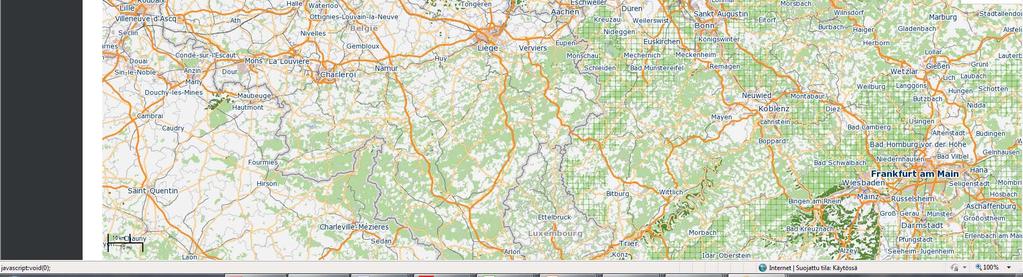
13 Demo running currently at oskariopenlayers/index.html

14 ELF Cloud (ArcGIS Online) Some of the ELF data available in the Cloud ArcGis Online Cloud implementation Web Maps for applications
15 ELF ELF Benefits and Challenges to INSPIRE and e government Added value by providing reference maps (Basemap Europe) Authorative data (data quality) Easy to get access to reference data and services Quality of Service Consistency Additional Content Management of licenses Governance of e government and INSPIRE Implementation based on INSPIRE national services > some of the features not required by the directive Data quality varies at countries Coverage Sustainability Different national data policies EULF 12 June, 2013


16 In short Showing that the NMCAs can contribute to or, make a real European SDI Showing how government, industry and academia can work together Thus, demonstrating what a region can achieve when co operating and interoperating Defining and promoting the role of EuroGeographics Pointing forward to a global geospatial information management

17 How can you benefit and contribute? Cross border project Regional bodies Become a part of the ELF community! Benefits Moving from Data to Services NSDIs Project results, esp. GeoTools are open and can be used for national tasks Contribution and impetus for the INSPIRE implementation Application developer Contribution Your experience with INSPIRE and in any cross border projects is important! Your data and services achieving a better European coverage


18 ONE SOURCE FOR REFERENCE GEO INFORMATION FOR coming
Sub-national dimensions of INSPIRE
 www.eurogeographics.org CONNECTING YOU TO THE Sub-national dimensions of INSPIRE SDIs in the evolving EU society Dave Lovell, Secretary General and Executive Director 24 June 2013 Copyright 2013 EuroGeographics
ELF- joining Europe together
 ELF- joining Europe together An open standard based multinational web mapping project, building on INSPIRE Presentation to: ISO/TC211 Standards in Action Workshop By: Date: Jari Reini 10 th June 2015 19
European Location Framework (ELF) acting as a facilitator implementing INSPIRE
 acting as a facilitator implementing INSPIRE") www.eurogeographics.org European Location Framework (ELF) acting as a facilitator implementing INSPIRE Saulius Urbanas, Mick Cory (EuroGeographics) 29 October 2016 Copyright 2013 EuroGeographics EuroGeographics
www.eurogeographics.org European Location Framework (ELF) acting as a facilitator implementing INSPIRE Saulius Urbanas, Mick Cory (EuroGeographics) 29 October 2016 Copyright 2013 EuroGeographics EuroGeographics
ELFI: A European Location Framework
 1 ELFI: A European Location Framework 1. Our Ambition Project ELFI will foster the wider use of geo-information and enable the creation of innovative valueadded services. 2. Our Objectives We aim to create
How to Report on Data Quality in a Multinational Environment?
 How to Report on Data Quality in a Multinational Environment? Presentation to: By: Date: SDMQ2015 Anja Hopfstock, BKG 20.01.2015 Agenda ELF architecture Data Quality Management Data Quality Reporting Summary
ELF + INSPIRE = LOVE STORY! ELF + INSPIRE = LOVE STORY! ELF + INSPIRE = LOVE STORY!
 www.eurogeographics.org ELF + INSPIRE = LOVE STORY! ELF + INSPIRE = LOVE STORY! ELF + INSPIRE = LOVE STORY! Schema transformation: an history of trees and tables 16 June 2014 INSPIRE conference 29 September
From Geoportal to Spatial Data Service Platform. Jani Kylmäaho National Land Survey of Finland Development Centre
 From Geoportal to Spatial Data Service Platform Jani Kylmäaho National Land Survey of Finland Development Centre Introduction National Land Survey of Finland - 1900 employees Development Centre - 120 employees
ELF Data Specifications
 ELF Data Specifications Presentation to: Author: Date: INSPIRE conference Anja Hopfstock (WP2), Antti Jakobsson (ELF project director) 16 th June 2014 Why extending INSPIRE? INSPIRE too much too little
Testing - an essential aspect of establishing an SDI
 Testing - an essential aspect of establishing an SDI Clemens Portele, Anders Östman, Michael Koutroumpas, Xin He, Janne Kovanen, Markus Schneider, Andriani Skopeliti INSPIRE Conference 2011 30 June 2011
Validating services and data in an SDI
 Validating services and data in an SDI Presentation to: By: Date: INSPIRE Conference Clemens Portele, Jon Herrmann, Roy Mellum 30 September 2016 4 October, 2016 ELF is the response from the European Mapping
How to Create a European INSPIRE Compliant Data Specification. Anja Hopfstock, BKG (Germany) Morten Borrebæk, SK (Norway)
 Morten Borrebæk, SK (Norway)") How to Create a European INSPIRE Compliant Data Specification Anja Hopfstock, BKG (Germany) Morten Borrebæk, SK (Norway) ESDIN Key Goals Further the ambition of the European Commission to create a European
How to Create a European INSPIRE Compliant Data Specification Anja Hopfstock, BKG (Germany) Morten Borrebæk, SK (Norway) ESDIN Key Goals Further the ambition of the European Commission to create a European
SDI Workshop ESDIN Best Practices INSPIRE conference, Edinburgh. Arnulf Christl, Metaspatial
 SDI Workshop ESDIN Best Practices 2011-06-28 INSPIRE conference, Edinburgh Arnulf Christl, Metaspatial Download this slide set as ODP or PDF at http://arnulf.us/publications Arnulf Christl Geospatially
Nathalie Delattre, National Geographic Institute of Belgium
 THE EUROPEAN LOCATION FRAMEWORK (ELF), INTEROPERABILITY SOLUTIONS FOR EUROPEAN PUBLIC ADMINISTRATIONS AND THE INSPIRE DIRECTIVE. Major challenges and lessons learnt for delivering authoritative, interoperable,
INSPIRE: ready for landing?
 INSPIRE: ready for landing? Prof. Bernardo De Bernardinis President ISPRA Italian National Institute for Environmental Protection and Research INSPIRE 2013 Conference Opening Plenary, 25 th June 2013 Network
Introduction to INSPIRE. Network Services
 Introduction to INSPIRE. Network Services European Commission Joint Research Centre Institute for Environment and Sustainability Digital Earth and Reference Data Unit www.jrc.ec.europa.eu Serving society
INSPIRE & Environment Data in the EU
 INSPIRE & Environment Data in the EU Andrea Perego Research Data infrastructures for Environmental related Societal Challenges Workshop @ pre-rda P6 Workshops, Paris 22 September 2015 INSPIRE in a nutshell
Sharing Environmental Information In Action. Chris Steenmans European Environment Agency
 Sharing Environmental Information In Action Chris Steenmans INSPIRE Conference 2012, Istanbul 26.06.2012 Sharing environmental information in action Outline What is SEIS? Implementation Content Cooperation
ELF extensions. Presentation to: INSPIRE MIG-T. Author: Anja Hopfstock (ELF WP2 Data Specifications) Date: 25 th February 2016.
 Date: 25 th February 2016.") ELF extensions Presentation to: Author: Date: INSPIRE MIG-T Anja Hopfstock (ELF WP2 Data Specifications) 25 th February 2016 What is ELF in connection to INSPIRE? Arrangements within NMCAs in Europe to
ELF extensions Presentation to: Author: Date: INSPIRE MIG-T Anja Hopfstock (ELF WP2 Data Specifications) 25 th February 2016 What is ELF in connection to INSPIRE? Arrangements within NMCAs in Europe to
INSPIRE trenutni status i buduće aktivnosti
 INSPIRE trenutni status i buduće aktivnosti Vlado Cetl Dani IPP 2017, Zagreb, Hrvatska Joint Research Centre The European Commission s science and knowledge service What is INSPIRE? 7.500 data providers
INSPIRE relevant policy developments in the EU's digital economy initiatives
 INSPIRE relevant policy developments in the EU's digital economy initiatives Interoperability Solutions and common Frameworks for European public Administrations, businesses and citizens as a means of
Augmenting Thematic Maps with Data Driven Graphics by Integrating Open APIs and Mapping Platforms. Umit Dost
 Augmenting Thematic Maps with Data Driven Graphics by Integrating Open APIs and Mapping Platforms Umit Dost Agenda Background Research question Case study- PxWEB and data visualizations on Oskari Visualization
Using Esri's Address Data Management Tools to Prepare for Next Generation 911
 Using Esri's Address Data Management Tools to Prepare for Next Generation 911 Chad Brothers, Client Services Manager State of Tennessee TeleCommunication Systems, Inc. James Wood, Public Safety Industry
SDI and the Key Elements
 SDI and the Key Elements Roger Longhorn Information Policy Advisor, The Coastal & Marine Union (EUCC) Senior Information Policy Analyst & Principal SDI Expert, Compass Informatics Ltd (Ireland) (www.compass.ie)
ELF download services
 ELF download services Presentation to: Author: Date: ELF workshop in Moldova Marcin Grudzień 8 h September2015 14 September, 2015 Plan Introduction Specification documents The envisaged production process
CREATING SMART TRANSPORT SERVICES BY FACILITATING THE RE-USE OF OPEN GIS DATA
 OPEN TRANSPORT NET TOMAS MILDORF 16 JUNE 2014 INSPIRE CONFERENCE 2014, AALBORG, DENMARK CREATING SMART TRANSPORT SERVICES BY FACILITATING THE RE-USE OF OPEN GIS DATA 2 1 OTN AT A GLANCE Full title OpenTransportNet
Report from UN-GGIM: Europe A year in review
 Report from UN-GGIM: Europe A year in review Carol Agius UN-GGIM: Europe Joint UN-GGIM: Europe ESS meeting on the Integration of Statistical and Geospatial Information March 2017 The aim of UN-GGIM: Europe
United Nations Spatial Data Infrastructure (UNSDI)
") United Nations Spatial Data Infrastructure (UNSDI) & UN Geographic Information Working Group (UNGIWG) T. Suha ÜLGEN Senior Advisor on Spatial Data Infrastructure Office of the Assistant Secretary-General
United Nations Spatial Data Infrastructure (UNSDI) & UN Geographic Information Working Group (UNGIWG) T. Suha ÜLGEN Senior Advisor on Spatial Data Infrastructure Office of the Assistant Secretary-General
Initial Operating Capability & The INSPIRE Community Geoportal
 INSPIRE Conference, Rotterdam, 15 19 June 2009 1 Infrastructure for Spatial Information in the European Community Initial Operating Capability & The INSPIRE Community Geoportal EC INSPIRE GEOPORTAL TEAM
INSPIRE in a nutshell, and overview of the European Union Location Framework
 INSPIRE in a nutshell, and overview of the European Union Location Framework Francesco Pignatelli European Commission, DG JRC 10 th European Congress and Exhibition on Intelligent Transport Systems and
Implementing Quality in SDIs Introducing Building Blocks of Quality Web Services
 Implementing Quality in SDIs Introducing Building Blocks of Quality Web Services Antti Jakobsson J. Mäkelä, R. Henriksson,J. Marttinen,L. Tsoulos, I.Kavadas, E. Onstein, M. Beare,F. Williams, J. Walsh,
Validation experience
 Validation experience Paloma Abad Head of SDI Department SDI Workshop 26-06-2018 INSPIRE KEN INSPIRE KEN, june 2018 1 Points 1. Introduction 2. Interoperability 3. Geoportal Thematic Viewer 4. Conclusions
INSPIRE overview and possible applications for IED and E-PRTR e- Reporting Alexander Kotsev
 INSPIRE overview and possible applications for IED and E-PRTR e- Reporting Alexander Kotsev www.jrc.ec.europa.eu Serving society Stimulating innovation Supporting legislation The European data puzzle 24
/// INTEROPERABILITY BETWEEN METADATA STANDARDS: A REFERENCE IMPLEMENTATION FOR METADATA CATALOGUES
 /// Position Paper /// INTEROPERABILITY BETWEEN METADATA STANDARDS: A REFERENCE IMPLEMENTATION FOR METADATA CATALOGUES /// Keywords: Public administration, Metadata, Geographical Information, Geospatial
SAFER the GIGAS Effect
 SAFER the GIGAS Effect How INSPIRE, GMES and GEOSS are influencing EC projects Arnaud Cauchy 23/06/2010 Agenda GIGAS Project Summary SAFER Project Summary SAFER Original Approach GIGAS Influences SAFER
INSPIRE: The ESRI Vision. Tina Hahn, GIS Consultant, ESRI(UK) Miguel Paredes, GIS Consultant, ESRI(UK)
 Miguel Paredes, GIS Consultant, ESRI(UK)") INSPIRE: The ESRI Vision Tina Hahn, GIS Consultant, ESRI(UK) Miguel Paredes, GIS Consultant, ESRI(UK) Overview Who are we? Introduction to ESRI Inc. and ESRI(UK) Presenters ArcGIS The ESRI Solution to
INSPIRE: The ESRI Vision Tina Hahn, GIS Consultant, ESRI(UK) Miguel Paredes, GIS Consultant, ESRI(UK) Overview Who are we? Introduction to ESRI Inc. and ESRI(UK) Presenters ArcGIS The ESRI Solution to
Semantic Interoperability of Basic Data in the Italian Public Sector Giorgia Lodi
 Semantic Interoperability of Basic Data in the Italian Public Sector Giorgia Lodi SEMIC conference 2013 21 June 2013 Dublin (AgID) Created last year, AgID is a public body that merged three different existing
ArcGIS Solutions for Community Resilience. Matthew S Deal
 ArcGIS Solutions for Community Resilience Matthew S Deal Solutions Overview Leverage hundreds of ready-to-use maps, apps, and platform configurations to meet your needs, delivering innovation and best
Managing Imagery and Raster Data using Mosaic Datasets
 Esri European User Conference October 15-17, 2012 Oslo, Norway Hosted by Esri Official Distributor Managing Imagery and Raster Data using Mosaic Datasets Peter Becker ArcGIS is a Comprehensive Imagery
GEOPORTAL SOLUTIONS BASED ON ESRI GIS PLATFORM IN SOUTHEAST EUROPE. Dejan KRSTEVSKI 1
 GEOPORTAL SOLUTIONS BASED ON ESRI GIS PLATFORM IN SOUTHEAST EUROPE Dejan KRSTEVSKI 1 ABSTRAKT The concept of spatial data infrastructure (SDI) has emerged and continues to advance as a framework for organizing
SII Law Organization Coordination activities Examples of good practices Education Technical matters Success stories Challenges
 SII Law Organization Coordination activities Examples of good practices Education Technical matters Success stories Challenges INSPIRE transposed by the legal act on Spatial Information Infrastructure
Transboundary data interoperability for Maritime Spatial Planning. Yuji KATO
 Transboundary data interoperability for Maritime Spatial Planning Yuji KATO CONTEXT THE MARITIME SPATIAL PLANNING DIRECTIVE DIRECTIVE 2014/89/EU establishing a framework for Maritime Spatial Planning (MSP)
Esri Maps for SharePoint
 Esri International User Conference San Diego, California Technical Workshops July, 2012 Esri Maps for SharePoint Art Haddad Nathan Bennett Agenda Location Analytics - Esri Maps for SharePoint - Overview
Web GIS: Principles and Applications. Pinde Fu, Ph.D. Project Lead / Senior Developer Professional Services Division
 Web GIS: Principles and Applications Pinde Fu, Ph.D. pfu@esri.com Project Lead / Senior Developer Professional Services Division 2 Web GIS: Principles and Applications Pinde Fu & Jiulin Sun Web GIS course
INSPIRE and Open Data Recent Developments and Best Practices
 INSPIRE and Open Data Recent Developments and Best Practices These documents are only complete, when used in connection with the verbal paper; any isolated use may lead to misunderstandings. Michael Müller
The cadastral data and standards based on XML in Poland
 The cadastral data and standards based on XML in Poland Jarosław Bydłosz, Piotr Parzych AGH University of Science and Technology Cracow, Poland 1 XML XML Extensible Markup Language Extensible Markup Language
Shared Challenges in ehealth Development at the Regional and Global Levels
 Shared Challenges in ehealth Development at the Regional and Global Levels Diana Zandi ehealth Unit World Health Organization Workshop on ehealth, European Parliament Brussels, 24 September 2013 ehealth
Evolution of INSPIRE interoperability solutions for e-government
 Evolution of INSPIRE interoperability solutions for e-government INSPIRE Implementation State-of-Play 26/05/2015 Robin S. Smith www.jrc.ec.europa.eu Serving society Stimulating innovation Supporting legislation
Compass INSPIRE Services. Compass INSPIRE Services. White Paper Compass Informatics Limited Block 8, Blackrock Business
 Compass INSPIRE Services White Paper 2010 Compass INSPIRE Services Compass Informatics Limited Block 8, Blackrock Business Park, Carysfort Avenue, Blackrock, County Dublin, Ireland Contact Us: +353 1 2104580
WP7: GEO-SERVICES FOR INFORMATION MANAGEMENT:
 WP7: GEO-SERVICES FOR INFORMATION MANAGEMENT: INTEGRATION AND COMMUNICATION Speaker: Sven Casteleyn Carlos Granell Task 7.1 Leader: Carlos Granell (UJI) Task 7.2 Leader: Carlos Granell (UJI) Task 7.3 Leader:
Achieving Interoperability Using Open Standards
 FedGIS Conference February 24 25, 2016 Washington, DC Achieving Interoperability Using Open Standards Satish Sankaran Marten Hogeweg Agenda Understanding Interoperability What, Why and How? ArcGIS Platform
GATE: Big Data for Smart Society Dessislava Petrova-Antonova Sofia University St. Kliment Ohridski Faculty of Mathematics and Informatics
 GATE: Big Data for Smart Society Dessislava Petrova-Antonova Sofia University St. Kliment Ohridski Faculty of Mathematics and Informatics Johann Wolfgang von Goethe Big Data provides the pipes, and AI
Exploitation towards Thematic Communities, Training Framework and stakeholders involvement
 Exploitation towards Thematic Communities, Training Framework and stakeholders involvement Giorgio Saio GISIG eenvplus Workshop INSPIRE Conference, Florence (IT), 24 June 2013 Exploitation prospects eenvplus
Esri and MarkLogic: Location Analytics, Multi-Model Data
 Esri and MarkLogic: Location Analytics, Multi-Model Data Ben Conklin, Industry Manager, Defense, Intel and National Security, Esri Anthony Roach, Product Manager, MarkLogic James Kerr, Technical Director,
Workshop 4.4: Lessons Learned and Best Practices from GI-SDI Projects II
 Workshop 4.4: Lessons Learned and Best Practices from GI-SDI Projects II María Cabello EURADIN technical coordinator On behalf of the consortium mcabello@tracasa.es euradin@navarra.es Scope E-Content Plus
Description of the European Big Data Hackathon 2019
 EUROPEAN COMMISSION EUROSTAT Ref. Ares(2018)6073319-27/11/2018 Deputy Director-General Task Force Big Data Description of the European Big Data Hackathon 2019 Description of the European Big Data Hackathon
The enabling role of geospatial information in the European energy policies
 The European Commission s science and knowledge service Joint Research Centre The enabling role of geospatial information in the European energy policies Francesco Pignatelli Kehl (DE), 5 September 2017
Workshop on Addressing the Barriers to IPv6 Deployment Spanish use case
 Workshop on Addressing the Barriers to IPv6 Deployment Spanish use case Cristina Ramos cristinapilar.ramos@correo.gob.es Agenda Agenda IPv6 addressing plan Barriers Conclusions 1 Background Digital Agenda
The PICTURE project, ICT R&I priorities in EaP, areas of cooperation
 The PICTURE project, ICT R&I priorities in EaP, areas of cooperation With the EU PICTURE project participants Yerevan, September 26,2013 THEME 1 : PICTURE PROJECT Svetlana Klessova, project coordinator
Understanding ArcGIS Online - why organizations should embrace the cloud now
 Understanding ArcGIS Online - why organizations should embrace the cloud now Presented to: GeoAlberta - workshop Presented by: David Parry September 25, 2013 Today s Agenda Introduction - Why the Cloud?
ICT Policy Perspective for APEC. Ministry of Internal Affairs and Communications March 2015
 ICT Policy Perspective for APEC Ministry of Internal Affairs and Communications March 2015 Current Status in APEC Region 1 GDP Growth Rate Twice the global average Share of Global Communications Service
SHARING GEOGRAPHIC INFORMATION ON THE INTERNET ICIMOD S METADATA/DATA SERVER SYSTEM USING ARCIMS
 SHARING GEOGRAPHIC INFORMATION ON THE INTERNET ICIMOD S METADATA/DATA SERVER SYSTEM USING ARCIMS Sushil Pandey* Birendra Bajracharya** *International Centre for Integrated Mountain Development (ICIMOD)
HUMBOLDT Application Scenario: Protected Areas
 CC by Erlend Schei Copyright by Kecko Copyright by Michael Bezzina CC by Gunnar Ries Copyright by Michael Bezzina Copyright by Michael Bezzina Copyright by Michael Bezzina CC by fs999 CC by Jordan Nielsen
Earth Observation Imperative
 Gregory W. Withee United States Geological Survey (USGS) United States Group on Earth Observation (USGEO) update NRC Board on Research Data and Information January 29, 2009 1 Earth Observation Imperative
Introduction to ArcGIS Online and Story Maps
 Introduction to ArcGIS Online and Story Maps Presented by the University of Connecticut s Center for Land Use Education and Research (CLEAR) CLEAR 1 Welcome! Instructor Introductions Course logistics Student
A Case Study about IFEZ(Song-do) Smart-City. Ryan LEE
 Smart-City. Ryan LEE") A Case Study about IFEZ(Song-do) Smart-City Ryan LEE Career History Incheon U-City Corporation Incheon, Korea - Director, IFEZ Smart-City Integrated Operation Center * Managing IFEZ Smart City Integrated
A Case Study about IFEZ(Song-do) Smart-City Ryan LEE Career History Incheon U-City Corporation Incheon, Korea - Director, IFEZ Smart-City Integrated Operation Center * Managing IFEZ Smart City Integrated
Report of Work Group B Data Integration. Joint UN-GGIM: Europe ESS Meeting
 Report of Work Group B Data Integration Joint UN-GGIM: Europe ESS Meeting 11.03.2016 Copyright 2013 EuroGeographics Tasks for Work Group B: Data Integration Supply three deliverables: 1. Definition of
D Public Final Project Report
 ECP-2007-GEO-317008 ESDIN Underpinning the European Spatial Data Infrastructure with a Best Practice Network D 1.10.3 Public Final Project Report Deliverable number Dissemination level D-1.10.3 Public
Experiences with. data for use in apps
 Experiences with publishing INSPIRE data for use in apps Presentation to: Author: Date: INSPIRE Conference 2014 Clemens Portele 2014 06 18 From INSPIRE Conference 2013: "How to use INSPIRE data?" INSPIRE
Toward Horizon 2020: INSPIRE, PSI and other EU policies on data sharing and standardization
 Toward Horizon 2020: INSPIRE, PSI and other EU policies on data sharing and standardization www.jrc.ec.europa.eu Serving society Stimulating innovation Supporting legislation The Mission of the Joint Research
Does Your Data Have Harmony. Dan Stone
 Does Your Data Have Harmony Dan Stone Agenda Introduction Configuration Patterns Implementation Approaches Your Feedback ArcGIS for Local Government Esri solutions for local government customers Series
Implementing GeoDRM support in an OpenLayers based viewer Access to the French geoportal WMS-C services from the Spanish SDI
 INSPIRE Conference 2011 Implementing GeoDRM support in an OpenLayers based viewer Access to the French geoportal WMS-C services from the Spanish SDI R. Béjar, M. Á. Latre, J. Valiño, F. Javier Zarazaga-Soria,
Enterprise Geographic Information Servers. Dr David Maguire Director of Products Kevin Daugherty ESRI
 Enterprise Geographic Information Servers Dr David Maguire Director of Products Kevin Daugherty ESRI Outline Introduction Enterprise GIS vs. Spatially-enabled IS Architectures for building Enterprise GIS
IMAGERY FOR ARCGIS. Manage and Understand Your Imagery. Credit: Image courtesy of DigitalGlobe
 IMAGERY FOR ARCGIS Manage and Understand Your Imagery Credit: Image courtesy of DigitalGlobe 2 ARCGIS IS AN IMAGERY PLATFORM Empowering you to make informed decisions from imagery and remotely sensed data
Directive on security of network and information systems (NIS): State of Play
: State of Play") Directive on security of network and information systems (NIS): State of Play Svetlana Schuster Unit H1 Cybersecurity and Digital Privacy DG Communications Networks, Content and Technology, European Commission
Directive on security of network and information systems (NIS): State of Play Svetlana Schuster Unit H1 Cybersecurity and Digital Privacy DG Communications Networks, Content and Technology, European Commission
Earth observation in implementing Sendai Framework for Disaster Risk Reduction: UN-SPIDER Efforts
 UN-SPIDER Conference, Beijing, 14-16 September 2015 Earth observation in implementing Sendai Framework for Disaster Risk Reduction: 2015-2030 UN-SPIDER Efforts Shirish Ravan Head, UN-SPIDER Beijing Office
International Journal of Spatial Data Infrastructures Research, 2015, Vol.10,
 Assessing existing in-situ capacities in EU Member States: an analysis of the Copernicus regulation approach for Hydrography and Transport Network datasets Massimiliano Rossi 1, Gunter Zeug 2, Tony Blagoev
Navigator for ArcGIS Presented by
 Navigator for ArcGIS Presented by Navigator for ArcGIS Get your field workforce where it needs to be Custom data (search, route, display) Fully integrated with other apps Advanced vehicle travel modes
Third public workshop of the Amsterdam Group and CODECS European Framework for C-ITS Deployment
 Third public workshop of the Amsterdam Group and CODECS European Framework for C-ITS Deployment 14 February 2017 Amsterdam Gerhard Menzel European Commission - DG MOVE EU Policy Tools Large-scale deployment
3D Data Modelling at Esri. Paul Hardy Business Development Consultant Esri Europe
 3D Data Modelling at Esri Paul Hardy phardy@esri.com Business Development Consultant Esri Europe Users of 3D GIS Local government Facilities management Civil engineering 3D GIS Defense / Public Safety
The age of location enlightenment
 The age of location enlightenment GIS in Public Safety. More than a map Chris McIntosh cmcintosh@esri.com Presentation Topics Patterns in Successful Deployments Requirements How GIS is Changing Examples
Leveraging metadata standards in ArcGIS to support Interoperability. Aleta Vienneau and Marten Hogeweg
 Leveraging metadata standards in ArcGIS to support Interoperability Aleta Vienneau and Marten Hogeweg Leveraging metadata standards in ArcGIS to support Interoperability Overview of metadata standards
MASAS. Overview & Backgrounder Document. Consultation Package. CanOps
 CanOps Overview & Backgrounder Document Consultation Package Defining CanOpS Multi-Agency Situational Awareness System () is a national information aggregation system that facilitates sharing situational
BUILD AND MAINTAIN SAFE COMMUNITIES WITH ARCGIS ONE PLATFORM, MANY MISSIONS
 BUILD AND MAINTAIN SAFE COMMUNITIES WITH ARCGIS ONE PLATFORM, MANY MISSIONS SAFETY AND SECURITY IN THE 21ST CENTURY National security, defence, and public safety agencies face challenges and threats that
ERCI cybersecurity seminar Guildford ERCI cybersecurity seminar Guildford
 Cybersecurity is a EU strategic priority DG CONNECT* > The Digital Single Market strategy aims to open up digital opportunities for people and business and enhance Europe's position as a world leader in
Open Data in Switzerland Impact on Society, Economy, Science and Culture
 Open Data in Switzerland Impact on Society, Economy, Science and Culture André Golliez President Opendata.ch, Swiss Chapter Open Knowledge Taiwan Summer School 2016 University of Konstanz 24th August 2016
Making Open Data work for Europe
 Making Open Data work for Europe Daniele Rizzi European Commission DG Communications Networks, Content and Technology daniele.rizzi@ec.europa.eu Nikolaos Loutas PwC EU Services nikolaos.loutas@be.pwc.com
Network and Information Security Directive
 Network and Information Security Directive Provisions + ENISA s activities Dr Evangelos Ouzounis Head of Secure Infrastructure and Services Unit, ENISA European Union Agency for Network and Information
DATA SHARING AND DISCOVERY WITH ARCGIS SERVER GEOPORTAL EXTENSION. Clive Reece, Ph.D. ESRI Geoportal/SDI Solutions Team
 DATA SHARING AND DISCOVERY WITH ARCGIS SERVER GEOPORTAL EXTENSION Clive Reece, Ph.D. ESRI Geoportal/SDI Solutions Team Geoportal Extension for ArcGIS Server Context within an Enterprise Spatial Data Infrastructure
Berlin 3 December Aarhus Convention: Key trends in the implementation of information pillar
 Berlin 3 December 2018 Aarhus Convention: Key trends in the implementation of information pillar Is this moorland in good enough condition to effectively capture rain and prevent flooding? What would the
GENeric European Sustainable Information Space for Environment.
 GENeric European Sustainable Information Space for Environment http://www.genesis-fp7.eu/ Outline Introduction The GENESIS FP7 project The GENESIS solution s architecture GENESIS experience with INSPIRE
Marine and Coastal Data Services in the Cloud. Richard Rombouts - Snowflake Software Ltd. & Keiran Millard SeaZone Solutions Ltd.
 Marine and Coastal Data Services in the Cloud Richard Rombouts - Snowflake Software Ltd. & Keiran Millard SeaZone Solutions Ltd. Marine Geospatial Data Inspired Marine Data? SeaZone HydroSpatial Global
Natalia Manola University of Athens ATHENA Research and Innovation Center. OpenAIRE. An Open Knowledge & Research Information Infrastructure
 Natalia Manola University of Athens ATHENA Research and Innovation Center OpenAIRE An Open Knowledge & Research Information Infrastructure ERALEARN 2020 September 29, 2015 OpenAIRE IN A NUTSHELL A coordination
SDI SOLUTIONS FOR INSPIRE: TECHNOLOGIES SUPPORTING A FRAMEWORK OF COOPERATION
 SDI SOLUTIONS FOR INSPIRE: TECHNOLOGIES SUPPORTING A FRAMEWORK OF COOPERATION Roberto Lucchi 1, Marten Hogeweg 1, Guenther Pichler 2 1 Esri, Redlands, CA, USA 2 Esri Kranzberg, Germany 1 Vision INSPIRE
INSPIRE and Service Level Management Why it matters and how to implement it
 Service Level Agreements for D-Grid INSPIRE and Service Level Management Why it matters and how to implement it Bastian Baranski con terra GmbH Münster, Germany http://www.sla4d-grid.de Motivation Evolution
CONCLUSIONS OF THE WESTERN BALKANS DIGITAL SUMMIT APRIL, SKOPJE
 CONCLUSIONS OF THE WESTERN BALKANS DIGITAL SUMMIT 2018 18-19 APRIL, SKOPJE CONCLUSIONS OF THE WESTERN BALKANS DIGITAL SUMMIT 2018 At the Trieste Western Balkans Summit, we stressed the importance of the
AHA CENTRE. ASEAN Coordinating Centre for Humanitarian Assistance on Disaster Management
 Geo-referenced Information and Application @ Presented at : Regional Workshop on Geo-referenced Disaster Risk Management Information System for South-East and East Asia, and the Pacific Bangkok 20-22 February
INSPIRE status report
 INSPIRE Team INSPIRE Status report 29/10/2010 Page 1 of 7 INSPIRE status report Table of contents 1 INTRODUCTION... 1 2 INSPIRE STATUS... 2 2.1 BACKGROUND AND RATIONAL... 2 2.2 STAKEHOLDER PARTICIPATION...
Metadata Topic Harmonization and Semantic Search for Linked-Data-Driven Geoportals -- A Case Study Using ArcGIS Online
 Metadata Topic Harmonization and Semantic Search for Linked-Data-Driven Geoportals -- A Case Study Using ArcGIS Online Yingjie Hu 1, Krzysztof Janowicz 1, Sathya Prasad 2, and Song Gao 1 1 STKO Lab, Department
Cloud28+ Compliance in Cross Border Business
 Cloud28+ Compliance in Cross Border Business SPEAKER: Munir Ismet Head of Cloud, - EMEA, Public Sector, HP Cloud28+ Compliance in Cross Border Business A single European Catalogue of cloud services Munir
The Scottish Spatial Data Infrastructure (SSDI)
") The Scottish Spatial Data Infrastructure (SSDI) INSPIRE Conference Istanbul Monday 25 th June 2012 15:55 Geoportals and registries II Tim Duffy BGS Edinburgh (trd@bgs.ac.uk) Shona Nicol Alex Ramage NERC
The Scottish Spatial Data Infrastructure (SSDI) INSPIRE Conference Istanbul Monday 25 th June 2012 15:55 Geoportals and registries II Tim Duffy BGS Edinburgh (trd@bgs.ac.uk) Shona Nicol Alex Ramage NERC