ELF + INSPIRE = LOVE STORY! ELF + INSPIRE = LOVE STORY! ELF + INSPIRE = LOVE STORY!
|
|
|
- Frederick Park
- 5 years ago
- Views:
Transcription


1 ELF + INSPIRE = LOVE STORY! ELF + INSPIRE = LOVE STORY! ELF + INSPIRE = LOVE STORY! Schema transformation: an history of trees and tables 16 June 2014 INSPIRE conference 29 September Barcelona Copyright 2013 EuroGeographics
")
2 The workshop is proposed by: ELF project INSPIRE KEN (Knowledge Exchange Network)
3 What is ELF? ELF is a European project From March 2013 to October 2016 Around 40 partners NMCAs (National Mapping and Cadastral Agencies) and EuroGeographics Technology providers Universities Application developers Co-funded by European Commission and the consortium partners Main objective: single access point to harmonised data and services from NMCAs

4 What is INSPIRE KEN? A Knowledge Exchange Network A EuroGeographics group launched in 2011 Open to any NMCA staff having interest in INSPIRE Main objective: help one another by sharing experiences about implementation of INSPIRE Activities: Exchange on BaseCamp Webinars Workshops
5 Workshop purpose Many persons wonder about the links between the ELF project and the INSPIRE framework The workshop aims to explain how the ELF project articulates with INSPIRE, presenting these interrelations as a modern love story!
6 Workshop agenda 1 - Introduction to the story: INSPIRE living alone Presenter: Christina Wasström 5 minutes 2 - The first meeting: how ELF and INSPIRE started to be a couple Presenter: Antti Jakobsson 5 minutes
: 50 minutes Specifications Services User access point Tools ELF Business model Christina")
7 Workshop agenda 3. ELF and INSPIRE living as an open couple (modern family): 50 minutes Specifications Services User access point Tools ELF Business model Christina Wasström/ Dominique Laurent Christina Wasström/Saulius Urbanas Christina Wasström/Antti Jakobsson Christina Wasström/Dorus Kruse Laila Aslesen
8 Workshop agenda 4. Planning the future: Commitment and family expansion? Presenter: Antti Jakobsson 10 minutes 5. Questions and discussions
9 Introduction to the story: INSPIRE living alone
10 INSPIRE alone Coming from the EU family, INSPIRE was a handsome and clever guy; though young, he already performed significant achievements by setting up the legal framework for the European Spatial Data Infrastructure. However, he felt alone and needed some help to develop the infrastructure to be more customized.

11 The EU family SDIC MS EFTA LMO C EEA JRC DG ENV


12 Why INSPIRE Data were hard to find It was hard to access data It was difficult to combine data


13 From a frame directive to practice
14 But.. Few data sets are yet harmonised It s still a bit tricky to access data, specially cross border... looking for a partner to fill some of the gaps
15 The first meeting: how ELF and INSPIRE started to be a couple antti.jakobsson@maanmittauslaitos.fi
16 First meeting Coming from the EuroGeographics family, the ELF initiative was also young but with similar ambitions as INSPIRE and with some practical achievements coming from a previous project (ESDIN). Of course, this common viewpoint brought them closer and they fell in love very quickly!
17 The EuroGeographics family partners members RISE Euro Roads EGN ESDIN ELF

 European Location")
18 Bringing INSPIRE to practice Key users needs Technical platform Business platform Geographic scope: whole Europe Thematic scope: focus on georeference data (NMCA themes) European Location Framework

19 The EuroGeographics family ELF is here!
 New Basemap service for Europe based Support of European languages Geo Locator service based on geographical names, addresses, administrative units Geo-tools for making national data")
20 This is ELF from data to service Combine national reference geoinformation offering through the ELF platform Support Several ELF affliated platforms (in the beginning ESRI ArcGISOnline, Open Source Oskari Platform) New Basemap service for Europe based Support of European languages Geo Locator service based on geographical names, addresses, administrative units Geo-tools for making national data interoperable Finding and accessing reference data at source (Geo Product Finder) Linkage with other content (national or thematic) Easy Web Maps for Applications through Open & ArcGisOnline platforms Language support Authorative Data Providers Easy to use Many visualizations Cost Effective Flexible Architecture
21 ELF and INSPIRE living as an open couple

22 Open couple In a classical tale, it would be the end of the love story but in a modern tale, the two lovers have to decide about how to manage their respective assets and how to raise their children all topics that may be cause of fruitful cooperation but also of dispute!
23 Data specifications Christina
24 Data specifications Do the ELF drawings bring any improvement to the (already) beautiful INSPIRE house?

25 INSPIRE Data specifications Objective: interoperable data Data easy to be combined between themes => common modelling patterns, syntaxes interoperability INSPIRE theme data models Generic Conceptual Model ISO standards Data easy to be combined between countries=> common data model, semantic interoperability

26 INSPIRE Data specifications A good start, but it have its limitations A general model that would benefit to have an extension to support specific use cases, e.g. Quality requirements Defined level of detail (multi-scale models)
27 ELF data specifications ELF data specifications are INSPIRE based What is the added value of ELF specification compared to INSPIRE ones? Extensions Keep the (few) additional features and attributes of EG products (ERM, EBM, EGM) Add some attributes required by the ELF products (mainly on theme GN) Clarification about levels of detail Levels of harmonisation
28 ELF extensions How to extend the INSPIRE data models? Respecting the rules given by the Generic Conceptual Model Inheritance of the INSPIRE models Additional attributes or constraints =>data conform to ELF data models are conform to INSPIRE Status of ELF data extensions Use of ELF data models is not mandatory Data conform to (pure) INSPIRE data models is accepted on the ELF platform Extensions mainly used for European products
29 ELF levels of detail INSPIRE Directive: The implementing rules shall be designed to ensure consistency between items of information which refer to the same object represented at different scales Data model is the same for all levels of details Information about LoD is given by metadata element: MD_Resolution 2K 5K 100K 250K 50K 10K 5K 1M 10K 20K 1 K 200 K 25K 2K 2,5 K Not easy for users to identify which data sets may be combined together
30 ELF levels of detail ELF approach: 5 levels of detail 1 K 2K 20K 2,5K 10K 5K 50K 250K 25K 1M Master level 0 To 5K Master level 1 5K 25K Master level 2 25K- 100K Regional level 100 k -500K Global level 500K- 1M
31 ELF levels of detail Some themes are relevant only for some levels of detail Theme MASTER LoD0 Master LoD1/2 REGIONAL GLOBAL Cadastral Parcels (CP) x Addresses (AD) x Buildings (BU) x x x Administrative Units (AU) x x x Geographical Names (GN) x x x Transport Networks (TN) x x x Hydrography (HY) x x x Land Cover (LC) x x x Elevation (EL) x x x NOTE: buildings are included in Regional level as POI (Point of Interest)
32 ELF levels of detail Objective Get whole coverage on Europe e.g. detailed DTM (LoD0) not considered Sources Global Regional Master LoD2 Master LoD1 Master LoD0 From European products: EGM, ERM, EBM => relatively homogeneous data, already available Second priority => poorly available in ELF Might come from transforming national LOD 2 data or from generalisation of ELF LOD 1 First priority From national (relatively heterogeneous) data

33 ELF harmonisation degrees ELF has defined various degrees of harmonisation That have been converted into conformance classes or stars
34 ELF harmonisation degrees Homogeneous level of detail To accepted on the ELF platform, data shall be at least (conform to INSPIRE) Core content Conformity to INSPIRE Common data model, Common CRS
35 ELF harmonisation degrees ELF is more demanding for Global and Regional levels Real core content (user requirements) Data capture rules the result is already (globally) achieved Data will be ELF is less demanding for master levels Limited core content (ELF products) No or few data capture rules Result not yet fully achieved Data at various conformity levels


36 Data specifications The one-floor INSPIRE house provides first step to interoperability Couple will live in the INSPIRE house that has been improved by ELF to ensure better interoperability
37 Services
38 Services Our young couple is quite willing to fund a family and to have children. To know more about how many children and how they look like, to get news about birth,


39 INSPIRE spatial data services I, II, III


40 INSPIRE network services Discover View Download System A Internt format Transform System B Internt format Schema omvandling


41 ELF services Discover ELF GeoProduct Finder Metadata GeoLocator Geographical Name View ELF BaseMap ELF Cadastral Index Map Download 12 themes
42 Simplified ELF flow diagram DP DP DP DP Q u a l i t y Geotools ELF schema, specs Geo Locator Geo Product Finder Security Manager licenses Access ELF showcase app, OSKARI Arc GIS Online Other platforms DP DP
43 Level of Details LoD Source data Responsible to transform data and set up download service ELF Global: 1: and smaller ELF Regional: 1: >1: ELF Master Level 2 (LoD2): 1: >1: ELF Master Level 1 (LoD1): 1: > 1: ELF Master Level 0 (LoD0): 1:5 000 and larger European product (EGM) European products (ERM -EBM) National data Done centrally Done centrally Data providers (NMCAand third parties)
 5.")
 8. Cadastral parcels 9. Land Cover, 10.")
 Cascading WFS Query distribution Content")
44 Download services: WFS 1. Administrative Units 2. Addresses 3. Geographical Names, 4. Hydrography (Physical waters, Network) 5. Transport Networks (Air, Roads, Rail, Cable, Water) 6. Elevation 7. Buildings (2D, 2D Extended) 8. Cadastral parcels 9. Land Cover, 10. Protected Sites 11. Sea Regions 12. Geology (HydroGeology) Cascading WFS Query distribution Content aggregation WFS NATIONAL DATA WFS WFS NATIONAL DATA NATIONAL DATA
 Pre-styled")


45 ELF view services ELF Topographic Base Map Pan-European Web Map Tile Service (WMTS) Pre-styled contextual data, suitable as reference data for a wide range of applications Data from Existing EG Products (small scale) and NMCA National Services (large scale) ELF Cadastral Index Map Pan-European Web Map Service (WMS) Pre-styled Administrative Boundaries, Cadastral Parcels, Buildings, Addresses An index for land & property information


46 GeoLocator GN, AU, AD Multilingual Exonyms and variant names Geocoding and reverse coding
47 INSPIRE/ELF services ServiceType ELF service Conform to INSPIRE ELF added value Search GeoLocator ELF specific service But utilises INSPIRE services Exonyms, variant names Download WFS Cross-country (cascading services) Base Map ELF specific service View Cadastral Index Map INSPIRE portrayal improved GetInfoFeature operation Cross-country (cascading services)
, more children to be born in")
48 Services ELF operational services are the very expected children of the couple (even if birth might have been long and difficult), more children to be born in future
49 Tools
50 Tools The young couple s service babies are growing. To become nice children, they require education. How will the INSPIRE father and the ELF mother organise their children training?


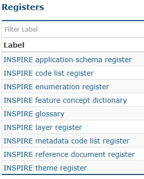
51 INSPIRE tools Find your scope and read specifications Platform for sharing theme specific experiences Metadata editor A central access point to a number of centrally managed INSPIRE registers Inspire Dashboard Metadata Validator
52 ELF GEO tools Tool Description Source Scalemaster Designing content of tiling schemas levels Open source standard / process ETF Compliance testing of INSPIRE networkservices Open Source (co-developed by ELF) OSKARI Platform of browser-based tools to serve, access and re-use geoinformation from different sources Open Source (co-developed by ELF) GoPublisher Transformation solution to harmoniseand serve INSPIRE data Closed Source (configured for ELF) HALE Open Source Transformation Tool Open Source (co-developed by ELF) 1Validate Tool to report on quality of data based on different quality parameters Closed Source (configured for ELF) ArcGIS Data Reviewer Tool to report on quality of data based on different quality parameters Closed Source (configured for ELF) PP Repair Check, find errors and automatically repair data Open Source (co-developed by ELF) IGN France Change Detection Tool detection of differences between 2 releases of the same vector database Open Source (co-developed by ELF) Geo Product Finder interface to find, view, compare and access the geo-information Open Source (co-developed by ELF) 1Integrate Edge matching tool of 1Spatial Closed Source (configured for ELF)
53 ELF GEO tools Tool Description Source ArcGIS Edge Match tool Edge matching tool of Esri Closed Source (configured for ELF) SLD Editor Tool to define symbologyfor geo-objects Open Source (co-developed by ELF) IGN France Generalisation tool Generalize ELF Regional data (medium scale) in order to produce ELF Global data (small scale). All themes and feature classes of the ELF Global level should be processed with this tool. Open Source (co-developed by ELF) 1Generalise Generalisationtool of 1Spatial Closed Source (configured for ELF) Gen.tool KADNL & Esri Tool and Procedure for generalisationfrom Master 1 to 2 based on ArcGIS Modelbuilder from Esri Partly Open Source and partly Closed Source (co-developed by ELF) ArcGIS Online Cloud-based platform to serve, find and access geo-data Closed Source (configured for ELF) Table Join Service Linking administrative / statistical data to location based data Open Source (co-developed by ELF) GeoLocator Tool for cascading WFS Open Source (co-developed by ELF) Spatineo Monitoring tool Closed Source (configured for ELF) Number of Geo tools on national level for implementing services Open Source and Closed Source
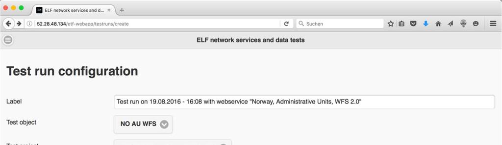
54 ETF A test framework for testing SDI services, datasets and metadata Builds on existing, widely used open source tools Extends these tools with additional capabilities Can be used in multiple ways Tests can be executed using the ETF Web Application or directly in SoapUI or BaseX ELF uses a centrally deployed ETF instance, but local deployments by a service provider are supported, too ETF is the basis of the INSPIRE validator currently under development for JRC as part of the ARE3NA project to support INSPIRE implementation in the Member States

55 ETF Web Application with ELF test projects
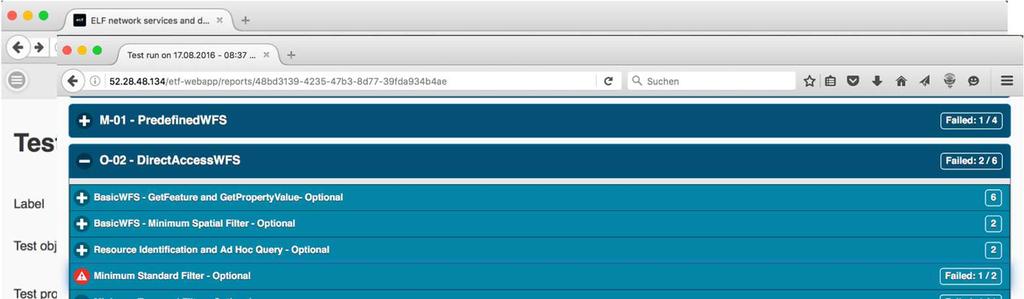

56 ETF Web Application with ELF test projects
57 ELF Data Quality Validation ELF Data from the national WFS Validate ELF Data using ELF quality Rules Review Data Quality Report Quality results Data Quality report available to download Reviewing results using your chosen GIS editor/browser. NMCA ELF Data ELF Data Quality Validation Tool Download Data Quality Report View Data Quality Report with Source Data


58 ELF tools: edge-matching Edge matching using connecting features Edge matching using data from neighbouring countries

59 ELF tools: edge-matching Simple matching to international boundaries Preconfigured ELF ruleset for each of the three edge-matching scenarios


60 Tools The INSPIRE father ensures primary education. The ELF mother provides professional education.
61 User Access Point
62 User access point The family is not living in isolation from the external world. Visitors are curious to discover the young children and are coming to see the family. Where and how are they received?


63 INSPIRE User access point

64 User access points through ELF Geo Product Finder in the Showcase application demo.locationframework.eu Provides discovery service Provides service and dataset metadata Provides quality stars and user evaluation Registered users Provides licensing and prices if needed and then URLs for the view (WMS) and Download (WFS) Web Maps (embedded maps from the Oskari) Target audience: Professionals and Developers


65 Affiliated Platforms ArcGIS Online ndex.html Web Services Web Maps Some open data Access to be negotiated Other platforms may be added
66 ELF platform components ELF Geo-Tools for Reference Data: edge matching, generalisation, transformation, change detection visualization, data quality analysis and improvement service testing National Mapping & Cadastral Authorities NSDIs ELF Platform: Reference Data & Services NMCA data NMCA data NMCA data European data Other Reference Data ELF Oskari Geo Product Finder Geo Locator INSPIR E/ ELF data locationframework.eu Applications: Use Reference Data and other data in any application environment Map applications Value-added Web Services GIS Platforms: Data and Application Hubs of the ELF Infrastructure feature data, gridded data, map tiles Other Data Providers Web Services JavaScript APIs Mobile SDKs Map Applications

 but third party data also welcome")
67 User access point INSPIRE portal is the big reception garden to welcome whole EU family (uncles, aunts, cousins, such as data and services from environmental community) ELF portal is the family garden smaller but more comfortable for the couple s children (ELF services and products) but third party data also welcome


68 ELF / INSPIRE The household

69 Budget and administration You can t run a household on love and idealism only Money or lack of it the bane of many marriages INSPIRE data sharing principles ELF licensing and administration

70 INSPIRE Art 17 on Data Sharing Each Member State shall adopt measures for the sharing of spatial data sets and services between its public authorities for the purposes of public tasks that may have an impact on the environment. preclude any restrictions likely to create practical obstacles, occurring at the point of use respecting the self-financing requirements where applicable Same arrangement for public authorities of other MS and Community bodies Regulation on use of contractors, metadata and response time

71 From wedding to daily living Art. 17 represent the marriage vows Who does what when? Economy sharing costs and benefits Decisions who makes them and how? Crisis management ELF adds administration and harmonisation Licensing and access terms Open and paid for data Personal data issues

72 Keep it simple and hide the complexities from the users Organise the data providers Licensing and pricing solutions based on national policies Technical solutions for one stop shopping One place for users to get services, support and to acquire licenses Licensing and pricing based on actual use


 ELF")


73 Access to the ELF Products Applications and affiliated platforms Geo Product Finder (Discovery and Metadata) ELF Data and Services Licensing Pricing Authentication, authorisation and accounting ELF Products


 VAR")


74 ELF Licences ELF Data and Services ELF Products Direct channel (European users) VAR Evaluation licence End User Licence Developers licence VAR Licence
 ELF download products (WFS) Sustainability The licensing must be a part of a")
75 ELF licensing principles Simplicity Immediate access to all products on a trial basis ELF evaluation and development licenses Licensing must be easy to understand and apply to the user s needs Harmonised terms and conditions Incorporating the data providers national requirements ELF viewing products (WMS, WMTS) ELF download products (WFS) Sustainability The licensing must be a part of a sustainable solution for long term financing and development of ELF

76 From multiple licenses to one source of European reference data


77 Planning the future: Commitment and family expansion?
78 Future Last but not least, what is the future of this love story? Will the promising children grow in beauty, strength, efficiency or will they just become exasperating teen-agers? Will they get new children? How will the children s financial future be secured? Will the European Commission and EuroGeographics families provide some financial help? Might they divorce or in opposite will they get officially married?
79 Future Data and specifications Quality Content Coverage Co-operation and working together with user/developer community
80 Future Platform Performance Easy to use Change only (Linked Open Data)
81 Future Expansion Sustainability Open Partners


82 Conclusion A beautiful love story from first meeting to a wide family And the story is not finished The family is willing to get more children and more visitors.
European Location Framework (ELF) acting as a facilitator implementing INSPIRE
 acting as a facilitator implementing INSPIRE") www.eurogeographics.org European Location Framework (ELF) acting as a facilitator implementing INSPIRE Saulius Urbanas, Mick Cory (EuroGeographics) 29 October 2016 Copyright 2013 EuroGeographics EuroGeographics
www.eurogeographics.org European Location Framework (ELF) acting as a facilitator implementing INSPIRE Saulius Urbanas, Mick Cory (EuroGeographics) 29 October 2016 Copyright 2013 EuroGeographics EuroGeographics
The European Location Framework (ELF) Project One Source for Reference Geo Information for Europe
 Project One Source for Reference Geo Information for Europe") The European Location Framework (ELF) Project One Source for Reference Geo Information for Europe Presentation to: By: Date: ICC Dresden Antti Jakobsson, Technical Coordinator 28 th August 2013 The ELF
The European Location Framework (ELF) Project One Source for Reference Geo Information for Europe Presentation to: By: Date: ICC Dresden Antti Jakobsson, Technical Coordinator 28 th August 2013 The ELF
How to Report on Data Quality in a Multinational Environment?
 How to Report on Data Quality in a Multinational Environment? Presentation to: By: Date: SDMQ2015 Anja Hopfstock, BKG 20.01.2015 Agenda ELF architecture Data Quality Management Data Quality Reporting Summary
How to Create a European INSPIRE Compliant Data Specification. Anja Hopfstock, BKG (Germany) Morten Borrebæk, SK (Norway)
 Morten Borrebæk, SK (Norway)") How to Create a European INSPIRE Compliant Data Specification Anja Hopfstock, BKG (Germany) Morten Borrebæk, SK (Norway) ESDIN Key Goals Further the ambition of the European Commission to create a European
How to Create a European INSPIRE Compliant Data Specification Anja Hopfstock, BKG (Germany) Morten Borrebæk, SK (Norway) ESDIN Key Goals Further the ambition of the European Commission to create a European
ELF- joining Europe together
 ELF- joining Europe together An open standard based multinational web mapping project, building on INSPIRE Presentation to: ISO/TC211 Standards in Action Workshop By: Date: Jari Reini 10 th June 2015 19
Sub-national dimensions of INSPIRE
 www.eurogeographics.org CONNECTING YOU TO THE Sub-national dimensions of INSPIRE SDIs in the evolving EU society Dave Lovell, Secretary General and Executive Director 24 June 2013 Copyright 2013 EuroGeographics
Validating services and data in an SDI
 Validating services and data in an SDI Presentation to: By: Date: INSPIRE Conference Clemens Portele, Jon Herrmann, Roy Mellum 30 September 2016 4 October, 2016 ELF is the response from the European Mapping
SDI Workshop ESDIN Best Practices INSPIRE conference, Edinburgh. Arnulf Christl, Metaspatial
 SDI Workshop ESDIN Best Practices 2011-06-28 INSPIRE conference, Edinburgh Arnulf Christl, Metaspatial Download this slide set as ODP or PDF at http://arnulf.us/publications Arnulf Christl Geospatially
ELFI: A European Location Framework
 1 ELFI: A European Location Framework 1. Our Ambition Project ELFI will foster the wider use of geo-information and enable the creation of innovative valueadded services. 2. Our Objectives We aim to create
Introduction to INSPIRE. Network Services
 Introduction to INSPIRE. Network Services European Commission Joint Research Centre Institute for Environment and Sustainability Digital Earth and Reference Data Unit www.jrc.ec.europa.eu Serving society
ELF extensions. Presentation to: INSPIRE MIG-T. Author: Anja Hopfstock (ELF WP2 Data Specifications) Date: 25 th February 2016.
 Date: 25 th February 2016.") ELF extensions Presentation to: Author: Date: INSPIRE MIG-T Anja Hopfstock (ELF WP2 Data Specifications) 25 th February 2016 What is ELF in connection to INSPIRE? Arrangements within NMCAs in Europe to
ELF extensions Presentation to: Author: Date: INSPIRE MIG-T Anja Hopfstock (ELF WP2 Data Specifications) 25 th February 2016 What is ELF in connection to INSPIRE? Arrangements within NMCAs in Europe to
INSPIRE & Environment Data in the EU
 INSPIRE & Environment Data in the EU Andrea Perego Research Data infrastructures for Environmental related Societal Challenges Workshop @ pre-rda P6 Workshops, Paris 22 September 2015 INSPIRE in a nutshell
ELF download services
 ELF download services Presentation to: Author: Date: ELF workshop in Moldova Marcin Grudzień 8 h September2015 14 September, 2015 Plan Introduction Specification documents The envisaged production process
Nathalie Delattre, National Geographic Institute of Belgium
 THE EUROPEAN LOCATION FRAMEWORK (ELF), INTEROPERABILITY SOLUTIONS FOR EUROPEAN PUBLIC ADMINISTRATIONS AND THE INSPIRE DIRECTIVE. Major challenges and lessons learnt for delivering authoritative, interoperable,
Consolidation Team INSPIRE Annex I data specifications testing Call for Participation
 INSPIRE Infrastructure for Spatial Information in Europe Technical documents Consolidation Team INSPIRE Annex I data specifications testing Call for Participation Title INSPIRE Annex I data specifications
INSPIRE status report
 INSPIRE Team INSPIRE Status report 29/10/2010 Page 1 of 7 INSPIRE status report Table of contents 1 INTRODUCTION... 1 2 INSPIRE STATUS... 2 2.1 BACKGROUND AND RATIONAL... 2 2.2 STAKEHOLDER PARTICIPATION...
Testing - an essential aspect of establishing an SDI
 Testing - an essential aspect of establishing an SDI Clemens Portele, Anders Östman, Michael Koutroumpas, Xin He, Janne Kovanen, Markus Schneider, Andriani Skopeliti INSPIRE Conference 2011 30 June 2011
Technical implementation of INSPIRE: feed-back from experiences
 Technical implementation of INSPIRE: feed-back from experiences Lisbon 27 February 2013 1 Modèle TN-02.018-1.2 Dominique.laurent@ign.fr Plan Introduction Metadata Services Interoperability 2 Introduction
Compass INSPIRE Services. Compass INSPIRE Services. White Paper Compass Informatics Limited Block 8, Blackrock Business
 Compass INSPIRE Services White Paper 2010 Compass INSPIRE Services Compass Informatics Limited Block 8, Blackrock Business Park, Carysfort Avenue, Blackrock, County Dublin, Ireland Contact Us: +353 1 2104580
Validation experience
 Validation experience Paloma Abad Head of SDI Department SDI Workshop 26-06-2018 INSPIRE KEN INSPIRE KEN, june 2018 1 Points 1. Introduction 2. Interoperability 3. Geoportal Thematic Viewer 4. Conclusions
SII Law Organization Coordination activities Examples of good practices Education Technical matters Success stories Challenges
 SII Law Organization Coordination activities Examples of good practices Education Technical matters Success stories Challenges INSPIRE transposed by the legal act on Spatial Information Infrastructure
MIG-T - Task #2475 Collect INSPIRE schema extensions and best practices
 MIG-T - Task #2475 Collect INSPIRE schema extensions and best practices 29 Jul 2015 02:29 pm - Christian Ansorge Status: Closed Start date: 29 Jul 2015 Priority: Normal Due date: Assignee: Christian Ansorge
ELF Data Specifications
 ELF Data Specifications Presentation to: Author: Date: INSPIRE conference Anja Hopfstock (WP2), Antti Jakobsson (ELF project director) 16 th June 2014 Why extending INSPIRE? INSPIRE too much too little
Implementing Quality in SDIs Introducing Building Blocks of Quality Web Services
 Implementing Quality in SDIs Introducing Building Blocks of Quality Web Services Antti Jakobsson J. Mäkelä, R. Henriksson,J. Marttinen,L. Tsoulos, I.Kavadas, E. Onstein, M. Beare,F. Williams, J. Walsh,
Initial Operating Capability & The INSPIRE Community Geoportal
 INSPIRE Conference, Rotterdam, 15 19 June 2009 1 Infrastructure for Spatial Information in the European Community Initial Operating Capability & The INSPIRE Community Geoportal EC INSPIRE GEOPORTAL TEAM
D Public Final Project Report
 ECP-2007-GEO-317008 ESDIN Underpinning the European Spatial Data Infrastructure with a Best Practice Network D 1.10.3 Public Final Project Report Deliverable number Dissemination level D-1.10.3 Public
INSPIRE overview and possible applications for IED and E-PRTR e- Reporting Alexander Kotsev
 INSPIRE overview and possible applications for IED and E-PRTR e- Reporting Alexander Kotsev www.jrc.ec.europa.eu Serving society Stimulating innovation Supporting legislation The European data puzzle 24
From the INSPIRE Engine Room
 From the INSPIRE Engine Room Michael Lutz ENiiG Conference, Lisbon 9 November 2016 Joint Research Centre the European Commission's in-house science service The JRC's role in INSPIRE Support MS in implementation
Validation in the Netherlands and European Location Framework
 Validation in the Netherlands and European Location Framework INSPIRE Workshop on validation and conformity testing 15 16 May 2014 Thijs Brentjens Contents Geonovum and ELF INSPIRE INSPIRE in the Netherlands
DATA VALIDATION AGAINST SCHEMA AND SOURCE DATA
 DATA VALIDATION AGAINST SCHEMA AND SOURCE DATA didier.bouteloup@ign.fr; dominique.laurent@ign.fr 3 June 2016 ign.fr Context IGN has performed data validation twice On test INSPIRE data (2013-2014) On ELF
The European Commission s science and knowledge service. Joint Research Centre
 The European Commission s science and knowledge service Joint Research Centre GeoDCAT-AP The story so far Andrea Perego, Antonio Rotundo, Lieven Raes GeoDCAT-AP Webinar 6 June 2018 What is GeoDCAT-AP Geospatial
Infrastructure for Spatial Information in Europe. Proposed action for update of MIWP: Alternative encodings for INSPIRE data
 INSPIRE Infrastructure for Spatial Information in Europe Proposed action for update of MIWP: Alternative encodings for INSPIRE data Type Creator MIWP Action fiche DG ENV Date/status/version 20/11/2017
INSPIRE tools What's new?
 INSPIRE tools What's new? Michael Lutz INSPIRE Conference, Antwerp 18 September 2018 Joint Research Centre The European Commission s science and knowledge service INSPIRE reference validator Why a reference
From Geoportal to Spatial Data Service Platform. Jani Kylmäaho National Land Survey of Finland Development Centre
 From Geoportal to Spatial Data Service Platform Jani Kylmäaho National Land Survey of Finland Development Centre Introduction National Land Survey of Finland - 1900 employees Development Centre - 120 employees
Basic Principles of MedWIS - WISE interoperability
 Co-ordination committee seminar of the national focal points Basic Principles of MedWIS - WISE interoperability Eduardo García ADASA Sistemas Nice - France Agenda WISE vs MedWIS WISE WISE DS WISE vs WISE
Transboundary data interoperability for Maritime Spatial Planning. Yuji KATO
 Transboundary data interoperability for Maritime Spatial Planning Yuji KATO CONTEXT THE MARITIME SPATIAL PLANNING DIRECTIVE DIRECTIVE 2014/89/EU establishing a framework for Maritime Spatial Planning (MSP)
HUMBOLDT Application Scenario: Protected Areas
 CC by Erlend Schei Copyright by Kecko Copyright by Michael Bezzina CC by Gunnar Ries Copyright by Michael Bezzina Copyright by Michael Bezzina Copyright by Michael Bezzina CC by fs999 CC by Jordan Nielsen
Spatial Data on the Web
 Spatial Data on the Web Tools and guidance for data providers The European Commission s science and knowledge service W3C Data on the Web Best Practices 35 W3C/OGC Spatial Data on the Web Best Practices
Guidelines for the encoding of spatial data
 INSPIRE Infrastructure for Spatial Information in Europe Guidelines for the encoding of spatial data Title Status Creator Date 2012-06-15 Subject Publisher Type Description Contributor Format Source Rights
Standards, standardisation & INSPIRE Status, issues, opportunities
 Standards, standardisation & INSPIRE Status, issues, opportunities INSPIRE Coordination Team 6 th MIG meeting, 13-14 June 2017 Joint Research Centre The European Commission's science and knowledge service
INSPIRE in a nutshell, and overview of the European Union Location Framework
 INSPIRE in a nutshell, and overview of the European Union Location Framework Francesco Pignatelli European Commission, DG JRC 10 th European Congress and Exhibition on Intelligent Transport Systems and
EMODnet Bathymetry. By Dick M.A. Schaap Coordinator. 20 th April 2016, EGU 2016, Vienna - Austria
 EMODnet Bathymetry By Dick M.A. Schaap Coordinator 20 th April 2016, EGU 2016, Vienna - Austria EMODNet Bathymetry Ongoing in 3 consecutive projects since 2009 with expanding consortium (at present >30
Workshop 4.4: Lessons Learned and Best Practices from GI-SDI Projects II
 Workshop 4.4: Lessons Learned and Best Practices from GI-SDI Projects II María Cabello EURADIN technical coordinator On behalf of the consortium mcabello@tracasa.es euradin@navarra.es Scope E-Content Plus
The European Soil Data Centre, the European Soil Bureau Network and INSPIRE Data Specifications for Soil
 The European Soil Data Centre, the European Soil Bureau Network and INSPIRE Data Specifications for Soil Marc Van Liedekerke, Panos Panagos, Luca Montanarella Land Management and Natural Harzards Unit
INSPIRE Download Services of the CNIG (Spain) Emilio López Romero
 Emilio López Romero") INSPIRE Download Services of the CNIG (Spain) Emilio López Romero 1 The beginning One day, few years ago, we decided to implement INSPIRE seriously 2 The sources The first step was to identify the available
INSPIRE Download Services of the CNIG (Spain) Emilio López Romero 1 The beginning One day, few years ago, we decided to implement INSPIRE seriously 2 The sources The first step was to identify the available
UN-GGIM: Europe core data and adaptation of INSPIRE models Dominique Laurent (IGN)
") Workshop about extensions of INSPIRE data specifications 20-21 June 2017 UN-GGIM: Europe core data and adaptation of INSPIRE models Dominique Laurent (IGN) UN-GGIM General presentation UN-GGIM(United Nations
Workshop about extensions of INSPIRE data specifications 20-21 June 2017 UN-GGIM: Europe core data and adaptation of INSPIRE models Dominique Laurent (IGN) UN-GGIM General presentation UN-GGIM(United Nations
The challenge of creating an INSPIRE Transport Networks DB from existing data in the National Geographic Institute of Spain
 The challenge of creating an INSPIRE Transport Networks DB from existing data in the National Geographic Institute of Spain Alicia González Jiménez (agjimenez@fomento.es) Instituto Geográfico Nacional
GeoDCAT-AP Representing geographic metadata by using the "DCAT application profile for data portals in Europe"
 GeoDCAT-AP Representing geographic metadata by using the "DCAT application profile for data portals in Europe" Andrea Perego, Vlado Cetl, Anders Friis-Christensen, Michael Lutz, Lorena Hernandez Joint
Monitoring and Reporting Drafting Team Monitoring Indicators Justification Document
 INSPIRE Infrastructure for Spatial Information in Europe Monitoring and Reporting Drafting Team Monitoring Indicators Justification Document Title Draft INSPIRE Monitoring Indicators Justification Document
Toward Horizon 2020: INSPIRE, PSI and other EU policies on data sharing and standardization
 Toward Horizon 2020: INSPIRE, PSI and other EU policies on data sharing and standardization www.jrc.ec.europa.eu Serving society Stimulating innovation Supporting legislation The Mission of the Joint Research
The cadastral data and standards based on XML in Poland
 The cadastral data and standards based on XML in Poland Jarosław Bydłosz, Piotr Parzych AGH University of Science and Technology Cracow, Poland 1 XML XML Extensible Markup Language Extensible Markup Language
Christian Ansorge 27th April CDDA webinar 27th April Linked Approach as reporting mechanism
 Christian Ansorge 27th April 2017 CDDA webinar 27th April 2017 Linked Approach as reporting mechanism Generic Linked Approach Scope Background and motivation for reporting reusing INSPIRE Introduction
Research Infrastructures and Horizon 2020
 Research Infrastructures and Horizon 2020 Christos VASILAKOS DG Research & 1 st CoPoRI Workshop on EoE 11-12 June 2012 Hamburg, DE The EU Framework Programme for Research and 2014-2020 Research and Europe
For each use case, the business need, usage scenario and derived requirements are stated. 1.1 USE CASE 1: EXPLORE AND SEARCH FOR SEMANTIC ASSESTS
 1 1. USE CASES For each use case, the business need, usage scenario and derived requirements are stated. 1.1 USE CASE 1: EXPLORE AND SEARCH FOR SEMANTIC ASSESTS Business need: Users need to be able to
Integration of INSPIRE & SDMX data infrastructures for the 2021 population and housing census
 Integration of INSPIRE & SDMX data infrastructures for the 2021 population and housing census Nadezhda VLAHOVA, Fabian BACH, Ekkehard PETRI *, Vlado CETL, Hannes REUTER European Commission (*ekkehard.petri@ec.europa.eu
Metadata for Data Discovery: The NERC Data Catalogue Service. Steve Donegan
 Metadata for Data Discovery: The NERC Data Catalogue Service Steve Donegan Introduction NERC, Science and Data Centres NERC Discovery Metadata The Data Catalogue Service NERC Data Services Case study:
Landslide Damage on Chemin de Fer de la Mure near Grenoble,
 Contents 1 What is the INSPIRE directive, and why is it important?... 3 1.1 What is the aim of this document?... 4 1.2 Who will this document be useful to?... 4 2 An overview of INSPIRE specifications...
Guidelines for the encoding of spatial data
 INSPIRE Infrastructure for Spatial Information in Europe Guidelines for the encoding of spatial data Title D2.7: Guidelines for the encoding of spatial data, Version 3.1 Creator INSPIRE Drafting Team "Data
Italy - Information Day: 2012 FP7 Space WP and 5th Call. Peter Breger Space Research and Development Unit
 Italy - Information Day: 2012 FP7 Space WP and 5th Call Peter Breger Space Research and Development Unit Content Overview General features Activity 9.1 Space based applications and GMES Activity 9.2 Strengthening
SHARING GEOGRAPHIC INFORMATION ON THE INTERNET ICIMOD S METADATA/DATA SERVER SYSTEM USING ARCIMS
 SHARING GEOGRAPHIC INFORMATION ON THE INTERNET ICIMOD S METADATA/DATA SERVER SYSTEM USING ARCIMS Sushil Pandey* Birendra Bajracharya** *International Centre for Integrated Mountain Development (ICIMOD)
ADMINISTRATIVE UNITS INSPIRE KEN WORKSHOP TRANSFORMATION OF THEMES AD, AU, BU, CP AND GN April 2015 ign.
 ADMINISTRATIVE UNITS INSPIRE KEN WORKSHOP TRANSFORMATION OF THEMES AD, AU, BU, CP AND GN dominique.laurent@ign.fr 16-17 April 201 ign.fr Plan Source data Transformation choices and issues Conclusions Source
CREATING SMART TRANSPORT SERVICES BY FACILITATING THE RE-USE OF OPEN GIS DATA
 OPEN TRANSPORT NET TOMAS MILDORF 16 JUNE 2014 INSPIRE CONFERENCE 2014, AALBORG, DENMARK CREATING SMART TRANSPORT SERVICES BY FACILITATING THE RE-USE OF OPEN GIS DATA 2 1 OTN AT A GLANCE Full title OpenTransportNet
INSPIRE implementation in Belgium : Opportunities and Challenges
 INSPIRE implementation in Belgium : Opportunities and Challenges April 2016 Ouns Kissiyar (INSPIRE NCP) Inspire.ncp@agiv.be Overview Belgium : Structure INSPIRE : Transposition NSDI Tools & Infrastructure
Towards a pan-european infrastructure for marine and ocean data management + Importance of standards
 Towards a pan-european infrastructure for marine and ocean data management + Importance of standards By Dick M.A. Schaap Technical Coordinator SeaDataNet & Coordinator EMODnet Bathymetry Hydrography Day,
Schema Transformation as a Tool for Data Reuse in Web Service Environment
 Schema Transformation as a Tool for Data Reuse in Web Service Environment Lassi Lehto Department of Geoinformatics and Cartography Finnish Geodetic Institute Masala, Finland lassi.lehto@fgi.fi Abstract
The enabling role of geospatial information in the European energy policies
 The European Commission s science and knowledge service Joint Research Centre The enabling role of geospatial information in the European energy policies Francesco Pignatelli Kehl (DE), 5 September 2017
Experience federating the metadata catalogue of IGN in the Spanish Open Data Portal
 Experience federating the metadata catalogue of IGN in the Spanish Open Data Portal Paloma Abad E. López, A.F. Rodríguez, A. Sánchez, S. Castro, S. Soriano, J.I Sánchez 1 Summary IGN Metadata Catalogue
PortalU, a Tool to Support the Implementation of the Shared Environmental Information System (SEIS) in Germany
 in Germany") European conference of the Czech Presidency of the Council of the EU TOWARDS eenvironment Opportunities of SEIS and SISE: Integrating Environmental Knowledge in Europe http:/www.e-envi2009.org/proceedings/
European conference of the Czech Presidency of the Council of the EU TOWARDS eenvironment Opportunities of SEIS and SISE: Integrating Environmental Knowledge in Europe http:/www.e-envi2009.org/proceedings/
Methodological approach for cross-theme harmonization of Polish spatial data sets the case study for the Annex I themes
 Methodological approach for cross-theme harmonization of Polish spatial data sets the case study for the Annex I themes Elżbieta Bielecka, Agnieszka Zwirowicz-Rutkowska, Alina Kmiecik, Marek Brylski, Magdalena
SEIS. (Shared Environmental Information System) From concept to information services
 From concept to information services") SEIS (Shared Environmental Information System) From concept to information services Stefan Jensen EEA supported by Sheila Cryan and Jon Maidens GSDI 11, Rotterdam 19.6.2009 What is SEIS is about... Sharing
SEIS (Shared Environmental Information System) From concept to information services Stefan Jensen EEA supported by Sheila Cryan and Jon Maidens GSDI 11, Rotterdam 19.6.2009 What is SEIS is about... Sharing
Transformation of El - OI data for INSPIRE
 Transformation of El - OI data for INSPIRE 29 Septembre 2015 1 ISN 15.12x Methodology Define some strategy Theme EL Meeting n 1 : information => decision: launch small test to gain experience Meeting n
Welcome. to Pre-bid meeting. Karnataka State Spatial Data Infrastructure (KSSDI) Project, KSCST, Bangalore.
 Project, KSCST, Bangalore.") Welcome to Pre-bid meeting Karnataka State Spatial Data Infrastructure (KSSDI) Project, KSCST, Bangalore. DEVELOPMENT OF KARNATAKA STATE SPATIAL DATA INFRASTRUCTURE (KSSDI) PROJECT Objective: To develop
Welcome to Pre-bid meeting Karnataka State Spatial Data Infrastructure (KSSDI) Project, KSCST, Bangalore. DEVELOPMENT OF KARNATAKA STATE SPATIAL DATA INFRASTRUCTURE (KSSDI) PROJECT Objective: To develop
INSPIRE and Open Data Recent Developments and Best Practices
 INSPIRE and Open Data Recent Developments and Best Practices These documents are only complete, when used in connection with the verbal paper; any isolated use may lead to misunderstandings. Michael Müller
SeaDataNet, Pan-European infrastructure for marine ands ocean data management + EMODNET Preparatory Action Hydrographic and Seabed Mapping
 SeaDataNet, Pan-European infrastructure for marine ands ocean data management + EMODNET Preparatory Action Hydrographic and Seabed Mapping By Dick M.A. Schaap Technical Coordinator SeaDataNet & Coordinator
Detailed analysis + Integration plan
 Outline Integration methodology Detailed analysis + Integration plan Conclusions 2 Outline Integration methodology Detailed analysis + Integration plan Conclusions 3 EULF-ISA Integration: methodology Phase
FP7-INFRASTRUCTURES Grant Agreement no Scoping Study for a pan-european Geological Data Infrastructure D 4.4
 FP7-INFRASTRUCTURES-2012-1 Grant Agreement no. 312845 Scoping Study for a pan-european Geological Data Infrastructure D 4.4 Report on recommendations for implementation of the EGDI Deliverable number D4.4
Interoperability and transparency The European context
 JOINING UP GOVERNMENTS EUROPEAN COMMISSION Interoperability and transparency The European context ITAPA 2011, Bratislava Francisco García Morán Director General for Informatics Background 2 3 Every European
CONCLUSIONS OF THE WESTERN BALKANS DIGITAL SUMMIT APRIL, SKOPJE
 CONCLUSIONS OF THE WESTERN BALKANS DIGITAL SUMMIT 2018 18-19 APRIL, SKOPJE CONCLUSIONS OF THE WESTERN BALKANS DIGITAL SUMMIT 2018 At the Trieste Western Balkans Summit, we stressed the importance of the
This document is a preview generated by EVS
 TECHNICAL REPORT RAPPORT TECHNIQUE TECHNISCHER BERICHT CEN/TR 15449-5 April 2015 ICS 07.040; 35.240.70 English Version Geographic information - Spatial data infrastructures - Part 5: Validation and testing
Use case 1 INSPIRE harmonization of existing Energy Performance Certificate datasets Phase 1
 The European Commission s science and knowledge service Joint Research Centre Use case 1 INSPIRE harmonization of existing Energy Performance Certificate datasets Phase 1 Giacomo Martirano (external consultant)
Singapore. Mr Soh Kheng Peng. Singapore Land Authority
 Country Report 2006 (Based on the PCGIAP-Data Integration Template 2006) Singapore Country/state: Name of contact person: Affiliation, Organization: Function, Position: Address: Email address: Tel, Fax
Integrating the UK Location Information Infrastructure and data.gov.uk
 Integrating the UK Location Information Infrastructure and data.gov.uk Rod Kedge - UK Location Programme 1 July 20011 This presentation The issue: How to derive the benefits of INSPIRE Background UKLII
European Space Policy
 European Space Policy Eleni Paliouras, ESA EuroGeographics General Assembly 3 October 2017 Vienna, Austria ESA UNCLASSIFIED - For Official Use ESA facts and figures Intergovernmental agency of 22 Member
INSPIRE relevant policy developments in the EU's digital economy initiatives
 INSPIRE relevant policy developments in the EU's digital economy initiatives Interoperability Solutions and common Frameworks for European public Administrations, businesses and citizens as a means of
Making Open Data work for Europe
 Making Open Data work for Europe Daniele Rizzi European Commission DG Communications Networks, Content and Technology daniele.rizzi@ec.europa.eu Nikolaos Loutas PwC EU Services nikolaos.loutas@be.pwc.com
Implementing INSPIRE UIDs and life-cycle information in a European SDI.
 Implementing INSPIRE UIDs and life-cycle information in a European SDI. Nathalie Delattre, IGN Belgium Work team: Romain Kereneur, IGN, France Noémie Grémeaux, IGN, France Marcus Brühl, BKG, Germany Esa
Implementing INSPIRE UIDs and life-cycle information in a European SDI.
 Implementing INSPIRE UIDs and life-cycle information in a European SDI. Nathalie Delattre, IGN Belgium Work team: Romain Kereneur, IGN, France Noémie Grémeaux, IGN, France Marcus Brühl, BKG, Germany Esa
Web apps for INSPIRE: the ELISE Energy pilot example
 Web apps for INSPIRE: the ELISE Energy pilot example 6 September 2017 Authors: Daniele Francioli Giacomo Martirano Maria Teresa Borzacchiello Francesco Pignatelli Outline Overview of the ELISE Energy Pilot
Experiences with. data for use in apps
 Experiences with publishing INSPIRE data for use in apps Presentation to: Author: Date: INSPIRE Conference 2014 Clemens Portele 2014 06 18 From INSPIRE Conference 2013: "How to use INSPIRE data?" INSPIRE
Marine and Coastal Data Services in the Cloud. Richard Rombouts - Snowflake Software Ltd. & Keiran Millard SeaZone Solutions Ltd.
 Marine and Coastal Data Services in the Cloud Richard Rombouts - Snowflake Software Ltd. & Keiran Millard SeaZone Solutions Ltd. Marine Geospatial Data Inspired Marine Data? SeaZone HydroSpatial Global
An Introduction to GIS for developers
 An Introduction to GIS for developers Part 4: GIS Sharing Canserina Kurnia & Tom Shippee Agenda Web GIS ArcGIS Online Cloud-based ArcGIS Server ArcGIS Server on-premises ArcGIS a complete platform discover,
Building a Europe of Knowledge. Towards the Seventh Framework Programme
 Building a Europe of Knowledge Towards the Seventh Framework Programme 2007-2013 FP7 /1 EUROPEAN COMMISSION - Research DG - November 2005 EU research: the story so far 1952: ECSC treaty; first projects
Third public workshop of the Amsterdam Group and CODECS European Framework for C-ITS Deployment
 Third public workshop of the Amsterdam Group and CODECS European Framework for C-ITS Deployment 14 February 2017 Amsterdam Gerhard Menzel European Commission - DG MOVE EU Policy Tools Large-scale deployment
Setting up the Ihlet Social Cadastre
 Setting up the Ihlet Social Cadastre Ihlet KHT Dr. Attila Molnár, GI consultant Bela Jarolics Rome, Italy TOPICS Goal of the project Architecture Database Solution Standards, communication Metadata Security
INSPIRE Web Services for Maritime Affairs in Germany
 INSPIRE Web Services for Maritime Affairs in Germany Matthias Pramme www.bsh.de 1 Agenda Introduction to BSH Relevant INSPIRE Themes Implementation Water Transport Networks Problems and Difficulties Future
The Plan4business Approach to Transfer Open Data into Real Estate Businesses
 The Plan4business Approach to Transfer Open Data into Real Estate Businesses Jan Ježek 1, Tomáš Mildorf 1, Karel Charvát Jr. 2, and Karel Charvát 3 1 University of West Bohemia, Pilsen, Czech Republic
Application of the Catalogue and Validator tools in the context of Inspire Alberto Belussi, Jody Marca, Mauro Negri, Giuseppe Pelagatti
 Application of the Catalogue and Validator tools in the context of Inspire Alberto Belussi, Jody Marca, Mauro Negri, Giuseppe Pelagatti Politecnico di Milano giuseppe.pelagatti@polimi.it spatialdbgroup.polimi.it
Transformative characteristics and research agenda for the SDI-SKI step change: A Cadastral Case Study
 Transformative characteristics and research agenda for the SDI-SKI step change: A Cadastral Case Study Dr Lesley Arnold Research Fellow, Curtin University, CRCSI Director Geospatial Frameworks World Bank
Enabling Efficient Discovery of and Access to Spatial Data Services. CHARVAT, Karel, et al. Abstract
 Article Enabling Efficient Discovery of and Access to Spatial Data Services CHARVAT, Karel, et al. Abstract Spatial data represent valuable information and a basis for decision making processes in society.
INSPIRE on tools workshop
 INSPIRE on tools workshop Geoportal, Registry, Validator Robert Tomas, Michael Lutz, Lorena Hernandez, Marco Minghini, Daniele Francioli, Emanuela Epure The European Commission s science and knowledge