LOCAL STREETS AND THE ARNOLD INITIATIVE
|
|
|
- Benedict Wilkinson
- 5 years ago
- Views:
Transcription


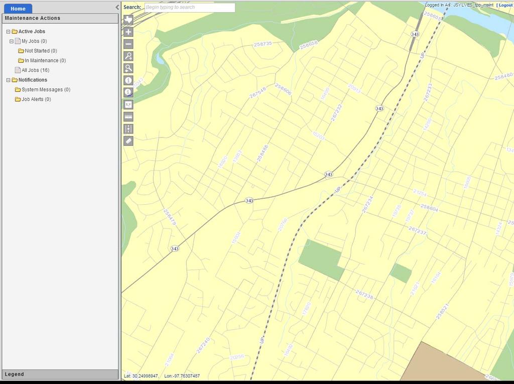
1 LOCAL STREETS AND THE ARNOLD INITIATIVE Jenn Sylvester, Mapping Branch Team Lead Transportation Planning & Programming Division (TPP) GIS-T Symposium Des Moines, IA
2 Key Terms ARNOLD FC Streets Local Streets 4 GRID 5 Local Partners 6 Data Dictionary 7 Attributes 2
3 ARNOLD: Building Better Data 1 Local Streets Project Planning and Overview 2 ARNOLD: Current and Future Dual Carriageway Addressing, Topology & Edge Matching 3 Partnering and Data Sharing Who Benefits? Digital Ownership 4 Building and Maintaining Local Partnerships Departmental Uses: Trickle Down Effect Functional Classification and Urban Boundary Updates Statewide Planning Map GRID New Spatial Asset Management System 3
4 Local Streets.Preliminary Decision Making Cost Effectiveness Collecting? Creating? Purchasing? Determine Who Benefits and Why Value of Partnerships Data Sharing Initiatives Research and Communication What s available? How is the data designed? How do we make it fit? Establish a Timeline and Goals Testing Making a decisions and sticking with it 4
 County City E-911 (Emergency")

5 Data Sources COG (Councils of Government) MPO (Metropolitan Planning Organizations) County City E-911 (Emergency Management Districts) Data Partnerships These organizations provided TxDOT with spatial data for 99% of Counties in the state of Texas 5
6 Group Project & Python Analysis ARNOLD: The Missing Piece was Local Streets. Phase I Phase II Phase III Phase IV Phase V Phase VI Phase VII Phase VIII Contact Data Providers and Collect Any Available Data* Processing with Data Translator (TxDOT Data Model) Route Class Assignments* Data Processing and QA/QC Classification of Error Types* Linework Corrections* End of Year QA/QC Local Street Maintenance * Group Project 6
7 Data Structure: 2 Data Models Statewide Addressing Layer (Intermediate Repository) All Inclusive All data received from each source included d16 Addressing Route Classes TxDOT Data Model Base Data for Future Updates Statewide LRS Layer (Final Goal) Local City Streets Only Contiguous measured linear features Integrated into existing roadway data at TxDOT Reported to FHWA More advanced data processing Minimal Data Processing 7
8 Slide 7 d16 Need to add slide for demo maps similar to slide 7. Top and bottom that would show the difference between the two data sets by showing RTE_CLASS in production data vs in local data. deleteme, 6/23/2014

9 Statewide Addressing Model Source Data Intermediate Repository TxDOT Data Model Addresses preserved if included in source Documented Base Data for Updates Symmetrical Difference Updates from Source Addressed Conflated Issues with centerline conflation Source data had to be edited Data quality poor Planned Lessons/Reality Need more localized participation 8
10 Scripting and Data Processing Data Dictionary Source Data TxDOT Data Model XLRD Python Module COG MPO CITY Data Model Requirements Full Street Name, City, Unique Route ID Route ID Full Street Name + City Number = Unique FLAG The street name was essential in building and identifying individual roadway features within each city TxDOT Data Model Scripting is ESSENTIAL in large data projects Initial data processing Creating Routes QA/QC Makes HUGE tasks faster and cleaner 9
11 Phase I, II, III: Collect, Process and Classify Collected Source Data with Route Classes Assigned 10


12 Phases IV & V: Routes, Errors & Multipart Classification Big Bump in the Road Longest part of the project Main issue when collecting data from other sources is topology and margin of error standards 80,000 records had errors (27%) Error Classification Project Topology, Divided Linework, Name Errors Gaps = Correct (multi segment routes) Ongoing QA/QC Lollipop and Circle Drive Issues Dedicated team of 13 analysts working half to full time 11
13 Phases IV & V: Routes, Errors & Multipart Classification 8 Separate Small Segments Results of Phase IV Street Boulevards Topology Name Gaps Errors Multiple Gaps in Roadways a route are had given the same continuous 211 Routes name segments measures shown with that bad did not dissolve topologydue to boulevard Unknown Did segmentation not pass roads the QC check for Did single not part pass lines the QC check Does Did for not single not have pass part gaps the lines QC check Marked for single as Gaps part lines and Flagged treated Does by as not Analyst correct have gaps as Street Name Does Error not have gaps Most Flagged issues by were Analyst gaps as Third without Flagged Topology Largest errors by Error Number Analyst of as Errors Boulevard fell into this and category documented ~10% Some for Largest future routes Number dual has both carriageway of Errors gaps fell and representations into errors this (flagged category with ~60% Gap as secondary issue Second Largest Number of Errors fell into this category ~25% 12
14 Phase VI: Linework Corrections Lollipops Error: Do not dissolve into a single line Correction: merge into a single line with end point at inner point of the loop Maintenance : Lines have to be re-measured in a separate group (Open edit environment) Issue: Create routes does not work due to the intersect Future: Addressing issues Remaining issue in HPMS submission (Self intersect and zero ring warnings) Circles Error: May dissolve to single line, but measures incorrect Correction: merge into a single line with end point at inner point of the loop Maintenance : Lines have to be re-measured in a separate group (Open edit environment) Issue: Create routes does not work due to the intersect Future: Addressing will have to be addressed Remaining issue in HPMS submission (Self intersect and zero ring warnings) 13
15 Phase VI: Linework Corrections The TxDOT Data Model Data had to be edited to fit the data model Needed single part lines or multi-segment routes with gaps Editing Required Digital Ownership is assumed QA/QC Ongoing throughout phase Scripts Multipart Checks Attribute Validation 14
16 Results 69,000 Miles.. Reported to FHWA Distributed & Available Comprehensive Basemaps Topology Challenges Long Term Maintenance 15
17 Data Collection Considerations Varied Uses Extra Linework Private Roads (Documented) Mobile Home Parks Apartment Complexes Boulevard Representations (Documented) Water Routes Airport Boundaries & Runways 16
18 ARNOLD Dual Carriageway On System and Functionally Classified Roadways On going analysis and updates of state maintained highways 10 years of reconciliation Dual carriageway complete for on system Change in Off-System Data Model: RTE_ID + Roadbed Type Suffix Example: KG, LG, RG Future phase: City, County and Federal Roads Phase I Phase II Phase III Analysis of attributes Survey Cities and Counties Visual Checks 17
19 ARNOLD: The Road Ahead Future Projects FC Streets and FC County Roads Attribute based analysis for dual carriageway New Data Model Edge Matching Snap Point Agreements with Adjacent States Informed Real World Decisions Addressing HUGE challenge Third party vendor project or massive data translation 2 types of data models in one place Topology Ongoing Project Goal is a routable network with no overlaps or gaps 18
20 d17 Data Maintenance Long Term Data Sources Primary and Maintenance COGs and MPOs were the Preferred Data Collection Source Largest aggregators of local data in their region County, E District, and City Broad swath collection Cities or E Districts as the Long d18term Data Maintenance Data Source But Why.? More local knowledge Data partnerships Greater Benefit of Partnership Digital Ownership Collected linework is now maintained in TxDOT Data Model Partnerships allow for updates and new inventory Cohesive part of all data reported and maintained Digital markups 19
21 Slide 19 d17 d18 This should be the start of the "Processing Slides" "The Process" deleteme, 6/23/2014 Include the number of organizations contacted # of data sets processed # of records (Total) # of records (Processed) deleteme, 6/23/2014
22 Long Term Data Maintenance and Partnering Web Portal Web application for markup Optionally can submit data via FTP Planning and Design Permissions and Roles IT Issues Server Space and Rights ArcGIS Online vs. ArcServer Digital Ownership Explaining and Providing Proof of Benefit Data Partnerships Ongoing process of reaching out and engaging with local GIS communities 20

23 Partnering & Data Sharing Who Benefits? Determining the Value of Data Exchange TxDOT GIS City GIS Roadway linework exchanged for TxDOT Data City Limit Boundary updates Improved data quality statewide Building and Maintaining Local Partnerships Hands on Communication is key Yearly calls for data submissions Option to update at any time 21
24 Timelines & Management Local Streets (September 2012 March 2013) 18 months, Finished May 2014 Dual Carriageway (Ongoing) Post GRID Launch (September 2015) 6+ Month Group Project Edge Matching (Future) Snap Points at State Boundaries Agreements with Adjacent state DOT s Topology (Future) Current: In-House Checks Future: Database submission checks and validation rules Addressing (Future) Cities, Counties, E-911 Districts Local Partnerships & Vendors Key Recommendations (FHWA) Shared Enterprise-Wide LRS Foundation Customer/Business Requirements Change Implement Change Management Design Flexibility and Scalability Implement Education and Training Management Goals with Strict Deadlines Strong Team of Analysts Automation and Scripting 22


25 Trickle Down Effects Statewide Planning Map Improvements Basemap Enhancements Local Streets Added a greater level of detail and value to the SWPM Updated names, geometries and coverage statewide Informed Planning and Locating for TxDOT employees as well as the general public 23


26 Trickle Down Effects GRID 24

27 Trickle Down Effects Functional Class Updates FC Updates Local Streets made the process of adding FC roadway updates much more streamlines Correct names and geometry No manual digitization 25
28 Questions? Questions? 26
29 THANK YOU! Jennifer Sylvester Texas Department of Transportation (512)
KEEPING DATA ACCURATE WITH THE DUSA APPLICATION
 KEEPING DATA ACCURATE WITH THE DUSA APPLICATION Jenn Sylvester, Mapping Branch Team Lead Adam Breznicky, Mapping Branch Web Master Transportation Planning & Programming Division (TPP) ESRI International
GRID. Geospatial Roadway Inventory Database. Michael Chamberlain, TxDOT. TPP Planning Conference Houston, TX
 GRID Geospatial Roadway Inventory Database Michael Chamberlain, TxDOT TPP Planning Conference - 2016 Houston, TX Topics 1 2 3 4 5 6 7 8 History (pre GRID) 3-6 GIS Resources 7-8 The Project 9-11 Assets
Developing New Hampshire s Transportation GIS Data Model. Kirk Weaver March 30, 2004 GIS-T Symposium Rapid City, South Dakota
 Kirk Weaver March 30, 2004 GIS-T Symposium Rapid City, South Dakota Presenter Kirk Weaver GIT Manager Michael Baker Jr., Inc. Princeton, New Jersey Introduction New Hampshire DOT is in the process of implementing
Esri Best Practices: QA/QC For Your Geodata. Michelle Johnson & Chandan Banerjee
 Esri Best Practices: QA/QC For Your Geodata Michelle Johnson & Chandan Banerjee Overview Understand Document Implement Understanding QA/QC Understanding QA/QC Fit For Use - support your GIS applications?
Anton van Wyk 1Spatial Australia Pty ltd Country Manager Spatial Data Infrastructure
 Anton van Wyk 1Spatial Australia Pty ltd Country Manager Anton.vanWyk@1spatial.com Spatial Data Infrastructure Industry Sectors Transportation Spatial Data Infrastructure Telecommunications Utilities Mapping
Standardized Data Production Strategies Across Your Enterprise
 Federal GIS Conference February 9 10, 2015 Washington, DC Standardized Data Production Strategies Across Your Enterprise Amber Bethell Sherry Fagin Authoritative content producers Knowledge Workers Executive
STATEWIDE CENTERLINE INITIATIVE EDITED: MAY 17, 2013
 STATEWIDE CENTERLINE INITIATIVE EDITED: MAY 17, 2013 WHAT IS THE CENTERLINE INITIATIVE? The Centerline Initiative is a joint effort between the Minnesota Department of Transportation (MnDOT), Minnesota
Colorado Dept. of Transportation (CDOT) s Geodatabase Migration Project. Lou Henefeld, CDOT Al Butler, Farragut Systems
 s Geodatabase Migration Project. Lou Henefeld, CDOT Al Butler, Farragut Systems") Colorado Dept. of Transportation (CDOT) s Geodatabase Migration Project Lou Henefeld, CDOT Al Butler, Farragut Systems Three Portions of Today s Presentation The Migration Project Goals & Stages The Data
Colorado Dept. of Transportation (CDOT) s Geodatabase Migration Project Lou Henefeld, CDOT Al Butler, Farragut Systems Three Portions of Today s Presentation The Migration Project Goals & Stages The Data
Referencing Traffic Data on a Linear Referencing System
 Referencing Traffic Data on a Linear Referencing System Kent L. Taylor, P. E. North Carolina Department of Transportation What is an LRS? Linear related to a line Reference provides a method to locate
Using Esri's Address Data Management Tools to Prepare for Next Generation 911
 Using Esri's Address Data Management Tools to Prepare for Next Generation 911 Chad Brothers, Client Services Manager State of Tennessee TeleCommunication Systems, Inc. James Wood, Public Safety Industry
Mississippi DOT's Approach to an Enterprise Wide Linear Referencing System
 Mississippi DOT's Approach to an Enterprise Wide Linear Referencing System Michael Cresap, Mississippi Department of Transportation Bruce Aquila, Intergraph Corporation Concurrent Session 3.4, State LRS
GIS-T 2016 PennDOT s Path to Survey123 for Field Collection
 GIS-T 2016 PennDOT s Path to Survey123 for Field Collection Jeff Fennimore, Spatial Infrastructure Manager Pennsylvania DOT Nate Reck, Gov t Solutions Director GeoDecisions Topics/Discussions Asset Condition
Iowa s Statewide Road Centerline Cooperative Program. Bill Schuman, GIS Coordinator Iowa Department of Transportation
 Iowa s Statewide Road Centerline Cooperative Program Bill Schuman, GIS Coordinator Iowa Department of Transportation Session Outline Current goals of Statewide Road Centerline Project Project challenges
The US Census Geographic Support System Initiative (GSS-I): Working with Partners for Enhanced Data Management KY GIS Conference, 10/01/13
: Working with Partners for Enhanced Data Management KY GIS Conference, 10/01/13") The US Census Geographic Support System Initiative (GSS-I): Working with Partners for Enhanced Data Management KY GIS Conference, 10/01/13 Kevin Holmes, Geographer US Census Bureau: Philadelphia Regional
The US Census Geographic Support System Initiative (GSS-I): Working with Partners for Enhanced Data Management KY GIS Conference, 10/01/13 Kevin Holmes, Geographer US Census Bureau: Philadelphia Regional
Los Angeles County Metropolitan Transportation Authority (Metro) Arterial Performance Measures Framework
 Arterial Performance Measures Framework") Los Angeles County Metropolitan Transportation Authority (Metro) Arterial Performance Measures Framework Anita Vandervalk-Ostrander Iteris, Inc. Santa Ana, California, USA Steven Gota, Deputy Executive
Los Angeles County Metropolitan Transportation Authority (Metro) Arterial Performance Measures Framework Anita Vandervalk-Ostrander Iteris, Inc. Santa Ana, California, USA Steven Gota, Deputy Executive
Washington Statewide Trails Database Project
 Washington Statewide Trails Database Project Project Overview Washington still is missing a statewide trails database. To date, some of the state and federal hiking, biking, horse and rail trails data
Applications of Python Scripting: Creating Custom Map Books in ArcGIS 10
 Applications of Python Scripting: Creating Custom Map Books in ArcGIS 10 JENNIFER SYLVESTER GIS ANALYST II TXDOT TRANSPORTATION, PLANNING & PROGRAMMING DIVISION Outline Identify Key Changes in Map Book
Municipal Parcel Mapping Workshop
 Municipal Parcel Mapping Workshop Presented to: Ontario Municipalities Presented by: Dave Gariepy, Director of Platform Content Dave Horwood, Land Information Systems Architect Sarah Sibbett, Senior Parcel
TxDOT TMS PERFORMANCE MEASURES ITS TEXAS Texas Department of Transportation
 TxDOT TMS PERFORMANCE MEASURES ITS TEXAS 2017 Texas Department of Transportation Traffic Management Systems November 2017 TRF-TM Update 1 2 Implementation of TMS Performance Metrics TMS Performance Metrics
Understanding ArcGIS Pipeline Referencing for Vertically Integrated Gas Companies. GeoConX 2017 September 7, 2017
 Understanding ArcGIS Pipeline Referencing for Vertically Integrated Gas Companies GeoConX 2017 September 7, 2017 The Asset Intelligence Imperative GOAL The necessity to learn ever more, in as close to
THIS SLIDE NOT PART OF PRESENTATION.
 THIS SLIDE NOT PART OF PRESENTATION. Abstract: The Ohio Department of Transportation initiated the Roadway Information Management System (RIMS) as a multiphase project to upgrade the architecture, software,
The Proposed Road Centerline Standard for Minnesota Overview and Frequently Asked Questions
 The Proposed Road Centerline Standard for Minnesota Overview and Frequently Asked Questions Introduction. Road Centerlines are a foundational geospatial dataset for Minnesota. They are a foundational data
Building a National Address Database. Presented by Steve Lewis, Department of Transportation Mark Lange, Census Bureau July 13, 2017
 Building a National Address Database Presented by Steve Lewis, Department of Transportation Mark Lange, Census Bureau July 13, 2017 Topics Building the NAD FGDC Address Theme 2 Building the NAD 3 First
New Jersey Statewide Transportation Data Model. Mark Gulbinsky November 5, 2004 NJDOT
 Statewide Transportation Data Model Mark Gulbinsky November 5, 2004 NJDOT Presenter Mark Gulbinsky NJDOT BIMTP/GIS Unit Mark.Gulbinsky@dot.state.nj.us 609-530-3097 Statewide Transportation Data Models
Community Certification
 PRIDE Community Certification 2009 National Extension Tourism Conference The Yarrow Resort Hotel Park City, Utah June14-17, 2009 What is PRIDE? Producingd i Resourceful Informed Devoted PRIDE: can link
Announcements. Data Sources a list of data files and their sources, an example of what I am looking for:
 Data Announcements Data Sources a list of data files and their sources, an example of what I am looking for: Source Map of Bangor MEGIS NG911 road file for Bangor MEGIS Tax maps for Bangor City Hall, may
Utility Network Management in ArcGIS: Migrating Your Data to the Utility Network. John Alsup & John Long
 Utility Network Management in ArcGIS: Migrating Your Data to the Utility Network John Alsup & John Long Presentation Outline Utility Network Preparation - Migration Patterns - Understanding the Asset Package
Texas Clear Lanes. Congestion Relief Initiative
 Texas Clear Lanes Congestion Relief Initiative March 2016 Governor Greg Abbott s Charge In September 2015, Governor Greg Abbott challenged the Texas Transportation Commission (Commission) and the (TxDOT)
West Virginia Site Locator and West Virginia Street Locator
 West Virginia Site Locator and West Virginia Street Locator West Virginia GIS Technical Center Final Report Prepared August 2009 Revised June 2010 Revised February 2014 West Virginia GIS Technical Center
Kansas City s Metropolitan Emergency Information System (MEIS)
") Information- Sharing Interagency Cooperation Resources Management Law Enforcement Fire Emergency Medical Services Public Health Private Sector Kansas City s Metropolitan Emergency Information System (MEIS)
Information- Sharing Interagency Cooperation Resources Management Law Enforcement Fire Emergency Medical Services Public Health Private Sector Kansas City s Metropolitan Emergency Information System (MEIS)
AZTech Capability Maturity Model
 AZTech Capability Maturity Model Faisal Saleem ITS Branch Manager & MCDOT SMARTDrive Program Manager Maricopa County Department of Transportation National Operations Center of Excellence August 9, 2017
Montana Department of Transportation (MDT) Location/Linear Referencing System (LLRS) Design Process
 Location/Linear Referencing System (LLRS) Design Process") Montana Department of Transportation (MDT) Location/Linear Referencing System (LLRS) Design Process Marlin Sander, MDT and Bill Schuman, GeoDecisions Session Outline Current MDT s transportation inventory
Montana Department of Transportation (MDT) Location/Linear Referencing System (LLRS) Design Process Marlin Sander, MDT and Bill Schuman, GeoDecisions Session Outline Current MDT s transportation inventory
Copyright The McGraw-Hill Companies, Inc. Permission required for reproduction or display.
 CHAPTER 11 VECTOR DATA ANALYSIS 11.1 Buffering 11.1.1 Variations in Buffering Box 11.1 Riparian Buffer Width 11.1.2 Applications of Buffering 11.2 Overlay 11.2.1 Feature Type and Overlay 11.2.2 Overlay
Expediting Nevada DOT s Crash Analysis through a Multilevel Linear Referencing System Session 6.3 Crashes
 Expediting Nevada DOT s Crash Analysis through a Multilevel Linear Referencing System Session 6.3 Crashes Grahame Ross, Nevada Department of Transportation Wednesday, April 18, 2012 Insert Company Logo
Climate Change/Extreme Weather Vulnerability Risk Assessment:
 Climate Change/Extreme Weather Vulnerability Risk Assessment: Federal Highway Administration (FHWA) Pilot Study for the Dallas-Fort Worth Region June 4, 2014 2014 TxDOT Transportation Planning Conference
Development and Maintenance of a Critical Application Geodatabase For DOT Use.
 Development and Maintenance of a Critical Application Geodatabase For DOT. Executive Summary This paper presents a description of the development and maintenance of a state-level database used by the Louisiana
IGIC Helping Coordinate GIS Initiatives for Indiana
 IGIC Helping Coordinate GIS Initiatives for Indiana GIS Day at Purdue University 2014 Phil Worrall, Executive Director Indiana Geographic Information Council, Inc. (IGIC) IGIC Helping Coordinate GIS Initiatives
San Antonio TransGuide: TOC Update ITS Texas 2009
 San Antonio TransGuide: TOC Update ITS Texas 2009 Brian G. Fariello, P.E. Traffic Management Engineer TxDOT- San Antonio bfariel@dot.state.tx.us (210) 731-5247 San Antonio TransGuide Partner Agencies Current
2014 UNIFIED TRANSPORTATION PROGRAM (UTP) UPDATE
 UPDATE") 2014 UNIFIED TRANSPORTATION PROGRAM (UTP) UPDATE Texas Transportation Commission June 26, 2014 Proposed amendments under consideration Funding-level adjustments Project list updates Projects under consideration
2014 UNIFIED TRANSPORTATION PROGRAM (UTP) UPDATE Texas Transportation Commission June 26, 2014 Proposed amendments under consideration Funding-level adjustments Project list updates Projects under consideration
3D in the ArcGIS Platform. Chris Andrews
 3D in the ArcGIS Platform Chris Andrews Geospatial 3D is already all around us 3D is expanding the GIS community s opportunity to provide value 3D City & Infrastructure Models Generated 3D features Photogrammetrc
Disaster Mitigation Projects in Polis. December 14, 2016
 1 Disaster Mitigation Projects in Polis December 14, 2016 Briefing Agenda 2 About Polis Multi s Mitigation Planning Flood s s Disaster Mitigation Platforms Consultancies Training Discussion 3 About us
Regional TSM&O Vision and ITS Architecture Update
 Regional TSM&O Vision and ITS Architecture Update Progress Update Transportation Coordinating Committee April 5, 2019 Task List (2018 2020) 1. Develop a Regional TSM&O Vision 2. Document Current TSM&O
STATEMENT OF WORK BETWEEN UNIVERSITY SERVICES PMO and ENVIRONMENTAL SYSTEMS RESEARCH INSTITUTE INC. for the GIS Interactive Campus Web Map Project
 STATEMENT OF WORK BETWEEN UNIVERSITY SERVICES PMO and ENVIRONMENTAL SYSTEMS RESEARCH INSTITUTE INC. for the GIS Interactive Campus Web Map Project I. Scope This Statement of Work (SOW) is effective May
RPMA - Roadway Project Mapping Application
 RPMA - Roadway Project Mapping Application RPMA Training Documentation Version: 1/9/2018 Title of Report 1 Table of Contents Table of Contents...2 Background Info on Roadway Project Mapping Application...3
Tips for a Good Meshing Experience
 Tips for a Good Meshing Experience Meshes are very powerful and flexible for modeling 2D overland flows in a complex urban environment. However, complex geometries can be frustrating for many modelers
Nevada Department of Transportation EGL(Event GeoLocator) System
 System") Nevada Department of Transportation EGL(Event GeoLocator) System OVERVIEW Advanced Geo-location System for Crashes and other linear events Utilized to accurately locate crashes from all Public Safety Agencies
Nevada Department of Transportation EGL(Event GeoLocator) System OVERVIEW Advanced Geo-location System for Crashes and other linear events Utilized to accurately locate crashes from all Public Safety Agencies
ADOT s GIS-based Functional Classification Database Maintenance/Mapping/Reporting Tools
 ADOT s GIS-based Functional Classification Database Maintenance/Mapping/Reporting Tools Jim Sterling S P A T I A L D I V I S I O N Formerly GIS/Trans, Ltd. Goals of the Overall Project Reconcile current
Highway Performance Monitoring System
 Highway Performance Monitoring System Version 1.0 June 2011 Quick Start Guide for Version 8.0 Federal Highway Administration Table of Contents Chapter 1 Introduction... 1 Chapter 2 HPMS Workflow... 2 Chapter
Contents. 1. Routing and Siting Process Routing and Siting Process Highlights Timeline Constraints Map
 Ranchtown Substation Project Open House Displays 08/16/2012 Contents 1. Routing and Siting Process Routing and Siting Process Highlights Timeline Constraints Map 2. Scope, Purpose and Need Existing Helotes
Data Governance for Asset Management & Safety:
 Data Governance for Asset Management & Safety: An Integrated Approach at CTDOT Karen Riemer CTDOT Transportation Asset Management Group Frances Harrison Spy Pond Partners, LLC Data Governance Timeline
2014 NASCIO Recognition Award Nomination
 2014 NASCIO Recognition Award Nomination TITLE: Network Communication Partnerships for Public Safety and Economic Opportunity CATEGORY: Cross Boundary Collaboration and Partnerships CONTACT: Shannon Barnes
Security Survey Executive Summary October 2008
 A government technology Executive Survey Summary: HP Security Survey Executive Summary October 2008 Produced by: In Partnership With: Introduction Information is paramount to the survival of government
State of Minnesota Enterprise GIS Opportunity Assessment 1 Introduction & Context 2 Minnesota Enterprise GIS Requirements & Activities
 State of Minnesota Enterprise GIS Opportunity Assessment September, 2008 1 Introduction & Context The following presents a high-level overview of the opportunities that exist to deploy GIS services and
Highway Advertising Sign Mobile Data Capture and Permit Management GIS OAPRT Mobile and OAPRT Web-based Applications
 Highway Advertising Sign Mobile Data Capture and Permit Management GIS OAPRT Mobile and OAPRT Web-based Applications Client Minnesota Department of Transportation (Mn/DOT) St. Paul, Minnesota Project In
NCTCOG MTP Policy Bundle Application for TXDOT
 MTP Policy Application Acknowledgement I hereby certify that all information provided and contained herein is complete, accurate, and true. I am authorized to provide information on behalf of my agency.
Transportation for the Nation (TFTN) GIS-T Symposium
 GIS-T Symposium") Strategic Plan for Transportation for the Nation (TFTN) GIS-T Symposium Steve Lewis Geospatial Information Officer, USDOT Director, Office of Geospatial Information Systems, USDOT/RITA/BTS March, 2011
Strategic Plan for Transportation for the Nation (TFTN) GIS-T Symposium Steve Lewis Geospatial Information Officer, USDOT Director, Office of Geospatial Information Systems, USDOT/RITA/BTS March, 2011
ArcGIS Pro Editing. Jennifer Cadkin & Phil Sanchez
 ArcGIS Pro Editing Jennifer Cadkin & Phil Sanchez ArcGIS Pro Editing Overview Provides tools that allow you to maintain, update, and create new data - Modifying geometry, drawing new features - Entering
Presented By: Jack L. Avis, PLS, GISP
 Pima County s Parcel Fabric Development Presented By: Jack L. Avis, PLS, GISP Migrating CAD Parcels to the Parcel Fabric Research current use of CAD data and its GIS usage Requires a close examination
2
 1 2 3 4 PennDOT has 11 engineering districts that provide engineering, maintenance, construction, traffic and related services for the state transportation system. PennDOT s Central Office provides administrative,
Internal Audit Report. Electronic Bidding and Contract Letting TxDOT Office of Internal Audit
 Internal Audit Report Electronic Bidding and Contract Letting TxDOT Office of Internal Audit Objective Review of process controls and service delivery of the TxDOT electronic bidding process. Opinion Based
Arizona Emergency VII (E-VII) Program Overview and Focus Areas
 Program Overview and Focus Areas") Arizona Emergency VII (E-VII) Program Overview and Focus Areas February 2008 The Arizona E-VII Initiative is Underway The Arizona DOT, Maricopa County DOT, FHWA and partners from the academic and private
Arizona Emergency VII (E-VII) Program Overview and Focus Areas February 2008 The Arizona E-VII Initiative is Underway The Arizona DOT, Maricopa County DOT, FHWA and partners from the academic and private
INSTRUCTIONS FOR THE 2017 ONLINE MCES SEWER SURVEY
 METROPOLITAN COUNCIL ENVIRONMENTAL SERVICES (MCES) 390 North Robert Street St. Paul, Minnesota 55101 INSTRUCTIONS FOR THE 2017 ONLINE MCES SEWER SURVEY I. BACKGROUND INFORMATION GENERAL INFORMATION A.
Reston Town Center North Development. Community Update
 Reston Town Center North Development Community Update May 31, 2017 1 Presentation Agenda Project Overview Site and Current Property Ownerships Development Plan/Grid of Streets Proposed Ownership Comprehensive
2 The IBM Data Governance Unified Process
 2 The IBM Data Governance Unified Process The benefits of a commitment to a comprehensive enterprise Data Governance initiative are many and varied, and so are the challenges to achieving strong Data Governance.
Hello, my name is Cara Daly, I am the Product Marketing Manager for Polycom Video Content Management Solutions and today I am going to be reviewing
 Page 1 of 19 Hello, my name is Cara Daly, I am the Product Marketing Manager for Polycom Video Content Management Solutions and today I am going to be reviewing the upcoming changes for our Q2 2013 Solutions
Cleburne, Texas Johnson County Seat 35 Square Miles 4 Police Districts 54 Sworn Officers $7.75 Million Police Budget
 Cleburne, Texas Johnson County Seat 35 Square Miles 4 Police Districts 54 Sworn Officers $7.75 Million Police Budget Preparing for Growth 102 Square Miles in Cleburne s ETJ May 2014: CTP - Cleburne & Fort
Investigation of Routing Options for the Nova Scotia Road Network (NSRN)
") Nova Scotia Investigation of Routing Options for the Nova Scotia Road Network (NSRN) 2007 GIS T Conference Nashville, TN March 25 28, 2007 David Loukes, P.Eng. Vice President 1 Nova Scotia Opus International
Nova Scotia Investigation of Routing Options for the Nova Scotia Road Network (NSRN) 2007 GIS T Conference Nashville, TN March 25 28, 2007 David Loukes, P.Eng. Vice President 1 Nova Scotia Opus International
Peoria County Front Desk Map Application
 Peoria County Front Desk Map Application Quick Guide, 2017 At a First Glance This guide will tell users all they need to know about the Peoria County Front Desk application which can be found on the Peoria
The Address Point Data Standard for Minnesota Overview and Frequently Asked Questions
 The Address Point Data Standard for Minnesota Overview and Frequently Asked Questions Introduction. Address points are a core geospatial infrastructure dataset for Minnesota. They are a foundational data
Nashville Metro Archives Artist in Residence Program In Partnership with Fort Negley Park. Overview
 Nashville Metro Archives Artist in Residence Program In Partnership with Fort Negley Park February 22, 2019 Overview About the Program Nashville Metro Archives in collaboration with Fort Negley Park and
Web-Distributed, Geo-temporal, Integrated Information Systems The Apache County Experience
 Web-Distributed, Geo-temporal, Integrated Information Systems The Apache County Experience Josephine R. Wyman Chief Executive Paphun Wangmutitakul Principal Programmer Max M. Wyman, Ph.D. Principal Scientist
VTrans Route Logs. Python-driven Map Automation with Straight Line Diagrams. Kerry Alley and Michael Trunzo GIS-T 2014
 VTrans Route Logs Python-driven Map Automation with Straight Line Diagrams Kerry Alley and Michael Trunzo GIS-T 2014 Today s Presentation Straight Line Diagrams Route Log Anatomy VTrans Route Log History
Oracle Field Sales/Laptop
 Oracle Field Sales/Laptop Concepts and Procedures Release 11i May 2002 Part No. A95947-02 Oracle Field Sales/Laptop Concepts and Procedures, Release 11i Part No. A95947-02 Copyright 2002 Oracle Corporation.
Chapter 9. Attribute joins
 Chapter 9 Spatial Joins 9-1 Copyright McGraw-Hill Education. Permission required for reproduction or display. Attribute joins Recall that Attribute joins: involve combining two attribute tables together
Request for Information. Services, Operations, and Maintenance of City-Built Fiber Optic Network. City of Westminster
 Request for Information for Services, Operations, and Maintenance of City-Built Fiber Optic Network City of Westminster Issued: April 12, 2013 1 Table of Contents I. Introduction... 3 II. Project Background...
Multilevel Linear Referencing Systems & Temporal Data Management Phil Hardy & Bruce Aquila
 Multilevel Linear Referencing Systems & Temporal Data Management Phil Hardy & Bruce Aquila Security, Government & Infrastructure Agenda Design goals of Temporal, Multilevel LRS 4 big hairy problems Maintaining
ArcGIS Enterprise: Portal Administration BILL MAJOR CRAIG CLEVELAND
 ArcGIS Enterprise: Portal Administration BILL MAJOR CRAIG CLEVELAND Agenda Welcome & Introduction to ArcGIS Enterprise Portal for ArcGIS - Basic Configuration - Advanced Configuration - Deploying Apps
TX CIO Leadership Journey Texas CIOs Bowden Hight Texas Health and Human Services Commission Tim Jennings Texas Department of Transportation Mark
 TX CIO Leadership Journey Texas CIOs Bowden Hight Texas Health and Human Services Commission Tim Jennings Texas Department of Transportation Mark Stone Texas A&M University System Moderator Anh Selissen
The State of Missouri
 NASCIO 2013 Recognition Awards Nomination The State of Missouri Hazardous Substance Site Locator Project Initiation and Completion Dates: 04/29/13 to 12/01/13 Category: Digital Government: Government to
QUESTIONS AND CONTACTS
 Contact: Jake Losinski, Management Analyst P.O. Box 2315 480 East Avenue North Ketchum, ID 83340 July 27, 2018 Telephone: (208) 727-5081 jlosinski@ketchumidaho.org SUBMITTAL DEADLINE The City of Ketchum,
Building and Analyzing Topology in Autodesk Map GI21-1
 December 2-5, 2003 MGM Grand Hotel Las Vegas Building and Analyzing Topology in Autodesk Map GI21-1 Alex Penney ISD Training Content Manager, Autodesk Professional Services, Autodesk Inc. Topology is one
QUESTIONS & ANSWERS FOR. ORTHOPHOTO & LiDAR AOT
 QUESTIONS & ANSWERS FOR ORTHOPHOTO & LiDAR AOT Question# 1. Section 3.2 Will the imagery be clipped to the 1000m boundary? If so, what color will be used for null valued pixels? Yes, the imagery will be
Customizing Survey123 Customization & Submission URL. Kelly Fisher, Project/GIS Manager GeoDecisions
 Customizing Survey123 Customization & Submission URL Kelly Fisher, Project/GIS Manager GeoDecisions Topics/Discussions Desktop Web Device PennDOT STAMPP Review Current STAMPP Application Why Change Current
STATE OF ALASKA RFP NUMBER 2516H009 AMENDMENT NUMBER ONE (1)
") STATE OF ALASKA RFP NUMBER 2516H009 AMENDMENT NUMBER ONE (1) AMENDMENT ISSUING OFFICE: Department of Transportation & Public Facilities Statewide Contracting & Procurement P.O. Box 112500 (3132 Channel
STATE OF ALASKA RFP NUMBER 2516H009 AMENDMENT NUMBER ONE (1) AMENDMENT ISSUING OFFICE: Department of Transportation & Public Facilities Statewide Contracting & Procurement P.O. Box 112500 (3132 Channel
What is Network Analyst?
 What is Network Analyst? Extension for analyzing transportation networks Four network solvers Route Closest Facility Service Area Uses Network Datasets Origin-Destination (OD) Cost Matrix Specialized layers
Internal Audit Follow-Up Report. Multiple Use Agreements TxDOT Office of Internal Audit
 Internal Audit Follow-Up Report Multiple Use Agreements TxDOT Office of Internal Audit Objective Assess the status of corrective actions for high risk Management Action Plans (MAPs) previously communicated
Case Study: Building Permit Files
 Case Study: Building Permit Files According to the Assistant Building Inspector, the primary responsibilities of the town s Building Division include issuing permits, performing inspections, enforcing
California Cybersecurity Integration Center (Cal-CSIC)
") California Cybersecurity Integration Center (Cal-CSIC) Agenda Mission and Scope Whole of State Government Approach Where is the Cal-CSIC? Cal-CSIC Partners Attaining Cyber Maturity in Parallel Machine
California Cybersecurity Integration Center (Cal-CSIC) Agenda Mission and Scope Whole of State Government Approach Where is the Cal-CSIC? Cal-CSIC Partners Attaining Cyber Maturity in Parallel Machine
OG0-091 Q&As TOGAF 9 Part 1
 CertBus.com OG0-091 Q&As TOGAF 9 Part 1 Pass The Open Group OG0-091 Exam with 100% Guarantee Free Download Real Questions & Answers PDF and VCE file from: 100% Passing Guarantee 100% Money Back Assurance
ArcGIS Data Reviewer: Ensuring Accurate and Complete Data to Meet Your Mission. John Grammer Kevin Pusey
 ArcGIS Data Reviewer: Ensuring Accurate and Complete Data to Meet Your Mission John Grammer Kevin Pusey Workshop agenda Defining data quality What is ArcGIS Data Reviewer? Automated review Semi-automated
Topology in the Geodatabase an Introduction. Erik Hoel Doug Morgenthaler
 Topology in the Geodatabase an Introduction Erik Hoel Doug Morgenthaler ESRI Super Secret Topology Laboratory, May 2012 Agenda ArcGIS Topology defined Validating a topology Editing a topology Geoprocessing
How Iowa DOT is using its Linear Referencing System. Eric Abrams Spatial Coordinator Iowa DOT Gis.iowadot.gov
 How Iowa DOT is using its Linear Referencing System Eric Abrams Spatial Coordinator Iowa DOT Gis.iowadot.gov Eric.abrams@dot.iowa.gov Linear Referencing System A set of procedures and methods for specifying
Understanding the Potential for Video Analytics to Support Traffic Management Functions
 Understanding the Potential for Video Analytics to Support Traffic Management Functions Project Summary Slides November 2014 ENTERPRISE Program Program Goals Facilitate rapid progress in the development
Driving value at Cars.com: Using spatial data to identify 7MM leads on dealership lots
 Welcome # T C 1 8 Driving value at Cars.com: Using spatial data to identify 7MM leads on dealership lots Jeff Bloomfield Senior Software Engineer Cars.com Who Are We? Cars.com is a leading two-sided digital
ArcGIS Pro Editing: An Introduction. Jennifer Cadkin & Phil Sanchez
 ArcGIS Pro Editing: An Introduction Jennifer Cadkin & Phil Sanchez See Us Here WORKSHOP ArcGIS Pro Editing: An Introduction LOCATION SDCC - Ballroom 20 D TIME FRAME Thursday 10:00 11:00 ArcGIS Pro: 3D
Texas Connector Training Manual. For TDCJ Users [2016]
![Texas Connector Training Manual. For TDCJ Users [2016]](/thumbs/79/80112153.jpg "Texas Connector Training Manual. For TDCJ Users [2016]") Texas Connector Training Manual For TDCJ Users [2016] CONTENTS OneStar Foundation and Texas Connector Overview... 3 The Data... 3 How To Log In... 4 TDCJ Quick Report Generator... 4 The Map... 8 Support
Texas Connector Training Manual For TDCJ Users [2016] CONTENTS OneStar Foundation and Texas Connector Overview... 3 The Data... 3 How To Log In... 4 TDCJ Quick Report Generator... 4 The Map... 8 Support
ER modeling. Lecture 4
 ER modeling Lecture 4 1 Copyright 2007 STI - INNSBRUCK Today s lecture ER modeling Slides based on Introduction to Entity-relationship modeling at http://www.inf.unibz.it/~franconi/teaching/2000/ct481/er-modelling/
Managing a Multilevel Linear Referencing System. Phil Hardy Transportation Industry Consultant
 Managing a Multilevel Linear Referencing System Phil Hardy Transportation Industry Consultant Agenda Design goals of Temporal, Multilevel LRS 4 big hairy problems Maintaining a Temporal, Multilevel LRS
Slide 1. Advanced Cartography in ArcGIS. Robert Jensen Edie Punt. Technical Workshops
 Slide 1 Technical Workshops Advanced Cartography in ArcGIS Robert Jensen Edie Punt Slide 2 Overview Using representations to manage symbology Solving graphic conflicts Geoprocessing for cartography in
What s New in ArcGIS 10.3 for Server. Tom Shippee Esri Training Services
 What s New in ArcGIS 10.3 for Server Tom Shippee Esri Training Services Today s Agenda What is ArcGIS for Server at 10.3 - ArcGIS Platform story - Expanding ArcGIS for Server paradigm What s new in ArcGIS