X Slippy Maps. (...and Scott Davis)
|
|
|
- Coral Robinson
- 6 years ago
- Views:
Transcription


1 X Slippy Maps (...and Scott Davis) 1
2 2


3 Scott Davis 3

4 4
5 It was the best of times, it was the worst of times... 5

6 6
7 Ajax 7
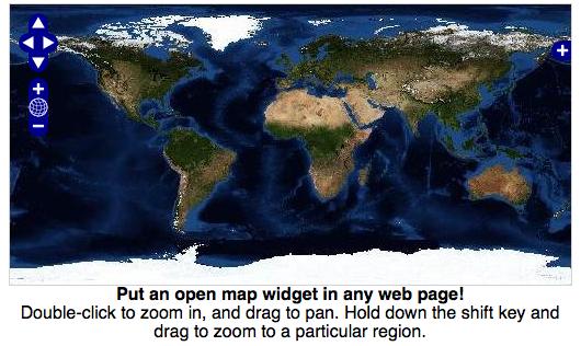
8 Static Maps vs. Slippy Maps 8

9 9

10 10
11 Who is the OGC? The Open Geospatial Consortium The Open Geospatial Consortium, Inc. (OGC) is a non-profit, international, voluntary consensus standards organization that is leading the development of standards for geospatial and location based services. 11
12 Web Mapping Service (WMS) VERSION=1.1.1& REQUEST=GetMap& SRS=EPSG:4326& BBOX=-126,20,-66,52& WIDTH=500& HEIGHT=500& LAYERS=us_states_poly& STYLES=& FORMAT=image/png& BGCOLOR=0xffffff& TRANSPARENT=FALSE& EXCEPTIONS=application/vnd.ogc.se_inimage 12

13 13
14 Composition The WMS spec predates Google Maps The intent is map composition, not slippy maps Each request is painstakingly assembled, lovingly rendered, and then thrown away 14
15 Decisions, Decisions Slippy Map Built for speed Many tiles Fixed zoom levels Fixed map layers Fixed image format WMS Built for customization One big tile Variable zoom levels Variable map layers Variable image format 15

16 16
17 17

18 Tiled Tessellated Mosaicked 18

19 19

20 20
21 21
22 Google Maps is one of many free APIs Others: Offers Ajax, Flash, and GeoRSS Microsoft s Offering 22

23 To begin, we need to sign up for a free Google Maps key 23

24 24

25 Example Page 25

26 Here is our first map 26
27 Adjusting our lat/lon and zoom level: Zoom 0 == World Zoom 20 == Street Level function load() { if (GBrowserIsCompatible()) { var map = new GMap2(document.getElementById("map")); map.setcenter(new GLatLng( , ), 16); } } 27

28 Map, Round 2 28
29 Let s add in some controls: function load() { if (GBrowserIsCompatible()) { var map = new GMap2(document.getElementById("map")); map.setcenter(new GLatLng( , ), 16); map.addcontrol(new GLargeMapControl()) map.addcontrol(new GMapTypeControl()) } } 29

30 Map, Round 3 30
31 Finally, let s add a marker and an info window: var logourl = " images/header_logotype.gif" var bcdesc = "<img src='" + logourl + "' width='321' height='72'/>" bcdesc += "<br />" bcdesc += "<a href=' lasvegas/index.html'>" bcdesc += "TheServerSide, Java Symposium" bcdesc += "</a><br />" bcdesc += "Las Vegas, NV" bcmarker.openinfowindowhtml(bcdesc) 31

32 Map, Round 4 32
33 OpenLayers Pure JavaScript web client In addition to supporting OGC layers Google Maps Yahoo Maps MS Virtual Earth (Local Live) WorldWind 33

34 One Map 34

35 One File 35 35

36 36
37 Two Dimensional Maps vs. Three Dimensional Maps 37


38 38

39 39


40 40
 client.")
. http://en.wikipedia.")
41 Google Earth is able to show all kinds of images overlaid on the surface of the earth and is also a Web Map Service (WMS) client. Google Earth supports managing threedimensional Geospatial data through Keyhole Markup Language (KML). 41


42 42
43 Data vs Pretty Pixels Data services: WFS (Web Feature Service) Portrayal services: WMS (Web Mapping Service) 43
44 GetCapabilities The first thing a program will do is ask the OGC server what data layers it has to offer This is called a GetCapabilities request service=wfs& version=1.0.0& request=getcapabilities 44

45 GetCapabilities And here is the response: 45 45
46 DescribeFeatureType Once you find a layer that looks interesting, you can ask the service to describe it: version=1.0.0& service=wfs& request=describefeaturetype& typename=us_states_poly 46

47 DescribeFeatureType And here is the response: 47
48 GetFeature Finally, you can request the data layer: version=1.0.0& service=wfs& request=getfeature& typename=us_states_poly 48
 49 49")
49 GetFeature And here is the response: This is called GML (Geography Markup Language) 49 49
50 ( Astoundingly boring, isn't it?) 50
51 51
52 52

53 53

54 54

55 55

56 56
57 [The 2009 JavaOne] Scriptbowl had 5 contenders: Jython, Groovy, Clojure, Scala and JRuby....via twitter: "Groovy won the Script Bowl at #javaone thanks to the griffon team for the demo". Here are a few snapshots of the demo: a mashup of NASA WorldWind and TwitterAPI, packaged as a Griffon application (Twittersphere): 57

58 58
59 NeoGeography [This term] arose with the concept of Web 2.0, around the increased public appeal of mapping and geospatial technologies that occurred with the release of such tools as "slippy maps" such as Google Maps, Google Earth, and also with the decreased cost of geolocated mobile devices such as GPS units. 59
60 Ajax Maps vs. RIA Maps 60

61 61

62 62

63 63

64 64

65 65
66 66

67 67

68 68

69 69
70 But wait -- there s more! 70

71 71

72 72
73 But wait -- there s STILL more! 73

74 74
75 75

76 76
77 So, what have we learned? 77
78 Desktop - Browser Deployment - Functionality Flex - Air 78
79 X Slippy Maps (...and Scott Davis) 79
80 Scott Davis Questions? Thanks for your time. 80
Interactive Web Mapping: Overview
 Interactive Web Mapping: Overview Overview of how geospatial data is formatted requested supplied consumed by/for web technologies 2 Definitions Analysis exploring and modeling geospatial phenomena Mapping
map1.html 1/1 lectures/8/src/
 map1.html 1/1 3: map1.html 5: Demonstrates a "hello, world" of maps. 7: Computer Science E-75 8: David J. Malan 9: 10: --> 1 13:
Lake Superior MapBuilder Demo Mapping Mashup Workshop Minnesota GIS/LIS Conference Duluth, Minnesota October 21, 2009
 Lake Superior MapBuilder Demo Mapping Mashup Workshop Minnesota GIS/LIS Conference Duluth, Minnesota October 21, 2009 Background The purpose of this exercise is to build a web mapping site that integrates
Getting Started with the ArcGIS Server JavaScript API
 Getting Started with the ArcGIS Server JavaScript API Agenda Introduction ArcGIS Server services and mashups REST API Services Directory JavaScript API ArcGIS Server Resource Center Dojo Maps, layers,
Getting Started with ArcGIS for Server. Charmel Menzel and Ken Gorton
 Getting Started with ArcGIS for Server Charmel Menzel and Ken Gorton Agenda What is ArcGIS for Server? Types of Web services Publishing resources onto the Web Clients to ArcGIS for Server Editions and
Upper Lake Michigan MapBuilder Demo GLOS Mapping Workshop Traverse City, Michigan November 11, 2009
 Upper Lake Michigan MapBuilder Demo GLOS Mapping Workshop Traverse City, Michigan November 11, 2009 Background The purpose of this exercise is to build a web mapping site that integrates different sources/formats
Leveraging OGC Services in ArcGIS Server
 Esri International User Conference San Diego, CA Technical Workshops Jul.14 th 2011 Leveraging OGC Services in ArcGIS Server Satish Sankaran Yingqi Tang Agenda Interoperability
Leveraging OGC Services in ArcGIS Server. Satish Sankaran Yingqi Tang
 Leveraging OGC Services in ArcGIS Server Satish Sankaran ssankaran@esri.com Yingqi Tang ytang@esri.com Agenda Interoperability Enablers OGC and esri OGC Web Services ArcGIS and OGC Web Services - @ version
Lecture note on the history and principles of geo-webservices
 A SHORT INTRODUCTION TO GEO-WEBSERVICES Lecture note on the history and principles of geo-webservices Barend Köbben Version 1.0 February 24, 2010 Contents 1 From monolithic to distributed GIS architectures
OpenLayers: Open Source Map Browser
 OpenLayers: Open Source Map Browser July 12, 2008 Introduction Outline OpenLayers Features, history, components Code example Types and integration of data layers Conclusion 1 History! "! )./ - DE #! $
Data Acquisition using Mashup and 3-D Technology. Matt Rahr College of Agriculture and Life Sciences University of Arizona
 Data Acquisition using Mashup and 3-D Technology Matt Rahr College of Agriculture and Life Sciences University of Arizona Let s Do It! What is a Mashup? + Your Data A hybrid website or web application
Leveraging OGC Services in ArcGIS Server. Satish Sankaran, Esri Yingqi Tang, Esri
 Leveraging OGC Services in ArcGIS Server Satish Sankaran, Esri Yingqi Tang, Esri GIS Creating and Managing Geo Information Products - Proprietary - Open Specifications - Standards Dissemination of Geo
Maps on the Web. Chapter 1. Emmanuel Stefanakis.
 Stefanakis, E., 2015. Web Mapping and Geospatial Web Services. CreateSpace Independent Publ. [In English], pp.168. Get a copy from Amazon Chapter 1 Maps on the Web Emmanuel Stefanakis http://www2.unb.ca/~estef/
Google Maps Mashups WORKSHOP. Jeff Blossom, Senior GIS Specialist Center for Geographic Analysis. Harvard University gis.harvard.
 Google Maps Mashups WORKSHOP Jeff Blossom, Senior GIS Specialist Center for Geographic Analysis Harvard University gis.harvard.edu Fall, 2012 Objectives: Workshop objectives and flow 1) In 2 hour, hands
Building Mashups Using the ArcGIS APIs for FLEX and JavaScript. Shannon Brown Lee Bock
 Building Mashups Using the ArcGIS APIs for FLEX and JavaScript Shannon Brown Lee Bock Agenda Introduction Mashups State of the Web Client ArcGIS Javascript API ArcGIS API for FLEX What is a mashup? What
Mash Something. Purdue e-pubs. Purdue University. Christopher C. Miller Purdue University,
 Purdue University Purdue e-pubs GIS Day GIS, Geoinformatics, and Remote Sensing at Purdue 11-18-2008 Mash Something Christopher C. Miller Purdue University, ccmiller@purdue.edu Follow this and additional
Interoperability and Standards Supports in ArcGIS
 Esri International User Conference San Diego, California Technical Workshops July 26, 2012 Interoperability and Standards Supports in ArcGIS Satish Sankaran, Esri Yingqi Tang, Esri Agenda Esri s participation
Sergio Luján Mora Department of Software and Computing Systems
 Sergio Luján Mora Department of Software and Computing Systems Embedding Google Maps in web pages GOOGLE MAPS Google Maps Documentation Simple Map Markers Info Window Index Google Maps GM is a geospatial
Leveraging OGC Standards on ArcGIS Server
 Leveraging OGC Standards on ArcGIS Server Satish Sankaran Interoperability and Standards Team James Michel III ESRI Intel Team ArcGIS Server Complete Interoperable Server-Based GIS Desktop Explorer Web
Client-side Web Engineering 2 From XML to Client-side Mashups. SWE 642, Spring 2008 Nick Duan. February 6, What is XML?
 Client-side Web Engineering 2 From XML to Client-side Mashups SWE 642, Spring 2008 Nick Duan February 6, 2008 1 What is XML? XML extensible Markup Language Definition: XML is a markup language for documents
ORACLE FUSION MIDDLEWARE MAPVIEWER
 ORACLE FUSION MIDDLEWARE MAPVIEWER 10.1.3.3 MAPVIEWER KEY FEATURES Component of Fusion Middleware Integration with Oracle Spatial, Oracle Locator Support for two-dimensional vector geometries stored in
Providing Interoperability Using the Open GeoServices REST Specification
 2013 Esri International User Conference July 8 12, 2013 San Diego, California Technical Workshop Providing Interoperability Using the Open GeoServices REST Specification Satish Sankaran Kevin Sigwart What
Road maps. Introduction. Structure
 Road maps Introduction This service let you embed interactive maps in your website (à la Google maps). You can customize map by displaying data in overlays You can create your own overlays. Structure To
Simple Carpool Application using SAP NetWeaver Portal, KM, XML Forms, and Google Maps
 Simple Carpool Application using SAP NetWeaver Portal, KM, XML Forms, and Google Maps Applies to: SAP NetWeaver Portal 6.x\7.x, Knowledge Management (KM), and Google Maps. For more information, visit the
OGC,, WMS and WFS. Strategic Goals. The Vision and the Mission
 The Vision and the Mission OGC,, WMS and WFS Vision: Realization of the full societal, economic and scientific benefits of integrating electronic location resources into commercial and institutional processes
GeoNURIS WebGIS Tutorial Cooperation & Communication International
 GeoNURIS WebGIS Tutorial 2011-11-07 by Cooperation & Communication International Table of Contents Foreword Part I Document Introduction 0 5 1 Terms... 5 2 Conventions... 5 3 Prerequisite... 6 Part II
MAP SCRIPTING 101. AH Example-Driven Guide to Building Interactive MapA with Sing, Yahoo!, and Google MapA. by Adam DuVander.
 MAP SCRIPTING 101 AH Example-Driven Guide to Building Interactive MapA with Sing, Yahoo!, and Google MapA by Adam DuVander no starch press San Francisco CONTENTS IN DETAIL ACKNOWLEDGMENTS INTRODUCTION
Open Source Cloud Map User Guide
 Open Source Cloud Map User Guide Table of Contents Map Page... 1 Static Mercator Map... 1 Customizable Map... 1 Title Bar... 2 Toolbar... 2 Non Toolbar Navigation... 3 Map Window... 3 Layers / Legend Window...
Extending the Functionality of the Client
 Stefanakis, E., 2015. Web Mapping and Geospatial Web Services. CreateSpace Independent Publ. [In English], pp.168. Get a copy from Amazon Chapter 5 Extending the Functionality of the Client Emmanuel Stefanakis
Working with the ArcGIS Viewer for Flex Application Builder
 Working with the ArcGIS Viewer for Flex Application Builder Esri Canada User Conference St. John s November 15, 2012 Presented By: Greg Yetman gyetman@esri.ca Agenda This seminar is designed to help you
SuperGIS Server 3.2 Value Edition Specification
 SuperGIS Server 3.2 Value Edition Specification 20140826 Specification 1. All of the services support SOAP (Simple Object Access Protocol). 2. Use map file created by SuperGIS Desktop as map services SuperGIS
Implementing Web GIS Solutions
 Implementing Web GIS Solutions using open source software Karsten Vennemann Seattle Talk Overview Talk Overview Why and What What is Open Source (GIS)? Why use it? Application Components Overview of Web
Carmenta Server Product Description
 White paper Carmenta Server Product Description Carmenta AB, Tel +46-31-775 57 00, www.carmenta.com P315 121RD, 2010 Carmenta reserves the right to change the specifications at any time and without notice.
Oracle Spatial Pure Web Editing for Telco Outside Plant Engineering Planning. Eamon Walsh espatial Solutions
 Spatial SIG Oracle Spatial Pure Web Editing for Telco Outside Plant Engineering Planning Eamon Walsh espatial Solutions Speaker Eamon Walsh, CTO espatial Solutions. over 20 years experience in the IT industry,
Introduction THE OPENGEO ARCHITECTURE
 Introduction Putting maps on the web used to be very very difficult. It required specialized software, and more important, specialized knowledge about the kinds of data and processes used to create cartographic
EUCOM/AFRICOM DEFENSE USER GROUP MEETING MARCH 2010 STUTTGART WELCOME!
 EUCOM/AFRICOM DEFENSE USER GROUP MEETING 23-25 MARCH 2010 STUTTGART WELCOME! AGENDA March 23, Tuesday 0800-0900 Registration 0900-0915 Welcome and Introductions 0915-1000 Getting Started with ArcGIS Server
BROWSER. LuciadRIA DATA SHEET
 BROWSER LuciadRIA DATA SHEET V2017 V2017.0 DATA SHEET LuciadRIA is the answer to today s demands for powerful, lightweight applications in the browser. Driven by today s most advanced web technologies,
Viewer Features. DataBC Mashup Framework (DMF)
") Viewer Features DataBC Mashup Framework (DMF) Copyright 2014 Ministry of Labour, Citizens' Services and Open Government All Rights Reserved. Printed in Canada The information contained in this document
Viewer Features DataBC Mashup Framework (DMF) Copyright 2014 Ministry of Labour, Citizens' Services and Open Government All Rights Reserved. Printed in Canada The information contained in this document
Help Documentation. Copyright 2007 WebAssist.com Corporation All rights reserved.
 Help Documentation Copyright 2007 WebAssist.com Corporation All rights reserved. Using Pro Maps for Google This wizard adds a Pro Map for Google to your web page, allowing you to configure and specify
OPEN SOURCE SOLUTIONS FOR SURVEYORS
 2 nd Sabah International Surveyors Congress 11 th 12 th March 2014 OPEN SOURCE SOLUTIONS FOR SURVEYORS Presented By : Sr Alexander Chong Director, Jurukur Antarabangsa The Benefits Of Closed Proprietary
Web Services Made Easy Without Any Coding. September 23, 2013
 Web Services Made Easy Without Any Coding September 23, 2013 Agenda Introduction Safe Software and FME FME Approach to Web Services Live Demos Consuming Web Services Leveraging Web Services Publishing
Open Geospatial Consortium (OGC) and Web Services (WMS, WFS)
 and Web Services (WMS, WFS)") Open Geospatial Consortium (OGC) and Web Services (WMS, WFS) Responsible persons: Regula Stopper (Overall) Ionut Iosifescu Enescu (Content) Samuel Wiesmann (Revision) Olaf Schnabel (Revision) Content
Open Geospatial Consortium (OGC) and Web Services (WMS, WFS) Responsible persons: Regula Stopper (Overall) Ionut Iosifescu Enescu (Content) Samuel Wiesmann (Revision) Olaf Schnabel (Revision) Content
OpenLayers Workshop. Follow along with the demos at Thomas Wood OpenLayers User & Contributor
 OpenLayers Workshop Follow along with the demos at http://sn.im/soc-ol-demos Thomas Wood OpenLayers User & Contributor SoC Summer School 09 Southampton Tuesday, 8th September What is OpenLayers? an Open
Web Mapping Applications with ArcGIS. Bernie Szukalski Derek Law
 Web Mapping Applications with ArcGIS Bernie Szukalski Derek Law Agenda Web Mapping and Map Services Fundamentals ArcGIS Web Mapping Applications - Hosted online - Hosted on-premise Summary Web Application
Genealogical Searching the World Wide Web. July 2015 Slides at:
 Genealogical Searching the World Wide Web July 2015 Slides at: http://www.colket.org/genealogy/usf/ Google Earth Overview Use of Google Earth for Genealogy: Get Directions to Research Locations Plan a
_ LUCIADRIA V PRODUCT DATA SHEET _ LUCIADRIA PRODUCT DATA SHEET
 _ LUCIADRIA PRODUCT DATA SHEET V2016 LuciadRIA offers browser-based geospatial situational awareness with the fluidity and speed of a desktop application. The software components of LuciadRIA have been
InCLUDE Data Exchange. Julia Harrell, GISP GIS Coordinator, NC DENR
 InCLUDE Data Exchange Julia Harrell, GISP GIS Coordinator, NC DENR Julia.harrell@ncdenr.gov InCLUDE Project Partners NC Department of Environment & Natural Resources: The State of NC s lead environmental
INTERRACTION COMPONENT STATE-OF-THE-ART
 INTERRACTION COMPONENT STATE-OF-THE-ART DELIVERABLE D6.1.1 By C2TECH Due date of deliverable : t0+ 6 Actual submission date: t0+ xxx Version :01 State : Draft/For approval/approved/obsolete Dissemination
Accessing OGC Services To access OGC WMS and WFS open the service in the directory that you want to consume, and click on either WMS or WFS.
 Using Web Services Web Services Overview This user guide contains instructions on how to consume a range of services through a range of both web based and desktop GIS applications. Web services are a live
Regarding the quality attributes, the architecture of the system must be:
 The SDSS System Overview This chapter gives an overview of the software architecture of the RiskChanges SDSS system. One of the objectives within the project is the development of a SDSS system for probabilistic
Features and Benefits
 AUTODESK MAPGUIDE ENTERPRISE 2010 Features and Benefits Extend the reach and value of your spatial information using Autodesk MapGuide Enterprise 2010 software. Access design and spatial data from a variety
Caching Tile Cache Creation & Management
 Exploring Options for Map Caching Tile Cache Creation & Management Presented By: Todd Wascher, Business Development Manager 04.21.2011 We Visualize Your World Whachutalkinbout? What we ll cover with this
user manual GeoViewer DB Netze Fahrweg
 user manual GeoViewer DB Netze Fahrweg Register of Infrastructure Updated: Juli 2018 Release: 1.11.0 Page 1 von 32 Content 1 List of illustrations 3 2 Basics 4 2.1 Components 4 2.1.1 Interfaces 4 2.1.2
OSGeo Web Mapping Typification: GeoMajas, Mapbender, MapFish and OpenLayers. Christoph Baudson Arnulf Christl FOSS4G 2010 Barcelona
 OSGeo Web Mapping Typification: GeoMajas, Mapbender, MapFish and OpenLayers Christoph Baudson Arnulf Christl FOSS4G 2010 Barcelona Disclaimer All information contained in this presentation has been compiled
Beginning Google Maps Mashups with Mapplets, KML, and GeoRSS
 Beginning Google Maps Mashups with Mapplets, KML, and GeoRSS From Novice to Professional ш я т Sterling Udell Apress" Contents About the Author About the Technical Reviewer Acknowledgments Introduction
Developing a Free and Open Source Software based Spatial Data Infrastructure. Jeroen Ticheler
 Developing a Free and Open Source Software based Spatial Data Infrastructure Jeroen Ticheler 1 License This work is licensed under the Creative Commons Attribution-NonCommercial-ShareAlike 2.5 License.
IIPIMAGE AND THE OLDMAPSONLINE.ORG PROJECT
 IIPIMAGE AND THE OLDMAPSONLINE.ORG PROJECT Petr Žabička Petr Přidal Moravian Library Brno: OldMapsOnline.org R&D grant of the Czech Ministry of Culture (DC08P02OUK006)
Best Practices for Designing Effective Map Services
 2013 Esri International User Conference July 8 12, 2013 San Diego, California Technical Workshop Best Practices for Designing Effective Map Services Ty Fitzpatrick Tanu Hoque What s in this session Map
Tutorial International Standards. Web Map Server (WMS) & Web Feature Server (WFS) Overview
 & Web Feature Server (WFS) Overview") ISO/TC 211 17 th Plenary & Associated Meetings Berlin, Germany, DIN Institute / 2003-10-31 Advisory Group on Outreach Tutorial International Standards Web Map Server (WMS) & Web Feature Server (WFS) Overview
ISO/TC 211 17 th Plenary & Associated Meetings Berlin, Germany, DIN Institute / 2003-10-31 Advisory Group on Outreach Tutorial International Standards Web Map Server (WMS) & Web Feature Server (WFS) Overview
Single and Multiple Thread Programming for Geo-visualization by Using WebGL with Web Workers
 , 23-25 October, 2013, San Francisco, USA Single and Multiple Thread Programming for Geo-visualization by Using WebGL with Web Workers Hyung Woo Kim, Yang-Won Lee Abstract So far, various web elements
ArcGIS Viewer for Microsoft Silverlight An Introduction
 Esri International User Conference San Diego, CA Technical Workshops July 12, 2011 ArcGIS Viewer for Microsoft Silverlight An Introduction Art Haddad, Rich Zwaap, and Derek Law Agenda Background Product
Using an ArcGIS Server.Net version 10
 Using an ArcGIS Server.Net version 10 Created by Vince DiNoto Vince.dinoto@kctcs.edu Contents Concept... 2 Prerequisites... 2 Data... 2 Process... 3 Creating a Service... 3 Down Loading Shapefiles... 3
Mobile Systeme Grundlagen und Anwendungen standortbezogener Dienste. Location Based Services in the Context of Web 2.0
 Mobile Systeme Grundlagen und Anwendungen standortbezogener Dienste Location Based Services in the Context of Web 2.0 Department of Informatics - MIN Faculty - University of Hamburg Lecture Summer Term
Developing Ajax Web Apps with GWT. Session I
 Developing Ajax Web Apps with GWT Session I Contents Introduction Traditional Web RIAs Emergence of Ajax Ajax ( GWT ) Google Web Toolkit Installing and Setting up GWT in Eclipse The Project Structure Running
PF-III User Guide for GUI and API - validation phase
 PF-III User Guide for GUI and API - validation phase Doc.No. : EUM/OPS/MAN/18/983019 Issue : v1a Date : 7 June 2018 WBS/DB : S EUMETSAT Eumetsat-Allee 1, D-64295 Darmstadt, Germany T l 49 6151 807 7 EUMETSAT
Author. Publish. Use
 Building Mashups Using the ArcGIS Web APIs Heather Gonzago Garima Vyas Agenda g Overview: Web Maps Overview: ArcGIS API for REST ArcGIS API for JavaScript p Google Maps Extension Bing Maps Extension ArcGIS
An Overview of FMW MapViewer
 An Overview of FMW MapViewer Agenda What is MapViewer Select Features Getting Started Additional Resources 2 Copyright 2013, Oracle and/or its affiliates. All rights reserved. Oracle
Real World Ajax Learning the magic behind Google, Yahoo!, and other Ajax-driven websites
 Real World Ajax Learning the magic behind Google, Yahoo!, and other Ajax-driven websites Scott Davis Davisworld Consulting Scott Davis Real World AJAX Page 1 Introduction My name is Scott Davis JBoss At
Lose Yourself in Map Services (Google, Microsoft, Yahoo, MapQuest) Luke Sankey 28 November 2006 / CSCI 7818: Web Services
 Luke Sankey 28 November 2006 / CSCI 7818: Web Services") Lose Yourself in Map Services (Google, Microsoft, Yahoo, MapQuest) Luke Sankey 28 November 2006 / CSCI 7818: Web Services Expected Features of a Map (from basic to advanced) Programmatically move, zoom,
Lose Yourself in Map Services (Google, Microsoft, Yahoo, MapQuest) Luke Sankey 28 November 2006 / CSCI 7818: Web Services Expected Features of a Map (from basic to advanced) Programmatically move, zoom,
WebGIS exercise Land Change Viewer. Elisabeth Weinke Department of Geoinformatics University of Salzburg
 WebGIS exercise Land Change Viewer Elisabeth Weinke Department of Geoinformatics University of Salzburg Overview Client Application OpenLayers Google Maps Interface WMS WFS Server GeoServer Data management
Esri Support for Geospatial Standards
 APRIL 2017 ArcGIS Is Open and Interoperable Esri Support for Geospatial Standards Copyright 2017 Esri All rights reserved. Printed in the United States of America. The information contained in this document
SDI Tecnological Components and Standards
 SDI Tecnological Components and Standards Salvador Bayarri sbayarri@gmail.com World Bank Consultant Contents The SDI architecture model Software components: the SDI stack Basic services Metadata SDI access
ArcGIS Online. The Road Ahead Geoff Mortson
 ArcGIS Online The Road Ahead Geoff Mortson gmortson@esricanada.com ArcGIS Online Easily create and share maps Delivered as intelligent maps Access on virtually any device anyone, anywhere Compliments and
Integrated Map Tool. Overview, Current Status, and Things to Come
 Integrated Map Tool Overview, Current Status, and Things to Come Integrated Mapping and Analysis Tool (IMAT) map widget Integrated Mapping Tool IMAT Reusable components for portrayal, query, analysis,
SEXTANT 1. Purpose of the Application
 SEXTANT 1. Purpose of the Application Sextant has been used in the domains of Earth Observation and Environment by presenting its browsing and visualization capabilities using a number of link geospatial
WEB MAPPING WITH GOOGLE MAPS MASHUPS: OVERLAYING GEODATA
 WEB MAPPING WITH GOOGLE MAPS MASHUPS: OVERLAYING GEODATA I. O. Bildirici a, *, N.N. Ulugtekin b a Selcuk University, Faculty of Eng., Dept. of Geomatic Engineering, 42079 Selcuklu Konya, Turkey bildirici@selcuk.edu.tr
pgrouting extends the postgis/postgresql geospatial database to provide geospatial routing and other network analysis functionality.
 Workshop: 1 pgrouting extends the postgis/postgresql geospatial database to provide geospatial routing and other network analysis functionality. Attendee s previous knowledge: SQL (PostgreSQL, PostGIS)
INTEGRATION OF DISASTER EVENT DATA INTO SPATIAL DATA INFRASTRUCTURES
 INTEGRATION OF DISASTER EVENT DATA INTO SPATIAL DATA INFRASTRUCTURES B. Stollberg a, *, T. De Groeve a, A. Hirner a, L. Vernaccini a, S. Paris a a Joint Research Centre of the European Commission, Institute
OGRS Perugia, Italy October 2016
 OGRS Perugia, Italy 12-14 October 2016 NASA WorldWind: virtual globe for an open smart city Maria Antonia Brovelli 1, Candan Eylül Kilsedar 1, Patrick Hogan 2, Gabriele Prestifilippo 1, Giorgio Zamboni
Using ArcGIS for Server. Javier Abadía, Esri España Peter McDaid, Esri UK
 Using ArcGIS for Server Javier Abadía, Esri España Peter McDaid, Esri UK 1. Intro 2. ArcGIS for Server = Geospatial Apps Server 3. Map Services Publishing Flow Apps 4. Spatial Functionality Services Publishing
A ONE-STOP SERVICE HUB INTEGRATING ESSENTIAL WEATHER AND GEOPHYSICAL INFORMATION ON A GIS PLATFORM. Hong Kong Observatory
 A ONE-STOP SERVICE HUB INTEGRATING ESSENTIAL WEATHER AND GEOPHYSICAL INFORMATION ON A GIS PLATFORM Hong Kong Observatory Mission HONG KONG OBSERVATORY To provide people-oriented quality services in meteorology
gvsig: towards 4D GIS
 gvsig: towards 4D GIS Salvador Bayarri IVER Salvador.Bayarri@iver.es www.gvsig.gva.es Contents gvsig's background & updates 3D visualization in gvsig Time and Animation in gvsig Implementation plan Demo
Desktop. ArcGIS Server. ArcGIS
 Getting Started with ArcGIS Server Nakul Bhatia and David Crosby ESRI Charlotte 1 Agenda g Overview of ArcGIS Server 9.3.1 Working with GIS Services Using g Web GIS Service Clients ArcGIS Online Map Caching
Challenges within Geographical Data Sharing Using OGC Standards Regarding the INSPIRE Directive
 Challenges within Geographical Data Sharing Using OGC Standards Regarding the INSPIRE Directive Johan Sandberg Master s of Science Thesis in Geoinformatics TRITA-GIT EX 11-008 School of Architecture and
What s New in ArcGIS 10.4 for Server
 What s New in ArcGIS 10.4 for Server Derek Law, Esri Jan 19, 2016 Esri Southwest User Conference Agenda Product story GIS Server Sharing content from ArcGIS Pro Portal for ArcGIS Client Apps Summary Strongly
Luis Bermudez Director Interoperability Certification May 31, 2011
 FÓRUM Padrões OGC Padrões OGC: WFS, WMS, WCS, CSW, SWE Luis Bermudez Director Interoperability Certification lbermudez@opengeospatial.org May 31, 2011 Copyright OpenGeospatial Consortium 2012 1 OGC Web
Maarten Vroegindeweij, 3BM, Domera
 BILT EUR 2018 GR Ljubljana Exhibition and Convention Centre, Ljubljana 11 13 October 2018 Session 1.4 GIS to BIM using Dynamo Maarten Vroegindeweij, 3BM, Domera Class Description GIS to BIM using Dynamo.
New Features in TNTmips 2010
 61st Release February 2010 New Features in TNTmips 2010 A tileset is a collection of small image files called tiles in a predefined file size, format, and directory structure. It is designed for efficient
ArcGIS 9.2 Works as a Complete System
 ArcGIS 9.2 Works as a Complete System A New Way to Manage and Disseminate Geographic Knowledge Author/Serve/Use Maps Data Models Globes Metadata Use Desktop Explorer Web Map Viewer Mobile Open APIs Enterprise
Managing Image Data on the ArcGIS Platform Options and Recommended Approaches
 Managing Image Data on the ArcGIS Platform Options and Recommended Approaches Peter Becker Petroleum requirements for imagery and raster Traditional solutions and issues Overview of ArcGIS imaging capabilities
Web Map Caching and Tiling. Overview David M. Horwood June 2011
 Web Map Caching and Tiling Overview David M. Horwood dhorwood@esricanada.com June 2011 Web Mapping Traditional Geographic projection Select / Refresh workflow Slow, non-interactive (refresh delay) http://www.geographynetwork.ca/website/obm/viewer.htm
KML Macro: Integrating SAS and Google API. Mapping Manitoba's Health Data. and Its Application in. on Google Earth and Google Map
 KML Macro: Integrating SAS and Google API and Its Application in Mapping Manitoba's Health Data on Google Earth and Google Map Presented and selected as Honorable mention Paper in 2010 SAS Global Forum,
Mapping, Visualization, and Digitization of the Geo-Referenced Information: A case study on Road Network Development in Near Real Time
 Mapping, Visualization, and Digitization of the Geo-Referenced Information: A case study on Road Network Development in Near Real Time Ronak Jain 1, Himansi Bhatt 2, Nithya Jeevanand 2, Praveen Kumar 3
Open Geospatial Consortium
 Open Geospatial Consortium Approval Date: 2013-01-18 Posted Date: 2012-12-07 Publication Date: 2013-03-26 Reference number of this document: OGC 12-097 OGC URI: http://www.opengis.net/def/doc-type/per/ows-9-bulk-data-transfer-gml
May 22, 2013 Ronald Reagan Building and International Trade Center Washington, DC USA
 May 22, 2013 Ronald Reagan Building and International Trade Center Washington, DC USA 1 Building Applications with Oracle MapViewer LJ Qian (lj.qian@oracle.com) Director, Software Development The following
Achieving Interoperability using the ArcGIS Platform. Satish Sankaran Roberto Lucchi
 Achieving Interoperability using the ArcGIS Platform Satish Sankaran Roberto Lucchi Thank you Please fill out the session survey in your mobile app Select [Achieving Interoperability using the ArcGIS Platform]
New Features in TNTmips 2012
 18 November 2011 63rd Release January 2012 New Features in TNTmips 2012 Highlight Features: Use popular color stereo viewing devices Annotate, sketch, or edit features in stereo Export geometric objects
The ActionScript Markup Language
 /[PLT]*/ presents: The ActionScript Markup Language Nathan Rogan Shaun Salzberg Anand Rajeswaran Sergio Biasi Team Member : Nathan Role : Project Manager System Architect System Integrator Programmer ASML
Google Maps Manually Place Marker On Click V3 Remove
 Google Maps Manually Place Marker On Click V3 Remove Following is the HTML Markup containing the Google Map implementation. To add markers you will need to click on the map. These markers are added. When
Distributed Map Animation Services for Spatiotemporal Datasets
 Distributed Map Animation Services for Spatiotemporal Datasets A. Sayar Key Words: Distributed Systems; animation; GIS; animated map; spatiotemporal data. Abstract. Maps are an excellent way to present