AND FOLLOWING. Tod S. Levitt, Daryl I. Lawton, David M. Chelberg, Philip C. Eelson. Advanced Decision Systems, Mountain View, California 94040
|
|
|
- Harry Shawn Harrell
- 5 years ago
- Views:
Transcription
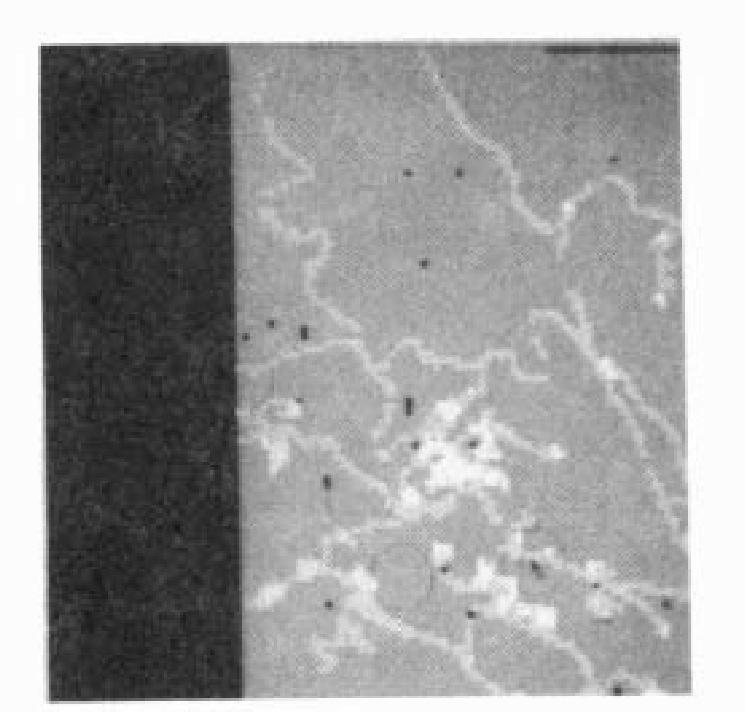
1 From: AAAI-87 Proceedings. Copyright 1987, AAAI ( All rights reserved. QUALITATIVE LANDMARK-BASED AND FOLLOWING PAT PLANNING Tod S. Levitt, Daryl I. Lawton, David M. Chelberg, Philip C. Eelson Advanced Decision Systems, Mountain View, California ABSTRACT This paper develops a theory for path planning and following using visual landmark recognition for the representation of environmental locations. It encodes local perceptual knowledge in structures called viewframes and orientation regions. Rigorous representations of places as visual events are developed in a uniform framework that smoothly integrates a qualitative version of path planning with inference over traditional metric representations. Paths in the world are represented as sequences of sets of landmarks, viewframes, orientation boundary crossings, and other distinctive visual events. Approximate headings are computed between viewframes that have lines of sight to common landmarks. Orientation regions are rangefree, topological descriptions of place that are rigorously abstracted from viewframes. They yield a coordinate-free model of visual landmark memory that can also be used for path planning and following. With this approach, a robot can opportunistically observe and execute visually cued shortcuts. 1. INTRODUCTION The questions that define the problems of path planning and following are: <Where am I?, Where are other places relative to me?, and LH~~ do I get to other places from here?. A robot that moves about the world must be able to compute answers to these questions. This paper is concerned with the structure and processing for robotic visual memory that yields visual path inference. The input data is assumed to be percepts extracted from imagery, and a database, i.e., memory, of models for visual recognition. A priori model and map data is only relevant insofar as it provides a basis for runtime recognition of observable events. This is distinguished from path traversability planning where the guidance questions concern computing shortest distances between points under constraints of support of the ground or surrounding environment for the robotic vehicle. Existing robot navigation techniques include triangulation [hfatthies and Shafer, 19861, ranging sensors [Hebert and Kanade, 19861, auto-focus [Pentland, 19853, stereo techniques [Lucas and Kanade, 19841, dead reckoning, inertial navigation, geo-satellite location, correspondence of map data with the robot s location, and local obstacle avoidance techniques. These approaches tend to be brittle Bajcsy et, al., 19861, accumulate error [Smith and Cheeseman, 19851, are limited by the range of an active sensor, depend on accurate measurement of distance/direction perceived or traveled, and are non- perceptual, or only utilize weak perceptual models. Furthermore, these theories are largely concerned with the problem of measurement and do not centrally address issues of man or visual memory and the use of this memory for inference in vision-based path planning or following. Exceptions to this are the work of IDavis, 19861, ;McDermott and Davis, 1984], and [Kuipers, Davis addressed the nroblem of renresentation and assimilation of 2D geomeiric memory, but assumed an orthographic - _ view of the world and did not consider navigation or guidance. McDermott and Davis developed an ad hoc mixture of vector and topological based route planning, but assumed a map, rather than vision derived world fin their assumptions of knowledge of boundaries, their shapes, and spatial relationship;), had no formal theory relating the multiple levels of representation, and consequently did not derive or implement results developed qualitative about - path- execution. Kuipers techniques for path planning and following that were the inspiration for our approach. He assumed capability of landmark do, but relied on dead-reckoning recognition, as we and constraint to one-dimensional (road) networks to permit path planning and execution. We develon renresentation and inference for relative geographic- position information that: build a memory of the environment the robot passes through; contains sufficient information to allow the robot to retrace its paths; can be used to construct or update an a posterior; map of the geographic area the -robot has passed through; and can utilize all available information, including that from runtime perceptual inferences and a priori map data, to perform path planning and following. The robust, qualitative properties and formal mathematical basis of the representation and inference processes presented herein are suggestive of the path planning and following behavior in animals and humans [Schone, However, we make no claims of biological foundations for this approach. 2. TOPOLOGICAL LANDMARK NETWO REPRESENTATIONS.A viewframe encodes the observable landmark information in a stationary panorama. To generate a viewframe, relative solid angles between distinguished points on landmarks are computed using a sensorcentered spherical coordinate system. We can pan from left to right, recognizing landmarks, L,. storing the Levitt, bawton, Ckelberg, and Nelson 689


2


3


4
5 A natural environmental representation based on viewframes orientation regions and LPB crossings, recorded while following a path, is given by a list of the ordered sequence of viewframes collected on the path, and another list of the set of landmarks observed on the path. For efficiency, the landmark list can be formed as a database that can be accessed based on spatial and/or visual proximity. When a new viewpath is added to the database of perceptual knowledge, additional links between viewpaths are constructed based on landmarks seen on both paths. Using coarse range estimates to common landmarks, viewframe headings are computed between viewframes on different viewpaths. This structure is pictured in Figure 7. Figure 7(a) shows two viewpaths, while Figure 7(b) s h ows the paths augmented with the additional links. It is this augmented visual memory over which path plans are generated prior to path execution. a b Each of these strategies provably reaches its goal, up to the perceptual re-acquisition of landmarks and the traversability of intervening terrain. if viewframe goal landmarks visible -- > compute viewframe-heading if at least one LPB has an incorrect orientation relative to our viewframe-destination-goal then follow heading for approximate distance estimated by the viewframe-heading else maintain heading by control-feedback path following on relative angles between landmarks build a new viewpath to destination goal, using the existing landmark list where possible if viewframe goal landmarks not visible and viewpaths exists --> make a viewframe of the currently visible region chain back through viewpaths until common landmarks are located chain forward through viewframes setting up intermediate destination-goals recursively execute viewframe headings 1) reach the destination goals corresponding to visible landmarks if viewframe goal landmarks not visible and no viewpath exists --> set goal to find a metric heading We have implemented these rules with routines that use A* to plan an initial route to a destination based on data in visual memory. This route is executed using vision, with re-planning based on the currently perceived viewframe at each step. Figure 8(a) shows the plan over visual memory to move between two points. The executed route is shown in Figure 8(b). Notice how much smoother it is. Figure 8(c) shows an original plan, while 8(d) shows a dramatic replan based on observing a short-cut at runtime. Figure 7: Visual Memory Linking 4. SUMMARY AND FUTURE WORM The top level loop for landmark-based path planning and following is to: determine a destination-goal, compute and select a current heading, and execute the heading while building up an environmental representation. The destination-goals implement a recursive goal-decomposition approach to perceptual path plarrning. The concept underlying the path planning/following strategies encoded in these rules is to mix the following approaches as knowledge is available or can be inferred: o find landmarks in common between viewframes between point of origin and viewframedestination and compute vector (i.e., direction and approximate range) headings between viewframes e locate and get on the correct side of LPB s specified in an orientation-destination, or o associate visible and goal landmarks with map data and compute a metric heading between current location and goal A rigorous theory of qualitative, landmark-based path planning and following for a mobile robot has been developed. It is based upon a theory of representation of spatial relationships between visual events that smoothly integrates topological, interval-based, and metric information. The rule-based inference processes opportunistically plan and execute routes using visual memory and whatever data is currently available from visual recognition, range estimates and a priori map or other metric data. This document was prepared by Advanced Decision Systems (ADS) of Mountain View, California, under U.S. Government contract number DACA C-0005 for the U.S. Army Engineer Topographic Laboratories (ETL), Fort Belvoir, Virginia, and the Defense Advanced Research Projects Agency (DARPA), Arlington, Virginia. The authors wish to thank Angela Erickson for providing administration, coordination, and document preparation support. Levitt, Lawton, Chelberg, and Nelson 693
6 a Understanding Workshop, Miami Beach, Florida, December 9-10, 1985, pp [Lucas and Kanade, B. Lucas and T. Kanade, Optical Navigation by the Method of Differences, Proceedings Image Understanding Workshop, New Orleans, Louisiana, October 3-4, 1984, pp [Matthies and Shafer, L. Matthies and S. Shafer, Error Modelling in Stereo Navigation, Carnegie-Mellon University, Computer Science Denartment. Technical Report, CMU-CS-86- f40, [McDermott and Davis, 1984) - D. McDermott and E. Davis, Planning Routes through Uncertain Territory, Artificial Intelligence - An International Journal, Vol. 22, No. 2, March 1984, pp %ssey, R. Massey, Introduction to Algebraic Topology, Addison-Wesley, Figure 8: Path Planning and Following Results REFERENCES [Bajcsy et al., R. Bajcsy, E. Krotkov, and M. Mintz, Models of Errors and Mistakes in Machine Perception, University of Pennsylvania, Computer and Info. Science Technical Report, MS-CIS-86-26, GRASP LAB 64, (Davis, 1986: - E. Davis, Representing and Acquiring Geographic Knowledge, Courant Institute of Mathematical Sciences, New York University, Morgan Kaufmann Publishers, Inc., [Pentland, A. Pentland, A New Sense for Depth of Field, Proceedings of the Ninth International Joint Conference on Artificial Intelligence, IJCAI-85, Los Angeles, California, August 18-23, 1985, pp [Schone, H. Schone, Spatial Orientation - The Spatial Control of Behavior in Animals and Man, Princeton Series in Neurobiol- %Y and Behavior, R. Capranica, P. Marler, and N. Adler (Eds.), [Smith and Cheeseman, R. Smith and P. C heeseman, On the Representation and Estimation of Spatial Uncertainty, SRI International Robotics Laboratory Technical Paper, Grant ECS , September [Forbus, K.D. Forbus, Theory, Artificial Qualitative Intelligence, Process Vol. 24, December, Robotics
Topological Navigation and Path Planning
 Topological Navigation and Path Planning Topological Navigation and Path Planning Based upon points of interest E.g., landmarks Navigation is relational between points of interest E.g., Go past the corner
Acquisition of Qualitative Spatial Representation by Visual Observation
 Acquisition of Qualitative Spatial Representation by Visual Observation Takushi Sogo Hiroshi Ishiguro Toru Ishida Department of Social Informatics, Kyoto University Kyoto 606-8501, Japan sogo@kuis.kyoto-u.ac.jp,
Domain Adaptation For Mobile Robot Navigation
 Domain Adaptation For Mobile Robot Navigation David M. Bradley, J. Andrew Bagnell Robotics Institute Carnegie Mellon University Pittsburgh, 15217 dbradley, dbagnell@rec.ri.cmu.edu 1 Introduction An important
Transactions on Information and Communications Technologies vol 16, 1996 WIT Press, ISSN
 ransactions on Information and Communications echnologies vol 6, 996 WI Press, www.witpress.com, ISSN 743-357 Obstacle detection using stereo without correspondence L. X. Zhou & W. K. Gu Institute of Information
Robotics Navigation I: Bug Algorithms
 Robotics Navigation I: Bug Algorithms Admin Any? Lab? Bug Algorithms Bug Algorithms Behavioral roboticists love(d) insects Simple behaviors easy to implement Complex emergent behaviors So first navigation
Visually Augmented POMDP for Indoor Robot Navigation
 Visually Augmented POMDP for Indoor obot Navigation LÓPEZ M.E., BAEA., BEGASA L.M., ESCUDEO M.S. Electronics Department University of Alcalá Campus Universitario. 28871 Alcalá de Henares (Madrid) SPAIN
DETERMINATION OF THE OPTIMUM PATH ON THE EARTH S SURFACE. (extended abstract) Abstract
 Abstract") Proceedings of the 17th International Cartographic Association Conference, Barcelona, Spain, September 1995. DETERMINATION OF THE OPTIMUM PATH ON THE EARTH S SURFACE (extended abstract) Marinos Kavouras
Proceedings of the 17th International Cartographic Association Conference, Barcelona, Spain, September 1995. DETERMINATION OF THE OPTIMUM PATH ON THE EARTH S SURFACE (extended abstract) Marinos Kavouras
Map-Based Strategies for Robot Navigation in Unknown Environments
 Map-Based trategies for Robot Navigation in Unknown Environments Anthony tentz Robotics Institute Carnegie Mellon University Pittsburgh, Pennsylvania 15213 U.. A. Abstract Robot path planning algorithms
Autonomous robot motion path planning using shortest path planning algorithms
 IOSR Journal of Engineering (IOSRJEN) e-issn: 2250-3021, p-issn: 2278-8719 Vol. 3, Issue 1 (Jan. 2013), V1 PP 65-69 Autonomous robot motion path planning using shortest path planning algorithms T. Ravi
Long-term motion estimation from images
 Long-term motion estimation from images Dennis Strelow 1 and Sanjiv Singh 2 1 Google, Mountain View, CA, strelow@google.com 2 Carnegie Mellon University, Pittsburgh, PA, ssingh@cmu.edu Summary. Cameras
Mobile Robotics. Mathematics, Models, and Methods. HI Cambridge. Alonzo Kelly. Carnegie Mellon University UNIVERSITY PRESS
 Mobile Robotics Mathematics, Models, and Methods Alonzo Kelly Carnegie Mellon University HI Cambridge UNIVERSITY PRESS Contents Preface page xiii 1 Introduction 1 1.1 Applications of Mobile Robots 2 1.2
Online Simultaneous Localization and Mapping in Dynamic Environments
 To appear in Proceedings of the Intl. Conf. on Robotics and Automation ICRA New Orleans, Louisiana, Apr, 2004 Online Simultaneous Localization and Mapping in Dynamic Environments Denis Wolf and Gaurav
Dominant plane detection using optical flow and Independent Component Analysis
 Dominant plane detection using optical flow and Independent Component Analysis Naoya OHNISHI 1 and Atsushi IMIYA 2 1 School of Science and Technology, Chiba University, Japan Yayoicho 1-33, Inage-ku, 263-8522,
Wireless Network Security : Spring Arjun Athreya March 3, 2011 Survey: Trust Evaluation
 Wireless Network Security 18-639: Spring 2011 Arjun Athreya March 3, 2011 Survey: Trust Evaluation A scenario LOBOS Management Co A CMU grad student new to Pittsburgh is looking for housing options in
Framed-Quadtree Path Planning for Mobile Robots Operating in Sparse Environments
 In Proceedings, IEEE Conference on Robotics and Automation, (ICRA), Leuven, Belgium, May 1998. Framed-Quadtree Path Planning for Mobile Robots Operating in Sparse Environments Alex Yahja, Anthony Stentz,
INTEGRATING LOCAL AND GLOBAL NAVIGATION IN UNMANNED GROUND VEHICLES
 INTEGRATING LOCAL AND GLOBAL NAVIGATION IN UNMANNED GROUND VEHICLES Juan Pablo Gonzalez*, William Dodson, Robert Dean General Dynamics Robotic Systems Westminster, MD Alberto Lacaze, Leonid Sapronov Robotics
Motion Planning. Howie CHoset
 Motion Planning Howie CHoset Questions Where are we? Where do we go? Which is more important? Encoders Encoders Incremental Photodetector Encoder disk LED Photoemitter Encoders - Incremental Encoders -
Sensory Augmentation for Increased Awareness of Driving Environment
 Sensory Augmentation for Increased Awareness of Driving Environment Pranay Agrawal John M. Dolan Dec. 12, 2014 Technologies for Safe and Efficient Transportation (T-SET) UTC The Robotics Institute Carnegie
Recent Results in Path Planning for Mobile Robots Operating in Vast Outdoor Environments
 In Proc. 1998 Symposium on Image, Speech, Signal Processing and Robotics, The Chinese University of Hong Kong, September,1998. Recent Results in Path Planning for Mobile Robots Operating in Vast Outdoor
Segmentation and Tracking of Partial Planar Templates
 Segmentation and Tracking of Partial Planar Templates Abdelsalam Masoud William Hoff Colorado School of Mines Colorado School of Mines Golden, CO 800 Golden, CO 800 amasoud@mines.edu whoff@mines.edu Abstract
Multibody reconstruction of the dynamic scene surrounding a vehicle using a wide baseline and multifocal stereo system
 Multibody reconstruction of the dynamic scene surrounding a vehicle using a wide baseline and multifocal stereo system Laurent Mennillo 1,2, Éric Royer1, Frédéric Mondot 2, Johann Mousain 2, Michel Dhome
Rendering and Modeling of Transparent Objects. Minglun Gong Dept. of CS, Memorial Univ.
 Rendering and Modeling of Transparent Objects Minglun Gong Dept. of CS, Memorial Univ. Capture transparent object appearance Using frequency based environmental matting Reduce number of input images needed
Autonomous Mobile Robots, Chapter 6 Planning and Navigation Where am I going? How do I get there? Localization. Cognition. Real World Environment
 Planning and Navigation Where am I going? How do I get there?? Localization "Position" Global Map Cognition Environment Model Local Map Perception Real World Environment Path Motion Control Competencies
EE631 Cooperating Autonomous Mobile Robots
 EE631 Cooperating Autonomous Mobile Robots Lecture 3: Path Planning Algorithm Prof. Yi Guo ECE Dept. Plan Representing the Space Path Planning Methods A* Search Algorithm D* Search Algorithm Representing
Comment on Numerical shape from shading and occluding boundaries
 Artificial Intelligence 59 (1993) 89-94 Elsevier 89 ARTINT 1001 Comment on Numerical shape from shading and occluding boundaries K. Ikeuchi School of Compurer Science. Carnegie Mellon dniversity. Pirrsburgh.
WHEN IS MORE NOT BETTER? Karen T. Sutherland Department of Computer Science University of Wisconsin La Crosse La Crosse, WI 56401
 WHEN IS MORE NOT BETTER? Karen T. Sutherland Department of Computer Science University of Wisconsin La Crosse La Crosse, WI 56401 ABSTRACT It is often assumed that when sensing in autonomous robot navigation,
Perspective Sensing for Inertial Stabilization
 Perspective Sensing for Inertial Stabilization Dr. Bernard A. Schnaufer Jeremy Nadke Advanced Technology Center Rockwell Collins, Inc. Cedar Rapids, IA Agenda Rockwell Collins & the Advanced Technology
Navigation Templates for PSA
 Navigation Templates for PSA Li Tan & David P. Miller School of Aerospace and Mechanical Engineering University of Oklahoma Norman, OK 73019 USA litan@ou.edu & dpmiller@ou.edu Abstract Navigation Templates
Yalin Xiong. Senior Member of Technical Staff, Jet Propulsion Lab, Pasadena, CA. February now.
 Yalin Xiong Jet Propulsion Lab 19711 Eagle Ridge Lane 4800 Oak Grove Dr., M/S 125-209 Northridge, CA 91326 Pasadena, CA 91109 (818) 363-6378 Phone: (818) 354-9784 FAX: (818) 393-4085 Internet: yx@robotics.jpl.nasa.gov
Path and Viewpoint Planning of Mobile Robots with Multiple Observation Strategies
 Path and Viewpoint Planning of Mobile s with Multiple Observation Strategies Atsushi Yamashita Kazutoshi Fujita Toru Kaneko Department of Mechanical Engineering Shizuoka University 3 5 1 Johoku, Hamamatsu-shi,
SYNTHESIS OF PLANAR MECHANISMS FOR PICK AND PLACE TASKS WITH GUIDING LOCATIONS
 Proceedings of the ASME 2013 International Design Engineering Technical Conferences and Computers and Information in Engineering Conference IDETC/CIE 2013 August 4-7, 2013, Portland, Oregon, USA DETC2013-12021
MANIAC: A Next Generation Neurally Based Autonomous Road Follower
 MANIAC: A Next Generation Neurally Based Autonomous Road Follower Todd M. Jochem Dean A. Pomerleau Charles E. Thorpe The Robotics Institute, Carnegie Mellon University, Pittsburgh PA 15213 Abstract The
Remote Sensing Image Analysis via a Texture Classification Neural Network
 Remote Sensing Image Analysis via a Texture Classification Neural Network Hayit K. Greenspan and Rodney Goodman Department of Electrical Engineering California Institute of Technology, 116-81 Pasadena,
Visual Topological Mapping
 Visual Topological Mapping Karel Košnar, Tomáš Krajník, and Libor Přeučil The Gerstner Laboratory for Intelligent Decision Making and Control Department of Cybernetics, Faculty of Electrical Engineering
Ground Plane Motion Parameter Estimation For Non Circular Paths
 Ground Plane Motion Parameter Estimation For Non Circular Paths G.J.Ellwood Y.Zheng S.A.Billings Department of Automatic Control and Systems Engineering University of Sheffield, Sheffield, UK J.E.W.Mayhew
Wilfong 1990), robots typically are Turing-equivalent (carrying general purpose computers on board). Some models allow the robot to carry pebbles to d
, robots typically are Turing-equivalent (carrying general purpose computers on board). Some models allow the robot to carry pebbles to d") Many Looks Before a Leap Xiaotie Deng 1, Evangelos Milios 2, Andy Mirzaian 3 1 Department of Computer Science, City University of Hong Kong Kowloon, Hong Kong 2 Department of Computer Science, York University
Many Looks Before a Leap Xiaotie Deng 1, Evangelos Milios 2, Andy Mirzaian 3 1 Department of Computer Science, City University of Hong Kong Kowloon, Hong Kong 2 Department of Computer Science, York University
Real-time Visual Self-localisation in Dynamic Environments
 Real-time Visual Self-localisation in Dynamic Environments A case study on the Off-road Platform RAVON H. Schäfer, P. Hahnfeld, K. Berns b schaef@informatik.uni-kl.de University of Kaiserslautern, Robotics
Mobile Robots: An Introduction.
 Mobile Robots: An Introduction Amirkabir University of Technology Computer Engineering & Information Technology Department http://ce.aut.ac.ir/~shiry/lecture/robotics-2004/robotics04.html Introduction
DEPTH ESTIMATION USING STEREO FISH-EYE LENSES
 DEPTH ESTMATON USNG STEREO FSH-EYE LENSES Shishir Shah and J. K. Aggamal Computer and Vision Research Center Department of Electrical and Computer Engineering, ENS 520 The University of Texas At Austin
A Learning Based and Vision Guided Robotic Agent Replanning Framework and a Case Study
 IC-AI'4 A Learning Based and Vision Guided Robotic Agent Replanning Framework and a Case Study Şule Yıldırım, Postdoctor, Norwegian University of Science and Technology, Institutt for datateknikk og informasjonsvitenskap
Integration of Multiple-baseline Color Stereo Vision with Focus and Defocus Analysis for 3D Shape Measurement
 Integration of Multiple-baseline Color Stereo Vision with Focus and Defocus Analysis for 3D Shape Measurement Ta Yuan and Murali Subbarao tyuan@sbee.sunysb.edu and murali@sbee.sunysb.edu Department of
Searching Image Databases Containing Trademarks
 Searching Image Databases Containing Trademarks Sujeewa Alwis and Jim Austin Department of Computer Science University of York York, YO10 5DD, UK email: sujeewa@cs.york.ac.uk and austin@cs.york.ac.uk October
Robotics. CSPP Artificial Intelligence March 10, 2004
 Robotics CSPP 56553 Artificial Intelligence March 10, 2004 Roadmap Robotics is AI-complete Integration of many AI techniques Classic AI Search in configuration space (Ultra) Modern AI Subsumption architecture
CS 4758: Automated Semantic Mapping of Environment
 CS 4758: Automated Semantic Mapping of Environment Dongsu Lee, ECE, M.Eng., dl624@cornell.edu Aperahama Parangi, CS, 2013, alp75@cornell.edu Abstract The purpose of this project is to program an Erratic
STEREO BY TWO-LEVEL DYNAMIC PROGRAMMING
 STEREO BY TWO-LEVEL DYNAMIC PROGRAMMING Yuichi Ohta Institute of Information Sciences and Electronics University of Tsukuba IBARAKI, 305, JAPAN Takeo Kanade Computer Science Department Carnegie-Mellon
Outline Sensors. EE Sensors. H.I. Bozma. Electric Electronic Engineering Bogazici University. December 13, 2017
 Electric Electronic Engineering Bogazici University December 13, 2017 Absolute position measurement Outline Motion Odometry Inertial systems Environmental Tactile Proximity Sensing Ground-Based RF Beacons
What is Computer Vision?
 Perceptual Grouping in Computer Vision Gérard Medioni University of Southern California What is Computer Vision? Computer Vision Attempt to emulate Human Visual System Perceive visual stimuli with cameras
Localization, Where am I?
 5.1 Localization, Where am I?? position Position Update (Estimation?) Encoder Prediction of Position (e.g. odometry) YES matched observations Map data base predicted position Matching Odometry, Dead Reckoning
Research Article Polygon Morphing and Its Application in Orebody Modeling
 Mathematical Problems in Engineering Volume 212, Article ID 732365, 9 pages doi:1.1155/212/732365 Research Article Polygon Morphing and Its Application in Orebody Modeling Hacer İlhan and Haşmet Gürçay
Acquiring Observation Models through Reverse Plan Monitoring
 Acquiring Observation Models through Reverse Plan Monitoring Sonia Chernova, Elisabeth Crawford, and Manuela Veloso Computer Science Department, Carnegie Mellon University, Pittsburgh PA 15213, USA Abstract.
TRANSPARENCY. Dan Stefanescu
 MASSACHUSETTS INSTITUTE OF TECHNOLOGY ARTIFICIAL INTELLIGENCE LABORATORY Working Paper 107 July 1975 Dan Stefanescu This report describes research done at the Artificial Intelligence Laboratory of the
Polygon reconstruction from local observations
 Polygon reconstruction from local observations work by D. Bilò, J. Chalopin, S. Das, Y. Disser, B. Gfeller, M. Mihalák, S. Suri, E. Vicari, P. Widmayer MITACS, Ottawa, Jan 31, 2011 Robots with Little Sensing
Pursuing Projections: Keeping a Robot on Path*
 Pursuing Projections: Keeping a Robot on Path* Karen T. Sutherland Computer Science Department University of Minnesota Minneapolis, MN 55455 William B. Thompson Department of Computer Science University
BROWN UNIVERSITY Department of Computer Science Master's Project CS-95-M17
 BROWN UNIVERSITY Department of Computer Science Master's Project CS-95-M17 "Robotic Object Recognition: Utilizing Multiple Views to Recognize Partially Occluded Objects" by Neil A. Jacobson ,'. Robotic
URBAN STRUCTURE ESTIMATION USING PARALLEL AND ORTHOGONAL LINES
 URBAN STRUCTURE ESTIMATION USING PARALLEL AND ORTHOGONAL LINES An Undergraduate Research Scholars Thesis by RUI LIU Submitted to Honors and Undergraduate Research Texas A&M University in partial fulfillment
Integrating multiple representations of spatial knowledge for mapping, navigation, and communication
 Integrating multiple representations of spatial knowledge for mapping, navigation, and communication Patrick Beeson Matt MacMahon Joseph Modayil Aniket Murarka Benjamin Kuipers Department of Computer Sciences
WE DESCRIBE AN efficient algorithm for localizing a
 IEEE TRANSACTIONS ON ROBOTICS AND AUTOMATION, VOL 13, NO 2, APRIL 1997 251 Mobile Robot Localization Using Landmarks Margrit Betke and Leonid Gurvits Abstract We describe an efficient method for localizing
Adaptive Zoom Distance Measuring System of Camera Based on the Ranging of Binocular Vision
 Adaptive Zoom Distance Measuring System of Camera Based on the Ranging of Binocular Vision Zhiyan Zhang 1, Wei Qian 1, Lei Pan 1 & Yanjun Li 1 1 University of Shanghai for Science and Technology, China
Path Planning and Execution Monitoring for a Planetary Rover. Erann Gat Marc G. Slack David P. Miller RJames Fiby
 Path Planning and Execution Monitoring for a Planetary Rover Erann Gat Marc G. Slack David P. Miller RJames Fiby Jet Propulsion Laboratory/California Institute of Technology 4800 Oak Grove Drive Pasadena,
Computer Vision. Introduction
 Computer Vision Introduction Filippo Bergamasco (filippo.bergamasco@unive.it) http://www.dais.unive.it/~bergamasco DAIS, Ca Foscari University of Venice Academic year 2016/2017 About this course Official
Clark F. Olson. Jet Propulsion Laboratory, California Institute of Technology Oak Grove Drive, MS , Pasadena, CA 91109
 Proceedings of the 8th International Conference on Advanced Robotics, pages 447-452, 1997. Mobile Robot Self-Localization by Iconic Matching of Range Maps Clark F. Olson Jet Propulsion Laboratory, California
OCCUPANCY GRID MODELING FOR MOBILE ROBOT USING ULTRASONIC RANGE FINDER
 OCCUPANCY GRID MODELING FOR MOBILE ROBOT USING ULTRASONIC RANGE FINDER Jyoshita, Priti 2, Tejal Sangwan 3,2,3,4 Department of Electronics and Communication Engineering Hindu College of Engineering Sonepat,
A Three dimensional Path Planning algorithm
 A Three dimensional Path Planning algorithm OUARDA HACHOUR Department Of Electrical and Electronics Engineering Faculty Of Engineering Sciences Signal and System Laboratory Boumerdes University Boulevard
CS 534: Computer Vision Segmentation and Perceptual Grouping
 CS 534: Computer Vision Segmentation and Perceptual Grouping Ahmed Elgammal Dept of Computer Science CS 534 Segmentation - 1 Outlines Mid-level vision What is segmentation Perceptual Grouping Segmentation
Reset Cursor Tool Clicking on the Reset Cursor tool will clear all map and tool selections and allow tooltips to be displayed.
 SMS Featured Icons: Mapping Toolbar This document includes a brief description of some of the most commonly used tools in the SMS Desktop Software map window toolbar as well as shows you the toolbar shortcuts
Using Active Vision to Simplify Perception for Robot Driving. Abstract
 Using Active Vision to Simplify Perception for Robot Driving Douglas A. Reece and Steven Shafer November 1991 CMU-CS-91-199 School of Computer Science Carnegie Mellon University Pittsburgh, Pennsylvania
Localization and Map Building
 Localization and Map Building Noise and aliasing; odometric position estimation To localize or not to localize Belief representation Map representation Probabilistic map-based localization Other examples
Visual Servoing for Floppy Robots Using LWPR
 Visual Servoing for Floppy Robots Using LWPR Fredrik Larsson Erik Jonsson Michael Felsberg Abstract We have combined inverse kinematics learned by LWPR with visual servoing to correct for inaccuracies
1-2 Feature-Based Image Mosaicing
 MVA'98 IAPR Workshop on Machine Vision Applications, Nov. 17-19, 1998, Makuhari, Chibq Japan 1-2 Feature-Based Image Mosaicing Naoki Chiba, Hiroshi Kano, Minoru Higashihara, Masashi Yasuda, and Masato
Visualizing and Animating Search Operations on Quadtrees on the Worldwide Web
 Visualizing and Animating Search Operations on Quadtrees on the Worldwide Web František Brabec Computer Science Department University of Maryland College Park, Maryland 20742 brabec@umiacs.umd.edu Hanan
2D image segmentation based on spatial coherence
 2D image segmentation based on spatial coherence Václav Hlaváč Czech Technical University in Prague Center for Machine Perception (bridging groups of the) Czech Institute of Informatics, Robotics and Cybernetics
PHOG:Photometric and geometric functions for textured shape retrieval. Presentation by Eivind Kvissel
 PHOG:Photometric and geometric functions for textured shape retrieval Presentation by Eivind Kvissel Introduction This paper is about tackling the issue of textured 3D object retrieval. Thanks to advances
Multi-Agent Deterministic Graph Mapping via Robot Rendezvous
 202 IEEE International Conference on Robotics and Automation RiverCentre, Saint Paul, Minnesota, USA May -8, 202 Multi-Agent Deterministic Graph Mapping via Robot Rendezvous Chaohui Gong, Stephen Tully,
INCREASING CLASSIFICATION QUALITY BY USING FUZZY LOGIC
 JOURNAL OF APPLIED ENGINEERING SCIENCES VOL. 1(14), issue 4_2011 ISSN 2247-3769 ISSN-L 2247-3769 (Print) / e-issn:2284-7197 INCREASING CLASSIFICATION QUALITY BY USING FUZZY LOGIC DROJ Gabriela, University
MULTIVIEW REPRESENTATION OF 3D OBJECTS OF A SCENE USING VIDEO SEQUENCES
 MULTIVIEW REPRESENTATION OF 3D OBJECTS OF A SCENE USING VIDEO SEQUENCES Mehran Yazdi and André Zaccarin CVSL, Dept. of Electrical and Computer Engineering, Laval University Ste-Foy, Québec GK 7P4, Canada
Subpixel Corner Detection for Tracking Applications using CMOS Camera Technology
 Subpixel Corner Detection for Tracking Applications using CMOS Camera Technology Christoph Stock, Ulrich Mühlmann, Manmohan Krishna Chandraker, Axel Pinz Institute of Electrical Measurement and Measurement
The Fox Project: Advanced Development of Systems Software
 The Fox Project: Advanced Development of Systems Software R&D Status Report July 1 to September 30, 1999 School of Computer Science Carnegie Mellon University Pittsburgh, PA 15213 19991222 022 This research
Peripheral drift illusion
 Peripheral drift illusion Does it work on other animals? Computer Vision Motion and Optical Flow Many slides adapted from J. Hays, S. Seitz, R. Szeliski, M. Pollefeys, K. Grauman and others Video A video
arxiv: v1 [cs.cv] 2 May 2016
![arxiv: v1 [cs.cv] 2 May 2016](/thumbs/86/93079061.jpg "arxiv: v1 [cs.cv] 2 May 2016") 16-811 Math Fundamentals for Robotics Comparison of Optimization Methods in Optical Flow Estimation Final Report, Fall 2015 arxiv:1605.00572v1 [cs.cv] 2 May 2016 Contents Noranart Vesdapunt Master of Computer
16-811 Math Fundamentals for Robotics Comparison of Optimization Methods in Optical Flow Estimation Final Report, Fall 2015 arxiv:1605.00572v1 [cs.cv] 2 May 2016 Contents Noranart Vesdapunt Master of Computer
Sensor Fusion: Potential, Challenges and Applications. Presented by KVH Industries and Geodetics, Inc. December 2016
 Sensor Fusion: Potential, Challenges and Applications Presented by KVH Industries and Geodetics, Inc. December 2016 1 KVH Industries Overview Innovative technology company 600 employees worldwide Focused
3d Pose Estimation. Algorithms for Augmented Reality. 3D Pose Estimation. Sebastian Grembowietz Sebastian Grembowietz
 Algorithms for Augmented Reality 3D Pose Estimation by Sebastian Grembowietz - 1 - Sebastian Grembowietz index introduction 3d pose estimation techniques in general how many points? different models of
Using temporal seeding to constrain the disparity search range in stereo matching
 Using temporal seeding to constrain the disparity search range in stereo matching Thulani Ndhlovu Mobile Intelligent Autonomous Systems CSIR South Africa Email: tndhlovu@csir.co.za Fred Nicolls Department
EE565:Mobile Robotics Lecture 3
 EE565:Mobile Robotics Lecture 3 Welcome Dr. Ahmad Kamal Nasir Today s Objectives Motion Models Velocity based model (Dead-Reckoning) Odometry based model (Wheel Encoders) Sensor Models Beam model of range
Autonomous Robot Navigation Using Advanced Motion Primitives
 Autonomous Robot Navigation Using Advanced Motion Primitives Mihail Pivtoraiko, Issa A.D. Nesnas Jet Propulsion Laboratory California Institute of Technology 4800 Oak Grove Dr. Pasadena, CA 91109 {mpivtora,
Optimal Grouping of Line Segments into Convex Sets 1
 Optimal Grouping of Line Segments into Convex Sets 1 B. Parvin and S. Viswanathan Imaging and Distributed Computing Group Information and Computing Sciences Division Lawrence Berkeley National Laboratory,
Local Search as a Tool for Horizon Line Matching
 Computer Science Technical Report Local Search as a Tool for Horizon Line Matching J. Ross Beveridge, Christopher Graves and Christopher E. Lesher December 16, 1995 Technical Report CS-96-109 Computer
Information Visualization. Overview. What is Information Visualization? SMD157 Human-Computer Interaction Fall 2003
 INSTITUTIONEN FÖR SYSTEMTEKNIK LULEÅ TEKNISKA UNIVERSITET Information Visualization SMD157 Human-Computer Interaction Fall 2003 Dec-1-03 SMD157, Information Visualization 1 L Overview What is information
Where s the Boss? : Monte Carlo Localization for an Autonomous Ground Vehicle using an Aerial Lidar Map
 Where s the Boss? : Monte Carlo Localization for an Autonomous Ground Vehicle using an Aerial Lidar Map Sebastian Scherer, Young-Woo Seo, and Prasanna Velagapudi October 16, 2007 Robotics Institute Carnegie
Brian Hamrick. October 26, 2009
 Efficient Computation of Homology Groups of Simplicial Complexes Embedded in Euclidean Space TJHSST Senior Research Project Computer Systems Lab 2009-2010 Brian Hamrick October 26, 2009 1 Abstract Homology
Graph-based Planning Using Local Information for Unknown Outdoor Environments
 Graph-based Planning Using Local Information for Unknown Outdoor Environments Jinhan Lee, Roozbeh Mottaghi, Charles Pippin and Tucker Balch {jinhlee, roozbehm, cepippin, tucker}@cc.gatech.edu Center for
Robot Motion Planning
 Robot Motion Planning James Bruce Computer Science Department Carnegie Mellon University April 7, 2004 Agent Planning An agent is a situated entity which can choose and execute actions within in an environment.
Visual Tracking (1) Tracking of Feature Points and Planar Rigid Objects
 Tracking of Feature Points and Planar Rigid Objects") Intelligent Control Systems Visual Tracking (1) Tracking of Feature Points and Planar Rigid Objects Shingo Kagami Graduate School of Information Sciences, Tohoku University swk(at)ic.is.tohoku.ac.jp http://www.ic.is.tohoku.ac.jp/ja/swk/
Intelligent Control Systems Visual Tracking (1) Tracking of Feature Points and Planar Rigid Objects Shingo Kagami Graduate School of Information Sciences, Tohoku University swk(at)ic.is.tohoku.ac.jp http://www.ic.is.tohoku.ac.jp/ja/swk/
GPS/GIS Activities Summary
 GPS/GIS Activities Summary Group activities Outdoor activities Use of GPS receivers Use of computers Calculations Relevant to robotics Relevant to agriculture 1. Information technologies in agriculture
A Survey of Light Source Detection Methods
 A Survey of Light Source Detection Methods Nathan Funk University of Alberta Mini-Project for CMPUT 603 November 30, 2003 Abstract This paper provides an overview of the most prominent techniques for light
CS 460/560 Introduction to Computational Robotics Fall 2017, Rutgers University. Course Logistics. Instructor: Jingjin Yu
 CS 460/560 Introduction to Computational Robotics Fall 2017, Rutgers University Course Logistics Instructor: Jingjin Yu Logistics, etc. General Lectures: Noon-1:20pm Tuesdays and Fridays, SEC 118 Instructor:
of human activities. Our research is motivated by considerations of a ground-based mobile surveillance system that monitors an extended area for
 To Appear in ACCV-98, Mumbai-India, Material Subject to ACCV Copy-Rights Visual Surveillance of Human Activity Larry Davis 1 Sandor Fejes 1 David Harwood 1 Yaser Yacoob 1 Ismail Hariatoglu 1 Michael J.
Local Image Registration: An Adaptive Filtering Framework
 Local Image Registration: An Adaptive Filtering Framework Gulcin Caner a,a.murattekalp a,b, Gaurav Sharma a and Wendi Heinzelman a a Electrical and Computer Engineering Dept.,University of Rochester, Rochester,
Fast Optical Flow Using Cross Correlation and Shortest-Path Techniques
 Digital Image Computing: Techniques and Applications. Perth, Australia, December 7-8, 1999, pp.143-148. Fast Optical Flow Using Cross Correlation and Shortest-Path Techniques Changming Sun CSIRO Mathematical
GIS Data Collection. This chapter reviews the main methods of GIS data capture and transfer and introduces key practical management issues.
 9 GIS Data Collection OVERVIEW This chapter reviews the main methods of GIS data capture and transfer and introduces key practical management issues. It distinguishes between primary (direct measurement)
Class #2. Data Models: maps as models of reality, geographical and attribute measurement & vector and raster (and other) data structures
 data structures") Class #2 Data Models: maps as models of reality, geographical and attribute measurement & vector and raster (and other) data structures Role of a Data Model Levels of Data Model Abstraction GIS as Digital
Class #2 Data Models: maps as models of reality, geographical and attribute measurement & vector and raster (and other) data structures Role of a Data Model Levels of Data Model Abstraction GIS as Digital