Ground-based estimates of foliage cover and LAI: lessons learned, results and implications
|
|
|
- Colleen Anderson
- 6 years ago
- Views:
Transcription


1 17 th June, 2014 Ground-based estimates of foliage cover and LAI: lessons learned, results and implications William Woodgate
2 Contents Background Part 1 Fieldwork (Completed work) LAI products Instrument comparison Part 2 Modelling Framework (Present work) Part 3 Future work Satellite level Partner input and discussion
 2. Leaf Angle (distribution) 3.")
3 Background Some of the main factors when sensing vegetation remotely: 1. Clumping (at all scales) 2. Leaf Angle (distribution) 3. Impact of woody components Erectophile leaf angle distribution
 Tree distribution (between-crown")
4 Background - Clumping Regular Clumped Crown architecture (within-crown clumping) Tree distribution (between-crown clumping)


5 Background Satellite Product Review
6 Part 1: Product Accuracy Requirements Need for accurate ground-based measurements in support of calibration/validation activities OLD LAI accuracy target CEOS/GCOS: NEW Target accuracy ± 0.5 LAI or 20% maximum 5% (products to match within ground based estimates, WMO 2013)


7 Ground Based Methods for LAI Direct Indirect
8 From indirect measurement to LAI estimate 0 90 Classification of gaps -> Gap probability LAI Algorithm (gap probability inversion) Clumping (all scales) LAD Woody components

9 Part 1 Study sites
10 Investigation Are there any significant differences between the ground-based instruments for estimating LAI? Following Best practise guidelines (where they exist) Standard approach
11 Part 1 Instruments Instrument LAI-2200 Model (Manufacturer) Angular resolution (degrees) FOV (degrees) H, V LAI-2200 (Li Cor Inc.) NA 300, 75** <490 Wavelength (nm) HR DHP D90 (Nikon) , LR DHP CI-110 (CID Inc.) , TLS VZ400 (Riegl) ,

12 Part 1 Results
13 Part 1 Results A total of 67 method-to-method pairwise comparisons were conducted across 11 plots. Out of 67 comparisons, 29 had an RMSE 0.5 LAIe. HR-DHP (S) HR-DHP (AT) LR-DHP (S) LR-DHP (AT) LAI-2200 TLS HR-DHP (S) HR-DHP (AT) LR-DHP (S) LR-DHP (AT) LAI TLS NA - Bottom diagonal is the average of plot RMSE s between instruments. Top diagonal is the number of plots where these instruments were compared.
14 Part 1 Results & Lessons learned Large uncertainties exist for these methods for LAI estimates following standard operational protocols for data collection What are the main causes of the differences? DHP = exposure (radiometric sensitivity), lighting and sky background and conditions TLS = combination of beam size, range/power, detection threshold, ranging method (phase vs ToF) & wavelength LAI-2200 = assumption that all elements are black when estimating transmittance
15 Part 2: So how accurate can you get?? (Current research) Test (gap fraction inversion) algorithm accuracy Use tree models as reference or truth Simulate instruments
 Woody components Clumping (all scales)")
16 From measurement to LAI estimate 0 90 Gap probability over view zenith angle LAI Algorithm (gap fraction inversion) Woody components Clumping (all scales) LAD


17 Model parameterisation: creating the forest Rushworth Forest 5km
18 Model parameterisation: creating the forest


19 Model parameterisation: creating the trees
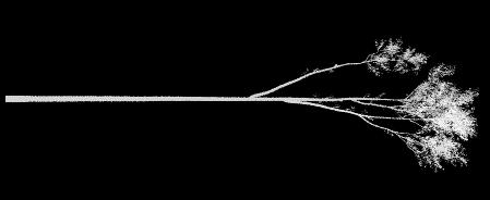


20 Model parameterisation: creating the trees Onyx tree Profile view simulation Top-down simulation

21 Model parameterisation: creating the trees Library of 51 trees (5 Eucalypt species)
22 Validation of the 51 tree models
23 Model parameterisation: creating the trees 20x20m plot characteristics Foliage projective cover = 35% Leaf area index = 1.1 Total plant area index = 1.7 Ave tree height = 12.9
 Figure2: LAD projection functions (G-value) from de Wit")
24 Part 2 results: Within-crown clumping and LAD Leaf Angle Distribution Background Figure1: Cumulative frequency of five different LADs of de Wit (1965) Figure2: LAD projection functions (G-value) from de Wit (1965)

25 Part 2 results: Within-crown clumping and LAD Within-crown clumping at nadir Foliage only All canopy elements

26 Part 2 results: Within-crown clumping and LAD Crown cover simulations
27 Part 2 results: 1 radian view angle is best for clumping Within crown clumping varying with LAD at nadir but not at 1 radian
28 Part 2 results: Does alpha matter? Within-crown clumping of foliage only vs all elements at nadir
29 Part 2 results: Alpha versus within-crown clumping, which matters more? Errors introduced assuming a constant clumping (left) and constant alpha (right) Constant clumping and alpha Constant clumping Constant alpha
30 Part 2: Up-scaling from tree to plot to stand Ongoing work Tree Plot Stand
 Stem position map 90m x")
31 Model parameterisation: creating the forest Characterising stem distribution (between crown clumping) Stem position map 90m x 90m

32 Exemplar stem distributions Stem Density

33 Part 2: Site scale prelim results


34 Part 2: Example site scale prelim results PAIe = 0.15 Openness = 79% Reference PAI = 0.6 PAIe = 0.28 Openness = 65% Reference PAI = 1.2 PAIe = 0.46 Openness = 51% Reference PAI = 1.8
35 Part 3: Future Work Simulate satellite imagery to compare reflectance of Landsat & Sentinel 2 (future) & investigate sensitivity to the different LAI and stem clumping levels Or Simulate MODIS pixels and use MODIS LAI algorithm to estimate LAI and compare with known LAI value of scene
Quantifying the impact of woody material on leaf area index estimation from hemispherical photography using 3D canopy simulations
 1 Title Quantifying the impact of woody material on leaf area index estimation from hemispherical photography using 3D canopy simulations Authors William Woodgate a,b,c *, John D. Armston d,e, Mathias
Application of Hyperspectral Remote Sensing for LAI Estimation in Precision Farming
 Preprint/Prétirage Application of Hyperspectral Remote Sensing for LAI Estimation in Precision Farming Anna Pacheco, Abdou Bannari Remote Sensing and Geomatics of Environment Laboratory Department of Geography,
In this lecture we will study how incident solar radiation interacts with vegetation
 In this lecture we will study how incident solar radiation interacts with vegetation 1 Why should we care about light? Here is a short list of key biometeorological processes that depend upon the flux
THREE-DIMENSIONAL FOREST CANOPY STRUCTURE FROM TERRESTRIAL LASER SCANNING
 Workshop on 3D Remote Sensing in Forestry, 14 th -15 th Feb. 2006, Vienna Session 2b 50 THREE-DIMENSIONAL FOREST CANOPY STRUCTURE FROM TERRESTRIAL LASER SCANNING F. Mark Danson 1, David Hetherington 1,
THE USE OF AIRBORNE HYPERSPECTRAL REFLECTANCE DATA TO CHARACTERIZE FOREST SPECIES DISTRIBUTION PATTERNS
 THE USE OF AIRBORNE HYPERSPECTRAL REFLECTANCE DATA TO CHARACTERIZE FOREST SPECIES DISTRIBUTION PATTERNS Weihs, P., Huber K. Institute of Meteorology, Department of Water, Atmosphere and Environment, BOKU
CHRIS Proba Workshop 2005 II
 CHRIS Proba Workshop 25 Analyses of hyperspectral and directional data for agricultural monitoring using the canopy reflectance model SLC Progress in the Upper Rhine Valley and Baasdorf test-sites Dr.
High Resolution Tree Models: Modeling of a Forest Stand Based on Terrestrial Laser Scanning and Triangulating Scanner Data
 ELMF 2013, 11-13 November 2013 Amsterdam, The Netherlands High Resolution Tree Models: Modeling of a Forest Stand Based on Terrestrial Laser Scanning and Triangulating Scanner Data Lothar Eysn Lothar.Eysn@geo.tuwien.ac.at
Quality assessment of RS data. Remote Sensing (GRS-20306)
") Quality assessment of RS data Remote Sensing (GRS-20306) Quality assessment General definition for quality assessment (Wikipedia) includes evaluation, grading and measurement process to assess design,
Quality assessment of RS data Remote Sensing (GRS-20306) Quality assessment General definition for quality assessment (Wikipedia) includes evaluation, grading and measurement process to assess design,
Forest canopy gap fraction from terrestrial laser scanning
 Forest canopy gap fraction from terrestrial laser scanning Danson, FM, Hetherington, D, Morsdorf, F and et, al http://dx.doi.org/10.1109/lgrs.2006.887064 Title Authors Type URL Forest canopy gap fraction
Evaluation of Terrestrial Laser Scanners for Measuring Vegetation Structure
 CSIRO SUSTAINABLE AGRICULTURE FLAGSHIP Evaluation of Terrestrial Laser Scanners for Measuring Vegetation Structure A comparison of the FARO Focus 3D 120, Leica C10, Leica HDS7000 and Riegl VZ1000 Glenn
VALERI 2003 : Concepcion site (Mixed Forest) GROUND DATA PROCESSING & PRODUCTION OF THE LEVEL 1 HIGH RESOLUTION MAPS
 GROUND DATA PROCESSING & PRODUCTION OF THE LEVEL 1 HIGH RESOLUTION MAPS") VALERI 2003 : Concepcion site (Mixed Forest) GROUND DATA PROCESSING & PRODUCTION OF THE LEVEL 1 HIGH RESOLUTION MAPS Marie Weiss 1 Introduction This report describes the production of the high resolution,
VALERI 2003 : Concepcion site (Mixed Forest) GROUND DATA PROCESSING & PRODUCTION OF THE LEVEL 1 HIGH RESOLUTION MAPS Marie Weiss 1 Introduction This report describes the production of the high resolution,
Non-destructive Measurements of Leaf Area Index Tanvir Demetriades-Shah November 10, 2009
 TRANSCRIPT Non-destructive Measurements INTRODUCTION SLIDE 1 [00.33]: Speaker: Today I m going to talk about Non-destructive measurements. This presentation will be a general introduction to the Gap Fraction
Linking sun-induced fluorescence and photosynthesis in a forest ecosystem
 Linking sun-induced fluorescence and photosynthesis in a forest ecosystem COST ES1309 Tagliabue G, Panigada C, Dechant B, Celesti M, Cogliati S, Colombo R, Julitta T, Meroni M, Schickling A, Schuettemeyer
LiDAR and its use for the enhanced forest inventory
 LiDAR and its use for the enhanced forest inventory Richard Fournier Département de géomatique appliquée Workshop of the Canadian Institute of Forestry Corner Brook, Newfoundland, March 27 2013 LiDAR -
Forest Structure Estimation in the Canadian Boreal forest
 Forest Structure Estimation in the Canadian Boreal forest Michael L. Benson Leland E.Pierce Kathleen M. Bergen Kamal Sarabandi Kailai Zhang Caitlin E. Ryan The University of Michigan, Radiation Lab & School
A Four-Scale Bidirectional Reflectance Model Based on Canopy Architecture
 1316 IEEE TRANSACTIONS ON GEOSCIENCE AND REMOTE SENSING, VOL. 35, NO. 5, SEPTEMBER 1997 A Four-Scale Bidirectional Reflectance Model Based on Canopy Architecture Jing M. Chen and Sylvain G. Leblanc Abstract
SIMULATED LIDAR WAVEFORMS FOR THE ANALYSIS OF LIGHT PROPAGATION THROUGH A TREE CANOPY
 SIMULATED LIDAR WAVEFORMS FOR THE ANALYSIS OF LIGHT PROPAGATION THROUGH A TREE CANOPY Angela M. Kim and Richard C. Olsen Remote Sensing Center Naval Postgraduate School 1 University Circle Monterey, CA
Voxelised metrics for forest inventory. Grant Pearse Phenotype Cluster Group Meeting April 2018
 Voxelised metrics for forest inventory Grant Pearse Phenotype Cluster Group Meeting April 2018 Overview Voxelisation for forest inventory Background on LiDAR metric analysis Voxelisation what and why?
Testing the Top-Down Model Inversion Method of Estimating Leaf Reflectance Used to Retrieve Vegetation Biochemical Content Within Empirical Approaches
 92 IEEE JOURNAL OF SELECTED TOPICS IN APPLIED EARTH OBSERVATIONS AND REMOTE SENSING, VOL. 7, NO. 1, JANUARY 2014 Testing the Top-Down Model Inversion Method of Estimating Leaf Reflectance Used to Retrieve
Airborne LiDAR Data Acquisition for Forestry Applications. Mischa Hey WSI (Corvallis, OR)
") Airborne LiDAR Data Acquisition for Forestry Applications Mischa Hey WSI (Corvallis, OR) WSI Services Corvallis, OR Airborne Mapping: Light Detection and Ranging (LiDAR) Thermal Infrared Imagery 4-Band
Airborne LiDAR Data Acquisition for Forestry Applications Mischa Hey WSI (Corvallis, OR) WSI Services Corvallis, OR Airborne Mapping: Light Detection and Ranging (LiDAR) Thermal Infrared Imagery 4-Band
Modeling Lidar Waveforms in Heterogeneous and Discrete Canopies
 IEEE TRANSACTIONS ON GEOSCIENCE AND REMOTE SENSING, VOL. 39, NO. 9, SEPTEMBER 2001 1943 Modeling Lidar Waveforms in Heterogeneous and Discrete Canopies Wenge Ni-Meister, David L. B. Jupp, and Ralph Dubayah
A Windows Graphic User Interface (GUI) for the Five-Scale model for fast BRDF simulations.
 for the Five-Scale model for fast BRDF simulations.") Preprint/Prétirage A Windows Graphic User Interface (GUI) for the Five-Scale model for fast BRDF simulations. Sylvain G. Leblanc and Jing M. Chen Canada Centre for Remote Sensing 588 Booth Street, 4 th
Preprint/Prétirage A Windows Graphic User Interface (GUI) for the Five-Scale model for fast BRDF simulations. Sylvain G. Leblanc and Jing M. Chen Canada Centre for Remote Sensing 588 Booth Street, 4 th
Definitions (1/1) Leaf Area Index (LAI, notation used: L) One half the total green leaves area per unit ground area
 Leaf Area Index (LAI, notation used: L) One half the total green leaves area per unit ground area") PINEWOOD LAI AND APAR ESTIMATION BY MULTI-SPECTRAL AND MULTI-ANGULAR SATELLITE DATA R. Benedetti, M. Chiesi*, S. Cristofori, P. Marcoionni**,. Maselli*, I. Pippi** La.M.M.A., Building D - Via Madonna del
PINEWOOD LAI AND APAR ESTIMATION BY MULTI-SPECTRAL AND MULTI-ANGULAR SATELLITE DATA R. Benedetti, M. Chiesi*, S. Cristofori, P. Marcoionni**,. Maselli*, I. Pippi** La.M.M.A., Building D - Via Madonna del
Study on LAI Sampling Strategy and Product Validation over Non-uniform Surface. Lingling Ma, Xiaohua Zhu, Yongguang Zhao
 of Opto Electronics Chinese of Sciences Study on LAI Sampling Strategy and Product Validation over Non-uniform Surface Lingling Ma, Xiaohua Zhu, Yongguang Zhao of (AOE) Chinese of Sciences (CAS) 2014-1-28
Suitability of the parametric model RPV to assess canopy structure and heterogeneity from multi-angular CHRIS-PROBA data
 Suitability of the parametric model RPV to assess canopy structure and heterogeneity from multi-angular CHRIS-PROBA data B. Koetz a*, J.-L. Widlowski b, F. Morsdorf a,, J. Verrelst c, M. Schaepman c and
Supplementary Materials for: Mapping urban forest leaf area index with airborne lidar using penetration metrics and allometry
 Supplementary Materials for: Mapping urban forest leaf area index with airborne lidar using penetration metrics and allometry Authors: Michael Alonzo, Bodo Bookhagen, Joseph P. McFadden, Alex Sun, and
Intercomparison and sensitivity analysis of Leaf Area Index retrievals from LAI-2000, AccuPAR, and digital hemispherical photography over croplands
 agricultural and forest meteorology 148 (2008) 1193 1209 available at www.sciencedirect.com journal homepage: www.elsevier.com/locate/agrformet Intercomparison and sensitivity analysis of Leaf Area Index
PROSPECT+SAIL: 15 Years of Use for Land Surface Characterization
 PROSPECT+SAIL: 15 Years of Use for Land Surface Characterization S. Jacquemoud, W. Verhoef, F. Baret, P.J. Zarco-Tejada G.P. Asner, C. François, and S.L. Ustin State of Science of Environmental Applications
Simulation of small-footprint full-waveform LiDAR propagation through a tree canopy in 3D
 Simulation of small-footprint full-waveform LiDAR propagation through a tree canopy in 3D Angela M. Kim a, Richard C. Olsen a, Martin Béland b a Naval Postgraduate School, Remote Sensing Center and Physics
Flood detection using radar data Basic principles
 Flood detection using radar data Basic principles André Twele, Sandro Martinis and Jan-Peter Mund German Remote Sensing Data Center (DFD) 1 Overview Introduction Basic principles of flood detection using
CHRIS PROBA instrument
 CHRIS PROBA instrument Wout Verhoef ITC, The Netherlands verhoef @itc.nl 29 June 2009, D1L5 Contents Satellite and instrument Images Multi-angular analysis Toolbox CHRIS-PROBA PROBA-CHRIS Project for On-Board
et al. 28) and computational fluid dynamics (CFD) (e.g., Kamiyama et al. 24). However, it is laborious to measure the distribution for many trees on t
 and computational fluid dynamics (CFD) (e.g., Kamiyama et al. 24). However, it is laborious to measure the distribution for many trees on t") Numerical Simulation of Solar Shading Effect of Urban Trees Using Airborne Laser Scanning-Derived 3D Tree Structures H. Oshio 1,*, T. Asawa 1, A. Hoyano 2, and S. Miyasaka 3 1 Interdisciplinary Graduate
Numerical Simulation of Solar Shading Effect of Urban Trees Using Airborne Laser Scanning-Derived 3D Tree Structures H. Oshio 1,*, T. Asawa 1, A. Hoyano 2, and S. Miyasaka 3 1 Interdisciplinary Graduate
LiDAR data pre-processing for Ghanaian forests biomass estimation. Arbonaut, REDD+ Unit, Joensuu, Finland
 LiDAR data pre-processing for Ghanaian forests biomass estimation Arbonaut, REDD+ Unit, Joensuu, Finland Airborne Laser Scanning principle Objectives of the research Prepare the laser scanning data for
ESTIMATING VERTICAL LEAF AREA DENSITY PROFILES OF TREE CANOPIES USING THREE-DIMENSIONAL PORTABLE LIDAR IMAGING
 In: Bretar F, Pierrot-Deseilligny M, Vosselman G (Eds) Laser scanning 2009, IAPRS, Vol. XXXVIII, Part 3/W8 Paris, France, September -2, 2009 ESTIMATING VERTICAL LEAF AREA DENSITY PROFILES OF TREE CANOPIES
Do It Yourself 8. Polarization Coherence Tomography (P.C.T) Training Course
 Training Course") Do It Yourself 8 Polarization Coherence Tomography (P.C.T) Training Course 1 Objectives To provide a self taught introduction to Polarization Coherence Tomography (PCT) processing techniques to enable
Do It Yourself 8 Polarization Coherence Tomography (P.C.T) Training Course 1 Objectives To provide a self taught introduction to Polarization Coherence Tomography (PCT) processing techniques to enable
IEEE TRANSACTIONS ON GEOSCIENCE AND REMOTE SENSING, VOL. 39, NO. 7, JULY
 IEEE TRANSACTIONS ON GEOSCIENCE AND REMOTE SENSING, VOL. 39, NO. 7, JULY 2001 1491 Scaling-Up and Model Inversion Methods with Narrowband Optical Indices for Chlorophyll Content Estimation in Closed Forest
LiForest Software White paper. TRGS, 3070 M St., Merced, 93610, Phone , LiForest
 0 LiForest LiForest is a platform to manipulate large LiDAR point clouds and extract useful information specifically for forest applications. It integrates a variety of advanced LiDAR processing algorithms
GEOG 4110/5100 Advanced Remote Sensing Lecture 2
 GEOG 4110/5100 Advanced Remote Sensing Lecture 2 Data Quality Radiometric Distortion Radiometric Error Correction Relevant reading: Richards, sections 2.1 2.8; 2.10.1 2.10.3 Data Quality/Resolution Spatial
An Analytical Hybrid GORT Model for Bidirectional Reflectance Over Discontinuous Plant Canopies
 IEEE TRANSACTIONS ON GEOSCIENCE AND REMOTE SENSING, VOL 37, NO 2, MARCH 1999 987 An Analytical Hybrid GORT Model for Bidirectional Reflectance Over Discontinuous Plant Canopies Wenge Ni, Member, IEEE,
SOYBEAN CANOPY REFLECTANCE MODELING DATA SETS. K. Jon Ranson Research Agronomist. L.L. Biehl Research Engineer
 NAS9-16528 LARS 071584 SOYBEAN CANOPY REFLECTANCE MODELING DATA SETS K. Jon Ranson Research Agronomist L.L. Biehl Research Engineer C.S.T. Daughtry Senior Research Agronomist Laboratory for Applications
OPERATIONAL MAPPING OF THE ENVIRONMENTAL CONDITION OF RIPARIAN ZONES OVER LARGE REGIONS FROM AIRBORNE LIDAR DATA
 OPERATIONAL MAPPING OF THE ENVIRONMENTAL CONDITION OF RIPARIAN ZONES OVER LARGE REGIONS FROM AIRBORNE LIDAR DATA K. Johansen a, b, c, L. Arroyo a, b and S. Phinn a, b a Joint Remote Sensing Research Program
CLASSIFICATION OF NONPHOTOGRAPHIC REMOTE SENSORS
 CLASSIFICATION OF NONPHOTOGRAPHIC REMOTE SENSORS PASSIVE ACTIVE DIGITAL CAMERA THERMAL (e.g. TIMS) VIDEO CAMERA MULTI- SPECTRAL SCANNERS VISIBLE & NIR MICROWAVE HYPERSPECTRAL (e.g. AVIRIS) SLAR Real Aperture
Estimating forest parameters from top-of-atmosphere radiance data
 Estimating forest parameters from top-of-atmosphere radiance data V. Laurent*, W. Verhoef, J. Clevers, M. Schaepman *Contact: valerie.laurent@wur.nl Guest lecture, RS course, 8 th Decembre, 2010 Contents
Status of MOLI development MOLI (Multi-footprint Observation Lidar and Imager)
") Status of MOLI development MOLI (Multi-footprint Observation Lidar and Imager) Tadashi IMAI, Daisuke SAKAIZAWA, Jumpei MUROOKA, Rei Mitsuhashi and Toshiyoshi KIMURA JAXA 0 Outline of This Presentation
Status of MOLI development MOLI (Multi-footprint Observation Lidar and Imager) Tadashi IMAI, Daisuke SAKAIZAWA, Jumpei MUROOKA, Rei Mitsuhashi and Toshiyoshi KIMURA JAXA 0 Outline of This Presentation
GROUND DATA PROCESSING & PRODUCTION OF THE LEVEL 1 HIGH RESOLUTION MAPS
 GROUND DATA PROCESSING & PRODUCTION OF THE LEVEL 1 HIGH RESOLUTION MAPS VALERI 2002 LARZAC site (grassland) Philippe Rossello, Marie Weiss December 2005 CONTENTS 1. Introduction... 2 2. Available data...
Optical Theory Basics - 2 Atmospheric corrections and parameter retrieval
 Optical Theory Basics - 2 Atmospheric corrections and parameter retrieval Jose Moreno 3 September 2007, Lecture D1Lb2 OPTICAL THEORY-FUNDAMENTALS (2) Radiation laws: definitions and nomenclature Sources
A. Verger 1, B. Martinez 1, F. Camacho-de Coca 2, J. García-Haro 1 and J.Meliá 1. CEOS/LPV Workshop, 15/03/2007, Davos
 Assessment of FVC and LAI ground measurement s uncertainties and estimation of reference maps for the validation of LSA SAF products over the Barrax cropland area A. Verger 1, B. Martinez 1, F. Camacho-de
Modeling reflectance and transmittance of leaves in the µm domain: PROSPECT-VISIR
 Modeling reflectance and transmittance of leaves in the 0.4-5.7 µm domain: PROSPECT-VISIR F. Gerber 1,2, R. Marion 1, S. Jacquemoud 2, A. Olioso 3 et S. Fabre 4 1 CEA/DASE/Télédétection, Surveillance,
Alaska FIA Plots Space, Time, Context and Lidar
 Alaska FIA Plots Space, Time, Context and Lidar 11th Biennial USDA FS Remote Sensing Conference Ken Winterberger USDA Forest Service Pacific Northwest Experiment Station Anchorage FSL, FIA Outline The
GEOG 4110/5100 Advanced Remote Sensing Lecture 4
 GEOG 4110/5100 Advanced Remote Sensing Lecture 4 Geometric Distortion Relevant Reading: Richards, Sections 2.11-2.17 Review What factors influence radiometric distortion? What is striping in an image?
Current Address: Faculty of Science and Technology, Uva Wellassa University, Badulla 90000, Sri Lanka.
 Remote Sens. 2013, 5, 6767-6789; doi:10.33/rs5126767 Article OPEN ACCESS Remote Sensing ISSN 2072-4292 www.mdpi.com/journal/remotesensing Evaluation of Different Topographic Corrections for Landsat TM
Lidar for Vegetation Applications
 Lidar for Vegetation Applications P. Lewis 1, R. Casey 1, and S. Hancock 2 1 Department of Geography, UCL, WC1E 6BT, UK 2 University of Durham, DH1 3LR Contact: plewis@geog.ucl.ac.uk Section 1: Introduction
Locating the Shadow Regions in LiDAR Data: Results on the SHARE 2012 Dataset
 Locating the Shadow Regions in LiDAR Data: Results on the SHARE 22 Dataset Mustafa BOYACI, Seniha Esen YUKSEL* Hacettepe University, Department of Electrical and Electronics Engineering Beytepe, Ankara,
MERIS solar diffuser BRDF modelling. Gerhard Meister and Ewa Kwiatkowska
 MERIS solar diffuser BRDF modelling Gerhard Meister and Ewa Kwiatkowska MERIS QWG-27 meeting, 12-14 June, 2013 Motivation for the solar diffuser model reanalysis MERIS radiometric gains display a seasonal
Potential of Sentinel-2 for retrieval of biophysical and biochemical vegetation parameters
 Insert the title of your slide Potential of Sentinel-2 for retrieval of biophysical and biochemical vegetation parameters D. Scheffler, T. Kuester, K. Segl, D. Spengler and H. Kaufmann Motivation Insert
Multi-temporal LIDAR data for forestry an approach to investigate timber yield changes
 Multi-temporal LIDAR data for forestry an approach to investigate timber yield changes UniSA Stefan Peters, Jixue Liu, David Bruce, Jiuyong Li ForestrySA Jim O Hehir, Mary-Anne Larkin, Anthony Hay 1 Why
Lecture 7. Spectral Unmixing. Summary. Mixtures in Remote Sensing
 Lecture 7 Spectral Unmixing Summary This lecture will introduce you to the concepts of linear spectral mixing. This methods is sometimes also called: Spectral Mixture Analysis (SMA: Wessman et al 1997)
TLS Parameters, Workflows and Field Methods
 TLS Parameters, Workflows and Field Methods Marianne Okal, UNAVCO June 20 th, 2014 How a Lidar instrument works (Recap) Transmits laser signals and measures the reflected light to create 3D point clouds.
Section G. POSITIONAL ACCURACY DEFINITIONS AND PROCEDURES Approved 3/12/02
 Section G POSITIONAL ACCURACY DEFINITIONS AND PROCEDURES Approved 3/12/02 1. INTRODUCTION Modern surveying standards use the concept of positional accuracy instead of error of closure. Although the concepts
Retrieval of Canopy Height Profiles from Lidar Measurements. over Coniferous Forests
 Retrieval of Canopy Height Profiles from Lidar Measurements over Coniferous Forests Svetlana Y. Kotchenova, Nikolay V. Shabanov, Yuri Knyazikhin, and Ranga B. Myneni Department of Geography, Boston University,
Testing the application of terrestrial laser scanning to measure forest canopy gap fraction
 Testing the application of terrestrial laser scanning to measure forest canopy gap fraction Ramirez Cardozo, FA, Armitage, RP and Danson, FM http://dx.doi.org/10.3390/rs5063037 Title Authors Type URL Testing
TLS Parameters, Workflows and Field Methods
 TLS Parameters, Workflows and Field Methods Marianne Okal, UNAVCO GSA, September 23 rd, 2016 How a Lidar instrument works (Recap) Transmits laser signals and measures the reflected light to create 3D point
Lecture 24. Lidar Simulation
 Lecture 24. Lidar Simulation q Introduction q Lidar Modeling via Lidar Simulation & Error Analysis q Functions of Lidar Simulation and Error Analysis q How to Build up Lidar Simulation? q Range-resolved
VALERI-2000 CAMPAIGN IN GOURMA (MALI)
") VALERI- CAMPAIGN IN GOURMA (MALI) Participants: Mougin Eric, Jarlan Lionel, Lelong Camille, Marty Georges (CESBIO) Hiernaux Pierre (ILRI) August 7 September 3, VALERI- CAMPAIGN IN GOURMA (MALI) The VALERI-
VALERI- CAMPAIGN IN GOURMA (MALI) Participants: Mougin Eric, Jarlan Lionel, Lelong Camille, Marty Georges (CESBIO) Hiernaux Pierre (ILRI) August 7 September 3, VALERI- CAMPAIGN IN GOURMA (MALI) The VALERI-
CHRIS / PROBA Data Analysis at the Swiss Midlands Testsite
 CHRIS / PROBA Data Analysis at the Swiss Midlands Testsite 4th CHRIS / PROBA Workshop Frascati 19-21 September 2006 Mathias Kneubühler, RSL, Univ. Zürich, CH Benjamin Koetz, Silvia Huber, Juerg Schopfer,
Geometric Accuracy Evaluation, DEM Generation and Validation for SPOT-5 Level 1B Stereo Scene
 Geometric Accuracy Evaluation, DEM Generation and Validation for SPOT-5 Level 1B Stereo Scene Buyuksalih, G.*, Oruc, M.*, Topan, H.*,.*, Jacobsen, K.** * Karaelmas University Zonguldak, Turkey **University
Optical/Thermal: Principles & Applications
 Optical/Thermal: Principles & Applications Jose F. Moreno University of Valencia, Spain Jose.Moreno@uv.es Lecture D1T2 1 July 2013 23/07/2013 1 OPTICAL PRINCIPLES AND APPLICATIONS Information content of
An Accuracy Assessment of Derived Digital Elevation Models from Terrestrial Laser Scanning in a Sub-Tropical Forested Environment
 Article An Accuracy Assessment of Derived Digital Elevation Models from Terrestrial Laser Scanning in a Sub-Tropical Forested Environment Jasmine Muir 1,2,3, * ID, Nicholas Goodwin 1,2, John Armston 1,2,4
Overview of MOLI data product (MOLI: Multi-footprint Observation Lidar and Imager)
") Overview of MOLI data product (MOLI: Multi-footprint Observation Lidar and Imager) Jan 7, 2016 JAXA Jumpei Murooka 1 Contents 1. Mission instruments: MOLI 2. Standard products of MOLI 3. Lidar product
Overview of MOLI data product (MOLI: Multi-footprint Observation Lidar and Imager) Jan 7, 2016 JAXA Jumpei Murooka 1 Contents 1. Mission instruments: MOLI 2. Standard products of MOLI 3. Lidar product
Remote Sensing of Environment
 Remote Sensing of Environment 125 (2012) 73 79 Contents lists available at SciVerse ScienceDirect Remote Sensing of Environment journal homepage: www.elsevier.com/locate/rse Measuring gap fraction, element
Multiple-Scattering Scheme Useful for Geometric Optical Modeling
 IEEE TRANSACTIONS ON GEOSCIENCE AND REMOTE SENSING, VOL. 39, NO. 5, MAY 2001 1061 Multiple-Scattering Scheme Useful for Geometric Optical Modeling Jing M. Chen and Sylvain G. Leblanc Abstract Geometrical
INTEGRATION OF TREE DATABASE DERIVED FROM SATELLITE IMAGERY AND LIDAR POINT CLOUD DATA
 INTEGRATION OF TREE DATABASE DERIVED FROM SATELLITE IMAGERY AND LIDAR POINT CLOUD DATA S. C. Liew 1, X. Huang 1, E. S. Lin 2, C. Shi 1, A. T. K. Yee 2, A. Tandon 2 1 Centre for Remote Imaging, Sensing
MEASUREMENTS AND MODELLING OF BI-DIRECTIONAL REFLECTANCE OF WHEAT: PROSAIL VALIDATION RESULTS
 MEASUREMENTS AND MODELLING OF BI-DIRECTIONAL REFLECTANCE OF WHEAT: PROSAIL VALIDATION RESULTS D. Barman, V.K. Sehgal, R.N. Sahoo, S. Nagarajan* and A. Chakraborty Division of Agricultural Physics *Nuclear
Sentinel-2/Landsat-8 Characterization and Cross - Cal
 Sentinel-2/Landsat-8 Characterization and Cross - Cal Markham Support for analysis of MSI performance data; coordination of Cal Team; Pre-launch Cross calibrations Helder/Leigh Improved use of PICS sites
Prof. Vidya Manian Dept. of Electrical l and Comptuer Engineering. INEL6007(Spring 2010) ECE, UPRM
 ECE, UPRM") Inel 6007 Introduction to Remote Sensing Chapter 5 Spectral Transforms Prof. Vidya Manian Dept. of Electrical l and Comptuer Engineering Chapter 5-1 MSI Representation Image Space: Spatial information
Inel 6007 Introduction to Remote Sensing Chapter 5 Spectral Transforms Prof. Vidya Manian Dept. of Electrical l and Comptuer Engineering Chapter 5-1 MSI Representation Image Space: Spatial information
RETRIEVING LEAF AREA INDEX OF A MATURE NORWAY SPRUCE FOREST STAND FROM AIRBORE HYPERSPECTRAL IMAGE BY INVERSION OF THE DART MODEL
 Centre for Geo-Information Thesis Report GIRS-2006-27 RETRIEVING LEAF AREA INDEX OF A MATURE NORWAY SPRUCE FOREST STAND FROM AIRBORE HYPERSPECTRAL IMAGE BY INVERSION OF THE DART MODEL Abebe Mohammed Ali
LIDAR MAPPING FACT SHEET
 1. LIDAR THEORY What is lidar? Lidar is an acronym for light detection and ranging. In the mapping industry, this term is used to describe an airborne laser profiling system that produces location and
Unsupervised and Self-taught Learning for Remote Sensing Image Analysis
 Unsupervised and Self-taught Learning for Remote Sensing Image Analysis Ribana Roscher Institute of Geodesy and Geoinformation, Remote Sensing Group, University of Bonn 1 The Changing Earth https://earthengine.google.com/timelapse/
CORRELATION BETWEEN NDVI AND SURFACE TEMPERATURES USING LANDSAT ETM IMAGERY FOR SAN ANTONIO AREA. Remote Sensing Project By Newfel Mazari Fall 2005
 CORRELATION BETWEEN NDVI AND SURFACE TEMPERATURES USING LANDSAT ETM IMAGERY FOR SAN ANTONIO AREA Remote Sensing Project By Newfel Mazari Fall 2005 Procedure Introduction and Objectives Site Date Acquisition
Retrieval of crop characteristics from high resolution airborne scanner data
 Retrieval of crop characteristics from high resolution airborne scanner data K. Richter 1, F. Vuolo 2, G. D Urso 1, G. Fernandez 3 1 DIIAT, Facoltà di Agraria, Università degli studi di Napoli Federico
CANOPY EXTRACTION USING AIRBORNE LASER SCANNING DATA IN FORESTRY AREAS
 CANOPY EXTRACTION USING AIRBORNE LASER SCANNING DATA IN FORESTRY AREAS C. Y. Lo *, L. C. Chen Center for Space and Remote Sensing Research, National Central University, Jhungli, Taoyuan 32001, Taiwan,China
LiDAR Data Processing:
 LiDAR Data Processing: Concepts and Methods for LEFI Production Gordon W. Frazer GWF LiDAR Analytics Outline of Presentation Data pre-processing Data quality checking and options for repair Data post-processing
EnsoMOSAIC. Kopterit metsäninventointidatan keruualustoina
 EnsoMOSAIC Kopterit metsäninventointidatan keruualustoina 20.4.2017 Company introduction MosaicMill founded in 2009 EnsoMOSAIC technology since 1994 Main businesses EnsoMOSAIC forestry solutions EnsoMOSAIC
Changes in the Phase 3 Indicator Field Guide Chapters from version 2.0 to version 3.0
 Changes in the Phase 3 Indicator Field Guide Chapters from version 2.0 to version 3.0 Changes documented in change proposals are indicated in bold type. The corresponding proposal name can be seen using
NIST DSE Plant Identification with Remote Sensing Evaluation Plan
 NIST DSE Plant Identification with Remote Sensing Evaluation Plan Version 0.3, Updated on August 29, 2017 1. Introduction This document defines the tasks and evaluation plan for the Data Science for Plant
DETECTION OF CHANGES IN ISTANBUL AREA WITH MEDIUM AND HIGH RESOLUTION SPACE IMAGES
 DETECTION OF CHANGES IN ISTANBUL AREA WITH MEDIUM AND HIGH RESOLUTION SPACE IMAGES S. Bayburt*, G.Büyüksalih*, I. Baz*, K. Jacobsen**, T. Kersten *** * BIMTAS, Tophanelioglu Cad. ISKI Hizmet Binasi No:62
TLS Parameters, Workflows and Field Methods
 TLS Parameters, Workflows and Field Methods Marianne Okal, UNAVCO GSA, October 20 th, 2017 How a Lidar instrument works (Recap) Transmits laser signals and measures the reflected light to create 3D point
MGF 2014 Performances of UAV and WorldView-2 Images for Individual Canopy Delineation in Tropical Forest
 MGF 2014 Performances of UAV and WorldView-2 Images for Individual Canopy Delineation in Tropical Forest Hamdan Omar Div. of Forestry & Environment, Forest Research Institute Malaysia (FRIM) Malaysia Geospatial
Improved MODIS Aerosol Retrieval using Modified VIS/MIR Surface Albedo Ratio Over Urban Scenes
 Improved MODIS Aerosol Retrieval using Modified VIS/MIR Surface Albedo Ratio Over Urban Scenes Min Min Oo, Matthias Jerg, Yonghua Wu Barry Gross, Fred Moshary, Sam Ahmed Optical Remote Sensing Lab City
Industrial 2D LASER SCANNER LMS-Q120ii
 LMS-Q120ii Preliminary Datasheet Industrial 2D LASER SCANNER LMS-Q120ii The RIEGL LMS-Q120ii 2D - laser scanner provides accurate noncontact line scanning using a narrow infrared laser beam. The instrument
SWOT LAKE PRODUCT. Claire POTTIER(CNES) and P. Callahan (JPL) SWOT ADT project team J.F. Cretaux, T. Pavelsky SWOT ST Hydro leads
 and P. Callahan (JPL) SWOT ADT project team J.F. Cretaux, T. Pavelsky SWOT ST Hydro leads") SWOT LAKE PRODUCT Claire POTTIER(CNES) and P. Callahan (JPL) SWOT ADT project team J.F. Cretaux, T. Pavelsky SWOT ST Hydro leads Lake, Climate and Remote Sensing Workshop Toulouse June 1&2 2017 High Rate
SWOT LAKE PRODUCT Claire POTTIER(CNES) and P. Callahan (JPL) SWOT ADT project team J.F. Cretaux, T. Pavelsky SWOT ST Hydro leads Lake, Climate and Remote Sensing Workshop Toulouse June 1&2 2017 High Rate
Hyperspectral Remote Sensing
 Hyperspectral Remote Sensing Multi-spectral: Several comparatively wide spectral bands Hyperspectral: Many (could be hundreds) very narrow spectral bands GEOG 4110/5100 30 AVIRIS: Airborne Visible/Infrared
Design based validation of the MODIS Global Burned Area Product
 Design based validation of the MODIS Global Burned Area Product Luigi Boschetti1, David Roy2, Chris Justice3, Steve Stehman4 1 University of Idaho, Department of Forest, Rangeland and Fire Sciences 2 South
This article appeared in a journal published by Elsevier. The attached copy is furnished to the author for internal non-commercial research and
 This article appeared in a journal published by Elsevier. The attached copy is furnished to the author for internal non-commercial research and education use, including for instruction at the authors institution
Airborne Laser Scanning: Remote Sensing with LiDAR
 Airborne Laser Scanning: Remote Sensing with LiDAR ALS / LIDAR OUTLINE Laser remote sensing background Basic components of an ALS/LIDAR system Two distinct families of ALS systems Waveform Discrete Return
TEACHING THE PRINCIPLES OF OPTICAL REMOTE SENSING USING GRAPHICAL TOOLS DEVELOPED IN TCL/TK
 TEACHING THE PRINCIPLES OF OPTICAL REMOTE SENSING USING GRAPHICAL TOOLS DEVELOPED IN TCL/TK M.J. Barnsley and P. Hobson, Department of Geography, University of Wales Swansea, Singleton Park, Swansea SA2
EXPLOITING EARTH OBSERVATION DATA PRODUCTS FOR MAPPING LOCAL CLIMATE ZONES
 EXPLOITING EARTH OBSERVATION DATA PRODUCTS FOR MAPPING LOCAL CLIMATE ZONES Zina Mitraka 1,3, Nektarios Chrysoulakis 1, Jean-Philippe Gastellu- Etchegorry 2, Fabio Del Frate 3 1 Foundation for Research
Street, Toronto, ON, M5S 3G3, Canada b Ontario Ministry of Natural Resources, Ontario Forest Research. Available online: 08 Aug 2011
 This article was downloaded by: [University of Toronto Libraries] On: 2 October 211, At: 7:29 Publisher: Taylor & Francis Informa Ltd Registered in England and Wales Registered Number: 172954 Registered
HYPERSPECTRAL DATA FOR FOREST INVENTORIES. Henning Aberle, M.Sc. Bogor & Jakarta, Indonesia March 2014
 T HE E C O L O G I C A L A N D E C O N O M I C C H A L L E N G E S OF M A N A G I N G F O R E S T E D L A N D S C A P E S IN A G L O B A L C O N T E X T - F O C U S : A S I A HYPERSPECTRAL DATA FOR FOREST
THE DEPENDENCE OF REFLECTED RADIANCE AND REFLECTANCE OF THE FOREST VEGETATION --- A CASE STUDY OF CYCLOBALANOPSIS GLAUCA
 THE DEPENDENCE OF REFLECTED RADIANCE AND REFLECTANCE OF THE FOREST VEGETATION --- A CASE STUDY OF CYCLOBALANOPSIS GLAUCA Chinsu LIN Associate Professor, Department of Forestr National Chiai Universit (NCYU)