TLS Parameters, Workflows and Field Methods
|
|
|
- Louise Montgomery
- 5 years ago
- Views:
Transcription

1 TLS Parameters, Workflows and Field Methods Marianne Okal, UNAVCO GSA, October 20 th, 2017
 Transmits laser signals")

 or green")
2 How a Lidar instrument works (Recap) Transmits laser signals and measures the reflected light to create 3D point clouds. Wavelength typically in the near infrared (~1550nm) or green (532nm) spectrum
3 TLS Instrument and Survey Parameters Precision/Accuracy Spot size (range, divergence) Spot spacing (range, angular resolution) Spot density (range, angle, number of setups) Angle of incidence (spot shape, intensity, range) Edge effects Registration Targets First return, last return, other Shadows, Field of View Area of Interest

4 Accuracy vs. Precision TLS Instrument and Survey Parameters
5 Beam Divergence Df = (Divergence * d) + Di TLS Instrument and Survey Df = Df = Df = 360mm!
6 Angular Step Spacing = d(m)*tan(step) TLS Instrument and Survey Parameters
7 TLS Instrument and Survey Parameters Angular Step Rule of thumb: scan at least 1/10 th of the wavelength of the object you wish to image.


8 TLS Instrument and Survey Parameters R > 500m R = m R < 200m Shot Spacing / Sample Density Shot spacing varies as a function of range to target. Choose angular scan resolution to optimize sample density.
 geometries.")
9 overhang Scan Positions Choose scan positions to minimize occluded (shadowed or hidden) geometries.


.")
10 TLS Instrument and Survey Parameters Targets Reflective objects that serve as reference points for scans. Same targets must be common between scan positions. Use at least 5 reference targets to register scan positions (the more the better). Different shapes and colors serve different functions (images not to scale)

11 TLS Instrument and Survey Parameters Riegl VZ400 Max. measurement range as function of target material
12 TLS Instrument and Survey Parameters Precision/Accuracy Spot size (range, divergence) Spot spacing (range, angular resolution) Spot density (range, angle, number of setups) Angle of incidence (spot shape, intensity, range) Edge effects Registration Targets First return, last return, other Shadows, Field of View Area of Interest

13 TLS Instrument Parameters - Datasheets
14 Terrestrial Laser Scanning Project Summary Project Planning Choose instrument based on capabilities and science/data goals. Schedule based on instrument availability, science requirements, environmental factors. Use Google Earth, field site photos, etc. to establish preliminary locations for scan positions, control targets, registration targets, etc. Instrument calibration & data collection Post-processing & Analysis Make a copy of the data collected in the field. Keep the original project(s) in a safe place. Post process using the copy of the project. Metadata Project summary document. GPS data (raw files, rinex files, antenna heights, log sheets, etc.). Field photos. Google Earth files, etc.

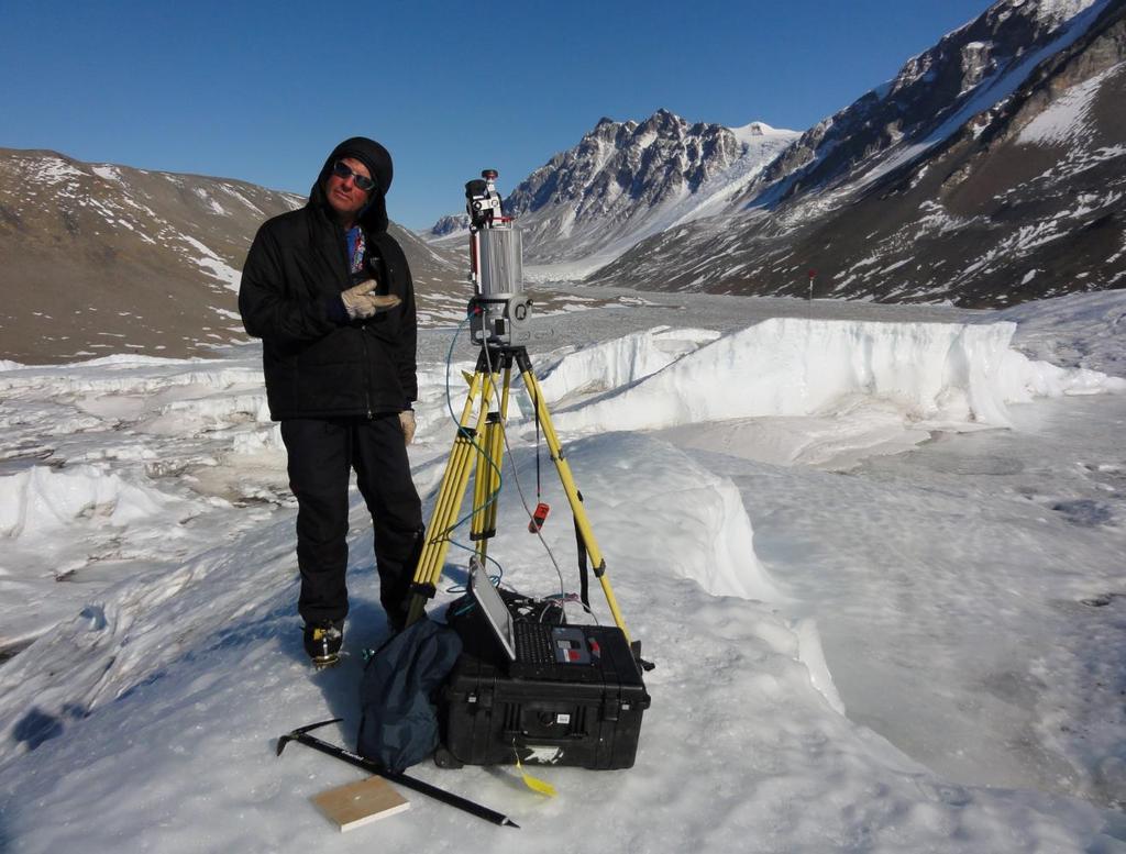
15 Before heading out into the field TLS Survey Workflow GPS network identify base stations, benchmarks and make sure they are operational! Understand field site, anticipate challenges you may encounter (complex landscape, is power available in evenings, etc.) Give equipment a test run.


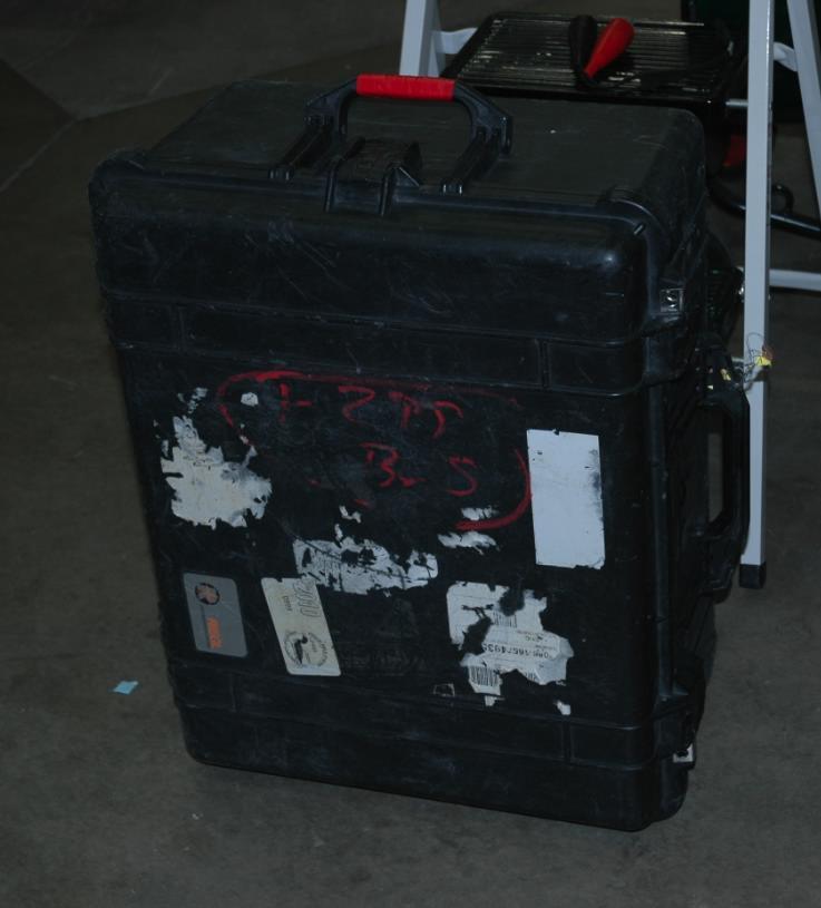
16 Checklist: Scanner Power supply Laptop Scanner tripod Reflector tripods Flat and Cylindrical Reflectors GPS receivers Safety gear Permit Up to 300 lbs!! Basic Field Kit


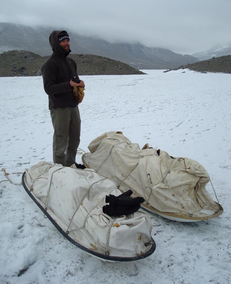
17 Basic Field Kit Will this fit in your vehicle? Who will carry it?

18 At the field site Take a walk around the field site before setting anything up. Identify scan positions, target positions and your GPS base station. Set up targets and start GPS data collection. 1-2 hours. Only now are you ready to start scanning! Scan Position deg Panorama scan + Image acquisition if desired. Target finescan Area of interest finescan Scan Position 2 and beyond TLS Survey Workflow Same as Scan Position 1+ registration to previous scans + quality check.

19 TLS Survey Workflow Standard tie point workflow Reminders use at least 5 targets. Every scan position sees at least 5 targets Every target is seen by at least 2 scan positions The more targets common to all scan positions, the better
20 TLS Survey Workflow Big Spring Run, Lancaster County, PA 800 m

21 TLS Survey Workflow Targets set up
22 TLS Survey Workflow Targets + Scan Positions
23 TLS Survey Workflow
24 Global Positioning System Constellation of 31 satellites which each house an atomic clock. Precise time information is sent to a receiver on earth. A minimum of 4 satellites in sky view is needed to obtain a coordinate. X,Y,Z
. Practical limit is 100km.")
25 Uses known reference points (base stations) on the Earth to provide corrections for unknown points. Advantage is cm to sub-cm precision! Differential GPS Base station and unknown points must share same occupation time Base stations and unknown points must see same errors (same sky view). Practical limit is 100km. Vertical precision will always be ~2x less precise than horizontal precision.

26 Adding GPS to a TLS Survey


27 Understanding coordinate systems - TLS SOCS Scanner Own Coordinate System Each scan position has origin at scanner location PRCS PRoject Coordinate System Local coordinate system for entire project GLCS GLobal Coordinate System ECEF, UTM, State Plane, etc. GLCS
28 Earth Centered, Earth Fixed (ECEF) Origin = center of mass of the Earth. Three right-handed orthogonal axis X, Y, Z. Units = meters. The Z axis = Earth s rotation axis. The (X,Z) plane contains the Earth s rotation axis and the prime meridian. The (X,Y) plane in equatorial plane. Preferred by geodesy community Not GIS friendly! Requires transformations into 2D cartesian (e.g., UTM). Application of data matters Con: Z height Understanding coordinate systems - GPS
29 TLS Workflow After data collection is complete The bulk of the work begins not a joke! Data processing will be the most time consuming (and hardest) portion of the project. Colorize data from photos Filter/clean points Re-register all scans to get best fit (especially important for larger field areas) Georeference point cloud(s) Archive your raw data set/project ASAP multiple copies. Archive final project and create metadata. Create higher order datasets (Chris will cover these). Export data to appropriate format.
30 Instrument precision and accuracy Increases with range, different for each point Scaling errors Registration errors Scan-to-scan registration Global registration GPS solution errors Depends on occupation times, space weather, etc. Operator error + Noise, false returns, phantom points, etc. Sources of Error

31 Sources of Error Instrument precision and accuracy Increases with range Manufacturers typically only provide #s for 1 range, no info on trend


32 Registration errors Sources of Error Scan-to-scan registration usually < 1cm Global registration can range 3mm cm Scan-to-scan Global
33 GPS Errors Ionosphere Troposphere Multi-Path Longer surveys are generally more accurate
34 GPS solution errors Sources of Error Depends on type of survey, baseline lengths, environmental factors (solar flares, multipath), instrument error (clock drift) Survey type Occupation Time Error horizontal (vertical = 2x) Static 2 hours days cm Fast static 20 minutes 2 hours 1 3 cm Post-processing Kinematic 20 minutes 2 hours 2 5cm Real-time kinematic Seconds hours 2cm 5cm (range dependent)
35 Sources of Error Scaling errors Atmospheric conditions can vary across a field site long range scanners can t correct for this. Effect is generally minimal mm in range calculation over 100 s of meters.
36 Sources of Error What does that leave us with? Error type Instrument precision & accuracy Registration/Alignment GPS solutions Scaling (atmospheric) Operator error? Best case scenario: ~ 1 cm Magnitude 3,5 mm -? cm cm cm mm Worst case scenario: ~10-20 cm or more

37 Metadata Reporting All of the information you can think of! Project objectives Atmospheric conditions GPS observations Who, what, when, where Someone tripped over the tripod, cow knocked over target Target types and geometry Coordinate system Error reporting Etc, etc, etc!


38 Exporting and Archiving Data UNAVCO TLS Data Archive All project materials archived All materials available to public free of charge User account required to download please sign up! Level 2 data product Exports UNAVCO standard deliverable: merged, aligned, georeferenced point cloud in ECEF in LAS format

39 Data considerations Data volume can be a problem: Technology outpaces most software for data processing & management. Just because you can, doesn t mean you should Science application should define data collection.
40 Questions?


 Spherical")

41 Understanding coordinate systems - GPS Projected values (ex. UTM) Spherical coordinates Earth Centered Earth Fixed (ECEF)
TLS Parameters, Workflows and Field Methods
 TLS Parameters, Workflows and Field Methods Marianne Okal, UNAVCO GSA, September 23 rd, 2016 How a Lidar instrument works (Recap) Transmits laser signals and measures the reflected light to create 3D point
TLS Parameters, Workflows and Field Methods
 TLS Parameters, Workflows and Field Methods Marianne Okal, UNAVCO June 20 th, 2014 How a Lidar instrument works (Recap) Transmits laser signals and measures the reflected light to create 3D point clouds.
TLS Data Processing and Exploration Manual
 Katherine Shervais (UNAVCO), Marin Clark (University of Michigan) Collecting data in the field is only the first step in the complete TLS workflow. This manual will take you through the skills needed to
On Grid: Tools and Techniques to Place Reality Data in a Geographic Coordinate System
 RC21940 On Grid: Tools and Techniques to Place Reality Data in a Geographic Coordinate System Seth Koterba Principal Engineer ReCap Autodesk Ramesh Sridharan Principal Research Engineer Infraworks Autodesk
Boresight alignment method for mobile laser scanning systems
 Boresight alignment method for mobile laser scanning systems P. Rieger, N. Studnicka, M. Pfennigbauer RIEGL Laser Measurement Systems GmbH A-3580 Horn, Austria Contents A new principle of boresight alignment
Airborne LiDAR Data Acquisition for Forestry Applications. Mischa Hey WSI (Corvallis, OR)
") Airborne LiDAR Data Acquisition for Forestry Applications Mischa Hey WSI (Corvallis, OR) WSI Services Corvallis, OR Airborne Mapping: Light Detection and Ranging (LiDAR) Thermal Infrared Imagery 4-Band
Airborne LiDAR Data Acquisition for Forestry Applications Mischa Hey WSI (Corvallis, OR) WSI Services Corvallis, OR Airborne Mapping: Light Detection and Ranging (LiDAR) Thermal Infrared Imagery 4-Band
Overview of the Trimble TX5 Laser Scanner
 Overview of the Trimble TX5 Laser Scanner Trimble TX5 Revolutionary and versatile scanning solution Compact / Lightweight Efficient Economical Ease of Use Small and Compact Smallest and most compact 3D
N.J.P.L.S. An Introduction to LiDAR Concepts and Applications
 N.J.P.L.S. An Introduction to LiDAR Concepts and Applications Presentation Outline LIDAR Data Capture Advantages of Lidar Technology Basics Intensity and Multiple Returns Lidar Accuracy Airborne Laser
Industrial 2D LASER SCANNER LMS-Q120ii
 LMS-Q120ii Preliminary Datasheet Industrial 2D LASER SCANNER LMS-Q120ii The RIEGL LMS-Q120ii 2D - laser scanner provides accurate noncontact line scanning using a narrow infrared laser beam. The instrument
Light Detection and Ranging (LiDAR)
") Light Detection and Ranging (LiDAR) http://code.google.com/creative/radiohead/ Types of aerial sensors passive active 1 Active sensors for mapping terrain Radar transmits microwaves in pulses determines
Light Detection and Ranging (LiDAR) http://code.google.com/creative/radiohead/ Types of aerial sensors passive active 1 Active sensors for mapping terrain Radar transmits microwaves in pulses determines
An Introduction to Lidar & Forestry May 2013
 An Introduction to Lidar & Forestry May 2013 Introduction to Lidar & Forestry Lidar technology Derivatives from point clouds Applied to forestry Publish & Share Futures Lidar Light Detection And Ranging
Data Integration in Building Virtual Models
 Data Integration in Building Virtual Models Erik Singels, Geospatial Information Sciences Program Brent Vollmar, Department of Geosciences Adewale Okunoren, Department of Geosciences Carlos L. V. Aiken,
Third Rock from the Sun
 Geodesy 101 AHD LiDAR Best Practice The Mystery of LiDAR Best Practice Glenn Jones SSSi GIS in the Coastal Environment Batemans Bay November 9, 2010 Light Detection and Ranging (LiDAR) Basic principles
Ground LiDAR fuel measurements of the Prescribed Fire Combustion and Atmospheric Dynamics Research Experiment
 Ground LiDAR fuel measurements of the Prescribed Fire Combustion and Atmospheric Dynamics Research Experiment Eric Rowell, Erik Apland and Carl Seielstad IAWF 4 th Fire Behavior and Fuels Conference, Raleigh,
THE RANGER-UAV FEATURES
 THE RANGER-UAV The Ranger Series Ranger-UAV is designed for the most demanding mapping applications, no compromises made. With a 9 meter laser range, this system produces photorealistic 3D point clouds
Airborne Laser Scanning: Remote Sensing with LiDAR
 Airborne Laser Scanning: Remote Sensing with LiDAR ALS / LIDAR OUTLINE Laser remote sensing background Basic components of an ALS/LIDAR system Two distinct families of ALS systems Waveform Discrete Return
IGTF 2016 Fort Worth, TX, April 11-15, 2016 Submission 149
 IGTF 26 Fort Worth, TX, April -5, 26 2 3 4 5 6 7 8 9 2 3 4 5 6 7 8 9 2 2 Light weighted and Portable LiDAR, VLP-6 Registration Yushin Ahn (yahn@mtu.edu), Kyung In Huh (khuh@cpp.edu), Sudhagar Nagarajan
ENY-C2005 Geoinformation in Environmental Modeling Lecture 4b: Laser scanning
 1 ENY-C2005 Geoinformation in Environmental Modeling Lecture 4b: Laser scanning Petri Rönnholm Aalto University 2 Learning objectives To recognize applications of laser scanning To understand principles
A Comparison of Laser Scanners for Mobile Mapping Applications
 A Comparison of Laser Scanners for Mobile Mapping Applications Craig Glennie 1, Jerry Dueitt 2 1 Department of Civil & Environmental Engineering The University of Houston 3605 Cullen Boulevard, Room 2008
Central Coast LIDAR Project, 2011 Delivery 1 QC Analysis LIDAR QC Report February 17 th, 2012
 O R E G O N D E P A R T M E N T O F G E O L O G Y A N D M I N E R A L I N D U S T R I E S OLC Central Coast Delivery 1 Acceptance Report. Department of Geology & Mineral Industries 800 NE Oregon St, Suite
Terrestrial Laser Scanning assignment
 Terrestrial Laser Scanning assignment Objective: Underground 3D survey using terrestrial laser scanning Location: Otaniemi campus, Innopoli 3 Business Area Equipment: Faro Focus 3D Methodology: Multiple
WADDENZEE SPRING SURVEY
 Report Lidar Survey WADDENZEE SPRING SURVEY 2016 Datum: 6th of June 2016 Client: Nederlandse Aardolie Maatschappij : Author: W. Velthoven Reviewer: F. de Boeck Project number: N605 Version: v1 page 1 van
Mapping Project Report Table of Contents
 LiDAR Estimation of Forest Leaf Structure, Terrain, and Hydrophysiology Airborne Mapping Project Report Principal Investigator: Katherine Windfeldt University of Minnesota-Twin cities 115 Green Hall 1530
Methods to survey, process, and georeference terrestrial LIDAR data to map regional seacliff erosion with uncertainty analysis
 Methods to survey, process, and georeference terrestrial LIDAR data to map regional seacliff erosion with uncertainty analysis Michael Olsen, Liz Johnstone, Adam Young, Scott Ashford, Neal Driscoll, and
High-Precision Positioning Unit 2.2 Student Exercise: Calculating Topographic Change
 High-Precision Positioning Unit 2.2 Student Exercise: Calculating Topographic Change Ian Lauer and Ben Crosby (Idaho State University) Change is an inevitable part of our natural world and varies as a
LIDAR MAPPING FACT SHEET
 1. LIDAR THEORY What is lidar? Lidar is an acronym for light detection and ranging. In the mapping industry, this term is used to describe an airborne laser profiling system that produces location and
Surveying. Session GPS Surveying 1. GPS Surveying. Carrier-Phase (RTK) Pseudo-Range (DGPS) Slide 1
 Pseudo-Range (DGPS) Slide 1") GPS Surveying Slide 1 GPS Surveying Surveying Mapping Standalone Relative Relative Standalone Post-Processed Real-Time Static / Fast Static Kinematic Stop & Go Rapid-Static Carrier-Phase (RTK) Pseudo-Range
GPS Surveying Slide 1 GPS Surveying Surveying Mapping Standalone Relative Relative Standalone Post-Processed Real-Time Static / Fast Static Kinematic Stop & Go Rapid-Static Carrier-Phase (RTK) Pseudo-Range
LiDAR Remote Sensing Data Collection: Yaquina and Elk Creek Watershed, Leaf-On Acquisition
 LiDAR Remote Sensing Data Collection: Yaquina and Elk Creek Watershed, Leaf-On Acquisition Submitted by: 4605 NE Fremont, Suite 211 Portland, Oregon 97213 April, 2006 Table of Contents LIGHT DETECTION
RIEGL SYSTEM CONFIGURATION 3D TERRESTRIAL SCANNER LMS-Z620
 Holder for GPS antenna, detachable, for Nikon D200 / D90 / D300(s) / D700 Part-No. HW-ZXX-06-000-00 High Resolution Digital Camera with accessories (for details see camera configuration) High-Precision
TERRESTRIAL LASER SCANNER DATA PROCESSING
 TERRESTRIAL LASER SCANNER DATA PROCESSING L. Bornaz (*), F. Rinaudo (*) (*) Politecnico di Torino - Dipartimento di Georisorse e Territorio C.so Duca degli Abruzzi, 24 10129 Torino Tel. +39.011.564.7687
Aerial and Mobile LiDAR Data Fusion
 Creating Value Delivering Solutions Aerial and Mobile LiDAR Data Fusion Dr. Srini Dharmapuri, CP, PMP What You Will Learn About LiDAR Fusion Mobile and Aerial LiDAR Technology Components & Parameters Project
VZ series Camera Calibration
 VZ series Camera Calibration Calibration Field Setup Place 30 5cm flat reflector targets 1 foot apart on three columns. Place 10 targets on each column vertically. The columns should be approximately 10
3D LASER SCANNING SYSTEMS. RobotEye RE08 3D LIDAR 3D Laser Scanning System. Product Datasheet
 3D LASER SCANNING SYSTEMS RobotEye RE08 3D LIDAR 3D Laser Scanning System Product Datasheet RobotEye RE08 3D LIDAR - 3D Laser Scanning System Ocular Robotics RobotEye RE08 3D LIDAR - 3D Laser Scanning
POINT CLOUD REGISTRATION: CURRENT STATE OF THE SCIENCE. Matthew P. Tait
 POINT CLOUD REGISTRATION: CURRENT STATE OF THE SCIENCE Matthew P. Tait Content 1. Quality control: Analyzing the true errors in Terrestrial Laser Scanning (TLS) 2. The prospects for automatic cloud registration
IP-S2 HD HD IP-S2. 3D Mobile Mapping System. 3D Mobile Mapping System
 HD HD 3D Mobile Mapping System 3D Mobile Mapping System Capture Geo-referenced, Time-Stamped Point Clouds and Imagery 3D Scanning of Roadside Features 360º Camera for Spherical Image Capture Dual Frequency
LiDAR & Orthophoto Data Report
 LiDAR & Orthophoto Data Report Tofino Flood Plain Mapping Data collected and prepared for: District of Tofino, BC 121 3 rd Street Tofino, BC V0R 2Z0 Eagle Mapping Ltd. #201 2071 Kingsway Ave Port Coquitlam,
3D BUILDINGS MODELLING BASED ON A COMBINATION OF TECHNIQUES AND METHODOLOGIES
 3D BUILDINGS MODELLING BASED ON A COMBINATION OF TECHNIQUES AND METHODOLOGIES Georgeta Pop (Manea), Alexander Bucksch, Ben Gorte Delft Technical University, Department of Earth Observation and Space Systems,
RIEGL SYSTEM CONFIGURATION 3D TERRESTRIAL SCANNER LMS-Z420i
 Holder for GPS antenna, detachable, for Nikon D200 / D90 / D300(s) / D700 and for Canon EOS 20D camera mount Part-No. HW-ZXX-06-000-00 or for Canon EOS 1Ds Mark II camera mount Part-No. HW-ZXX-06-001-00
IP-S2 HD. High Definition 3D Mobile Mapping System
 IP-S2 HD High Definition 3D Mobile Mapping System Integrated, turnkey solution Georeferenced, Time-Stamped, Point Clouds and Imagery High Density, Long Range LiDAR sensor for ultimate in visual detail
Open Pit Mines. Terrestrial LiDAR and UAV Aerial Triangulation for. Figure 1: ILRIS at work
 Terrestrial LiDAR and UAV Aerial Triangulation for Open Pit Mines Figure 1: ILRIS at work Figure 2: Geo-Copter X-8000 taking off ay what you will about the past few years, it has produced some useful tools
Module 7 Defining Coordinate Systems
 Module 7 Defining Coordinate Systems Introduction Objectives Outline of Topics Covered The use of coordinate systems is very important in managing 3D spatial data including point clouds. In this module
RIEGL SYSTEM CONFIGURATION 3D TERRESTRIAL SCANNER LMS-Z620
 Holder for GPS antenna, detachable, for Nikon D70s / D100 / D200 / D300 and for Canon EOS 20D camera mount Part-No. 02RA09-00-011-02 or for Canon EOS 1Ds Mark II camera mount Part-No. 02RA09-00-011-00
Satellite Attitude Determination
 Satellite Attitude Determination AERO4701 Space Engineering 3 Week 5 Last Week Looked at GPS signals and pseudorange error terms Looked at GPS positioning from pseudorange data Looked at GPS error sources,
LAS extrabytes implementation in RIEGL software WHITEPAPER
 in RIEGL software WHITEPAPER _ Author: RIEGL Laser Measurement Systems GmbH Date: May 25, 2012 Status: Release Pages: 13 All rights are reserved in the event of the grant or the registration of a utility
Lidar Sensors, Today & Tomorrow. Christian Sevcik RIEGL Laser Measurement Systems
 Lidar Sensors, Today & Tomorrow Christian Sevcik RIEGL Laser Measurement Systems o o o o Online Waveform technology Stand alone operation no field computer required Remote control through wireless network
VISUALIZATION OF GEOINFORMATION IN DAM DEFORMATION MONITORING
 VISUALIZATION OF GEOINFORMATION IN DAM DEFORMATION MONITORING Gergana Antova Abstract This paper introduces laser scanning as an instrument which may be applicable to the field of dam deformation monitoring.
Watershed Sciences 4930 & 6920 ADVANCED GIS
 Watershed Sciences 4930 & 6920 ADVANCED GIS TERRESTRIAL LASER SCANNING (AKA GROUND BASED LIDAR) Joe Wheaton PURPOSE OF TODAY S DEMONSTRATION Introduce you to TLS Demystify TLS & LiDaR TODAY S PLAN I. What
3D Laser Scanner VS1000 User Manual
 3D Laser Scanner VS1000 User Manual 1 VS1000 Introduction SMART MAX GEOSYSTEMS CO., LTD VS1000 3D Laser Scanner based on pulses ranging principle, could quick acquire massive point cloud data from the
2010 LiDAR Project. GIS User Group Meeting June 30, 2010
 2010 LiDAR Project GIS User Group Meeting June 30, 2010 LiDAR = Light Detection and Ranging Technology that utilizes lasers to determine the distance to an object or surface Measures the time delay between
Information page for written examinations at Linköping University TER2
 Information page for written examinations at Linköping University Examination date 2016-08-19 Room (1) TER2 Time 8-12 Course code Exam code Course name Exam name Department Number of questions in the examination
THREE-DIMENSIONAL FOREST CANOPY STRUCTURE FROM TERRESTRIAL LASER SCANNING
 Workshop on 3D Remote Sensing in Forestry, 14 th -15 th Feb. 2006, Vienna Session 2b 50 THREE-DIMENSIONAL FOREST CANOPY STRUCTURE FROM TERRESTRIAL LASER SCANNING F. Mark Danson 1, David Hetherington 1,
REMOTE SENSING LiDAR & PHOTOGRAMMETRY 19 May 2017
 REMOTE SENSING LiDAR & PHOTOGRAMMETRY 19 May 2017 SERVICES Visual Inspections Digital Terrain Models Aerial Imagery Volume Computations Thermal Inspections Photo maps Aerial Video Training & Consultancy
BEFORE YOU BUY: SEVEN CRITICAL QUESTIONS TO ASK ABOUT LASER SCANNERS. Robert Gardiner
 BEFORE YOU BUY: SEVEN CRITICAL QUESTIONS TO ASK ABOUT LASER SCANNERS Robert Gardiner Table of Contents Introduction... 3 Horizontal and Vertical Angular Accuracies... 4 Movement Tracking... 6 Range Limitations...
TAKING LIDAR SUBSEA. Adam Lowry, Nov 2016
 TAKING LIDAR SUBSEA Adam Lowry, Nov 2016 3D AT DEPTH Based in the technology hub of Boulder, Colorado, 3D at Depth is dedicated to the development of underwater laser measurement sensors and software Patented
TBC v License Matrix - Rev 0
 Command Name Viewer (Unlicensed) Base Intermediate Advanced Advanced Drafting Aerial Photogrammetry Data Prep GIS Scanning Tunneling Category 3D Preset Views x x x x General Software 3D View Projection
Critical Aspects when using Total Stations and Laser Scanners for Geotechnical Monitoring
 Critical Aspects when using Total Stations and Laser Scanners for Geotechnical Monitoring Lienhart, W. Institute of Engineering Geodesy and Measurement Systems, Graz University of Technology, Austria Abstract
1. LiDAR System Description and Specifications
 High Point Density LiDAR Survey of Mayapan, MX PI: Timothy S. Hare, Ph.D. Timothy S. Hare, Ph.D. Associate Professor of Anthropology Institute for Regional Analysis and Public Policy Morehead State University
Using Mobile LiDAR To Efficiently Collect Roadway Asset and Condition Data. Pierre-Paul Grondin, B.Sc. Surveying
 Using Mobile LiDAR To Efficiently Collect Roadway Asset and Condition Data Pierre-Paul Grondin, B.Sc. Surveying LIDAR (Light Detection and Ranging) The prevalent method to determine distance to an object
RobotEye RE08 3D LIDAR 3D Laser Scanning System. Product Datasheet
 3 D L A S E R S C A N N I N G S Y S T E M S RobotEye RE08 3D LIDAR 3D Laser Scanning System Product Datasheet 2015 Ocular Robotics Ltd All rights reserved RobotEye RE08 3D LIDAR - 3D Laser Scanning System
Automating Data Alignment from Multiple Collects Author: David Janssen Optech Incorporated,Senior Technical Engineer
 Automating Data Alignment from Multiple Collects Author: David Janssen Optech Incorporated,Senior Technical Engineer Stand in Presenter: David Collison Optech Incorporated, Regional Sales Manager Introduction
The process components and related data characteristics addressed in this document are:
 Tech Notes Certainty 3D February 7, 2017 To: General Release From: Ted Knaak Certainty 3D, LLC Re: Structural Wall Monitoring (#1017) rev: C Introduction TopoDOT offers several tools designed specifically
Navigation coordinate systems
 Lecture 3 Navigation coordinate systems Topic items: 1. Basic Coordinate Systems. 2. Plane Cartesian Coordinate Systems. 3. Polar Coordinate Systems. 4. Earth-Based Locational Reference Systems. 5. Reference
Z series Camera Calibration
 Z series Camera Calibration Calibration Field Place 30 5cm flat reflector targets 1 foot apart on three columns. Place 10 targets on each column vertically. The columns should be approximately 10 feet
Rigorous Scan Data Adjustment for kinematic LIDAR systems
 Rigorous Scan Data Adjustment for kinematic LIDAR systems Paul Swatschina Riegl Laser Measurement Systems ELMF Amsterdam, The Netherlands 13 November 2013 www.riegl.com Contents why kinematic scan data
AIRBORNE GEIGER MODE LIDAR - LATEST ADVANCEMENTS IN REMOTE SENSING APPLICATIONS RANDY RHOADS
 Place image here (10 x 3.5 ) AIRBORNE GEIGER MODE LIDAR - LATEST ADVANCEMENTS IN REMOTE SENSING APPLICATIONS RANDY RHOADS Geospatial Industry Manager HARRIS.COM #HARRISCORP Harris Company Information SECURITY
COORDINATE TRANSFORMATION. Lecture 6
 COORDINATE TRANSFORMATION Lecture 6 SGU 1053 SURVEY COMPUTATION 1 Introduction Geomatic professional are mostly confronted in their work with transformations from one two/three-dimensional coordinate system
High Definition Modeling of Calw, Badstrasse and its Google Earth Integration
 Master Thesis Yuanting LI High Definition Modeling of Calw, Badstrasse and its Google Earth Integration Duration of the Thesis: 6 months Completion: July, 2014 Supervisors: Prof.Dr.-Ing.Dieter Fritsch
INTEGRATING PHOTOGRAMMETRIC TECHNOLOGIES AND GEODETIC METHODS FOR 3D MODELING
 INTEGRATING PHOTOGRAMMETRIC TECHNOLOGIES AND GEODETIC METHODS FOR 3D MODELING Georgeta Pop Faculty of Geodesy, Geodesy and Photogrammetry Department, Technical University of Civil Engineering Bucharest,
2/19/2018. Who are we? Who am I? What is Scanning? How does scanning work? How does scanning work? Scanning for Today s Surveyors
 2/19/2018 Who are we? Scanning for Today s Surveyors Survey, GIS, and Construction dealer Founded in 1988 Employee Owned Headquartered in Bismarck, ND States covered: ND, SD, MN, MT, WY, CO, UT, ID, WA,
FIRST EXPERIENCES WITH THE TRIMBLE GX SCANNER
 FIRST EXPERIENCES WITH THE TRIMBLE GX SCANNER K. Hanke a, P. Grussenmeyer b, A. Grimm-Pitzinger a, Th. Weinold a a Surveying and Geoinformation Unit, University of Innsbruck Technikerstrasse 13, A 6020
Terrestrial GPS setup Fundamentals of Airborne LiDAR Systems, Collection and Calibration. JAMIE YOUNG Senior Manager LiDAR Solutions
 Terrestrial GPS setup Fundamentals of Airborne LiDAR Systems, Collection and Calibration JAMIE YOUNG Senior Manager LiDAR Solutions Topics Terrestrial GPS reference Planning and Collection Considerations
Engineered Diffusers Intensity vs Irradiance
 Engineered Diffusers Intensity vs Irradiance Engineered Diffusers are specified by their divergence angle and intensity profile. The divergence angle usually is given as the width of the intensity distribution
TcpMDT. Digital Terrain Model Version 7.5. TcpMDT
 Digital Terrain Model Version 7.5 Versions and Modules PROFESSIONAL STANDARD IMAGES SURVEYING POINT CLOUD Product Features STANDARD Surveying Points Management Digital Terrain Model Contours Terrain Cross
SUMMARY. Page INTERIOR SURVEY - SAN FRANCESCO CHURCH (TERNI) EXTERIOR SURVEY - UFFIZI & PIAZZA DUOMO TUNNEL SURVEY TERNI
 EXTERIOR SURVEY - UFFIZI & PIAZZA DUOMO TUNNEL SURVEY TERNI") CASE STUDIES SUMMARY Page INTERIOR SURVEY - SAN FRANCESCO CHURCH (TERNI) EXTERIOR SURVEY - UFFIZI & PIAZZA DUOMO TUNNEL SURVEY TERNI FOREST SURVEY - MARMORE WATERFALLS ROAD SURVEY FERRARA 3 4 5 6 7 2 INTERIOR
CASE STUDIES SUMMARY Page INTERIOR SURVEY - SAN FRANCESCO CHURCH (TERNI) EXTERIOR SURVEY - UFFIZI & PIAZZA DUOMO TUNNEL SURVEY TERNI FOREST SURVEY - MARMORE WATERFALLS ROAD SURVEY FERRARA 3 4 5 6 7 2 INTERIOR
Developing a Method Using Field Surveying Techniques and Instruments to Create 3D Terrain Models. Faheem Muhammad
 Developing a Method Using Field Surveying Techniques and Instruments to Create 3D Terrain Models Faheem Muhammad Office of Science, Science Undergraduate Laboratory Internship (SULI) Savannah State University
Sandy River, OR Bathymetric Lidar Project, 2012 Delivery QC Analysis Lidar QC Report March 26 th, 2013
 O R E G O N D E P A R T M E N T O F G E O L O G Y A N D M I N E R A L I N D U S T R I E S OLC Sandy River, OR Bathymetric Lidar Project Delivery Acceptance Report. Department of Geology & Mineral Industries
State Plane Coordinates and Computations using them GISC Spring 2013
 State Plane Coordinates and Computations using them GISC-3325 - Spring 2013 Map Projections From UNAVCO site hosting.soonet.ca/eliris/gpsgis/lec2geodesy.html Taken from Ghilani, SPC State Plane Coordinate
Phone: Fax: Table of Contents
 Geomorphic Characterization of Precarious Rock Zones LIDAR Mapping Project Report Principal Investigator: David E. Haddad Arizona State University ASU School of Earth and Space
Sensor Integration and Image Georeferencing for Airborne 3D Mapping Applications
 Sensor Integration and Image Georeferencing for Airborne 3D Mapping Applications By Sameh Nassar and Naser El-Sheimy University of Calgary, Canada Contents Background INS/GPS Integration & Direct Georeferencing
ROAD-SCANNER COMPACT APPLICATION FIELDS MAIN FEATURES
 ROAD-SCANNER COMPACT Mobile Mapping System by GEXCEL & SITECO collaboration A smaller mobile system for asset management and cartography suited for ZOLLER & FRÖHLICH PROFILER 9012 laser scanner. 2 + 3
Observed Differential Carrier Phase Float Accuracies on three Kinematic Surveys using a u-blox Antaris GPS Receiver under Open Sky Conditions
 Observed Differential Carrier Phase Float Accuracies on three Kinematic Surveys using a u-blox Antaris GPS Receiver under Open Sky Conditions By David MacDonald Waypoint Consulting Inc. June 2005 Three
3D Laser Scanning Technology. Fast, Safe, Accurate. Rugged hardware and powerful software combined with streamlined survey workflow
 3D Laser Scanning Technology Fast, Safe, Accurate Rugged hardware and powerful software combined with streamlined survey workflow Maptek specialises in the research, development and application of 3D laser
Iwane Mobile Mapping System
 Iwane Mobile Mapping System Geo-Imaging Mobile Mapping Solution Iwane Mobile Mapping System (IMMS) is high-efficient, easyto-use, end-to-end solution that provides tremendous flexibility in collecting,
[Youn *, 5(11): November 2018] ISSN DOI /zenodo Impact Factor
![[Youn *, 5(11): November 2018] ISSN DOI /zenodo Impact Factor](/thumbs/91/105079225.jpg "[Youn *, 5(11): November 2018] ISSN DOI /zenodo Impact Factor") GLOBAL JOURNAL OF ENGINEERING SCIENCE AND RESEARCHES AUTOMATIC EXTRACTING DEM FROM DSM WITH CONSECUTIVE MORPHOLOGICAL FILTERING Junhee Youn *1 & Tae-Hoon Kim 2 *1,2 Korea Institute of Civil Engineering
GLOBAL JOURNAL OF ENGINEERING SCIENCE AND RESEARCHES AUTOMATIC EXTRACTING DEM FROM DSM WITH CONSECUTIVE MORPHOLOGICAL FILTERING Junhee Youn *1 & Tae-Hoon Kim 2 *1,2 Korea Institute of Civil Engineering
MODULE 3. FACTORS AFFECTING 3D LASER SCANNING
 MODULE 3. FACTORS AFFECTING 3D LASER SCANNING Learning Outcomes: This module discusses factors affecting 3D laser scanner performance. Students should be able to explain the impact of various factors on
NEW RIEGL. Triple Scanner Mobile Mapping System Specifically Designed for Rail Application. Typical Applications
 NEW RIEGL VMX -RAIL 3 MHz pulse repetition rate, and 750 lines per second resulting in up to 7000 pts/m 2 in 3m range at 80 km/h platform speed 420m 3 MHz optional The is a fully integrated Mobile Laser
2/9/2016. Session Agenda: Implementing new Geospatial Technologies for more efficient data capture
 Implementing new Geospatial Technologies for more efficient data capture Jay Haskamp Applied Geospatial Engineer Steve Richter VP Sales Session Agenda: Today s changing technologies and what lies ahead
The YellowScan Surveyor: 5cm Accuracy Demonstrated
 The YellowScan Surveyor: 5cm Accuracy Demonstrated Pierre Chaponnière1 and Tristan Allouis2 1 Application Engineer, YellowScan 2 CTO, YellowScan Introduction YellowScan Surveyor, the very latest lightweight
RAILWAY PROJECT Geodetic Reference System, Geodetic Control Network and Rail Construction Measurements
 RAILWAY PROJECT Geodetic Reference System, Geodetic Control Network and Rail Construction Measurements Railway Project 2 / 8 INDEX 1 Introduction... 3 2 Reference System... 3 2.1 Reference system... 3
HIGH-PERFORMANCE LONG-RANGE LASER SCANNER WITH CALIBRATED DIGITAL CAMERA: A HYBRID 3D LASER SENSOR SYSTEM
 HIGH-PERFORMANCE LONG-RANGE LASER SCANNER WITH CALIBRATED DIGITAL CAMERA: A HYBRID 3D LASER SENSOR SYSTEM ANDREAS ULLRICH Technical Director RIEGL Laser Measurement Systems GmbH Horn, Austria www.riegl.co.at
RobotEye RE05 3D LIDAR 3D Laser Scanning System. Product Datasheet
 3 D L A S E R S C A N N I N G S Y S T E M S RobotEye RE05 3D LIDAR 3D Laser Scanning System Product Datasheet 2014 Ocular Robotics Ltd All rights reserved RobotEye RE05 3D LIDAR - 3D Laser Scanning System
Geometric Accuracy Investigations of the Latest Terrestrial Laser Scanning Systems
 Thomas Kersten, Klaus Mechelke, Maren Lindstaedt, Harald Sternberg Geometric Accuracy Investigations of the Latest Terrestrial Laser Scanning Systems Outline of presentation Introduction Laser scanning
Runway Centerline Deviation Estimation from Point Clouds using LiDAR imagery
 Runway Centerline Deviation Estimation from Point Clouds using LiDAR imagery Seth Young 1, Charles Toth 2, Zoltan Koppanyi 2 1 Department of Civil, Environmental and Geodetic Engineering The Ohio State
Terrasolid European Training Event
 Terrasolid European Training Event February 13 th 18 th, 2012 - Levi / Finland Nikolaus STUDNICKA Business Development Manager RIEGL Laser Measurement Systems GmbH Content Mobile Laser Scanning System
EXTRACTING SURFACE FEATURES OF THE NUECES RIVER DELTA USING LIDAR POINTS INTRODUCTION
 EXTRACTING SURFACE FEATURES OF THE NUECES RIVER DELTA USING LIDAR POINTS Lihong Su, Post-Doctoral Research Associate James Gibeaut, Associate Research Professor Harte Research Institute for Gulf of Mexico
AUTOMATIC ORIENTATION AND MERGING OF LASER SCANNER ACQUISITIONS THROUGH VOLUMETRIC TARGETS: PROCEDURE DESCRIPTION AND TEST RESULTS
 AUTOMATIC ORIENTATION AND MERGING OF LASER SCANNER ACQUISITIONS THROUGH VOLUMETRIC TARGETS: PROCEDURE DESCRIPTION AND TEST RESULTS G.Artese a, V.Achilli b, G.Salemi b, A.Trecroci a a Dept. of Land Planning,
Reality Modeling Drone Capture Guide
 Reality Modeling Drone Capture Guide Discover the best practices for photo acquisition-leveraging drones to create 3D reality models with ContextCapture, Bentley s reality modeling software. Learn the
Outline of Presentation. Introduction to Overwatch Geospatial Software Feature Analyst and LIDAR Analyst Software
 Outline of Presentation Automated Feature Extraction from Terrestrial and Airborne LIDAR Presented By: Stuart Blundell Overwatch Geospatial - VLS Ops Co-Author: David W. Opitz Overwatch Geospatial - VLS
GABRIELE GUIDI, PHD POLITECNICO DI MILANO, ITALY VISITING SCHOLAR AT INDIANA UNIVERSITY NOV OCT D IMAGE FUSION
 GABRIELE GUIDI, PHD POLITECNICO DI MILANO, ITALY VISITING SCHOLAR AT INDIANA UNIVERSITY NOV 2017 - OCT 2018 3D IMAGE FUSION 3D IMAGE FUSION WHAT A 3D IMAGE IS? A cloud of 3D points collected from a 3D
Licensed Features - Trimble Business Center v3.10
 Licensed Features - Trimble Business Center v3.10 The following table lists the features available in Trimble Business Center based on the installed. Feature No License Base Complete Advanced Photogrammetry