Develop proxy VIIRS Ocean Color remotesensing reflectance from MODIS
|
|
|
- Frank Moody
- 5 years ago
- Views:
Transcription
1 Develop proxy VIIRS Ocean Color remotesensing reflectance from ODIS 1) Define a VIIRS Proxy Data Stream 2) Define the required in situ data stream for Cal/Val 3) Tuning of algorithms and LUTS (Vicarious calibration and SDR feedback) 4) Ocean Algorithm, stability evaluation and uncertainty 5) Product validation and product long-term stability Presenter/Affiliation: Zhongping Lee/SU Performers: ZhongPing Lee, Ronald Vaughan Thrust area: 1, 3, 4, 5, 6 Award date: ay 2009 Total an-onths Effort: FY09 FY10 FY ) Satellite intercomparisons, robustness, seasonal and product stability
2 Develop proxy VIIRS Ocean Color remotesensing reflectance from ODIS Project Objectives 1) Develop and implement the generation of VIIRS proxy ocean color data stream; 2) Evaluate/refine algorithms; 3) Ensure consistency of ocean-color products; ajor FY09 Challenges/Issues 1) Algorithms for generation of hyperspectral water-leaving radiance from multi-band ODIS measurements; 2) Software for automatic generation of data stream; 3) Integrating software with GRAVITE. Supports: Ocean cal/val plan elements 1, 3, 4, 6 1. Concept/strategy for proxy VIIRS ocean color 2. erge proxy module with GRAVITE ilestones / Deliverables FY S D S FY Evaluate proxy data S D products D FY ajor Progress 1) Developed stable algorithm to generate hyperspectral water-leaving radiance; 2) Completed v1 software development for proxy VIIRS ocean-color data stream; 3) Delivered software (v1) to IPO/GRAVITE. 4 Develop/Refine algorithms S D
3 Develop proxy VIIRS Ocean Color remotesensing reflectance from ODIS Collaboration and Coordination with Inside and Outside Activities Transition Partners NASA OBPG ESA CoastalColor Program NRL Oceanography, Remote Sensing ONR Code 32 (Ackleson/Cleveland) IPO GRAVITE SDR VIIRS Cal/Val team NOAA NESDIS-Coastwatch (P. DiGiacomo) NOS (R. Stumpf) NASA SeaDAS (B. Franz) NAVOCEANO NP3- SCCT - Doug ay NP3 Satellite Optics P. Lyon NGAS Cal/val (S. Jackson, P. Patt) NRL Oceanography (R. Arnone) IPO GRAVITE (Joe Zajic) Leveraged RDT&E Projects 6.1 NRL Hyperspectral Signatures of Coastal Zone 6.2 NRL Hyperspectral/LIDAR 6.1 ONR HICO 6.1 NRL 3D Remote Sensing NASA Ocean Biology and Biogeochemistry Water Cycle and Energy NOAA Northern Gulf Institute International Partnerships ESA C. Brockmann (Germany) U. Queensland S. Phinn (Australia) Joint Research Centre G. Zibordi (Italy) Korea Ocean Research and Development Institute Y.H. Ahn (S. Korea) Plymouth arine Lab S. Groom (Britain)
4 Develop proxy VIIRS Ocean Color remotesensing reflectance from ODIS FY 09- ILESTONES Completed In Progress ilestone 1: Development of concept/strategy for generation of proxy VIIRS remote-sensing reflectance ilestone 2: Expand ODIS multi-band properties to hyperspectral properties Expand atmospheric contributions to hyperspectral Expand atmospheric transmittance to hyperspectral Generate multispectral IOPs Expand multispectral IOPs to hyperspectral IOPs Generate hyperspectral water reflectance ilestone 3: Develop and deliver software module (V1) for VIIRS proxy TOA radiance Software development (V1) Generate proxy VIIRS radiance ilestone 4: Lead algorithms evaluation team for NPP ilestone 5: Coordinate with NRL on integrating proxy into APS
5 Task 1: Concept/strategy for proxy ocean-color data Top-of-atmosphere radiance: L t : Lt(λ) = LR(λ) + LA(λ) + t Lw(λ) + Lg(λ) Reflectance ec ce domain: Rt(λ) = RR(λ) + RA(λ) + t sen t sol Rw(λ) + Rg(λ) R = L/F 0 L t ODIS/AQUA Photons ODIS ultispectral Hyperspectral L t (λ) * BRF VIIRS = L T (B i ) VIIRS VIIRS Proxy Stream Hyperspectral (1nm) / Reverse APS Atmospheric Correction Atmosphere APS Atmospheric Correction Aerosol Correction Rayleigh Correction Atmosphere Water ultispectral nlw, IOPs Lw(λ) Hyperspectral ( nm, 1 nm step)
6 Develop proxy VIIRS Ocean Color remotesensing reflectance from ODIS FY 09- ILESTONES Completed In Progress ilestone 1: Development of concept/strategy for generation of proxy VIIRS remote-sensing reflectance ilestone 2: Expand ODIS multi-band properties to hyperspectral properties Expand atmospheric contributions to hyperspectral Expand atmospheric transmittance to hyperspectral Generate multispectral IOPs Expand multispectral IOPs to hyperspectral IOPs Generate hyperspectral water reflectance ilestone 3: Develop and deliver software module (V1) for VIIRS proxy TOA radiance Software development (V1) Generate proxy VIIRS radiance ilestone 4: Lead algorithms evaluation team for NPP ilestone 5: Coordinate with NRL on integrating proxy into APS
7 VIIRS PROXY DATA STREA ODIS TOA L t Hyperspectral TOA L t H VIIRS TOA L t V Radiance space: t sen w r a L = t L + L + L + l Reflectance space: t sol sen w r a R = t t Rrs + R + R + R g sol t = t r t a t G Every component needs to be expanded dto hyperspectral ( nm, 1 nm resolution) before band convolution.
8 t sol sen w r a R = t t Rrs + R + R + A: Atmospheric component: R g 1. Rayleigh reflectance: R r R r ( λ ) = 1.03 R r (412 ) λ 4
9 t sol sen w r a R = t t Rrs + R + R + AAt A: Atmospheric component: R g 2. Aerosol reflectance: R a linear interpolation/extrapolation.
10 t sol sen w r a R = t t Rrs + R + R + A: Atmospheric component: R g 3. transmittance: t sen linear interpolation/extrapolation, same for t sol
11 t sol sen w r a R = t t Rrs + R + R + B: Water component (Rrs): [sr -1 ] Rrs True HS R g Wavelength [nm] Blue dots: ODIS; green line: interpolation; red line: hyperspectral Bottom line: spectral interpolation could not capture the spectral variation of Rrs.
12 B: Water component: Rrs H Rrs R rs = F( a bb + b b ) Two approaches were tested: Approach 1: Focus on hyperspectral IOPs QAA Approach 2: Focus on hyperspectral Rrs (absorption)
13 Approach 1: Inverting spectral a and b b Rrs w a( λ ) = a j w ( λ ) + j QAA 5 i= 1 β ij ( a( λ ) a ( λ )) i a(λ i ), i: 1-5; b bp (λ 0 ) and Y w i b ( λ ) = b ( λ) + b ( λ); b b bw bp λ λ ( bp λ ) = b ( 0 bp λ ) 0 Y Hyperspectral β ij has been developed. Spectral transfer coefficient ulti HS Hyperspectral a(λ)andb b (λ) R rs = F Hyperspectral Rrs H w b a + b b ( b )
14 Spectral transfer Coefficient, β i,j ulti to HS LUT Sample data of β ij (developed based on IOCCG dataset) Hyperspectral p ( nm, 1 nm step) ODIS Bands a( λ ) j = a w ( λ ) + j 5 i= 1 β ij ( a( λ ) a ( λ )) i w i Software developed, tested and integrated.
15 True Color ODIS RGB B8,B5,B2 bands ODIS Proxy TOA VIIRS RGB 5,4,2 Proxy Negative nlw412 Sample result based on Approach 1 Pro oxy Lt488 Didn t use with GRAVITE! ODIS Lt488
16 Approach 2: Focus on hyperspectral Rrs (Lw) Step 1: From ODIS Rrs, calculate parameter Z: Rrs(443) x = log Rrs(551) y = x x y z = Rrs(488) ; Rrs(667) 2 ; total absorption at 443 nm equivalent chlorophyll conc. Step2: From the above z, generate absorption coefficient of each ODIS band ( nm): a(b) a ( B) = a ( B) + K( B) z w e( B) Values of K and e are based on orel et al (2001)
17 Step 3: From the above a(b) and ODIS Rrs at each band, Rrs(B), calculate l b bp (B): b bp ( B) = R ( B) a( B)/0.05 b ( B) rs bw particle backscattering Step 4: Interpolate the above b bp (B) to hyperspectral (every 1 nm) b bp (H) Step 5: From the z of Step 1, calculate hyperspectral absorption (hyperspectral K and e values were after interpolating the orel 2001 table) a ( H ) = a ( H ) + K ( H ) z ( w e( H) HS absorption of total Step 6: From the above a(h) and b bp (H), calculate hyperspectral Rrs(H): R rs b ( H) = 0.05 bw ( H) + b a( H) bp ( H) Hyperspectral Rrs!!!
18 Approach 2: Example of output hyperspectral Rrs vs input ODIS Rrs VIIRS Bands Linear Interpolation ] Rrs [sr True HS Wavelength [nm] Proxy VIIRS water-leaving radiance is generated with Approach 2. Note that the x better represents the true spectral signature.
19 Develop proxy VIIRS Ocean Color remotesensing reflectance from ODIS FY 09- ILESTONES Completed In Progress ilestone 1: Development of concept/strategy for generation of proxy VIIRS remote-sensing reflectance ilestone 2: Expand ODIS multi-band properties to hyperspectral properties Expand atmospheric contributions to hyperspectral Expand atmospheric transmittance to hyperspectral Generate multispectral IOPs Expand multispectral IOPs to hyperspectral IOPs Generate hyperspectral water reflectance ilestone 3: Develop and deliver software module (V1) for VIIRS proxy TOA radiance Software development (V1) Generate proxy VIIRS radiance ilestone 4: Lead algorithms evaluation team for NPP ilestone 5: Coordinate with NRL on integrating proxy into APS


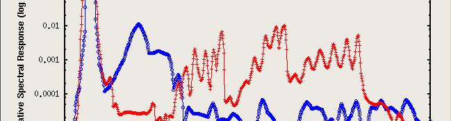


20 Incorporating VIIRS Band Response Function: L * i t (λ) BRF VIIRS (λ)dλ =L( t i ) VIIRS 412 nm Out of band response 488 nm 555 nm 865 nm


 Top of")


21 Example VIIRS Proxy image Approach 2 applied, only to valid water pixels (Black: land or clouds) Top of Atmosphere True Color ODIS RGB B8,B5,B2 B5 B2 bands Top of Atmosphere Proxy TOA VIIRS RGB 5,4,2 Convolved with Spectral response of VIIRS
22 Comparison between ODIS and Proxy Lt 412 nm 488 nm A Lt IRS TOA Proxy VI 555 nm 865 nm ODIS TOA Lt
23 Proxy Rrs 555 ODIS Rrs 551 At ~550 nm, Rrs from both sensors are quite consistent!
24 Develop proxy VIIRS Ocean Color remotesensing reflectance from ODIS FY 10 - ILESTONES Completed In Progress ilestone 1: Update and refine S to HS for VIIRS proxy ilestone e 2: Evaluate proxy data stream with ODIS/ERIS S data Image to image comparison (Lt, Rrs, bio-optical properties) atch-up comparison (e.g. Norfolk, Chesapeake Bay) ilestone 3: Lead the algorithms evaluation team
25 Develop proxy VIIRS Ocean Color remotesensing reflectance from ODIS Status and Issues: Deliverable: Concept/strategy for proxy VIIRS ocean color 1. Dates achieved: September %. Deliverable: Algorithm for proxy hyperspectral VIIRS data 1. Dates achieved: February % 2. Steps are being taken to further refine the algorithm. Deliverable: Software module to generate proxy VIIRS ocean color data within GRAVITE 1. Version 1 module is now incorporated in GRAVITE. 90% 2. Software test/evaluation
 Proxy Rrs(488) >")

 488")
26 Comparison between ODIS and Proxy Rrs(488) Proxy Rrs(488) > ODIS Rrs(488)! Proxy? Effect of out-of-band response? Atmosphere correction? Pro oxy VIIRS Rrs(488 8 nm) 488 nm ODIS Rrs(488 nm)
27 Comparison between ODIS and Proxy Rrs(488) Higher proxy Rrs(488) happened at open ocean
28 Develop proxy VIIRS Ocean Color remotesensing reflectance from ODIS Summary: Impact of Deliverables on Program Provide critical components to test and ensure the readiness of VIIRS ocean-color data processing infrastructure Provide important data stream to evaluate the likely performance of VIIRS ocean color sensor in various environments
29 Develop proxy VIIRS Ocean Color remotesensing reflectance from ODIS Schedule with ajor Deliverables Title ilestones Task #1: Develop and implement VIIRS proxy OC data algorithm Task #2: Refine algorithm for VIIRS proxy OC data and evaluate VIIRS proxy OC products Task #3: Develop and g VIIRS OC products FY08 FY09 FY10 FY11 FY12 Q1 Q2 Q3 Q4 Q1 Q2 Q3 Q4 Q1 Q2 Q3 Q4 Q1 Q2 Q3 Q4 Q1 Q2 Q3 Q4 S D T S C R refine algorithms for S C R S Start, C Complete, D Demo, I-Issues, - anual/documentation, R Final Report, T- Transition
30 Develop proxy VIIRS Ocean Color remotesensing reflectance from ODIS 1) Define a VIIRS Proxy Data Stream 2) Define the required in situ data stream for Cal/Val Questions? 3) Tuning of algorithms and LUTS (Vicarious calibration and SDR feedback) 4) Ocean Algorithm, stability evaluation and uncertainty 5) Product validation and product long-term stability 6) Satellite intercomparisons, robustness, seasonal and product stability
31 Extra Slides

 ODIS TOA Lt")
32 Comparison between ODIS and Proxy Lt Proxy VIIRS TOA Lt (412 nm) ODIS TOA Lt (412 nm) 412 nm

")
33 Comparison between ODIS and Proxy Lt Proxy VIIRS TOA Lt (48 88 nm) ODIS TOA Lt (488 nm) 488 nm

")
34 Comparison between ODIS and Proxy Lt Proxy VIIRS TOA Lt (55 55 nm) ODIS TOA Lt (551 nm) 555 nm

")
35 Comparison between ODIS and Proxy Lt Proxy VIIRS TOA Lt (86 65 nm) ODIS TOA Lt (869 nm) 865 nm
36 ISSUES ODIS Rrs 488 Proxy Rrs 488
Menghua Wang NOAA/NESDIS/STAR Camp Springs, MD 20746, USA
 Ocean EDR Product Calibration and Validation Plan Progress Report: VIIRS Ocean Color Algorithm Evaluations and Data Processing and Analyses Define a VIIRS Proxy Data Stream Define the required in situ
Ocean EDR Product Calibration and Validation Plan For the VIIRS Sensor for Ocean products
 DRAFT Cal Val Plan VIIRS Workshop Ocean EDR Product Calibration and Validation Plan For the VIIRS Sensor for Ocean products Developed by the Government Ocean Team representing (NOAA, NAVY. NASA, University
Ocean Products and Atmospheric Removal in APS
 Oregon State Ocean Products and Atmospheric Removal in APS David Lewis Oceanography Division Naval Research Laboratory Stennis Space Center, Mississipp david.lewis@nrlssc.navy.mil Contributors: David Lewis
Development of datasets and algorithms for hyperspectral IOP products from the PACE ocean color measurements
 Development of datasets and algorithms for hyperspectral IOP products from the PACE ocean color measurements Principal Investigator: Co-Investigators: Collaborator: ZhongPing Lee Michael Ondrusek NOAA/NESDIS/STAR
Atmospheric correction of hyperspectral ocean color sensors: application to HICO
 Atmospheric correction of hyperspectral ocean color sensors: application to HICO Amir Ibrahim NASA GSFC / USRA Bryan Franz, Zia Ahmad, Kirk knobelspiesse (NASA GSFC), and Bo-Cai Gao (NRL) Remote sensing
Calibration Techniques for NASA s Remote Sensing Ocean Color Sensors
 Calibration Techniques for NASA s Remote Sensing Ocean Color Sensors Gerhard Meister, Gene Eplee, Bryan Franz, Sean Bailey, Chuck McClain NASA Code 614.2 Ocean Biology Processing Group October 21st, 2010
The NIR- and SWIR-based On-orbit Vicarious Calibrations for VIIRS
 The NIR- and SWIR-based On-orbit Vicarious Calibrations for VIIRS Menghua Wang NOAA/NESDIS/STAR E/RA3, Room 3228, 5830 University Research Ct. College Park, MD 20746, USA Menghua.Wang@noaa.gov Workshop
Exploring Techniques for Improving Retrievals of Bio-optical Properties of Coastal Waters
 DISTRIBUTION STATEMENT A. Approved for public release; distribution is unlimited. Exploring Techniques for Improving Retrievals of Bio-optical Properties of Coastal Waters Samir Ahmed Department of Electrical
OCEANSAT-2 OCEAN COLOUR MONITOR (OCM-2)
") OCEANSAT-2 OCEAN COLOUR MONITOR (OCM-2) Update of post launch vicarious, lunar calibrations & current status Presented by Prakash Chauhan Space Applications Centre Indian Space Research Organistaion Ahmedabad-
OCEANSAT-2 OCEAN COLOUR MONITOR (OCM-2) Update of post launch vicarious, lunar calibrations & current status Presented by Prakash Chauhan Space Applications Centre Indian Space Research Organistaion Ahmedabad-
Development of datasets and algorithms for hyperspectral IOP products from the PACE ocean color measurements
 Development of datasets and algorithms for hyperspectral IOP products from the PACE ocean color measurements Principal Inves.gator: Co- Inves.gators: Collaborator: ZhongPing Lee Michael Ondrusek NOAA/NESDIS/STAR
Improving remotely sensed fused ocean data products through crosssensor
 Improving remotely sensed fused ocean data products through crosssensor calibration Mark David Lewis Ruhul Amin Sonia Gallegos Richard W. Gould, Jr. Sherwin Ladner Adam Lawson Rong-rong Li Improving remotely
Ocean Colour Vicarious Calibration Community requirements for future infrastructures
 Ocean Colour Vicarious Calibration Community requirements for future infrastructures IOCS 2017 - Breakout Workshop#3 IOCS 2017 ocean colour vicarious calibration 1 Part II: Discussion on community requirements
Atmospheric Correction and Vicarious Calibration of Oceansat-1 Ocean Color Monitor (OCM) Data in Coastal Case 2 Waters
 Data in Coastal Case 2 Waters") Remote Sens. 2012, 4, 1716-1740; doi:10.3390/rs4061716 Article OPEN ACCESS Remote Sensing ISSN 2072-4292 www.mdpi.com/journal/remotesensing Atmospheric Correction and Vicarious Calibration of Oceansat-1
Remote Sens. 2012, 4, 1716-1740; doi:10.3390/rs4061716 Article OPEN ACCESS Remote Sensing ISSN 2072-4292 www.mdpi.com/journal/remotesensing Atmospheric Correction and Vicarious Calibration of Oceansat-1
IOCS San Francisco 2015 Uncertainty algorithms for MERIS / OLCI case 2 water products
 IOCS San Francisco 2015 Uncertainty algorithms for MERIS / OLCI case 2 water products Roland Doerffer Brockmann Consult The problem of optically complex water high variability of optical properties of
MERIS Case 1 Validation ->
 MAVT meeting 20-24 March 2006 MERIS Case 1 Validation -> Performance of the NN case 2 water algorithm for case 1 water Presenter: Roland Doerffer GKSS Forschungszentrum, Institute for Coastal Research
Improved Global Ocean Color using POLYMER Algorithm
 Improved Global Ocean Color using POLYMER Algorithm François Steinmetz 1 Didier Ramon 1 Pierre-Yves Deschamps 1 Jacques Stum 2 1 Hygeos 2 CLS June 29, 2010 ESA Living Planet Symposium, Bergen, Norway c
2017 Summer Course on Optical Oceanography and Ocean Color Remote Sensing. Introduction to Remote Sensing
 2017 Summer Course on Optical Oceanography and Ocean Color Remote Sensing Introduction to Remote Sensing Curtis Mobley Delivered at the Darling Marine Center, University of Maine July 2017 Copyright 2017
SENSITIVITY ANALYSIS OF SEMI-ANALYTICAL MODELS OF DIFFUSE ATTENTUATION OF DOWNWELLING IRRADIANCE IN LAKE BALATON
 SENSITIVITY ANALYSIS OF SEMI-ANALYTICAL MODELS OF DIFFUSE ATTENTUATION OF DOWNWELLING IRRADIANCE IN LAKE BALATON Van der Zande D. (1), Blaas M. (2), Nechad B. (1) (1) Royal Belgian Institute of Natural
REPORT TYPE Conference Proceeding
 REPORT DOCUMENTATION PAGE Form Approved OMB No. 0704-0188 The public reporting burden (or this collection of information is estimated to average 1 hour per response, including the time for reviewing instructions,
) Define a VIIRS Proxy Data Stream
 Define a VIIRS Proxy Data Stream") 1) Define a VIIRS Proxy Data Stream 2) Define the required in situ data stream for Cal/Val 3) Tuning of algorithms and LUTS (Vicarious calibration and SDR feedback) 4) Ocean Algorithm, stability evaluation
1) Define a VIIRS Proxy Data Stream 2) Define the required in situ data stream for Cal/Val 3) Tuning of algorithms and LUTS (Vicarious calibration and SDR feedback) 4) Ocean Algorithm, stability evaluation
Uncertainties in ocean colour remote sensing
 ENMAP Summer School on Remote Sensing Data Analysis Uncertainties in ocean colour remote sensing Roland Doerffer Retired from Helmholtz Zentrum Geesthacht Institute of Coastal Research Now: Brockmann Consult
Shallow-water Remote Sensing: Lecture 1: Overview
 Shallow-water Remote Sensing: Lecture 1: Overview Curtis Mobley Vice President for Science and Senior Scientist Sequoia Scientific, Inc. Bellevue, WA 98005 curtis.mobley@sequoiasci.com IOCCG Course Villefranche-sur-Mer,
MODIS Land Bands for Ocean Remote Sensing Applications
 MODIS Land Bands for Ocean Remote Sensing Applications Bryan A. Franz,2, P. Jeremy Werdell,3, Gerhard Meister,4, Ewa J. Kwiatkowska,2, Sean W. Bailey,4, Ziauddin Ahmad,5, and Charles R. McClain NASA Goddard
IOCCG Calibration Workshop 30 October 2004, Fremantle, Australia. In-Flight Calibration of Satellite Ocean-Color Sensors
 IOCCG Calibration Workshop 30 October 2004, Fremantle, Australia In-Flight Calibration of Satellite Ocean-Color Sensors Purpose The purpose of the workshop was to review the calibration of ocean-color
Ocean color algorithms in optically shallow waters: Limitations and improvements
 Ocean color algorithms in optically shallow waters: Limitations and improvements Kendall L. Carder *a, Jennifer P. Cannizzaro a, Zhongping Lee b a University of South Florida, 140 7 th Ave. S, St. Petersburg,
Estimating land surface albedo from polar orbiting and geostationary satellites
 Estimating land surface albedo from polar orbiting and geostationary satellites Dongdong Wang Shunlin Liang Tao He Yuan Zhou Department of Geographical Sciences University of Maryland, College Park Nov
Reprocessing of Suomi NPP CrIS SDR and Impacts on Radiometric and Spectral Long-term Accuracy and Stability
 Reprocessing of Suomi NPP CrIS SDR and Impacts on Radiometric and Spectral Long-term Accuracy and Stability Yong Chen *1, Likun Wang 1, Denis Tremblay 2, and Changyong Cao 3 1.* University of Maryland,
UAV-based Remote Sensing Payload Comprehensive Validation System
 36th CEOS Working Group on Calibration and Validation Plenary May 13-17, 2013 at Shanghai, China UAV-based Remote Sensing Payload Comprehensive Validation System Chuan-rong LI Project PI www.aoe.cas.cn
Continued Development of the Look-up-table (LUT) Methodology For Interpretation of Remotely Sensed Ocean Color Data
 Methodology For Interpretation of Remotely Sensed Ocean Color Data") Continued Development of the Look-up-table (LUT) Methodology For Interpretation of Remotely Sensed Ocean Color Data Curtis D. Mobley Sequoia Scientific, Inc. 2700 Richards Road, Suite 107 Bellevue, WA
Continued Development of the Look-up-table (LUT) Methodology For Interpretation of Remotely Sensed Ocean Color Data Curtis D. Mobley Sequoia Scientific, Inc. 2700 Richards Road, Suite 107 Bellevue, WA
Motivation. Aerosol Retrieval Over Urban Areas with High Resolution Hyperspectral Sensors
 Motivation Aerosol etrieval Over Urban Areas with High esolution Hyperspectral Sensors Barry Gross (CCNY) Oluwatosin Ogunwuyi (Ugrad CCNY) Brian Cairns (NASA-GISS) Istvan Laszlo (NOAA-NESDIS) Aerosols
Retrieval of optical and microphysical properties of ocean constituents using polarimetric remote sensing
 Retrieval of optical and microphysical properties of ocean constituents using polarimetric remote sensing Presented by: Amir Ibrahim Optical Remote Sensing Laboratory, The City College of the City University
New Algorithm for MODIS chlorophyll Fluorescence Height Retrieval: performance and comparison with the current product
 New Algorithm for MODIS chlorophyll Fluorescence Height Retrieval: performance and comparison with the current product I. Ioannou, J. Zhou, A. Gilerson, B. Gross, F. Moshary and S. Ahmed Optical Remote
2017 Summer Course on Optical Oceanography and Ocean Color Remote Sensing. Apparent Optical Properties and the BRDF
 2017 Summer Course on Optical Oceanography and Ocean Color Remote Sensing Curtis Mobley Apparent Optical Properties and the BRDF Delivered at the Darling Marine Center, University of Maine July 2017 Copyright
Continued Development of the Look-up-table (LUT) Methodology For Interpretation of Remotely Sensed Ocean Color Data
 Methodology For Interpretation of Remotely Sensed Ocean Color Data") Continued Development of the Look-up-table (LUT) Methodology For Interpretation of Remotely Sensed Ocean Color Data W. Paul Bissett Florida Environmental Research Institute 10500 University Center Dr.,
Continued Development of the Look-up-table (LUT) Methodology For Interpretation of Remotely Sensed Ocean Color Data W. Paul Bissett Florida Environmental Research Institute 10500 University Center Dr.,
CHALLENGES GLOBAL APPROACH TO:
 CHALLENGES GLOBAL APPROACH TO: SPECTRAL LIBRARIES(MACROPHYTES, MACRO_ALGAE, SEAGRASSES, MUD, SAND, RUBBLE, DETRITUS, BENTHIC MICRO_ALGAE PHYTOPLANKTON) INLAND BIO-OPTICAL DATABASES-OPEN SOURCE INLAND WATER
Remote Sensing Reflectance Inversion of Phytoplankton Community Size Structure and Ecological Implications
 Remote Sensing Reflectance Inversion of Phytoplankton Community Size Structure and Ecological Implications Colleen Mouw RTE and Remote Sensing Course - DMC July 30, 2004 Ecological Importance Many biogeochemical
Algorithm Comparison for Shallow-Water Remote Sensing
 DISTRIBUTION STATEMENT A: Approved for public release; distribution is unlimited. Algorithm Comparison for Shallow-Water Remote Sensing Curtis D. Mobley Sequoia Scientific, Inc. 2700 Richards Road, Suite
ONR 800 N. Quincy St. Arlington, VA
 RForm Approved REPORT DOCUMENTATION PAGE OMB No. 0704-0188 The public reporting burden for this collection of information is estimated to average t hour per response, including the time for reviewing instructions,
Challenges in detecting trend and seasonal changes in bathymetry derived from HICO imagery: a case study of Shark Bay, Western Australia
 Challenges in detecting trend and seasonal changes in bathymetry derived from HICO imagery: a case study of Shark Bay, Western Australia Rodrigo Garcia 1, Peter Fearns 1, Lachlan McKinna 1,2 1 Remote Sensing
CHRIS Proba Workshop 2005 II
 CHRIS Proba Workshop 25 Analyses of hyperspectral and directional data for agricultural monitoring using the canopy reflectance model SLC Progress in the Upper Rhine Valley and Baasdorf test-sites Dr.
Uncertainties in the Products of Ocean-Colour Remote Sensing
 Chapter 3 Uncertainties in the Products of Ocean-Colour Remote Sensing Emmanuel Boss and Stephane Maritorena Data products retrieved from the inversion of in situ or remotely sensed oceancolour data are
UV Remote Sensing of Volcanic Ash
 UV Remote Sensing of Volcanic Ash Kai Yang University of Maryland College Park WMO Inter-comparison of Satellite-based Volcanic Ash Retrieval Algorithms Workshop June 26 July 2, 2015, Madison, Wisconsin
Lab 13 SeaDAS Ocean color Processing
 Lab 13 SeaDAS Ocean color Processing 13. 1 Interactive SeaDAS Processing: MODIS The purpose of this exercise is to present an overview of the basic steps involved in processing the MODIS data that you
CalVal needs for S2/S3 data normalisation
 CalVal needs for S2/S3 data normalisation Mission Performance Centre B. Alhammoud, with support of R. Serra & V. Vellucci presentation by FR Martin-Lauzer FRM4SOC,21-23 February 2017, ESRIN Goal: EO synergy
Suomi NPP CrIS Reprocessed SDR Long-term Accuracy and Stability
 Suomi NPP CrIS Reprocessed SDR Long-term Accuracy and Stability Yong Chen 1, Yong Han, Likun Wang 1, Fuzhong Weng, Ninghai Sun, and Wanchun Chen 1 CICS-MD, ESSIC, University of Maryland, College Park,
MERIS US Workshop. Vicarious Calibration Methods and Results. Steven Delwart
 MERIS US Workshop Vicarious Calibration Methods and Results Steven Delwart Presentation Overview Recent results 1. CNES methods Deserts, Sun Glint, Rayleigh Scattering 2. Inter-sensor Uyuni 3. MOBY-AAOT
Attenuation of visible solar radiation in the upper water column: A model based on IOPs
 Attenuation of visible solar radiation in the upper water column: A model based on IOPs ZhongPing Lee, KePing Du 2, Robert Arnone, SooChin Liew 3, Bradley Penta Naval Research Laboratory Code 7333 Stennis
NASA e-deep Blue aerosol update: MODIS Collection 6 and VIIRS
 NASA e-deep Blue aerosol update: MODIS Collection 6 and VIIRS Andrew M. Sayer, N. Christina Hsu (PI), Corey Bettenhausen, Nick Carletta, Jaehwa Lee, Colin Seftor, Jeremy Warner Past team members: Ritesh
Global and Regional Retrieval of Aerosol from MODIS
 Global and Regional Retrieval of Aerosol from MODIS Why study aerosols? CLIMATE VISIBILITY Presented to UMBC/NESDIS June 4, 24 Robert Levy, Lorraine Remer, Yoram Kaufman, Allen Chu, Russ Dickerson modis-atmos.gsfc.nasa.gov
REMOTE SENSING OF VERTICAL IOP STRUCTURE
 REMOTE SENSING OF VERTICAL IOP STRUCTURE W. Scott Pegau College of Oceanic and Atmospheric Sciences Ocean. Admin. Bldg. 104 Oregon State University Corvallis, OR 97331-5503 Phone: (541) 737-5229 fax: (541)
Spectral interdependence of remote-sensing reflectance and its implications on the design of ocean color satellite sensors
 Spectral interdependence of remote-sensing reflectance and its implications on the design of ocean color satellite sensors Zhongping Lee, 1, * Shaoling Shang, 2 Chuanmin Hu, 3 and Giuseppe Zibordi 4 1
A new simple concept for ocean colour remote sensing using parallel polarisation radiance
 Supplement Figures A new simple concept for ocean colour remote sensing using parallel polarisation radiance Xianqiang He 1, 3, Delu Pan 1, 2, Yan Bai 1, 2, Difeng Wang 1, Zengzhou Hao 1 1 State Key Laboratory
Evaluation of Satellite Ocean Color Data Using SIMBADA Radiometers
 Evaluation of Satellite Ocean Color Data Using SIMBADA Radiometers Robert Frouin Scripps Institution of Oceanography, la Jolla, California OCR-VC Workshop, 21 October 2010, Ispra, Italy The SIMBADA Project
Seawater reflectance in the near-ir
 Seawater reflectance in the near-ir Maéva DORON David DOXARAN Simon BELANGER Marcel BABIN Laboratoire d'océanographie de Villefranche Seawater Reflectance in the Near-IR Doron, Doxaran, Bélanger & Babin
CrIS Full Spectral Resolution SDR and S-NPP/JPSS-1 CrIS Performance Status
 CrIS Full Spectral Resolution SDR and S-NPP/JPSS-1 CrIS Performance Status Yong Han NOAA Center for Satellite Applications and Research, College Park, MD, USA and CrIS SDR Science Team ITSC-0 October 7
A Look-up-Table Approach to Inverting Remotely Sensed Ocean Color Data
 A Look-up-Table Approach to Inverting Remotely Sensed Ocean Color Data Curtis D. Mobley Sequoia Scientific, Inc. Westpark Technical Center 15317 NE 90th Street Redmond, WA 98052 phone: 425-867-2464 x 109
Utilization of AGI STK and S-NPP Operational Data to Generate JPSS-1 Proxy Test Data
 Utilization of AGI STK and S-NPP Operational Data to Generate JPSS-1 Proxy Test Data Emily Greene Wael Ibrahim Chris van Poollen Ed Meletyan Scott Leszczynski 2018 AMS Annual Meeting Austin, TX, USA Copyright
SWIR/VIS Reflectance Ratio Over Korea for Aerosol Retrieval
 Korean Journal of Remote Sensing, Vol.23, No.1, 2007, pp.1~5 SWIR/VIS Reflectance Ratio Over Korea for Aerosol Retrieval Kwon Ho Lee*, Zhangqing Li*, Young Joon Kim** *Earth System Science Interdisciplinary
BETTER LINKAGES BETWEEN NUMERICAL MODEL OUTPUT AND OPTICAL/OCEAN COLOUR PRODUCTS AND CLIMATE CHANGE
 BETTER LINKAGES BETWEEN NUMERICAL MODEL OUTPUT AND OPTICAL/OCEAN COLOUR PRODUCTS AND CLIMATE CHANGE Stephanie Dutkiewicz Massachusetts Institute of Technology What causes differences in quantum yield?
Application of the SCAPE-M atmospheric correction algorithm to the processing of MERIS data over continental water bodies
 Application of the SCAPE-M atmospheric correction algorithm to the processing of MERIS data over continental water bodies L. Guanter 1, J. A. Domínguez 2, L. Conde 2, A. Ruiz-Verdú 2, V. Estellés 3, R.
Improved MODIS Aerosol Retrieval using Modified VIS/MIR Surface Albedo Ratio Over Urban Scenes
 Improved MODIS Aerosol Retrieval using Modified VIS/MIR Surface Albedo Ratio Over Urban Scenes Min Min Oo, Matthias Jerg, Yonghua Wu Barry Gross, Fred Moshary, Sam Ahmed Optical Remote Sensing Lab City
Uncertainties in ocean colour remote sensing
 NOWPAP / PICES / WESTPAC Joint Training Course on Remote Sensing Data Analysis Introduction and recent progress in ocean color remote sensing part I: Uncertainties in ocean colour remote sensing Roland
Neural Network uncertain/es. Roland Doerffer & Carsten Brockmann Brockmann Consult GmbH Germany
 Neural Network uncertain/es Roland Doerffer & Carsten Brockmann Brockmann Consult GmbH Germany Content General uncertain:es of Case 2 water remote sensing using inverse modelling Specific uncertain:es
OCEAN COLOUR PRODUCTION CENTRE Ocean Colour Mediterranean and Black Sea Observation Product
 OCEAN COLOUR PRODUCTION CENTRE Black Sea Observation Product OCEANCOLOUR_MED_OPTICS_L3_NRT_OBSERVATIONS_009_038 OCEANCOLOUR_MED_OPTICS_L4_NRT_OBSERVATIONS_009_039 OCEANCOLOUR_MED_OPTICS_L3_REP_OBSERVATIONS_009_095
Update on S3 SYN-VGT algorithm status PROBA-V QWG 4 24/11/2016
 ACRI-ST S3MPC 2014-2016 Update on S3 SYN-VGT algorithm status PROBA-V QWG 4 24/11/2016 Agenda Continuity with PROBA-V data - Evolution of S3 SYN / Creation of an alternative Proba-V like processing chain
GODDARD SPACE FLIGHT CENTER. Future of cal/val. K. Thome NASA/GSFC
 GODDARD SPACE FLIGHT CENTER Future of cal/val K. Thome NASA/GSFC Key issues for cal/val Importance of cal/val continues to increase as models improve and budget pressures go up Better cal/val approaches
VIIRS Radiance Cluster Analysis under CrIS Field of Views
 VIIRS Radiance Cluster Analysis under CrIS Field of Views Likun Wang, Yong Chen, Denis Tremblay, Yong Han ESSIC/Univ. of Maryland, College Park, MD; wlikun@umd.edu Acknowledgment CrIS SDR Team 2016 CICS
Modeling of the ageing effects on Meteosat First Generation Visible Band
 on on Meteosat First Generation Visible Band Ilse Decoster, N. Clerbaux, J. Cornelis, P.-J. Baeck, E. Baudrez, S. Dewitte, A. Ipe, S. Nevens, K. J. Priestley, A. Velazquez Royal Meteorological Institute
Cross Calibration Of IRS-P4 OCM Satellite Sensor
 Cross Calibration Of IRS-P4 OCM Satellite Sensor T.Suresh, Elgar Desa, Antonio Mascarenhas, S.G. Prabhu Matondkar, Puneeta Naik, S.R.Nayak* National Institute of Oceanography, Goa 403004, India *Space
Analysis of Hyperspectral Data for Coastal Bathymetry and Water Quality
 Analysis of Hyperspectral Data for Coastal Bathymetry and Water Quality William Philpot Cornell University 453 Hollister Hall, Ithaca, NY 14853 phone: (607) 255-0801 fax: (607) 255-9004 e-mail: wdp2@cornell.edu
Hyperspectral Remote Sensing of Coastal Environments
 Hyperspectral Remote Sensing of Coastal Environments Miguel Vélez-Reyes, Ph.D. Laboratory for Applied Remote Sensing and Image Processing Center for Subsurface Sensing and Imaging Systems University of
Prototyping GOES-R Albedo Algorithm Based on MODIS Data Tao He a, Shunlin Liang a, Dongdong Wang a
 Prototyping GOES-R Albedo Algorithm Based on MODIS Data Tao He a, Shunlin Liang a, Dongdong Wang a a. Department of Geography, University of Maryland, College Park, USA Hongyi Wu b b. University of Electronic
MEPIX Software User Manual
 1.1 i MEPIX Software User Manual Copyright 2009 Brockmann Consult GmbH ESA and the ESA logo are trademarks of the European Space Agency. The Brockmann Consult logo is a trademark of Brockmann Consult GmbH.
ALGAE BLOOM DETECTION IN THE BALTIC SEA WITH MERIS DATA
 P P German P ALGAE BLOOM DETECTION IN THE BALTIC SEA WITH MERIS DATA ABSTRACT Harald Krawczyk P P, Kerstin Ebert P P, Andreas Neumann P Aerospace Centre Institute of Remote Sensing Technology, Rutherford
Update on Pre-Cursor Calibration Analysis of Sentinel 2. Dennis Helder Nischal Mishra Larry Leigh Dave Aaron
 Update on Pre-Cursor Calibration Analysis of Sentinel 2 Dennis Helder Nischal Mishra Larry Leigh Dave Aaron Background The value of Sentinel-2 data, to the Landsat world, will be entirely dependent on
In situ Validation of the Source of Thin Layers Detected by NOAA Airborne Fish Lidar
 DISTRIBUTION STATEMENT A: Approved for public release; distribution is unlimited. In situ Validation of the Source of Thin Layers Detected by NOAA Airborne Fish Lidar Dr. Percy L. Donaghay Dr. James Sullivan
Improved Temporal Resolution of Pseudo Invariant Calibration Sites (PICS) Through Development of the PICS Normalization Process (PNP)
 Through Development of the PICS Normalization Process (PNP)") Improved Temporal Resolution of Pseudo Invariant Calibration Sites (PICS) Through Development of the PICS Normalization Process (PNP) CALCON 2017 Utah State University, Logan 22-25 August 2017 By Morakot
Improved Temporal Resolution of Pseudo Invariant Calibration Sites (PICS) Through Development of the PICS Normalization Process (PNP) CALCON 2017 Utah State University, Logan 22-25 August 2017 By Morakot
Preliminary results of an algorithm to determine the total absorption coefficient of water Suresh Thayapurath* a a
 Preliminary results of an algorithm to determine the total absorption coefficient of water Suresh Thayapurath* a a, Madhubala Talaulikar, Erwin J.A. Desa 1, Aneesh Lotlikar 2 a National Institute of Oceanography
PICSCAR Status Radiometric Calibration Workshop for European Missions
 PICSCAR-PPT-022-MAG PUTTING KNOWLEDGE ON THE MAP PICSCAR Status Radiometric Calibration Workshop for European Missions Béatrice Berthelot (Magellium) Patrice Henry (CNES) 1 Characterisation of PICS PICS
A Generic Approach For Inversion And Validation Of Surface Reflectance and Aerosol Over Land: Application To Landsat 8 And Sentinel 2
 A Generic Approach For Inversion And Validation Of Surface Reflectance and Aerosol Over Land: Application To Landsat 8 And Sentinel 2 Eric Vermote NASA Goddard Space Flight Center, Code 619, Greenbelt,
Curt Mobley from my summer course lecture
 This is a placeholder for the web book section on polarization Polari zation Curt Mobley from my summer course lecture from Ken Voss PhD Dissertation Fun with Polarization (1) Using polarization
OCIS codes: , ,
 Refinement of atmospheric correction of absorbing aerosols for highly productive coastal waters using the SWIR retrieval algorithm together with water leaving reflectance constraints at 412nm Marco Vargas,
A Method Suitable for Vicarious Calibration of a UAV Hyperspectral Remote Sensor
 A Method Suitable for Vicarious Calibration of a UAV Hyperspectral Remote Sensor Hao Zhang 1, Haiwei Li 1, Benyong Yang 2, Zhengchao Chen 1 1. Institute of Remote Sensing and Digital Earth (RADI), Chinese
Verification of MSI Low Radiance Calibration Over Coastal Waters, Using AERONET-OC Network
 Verification of MSI Low Radiance Calibration Over Coastal Waters, Using AERONET-OC Network Yves Govaerts and Marta Luffarelli Rayference Radiometric Calibration Workshop for European Missions ESRIN, 30-31
Preliminary validation of Himawari-8/AHI navigation and calibration
 Preliminary validation of Himawari-8/AHI navigation and calibration Arata Okuyama 1, Akiyoshi Andou 1, Kenji Date 1, Nobutaka Mori 1, Hidehiko Murata 1, Tasuku Tabata 1, Masaya Takahashi 1, Ryoko Yoshino
Exercises with Level-2 satellite data
 Exercises with Level-2 satellite data Mati Kahru WimSoft, http://www.wimsoft.com Email: wim@wimsoft.com also at Scripps Institution of Oceanography UCSD, La Jolla, CA 92093-0218, USA mkahru@ucsd.edu 10/25/2008
mlo 6 E ~DCJ 5 7Q 0) 0 _ 0 41) 2 ED '0'7E E rn 00r C ~13CO i~ in I'wi- w-f ' L)) m op~ '0.0+
 0 _ 0 41) 2 ED '0'7E E rn 00r C ~13CO i~ in I'wi- w-f ' L)) m op~ '0.0+") mlo ~DCJ 5 6 E 7Q 0) 0 _ 0 41) 2 ED M E wj 0 CO2 0 '0'7E E > $i ~13CO rn 00r C i~ in w 3 0 I'wi- w-f ' M G 0- -q L)) m op~ '0.0+ 200606900 I { a UJ- X~i _ Bathymetry of shallow coastal regions derived
mlo ~DCJ 5 6 E 7Q 0) 0 _ 0 41) 2 ED M E wj 0 CO2 0 '0'7E E > $i ~13CO rn 00r C i~ in w 3 0 I'wi- w-f ' M G 0- -q L)) m op~ '0.0+ 200606900 I { a UJ- X~i _ Bathymetry of shallow coastal regions derived
CHLOROPHYLL CONCENTRATION ESTIMATED FROM IRRADIANCE MEASUREMENTS AT FLUCTUATING DEPTHS
 Ocean Optics XIV, Kailua-Kona, November 1998-1 - CHLOROPHYLL CONCENTRATION ESTIMATED FROM IRRADIANCE MEASUREMENTS AT FLUCTUATING DEPTHS Jasmine S. Bartlett, Mark R. Abbott, Ricardo M. Letelier and James
Name Company Function Signature Date
 Page : i of 1 Title: MERMAID data format Doc. no: QWG-MER-MERMAID-DF-02 Issue: 2 Revision: 3 Date: 22/03/2012 Name Company Function Signature Date Prepared by: C. Mazeran ACRI-ST W.P. Manager 22/03/2012
Sentinel-2 Calibration and Validation : from the Instrument to Level 2 Products
 Sentinel-2 Calibration and Validation : from the Instrument to Level 2 Products Vincent Lonjou a, Thierry Tremas a, Sophie Lachérade a, Cécile Dechoz a, Florie Languille a, Aimé Meygret a, Olivier Hagolle
Hyperspectral Remote Sensing
 Hyperspectral Remote Sensing Multi-spectral: Several comparatively wide spectral bands Hyperspectral: Many (could be hundreds) very narrow spectral bands GEOG 4110/5100 30 AVIRIS: Airborne Visible/Infrared
Results of Cross-comparisons using multiple sites
 Results of Cross-comparisons using multiple sites Dave Smith CEOS WGCV IVOS workshop 18-20 Oct 2010 1 Content AATSR Drift Analysis AATSR vs. MERIS comparisons over Deserts Intercomparisons Over Dome-C
Operational use of the Orfeo Tool Box for the Venµs Mission
 Operational use of the Orfeo Tool Box for the Venµs Mission Thomas Feuvrier http://uk.c-s.fr/ Free and Open Source Software for Geospatial Conference, FOSS4G 2010, Barcelona Outline Introduction of the
HICO User Annual Report. Using HICO data for the preparation of the future EnMAP satellite mission
 August 31, 2012 HICO User Annual Report Using HICO data for the preparation of the future EnMAP satellite mission Nicole Pinnel 1, Rolf Richter 1, Slava Kiselev 2, Martin Bachmann 1 1 DLR, Earth Observation
End-to-End Simulation of Sentinel-2 Data with Emphasis on Atmospheric Correction Methods
 End-to-End Simulation of Sentinel-2 Data with Emphasis on Atmospheric Correction Methods Luis Guanter 1, Karl Segl 2, Hermann Kaufmann 2 (1) Institute for Space Sciences, Freie Universität Berlin, Germany
Adaptive SIOP parameterisation algorithm for complex waters
 NASA-Aqua MODIS January 4 2011 Satellite Chlorophyll estimate Courtesy of Dr. V. Brando, CLW Adaptive SIOP parameterisation algorithm for complex waters Dekker A. G., Brando V. E., Schroeder T., Boldeau-Patissier,
MERIS MERIS ATBD 2.24 Vicarious adjustment of the MERIS Ocean Colour Radiometry
 MERIS Issue: 1. 0 Page: i MERIS ATBD 2.24 Issue: 1. 0 Page: ii Preparation and signature list Name and role Company Signature Prepared by C. Lerebourg ACRI-ST C. Mazeran ACRI-ST J.P. Huot ESA D. Antoine
REMOTE SENSING OF BENTHIC HABITATS IN SOUTHWESTERN PUERTO RICO
 REMOTE SENSING OF BENTHIC HABITATS IN SOUTHWESTERN PUERTO RICO Fernando Gilbes Santaella Dep. of Geology Roy Armstrong Dep. of Marine Sciences University of Puerto Rico at Mayagüez fernando.gilbes@upr.edu
Ocean Optics Inversion Algorithm
 Ocean Optics Inversion Algorithm N. J. McCormick 1 and Eric Rehm 2 1 University of Washington Department of Mechanical Engineering Seattle, WA 98195-26 mccor@u.washington.edu 2 University of Washington
Interactive comment on Quantification and mitigation of the impact of scene inhomogeneity on Sentinel-4 UVN UV-VIS retrievals by S. Noël et al.
 Atmos. Meas. Tech. Discuss., www.atmos-meas-tech-discuss.net/5/c741/2012/ Author(s) 2012. This work is distributed under the Creative Commons Attribute 3.0 License. Atmospheric Measurement Techniques Discussions