Uncertainties in ocean colour remote sensing
|
|
|
- Lynne Simon
- 6 years ago
- Views:
Transcription
1 ENMAP Summer School on Remote Sensing Data Analysis Uncertainties in ocean colour remote sensing Roland Doerffer Retired from Helmholtz Zentrum Geesthacht Institute of Coastal Research Now: Brockmann Consult
2 What determines the radiance spectrum at TOA TOA Radiance Spectra Radiance (Wm-2 sr-1 µm-1) North Sea wavelength (nm) Pin 1 Pin 2 Pin 3 Pin 4 Pin 5 Pin 6 air molecules different aerosols thin clouds contrails Sky reflectance Sun glint foam floating material Suspended particles dissolved organic matter Vertical distribution chlorophyll Bottom reflection different phytoplankton species

3 Accuracy and Precision bias Reliability Accuracy Precision Stability Reproducibility RMS error Bias Linearity Scatter Standard deviation
4 Calibration of the Space Sensor Overview On board calibration Vicarious calibration Radiometric calibration Spectral calibration Dark signal Linearity stability Requirement for radiometric calibration very high (~ 1% accuracy) Long term performance and stability has to be monitored


5 Calibration of MERIS


6 Long term gain development of MERIS Camera 1 Camera 4 Camera 2 Camera 5 Camera 3 mean per camera optics degradation for all bands. Cameras 1 to 5 from top to bottom.
7 Atmosphere and water surface Large variety of aerosols Use of selected aerosol types (models) Thin clouds (cirrus, contrails) Sub-pixel clouds Cloud shadows Absorption by atmospheric gases: water vapour, oxygen, ozone, NO2 Foam and white caps Waves Sky and sun glint
8 Radiances at Top of Atmosphere (TOA) W m-2 sr-1 µm Laer Lray Lwat wavelength nm

9 MERIS Top of atmosphere radiance reflectance RLtoa RGB New York

10 Path radiance+ Fresnel reflectance RLpath MERIS band 5 (560 nm)

11 Water leaving radiance reflectance RLw MERIS band 5 (560 nm)

12 Water leaving radiance reflectance RLw MERIS band 2 (443 nm)

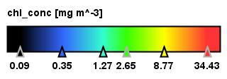
13 Chlorophyll
14 Water Nature of water Pure water optical properties only partly known with required accuracy Temperature and salinity effects Many different water constituents with different and varying inherent optical properties Vertical distribution not homogenous Sub pixel patchiness Model of water Definition of a bio-optical model Optical components and their similarity and variability Methods to separate different components
15 Pure water absorption II courtesy of R. Roettgers, HZG
16 Impact of salinity on reflectance spectrum Water leaving radiance reflectance of oligotrophic water for temperature 15 deg C, salinity 0 and 35, chl 0.1 mg m-3, ys(440 nm) 0.01, SPM 0.01 g m-3.
17 Water constituents Variable optical properties How to define a bio-optical model How to measure IOPs separately for different constituents Relationship between IOPs and concentrations Influence of the vertical distribution Saturation and masking effects
18 Case 1 water algorithm based on reflectance ratio model R445 / R555 Chl =a[r(445) / R(555)] b Case 1 water: Morel / Antoine MERIS Case 1 water ATBD


19 Phytoplankton Photos by Marion Rademaker


20 Suspended Matter and Phytoplankton in Coastal Water Photos by K. Heymann
21 Uncertainties due to the bio-optical model Optically relevant variables in the water Optical components with IOPs and variability Proxy concentration variable Scattering material Absorbing material Phytoplankton pigments Scattering by all particles Absorption by organic material Absorption by phyto pigments Dry weight of suspended matter [ g m-3] Concentration of DOC / POC [mg m-3] Concentration of chlorophyll a [mg m-3]
22 Uncertainties due to variability of optical properties Heincke187 a443 pigment n= a (m -1 )) norm chlorophyll a [mg/l] wavelength (nm) Normalized absorption spectra of North Sea phytoplankton Summer period a(443) (m -1 )) Variability in the relationship between a_pig and chlorophyll concentration Conversions: Chl. a [mg m-3] = 21 * a_pig_442 ^1.04
23 Sensitivity at different concentration ranges and spectral bands RLw for MERIS bands 1 (412 nm), 6 (560 nm), 10 (708 nm) 0.03 RLw [sr -1 ] band 1 = 412 nm band 5 = 560 nm band 9 = 708 nm Sensitivity of the reflectance at a spectral band depends on the concentration To cover a large concentration range many bands from the blue to NIR range are necessary a_gelb_440: 0.2, a_part_440: SPM/25, pig: 2 mg m SPM [g m -3 ]
24 Sensitivity at different concentration ranges and spectral bands 9.00E-003 Remote Sensing reflectance TSM E-002 Remote Sensing reflectance TSM E E E E E-002 Rsr (sr-1) 5.00E E E-003 Rsr 5_01_1 Rsr 10_01_1 Rsr (sr-1) 3.00E E-002 Rsr 5_01_100 Rsr 10_01_ E E E E wavelength (nm) 0.00E wavelength (nm) Chl. 5/10 mg m-3 TSM 1 g m-3 ays(443) 0.1 m-1 Chl. 5/10 mg m-3 TSM 100 g m-3 ays(443) 0.1 m-1
25 Signal depth at different spectral bands Multiband algorithms: the information for each band may come from a different water layer water depth m turbid coastel ocean Signal depth z90 z 90 =1/k coastal: TSM=5 mg/l Chlor.=5µg/l Gelb=a 380 =1m -1 open ocean: Chlor.=1µg/l -50 pure water wavelength µm
26 The inverse problem reflectance spectrum inverse model pure water phytoplankton suspended matter dissolved org. matter sun zenith view zenith azimuth diff forward model sun zenith view zenith azimuth diff Matrix inversion Inversion by optimization Inversion by neural network Success depends on: Bio-optical model ambiguities
27 How to reduce / determine uncertainties Exclude pixels with doubtful results -> flagging Check if spectrum is within the scope of your algorithm Comparison with in situ data (global, per water type) determine conficence range from model results
28 Searching for minimum: principle, 1D case Search for minimum: Deviation between measured and simulated spectrum deviation Acceptance level deviation Acceptance level Independent variable Independent variable Width can be estimated from the 2nd order derivative (Hessean matrix)
29 Error due to masking and ambiguities simulated reflectance test error 0.01 stdev RLw [sr-1] wavelength [nm] rlw_true rlw_err rlw_retr True spectrum simulated measured spectrum = true * random error Retrieved spectrum when LM has found solution
30 Results and errors of retrieval Variable conc true conc retr. stdev of log_conc err. estimated % err true % chlorophyll [mg m-3] detritus [g m-3] gelbstoff a443 [m-1] min. SPM [g m-3] kdmin_true: kdmin_ret: error: % kd490_true: kd490_ret: error: -1.04%
31 Uncertainties due to ambiguities for different concentration mixtures 10 2 case 2 water chlorophyll retrieval with NN nn-derived µg/l model chlorophyll µg/l All cases of turbid water 2 mg m-3
32 Ambiguities Pigment in North Sea Water (gelb < 0.2 m-1, MSM < 5 mg/l) nn µg/l model µg/l Typical North Sea coastal water: ay_443: < 0.2 m-1, TSM < 5 mg /l
33 Detection of out of scope conditions (MERIS processor) r g Reflectance spectrum r g i nvnn r, r log of reflectances c log of concentrations g geometry information q quality indicator c IOPs or concentrations f or wnn r NN input NN output q c q c Comparator to trigger out of scope flag C: log(b_tot) log(a_ys+a_btsm) log(a_pig) All at 443 nm Out of scope flag Angles: Sun zenith View nadir Azimuth diff If RLw < , RLw = ( ρ 0.003) Reflectance spectrum Output of NN flag PCD1_16,17 q true if sum (r(i) / r (i)) > 4.0 courtesy of H. Schiller


34 Detection of out of scope conditions (MERIS processor) Top of atmosphere radiance spectra at normal and critical locations
 Exceptional bloom, Indicated by high")

35 Detection of out of scope conditions (MERIS processor) Exceptional bloom, Indicated by high Chi_square value Chi_square is computed by comparing The input reflectance spectrum with the output of the forward NN
36 Detection of out of scope conditions using an aann Important to detect toa radiance specta which are not in the simulated training data set These are out of scope of the atmospheric correction algorithm Autoassociative neural network with a bottle neck layer Functions also as nonlinear PCA i.e. bottle neck number of neurons Provide estimate of Independent components Input layer Hidden 1 Bottleneck Hidden 3 output layer For the GAC training data Set of ~ 1Mio. Cases Bottleneck minimum was 4-5
 data High SPM Sun glint")
37 Detection of out of scope conditions aann: example for L1 (TOA) data High SPM Sun glint Transect
38 Detection of out of scope conditions aann: example AutoNN test 12x5x12 Yellow Sea transect, MERIS band 7, nm AutoNN test 12x5x12 Yellow Sea transect, MERIS band 7, nm rltoa rltoa_ann difference ratio rel. deviation RLtoa longitude longitude significant deviation in area with high SPM concentrations, but not in sun glint area rel. frequency AutoNN test Yellow Sea transect 12x5x12, MERIS band 7, nm Histogram of deviations shows 2 maxima, around 1 in sun glint 0.9 in high SPM area, which out of scope rel. radiance reflectance ratio to true
39 Validation NOMAD data set as reference Compiled, quality checked and maintained by OC group of NASA In situ observations from different cruises, different teams, instruments, procedures, sky and wave conditions Includes RLw at 6 MERIS bands (412,443,490, 510, 560,665) a_total, b_total / bb_total at443 Note: in situ data have their own variabilities and uncertainties! Relationship between chlorophyll a concentration and the absorption coefficient of phytoplankton pigments
40 a443 log10_a443_nn = log10_a443_measured * , stdev = 0.141
41 Frequency distribution Frequency distributions of measured and derived a443 after removing outliers with sum_sq > 1.0 e-5
42 Measured and nn-derived a443 for all cases with sd <1.0e-5
43 Test of NN based on measurements for chlorophyll Log10 scale, red: 1 by 1 line
44 Comparison of histograms: measured, NN computed
45 NN for kd489
46 Histogram kd489 measured and NN derived

47 Helgoland transect C Rtosa Rpath aann
48 Rw water reflectance 443 nm 560 nm 756 nm
49 Helgoland transect C atotal_443 TSM
50 Helgoland transect C apig_443 and uncertainty chlorophyll
51 Uncertainties related to comparison with in situ data Error in method and handling, e.g. HPLC for chlorophyll determination Sample not representative for water volume of pixel Vertical distribution: water comes from a certain depth, e.g. 4 m for FerryBox Temporal difference between sample and satellite overpass Sub-pixel patchiness Scatter in bio-optical data, e.g. relationship between concentration and IOPs
52 Summary and conclusions Uncertainty in coastal water products can be large due to the large number of factors in atmosphere and water, which determine the reflectance spectrum Conditions where algorithms (AC & water) fail Prerequisite for a successful retrieval are optical models of the atmosphere and the water, which meet the actual conditions Regional models might be necessary Reflectance spectra have to be tested if they are within the scope of these models Out of scope spectra have to be flagged, treated with special algorithms or excluded from further processing Limited sensitivity of reflectance spectrum and ambiguities lead to an uncertainty even for spectra, which are in scope Uncertainties have to be quantified on a pixel-by-pixel basis Validation in coastal waters by match up in situ samples can be difficult due to patchiness and fast changes Uncertainties in in situ match up data have to be quantified Validation should be complemented by statistical analysis of larger areas, transects and time series
IOCS San Francisco 2015 Uncertainty algorithms for MERIS / OLCI case 2 water products
 IOCS San Francisco 2015 Uncertainty algorithms for MERIS / OLCI case 2 water products Roland Doerffer Brockmann Consult The problem of optically complex water high variability of optical properties of
Neural Network uncertain/es. Roland Doerffer & Carsten Brockmann Brockmann Consult GmbH Germany
 Neural Network uncertain/es Roland Doerffer & Carsten Brockmann Brockmann Consult GmbH Germany Content General uncertain:es of Case 2 water remote sensing using inverse modelling Specific uncertain:es
Uncertainties in ocean colour remote sensing
 NOWPAP / PICES / WESTPAC Joint Training Course on Remote Sensing Data Analysis Introduction and recent progress in ocean color remote sensing part I: Uncertainties in ocean colour remote sensing Roland
MERIS Case 1 Validation ->
 MAVT meeting 20-24 March 2006 MERIS Case 1 Validation -> Performance of the NN case 2 water algorithm for case 1 water Presenter: Roland Doerffer GKSS Forschungszentrum, Institute for Coastal Research
Uncertainties in the Products of Ocean-Colour Remote Sensing
 Chapter 3 Uncertainties in the Products of Ocean-Colour Remote Sensing Emmanuel Boss and Stephane Maritorena Data products retrieved from the inversion of in situ or remotely sensed oceancolour data are
Retrieval of optical and microphysical properties of ocean constituents using polarimetric remote sensing
 Retrieval of optical and microphysical properties of ocean constituents using polarimetric remote sensing Presented by: Amir Ibrahim Optical Remote Sensing Laboratory, The City College of the City University
ALGAE BLOOM DETECTION IN THE BALTIC SEA WITH MERIS DATA
 P P German P ALGAE BLOOM DETECTION IN THE BALTIC SEA WITH MERIS DATA ABSTRACT Harald Krawczyk P P, Kerstin Ebert P P, Andreas Neumann P Aerospace Centre Institute of Remote Sensing Technology, Rutherford
2017 Summer Course on Optical Oceanography and Ocean Color Remote Sensing. Introduction to Remote Sensing
 2017 Summer Course on Optical Oceanography and Ocean Color Remote Sensing Introduction to Remote Sensing Curtis Mobley Delivered at the Darling Marine Center, University of Maine July 2017 Copyright 2017
Algorithm Theoretical Basis Document (ATBD) MERIS Regional Coastal and Lake Case 2 Water Project Atmospheric Correction ATBD
 MERIS Regional Coastal and Lake Case 2 Water Project Atmospheric Correction ATBD") DOC: GKSS-KOF--ATBD01 Name: Case II ATBD-ATMO Page: 1 Algorithm Theoretical Basis Document (ATBD) Regional Coastal and Lake Case 2 Water Project Version 1.0, 18. May 2008 Roland Doerffer & Helmut Schiller
DOC: GKSS-KOF--ATBD01 Name: Case II ATBD-ATMO Page: 1 Algorithm Theoretical Basis Document (ATBD) Regional Coastal and Lake Case 2 Water Project Version 1.0, 18. May 2008 Roland Doerffer & Helmut Schiller
Evaluation of Satellite Ocean Color Data Using SIMBADA Radiometers
 Evaluation of Satellite Ocean Color Data Using SIMBADA Radiometers Robert Frouin Scripps Institution of Oceanography, la Jolla, California OCR-VC Workshop, 21 October 2010, Ispra, Italy The SIMBADA Project
Improved Global Ocean Color using POLYMER Algorithm
 Improved Global Ocean Color using POLYMER Algorithm François Steinmetz 1 Didier Ramon 1 Pierre-Yves Deschamps 1 Jacques Stum 2 1 Hygeos 2 CLS June 29, 2010 ESA Living Planet Symposium, Bergen, Norway c
Regional MERIS level 2 algal products
 Regional MERIS level 2 algal products Development and validation in the Skagerrak Sea and Norwegian coastal waters Kai Sørensen 1, Jan Magnusson 1, Jo Høkedal 1, Eyvind Aas 2, Roland Doerffer 3, Carsten
Exploring Techniques for Improving Retrievals of Bio-optical Properties of Coastal Waters
 DISTRIBUTION STATEMENT A. Approved for public release; distribution is unlimited. Exploring Techniques for Improving Retrievals of Bio-optical Properties of Coastal Waters Samir Ahmed Department of Electrical
Atmospheric correction of hyperspectral ocean color sensors: application to HICO
 Atmospheric correction of hyperspectral ocean color sensors: application to HICO Amir Ibrahim NASA GSFC / USRA Bryan Franz, Zia Ahmad, Kirk knobelspiesse (NASA GSFC), and Bo-Cai Gao (NRL) Remote sensing
Menghua Wang NOAA/NESDIS/STAR Camp Springs, MD 20746, USA
 Ocean EDR Product Calibration and Validation Plan Progress Report: VIIRS Ocean Color Algorithm Evaluations and Data Processing and Analyses Define a VIIRS Proxy Data Stream Define the required in situ
Name Company Function Signature Date
 Page : i of 1 Title: MERMAID data format Doc. no: QWG-MER-MERMAID-DF-02 Issue: 2 Revision: 3 Date: 22/03/2012 Name Company Function Signature Date Prepared by: C. Mazeran ACRI-ST W.P. Manager 22/03/2012
OCEANSAT-2 OCEAN COLOUR MONITOR (OCM-2)
") OCEANSAT-2 OCEAN COLOUR MONITOR (OCM-2) Update of post launch vicarious, lunar calibrations & current status Presented by Prakash Chauhan Space Applications Centre Indian Space Research Organistaion Ahmedabad-
OCEANSAT-2 OCEAN COLOUR MONITOR (OCM-2) Update of post launch vicarious, lunar calibrations & current status Presented by Prakash Chauhan Space Applications Centre Indian Space Research Organistaion Ahmedabad-
New Algorithm for MODIS chlorophyll Fluorescence Height Retrieval: performance and comparison with the current product
 New Algorithm for MODIS chlorophyll Fluorescence Height Retrieval: performance and comparison with the current product I. Ioannou, J. Zhou, A. Gilerson, B. Gross, F. Moshary and S. Ahmed Optical Remote
VALIDATION OF MERIS REMOTE SENSING REFLECTANCE IN ATLANTIC CASE 1 WATERS WITH GROUND BASED IN-SITU MEASUREMENTS
 VALIDATION OF MERIS REMOTE SENSING REFLECTANCE IN ATLANTIC CASE 1 WATERS WITH GROUND BASED IN-SITU MEASUREMENTS Anja Theis(1), Bettina Schmitt(1), Steffen Gehnke(), Roland Doerffer(), Astrid Bracher(1)
OCEAN COLOUR REMOTE SENSING OF EXTREME CASE-2 WATERS
 OCEAN COLOUR REMOTE SENSING OF EXTREME CASE-2 WATERS Martin Hieronymi (1), Hajo Krasemann (1), Dagmar Müller (1), Carsten Brockmann (2), Ana Ruescas (2), Kerstin Stelzer (2), Bouchra Nechad (3), Kevin
MERIS VALIDATION OF GEOPHYSICAL OCEAN COLOUR PRODUCTS: PRELIMINARY RESULTS FOR THE NETHERLANDS
 MERIS VALIDATION OF GEOPHYSICAL OCEAN COLOUR PRODUCTS: PRELIMINARY RESULTS FOR THE NETHERLANDS Reinold Pasterkamp (1), Steef W. M. Peters (1), Hans van der Woerd (1) (1) Institute for Environmental Studies,
TOTAL SUSPENDED MATTER MAPS FROM CHRIS IMAGERY OF A SMALL INLAND WATER BODY IN OOSTENDE (BELGIUM)
") TOTAL SUSPENDED MATTER MAPS FROM IMAGERY OF A SMALL INLAND WATER BODY IN OOSTENDE (BELGIUM) Barbara Van Mol (1) and Kevin Ruddick (1) (1) Management Unit of the North Sea Mathematical Models (MUMM), Royal
TOTAL SUSPENDED MATTER MAPS FROM IMAGERY OF A SMALL INLAND WATER BODY IN OOSTENDE (BELGIUM) Barbara Van Mol (1) and Kevin Ruddick (1) (1) Management Unit of the North Sea Mathematical Models (MUMM), Royal
Seawater reflectance in the near-ir
 Seawater reflectance in the near-ir Maéva DORON David DOXARAN Simon BELANGER Marcel BABIN Laboratoire d'océanographie de Villefranche Seawater Reflectance in the Near-IR Doron, Doxaran, Bélanger & Babin
GEOG 4110/5100 Advanced Remote Sensing Lecture 2
 GEOG 4110/5100 Advanced Remote Sensing Lecture 2 Data Quality Radiometric Distortion Radiometric Error Correction Relevant reading: Richards, sections 2.1 2.8; 2.10.1 2.10.3 Data Quality/Resolution Spatial
Algorithm Theoretical Basis Document (ATBD) for Calibration of space sensors over Rayleigh Scattering : Initial version for LEO sensors
 for Calibration of space sensors over Rayleigh Scattering : Initial version for LEO sensors") 1 Algorithm Theoretical Basis Document (ATBD) for Calibration of space sensors over Rayleigh Scattering : Initial version for LEO sensors Bertrand Fougnie, Patrice Henry CNES 2 nd July, 2013 1. Introduction
1 Algorithm Theoretical Basis Document (ATBD) for Calibration of space sensors over Rayleigh Scattering : Initial version for LEO sensors Bertrand Fougnie, Patrice Henry CNES 2 nd July, 2013 1. Introduction
Atmospheric Correction and Vicarious Calibration of Oceansat-1 Ocean Color Monitor (OCM) Data in Coastal Case 2 Waters
 Data in Coastal Case 2 Waters") Remote Sens. 2012, 4, 1716-1740; doi:10.3390/rs4061716 Article OPEN ACCESS Remote Sensing ISSN 2072-4292 www.mdpi.com/journal/remotesensing Atmospheric Correction and Vicarious Calibration of Oceansat-1
Remote Sens. 2012, 4, 1716-1740; doi:10.3390/rs4061716 Article OPEN ACCESS Remote Sensing ISSN 2072-4292 www.mdpi.com/journal/remotesensing Atmospheric Correction and Vicarious Calibration of Oceansat-1
Verification of MSI Low Radiance Calibration Over Coastal Waters, Using AERONET-OC Network
 Verification of MSI Low Radiance Calibration Over Coastal Waters, Using AERONET-OC Network Yves Govaerts and Marta Luffarelli Rayference Radiometric Calibration Workshop for European Missions ESRIN, 30-31
2017 Summer Course on Optical Oceanography and Ocean Color Remote Sensing. Apparent Optical Properties and the BRDF
 2017 Summer Course on Optical Oceanography and Ocean Color Remote Sensing Curtis Mobley Apparent Optical Properties and the BRDF Delivered at the Darling Marine Center, University of Maine July 2017 Copyright
REMOTE SENSING OF VERTICAL IOP STRUCTURE
 REMOTE SENSING OF VERTICAL IOP STRUCTURE W. Scott Pegau College of Oceanic and Atmospheric Sciences Ocean. Admin. Bldg. 104 Oregon State University Corvallis, OR 97331-5503 Phone: (541) 737-5229 fax: (541)
Development of datasets and algorithms for hyperspectral IOP products from the PACE ocean color measurements
 Development of datasets and algorithms for hyperspectral IOP products from the PACE ocean color measurements Principal Investigator: Co-Investigators: Collaborator: ZhongPing Lee Michael Ondrusek NOAA/NESDIS/STAR
Estimating oceanic primary production using. vertical irradiance and chlorophyll profiles. from ocean gliders in the North Atlantic
 Estimating oceanic primary production using vertical irradiance and chlorophyll profiles from ocean gliders in the North Atlantic Victoria S. Hemsley* 1,2, Timothy J. Smyth 3, Adrian P. Martin 2, Eleanor
Calibration Techniques for NASA s Remote Sensing Ocean Color Sensors
 Calibration Techniques for NASA s Remote Sensing Ocean Color Sensors Gerhard Meister, Gene Eplee, Bryan Franz, Sean Bailey, Chuck McClain NASA Code 614.2 Ocean Biology Processing Group October 21st, 2010
Shallow-water Remote Sensing: Lecture 1: Overview
 Shallow-water Remote Sensing: Lecture 1: Overview Curtis Mobley Vice President for Science and Senior Scientist Sequoia Scientific, Inc. Bellevue, WA 98005 curtis.mobley@sequoiasci.com IOCCG Course Villefranche-sur-Mer,
CHRIS Proba Workshop 2005 II
 CHRIS Proba Workshop 25 Analyses of hyperspectral and directional data for agricultural monitoring using the canopy reflectance model SLC Progress in the Upper Rhine Valley and Baasdorf test-sites Dr.
Optical Theory Basics - 2 Atmospheric corrections and parameter retrieval
 Optical Theory Basics - 2 Atmospheric corrections and parameter retrieval Jose Moreno 3 September 2007, Lecture D1Lb2 OPTICAL THEORY-FUNDAMENTALS (2) Radiation laws: definitions and nomenclature Sources
COMPONENTS OF REMOTE SENSING REFLECTANCE OF NORTHERN BALTIC NATURAL WATER BASINS
 COMPONENTS OF REMOTE SENSING REFLECTANCE OF NORTHERN BALTIC NATURAL WATER BASINS Helgi Arst, and Vladimir I. Haltrin Estonian Marine Institute, 1 Paldiski Road, Tallinn, Estonia, 1137 e-mail: helarst@online.ee
Quantification of mineral particles from remote sensing. Using of spectroradiometric measurements and WASI simulations
 Quantification of mineral particles from remote sensing. Using of spectroradiometric measurements and WASI simulations Results obtained by V. Lafon, C. Giry, N. Bonneton, D. Doxaran, D. Bru C. Petus, M.
Revision History. Applicable Documents
 Revision History Version Date Revision History Remarks 1.0 2011.11-1.1 2013.1 Update of the processing algorithm of CAI Level 3 NDVI, which yields the NDVI product Ver. 01.00. The major updates of this
The Use of MERIS for Harmful Algal Bloom Monitoring in the Southern Benguela
 The Use of MERIS for Harmful Algal Bloom Monitoring in the Southern Benguela Stewart Bernard 1 Christelle Balt 1 Trevor Probyn 2 Grant Pitcher 2 Alex Fawcett 1 Andre Du Randt 2 1 Oceanography Department,
Class 11 Introduction to Surface BRDF and Atmospheric Scattering. Class 12/13 - Measurements of Surface BRDF and Atmospheric Scattering
 University of Maryland Baltimore County - UMBC Phys650 - Special Topics in Experimental Atmospheric Physics (Spring 2009) J. V. Martins and M. H. Tabacniks http://userpages.umbc.edu/~martins/phys650/ Class
The NIR- and SWIR-based On-orbit Vicarious Calibrations for VIIRS
 The NIR- and SWIR-based On-orbit Vicarious Calibrations for VIIRS Menghua Wang NOAA/NESDIS/STAR E/RA3, Room 3228, 5830 University Research Ct. College Park, MD 20746, USA Menghua.Wang@noaa.gov Workshop
Estimation of surface reflection effects on upwelling radiance field measurements in turbid waters
 INSTITUTE OF PHYSICS PUBLISHING JOURNAL OF OPTICS A: PURE AND APPLIED OPTICS J. Opt. A: Pure Appl. Opt. 6 (2004) 690 697 PII: S1464-4258(04)75616-0 Estimation of surface reflection effects on upwelling
COASTCOLOUR. CoastColour UCM1 * ESRIN *
 CoastColour UCM1 * ESRIN * 16-17.11.2010 1 In situ data 02/03-11-2010 2 Algorithm REQUIREMENTS These parameters are needed for basic water algorithms (for training of neural networks) The adaptation of
STSE-WaterRadiance. The. project. Final Report. (ESA Contract: AO /08/NL/CT)
") DOC: D8 7.0. Page: of 63 The STSE-WaterRadiance project (ESA Contract: AO -5859/08/NL/CT) Authors: Rüdiger Röttgers, Carsten Brockmann, Roland Doerffer, Jürgen Fischer, Andre Hollstein, Samantha Lavender,
DOC: D8 7.0. Page: of 63 The STSE-WaterRadiance project (ESA Contract: AO -5859/08/NL/CT) Authors: Rüdiger Röttgers, Carsten Brockmann, Roland Doerffer, Jürgen Fischer, Andre Hollstein, Samantha Lavender,
Continued Development of the Look-up-table (LUT) Methodology For Interpretation of Remotely Sensed Ocean Color Data
 Methodology For Interpretation of Remotely Sensed Ocean Color Data") Continued Development of the Look-up-table (LUT) Methodology For Interpretation of Remotely Sensed Ocean Color Data Curtis D. Mobley Sequoia Scientific, Inc. 2700 Richards Road, Suite 107 Bellevue, WA
Continued Development of the Look-up-table (LUT) Methodology For Interpretation of Remotely Sensed Ocean Color Data Curtis D. Mobley Sequoia Scientific, Inc. 2700 Richards Road, Suite 107 Bellevue, WA
CLEAR VISION ON TURBID WATER: THE NAIVASHA LAKE
 CLEAR VISION ON TURBID WATER: THE NAIVASHA LAKE M.S. Salama S.SALAMA@UTWNTE.NL June 13-14, 2013 Outlines Study Area The problem Objectives Field data Hydro optical models Empirical: CDOM, Chl-a and KD
Prototyping GOES-R Albedo Algorithm Based on MODIS Data Tao He a, Shunlin Liang a, Dongdong Wang a
 Prototyping GOES-R Albedo Algorithm Based on MODIS Data Tao He a, Shunlin Liang a, Dongdong Wang a a. Department of Geography, University of Maryland, College Park, USA Hongyi Wu b b. University of Electronic
The 4A/OP model: from NIR to TIR, new developments for time computing gain and validation results within the frame of international space missions
 ITSC-21, Darmstadt, Germany, November 29th-December 5th, 2017 session 2a Radiative Transfer The 4A/OP model: from NIR to TIR, new developments for time computing gain and validation results within the
Preliminary results of an algorithm to determine the total absorption coefficient of water Suresh Thayapurath* a a
 Preliminary results of an algorithm to determine the total absorption coefficient of water Suresh Thayapurath* a a, Madhubala Talaulikar, Erwin J.A. Desa 1, Aneesh Lotlikar 2 a National Institute of Oceanography
MERIS US Workshop. Vicarious Calibration Methods and Results. Steven Delwart
 MERIS US Workshop Vicarious Calibration Methods and Results Steven Delwart Presentation Overview Recent results 1. CNES methods Deserts, Sun Glint, Rayleigh Scattering 2. Inter-sensor Uyuni 3. MOBY-AAOT
Hyperspectral remote sensing for shallow waters: 2. Deriving bottom depths and water properties by optimization
 Hyperspectral remote sensing for shallow waters: 2. Deriving bottom depths and water properties by optimization Zhongping Lee, Kendall L. Carder, Curtis D. Mobley, Robert G. Steward, and Jennifer S. Patch
Develop proxy VIIRS Ocean Color remotesensing reflectance from MODIS
 Develop proxy VIIRS Ocean Color remotesensing reflectance from ODIS 1) Define a VIIRS Proxy Data Stream 2) Define the required in situ data stream for Cal/Val 3) Tuning of algorithms and LUTS (Vicarious
Curt Mobley from my summer course lecture
 This is a placeholder for the web book section on polarization Polari zation Curt Mobley from my summer course lecture from Ken Voss PhD Dissertation Fun with Polarization (1) Using polarization
Preprocessed Input Data. Description MODIS
 Preprocessed Input Data Description MODIS The Moderate Resolution Imaging Spectroradiometer (MODIS) Surface Reflectance products provide an estimate of the surface spectral reflectance as it would be measured
SENSITIVITY ANALYSIS OF SEMI-ANALYTICAL MODELS OF DIFFUSE ATTENTUATION OF DOWNWELLING IRRADIANCE IN LAKE BALATON
 SENSITIVITY ANALYSIS OF SEMI-ANALYTICAL MODELS OF DIFFUSE ATTENTUATION OF DOWNWELLING IRRADIANCE IN LAKE BALATON Van der Zande D. (1), Blaas M. (2), Nechad B. (1) (1) Royal Belgian Institute of Natural
PV-LAC: D-2-A3 ATBD Activity 3 & D-3-A3 IODD Activity 3
 Delivery report PV-LAC: advances Land, Aerosol and Coastal products for Proba-V PV-LAC: D-2-A3 ATBD Activity 3 & D-3-A3 IODD Activity 3 Sindy Sterckx, Nitin Bhatia November 2016 Distribution List DISTRIBUTION
MAPPING OF CHLOROPHYLL AND SUSPENDED PARTICULATE MATTER MAPS FROM CHRIS IMAGERY OF THE OOSTENDE CORE SITE
 MAPPING OF CHLOROPHYLL AND SUSPENDED PARTICULATE MATTER MAPS FROM CHRIS IMAGERY OF THE OOSTENDE CORE SITE Barbara Van Mol, Young-Je Par, Kevin Ruddic, Bouchra Nechad Management Unit of the North Sea Mathematical
Ocean Products and Atmospheric Removal in APS
 Oregon State Ocean Products and Atmospheric Removal in APS David Lewis Oceanography Division Naval Research Laboratory Stennis Space Center, Mississipp david.lewis@nrlssc.navy.mil Contributors: David Lewis
2017 Summer Course Optical Oceanography and Ocean Color Remote Sensing. Overview of HydroLight and EcoLight
 2017 Summer Course Optical Oceanography and Ocean Color Remote Sensing Curtis Mobley Overview of HydroLight and EcoLight Darling Marine Center, University of Maine July 2017 Copyright 2017 by Curtis D.
Modeling of the ageing effects on Meteosat First Generation Visible Band
 on on Meteosat First Generation Visible Band Ilse Decoster, N. Clerbaux, J. Cornelis, P.-J. Baeck, E. Baudrez, S. Dewitte, A. Ipe, S. Nevens, K. J. Priestley, A. Velazquez Royal Meteorological Institute
Sentinel-3 OLCI: Status
 Sentinel-3 OLCI: Status Jens Nieke, F. Borde, C. Mavrocordatos OLCI Status 26 Nov 2013 ESRIN 1 Outline Background OLCI development status Assembly, Testing & Integration (AIT) Camera EM and FM test results
Important Notes on the Release of FTS SWIR Level 2 Data Products For General Users (Version 02.xx) June, 1, 2012 NIES GOSAT project
 June, 1, 2012 NIES GOSAT project") Important Notes on the Release of FTS SWIR Level 2 Data Products For General Users (Version 02.xx) June, 1, 2012 NIES GOSAT project 1. Differences of processing algorithm between SWIR L2 V01.xx and V02.xx
Important Notes on the Release of FTS SWIR Level 2 Data Products For General Users (Version 02.xx) June, 1, 2012 NIES GOSAT project 1. Differences of processing algorithm between SWIR L2 V01.xx and V02.xx
CHLOROPHYLL CONCENTRATION ESTIMATED FROM IRRADIANCE MEASUREMENTS AT FLUCTUATING DEPTHS
 Ocean Optics XIV, Kailua-Kona, November 1998-1 - CHLOROPHYLL CONCENTRATION ESTIMATED FROM IRRADIANCE MEASUREMENTS AT FLUCTUATING DEPTHS Jasmine S. Bartlett, Mark R. Abbott, Ricardo M. Letelier and James
Polarization impacts on the water-leaving radiance retrieval from above-water radiometric measurements
 Polarization impacts on the water-leaving radiance retrieval from above-water radiometric measurements Tristan Harmel, 1, * Alexander Gilerson, 2 Alberto Tonizzo, 2 Jacek Chowdhary, 3 Alan Weidemann, 4
Water remote sensing reflectance from radiative transfer simulations on a global scale of Inherent Optical Properties
 Earth Syst. Sci. Discuss., https://doi.org/.194/essd-2018- Manuscript under review for journal Earth Syst. Sci. Water remote sensing reflectance from radiative transfer simulations on a global scale of
CHAPTER 15 INVESTIGATING LAND, OCEAN, AND ATMOSPHERE WITH MULTISPECTRAL MEASUREMENTS
 CHAPTER 15 INVESTIGATING LAND, OCEAN, AND ATMOSPHERE WITH MULTISPECTRAL MEASUREMENTS 15.1 Introducing Hydra A multi-spectral data analysis toolkit has been developed using freeware; it is called Hydra.
Breakout session: Active Remote Sensing for Ocean Colour
 Breakout session: Active Remote Sensing for Ocean Colour Jamet, C. Laboratoire d Océanologie et de Géosciences, Wimereux, France Churnside, J. NOAA, Boulder, USA Hostetler, C. NASA, Langley, USA Passive
Update on Pre-Cursor Calibration Analysis of Sentinel 2. Dennis Helder Nischal Mishra Larry Leigh Dave Aaron
 Update on Pre-Cursor Calibration Analysis of Sentinel 2 Dennis Helder Nischal Mishra Larry Leigh Dave Aaron Background The value of Sentinel-2 data, to the Landsat world, will be entirely dependent on
Application of the SCAPE-M atmospheric correction algorithm to the processing of MERIS data over continental water bodies
 Application of the SCAPE-M atmospheric correction algorithm to the processing of MERIS data over continental water bodies L. Guanter 1, J. A. Domínguez 2, L. Conde 2, A. Ruiz-Verdú 2, V. Estellés 3, R.
Algorithm Theoretical Basis Document (ATBD) for ray-matching technique of calibrating GEO sensors with Aqua-MODIS for GSICS.
 for ray-matching technique of calibrating GEO sensors with Aqua-MODIS for GSICS.") Algorithm Theoretical Basis Document (ATBD) for ray-matching technique of calibrating GEO sensors with Aqua-MODIS for GSICS David Doelling 1, Rajendra Bhatt 2, Dan Morstad 2, Benjamin Scarino 2 1 NASA-
Algorithm Theoretical Basis Document (ATBD) for ray-matching technique of calibrating GEO sensors with Aqua-MODIS for GSICS David Doelling 1, Rajendra Bhatt 2, Dan Morstad 2, Benjamin Scarino 2 1 NASA-
MERIS MERIS ATBD 2.24 Vicarious adjustment of the MERIS Ocean Colour Radiometry
 MERIS Issue: 1. 0 Page: i MERIS ATBD 2.24 Issue: 1. 0 Page: ii Preparation and signature list Name and role Company Signature Prepared by C. Lerebourg ACRI-ST C. Mazeran ACRI-ST J.P. Huot ESA D. Antoine
A Survey of Modelling and Rendering of the Earth s Atmosphere
 Spring Conference on Computer Graphics 00 A Survey of Modelling and Rendering of the Earth s Atmosphere Jaroslav Sloup Department of Computer Science and Engineering Czech Technical University in Prague
TEMPO & GOES-R synergy update and! GEO-TASO aerosol retrieval!
 TEMPO & GOES-R synergy update and! GEO-TASO aerosol retrieval! Jun Wang! Xiaoguang Xu, Shouguo Ding, Weizhen Hou! University of Nebraska-Lincoln!! Robert Spurr! RT solutions!! Xiong Liu, Kelly Chance!
Polar Multi-Sensor Aerosol Product: ATBD
 Polar Multi-Sensor Aerosol Product: ATBD Doc.No. : EUM/TSS/SPE/14/739904 Issue : v3b e-signed Date : 30 November 2015 WBS : EUMETSAT Eumetsat-Allee 1, D-64295 Darmstadt, Germany Tel: +49 6151 807-7 Fax:
Inversion of irradiance and remote sensing reflectance in shallow water between 400 and 800 nm for calculations of water and bottom properties
 Inversion of irradiance and remote sensing reflectance in shallow water between 400 and 800 nm for calculations of water and bottom properties Andreas Albert and Peter Gege What we believe to be a new
The Water Colour Simulator WASI
 WASI manual version 3 1 The Water Colour Simulator WASI User manual for version 3 Peter Gege WASI 2 WASI manual version 3 This document can be cited as follows: Gege, P. (2005): The Water Colour Simulator
MTG-FCI: ATBD for Clear Sky Reflectance Map Product
 MTG-FCI: ATBD for Clear Sky Reflectance Map Product Doc.No. Issue : : v2 EUMETSAT Eumetsat-Allee 1, D-64295 Darmstadt, Germany Tel: +49 6151 807-7 Fax: +49 6151 807 555 Date : 14 January 2013 http://www.eumetsat.int
UV Remote Sensing of Volcanic Ash
 UV Remote Sensing of Volcanic Ash Kai Yang University of Maryland College Park WMO Inter-comparison of Satellite-based Volcanic Ash Retrieval Algorithms Workshop June 26 July 2, 2015, Madison, Wisconsin
Multi-sensors vicarious calibration activities at CNES
 Multi-sensors vicarious calibration activities at CNES Patrice Henry, Bertrand Fougnie June 11, 2013 CNES background in image quality monitoring of operational Earth observation systems Since the launch
CALIBRATION OF VEGETATION CAMERAS ON-BOARD SPOT4
 CALIBRATION OF VEGETATION CAMERAS ON-BOARD SPOT4 Patrice Henry, Aimé Meygret CNES (Centre National d'etudes Spatiales) 18 avenue Edouard Belin - 31401 TOULOUSE CEDEX 4 - FRANCE Tel: 33 (0)5 61 27 47 12,
Ocean color algorithms in optically shallow waters: Limitations and improvements
 Ocean color algorithms in optically shallow waters: Limitations and improvements Kendall L. Carder *a, Jennifer P. Cannizzaro a, Zhongping Lee b a University of South Florida, 140 7 th Ave. S, St. Petersburg,
A comparison between above-water surface and subsurface spectral reflectances collected over inland waters
 University of Nebraska - Lincoln DigitalCommons@University of Nebraska - Lincoln Papers in Natural Resources Natural Resources, School of 4-2009 A comparison between above-water surface and subsurface
SIMEC, An Environment Correction For MERIS Based On The NIR Similarity Spectrum
 SIMEC, An Environment Correction For MERIS Based On The NIR Similarity Spectrum Els Knaeps, Sindy Sterckx, Flemish Institute for Technological Research (VITO), Remote Sensing Unit (TAP), Boeretang 200,
Ocean Colour Vicarious Calibration Community requirements for future infrastructures
 Ocean Colour Vicarious Calibration Community requirements for future infrastructures IOCS 2017 - Breakout Workshop#3 IOCS 2017 ocean colour vicarious calibration 1 Part II: Discussion on community requirements
Hyperspectral Remote Sensing
 Hyperspectral Remote Sensing Multi-spectral: Several comparatively wide spectral bands Hyperspectral: Many (could be hundreds) very narrow spectral bands GEOG 4110/5100 30 AVIRIS: Airborne Visible/Infrared
Improving remotely sensed fused ocean data products through crosssensor
 Improving remotely sensed fused ocean data products through crosssensor calibration Mark David Lewis Ruhul Amin Sonia Gallegos Richard W. Gould, Jr. Sherwin Ladner Adam Lawson Rong-rong Li Improving remotely
Interactive comment on Quantification and mitigation of the impact of scene inhomogeneity on Sentinel-4 UVN UV-VIS retrievals by S. Noël et al.
 Atmos. Meas. Tech. Discuss., 5, C751 C762, 2012 www.atmos-meas-tech-discuss.net/5/c751/2012/ Author(s) 2012. This work is distributed under the Creative Commons Attribute 3.0 License. Atmospheric Measurement
REMOTE SENSING OF BENTHIC HABITATS IN SOUTHWESTERN PUERTO RICO
 REMOTE SENSING OF BENTHIC HABITATS IN SOUTHWESTERN PUERTO RICO Fernando Gilbes Santaella Dep. of Geology Roy Armstrong Dep. of Marine Sciences University of Puerto Rico at Mayagüez fernando.gilbes@upr.edu
Infrared Scene Simulation for Chemical Standoff Detection System Evaluation
 Infrared Scene Simulation for Chemical Standoff Detection System Evaluation Peter Mantica, Chris Lietzke, Jer Zimmermann ITT Industries, Advanced Engineering and Sciences Division Fort Wayne, Indiana Fran
Kohei Arai 1 Graduate School of Science and Engineering Saga University Saga City, Japan
 Sensitivity Analysis and Error Analysis of Reflectance Based Vicarious Calibration with Estimated Aerosol Refractive Index and Size Distribution Derived from Measured Solar Direct and Diffuse Irradiance
Development of datasets and algorithms for hyperspectral IOP products from the PACE ocean color measurements
 Development of datasets and algorithms for hyperspectral IOP products from the PACE ocean color measurements Principal Inves.gator: Co- Inves.gators: Collaborator: ZhongPing Lee Michael Ondrusek NOAA/NESDIS/STAR
Data Mining Support for Aerosol Retrieval and Analysis:
 Data Mining Support for Aerosol Retrieval and Analysis: Our Approach and Preliminary Results Zoran Obradovic 1 joint work with Amy Braverman 2, Bo Han 1, Zhanqing Li 3, Yong Li 1, Kang Peng 1, Yilian Qin
Remote Sensing of Environment
 Remote Sensing of Environment 114 (2010) 854 866 Contents lists available at ScienceDirect Remote Sensing of Environment journal homepage: www.elsevier.com/locate/rse Calibration and validation of a generic
MTG-FCI: ATBD for Outgoing Longwave Radiation Product
 MTG-FCI: ATBD for Outgoing Longwave Radiation Product Doc.No. Issue : : EUM/MTG/DOC/10/0527 v2 EUMETSAT Eumetsat-Allee 1, D-64295 Darmstadt, Germany Tel: +49 6151 807-7 Fax: +49 6151 807 555 Date : 14
MODIS Atmosphere: MOD35_L2: Format & Content
 Page 1 of 9 File Format Basics MOD35_L2 product files are stored in Hierarchical Data Format (HDF). HDF is a multi-object file format for sharing scientific data in multi-platform distributed environments.
OMAERO README File. Overview. B. Veihelmann, J.P. Veefkind, KNMI. Last update: November 23, 2007
 OMAERO README File B. Veihelmann, J.P. Veefkind, KNMI Last update: November 23, 2007 Overview The OMAERO Level 2 data product contains aerosol characteristics such as aerosol optical thickness (AOT), aerosol
Comparison of Full-resolution S-NPP CrIS Radiance with Radiative Transfer Model
 Comparison of Full-resolution S-NPP CrIS Radiance with Radiative Transfer Model Xu Liu NASA Langley Research Center W. Wu, S. Kizer, H. Li, D. K. Zhou, and A. M. Larar Acknowledgements Yong Han NOAA STAR
A new simple concept for ocean colour remote sensing using parallel polarisation radiance
 Supplement Figures A new simple concept for ocean colour remote sensing using parallel polarisation radiance Xianqiang He 1, 3, Delu Pan 1, 2, Yan Bai 1, 2, Difeng Wang 1, Zengzhou Hao 1 1 State Key Laboratory
RADIANCE IN THE OCEAN: EFFECTS OF WAVE SLOPE AND RAMAN SCATTERING NEAR THE SURFACE AND AT DEPTHS THROUGH THE ASYMPTOTIC REGION
 RADIANCE IN THE OCEAN: EFFECTS OF WAVE SLOPE AND RAMAN SCATTERING NEAR THE SURFACE AND AT DEPTHS THROUGH THE ASYMPTOTIC REGION A Thesis by JULIE MARIE SLANKER Submitted to the Office of Graduate Studies
Implementation of Version 6 AQUA and TERRA SST processing. K. Kilpatrick, G. Podesta, S. Walsh, R. Evans, P. Minnett University of Miami March 2014
 Implementation of Version 6 AQUA and TERRA SST processing K. Kilpatrick, G. Podesta, S. Walsh, R. Evans, P. Minnett University of Miami March 2014 Outline of V6 MODIS SST changes: A total of 3 additional