Advanced Data Types and New Applications
|
|
|
- Gabriella Webster
- 5 years ago
- Views:
Transcription
1 Advanced Data Types and New Applications These slides are a modified version of the slides of the book Database System Concepts (Chapter 24), 5th Ed., McGraw-Hill, by Silberschatz, Korth and Sudarshan. Original slides are available at
2 Temporal Databases 1.2
3 Time In Databases Databases model the current state of the world, reality at the current time. Temporal databases model the states of the real world across time. In many applications it is important to store and retrieve information about past states (patient data base: medical history of a patient, factory monitoring system: past and current reading from sensors) Databases that store information about states of the real world across time are called temporal databases. Facts in temporal relations have associated times Valid time: denotes the time period during which a fact is true with respect to the real world The transaction time for a fact is the time interval during which the fact is stored within the database system. In a temporal relation, each tuple has an associated time when it is true; the time may be either valid time or transaction time. A bi-temporal relation stores both valid and transaction time. 1.3
4 We record not only changes in what happened at different times, but also changes in what was officially recorded at different times. Only the transaction time is system dependent and is generated by the database system. Oracle, DB2,.. 1.4

5 Time In Databases (Cont.) Example of a temporal relation: A tuple has only one time interval. A tuple is represented once for every disjoint time interval in which it is true. * in the to column means the tuple is true until the time in the column is changed Temporal query languages have been proposed to simplify modeling of time as well as time related queries. 1.5
6 Account table Account-number branch-name balance A-101 Downtown 100 B-215 Mianus
7 BiTemporal Account table Accountnumber branch-name balance VT_from VT_to TT_from TT_to A-101 Downtown /1/1 1999/1/ /1/1 1999/2/1 A-101 Downtown /1/25 * 1999/3/1 * A-215 Mianus /6/2 2000/8/8 2000/6/5 2000/8/2 A-215 Mianus /8/8 2000/9/5 2000/8/2 2000/9/5 A-215 Mianus /9/5 * 2000/9/9 * 1.7
8 Suppose we consider our sample bank database to be bi-temporal. Only the concept of valid time allows the system to answer queries such as - What was Smith s balance two days ago?. On the other hand, queries such as - What did we record as Smith s balance two days ago? can be answered based on the transaction time. The difference between the two times is important. For example, suppose, three days ago the teller made a mistake in entering Smith s balance and corrected the error only yesterday. This error means that there is a difference between the results of the two queries (if both of them are executed today). 1.8

9 Time Specification in SQL-92 date: four digits for the year ( ), two digits for the month (1--12), and two digits for the date (1--31). time: two digits for the hour, two digits for the minute, and two digits for the second, plus optional fractional digits. timestamp: the fields of date and time, with six fractional digits for the seconds field. Times are specified in the Universal Coordinated Time, abbreviated UTC (from the French); supports time with time zone (time as local time plus the offset of the local time from UTC). interval: refers to a period of time (e.g., 2 days and 5 hours), without specifying a particular time when this period starts; could more accurately be termed a span. 1.9
10 Temporal Query Languages Predicates on time intervals precedes, overlaps, and contains. Intersect can be applied on two intervals, to give a single (possibly empty) interval; the union of two intervals may or may not be a single interval. A snapshot of a temporal relation at time t consists of the tuples that are valid at time t, with the time-interval attributes projected out. Temporal selection: involves time attributes Temporal projection: the tuples in the projection inherit their timeintervals from the tuples in the original relation. Temporal join: the time-interval of a tuple in the result is the intersection of the time-intervals of the tuples from which it is derived. If intersection is empty, tuple is discarded from join. 1.10
11 VT_from A /1/1 A-215 A-215 VT_to * Temporal join VT_from VT_to A /1/1 1990/1/21 A A-215 A-101 not belongs to the output 1.11
12 Temporal Query Languages (Cont.) Functional dependencies must be used with care: adding a time field may invalidate functional dependency A temporal functional dependency x Y holds on a relation schema R if, all snapshots of r satisfy the functional dependency X Y. SQL:1999 Part 7 (SQL/Temporal) is a proposed extension to SQL:1999 to improve support of temporal data. 1.12
13 Spatial and Geographic Data
14 Spatial Databases Spatial databases store information related to spatial locations, and support efficient storage, indexing and querying of spatial data. Special purpose index structures are important for accessing spatial data, and for processing spatial join queries. Computer Aided Design (CAD) databases store design information about how objects are constructed E.g.: designs of buildings, aircraft, layouts of integrated-circuits Geographic databases store geographic information (e.g., maps). Database for geographic information systems (GIS). (INITIALLY store & retrieve data as files in the file system) (Ability to store and query large amount of data efficiently) 1.14
15 Represented of Geometric Information Various geometric constructs can be represented in a database in a normalized fashion. Represent a line segment by the coordinates of its endpoints. Approximate a curve by partitioning it into a sequence of segments Create a list of vertices in order, or Represent each segment as a separate tuple that also carries with it the identifier of the curve (2D features such as roads). Closed polygons List of vertices in order, starting vertex is the same as the ending vertex, or Represent boundary edges as separate tuples, with each containing identifier of the polygon, or Use triangulation divide polygon into triangles Note the polygon identifier with each of its triangles. 1.15
16 Representation of Geometric Constructs 1.16
17 Representation of Geometric Information (Cont.) Representation of points and line segment in 3-D similar to 2-D, except that points have an extra z component Represent arbitrary polyhedra by dividing them into tetrahedrons, like triangulating polygons. Alternative: 1.17
18 Design Databases Represent design components as objects (generally geometric objects); the connections between the objects indicate how the design is structured. Simple two-dimensional objects: points, lines, triangles, rectangles, polygons. Complex two-dimensional objects: formed from simple objects via union, intersection, and difference operations. Complex three-dimensional objects: formed from simpler objects such as spheres, cylinders, and cuboids, by union, intersection, and difference operations. Wireframe models represent three-dimensional surfaces as a set of simpler objects. Wireframing is one of the method of geometric modelling system. A wireframe model represents shape of solid object by its characteristics links and points 1.18
 Spatial integrity constraints are important. E.g., pipes should not intersect, wires should not be too close to each other, etc. 1.19")
19 Representation of Geometric Constructs (a) Difference of cylinders (b) Union of cylinders Design databases also store non-spatial information about objects (e.g., construction material, color, etc.) Spatial integrity constraints are important. E.g., pipes should not intersect, wires should not be too close to each other, etc. 1.19
20 Geographic Data
21 Applications of Geographic Data Geographic data Examples of geographic data map data for vehicle navigation distribution network information for power, telephones, water supply, and sewage Vehicle navigation systems store information about roads and services for the use of drivers: Spatial data: e.g, road/restaurant/gas-station coordinates Non-spatial data: e.g., one-way streets, speed limits, traffic congestion Global Positioning System (GPS) unit - utilizes information broadcast from GPS satellites to find the current location of user with an accuracy of tens of meters. increasingly used in vehicle navigation systems as well as utility maintenance applications. 1.21

22 Geographic Information System A geographic information system (GIS) is a system designed to capture, store, manipulate, analyze, manage, and present all types of geographic information for decision making In developing a digital topographic data base for a GIS, topographical maps are the main source, and aerial photography and satellite images are extra sources for collecting data and identifying attributes which can be mapped in layers. GIS applications are tools that allow users to create interactive queries (user-created searches), analyze spatial information, edit data in maps, and present the results of all these operations. 1.22

23 Example Geographical distribution of earthquakes Each point is an earthquake area Each point is a record in tha table with different attributes: - earthquake deph - earthquake magnitude - some attributes that denote properties of the object: colour, shape, symbol Sometimes table analysis not allow to find correlations between phisycal phenomena 1.23

24 GIS organize information in individual data themes that describe the distribution of a phenomenon across a geographic extent. This organizing principle of geographic layers became one of the universal GIS principles that provided the foundation for how GIS systems represent, operate on, manage, and apply geographic information. Thematic layers There are two broad methods used to store data in a GIS : raster images and vectors. 1.24
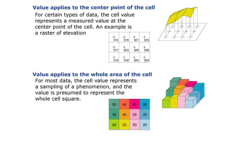
25 Geographic Data Raster data consist of bit maps or pixel maps, in two or more dimensions. Example 2-D raster image: satellite image of cloud cover, where each pixel stores the cloud visibility in a particular area. Additional dimensions might include the temperature at different altitudes at different regions, or measurements taken at different points in time. Design databases generally do not store raster data. 1.25

26 Raster data a matrix of cells (or pixels) organized into rows and columns (a grid), as shown in the graphic below, where each cell contains a value representing information of the geographic feature at the cell location, such as land-use. Raster image: digital aerial photographs, imagery from satellites, digital pictures, or even scanned maps. 1.26

27 Raster data set Raster attribute table There is a row for each distinct value in the data set. A column contains the count of the number of cells with each value. This table may also have a column that provides a textual description of each of the values in the data set. There are three default fields created in the table: - ObjectID (OID) is a unique system-defined object identifier number for each row - VALUE is a value in the raster data set. - COUNT represents the number of cells in the raster data set with the cell value in the VALUE column. Cell values represented by NoData are not in the raster attribute table. 1.27
28 1.28

29 The cell size determines how coarse or fine the patterns or features in the raster will appear. The smaller the cell size, the smoother or more detailed the raster will be. However, the greater the number of cells, the longer it will take to process, and it will increase the demand for storage space. If a cell size is too large, information may be lost or subtle patterns may be obscured. 1.29
30 Geographic Data (Cont.) Vector data are constructed from basic geometric objects: points, line segments, triangles, and other polygons in two dimensions, and cylinders, spheres, cuboids, and other polyhedrons in three dimensions. Vector format are often used to represent map data. Roads can be considered as two-dimensional and represented by lines and curves (multiple line segments). Some features, such as rivers, may be represented either as complex curves or as complex polygons, depending on whether their width is relevant. Features such as regions and lakes can be depicted as polygons. Topological information, such as height, may be represented by a surface divided into polygons covering regions of equal height (a height value associated with each polygon) 1.30
 and each point has attributes of deep and amount of water")
31 Vector data Point Each point is stored by its location (X, Y) together with the table attribute of this point. For example, 4 points below have their coordinate location in (X, Y) and each point has attributes of deep and amount of water contamination. 1.31
 have their first and last node to distinguish their location and each line has attributes of flow and capacity of the sewerage pipe.")
32 Line Each line is stored by the sequence of first and last point together with the associated table attribute of this line. For example, three lines below (a, b and c) have their first and last node to distinguish their location and each line has attributes of flow and capacity of the sewerage pipe. Notice that each node has coordinate (X, Y) that is stored in another table. 1.32

33 Polygon Polygon is represented by a closed sequence of lines. Unlike line or poly-line (sequence of line), polygon always closed. That is, the first point is equal to the last point. A polygon can be represented by a sequence of nodes where the last node is equal to the first node. For example, polygon A below has its first and last node in node number 1 to settle its location. Aside from location attributes, the polygon has associated attributes of area and population. Notice that each node has coordinate (X, Y) that is stored in another table. 1.33
34 Spatial Queries A number of types of query involve spatial locations Nearness queries request objects that lie near a specified location. Find all restaurants that lie within a given distance Nearest neighbor queries, given a point or an object, find the nearest object that satisfies given conditions. The nearest gasoline station Region queries deal with spatial regions. e.g., ask for objects that lie partially or fully inside a specified region. All markets within the boundaries of a given town. Queries that compute intersections or unions of regions. All regions with a low annual rainfall and a high population density. They use Spatial join of two spatial relations with the location playing the role of join attribute (one relation representing rainfall, the other relation population density). 1.34
35 Spatial Queries (Cont.) Spatial data is typically queried using a graphical query language; results are also displayed in a graphical manner. Graphical interface constitutes the front-end Extensions of SQL with abstract data types, such as lines, polygons and bit maps, have been proposed to interface with backend. allows relational databases to store and retrieve spatial information Queries can use spatial conditions (e.g. contains or overlaps). queries can mix spatial and nonspatial conditions (the nearest restaurant that has vegetarian selection and that charges less than $10 for a meal) 1.35
36 Indices are required for efficient access to spatial data. Queries often access data in a region of the space The problem is: how the space can be partitioned into regions such that all records in the region can be stored in a block? Traditional index structures such as hash indices and B-trees are not suitable, since they deal only with one-dimensional data, where spatial data are typically of two or more dimensions 1.36
37 Indexing of Spatial Data k-d tree - early structure used for indexing in multiple dimensions (balanced binary tree). Each level of a k-d tree partitions the space into two. choose one dimension for partitioning at the root level of the tree. choose another dimensions for partitioning in nodes at the next level and so on, cycling through the dimensions. In each node, approximately half of the points stored in the sub-tree fall on one side and half on the other. Partitioning stops when a node has less than a given maximum number of points. The k-d-b tree extends the k-d tree to allow multiple child nodes for each internal node; well-suited for secondary storage. 1.37
38 Division of Space by a k-d Tree Cities (Name, Latitude, Longitude) A B C D E F G H A D B E C G H F Each line in the figure (other than the outside box) corresponds to a node in the k-d tree the maximum number of points in a leaf node has been set to 1. The numbering of the lines in the figure indicates the level of the tree at which the corresponding node appears. K-d-B tree extends the number of children (to reduce the high of the tree) of internal nodes 1.38
39 Division of Space by a k-d Tree A B C D F E 1 G H Latitude number of cities in a block set to 1 half of the cities on one side and half on the other A B D E C F G H 2 Longitude Latitude 1.39
40 Division of Space by a k-d Tree A B C D E F G H number of cities in a block set to 2 half of the cities on one side and half on the other 1 Latitude 2 2 Longitude A,B Block D,E C,F G,H Cities located in the same region are stored in the same block 1.40
41 Division of Space by Quadtrees Quadtrees Each node of a quadtree is associated with a rectangular region of space; the top node is associated with the entire target space. Each non-leaf nodes divides its region into four equal sized quadrants correspondingly each such node has four child nodes corresponding to the four quadrants and so on Leaf nodes have between zero and some fixed maximum number of points (set to 1 in example). This type of quadtree is called Point Region quadtree (PR quadtree) A B C PR quadtree: stores points; space is divided based on regions, rather than on the actual set of points stored (four equal sized quadrants). D F E G H 1.41

42 PR quadtree NO NE A B C SO SE quadrants are named according to the geographycal position and are listed in the order NE, NO, SO and SE PR quadtree D E G H F NE NO SO SE NE NO A SO SE NE NO SO SE NE D E F NO SO SE NE C NO SO B SE NE NO SO G SE H 1.42
43 Quadtrees (Cont.) We can use Region quadtree to store raster information Region quadtrees store raster information. A node is a leaf node if all the values in the cells that it covers are the same. Otherwise, it is subdivided further into four children of equal area, and is therefore an internal node. Each node corresponds to a matrix of cells. The matrix corresponding to leaves either contain just a single element (cell), or have multiple elements (cells), all of which have the same value. 1.43


44 Raster data < to be done> 1.44
45 Quadtrees (Cont.) Indexing of line segments and polygons presents new problems Extensions of k-d trees and PR quadtrees have been proposed to index line segments and polygons However, a line segment or polygon may cross a partitioning line This requires splitting segments/polygons into pieces at partitioning boundaries and they must be represented in each of the sub-trees in which its pieces occur. Same segment/polygon may be represented at several leaf nodes-> inefficiencies in storage and inefficiencies in queries 1.45

46 R-Trees Indexing of objects such as line segments, rectangles, and other polygons R-trees (Rectangle-trees) are a N-dimensional extension of B + -trees. Basic idea: generalize the notion of a one-dimensional interval associated with each B+ -tree node to an N-dimensional interval, that is, an N-dimensional rectangle. Balanced tree structure with indexed objects in leaf nodes. The storage efficiency of R-trees is better than that of k-d trees or quadtrees since a polygon is stored only once Will consider only the two-dimensional case (N = 2) generalization for N > 2 is straightforward, although R-trees work well only for relatively small N Example of B+-tree 1.46 file
47 R Trees (Cont.) A rectangular bounding box is associated with each tree node. Bounding box of a leaf node is a minimum sized rectangle parallel to the axes that contains all objects (lines, rectangles, polygons) associated with the leaf node. The bounding box associated with a non-leaf node is the smallest rectangle parallel to the axes that contains the bounding box associated with all its children. Bounding box of a node serves as its key in its parent node (if any) Bounding boxes of children of a node are allowed to overlap A polygon is stored only in one node, and the bounding box of the node must contain the polygon 1.47

48 Example R-Tree A set of rectangles (solid line) and the bounding boxes (dashed line) of the nodes of an R-tree for a set of rectangles. The R-tree is shown on the right. leaf nodes Bounding boxes are shown with extra space inside them, to make them stand out We shall see how to implement search, insert and delete operations on an R-tree If indexed objects are not rectangles, we can store bounding boxes of objects in leaves. This helps to speed up checks for overlaps in a query. 1.48
49 Queries Point queries select * from where latitude =. AND longitude =. Region queries select * from where v1 <= latitude <= v2 AND w1 <= longitude <= w2 Nearest-neighbor queries nearest point to a specific location Partial match queries select * from where v1 <= latitude <= v2 1.49
50 Search in R-Trees A search for objects containing a point has to follow all child nodes whose associated bounding boxes contain the point. To find data items (rectangles/polygons) intersecting (overlaps) a given query object (point/region), do the following, starting from the root node: If the node is a leaf node, output the data items whose keys intersect the given query object (point/region). Else, for each child of the current node whose bounding box overlaps the query object (point/region), recursively search the child Can be very inefficient in worst case since multiple paths may need to be searched but works acceptably in practice. 1.50
51 Insertion in R-Trees To insert a data item (single traversal down from the root): Find a leaf to store it, and add it to the leaf To find leaf, follow a child (if any) whose bounding box contains bounding box of data item At each internal node, we may find multiple children whose bounding boxes contain the bounding box of the object The R-tree algorithm chooses one of them arbitrarily In none of the children satisfy this condition, chooses a child whose overlap with data item bounding box is maximum for continuing the traversal of the tree Once the leaf node has been reached, if the node is already full, the algorithm performs node splitting 1.51

52 Insertion in R-Trees Handle overflows by splitting and propagates splitting upwards if required (as in B+ -trees) The R-tree insertion ensures that the tree remains balanced Adjust bounding boxes such that they remain consistent: bounding boxes of leaves contains all the bounding boxes of the objects stored at the leaf; bounding boxes of internal nodes contain all bounding boxes of the children nodes The main difference with B+-tree is in how the node is split: in B+-tree it is possible to find a value such that half entries are less and half entries are greater than the value. in two dimensions, it is not always possible to split the entries into two sets so that their bounding boxes do not overlap 1.52
53 Split procedure Split procedure: Goal: divide the set S of entries of an overfull node into two sets S1 and S2 such that the bounding boxes of S1 and S2 have minimum total area. This is a heuristic. Alternative: divide the set S of entries of an overfull node into two sets S1 and S2 such that the bounding boxes of S1 and S2 have the minimum overlap Finding the best split (minimum total area or minimum overlap) is expensive Cheaper heuristics such as quadratic split are used 1.53
54 Splitting an R-Tree Node Quadratic split divides the entries in a node as follows 1. Find pair of entries in S with maximum separation that is, the pair such that the bounding box of the two would has the maximum wasted space (area of bounding box sum of areas of two entries) 2. Place these entries in the two new sets S1 and S2, respectively 3. Then to add the remaining entries: repeatedly find the entry with maximum preference for one of the two new sets, and assign the entry to that set. For each entry e, let e1 be the increase in size of the bounding box of S1 and e2 the increase in size of the bounding box of S2 if e is added to S1 or S2; choose one of the entries with maximum difference of e1 and e2 and add it to S1 if e1 is less than e2 4. Stop when half the entries have been added to one set Then assign remaining entries to the other set Nodes are constructed from S1 and S2 1.54
55 Deletion of an entry in an R-tree done much like a B + -tree deletion. In case of underfull node, borrow entries from a sibling if possible, else merging sibling nodes Alternative approach removes all entries from the underfull node, deletes the node, then reinserts all entries Each node at least half full. Deleting in R-Trees R-Trees R-trees are supported in many modern database systems, along with variants like R + -trees and R*-trees 1.55
Advanced Data Types and New Applications
 Advanced Data Types and New Applications These slides are a modified version of the slides of the book Database System Concepts (Chapter 24), 5th Ed., McGraw-Hill, by Silberschatz, Korth and Sudarshan.
Chapter 25: Spatial and Temporal Data and Mobility
 Chapter 25: Spatial and Temporal Data and Mobility Database System Concepts, 6 th Ed. See www.db-book.com for conditions on re-use Chapter 25: Spatial and Temporal Data and Mobility Temporal Data Spatial
Database index structures
 Database index structures From: Database System Concepts, 6th edijon Avi Silberschatz, Henry Korth, S. Sudarshan McGraw- Hill Architectures for Massive DM D&K / UPSay 2015-2016 Ioana Manolescu 1 Chapter
Chapter 11: Indexing and Hashing
 Chapter 11: Indexing and Hashing Basic Concepts Ordered Indices B + -Tree Index Files B-Tree Index Files Static Hashing Dynamic Hashing Comparison of Ordered Indexing and Hashing Index Definition in SQL
Spatial Data Management
 Spatial Data Management Chapter 28 Database management Systems, 3ed, R. Ramakrishnan and J. Gehrke 1 Types of Spatial Data Point Data Points in a multidimensional space E.g., Raster data such as satellite
Spatial Data Management
 Spatial Data Management [R&G] Chapter 28 CS432 1 Types of Spatial Data Point Data Points in a multidimensional space E.g., Raster data such as satellite imagery, where each pixel stores a measured value
Chapter 12: Indexing and Hashing
 Chapter 12: Indexing and Hashing Database System Concepts, 5th Ed. See www.db-book.com for conditions on re-use Chapter 12: Indexing and Hashing Basic Concepts Ordered Indices B + -Tree Index Files B-Tree
Principles of Data Management. Lecture #14 (Spatial Data Management)
") Principles of Data Management Lecture #14 (Spatial Data Management) Instructor: Mike Carey mjcarey@ics.uci.edu Database Management Systems 3ed, R. Ramakrishnan and J. Gehrke 1 Today s Notable News v Project
Principles of Data Management Lecture #14 (Spatial Data Management) Instructor: Mike Carey mjcarey@ics.uci.edu Database Management Systems 3ed, R. Ramakrishnan and J. Gehrke 1 Today s Notable News v Project
Chapter 12: Indexing and Hashing. Basic Concepts
 Chapter 12: Indexing and Hashing! Basic Concepts! Ordered Indices! B+-Tree Index Files! B-Tree Index Files! Static Hashing! Dynamic Hashing! Comparison of Ordered Indexing and Hashing! Index Definition
Chapter 12: Indexing and Hashing
 Chapter 12: Indexing and Hashing Basic Concepts Ordered Indices B+-Tree Index Files B-Tree Index Files Static Hashing Dynamic Hashing Comparison of Ordered Indexing and Hashing Index Definition in SQL
Chapter 12: Indexing and Hashing (Cnt(
 Chapter 12: Indexing and Hashing (Cnt( Cnt.) Basic Concepts Ordered Indices B+-Tree Index Files B-Tree Index Files Static Hashing Dynamic Hashing Comparison of Ordered Indexing and Hashing Index Definition
Database System Concepts, 5th Ed. Silberschatz, Korth and Sudarshan See for conditions on re-use
 Chapter 12: Indexing and Hashing Database System Concepts, 5th Ed. See www.db-book.com for conditions on re-use Chapter 12: Indexing and Hashing Basic Concepts Ordered Indices B + -Tree Index Files B-Tree
Advanced Data Types and New Applications
 C H A P T E R25 Advanced Data Types and New Applications Practice Exercises 25.1 What are the two types of time, and how are they different? Why does it make sense to have both types of time associated
Advances in Data Management Principles of Database Systems - 2 A.Poulovassilis
 1 Advances in Data Management Principles of Database Systems - 2 A.Poulovassilis 1 Storing data on disk The traditional storage hierarchy for DBMSs is: 1. main memory (primary storage) for data currently
Database System Concepts, 6 th Ed. Silberschatz, Korth and Sudarshan See for conditions on re-use
 Chapter 11: Indexing and Hashing Database System Concepts, 6 th Ed. See www.db-book.com for conditions on re-use Chapter 12: Indexing and Hashing Basic Concepts Ordered Indices B + -Tree Index Files Static
Multidimensional Data and Modelling - DBMS
 Multidimensional Data and Modelling - DBMS 1 DBMS-centric approach Summary: l Spatial data is considered as another type of data beside conventional data in a DBMS. l Enabling advantages of DBMS (data
Introduction to Indexing R-trees. Hong Kong University of Science and Technology
 Introduction to Indexing R-trees Dimitris Papadias Hong Kong University of Science and Technology 1 Introduction to Indexing 1. Assume that you work in a government office, and you maintain the records
Class #2. Data Models: maps as models of reality, geographical and attribute measurement & vector and raster (and other) data structures
 data structures") Class #2 Data Models: maps as models of reality, geographical and attribute measurement & vector and raster (and other) data structures Role of a Data Model Levels of Data Model Abstraction GIS as Digital
Class #2 Data Models: maps as models of reality, geographical and attribute measurement & vector and raster (and other) data structures Role of a Data Model Levels of Data Model Abstraction GIS as Digital
Geometric Algorithms. Geometric search: overview. 1D Range Search. 1D Range Search Implementations
 Geometric search: overview Geometric Algorithms Types of data:, lines, planes, polygons, circles,... This lecture: sets of N objects. Range searching Quadtrees, 2D trees, kd trees Intersections of geometric
Intro to DB CHAPTER 12 INDEXING & HASHING
 Intro to DB CHAPTER 12 INDEXING & HASHING Chapter 12: Indexing and Hashing Basic Concepts Ordered Indices B+-Tree Index Files B-Tree Index Files Static Hashing Dynamic Hashing Comparison of Ordered Indexing
Understanding Geospatial Data Models
 Understanding Geospatial Data Models 1 A geospatial data model is a formal means of representing spatially referenced information. It is a simplified view of physical entities and a conceptualization of
Multidimensional Indexing The R Tree
 Multidimensional Indexing The R Tree Module 7, Lecture 1 Database Management Systems, R. Ramakrishnan 1 Single-Dimensional Indexes B+ trees are fundamentally single-dimensional indexes. When we create
M. Andrea Rodríguez-Tastets. I Semester 2008
 M. -Tastets Universidad de Concepción,Chile andrea@udec.cl I Semester 2008 Outline refers to data with a location on the Earth s surface. Examples Census data Administrative boundaries of a country, state
1. Meshes. D7013E Lecture 14
 D7013E Lecture 14 Quadtrees Mesh Generation 1. Meshes Input: Components in the form of disjoint polygonal objects Integer coordinates, 0, 45, 90, or 135 angles Output: A triangular mesh Conforming: A triangle
Chapter 11: Indexing and Hashing
 Chapter 11: Indexing and Hashing Database System Concepts, 6 th Ed. See www.db-book.com for conditions on re-use Chapter 11: Indexing and Hashing Basic Concepts Ordered Indices B + -Tree Index Files B-Tree
Chapter 11: Indexing and Hashing
 Chapter 11: Indexing and Hashing Database System Concepts, 6 th Ed. See www.db-book.com for conditions on re-use Chapter 11: Indexing and Hashing Basic Concepts Ordered Indices B + -Tree Index Files B-Tree
Topic 5: Raster and Vector Data Models
 Geography 38/42:286 GIS 1 Topic 5: Raster and Vector Data Models Chapters 3 & 4: Chang (Chapter 4: DeMers) 1 The Nature of Geographic Data Most features or phenomena occur as either: discrete entities
CSIT5300: Advanced Database Systems
 CSIT5300: Advanced Database Systems L08: B + -trees and Dynamic Hashing Dr. Kenneth LEUNG Department of Computer Science and Engineering The Hong Kong University of Science and Technology Hong Kong SAR,
Chapter 12: Query Processing
 Chapter 12: Query Processing Overview Catalog Information for Cost Estimation $ Measures of Query Cost Selection Operation Sorting Join Operation Other Operations Evaluation of Expressions Transformation
Query Processing. Debapriyo Majumdar Indian Sta4s4cal Ins4tute Kolkata DBMS PGDBA 2016
 Query Processing Debapriyo Majumdar Indian Sta4s4cal Ins4tute Kolkata DBMS PGDBA 2016 Slides re-used with some modification from www.db-book.com Reference: Database System Concepts, 6 th Ed. By Silberschatz,
An Introduction to Spatial Databases
 An Introduction to Spatial Databases R. H. Guting VLDB Journal v3, n4, October 1994 Speaker: Giovanni Conforti Outline: a rather old (but quite complete) survey on Spatial DBMS Introduction & definition
GIS Data Models. 4/9/ GIS Data Models
 GIS Data Models 1 Conceptual models of the real world The real world can be described using two conceptually different models: 1. As discrete objects, possible to represent as points, lines or polygons.
Chapter 11: Indexing and Hashing
 Chapter 11: Indexing and Hashing Database System Concepts, 6 th Ed. See www.db-book.com for conditions on re-use Chapter 12: Indexing and Hashing Basic Concepts Ordered Indices B + -Tree Index Files B-Tree
Chapter 12: Query Processing. Chapter 12: Query Processing
 Chapter 12: Query Processing Database System Concepts, 6 th Ed. See www.db-book.com for conditions on re-use Chapter 12: Query Processing Overview Measures of Query Cost Selection Operation Sorting Join
Representing Geography
 Data models and axioms Chapters 3 and 7 Representing Geography Road map Representing the real world Conceptual models: objects vs fields Implementation models: vector vs raster Vector topological model
Chapter 11: Indexing and Hashing" Chapter 11: Indexing and Hashing"
 Chapter 11: Indexing and Hashing" Database System Concepts, 6 th Ed.! Silberschatz, Korth and Sudarshan See www.db-book.com for conditions on re-use " Chapter 11: Indexing and Hashing" Basic Concepts!
Algorithms for GIS csci3225
 Algorithms for GIS csci3225 Laura Toma Bowdoin College Spatial data types and models Spatial data in GIS satellite imagery planar maps surfaces networks point cloud (LiDAR) Spatial data in GIS satellite
9. Visible-Surface Detection Methods
 9. Visible-Surface Detection Methods More information about Modelling and Perspective Viewing: Before going to visible surface detection, we first review and discuss the followings: 1. Modelling Transformation:
R-Trees. Accessing Spatial Data
 R-Trees Accessing Spatial Data In the beginning The B-Tree provided a foundation for R- Trees. But what s a B-Tree? A data structure for storing sorted data with amortized run times for insertion and deletion
CS127: B-Trees. B-Trees
 CS127: B-Trees B-Trees 1 Data Layout on Disk Track: one ring Sector: one pie-shaped piece. Block: intersection of a track and a sector. Disk Based Dictionary Structures Use a disk-based method when the
Hashing file organization
 Hashing file organization These slides are a modified version of the slides of the book Database System Concepts (Chapter 12), 5th Ed., McGraw-Hill, by Silberschatz, Korth and Sudarshan. Original slides
Organizing Spatial Data
 Organizing Spatial Data Spatial data records include a sense of location as an attribute. Typically location is represented by coordinate data (in 2D or 3D). 1 If we are to search spatial data using the
Multidimensional (spatial) Data and Modelling (2)
 Data and Modelling (2)") Multidimensional (spatial) Data and Modelling (2) 1 Representative operations on maps l l l l l are operations on layers used in maps (all 2-d). Synonyms f. map: layer, spatial partition Def. properties:
Multidimensional (spatial) Data and Modelling (2) 1 Representative operations on maps l l l l l are operations on layers used in maps (all 2-d). Synonyms f. map: layer, spatial partition Def. properties:
Multidimensional Indexes [14]
![Multidimensional Indexes [14]](/thumbs/88/117268268.jpg "Multidimensional Indexes [14]") CMSC 661, Principles of Database Systems Multidimensional Indexes [14] Dr. Kalpakis http://www.csee.umbc.edu/~kalpakis/courses/661 Motivation Examined indexes when search keys are in 1-D space Many interesting
CMSC 661, Principles of Database Systems Multidimensional Indexes [14] Dr. Kalpakis http://www.csee.umbc.edu/~kalpakis/courses/661 Motivation Examined indexes when search keys are in 1-D space Many interesting
Computer Graphics Prof. Sukhendu Das Dept. of Computer Science and Engineering Indian Institute of Technology, Madras Lecture - 24 Solid Modelling
 Computer Graphics Prof. Sukhendu Das Dept. of Computer Science and Engineering Indian Institute of Technology, Madras Lecture - 24 Solid Modelling Welcome to the lectures on computer graphics. We have
A New Progressive Lossy-to-Lossless Coding Method for 2.5-D Triangle Mesh with Arbitrary Connectivity
 A New Progressive Lossy-to-Lossless Coding Method for 2.5-D Triangle Mesh with Arbitrary Connectivity Dan Han University of Victoria October 31, 2016 New Mesh-Coding Method Dan Han 1 Outline 1 Introduction
Spatial Data Models. Raster uses individual cells in a matrix, or grid, format to represent real world entities
 Spatial Data Models Raster uses individual cells in a matrix, or grid, format to represent real world entities Vector uses coordinates to store the shape of spatial data objects David Tenenbaum GEOG 7
Chapter 12: Query Processing
 Chapter 12: Query Processing Database System Concepts, 6 th Ed. See www.db-book.com for conditions on re-use Overview Chapter 12: Query Processing Measures of Query Cost Selection Operation Sorting Join
Algorithms for GIS:! Quadtrees
 Algorithms for GIS: Quadtrees Quadtree A data structure that corresponds to a hierarchical subdivision of the plane Start with a square (containing inside input data) Divide into 4 equal squares (quadrants)
Lecture 6: GIS Spatial Analysis. GE 118: INTRODUCTION TO GIS Engr. Meriam M. Santillan Caraga State University
 Lecture 6: GIS Spatial Analysis GE 118: INTRODUCTION TO GIS Engr. Meriam M. Santillan Caraga State University 1 Spatial Data It can be most simply defined as information that describes the distribution
layers in a raster model
 layers in a raster model Layer 1 Layer 2 layers in an vector-based model (1) Layer 2 Layer 1 layers in an vector-based model (2) raster versus vector data model Raster model Vector model Simple data structure
Introduction to Spatial Database Systems
 Introduction to Spatial Database Systems by Cyrus Shahabi from Ralf Hart Hartmut Guting s VLDB Journal v3, n4, October 1994 Data Structures & Algorithms 1. Implementation of spatial algebra in an integrated
What we have covered?
 What we have covered? Indexing and Hashing Data warehouse and OLAP Data Mining Information Retrieval and Web Mining XML and XQuery Spatial Databases Transaction Management 1 Lecture 6: Spatial Data Management
LECTURE 2 SPATIAL DATA MODELS
 LECTURE 2 SPATIAL DATA MODELS Computers and GIS cannot directly be applied to the real world: a data gathering step comes first. Digital computers operate in numbers and characters held internally as binary
Multidimensional Data and Modelling
 Multidimensional Data and Modelling 1 Problems of multidimensional data structures l multidimensional (md-data or spatial) data and their implementation of operations between objects (spatial data practically
Database System Concepts
 Chapter 13: Query Processing s Departamento de Engenharia Informática Instituto Superior Técnico 1 st Semester 2008/2009 Slides (fortemente) baseados nos slides oficiais do livro c Silberschatz, Korth
Indexing. Week 14, Spring Edited by M. Naci Akkøk, , Contains slides from 8-9. April 2002 by Hector Garcia-Molina, Vera Goebel
 Indexing Week 14, Spring 2005 Edited by M. Naci Akkøk, 5.3.2004, 3.3.2005 Contains slides from 8-9. April 2002 by Hector Garcia-Molina, Vera Goebel Overview Conventional indexes B-trees Hashing schemes
Introduction to Spatial Database Systems. Outline
 Introduction to Spatial Database Systems by Cyrus Shahabi from Ralf Hart Hartmut Guting s VLDB Journal v3, n4, October 1994 1 Outline Introduction & definition Modeling Querying Data structures and algorithms
Query Processing & Optimization
 Query Processing & Optimization 1 Roadmap of This Lecture Overview of query processing Measures of Query Cost Selection Operation Sorting Join Operation Other Operations Evaluation of Expressions Introduction
Multi-way Search Trees. (Multi-way Search Trees) Data Structures and Programming Spring / 25
 Data Structures and Programming Spring / 25") Multi-way Search Trees (Multi-way Search Trees) Data Structures and Programming Spring 2017 1 / 25 Multi-way Search Trees Each internal node of a multi-way search tree T: has at least two children contains
Multi-way Search Trees (Multi-way Search Trees) Data Structures and Programming Spring 2017 1 / 25 Multi-way Search Trees Each internal node of a multi-way search tree T: has at least two children contains
Indexing and Hashing
 C H A P T E R 1 Indexing and Hashing This chapter covers indexing techniques ranging from the most basic one to highly specialized ones. Due to the extensive use of indices in database systems, this chapter
CMSC 754 Computational Geometry 1
 CMSC 754 Computational Geometry 1 David M. Mount Department of Computer Science University of Maryland Fall 2005 1 Copyright, David M. Mount, 2005, Dept. of Computer Science, University of Maryland, College
Physical Level of Databases: B+-Trees
 Physical Level of Databases: B+-Trees Adnan YAZICI Computer Engineering Department METU (Fall 2005) 1 B + -Tree Index Files l Disadvantage of indexed-sequential files: performance degrades as file grows,
! Good algorithms also extend to higher dimensions. ! Curse of dimensionality. ! Range searching. ! Nearest neighbor.
 Geometric search: Overview Geometric Algorithms Types of data. Points, lines, planes, polygons, circles,... This lecture. Sets of N objects. Geometric problems extend to higher dimensions.! Good algorithms
External Memory Algorithms and Data Structures Fall Project 3 A GIS system
 External Memory Algorithms and Data Structures Fall 2003 1 Project 3 A GIS system GSB/RF November 17, 2003 1 Introduction The goal of this project is to implement a rudimentary Geographical Information
Introduction to GIS. Geographic Information Systems SOCR-377 9/24/2015. R. Khosla Fall Semester The real world. What in the world is GIS?
 Introduction to GIS Geographic Information Systems SOCR-377 What in the world is GIS? GIS is simultaneously the telescope, the microscope, the computer and the Xerox machine of regional analysis and synthesis
Extended R-Tree Indexing Structure for Ensemble Stream Data Classification
 Extended R-Tree Indexing Structure for Ensemble Stream Data Classification P. Sravanthi M.Tech Student, Department of CSE KMM Institute of Technology and Sciences Tirupati, India J. S. Ananda Kumar Assistant
Review of Cartographic Data Types and Data Models
 Review of Cartographic Data Types and Data Models GIS Data Models Raster Versus Vector in GIS Analysis Fundamental element used to represent spatial features: Raster: pixel or grid cell. Vector: x,y coordinate
CSE 530A. B+ Trees. Washington University Fall 2013
 CSE 530A B+ Trees Washington University Fall 2013 B Trees A B tree is an ordered (non-binary) tree where the internal nodes can have a varying number of child nodes (within some range) B Trees When a key
CMPUT 391 Database Management Systems. Spatial Data Management. University of Alberta 1. Dr. Jörg Sander, 2006 CMPUT 391 Database Management Systems
 CMPUT 391 Database Management Systems Spatial Data Management University of Alberta 1 Spatial Data Management Shortcomings of Relational Databases and ORDBMS Modeling Spatial Data Spatial Queries Space-Filling
Data Warehousing & Data Mining
 Data Warehousing & Data Mining Wolf-Tilo Balke Kinda El Maarry Institut für Informationssysteme Technische Universität Braunschweig http://www.ifis.cs.tu-bs.de Summary Last week: Logical Model: Cubes,
Exploring GIS Data. I) GIS Data Models-Definitions II) Database Management System III) Data Source & Collection IV) Data Quality
 GIS Data Models-Definitions II) Database Management System III) Data Source & Collection IV) Data Quality") Exploring GIS Data I) GIS Data Models-Definitions II) Database Management System III) Data Source & Collection IV) Data Quality 1 Geographic data Model Definitions: Data : A collection of related facts
Exploring GIS Data I) GIS Data Models-Definitions II) Database Management System III) Data Source & Collection IV) Data Quality 1 Geographic data Model Definitions: Data : A collection of related facts
Summary. 4. Indexes. 4.0 Indexes. 4.1 Tree Based Indexes. 4.0 Indexes. 19-Nov-10. Last week: This week:
 Summary Data Warehousing & Data Mining Wolf-Tilo Balke Silviu Homoceanu Institut für Informationssysteme Technische Universität Braunschweig http://www.ifis.cs.tu-bs.de Last week: Logical Model: Cubes,
GIS Data Collection. This chapter reviews the main methods of GIS data capture and transfer and introduces key practical management issues.
 9 GIS Data Collection OVERVIEW This chapter reviews the main methods of GIS data capture and transfer and introduces key practical management issues. It distinguishes between primary (direct measurement)
Geometric Rectification of Remote Sensing Images
 Geometric Rectification of Remote Sensing Images Airborne TerrestriaL Applications Sensor (ATLAS) Nine flight paths were recorded over the city of Providence. 1 True color ATLAS image (bands 4, 2, 1 in
Query processing and optimization
 Query processing and optimization These slides are a modified version of the slides of the book Database System Concepts (Chapter 13 and 14), 5th Ed., McGraw-Hill, by Silberschatz, Korth and Sudarshan.
Lecture 06. Raster and Vector Data Models. Part (1) Common Data Models. Raster. Vector. Points. Points. ( x,y ) Area. Area Line.
 Common Data Models. Raster. Vector. Points. Points. ( x,y ) Area. Area Line.") Lecture 06 Raster and Vector Data Models Part (1) 1 Common Data Models Vector Raster Y Points Points ( x,y ) Line Area Line Area 2 X 1 3 Raster uses a grid cell structure Vector is more like a drawn map
Lecture 06 Raster and Vector Data Models Part (1) 1 Common Data Models Vector Raster Y Points Points ( x,y ) Line Area Line Area 2 X 1 3 Raster uses a grid cell structure Vector is more like a drawn map
LSGI 521: Principles of GIS. Lecture 5: Spatial Data Management in GIS. Dr. Bo Wu
 Lecture 5: Spatial Data Management in GIS Dr. Bo Wu lsbowu@polyu.edu.hk Department of Land Surveying & Geo-Informatics The Hong Kong Polytechnic University Contents 1. Learning outcomes 2. From files to
Contents Contents Introduction Basic Steps in Query Processing Introduction Transformation of Relational Expressions...
 Contents Contents...283 Introduction...283 Basic Steps in Query Processing...284 Introduction...285 Transformation of Relational Expressions...287 Equivalence Rules...289 Transformation Example: Pushing
Lecturer 2: Spatial Concepts and Data Models
 Lecturer 2: Spatial Concepts and Data Models 2.1 Introduction 2.2 Models of Spatial Information 2.3 Three-Step Database Design 2.4 Extending ER with Spatial Concepts 2.5 Summary Learning Objectives Learning
Outline. Database Management and Tuning. Index Data Structures. Outline. Index Tuning. Johann Gamper. Unit 5
 Outline Database Management and Tuning Johann Gamper Free University of Bozen-Bolzano Faculty of Computer Science IDSE Unit 5 1 2 Conclusion Acknowledgements: The slides are provided by Nikolaus Augsten
1 The range query problem
 CS268: Geometric Algorithms Handout #12 Design and Analysis Original Handout #12 Stanford University Thursday, 19 May 1994 Original Lecture #12: Thursday, May 19, 1994 Topics: Range Searching with Partition
Solid Modelling. Graphics Systems / Computer Graphics and Interfaces COLLEGE OF ENGINEERING UNIVERSITY OF PORTO
 Solid Modelling Graphics Systems / Computer Graphics and Interfaces 1 Solid Modelling In 2D, one set 2D line segments or curves does not necessarily form a closed area. In 3D, a collection of surfaces
Lecture 25 of 41. Spatial Sorting: Binary Space Partitioning Quadtrees & Octrees
 Spatial Sorting: Binary Space Partitioning Quadtrees & Octrees William H. Hsu Department of Computing and Information Sciences, KSU KSOL course pages: http://bit.ly/hgvxlh / http://bit.ly/evizre Public
Collision Detection based on Spatial Partitioning
 Simulation in Computer Graphics Collision Detection based on Spatial Partitioning Matthias Teschner Computer Science Department University of Freiburg Outline introduction uniform grid Octree and k-d tree
Spatial Data Structures
 Spatial Data Structures Hierarchical Bounding Volumes Regular Grids Octrees BSP Trees Constructive Solid Geometry (CSG) [Angel 9.10] Outline Ray tracing review what rays matter? Ray tracing speedup faster
Geometric Structures 2. Quadtree, k-d stromy
 Geometric Structures 2. Quadtree, k-d stromy Martin Samuelčík samuelcik@sccg.sk, www.sccg.sk/~samuelcik, I4 Window and Point query From given set of points, find all that are inside of given d-dimensional
Basic Idea. The routing problem is typically solved using a twostep
 Global Routing Basic Idea The routing problem is typically solved using a twostep approach: Global Routing Define the routing regions. Generate a tentative route for each net. Each net is assigned to a
Mathematics Curriculum
 6 G R A D E Mathematics Curriculum GRADE 6 5 Table of Contents 1... 1 Topic A: Area of Triangles, Quadrilaterals, and Polygons (6.G.A.1)... 11 Lesson 1: The Area of Parallelograms Through Rectangle Facts...
So, we want to perform the following query:
 Abstract This paper has two parts. The first part presents the join indexes.it covers the most two join indexing, which are foreign column join index and multitable join index. The second part introduces
Computational Geometry. Algorithm Design (10) Computational Geometry. Convex Hull. Areas in Computational Geometry
 Computational Geometry. Convex Hull. Areas in Computational Geometry") Computational Geometry Algorithm Design (10) Computational Geometry Graduate School of Engineering Takashi Chikayama Algorithms formulated as geometry problems Broad application areas Computer Graphics,
Computational Geometry Algorithm Design (10) Computational Geometry Graduate School of Engineering Takashi Chikayama Algorithms formulated as geometry problems Broad application areas Computer Graphics,
Simulation in Computer Graphics Space Subdivision. Matthias Teschner
 Simulation in Computer Graphics Space Subdivision Matthias Teschner Outline Introduction Uniform grid Octree and k-d tree BSP tree University of Freiburg Computer Science Department 2 Model Partitioning
Ray Tracing Acceleration Data Structures
 Ray Tracing Acceleration Data Structures Sumair Ahmed October 29, 2009 Ray Tracing is very time-consuming because of the ray-object intersection calculations. With the brute force method, each ray has
Course Content. Objectives of Lecture? CMPUT 391: Spatial Data Management Dr. Jörg Sander & Dr. Osmar R. Zaïane. University of Alberta
 Database Management Systems Winter 2002 CMPUT 39: Spatial Data Management Dr. Jörg Sander & Dr. Osmar. Zaïane University of Alberta Chapter 26 of Textbook Course Content Introduction Database Design Theory
Implementation Techniques
 V Implementation Techniques 34 Efficient Evaluation of the Valid-Time Natural Join 35 Efficient Differential Timeslice Computation 36 R-Tree Based Indexing of Now-Relative Bitemporal Data 37 Light-Weight
CSE 512 Course Project Operation Requirements
 CSE 512 Course Project Operation Requirements 1. Operation Checklist 1) Geometry union 2) Geometry convex hull 3) Geometry farthest pair 4) Geometry closest pair 5) Spatial range query 6) Spatial join
Chapter 14: Query Optimization
 Chapter 14: Query Optimization Database System Concepts 5 th Ed. See www.db-book.com for conditions on re-use Chapter 14: Query Optimization Introduction Transformation of Relational Expressions Catalog
SPATIAL RANGE QUERY. Rooma Rathore Graduate Student University of Minnesota
 SPATIAL RANGE QUERY Rooma Rathore Graduate Student University of Minnesota SYNONYMS Range Query, Window Query DEFINITION Spatial range queries are queries that inquire about certain spatial objects related
External-Memory Algorithms with Applications in GIS - (L. Arge) Enylton Machado Roberto Beauclair
 Enylton Machado Roberto Beauclair") External-Memory Algorithms with Applications in GIS - (L. Arge) Enylton Machado Roberto Beauclair {machado,tron}@visgraf.impa.br Theoretical Models Random Access Machine Memory: Infinite Array. Access
External-Memory Algorithms with Applications in GIS - (L. Arge) Enylton Machado Roberto Beauclair {machado,tron}@visgraf.impa.br Theoretical Models Random Access Machine Memory: Infinite Array. Access
QUERY PROCESSING AND OPTIMIZATION FOR PICTORIAL QUERY TREES HANAN SAMET
 qt0 QUERY PROCESSING AND OPTIMIZATION FOR PICTORIAL QUERY TREES HANAN SAMET COMPUTER SCIENCE DEPARTMENT AND CENTER FOR AUTOMATION RESEARCH AND INSTITUTE FOR ADVANCED COMPUTER STUDIES UNIVERSITY OF MARYLAND