Foreword. Stephen Beard Director
|
|
|
- Ophelia Dean
- 5 years ago
- Views:
Transcription
1 C ATA LO G U E
2 Foreword The latest catalogue of C.R.Kennedy surveying and construction equipment exhibits some of the most exciting technologies on today s market. Leica Geosystems has continued to earn its place as a world leader in surveying technologies with the release of their Viva range of GPS/ GNSS and TPS sensors. Leica Geosystems and C.R.Kennedy together have created SmartNet Aus, a CORS network of GNSS reference stations across Australia, opening vast new potentials in surveying, agriculture, and asset monitoring. The subscription based service is continually expanding and private owners may add their own base stations to the network in return for royalties. In the construction field, Leica continues to build on its 20 years of Disto models with a completely new D series range, and new line and point lasers. The new Digicat 550i takes the difficulty out of locating underground assets. With one national management group operating across Australia, C.R.Kennedy & Company Pty Ltd is the only true national survey and construction supplier. Whether you re a sole trader or a large multi-national, C.R.Kennedy can offer a level of service to match the calibre of its products through its service centres in each state capital, extensive hire fleets, maintenance agreements, finance options, training and technical support. Stephen Beard Director
3 Contents Leica Levels 2 Pentax Levels 3 Pentax Theodolites and Total Stations 3 Leica Builder 4 Total Stations Leica FlexLine 5 Total Stations TS30 Precision 6 Leica Viva Total Stations 7 Leica Viva GPS/GNSS 8 Leica Viva Field Controller 9 Monitoring 10 Leica Viva GIS 11 TPS & GPS Software 12 Reference Stations 13 SmartNet Aus Networking Australia 14 Leica HDS 15 3D Scanning 16 Rail Alignment 17 Underground Service Locators 18 Machine Control Digging Solutions 19 Machine Control Grading Solutions 21 Machine Control Paving Solutions 22 Machine Control RedLine 23 Disto 24 Disto Accessories 25 Agatec Laser Level 26 Leica Lino Laser Levels 27 Leica Laser Levels 28 Mikrofyn Laser Level 30 Tuf Laser Levels 31 Pipe Lasers 32 Digital Spirit Levels 33 Survey Accessories Batteries 34 Survey Accessories Carriers 36 Survey Accessories Chargers 37 Survey Accessories Chartwell Field Books 38 Survey Accessories Compasses & Clinometers 39 Survey Accessories CST Accessories 40 Survey Accessories CST Prisms 41 Survey Accessories GME Radios 42 Survey Accessories HP Calculators 43 Survey Accessories HPRC Cases 43 Survey Accessories Measuring tapes 44 Survey Accessories Measuring wheels 45 Survey Accessories Memory 46 Survey Accessories Miscellaneous 47 Survey Accessories Optical Plummets 49 Survey Accessories Pentax Binoculars 50 Survey Accessories Pentax Cameras 50 Survey Accessories GPS Accessories 51 Survey Accessories Planometers 52 Survey Accessories CST Poles 53 Survey Accessories Leica Poles 54 Survey Accessories Polytech Pegs 55 Survey Accessories Leica Prisms 56 Survey Accessories Prisms & Accessories 57 Survey Accessories Spray Paint 59 Survey Accessories General Flagging Tape 59 Survey Accessories Staves 60 Survey Accessories Leica Tribrachs 61 Survey Accessories Bi-Pods 62 Survey Accessories Tripods 63 Survey Accessories GOSCAM 65 Survey Accessories Wall Stations 65 Survey Accessories ikegps 66 C.R. Kennedy National Hire Fleet 67 Repairs and Service 67 Technical Support & Training 68 Training Course 69 Machine Control Training Centre 70 Maintenance Agreements 71 Insurance 71 Finance Options 71

. - NA720: 1km run, 2.5mm. - NA724: 1km run, 2.0mm.")


 - Jogger 20: 1km run, 2.5mm. - Jogger 24: 1km run, 2.0mm.")

 - Sprinter 50 accuracy: 1km run, 2mm.")

4 Leica Levels NAK2 For survey grade leveling. (# LG352038) - Auto level. - Accuracy 1km run, 0.7mm mm accuracy with parallel plate micrometer x magnification. - Operating temp -20 to IP53 weather resistant. - 3 year warranty. NA700 series Mid range leveling. (NA720# LG641982, NA724, LG641983, NA728# LG641984). - NA720: 1km run, 2.5mm. - NA724: 1km run, 2.0mm. - NA728: 1km run, 1.5mm - NA730: 1km run, 1.2mm. - Shortest focus range of 0.5m. - 3 year warranty. - IP57 weather proof. - Operating temp -20 C to +50 C. Runner 20/24 For construction leveling. (RUNNER 20# LG727585, RUNNER 24# LG727586) - Runner 20: 1km run, 2.5mm. - Runner 24: 1km run, 2.0mm or 24 x magnification m shortest focus distance. - Water resistant to IP55. - Operating temp -20 C to +50 C. - 2 year warranty. Jogger 20/24 For construction leveling. (JOGGER 20# LG762263, JOGGER 24# LG762264) - Jogger 20: 1km run, 2.5mm. - Jogger 24: 1km run, 2.0mm or 24 x magnification. - IP54 weather proof. - Operating temp -20 C to +40 C. - 1m shortest focusing distance. - 3 year warranty. Sprinter 50/150M/250M Digital Level Simply aim, focus and press measure. Fast and error free digital leveling. (Sprinter 50# LG762628, Sprinter 150# LG762630, Sprinter 250# LG762631) - Sprinter 50 accuracy: 1km run, 2mm. - Sprinter 150/250 Accuracy: 1km run, 1mm. - Measures bar coded staff up to 100m away point memory for M models. - 2 year warranty. DNA 03/10 Digital Level Up to a 50% time saving over conventional levels. (DNA03# LG723289, DNA10# LG726540) - Alphanumeric keypad. - DNA03 Accuracy: 1km run, 1.5mm. - DNA10 Accuracy, 1km run, 1.0mm. - 6,000 measurement internal memory. - Rechargable or Alkaline. - Measures bar coded staff up to 110m away. - 2 year warranty CATALOGUE
 - Available in 20x, 24x and 28x magnification.")


, 3 (519406) and 5 (519408) accuracies.")
5 Pentax Levels AP For construction leveling (AP-201# , AP-241# , AP-281# ) - Available in 20x, 24x and 28x magnification. - AP-201 Accuracy, 1km run, 2.5mm. - AP241 Accuracy, 1km run, 2.0mm. - AP281 Accuracy, 1km run, 1.5mm. - IP54 weather resistant. Solution Levels (Solution 20x# , Solution 32x# ) - Available in 20x and 30x magnification. - Low cost SOLUTION to optical leveling. Pentax Theodolites and Total Stations Pentax ETH-320 (#519235) - Compact and portable electronic theodolite second accuracy. - 30x magnification hours operation. - Optical plummet in base. - Applications include: 90 layout, alignment measurements, and anchor bolt layout. Pentax W-800 Available in 2 (#519405), 3 (519406) and 5 (519408) accuracies. - Built in Carlson SurvCE 2.0 software. - Large colour display. - Graphical CAD. - Advanced functions for surveying and staking CATALOGUE 3


 Call up plan data and record points eliminates read and write errors, data exchange via industrial grade USB stick simplifies data")

6 Leica Builder Leica Builder 100 if you need to trust angles and alignments (# LG772727) With a laser plummet for simple and fast setup over control line, dual axis compensation for accurate plumbing, endless drives eliminating steps, audible notice for 90 turns, graphical leveling aid for fast and convenient setup and IP55 rating, the Leica Builder 100 is an outstanding theodolite. Leica Builder 200 when tapes are a thing of the past (#LG772730) Traditional layouts require many steps and manipulations. The Leica Builder reduces these steps. As such the Leica Builder 200 adds benefit by reducing the number of set-ups and offers laser-aided layouts up to 80m/260ft. Its serial interface allows connection to any 3rd party device/program. 3 languages loadable. Leica Builder 300 when a construction plan goes digital (#LG772731) Call up plan data and record points eliminates read and write errors, data exchange via industrial grade USB stick simplifies data handling, a direct DXF download function, tracking mode, setup any-where function, optional volumes calculation and laser distance measurements up to 120m/400ft make the Leica Builder 300 a real workhorse. Leica Builder 400 if performance makes the deal With an extended working range to prisms of up to 500m/1600ft (optional 3500m/2.2mi), a full alpha-numeric keyboard for rapid entry/recall of point numbers (cell phone style use), short range laser distance measurements with 15m/50ft for quick as-builts of inaccessible points and a huge memory of 50,000 points, Leica Builder 400 is the high performer in its league. Leica Builder 500 when versatility meets efficiency (# LG772736) The flagship of the Leica Builder Series equipped with all of the above features plus wireless communication via Bluetooth, full laser distance measurements up to 250m/820ft and up to 1.5mm accuracy at 100m covers the full range of tasks to be performed on any construction site. An -30 C option is available additionally. Builder Specifications Leica Builder 100 Leica Builder 200 Leica Builder 300 Leica Builder 400 Leica Builder 500 Full Power Site Software 3 Wireless Communication 3 Prism Measurement Mode 3 3 Full alphanumeric keyboard 3 3 Volumes Calculation Data Im/Export to USB Stick PC/Handheld Interface Laser Distance Measure Control Line Setup Languages Leveling Aid Dual Axis Compensator Laser Plummet Li-Ion Batteries Internal Memory [points] Angular Accuracy 9, 6 9, 6 9, 6 9, 5 9, 5, 3 Distance without reflector (90% reflective) 80 m 120 m 150 m 250 m Distance to reflective tape (60mm x 60mm) 250 m 250 m 150 m 250 m Distance to glass prism 500 (3500) m 500 (3500) m CATALOGUE

7 Total Stations Leica FlexLine For basic to advanced users with the need for flexibility and performance. To ensure that you stay one-step-ahead, Leica Geosystems has developed a new generation of Total Stations using the latest technology, the Leica FlexLine. For the first time, hardware and software options can be simply selected so that the FlexLine Total Station exactly meets your requirements. Leica FlexLine TS02 Ideal today, perfect tomorrow The ideal Total Station for standard measurement tasks. Designed especially for mid-to-low accuracy applications. It comes complete with a standard set of application software that guide you through your daily work. If more convenient, use Bluetooth wireless technology to connect any data collector, e.g. the Leica CS10/15. Use SmartWorx Viva or the Software which best suits your task and familiarity. Leica FlexLine TS06 Flexibility that counts For complete flexibility a Total Station that is ready for any challenge. Designed for mid accuracy applications. As standard, an alpha-numerical keyboard and a complete set of application software is included. For additional flexibility, a wide range of options ensures that you can always count on your TS06 Total Station. Leica FlexLine TS09 Performance guaranteed A true performance orientated Total Station that continually delivers regardless how demanding the task may be. Designed especially for mid-tohigh accuracy applications. Equipped with all FlexLine features from removable USB memory, Bluetooth wireless technology, Electronic Guide Light to a complete range of application software, your TS09 guarantees maximum performance. Flexline Specifcations Leica TS02 Leica TS06 Leica TS09 High accuracy instrument 1 angular accuracy 3 1 mm ppm distance measurement accuracy 3 Distance measurement Prism, 3500 m range Non-Prism: 30 m FlexPoint incl. Laserpointer Non-Prism: >400 m PinPoint Power Non-Prism: >1000 m PinPoint Ultra Data storage/communication Internal memory Enhanced Internal memory 3 3 Removable USB memory stick, mini-usb port Integrated Bluetooth wireless technology Keyboard Alpha-numerical Second Keyboard functionTrigger key functionTrigger key 3 3 FlexField Onboard Software Topography (Orientation & Surveying), Stake Out, Resection, Height Transfer, Construction, Area (Plan & Surface), DTM Volume calculation, Tie Distance (MLM), Remote Height, Hidden Point,Backsight Check, Offset, Reference Line Reference Arc, Reference Plane, COGO, Road 2D Roadworks 3D, TraversePRO 0 3 Electronic Guide Light (EGL) Electronic Guide Light (EGL) for stake out Arctic Version Temperature -35 C (operation) included 0 Optional not included CATALOGUE 5

8 Total Stations TS30 Precision The new Leica TS30 total station is unique. This new total station redefines precise surveying by offering unmatched accuracy and quality. Never again will surveyors with demanding tasks need to make compromises, the TS30 total station is ready for any challenge. The TS30 is designed for when only 0.5 accuracy is acceptable. Performance that counts Achieving both high performance and high accuracy is challenging. The Leica TS30 has reached a new level of performance, whereby high accuracy surveying can be achieved in an easy, fast and reliable way, regardless of the project demands. World s best Dynamic Tracking Performance New direct drives using Piezo technology were developed specifically for the TS30 to achieve maximum acceleration and speed whilst still retaining accuracy. Fastest Start-to-Finish Workflow Long service intervals Leica TS30 is designed to withstand the roughest use in the most severe environments. It will operate throughout a wide temperature range and is protected against wind driven rain, sand and dust. The TS30 can operate for extremely long intervals without suffering from wear and tear. Pride in accuracy Surveyors take great pride in accuracy. The Leica TS30 delivers impressive performance in individual disciplines. But most importantly it is a champion in perfectly combining angle measurement, distance measurement, automatic target recognition and motorisation. The accuracy of the Leica TS30 is in a league of its own, a true companion for surveyors with pride. Leica TS30 accuracy the facts: Angular accuracy 0.5 Pinpoint EDM accuracy 0.6 mm ± 1 ppm to prism 2 mm ± 2 ppm to any surface Automatic Target Recognition (ATR) accuracy 1 The Leica TS30 offers unlimited flexibility and scalability through complete compatibility with system 1200 accessories CATALOGUE


9 Leica Viva Total Stations Total Viva Solution - Leica TPS together with CS controller, GNSS and SmartStation. The Leica Viva TS11 and TS15 are the fastest imaging total stations in the world. Productivity and documentation rises to the next level. Complete every project easier and faster than ever before. Designed to work seamlessly together, Viva controller, Viva GNSS, Viva TPS, and Viva SmartStation offer a comprehensive system. TS11 Manual Total Station Leica Viva TS11, is the most advanced manual total station with the inclusion of advanced imaging functionality and the Leica SmartWorx Viva easy-to-use onboard software. Leica Viva TS11 raises productivity to the next level with imaging and Leica SmartWorx Viva software. The unique capturesketch-link functionality enables high resolution total station images to be captured, enhanced with sketching and then linked to any point of interest. Costly revisits can be avoided to significantly improve productivity. Every vision on every scale becomes reality with ease. TS15 Robotic total station The fastest imaging total station The Leica Viva TS15 is a state-ofthe-art total station that provides advanced imaging functionality combined with dynamic tracking capabilities for one-person surveying. Furthermore, Leica Viva TS15 features the easy-to-use Leica SmartWorx Viva onboard software. The Leica Viva TS15 adds a highresolution camera to further enhance total station productivity. Traditional robotic operation is significantly improved with imaging features through Image Assisted Surveying and Documentation. Thanks to live streaming of the total station view on the robotic controller, remote points can be easily measured with the new tap, turn & measure functionality without returning to the total station. In addition, the TS15 now also includes new grid scanning functionality. It is now easily possible to graphically define an area to be scanned on the total station view shown on the display. The total station will then rapidly scan the object to measure a true grid with survey accuracy. SmartStation & SmartPole Extend the TS15 by integrating full GNSS functionality to further improve productivity. The TS15 can be used as a Leica SmartStation for TPS setup without the need of control points, traverses and resections, or as a Leica SmartPole to save time with setup Onthe-fly and measure parallel with TPS and GNSS for double productivity CATALOGUE 7


10 Leica Viva GPS/GNSS Leica Viva GS10 Leica Viva GS15 Leica Viva GNSS is a complete range of versatile GNSS solutions for you. From completely integrated, to totally modular solutions; Viva GNSS provides a system to master all of your tasks. 8 Proven GNSS technology Built on years of knowledge and experience, the Leica GS10 and GS15 deliver the hallmarks of Leica GNSS reliability and accuracy. - SmartCheck RTK data-processing to guarantee correct results. - SmartTrack advanced four constellation tracking of all GNSS satellites today and tomorrow. - SmartRTK delivers consistent results in all networks. Leica Viva GS08 NetRover - Simple Turn-on & Measure GNSS solution The Viva NetRover using the new Leica Viva GS08 GNSS receiver has been designed to create an ideal RTK network rover. Consisting of a GS08 GNSS receiver and a CS10 3.5G field controller to create an easy to use all-inone GNSS Network Solution. The Leica Viva NetRover is optimised for RTK network use. All components work seamlessly together, creating a lightweight and cable-free network rover. The NetRover automatically connects to any reference station network, and with full support of the RTCM 3.1 transformation message, it is no longer necessary to measure control points for the determination of a local transformation, saving time and reducing errors CATALOGUE Work as you want to The Leica GS10 and GS15 are designed to suit any surveying task. - Exchangeable communication devices for field base stations and RTK rovers with removable SIM cards (Built-in for GS15). - Fully scalable sensor allows you to buy only what you need today and upgrade with additional functionality as you need it. - Integrated web server to configure the logging of Leica or RINEX raw data and measure with one button press in the field. Leica Viva GS12 SmartPole Complete freedom of choice The Viva GS12 is a lightweight receiver that ergonomically combines GNSS and TPS for a SmartPole setup, an integrated All-onthe Pole system for productive one-person surveying. By combining the GS12 GNSS receiver and a 360º prism, you can use GNSS to orientate your TPS and easily switch between GNSS and TPS to measure any point with total flexibility. With the SmartPole there is no need to first measure orientation points. By starting the survey and conducting setup on-the-fly whilst completing measurements, you save time in survey planning and execution. Viva GS15 GNSS receiver can also be used with Viva SmartPole. Rugged The Leica GS10 and GS15 are built for the most demanding environments. - IP67 protection against dust and immersion to 1m. - Built for extreme temperatures of -40 C to +65 C. - Integrated intenna technology to avoid breaking, losing or forgetting antenna (for GS15). Leica Viva Uno Packed with features and designed for use in extreme environments. - IP67, operating temperature -30 to +60 C. - SD and CF cards and USB stick support - Camera, WLAN, Bluetooth, colour VGA touch screen. - Easy to use, handheld GNSS data collector channel L1 GPS, GLONASS & SBAS sensor. - Post processing accuracy 10mm ±2ppm. - DGPS accuracy < 0.4m. - Wide range of apps for all surveying work. Leica Viva Uno CS15 (left) and CS10 (right).


11 Leica Viva Field Controller The CS10 and CS15 Leica Viva controllers use a high quality measurement engine combined with proven antenna technology to provide reliable data and accurate measurements. Combined with Leica SmartWorx Viva surveying software, data collection has never been so easy. Reliable data and measurements High quality measurement engine and proven antenna technology provide the highest quality measurement data channel L1 GPS, GLONASS, SBAS sensor - Post processing accuracy 10mm + 2 ppm - DGPS accuracy <0.4 m - Leica MDB and RINEX raw data logging Leica Viva Controller CS-10 - #LG alpha-numeric keys. 3.5G Modem The Viva CS10 3.5G and CS15 3.5G field controllers include a fully integrated high-speed 3.5G modem to connect to RTK reference networks and allow mobile broadband internet connectivity for field-to-office data transfer. Simply productive surveying software With clear graphics, non-technological terminology and simplified workflows SmartWorx Viva is incredibly easy to use. - Survey, coding and linework - Advanced coordinate system handling - Wide range of apps for all surveying and staking tasks Leica Viva Controller CS-15 - #LG Full 65 key QWERTY keyboard. Built for the field Designed for extreme environments, you can always rely on your CS10 & CS15. Comfortable in the hand, and easy-to-use for all tasks. - IP67 and operating temperature -30 to 60 C - Tactile, fully illuminated, rubber keypad (numeric on CS10, alphanumeric QWERTY on CS15) - 2 Megapixel camera (perfectly placed for taking pictures when in hand or mounted on pole) - Colour, VGA touch screen, illuminated Flexible communication and data handling Stay connected with a wide range of communication and data storage options. Your CS10 & CS15 is ready for all challenges. - Fully integrated wireless Intenna technology (Bluetooth, WLAN, TPS Radio) - Choice of 2 connector modules Lemo module: Lemo (USB and serial), USB A host, 7-pin connector, power RS232 module: RS232, USB A host, USB mini AB OTG, 7-pin connector, power - Data storage using SD Card, CF Card, USB memory stick Work how you like Designed as part of the Leica Viva series, but versatile to work with many instrument and software combinations. - Ideal for use with all Leica Viva Series Total Stations and GNSS sensors - Perfectly designed to be used with SmartWorx Viva surveying software - Powerful ARM core processor for many software applications CATALOGUE 9


12 Monitoring We live in a dynamic world. Buildings and dams settle, bridges flex and vibrate, rock masses shift, mud slides, glaciers flow and volcanoes erupt. Whether by human activity such as mining and construction or by natural processes such as climate change and erosion, the world in which we live is continually changing. Leica TM30 - #LG The Leica TM30 is designed to meet the highest accuracy standards. High precision measurements, combined with automatic, fast and silent operation ensures that the TM30 detects the smallest movement in all monitoring applications. Combined with GeoMoS software, the TM30 provides the highest performance and accuracy for monitoring applications in the market to achieve maximum productivity and efficiency. The Leica TM30 succeeds the highly acclaimed Leica TCA2003 and TCA1800 Total Stations and is designed specifically for use in monitoring applications. Equipped with direct drives based on the latest Piezo technology, the Leica TM30 accelerates extremely fast, allowing shorter measurements cycles when working with multiple prisms. The extraordinary silent drives enable the TM30 to be installed in urban areas for monitoring applications with zero noise pollution. The Leica TM30 offers accurate angle measurements of 0.5 or 1. Distances can now be measured with Leica Geosystems proven PinPoint EDM Technology with an unprecedented precision of 0.6 mm + 1 ppm on prisms. On natural surfaces a high accuracy of 2 mm + 2 ppm is achieved. Automatic prism detection is possible up to 3,000 meters away with millimeter accuracy angle accuracy. - EDM accuracy of 0.6mm ± 1ppm to prism, and 2mm ± 2ppm to any surface - EDM range of 3000m ± 7mm. - Continuous operation. - Long service intervals - Theft protection. - Low power consumption. - Detects correct prism when multiple are in range. - Zero noise pollution. - Extremely fast workflow. GMX 902GG NIVEL 210 NIVEL 220 GMX 901 TM30 GMX Monitoring Prism GMP104 - #LG Mini Prism with L-bar : Mini monitoring prism mounted in metal holder. Supplied with L-bar for fixed installations. The prism offset is dependant on the mounting position. Max. IR range of 2000m (7000ft). Monitoring Prism GPR112 - #LG Large diameter monitoring prism for long range measurements. For installation on M8 or 5/8 threaded bolts. Built-in filter prevents condensation on the reflecting surface. Rain/snow cover available seperately. Max. range with IR of 2500m. Leica GeoMoS Leica GeoMoS Web Monitoring Software Leica GeoMos: Each monitoring project has specific measurement and accuracy requirements. The Leica GeoMoS software provides a highly flexible automatic deformation monitoring system that is able to combine geodetic, geotechnical and meteorological sensors to match the needs of your monitoring project, whether it is large or small, temporary or permanent CATALOGUE

13 Leica Viva GIS Leica Viva Controller Zeno 10 and Zeno 15 Leica Zeno 10 & Zeno 15 are designed for high-accuracy mapping in real-time and post-processing. The most rugged and versatile GNSS/GIS Handhelds in the market High performance GNSS/GIS handhelds give you all the power you need. The perfect field tools for maintaining your GIS whether you are working for a utility company, local government, federal agency, or for anyone managing or mapping infrastructure or assets. Leica Zeno GIS series delivers the quality and reliability you can trust. - IP67 and -30 to 60 C operation - Combine GIS and Survey equipment High-Performance sub-meter GNSS/GIS Handhelds Delivering consistent sub-meter accuracy both real-time and postprocessed. Leica Zeno 10 and Leica Zeno 15 handhelds combine a highperformance sub-meter GNSS sensor with a rugged handheld for anyone who needs accurate and reliable data even in the most demanding environments. - DGPS <0.4 m - SBAS <1.2 m - Post-processed sub-meter decimeter Packed with power for outstanding performance The optional docking station ensures quick, direct and easy access to the data you have measured in the field. Just plug in and field data is downloaded, post-processed and updated in Zeno Office, with just one simple click. Together with full support of all survey equipment, data maintenance has never been so easy. - Convenient wireless or wired data download & upload Leica Viva GIS Communications The Zeno models are available with 3.5G built-in communication modules (integrated 3.5G modem, WLAN and Bluetooth). The Leica Zeno GPS/ GNSS and its integrated compatibility with RTK reference station networks enables GIS users to map features in high-accuracy anywhere and anytime, without requiring an external Bluetooth mobile phone. Leica Zeno Software The Leica Zeno GIS series offers an ideal set of tools for anyone who needs more accurate data in a GIS database. All GNSS post-processing is automated; GIS and GNSS technologies are seamlessly combined in one easy solution. Leica Zeno Office Available as Leica Zeno Office and Leica Zeno Office on ArcGIS an extension to ArcGIS Desktop. Leica Zeno Office is a software package to maintain, manage and post-process GIS, GNSS and surveying data. Zeno Office also provides an easy interface between the field and CAD/GIS applications such as MobileMatriX, AutoCAD, ArcGIS or Microstation. Leica Zeno Field Leica Zeno Field is an OEM version of ArcPad 8 and provides in addition to the well known ArcPad functionality: - GNSS raw data logging, - Easy handling of GNSS configurations (such as DGPS settings), surveying technology made available to the GIS user. - Automated re-dial to real-time source in case connection gets interrupted. - Feature accuracy management EasyIn and EasyOut Leica Zeno GIS introduces the new EasyIn/EasyOut workflows to simultaneously: - Check-in feature and GNSS raw data - Post-Process and - Update feature vertices CATALOGUE 11


14 TPS & GPS Software You ve collected your data. The hard work is done. Or so you think. Without the right software to process that data you could end up in a real mess. Leica Geo Office One Office Software for all your instruments Seamlessly import and combine data from all your instruments to produce the final results. Manage and combine your data with Leica Geo Office to ensure you get the best results. - GNSS instrument support - TPS instrument support - Level instrument support Best-in-class Processing Options Years of experience in the fields of surveying and GNSS data processing resulted in the world s most powerful processing options. - GNSS data processing using SmartCheck techniques - TPS processing from simple station updates to complex traverses - Level processing - Combined network adjustments - COGO calculations, Datum transformations and Volume calculations All components integrated in one software. Leica Geo Office enables you to manage your project in an integrated way. No need to transfer data between the various modules. - Use GNSS processing to automatically update SmartStation setups - Combine GNSS and terrestrial data with an integrated Least Squares Adjustment - Benefit from volume calculations being instantly updated whenever coordinates change GNSS Spider GNSS Spider is an integrated software suite for centrally controlling and operating GNSS reference stations and networks. GNSS Spider is modular and scalable and can be tailored to suit various GNSS surveying, seismic and strucutural monitoring applications. The advanced SpiderNET solution provides long-range high-accuracy Network RTK and centralised data distribution. The Spider Business Center portal provides powerful and secure access management. Professional service providers world-wide count on using the best infrastructure solution for their needs Join them in using Leica GNSS Spider solutions LISCAD LISCAD is a purpose made software for the Engineer and Surveyor. Data from virtually any surveying instrument can be imported and turned into finished plans so easily; you ll wonder how you ever managed without it CATALOGUE

, GLONASS and Galileo.")


15 Leica Reference Stations Whether providing corrections from just a single reference station, or an extensive range of services from a nationwide RTK network - innovative reference station solutions from Leica Geosystems offer tailor-made yet scalable systems, designed for minimum operator interaction whilst providing maximum user benefit. Leica GRX1200+ High Performance GNSS Receiver The Leica GRX1200+ Series delivers uncorrelated data of the highest quality under all conditions making them ideal for all reference station applications. The GRX1200+ Series is able to track the new multi-frequency signals from modernised GPS (including L5 and L2C), GLONASS and Galileo. The benefits are excellent signal strength, reliable tracking to low elevations, phase and code multipath suppression, high precision code and phase measurements up to 20 Hz, high reliability and robustness and low power consumption. Leica AR10 Multi-Purpose GNSS Antenna with Integrated Radome Wideband reference station antenna with a large ground plane and integrated radome. The AR10 is the ideal antenna for a wide range of high accuracy permanent and mobile base station applications. Using state-of-the-art technology it offers near choke-ring level performance but without the weight, size and cost. An all new antenna design, together with a large ground plane and integrated radome, ensures that the AR10 provides exceptional signal tracking, phase centre accuracy and multipath suppression. Leica GR10 Plug and Play GNSS Receiver The Leica GR10 is a next generation GNSS reference station receiver that combines the latest state-of-the-art technologies with a streamlined plug and play workflow. Designed for a wide variety of GNSS reference station applications, the Leica GR10 offers new levels of simplicity, reliability and performance. The GR10 provides excellent low noise code and phase data with logging and streaming rates up to 50 Hz. The powerful onboard RefWorx software features flexible data handling and communication, ensuring high performance and secure long term operation. Leica AR25 3D Choke Ring GNSS Antenna Revolutionary 3D choke ring that sets new standards in low elevation tracking and multipath reduction. The new AR25 has been designed for all existing and currently planned signals of the GPS, GLONASS, Galileo and Compass (Beidou) systems. The AR25 uses a new ultra-wideband Dorne-Margolin element, the industry standard for high accuracy and performance. Designed for a variety of applications, including reference stations, monitoring, seismic studies, scientific and atmospheric studies, the AR25 is a robust high performance antenna, built to last CATALOGUE 13
 Network connected with Spider (Leica Geosystems Reference Network software) to provide centimeter level Real Time")

16 What is SmartNet Aus? SmartNet Aus is a fully comprehensive CORS (Continuously Operating Reference Station) Network connected with Spider (Leica Geosystems Reference Network software) to provide centimeter level Real Time corrections for Surveying, Construction, Mining, Machine Control and Agricultural Auto-Steer Applications via ntrip. SmartNet Aus is a joint initiative of Leica Geosystems and C.R. Kennedy & Company Pty Ltd. Problems with conventional RTK Single Base RTK: One of the problems with current Single Base RTK solutions is distance dependant errors. The further the rover gets from the base, distance dependant errors increase to the point of exceeding the accuracy required for most tasks. Communications: With GNSS equipment more readily available to users, licensing of UHF frequencies is getting crowded. Most people in built up areas will only get a 5W license, greatly restricting their baseline lengths. Even 25W licenses may only give you 10km range. Topology, buildings, trees and atmospherics all affect your baseline lengths and with the crowded frequencies, clashing of radio signals is common. Another consideration is future data bandwidth. The increasing number of satellites and GNSS Systems means more data that has to be transferred via the radio. Operating Costs: Have you ever analysed how much it actually costs you to have your own base? Interest, servicing, firmware upgrades, wear & tear, battery charging & replacement and insurance all add up to your yearly operational costs. Have you worked out just how much time you have spent driving to and from the base to setup and pull down daily? Is your base in a fixed location? How secure is it? Will it still be there in the morning? The solution: SmartNet Aus SmartNet Aus have a network of CORS which are connected to Spider software to create RTK corrections in various formats. Spider analyses all the data and creates network solutions removing distance dependant errors and increasing accuracy on long baselines. Communications to SmartNet Aus require the user to connect their GNSS equipment to the internet via either a Bluetooth Mobile Phone or proprietary modems, from there the user connects to the SmartNet Aus ntrip caster to receive the corrections. Using ntrip eliminates UHF radio issues. No Bandwidth issues. No Interference. No weak signals due to distance. Significantly reduced operational costs are another benefit of SmartNet Aus. Turn on your GNSS equipment, connect to the SmartNet Aus servers and you are working. No setup time for the base required. Want to perform some Static Surveys? No worries, log onto and view all the RINEX data available with just a few mouse clicks. You can even upload your Rinex files and let Spider Web process the data for you. The Spider and GNSSQC Software, Leica s quality control monitoring software, continuously monitors the network for errors so you know that the integrity in the solution is there. Recently, SmartNet Aus was commissioned by the Gold Coast City Council to provide Network RTK over the entire council area. SmartNet Aus has installed new bases and utilised existing bases to provide the Cold Coast City Council with centimeter accuracy RTK. SmartNet Aus is one of many Reference Networks around the world powered by Leica- Geosystems Spider software. For more information, visit or contact your closest C.R.Kennedy office. South Australian Coverage S/E Queensland and Northern New South Wales CATALOGUE


17 Leica HDS For any project, it makes sense to deploy the right tools. For as-built, topographic, detail, and engineering surveys, Leica High-Definition Surveying (HDS) systems are the way to go. Leica s HDS hardware and software captures, visualies and processes 3D spatial data through the employment of advanced laser scanning technologies. HDS6200 LG The Leica HDS6200 features several major next generation advances that increase the versatility, portability, and productivity of ultra high-speed, phase-based laser scanning for many plant, architectural and heritage as-built survey applications. It has a compact design with scanner, scan control panel, data storage, and battery integrated into a single, easy-tocarry unit. Features include: - 79m range - Three scanner control options: integrated side panel, wireless PDA, or full laptop control - Higher accuracy for each single point measurement and greater precision - High scan density - Extended temperature range Leica Scanstation C10 LG Today s most popular class of laser scanner, ScanStation, is now in a compact, all-in-one C10 platform. It includes scanner, tilt sensor, battery, controller, data storage, autoadjusting video camera and laser plummet. The C10 also features major productivity advances, including a new Smart X-Mirror that lets users conduct full-dome scans in literally just minutes using a spinning mirror. With outstanding performance for site, exterior, and interior applications, ScanStation C10 makes High-Definition Surveying (HDS ) profitable for even more as-built, topographic and monitoring surveys. The ScanStation C10 platform represents the most capabilities and best value packed into a single laser scanner instrument. Users can take advantage of surveyor-friendly, onboard total station-like control or use an external laptop for even more powerful, onsite viewing and data processing m range. - Full 360º x 270º field-of-view - Scans at 50,000 points per second. - Compatability with existing Leica GNSS sensors. - Integrated high resolution camera for texture mapping point clouds CATALOGUE 15


18 3D Scanning Riegl Riegl VZ Medium Range The V-Line 3D Terrestrial Laser Scanner RIEGL VZ-400 provides high speed, non-contact data acquisition using a narrow infrared laser beam and a fast scanning mechanism up to 600m away. High-accuracy laser ranging is based upon RIEGL s unique echo digitization and online waveform processing, which allows achieving superior measurement capability even under adverse atmospheric conditions and the evaluation of multiple target echoes. The line scanning mechanism is based upon a fast rotating multifacet polygonal mirror, which provides fully linear, unidirectional and parallel scan lines. The RIEGL VZ-400 is a very compact and lightweight surveying instrument, mountable in any orientation and even under limited space conditions. Riegl VMX Mobile Mapper Mobile Laser Scanning System for 3D data acquisition from moving platforms The new RIEGL VMX-250 is an extremely compact and user-friendly Mobile Laser Scanning (MLS) measurement unit. The roof-carrier mounted measuring head integrates two RIEGL VQ-250 scanners, inertial and satellite navigation hardware, and mounting points for digital cameras or video equipment. Fast 3D data collection, featuring high accuracy and high resolution, provides a basis for a variety of applications, like mapping of roadways and rail corridors (e.g. route inventory, noise protection, clearance gauge), waterways, ports, and harbors (e.g. river banks, jetties, cliffs) as well as extended urban and vacant areas. VZ Long Range The V-Line 3D Terrestrial Laser Scanner RIEGL VZ-1000 provides high speed, noncontact data acquisition for ranges up to 1200 m using a narrow infrared laser beam and a fast scanning mechanism. High-accuracy laser ranging is based upon RIEGL s unique echo digitization and online waveform processing, which allows achieving superior measurement capability even under adverse atmospheric conditions and the evaluation of multiple target echoes. The line scanning mechanism is based upon a fast rotating multi-facet polygonal mirror, which provides fully linear, unidirectional and parallel scan lines. The RIEGL VZ-1000 is a very compact and lightweight surveying instrument, mountable in any orientation and even under limited space conditions. 16 Main Features - Very long range up to 1200 m - Very high speed data acquisition - Wide field-of-view, controllable while scanning - High-accuracy, high-precision ranging based on echo digitization and online waveform processing - Multiple target capability - Superior measurement capability in adverse atmospheric conditions - High-precision mounting pads for optional digital camera - Integrated inclination sensors, laser plummet, and compass - Integrated GPS receiver with antenna - Various interfaces (LAN, WLAN, USB 2.0) - Internal data storage capability Main Applications - Topography & Mining - Archaeology & Cultural Heritage - As-Built Surveying - Monitoring CATALOGUE Main Features - Very high speed data acquisition - Wide field-of-view, controllable while scanning - High-accuracy, high-precision ranging based on echo digitization and online waveform processing - Multiple target capability - Superior measurement capability in adverse atmospheric conditions - High-precision mounting pads for optional digital camera - Integrated inclination sensors and laser plummet - Integrated GPS receiver with antenna - Various interfaces (LAN, WLAN, USB 2.0) - Internal data storage capability Main Applications - Architecture & Facade Measurements - As-Built Surveying - Archaeology & Cultural Heritage - City Modelling - Tunnel Surveying - Civil Engineering Optech CMS-V400 Optech s CMS Cavity Monitoring System is the ideal scanning solution for dangerous and inaccessible cavities. With wireless control using the included Netpad handheld computer and an extendable boom system, the CMS can go deeper and farther than other scanning solutions, all while maintaining operator safety. The unit is fully programmable, allowing the user to define scan parameters including elevation step, azimuth step and scan limits. CMS provides efficient and accurate measurements of voids and cavities in underground mines. It can be inserted through boreholes as narrow as 25 cm (10 inches).


19 Rail Alignment Amberg Technologies has been the leading provider of specialised rail and tunnel measurement systems for more than 25 years. A unique combination of industry knowledge and engineering expertise has produced innovative and flexible systems, based on practical designs and user-friendly software. With worldwide support and service, these railway surveying solutions have won the trust and respect of both the rail and tunnelling industry. GRP1000 Fast and accurate rail surveying, construction and tamping Can be geo-referenced with Leica total station or GPS/GNSS Software modules: - Amberg Survey Basic - Amberg Slabtrack Plus - Amberg Tamping Plus GRP3000 Clearance measurements in 2D or 3D to bridges, tunnels and platforms Software module: - Amberg Clearance Basic GRP5000 Clearance measurement and asset capture using laser scanning Software module: - Amberg Clearance Plus CATALOGUE 17

 The DIGICAT 100 unit is designed to help avoid damage to underground services during excavation and is an easy to operate, fully automatic location system with the ability to")
 the real depth and location of all services can be found.")


20 Underground Service Locators With the DIGISYSTEM operators can locate, trace and mark underground services quickly, precisely and reliably prior to excavation. It can be used for metallic pipes, power / data cables, and plastic piping or conduit. The DIGISYSTEM takes the guess work out of underground digging, whilst increasing productivity and safety. Buried service location has never been so easy. Digicat 100 (#LG731047) The DIGICAT 100 unit is designed to help avoid damage to underground services during excavation and is an easy to operate, fully automatic location system with the ability to manually tune if preferred. Digicat 550i (#LG780231) The Digicat 550i extends the depth of the Digicat 100 to 3m. When used with the DIGITEX 8/33 (operating in the 33kHz mode) the real depth and location of all services can be found. Available in two display formats, offering depth estimation to 3m and an accuracy of 10%. With its automatic controls and combined detection mode Auto Mode the Digicat 550i locator has been specifically designed to reduce human error during the location process. Combined with its precise and reliable service positioning, the Digicat 550i will prevent damage to underground services during excavation projects. Active signal tracing is available when using the Digitex 8/33 signal generator. DIGITEX 8/33 Signal Generator & Digitrace (#LG731049) Designed in conjunction with the DIGICAT locator, to easily and accurately trace the route of, or locate, an underground cable or metal pipe that does not carry a naturally present signal. The DIGITEX generates a specific active signal, which can then be traced using the DIGICAT. The Digitrace cable comes in 30m, 50m and 80m models. Accessories Digicat carry bag #LG DigiMouse point radiator #LG Digitrace 30m/50m/80m (#LG / LG / LG731052) The Digitrace is connected into the Digitex 8/33, and fed into non-metallic pipes or conduits. The Digicat 550i and 200 are used to detect the location of the Digitrace. The Digitrace is available in 30m, 50m or 80m lengths. Property Connection Set #LG Signal Clamp (100mm diamter) #LG CST MAGNA TRAK 100 (#530550) LCD indicator offers a digital bar graph display, plus standard audio tone, to precisely identify the target object. Locate ferrous objects under ground, under snow, or in water. CST SC MAGNA TRAK 202 (#530558) Same as above but with erase function: lets you block out interference from a magnetic disturbance (such as a nearby fence) CATALOGUE
 The world s first excavator mounted buried service locators.")

 This sensor is ideal for mini excavators, bobcats, or backhoes.")


21 Machine Control Digging Solutions We stock a complete range of products to suit any excavators, from less than one tonne to more than 50 tonnes. EZIDig Wireless pack (# LG763702) The world s first excavator mounted buried service locators. Take the guesswork out of digging, increase asset protection, increase safety, and increase productivity. The EZIDig mounts onto the stick of the excavator magnetically, and delivers real time warnings to a display mounted in the cab. The EZIDig can also plug directly into the Mikrofyn XC-2 or the Leica MC300 2D excavator systems, and can be used in conjuction with the Leica Digitex 8/33. CST LD-500 (# 53LD500) This sensor is ideal for mini excavators, bobcats, or backhoes. It can be mounted via magnets or brackets, It has a 240 acceptance angle, and indicates plumb via audio or LED. It can be used as either a hand receiver or a machine sensor, operates on 2 x AA batteries, and will detect most lasers. MC200 Depthmaster (# LG742440) This laser sensor is a quick and easy height detection sensor for excavators. Built tough, it can withstand highly demanding jobs. It s mounted on the stick via magnets or brackets, and with constant accuracy band control and patented plumb indicators, indicates plumb via ultra bright LED displays on the front and back. It has a self contained rechargeable battery pack, is 100% waterproof, and detects a large range of lasers. Mikrofyn MD-40 #M cm receiver height. - Accuracy of ±5mm. - Captures 360 degree angles. - Working diameter of up to 1000m with Mikrofyn Lasers. - Works with all types of lasers. - Shock and water proof to IP68. - Military spec connectors. - Easy to install with quick clamp CATALOGUE 19

22 Machine Control Digging Solutions PowerDigger 2D Panel Trenching, Layering and Fixed Depth Enter the desired depth and slope and PowerDigger Plus will guide the operator in digging fixed depth. Dual Slope Option The heading of the machine and the tilt of the bucket are clearly shown on the screen. Slopes, Grades, and Profiles Creating embankments and other single grades, just enter the desired slope and the system guides you. Height/Depth Detection PowerDigger Plus allows operators to set a height or depth alarm that alerts them if they exceed defined limits. Precision Jobs Laser Mode Option Integrate PowerDigger Plus with a rotating laser to provide a precision reference height and slope. Blind Cuts Work faster and safe on blind cuts or underwater with the PowerDigger Plus graphical display. Leica PowerDigger 2D PowerDigger Plus provides excavator operators with real-time depth, slope and reach information, in relation to any reference, on an easy-to-read graphical display control panel mounted in the cab. PowerDigger Plus gives you the real-time information you need to increase the productivity of your machine by up to 50%. It s a reliable and flexible guidance solution that you can expand on to meet your future needs. Benefits Accurate digging exactly to your planned profile Reduces or elimates grade checking New LMB300 Remote Display supported Interface to EZiDIG Buried Service Detector Selectable Bucket Reference point Reach measurement always displayed on the screen; no manual checking any more Digging under water with full guidance Easy vertical positioning of sheet piles with the new PowerDriller function PowerDigger Plus Features Most accurate system on the market 1 cm (0.5 ) or 0.2% of the reach Fits any machine ranging from 1 to 600 plus tons, dual booms or long reach machines with areach of more than 25 m (80 ) 4 Colour Graphic display Simple menu structure, very easy to use Remote display supported Holds 20 different bucket settings 100 % waterproof (IP68) no special sensors or cables needed for underwater use Upgradeable from single grade to dual grade and 3D guidance Upgrade with tilt bucket sensor Bucket sensor can be mounted on the dog bone Selectable bucket reference point Often used function keys can be activated from the joystick Interface to EZiDIG Buried Services Detector New PowerDriller function for easy vertical positioning of sheet piles or drilling PowerDigger Lite Panel Leica PowerDigger Lite Designed for mini excavators and backhoes 5 tonnes and down, the PowerDigger Lite is the new standard in entry level machine control. Ideal for foundations, embankments, pipe trenches, grading, and even for underwater work. The bucket s position is displayed relative to a target grade on the display. By eliminating overexcavation, and working faster, contractors will save time, money, fuel and materials costs. Safety Features of PowerDigger Lite Leica PowerDigger Lite also removes the need for grade checking, increasing safety on busy construction sites. Additionally, when working in potentially dangerous areas, e.g. under bridges and power lines or inside buildings, the operator can preset a maximum working height or depth, and be warned when the excavator arm or bucket reaches the critical height. Leica PowerDigger Lite also features the unique integrated buried service detection warning. An EZiDIG cable detection sensor can be interfaced directly to the PowerDigger CAN connection. The operator will be alerted of buried services while digging by an audio alarm and a multi-level bar on the PowerDigger Lite display CATALOGUE


23 Machine Control Grading Solutions Leica PowerGrade can dramatically increase machine utilisation, productivity and optimise material usage on any earthmoving and fine-grading contract. It can be used with a wide range of sensors and combines ease-of-use, unrivalled flexibility with very powerful and intuitive user interface. Leica PowerBlade The Leica PowerBlade system is a complete solution steered by the MCP-700 Control Box easy-touse and full of features. A choice of Laser Receivers allows you to tailor the system to your application. An extremely rugged Electric Mast and a variety of hydraulic options complete the system. All components have been developed to meet the extra strain experienced on Dozers and agricultural Tractors. The Leica PowerBlade system features a very rugged and durable design and is up to any challenge. Leica Power Grade Leica PowerGrade will revolutionise your construction process. It not only boosts your productivity and performance, it also offers unmatched flexibility and upgradeability. Leica PowerGrade can dramatically increase machine utilisation, productivity and optimise material usage on any earthmoving and fine-grading contract. It can be used with a wide range of sensors and combines ease-of-use, unrivalled flexibility with very powerful and intuitive user interface. The key to the Leica PowerGrade system lies in our unique PowerSnap concept a single docking station allowing easy and quick exchange of panels, depending on the job you need to do. Just snap the control panel into place and get to work. Leica Power Grade 3D Leica PowerGrade 3D will revolutionize the way you move dirt and fine-grade. It not only boosts your productivity and performance, it also offers unmatched flexibility. Leica PowerGrade 3D can dramatically increase machine utilisation, productivity and optimise material usage on any earthmoving and fine-grading contract. It can be used with a wide range of sensors and combines ease-of-use, unrivalled flexibility with intuitive and powerful software. The key to the Leica PowerGrade system lies in our unique PowerSnap concept a single docking station allowing easy and quick exchange of panels, depending on the job you need to do. Simply swap the 2D with the 3D panel or even transfer the panels between machines. Just snap the control panel into place and get to work CATALOGUE 21


24 Machine Control Paving Solutions Eliminate the need for string lines and increase productivity with Leica s range of paving solutions. Basic Paving System Works as stand-alone using ultrasound, laser, or system or with lasers, complete system with Cross slope, CAN Bus System and expandable to Leica 3D solutions. PaveSmart 3D for curbs & gutters, milling, slipformers, and final grade trimmers. Leica Geosystems PaveSmart 3D for Curb & Gutter eliminates the need to set stringline for any kind of offset concrete paving application and gives you total jobsite flexibility and mobility. Fully automatic grade and steer control using 3D sensor technology means you can pave exactly where and when you want to, not where you re forced to. Free yourself up from the cost and inflexibility of strings, stakes & hubs. PaveSmart 3D for asphalt pavers Leica PaveSmart 3D uses computerised project design files, straight from the architect s CAD system Eliminates the cost, potential for errors and logistical problems with setting and checking lines and removing it all after paving Hundreds of projects anything from simple one-off jobs to complex subdivisions can be stored in one system Full 3D graphics allow you to see where you are, where you re going, and verify there are no problems with the project design before you pave Bid lower than your stringline-based competitors and win more contracts CATALOGUE


25 Machine Control RedLine Leica RedLine The Leica RedLine series has been designed from the ground up to work perfectly with Leica s machine control range of products. From office to field and back again, the new RedlLine product range has the perfect solution for all your construction site design and positioning needs: The unique modular system design allows the same sensors to be used across the entire construction site. Leica PowerTracker Leica PowerTracker is a highly accurate robotic tracking sensor, which is the perfect tool for all your construction positioning needs. From stakeout, to machine control, to asbuilt verification Leica PowerTracker is the ideal sensor to get the job done right the first time. Designed specifically with the construction site and the construction user in mind, simply level the Leica PowerTracker and GO. With no keyboard on the sensor and an extremely intuitive user interface, all users will be up and running in no time. Leica PowerAntenna Leica PowerAntenna is the world s first system that uses the same components for on- and off-machine applications. Combine it with the Leica PowerBox to boost productivity of your excavator with dual GNSS positions, move it on a pole for staking out or checking as-builts while the excavator continues in single GNSS operation, or use it as a base station that site personnel easily can set-up. The scalable design allows you tailor the system precisely to your needs. Leica PowerBox Leica PowerBox is designed to exceed the needs of the toughest machine control applications. Vibration, dirt, dust, rain or snow can not stop the Leica PowerBox providing high accuracy uninterrupted data. Combine Leica PowerBox with Leica PowerAntenna for a unique dual GNSS control solution for use on excavators. Use the same components for all offmachine applications, such as base station, pole or site supervisor vehicle solutions. Leica PowerBox is a scalable position system, that can grow with your need. GLONASS, Networking, update rate and base station use, can all be configured to provide a tailored solution for your needs. Leica PowerController The PowerController is the first tool that allows all construction site staff access to digital design. It can display design files from the project engineers anywhere on site. Running Windows CE, it has removable CF card slot for easy data transfer or extended data storage. The simple user interface allows non-specialists to set-up GPS/ GNSS base stations or total stations with ease CATALOGUE 23
 Measure distances up to 60m with the smallest laser distance meter in the world.")
 The large, illuminated screen ensures information is read clearly and easily. Smart Horizontal mode allows you to determine horizontally distance precisely.")
 Large colour screen, digital view finder, and tilt sensor in one. Disto D8 (#LG764555) The most versatile laser distance meter in the world!")
26 Disto The new Leica Disto range is the most advanced range of hand held laser distance meters in the world. All Disto models are accurate to within ±1mm, and come with a 3 year international warranty. Disto D2 (#LG762200) Measure distances up to 60m with the smallest laser distance meter in the world. Disto DXT (#LG774697) The only laser distance meter, which is protected against jet water and is absolutely tight against dust. Shock proof to a 2m drop. Disto D3A (#LG776148) The large, illuminated screen ensures information is read clearly and easily. Smart Horizontal mode allows you to determine horizontally distance precisely. Disto D3A BT (#LG776747) All the benefits of the D3A, with the ability to transfer data wirelessly to a Bluetooth enabled PC or Pocket PC. Disto D5 (#LG764550) Large colour screen, digital view finder, and tilt sensor in one. Disto D8 (#LG764555) The most versatile laser distance meter in the world! Equipped with a large colour display, digital view finder, tilt sensor and Bluetooth, this model will perform for the most demanding users. Model Range Tilt Sensor Bluetooth Viewfinder Disto D2 60M NO NO NO Disto DXT 70M NO NO NO Disto D3A 100M YES ±± 45 NO NO Disto D3A BT 100M YES ±± 45 YES NO Disto D5 200M YES ±± 45 NO YES Disto D8 200M YES 360 YES YES CATALOGUE
 LG723777 Leica Disto Laser glasses LG723774 Leica")


 SLKF630 SLIK Tripod for Disto/ Lino LG723774 Disto TRI-100 TRIPOD, Fine")
27 Disto Accessories LG Disto GZM26 target plate (flat A4 size) LG Disto GZM27 target plate (Plus section) LG Leica Disto Laser glasses LG Leica TRI-100 Tripod LG Disto GZM26 target plact (flat A4 size) SupaRule 600E # The SupaRule cable height meter is a handheld meter for measurements of cable sag, height, and overhead clearance. It is a modern alternative to telescopic measuring poles. Using ultrasonic signals, it can determine the height of up to 6 cables simultaneously, up to a height of 23m. Item number Description HX2110 HP IPAC Pocket PC for Bluetooth measurements Disto Telescopic viewer & adapter plate LG Leica Disto Laser glasses LG Disto GZM26 target plate (flat A4 size) LG Disto GZM27 target plate (Plus section) SLKF630 SLIK Tripod for Disto/ Lino LG Disto TRI-100 TRIPOD, Fine adjustment LG Disto LSA360 adapter for pole or tripod LG Disto Plastic target plate. 197mm X 274mm LG Disto soft carry case CATALOGUE 25


28 Agatec Laser Levels Agatec lasers have a range of low cost, high quality lasers in red and green beam. All Agatec lasers come with a 2 year warranty. A110 A510 / A510G M10 Rotating Lasers Item Number Model Laser Levelling Vertical Plumb Interior/Exterior Batteries A110 Red Auto Yes Yes Int Alkaline A510S Red Auto Yes Yes Int/Ext NiCad AG A510G Green Auto Yes Yes Int/Ext NiCad M10 Red Manual No No Int/Ext Alkaline AG RL110G Green Auto No Yes Int/Ext Alkaline Receivers Item Number Model Remote SR200 No RC500 Yes AG RC500G Yes AG SmartRod No SmartRod #AG All-in-one: laser receiver, rod, digital measuring tape. - Automatically calculates cut-and-fill. - Makes work quicker and easier CATALOGUE


29 Leica Lino Laser Levels With Leica Linos everything is plumb and perfectly aligned. They project lines and points to millimeter accuracy, leaving your hands free to get on with the job. All Linos have a 3 year warranty. Lino L2 Range - 15m, 30m with detector 5m - ± 1.5 mm Self levelling - 4 ± 0.5 Protection - IP54 Locking switch for laser module. Leica Lino Lasers Lino L2P5 Range - 15m, 30m with detector 5m - ± 1.5 mm Self levelling - 4 ± 0.5 Protection - IP54 Locking switch for laser module. Lino P5 Range - 15m, 30m with detector 5m - ± 1.5 mm Self levelling - 4 ± 0.5 Protection - IP54 Locking switch for laser module. Item Number Model Description Accessories LG Lino L2 Cross line laser Soft carry case, batteries, mini tripod, target, & magnetic wall mount LG Lino P5 5 point vector Hard carry case, soft carry case, batteries, target, &magnetic bracket LG Lino L2P5 5 point and cross line laser Hard carry case, soft carry case, batteries, target, &magnetic bracket LG L2 D2 Kit Lino L2 + Disto D2 Kit Hard carry case, target, batteries, disto case Accessories Item Number LG LG LG LG LG LG LG Model Laser Glasses LL2 - Laser Receiver Tripod Mini Tripod Wall bracket CLR-290 Ceiling Pole Bracket for LL2 Receiver LL2 - Laser Receiver #LG LL2 Laser Receiver for Lino L2P5 or Lino L CATALOGUE 27


 2 2 2 2 2 Visible beam Yes No Yes Yes No Yes Manual grade No No Yes Yes Yes Yes Dial in grade No No No")
30 Leica Laser Levels Rugby range Roteo 35 The Leica Roteo and Rugby range of lasers are the most comprehensive line of lasers on the market. Whether you need a laser for machine control grading, concreting, pipe laying, indoor fitouts, etc, Leica have the right laser for your job. Rotating Lasers Model Roteo 35G Rugby 50 Rugby 55 Rugby 100 Rugby 100LR Rugby 200 Diameter 300m 300m 300m 400m 750m 300m Grade No No No Single ±10% Single ±10% Single Accuracy at 30mm ±1.5mm ±2.6mm ±2.6mm ±1.5mm ±1.5mm ±1.5mm Veritcal Yes No Yes No No Yes Plumb laser Yes No up No No up / down Laser class 3R (Green) Visible beam Yes No Yes Yes No Yes Manual grade No No Yes Yes Yes Yes Dial in grade No No No No No No Battery Life (Alk) 160 hours 50 hours 50 hours 60 hours 60 hours 50 hours Motorised Wall mount Yes No No No No No Interior / Exterior Interior Exterioir Interior Exterioir Exterioir Interior Warranty 3 years 2 years 2 years 2 years 2 years 2 years Wall bracket Yes Optional Optional Optional Optional Yes Remote Control Yes Optional Optional Spotting Scope Model Rugby 260 Rugby 270 Rugby 280 Rugby 320SG Rugby 410DG Rugby 420DG Diameter 600m 700m 700m 900m 1,100m 1,100m Grade Single ±10% Single ±15% Dual ±15% Single -5 to +25% Dual -5 to +25% Dual -5 to +25% Accuracy at 30mm ±1.5mm ±1.5mm ±1.5mm ±1.6mm ±1.6mm ±1.6mm Veritcal No No No No No No Plumb laser No No Up Up Up Up Laser class Visible beam Yes Yes Yes Yes No Yes Manual grade Yes Yes Yes Yes Yes Yes Dial in grade Yes Yes Yes Yes Yes Yes Battery Life (Alk) 70 hours 70 hours 70 hours 130 hours 130 hours 130 hours Motorised Wall mount No No No No No No Interior / Exterior Exterioir Exterioir Exterioir Exterioir Exterioir Exterioir Warranty 2 years 2 years 2 years 2 years 2 years 2 years Wall bracket Remote Control Yes Optional Optional Optional Spotting Scope Optional Optional Optional CATALOGUE


31 Leica Laser Levels The ROD-EYE Family of sensors offers solutions for any general construction and interior application, and are ideally matched to work with the RUGBY family of lasers. ROD Eye Basic ROD Eye Plus ROD Eye Digital RRFC350 - Roteo remote control and receiver RRFC350 - Roteo remote control and receiver for green beam. Leica Receivers Model Basic Plus Digital RRFC350 RRFC350 Item Number LG LG LG LG LG Accuracy ± 1 mm ± 1 mm ± 0.5 mm ± 1 mm ± 1 mm Battery life 50 hours 70+ hours 60+ hours 50 hours 50 hours Radius 150m 450m 450m 150m 150m Display channels Height reading No No Yes No No Red, Green, Blue LED No Yes Yes No No Anti strobe No Yes Yes No No Memory No Yes Yes No No Beam finder No Yes Yes No No Low laser battery indicator No Yes Yes No No Front and Rear LCD Yes Yes Yes Yes Yes Warranty 1 year 2 years 2 years 1 year 1 year Leica Accessories Item number Description Compatible with LG CRP290 Ceiling Pole All LG Scope and mounting assembly 320, 410, 420 LG IR Remote Control 55 LG RF Remote Control 200 LG RF Remote Control 400 LG RF Remote Control 420 LG RC350 Wireless remote control All Roteo LG Wall mount bracket Rugby 50,55,100,200 LG Ceiling grid target All V cable 320, 410, 420 LG Alk battery base 100, 100LR, 200 LG NiMH Battery 50, 55 LG NiMH Battery 100, 100LR, 200, 260, 270, 280 LG NiMH Battery 320, 410, 420 LG NiMH Charger 320, 410, 420 LG NiMH Charger 50, 55, 100, 100LR, 200, 260, 270, CATALOGUE 29


 20 hours 20 hours 20")
32 Mikrofyn Laser Levels Built from the same material used in crash helmets, and waterproof to IP68, the new range of Mikrofyn lasers are tough and durable, work with Makita 7.2V batteries, and come with a 2 year warranty. All lasers come with a hard carry case, receiver, laser glasses, battery and charger. Battery charging time is fast; only 1 hour for 20 hours of use. Mikrofyn ML-10 #M Mikrofyn ML-11 #M Mikrofyn ML-13 #M Mikrofyn ML-14 #M Mikrofyn HS-10 receiver #M Model ML-10 ML-11 ML-13 ML-14 Item Number M M M M Diameter 300m 300m 300m 300m Accuracy at 30mm ±1.5mm ±1.5mm ±1.5mm ±1.5mm Grade - Single 10% Dual 10% Dual 10% Self Levelling ±5 ±5 ±5 ±5 Vertical No No No Yes Plumb laser - - Yes Yes Laser class Visible beam No No Yes Yes Dial in grade No Yes Yes Yes Battery Life (Alk) 20 hours 20 hours 20 hours 20 hours Interior / Exterior Ext Ext Ext Int & Ext Warranty 2 years 2 years 2 years 2 years Wall bracket No No No Yes Receiver HS-10 HS-10 HS-10 HS-14 Battery Makita 7.2V Makita 7.2V Makita 7.2V Makita 7.2V Wall mount Optional Optional Optional Included CATALOGUE


33 Tuf Laser Levels Tuf Lasers offers a range of lasers at an unbeatable price. All Tuf Lasers come with a 1 year warranty. 5 Pointer #LP105 5 point vector laser. X-Line #LS636 1 vertical laser, and 360 degree horizontal laser. X-Line + 5 #LP106 1 cross line, and 5 point laser in one. M-Line #MCL4V3H 4 vertical, 360 degree horizontal laser, and plumb dot laser. H1 #FRE205 Horizontal rotating laser. Comes complete with receiver, remote control, glasses and carry case. HVG #RHVP500G Rotating green beam laser. Comes complete with receiver, remote control, glasses, wall mount bracket and carry case. Accessories Tuf Cross Line #TUFXLINE2P Horizontal and vertical cross line laser with plumb up and plumb down. Item Number WM-3B FRA-1 TUFTARGETR TUFTARGETG Description Wall mount bracket Tripod spacer for M-Line Tuf Laser Target - Red Tuf Laser Target - Green CATALOGUE 31
 and Piper 200 (# LG748710) The Leica Piper series of pipe lasers are perfect for storm and sanitary sewer construction, gravity flow pipe line and anywhere grade and line")
 pipe, making it the perfect tool for road crossings or tight culverts.")

34 Pipe Lasers The world s smallest pipe laser. Leica Piper 100 (# LG748704) and Piper 200 (# LG748710) The Leica Piper series of pipe lasers are perfect for storm and sanitary sewer construction, gravity flow pipe line and anywhere grade and line are required with a single beam. Built with rugged alumiumn housing, Piper lasers perform exceptionally well in the toughest conditions. The Piper is the only laser piper laser in the world that fits inside a 100mm (4 inch) pipe, making it the perfect tool for road crossings or tight culverts. Alignmaster is Leica patented technology in the Piper 200. The laser searches and finds the target for quick second day setups. Model Piper 100 Piper 200 Beam Highly visible red beam Highly visible red beam Display Large, easy to read LCD display Large, easy to read LCD display Alignmaster No Yes Line and Grade Locks Yes Yes Wide Line Adjustment Yes Yes Self-leveling -15 % to +30 % -15 % to +30 % Grade Range -10 % to +25 % -10 % to +25 % Grade entry Direct or by digit Direct or by digit Working Range 200m 200m Remote control Yes, wireless Yes, wireless Housing Rock solid metal Rock solid metal Battery pack Rechargeable Lithium-Ion Rechargeable Lithium-Ion Waterproof 100% 100% Mikrofyn MLP-120 (# M ) The Mikrofyn MLP-120 pipe laser is designed to function under all jobsite conditions. It is manufactured using first class materials to provide contractors a rugged, reliable and easy-to-use instrument. Built to be strong and job-site tough. The round all aluminum housing insures perfect sealing plus provides a rugged protection enclosure for the mechanics, optics and electronics of the MLP 120 C. MLP 120 C is rated to a depth of 9m (30 ) head of water. Simple to use control panel Small size - 120x270mm (4 3/4 x 10 2/3 ) Large grade range -15% to 50% Full self-leveling range - no tilting required Large cross axis compensation range ±10% Internal self calibrating technology High quality bright beam Low cost off-the-shelf rechargeable battery 1-Hour charging system Easy to remove handle/clamp with tripod mount Heavy duty waterproof carrying case Complete range of accessories Totally water proof (9m/30 head of water) The Pipe Laying Laser is delivered in a sturdy waterproof carrying case CATALOGUE


35 Digital Spirit Levels DigiPas Digipas units are the quick and accurate way of measuring angles. All are made of a strong ABS polymer with an aluminium base and built in magnet. All have a crisp LCD to display angles in degrees and percentage slopes. Calibration can be performed by the user very quickly. Model DWL-80 Pro DWL-180 DWL-280 Range 0 to ±90 0 to ±90 0 to ±90 Resolution Accuracy ±0.05 ±0.2 ±0.2 L x W x H (mm) 107 x 55 x x 48 x x 43 x 18 DWL # Turns a bubble spirit level into a digital spirit level. DWL-280 Torpedo - # Torpedo digital level. DWL-80 Pro - # Pocket digital mini level. Smart Tool 20cm Module # Smart Tool 120cm # SmartTool The original digital spirit level SmartTool is the industry standard digital level. Extremely durable and easy to calibrate, it will keep its accuracy for years. Features include: Digital display with backlight. 1mm accuracy per meter. Display in degrees, inches/feet, or percent. Hold button to retain measured value. Audible beep at level or plumb. Very strong railing. Easy to calibrate. 9V battery included. Magnetic bracket for Smart Tool Module - # Smart Tool cover 60cm # Smart Tool cover 120cm # Smart Tool 60cm # Smart Tool 60cm with laser # CATALOGUE 33


36 Survey Accessories Batteries The batteries available from Leica Geosystems are of the highest quality in respect of temperature tolerance, recharging capability, operating time and cycle behaviour. GEB111 GEB121 GEB187 GEB211 GEB212 GEB221 GEB241 GEB77 Leica Batteries Item Number LG LG LG LG LG LG LG Model Number GEB241 GEB221 GEB212 GEB211 GEB121 GEB111 GEB187 Chemistry Li-Ion Li-Ion Li-Ion Li-Ion NiMH NiMH NiMH Output 14.8 V / 4.8Ah 7.4V / 4.4Ah 7.4V / 2.6Ah 7.4V / 2.6Ah 6V / 4.2Ah 6V / 2.1Ah 12 V / 1.8Ah Instrument TMS30 / TS30 System 1200, Flexline, GS10 receiver, Piper GNSS receiver Field controller TPS400/700 & Builder TPS400/800 & DNA TPS1000 & TPS CATALOGUE


37 Survey Accessories Batteries GEB63 #LG GEV208 #LG GEV71 #LG GEV186 #LG GEB171 #LG Leica Accessories Item Number LG LG LG LG LG LG Model Number GEB171 GEV208 GEV71 GEB63 GEV208 GEV186 Chemistry NiMH Mains 12V car battery Output 12V / 9Ah 12V / 9Ah Description External Battery Power Supply 12V cable Battery Box Power Supply Y-Cable RX/TCPS Toshiba Batteries 2 pieces Item Number TSLR3SP TSLR6SP TSLR14SP TSLR20SP Model AAA AA C D CATALOGUE 35

38 Survey Accessories Carriers Like all other Leica Geosystems accessories, Leica carriers distinguish themselves through outstanding quality features. The high precision carriers of the Professional 5000 Series offer you a choice between a carrier with laser plummet, or optical plummet and longitudinal bubble for high accuracy positioning. Professional 5000 carriers deliver an outstanding 0.3 mm centring accuracy, while the Professional 3000 Series offer a centring accuracy of 1.0 mm. SNLL121 #LG GRT144 #LG GRT146 #LG GRT247 #LG GZR3 #LG GZR103 #LG GZR2 #LG Item Number LG LG LG LG LG LG LG Model Number SNLL121 GRT144 GRT146 GRT247 GZR3 GZR103 GRZ2 Plummet Laser Optical Optical None Optical Optical Optical Accuracy 0.3mm 1.0mm 1.0mm 1.0mm 0.3mm 1.0mm 0.3mm Bubble No No No No Yes Yes No Accessories Item Number LG LG Model Number GAD31 GZS4 Use Scew to Stub adapter Height hook CATALOGUE GAD31 # LG GZ4 # LG667244


39 Survey Accessories Chargers Leica Geosystems chargers ensure the fastest recharging time and the longest life span of Leica batteries. GKL221 #LG GKL221 #LG GKL112 #LG GKL22 #LG Chargers Item Number LG LG LG LG Model name GKL221 GKL211 GKL112 GKL22 Battery Use adapter GEB211, GEB212, GEB211 GEB121, GEB111 5 pin batteries Number of batteries GDC221 #LG GDI221 #LG GDI222 #LG Adapters for GKL221 Item Number LG LG LG Model name GDI221 GDC221 GDI222 Battery GEB211, GEB212, GEB221, GEB241 GEB121, GEB111 Type Adapter plate Car adapter cable Adapter plate CATALOGUE 37

 Description 92291 2291 Watershed - Notebook 156x101mm Ruled notebook, wire bound, waterproof, write underwater 08207026 2226 Field Book 192x120mm Ruled")

40 Survey Accessories Chartwell Field Books Chartwell field books are made to the highest specification using quality strength paper with high cotton content. They provide excellent tear resistance when wet. Strength and writing surface is retained when dried even after being subjected to extreme weather conditions. All books come with 160 pages printed with permanent waterproof ink. Covers can be wiped clean, fold flat, and are sewn in sections with nylon thread to withstand the most demanding environments. Item number Model Description Size (w x h) Description Watershed - Notebook 156x101mm Ruled notebook, wire bound, waterproof, write underwater Field Book 192x120mm Ruled notebook Field Book 106x205mm Ruled 2 red centre lines without feints Field Book 130x205mm Ruled 2 red centre lines without feints Field Book 130x205mm Ruled 2 red centre lines with blue feints Traverse 106x205mm Ruled 2 red centre lines with blue feints Traverse 106x165mm Ruled 2 red centre lines with blue feints Graph paper 130x205mm 1/10" and 1/2" grey graph and 2 red centre lines Levels: Rise & Fall 192x120mm For surveying with a level Levels: Collimation 192x120mm For collimating levels Tache Theodolite 192x120mm For use with a theodolite Tache auto redn 192x120mm For use with an automatic level Mining 5mm Graph 192x120mm Horizontally ruled pages opposite 5mm sqaure graph pages Mining 2mm Graph 192x120mm Horizontally ruled pages opposite 2mm sqaure graph pages CATALOGUE


41 Survey Accessories Compasses & Clinometers Silva is the leading manufacturer of compasses worldwide, starting in 1933 with the invention of the first liquid filled compass. The head office is situated north of Stockholm in Sweden. Silva Survey Master # This instrument is a combination of the SightMaster compass and the ClinoMaster clinometers in one, allowing you to measure vertical angles to ±90 and compass bearings through site or on the dials. Silva CM360 Clinometer # The CM360 allows you to measure vertical angles to ±90 through a lens or on the dial. Silva SM360 LA Compass # The SM360 LA has a site and dial to measure accurate compass bearings. Silva Rubber Cover # This rubber cover will protect the SM360 compass or the CM360 clinometer. Leather pouch for CM360 Clinometer # Suited for the Silva Survey Master, this high quality leather pouch will protect the clinometer. Silva ADC Summit # Functional wind gauge and altimeter. Collected data can be transferred to a PC using ADC IR (accessory). Functions include: - Wind gauge, max and average wind speed - Thermometer, Celsius or Fahrenheit - Altimeter, precise to 1 metre - Barometer, with 24 hours history - Clock with alarm - Stopwatch, with split times and countdown timer CATALOGUE 39


42 Survey Accessories CST Accessories CST Tribach Adapters Item number Model Comments Fixed tribach adapter Rotating adapter Rotating friction adapter CST Adapter General Adapter Leica Mushroom Point & Hook Thread Adapters Item number Description /8" thread to leica male spiggot BRASS 5/8" thread to leica male spiggot Leica spiggot female to 5/8" thread BRASS Leica spiggot female to 5/8" thread /8" thread to Leica 5/8" Leica spiggot to mushroom BRASS Leica spiggot to 5/8" thread CST Plumb Bobs Item number Model Comments Plum Bob 340g Plum Bob 400g Plum Bob 455g Plum Bob 680g CST Plumb Bob Accessories Item number Model 11555A 11555B Comments Plum Bob cap Plum Bob Point CST Gamon Reel Item number Model Comments 3.6m 2.1m Plumb Bob Pounch: 400g to 510g Plumb Bob Pouch: g Plumb Bob Hook CATALOGUE


43 Survey Accessories CST Prisms # # # #531100, #532010, , M, M #531010, , S, V # # Item number Model number Prism type Holder Comments Circular Canister Sealed in black anodized aluminum can Circular Canister Hermetically sealed precision prism with 5/8" thread Circular Canister Precision prism with LED in centre. M20 thread Circular Canister Snap-In Leica style prism Circular Prism assembly Optima target back, metal assembly, with 5/8" thread M M Circular Prism assembly Single tilt plastic assembly with metal yoke and 5/8" thread Circular Prism assembly Hermetically sealed. Plastic yoke M M Circular Prism assembly Hermetically sealed with polycarbonate metal yoke and assembly Mini Prism assembly Plastic assembly with levelling bubble and 5/8" thread base M Mini Prism assembly Leica style with spiggot base and bag included M Mini Prism assembly "Peanut Pack" Leica style metal assembly with 5/8" thread, bag included Circular Canister Copper coated monitoring prism. Ideal for humid conditions V V Circular Canister Hermetically sealed, Monitoring seconds prism S S Circular Canister Seconds prism CATALOGUE 41


44 Survey Accessories GME Radios GME is an Australian manufacture of high quality radio communcations equipment. The most popular UHF radio we sell is the TX650. We can source any GME model to suit your requirements. GME TX650 - Twin UHF Radio Pack # The TX650 is GME s most compact UHF 40 channel radio, at just 12mm thick. Features: Ability to scan through all 40 channels. 5 different calling tones. Ability to monitor two channels at once. Power save mode when ont in use. CTSS- select on of 38 codes per channel. Key pad lock. VOX - Talk without pressing the transmit button. Roger beep. LCD Display. Only 12mm thick. Trasmits 1W or 0.5W at close range. Comes complete with 2 rechargeable radios, cradle charger, AC adapter, 2 ear mics, and 2 neck lanyards. GME LCM7000 carry case # GME TX650 car charging kit # GME TX610 Speaker microphone # GME HS6000 head set # CATALOGUE


45 Survey Accessories HP Calculators HP48GII # D and 3D graphics calculator with over 180 scientific constants and units built in. 128KB memory. HP50G # D and 3D graphics calculator with more than 2,300 built in functions. 2.5MB memory with SD card slot. HP35S # Scientific calculator with RPN or algebraic logic. 30KB memory. Survey Accessories HPRC Cases HPRC - High Precision Resin Cases HPRC cases are designed tough for any purpose, including: survey, photography, military, police, naval, and much more. Manufactured and designed in Italy, HPRC cases are made to the highest standards, and protect your equipment from dust, water, impacts, corrosion and chemical agents. All HPRC cases come with a life time unconditional warranty. If it breaks, you receive a new one on exchange, no questions asked. Sizes range from small flash card cases all the way to large wheeled trunks CATALOGUE 43


46 Survey Accessories Measuring tapes Tajima Engineer Steel Tajima Engineer Fibre Glass Tajima Engineer Plastic Coasted Steel Tajima Hi-Lock Tajima G-Lock Tajima Tapes G-Lock measuring tapes The original armored tape measures with the thick elastomer cover that protects the tape casing and end hook and provides a comfortable, sure grip. Compact and smooth working tapes, with superior engineering and easy-to-read crisp, clean scales imprinted on white backgrounds. In standard, metric and standard/metric dual-scale models. 25mm wide, 7m long - # mm wide, 8m long - # mm wide, 10m long - # Hi-Lock measuring tapes Compact and smooth working tapes, engineered with heavy-gauge ABS casings, triple-riveted end hooks and cushioned return stops. All feature easy-to-read crisp, clean scales imprinted on white backgrounds, in standard and standard/metric dualscale models. 16mm wide, 3m long - # mm wide, 5m long - # mm wide, 5m long - # mm wide, 7m long - # Engineer Tapes High quality tapes with end hooks, all featuring crisp, clean scales. Available in fibre glass or steel. 30m fibreglass - # m fibreglass - # m plastic coated steel- # m plastic coated steel - # m steel- # CATALOGUE


47 Survey Accessories Measuring wheels Tajima JM316 # cm wheel diameter. With carry bag. Measures to 10,000m. Geo Fennel M10 # m circumference. With carry bag. Measures to 10,000m. CST 3140M # diameter wheel. Measures to 10,000m. CST 3130M # diameter wheel. Measures to 10,000m. Measuring wheel bag 416 for CST # CATALOGUE 45


48 Survey Accessories Memory Losing data after a work-filled day is frustrating and expensive. The electronic accessories from Leica Geosystems comply with a higher standard than the commercially available accessories that meet consumer or even industry standards. The storage media and other data transfer products from Leica Geosystems are qualitatively of extremely high value and reliability. MCF MB MCF1000-1GB MSD1000-1GB MS1-1GB MCFAD - Compact flash adapter MCF8000-8GB Model Name MCF32 MCF256 MCF1000 MCF8000 MCFAD Capacity 32 MB 256 MB 1 GB 8 GB Compact flash adapter MCR8 - SF/CR/RAM MCR7 - SD/CF MS1 MSD1000 MCR5 MCR7 MCR8 1 GB 1 GB CF SD/CF SF/CR/RAM CATALOGUE


49 Survey Accessories Miscellaneous Model Description Tajima G Magnetic Plumb Bob Boxcutter knife PL-1700 Chack line " compass Nails mm mm mm mm Nail Washer Nail washer for 55mm and 80mm Nail washer for 20mm and 40mm FIELD BAGS Field bag long 10 pocket Field bag short 10 pocket Field bag belt Markers Red Crayons Maruzen marker Optical Squares Double penta prism optical square. Tally Counters Tally counter with bracket Tally counter hand held Double penta prism optical square compass PL-1700 Chack line Field bag belt Screen Protector LG SPF01 - Anti glare screen protector Red Crayons Maruzen marker LG SPF01 - Anti glare screen protector Laser Signs Laser safety sign Stick on laser safety sign General nails 20mm, 40mm, 55mm, 80mm Washers for nails # , # CATALOGUE 47


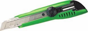


50 Survey Accessories Miscellaneous Tajima Plumbrite # Tajima knife # pocket filed bag Short # Long # Laser safety sign # Stick on # Tally counter # Tally counter with mount # Field bag belt # CATALOGUE


51 Survey Accessories Optical Plummets FPM Made in Germany. Nadir and zenith optical plummets. FG-L100 Zenith Plummet Measuring accuracy Mean square plumb line error at 100 m ±1 mm Telescope Image position erect and true-to-side Magnification 32 x Shortest target 2.2 m distance free objective diameter 40mm Compensator Working range ±10 Mean square setting ±0,15" error Temperature Operating range Instrument Magnification Dimensions Weight -25 C to +45 C 32 x 140x295mm 3.5 kg FG-L30 Zenith & nadir plummet Measuring accuracy Mean square plumb line error at 30 m ±1 mm Telescope Image position upside down, side-inverted Magnification 9 x Shortest target 0.4 m distance free objective diameter Bubble level Instrument Dimensions Weight 20 mm reversion bubble level 20" / 2 mm 140 x 190 mm 2.2 kg FG-LL-30/-31 Zenith FG-LL-32/-33 Nadir Both laser Zenith and Nadir come with low power (approx. 200m) or high power (approx. 500m) options. This is an ideal solution for mining or construction applications where longer range laser plumbing is required. Adjustments can be made in the field without having to open the device Technical specifications Laser class FG-LL30/-32: 2, < 1 mw Laser class FG-LL31/-33: 3 R, < 5 mw Laser: diode laser, visible red, 635 nm Beam diameter: 13 mm at laser Range FG-LL30/-32: 200 m Range FG-LL31/33: 500 m Self-levelling range: ± 5 % Permissible deviation: ± % Operating time: 26h Low battery cut-out: yes Watertight: 3.5 m Temperature range:- 10 C to + 50 C Weight: 3.4 kg Accessories: FG-DFXI Tribrach with circular bubble FG-USDFXI Conversion kit CATALOGUE 49


52 Survey Accessories Pentax Binoculars Pentax binoculars are made of the finest optics. All models comes with a case. We carry the full range of Pentax binoculars. Below are our top selling items. 8 X 21 UCFR #62209 Magnification: x8 Objective diamter: 21mm 10 X 25 UCF XII #62212 Magnification: x10 Objective diamter: 25mm 16 X 50 XCF #65793 Magnification: x16 Objective diamter: 50mm 20 X 60 PCF WPII #65810 Magnification: x20 Objective diamter: 60mm Top of the range model. Survey Accessories Pentax Cameras CR Kennedy is the importer of Pentax for Australia, and stocks the full range of Pentax compact cameras, SLRs, and lenses. For the best prices on current models, please contact a sales representative CATALOGUE


53 Survey Accessories GPS Accessories LG LG LG LG LG LG LG GPS Accessories Item Number Model Number Description LG GHT63 Clamp for attaching GHT39 to pole LG GHT62 Holder plate for GHT39 LG GHT61 Hand strap for GHT39 LG GHT58 Tripod bracket for GFU Radio LG GHT39 Bracket for RX1200 on pole LG GVP644 Soft carry bag for CS15 controller LG GAD109 GS15 to TNC adapter CATALOGUE 51


54 Survey Accessories Planometers Tamaya digital planimeters are excellent tools to use when measuring irregular-shaped areas on plans or drawings. They eliminate the need for grids, charts, or calculations done by hand. Tamaya Planix 7 - # The Planix 7 is a roller planimeter. It is attached to wheels that allow unlimited horizontal travel and vertical travel within the limits of the arm movement. Tamaya Planix 10S - # The Planix 10S is a digital planimeter, used to calculate areas and lines on a map. Tamaya Planix Ex - # The PLANIX EX not only allows you to quickly and accurately measure areas, but also allows you to calculate lengths, coordinates, radii, and angles. Scalex Mapwheel SCMW #SCALEX MAPWHEEL This is the perfect tool, specifically designed for quickly taking scale measurements from maps. Just select the built-in scale factor to match the map and roll the MapWheel along any straight or curved line. The measurement is displayed instantly. Calculate road distances and fuelcosts easily. Scalex Planwheel SA2 #SCALEX PLANWEEL The PlanWheel SA2 is the perfect tool for taking scaled measurements from blueprints, maps and plans. Just select the built-in scale factor to match the plan and roll the PlanWheel. The measurement is displayed instantly. Scalex Protective Case #SCALEX CASE Made of high impact ABS, this rugged case provides the protection required on the job. With a hot-stamped Scalex legend and flocktex interior, the case can also hold an extra set of batteries. AC Adapter For Planix 7 # Battery for Planx 10S # Map wheel # CATALOGUE
55 Survey Accessories CST Poles CST 2.0m / 2 section pole CST 2.5m / 2 Section pole CST 2.5m / 2 section pole CST 3.6m / 3 section pole CST 4.6m / 4 section pole / Pentax Barbers Pole CST range pole #523706, CST Prism Poles with 5/8 Thread and Circular Bubble Level Item number Model TML TML TMA TMA TMA TMA TMA TML TMA TML Height 2.0m 2.5m 2.5m 2.5m 2.5m 2.5m 3.6m 3.6m 4.6m 4.6m Sections Material Aluminium Aluminium Aluminium Aluminium Aluminium Fibreglass Aluminium Aluminium Aluminium Aluminium (light) (light) Lock Quick Twist Twist Quick Quick Quick Quick Quick Quick Quick Thread Leica Leica 5/8 5/8 5/8 5/8 5/8 Leica 5/8 Leica Spiggot Spiggot Spiggot Spiggot CST Range Poles Item Number Height 1.8m 1.8m 2m No. of pieces Pentax Item Number Model MT-31 Description Mini Pole CATALOGUE 53

56 Survey Accessories Leica Poles GLS115 GLS111 GLS112 GLS113 GLS14 GLS30 GLS12 GLS13 Leica Poles Item number LG LG LG LG LG LG LG LG LG Model GLS14 Leica Style GLS12 GLS13 GLS30 GLS31 GLS11 GLS111 GLS112 GLS115 Max height 0.2m 0.8m 2.0m 2.0m 2.0m 2m 2.15m 2.60m 3.65m 1.3m Bubble Circular - - Circular Bull's eye - Circular Bull's eye Bull's eye GLI115 clip on Thread Spiggot Spiggot Spiggot 5/8 Spiggot Spiggot Spiggot Spiggot Spiggot 1/4 Material Aluminium Aluminium Aluminium Aluminium Carbon Fibre Carbon Fibre Aluminium Aluminium Carbon Fibre Aluminium Accessories GZW12 LG m extension for GLS CATALOGUE

57 Survey Accessories Polytech Pegs Polytech Pegs Made from polypropylene, a non toxic and chemically inert plastic, these pegs are half the weight of a traditional wooden peg. Manufactured and designed by Survey Pegs Australia, Polytech Pegs are the survey pegs of the future. Features include; centring point to take a nail or metal tag to, lot numbers can be stamped on individual pegs, UV resistant, heat resistant, non-flammable, impervious to white ants, designed to be easily driven into various soil types, engineered to suit state specifications, recyclable and available in a range of colours. FROM LEFT TO RIGHT OF THE IMAGE CADASTRAL: 75x75x450mm STATE: NSW, QLD, WA, TAS. CADASTRAL: 75x75x350mm Red: WA White: QLD CADASTRAL: 50x50x350mm VIC, QLD, SA, WA, NT, TAS 75x50x350mm, NSW ENGINEERING: 50x50x210mm Set out peg. White, green, yellow and orange CATALOGUE 55

58 Survey Accessories Leica Prisms Prisms Item Number Model Number Prism type Holder Accuracy Range Manufacturer Comments LG GPR121 Circular Yes 1.0mm 3,500m Leica LG GPR111 Circular Yes 2.0mm 2,500m Leica LG GPR112 Circular No N/A 2,500m Leica Monitoring/Mining prism LG GPR113 Circular Yes 2.0mm 2,500m Leica LG GPR1 Circular No 1.0mm 3,500m Leica LG GRZ4 360 No 5mm 600m Leica LG GRZ Yes 2.0mm 600m Leica Can be connected to the Leica SmartAntenna. LG GRZ Yes 1.5mm 2000m Leica LG GMP104 Mini Prism Yes N/A 2000m Leica Monitoring Prism with L-Bar for fixed installation LG GMP101 Mini Prism Yes 1.0mm 2000m Leica Includes bubble, target plate, spike and bag. LG GMP111 Mini Prism Yes 2.0mm Long range Leica Includes bubble, and GLS115 mini reflector pole LG GMP111-0 Mini Prism Yes 2.0mm Long range Leica 0 constant prism. Includes bubble, and GLS115 mini reflector pole LG SMP222 Mini Prism Yes 2.0mm Long range Leica Sliding prism, 0 constant. Accessories Item Number Model Number Description For Manufacturer LG GPH1 Prism Holder GPR1 Leica LG GPH3 3 Prisms Holder GPR1 Leica LG GHT112 Mounting Kit GPR112 Leica LG GZT4 Target Plate GPH1 Leica LG GDZ112 Rain Shelter GPR112 Leica LG GVP608 Soft bag GMP111, GRZ101 Leica LG GMP112 Pole extension GMP111 Leica LG GAD105 Pole adapter GMP111 Leica LG GAD103 Pole adapter GRZ101 Leica GPH1P GAD103 GAD CATALOGUE


59 Survey Accessories Prisms & Accessories GDZ112 GHT112 GMP101 SMP222 GMP111 GMP112 GMP104 GRZ4 GRZ112 GPH1 GPH3 GVP CATALOGUE 57


60 Survey Accessories Prisms & Accessories GTZ4 GPR121 GRZ101 GPR1 GPR111 GPR112 GPR113 Survey Accessories Reflectors Item Number LG LG LG LG Model GZM29 GZM30 GZM31 CPR105 Range 100m 200m 250m 250m Mount Tape Tape Tape GLS105 pole 20x20mm 40x40mm 60x60mm CPR105 GZM29, GZM30 and GZM CATALOGUE


 7090337 Spray paint attachment wheel Survey Accessories General Flagging Tape Item Number Description 7090481DB Dark Blue 7090481DG Dark Green 7090481FL Fluro Lime")
61 Survey Accessories Spray Paint Dy-Mark Spray & Mark is Australia s best selling marking paint. All cans have an inverted nozzle,weigh 340g and are suitable for a range of applications such as surveying, construction, landscaping, civil works, etc. Cans are available as individual items or in packs of 12. ITEM NUMBER DESCRIPTION B Survey spray black DB Survey spray dark blue FG Survey spray fluro green FO Survey spray fluro orange FP Survey spray fluro pink FR Survey spray fluro red G Survey spray green GR Survey spray grey O Survey spray orange R Survey spray red W Survey spray white Y Survey spray yellow Spray paint holster (plastic) Spray paint attachment wheel Survey Accessories General Flagging Tape Item Number Description DB Dark Blue DG Dark Green FL Fluro Lime FO Fluro Orange FP Fluro Pink LG Light Green O Orange R Red SB Sky Blue W White Y Yellow Red/White Fluro Orange These vinyl flagging tapes are ideal for surveyors, and available in a wide range of colours. All rolls are 25mm x 100m CATALOGUE 59

62 Survey Accessories Staves LR39 and LR34 SMP222 GMP104 GMP111 GMP112 GRZ4 Leica Item Number Model Description LG GSS113 3m/1 section fiberglass, barcode & E face. LG GKNL 4m/3 section fiberglass, barcode & E face. LG GTL4M 4m/4 section fiberglass, barcode & metric face. LG GSS m/4 section fiberglass, barcode & E face. LG GTL4C 4m/4 section aluminum, barcode & metric face. LG GS112 4m/4 section aluminum, barcode & E face. LG GS111 5m/4 section aluminum, barcode & E face. LG GWCL60 0.6m/1 section barcode & Invar scale face. LG GPCL2 2m/1 section Invar bar & barcode face. LG GPCL3 3m/1 section Invar bar & barcode face. E Face Staff Metric Staff Myzox Item Number Model Description SUM33EB 3m/3 section E face - 118cm with cover SUM33MB 3m/3 section Metric - 118cm with cover ALG-55EB 5m/5 section E face - 127cm with cover ALG-55MB 5m/5 section Metric - 127cm with cover ALS-74 7m/4 section Metric - 182cm with cover Astor Item Number Model Description WC 3M/3E 3m/3 section E face - 118cm with cover WC 3M/3M 3m/3 section Metric - 118cm with cover WC 5M/5E 5m/5 section E face - 127cm with cover WC 5M/5M 5m/5 section Metric - 127cm with cover WC 7m/5E 7m/5 section E face cm with cover Accessories Staff Bubble Item Number Description LR39 Staff Bubble Plastic LR34 Staff Bubble Metal LR7 Staff Bubble detachable for Astor Clip on Bubble for GTL4 Staves SA60 bubble for Myzox 5m & 7m staves SB60 bubble for Myzox 3m staves Staff 5/8 thread prism adapter CST Cut and Fill Rods Item Number Model Description LRM Cut & fill laser rod, 2.5m, 3 section TLM Cut & fill rod, 2.4m, 2 section CATALOGUE


63 Survey Accessories Leica Tribrachs CTB101 GDF111 GDF112 GDF121 GDF122 GDF22 Model Name Model Number Optical Plummet Torsional Stiffness GDF121 LG No <1" GDF111-1 LG No <3" CTB101 LG No <5" GDF122 LG Yes <1" GDF112 LG Yes <3" GDF21 LG No GDF22 LG Yes GDF21 Tribrach Tester GHM007 GHT196 Accessories Model name Model Number Description GHM007 LG Height meter GHT196 LG Holder for GMH Tribrach Tester CATALOGUE 61
.")
.")
64 Survey Accessories Bi-Pods Leica and CST bi-pods are ideal for holding prism poles in the field. GSR2 #LG for 25mm diameter poles (Leica GLS11/GLS11K). GSR111 #LG suitable for poles of all diameters. CST Quick Release # Fits all CST poles (22mm - 38mm diameter). CST X Thumb Release # Fits all CST poles (22mm - 38mm diameter) CATALOGUE


65 Survey Accessories Tripods Aluminium Flat Head # Aluminium Dome Head # CST Wood # CST Wood/Fibreglass # Elevating tripod # Tripod for staves # GST20 #LG GST20-9 #LG GST05 #LG GST05L #LG CTP106 #LG GST120-9 #LG CATALOGUE 63


66 Survey Accessories Tripods CTP101 #LG CTP102 #LG CST #534262, # GHT 58 Tripod Bracket #LG GHT43 Tripod Bracket #LG GST4 Tripod Star #LG Model Item # Manufacturer Material Leg clamp top Weight Max height Collasped height Total Station GPS Laser/ Levels/ Targets RA FLAT RA Aluminium Screw flat 5kg 1.73m 1.3m no no yes no RA FLAT QR RA Aluminium Quick release flat 5kg 1.73m 1.3m no no yes no RA DOME RA Aluminium Screw dome 5kg 1.73m 1.3m no no yes no RA DOME QR RA Aluminium Quick release dome 5kg 1.73m 1.3m no no yes no ELV RA Aluminium Screw flat 6.2kg 3m 1.26m no no yes no ELV-COVER RA Aluminium Screw Flat 5kg 1.73m 1.03m No No Yes No. CTP101 LG Leica Wood Screw flat 5kg 1.73m 1.3m yes yes yes no CTP102 LG Leica Wood Quick release flat 5kg 1.73m 1.3m no yes yes no CTP103 LG Leica Aluminium Screw flat 5kg 1.73m 1.3m no yes yes no GST05 LG Leica Wood screw flat 5.6kg 1.76m 1.07m no yes yes no GST05L LG Leica Aluminium screw flat 5.6kg 1.76m 1.07m no no yes no CTP106 LG Leica Aluminium screw flat 3.45kg 1.65m 1.0m no no yes no GST20-9 LG Leica Wood screw flat 6.4kg 1.8m 1.07m no yes yes no GST120-9 LG Leica Wood screw flat 6.4kg 1.8m 1.07m yes yes yes no GST20 LG Leica Wood screw flat 6.4kg 1.8m 1.07m no no yes no WDW20HV CST Wood Screw flat 7.2kg 1.83m 1.07m yes yes yes no WDF CST Wood/ fibreglass Screw flat 7.2kg 1.83m 1.07m no yes yes no CST Aluminium Screw Gator for staves 1-1/4" diameter X CST Aluminium Thumb Release CST Aluminium Quick Release For poles (22-38mm) For poles (22-38mm) Poles/ staves 1.5kg 1.07m 1.07m no no no yes 1-1/4 1.3kg 1.8m 1.2m No No No Yes 1.3kg 1.8m 1.2m No No No Yes Accessories Name Description Model number GST4 Tripod Star LG GHT43 Tripod Bracket LG CATALOGUE GHT58 Tripod Bracket LG Tripod Bag Tripod Bag Tripod Bag #516020


67 Survey Accessories Goscam The Goscam is a waterproof 17mm diameter, 1m long wireless inspection camera with colour 3.5 LCD monitor, and allows for easy visual inspection of hard-to-reach areas. Easily find, diagnose and solve problems with the flexible extended tube & accessories. Goscam also allows videos and photos to be recorded onto a SD card. The Goscam kit includes wireless camera, wireless LCD monitor, hard carry case, and clip on accessories (hook, mirror and magnet). Item number GOSCAM 8802AL GOSCAM 8802T GOSCAM GT4803 Description Goscam wireless inspection camera Inspection camera tube extension Mini camera extension The perfect tool for: - Checking for internal leaks around chimney flashing. - Inspecting car components. - Reading the model number on a furnace fan motor. - Retrieving a screw lost under the refrigerator. - Checking the teeth on a kitchen garbage disposal. - Reading the service tag on hard-toreach equipment. - Inspecting inside of 2 heat exchanger tubes (boiler). - Examining AC coils in a residential furnace. - Finding cabling installed in a closed wall cavity. - Checking air conditioners for debris. - Checking for lint build up past the primary filter in a dryer. - Checking sink connections in a crowded sink space. - Checking the gas connections under an installed stove. Survey Accessories Wall Stations Wall Station Mount with Leica Male Spigot # MTL1-LR slim line mining laser # SL Wall stations are used for underground survey control to create a survey network. They are typically used in conjunction with Leica prisms and Leica total stations or a MTL1-LR underground mining laser. Item number Description MTL1-LR Mining Laser SL MTL1-LR slim line mining laser Wall mount for MRL1-LR laser Wall Station Mount with Leica Male Spigot Wall Station Sleeves Aluminum - 1m length Wall Station Sleeves Stainless steel - 80mm Steel pillar plate Monitoring P Plate LG GPH1 Single Prism Holder LG GPR1 Prism in container CATALOGUE 65


68 Survey Accessories ikegps The ike1000 is a combination of a GPS, camera, rangefinder and compass in one instrument. Ike1000 is able to instantly provide the location of a site up to 1000m away. A number of benefits immediately result: - The user can capture multiple points while remaining at a single site. - The user can remain safe, where physically collecting the points would put him/her at risk. - The data collection time can be reduced. The ike1000 is shock and water proof to IP67, and boasts a Windows Mobile computer, GPS, compass and inclinometer. ikegps simplifies GIS data capture to point-and-shoot. The targeted point location is calculated from the instrument readings, inclusive of local GPS location, compass bearing, pitch and roll and rangefinder distance. Cross-hairs are embedded into the image so the captured location data is 100% verifiable with an image that can always be referred back to for confirmation. ikegps integrates with data capture applications like ArcPad and comes with a range of optional accessories. Users such as the US military, oil & gas industry, utilities, forestry, land surveyors, law enforcement, environmental researchers, and public works agencies have been using ikegps for years in situations where targets are difficult to reach or safety is a concern. Range: 1000m ±0.5m + 0.5% Camera Resolution: 5 MP GPS Type: 12 channel L CATALOGUE

69 C.R. Kennedy National Hire Fleet We carry a comprehensive range of hire equipment to cover nearly all survey and measurements applications These include: - Total stations - Theodolites - GPS/GNSS - Machine control - Scanning lasers - Optical and laser levels - Pipe lasers - Cable locators - Accessories such as staves, tripods, prisms, etc. What does this mean to you? - The fleet consists of the world s most advanced equipment, kept in excellent condition - We supply basic training for rapid productivity - Allows you to evaluate on the job without purchase commitment - Gives you the equipment you need for the one-off job - Allows you to take on jobs you otherwise couldn t handle Repairs and Service Service Centres We have service centres at all of our offices. With technicians who have been factory trained, workshops that are accredited by Leica Geosystems, and use of only genuine components, CR Kennedy can offer you the best service for your instrument. We offer replacement instruments from our hire fleet during a servicing to minimise down time CATALOGUE 67

70 Technical Support & Training Over many years, C.R.Kennedy has acquired the expertise of the leaders in the surveying field. We have built a surveyor based service business with a full range of the best products in the world, combined with the best support people in the country. Technical Support At C.R.Kennedy, we understand the importance of supporting our extensive range of surveying products. With a highly committed and responsive technical support and training team who can answer your questions, whether simple or complex, and provide the required product training. To this extent, we have recently invested in our support structure to expand our team, so that we can continue to provide the level of service that our clients demand. This new support and training structure comprises of state based personnel that will assist with your day to day support and training needs, and backed-up by a national team of product experts. Training In addition to technical support, we also understand that high quality training is critical and the key to unlocking the true potential of your survey equipment. Our structured training programs will enable you to take full advantage of your instruments capabilities, and improve your work flow, both in the field and in the office, with the goal of increasing your productivity and giving your company a competitive advantage. C.R.Kennedy offers a flexible selection of training packages to suit your company s needs, experience and time frame. CPD Accreditation These courses are designed to advance the knowledge of our clients in the most efficient and productive use of their surveying equipment and software, and will contribute to their continued professional development. In this regard, we have received CPD accreditations for these courses by a number of state Surveying Authorities. Please contact us for details and applicable CPD points. VIC / TAS: (03) NSW / ACT: (02) QLD: (07) WA / NT: (08) SA : (08) surveysupport@crkennedy.com.au surveytraining@crkennedy.com.au CATALOGUE

71 Training Courses Total Stations (TPS) Getting Started (1 day) Workflow training for any Leica Total Station, including data exchange with popular CAD packages. Learn the standard functions of your TPS instrument and be able to perform common survey tasks, including detail and set-out surveys. Advanced TPS (1 day) Understand how to customise your instrument, perform advanced field coding, create / edit data export formats and the more advanced on-board applications. Import data into Leica Geo Office (LGO), edit and export to required format and generate jobs using design to field. GPS/GNSS Getting Started (1 day) Learn the basic concepts of GPS/GNSS positioning and the functionality of your Leica equipment, workflow training in RTK including detail surveys, coding and export of data, and perform site transformation to gain an understanding of coordinate systems. Advanced (1 day) Explore the advanced settings of the Leica GPS/GNSS. Learn complete equipment configuration, static data capture and basic processing, field coordinate transformation, the more advanced applications and how to create field data reports. Leica Geo Office Getting Started (1 day) Workflow training in Leica Geo Office incorporating TPS/GPS data import, editing, simple processing, and basic analysis. This course provides a detailed explanation behind the settings and functionality enabling the user to get the most from the LGO software. Advanced (1 day) Develop your understanding of static post-processing, data analysis, reporting and network adjustmnet. Learn new troubleshooting skills. Then further explore LGO looking at precise ephemeris, internet download and image referencing. Additional Courses Introduction to RoadRunner (1 day) This course is designed for new users of the RoadRunner application. You will be taken through the practical procedures necessary for performing road setout within RoadRunner. The course will include an explanation of stringlines, RoadRunner elements and task development. Introduction to Laser Scanning (1 day) Overview of 3D Laser Scanning technology and how this could benefit your business. Includes the basic principles of data capture, target registration and 3D pointcloud processing using specialised software. Plus reviewing case studies and projects. Customised Company Training All published courses may be customised to your company s requirements, allowing you to get the most from your training investment. Choose between training on-site or at one for our state based training facilities. Or let us know what training you need and we ll do our best to accommodate. Product Workshops Throughout the year we will hold a series of half day product workshops aimed at existing users. These workshops are designed to keep users up to date with new applications, software updates, new products, improved workflows and general advancements in survey technology CATALOGUE 69


72 Machine Control Training Centre Located in Altona North, Victoria, the C.R. Kennedy Training Centre has live earthmoving machinery on site in a civil construction environment so that visitors can experience and use the Leica Geosystems machine control applications on a real machine. For further information contact your local CRKennedy office or surveytraining@crkennedy.com.au. There is also a full simulation training room for any client who has not yet experienced the ease of using a Machine Control application. The centre provides the perfect opportunity to get a hands-on preview of what operating a system is like. PowerDigger 2D Screen C.R. Kennedy is dedicated to providing the best instruments and systems to the surveying and construction community. The investment in this centre to support our clients reflects that commitment. It is important to us that you know what you are investing in and how it will work. To that end the C.R. Kennedy Training Centre offers comprehensive, practical training with experienced technical staff on hand to answer all questions. Groups or individual training can be catered for and certificates of completion are awarded to all participants. 8 Kearsley Court North Altona, Victoria Phone: PowerDigger 2D & 3D Screens Pinnacle Rd IVES RD STUBER RD BALDWIN RD CLIFT CT KEARSLEY CT Grieve Pde CATALOGUE
73 Maintenance Agreements Maintenance contracts Give yourself and your instrument special attention. Service contracts reduce your instrument running costs, promote instrument longevity and ensure the best possible performance. Typical contracts may include: - Extension of warranty including parts and labour for remedial services. - Priority service and repairs. - Certain software/firmware upgrades free of charge. - Loan units made available free of charge. - Annual service including test protocol and service declaration. - Flexible invoice periods to suit your business. - Fixed costs per annum to allow easy budgeting. Fully Maintained Rentals Our Fully Maintained Rental program is designed specifically for surveyors to provide the ideal business solution. By combining a rental with a maintenance agreement, we can offer protection from obsolescence with regular upgrades to the latest technology, and ensure your survey instruments are productive at all times. By reducing your capital expenses on equipment, you can preserve your capital and better budget for new business opportunities. Advantages of a fully maintained rental are: - One fixed monthly cost, so you can better budget your work. - Reduced capital expenditure. - No maintenance costs or repair bills. - The latest software and hardware protecting you from obsolescence. - Loan equipment free of charge during servicing so you re always able to work. Insurance You wouldn t purchase a car without insurance, so why wouldn t you insure a total station? C.R.Kennedy can recommend the right insurance options for your instruments. Finance Options With various finance companies, C.R.Kennedy can offer a range of flexible finance options to suit individual circumstances. You can reduce your capital expenses, get access to the latest equipment, and meet the requirements of the work you have today CATALOGUE 71
74 Notes CATALOGUE
75 Notes
 3862 6210 Fax (07) 3862 6212 Email qldsurvey@crkennedy.com.au Central Queensland PO Box 4032, Mackay South, 4740 Tel (07) 4957 6733 Fax (07) 4957 6755 Email itruscott@crkennedy.")
76 crkennedy.com.au Victoria 663 Chapel Street, South Yarra, 3141 Tel (03) Fax (03) New South Wales 3 / 280 Coward Street, Mascot, 2020 Tel (02) Fax (02) nswsurvey@crkennedy.com.au Queensland 80 Kingsford Smith Drive, Albion, 4010 Tel (07) Fax (07) qldsurvey@crkennedy.com.au Central Queensland PO Box 4032, Mackay South, 4740 Tel (07) Fax (07) itruscott@crkennedy.com.au Far North QUEENSLAND Unit 1, 131 Scott Street, Cairns, 4870 Tel (07) Fax (07) qldsurvey@crkennedy.com.au South Australia 261 Sturt Street, Adelaide, 5000 Tel (08) Fax (08) sasurvey@crkennedy.com.au Western Australia Oxford Close, West Leederville, 6007 Tel (08) Fax (08) wasurvey@crkennedy.com.au Training surveytraining@crkennedy.com.au Support surveysupport@crkennedy.com.au
Leica FlexLine TS06plus Top Precision meets High Efficiency
 Leica FlexLine TS06plus Top Precision meets High Efficiency The First Plus: Original Leica Geosystems Quality For most, quality is relative. Not so at Leica Geosystems. To ensure our instruments meet the
Leica FlexLine TS09plus Full Precision at High Performance
 Leica FlexLine TS09plus Full Precision at High Performance The First Plus: Original Leica Geosystems Quality For most, quality is relative. Not so at Leica Geosystems. To ensure our instruments meet the
For construction levelling. Jogger 20: #LG762263, Jogger 24: #LG762264, Jogger 28: #LG783739, Jogger 32: #LG783740
 2017 18 CATALOGUE Automatic Levels Pentax AP-200 Rugged and dependable, ideal for engineering and construction use. AP224: #TBA, AP228: #TBA AP230: #TBA, AP241: #TBA - 20, 24 or 28x magnification - Short
Leica FlexLine TS06plus Top precision meets high efficiency
 Leica FlexLine TS06plus Top precision meets high efficiency The First Plus: Original Leica Geosystems quality For most, quality is relative. Not so at Leica Geosystems. To ensure our instruments meet the
Foreword. Robert Kennedy Director
 2014 2015 CATALOGUE Foreword Founded in 1934, C.R.Kennedy & Company has grown to become Australia s largest supplier of surveying instrument in Australia by dollar value. We are proud to represent many
Leica ScanStation C10 The All-in-One Laser Scanner for Any Application
 The All-in-One Laser Scanner for Any Application Versatility, Productivity, Value Many organizations interested in laser scanning to diversify and/or improve current business have been waiting for a scanner
Leica FlexLine plus. Product Presentation V4.00
 Leica FlexLine plus Product Presentation V4.00 Leica FlexLine plus Table of contents 1. FlexLine plus - Product Concept 2. FlexLine plus - Hardware Features 3. FlexField plus - Onboard Firmware 4. FlexLine
Leica Viva GS14 Designed for Performance
 Leica Viva GS14 Designed for Performance Your Vision: Flexibility and Performance Introducing Leica Viva GS14 Your Tool for All GNSS Applications The Leica GS14 is the most compact and powerful GNSS receiver.
Increase Field Survey Efficiency by Merging Technologies in NOVA MultiStation. Vincent Lui Leica Geosystems Ltd
 Increase Field Survey Efficiency by Merging Technologies in NOVA MultiStation Vincent Lui Leica Geosystems Ltd Advantages of Laser Scanning Advantages of TPS Measurements Advantages of Imaging Advantages
2D CONSTRUCTION SOLUTIONS
 2D CONSTRUCTION SOLUTIONS 2D CONSTRUCTION SOLUTIONS Keep your projects on time and under budget. We have the leadingedge hardware, software, and mobile solutions you need to increase efficiency, improve
GeoMax GNSS ZGP800 Series. Works when you do
 GeoMax GNSS ZGP800 Series Works when you do GeoMax About Us GeoMax is an internationally active company developing, manufacturing and distributing quality surveying instruments. We provide a comprehensive
Leica Zeno 20 More than GPS
 Leica Zeno 20 More than GPS TECHNOLOGIES Leica Zeno 20 does so much more The Leica Zeno 20 is much more than just GPS it is a fusion of great technologies. Powerful and easy, it s the ultimate geospatial
Leica TPS800 Series Powerful, efficient, reliable and intuitive. PinPoint Technology
 Leica TPS800 Series Powerful, efficient, reliable and intuitive PinPoint Technology powerful Leica TPS800 Performance Series... Three classes of accuracy TPS800 total stations are available in angular
trimble gnss surveying systems
 trimble gnss surveying systems TRIMBLE GNSS SYSTEMS: SOLVING YOUR CHALLENGES IN THE FIELD INDUSTRY-LEADING GNSS SOLUTIONS DESIGNED WITH THE SURVEYOR IN MIND Backed by a legacy of GNSS technology surveying
Provided by Xpert Survey Equipment Click Leica TS06 for Product Info and Updated Pricing. Leica FlexLine TS06plus Top precision meets high efficiency
 Provided by Xpert Survey Equipment Click Leica TS06 for Product Info and Updated Pricing Leica TS06plus Top precision meets high efficiency The First Plus: Leica Geosystems quality For most, quality is
Leica Geosystems Construction Products The right tools for any site
 Leica Geosystems Construction Products The right tools for any site - when it has to be right The right tools for any construction site Multipurpose and General Construction Lasers Multipurpose Leica Rugby
2012 Product Catalogue
 It s Professional 2012 Product Catalogue FOIF Canada Inc. 4180 Boul. Thimens Saint-Laurent, QC, H4R 2B9, Canada Tel: +1 (514) 336-0003 Fax: +1 (514) 336-0300 Email: info@foif.ca Web: www.foif.ca 2 2012
2D CONSTRUCTION SOLUTIONS
 2D CONSTRUCTION SOLUTIONS 2D CONSTRUCTION SOLUTIONS Keep your projects on time and under budget. We have the leadingedge hardware, software, and mobile solutions you need to increase efficiency, improve
Release 4.1. Description
 Leica MobileMatriX Release 4.1 Products - Options Packages - Hardware Description Leica MobileMatriX 4.1 Leica Geosystems, 2004-2010 1 PRODUCTS Three different Editions are available: Standard Edition
Leica GR25 Don t think Receiver, think Reference Server
 Leica GR25 Don t think Receiver, think Reference Server Leica GR25 GNSS Reference Server Think Reference Server The GR25 is more than just a reference receiver, it is a GNSS Reference Server. Just like
Leica Viva GS14 Designed for Performance
 Leica Viva GS14 Designed for Performance Your Vision: Flexibility and Performance Introducing Leica Viva GS14 Your Tool for All GNSS Applications The Leica Viva GS14 is the most compact and powerful GNSS
Shaping the World with Leica Zeno GIS Asset Collection & Management
 Shaping the World with Leica Zeno GIS Asset Collection & Management Edward Toh GIS Segment Manager, APAC Agenda Power of Geography Location bring values Case Studies Integration of Surveyors into GIS Leica
Leica TPS1200 Series High performance Total Station
 Leica TPS1200 Series High performance Total Station Leica TPS1200 Total Stations Packed with exciting new features, built for speed, accuracy, ease-of-use and reliability. Leica TPS1200 Total Stations
Leica FlexLine Equipment List
 Leica FlexLine Equipment List FlexLine Equipment List TS02 Instruments Total Stations for Prism Measurements 765268 TS02, 3"(1mgon) total station, laser plummet, 1 standard keyboard, user manual 765265
Grade Control. GRADE CONTROL SYSTEMS Topcon. MOTOR GRADER 3D-GPS+, mmgps Plug-and-Play. HYDRAULIC EXCAVATOR X63 3D-GPS+ Plug-and-Play
 GRADE CONTROL SYSTEMS Topcon Grade Control CRAWLER DOZER 3D-MC 2 Plug-and-Play HYDRAULIC EXCAVATOR X63 3D-GPS+ Plug-and-Play MOTOR GRADER 3D-GPS+, mmgps Plug-and-Play PHOTOS MAY INCLUDE OPTIONAL EQUIPMENT
3D Laser Scanner VS1000 User Manual
 3D Laser Scanner VS1000 User Manual 1 VS1000 Introduction SMART MAX GEOSYSTEMS CO., LTD VS1000 3D Laser Scanner based on pulses ranging principle, could quick acquire massive point cloud data from the
Leica DISTO D110 Laser Distance Meter
 Page 1 of 5 Leica DISTO D110 Laser Distance Meter Small size, big possibilities The new Leica DISTO D110 is the first laser distance meter with Bluetooth Smart that fits to a pocket. Its handy design with
Leica Digisystem xf-series Intelligent cable locators & signal transmitters
 Leica Digisystem xf-series Intelligent cable locators & signal transmitters Leica Digisystem xf-series Making cable avoidance easier & safer Every year site workers are injured due to inadvertently striking
A KHL SPECIAL REPORT SURVEYING
 A KHL SPECIAL REPORT SURVEYING 3 YEARS OF REPORTS FROM CONSTRUCTION EUROPE CONSTRUCTION Rugged and efficient A range of new hardware and software in the surveying sector has been designed to improve efficiency,
TRIMBLE TOTAL STATIONS: TRUSTED TODAY, DESIGNED FOR TOMORROW.
 GEOSPatial SOLUTIONS Trimble S-SERIES TOTAL Stations TRIMBLE TOTAL STATIONS: TRUSTED TODAY, DESIGNED FOR TOMORROW. For more than a decade, on countless jobs all over the world, Trimble Robotic s have delivered
Protect by Leica Geosystems A Lifetime Guarantee
 Protect by Leica Geosystems A Lifetime Guarantee Protect by Leica Geosystems We always protect your success PROTECT by Leica Geosystems Lifetime Warranty No Cost Period Certified Quality Swiss Technology
Leica TPS1200+ Series High performance Total Station
 PointSolutions www.pointsolutions-us.com Leica TPS1200+ Series High performance Total Station Leica TPS1200+ Total Stations Packed with exciting new features, built for speed, accuracy, ease-of-use and
Leica Geosystems Measure, align, level
 Leica Geosystems Measure, align, level Increase your productivity measurably IN- DOOR Save time and money on any construction site: with the products from Leica Geosystems you can work fast, accurate and
GeoMax Total Station Zoom30 Series
 GeoMax Total Station Zoom30 Series GeoMax About Us GeoMax is an internationally active company developing, manufacturing and distributing quality construction and surveying instruments. We provide a comprehensive
High-End Surveying Precise, Fast and Intelligent. LEICA TPS1100 Professional Series
 High-End Surveying Precise, Fast and Intelligent LEICA TPS1100 Professional Series TPS1100 Professional Series More time for the essentials. Automated, practical programs are the main features of the TPS1100
Leica TPS1200 Series High performance Total Station
 Leica TPS1200 Series High performance Total Station Leica TPS1200 Total Stations Packed with exciting new features, built for speed, accuracy, ease-of-use and reliability. Leica TPS1200 Total Stations
Leica TPS700 Automated Series Increased surveying performance and comfort. PinPoint Technology
 Leica TPS700 Automated Series Increased surveying performance and comfort PinPoint Technology Leica TPS700 Automated Series with automation for more comfort Do you have to solve various surveying tasks
Leica Viva GS14 Designed for Performance
 Leica Viva GS14 Designed for Performance Your Vision: Flexibility and Performance Introducing Leica Viva GS14 Your Tool for All GNSS Applications The Leica Viva GS14 is the most compact and powerful GNSS
Leica Rugby 320 SG & 410/420 DG The toughest players on big fields
 Leica Rugby 320 SG & 410/420 DG The toughest players on big fields Provided by Xpert Survey Equipment Click Leica Rugby 420DG for Product Info and Updated Pricing n Construction n Machine Control n Agriculture
ProMark 3RTK. High Precision Without the High Cost
 ProMark 3RTK High Precision Without the High Cost High-Precision RTK ProMark 3 RTK Proprietary Magellan RTK Technology ProMark3 RTK offers complete real-time GNSS surveying and mobile mapping capabilities
Leica System 1200 Software Integrated Software for GPS1200 and TPS1200
 Leica System 1200 Software Integrated Software for GPS1200 and TPS1200 Leica System 1200 Software System 1200 software includes SmartWorx the onboard TPS, GPS and RX1250 software and the Leica Geo Office
trimble gnss surveying systems
 trimble gnss surveying systems TRIMBLE GNSS SYSTEMS: SOLVING YOUR CHALLENGES IN THE FIELD INDUSTRY-LEADING GNSS SOLUTIONS DESIGNED WITH THE SURVEYOR IN MIND Backed by a legacy of GNSS technology surveying
Leica TDRA6000 Product Brochure
 Leica TDRA6000 Product Brochure Version 01/2009 www.leica-geosystems.com/metrology The Laser Station Leica TDRA6000 The Leica TDRA6000 Laser Station is a portable inspection system designed for precision
GeoMax TPS family. Works when you do.
 Works when you do GeoMax TPS family GeoMax has a complete TPS portfolio to fulfill the needs of all users. Ensure ultimate reliability with GeoMax TPS systems even in challenging environments. Providing
Provided by Xpert Survey Equipment Click Topcon GPT-8003A for Product Info and Updated Pricing GPT-8000A/GTS-810A SERIES AUTO TRACKING TOTAL STATION
 Provided by Xpert Survey Equipment Click Topcon GPT-8003A for Product Info and Updated Pricing GPT-8000A/GTS-810A SERIES AUTO TRACKING TOTAL STATION The Solo Survey System that puts you in control The
Leica Rugby 320 SG & 410/420 DG The toughest players on big fields. Construction Machine Control Agriculture
 Leica Rugby 320 SG & 410/420 DG The toughest players on big fields Construction Machine Control Agriculture Leica Rugby 320 SG & 410/420 DG When accuracy is the goal, Leica Rugby makes the grade Making
Leica ScanStation C10 Equipment List
 Leica ScanStation C10 Equipment List Table of Contents ScanStation C10 3 1 Scanner Set 3 Accessories for ScanStation C10 4 2 Accessory Set 4 3 Power Supply 4 3.1 Internal Power Supply 4 3.2 External Power
LEICA T1800 TC1800 TCA1800
 30 40 50 LEICA T1800 TC1800 TCA1800 Equal to any survey task Theodolites and total stations with 1 accuracy Survey instruments for every task Leica theodolites and total stations of the 1800 class Survey
DATA COLLECTORS FC-100 / FC-2000
 FC-100 / FC-2000 DATA COLLECTORS Topcon Field Computers; FC-100 and FC-2000 Compact, ultra bright, sealed and sturdy field computers. The demands of modern field data collection and control have changed
Product Overview Leica Geosystems Asset Collection & Management Segment Brett Black GIS Sales & Support Manager
 Product Overview Leica Geosystems Asset Collection & Management Segment Brett Black GIS Sales & Support Manager Outline Market Segments & Application Areas GIS Hardware Solutions Overview Leica GIS Asset
GeoMax Total Station Zoom30 Series
 GeoMax Total Station Zoom30 Series GeoMax About Us GeoMax is an internationally nology group with strong mar- The close cooperation within active company developing, ket positions within measure- the Hexagon
Geospatial GNSS Systems TRANSFORMING THE WAY THE WORLD WORKS
 Geospatial GNSS Systems GNSS Solutions Designed with the Surveyor in Mind POWERFUL TECHNOLOGY YOU CAN DEPEND ON NO MATTER WHAT THE CHALLENGE Whether you are climbing over rough terrain to collect topographic
Leica DISTO UP TO ANY TASK
 Leica DISTO UP TO ANY TASK Content Leica DISTO TM Accessories Technical data 4-19 20 21-22 2 When it has to be right outstanding measuring performance, built on decades of experience Leica Geosystems has
LAR 350 rotation laser: Tough DUAL SLOPE laser kit Made in Germany. World s first MOTION CONTROL
 LAR 350 rotation laser: Tough DUAL SLOPE laser kit Made in Germany World s first MOTION CONTROL LAR 350 rotating laser with MOTION CONTROL: Welcome to the new age of laser control For serious professionals:
Leica DISTO TM. The original laser distance meter
 Leica DISTO TM The original laser distance meter Why do you make your life so miserable? There is an alternative: Quick and efficient Just press the button and measure. One person measuring that saves
Leica Captivate. Software Release Notes. Field Controllers: CS20, CS35 Total Stations: TS16, TS60, MS60, TS13 GNSS Sensors: GS18 T
 Leica Captivate v4.10 Software Release Notes Product Leica Captivate Field Controllers: CS20, CS35 Total Stations: TS16, TS60, MS60, TS13 GNSS Sensors: GS18 T Release date 10 th December 2018 Maintenance
Leica Rugby 810, 820 & 840 The toughest construction lasers on site
 Leica Rugby 810, 820 & 840 The toughest construction lasers on site Leica Rugby The toughest construction lasers on site Leica Rugby construction lasers are more than just a product, they are an intelligent,
Leica Zeno GIS Equipment List
 Leica Zeno GIS Equipment List Table of Contents 1 Leica Zeno 10/Zeno 15 - GNSS/GIS Handhelds 3 2 GNSS Caps GS05 and GS06 for CS10 GIS & CS15 GIS 3 3 Packages 3 4 Additional Leica Zeno 10/Zeno 15 Options
Leica DISTO S910 Measure point data and create plans
 Leica DISTO S910 Measure point data and create plans The world s first Measure anything from anywhere with P2P Technology It s been over 20 years since Leica Geosystems launched the first hand-held laser
Leica DISTO S910 Measure point data and create plans
 Leica DISTO S910 Measure point data and create plans The world s first Measure anything from anywhere with P2P Technology It s been over 20 years since Leica Geosystems launched the first hand-held laser
LEICA TPS700 Performance Series
 LEICA TPS700 Performance Series TPS700 now with automatic for increased surveying performance and comfort LEICA TPS700 Performance Series... Do you have to solve various surveying tasks every day? Would
Leica Viva TS11 & TS15 Hardware
 Leica Viva TS11 & TS15 Hardware Contents 1. Introduction 2. Product Variants 3. Side Cover 4. Display and Keyboard 5. Environmental Rating 6. Telescope 8. Operating System & Software 9. Summary 1. Introduction
Topcon GRS-1 1 Receiver Field Preparation
 Topcon GRS-1 1 Receiver Field Preparation What do you need to know to get started with your Topcon GRS-1? Topcon GRS-1 Receiver - Field Preparation Some Common Questions Which TopSURV modules do I buy?
Leica Public Safety Solutions Versatile. Durable. Admissible
 Leica Public Safety Solutions Versatile. Durable. Admissible Public Safety Solutions 3D Laser Scanners Software Training and Consulting Services Leica ScanStation PS Series Professional Grade 3D Laser
Provided by Xpert Survey Equipment Click Topcon GPT-8205A for Product Info and Updated Pricing GPT-8200A/GTS-820A SERIES AUTO TRACKING TOTAL STATION
 Provided by Xpert Survey Equipment Click Topcon GPT-8205A for Product Info and Updated Pricing GPT-8200A/GTS-820A SERIES AUTO TRACKING TOTAL STATION The Solo Survey System that puts you in control The
Leica Builder... Built to Build
 Leica Builder... Built to Build Leica Builder... Built to Build Instead of tediously setting up strings, with the Builder T100 my masons can start work right away. The Builder T100 or T200 can determine
3D Laser Scanner. Fast, Portable, Accurate. Long range laser scanner Modular design configured to suit your survey needs
 3D Laser Scanner Fast, Portable, Accurate Long range laser scanner Modular design configured to suit your survey needs Introducing the Maptek I-Site 8820 laser scanner The Maptek I-Site 8820 laser scanner
Leica Geosystems TPS
 Leica Geosystems TPS Leica Geosystems Total Stations Semiprofessional Basic TS15 TS50 MS50 TM50 TS11 Monitoring ScanStation TS09 plus TS06 plus Professional TS02 plus Flexline Leica FlexLine plus Product
Leica Builder... Built to Build
 Leica Builder... Built to Build Leica Builder... Built to Build Instead of tediously setting up strings, with the Builder T100 my masons can start work right away. The Builder T100 or T200 can determine
ProMark 3 >> BREAKING NEW GPS SURVEY GROUND.
 ProMark 3 >> BREAKING NEW GPS SURVEY GROUND www.thalesgroup.com/navigation ProMark3 Get More Than Centimeter Accuracy The leader in L1 GPS surveying introduces ProMark3. ProMark3 extends the Thales philosophy
Leica Rugby 810, 820 & 840 The toughest construction lasers on site
 Leica Rugby 810, 820 & 840 The toughest construction lasers on site Leica Rugby The toughest construction lasers on site Leica Rugby construction lasers are more than just a product, they are an intelligent,
LEICA MobileMatriX Equipment List
 LEICA MobileMatriX LEICA MobileMatriX software 742117 GSW450, LEICA MobileMatriX License. Single user license for Standard Edition. ESRI ArcView OEM. Protected. COGO computation and rendering of COGO measurements
Leica ScanStation C5 Scalable Laser Scanner
 Leica ScanStation C5 Scalable Laser Scanner Leica ScanStation C5 Scalable from the Start Companies entering into laser scanning are often faced with inflexible and complex situations and would like a scalable
E D I T I O N PRODUCT LIST SURVEY PRODUCTS LTD
 PRODUCT LIST DATUM AL LEVEL RANGE The Datum AL Series Automatic Levels provide specifications from a 20x Magnification / 2.5mm per double km run accuracy up to 30x Magnification and 1mm per double km run
Leica FlexField plus & Leica FlexOffice A Perfect Match
 Leica FlexField & Leica FlexOffice A Perfect Match FlexField Onboard Software General File Management Data Import Data Export Status icon bar Instrument Protection with PIN Stake Out beep Map Select Programs
Leica Captivate. Software Release Notes. Field Controllers: CS20, CS35 Total Stations: TS16, TS60, MS60. Release date 1 st December 2017
 Leica Captivate v3.00 Software Release Notes Product Leica Captivate Field Controllers: CS20, CS35 Total Stations: TS16, TS60, MS60 Release date 1 st December 2017 Maintenance date 1 st December 2017 Available
LTI Products. TruPulse Series. TruPulse Product Line. TruPulse 200 Yellow. TruPulse 200L. TruPulse 200X
 TruPulse Series TruPulse Product Line TruPulse 200 Yellow 7005025 TruPulse 200,YELLOW LTI Products Lightweight, low-cost laser rangefinder that measures Slope Distance and Inclination. Calculates Horizontal
Portable MEMS Inclinometer
 DATASHEET Portable MEMS Inclinometer Proven MEMS technology Wireless communication to readout Lightweight Rugged construction On board calibration in probe Probes and reels are interchangeable Portable
nconstruction nmachine Control nagriculture Leica Rugby 320 SG & 410/420 DG The toughest player on the field
 nconstruction nmachine Control nagriculture Leica Rugby 320 SG & 410/420 DG The toughest player on the field Leica Rugby 320 SG & 410/420 DG When accuracy is the goal, Leica Rugby makes the grade Making
Leica Captivate. Software Release Notes. Field Controllers: CS20, CS35 Total Stations: TS16, TS60, MS60. Release date 5 th March 2018
 Leica Captivate v3.20 Software Release Notes Product Leica Captivate Field Controllers: CS20, CS35 Total Stations: TS16, TS60, MS60 Release date 5 th March 2018 Maintenance date 5 th March 2018 Available
Stockpile Volume Calculation White Paper by Atterbury Consultants, Inc.
 White Paper by In recent times, calculating stockpile volumes has been difficult and expensive. This white paper explains an easy, yet consistently accurate method for measuring stockpiles and calculating
HV601/HV602 for General Construction
 HV601/HV602 for General Construction CONTROL YOU CAN RELY ON Accurate Versatile Fast Easy to Use Precision Leveling and Aligning Maximum Versatility The Spectra Precision Laser HV601 and HV602 from Trimble
TECHNICAL NOTES TRIMBLE SURVEY CONTROLLER SOFTWARE
 TRIMBLE SURVEY CONTROLLER SOFTWARE TECHNICAL NOTES The Trimble Survey Controller software is the data collection solution that will make your survey work faster, easier, and more productive than ever before.
TECHNOLOGY SOLUTIONS TRANSFORMING CONSTRUCTION LAYOUT. Trimble Field Link TRANSFORMING THE WAY THE WORLD WORKS
 TECHNOLOGY SOLUTIONS TRANSFORMING CONSTRUCTION LAYOUT Taking full advantage of the Trimble Tablet s processor and multi-touch screen functionality, has been designed to work the way you work. Featuring
Construction. Product Guide
 Construction Product Guide 1 INTRODUCTION Topcon laser tools are designed to provide professional contractors reliable layout reference for increased jobsite productivity and profit. Please read the Topcon
Presentation Overview
 Stringless Concrete Paving STRINGLESS CONCRETE PAVING ACPA BUS TOUR AUGUST 5, 2015 Presentation Overview 1) Manufactures 2) Components needed for Stringless Paving 3) Conventional Methods VS Stringless
ROAD-SCANNER COMPACT APPLICATION FIELDS MAIN FEATURES
 ROAD-SCANNER COMPACT Mobile Mapping System by GEXCEL & SITECO collaboration A smaller mobile system for asset management and cartography suited for ZOLLER & FRÖHLICH PROFILER 9012 laser scanner. 2 + 3
RIEGL VMX-250. Mobile Laser Scanning. Compact Mobile Laser Scanning System. visit our website
 Compact Mobile Laser Scanning System RIEGL VMX-250 The RIEGL VMX-250 is an extremely compact and user-friendly Mobile Laser Scanning System. 2 RIEGL VQ-250 scanners smoothly integrated with IMU/GNSS unit
In North America call toll free: Fax
 WTS Inclinometer All-weather radio telemetry Inclinometer system Features Advanced MEMS inclinometer design for ultra-reliability and performance Distortion free digital 2 way radio system for data integrity
2LS products are high quality positioning. tools that bridge the gap between. do-it-yourself laser gadgets and industrial
 www.2ls-tools.com About 2LS 2LS products are high quality positioning tools that bridge the gap between do-it-yourself laser gadgets and industrial quality laser and surveying instruments used on large
Leica Geosystems Original Accessories The right selection
 Leica Geosystems Original Accessories The right selection Original Accessories Become the best surveyor with Leica Geosystems equipment Designed and built to the most stringent standards, Leica Geosystems
Leica DISTO D410 Laser Distance Meter
 Page 1 of 5 Leica DISTO D410 Laser Distance Meter Precise targeting and simple outdoor measurement! The new Leica DISTO D410 stands for easy and effortless outdoor distance measurement. With its digital
 MS Series MS05A / MS1A Ultra-high Precision Auto-tracking Total Station n 0.5 / 1 Angular Accuracy n High-Performance, versatile EDM n 0.5 mm Distance Accuracy n Optimised Auto-Pointing n Laser Option
Introducing. GeoSLAM. The experts in go anywhere 3D mobile mapping technology. The Company. The Technology. The Applications. Strategic Partnerships
 Introducing GeoSLAM The experts in go anywhere 3D mobile mapping technology The Company The Technology The Applications Strategic Partnerships The Company Multipurpose Presentation Template 2 About Us
ZED Tunnel Guidance Ltd
 Tunnel Guidance Ltd Unit 1, Russell House, Molesey Road, Walton-on-Thames, Surrey, KT12 3PJ, UK. Telephone: +44 (0)1932 251 440 Email: sales@zed-tg.co.uk Fax: +44 (0)1932 244 971 Website: http://www.zed-tg.co.uk
BRx6 Sensor Calibration Using SurvCE/SurvPC
 OVERVIEW BRx6 Sensor Calibration Using SurvCE/SurvPC The BRx6 internal sensors (tilt, accelerometer and compass) must be calibrated in order to use the electronic bubble and tilted pole corrections in
Trimble Business Center Software, v3.30
 Trimble Business Center Software, v3.30 We are pleased to announce a new version of the Trimble Business Center software, version 3.30. This new version includes over 30 new features and enhancements increasing
Leica icon grade Intelligent grading systems NEW. igd4 SP System. i n telligent COnstruction
 Leica icon grade Intelligent grading systems NEW igd4 SP System i n telligent COnstruction Leica icon grade Maximize productivity, speed & flexibility The Leica icon grade solutions can revolutionize your
History. The Lingo. I am confused by the different models, what are the differences?
 GeoMax Robot Notes Rev: 2019.03.04 A Robotic Total Station (RTS) is one of the most important and most expensive equipment purchases that a surveyor will make. These notes are updated to include commonly
Leica 3D Disto Recreating the real world
 Leica 3D Disto Recreating the real world Brought to you by : Beautifully productive Your new partner for efficient room measurement Measures in 3-dimensions with high precision. Projects point for point.