TELEDYNE GEOSPATIAL SOLUTIONS
|
|
|
- Arnold Welch
- 6 years ago
- Views:
Transcription
1 GEOSPATIAL SOLUTIONS

2 THE CONTENTS TELEDYNE GEOSPATIAL SOLUTIONS Capability Overview... 4 Hosted Payloads... 6 Payload Operations as a Service... 8 TCloud Data Management Imagery Sales About Muses PRODUCTS AND SERVICES TO MEET YOUR NEEDS FROM SPACE TO THE OCEAN FLOOR. 3

 to orbit at about half the cost of dedicated launches. On-orbit installation, removal and return of hosted payloads.")
3 CAPABILITY OVERVIEW GEOSPATIAL SOLUTIONS HOSTED PAYLOADS We provide a standardized payload container, payload integration (12-18 months to launch), launch services, variable mission lengths, onorbit operations, and payload return to provide high value at low cost. Our payloads are about half the cost of free-flying satellite launches! PAYLOAD OPERATIONS AS A SERVICE Our model-based architecture for planning and operations tools enable rapid delivery of end-to-end payload operations services for both free-flying and ISS payloads. Delivery of small satellite payloads (50 Kg to 100 Kg) to orbit at about half the cost of dedicated launches. On-orbit installation, removal and return of hosted payloads. End-to-end payload mission planning, operations, and data processing for free flying, ISS, or MUSES payloads. C l o u d - b a s e d d a t a m a n a g e m e n t, p r o c e s s i n g, a n d delivery of Teledyne and customer data and imagery products TCLOUD DATA MANAGEMENT Our cloud-based data management system enables cost-effective (pay for what you use) solutions for flexible and reconfigurable work-flow processing as well as archive and distribution of geospatial data. IMAGERY SALES Our cloud provides web-enabled storefront access to Teledyne s hyperspectral data from LEO as well as partner geospatial data. A variety of data analytics (multi-sensor fusion, index calculations, component analysis, etc.) leverage each pixel with critical decision information. 4 5

4 GEOSPATIAL CAPABILITY HOSTED KEEP YOUR DEADLINE RAPID PRESERVE YOUR INVESTMENT RESPONSIVE REDUCE YOUR COST REUSABLE PAYLOADS KEY BENEFITS: Variable Mission Length On-Orbit Operations Cost Effective Solution RAPID TIME TO ORBIT > PAYLOAD RETURN > REUSABLE CANISTERS > 01 We provide ISS payload integration, launch manifesting, and operations services using our streamlined commercial approach. Use of the MUSES system enables contract to launch in as little as 12 months. Unique in the industry, we offer the ability of returned payloads. Return payloads can be analyzed, repaired, reflown or reconfigured for free-flyer missions. Our reconfigurable interface supports both MUSES and Free-Flyer missions. The canister would not be bolted to a small satellite for launch. The Oakman interface could be reprogrammed to support a satellite bus interface. Only the interface would be adapted to a freeflyer mission. 6 7


5 GEOSPATIAL CAPABILITY PAYLOAD OPERATIONS AS A SERVICE 02 YOU FOCUS ON THE SCIENCE. WE TAKE CARE OF EVERYTHING ELSE. 8 LEVERAGE OUR INFRASTRUCTURE TO SUPPORT YOUR PAYLOAD The Teledyne Operations Center (TOC) hosts the personnel and tools to plan, operate, and control payloads. The heart of the MUSES planning system is built upon tailored implementations of Order Logic TM and Collection Planning and Analysis Workstation TM from Orbit Logic. Common models are used to represent orbital dynamics as well as platform/ sensor time, position, and attitude dynamics. 9

6 GEOSPATIAL CAPABILITY TCLOUD DATA LEVERAGING THE CLOUD FOR FLEXIBLE, SCALABLE, AND RECONFIGURABLE DATA MANAGEMENT MANAGEMENT 03 GEOSPATIAL DATA CATALOGUE, ARCHIVE, & PROCESSING Features a reconfigurable workflow engine to rapidly implement and support custom processing. Dynamic processor and storage scaling drives down costs! Our catalogue services provide direct access to MUSES sensor data, Landsat, and NAIP imagery. 10 OUR CLOUD CAPABILITIES Just as the MUSES Flight Segment was designed to accommodate different sensor modules, the Teledyne data management system has been designed for multi-sensor flexibility and adaptability. The TCloud is built on Amazon Web Services providing a web-based customer access to geospatial data including imagery, point clouds, and vector data. TCloud enables a custom interface for archive, access, and distribution. 11


7 GEOSPATIAL CAPABILITY IMAGERY SALES WV-2 DATA (2M MS 8-BAND) SPATIALLY-ENHANCED HYPERSPECTRAL DATA DLR Earth Observation Center SIMULATED DESIS DATA US Environmental Protection Agency HYPERSPECTRAL DATA CUBE Use either the orthorectified and atmospherically corrected DESIS data or spatiallyenhanced DESIS data (fused with high resolution multispectral data) to support your own analytic and production needs. 235 CONTIGUOUS BANDS OF VISIBLE TO NEAR-INFRARED DATA AT 2.55 NM INTERVALS FROM 400 NM TO 1000 NM. 04 CHLOROPHYLL A TURBIDITY COLORED DISSOLVED ORGANIC MATTER ECOSYSTEM MANAGEMENT HAZARD ASSESSMENT DLR Earth Observation Center DROUGHT IMPACT ASSESSMENT AQUACULTURE LAND USE & COVER Information products for coastal zone monitoring, water quality assessments, and oil spill identification & monitoring. Information products for improved land cover classification, or vegetation health, biomass, drought, or hazard assessments. Forest products including classification, health assessment, pest and disease identification, and environmental change monitoring
 in-flight")

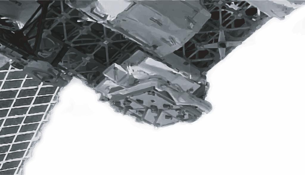
8 LAUNCHED ON JUNE 3, 2O17, INSTALLED ON THE INTERNATIONAL SPACE STATION AND DECLARED FULLY OPERATIONAL. ABOUT MUSES THE FIRST OF ITS KIND MUSES IS A TELEDYNE SPACE PLATFORM THAT PROVIDES ON-ORBIT MUSES is a first of its kind commercial space imaging mission that supports up to four (4) in-flight robotically installed sensors. The MUSES mission is enabled by flight and ground segments designed for flexibility and reconfigurability. INSTALL AND REMOVAL OF MULTIPLE PAYLOADS. 14 Teledyne Brown Engineering has supported civil space programs for over 60 years. In continuation of this relationship and the commercialization of space, MUSES was developed through a first of its kind coorperative agreement with the ISS Program Office. Photo courtesy of the ISS Program Office 15


9 COMMANDS & DATA DOWNLINK COMMAND UPLINK VLN 1553 Bus Architecture FLIGHT DATA PROCESSOR Available Onboard Server ONBOARD STORAGE CAPACITY 6TB DATA TRANSMISSION RATE 21 Mb/sec (estimated) from MUSES to Onboard Server 16 We operate the MUSES platform and collect telemetry and data downlink from the Teledyne Operations Center in Huntsville, Alabama. Our operational commands are transmitted to MUSES via a secure link to the ISS. We control MUSES functions and its hosted payloads and manage the data from collection to post processing. TOTAL AGGREGATED DAILY VOLUME TO GROUND 225 GB REQUIRED BUFFER SIZE 30 Minutes of Acquired Data COMMUNICATIONS OVERVIEW A dedicated MUSES Server on-board the ISS is used to temporarily store the data before it is encrypted and downlinked through the ISS high-rate data transmission link to the ground. 17


10 MUSES SPECIFICATIONS Large Payload Accommodations Maximum Mass: 100 kg Maximum Height: 35 (92 cm) Maximum Width: ~18 (~46 cm) dia Maximum Power: 28 Vdc Provide support equivalent to small satellite payloads in the 100 lb to 200 lb class. PAYLOAD ACCOMMODATIONS INCLUDE: Commanding through Gbit Ethernet Payload Health & Status via Gbit Ethernet Primary data transmitted via Gbit Ethernet Radiative Heat Rejection only. Htr Pwr available Files may be transferred one-by-one or batches PRECISE TIME, POSITION, AND ATTITUDE INFORMATION FOR PAYLOAD OPERATIONS The MUSES Platform is mounted on EXPRESS Logistics Carrier 4 (ELC- 4) on the starboard-nadir side of the ISS truss. The MUSES pointing accuracy is better than 30 arc seconds, which corresponds to about 60 m on the ground at the nominal ISS altitude of 400 km. The MUSES Master Time provided to hosted payloads has an accuracy of < ±250 μsec to GPS time. Geo-location is sourced from the ISS GPS system and is accurate to ±50 m. Small Payload Accommodations Maximum Mass: 50 kg Maximum Height: 35 (92 cm) Maximum Width: ~10 (~25 cm) dia Maximum Power: 28 Vdc Provide support equivalent to small satellite payloads in the 50 lb to 100 lb class
11 FOR MORE INFORMATION, CONTACT OUR BUSINESS DEVELOPMENT TEAM Approved for Public Release
Mohammed Bin Rashid Space Centre.
 Mohammed Bin Rashid Space Centre Introduction to MBRSC Started as Emirates Institution for Advanced Science and Technology (EIAST) which was established in February 2006. On April 18th, 2015: a decree
European Data Relay Satellite System EDA Workshop
 European Data Relay Satellite System EDA Workshop Brussels 7/06/2011 Agenda 1. Rationale for Data Relay Services 2. Potential benefits for Earth Observation systems 3. EDRS Programme principles, targeted
Total and Spectral solar Irradiance Sensor (TSIS-1) Project Overview
 Project Overview") November 12, 2015 TSIS-1 Project Overview 1 Total and Spectral solar Irradiance Sensor (TSIS-1) Project Overview 2015 Sun-Climate Symposium Project Manager: Candace Carlisle Deputy Project Manager / Resources:
November 12, 2015 TSIS-1 Project Overview 1 Total and Spectral solar Irradiance Sensor (TSIS-1) Project Overview 2015 Sun-Climate Symposium Project Manager: Candace Carlisle Deputy Project Manager / Resources:
WHAT IS IRIDIUM PRIME?
 WHAT IS IRIDIUM PRIME? Iridium PRIME / EuroPRIME is a payload accommodation service that leverages the Iridium NEXT spacebased global mesh network, ground infrastructure, and flexible bus design. 1 Iridium
APPENDIX I: ISS EXISTING HARDWARE, REMOTE SENSING IMPLEMENTATION PARTNERS & HARDWARE PROVIDERS
 Request for Proposals NO. CASIS 2015-2 Earth Observation to Benefit Energy Technology APPENDIX I: ISS EXISTING HARDWARE, REMOTE SENSING IMPLEMENTATION PARTNERS & HARDWARE PROVIDERS ISSUANCE Date: October
Blue Canyon Technologies XB1 Enabling a New Realm of CubeSat Science. George Stafford BCT Range St, Suite 200 Boulder, CO 80301
 Blue Canyon Technologies XB1 Enabling a New Realm of CubeSat Science George Stafford BCT 720.458.0703 1600 Range St, Suite 200 Boulder, CO 80301 About BCT Blue Canyon Technologies is a small business founded
An Introduction to Lidar & Forestry May 2013
 An Introduction to Lidar & Forestry May 2013 Introduction to Lidar & Forestry Lidar technology Derivatives from point clouds Applied to forestry Publish & Share Futures Lidar Light Detection And Ranging
Satellite Technology Trends - A perspective from Intelsat
 Satellite Technology Trends - A perspective from Intelsat Gonzalo de Dios ITU International Satellite Symposium 2017 May 29, 2017 2 Building Blocks of Transformation of the Satellite Industry - A Renaissance
Trends in Digital Aerial Acquisition Systems
 Trends in Digital Aerial Acquisition Systems Ernest Yap Regional Sales Manager, Airborne-Americas eyap@applanix.com 1 Medium Format Digital Cameras Medium Format Digital Cameras Where does the Medium
> OLEODL Workshop > Christopher Schmidt OSIRIS Update and Outlook. Christopher Schmidt Institute of Communications and Navigation
 DLR.de Chart 1 OSIRIS Update and Outlook Christopher Schmidt Institute of Communications and Navigation DLR.de Chart 2 OSIRIS Design Roadmap OSIRISv1: Open-Loop Body Pointing 200 Mbit/s OSIRISv2: Closed-Loop
GEOBIA for ArcGIS (presentation) Jacek Urbanski
 Jacek Urbanski") GEOBIA for ArcGIS (presentation) Jacek Urbanski INTEGRATION OF GEOBIA WITH GIS FOR SEMI-AUTOMATIC LAND COVER MAPPING FROM LANDSAT 8 IMAGERY Presented at 5th GEOBIA conference 21 24 May in Thessaloniki.
GEOBIA for ArcGIS (presentation) Jacek Urbanski INTEGRATION OF GEOBIA WITH GIS FOR SEMI-AUTOMATIC LAND COVER MAPPING FROM LANDSAT 8 IMAGERY Presented at 5th GEOBIA conference 21 24 May in Thessaloniki.
Case Study for Long- Range Beyond Visual Line of Sight Project. March 15, 2018 RMEL Transmission and Planning Conference
 Case Study for Long- Range Beyond Visual Line of Sight Project March 15, 2018 RMEL Transmission and Planning Conference 2014 HDR Architecture, 2016 2014 HDR, Inc., all all rights reserved. Helicopters
The SmallSat Revolution: Your World Now! Peter M. Wegner, CTO Spaceflight Industries
 The SmallSat Revolution: Your World Now! Peter M. Wegner, CTO Spaceflight Industries peter@spaceflightindustries.com What technologies are enabling the small satellite revolution? Technologies feeding
IMAGINE Objective. The Future of Feature Extraction, Update & Change Mapping
 IMAGINE ive The Future of Feature Extraction, Update & Change Mapping IMAGINE ive provides object based multi-scale image classification and feature extraction capabilities to reliably build and maintain
Overview of MOLI data product (MOLI: Multi-footprint Observation Lidar and Imager)
") Overview of MOLI data product (MOLI: Multi-footprint Observation Lidar and Imager) Jan 7, 2016 JAXA Jumpei Murooka 1 Contents 1. Mission instruments: MOLI 2. Standard products of MOLI 3. Lidar product
Overview of MOLI data product (MOLI: Multi-footprint Observation Lidar and Imager) Jan 7, 2016 JAXA Jumpei Murooka 1 Contents 1. Mission instruments: MOLI 2. Standard products of MOLI 3. Lidar product
Thematic Mapping with Remote Sensing Satellite Networks
 Thematic Mapping with Remote Sensing Satellite Networks College of Engineering and Computer Science The Australian National University outline satellite networks implications for analytical methods candidate
CLASSIFICATION OF NONPHOTOGRAPHIC REMOTE SENSORS
 CLASSIFICATION OF NONPHOTOGRAPHIC REMOTE SENSORS PASSIVE ACTIVE DIGITAL CAMERA THERMAL (e.g. TIMS) VIDEO CAMERA MULTI- SPECTRAL SCANNERS VISIBLE & NIR MICROWAVE HYPERSPECTRAL (e.g. AVIRIS) SLAR Real Aperture
REFLIGHT OF THE METRIC CAMERA ON THE ATLAS-1 MISSION. M. Schroeder, R. Statter DFVLR, FR Germany
 REFLIGHT OF THE METRIC CAMERA ON THE ATLAS-1 MISSION M. Schroeder, R. Statter DFVLR, FR Germany Abstract: It is planned to fly the Metric Camera again on a Space Shuttle Flight - the ATLAS-1 Mission in
Leica - Airborne Digital Sensors (ADS80, ALS60) Update / News in the context of Remote Sensing applications
 Update / News in the context of Remote Sensing applications") Luzern, Switzerland, acquired with GSD=5 cm, 2008. Leica - Airborne Digital Sensors (ADS80, ALS60) Update / News in the context of Remote Sensing applications Arthur Rohrbach, Sensor Sales Dir Europe,
Luzern, Switzerland, acquired with GSD=5 cm, 2008. Leica - Airborne Digital Sensors (ADS80, ALS60) Update / News in the context of Remote Sensing applications Arthur Rohrbach, Sensor Sales Dir Europe,
IMAGERY FOR ARCGIS. Manage and Understand Your Imagery. Credit: Image courtesy of DigitalGlobe
 IMAGERY FOR ARCGIS Manage and Understand Your Imagery Credit: Image courtesy of DigitalGlobe 2 ARCGIS IS AN IMAGERY PLATFORM Empowering you to make informed decisions from imagery and remotely sensed data
Leveraging UAS and Hyperspectral Technology for Advanced Remote Sensing
 Leveraging UAS and Hyperspectral Technology for Advanced Remote Sensing Tom Breen, Director of Global Sales Slide 1 Abstract The convergence of hyperspectral imaging aboard UASs is occurring at a very
Leica ALS70. Airborne Laser Scanners Performance for diverse Applications
 Leica ALS70 Airborne Laser Scanners Performance for diverse Applications Three Models, One Result. Highest Productivity in all Applications. Imagine an affordable 500 khz pulse rate city-mapping LIDAR
ENVI THE PREMIER SOFTWARE FOR EXTRACTING INFORMATION FROM GEOSPATIAL DATA
 ENVI THE PREMIER SOFTWARE FOR EXTRACTING INFORMATION FROM GEOSPATIAL DATA HarrisGeospatial.com BENEFITS Use one solution to work with all your data types Access a complete suite of analysis tools Customize
ALS40 Airborne Laser Scanner
 ALS40 Airborne Laser Scanner Airborne LIDAR for Professionals High Performance Laser Scanning Direct Measurement of Ground Surface from the Air The ALS40 Airborne Laser Scanner measures the topography
TET- the first satellite of the FIREBIRD constellation Eckehard Lorenz DLR OS-CV
 www.dlr.de Chart 1 Presentation > E. Lorenz FIREBIRD-Info > 29. 08. 2014 TET- the first satellite of the FIREBIRD constellation Eckehard Lorenz DLR OS-CV www.dlr.de Chart 2 Presentation > E. Lorenz FIREBIRD-Info
International D&I Programs SUMMER OLYMPICS SECURITY PACKAGE
 PPRROOM MOO International D&I Programs SUMMER OLYMPICS SECURITY PACKAGE BARRA OLYMPIC PARK CONSTRUCTION RIO DE JANEIRO PROMO OLYMPIC SECURITY PACKAGE 2016 Olympic security package Since the 2009 announcement
KhalifaSat: Mission Overview
 KhalifaSat: Mission Overview 1 Introduction to EIAST Emirates Institution for Advanced Science and Technology Government entity based in Dubai, UAE Established in 2006 Vision To be recognized globally
DARPA Perspective on Space
 DARPA Perspective on Space Ms. Pamela A. Melroy, Deputy Director DARPA Tactical Technology Office Briefing prepared for International Symposium for Personal and Commercial Spaceflight (ISPCS) 2015 October
TopoDrone Photogrammetric Mapping Reliable, Accurate, Safe
 TopoDrone Photogrammetric Mapping Reliable, Accurate, Safe A complete solution for accurate airborne data capture and photogrammetric mapping using an unmanned aerial vehicle COST EFFICIENT SOLUTION TO
Onshore remote sensing applications: an overview
 Onshore remote sensing applications: an overview Dr. Richard Teeuw and Dr. Malcolm Whitworth School of Earth and Environmental Sciences, University of Portsmouth, UK. Overview Presentation on the applications
HASP Student Payload Interface Manual
 HASP Student Payload Interface Manual Version 02.08.08 1 I. Introduction This document describes the basic features of your HASP payload mounting plate and provides information on the mechanical, electrical,
Feel4U TerrEye. Tactical decision-support solutions for land management (for a better and cost-efficiency & environmental friendly land stewardship)
") Feel4U TerrEye Tactical decision-support solutions for land management (for a better and cost-efficiency & environmental friendly land stewardship) Guillaume Janssens Agro-Environment Consultant info@terreye.com
Feel4U TerrEye Tactical decision-support solutions for land management (for a better and cost-efficiency & environmental friendly land stewardship) Guillaume Janssens Agro-Environment Consultant info@terreye.com
Shallow-water Remote Sensing: Lecture 1: Overview
 Shallow-water Remote Sensing: Lecture 1: Overview Curtis Mobley Vice President for Science and Senior Scientist Sequoia Scientific, Inc. Bellevue, WA 98005 curtis.mobley@sequoiasci.com IOCCG Course Villefranche-sur-Mer,
High resolution survey and orthophoto project of the Dosso-Gaya region in the Republic of Niger. by Tim Leary, Woolpert Inc.
 High resolution survey and orthophoto project of the Dosso-Gaya region in the Republic of Niger by Tim Leary, Woolpert Inc. Geospatial Solutions Photogrammetry & Remote Sensing LiDAR Professional Surveying
LIDAR MAPPING FACT SHEET
 1. LIDAR THEORY What is lidar? Lidar is an acronym for light detection and ranging. In the mapping industry, this term is used to describe an airborne laser profiling system that produces location and
InSAR Operational and Processing Steps for DEM Generation
 InSAR Operational and Processing Steps for DEM Generation By F. I. Okeke Department of Geoinformatics and Surveying, University of Nigeria, Enugu Campus Tel: 2-80-5627286 Email:francisokeke@yahoo.com Promoting
Living Pléiades : Sharing experiences on the operational use of the system. Laurent Maggiori - Pléiades Program Director Airbus DS
 Living Pléiades : Sharing experiences on the operational use of the system Laurent Maggiori - Pléiades Program Director Airbus DS Accurate, Reactive, Available Sensors Products One camera 1 panchromatic
Interface Control Document Between
 Classification: Public Domain Date: 2011-1-11 Revision: 1 Page 1 of 15 Space Systems Laboratory 453 F. Paul Anderson Tower University of Kentucky Lexington, KY, United States 40506 (859) 257-8042 Document
Integrated Multi-Source LiDAR and Imagery
 Figure 1: AirDaC aerial scanning system Integrated Multi-Source LiDAR and Imagery The derived benefits of LiDAR scanning in the fields of engineering, surveying, and planning are well documented. It has
Iridium operations and development. Update Sept 2012
 Iridium operations and development Update Sept 2012 66 satellite constellation 2007: Iridium constellation status and plans 2008 2009 2010 2011 2012 2013 2014 2015 2016 Requirements and Supplier Selection
HASP Payload Specification and Integration Plan
 Payload Title: Measurement of Ozone Profile in the Stratosphere Using Nanocrystalline Sensor Arrays Payload Class: Small Large (circle one) Payload ID: 7 Institution: Contact Name: Contact Phone: Contact
CONTENTS. Quick Start Guide V1.0
 Quick Start Guide CONTENTS 1 Introduction... 2 2 What s in the box?... 3 3 Using your buzzard multispectral sensor... 4 3.1 Overview... 4 3.2 Connecting the power / remote trigger cable... 5 3.3 Attaching
Spacecraft Communications Payload (SCP) for Swampworks
 for Swampworks") Spacecraft Communications Payload (SCP) for Swampworks Joseph A. Hauser Praxis, Inc. 2550 Huntington Avenue Suite 300 Alexandria, VA 22303 phone: (703) 682-2059 fax: (703) 837-8500 email: hauserj@pxi.com
Spacecraft Communications Payload (SCP) for Swampworks Joseph A. Hauser Praxis, Inc. 2550 Huntington Avenue Suite 300 Alexandria, VA 22303 phone: (703) 682-2059 fax: (703) 837-8500 email: hauserj@pxi.com
Status of MOLI development MOLI (Multi-footprint Observation Lidar and Imager)
") Status of MOLI development MOLI (Multi-footprint Observation Lidar and Imager) Tadashi IMAI, Daisuke SAKAIZAWA, Jumpei MUROOKA, Rei Mitsuhashi and Toshiyoshi KIMURA JAXA 0 Outline of This Presentation
Status of MOLI development MOLI (Multi-footprint Observation Lidar and Imager) Tadashi IMAI, Daisuke SAKAIZAWA, Jumpei MUROOKA, Rei Mitsuhashi and Toshiyoshi KIMURA JAXA 0 Outline of This Presentation
SKY Perfect JSAT Corporation Overview. June 2018
 SKY Perfect JSAT Corporation Overview June 2018 Business Segments Space & Satellite Business First satellite launched in 1989 Solid and diverse customers Government sector Public Service Companies Telcos,
Managing Imagery and Raster Data using Mosaic Datasets
 Esri European User Conference October 15-17, 2012 Oslo, Norway Hosted by Esri Official Distributor Managing Imagery and Raster Data using Mosaic Datasets Peter Becker ArcGIS is a Comprehensive Imagery
Orthorectifying ALOS PALSAR. Quick Guide
 Orthorectifying ALOS PALSAR Quick Guide Copyright Notice This publication is a copyrighted work owned by: PCI Geomatics 50 West Wilmot Street Richmond Hill, Ontario Canada L4B 1M5 www.pcigeomatics.com
Leica Systems Overview
 RC30 AERIAL CAMERA SYSTEM Leica Systems Overview The Leica RC30 aerial film camera is the culmination of decades of development, started with Wild's first aerial camera in the 1920s. Beautifully engineered
Navigation for Future Space Exploration Missions Based on Imaging LiDAR Technologies. Alexandre Pollini Amsterdam,
 Navigation for Future Space Exploration Missions Based on Imaging LiDAR Technologies Alexandre Pollini Amsterdam, 12.11.2013 Presentation outline The needs: missions scenario Current benchmark in space
AISASYSTEMS PRODUCE MORE WITH LESS
 AISASYSTEMS PRODUCE MORE WITH LESS AISASYSTEMS SPECIM s AISA systems are state-of-the-art airborne hyperspectral imaging solutions covering the VNIR, NIR, SWIR and LWIR spectral ranges. The sensors unbeatable
Drone2Map for ArcGIS: Bring Drone Imagery into ArcGIS
 Drone2Map for ArcGIS: Bring Drone Imagery into ArcGIS Mike Sweeney 1 Drone2Map for ArcGIS Turn Drones into Enterprise Productivity Tools ArcGIS Drone2Map for ArcGIS Create 2D and 3D products from raw drone
Mohammed Bin Rashid Space Centre
 Mohammed Bin Rashid Space Centre Space in the UAE Today The UAE is one of the most ambitious countries in space and is a major player in the Gulf and Arab Word The UAE is very active and is developing:
The Geostationary Operational Satellite R Series (GOES-R) SpaceWire Implementation
 SpaceWire Implementation") The Geostationary Operational Satellite R Series (GOES-R) SpaceWire Implementation Session: SpaceWire Missions and Applications William H. Anderson NASA Goddard Space Flight Center/MEI Technologies E-mail:
The Geostationary Operational Satellite R Series (GOES-R) SpaceWire Implementation Session: SpaceWire Missions and Applications William H. Anderson NASA Goddard Space Flight Center/MEI Technologies E-mail:
THE USE OF AIRBORNE HYPERSPECTRAL REFLECTANCE DATA TO CHARACTERIZE FOREST SPECIES DISTRIBUTION PATTERNS
 THE USE OF AIRBORNE HYPERSPECTRAL REFLECTANCE DATA TO CHARACTERIZE FOREST SPECIES DISTRIBUTION PATTERNS Weihs, P., Huber K. Institute of Meteorology, Department of Water, Atmosphere and Environment, BOKU
UAS Campus Survey Project
 ARTICLE STUDENTS CAPTURING SPATIAL INFORMATION NEEDS UAS Campus Survey Project Texas A&M University- Corpus Christi, home to the largest geomatics undergraduate programme in Texas, USA, is currently undergoing
Classify Multi-Spectral Data Classify Geologic Terrains on Venus Apply Multi-Variate Statistics
 Classify Multi-Spectral Data Classify Geologic Terrains on Venus Apply Multi-Variate Statistics Operations What Do I Need? Classify Merge Combine Cross Scan Score Warp Respace Cover Subscene Rotate Translators
Data, Data, Everywhere. We are now in the Big Data Era.
 Data, Data, Everywhere. We are now in the Big Data Era. CONTENTS Background Big Data What is Generating our Big Data Physical Management of Big Data Optimisation in Data Processing Techniques for Handling
Drones for research - Observing the world in 3D from a LiDAR-UAV
 Drones for research - Observing the world in 3D from a LiDAR-UAV Program lunch seminar: Lammert Kooistra: The Unmanned Aerial Remote Sensing Facility goes 3D: Unmanned Aerial Laser Scanning Sander Mücher:
Remote Sensing Introduction to the course
 Remote Sensing Introduction to the course Remote Sensing (Prof. L. Biagi) Exploitation of remotely assessed data for information retrieval Data: Digital images of the Earth, obtained by sensors recording
UAS for Surveyors. An emerging technology for the Geospatial Industry. Ian Murgatroyd : Technical Sales Rep. Trimble
 UAS for Surveyors An emerging technology for the Geospatial Industry Ian Murgatroyd : Technical Sales Rep. Trimble Project Overview Voyager Quarry, located near Perth Australia Typical of hard rock mines,
SD CABIN NETWORKING SOLUTIONS
 SD CABIN NETWORKING SOLUTIONS RAISING THE STANDARD FOR IN-FLIGHT CONNECTIVITY THE SDR A POWERFUL CONDUIT FOR AIRCRAFT PERFORMANCE DATA AND SD ENHANCED SERVICES The SDR is a connectivity platform that optimizes
Leica ADS80 and Leica XPro - A total solution for photogrammetric mapping
 Leica ADS80 and Leica XPro - A total solution for photogrammetric mapping Ruedi Wagner, VP Imaging, Geospatial Solutions Division Phowo 2009 - Real Geospatial Solutions What else can I do with my sensor?
Overview of the GMES Space Component & DMC as a GMES Contributing Mission
 Overview of the GMES Space Component & DMC as a GMES Contributing Mission Eleni Paliouras GMES Space Office, Directorate of Earth Observation, ESA DMC Consortium Meeting, London 16/02/2011 ESA UNCLASSIFIED
DEVELOPMENT OF CAMERA MODEL AND GEOMETRIC CALIBRATION/VALIDATION OF XSAT IRIS IMAGERY
 DEVELOPMENT OF CAMERA MODEL AND GEOMETRIC CALIBRATION/VALIDATION OF XSAT IRIS IMAGERY Leong Keong Kwoh, Xiaojing Huang, Wee Juan Tan Centre for Remote, Imaging Sensing and Processing (CRISP), National
Preliminary Payload Specification and Integration Plan
 ARIES GPS Payload By ARIES GPS Payload Team Oscar Valle Damian Miralles Rafael Isaac Alexander Santiago Jean Ojeda Faculty Advisor: Dr. Hien Vo Payload Title: ARIES SAT GPS Payload Payload Class: Small
Harnessing GIS and Imagery for Power Transmission Inspection. ESRI European Users Conference October 15, 2015
 Harnessing GIS and Imagery for Power Transmission Inspection ESRI European Users Conference October 15, 2015 About Us Airborne/Threod Designer, manufacturer & service provider for multi-rotor & fixed wing
Overview of the Trimble TX5 Laser Scanner
 Overview of the Trimble TX5 Laser Scanner Trimble TX5 Revolutionary and versatile scanning solution Compact / Lightweight Efficient Economical Ease of Use Small and Compact Smallest and most compact 3D
Mission Status and Data Availability: TanDEM-X
 Mission Status and Data Availability: TanDEM-X Irena Hajnsek, Thomas Busche, Alberto Moreira & TanDEM-X Team Microwaves and Radar Institute, German Aerospace Center irena.hajnsek@dlr.de 26-Jan-2009 Outline
P H A S E O N E I N D U S T R I A L. T h e w o r l d l e a d e r i n h i g h r e s o l u t i o n i m a g i n g
 P H A S E O N E I N D U S T R I A L T h e w o r l d l e a d e r i n h i g h r e s o l u t i o n i m a g i n g 1 WE ARE A WORLD LEADING PROVIDER of medium format digital imaging systems and solutions for
Leica Geosystems UAS Airborne Sensors. MAPPS Summer Conference July 2014 Alistair Stuart
 Leica Geosystems UAS Airborne Sensors MAPPS Summer Conference July 2014 Alistair Stuart 1 Sensors for UAS! Promise of UAS is to expand aerial data acquisition capabilities for traditional and non-traditional
Defining Remote Sensing
 Defining Remote Sensing Remote Sensing is a technology for sampling electromagnetic radiation to acquire and interpret non-immediate geospatial data from which to extract information about features, objects,
Bringing Disaster Management Information to the Web: Efforts at the German Remote Sensing Data Center
 German Aerospace Center (DLR) Bringing Disaster Management Information to the Web: Efforts at the German Remote Sensing Data Center Stefan Plattner DLR-DFD www.dlr.de Chart 2 > Bringing Disaster Management
Sodankylä National Satellite Data Centre. Jyri Heilimo Head of Satellite based services R&D
 Sodankylä National Satellite Data Centre Jyri Heilimo Head of Satellite based services R&D Sodankylä National Satellite Data Centre National satellite data center providing satellite data reception and
Forest Planning with UAVs and other Emerging Technologies. Jonathan Lok, RFT
 Forest Planning with UAVs and other Emerging Technologies Jonathan Lok, RFT Core Concepts of Planning Plan the Work Work the Plan Qualified professionals Best available data Applied knowledge and experience
Development of Formation Flight and Docking Algorithms Using the SPHERES Testbed
 Development of Formation Flight and Docking Algorithms Using the Testbed Prof. David W. Miller MIT Allen Chen, Alvar Saenz-Otero, Mark Hilstad, David W. Miller Introduction : Synchronized Position Hold
Absolute Horizontal Accuracies of Pictometry s Individual Orthogonal Frame Imagery
 A Pictometry International, Corp White Paper Absolute Horizontal Accuracies of Pictometry s Individual Orthogonal Frame Imagery Michael J. Zoltek VP, Surveying & Mapping Pictometry International, Corp
UAV Hyperspectral system for remote sensing application
 UAV Hyperspectral system for remote sensing application The system consists airborne imaging spectrophotometer placed on a frame suitable for use aircraft, a UAV helicopter and all components needed for
Current status of ESA s Space Situational Awareness Near-Earth Object programme
 Current status of ESA s Space Situational Awareness Near-Earth Object programme Detlef Koschny, European Space Agency, Solar System Missions Division Keplerlaan 1 NL-2201 AZ Noordwijk ZH Detlef.Koschny@esa.int
ENVI ANALYTICS ANSWERS YOU CAN TRUST
 ENVI ANALYTICS ANSWERS YOU CAN TRUST HarrisGeospatial.com Since its launch in 1991, ENVI has enabled users to leverage remotely sensed data to better understand our complex world. Over the years, Harris
ISPRS Hannover Workshop 2013, May 2013, Hannover, Germany
 New light-weight stereosopic spectrometric airborne imaging technology for highresolution environmental remote sensing Case studies in water quality mapping E. Honkavaara, T. Hakala, K. Nurminen, L. Markelin,
PROSILICA GigE Vision Kameras CCD und CMOS
 PROSILICA GigE Vision Kameras CCD und CMOS Case Study: GE4900C, GE4000C, GE1910C and GC2450C used in UAV-technology Prosilica Cameras Go Airborne Prosilica Kameras überzeugen mit hervorragender Bildqualität,
9/14/2011. Contents. Lecture 3: Spatial Data Acquisition in GIS. Dr. Bo Wu Learning Outcomes. Data Input Stream in GIS
 Contents Lecture 3: Spatial Data Acquisition in GIS Dr. Bo Wu lsbowu@polyu.edu.hk 1. Learning outcomes. Data acquisition: Manual digitization 3. Data acquisition: Field survey 4. Data acquisition: Remote
APPLICATION OF SOFTMAX REGRESSION AND ITS VALIDATION FOR SPECTRAL-BASED LAND COVER MAPPING
 APPLICATION OF SOFTMAX REGRESSION AND ITS VALIDATION FOR SPECTRAL-BASED LAND COVER MAPPING J. Wolfe a, X. Jin a, T. Bahr b, N. Holzer b, * a Harris Corporation, Broomfield, Colorado, U.S.A. (jwolfe05,
Lecture 13.1: Airborne Lidar Systems
 Lecture 13.1: Airborne Lidar Systems 1. Introduction v The main advantages of airborne lidar systems are that they expand the geographical range of studies beyond those possible by surface-based fixed
N.J.P.L.S. An Introduction to LiDAR Concepts and Applications
 N.J.P.L.S. An Introduction to LiDAR Concepts and Applications Presentation Outline LIDAR Data Capture Advantages of Lidar Technology Basics Intensity and Multiple Returns Lidar Accuracy Airborne Laser
A SENSOR FUSION APPROACH TO COASTAL MAPPING
 A SENSOR FUSION APPROACH TO COASTAL MAPPING Maryellen Sault, NOAA, National Ocean Service, National Geodetic Survey Christopher Parrish, NOAA, National Ocean Service, National Geodetic Survey Stephen White,
Sensors and applications for drone based remote sensing
 Sensors and applications for drone based remote sensing Dr. Ilkka Pölönen Dr. Eija Honkavaara, NLS Dr. Heikki Saari, VTT Dr. Sakari Tuominen, Mr. Jere Kaivosoja, Luke Laboratory Joint research with Finnish
TOA RADIANCE SIMULATOR FOR THE NEW HYPERSPECTRAL MISSIONS: STORE (SIMULATOR OF TOA RADIANCE)
") TOA RADIANCE SIMULATOR FOR THE NEW HYPERSPECTRAL MISSIONS: STORE (SIMULATOR OF TOA RADIANCE) Malvina Silvestri Istituto Nazionale di Geofisica e Vulcanologia In the frame of the Italian Space Agency (ASI)
TOA RADIANCE SIMULATOR FOR THE NEW HYPERSPECTRAL MISSIONS: STORE (SIMULATOR OF TOA RADIANCE) Malvina Silvestri Istituto Nazionale di Geofisica e Vulcanologia In the frame of the Italian Space Agency (ASI)
HASP Payload Specification and Integration Plan
 Payload Title: PLEASE LSU Payload Class: Small Large (circle one) Payload ID: 12 Institution: Contact Name: Louisiana State University Joel Taylor Contact Phone: (985) 788-5384 Contact E-mail: jet.taylor10@gmail.com
MAPPS 2013 Winter Conference 2013 Cornerstone Mapping, Inc. 1
 MAPPS 2013 Winter Conference 2013 Cornerstone Mapping, Inc. 1 What is Thermal Imaging? Infrared radiation is perceived as heat Heat is a qualitative measure of temperature Heat is the transfer of energy
Optical Theory Basics - 2 Atmospheric corrections and parameter retrieval
 Optical Theory Basics - 2 Atmospheric corrections and parameter retrieval Jose Moreno 3 September 2007, Lecture D1Lb2 OPTICAL THEORY-FUNDAMENTALS (2) Radiation laws: definitions and nomenclature Sources
Best Practices for Managing Processed Ortho Imagery
 Best Practices for Managing Processed Ortho Imagery Cody Benkelman DRAFT slides (June 2017) Characteristics of Processed Ortho Imagery Typically 8 bit (sometimes 16) Typically 3 spectral bands (sometimes
Hardware 3D Mapping Systems
 Hardware 3D Mapping Systems About Us GreenValley International GreenValley International provides 3D mapping solutions that include mobile & aerial LiDAR acquisition hardware, post-processing software
Airborne Hyperspectral Imaging Using the CASI1500
 Airborne Hyperspectral Imaging Using the CASI1500 AGRISAR/EAGLE 2006, ITRES Research CASI 1500 overview A class leading VNIR sensor with extremely sharp optics. 380 to 1050nm range 288 spectral bands ~1500
Hyperspectral Remote Sensing in Acquisition of Geospatial Information for the Modern Warfare. Dr M R Bhutiyani,
 Hyperspectral Remote Sensing in Acquisition of Geospatial Information for the Modern Warfare Dr M R Bhutiyani, Ex-Director, DTRL, New Delhi Chairman, ISRS, Delhi Chapter Air photo-interpretation Multi-spectral
SGEO: Overview and Product Offering. Marco R. Fuchs. Marco R. R. Fuchs. DLR-ESA Workshop on ARTES 11. Marco R. Fuchs OHB Technology AG
 DLR-ESA Workshop on ARTES 11 SGEO: Overview and Product Offering Marco R. R. Fuchs June June29, 29, 2006 2006 Tegernsee, Tegernsee, Germany Germany Marco R. Fuchs Marco R. Fuchs OHB Technology AG OHB Technology
Catapult Open. The Open Data Cube (ODC) A tool to increase the value and impact of global Earth observation satellite data
 A tool to increase the value and impact of global Earth observation satellite data") The Open Data Cube (ODC) A tool to increase the value and impact of global Earth observation satellite data SATELLITE APPLICATIONS CATAPULT Our Mission // To innovate for a better world, empowered by satellites.
The Open Data Cube (ODC) A tool to increase the value and impact of global Earth observation satellite data SATELLITE APPLICATIONS CATAPULT Our Mission // To innovate for a better world, empowered by satellites.
trimble unmanned aircraft systems
 trimble unmanned aircraft systems FOR SURVEYING and MAPPING TRIMBLE UAS AERIAL IMAGING solution: INDUSTRY-LEADING UAS MAPPING SOLUTIONS FOR ALL YOUR APPLICATION NEEDS Trimble prides itself on being a leader
Remote Control Software for Experiments on the
 Chattanooga Engineers Club 12 July 2010 Remote Control Software for Experiments on the International Space Station Dr. Jim Henry -- UTChattanooga 1 Chattanooga Engineers Club 12 July 2010 EXPRESS Payload
EVALUATION OF CONVENTIONAL DIGITAL CAMERA SCENES FOR THEMATIC INFORMATION EXTRACTION ABSTRACT
 EVALUATION OF CONVENTIONAL DIGITAL CAMERA SCENES FOR THEMATIC INFORMATION EXTRACTION H. S. Lim, M. Z. MatJafri and K. Abdullah School of Physics Universiti Sains Malaysia, 11800 Penang ABSTRACT A study