GeoNetwork User Manual
|
|
|
- Irma Stanley
- 6 years ago
- Views:
Transcription
1 GeoNetwork User Manual Release GeoNetwork April 05, 2012
2
3 Contents 1 Preface About this Project License Information Author Information Quick Start Guide Geographic Information Management for all Getting Started Viewing and Analysing the Data Adding new Data and Information Entering Metadata for your Map Uploading a New Record using the XML Metadata Insert Tool Metadata in Spatial Data Management Installing the software Administration Basic configuration User and Group Administration OGC CSW Server configuration Import facilities Harvesting Metadata ownership Templates Thesaurus GeoNetwork s Administrator Survival Tool - GAST Localization Import / export tools Glossary of Metadata Fields Description ISO Topic Categories Free and Open Source Software for Geospatial Information Systems Web Map Server software i
4 6.2 GIS Desktop software Web Map Viewer and Map Server Management Frequently Asked Questions HTTP Status 400 Bad request Metadata insert fails Thumbnail insert fails The data and data/tmp directories Glossary 125 Index 129 ii
5 Welcome to the GeoNetwork User Manual v The manual is a comprehensive guide to all aspects of using GeoNetwork opensource. Other documents: GeoNetwork Developer Manual GeoNetwork User Manual (PDF) Contents 1
6 2 Contents
7 CHAPTER 1 Preface 1.1 About this Project This document provides guidelines to install, configure, use and customise the GeoNetwork opensource software. The GeoNetwork project started out as a Spatial Data Catalogue System for the Food and Agriculture organisation of the United Nations (FAO), the United Nations World Food Programme (WFP) and the United Nations Environmental Programme (UNEP). At present the project is widely used as the basis of Spatial Data Infrastructures all around the world. The project is part of the Open Source Geospatial Foundation (OSGeo) and can be found at GeoNetwork opensource. 1.2 License Information Software The GeoNetwork opensource software is released under the GPL v2 license and can be used and modified free of charge Documentation Documentation is released under a Creative Commons license with the following conditions. You are free to Share (to copy, distribute and transmit) and to Remix (to adapt) the documentation under the following conditions: 3
8 Attribution. You must attribute GeoNetwork opensource documentation to GeoNetwork opensource developers. Share Alike. If you alter, transform, or build upon this work, you may distribute the resulting work only under the same or similar license to this one. With the understanding that: Any of the above conditions can be waived if you get permission from the copyright holder. Public Domain. Where the work or any of its elements is in the public domain under applicable law, that status is in no way affected by the license. Other Rights. In no way are any of the following rights affected by the license: Your fair dealing or fair use rights, or other applicable copyright exceptions and limitations; The author s moral rights; Rights other persons may have either in the work itself or in how the work is used, such as publicity or privacy rights. Notice: For any reuse or distribution, you must make clear to others the license terms of this work. The best way to do this is with a link to this web page. You may obtain a copy of the License at Creative Commons Attribution-ShareAlike 3.0 Unported License The document is written in restructuredtext format for consistency and portability. 1.3 Author Information The documentation was written by the GeoNetwork opensource Developers and other community members. The basis for the restructuredtext based documentation is based on the work done by the GeoServer project and the Sphinx framework. If you have questions, found a bug or have enhancements, please contact us through the GeoNetwork opensource Development Mailing list at geonetwork-devel@lists.sourceforge.net 4 Chapter 1. Preface
9 CHAPTER 2 Quick Start Guide 2.1 Geographic Information Management for all Introduction What is GeoNetwork opensource GeoNetwork opensource is a standard based and decentralised spatial information management system, designed to enable access to geo-referenced databases and cartographic products from a variety of data providers through descriptive metadata, enhancing the spatial information exchange and sharing between organisations and their audience, using the capacities and the power of the Internet. The system provides a broad community of users with easy and timely access to available spatial data and thematic maps from multidisciplinary sources, that may in the end support informed decision making. The main goal of the software is to increase collaboration within and between organisations for reducing duplication and enhancing information consistency and quality and to improve the accessibility of a wide variety of geographic information along with the associated information, organised and documented in a standard and consistent way. Main Features Instant search on local and distributed geospatial catalogues Uploading and downloading of data, documents, PDF s and any other content An interactive Web map viewer that combines Web Map Services from distributed servers around the world Online map layout generation and export in PDF format Online editing of metadata with a powerful template system Scheduled harvesting and synchronisation of metadata between distributed catalogues Groups and users management Fine grained access control 5
10 Background and evolution The prototype of the GeoNetwork catalogue was developed by the Food and Agriculture organisation of the United Nations (FAO) in 2001 to systematically archive and publish the geographic datasets produced within the organisation. The prototype was built on experiences within and outside the organisation. It used metadata content available from legacy systems that was transformed into what was then only a draft metadata standard, the ISO Later on, another UN agency, the World Food Programme (WFP) joined the project and with its contribution the first version of the software was released in 2003 and operational catalogues were established in FAO and WFP. The system was based on the ISO19115:DIS metadata standard and embedded the Web Map Client InterMap that supported Open Geospatial Consortium (OGC) compliant Web Map Services. Distributed searches were possible using the standard Z39.50 catalogue protocol. At that moment it was decided to develop the program as a Free and Open Source Software to allow the whole geospatial users community to benefit from the development results and to contribute to the further advancement of the software. Jointly with the UN Environmental Programme (UNEP), FAO developed a second version in The new release allowed users to work with multiple metadata standards (ISO 19115, FGDC and Dublin Core) in a transparent manner. It also allowed metadata to be shared between catalogues through a caching mechanism, improving reliability when searching in multiple catalogues. In 2006, the GeoNetwork team dedicated efforts to develop a DVD containing the GeoNetwork version and the best free and open source software in the field of Geoinformatics. The DVD was produced and distributed in hard copy to over three thousand people and is now also available for download from the GeoNetwork Community website. GeoNetwork opensource is the result of the collaborative development of many contributors. These include among others the Food and Agriculture organisation (FAO), the UN Office for the Coordination of Humanitarian Affairs (UNOCHA), the Consultative Group on International Agricultural Research (CSI- CGIAR), The UN Environmental Programme (UNEP), The European Space Agency (ESA) and many others. Support for the metadata standard ISO19115:2003 has been added by using the ISO19139:2007 implementation specification schema published in May The release also serves as the open source reference implementation of the OGC Catalogue Service for the Web (CSW 2.0.2) specification. Improvements to give users a more responsive and interactive experience have been substantial and include a new Web map viewer and a complete revision of search interface. The use of International Standards GeoNetwork has been developed following the principles of a Free and Open Source Software (FOSS) and based on International and Open Standards for services and protocols, like the ISO-TC211 and the Open Geospatial Consortium (OGC) specifications. The architecture is largely compatible with the OGC Portal Reference Architecture, i.e. the OGC guide for implementing standardised geospatial portals. Indeed the structure relies on the same three main modules identified by the OGC Portal Reference Architecture, that are focused on spatial data, metadata and interactive map visualisation. The system is also fully compliant with the OGC specifications for querying and retrieving information from Web catalogues (CSW). It supports the most common standards to specifically describe geographic data (ISO19139 and FGDC) and the international standard for general documents (Dublin Core). It uses standards (OGS WMS) also for visualising maps through the Internet. Harvesting geospatial data in a shared environment Within the geographic information environment, the increased collaboration between data providers and their efforts to reduce duplication have stimulated the development of tools and systems to significantly 6 Chapter 2. Quick Start Guide
11 improve the information sharing and guarantee an easier and quicker access of data from a variety of sources without undermining the ownership of the information. The harvesting functionality in GeoNetwork is a mechanism of data collection in perfect accordance with both rights to data access and data ownership protection. Through the harvesting functionality it is possible to collect public information from the different GeoNetwork nodes installed around the world and to copy and store periodically this information locally. In this way a user from a single entry point can get information also from distributed catalogues. The logo posted on top each harvested record informs the user about the data source GeoNetwork and the Open Source Community Development The community of users and developers of the GeoNetwork software has increased dramatically since the release of version 2.0 in December 2005 and the subsequent releases. At present, the user and developer mailing lists count well over 250 subscriptions each. Subscription to these lists is open to anyone interested. The archive of the mailing lists provides an important resource for users and can be freely browsed online. Members provide feedback within the community and provide translations, new functionalities, bug reports, fixes and instructions to the project as a whole. Building a self sustaining community of users and developers is one of the biggest challenges for the project. This communitybuilding process relies on active participation and interaction of its members. It also relies on building trust and operating in a transparent manner, thereby agreeing on the overall objectives, prioritization and long term direction of the project. A number of actions have been taken by the project team to facilitate this process. The foundation for the establishment of a GeoNetwork Advisory Board was laid at the 2006 workshop in Rome and membership criteria were defined. A work plan is presented and discussed at the yearly GeoNetwork workshop; subsequently, the plan is maintained and updated throughout the year where needed. The project management team reports back to the advisory board about the reached developments and objectives during the annual workshops. Two public Websites have been established. One focuses on the users of the software ( while the other one is dedicated to the developers ( Both can be updated and maintained online by trusted members of the community. They provide documentation, bug reporting and tracking, Wiki pages et cetera. A small part of the community connects through Internet Relay Chat (IRC) on a public irc://irc.freenode.net/geonetwork channel. But most interaction takes place on the user and the developer mailing lists. During the 2006 workshop, the Project Advisory Board decided to propose the GeoNetwork opensource project as an incubator project to the newly founded Open Source Geospatial Foundation (OSGeo). This incubation process is currently ongoing but close to conclusions. The project Websites have been moved to servers accessible under the umbrella of the OSGeo foundation. Web pages have been updated to reflect the OSGeo principles and a source code review performed. Source code is maintained in a publicly accessible code repository, hosted at an independent service provider, SourceForge.net that hosts thousands of FOSS projects. Developers and users have full access to all sections of the source code, while trusted developers can make changes in the repository itself. A special mailing list has been established to monitor changes in the code repository. This so-called commit mailing list delivers change reports by to its subscribers. The documentation is written in restructuredtext format using the Sphinx framework to ensure versioning and support of multiple output formats (e.g. HTML and PDF) Geographic Information Management for all 7

12 2.2 Getting Started Please make sure you have opened the home page of the GeoNetwork based catalogue. If you installed the software on your local machine and started it, the default URL is There are many different ways to search the catalogue for maps and other geographic data. This guide will introduce you to the most popular search methods: default, advanced and by category. Whichever search you choose, remember that you will see results based on your privileges and assigned work group (privileges). Note: The term data in this application refers to datasets, maps, tables, documents, etc. that are linked to the metadata of a specific record Default Search The default search allows you to search text within the entire record, such as keywords of the metadata and/or geographic location. Free text search. Type a search term in the What? field. You can type anything here (free text). You can use quotes around text to find exact combinations of words. Text and operators (and, or, not) are not case sensitive. Figure 2.1: The free text field. 8 Chapter 2. Quick Start Guide

13 Geographic search. For the geographic search, two options are available for selecting a particular region to limit the search: You can select a region from a predefined list; Figure 2.2: The region field You can select your own area of interest in a more interactive way. A small global map is shown on the screen from which you can drag and drop the frame of your location area. Just click on the button on the upper right of the map screen. Perform search. Both types of search, free text search and geographic search can be combined to restrict the query further. Click the Search button to proceed and show the results Searching by Categories An additional way to search data within the GeoNetwork database, from the home page, is searching by Category. A list of categories is provided to the user to identify data at a more generic level: Applications, Audio/Video, Case study and best practises, Conference proceedings, Datasets, Directories, Interactive resources, Maps and graphics, Other information resources, Photo. To search only for maps, click on Maps and Graphics. A list of maps will be displayed from which you may view details of every single map; just clicking on the Metadata button of the map you wish to review Getting Started 9

14 Figure 2.3: Interactive Area Of Interest map Figure 2.4: The Search button 10 Chapter 2. Quick Start Guide

15 Figure 2.5: Search by Category Advanced Search The advanced search option works similarly to the default search. However, you can be more specific in your search criteria as it offers different elements to look for data, each of them focusing one of the following aspects: What?, Where?, When? To perform an advanced search, from the home page click Advanced just below the search bottom. In the WHAT? section the elements are all related to the data content. Through them, in addition to searching only free keywords in the entire metadata content, you can also search directly in the title or abstract fields and add more keywords to customise your search further. You can also specify the level of accuracy you wish to reach in performing your search. To search by Title, Abstract, Free Text, or Keyword(s) type any text into the respective field. You can enter information in one or multiple field(s). If you do not want to search by a given field, simply leave it blank; You can choose the accuracy of your search, in terms of spelling words, from Precise = 1 to Imprecise = 0.2, through 3 more consecutive steps which are equal to 0.8, 0.6, 0.4. The WHERE? parameters, which are related to the spatial extent, allow you, as in the default search, either to select your own area of interest or to select a predefined region from the drop-down list. In this section you can also type the geographic coordinates of a specific location that is not available from the above list. To select your own area of interest, drag and drop the frame of your area on the global map using the appropriate tool on the bottom left of the map screen; To use free coordinates, type the lat-long geographic references in the appropriate fields around the map screen, without any limitation of decimal figures; To use the coordinates of a predefined region, select the region from the drop-down list. Whatever type of geographic search you decide to perform, in the Spatial search type field, you can choose from different options: is, overlaps, encloses, is fully outside of. If you use this field, be cautious as this limits your output data as follows: 2.2. Getting Started 11

16 Figure 2.6: Advanced search options 12 Chapter 2. Quick Start Guide

17 Figure 2.7: Show advanced search options Figure 2.8: What section in the Advanced search 2.2. Getting Started 13

18 Figure 2.9: Where section in the Advanced search If you choose Spatial search type is Country, only maps for the selected country will be displayed. In other words, a city map within that country will not show in the output results. If you choose Spatial search type overlaps Country, all maps with the bounding box overlapping that country will be displayed in the results, i.e. the neighbouring countries, the continent of which that country is part of and the global maps. If you choose Spatial search type encloses Country you will get, in the output results, maps of that country first and then all maps within its bounding box. Similarly, if you choose Spatial search type is fully outside of a selected region, only maps that follow that exact criteria will show in the output results. The WHEN? section gives you the possibility to restrict your search in terms of temporal extent, indicating a specific range of time referred to the data creation or publication date. To specify a range of time, click on the date selector button next to From To fields. Make use of the symbols > and >> on top of the calendar to select the month and the year first and then click on the exact day; a complete date will be filled in using the following standard order: YY-MM-DD. To clean the time fields, simply click on the white cross on their right; the box Any will be automatically selected and the search will be performed without any restriction on the time period. Finally, the advanced search allows you to apply further restrictions on the basis of additional parameters as data source, data categories and data format. To limit your queries to only one Catalogue out of those made available by the installation through the harvesting process, highlight the catalogue of preference or just keep Any selected to search all sites. To search for data organised by Category, such as Applications, Datasets, etc., simply highlight the category you wish to search in from the related drop-down list, otherwise we suggest to leave 14 Chapter 2. Quick Start Guide
19 Figure 2.10: When section in the Advanced search this field in Any Category. You can search for Digital or Hard Copy maps. To search in one or the other, simply check the box next to the one you wish to search. If no box is checked, all content will be searched. At last, you can customise the number of output results per page in the Hits Per Page field. Simply highlight the number of records to be displayed or leave the field set on the default number (10). Click the Search button. Figure 2.11: Other options in the Advanced search Search Results The output of a search provides you a list of the metadata records that should fit your request. For each record, the result page shows the title, an abstract and the keywords. According to the privileges that have been set for each metadata, a maximum of four sections can be consulted, as shown below. 1. Metadata: The metadata section describes the dataset (e.g.: citation, data owner, temporal/spatial/methodological information) and could contain links to other web sites that could provide further information about the dataset. 2. Download: Depending on the privileges that have been set for each record, when this button is present, the dataset is available and downloadable. The process for retrieving data is simple and 2.2. Getting Started 15

20 Figure 2.12: Search results 16 Chapter 2. Quick Start Guide


21 quick by just clicking the download button or by using the proper link in the specific metadata section for distribution info in the full metadata view. Figure 2.13: A single search result Figure 2.14: Available services related to the resource 3. Interactive Map: The map service is also optional. When this button is shown, an interactive map for this layer is available and, by default, it will be displayed on the map screen of the simple search. To better visualise the map through the map viewer, click on Show Map on the top of search results panel. 4. Graphic Overviews: There are small and large overviews of the map used to properly evaluate usefulness of the data, especially if the interactive map is not available. Simply click on the small image to enlarge it Privileges, roles and user groups GeoNetwork uses a system of Privileges, Roles and User groups. There are no restrictions for users to search and access public information in a GeoNetwork opensource based catalogue. To get access to restricted information or advanced functionality, an account to log in is required. This should be provided by the GeoNetwork administrator. To log in, simply go to the home page and enter your username and password in the dedicated fields on the top right corner, then click the login button Getting Started 17

22 Figure 2.15: The interactive map viewer 18 Chapter 2. Quick Start Guide

23 Figure 2.16: Large preview image Figure 2.17: Login 2.2. Getting Started 19
24 Privileges. Depending on the privileges set on a metadata record and on your role as an authenticated user, you will be able to read about a resource and download or interactively browse data related to that resource. Roles. Users with an Editor role can create, import and edit metadata records. They can also upload data and configure links to interactive map services. User groups. Every authenticated user is assigned to a particular work group and is able to view data within that work group. 2.3 Viewing and Analysing the Data Once you have completed your search, you view details of a particular record by clicking on the Metadata button. The metadata profiles used by GeoNetwork opensource to present and describe geographic data and general documents stored in the catalogue are based on the International Standard ISO 19115:2003, encoded according to the implementation schema 19139:2007, the FGDC and the international standard Dublin Core. In this guide the ISO metadata implementation will be described in details since it is also suggested as profile for the creation of new metadata records Metadata Description The metadata ISO profile used by GeoNetwork opensource to describe the geographic data and services is based on the ISO standard 19115:2003 and provides information related to the identification, the maintenance and constraints, the spatial and temporal extent, the spatial representation and reference, the quality and distribution of a geographic dataset. The metadata profile is organised in sections and the most important, illustrated in main_sections, are the: Identification Section, Distribution Section, Reference System Section, Data Quality Section and Metadata Section. These sections are described here in details. Identification Section This section includes information on the citation of the resource (title, date of creation or publication, edition, presentation form), the abstract, the purpose and the present*status* of the resource that can be defined among the options: completed, historical archive, obsolete, ongoing, planned, required or under development. This section also contains information about the person or organisation responsible for the data and who is considered to be a point of contact for the resource i.e. the dataset owner, originator, distributor, publisher, etc. and it provides information on data maintenance i.e. annually, monthly, daily, not planned, as needed, etc. Elements for keywords and for describing restrictions on data access and use are also included in this section in addition to spatial representation info like data type (vector, raster, text table, etc.) The identification section provides information about the scale, the language and character set used within the resource and the list of ISO categories through which your map could be classified. 20 Chapter 2. Quick Start Guide

25 Figure 2.18: Main metadata sections 2.3. Viewing and Analysing the Data 21

26 Figure 2.19: Identification information 22 Chapter 2. Quick Start Guide
27 Figure 2.20: Point of Contact 2.3. Viewing and Analysing the Data 23


28 Figure 2.21: Descriptive keywords Figure 2.22: Scale and other data properties 24 Chapter 2. Quick Start Guide


29 Finally, the temporal and spatial extent are also defined in this section. The temporal extent is defined through the starting and ending date of data validation. Figure 2.23: Temporal extent The spatial extent of the interested area is defined through geographic coordinates or through the selection of a country or region from a predefined list. Free text supplemental information can be added to complete the data identification section. Figure 2.24: Geographic bounding box Distribution Section This section provides metadata elements for accessing other useful on-line resources available through the web. The distribution elements allow for on-line access using an URL address or similar addressing scheme and provide the protocol for the proper connection for accessing geographic data or any other types of digital documents using the download function. Furthermore, it is possible to link a metadata with a predefined map service through the online resource and see the map interactively Viewing and Analysing the Data 25


30 Figure 2.25: Distribution information Reference System Section The Spatial Reference System section defines metadata required to describe the spatial reference system of a dataset. It contains one element to identify the name of the reference system used. Using elements from the advanced form, this section may be modified to provide more details on data projection, ellipsoid and datum. Note that if this information is provided, a reference system identifier is not mandatory. Figure 2.26: Reference system Data Quality Section The Data Quality section provides a general assessment of the quality of the data. It describes the*different hierarchical levels of data quality*, namely a dataset series, dataset, features, attributes, etc. This section also contains information about sources of the input data, and a general explanation of the production processes (lineage) used for creating the data. Metadata Information Section This section contains information about the metadata itself: the Universally Unique Identifier (UUID) assigned to the record (this is the File identifier ), language and characterset used, date of last edit 26 Chapter 2. Quick Start Guide

31 Figure 2.27: Data quality ( Date stamp ) and the metadata standard and version name of the record. It also contains information on the metadata author responsible for the metadata record; this person can also be a point of contact for the resource described. Information on the Metadata author is mandatory. 2.4 Adding new Data and Information This section guides you through the process of adding new records (new data with information) into the GeoNetwork catalogue using either the online metadata editor or the advanced metadata insert tool, based on XML documents. In both cases you will use the template system, add thumbnails, upload data, link to services and set access privileges to the metadata and data. To add or edit data and metadata, you must be registered as an Editor into the work group you want to add records to. Contact your administrator if you are not a registered editor for your work group. For the metadata creation using the online editor, GNos provides a set of simplified metadata templates based on the cited standards: ISO, FGDC and DC. The templates for vector and raster based on the ISO are the preferred ones since they are devised in a way that hides the complexity of the ISO19115 standard in the default view. At the same time those templates are extensible with new elements to fit specialized needs through the advanced view. To produce a good metadata record, always try to gather as much details as possible on the resource that you want to describe taking into account the metadata elements that have been presented in the previous chapter. The next step is to fill out properly the fields provided by the metadata templates, while at the same time avoiding duplication of information throughout the form. The most important fields that may not be waived while compiling a standard based metadata record are the following: Title, Date of Creation o Publication, Abstract, Language used for documenting data, Topic Category, Scale, Maintenance and Update Frequency, Metadata Author, Language Used for Documenting Metadata. In addition to the main mandatory fields, we recommend you to fill out these optional but critical fields (if information is available): Purpose - Keywords - Presentation Form - Status - Spatial Representation Type - Geographic Location - Reference System Info - Temporal Extent - Data Quality Info - Access and Use Constraints - Point of Contact - Distribution Info: Online Resources. You should also prepare an image of your data that is required to be displayed in search results as thumbnail Adding new Data and Information 27

32 Figure 2.28: Metadata properties 28 Chapter 2. Quick Start Guide

33 Next section will guide you through the process of metadata creation using the online editor Creating a New Record using the web based Metadata Editor 1. In the home page, click on the Administration Tab. 2. Select New Metadata from the List of the admin page. 3. Select the metadata standard Template, if possible, using the preferred ones. GeoNetwork opensource comes by default with support for three metadata standards, ISO19139, FGDC and Dublin core. For the ISO standard, two templates have been developed; one for vector and one for raster data. Both contain a relevant set of elements to describe the respective types of data. More templates can be developed online. 4. Select the Group the metadata will belong to. These are the groups authorized to add metadata to by your administrator. 5. Click on Create The steps in more details 1. Enter your username and password and click on the login button. The system will identify you and assign the correct privileges to work with. Figure 2.29: Login 2. Open the Administration page by clicking the Administration button in the banner and then click on the New metadata link. Figure 2.30: Administration panel 2.4. Adding new Data and Information 29
 Figure 2.31: Template selection 4.")


34 3. From the metadata creation page, select the metadata standard to use from the dropdown list (Figure 4.3, Template selection ) Figure 2.31: Template selection 4. After selecting the correct template, you should identify which group of users the metadata will belong to and finally click on Create. Figure 2.32: Group selection 5. A new metadata form based on the selected template will be displayed for you to fill out Switching Editing Views from Default to Advanced to XML View Once you create a new record, you can choose between Default, Advanced or XML View. To switch view, simply click on the view you want to switch to on the left column of the page. The view in bold is the view you are currently using. Figure 2.33: Metadata view options 30 Chapter 2. Quick Start Guide

35 In the previous chapter you have analyzed the metadata structure as it is presented in the Default View. A selection of the main fields from different categories of information is shown in one single view. The minimum set of metadata required to serve the full range of metadata applications (data discovery, determination of data fitness for use, data access, data transfer and use of digital data) is defined here, along with optional metadata elements to allow for a more extensive standard description of geographic data, if required. However, if should be there a need to add more metadata elements, you can switch to the advanced view at any time while editing. In the Advanced View, the ISO profile offers the possibility to visualize and edit the entire metadata structure organized in sections accessible through tabs from the left column. You can use this view to write more advanced metadata descriptions or templates to fit specialized needs. Figure 2.34: Advanced view The XML View shows the entire content of the metadata in the original hierarchical structure; different colors allow to distinguish between an element s name and its value. The XML structure is composed of tags and to every tag must correspond a closing tag. The content is entirely contained withing the two, i.e.: <gmd:language> <gco:characterstring>eng</gco:characterstring> </gmd:language> Nevertheless, the use of the XML view requires some knowledge of the XML language. Both the Default and the Advanced Views are composed of mandatory, conditional and optional metadata fields. The meaning of mandatory and optional is fairly intuitive; the mandatory fields are required, like Title and Abstract for instance, whereas the optional fields can be provided but are not fundamental, depending on the metadata author. The conditional fields may be considered mandatory under certain circumstances: essentially a conditional requirement indicates that the 2.4. Adding new Data and Information 31

36 Figure 2.35: XML view presence of a specified data element is dependent on the value or presence of other data elements in the same section. For instance, the Individual name metadata element of the Point of Contact, which is a conditional element of the Identification section, becomes mandatory if another element of the same section, Organization name or Position name is not already defined. The mandatory fields as well as those highly recommended are flagged with red asterisk [*]. The standard definition for each field can be read by passing the mouse on the element name. The Default View is the preferred view as it provides a selection of the available metadata elements, facilitating both the user and the editor in reading and editing a metadata record, and at the same time it ensures that a geospatial data can be properly described, through : the minimum set of metadata required to serve the full range of metadata applications (data discovery, determination of data fitness for use, data access, data transfer, and use of digital data); optional metadata elements - to allow for a more extensive standard description of geographic data, if required; a method for extending metadata to fit specialized needs Using basic commands of the editor Fields are either free text fields or drop down lists. Free text means you can type any text into that field. Drop down lists allow you to select only one option from the list. You can add multiple fields of the same kind by clicking on the [+] symbol next to the element. Every new field that you will add in the advanced view will then be visible in the default view. You can also delete existing fields by clicking on the [x] symbol next to the element. Clearly, mandatory fields cannot be deleted. One example of the 32 Chapter 2. Quick Start Guide
37 Figure 2.36: Point of Contact 2.4. Adding new Data and Information 33

38 need to add multiple fields can arise if the content of your dataset has some text written in two different languages. Figure 2.37: Describing multilingual data 2.5 Entering Metadata for your Map As we mentioned in the introduction to this guide, GNos provides tools to describe any type of geographic data (verctor layers, raster, tables, map services, etc.) as well as general document like reports, projects, papers, etc. For the purpose of this Quick Start Guide, an example of required and useful metadata elements to properly describe a thematic map will be provided hereafter. You should gather as much information as possible to identify and understand the map s resource and characteristics you want to describe. Use the default view to start. If necessary, you can always switch to advanced view or come back later and edit the record with the additonal information collected Entering Metadata For Your Map Please follow these steps to enter your map s metadata. Note that we will only go through the fields that have been identified as compulsory (i.e. those fields marked with the asterix [*], mandatory or highly recommended). Title *: Under the Identification Info field, give your map a name. There will be a default name of your data. Use free text to describe your map here. Date *: Indicate the exact date of creation, publication or revision on your map. Presentation Form: Specify the type of presentation, i.e. digital, hard copy, table, etc. Abstract *: Enter some description of the map. Purpose: Enter a short summary of the purposes for your map to be developed. 34 Chapter 2. Quick Start Guide
39 Status: Specify the status of your map within the following options: completed, historical archive, obsolete, ongoing, planned, required, under development. Point of Contact: Enter all mandatory information and others you have at hand for the contact of the person(s) associated with this resources of the map. Note that some fields are only conditionally mandatory, such as Organization Name if Individual Name and Position are not entered. Maintenance and update frequency * : Specify the frequency with which you expect to make changes and additions to your map after the initial version is completed. If any changes are scheduled you can leave As Needed selected from the drop-down list. Descriptive Keywords: Enter keywords that describe your map. Also specify the type of keyword you are entering, i.e. place, theme, etc. Remember that you can add another keyword field if you need to add different types of keywords. Access Constraints: Enter an access constraint here, such as a copyright, trademark, etc. to assure the protection of privacy and intellectual property. User Constraints: Enter a user constraint here to assure the protection of privacy and intellectual property. Other Constraints * : Enter other constraint here to assure the protection of privacy and intellectual property. Note that this field is conditionally mandatory if Access and Use constraints are not entered. Spatial representation type: Select, from the drop-down list the method used to spatially represent your data. The options are: vector, grid, text table, stereo model, video. Scale Denominator * : Enter the denominator for an equivalent scale of a hard copy of the map. Language* : Select the language used within your map Topic category * : Specify the main ISO category/ies through which your map could be classified (see Annex for the complete list of ISO topic categories). Temporal Extent * : Enter the starting and ending date of the validity period. Geographic Bounding Box * : Enter the longitude and latitude for the map or select a region from the predefined drop-down list. Make sure you use degrees for the unit of the geographic coordinates as they are the basis for the geographic searches. Supplemental Information: Enter any other descriptive information about your map that can help the user to better understand its content. Distribution Info: Enter information about the distributor and about options for obtaining your map. Online Resource: Enter information about online resources for the map, such as where a user may download it, etc. This information should include a link, the link type (protocol) and a description of the resource. Reference System Info: Enter information about the spatial reference system of your map. The default view contains one element to provide the alphanumeric value identifying the reference system used. GNos uses the EPSG codes which are numeric codes associated with coordinate system definitions. For instance, EPSG:4326 is Geographic lat-long WGS84, and EPSG:32611 is UTM zone 11 North, WGS84. Using elements from the advanced view, you may add more details on data projection, ellipsoid and datum. Note that if this information is provided, a reference system identifier is not mandatory. Data Quality: Specify the hierarchal level of the data (dataset series, dataset, features, attributes, etc.) and provide a general explanation on the production processes (lineage) used for creating the data. The statement element is mandatory if the hierarchical level element is equal to dataset or series. Detailed 2.5. Entering Metadata for your Map 35
40 information on completeness, logical consistency and positional, thematic and temporal accuracy can be directly added into the advanced form. Metadata Author * : Provide information about the author of the map, including the person s name, organization, position, role and any other contact information available. After completion of this section, you may select the Type of document that you are going to save in the catalogue. You have three options: Metadata, Template, Sub-template. By default Metadata is set up. When done, you may click Save or Save and Close to close the editing session Metadata validation In editing mode, editors could validate the current metadata record against standard rules and recommendations. For all standards, a first level of validation is made for XML metadata validation based on XML Schema (XSD). For ISO19139 records, other rules are checked: ISO recommendations GeoNetwork recommendations (Optional and not available by default) INSPIRE recommendations The validation report display the list of rules checked and their status (pass or failed). The top checkbox allows to display only errors or all Creating a Thumbnail Next, you need to create a graphic overview of your map which will be for a double purpose; as small thumbnail will be displayed in search results and as large thumbnail with much more details, to allow users to properly evaluate the data usefulness. As for the latest, the image that you will use as source should be a significant reproduction of the real dataset, possibly inclusive of the legend. To create a thumbnail, go to the editing menu for your map. If you are no longer in editing mode, retrieve the map from one of the search options then click on Edit. Then follow these simple steps: From the editing menu, click on the Thumbnails button on the top or bottom of the page. You will be taken to the Thumbnail Management wizard. To create a small or large thumbnail, click on the Browse button next to either one. It is recommended that you use 180 pixels for small thumbnails and 800x600 for large thumbnails. Using the Large thumbnail option allows you to create both a small and large thumbnail in one go. You can use GIF, PNG and JPEG images as input for the thumbnails. A pop up window will appear allowing you to browse your files on your computer. Select the file you wish to create a thumbnail with by double-clicking on it. Click on Add. Your thumbnail will be added and displayed on the following page. You can then click on Back to Editing and save your record. 36 Chapter 2. Quick Start Guide


41 Figure 2.38: The thumbnail wizard button 2.5. Entering Metadata for your Map 37

42 Figure 2.39: Thumbnail wizard 38 Chapter 2. Quick Start Guide

43 Figure 2.40: Completed thumbnail wizard 2.5. Entering Metadata for your Map 39
44 2.5.4 Linking WMS online resources Metadata records in ISO19139 could be related to resources defined in WMS services. When searching metadata that has related WMS online resources, the Interactive Map button is displayed to load the WMS layer/s in the map viewer. A WMS online resource can be referenced in metadata like: Selecting protocol OCG-WMS Web Map Capabilities or OCG-WMS Web Map Capabilities 1.3.0: 1. URL: Url of WMS service 2. Name of the resource: empty. Figure 2.41: WMS online resource The Interactive Map button opens a window to select the layer/s defined in WMS capabilities document to load in map viewer. Selecting protocols OGC-WMS Web Map Service, OGC Web Map Service or OGC Web Map Service 1.3.0: 1. URL: Url of WMS service 2. Name of the resource: WMS layer name (optional) The behaviour the Interactive Map button depends if user indicated the layer name in the field Name of the resource or not, to show the window to select the layer/s to load in map viewer or load the layer directly Linking data for download Finally, you can upload the dataset stored on your local computer and then create a link between data and related description. Files in whatever format can be uploaded: doc, PDF, images, vector layers, etc. For the latter the distribution in a compressed file is recommended. You can include the verctor data, the legend, any documentation that can help the interpretation of the data, related reports, detailed descriptions of the data processing, base data used to create the dataset specified and/or other relevant information. Follow these guidelines for uploading datasets: Make sure the total size of the compressed file is reasonable (less than 50 MB). Should your data be bigger than 50MB, consider a different mechanism to serve this data, e.g. through an FTP or HTTP server and than link the resource through an online resource Web address (URL). You can create several smaller files when appropriate and upload them sequentially. You add the size of the file at the end of the description field. To Upload a Dataset, follow these steps: 40 Chapter 2. Quick Start Guide

45 Figure 2.42: Window to select WMS layer/s referenced in online resource to load in map viewer Figure 2.43: WMS online resource 2.5. Entering Metadata for your Map 41

46 1. The URL field can be left empty when uploading a file. The system will automatically fill this field out; 2. Select the correct protocol to be used. If you do not see the buttons to browse and upload when File for download is selected, save the metadata and return to the upload section. Both buttons should appear; 3. Provide a short description of the data; 4. Click the Browse button and navigate to the folder where the file to be released is stored. Consider if you want to upload multiple files as one unique zip file or as multiple separate downloads. It is a good idea to add additional documentation with the datasets that provide the user with information related to the data described. Remind: the size of a single file to upload can t exceed 50 Mbytes; 5. Click Upload and then Save. Figure 2.44: An online resource Linking metadata Metadata records in ISO19139 could be related together based on ISO elements using for example: parent identifier operates on element for service metadata Using GeoNetwork editor, user could define 3 types of relation: dataset metadata / service metadata (including a link to the data based on WMS layer name) parent / child relation feature catalogue (ISO19110) / dataset metadata (ISO19139) All relations are described in the top right corner of the metadata. The menu allows navigation from one record to the other. Only metadata records visible to current user are displayed (ie. a metadata could be linked to another one but not displayed because not published for current user). Parent / child relation To create a child record, editors could click on the other actions menu, create child option in the search results. Using this option, parent identifier will be automatically set up when duplicating the record. Editors could also link an existing metadata record using the parent identifier displayed in the advanced view, metadata section. Clicking on the Add or update parent metadata section on the metadata relation 42 Chapter 2. Quick Start Guide
 to expand the parent identifier and click on the field to open the metadata selection panel.")


47 list will move to this view. Then editors should use the (+) to expand the parent identifier and click on the field to open the metadata selection panel. Once the parent selected, it will appear in the metadata relation list on the top right corner of the editor. If a metadata record has children attached, the editor suggest the children update mechanism which propagate changes from a parent to all its children. The following interface define the configuration of the propagation: Metadata on dataset / metadata on service relation Linking a dataset to a service or a service to a dataset is made using the following panel: Editor could define a layer name using the combo box (which try to retrieve layers from the WMS GetCapabilities document) or typing the layer name in the text field. This information is required to display the layer using the map viewer Entering Metadata for your Map 43

48 Relation is stored in : <srv:operateson uuidref="" xlink:href=""/> and (according to ISO CSW profil) <srv:coupledresource> <srv:sv_coupledresource> <srv:operationname></srv:operationname> <srv:identifier></srv:identifier> <gco:scopedname></gco:scopedname> </srv:sv_coupledresource> </srv:coupledresource> Only relation between records in the same catalogue are handle. Use of XLink attributes are not supported to create relation between datasets and services. Feature catalogue relation Feature catalogues are records stored in ISO standard. Relation between the 2 records are created using the link feature catalogue menu Compute bounding box from keywords Editor can add extent information based on keyword analysis. For each keywords Search for the keyword in thesaurus If keyword in the thesaurus has an extent Add an extent with a description and a bounding box to the metadata record. The process could be run in 2 modes : Add : Keep existing extent elements and add the new one at the end. Editor could clean the section after processing. Replace : Remove all extent having only a bounding box (temporal, vertical and bounding polygon are not removed), and add the new one at the end. 44 Chapter 2. Quick Start Guide

49 Editor need to select keyword from a thesaurus with spatial information. The name is added to the extent description field. Then in the other actions menu, the compute boundinx box menus are available: The metadata is saved during the process and one extent is added for each keywords. If user manually add keywords just before computing bounding box, then it s recommended to save your metadata record before launching the action in order to have latest keywords taken into account Assigning Privileges for a Map As an important step of entering metadata to your map, you need to assign privileges for each map. This means that you will identify which work groups have which privileges, i.e. view, download, etc. for your particular map. For instance, you can fdefine if the information and related services is visible to all (Internet users) or just to internal users only (Intranet). Privileges are assigned on a per group basis. Depending on the user profile (Guest, Registered User, Editor, Admin etc.) access to these functions may differ on a per user basis. To assign privileges for your map, follow these steps: Find your map by using the search option. Whether you have multiple or single results from the search, on top of the individual record or next to the record you will always see a row of buttons including a Privileges button. Click on the Privileges button. This will take you to a new page. You can assign certain privileges to specific groups by selecting or deselecting them from this page. Simply click on the small box next to the privilege to place or remove a checkmark. Set All and Clear All buttons allow you to place and remove the checkmarks all at once. Below is a brief description for each privilege to help you identify which ones you should assign to which group(s) Entering Metadata for your Map 45


50 Figure 2.45: The editing toolbar with Privileges button 46 Chapter 2. Quick Start Guide
51 Figure 2.46: Privileges settings Publish: Users in the specified group/s are able to see the map, i.e. if searching with matching criteria. Download: Users in the specified group/s are able to download the map. Interactive Map: Users in the specified group/s are able to get an interactive map. The interactive map has to be created separately using a Web Map Server, which is part of the GeoNetwork opensource application. Featured: When selected, the map is placed in the Features Maps of the home page and it appears there randomly. Notify: Users in that work group receive notification that the map has been uploaded Assigning Categories for a Map As a final step to entering metadata for a map, you should assign categories for it. The assigned categories will determine the categories the map will display under on the home page. To assign categories for a map, follow these steps: Find your map by using the search option. Whether you have multiple or single results from your search, on top of the individual record or next to the record, you will always see a row of buttons including a Categories button. Click on the Categories button. This will take you to a new page. You can assign one or multiple categories selecting or deselecting them from this page. Simply click on the small box next to the category to place or remove a checkmark Multilingual metadata in ISO19139 Editors could create multilingual metadata using ISO A default template is provided but user could add translation to an existing record Entering Metadata for your Map 47

52 Figure 2.47: Category management 48 Chapter 2. Quick Start Guide
 By default, the selected language is")
53 To declare a new language in a metadata record: First check, the main language is defined in the metadata section then add one or more languages in the other language in the metadata section. In editing mode, each multilingual elements are composed of: text input language selection list (language declared on the other language section are listed here) By default, the selected language is the GUI language if language is defined in the metadata. Optionnaly, Google translation service could be used. Translation could be suggested to the editor using the small icon right to the language selector. The translation convert the default metadata character string in the current selected language. In view mode, according to GUI language : if GUI language is available in the metadata, the element is displayed in this language else the element is displayed in metadata default language. This behaviour is also applied to dublin core output for CSW services. 2.6 Uploading a New Record using the XML Metadata Insert Tool A more advanced procedure to upload a new metadata record in the GeoNetwork system is using an XML document. This procedure is particularly useful for users who already have metadata in XML format, for instance created by some GIS application. To this regard, it has to be noted that the metadata must be in one of the standards used by GeoNetwork: ISO19115, FGDC and Dublin Core. To start the metadata uploading process through the XML Metadata Insert tool, you should log in and select the appropriate option from the Administration page. The main part of the page Import XML Formatted Metadata that is displayed is the Metadata text area, where the user can paste the XML metadata to import. Below this, there is the Type choice, which allows you select the type of record that you are going to create (Metadata, Template and Subtemplate). Then you can apply a stylesheet to convert your metadata input from ArcCatalog8 to ISO1915 or from ISO19115 to ISO19139, if required. Otherwise you can just leave none selected. The Destination schema list provides you with four options to choose the final standard layout for your metadata (ISO19115, ISO19139, FGDC and Dublin Core). Finally you should select the Group as main group in charge of the metadata and the Category that you want to assign to your metadata. By clicking the Insert button the metadata is imported into the system; please note that all links to external files, for instance to thumbnails or data for download, have to be removed from the metadata input, to avoid any conflict within the data repository. If your metadata is already in ISO19115 format, the main actions to be performed are the following: 1. Paste the XML file that contains the metadata information in the Metadata text area; 2. Select Metadata as type of record that you are going to create 2.6. Uploading a New Record using the XML Metadata Insert Tool 49
54 Figure 2.48: Administration panel 3. Select the metadata schema ISO19139 that will be the final destination schema; 4. Select the validate check box if you want your metadata to be validated according to the related schema. 5. Select the group in charge of the metadata from the drop down list; 6. Select Maps and Graphics from the list of categories; 7. Click the Insert button and the metadata will be imported into the system. 2.7 Metadata in Spatial Data Management What is Metadata? Metadata, commonly defined as data about data or information about data, is a structured set of information which describes data (including both digital and non-digital datasets) stored in administrative systems. Metadata may provide a short summary about the content, purpose, quality, location of the data as well as information related to its creation What are Metadata Standards? Metadata standards provide data producers with the format and content for properly describing their data, allowing users to evaluate the usefulness of the data in addressing their specific needs. The standards provide a documented, common set of terms and definitions that are presented in a structured format. 50 Chapter 2. Quick Start Guide

55 Figure 2.49: XML metadata import tool 2.7. Metadata in Spatial Data Management 51

56 Figure 2.50: XML metadata import 2 52 Chapter 2. Quick Start Guide
57 2.7.3 Why do we need Standardised Metadata? Standardised metadata support users in effectively and efficiently accessing data by using a common set of terminology and metadata elements that allow for a quick means of data discovery and retrieval from metadata clearinghouses. The metadata based on standards ensure information consistency and quality and avoid that important parts of data knowledge are lost Geographic Information Metadata Standard Geographic data, which can be defined as any data with a geographic component, is often produced by one individual or organisation, and may address the needs of various users, including information system analysts, programme planners, developers of geographic information or policy makers. Proper standard documentation on geographic data enable different users to better evaluate the appropriateness of data to be used for data production, storage, update. The metadata standards supported by GeoNetwork opensource are the ISO 19115: approved by the international community in April 2003 as a tool to define metadata in the field of geographic information - and the FGDC - the metadata standard adopted in the United States by the Federal Geographic Data Committee. In addition, GeoNetwork opensource supports also the international standard Dublin Core for the description of general documents. This ISO Standard precisely defines how geographic information and related services should be described, providing mandatory and conditional metadata sections, metadata entities and metadata elements. This standard applies to data series, independent datasets, individual geographic features and feature properties. Despite ISO 19115:2003 was designed for digital data, its principles can be extended to many other forms of geographic data such as maps, charts, and textual documents as well as nongeographic data. The underlying format of an ISO19115:2003 compliant metadata is XML. GeoNetwork uses the ISO Technical Specification Geographic information - Metadata - XML schema implementation for the encoding of this XML Metadata profiles GeoNetwork supports multiple metadata profiles. Profiles can take the form of Templates that you can create using the metadata editor. Using the Advanced view of the editor, virtually all of the metadata elements are accessible to the user. Support for extensions to a metadata standard can also be achieved relatively quick by an experienced XML/XSL software engineer Transition between metadata standards With the ISO19115:2003 Metadata standard for Geographic Information now being the preferred common standard, many have a need to migrate legacy metadata into the new standard. GeoNetwork provides import (and export) functionality and has a number of transformers in place. It is an easy process for a system administrator to install custom transformers based on XSLT Metadata in Spatial Data Management 53
58 2.8 Installing the software New version - New funtionality The new GeoNetwork opensource comes with substantial upgrades of different components for a more intuitive and responsive user-system interaction. Web2 technologies have been adopted, in particular AJAX techniques, to allow for more interactive and faster services in the web interface and for the integration of the existing web map viewer in the home page. Similar functionalities have been implemented in the administrative part of the system, to provide an easier access to the configuration pages related to site settings, catalogue harvesting, scheduling and maintenance. The search interface has been completely overhauled to provide highly interactive searching capabilities. Furthermore, the new version of GNos embeds GeoServer as map server. Users can now not only overlay OGC web map services available on the web, but also create their own map services for other users to browse without having to download additional plugins. Maps created with web map services can be now saved as PDF and sent to others. The metadata catalogue handles the latest ISO19115:2003 geographic metadata format based on the ISO19139:2007 schemas, as well as the older ISO19115 final draft format, FGDC and Dublin Core. The metadata editor is able to handle the majority of these complex standards, providing default, advanced and XML editing online tools. The new version has a number of different harvesting interfaces allowing users to connect their own server to many other catalogues around the world. This is the result of the implementation of the open source reference for the web catalog services according to OGC specifications. Harvesting in the new version is fully compatible with GeoNetwork 2.0 and higher nodes. We have added avanced online and offline administration funcionalities to configure, backup and migrate the application. We have also added a convenient import and export format MEF or Metadata Exchange Format, that allows the users to move metadata, previews and even data in a convenient single file. GNos can be easily expanded with plugins to export/import metadata to/from other software supporting MEF Where do I get the installer? You can find the software on the Internet at the GeoNetwork opensource Community website. The software is also distributed through the SourceForge.net Website at Use the platform independent installer (.jar) if you need anything more than a plain Windows installation System requirements GeoNetwork can run either on MS Windows, Linux or Mac OS X. Some general system requirements for the software to run without problems are listed below: Processor : 1 GHz or higher Memory (RAM) : 512 MB or higher Disk Space : 30 MB minimum. However, it is suggested to have a minimum of 250 MB of free disk space. Additional space is required depending on the amount of spatial data that you expect to upload into the internal geodatabse. 54 Chapter 2. Quick Start Guide
 can be used instead of Jetty and McKoiDB respectively.")
59 Figure 2.51: Standard home page of GeoNetwork opensource Other Software requirements : A Java Runtime Environment (JRE 1.5.0). For server installations, Apache Tomcat and a dedicated JDBC compliant DBMS (MySQL, Postgresql, Oracle) can be used instead of Jetty and McKoiDB respectively. Additional Software The software listed here is not required to run GeoNetwork, but can be used for custom installations. 1. MySQL DBMS v5.5+ (All) 1 2. Postgresql DBMS v7+ (All) 1 3. Apache Tomcat v5.5+ (All) 1 4. Druid v3.8 (All) 1 to inspect the database Supported browsers GeoNetwork should work normally with the following browsers: 1. Firefox v1.5+ (All) 1 2. Internet Explorer v6+ (Windows) 3. Safari v3+ (Mac OS X Leopard) 1 All = Windows, Linux and Mac OS X 2.8. Installing the software 55
60 2.8.4 How do I install GeoNetwork opensource? Before running the GeoNetwork installer, make sure that all system requirements are satisfied, and in particular that the Java Runtime Environment version is set up on your machine. On Windows If you use Windows, the following steps will guide you to complete the installation (other FOSS will follow): 1. Double click on geonetwork-install exe to start the GeoNetwork opensource desktop installer 2. Follow the instructions on screen. You can choose to install sample data, install the embedded map server (based on GeoServer and the CSW test client. Developers may be interested in installing the source code and installer building tools. Full source code can be found in the GeoNetwork SubVersion code repository. 3. After completion of the installation process, a GeoNetwork desktop menu will be added to your Windows Start menu under Programs 4. Click Start>Programs>GeoNetwork desktop>start server to start the Geonetwork opensource Web server. The first time you do this, the system will require about 1 minute to complete startup. 5. Click Start>Programs>Geonetwork desktop>open GeoNetwork opensource to start using GeoNetwork opensource, or connect your Web browser to Installation using the platform independent installer If you downloaded the platform independent installer (a.jar file), you can in most cases start the installer by simply double clicking on it. Follow the instructions on screen (see also the section called On Windows). At the end of the installation process you can choose to save the installation script (Figure Save the installation script for commandline installations). Commandline installation If you downloaded the platform independent installer (a.jar file), you can perform commandline installations on computers without a graphical interface. You first need to generate an install script (see Figure Save the installation script for commandline installations). This install script can be edited in a text editor to change some installation parameters. To run the installation from the commandline, issue the following command in a terminal window and hit enter to start: java -jar geonetwork-install jar install.xml [ Starting automated installation ] [ Starting to unpack ] [ Processing package: Core (1/3) ] [ Processing package: Sample metadata (2/3) ] [ Processing package: GeoServer web map server (3/3) ] [ Unpacking finished ] 56 Chapter 2. Quick Start Guide


61 Figure 2.52: Installer Figure 2.53: Packages to be installed 2.8. Installing the software 57

62 Figure 2.54: Save the installation script for commandline installations 58 Chapter 2. Quick Start Guide
63 [ Writing the uninstaller data... ] [ Automated installation done ] You can also run the installation with lots of debug output. To do so run the installer with the flag -DTRACE=true: java -DTRACE=true -jar geonetwork-install jar XSLT processor configuration The file INSTALL_DIR/web/geonetwork/WEB-INF/classes/META-INF/javax.xml.transform.Tra defines the XSL processor to use in GeoNetwork. The allowed values are: 1. de.fzi.dbs.xml.transform.cachingtransformerfactory for XSL caching (recommended value for production use). When caching is on, only the main XSL stylesheet last update date is checked and not all included XSL. If you update an included stylesheet, cache is still used. 2. net.sf.saxon.transformerfactoryimpl to use Saxon GeoNetwork sets the XSLT processor configuration on the JVM system properties at startup time for an instant to obtain its TransformerFactory implementation, then resets it to original value, to minimize affect the XSL processor configuration for other applications Installing the software 59
64 60 Chapter 2. Quick Start Guide
65 CHAPTER 3 Administration 3.1 Basic configuration System configuration Most of the GeoNetwork system configuration parameters can be changed using the web interface. Those parameters that cannot be changed through the web interface can usually be changed using the GAST application. Important: Configuration of these parameters is critically important for a proper functioning of the GeoNetwork catalogue in an operational context. Failing to properly change these settings may result in a system that does not function as expected. For example, downloads may fail to be correctly processed, or metadata harvesting from other servers may not work. To get to the System configuration, you must be logged on as administrator first. Open the Administration page and select System configuration (The link is surrounded with a red rectangle). Important: New installations of GeoNetwork use admin for both username and password. It is important to change this from the Administration page once you logged on! Clicking the page s link you will get the set of parameters that you can change. Here follows a detailed description of them: At the bottom of the page there are some buttons with the following purpose: Back Simply returns to the main administration page. Save Saves the current options. If some options are invalid, the system will show a dialogue with the wrong parameter and will focus its text field on the page. Once the configuration is saved a success dialogue will be shown. Refresh This button simply refreshes the displayed options taking the new values from the server. This can be useful if some options get changed dynamically (for example by another user). Public host and port usage Up to now, the server s host and port are used in these cases: 1. During an editing session, when adding data links to a metadata. The host and port will be used to build download links to store inside the metadata. 2. During CSW requests. The GetCapabilities operation returns an XML document with HTTP links to the CSW services. These links are dynamically built using the host and port values. 61

66 Figure 3.1: The link to the System configuration page Site General site parameters Name The name of the GeoNetwork installation. This name will be used to identify the node in operations like the harvesting. Organization The organization the node belongs to. Just for informative reasons. Server Here you have to enter the address of your GeoNetwork s node. This address is important because it will be used to access the node. Host The node s address or IP number. If your node is publicly accessible from the Internet, you have to use the machine s domain/address. If your node is hidden into your private network and you have a firewall or web server that redirects incoming calls to the node, you have to enter the public address of the firewall or web server. A typical configuration is to have an Apache web server on address A that is publicly accessible and redirects the requests to a Tomcat server on a private address B. In this case you have to enter A in the host parameter. Port The node s port (usually 80 or 8080). If the node is hidden, you have to enter the port on the public firewall or web server. Intranet A common need for an organisation is to discriminate between internal anonymous users (users that access the node from within the organisation) and external ones (users from the Internet). Node s administrators can specify different privileges for internal and external anonymous users and, in order to do so, they have to specify the parameters of the internal network. Network The internal network s address in IP form. Netmask The network s mask. 62 Chapter 3. Administration

67 3.1. Basic configuration 63
68 Catalogue services (CSW, Z39.50) OGC CSW configuration See OGC CSW Server configuration Z39.50 configuration Z39.50: GeoNetwork can act as a Z39.50 server, which is an OGC communication protocol to query and retrieve metadata. Enable: Check this option to start the Z39.50 submodule. Please, notice that GeoNetwork must be restarted in order to make this change active. port: This is the port on which GeoNetwork will be listening for incoming Z39.50 requests. Usually, the value of 2100 is a standard one, but to have multiple GeoNetwork nodes on the same machine you have to change this value in order to avoid port conflicts between the different nodes. XLink resolver Enables/disables the XLink resolver. XLink resolver replaces content of the elements with (except for srv:operateson element) with the referenced content. The XLink resolver is used for example in Metadata fragments harvester to retrieve the metadata fragments referenced in the metadata and insert in it. Clickable hyperlinks Enables/disables hyperlinks in metadata content for urls. INSPIRE Enables/disables the INSPIRE search options in advanced search panel. Proxy configuration Proxy: In some occasions (like harvesting) GeoNetwork must be able to connect to remote sites and this may be denied if an organisation uses proxy servers. In this cases, GeoNetwork must be configured to use the proxy server in order to route outgoing requests. Host: The proxy s name or address to use (usually an IP address). Port: The proxy s port to use. Username (optional): a username should be provided if the proxy server requires authentication. Password (optional): a password should be provided if the proxy server requires authentication. 64 Chapter 3. Administration

. SMTP host: the mail server address to use when sending email.")
69 Figure 3.3: The proxy configuration options & notification Feedback GeoNetwork can sometimes send , for example if a metadata is downloaded or if a user provides feedback using the online form. You have to configure the mail server GeoNetwork should use in order to enable it to send . Figure 3.4: The mail server configuration options This is the address that will be used to send the (the From address). SMTP host: the mail server address to use when sending . SMTP port: the mail server SMTP port (usually 25). Removed metadata Defines the directory used to store a backup of metadata and data after a delete action. This directory is used as a backup directory to allow system administrators to recover metadata and possibly related data after erroneous deletion. By default the removed directory is created under the data folder Authentication In this section you define the source against which GeoNetwork will authenticate users and passwords. By default, users are authenticated against info held in the GeoNetwork database. When the GeoNetwork database is used as the authentication source, the user self-registation function can be enabled Basic configuration 65


70 Figure 3.5: Authentication configuration options You may choose to authenticate logins against either the GeoNetwork database tables or LDAP (the lightweight directory access protocol) but not both. The next section describes how to authenticate against LDAP. In addition to either of these options, you may also configure other authentication sources. At present, Shibboleth is the only additional authentication source that can be configured. Shibboleth is typically used for national access federations such as the Australian Access Federation. Configuring shibboleth authentication in GeoNetwork to use such a federation would allow not only users from a local database or LDAP directory to use your installation, but any user from such a federation. LDAP Authentication The section defines how to connect to an LDAP authentication system. Figure 3.6: The LDAP configuration options Typically all users must have their details in the LDAP directory to login to GeoNetwork. However if a user is added to the GeoNetwork database with the Administrator profile then they will be able to login 66 Chapter 3. Administration

71 without their details being present in the LDAP directory. Shibboleth Authentication When using either the GeoNetwork database or LDAP for authentication, you can also configure shibboleth to allow authentication against access federations. Figure 3.7: The Shibboleth configuration options Shibboleth authentication requires interaction with Apache web server. In particular, the apache web server must be configured to require Shibboleth authentication to access the path entered in the configuration. The apache web server configuration will contain the details of the shibboleth server that works out where a user is located (sometimes called a where are you from server). The remainder of the shibboleth login configuration describes how shibboleth authentication attributes are mapped to GeoNetwork user database fields as once a user is authenticated against shibboleth, their details are copied to the local GeoNetwork database. 3.2 User and Group Administration GeoNetwork uses the concept of Users, Groups and User Profiles. A User can be part of several Groups. A User also has a User Profile A User can only have one User Profile associated. The combination of User Profile and Group defines what tasks the User can perform on the system or on specific metadata records Creating new user Groups The administrator can create new groups of users. User groups can correspond to logical units within an organisation. For example groups for Fisheries, Agriculture, Land and Water, Health etcetera. To create new groups you should be logged on with an account that has administrative privileges. To log in, simply go to the home page and enter your username and password in the top right corner fields, then click on the login button User and Group Administration 67
72 Warning: New installations of GeoNetwork use admin for both username and password. It is important to change this from the Administration page once you logged on! Figure 3.8: Login form 1. Select the Administration button in the menu. On the Administration page, select Group management. Figure 3.9: Administration page 2. Select Add a new group. You may want to rename or remove the Sample group; 3. Fill out the details. The address will be used to send feedback on data downloads when they occur for resources that are part of the Group. 4. Click on Save Warning: The Name should NOT contain spaces! You can use the Localisation functions to provide localised names for groups. 68 Chapter 3. Administration


73 Figure 3.10: Group management Figure 3.11: Group edit form 3.2. User and Group Administration 69
74 Access privileges can be set per metadata record. You can define privileges on a per Group basis. Privileges that can be set relate to visibility of the Metadata (Publish), data Download, Interactive Map access and display of the record in the Featured section of the home page. Editing defines the groups for which editors can edit the metadata record. Notify defines what groups are notified when a file managed by GeoNetwork is downloaded. Below is an example of the privileges management table related to a dataset. Figure 3.12: Privilege settings Creating new Users To add a new user to the GeoNetwork system you do the following: 1. Select User Management from the Administration link in the toolbar; 2. Click the button Add a new user; 1. Provide the information required for the new user; 1. Assign the correct profile; 2. Assign the user to a group; 3. Click on Save User Profiles Users can have different profiles depending on their role in the GeoNetwork system. A profile defines what tasks the user can perform. 70 Chapter 3. Administration


75 Figure 3.13: User administration form Figure 3.14: User information form 3.2. User and Group Administration 71
76 User profiles are hierarchical and based on inheritance. This means that a user with an Editor profile can create and modify new metadata records, but can also use all functions a Registered user can use. Rights associated with the profiles are illustrated in detail in the list below: 1. Administrator Profile The Administrator has special privileges that give access to all available functions. These include: Full rights for creating new groups and new users Rights to change users/groups profiles Full rights for creating/editing/deleting new/old metadata Perform system administration and configuration tasks. 2. User Administrator Profile The User Administrator is the administrator of his/her own group with the following privileges: Full rights on creating new users within the own group Rights to change users profiles within the own group Full rights on creating/editing/ deleting new/old data within the own group 3. Content Reviewer Profile The content reviewer is the only person allowed to give final clearance on the metadata publication on the Intranet and/or on the Internet: Rights on reviewing metadata content within the own group and authorising its publication 4. Editor Profile The editor works on metadata with following privileges: Full rights on creating/editing/ deleting new/old data within the own group 5. Registered User Profile The Registered User has more access privileges than non-authenticated Guest users: Right to download protected data 3.3 OGC CSW Server configuration When using Open Geospatial Catalogue Service for the Web (OGC-CSW) service, a client will ask for a description of the service. This description, provided in the form of a GetCapabilities document, describes the main service s properties. The CSW server section allows configuration of the following CSW properties: Enable: This option allows you to start or stop the CSW services. If this option is disabled, other catalogues cannot connect to the node using CSW protocol. Inserted metadata is public: By default, metadata inserted with CSW Transaction operation is not public viewable unless a user with proper rights, sets later the metadata permissions to be public viewable. If this option is checked all metatada inserted with CSW Transation is public viewable by default. 72 Chapter 3. Administration
77 3.3. OGC CSW Server configuration 73
78 Contact: The main contact who is defined in the GetCapabilities document of the CSW service. This contact is one user of the catalogue. Title: The title of your CSW service. Abstract: The abstract of your CSW service. Fees Access constraints The properties Title, Abstract, Fees and Access constraints can be configured in the languages supported by GeoNetwork GUI. When the user asks for the Capabilities document the values are returned in the language used in the URL: returns the Capabilities document with english values returns the Capabilities document with french values When INSPIRE is enabled and is provided the language parameter in the Capabilities URL it is used the value of this parameter. For example: returns the Capabilities document with english values The service description also contains the main keywords of the catalogue. The list of keywords is generated by the catalogue based on metadata content. 3.4 Import facilities File import The file import facility allows you to import metadata records in XML format or MEF format or copy/paste XML metadata to insert. In order to use this facility, you have to be logged in as an editor. After the login step, go to the administration page and select the Metadata insert link. Clicking the link, you will open the metadata import page. You have to specify a set of parameters to make the import working. Depending on the insert type you will perform: XML file import For both, XML and MEF file import, you could choose actions to be performed at import. Import actions options are: No action on import (nothing done during import process), Overwrite metadata with same UUID (this option will delete existing metadata with the same UUID, and add the new one), Generate UUID for inserted metadata (this option will force a new UUID for each metadata inserted). Stylesheet option: This is a powerful option because allows you to specify a stylesheet for an XSL transformation. The drop down control is filled with files taken from the web/xsl/conversion/import folder: all XSL files you put there will be made available. This is a dynamic process so you don t have to restart GeoNetwork. The purpose of this option is to allow the conversion of a metadata into a suitable format that is supported by GeoNetwork. Validate option: This is a simple validation step that you can choose to perform. The metadata is validated against its schema. Group option: You have to select a group to associate to the imported metadata. Usually the group is the creator of the metadata 74 Chapter 3. Administration

79 Figure 3.15: The XML file import options 3.4. Import facilities 75

80 set. Category option: You can specify one category to associate to your metadata in order to simplify the search. MEF file import Figure 3.16: The MEF file import options As presented before, only actions options could be selected during a MEF import. XML metadata insert Choosing the radio button Copy/Paste, you could perform an XML insert, directly copy/pasting your metadata record. Please refer to XML import for options you could use Batch import The batch import facility allows you to import a set of metadata into the system all at once. In order to use this facility, you have to be logged in as an administrator. After the login step, go to the administration page and select the batch import s link. Clicking the link will open the batch import page. You have to specify a set of parameters to make the import working. They are: Directory This is the full path on the server s file system of the directory to scan. GeoNetwork will look for and try to import all XML or MEF files present into this directory. It is important to notice that this is the directory on the server machine and not on the client of the user that is doing the import. Import actions options are also available from bacth import (please refer to XML import for options you could use). Validate This is a simple validation step that you can choose to perform. The metadata is validated against its schema. Group You have to select a group to associate to the imported metadata. Usually the group is the creator of the metadata set. Category You can specify one category to associate to your metadata in order to simplify the search. Stylesheet This is a powerful option because allows you to specify a stylesheet for an XSL transformation. The drop down control is filled with files taken from the web/xsl/conversion/import folder: all XSL files you put there will be made available. This is a dynamic process so you don t have to restart GeoNetwork. The purpose of this option is to allow the conversion of a metadata into a suitable format that is supported by GeoNetwork. Therefore, it is important that the result of the transformation matches the schema format selected above. Below the page, there are the following buttons: Back Goes back to the administration form. Upload Starts the import process. When the process ends, the total count of imported metadata will be shown. Please notice that the import is transactional: the 76 Chapter 3. Administration

81 Figure 3.17: The XML insert options 3.4. Import facilities 77
82 Figure 3.18: How to reach the batch import page metadata set will be fully imported or fully discarded (there are no partial imports). Files that starts with. or that do not end with.xml are ignored. Structured import An hidden feature of the batch import is the possibility to specify some import parameters in more detail. This feature is triggered when the specified folder contains the import-config.xml file. When this happen, this file is read and the standard import switches to the structured one. The import-config.xml file has a config root element with the following children: 1. categorymapping [1]: this element specifies the mapping of directories to categories. (a) mapping [0..n]: This element can appear 0 or more times and maps one directory name to a category name. It must have a dir attribute that indicates the directory and a to attribute that indicates the category name. (b) default [1]: This element specifies a default mapping of categories for all directories that do not match the other mapping elements. It must have only the to attribute. 2. schemamapping [1]: this element specifies the mapping of directories to metadata schemas. (a) mapping [0..n]: This element can appear 0 or more times and maps one directory to the schema name that must be used when importing. The provided schema must match the one used by the metadata contained into the specified directory, which must all have the same schema. It must have a dir attribute that indicates the directory and a to attribute that indicates the schema name. 78 Chapter 3. Administration
![Figure 3.19: The batch import options (b) default [1]: default behaviour to use when all other mapping elements do not match. It must have only the to attribute.](/docs-images/77/76698679/images/83-0.jpg "Here is an example of the import-config.")
83 Figure 3.19: The batch import options (b) default [1]: default behaviour to use when all other mapping elements do not match. It must have only the to attribute. Here is an example of the import-config.xml file: <config> <categorymapping> <mapping dir="1" to="maps" /> <mapping dir="3" to="datasets" /> <mapping dir="6" to="interactiveresources" /> <mapping dir="30" to="photo" /> <default to="maps" /> </categorymapping> <schemamapping> <mapping dir="3" to="fgdc-std" /> <default to="dublin-core" /> </schemamapping> </config> The import procedure starts by scanning the provided directory. This can contain, beside the importconfig.xml file, only subdirectories which name will be ignored but used only as a container. Inside each directory, there is another level made only by directories that represent a metadata grouping for categories. Each directory name will be used as the dir attribute in the mapping scheme previously described. 3.5 Harvesting Introduction Since the beginning of the project, there has been the need to share metadata among several GeoNetwork nodes. Usually, each node takes care of a region of interest so it is important to be able to perform a search over all these nodes at the same time. This is called distributed search and exploits the Internet 3.5. Harvesting 79
84 connectivity. In our cases, this distributed search can be heavy to perform if there are many maps with associated thumbnails. Furthermore, GeoNetwork is usually employed in areas (like Africa, Asia) where the connectivity can be limited, making the use of distributed search not feasible. Harvesting is the process of collecting remote metadata and storing them locally for a faster access. This is a periodic process to do, for example, once a week. Harvesting is not a simple import: local and remote metadata are kept aligned. Using some magic, one GeoNetwork node is capable of discovering metadata that have been added, removed or updated in the remote node. GeoNetwork is able to harvest from the following sources (for more details see below): 1. Another GeoNetwork node (version 2.1 or above). 2. An old GeoNetwork 2.0 node. 3. A WebDAV server. 4. A CSW or catalogue server. 5. An OAI-PMH server. 6. An OGC service using its GetCapabilities document. These include WMS, WFS, WPS and WCS services. 7. An ArcSDE server Mechanism overview The harvesting mechanism is based on the concept of a universally unique identifier (UUID). This is a special id because it is not only unique locally to the node that generated it but it is unique across all the world. It is a combination of the network interface s MAC address, the current date/time and a random number. Every time you create a new metadata in GeoNetwork, a new UUID is generated and assigned to it. Another important concept behind the harvesting is the last change date. Every time you change a metadata, its last change date is updated. Just storing this parameter and comparing it with a new one allows any system to find out if the metadata has been modified since last update. These two concepts allow GeoNetwork to fetch a remote metadata, check if it has been updated and remove it locally if it has been removed remotely. Furthermore, thanks to UUIDs, a hierarchy of harvesting nodes can be built where B harvests from C and A harvests from B. Even loops can be created because harvested metadata cannot be modified Harvesting life cycle When a harvesting node is set, there is no harvested metadata. During the first run, all remote matching metadata are retrieved and stored locally. After the first run, only changed metadata are retrieved. Harvested metadata are not editable for the following reasons: 1. The harvesting is periodic so any local change to harvested metadata will be lost during the next run. 2. The change date is used to keep track of changes so if it gets changed outside the originator site, the harvesting mechanism is compromised. Beside the metadata itself, this implies that users cannot change all other metadata properties (like categories, privileges etc...). 80 Chapter 3. Administration
85 The harvesting process goes on until one of the following situations arises: 1. An administrator stops (deactivates) the node. 2. An exception arises. In this case the node is automatically stopped. When a harvesting node is removed, all harvest metadata are removed too Multiple harvesting and hierarchies Catalogues that provide UUIDs for metadata (for example GeoNetwork and a CSW server) can be harvested several times without having to take care about metadata overlap. This allows the possibility to perform a thematic search and a metadata belonging to multiple searches is harvested only once and not duplicated. This mechanism allows the GeoNetwork harvesting type to be combined with other GeoNetwork nodes to perform hierarchical harvesting. This way a metadata can be harvested from several nodes. For example, consider this scenario: 1. Node (A) has created metadata (a) 2. Node (B) harvests (a) from (A) 3. Node (C) harvests (a) from (B) 4. Node (D) harvests from both (A), (B) and (C) In this scenario, Node (D) will get the same metadata (a) from all 3 nodes (A), (B), (C). The metadata will flow to (D) following 3 different paths but thanks to its UUID only one copy will be stored. When (a) will be changed in (A), a new version will flow to (D) but, thanks to the change date, the copy in (D) will be updated with the most recent version General notes and issues General 1. The harvesting engine does not store harvesting results. This implies that if the server is restarted the last results are lost. 2. Changes to the harvesting parameters (for example privileges and categories) are taken into account in the next harvesting run. GeoNetwork harvesting type 1. During harvesting, site icons are harvested and local copies updated. Icons are propagated to new nodes as soon as these nodes harvest from this one. 2. The metadata UUID is taken from the info.xml file of the MEF bundle. Any UUID stored inside the metadata will be overwritten with this one Harvesting 81
86 WebDAV harvesting type 1. The same metadata could be harvested several times by different harvesting nodes. Anyway, this is not a good practise because every copy of the metadata will have a different UUID and the system will fill with different copies of the same metadata. CSW harvesting type 1. If the dct:modified element is missing from the GetRecords response the metadata will be always harvested. 2. Any exception during getrecordbyid operation is discarded and the metadata skipped. OAI-PMH harvesting type 1. The id of the remote server must be a UUID. If not, metadata can be harvested but during hierarchical propagation id clashes could corrupt harvested metadata. 2. During harvesting, GeoNetwork will try to auto detect the schema of each metadata. If the schema is not supported the metadata is skipped. OGC service harvesting type 1. Every time the harvester runs, it will remove previously harvested information and create new ones. GeoNetwork will generate the id for all metadata (both service and datasets). Therefor, for datasets, if the metadata is created using a remote XML document (ie. if a MetadataUrl tag is in the GetCapability document), the UUID of the document is used. 2. Thumbnails are generated only for Web Map Service (WMS). The service should also support the WGS84 projection The main page To access the harvesting main page you have to be logged in as an administrator. From the administration page, click the link shown below with a red rectangle. The figure above shows the harvesting main page. The page shows a list of harvesting nodes that have been created so far. On the bottom side there is a set of buttons to manage these nodes. The meaning of each column is as follows: 1. Select This is just a check box to select one or more nodes. The selected nodes will be affected by the first row of buttons (start, stop, run, remove). For example, if you select 3 nodes and press the Remove button, these 3 nodes will be removed. 2. Name This is the node s name provided by the administrator. 3. Type The node s harvesting type chosen when the node was created (GeoNetwork, web folder etc...). 4. Status This is an icon that reflects the node s current status. See admin_harvesting_status for all different icons and status description. 82 Chapter 3. Administration
 between two consecutive harvesting from this node. 7.")
87 Figure 3.20: How to access the harvesting main page 5. Errors This column reflects the status of the last harvesting run, which could have succeeded or not. The result is reflected on this icon and a tool tip will show detailed information. 6. Every The time (in days, hours, minutes) between two consecutive harvesting from this node. 7. Last run The date, in ISO 8601 format, of the most recent harvesting run. 8. Operation A list of buttons for all possible operations on a node. 9. Selecting Edit will allow you to change the parameters for a node. Figure 3.21: The harvesting main page The bottom side of the page contains two rows of buttons. The first row contains buttons that can operate on a set of nodes. You can select the nodes using the check box on the first column and then press the proper button. When the button finishes its action, the check boxes are cleared. Here is the meaning of each button: 3.5. Harvesting 83
88 1. Activate When a new harvesting node is created, it s status is inactive. Use this button to make it active and thus to start harvesting from the remote node. 2. Deactivate Stops harvesting from a node. Please notice that this does not mean that a currently running harvesting will be stopped but it means that this node will be ignored during future harvesting. 3. Run This button simply tells the harvesting engine to start harvesting immediately. This is useful for testing during the harvesting setup. 4. Remove Remove all currently selected nodes. A dialogue will ask the user to confirm the action. The second row contains general purpose buttons. Here is the meaning of each button: 1. Back Simply returns to the main administration page. 2. Add This button allows to create new harvesting nodes. 3. Refresh Refreshes the current list of nodes querying the server. This can be useful to see if the harvesting list has been altered by someone else or if any harvesting process started. Icon Status Inactive Active Running Possible status icons Icon Description Description The harvesting from this node is stopped. The harvesting engine is waiting for the timeout specified for this node. When the timeout is reached, the harvesting starts. The harvesting engine is currently running, fetching metadata from remote nodes. When the process will be finished, the status will be switched to active. The harvesting was OK, no errors were found. In this case, a tool tip will show some harvesting results (like the number of harvested metadata etc...). The harvesting was aborted due to an unexpected condition. In this case, a tool tip will show some information about the error. Possible error icons Harvesting result tips If the harvesting succeeds, a tool tip will show detailed information about the harvesting process. This way you can check if the harvester worked as expected or if there is something to fix to the harvesting parameters or somewhere else. The result tip is like a table, where each row refers to Total This is the total number of metadata found remotely. Metadata with the same id are considered as one. Added Number of metadata added to the system because they were not present locally. Removed Number of metadata that have been removed locally because they are not present in the remote server anymore. Updated Number of metadata that are present locally but that needed to be updated because their last change date was different from the remote one. Unchanged Local metadata left unchanged. Their remote last change date did not change. Unknown schema Number of skipped metadata because their format was not recognised by GeoNetwork. Unretrievable Number of metadata that were ready to be retrieved from the remote server but for some reason there was an exception during the data 84 Chapter 3. Administration
89 transfer process. Bad Format Number of skipped metadata because they did not have a valid XML representation. Does not validate Number of metadata which did not validate against their schema. These metadata were harvested with success but skipped due to the validation process. Usually, there is an option to force validation: if you want to harvest these metadata anyway, simply turn it off. Result vs harvesting type GeoNetwork WebDAV CSW OAI-PMH OGC Service Total Added Removed Updated Unchanged Unknown schema Unretrievable Bad Format Does Not Validate Thumbnails / Thumbnails failed Metadata URL attribute used Result information supported by harvesting types Adding new nodes The Add button in the main page allows you to add new harvesting nodes. It will open the form shown in admin_harvesting_add. When creating a new node, you have to choose the harvesting protocol supported by the remote server. The supported protocols are: 1. GeoNetwork 2.1 remote node This is the standard and most powerful harvesting protocol used in GeoNetwork. It is able to log in into the remote node, to perform a standard search using the common query fields and to import all matching metadata. Furthermore, the protocol will try to keep both remote privileges and categories of the harvested metadata if they exist locally. Please notice that since GeoNetwork 2.1 the harvesting protocol has been improved. This means that it is not possible to use this protocol to harvest from version 2.0 or below. 2. WebDAV server This harvesting type uses the webdav (Distributed Authoring and Versioning) protocol to harvest metadata from a DAV server. It can be useful to users that want to publish their metadata through a web server that offers a DAV interface. The protocol allows to retrieve the contents of a web page (a list of files) with their change date. 3. Catalogue Services for the Web 2.0 The Open Geospatial Consortium Catalogue Services for the Web and it is a search interface for catalogues developed by the Open Geospatial Consortium. GeoNetwork implements version 2.0 of this protocol. 4. GeoNetwork v2.0 remote node GeoNetwork 2.1 introduced a new powerful harvesting engine which is not compatible with GeoNetwork version 2.0 based catalogues. Old 2.0 servers can still harvest from 2.1 servers but harvesting metadata from a v2.0 server requires this harvesting type. This harvesting type is deprecated. 5. Z3950 Remote search Not implemented. This is a placeholder Harvesting 85

90 6. OAI Protocol for Metadata Harvesting 2.0 This is a good harvesting protocol that is widely used among libraries. GeoNetwork implements version 2.0 of the protocol. 7. ArcSDE This is a harvesting protocol for metadata stored in an ArcSDE installation. The drop down list shows all available protocols. Pressing the Add button you will reach an edit page whose content depends on the chosen protocol. The Back button will go back to the main page. Figure 3.22: Adding a new harvesting node Adding a GeoNetwork node This type of harvesting allows you to connect to a GeoNetwork node, perform a simple search as in the main page and retrieve all matched metadata. The search is useful because it allows you to focus only on metadata of interest. Once you add a node of this type, you will get a page like the one shown below. The meaning of the options is the following: Site - Here you put information about the GeoNetwork s node you want to harvest from (host, port and servlet). If you want to search protected metadata you have to specify an account. The name parameter is just a short description that will be shown in the main page beside each node. Search criteria - In this section you can specify search parameters: they are the same present in the GeoNetwork homepage. Before doing that, it is important to remember that the GeoNetwork s harvesting can be hierarchical so a remote node can contain both its metadata and metadata harvested from other nodes and sources. At the beginning, the Source drop down is empty and you have to use the Retrieve sources button to fill it. The purpose of this button is to query GeoNetwork about all sources which it is currently harvesting from. Once you get the drop down filled, you can choose a source name to constrain the search to that source only. Leaving the drop down blank, the search will spread over all metadata (harvested and not). You can add several search criteria for each site through the Add button: several searches will be performed and results merged. Each search box can be removed pressing the small button on the left of the site s name. If no search criteria is added, a global unconstrained search will be performed. Options - This is just a container for general options. Every - This is the harvesting period. The smallest value is 1 minute while the greatest value is 100 days. One run only - If this option is checked, the harvesting will do only one run after which it will become inactive. Privileges - Here you decide how to map remote group s privileges. You can assign a copy policy to each group. The Intranet group is not considered because it does not make sense to copy its privileges. The All group has different policies from all the others: 1. Copy: Privileges are copied. 86 Chapter 3. Administration

91 Figure 3.23: Adding a GeoNetwork node 3.5. Harvesting 87
92 2. Copy to Intranet: Privileges are copied but to the Intranet group. This way public metadata can be made protected. 3. Don t copy: Privileges are not copied and harvested metadata will not be publicly visible. For all other groups the policies are these: 1. Copy: Privileges are copied only if there is a local group with the same (not localised) name as the remote group. 2. Create and copy: Privileges are copied. If there is no local group with the same name as the remote group then it is created. 3. Don t copy: Privileges are not copied. Adding a WebDAV node In this type of harvesting, metadata are retrieved from a remote web page. The available options are shown below and have the following meaning: Site - This contains the connection information. Name - This is a short description of the node. It will be shown in the harvesting main page. URL - The remote URL from which metadata will be harvested. Each file found that ends with.xml will indicate a metadata and will be retrieved, converted into XML and imported. Icon - Just an icon to assign to harvested metadata. The icon will be used when showing search results. Use account - Account credentials for a basic HTTP authentication towards the remote URL. Options - General harvesting options. Every - This is the harvesting period. The smallest value is 1 minute while the greatest value is 100 days. One run only If this option is checked, the harvesting will do only one run after which it will become inactive. Validate - If checked, the metadata will be validate during import. If the validation does not pass, the metadata will be skipped. Recurse - When the harvesting engine will find folders, it will recursively descend into them. Privileges - Here it is possible to assign privileges to imported metadata. Groups - Groups area lists all available groups in GeoNetwork. Once one (or more) group has been selected, it can be added through the Add button (each group can be added only once). For each added group, a row of privileges is created at the bottom of the list to allow privilege selection. Remove - To remove a row simply press the associated Remove button on its right. Categories - Here you can assign local categories to harvested metadata. Adding a CSW node This type of harvesting is capable of connecting to a remote CSW server and retrieving all matching metadata. Please, note that in order to be harvested metadata must have one of the schema format 88 Chapter 3. Administration

93 Figure 3.24: Adding a WebDAV node 3.5. Harvesting 89
94 handled by GeoNetwork. The figure above shows the options available: Site - Here you have to specify the connection parameters which are similar to the web DAV harvesting. In this case the URL points to the capabilities document of the CSW server. This document is used to discover the location of the services to call to query and retrieve metadata. Search criteria - Using the Add button, you can add several search criteria. You can query only the fields recognised by the CSW protocol. Options - General harvesting options: Every - This is the harvesting period. The smallest value is 1 minute while the greatest value is 100 days. One run only - If this option is checked, the harvesting will do only one run after which it will become inactive. Privileges - Please, see WebDAV harvesting. Categories - Please, see WebDAV harvesting. Adding an OAI-PMH node An OAI-PMH server implements a harvesting protocol that GeoNetwork, acting as a client, can use to harvest metadata. If you are requesting the oai_dc output format, GeoNetwork will convert it into its Dublin Core format. Other formats can be harvested only if GeoNetwork supports them and is able to autodetect the schema from the metadata. Configuration options: Site - All options are the same as WebDAV harvesting. The only difference is that the URL parameter here points to an OAI-PMH server. This is the entry point that GeoNetwork will use to issue all PMH commands. Search criteria - This part allows you to restrict the harvesting to specific metadata subsets. You can specify several searches: GeoNetwork will execute them sequentially and results will be merged to avoid the harvesting of the same metadata. Several searches allow you to specify different search criteria. In each search, you can specify the following parameters: From - You can provide a start date here. All metadata whose last change date is equal to or greater than this date will be harvested. You cannot simply edit this field but you have to use the icon to popup a calendar and choose the date. This field is optional so if you don t provide it the start date constraint is dropped. Use the icon to clear the field. Until - Works exactly as the from parameter but adds an end constraint to the last change date. The until date is included in the date range, the check is: less than or equal to. Set - An OAI-PMH server classifies its metadata into hierarchical sets. You can request to return metadata that belong to only one set (and its subsets). This narrows the search result. Initially the drop down shows only a blank option that indicate no set. After specifying the connection URL, you can press the Retrieve Info button, whose purpose is to connect to the remote node, retrieve all supported sets and prefixes and fill the search drop downs. After you have pressed this button, you can select a remote set from the drop down. Prefix - Here prefix means metadata format. The oai_dc prefix is mandatory for any OAI- PMH compliant server, so this entry is always present into the prefix drop down. To have 90 Chapter 3. Administration

95 Figure 3.25: Adding a Catalogue Services for the Web harvesting node 3.5. Harvesting 91

96 Figure 3.26: Adding an OAI-PMH harvesting node 92 Chapter 3. Administration

97 this drop down filled with all prefixes supported by the remote server, you have to enter a valid URL and press the Retrieve Info button. You can use the Add button to add one more search to the list. A search can be removed clicking the icon on its left. Options - Most options are equivalent to WebDAV harvesting. Validate - The validate option, when checked, will validate each harvested metadata against GeoNetwork s schemas. Only valid metadata will be harvested. Invalid one will be skipped. Privileges - Please, see WebDAV harvesting. Categories - Please, see WebDAV harvesting. Please note that when you edit a previously created node, both the set and prefix drop down lists will be empty. They will contain only the previously selected entries, plus the default ones if they were not selected. Furthermore, the set name will not be localised but the internal code string will be displayed. You have to press the retrieve info button again to connect to the remote server and retrieve the localised name and all set and prefix information. Adding an OGC Service (ie. WMS, WFS, WCS) An OGC service implements a GetCapabilities operation that GeoNetwork, acting as a client, can use to produce metadata. The GetCapability document provides information about the service and the layers/feature types/coverages served. GeoNetwork will convert it into ISO19139/119 format. Figure 3.27: Adding an OGC service harvesting node Configuration options: Site Name - The name of the catalogue and will be one of the search criteria. Type - The type of OGC service indicates if the harvester has to query for a specific kind of service. Supported type are WMS (1.0.0 and 1.1.1), WFS (1.0.0 and 1.1.0, WCS (1.0.0) and WPS (0.4.0 and 1.0.0) Harvesting 93
98 Service URL - The service URL is the URL of the service to contact (without parameters like REQUEST=GetCapabilities, VERSION=,...). It has to be a valid URL like Metadata language - Required field that will define the language of the metadata. It should be the language used by the web service administrator. ISO topic category - Used to populate the metadata. It is recommended to choose on as the topic is mandatory for the ISO standard if the hierarchical level is datasets. Type of import - Defines if the harvester should only produce one service metadata record or if it should loop over datasets served by the service and produce also metadata for each datasets. For each dataset the second checkbox allow to generate metadata for the dataset using an XML document referenced in the MetadataUrl attribute of the dataset in the GetCapability document. If this document is loaded but it is not valid (ie. unknown schema, bad XML format), the GetCapability document is used. For WMS, thumbnails could be created during harvesting. - Icon - The default icon displayed as attribution logo for metadata created by this harvester. Options - Please, see WebDAV harvesting. Privileges - Please, see WebDAV harvesting. Category for service - Metadata for the harvested service is linked to the category selected for the service (usually interactive resources ). Category for datasets - For each dataset, the category for datasets is linked to each metadata for datasets. Adding an ArcSDE server The ArcSDE harvester allows harvesting metadata from an ArcSDE installation. ArcSDE java API libraries are required to be installed by the user in GeoNetwork (folder INSTALL_DIR/web/geonetwork/WEB-INF/lib), as these are proprietary libraries not distributed with GeoNetwork: jpe_sdk.jar jsde_sdk.jar Note: dummy-api-xxx.jar must be removed from INSTALL_DIR/web/geonetwork/WEB-INF/lib The harvester identifies the ESRI metadata format: ESRI ISO, ESRI FGDC to apply the required xslts to transform metadata to ISO19139 Configuration options: Site Name - This is a short description of the node. It will be shown in the harvesting main page. Server - ArcSde server IP or name Port - ArcSde service port (tipically 5151) Username - Username to connect to ArcSDE server 94 Chapter 3. Administration
99 Figure 3.28: Adding an ArcSDE harvesting node 3.5. Harvesting 95
100 Password - Password of the ArcSDE user Database name - ArcSDE instance name (tipically esri_sde) Options - Please, see WebDAV harvesting. Privileges - Please, see WebDAV harvesting. Category for service - Metadata for the harvested service is linked to the category selected for the service (usually interactive resources ). Category for datasets - For each dataset, the category for datasets is linked to each metadata for datasets. 3.6 Metadata ownership Introduction Starting from release 2.1.0, GeoNetwork has a new metadata access policy. The old edit and admin privileges have been removed and the concept of reviewer has been introduced. The purpose of this new profile is to control when a metadata can be published outside or not. In previous releases, all users belonging to a group with edit privileges could edit the same metadata. Now, a metadata is only visible to its creator, to a reviewer which has access to the group owner and to an administrator Access policy A public metadata is a metadata that has the view privilege for the group named all. Visualisation An administrator can view any metadata. A reviewer can view a metadata if: 1. The metadata owner is member of one of the groups assigned to the reviewer. 2. She/he is the metadata owner. A user administrator or an editor can view: 1. All metadata that has the view privilege selected for one of the groups she/he is member of. 2. All metadata created by her/him. A registered user can view: 1. All metadata that has the view privilege selected for one of the groups she/he is member of. Public metadata can be viewed by any user (logged in or not). Editing An administrator can edit any metadata. A reviewer can edit a metadata if: 96 Chapter 3. Administration
101 1. The metadata owner is member of one of the groups assigned to the reviewer. 2. She/he is the metadata owner. A User Administrator or an Editor can only edit metadata she/he created Privileges The Privileges administration page is accessible only by: 1. All Administrators 2. All Reviewers that are member of one of the groups assigned to the metadata owner. 3. The Owner of the metadata Privileges for the All and Intranet groups can only be edited by Administrators and Reviewers Transfer Ownership When metadata ownership needs to be transferred from one user to another for all or specific metadata records, the Transfer Ownership option is available. It is located in the Administration page and once selected, leads to the following page. Figure 3.29: How to open the Transfer Ownership page Initially, the page shows only a dropdown for a Source editor (the current metadata owner). The dropdown is filled with all GeoNetwork Users that have the Editor role and own some metadata. Selecting an Editor will select all metadata that is managed by that Editor. An empty dropdown means that there are no Editors with metadata associated and hence no transfer is possible Metadata ownership 97

102 Note The drop down will be filled with all Editors visible to you. If you are not an Administrator, you will view only a subset of all Editors. Figure 3.30: The Transfer Ownership page Once a Source Editor has been selected, a set of rows is displayed. Each row refers to the group of the Editor for which there are privileges. The meaning of each column is the following: 1. Source group: This is a group that has privileges in the metadata that belong to the source editor. Put in another way, if one of the editor s metadata has privileges for one group, that group is listed here. 2. Target group: This is the destination group of the transferring process. All privileges relative to the source group are transferred to the target group. The target group drop down is filled with all groups visible to the logged user (typically an administrator or a user administrator). By default, the Source group is selected in the target dropdown. Privileges to groups All and Intranet are not transferable. 3. Target editor: Once a Target group is selected, this drop down is filled with all editors that belong to that Target group. 4. Operation: Currently only the Transfer operation is possible. By selecting the Transfer operation, if the Source group is different than the Target group, the system performs the Transfer of Ownership, shows a brief summary and removes the current row because now there are no privileges to transfer anymore. 3.7 Templates The templates options allows to manage the metadata templates in the catalog. In order to use these facilities, you have to be logged in as an administrator. After the login step, go to the administration page Sort templates This option allows to set the order of the templates avalaible when creating a new metadata. In the administration panel, select Sort Templates option: The list of avalaible templates is shown with the current display order. To change the position of a template click on it s name and drag it to move it to the new position. Once the order of templates is configured, click on Save button to save the changes. To cancel the changes and return to the administration form click on Back button. 98 Chapter 3. Administration

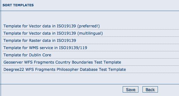
103 3.7. Templates 99
104 3.7.2 Add templates This option allows the user to select the metadata templates to add in the catalog to create new metadata records. Mark the metadata templates to import and click Add templates button to import them in the catalog and make them are avaliable when creating new metadata records. 3.8 Thesaurus Introduction Thesaurus support in GeoNetwork allows: Metadata editing: controlled vocabulary on the metadata editing interface for ISO and Dublin Core Administration interface allows import/export/creation/browse thesaurus Search interface: a list of keyword is proposed for the keyword criteria On a node, thesaurus types could be defined as: External: When a thesaurus is imported, it is flagged to external which means that users are not allowed to edit the thesaurus. This thesaurus is managed by an external organisation. Local: When a thesaurus is created, it is flagged to local which means that users are allowed to edit the thesaurus Thesaurus / SKOS format The Simple Knowledge Organisation Systems (SKOS) is an area of work developing specifications and standards to support the use of knowledge organisation systems (KOS) such as thesauri, classification schemes. This format is used by GeoNetwork to store thesaurus information. A concept is defined by an identifier, a preferred label, a definition and links with other concepts. Labels and definitions could be stored in multiple languages (using the xml:lang attributes). Three type of links between concepts have been defined in the SKOS format: related terms broader terms narrower terms For example, a concept ABLETTE could be defined as follow with a label in French and English, linked to broader concept: 100 Chapter 3. Administration

105 <skos:concept rdf:about=" <skos:preflabel xml:lang="fr">ablette</skos:preflabel> <skos:preflabel xml:lang="en">bleak</skos:preflabel> <skos:broader rdf:resource=" </skos:concept> GeoNetwork support multilingual thesaurus (e.g. Agrovoc). Search and edition are made based on current user interface language (i.e. if the interface is in English, when editing metadata, GeoNetwork will only search for concept in English) Thesaurus administration To reach the thesaurus administration page you have to be logged in as an administrator. From the administration page, click the link Manage thesauri. The page shows a list of thesaurus that have been created or imported. The upper part of the page allows user to edit/add/modify/consult thesaurus. The lower part allows upload of thesaurus in SKOS format. Creation of a new thesaurus To create a new thesaurus, click the + sign in the category you want your thesaurus to be in. Once created, the thesaurus could be updated through the edit interface. The meaning of each column is as follows: Type - The type allows to classify thesaurus according to its type. First, is defined the type of the thesaurus following ISO category list, then the type indicates if the thesaurus is a local one or an external one. Name - This is the thesaurus s name provided by the administrator on creation or filename on upload. When creating a thesaurus, the name of the thesaurus will be the filename of the thesaurus. Figure 3.31: Administration interface for thesaurus For each thesaurus the following buttons are available: Download - Link to the RFD file. Delete - Remove thesaurus from the current node Thesaurus 101
106 View - If type is external, the view button allows to search and view concepts. Edit - If type is local, the edit button allows to search, add, remove and view concepts. Import existing thesaurus GeoNetwork allows thesaurus import in SKOS format. Once uploaded, an external thesaurus could not be updated. Select the category, browse for the thesaurus file and click upload. The file is located in /web/xml/codelist/external/thesauri/category/. Figure 3.32: Upload interface for thesaurus At the bottom of the page there are the following buttons: 1. Back: Go back to the main administration page. 2. Upload: Upload the selected RFD file to the node. Then it will list all thesaurus available on the node Editing/browsing thesaurus: add/remove/browse keywords From the thesaurus administration interface, click on the edit button for a local thesaurus or the view button for an external thesaurus. This interface allows: keywords search add/remove keywords for local thesaurus. Use the textbox and the type of search in order to search for keywords Metadata editing: adding keywords When editing metadata in ISO, it allows editors to: - do one or more searches in all thesaurus registered in the catalogue. - select one or more keywords added to the selected items list (using arrows or drag & drop) on the right. - add the selected keywords directly into metadata, grouping keywords by thesaurus. The search interface allows editors to choose the maximum number of keywords to returns, and the thesaurus to search into (default is all) Search criteria: keywords In the advanced search interface, search for keyword is available. By default, the keyword field will proposed all keywords used in the metadata. These keywords are indexed by Lucene on creation/update of metadata. The number of metadata linked to all keywords 102 Chapter 3. Administration


107 Figure 3.33: Browse interface for thesaurus Figure 3.34: Keyword description 3.8. Thesaurus 103
 36: Keyword")
108 Figure 3.35: Keyword selection interface (editing mode) Figure 3.36: Keyword selection (view mode) 104 Chapter 3. Administration

109 available in the index are display. User could type in the keyword field or click the icon to get the list of keywords available. Figure 3.37: Thesaurus search interface Figure 3.38: Auto-complete function in thesaurus search interface By configuring the config-gui.xml file in the WEB-INF directory, search for keyword using the advanced keyword selection panel is available as in the metadata editor: <search> <!-- Display or not keyword selection panel in advanced search panel <keyword-selection-panel/> --> </search> 3.9 GeoNetwork s Administrator Survival Tool - GAST What is GAST? GAST stands for GeoNetwork s Administrator Survival Tool and is a standalone application whose purpose is to simplify some low level tasks like change of the servlet, configuration of the JDBC account, setup the database and so on. Most of the GAST s facilities work only for the GeoNetwork s installation where GAST is in. This implies that if you are using a servlet container other than Jetty (like Tomcat) you will not be able to change some options (like the servlet s name). Other facilities work for any servlet container but you have to specify the GeoNetwork s URL into the GAST s configuration dialogue Starting GAST GAST belongs to the core components so it is installed by default. On Windows computers, simply select the Start GAST option under the GeoNetwork opensource program group under Start Programs GeoNetwork opensource 3.9. GeoNetwork s Administrator Survival Tool - GAST 105

110 Other options to start GAST are either to use a Java command from a terminal window or just click its jar s icon. To issue the Java command you have to: 1. change directory to the GeoNetwork installation folder 2. issue the command java -jar gast/gast.jar GAST will be in current system language if any translation is available. If you want to force GAST GUI language, you could start GAST using the -Duser.language option (e.g../gast.sh -Duser.language=fr or java -Duser.language=fr -jar gast/gast.jar). You can also try to simply open the GeoNetwork installation folder, go to the gast folder and double click on the gast.jar file. If you have Java installed, GAST should start in a few seconds. To run, GAST requires Java 1.5. It will not work on Java 1.4 and it should run on Java Operating modes On the left side you have a panel with the tools you can use. After selecting a tool, on the right side you get the tool s options panel. Figure 3.39: GAST s main window with a tool selected Every function has an operating mode, which defines the condition under which the tool can be used. The tool s mode is shown with an icon on the right side of the tool s name. The operating modes, with their icons are summarised in the following table: 106 Chapter 3. Administration

111 Mode Icon Description Restarted Running Stopped The tool can be always used, but GeoNetwork must be restarted in order to make the change effective. The tool can be used only if GeoNetwork is running. The tool can be used only if GeoNetwork is stopped. This is important because some tools change the database s account or create the database from scratch. These are sensitive operations that cannot be performed while GeoNetwork is running Tools subdivision All GAST tools present into the left panel are logically subdivided into groups. Each group represents a GeoNetwork s aspect for which GAST allows you a graphic interface. The groups are: Configuration You can change some configuration parameters, like the servlet s name, JDBC account etc... Management General purpose tools related to the site s administration. Database Operations that regard the database. Here you can find tools to create a database from scratch, creating the schema and filling it with proper data. Migration Tools that allow you to migrate metadata from old installation Server and Account configuration dialogue Some of the GAST s tools access a running GeoNetwork application. Usually, GAST connects to GeoNetwork using the connection parameters it finds on the installation folder but you can specify other parameters in order to connect to other instances. This is required when the GeoNetwork instance is not running on the embedded Jetty server. In addition to that, some tools require authentication so account parameters must be provided. To provide these parameters, you have to use the GAST s configuration dialogue. To open the dialogue, select Options >> Config from the menu bar. You will get the following dialogue: Figure 3.40: The configuration dialogue 3.9. GeoNetwork s Administrator Survival Tool - GAST 107
112 The dialogue is subdivided into 2 areas: Server - Tells GAST how to connect to a running GeoNetwork. If you select the embedded option, GAST will get the connection parameters from the installation directory. Alternatively, if you use Tomcat or an external servlet container you have to choose the external option and provide the connection parameters yourself. Remember that this will work only for tools which operating mode is Running. For all the others, GAST will access the parameters from the installation directory. Account - Some tools require authentication. To authenticate, simply select the Use this account option and provide the username and password of a valid account. These parameters will work for both the embedded instance and for any external instance Localization Localization of dynamic user interface elements The user interface of GeoNetwork can be localized into several languages through XML language files. Beside static text, there is also more dynamic text that can be added and changed interactively. This text is stored in the database and is translated using the Localization form that is part of the administrative functions. Figure 3.41: How to open the Localization form The form allows you to localize the following entities: Groups, Categories, Operations and Regions. The localization form is subdivided in a left and a right panel. The left panel allows you to choose which elements you want to edit. On the top, a dropdown let you choose which entity to edit. All elements of the selected type are shown in a list. 108 Chapter 3. Administration

113 When you select an element from the list, the right panel will show the text as it will be displayed in the user interface. The text in the source language is read only while you can update the text in the target language field. Note: You can change the source and target languages to best suit your needs. Some users may for instance prefer to translate from French to Spanish, others prefer to work with English as the source language. Use the Save button to store the updated label and move to the next element. Warning: If the user changes a label and chooses another target language without saving, the label change is lost. Figure 3.42: The Localization form 3.11 Import / export tools Introduction Using GAST, you can import and export metadata at will. It allows you to: 1. Create a backup of the entire metadata set. Each metadata has its own file, including maps and other data files. Once you have the backup, you can decide to import all or only some of them. 2. Move your metadata from one GeoNetwork catalogue to another. This can be done to mirror your metadata or to upgrade an old installation. In the last case, you export your metadata from your old installation and then re-import them into the new one Import / export tools 109

114 3. Fill the system with test data. Using the skip UUID option, you can re-import the same metadata over and over again. This is useful, for example, if you want to perform stress tests. Metadata are exported in the MEF format. Warning: Ownership - Please, consider that the MEF format version 1.0 does not take into account user and group ownership. When exporting metadata, you loose this information. When importing metadata, the new owner becomes the user that is performing the import while the group ownership is set to null Import This tool is located under Management tools on the left panel and allows you to import a set of metadata that have been previously exported using the export facility. Selecting the Import tool opens the option panel. Figure 3.43: The metadata import panel Input folder - The source folder in your system that GAST will scan to collect metadata to import. GAST will try to import all files with the MEF extension. Browse button - Navigate through your file system to choose an output location or enter it manually into the text field. Import - This will start the process. A progress dialogue will be opened to show the import status. Note: Sub-folders are not scanned Export This tool is located under the Management tool on the left panel and allows you to export a set of metadata using the MEF format. Selecting the Export tool opens the option panel. Output folder - The target folder in your file system where GAST will put the exported metadata. You can either select the Browse button to navigate through your file system to choose a better location or enter it manually in the text field. 110 Chapter 3. Administration
 but you will be able to re-import that metadata over and over again. This is useful to fill the system with test data.")
115 Figure 3.44: The metadata export panel Format - Here you can specify the metadata s output format. See the MEF specification for more information. Skip UUID - Normally this option is not required. If you select it, you will loose the metadata s unique identifier (UUID) but you will be able to re-import that metadata over and over again. This is useful to fill the system with test data. Search - Allows to specify free text search criteria to limit the set of exported records. Export - This will start the export process. A progress dialogue will be opened to show the export status. Note: The result of the export will depend on the access privileges of the user. If you do not authenticate, you will get only public metadata. Warning: Skipping the UUID on import or export can cause metadata to be duplicated. This should normally always be avoided Import / export tools 111
GeoNetwork User Manual
 GeoNetwork User Manual Release 2.10.4-0 GeoNetwork December 22, 2014 Contents 1 Preface 3 1.1 About this Project..................................... 3 1.2 License Information....................................
GeoNetwork User Manual
 GeoNetwork User Manual Release 2.10.4-0 GeoNetwork December 08, 2017 Contents 1 Preface 3 1.1 About this Project............................................ 3 1.2 License Information...........................................
The complete manual. By the developers. V 2.4 Copyright The Open Source Geospatial Foundation
 The complete manual By the developers V 2.4 Copyright 2007-2009 The Open Source Geospatial Foundation Table of Contents Preface... vi I. User Guide... 1 1. A Geographic Information Management System for
Description. Speaker Patrizia Monteduro (International Consultant, FAO) TRAINING GEONETWORK OPENSOURCE Islamabad, Pakistan, Jan 29-31, 2014
 TRAINING GEONETWORK OPENSOURCE Islamabad, Pakistan, Jan 29-31, 2014") BUILDING PROVINCIAL CAPACITY IN PAKISTAN FOR CROP ESTIMATION, FORECASTING, AND REPORTING BASED ON THE INTEGRATED USE OF REMOTELY SENSED DATA (GCP/PAK/125/USA) Description Speaker Patrizia Monteduro (International
BUILDING PROVINCIAL CAPACITY IN PAKISTAN FOR CROP ESTIMATION, FORECASTING, AND REPORTING BASED ON THE INTEGRATED USE OF REMOTELY SENSED DATA (GCP/PAK/125/USA) Description Speaker Patrizia Monteduro (International
Benefits of CORDA platform features
 Benefits of CORDA platform features Functionalities, main tools and the benefits of using CORDA platform Copernicus service providers (land monitoring and emergency services) require reference data for
Sharing geographic data across the GEF IW Portfolio: IW:LEARN Web-based GIS
 1 Sharing geographic data across the GEF IW Portfolio: IW:LEARN Web-based GIS 16-22 March 2009 Sean Khan (Project Manager) sean.khan@unep.org Dr. Richard Cooper (Regional Coordinator) richard@iwlearn.org
GeoNetwork opensource
 GeoNetwork opensource Spatial data management Geographic data sharing for everyone 20070907 François Prunayre FOSS4G2007 - LAB09 1 Getting started with GeoNetwork opensource Installation at a glimpse Directory
Initial Operating Capability & The INSPIRE Community Geoportal
 INSPIRE Conference, Rotterdam, 15 19 June 2009 1 Infrastructure for Spatial Information in the European Community Initial Operating Capability & The INSPIRE Community Geoportal EC INSPIRE GEOPORTAL TEAM
How to Create Metadata in ArcGIS 10.0
 How to Create Metadata in ArcGIS 10.0 March 2012 Table of Contents Introduction... 1 Getting Started... 2 Software Requirements... 2 Configure ArcGIS Desktop to View FGDC Metadata... 2 Other Thoughts...
The geospatial metadata catalogue. FOSS4G Barcelona. Jeroen Ticheler. Founder and chair. Director
 The geospatial metadata catalogue FOSS4G2010 - Barcelona Jeroen Ticheler Director Founder and chair GeoNetwork opensource Dutch National Geo Registry FAO GeoNetwork SwissTopo geocat.ch GeoNetwork history
Risk Habitat Megacity
 Contact Internet: Coordination: Data management: www.risk-habitat-megacity.ufz.de Dr. Dirk Heinrichs [dirk.heinrichs@ufz.de] Dr. Kerstin Krellenberg [kerstin.krellenberg@ufz.de] Christian Gadge [christian.gadge@ufz.de]
Knowledge Inventory for hydrogeology research
 Knowledge Inventory for hydrogeology research This project has received funding from the European Union s Horizon 2020 research and innovation programme under grant agreement No 642047. REDIAM Environmental
Roxen Content Provider
 Roxen Content Provider Generation 3 Templates Purpose This workbook is designed to provide a training and reference tool for placing University of Alaska information on the World Wide Web (WWW) using the
ECP-2007-GEO OneGeology-Europe. Annex 1: Cookbook
 ECP-2007-GEO-317001 OneGeology-Europe Annex 1: Cookbook for creating multilingual metadata records using the OneGeology-Europe Metadata system (MIcKA) Authors: Lucie Kondrová, Robert Tomas, Štěpán Kafka
User Guide. Kronodoc Kronodoc Oy. Intelligent methods for process improvement and project execution
 User Guide Kronodoc 3.0 Intelligent methods for process improvement and project execution 2003 Kronodoc Oy 2 Table of Contents 1 User Guide 5 2 Information Structure in Kronodoc 6 3 Entering and Exiting
Compass INSPIRE Services. Compass INSPIRE Services. White Paper Compass Informatics Limited Block 8, Blackrock Business
 Compass INSPIRE Services White Paper 2010 Compass INSPIRE Services Compass Informatics Limited Block 8, Blackrock Business Park, Carysfort Avenue, Blackrock, County Dublin, Ireland Contact Us: +353 1 2104580
DataCollect Administrative Tools Supporting DataCollect (CMDT 3900) Version 3.0.0
 Version 3.0.0") Administrator Manual DataCollect Administrative Tools Supporting DataCollect (CMDT 3900) Version 3.0.0 P/N 15V-090-00054-100 Revision A SKF is a registered trademark of the SKF Group. All other trademarks
Administrator Manual DataCollect Administrative Tools Supporting DataCollect (CMDT 3900) Version 3.0.0 P/N 15V-090-00054-100 Revision A SKF is a registered trademark of the SKF Group. All other trademarks
Welcome to the Investor Experience
 Welcome to the Investor Experience Welcome to the Black Diamond Investor Experience, a platform that allows advisors to customize how they present information to their clients. This document provides important
Sourcing - How to Create a Negotiation
 Martin Baker Secure Source-To-Pay Sourcing - How to Create a Negotiation December 07 Contents To Create a Project... To Create a Negotiation... 5 Attachments... 7 Private File Archive... 7 Creating Lines,
ArcGIS Server: publishing geospatial data to the web using the EEA infrastructure
 ArcGIS Server: publishing geospatial data to the web using the EEA infrastructure *IMPORTANT: Map Services should be published using the EEA Map Services Tick Sheet for guidance. Contact Sebastien Petit
TemperateReefBase Data Submission
 TemperateReefBase Data Submission Home Help Sign In TemperateReefBase Data Submission An open source tool for capturing research data - simplifying the process of gathering information in a standard format
ARCHITECTURE OF SPATIAL DATA INFRASTRUCTURE (SDI) (DRAFT)
 (DRAFT)") ARCHITECTURE OF SPATIAL DATA INFRASTRUCTURE (SDI) (DRAFT) Author: Carlo Cipolloni September 20, 2018 Version 1.0 A SDI platform to support the SEIS in the ENP South region Introduction Based on the Contribution
ARCHITECTURE OF SPATIAL DATA INFRASTRUCTURE (SDI) (DRAFT) Author: Carlo Cipolloni September 20, 2018 Version 1.0 A SDI platform to support the SEIS in the ENP South region Introduction Based on the Contribution
User Documentation. Studywiz Learning Environment. Student's Guide
 User Documentation Studywiz Learning Environment Student's Guide Studywiz Learning Environment Student's Guide Contents 1 Introduction 4 1.1 Studywiz 4 1.2 The Studywiz Student s Guide 4 2 What s New
This document contains information that will help you to create and send graphically-rich and compelling HTML s through the Create Wizard.
 This document contains information that will help you to create and send graphically-rich and compelling HTML emails through the Create Email Wizard. or warranty by AT&T and is subject to change. 1 Contents
Instructions on the use of the AODN s MEST Metadata Entry and Search Tool (M.E.S.T)
") Instructions on the use of the AODN s MEST Metadata Entry and Search Tool (M.E.S.T) http://bluenet.its.utas.edu.au Document Version 1.0 Last updated 06 August 2008 1. Introductory note:...2 2. Searching
Instructions on the use of the AODN s MEST Metadata Entry and Search Tool (M.E.S.T) http://bluenet.its.utas.edu.au Document Version 1.0 Last updated 06 August 2008 1. Introductory note:...2 2. Searching
CUMULUS WEB CLIENT USER ASSISTANCE 2014, CANTO GMBH. ALL RIGHTS RESERVED. Welcome!
 Cumulus is Canto s state-of-the-art Digital Asset Management solution. Cumulus makes it easy to quickly organize, find, share, and track all of your digital files: photos, logos, presentations, videos,
Open Geospatial Consortium
 Open Geospatial Consortium Date: 28-March-2011 Reference number of this document: 10-195 Editors: OGC Aviation Domain Working Group Requirements for Aviation Metadata Copyright 2011 Open Geospatial Consortium.
European Commission FSF. - Financial Sanctions Files - Administrators' User Guide DIRECTORATE GENERAL DEVCO R4
 European Commission DIRECTORATE GENERAL DEVCO R4 FSF - Financial Sanctions Files - Administrators' User Guide 1 Table of Contents 1 INTRODUCTION... 3 1.1 LOG IN... 3 1.2 USE QUICK PRESENTATION OF THE MENU
Introduction to INSPIRE. Network Services
 Introduction to INSPIRE. Network Services European Commission Joint Research Centre Institute for Environment and Sustainability Digital Earth and Reference Data Unit www.jrc.ec.europa.eu Serving society
Desire2Learn eportfolio
 This training guide will provide you with the skills to create and manage an online repository for storing your digital artefacts and experiences. can be used by students and academics alike, to record
COMMUNITIES USER MANUAL. Satori Team
 COMMUNITIES USER MANUAL Satori Team Table of Contents Communities... 2 1. Introduction... 4 2. Roles and privileges.... 5 3. Process flow.... 6 4. Description... 8 a) Community page.... 9 b) Creating community
Knowledge Hub Walkthrough
 Knowledge Hub Walkthrough Welcome page Sign in Use your Knowledge Hub account to sign in. Register Are you new to the Knowledge Hub, then please register a new account Forgotten Password? You will be asked
EFM Community 3.1 Portal Administration Guide
 EFM Community 3.1 Portal Administration Guide WHITE PAPER For technical support please call: 1-800-787-8755 Or visit: Hwww.Vovici.comH Please contact Vovici technical support if you believe any of the
DanubeGIS User Manual Document number: Version: 1 Date: 11-Nov-2016
 DanubeGIS User Manual Document number: Version: 1 Date: 11-Nov-2016 Imprint Published by: ICPDR International Commission for the Protection of the Danube River ICPDR 2016 Contact ICPDR Secretariat Vienna
Introduction to GeoServer
 Tutorial ID: This tutorial has been developed by BVIEER as part of the IGET web portal intended to provide easy access to geospatial education. This tutorial is released under the Creative Commons license.
Salesforce CRM Content Implementation Guide
 Salesforce CRM Content Implementation Guide Salesforce, Winter 18 @salesforcedocs Last updated: October 13, 2017 Copyright 2000 2017 salesforce.com, inc. All rights reserved. Salesforce is a registered
Tzunami Deployer Oracle WebCenter Interaction Exporter Guide
 Tzunami Deployer Oracle WebCenter Interaction Exporter Guide Supports extraction of Oracle WebCenter Interaction components and migrate to Microsoft SharePoint using Tzunami Deployer Version 2.8 Table
Administrative Training Mura CMS Version 5.6
 Administrative Training Mura CMS Version 5.6 Published: March 9, 2012 Table of Contents Mura CMS Overview! 6 Dashboard!... 6 Site Manager!... 6 Drafts!... 6 Components!... 6 Categories!... 6 Content Collections:
Web Page Basics. FRSD Elementary Technology Workshop. February Presented by Lisa Stewart, Tammy Gianvito, and Diane Kaufmann
 Web Page Basics FRSD Elementary Technology Workshop February 2014 Presented by Lisa Stewart, Tammy Gianvito, and Diane Kaufmann Please save this booklet for future reference. 2 P a g e Notes and Questions
Salesforce CRM Content Implementation Guide
 Salesforce CRM Content Implementation Guide Salesforce, Summer 16 @salesforcedocs Last updated: June 7, 2016 Copyright 2000 2016 salesforce.com, inc. All rights reserved. Salesforce is a registered trademark
Administrator Manual. Last Updated: 15 March 2012 Manual Version:
 Administrator Manual Last Updated: 15 March 2012 Manual Version: 1.6 http://www.happyfox.com Copyright Information Under the copyright laws, this manual may not be copied, in whole or in part. Your rights
Tzunami Deployer Oracle WebCenter Interaction Exporter Guide
 Tzunami Deployer Oracle WebCenter Interaction Exporter Guide Supports extraction of Oracle WebCenter Interaction components and migrate to Microsoft SharePoint using Tzunami Deployer Version 3.2 Table
Learn how to login to Sitefinity and what possible errors you can get if you do not have proper permissions.
 USER GUIDE This guide is intended for users of all levels of expertise. The guide describes in detail Sitefinity user interface - from logging to completing a project. Use it to learn how to create pages
EQUELLA. Moodle User Guide. Version 6.2
 EQUELLA Moodle User Guide Version 6.2 Document History Document No. Reviewed Finalised Published 1 12/12/2013 13/12/2013 13/12/2013 December 2013 edition. Information in this document may change without
Deliverable D3.12. Contract number: OJEU 2010/S Deliverable: D3.12 Author: Igor Antolovic Date: Version: Final
 Deliverable D3.12 Final and public version of the implemented web site with full functionality that hosts all relevant information on the Climate Atlas of the Carpathian Region, including a public download
CollabNet Desktop - Microsoft Windows Edition
 CollabNet Desktop - Microsoft Windows Edition User Guide 2009 CollabNet Inc. CollabNet Desktop - Microsoft Windows Edition TOC 3 Contents Legal fine print...7 CollabNet, Inc. Trademark and Logos...7 Chapter
The European Commission s science and knowledge service. Joint Research Centre
 The European Commission s science and knowledge service Joint Research Centre GeoDCAT-AP The story so far Andrea Perego, Antonio Rotundo, Lieven Raes GeoDCAT-AP Webinar 6 June 2018 What is GeoDCAT-AP Geospatial
Administrator Manual. Last Updated: 15 March 2012 Manual Version:
 Administrator Manual Last Updated: 15 March 2012 Manual Version: 1.6 http://www.helpdeskpilot.com Copyright Information Under the copyright laws, this manual may not be copied, in whole or in part. Your
PROSPECT USER MANUAL
 PROSPECT USER MANUAL 1 Table of Contents 1. INTRODUCTION...3 1.1 WHAT IS PROSPECT?... 3 2. BEFORE STARTING: TIPS TO HELP YOU WITH YOUR APPLICATION...4 3. ACCESSING AND SUBMITTING AN APPLICATION WITH PROSPECT...5
HCA ArcGIS. Online Tool - How To Guide V1.0 2/15/2016 HAWAII CONSERVATION ALLIANCE AGOL
 HCA ArcGIS 2/15/2016 Online Tool - How To Guide V1.0 HAWAII CONSERVATION ALLIANCE AGOL Table of Contents What is ArcGIS Online?... 1 Getting Started... 1 Getting a Login... 1 Logging In... 2 Searching
Metadata for Data Discovery: The NERC Data Catalogue Service. Steve Donegan
 Metadata for Data Discovery: The NERC Data Catalogue Service Steve Donegan Introduction NERC, Science and Data Centres NERC Discovery Metadata The Data Catalogue Service NERC Data Services Case study:
GeoDCAT-AP Representing geographic metadata by using the "DCAT application profile for data portals in Europe"
 GeoDCAT-AP Representing geographic metadata by using the "DCAT application profile for data portals in Europe" Andrea Perego, Vlado Cetl, Anders Friis-Christensen, Michael Lutz, Lorena Hernandez Joint
CMS Shado 9. Quick Start Guide
 CMS Shado 9 Quick Start Guide 1 Logging In 3 Shado Central Interface 4 Sections, Pages and Containers 7 Sections 7 Pages 7 Containers 7 The Site Tree 8 Edit Content on a Page 9 Editing Container Content
Tzunami Deployer AquaLogic Exporter Guide Supports extraction of Web Components on the server and guides migration to Microsoft SharePoint.
 Tzunami Deployer AquaLogic Exporter Guide Supports extraction of Web Components on the server and guides migration to Microsoft SharePoint. Version 2.7 Table of Content PREFACE... I INTENDED AUDIENCE...
MY DEWETRA IPAFLOODS REPORT
 Grant Contract N. ECHO/SUB/2014/692292 Programme for Prevention, Preparedness and Response to Floods in the Western Balkans and Turkey IPA FLOODS Capacity Building Activities 2016 MY DEWETRA IPAFLOODS
SIMSme Management Cockpit Documentation
 Introduction SIMSme Management Cockpit Documentation Version 2.1 February 2018 Table of Contents 1 INTRODUCTION... 2 2 USERS... 3 3 LICENSES... 5 4 GROUPS... 7 5 CHANNELS... 8 6 DASHBOARD...10 7 APP SETTINGS...12
Microsoft Windows SharePoint Services
 Microsoft Windows SharePoint Services SITE ADMIN USER TRAINING 1 Introduction What is Microsoft Windows SharePoint Services? Windows SharePoint Services (referred to generically as SharePoint) is a tool
Drupal 7 Template. Page 1 of 27. Site Title. Navigation Tabs. Homepage Slide. Social Media. News article. Events. Links. Contact Information
 Site Title Navigation Tabs Homepage Slide News article Social Media Events Contact Information Links Page 1 of 27 Table of Contents USER ACCOUNT... 3 Edit Profile... 3 CONTENT... 5 ADD CONTENT... 5 BASIC
Interactive Voice Response (IVR) Extension Type Guide
 Extension Type Guide") 4PSA VoipNow 2.0.3 Interactive Voice Response (IVR) Extension Type Guide For more information about 4PSA VoipNow, check: http://www.voipnow.com Copyrights 2002-2009 Rack-Soft, LLC. VoipNow is a registered
4PSA VoipNow 2.0.3 Interactive Voice Response (IVR) Extension Type Guide For more information about 4PSA VoipNow, check: http://www.voipnow.com Copyrights 2002-2009 Rack-Soft, LLC. VoipNow is a registered
Webmail 7.0 is an online client which runs in your web browser. Webmail 7.0 allows you to access your , contact list, and calendar from
 Webmail 7.0 is an online email client which runs in your web browser. Webmail 7.0 allows you to access your email, contact list, and calendar from any computer with an internet connection and a web browser.
Contents. Announcer Pro Version 4.6 Page 2 of 35 Version V4.6
 User Guide Contents 1. Introduction... 3 1.1. Getting Started... 3 1.2. Navigation... 4 2. Create a Newsletter... 6 2.1. Confirm Company Details... 6 2.2. Choose Template... 8 2.3. Edit Newsletter... 8
SAP Jam Communities What's New 1808 THE BEST RUN. PUBLIC Document Version: August
 PUBLIC Document Version: August 2018 2018-10-26 2018 SAP SE or an SAP affiliate company. All rights reserved. THE BEST RUN Content 1 Release Highlights....3 1.1 Anonymous access to public communities....4
INSPIRE WS2 METADATA: Describing GeoSpatial Data
 WS2 METADATA: Describing GeoSpatial Data Susana Fontano Planning General concepts about metadata The use of standards Items about the creation of metadata Software How to create metadata The ISO19115 Standard
Administrator Quick Guide
 1 Administrator Quick Guide Login Screen The first page employees will see when visiting their training site is the login screen. This is where employees must enter their username and password to access
REACH SCREEN SYSTEMS. System Support Manual. User manual for operating the REACH Announcement Tool, Scheduling Tool, and Touch Screen Systems.
 REACH SCREEN SYSTEMS System Support Manual User manual for operating the REACH Announcement Tool, Scheduling Tool, and Touch Screen Systems. Table of Contents REACH Announcement Tool... 4 Overview... 4
Legal Notes. Regarding Trademarks KYOCERA MITA Corporation
 Legal Notes Unauthorized reproduction of all or part of this guide is prohibited. The information in this guide is subject to change without notice. We cannot be held liable for any problems arising from
GeoNode Integration with SDIs and Community Mapping
 GeoNode Integration with SDIs and Community Mapping Salvador Bayarri sbayarri@gmail.com World Bank Consultant Contents Accessing other SDI services Catalog harvesting through Geonetwork Cascading external
Network Rail Brand Hub USER GUIDE
 Network Rail Brand Hub USER GUIDE The Brand Hub Using keywords, visual thumbnails and a more upto-date online interface, the new Brand Hub will make searching, browsing and downloading images, templates
THE NEW NATIONAL ATLAS OF SPAIN ON INTERNET
 CO-343 THE NEW NATIONAL ATLAS OF SPAIN ON INTERNET PEREZ N., SANCHEZ-ORTIZ P., ALONSO J.J., ROMERA C. NATIONAL GEOGRAPHIC INSTITUTE, MADRID, SPAIN 1. BACKGROUND AND OBJECTIVES In 2009, the National Atlas
FileMaker, Inc. All Rights Reserved. Document Version 2.0 FileMaker, Inc Patrick Henry Drive Santa Clara, California FileMaker
 User s Guide 2003-2004 FileMaker, Inc. All Rights Reserved. Document Version 2.0 FileMaker, Inc. 5201 Patrick Henry Drive Santa Clara, California 95054 FileMaker is a trademark of FileMaker, Inc., registered
SharePoint 2010 Tutorial
 SharePoint 2010 Tutorial TABLE OF CONTENTS Introduction... 1 Basic Navigation... 2 Navigation Buttons & Bars... 3 Ribbon... 4 Library Ribbon... 6 Recycle Bin... 7 Permission Levels & Groups... 8 Create
panmetaworks User Manual Version 1 July 2009 Robert Huber MARUM, Bremen, Germany
 panmetaworks A metadata based scientific information exchange system User Manual Version 1 July 2009 Robert Huber MARUM, Bremen, Germany panmetaworks is a collaborative, metadata based data and information
Guide to EST data input for beneficiaries
 Guide to EST data input for beneficiaries Comenius school partnerships Comenius Regio Leonardo da Vinci Partnerships Grundtvig Learning Partnerships Grundtvig Senior Volunteering projects Contents 1. Introduction...3
Designing Adhoc Reports
 Designing Adhoc Reports Intellicus Enterprise Reporting and BI Platform Intellicus Technologies info@intellicus.com www.intellicus.com Copyright 2010 Intellicus Technologies This document and its content
Table Of Contents. iii
 Table Of Contents Welcome... 1 Using the Content Repository... 3 Content Repository Overview... 3 Description... 3 Repository File Types... 4 Working with the Repository... 6 Content Repository Interface...
User Manual For SmartRoom Managers
 User Manual For SmartRoom Managers Table of Contents 1.0 Login 2.0 Confidentiality Agreement 3.0 Software Installation 4.0 Dashboard 5.0 Document Review and Index Maintenance 5.1 View by Index 5.1.1 Index
myexplorer Channel Admin Guide
 myexplorer Channel Admin Guide 2017 PETROLIAM NASIONAL BERHAD (PETRONAS) All rights reserved. No part of this document may be reproduced, stored in a retrieval system or transmitted in any form or by any
Get started with PING PONG
 Get started with PING PONG - User guide for lecturers Version 1 Get started with PING PONG User guide for lecturers. Version 1 Anita Eklöf, Faculty of Librarianship, Information, Education and IT, University
GETTING STARTED 8 December 2016
 GETTING STARTED 8 December 2016 About Platform... 4 Browser support... 5 Registration Registering as a Teacher... 6 Registering as a Student... 6 Registering as School... 6 Registering as Municipality
Océ Posterizer Pro Designer. POP into retail. User manual Application guide
 - Océ Posterizer Pro Designer POP into retail o User manual Application guide Copyright copyright-2010 Océ All rights reserved. No part of this work may be reproduced, copied, adapted, or transmitted in
Creating Pages with the CivicPlus System
 Creating Pages with the CivicPlus System Getting Started...2 Logging into the Administration Side...2 Icon Glossary...3 Mouse Over Menus...4 Description of Menu Options...4 Creating a Page...5 Menu Item
Get started with PING PONG
 Get started with PING PONG - Lecturer user guide Version 2 Get started with PING PONG Lecturer user guide. Version 2 Anita Eklöf, Faculty of Librarianship, Information, Education and IT, University of
ArcGIS Desktop: Fundamentals of Cartography
 ArcGIS Desktop: Fundamentals of Cartography Outline Symbology Style Files -.style Layer files -.lyr Labeling Label Classes Label Expressions Map Document files -.mxd Map Template files -.mxt Map Elements
1.1 Create a New Survey: Getting Started. To create a new survey, you can use one of two methods: a) Click Author on the navigation bar.
 Click Author on the navigation bar.") 1. Survey Authoring Section 1 of this User Guide provides step-by-step instructions on how to author your survey. Surveys can be created using questions and response choices you develop; copying content
1. Survey Authoring Section 1 of this User Guide provides step-by-step instructions on how to author your survey. Surveys can be created using questions and response choices you develop; copying content
ibase Manager Net Admin Guide 2005 ibase
 ibase Manager Net Admin Guide 1 ibase Manager Net Table of Contents Section 1 Welcome to the ibase Manager Net Admin Help 3 Section 2 Purpose 3 Section 3 Copyright 3 Section 4 Disclaimer 3 Section 5 Main
Welcome to the Introduction to Mapbender
 0 Welcome to the Introduction to Mapbender Author: Astrid Emde Author: Christoph Baudson Version: 1.0 License: Creative Commons Date: 2010-08-30 1 Table of Contents 1 Project Overview 2 1.1 Geoportal Framework
FileLoader for SharePoint
 Administrator s Guide FileLoader for SharePoint v. 2.0 Last Updated 6 September 2012 Contents Preface 3 FileLoader Users... 3 Getting Started with FileLoader 4 Configuring Connections to SharePoint 8
VolunteerMatters Wordpress Web Platform Calendar Admin Guide. Version 1.1
 VolunteerMatters Wordpress Web Platform Calendar Admin Guide Version 1.1 VolunteerMatters Wordpress Web: Admin Guide This VolunteerMatters Wordpress Web Platform administrative guide is broken up into
Inland Fisheries Ireland Online Application Portal. User Guide IFI/2018/1-4434
 Inland Fisheries Ireland Online Application Portal User Guide IFI/2018/1-4434 USER GUIDE Inland Fisheries Ireland Online Application Portal Document Updated 21/5/2018 Version:1.1 The purpose of this document
METAINFORMATION INFRASTRUCTURE FOR GEOSPATIAL INFORMATION
 2010/2 PAGES 1 7 RECEIVED 15. 6. 2009 ACCEPTED 2. 3. 2010 T. KLIMENT METAINFORMATION INFRASTRUCTURE FOR GEOSPATIAL INFORMATION ABSTRACT Tomáš KLIMENT email: tomas.kliment@stuba.sk Research field: Spatial
ZENworks Reporting System Reference. January 2017
 ZENworks Reporting System Reference January 2017 Legal Notices For information about legal notices, trademarks, disclaimers, warranties, export and other use restrictions, U.S. Government rights, patent
BeetleEye Application User Documentation
 BeetleEye Application User Documentation BeetleEye User Documentation 1 Table of Contents Welcome to the BeetleEye Application... 6 Overview... 6 Navigation... 6 Access BeetleEye... 6 Update account information...
Leveraging metadata standards in ArcGIS to support Interoperability. David Danko and Aleta Vienneau
 Leveraging metadata standards in ArcGIS to support Interoperability David Danko and Aleta Vienneau Leveraging Metadata Standards in ArcGIS for Interoperability Why metadata and metadata standards? Overview
Spontania Administrators Manual
 Spontania Administrators Manual ClearOne 5225 Wiley Post Way Suite 500 Salt Lake City, UT 84116 Telephone 1.800.945.7730 1.801.975.7200 Spontania Support 801-974-3612 TechSales 1.800.705.2103 FAX 1.801.977-0087
KYOCERA Net Admin User Guide
 KYOCERA Net Admin User Guide Legal Notes Unauthorized reproduction of all or part of this guide is prohibited. The information in this guide is subject to change without notice. We cannot be held liable
Tzunami Deployer Documentum Exporter Guide
 Tzunami Deployer Documentum Exporter Guide Supports migration of EMC Documentum content repositories into Microsoft SharePoint using Tzunami Deployer Version 3.2 Table of Contents PREFACE... II INTENDED
Tzunami Deployer Confluence Exporter Guide
 Tzunami Deployer Confluence Exporter Guide Supports extraction of Confluence Enterprise contents and migrate to Microsoft SharePoint using Tzunami Deployer. Version 2.7 Table of Content PREFACE... I INTENDED
ewater SDI for water resource management
 PROJECT GEONETCAST WS 2009/2010 ewater SDI for water resource management Technical Documentation Theresia Freska Utami & Wu Liqun 2/12/2010 I. GEONETWORK 1. Installation e-water uses the software package
EarthLookCZ as Czech way to GMES
 EarthLookCZ as Czech way to GMES Karel Charvat 1 and Petr Horak 1 1 WirelessInfo, Czech Republic, charvat@wirelessinfo.cz Abstract Global Monitoring for Environment and Security is one of 4 ranges of solutions
Mentor User Guide Edited Sept 22, 2011
 Mentor User Guide Edited Sept 22, 2011 Table of Contents 1 Introduction... 4 2 Getting Started... 5 2.1 Logging In... 5 2.2 Navigating Mentor... 6 3 Managing Mentor Groups and User Roles... 7 3.1 Managing