Google Maps Mashups WORKSHOP. Jeff Blossom, Senior GIS Specialist Center for Geographic Analysis. Harvard University gis.harvard.
|
|
|
- Colleen Audra Garrett
- 6 years ago
- Views:
Transcription
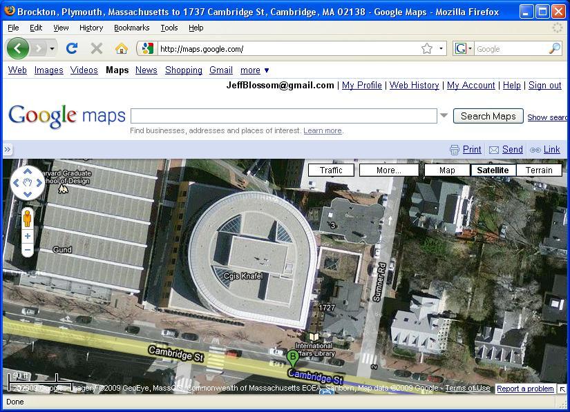
1 Google Maps Mashups WORKSHOP Jeff Blossom, Senior GIS Specialist Center for Geographic Analysis Harvard University gis.harvard.edu Fall, 2012
2 Objectives: Workshop objectives and flow 1) In 2 hour, hands on, interactive session, learn how to create and customize a Google map mashup. 2) Learn a few fundamentals of programming, and gain insight into what skills and knowledge are required to be a successful Google map masher. 3) Learn the differences between Google MyMaps, mashups, and Google Earth and when to use each. Workshop flow: Introduction / Lecture (~20 min.) Lab exercise: Customizing a Basic Map (~90 min.) More exploration / Conclusion (~10 min.)


3 What is a Google Map? Maps.google.com - interactive street, satellite, terrain maps and more.


 A")

4 What is a Google Map? An enormous amount of searchable geographic information (gazetteer) A way of organizing the worlds information geographically

5 What is a Google Map? Maps.google.com > MyMaps create custom maps to share.


6 What is a Google Map? Google MyMaps customize maps with user created enhancements.
7 What is Google Maps - summary A web mapping service, free for noncommercial use that contains: Detailed global basemaps: streets, satellite imagery, and terrain. Useful services such as address and place locating by searching against an information rich gazetteer. Ability to overlay a wide variety of map layers, (weather, traffic) from static or dynamic sources. Map layer creation and light customization through functionality through MyMaps. An API that allows for embedding and extensive customization.
8 Application Programming Interface (API) API - An interface to a software program that allows users to interact and customize it. Determines the vocabulary and calling conventions a programmer uses to employ the software services. Usually based on an existing programming languages (C,.NET, VisualBasic, Java, javascript) Many desktop and web software applications have API s Google Maps API uses javascript

9 Google Maps API Allows embedding of a Google map into one s own web page using javascript. Free to use, on any website that is provided free of charge to others. Relatively gentle learning curve. Highly customizable and easily transferrable. Evolving - new functionality consistently being added.
10 What is a Mashup A web page or application that combines data or functionality from two or more external sources to create a new service. Therefore: MyWebPage + Google Map = mashup Even better: MyWebPage + Google Map + Other web service(s)


11 Google Map mashups examples: embeddable and customizable
12 Markup languages and javascript Markup languages Hyper Text Markup Language (HTML), Extensible Markup Language (XML), Keyhole Markup Language (KML), and many more Text encoding schemes used to create and format a web document. Use tags contained within brackets <> to define formatting that web browsers read. Markup language code sample: <html> <body> <p><b>this a new paragraph of text that is bold</b></p> <p><big>this text is new paragraph of text that is big</big></p> <i>this text is italic</i> </body> </html>

13 Markup languages and javascript Markup language code sample: <html> <body> <p><b>this a new paragraph of text that is bold</b></p> <p><big>this text is new paragraph of text that is big</big></p> <i>this text is italic</i> </body> </html> Rendered in a web browser:

14 Javascript Javascript: A programming language used primarily in web browsers. Uses variables, loops, and functions to generate output on the web. Allows for the development of enhanced user interfaces and dynamic websites. Javascript code sample (Adds a placemark on a Google map) function createmarker(point,html) { var marker = new GMarker(point); GEvent.addListener(marker, "click", function() { marker.openinfowindowhtml(html); }); return marker; } var point = new GLatLng(35.6,-106.8); var marker = createmarker(point, <b>info in Window</b> ); gmap.addoverlay(marker);
15 Lab Exercise Open Firefox Go to Click on Google Maps tutorials Click on Exercise 1: Modifying a Basic Map


")

16 Google Maps API Coordinate System Notation Geographic Decimal Degrees Values of latitude (south to north range from -90 to 90) and longitude (west to east range from -180 to 180) A pair of latitude, longitude values represent a discreet spot on Earth
17 Google Maps, Mashups, and Google Earth Differences and similarities Google Maps A free web application (no software installation necessary) 2 dimensional map view, with street, satellite, terrain basemaps Data creation possible (points, lines, polygons), reads limited kml. A selected set of map overlays and functions available. Specific maps can be saved and shared easily on the web. Google Maps Mashups A free service allowing one to embed a Google Map into a web page. 2 dimensional map view, with street, satellite, terrain basemaps. Highly customizable to include everything in MyMaps and more. Customization requires using javascript and HTML. Requires access to a web-server to publish to the web. Google Earth A free desktop application (downloading and installation necessary). 3 dimensional map view with satellite basemap, many map overlay layers, and a rich set of visualization tools. Data creation possible (points, lines, polygons). Complex kml creation is possible.
18 Google Maps, Mashups, and Google Earth Which one to use? Google Maps Locating, measuring, or learning about the geography of a place. If you want to share a map. Communicate geographic information quickly. Google Maps Mashups Used to embed a map into a new or existing website. Create interactive web maps for your users. Google Earth Visualizing terrain, 3d buildings, historical imagery, and access to many thematic map layers. Virtual tour creation (movies) Small amounts of data collection, geocoding, and image georeferencing.
19 Axioms to follow for fledgling Google mappers If MyMaps or an existing mashup can be used to accomplish your web mapping goal, use it. In your internet browser, use View > Page Source to learn what code is used to produce a specific website. When coding, pay attention to every character. Comment your code thoroughly. Organize, document, and backup your maps and data. Other web map mashup API s exist (Yahoo!, Microsoft, OpenLayers). If Google s API doesn t serve your needs, explore the others.
20 Conclusion Google Maps contains an incredible amount of information with creative, intuitive ways to access and use it. Use Google Maps to communicate geographically!! Please fill out the workshop evaluation at: gis.harvard.edu > Learn GIS > Non Credit Training > scroll to the bottom Contact info: or CGA Website: Course exercise: Power point: Credits: This presentation includes material and information from maps.google.com and wikipedia.org
Data Acquisition using Mashup and 3-D Technology. Matt Rahr College of Agriculture and Life Sciences University of Arizona
 Data Acquisition using Mashup and 3-D Technology Matt Rahr College of Agriculture and Life Sciences University of Arizona Let s Do It! What is a Mashup? + Your Data A hybrid website or web application
Table of contents. DMXzone Google Maps Manual DMXzone.com
 Table of contents Table of contents... 1 About DMXzone Google Maps... 2 Features in Detail... 3 The Basics: Insterting DMXzone Google Maps on a Page... 16 Advanced: Creating Dynamic DMXzone Google Maps...
Google Earth II: Create a tour with Google Earth
 Google Earth II: Create a tour with Google Earth This workshop is a continuation of The Google Earth Workshop I: Map-making Basics. You will create a tour to show the main and satellite campuses of the
Tutorial for Importing Open Green Map Sites into Google Earth
 Tutorial for Importing Open Green Map Sites into Google Earth Step 1. Download your Open Green Map data files by logging in on Open Green Map and viewing your map(s). Choose the Import/Export tab over
Getting Started with the ArcGIS Server JavaScript API
 Getting Started with the ArcGIS Server JavaScript API Agenda Introduction ArcGIS Server services and mashups REST API Services Directory JavaScript API ArcGIS Server Resource Center Dojo Maps, layers,
Data Visualization Techniques with Google Earth
 Data Visualization Techniques with Google Earth E-Learning for the GIS Professional Any Time, Any Place! geospatialtraining.com Course Outline Module 1: Google Earth Pro Fundamentals Module 2: Adding Features
Using Google Earth. Middlebury College Library and Information Services
 Using Google Earth Middlebury College Introduction: While Google Earth can be a fun tool for simply looking at the surface of the earth, there are many other more sophisticated features to explore. Google
Viewer Features. DataBC Mashup Framework (DMF)
") Viewer Features DataBC Mashup Framework (DMF) Copyright 2014 Ministry of Labour, Citizens' Services and Open Government All Rights Reserved. Printed in Canada The information contained in this document
Viewer Features DataBC Mashup Framework (DMF) Copyright 2014 Ministry of Labour, Citizens' Services and Open Government All Rights Reserved. Printed in Canada The information contained in this document
Genealogical Searching the World Wide Web. July 2015 Slides at:
 Genealogical Searching the World Wide Web July 2015 Slides at: http://www.colket.org/genealogy/usf/ Google Earth Overview Use of Google Earth for Genealogy: Get Directions to Research Locations Plan a
Table of contents. DMXzone Google Maps 2 DMXzone
 Table of contents Table of contents... 1 About... 2 Features in Detail... 3 The Basics: Inserting Google Maps on a Page... 20 Advanced: Control Google Maps with Behaviors... 27 Advanced: Track Your Current
Open Source Cloud Map User Guide
 Open Source Cloud Map User Guide Table of Contents Map Page... 1 Static Mercator Map... 1 Customizable Map... 1 Title Bar... 2 Toolbar... 2 Non Toolbar Navigation... 3 Map Window... 3 Layers / Legend Window...
SEXTANT 1. Purpose of the Application
 SEXTANT 1. Purpose of the Application Sextant has been used in the domains of Earth Observation and Environment by presenting its browsing and visualization capabilities using a number of link geospatial
Easy Mapping with Google
 Easy Mapping with Google Applications: Mapping is a great way for students to visualize spatial information to help them develop analytical abilities or conduct research. With Google Maps, it is easy to
Web Mapping Applications with ArcGIS. Bernie Szukalski Derek Law
 Web Mapping Applications with ArcGIS Bernie Szukalski Derek Law Agenda Web Mapping and Map Services Fundamentals ArcGIS Web Mapping Applications - Hosted online - Hosted on-premise Summary Web Application
Help Documentation. Copyright 2007 WebAssist.com Corporation All rights reserved.
 Help Documentation Copyright 2007 WebAssist.com Corporation All rights reserved. Using Pro Maps for Google This wizard adds a Pro Map for Google to your web page, allowing you to configure and specify
RAPIDMAP Geocortex HTML5 Viewer Manual
 RAPIDMAP Geocortex HTML5 Viewer Manual This site was developed using the evolving HTML5 web standard and should work in most modern browsers including IE, Safari, Chrome and Firefox. Even though it was
Building Mashups Using the ArcGIS APIs for FLEX and JavaScript. Shannon Brown Lee Bock
 Building Mashups Using the ArcGIS APIs for FLEX and JavaScript Shannon Brown Lee Bock Agenda Introduction Mashups State of the Web Client ArcGIS Javascript API ArcGIS API for FLEX What is a mashup? What
Road maps. Introduction. Structure
 Road maps Introduction This service let you embed interactive maps in your website (à la Google maps). You can customize map by displaying data in overlays You can create your own overlays. Structure To
Final Project: Integrating ArcGIS Server with Google Maps Creating a Southern California Wildfire Mapping Application
 Final Project: Integrating ArcGIS Server with Google Maps Creating a Southern California Wildfire Mapping Application In the final project for this course you will be creating an integrated Google Maps
Getting Started with ArcGIS for Server. Charmel Menzel and Ken Gorton
 Getting Started with ArcGIS for Server Charmel Menzel and Ken Gorton Agenda What is ArcGIS for Server? Types of Web services Publishing resources onto the Web Clients to ArcGIS for Server Editions and
The Data Journalist Chapter 7 tutorial Geocoding in ArcGIS Desktop
 The Data Journalist Chapter 7 tutorial Geocoding in ArcGIS Desktop Summary: In many cases, online geocoding services are all you will need to convert addresses and other location data into geographic data.
Leverage custom geographical polygons in SAS Visual Analytics
 ABSTRACT Paper SAS1732-2018 Leverage custom geographical polygons in SAS Visual Analytics Falko Schulz, SAS Institute Inc., Brisbane, Australia Discover how you can explore geographical maps using your
Overview. Setting Up. Geospatial Centre University of Waterloo May 2014
 Overview ArcGIS Online is a web-based mapping and app-building site created by Esri, the world leader in GIS software. In an effort to empower users of all levels to create interactive maps and applications
X Slippy Maps. (...and Scott Davis)
") X Slippy Maps (...and Scott Davis) 1 2 Scott Davis 3 4 It was the best of times, it was the worst of times... 5 6 Ajax 7 Static Maps vs. Slippy Maps 8 9 10 Who is the OGC? The Open Geospatial Consortium
X Slippy Maps (...and Scott Davis) 1 2 Scott Davis 3 4 It was the best of times, it was the worst of times... 5 6 Ajax 7 Static Maps vs. Slippy Maps 8 9 10 Who is the OGC? The Open Geospatial Consortium
A MASHUP TECHNOLOGY WITH GOOGLEMAPS AND.NET FRAMEWORK
 A MASHUP TECHNOLOGY WITH GOOGLEMAPS AND.NET FRAMEWORK 1 Terumalasetti Sailaja, 2 Jalgama Ramesh, 3 D.Rajya Lakhsmi 1 Dept. of CSE, UCE-JNTUK Vizianagaram, 2 HPS-ACS, Honeywell Technology Solutions Email
Data to App: Web,Tablet and Smart Phone Duane Griffith, Montana State University,
 Data to App: Web,Tablet and Smart Phone Duane Griffith, Montana State University, griffith@montana.edu This tutorial is broken into several steps related mostly to the technology applied at each step.
Introduction to using QGIS for Archaeology and History Workshop by the Empirical Reasoning Center
 Introduction to using QGIS for Archaeology and History Workshop by the Empirical Reasoning Center In this workshop, we will cover the basics of working with spatial data, as well as its main uses for archaeology.
Juniata County, Pennsylvania
 GIS Parcel Viewer Web Mapping Application Functional Documentation June 21, 2017 Juniata County, Pennsylvania Presented by www.worldviewsolutions.com (804) 767-1870 (phone) (804) 545-0792 (fax) 115 South
Free to download and distribute from
 Topics for this session Introduction Overview of features Using ArcGIS Explorer effectively Customization New features & capabilities Demonstrations *Note: Explorer 1200 What is ArcGIS Explorer GIS for
Using Google Earth Pro
 Using Google Earth Pro (v7.3.2) University of Toronto Mississauga Library Hazel McCallion Academic Learning Centre October 2018 FURTHER ASSISTANCE If you have questions or need assistance contact Tanya
This worksheet will walk you through the basics of creating a digital map using CARTO, a cloud-based GIS and web mapping tools platform.
 MappingBasics This worksheet will walk you through the basics of creating a digital map using CARTO, a cloud-based GIS and web mapping tools platform. The goals of this exercise are: Learn how to geocode
+ Make it from the satellite images in sale, (Easier & Faster, but not always available) (It does cost much. An astronomical number!
 (It does cost much. An astronomical number!") BaseMap: + Look for it among the existent digital maps, (Easiest & Fastest because no processing required) (Therefore, the most desirable, but not always available) (It can cost much) + Make it from the
BaseMap: + Look for it among the existent digital maps, (Easiest & Fastest because no processing required) (Therefore, the most desirable, but not always available) (It can cost much) + Make it from the
Google Earth Pro: A tutorial
 Google Earth Pro: A tutorial 1 OVERVIEW As of early 2015, Google Earth Pro, which used to be a $400 product, is now free. This is a powerful yet simple tool for viewing information geographically whether
Author. Publish. Use
 Building Mashups Using the ArcGIS Web APIs Heather Gonzago Garima Vyas Agenda g Overview: Web Maps Overview: ArcGIS API for REST ArcGIS API for JavaScript p Google Maps Extension Bing Maps Extension ArcGIS
Google Earth an introduction
 Luana Valentini InternetGIS course - 2011 Google Earth an introduction Google Earth combines the power of Google Search with satellite imagery, maps, terrain and 3D buildings to put the world's geographic
Upper Lake Michigan MapBuilder Demo GLOS Mapping Workshop Traverse City, Michigan November 11, 2009
 Upper Lake Michigan MapBuilder Demo GLOS Mapping Workshop Traverse City, Michigan November 11, 2009 Background The purpose of this exercise is to build a web mapping site that integrates different sources/formats
Google Earth Tutorial 1: The Basics of Map-making in Google Earth 6.2
 Google Earth Tutorial 1: The Basics of Map-making in Google Earth 6.2 University of Waterloo Map Library, 2012 Part 1: Placemarks 1. Locating a Geographical Area a. Open up Google Earth. b. In the Search
GPS/GIS Activities Summary
 GPS/GIS Activities Summary Group activities Outdoor activities Use of GPS receivers Use of computers Calculations Relevant to robotics Relevant to agriculture 1. Information technologies in agriculture
Corporation. GeoCode LOS
 Micropath Corporation 2023 Montane Drive East Tel: 303.526-5454 Web: www.micropath.com Golden, Colorado 80401-8099 Fax: 303.526-0202 E-Mail: sales@micropath.com GeoCode LOS GeoCode LOS generates radio
Beginning Google Maps Mashups with Mapplets, KML, and GeoRSS
 Beginning Google Maps Mashups with Mapplets, KML, and GeoRSS From Novice to Professional ш я т Sterling Udell Apress" Contents About the Author About the Technical Reviewer Acknowledgments Introduction
Analysing crime data in Maps for Office and ArcGIS Online
 Analysing crime data in Maps for Office and ArcGIS Online For non-commercial use only by schools and universities Esri UK GIS for School Programme www.esriuk.com/schools Introduction ArcGIS Online is a
INTERRACTION COMPONENT STATE-OF-THE-ART
 INTERRACTION COMPONENT STATE-OF-THE-ART DELIVERABLE D6.1.1 By C2TECH Due date of deliverable : t0+ 6 Actual submission date: t0+ xxx Version :01 State : Draft/For approval/approved/obsolete Dissemination
Google Earth: Significant Places in Your Life Got Maps? Workshop June 17, 2013
 Google Earth: Significant Places in Your Life Got Maps? Workshop June 17, 2013 1. Open Google Earth. 2. Familiarize yourself with Google Earth s navigational features by zooming into Furman s campus, your
An Introduction to Google Earth Pro
 An Introduction to Google Earth Pro Virginia Tech Geospatial Extension Program By: Katherine Britt Ph.D. Candidate Virginia Tech Department of Forest Resources and Environmental Conservation John McGee
WEB GIS USING OPEN-SOURCE TECHNOLOGY AND GOOGLE MAPS API
 WEB GIS USING OPEN-SOURCE TECHNOLOGY AND GOOGLE MAPS API Lantzaki Christina Department of Applied Informatics, University of Macedonia it06135@uom.gr Samaras Nikolaos Department of Applied Informatics,
Tutorial for PGIS in Accra, Ghana
 Tutorial for PGIS in Accra, Ghana Chung-Rui Lee 1, Ick Hoi Kim 2, and Jayesh Patel 3 Welcome to Participatory GIS (PGIS) in Accra, Ghana (access to the PGIS website). This project is funded by NICHD Grant
Best Practices for Designing Effective Map Services
 2013 Esri International User Conference July 8 12, 2013 San Diego, California Technical Workshop Best Practices for Designing Effective Map Services Ty Fitzpatrick Tanu Hoque What s in this session Map
GOOGLE FUSION TABLES AS A GEOGRAPHIC INFORMATION SYSTEM LEARNING TOOLS
 6-05 Google Fusion Tables As A Geographic Information System Learning Tools GOOGLE FUSION TABLES AS A GEOGRAPHIC INFORMATION SYSTEM LEARNING TOOLS Adri Gabriel Sooai Department of Computer Science, Engineering
LIFE N TOUCH KYLE DOBITZ JEREMY MUEHLBAUER. Team Winner 05/01/08
 LIFE N TOUCH KYLE DOBITZ JEREMY MUEHLBAUER Team Winner 05/01/08 Questions Problem: Information is readily available but requires a translation to reality Solution: To create a platform from which applications
Georeferencing Tutorials and Recommended Practices
 March 21, 2008 Georeferencing Tutorials and Recommended Practices Topic Page Introduction 1 Preparing address data for georefernecing 1 Available address geocoders, pros and cons 1 Using Batchgeocode.com
Implementing a User-Oriented Web-based Traffic Data Management and Archive System
 Implementing a User-Oriented Web-based Traffic Data Management and Archive System Timothy J. Welch Department of Computer Science Portland State University P.O. Box 751, Portland, OR, 97207 E-mail: twelch@cs.pdx.edu
Leveraging OGC Services in ArcGIS Server
 Esri International User Conference San Diego, CA Technical Workshops Jul.14 th 2011 Leveraging OGC Services in ArcGIS Server Satish Sankaran Yingqi Tang Agenda Interoperability
Fundisa Web Map Applications
 Fundisa Web Map Applications 2013-01-09 Prepared by SANSA Earth Observation 1 Using the SANSA Fundisa Web Map Applications The Fundisa web map applications were created to aid students in their search
Address Management User Guide. PowerSchool 6.0 Student Information System
 User Guide PowerSchool 6.0 Student Information System Released June 2009 Document Owner: Document Services This edition applies to Release 6.0 of the PowerSchool Premier software and to all subsequent
PlaceMap. Accommodation. Slide 1
 PlaceMap for Accommodation Slide 1 PlaceMap Using the power of Google Earth to store and display all of your spatial data in a much more dynamic way Google Earth is a free software program that lets you
Design and Development of a Dynamic Portal Travel Guide for the City of Florina Concerning Smart Portable Devices
 Design and Development of a Dynamic Portal Travel Guide for the City of Florina Concerning Smart Portable Devices Dimitris Solakis 1, Panagiotis Lefakis 2 1 MSc in Applied Informatics, University of Macedonia,
Database Systems Lab. 19. Google Maps API 충남대학교컴퓨터공학과 데이타베이스시스템연구실
 데이타베이스시스템연구실 Database Systems Lab. 19. Google Maps API 충남대학교컴퓨터공학과 데이타베이스시스템연구실 Google Maps API Tutorial What is Google Maps? Allows you to display maps on your web site Google Maps API Google Maps API
ARCTIC BASEMAPS IN GOOGLE MAPS
 ARCTIC BASEMAPS IN GOOGLE MAPS J. Muggah 1, D. Mioc 2* 1 Department of Geodesy and Geomatics Engineering, University of New Brunswick, Fredericton, NB, Canada, X3625unb.ca 2 Technical University of Denmark,
WEB MAPPING WITH GOOGLE MAPS MASHUPS: OVERLAYING GEODATA
 WEB MAPPING WITH GOOGLE MAPS MASHUPS: OVERLAYING GEODATA I. O. Bildirici a, *, N.N. Ulugtekin b a Selcuk University, Faculty of Eng., Dept. of Geomatic Engineering, 42079 Selcuklu Konya, Turkey bildirici@selcuk.edu.tr
Software Engineering Large Practical
 Software Engineering Large Practical Stephen Gilmore (Stephen.Gilmore@ed.ac.uk) School of Informatics September 21, 2016 About The Software Engineering Large Practical is a 20 point Level 9 course which
OGRS Perugia, Italy October 2016
 OGRS Perugia, Italy 12-14 October 2016 NASA WorldWind: virtual globe for an open smart city Maria Antonia Brovelli 1, Candan Eylül Kilsedar 1, Patrick Hogan 2, Gabriele Prestifilippo 1, Giorgio Zamboni
Lake Superior MapBuilder Demo Mapping Mashup Workshop Minnesota GIS/LIS Conference Duluth, Minnesota October 21, 2009
 Lake Superior MapBuilder Demo Mapping Mashup Workshop Minnesota GIS/LIS Conference Duluth, Minnesota October 21, 2009 Background The purpose of this exercise is to build a web mapping site that integrates
Address Management User Guide. PowerSchool 8.x Student Information System
 PowerSchool 8.x Student Information System Released July 2014 Document Owner: Documentation Services This edition applies to Release 8.0.1 of the PowerSchool software and to all subsequent releases and
Google Earth Maps. Creating an Outdoor Location Using Google Earth. Understanding Geographical Coordinates for Google Earth CHAPTER
 CHAPTER 18 Within Monitor >, you can create an outdoor location, import a file, view Google Earth maps, and specify Google Earth settings. Creating an Outdoor Location Using Google Earth Importing a File
Brought to You By: University of Connecticut Center for Land Use Education and Research (CLEAR) University of Rhode Island Coastal Institute USDA
 University of Rhode Island Coastal Institute USDA") Mashup Madness: Using Google to Display Geographic Information on the Web February 22, 2010 Land & Sea Grant National Water Conference Hilton Head, SC Brought to You By: University of Connecticut Center
Mashup Madness: Using Google to Display Geographic Information on the Web February 22, 2010 Land & Sea Grant National Water Conference Hilton Head, SC Brought to You By: University of Connecticut Center
Android Programming Lecture 9: Two New Views 9/30/2011
 Android Programming Lecture 9: Two New Views 9/30/2011 ListView View Using ListViews is very much like using Spinners Build off an array of data Events on the list happen at a particular position ListView
EUCOM/AFRICOM DEFENSE USER GROUP MEETING MARCH 2010 STUTTGART WELCOME!
 EUCOM/AFRICOM DEFENSE USER GROUP MEETING 23-25 MARCH 2010 STUTTGART WELCOME! AGENDA March 23, Tuesday 0800-0900 Registration 0900-0915 Welcome and Introductions 0915-1000 Getting Started with ArcGIS Server
A ONE-STOP SERVICE HUB INTEGRATING ESSENTIAL WEATHER AND GEOPHYSICAL INFORMATION ON A GIS PLATFORM. Hong Kong Observatory
 A ONE-STOP SERVICE HUB INTEGRATING ESSENTIAL WEATHER AND GEOPHYSICAL INFORMATION ON A GIS PLATFORM Hong Kong Observatory Mission HONG KONG OBSERVATORY To provide people-oriented quality services in meteorology
MAP SCRIPTING 101. AH Example-Driven Guide to Building Interactive MapA with Sing, Yahoo!, and Google MapA. by Adam DuVander.
 MAP SCRIPTING 101 AH Example-Driven Guide to Building Interactive MapA with Sing, Yahoo!, and Google MapA by Adam DuVander no starch press San Francisco CONTENTS IN DETAIL ACKNOWLEDGMENTS INTRODUCTION
Lose Yourself in Map Services (Google, Microsoft, Yahoo, MapQuest) Luke Sankey 28 November 2006 / CSCI 7818: Web Services
 Luke Sankey 28 November 2006 / CSCI 7818: Web Services") Lose Yourself in Map Services (Google, Microsoft, Yahoo, MapQuest) Luke Sankey 28 November 2006 / CSCI 7818: Web Services Expected Features of a Map (from basic to advanced) Programmatically move, zoom,
Lose Yourself in Map Services (Google, Microsoft, Yahoo, MapQuest) Luke Sankey 28 November 2006 / CSCI 7818: Web Services Expected Features of a Map (from basic to advanced) Programmatically move, zoom,
Google FusionTables for Global Health User Manual
 Google FusionTables for Global Health User Manual Version: January 2015 1 1. Introduction... 3 Use Requirements... 3 Video Tutorials... 3 2. Getting started with Google FusionTables... 4 2.1. Setup...
Software Engineering Large Practical. Stephen Gilmore School of Informatics October 9, 2017
 Software Engineering Large Practical Stephen Gilmore School of Informatics October 9, 2017 About the Software Engineering Large Practical The Software Engineering Large Practical is a programming practical
ArcMap and Google Earth
 ArcMap and Google Earth Prepared by Andrew Hobby CVEN 658 November 25, 2008 Contents: Brief Overview of Google Earth Goals of Exercise Computer and Data Requirements Procedure: 1. Creating a KML File 2.
Dan Greenberg Senior Design Project
 CSE 401 Senior Design Project Taylor Project Title: Penn Restaurants: An Interactive Map By: Daniel Greenberg deg@seas.upenn.edu Faculty Advisor: Max Mintz Abstract For my senior design project, I have
Week 8 Google Maps. This week you ll learn how to embed a Google Map into a web page and add custom markers with custom labels.
 Introduction Hopefully by now you ll have seen the possibilities that jquery provides for rich content on web sites in the form of interaction and media playback. This week we ll be extending this into
Training Workshop Developing Rich Web mapping Applications Tunis, May 2016
 Training Workshop Developing Rich Web mapping Applications Tunis, 10 12 May 2016 1 Introduction With the advance of web mapping services and web technology, creating and publishing high-performing, modern-looking
AfricaMap Release I, Beta Workshop A Framework for Collaboration March,
 AfricaMap Release I, Beta Workshop A Framework for Collaboration March, 2009 http://africamap.harvard.edu Workshop Funding provided by: Spatial Perspectives on Analysis for Curriculum Development http://www.csiss.org/space/
Creating a Continuously Updated Animated KML Loop with a PHP Mashup
 PRACTICAL CARTOGRAPHER'S CORNER Creating a Continuously Updated Animated KML Loop with a PHP Mashup Bruce D. Muller University of Nebraska at Omaha Email This is the first of three Practical Cartographer's
GpsGate VehicleTracker
 GpsGate VehicleTracker Application Manual Version: 2.3.1 Rev: 1.0 Table of Contents 1 1.1 2 2.1 2.2 2.2.1 2.3 2.3.1 2.3.2 2.3.3 2.4 2.4.1 2.4.2 2.5 2.5.1 3 3.1 3.1.1 3.1.2 3.1.3 3.2 3.3 3.4 3.4.1 3.4.2
Agenda. Introduction. Supported Formats. Creating a Custom REST Service. What s Next
 Using the ArcGIS Server REST API Jeremy Bartley Keyur Shah Agenda Introduction Design and Concepts Supported Formats REST API Admin Creating a Custom REST Service What s New (Since 9.3) What s Next Conclusion
Simple Carpool Application using SAP NetWeaver Portal, KM, XML Forms, and Google Maps
 Simple Carpool Application using SAP NetWeaver Portal, KM, XML Forms, and Google Maps Applies to: SAP NetWeaver Portal 6.x\7.x, Knowledge Management (KM), and Google Maps. For more information, visit the
HTML/CSS Lesson Plans
 HTML/CSS Lesson Plans Course Outline 8 lessons x 1 hour Class size: 15-25 students Age: 10-12 years Requirements Computer for each student (or pair) and a classroom projector Pencil and paper Internet
Geocoding vs. Add XY Data using Reference USA data in ArcMap
 Geocoding vs. Add XY Data using Reference USA data in ArcMap 10.4.1 Written by Barbara Parmenter. Revised by Carolyn Talmadge 2/27/2017 GETTING BUSINESS DATA FROM REFERENCE USA BY NAICS AND CITY... 2 MODIFY
WorldMap Help Center for Geographic Analysis, Harvard
 WorldMap Help Center for Geographic Analysis, Harvard 1.0 OVERVIEW... 2 1.1 WORLDMAP TERMS AND CONDITIONS... 3 1.2 GETTING SUPPORT... 3 1.3 TERMINOLOGY... 4 2.0 VIEWING A MAP... 4 2.1 FIND A MAP TO VIEW...
Mapping, Visualization, and Digitization of the Geo-Referenced Information: A case study on Road Network Development in Near Real Time
 Mapping, Visualization, and Digitization of the Geo-Referenced Information: A case study on Road Network Development in Near Real Time Ronak Jain 1, Himansi Bhatt 2, Nithya Jeevanand 2, Praveen Kumar 3
Join us for our next session: General Mapping Overview
 Join us for our next session: General Mapping Overview 10:15 a.m. #GoogleDay General Mapping Overview: Storytelling with Google Maps October 28, 2014 10:15 a.m. #GoogleDay Today s Presenter Vanessa Schneider
ANSWER ALL QUESTIONS ON THE SEPARATE ANSWER SHEET
 GIS Career Awareness Learning Module # 1 Version 2 - Revision 2-4 APR 2007 The Digital Earth --- Virtual Globes and Computerized Maps Estimated Time: 2.5 hours Learning Goal: This module will introduce
Google Map for Magento 2
 Last update: 2018/03/16 11:06 magento_2:google_map https://amasty.com/docs/doku.php?id=magento_2:google_map For more details see the Google Map extension page. Google Map for Magento 2 Provide customers
The Use of Google Earth in Meteorological Satellite Visualization
 The Use of Google Earth in Meteorological Satellite Visualization Thomas J. Kleespies National Oceanic and Atmospheric Administration National Environmental Satellite Data and Information Service Center
Google Earth. Tutorials. Tutorial 2: Annotating Google Earth
 Google Earth Tutorials Tutorial 2: Annotating Google Earth Google Earth makes it easy to create a map with annotations - you can add placemarks (points), paths (lines), polygons in Google Earth, and add
ArcWeb Services (APIs, GIS Content and Functionality)
") ArcWeb Services SOAP API Deep Dive Marwa Mabrouk: Saravanan Rajaram: ArcWeb Development Manager ArcWeb Senior QA Engineer Developer Summit 2007 1 Topics Quick Overview Location services Spatial analysis
ArcWeb Services SOAP API Deep Dive Marwa Mabrouk: Saravanan Rajaram: ArcWeb Development Manager ArcWeb Senior QA Engineer Developer Summit 2007 1 Topics Quick Overview Location services Spatial analysis
COMMISSION OF TEXAS MAY
 GIS Viewer RAILROAD COMMISSION OF TEXAS MAY 2017 Table of Contents GIS Viewer Basics... 1 Basics... 1 Screen Overview... 2 Tools... 5 Visibility... 5 Measure Tool... 7 Identify Tool... 10 Coordinates Tool...
Extending the Functionality of the Client
 Stefanakis, E., 2015. Web Mapping and Geospatial Web Services. CreateSpace Independent Publ. [In English], pp.168. Get a copy from Amazon Chapter 5 Extending the Functionality of the Client Emmanuel Stefanakis
Note: This tutorial was designed for Windows users. Applications DANA PORTER LIBRARY. February 19, 2013 Authored by: The Geospatial Centre
 Applications DANA PORTER LIBRARY February 19, 2013 Authored by: The Geospatial Centre 0 TABLE OF CONTENTS Google Earth Introduction... 2 Historical Imagery... 3 Objective... 3 Step by Step... 3 Ruler...
Introduction. Creating An Account. MapBox Creating Custom Maps
 Introduction MapBox is an application for designing maps. It allows you to customize the look of the map and add markers. Once completed, you can integrate the maps into your website or other online platforms!
Optimized design of customized KML files
 Proceedings of the 9 th International Conference on Applied Informatics Eger, Hungary, January 29 February 1, 2014. Vol. 2. pp. 203 208 doi: 10.14794/ICAI.9.2014.2.203 Optimized design of customized KML
Introduction to Programming the Google Maps API
 Introduction to Programming the Google Maps API E-Learning for the GIS Professional Any Time, Any Place! geospatialtraining.com Course Modules Module 1: Introduction to Programming the Google Maps API
Software Engineering Large Practical
 1 Software Engineering Large Practical Stephen Gilmore (Stephen.Gilmore@ed.ac.uk) School of Informatics Document version 1.0. Issued on: September 28, 2016 About The Software Engineering Large Practical
WILD 2400 ASSIGNMENT #1: GPS TUTORIAL*
 WILD 2400 ASSIGNMENT #1: GPS TUTORIAL* Overview: In this tutorial you will learn how to collect, download, and display data using a Garmin GPSMAP 64 unit, the DNRGPS Application, and Google Earth. For
Table JESSICA MILLER WCLS COORDINATOR
 Google Fusion Table JESSICA MILLER WCLS COORDINATOR JMILLER@CITLIB.ORG Purpose Google Fusion Tables is a data management tool that allows you to come to new conclusions about your data by seeing it in