Genealogical Searching the World Wide Web. July 2015 Slides at:
|
|
|
- Michael Strickland
- 5 years ago
- Views:
Transcription

1 Genealogical Searching the World Wide Web July 2015 Slides at:
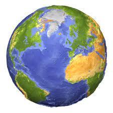
2 Google Earth Overview Use of Google Earth for Genealogy: Get Directions to Research Locations Plan a visit to ancestral homeland View ancestral known addresses Take a virtual trip of ancestral hometown First 22 Slides only Slides at: 2

3 Google Earth 3

4 Fly to Trinity College Dublin, Ireland - 1 4

5 Fly to Trinity College Dublin, Ireland - 2 5

6 Fly to Trinity College Dublin, Ireland - 3 6

7 Fly to Trinity College Dublin, Ireland - 4 7


8 Fly to 1 Rue de Chateau, La Neuveville - 1 Jonas Pelot house in La Neuveville, Switzerland. Jonas Pelot immigrated into SC in Photos by David Evans, a relative..

9 Fly to 1 Rue de Chateau, La Neuveville - 2 9

10 Fly to 1 Rue de Chateau, La Neuveville

11 Fly to 1 Rue de Chateau, La Neuveville

12 Fly to 1 Rue de Chateau, La Neuveville


13 Fly to 1 Rue de Chateau, La Neuveville Town Center 13

14 Google Earth Tours Demo of Paris Tour 14


15 Google Earth Gallery Gallery done by Google and Public 15

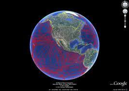
16 Google Earth Flyby -1 16

17 Google Earth Flyby -2 17

18 Google Earth Flyby -3 18

19 Google Earth Flyby -4 19

20 Google Earth Flyby -5 20

21 Google Earth Flyby -6 21


22 Questions Please Ask Questions if you do not Understand Anything 22
23 Google Earth - Overview 23
24 Google Earth Download

25 Google Earth Download -2 Keep Going 25

26 Google Earth Download - 3 Your Choice Double Click to Download 26

27 Google Earth Tutorials


28 Google Earth Tutorials -2 28

29 Google Earth Historical December

30 30 December 2003 Google Earth Historical

31 Google Earth Moon 31

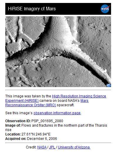
32 Google Earth Mars 32

33 Google Earth Sky -1 33

34 Google Earth Sky -2 34
35 Google Earth Files - 1 Keyhole Markup Language (KML) is an XML notation for expressing geographic annotation and visualization within Internet-based, twodimensional maps and three-dimensional Earth browsers. KML was developed for use with Google Earth, which was originally named Keyhole Earth Viewer. It was created by Keyhole, Inc, which was acquired by Google in KML is an international standard of the Open Geospatial Consortium. Google Earth was the first program able to view and graphically edit KML files. Keyhole Markup Language Zipped (KMZ) - KML files are often distributed as KMZ files, which are zipped files with a.kmz extension. The root KML document is typically a file named "doc.kml" at the root directory level but the first.kml file entry in the KMZ file is the actual one selected in Google Earth regardless of its name. By convention the root KML document is at root level and referenced files are in subdirectories (e.g. images for overlay images). 35
36 Google Earth Files - 2 Example KML File for a Placemark: <?xml version="1.0" encoding="utf-8"?> <kml xmlns=" <Document> <Placemark> <name>new York City</name> <description>new York City</description> Placemark contains: 1. Name 2. Description 3. Coordinates <Point> <coordinates> , ,0</coordinates> </Point> </Placemark> </Document> </kml> Tutorial on KML, KMZ, and GPS 36

37 Google Maps
38 Google Maps 2 Get Directions From To 38

39 Google Maps 3 Get Directions 39
40 Google Maps 4 Address Location 40

41 Google Maps 5 Traffic 41

42 Google Maps 6 Satellite View 42

43 Google Maps 7 Satellite View 43

44 Google Maps 8 Satellite View 44

45 Google Maps Street View 1 Double Click Twice Example 45

46 Google Maps Street View 2 Double Click Twice 46

47 Google Maps Street View 3 47
48 Google Maps Street View 4 48


49 Google Maps Street View 5 49

50 Google Maps Photos in Local Area 50

51 Google Maps Panoramio Panoramio is a geolocation-oriented photo sharing website. Currently, some of the photos uploaded to the site can be accessed as a layer in Google Earth and Google Maps, with new photos being added at the end of every month. The site's goal is to allow Google Earth users to learn more about a given area by viewing the photos that other users have taken 51

52 Google Maps - Cemetery 52
Google Earth II: Create a tour with Google Earth
 Google Earth II: Create a tour with Google Earth This workshop is a continuation of The Google Earth Workshop I: Map-making Basics. You will create a tour to show the main and satellite campuses of the
Tutorial for Importing Open Green Map Sites into Google Earth
 Tutorial for Importing Open Green Map Sites into Google Earth Step 1. Download your Open Green Map data files by logging in on Open Green Map and viewing your map(s). Choose the Import/Export tab over
Google Earth an introduction
 Luana Valentini InternetGIS course - 2011 Google Earth an introduction Google Earth combines the power of Google Search with satellite imagery, maps, terrain and 3D buildings to put the world's geographic
Google Earth for Genealogy October 15, 2016 Heritage Hunters of Saratoga County
 Google Earth for Genealogy October 15, 2016 Heritage Hunters of Saratoga County http://www.saratoganygenweb.com/gwsarhh.html Dennis A. Hogan, http:// This Complete Presentation is available online At,
Google Maps Mashups WORKSHOP. Jeff Blossom, Senior GIS Specialist Center for Geographic Analysis. Harvard University gis.harvard.
 Google Maps Mashups WORKSHOP Jeff Blossom, Senior GIS Specialist Center for Geographic Analysis Harvard University gis.harvard.edu Fall, 2012 Objectives: Workshop objectives and flow 1) In 2 hour, hands
Using Google Earth. Middlebury College Library and Information Services
 Using Google Earth Middlebury College Introduction: While Google Earth can be a fun tool for simply looking at the surface of the earth, there are many other more sophisticated features to explore. Google
Google Earth. Tutorials. Tutorial 2: Annotating Google Earth
 Google Earth Tutorials Tutorial 2: Annotating Google Earth Google Earth makes it easy to create a map with annotations - you can add placemarks (points), paths (lines), polygons in Google Earth, and add
Google Earth Pro: A tutorial
 Google Earth Pro: A tutorial 1 OVERVIEW As of early 2015, Google Earth Pro, which used to be a $400 product, is now free. This is a powerful yet simple tool for viewing information geographically whether
PlaceMap. Accommodation. Slide 1
 PlaceMap for Accommodation Slide 1 PlaceMap Using the power of Google Earth to store and display all of your spatial data in a much more dynamic way Google Earth is a free software program that lets you
Note: This tutorial was designed for Windows users. Applications DANA PORTER LIBRARY. February 19, 2013 Authored by: The Geospatial Centre
 Applications DANA PORTER LIBRARY February 19, 2013 Authored by: The Geospatial Centre 0 TABLE OF CONTENTS Google Earth Introduction... 2 Historical Imagery... 3 Objective... 3 Step by Step... 3 Ruler...
QGIS LAB SERIES GST 103: Data Acquisition and Management Lab 1: Reviewing the Basics of Geospatial Data
 QGIS LAB SERIES GST 103: Data Acquisition and Management Lab 1: Reviewing the Basics of Geospatial Data Objective Explore and Understand Geospatial Data Models and File Formats Document Version: 2014-08-15
2. The flight across the globe will begin and your final destination will be your home.
 Google Earth 5.0 The Google Earth interface has a toolbar across the top and a panel down the left side. On the left panel, there are three sections: Search, Places and Layers. 1. In the Search section,
An Introduction to Google Earth Pro
 An Introduction to Google Earth Pro Virginia Tech Geospatial Extension Program By: Katherine Britt Ph.D. Candidate Virginia Tech Department of Forest Resources and Environmental Conservation John McGee
Augmented Reality, Google Earth and Tcl/Tk. Steve Landers and David Roseman. Abstract
 Augmented Reality, Google Earth and Tcl/Tk Steve Landers and David Roseman steve@digitalsmarties.com dlr@eolas.com Abstract This paper will describe the implementation of an augmented reality simulation
Google Earth Tutorial 1: The Basics of Map-making in Google Earth 6.2
 Google Earth Tutorial 1: The Basics of Map-making in Google Earth 6.2 University of Waterloo Map Library, 2012 Part 1: Placemarks 1. Locating a Geographical Area a. Open up Google Earth. b. In the Search
4/7/2009. Model: Abstraction of reality following formal rules e.g. Euclidean space for physical space
 Model: Abstraction of reality following formal rules e.g. Euclidean space for physical space At different levels: mathematical model (Euclidean space) conceptual design model (ER model) data model (design)
Data Visualization Techniques with Google Earth
 Data Visualization Techniques with Google Earth E-Learning for the GIS Professional Any Time, Any Place! geospatialtraining.com Course Outline Module 1: Google Earth Pro Fundamentals Module 2: Adding Features
Viewer Features. DataBC Mashup Framework (DMF)
") Viewer Features DataBC Mashup Framework (DMF) Copyright 2014 Ministry of Labour, Citizens' Services and Open Government All Rights Reserved. Printed in Canada The information contained in this document
Viewer Features DataBC Mashup Framework (DMF) Copyright 2014 Ministry of Labour, Citizens' Services and Open Government All Rights Reserved. Printed in Canada The information contained in this document
Google Earth Maps. Creating an Outdoor Location Using Google Earth. Understanding Geographical Coordinates for Google Earth CHAPTER
 CHAPTER 18 Within Monitor >, you can create an outdoor location, import a file, view Google Earth maps, and specify Google Earth settings. Creating an Outdoor Location Using Google Earth Importing a File
Getting Started with ArcGIS for Server. Charmel Menzel and Ken Gorton
 Getting Started with ArcGIS for Server Charmel Menzel and Ken Gorton Agenda What is ArcGIS for Server? Types of Web services Publishing resources onto the Web Clients to ArcGIS for Server Editions and
PointMarker for ipad (version 1.2.1)
") (version 1.2.1) Last Revision: September 2014 Introduction This tutorial was designed to introduce users to the new ipad app, PointMarker. The app allows users to log and annotate locations of interest.
(version 1.2.1) Last Revision: September 2014 Introduction This tutorial was designed to introduce users to the new ipad app, PointMarker. The app allows users to log and annotate locations of interest.
ArcMap and Google Earth
 ArcMap and Google Earth Prepared by Andrew Hobby CVEN 658 November 25, 2008 Contents: Brief Overview of Google Earth Goals of Exercise Computer and Data Requirements Procedure: 1. Creating a KML File 2.
Accessing OGC Services To access OGC WMS and WFS open the service in the directory that you want to consume, and click on either WMS or WFS.
 Using Web Services Web Services Overview This user guide contains instructions on how to consume a range of services through a range of both web based and desktop GIS applications. Web services are a live
Tutorial for PGIS in Accra, Ghana
 Tutorial for PGIS in Accra, Ghana Chung-Rui Lee 1, Ick Hoi Kim 2, and Jayesh Patel 3 Welcome to Participatory GIS (PGIS) in Accra, Ghana (access to the PGIS website). This project is funded by NICHD Grant
CALIFORNIA EARTHQUAKE CLEARINGHOUSE. Tools for Mobile Data Collection
 CALIFORNIA EARTHQUAKE CLEARINGHOUSE Tools for Mobile Data Collection Need for Data Collection & Sharing 100s of engineers and scientists are expected to contribute data after a major earthquake in California
A Google Earth User Manual for Earth Science Teachers
 A Google Earth User Manual for Earth Science Teachers Eric J. Fermann Eastchester High School Eric J. Fermann, 2006 TABLE OF CONTENTS Table of Contents... 1 Introduction... 2 Getting and Installing Google
Easy Mapping with Google
 Easy Mapping with Google Applications: Mapping is a great way for students to visualize spatial information to help them develop analytical abilities or conduct research. With Google Maps, it is easy to
GPS Tutorial for Hikers How to efficiently use your mobile as GPS navigator for hiking
 GPS Tutorial for Hikers How to efficiently use your mobile as GPS navigator for hiking By Marc TORBEY Examples from the Android software OruxMaps V1.0 1 Table of contents Basics about GPS for hiking slide
Optimized design of customized KML files
 Proceedings of the 9 th International Conference on Applied Informatics Eger, Hungary, January 29 February 1, 2014. Vol. 2. pp. 203 208 doi: 10.14794/ICAI.9.2014.2.203 Optimized design of customized KML
Visualization with ArcGlobe. Brady Hoak
 Visualization with ArcGlobe Brady Hoak Contents What is ArcGlobe? 3D Mapping and ArcGlobe Displaying data in ArcGlobe ArcGlobe tools Tips for constructing ArcGlobe documents New at ArcGIS 9.3 ArcGIS integration
CITIZENS SERVING COMMUNITIES
 Civil Air Patrol Geospatial Information Interoperability Exploitation Portable (GIIEP) Operator Version 2 Update Training Lt Col Bob Becker, CAP GIIEP Program Coordinator 15-Nov-15 CITIZENS SERVING COMMUNITIES
Nicole C. Weber Displaying UAV Imagery in Google Earth 1
 Nicole C. Weber Displaying UAV Imagery in Google Earth 1 Abstract This research designs and implements a web-embedded Google Earth application for disaster response field workers to upload images of disaster
Web Mapping Applications with ArcGIS. Bernie Szukalski Derek Law
 Web Mapping Applications with ArcGIS Bernie Szukalski Derek Law Agenda Web Mapping and Map Services Fundamentals ArcGIS Web Mapping Applications - Hosted online - Hosted on-premise Summary Web Application
Using Google Earth Pro
 Using Google Earth Pro (v7.3.2) University of Toronto Mississauga Library Hazel McCallion Academic Learning Centre October 2018 FURTHER ASSISTANCE If you have questions or need assistance contact Tanya
Technical Note: GPS/GNSS Simulators
 Technical Note: GPS/GNSS Simulators Background The typical application for a GPS simulator assumes an unobstructed view of the satellites. For advanced testing applications, it is possible to model the
Road maps. Introduction. Structure
 Road maps Introduction This service let you embed interactive maps in your website (à la Google maps). You can customize map by displaying data in overlays You can create your own overlays. Structure To
Secure Zoo Strategy Biosecurity Mapping Tool. Instructional Guide
 Secure Zoo Strategy Biosecurity Mapping Tool Instructional Guide Table of Contents Introduction Acronyms & Abbreviations Materials Section 1: Data Definitions and Symbology o Definitions o Symbology Section
Google Earth Visualization of Magnetometer Data
 Google Earth Visualization of Magnetometer Data Brian Love Computer Science Department Augsburg College Minneapolis, MN 55454 loveb@augsburg.edu Noel Petit Computer Science Department Augsburg College
Lesson 2 Installing and Using Quantum GIS (QGIS)
") Lesson 2 Installing and Using Quantum GIS (QGIS) Use file Explorer to open County QGIS portable hard drive provided. The program execute (.exe) will be at the bottom of the list. Double click on the file.
Lesson 2 Installing and Using Quantum GIS (QGIS) Use file Explorer to open County QGIS portable hard drive provided. The program execute (.exe) will be at the bottom of the list. Double click on the file.
FrontCounter BC Discovery Tool Instructions. NOTE: You must have Google Earth installed to use this tool.
 NOTE: You must have Google Earth installed to use this tool. These instructions are written for use with a Microsoft Windows Work Station. This tutorial will step you through navigating to and viewing
The Use of Google Earth in Meteorological Satellite Visualization
 The Use of Google Earth in Meteorological Satellite Visualization Thomas J. Kleespies National Oceanic and Atmospheric Administration National Environmental Satellite Data and Information Service Center
CS4HS#workshop! Google&maps!!!
 CS4HS#workshop! Google&maps!!!!!!! Developed!by!Claire!Hocking!! Class/Individual Project - Teacher Setup Prior to setting the homework Create 4 spreadsheets that are shared between all students in the
Google Earth: Significant Places in Your Life Got Maps? Workshop June 17, 2013
 Google Earth: Significant Places in Your Life Got Maps? Workshop June 17, 2013 1. Open Google Earth. 2. Familiarize yourself with Google Earth s navigational features by zooming into Furman s campus, your
Introduction to Google Earth Tutorial Haiti. 3/15/2011. Tufts GIS Center. Data Exploration
 Introduction to Google Earth Tutorial Haiti. 3/15/2011. Tufts GIS Center. Data Exploration 1. Open Google Earth 2. On the left you will see a navigation pane with 3 sections: Search, Places and Layers.
You ll also be able to add markers like Placemarks to keep track of some special locations.
 Google Earth Basics Google helps bring the world to your desktop with Google Earth. This program allows you to search for specific locations and then zooms in to bring those areas to life through aerial
PointMarker for ipad
 Last Revision: September 2013 Introduction This tutorial was designed to introduce users to the new ipad app, PointMarker. The app allows users to log and annotate locations of interest. After recording
PlaceMap for the Exploration and Mining Industry
 PlaceMap Slide 1 PlaceMap for the Exploration and Mining Industry Using the power of Google Earth to store and display all of your spatial data in a much more dynamic way Google Earth is a free software
Geodatabases. Dr. Zhang SPRING 2016 GISC /03/2016
 Geodatabases Dr. Zhang SPRING 2016 GISC 1401 10/03/2016 Using and making maps Navigating GIS maps Map design Working with spatial data Spatial data infrastructure Interactive maps Map Animations Map layouts
Lose Yourself in Map Services (Google, Microsoft, Yahoo, MapQuest) Luke Sankey 28 November 2006 / CSCI 7818: Web Services
 Luke Sankey 28 November 2006 / CSCI 7818: Web Services") Lose Yourself in Map Services (Google, Microsoft, Yahoo, MapQuest) Luke Sankey 28 November 2006 / CSCI 7818: Web Services Expected Features of a Map (from basic to advanced) Programmatically move, zoom,
Lose Yourself in Map Services (Google, Microsoft, Yahoo, MapQuest) Luke Sankey 28 November 2006 / CSCI 7818: Web Services Expected Features of a Map (from basic to advanced) Programmatically move, zoom,
MAPPING IN GOOGLE EARTH
 MAPPING IN GOOGLE EARTH Guided Lab: Mapping, Part I - Sample and Existing Data I. Geolocating the Pavilion in Google Earth (via SketchUp). For this exercise you will have both the Sketchup and Google Earth
X Slippy Maps. (...and Scott Davis)
") X Slippy Maps (...and Scott Davis) 1 2 Scott Davis 3 4 It was the best of times, it was the worst of times... 5 6 Ajax 7 Static Maps vs. Slippy Maps 8 9 10 Who is the OGC? The Open Geospatial Consortium
X Slippy Maps (...and Scott Davis) 1 2 Scott Davis 3 4 It was the best of times, it was the worst of times... 5 6 Ajax 7 Static Maps vs. Slippy Maps 8 9 10 Who is the OGC? The Open Geospatial Consortium
Tutorial on Getting Started. Section 1 Getting started All users read this section 2
 Tutorial on Getting Started Section 1 Getting started All users read this section 2 Section 2 Exploring the database as a GUEST Recommended that all new users read this demonstration section to become
Picasa for Mac Users. 1. Go to Click Download Picasa for Mac (Beta) to download Picasa. 2. You will see this screen:
 to download Picasa. 2. You will see this screen:") Picasa for Mac Users 1. Go to http://picasa.google.com/mac/. Click Download Picasa for Mac (Beta) to download Picasa. 2. You will see this screen: 3. You will see that Picasa has been downloaded in Downloads
Picasa for Mac Users 1. Go to http://picasa.google.com/mac/. Click Download Picasa for Mac (Beta) to download Picasa. 2. You will see this screen: 3. You will see that Picasa has been downloaded in Downloads
Using Google Earth in the Classroom (Tours)
") Eric J. Fermann 2006 Eastchester High School Using Google Earth in the Classroom (Tours) Since its release in the summer of 2005, Google Earth has provided an uncomplicated means of combining satellite
Eric J. Fermann 2006 Eastchester High School Using Google Earth in the Classroom (Tours) Since its release in the summer of 2005, Google Earth has provided an uncomplicated means of combining satellite
RELEASE NOTES FOR TERRAEXPLORER 7.0.1
 s RELEASE NOTES FOR TERRAEXPLORER 7.0.1 New Features in Release 7.0.1 Raster layer enhancements Load raster layers from Google Earth Enterprise Server - TerraExplorer 7.0.1 extends imagery and elevation
The service provided consists of the global collection and distribution of AIS messages from the two available AIS channels.
 exactais Delivery The service provided consists of the global collection and distribution of AIS messages from the two available AIS channels. For a given customer, the service level purchased, and hence
WILD 2400 ASSIGNMENT #1: GPS TUTORIAL*
 WILD 2400 ASSIGNMENT #1: GPS TUTORIAL* Overview: In this tutorial you will learn how to collect, download, and display data using a Garmin GPSMAP 64 unit, the DNRGPS Application, and Google Earth. For
Project Manager Quick Start Guide
 Project Manager Quick Start Guide Developed by the North Carolina Institute for Public Health v November 6, 2015 Development Team: Principal Investigator: Rachel Wilfert, MD, MPH, CPH Project Manager:
Brought to You By: University of Connecticut Center for Land Use Education and Research (CLEAR) University of Rhode Island Coastal Institute USDA
 University of Rhode Island Coastal Institute USDA") Mashup Madness: Using Google to Display Geographic Information on the Web February 22, 2010 Land & Sea Grant National Water Conference Hilton Head, SC Brought to You By: University of Connecticut Center
Mashup Madness: Using Google to Display Geographic Information on the Web February 22, 2010 Land & Sea Grant National Water Conference Hilton Head, SC Brought to You By: University of Connecticut Center
Dataset2: Fleurac. Contents. Using a dataset containing geo-tags Getting familiar with spatial reference systems Advanced features
 Dataset2: Fleurac Using a dataset containing geo-tags Getting familiar with spatial reference systems Advanced features Contents 1. Creating a new project... 2 2. Importing your data... 3 3. Checking the
SURFACE WATER MODELING SYSTEM. This tutorial requires that you have Google Earth installed on your computer.
 SURFACE WATER MODELING SYSTEM Google Earth Files This lesson is designed to help you understand how to save SMS data to a *.kmz file format. Files of this type are Google Earth files and will allow you
Software Engineering Large Practical
 Software Engineering Large Practical Stephen Gilmore (Stephen.Gilmore@ed.ac.uk) School of Informatics September 21, 2016 About The Software Engineering Large Practical is a 20 point Level 9 course which
Setting up Flickr. Open a web browser such as Internet Explorer and type this url in the address bar.
 Workshop 15 th July 2008 Page 1 http://blog.larkin.net.au/ Setting up Flickr Flickr is a photo sharing tool that has rich functionality and allows the public to share their photographs with others., It
CREATING A MANAGEMENT MAP
 LEVEL Basic MODULE 1 PEOPLE 1 BUDGET $ WHEN Anytime CREATING A MANAGEMENT MAP REPEAT As needed IN A NUTSHELL Creating an electronic map that can be easily updated as needed and stored in perpetuity Map
Dual-Platform GMTI: First Results With The TerraSAR-X/TanDEM-X Constellation
 Dual-Platform GMTI: First Results With The TerraSAR-X/TanDEM-X Constellation Stefan V. Baumgartner, Gerhard Krieger Microwaves and Radar Institute, German Aerospace Center (DLR) Muenchner Strasse 20, 82234
What is MapBuddy: The main toolbar: MapBuddy Reference Guide V1.0
 MapBuddy Reference Guide V1.0 What is MapBuddy: MapBuddy is a Windows application designed for searching, storing and displaying information on top of a Google Maps interface. MapBuddy has various optional
Media Mapper Mobile Iteration #10 updated mockups
 Topic Media Mapper Mobile Iteration #10 updated mockups By Martha Roden November 14, 2013 Quick Overview 2 What Does MMM Do? (diagram) 3 Startup and Home Screens 4 Home > GPS Details & Point of Interest
Bringing NYSGA Guidebooks to Google Earth
 Bringing NYSGA Guidebooks to Google Earth Otto H. Muller Geology Department, Alfred University Alan I. Benimoff Executive Secretary, New York State Geological Association benimoff@mail.csi.cuny.edu William
Mapping GeoRSS Feeds and the Shift from KML to GeoJSON. Michael P. Peterson
 Mapping GeoRSS Feeds and the Shift from KML to GeoJSON Michael P. Peterson ABSTRACT: A primary benefit of cloud-based mapping is the presentation of updated maps. Data can be made available through a data
Major features Support multi-language Automatically match photo and GPS tracks by time synchronization. Add photo comments.
 Users Manual V1.1 Users Manual Major features Read GPS log from device Add Photo and photo management Auto match photo and waypoints in tracks Shift photo time View in Google earth Save as kmz file GeoTag
ArcGIS Viewer for Microsoft Silverlight An Introduction
 Esri International User Conference San Diego, CA Technical Workshops July 12, 2011 ArcGIS Viewer for Microsoft Silverlight An Introduction Art Haddad, Rich Zwaap, and Derek Law Agenda Background Product
Photo2GPS Instructions:
 Photo2GPS Instructions: Photo2GPS is a program designed to read a text file of track points and the contents of a folder containing your digital photographs then create coordinates with links to the associated
GPS Essentials. This guide may be downloaded as gps-essentials_en.odt or gps-essentials_en.pdf Reviewed
 GPS Essentials GPS Essentials This guide may be downloaded as gps-essentials_en.odt or gps-essentials_en.pdf Reviewed 2015-05-24 Installation of GPS Essentials 1. Tap the Google Play Store app icon on
Working with the ArcGIS Viewer for Flex Application Builder
 Working with the ArcGIS Viewer for Flex Application Builder Esri Canada User Conference St. John s November 15, 2012 Presented By: Greg Yetman gyetman@esri.ca Agenda This seminar is designed to help you
Area of Interest (AOI) to KML
 to KML") Area of Interest (AOI) to KML The Integrated Land & Resource Registry (ILRR) offers a bit more functionality for Keyhole Markup Language (KML) creation and usage than Mineral Titles Online (MTO). Both
Area of Interest (AOI) to KML The Integrated Land & Resource Registry (ILRR) offers a bit more functionality for Keyhole Markup Language (KML) creation and usage than Mineral Titles Online (MTO). Both
Working with Google Earth
 Working with Google Earth The Places panel in Google Earth serves as a repository to bookmark locations that you want easy access to. There are two folders located in Places: My Places and Temporary Places.
Data Acquisition using Mashup and 3-D Technology. Matt Rahr College of Agriculture and Life Sciences University of Arizona
 Data Acquisition using Mashup and 3-D Technology Matt Rahr College of Agriculture and Life Sciences University of Arizona Let s Do It! What is a Mashup? + Your Data A hybrid website or web application
NAACCR Webinar Exercises. May 6, 2010 Kevin Henry Francis Boscoe
 NAACCR Webinar Exercises May 6, 2010 Kevin Henry Francis Boscoe EXERCISE 1 Google Earth and Geocoding Individual Cases Part 1 Introduction to Google Earth 1 Open Google Earth Click Start Programs Google
GPS Road Logger Concerto-B User Manual
 GPS Road Logger Concerto-B User Manual MAP electronics co.,ltd. 1 Concerto-B GPS Road Logger User Manual Specifications and accessories. P.3 Introduction and operation. P.4~7 Outline introduction.....
6 New Approaches for Integrating GIS layers and Remote Sensing Imagery for Online Mapping Services
 6 New Approaches for Integrating GIS layers and Remote Sensing Imagery for Online Mapping Services Harry Kuo-Chen Chang*, Ming-Hsiang Tsou ** * Department of Geography, National Taiwan Normal University,
A Dozen Ways to Use Your ipad2 for Genealogy and Writing. Presented by: Lisa A. Alzo, M.F.A.
 A Dozen Ways to Use Your ipad2 for Genealogy and Writing Presented by: Lisa A. Alzo, M.F.A. All About Apps Specific tasks performed with applications ("Apps") Some are built in Some are free or affordable
Ray Dos Santos 07/03/2009
 Footprint Annotation For XML Schemas of Geospatial Web Services 1 Ray Dos Santos 07/03/2009 Outline: Problem Statement Annotate the Schema Create the Footprint Examples & Challenges Conclusion 2 Problem:
Pinpoint AVM 4.0 Quick Reports Detailed User Manual
 Pinpoint AVM 4.0 Quick Reports Detailed User Manual Page 1 of 11 Table of Contents General avm navigation... 3 1 Quick Reports.... 3 Show... 4 Find... 5 Show Last X hours... 5 Show Trips Over Last 24 Hours...
Presented by: Megan Bishop & Courtney Valentine
 Presented by: Megan Bishop & Courtney Valentine Early navigators relied on landmarks, major constellations, and the sun s position in the sky to determine latitude and longitude Now we have location- based
Release Notes TRIMBLE BUSINESS CENTER. Version 2.50
 Release Notes TRIMBLE BUSINESS CENTER Version 2.50 Corporate office: Trimble Navigation Limited Engineering and Construction Division 5475 Kellenburger Road Dayton, Ohio 45424-1099 USA Phone: +1-937-233-8921
Introduction to Google Earth
 Introduction to Google Earth Assignment: The goal of this assignment is for you to become familiar with Google Earth. You may work alone or with a partner but you must turn in your own individual work.
Mapping with Google Fusion Tables
 Mapping with Google Fusion Tables You will learn how to transform location information stored in an Excel spreadsheet to a format that can be mapped directly with Google Fusion Tables. Format of Data within
By Guy Laroche. Computer Booters of Sun Lakes 02/26/2013 1
 By Guy Laroche 1 There is much more than Google Search! And, It s FREE 2 Google Toolbar Google Search Specialized Searches Web History Images/Videos Calculator Blogs Customs Scholar Google Chrome (Web
Google chrome xbox 360 app
 Google chrome xbox 360 app Tim Cook Says iphone Activations Set New Christmas Day Records in United States and Canada. Apple drops iphone bombshell on already reeling stock market. Two things Tim Cook
NEW FEATURES IN RELEASE 7.0
 Native 64bit Application NEW FEATURES IN RELEASE 7.0 TerraExplorer 7.0 has been redesigned as a native 64 bit application, enabling TerraExplorer to take advantage of available memory for resource-intensive
Software Engineering Large Practical. Stephen Gilmore School of Informatics October 9, 2017
 Software Engineering Large Practical Stephen Gilmore School of Informatics October 9, 2017 About the Software Engineering Large Practical The Software Engineering Large Practical is a programming practical
Getting Started with TerraExplorer for Web
 Getting Started with TerraExplorer for Web Version 7.0.0 Skyline Software Systems Inc. Information contained in this document is subject to change without notice and does not represent a commitment on
Activity: Exploring GeoPDFs
 Activity: Exploring GeoPDFs A GeoPDF is a map stored in Adobe s Portable Document Format that is geographically referenced to a real world coordinate system. TerraGo Technologies, which is the company
Getting Started with the ArcGIS Server JavaScript API
 Getting Started with the ArcGIS Server JavaScript API Agenda Introduction ArcGIS Server services and mashups REST API Services Directory JavaScript API ArcGIS Server Resource Center Dojo Maps, layers,
Making and Sharing Digital Community Asset Maps Using Free Software and Web Resources
 Making and Sharing Digital Community Asset Maps Using Free Software and Web Resources A Guide for Community Groups Prepared by Dave Whiting Consulting (dave.whiting@shaw.ca) May, 2009 A product of the
KML Best Practices for Interoperability
 Approved for Public Release: 11-3295. Distribution Unlimited. M T R 1 1 0 3 5 8 M I T R E T E C H N I C A L R E P O RT KML Best Practices for Interoperability The views, opinions and/or findings contained
Design and Development of a Dynamic Portal Travel Guide for the City of Florina Concerning Smart Portable Devices
 Design and Development of a Dynamic Portal Travel Guide for the City of Florina Concerning Smart Portable Devices Dimitris Solakis 1, Panagiotis Lefakis 2 1 MSc in Applied Informatics, University of Macedonia,
user manual GeoViewer DB Netze Fahrweg
 user manual GeoViewer DB Netze Fahrweg Register of Infrastructure Updated: Juli 2018 Release: 1.11.0 Page 1 von 32 Content 1 List of illustrations 3 2 Basics 4 2.1 Components 4 2.1.1 Interfaces 4 2.1.2
Creating your own Website
 Park Street Camera Club Creating your own Website What is a web site A set of interconnected web pages, usually including a homepage, generally located on the same server, and prepared and maintained as
Geotagging your images.
 Geotagging your images http://goo.gl/ybryr Where was this taken? Where was this taken? Why Geocode your images Organize images better, keep track of where you ve been Better way to show your images Remembers