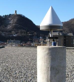
Low cost GNSS receivers: navigation and monitoring activities
|
|
|
- Garry Lee
- 6 years ago
- Views:
Transcription
1 PHD in Environmental and Infrastructure Engineering XXIX cycle Low cost GNSS receivers: navigation and monitoring activities Ph.D.'s activity final report Marco Negretti Supervisor: Ludovico Biagi Tutor: Giovanna Venuti
2 Low cost GNSS receivers: navigation and monitoring activities Performances assessment and improvement of Low Cost GNSS receivers Navigation: identify paths, POI correction using data from Continuously Operating Reference Stations (CORS) correction using local cartography as reference Local Monitoring (landslide monitoring): verify if it is possible do local monitoring with low cost receivers using geodetic techniques 2
 project Winner Polisocial Award 2014,")


3 Navigation Navigation Case study: MEP (Map for Easy Path) project Winner Polisocial Award 2014, the academic social responsibility programme launched by the Politecnico di Milano Get around the city for physically impaired people can be difficult different kinds of obstacles and dangers 3
4 Navigation MEP: aim of the projetc create a tool to map obstacles identify accessible paths data should be easily upgradeable continuously feedback to identify problems and define methods to improve mobility Three department are involved DICA, DEIB, DESIGN DICA group: manage GNSS data 4

5 Navigation The mapping activity is expected to be carried out by volunteers mappers, with mass market devices (smartphones and tablets) Improve their accuracy to warrant the identification the right side of the road if possible, otherwise only the road Example: obstacle on sidewalk it is important identify the side of the street actual coordinates collected coordinates 5
6 Navigation: correction using data from CORS Correction using data from CORS Compute individualized epoch by epoch corrections from CORS data Apply corrections to rover trajectory CORS CORS estimated coords epoch by epoch rover Rover estimated coords epoch by epoch 6
7 Navigation: correction using data from CORS Rover observes a subset of visible satellites viewed by CORS CORS rover 7
8 Navigation: correction using data from CORS Rover observes a subset of visible satellites viewed by CORS a software was developed to remove satellites not observed by rover from the CORS RINEX read from rover NMEA file the list of satellites at epoch i read from CORS RINEX file the list of satellites at epoch i compare satellites lists remove epoch by epoch from the RINEX file the data of satellites that are not viewed by the rover 8


9 Navigation: correction using data from CORS First test: static positioning Test in Milan and Como 9
10 Navigation: correction using data from CORS First test: static positioning Test in Milan and Como Data elaboration to estimate CORS positions one week for both sites RINEX files from CORS gogps ( rtklib ( Comparison between the corrections obtained using: the original CORS RINEX the modified CORS RINEX 10

11 Navigation: correction using data from CORS Example with Como Data day , north CORS, rover, rover corrected 11
12 Como u-blox [m] CORS data: point positioning day u-blox corr. [m] (modified RINEX) East -0,08 North 0,78 East -0,02 North -0,26 East -0,03 North -0,26 std 0,77 1,24 0,64 0,81 0,64 0,80 mean 0,34 0,63 0,02-0,34 0,02-0,34 std 0,84 1,39 0,64 0,81 0,63 0,80 mean 0,20 0,37 0,08-0,44 0,09-0,44 std 0,84 1,21 0,65 0,84 0,65 0,83 mean 0,19 0,68 0,13-0,48 0,14-0,47 std 0,91 1,12 0,71 0,82 0,69 0,81-0,32 0,46 0,12-0,46 0,11-0,47 0,87 1,12 0,65 0,82 0,65 0,81-0,24 1,09 0,04-0,42 0,03-0,42 std 0,91 1,20 0,68 0,88 0,67 0,86 mean 0,07 0,19 0,11-0,51 0,11-0,50 std 0,90 1,25 0,64 0,82 0,63 0,81 mean 0,41 0,47 0,09-0,27 0,09-0,26 std 0,76 1,28 0,62 0,77 0,61 mean mean std u-blox corr. [m] (original RINEX) mean 0,76 12
13 Navigation: correction using data from CORS Milan u-blox [m] u-blox corr. [m] (original RINEX) day East mean std mean std mean std mean std mean std mean std mean std North East North u-blox corr. [m] (modified RINEX) East North
14 Navigation: correction using data from CORS Milan u-blox [m] u-blox corr. [m] (original RINEX) day East North Generally East CORSNorth corrections work mean std rover mean mean std mean std mean std East Few improvements using original RINEX 1.39 std compared modified RINEX-0.68 mean std u-blox corr. [m] (modified RINEX) mean std in a1.49 good position North

15 Navigation: correction using data from CORS Second test: kinematic survey Two test paths were defined to verify different conditions of satellite visibility urban canyons areas of intermediate visibility open areas Path 1 Path 2 OpenStreetMap contributors OpenStreetMap contributors 15
16 Navigation: correction using data from CORS Test with geodetic receiver, tablet/smartphone and u-blox Path 1 Leica GX 1230 Samsung Galaxy Tab2 Path 2 Leica GX 1230 Samsung S5 u-blox EVK-7P evaluation kit 16
17 Navigation: correction using data from CORS Geodetic receiver reference to evaluate tablet survey data processed with double different method Path 1 a good accuracy will be reached only if it is obtained a fixed phase solution N of points fixed/total 1886/2144 fixed solutions 88% 36% / % 33% / % N of points fixed/total 1805/4038 fixed solutions 45% / /3547 Path 2 17
18 Navigation: correction using data from CORS Statistical errors before and after the correction with CORS data along the Path 1 Day tablet collected [m] East corrected mod RINEX North East North mean std std mean std mean 18
19 Navigation: correction using data from CORS Statistical errors before and after the correction with CORS data along the Path 2 Day smartphone collected [m] mean std mean std mean std East North u-blox corrected mod RINEX East North collected East North corrected mod RINEX East North

20 Navigation: correction using data from CORS The accuracy after the CORS correction does not improve Local disturbances particular properties of the area local effects are prevalent reference points corrected points collected points 20
 Database:")

21 Navigation: correction using local cartography as reference Correction using local cartography as reference Reference map: OpenStreetMap (OSM) Database: PostgreSQL/PostGIS points detected with mass market devices paths and buildings from the OSM maps in the neighborhood of the points detected script to implement the data correction procedures 21

22 Navigation: correction using local cartography - on segments Correction on segments Chose the segment OpenStreetMap contributors distance from the point collected to the candidate segment the bearing from the previous to the current point the bearing of the candidate segment the distance from the current corrected point to the previous corrected point Drawback: could corrects too much 22
23 Navigation: correction using local cartography - out of buildings Correction out of the buildings to avoid overlap between points collected and buildings For each point query to check if it is inside a building in case, the point is projected outside 23

24 Navigation: correction using local cartography - out of buildings Example of correction effective 24

25 Navigation: correction using local cartography - out of buildings Example of correction ineffective 25
26 Navigation: correction using local cartography - on buffers Correction on buffers 1.Searching and selection of a potential path choice of a set of segments candidates to be part of the potential path 1,4 m 0,5 m 0,0 m every collected point assigns a score to the closest n segments 0,7 1,0 1,0 total score: 2,7 26
27 Navigation: correction using local cartography - on buffers 1. Searching and selection of a potential path identification of the potential path: segments selected every collected point selects, between the n nearest segments candidates, the one with the highest score 27

28 Navigation: correction using local cartography - on buffers 2. Building of the buffer around of the selected potential path 28

29 Navigation: correction using local cartography - on buffers 3. Correction of position of points that are outside the buffer 29
30 Navigation: correction using local cartography - on buffers Buffer size fixed: 7 m urban two-lane road with the sidewalks 30
31 Navigation: correction using local cartography - on buffers Buffer size variable dseg= distance between segment and the nearest building buffer size: 2 < dseg < 7 [m] 31
32 Navigation: correction using local cartography - on buffers In case of very bad quality of signal a wrong segment can receive an high score and be selected as segment path 32
 cover the holes: adds the segments not selected both the vertexes shared with others candidate segments suspected to be erroneously discarded (B) segments selected segments not selected")
33 Navigation: correction using local cartography - on buffers Reclassification: reduces the score for handling segments one vertex not shared with others candidate segments suspected to be erroneously selected (A) cover the holes: adds the segments not selected both the vertexes shared with others candidate segments suspected to be erroneously discarded (B) segments selected segments not selected 33

34 Navigation: correction using local cartography - on buffers 34
35 Navigation: correction using local cartography - results Comparing results Around to the true path two tolerance areas were defined: 2.5 m and 5 m it was checking how many points were inside Total points: 5879 Proximity areas 5m 2.5 m collected out of the data buildings on buffers constant variable correction on variable segment with reclass. points inside % points inside % Day
36 Navigation: correction using local cartography - results Great difference due to the reference used to do the correction "on segments" method => moves all points on the segment "on buffers" methods => define an area where the points are not corrected 36
37 Navigation: correction using local cartography - results Tolerance area of 5 m all corrected points are inside tolerance area true path OSM segments buffer around segments 37

38 Navigation: correction using local cartography - results Tolerance area of 2.5 m points corrected with "on segment" method are outside: the method corrects too much tolerance area true path OSM segments buffer around segments 38
39 Navigation: correction using local cartography - results This is clearly a particular case In general the choice of correction method is not easy The final results are very dependent on the site characteristic and from the cartography used as reference an incomplete or wrong reference datum can lead to consider a point position wrong when the problem can be the map itself it is important to have cartography updated and easily upgradeable, like OSM, that permits to add a new path as it becomes available 39
40 local monitoring Local Monitoring Research to assess precision and accuracy of low-cost GNSS receivers in monitoring displacements with low latency Controlled movements imposed to a low cost rover, estimated displacements compared with the imposed ones accuracy of low cost GNSS receivers how reliable are the results obtained or rather, how many false or missed alarms are expected per unit of time 40
41 local monitoring Two different analysis have been performed Significance analysis based on Fisher test this procedure allows a separation of the results into two groups: coordinates significantly changed with consecutive sessions and coordinates unchanged compared to the actual values Congruence analysis the aim of the congruence analysis is to verify whether the estimated coordinates differences are congruent with the imposed displacements 41
42 local monitoring: test 1 Test 1: points of survey Reference station Valleggio 1: COMO CORS (EUREF network) receiver: Topcon Odyssey RS antenna: TPSCR3 GGD Rover: ublox NEO 7P (evaluation kit) about 100 m from the reference station 42

43 local monitoring: test 1 m Points of survey m 43

44 local monitoring: test 1 Points of survey 44

45 local monitoring: test 1 Simulation slide test started on GPS Day two days of static acquisition to compute the reference start position the antenna was shifted horizontally 5 mm for each session three session per day, three hour per session total displacement of 10 cm was aimed but, due to an instrumental problem, the test stopped at 5.5 cm Data processed with LGO and rtklib 45
46 local monitoring: test 1 Data processed with LGO and rtklib LGO rtklib Estimated displacement Imposed displacement 46
47 local monitoring: test 1 Congruence analysis: number of couples class 0 class 1-2 class 3-5 LGO 43.9 % 48.8 % 6.4 % rtklib 46.5 % 49.0 % 4.5 % 47
48 local monitoring: test 2 Test 2: points of survey: Reference station Valleggio 1: Reference station Valleggio 2: COMO CORS (EUREF network) receiver: Topcon Odyssey RS antenna: TPSCR3 GGD receiver: ublox NEO 7P (evaluation kit) antenna Tallysman TW31525* about 10 m from the reference station Rover: receiver: ublox NEO 7P (evaluation kit) about 130 m from the reference station * Many thanks to Geomatics Research & Development (GReD) 48

49 local monitoring: test 2 Points of survey 49

50 local monitoring: test 2 Points of survey reference station Valleggio 2 reference station Valleggio 1 50

51 local monitoring: test 2 Points of survey N 45 Rover is installed on a device* (slide) that allows to apply controlled displacements E * Many thanks to the colleagues of the Politecnico di Torino - DIATI 51
52 local monitoring: test 2 Initial position of the receiver was determined by a 24 hour session with a geodetic receiver and estimated respect COMO CORS From day to The rover antenna was moved, alternately in horizontal and down in vertical every 2 hours 5 mm in horizontal (0 10 cm) 5 mm in vertical (0 10 cm) The data were processed with LGO software two times: once using Valleggio 1 as reference station, the other one using Valleggio 2 52
53 local monitoring: test 2 Horizontal displacement estimated imposed 53
54 local monitoring: test 2 Vertical displacements estimated imposed 54
55 local monitoring: test 2 Statistical errors [cm] mean std E N vert. horiz Reference station: Valleggio 1 [cm] mean std E N vert. horiz Reference station: Valleggio 2 55
56 local monitoring: test 2 Significance analysis 78 % 85 % 80 % Movements between couples % 14 % 28 % 2 29 % 17 % 3 63 % 4 5 Movements between couples 0 2D UP 3D 2D UP 3D 88 % 84 % 92 % 1 14 % 14 % 14 % 46 % 2 23 % 18 % 21 % 28 % 68 % 3 31 % 27 % 31 % 88 % 31 % 90 % 4 64 % 33 % 61 % 99 % 38 % 100 % 5 84 % 36 % 88 % Reference station: Valleggio 1 Reference station: Valleggio 2 56
57 local monitoring: test 2 Congruence analysis East North Vertical Horizontal class 0 16 % 14 % 2% 18 % class % 52 % 9% 58 % class % 31 % 12 % 23 % 1% 3% 77 % 1% over Reference station: Valleggio 1 East North Vertical Horizzontal class 0 17 % 14 % 2% 19 % class % 46 % 8% 58 % class % 35 % 12 % 22 % 4% 5% 78 % 1% over Reference station: Valleggio 2 57
58 local monitoring Generally the estimated displacements follow the trend of the imposed displacement Low cost receiver can be used, under specific constraints, in monitoring activities vertical component is not well recognized main displacement in the monitored area should be in the horizontal component It is possible to use a low-cost receiver also as a reference station enhanced antenna 58
59 Future work Future work Monitoring test with better antennas, but always low cost Navigation trajectory estimation using neural networks 59
60 Reference MEP - PostgreSQL - PostGIS - gogps - RTKLIB - Cartography OpenStreetMap - Orthophoto AGEA 2012 from WMS service of Regione Lombardia:
EAI Endorsed Transactions on Internet of Things
 EAI Endorsed Transactions on Research Article Maps for Easy Paths (MEP): Accessible Paths Tracking and Reconstruction S. Comai 1, *, E. De Bernardi 1, M. Matteucci 1, F. Salice 1 1 Dipartimento di Elettronica
SmartWorx Viva How to Record Static Observation Data On-Board GS Receivers Operating in Base Mode
 SmartWorx Viva How to Record Static Observation Data On-Board GS Receivers Operating in Base Mode Firmware Version 4.03 AUG12 The Viva system provides many options that improve on needed hardware in the
FieldGenius 2010 Release Notes
 FieldGenius 2010 Release Notes This document contains the release notes for all FieldGenius 2010 releases. The latest release notes can be found at the end of the document. FieldGenius 2010 4.2.0 (Released
DIGITAL ROAD PROFILE USING KINEMATIC GPS
 ARTIFICIAL SATELLITES, Vol. 44, No. 3 2009 DOI: 10.2478/v10018-009-0023-6 DIGITAL ROAD PROFILE USING KINEMATIC GPS Ashraf Farah Assistant Professor, Aswan-Faculty of Engineering, South Valley University,
MobileMapper 300 Frequently Asked Questions
 November 19 th, 2014 MobileMapper 300 Frequently Asked Questions What is the main application of MobileMapper 300? MobileMapper 300 provides professional grade accuracy to consumer handheld devices. A
A USABILITY EVALUATION OF A 3D MAP DISPLAY FOR PEDESTRIAN NAVIGATION
 September 29 th, 2018 A USABILITY EVALUATION OF A 3D MAP DISPLAY FOR PEDESTRIAN NAVIGATION Key words: Pedestrian Navigation, LOD 1, 3D, 2D, Usability Department of Geodetic Engineering, Universitas Gadjah
Seagull #GPK. User Manual. Product: Seagull #GPK Released: FW: 1.0
 Seagull #GPK User Manual Product: Seagull #GPK Released: 2018-12-06 FW: 1.0 CONTENTS GENERAL INFORMATION... 3 CONFIG FILE... 4 GENERAL... 4 EDITING... 4 SETTINGS AND VALUES TABLE... 5 FLIGHT CONTROLLER
Evidence Recorder Release Notes
 Evidence Recorder 7.1.0 Release Notes Released on: August 20, 2010 Important Notes We will be dropping support for several older builds of Evidence Recorder including: Allegro CE, Toughbook, Recon.Net,
CORS networks today and tomorrow latest improvements and applications
 CORS networks today and tomorrow latest improvements and applications Dennis KILIAN, Germany Trimble Germany GmbH, Am Prime Parc 11, Raunheim, Germany Keywords: GNSS, Global Navigation Satellite System,
Use of SmartRinex for Post Processed Kinematic Surveys
 Use of SmartRinex for Post Processed Kinematic Surveys This guide is intended to provide the user with a method of working with a Leica SmartNet licence where real time corrections whether with GPRS, GSM
Getting Started for GIS data
 EZSurv Getting Started for GIS data Version 2.94 2012-2014 Effigis, All rights reserved. 1 Summary Information Why post-processing? Compatible data collection software Basic post-processing concepts 2
Lecture ID: WT
 GNSS Online Lecture # 1 Lecture ID: WT-103-401 Lecture Topic: GNSS Data Processing in RTKLIB Dinesh Manandhar Center for Spatial Information Science The University of Tokyo Contact Information: dinesh@iis.u-tokyo.ac.jp
Presented at the FIG Working Week 2017, May 29 - June 2, 2017 in Helsinki, Finland
 Presented at the FIG Working Week 2017, May 29 - June 2, 2017 in Helsinki, Finland OUTLINE I INTRODUCTION II GNSS MEASUREMENTS AND METHODOLOGY III IV TEST RESULTS AND DISCUSSION Concluding Remarks ONE
MobileMapper 300 Frequently Asked Questions
 April 13th, 2015 MobileMapper 300 Frequently Asked Questions What is the main application of MobileMapper 300? MobileMapper 300 provides professional grade accuracy to consumer handheld devices. A customer
TRIMBLE GPS SEARCH TECHNOLOGY FOR THE PROFESSIONAL SURVEYOR
 TRIMBLE GPS SEARCH TECHNOLOGY FOR THE PROFESSIONAL SURVEYOR BY TIM LEMMON AND CHRIS VAN DER LOO, TRIMBLE APPLICATIONS SPECIALISTS, WESTMINSTER, COLORADO, U.S.A. ABSTRACT The Global Positioning System (GPS)
Table of Contents 1 PURPOSE SCOPE DEFINITIONS PROCEDURE... 5
 Table of Contents 1 PURPOSE... 3 2 SCOPE... 3 3 DEFINITIONS... 4 4 PROCEDURE... 5 4.1 Overview - Performing a Site Calibration... 5 4.1.1 Upload Mine Grid Control... 6 4.1.2 Obtain SSM Data... 7 4.1.3
Mr. Sumiya Altangerel Participant
 Mr. Sumiya Altangerel Participant Contents COUNTRY BACKGROUND CURRENT STATUS OF MONGOLIAN REAL-TIME GNSS NETWORK CHALLENGES ENHANCEMENT IDEA of REAL-TIME GNSS NETWORK GEOGRAPHY Location: East Asia, between
TcpGPS. User Manual. Installation. The steps below must be followed:
 TcpGPS User Manual Installation The steps below must be followed: 1. Decompress the file TcpGPSSetup.zip. 2. Execute the file vcredist_x86_vs2008.exe. This application will install the libraries required
High-Precision Positioning Unit 2.2 Student Exercise: Calculating Topographic Change
 High-Precision Positioning Unit 2.2 Student Exercise: Calculating Topographic Change Ian Lauer and Ben Crosby (Idaho State University) Change is an inevitable part of our natural world and varies as a
GNSS/INS positioning for mobile mapping: analysis and performances in critical situations
 GNSS/INS positioning for mobile mapping: analysis and performances in critical situations A. CINA, H. BENDEA, P. DABOVE, A.M. MANZINO, M. PIRAS, C. TAGLIORETTI Dipartimento di Ingegneria dell Ambiente,
Quality Assurance and Quality Control Procedures for Survey-Grade Mobile Mapping Systems
 Quality Assurance and Quality Control Procedures for Survey-Grade Mobile Mapping Systems Latin America Geospatial Forum November, 2015 Agenda 1. Who is Teledyne Optech 2. The Lynx Mobile Mapper 3. Mobile
Product Leica Infinity. Date July 13 t, From Kevin Hanson
 Product Leica Infinity Date July 13 t, 2018 From Kevin Hanson Leica Geosystems AG Heinrich-Wild-Strasse CH-9435 Heerbrugg Switzerland www.leica-geosystems.com Table of Contents 1 About Infinity v3.0.1...
TechnicalNotes. Trimble Total Control Software
 TechnicalNotes Trimble Total Control Software POWERFUL GEODETIC CONTROL FOR ALL SURVEY PROJECTS A survey is only as good as its control elements. Trimble Total Control software puts you in total control
Getting Started for GIS data
 EZSurv Getting Started for GIS data Version 2.96 2012-2016 Effigis, All rights reserved. 1 Summary Information Why post-processing? Compatible data collection software Basic post-processing concepts 2
CORSnet-NSW: Towards State-wide CORS Infrastructure for NSW, Australia
 CORSnet-NSW: Towards State-wide CORS Infrastructure for NSW, Australia Volker Janssen, Adrian White and Thomas Yan Dr Volker Janssen GNSS Surveyor (CORS Network) Survey Infrastructure and Geodesy NSW Land
The GPS Data Campaign for the Slip Surface Estimation Ciloto Landslide Zone, West Java, Indonesia
 The GPS Data Campaign for the Slip Surface Estimation Ciloto Landslide Zone, West Java, Indonesia { Vera SADARVIANA, Hasanuddin Zainal ABIDIN, Djoko SANTOSO, Joenil KAHAR and Achmad Ruchlihadiana TISNASENDJAJA
Consistency between CORS and NACN Egyptian Networks in Cairo and Nile Delta
 Consistency between CORS and NACN Egyptian Networks in Cairo and Nile Delta 625 Mohammed El-Tokhey, Tamer F. Fath-Allah, Yasser M. Mogahed and Mohammed Mamdouh Public Works Department, Faculty of Engineering,
Template for CORS Networks
 Template for CORS Networks This template gives an idea on what can be included in the document or poster to describe the national or regional CORs network that your organisation is responsible for. The
Precision Roadway Feature Mapping Jay A. Farrell, University of California-Riverside James A. Arnold, Department of Transportation
 Precision Roadway Feature Mapping Jay A. Farrell, University of California-Riverside James A. Arnold, Department of Transportation February 26, 2013 ESRA Fed. GIS Outline: Big picture: Positioning and
Continuously Operating GPS Reference Network. Jim Waters, PE, RLS Assistant Director, Design Division
 Continuously Operating GPS Reference Network Jim Waters, PE, RLS Assistant Director, Design Division TDOT began discussions internally about a possible Continuously Operating Reference Network in 1999
Combination of GNSS and InSAR for Future Australian Datums
 Combination of GNSS and InSAR for Future Australian Datums Thomas Fuhrmann, Matt Garthwaite, Sarah Lawrie, Nick Brown Interferometric Synthetic Aperture Radar Motivation Current situation Static Datum:
Qinertia THE NEXT GENERATION INS/GNSS POST-PROCESSING SOFTWARE. For all mobile surveying applications
 Qinertia THE NEXT GENERATION INS/GNSS POST-PROCESSING SOFTWARE For all mobile surveying applications Survey Efficiently, Survey Anywhere, Survey Serenely. QINERTIA has been designed to help surveyors get
Trimble Survey Controller. Release Notes
 Trimble Survey Controller Release Notes Version 7.70 Revision A January 2001 Corporate Office Trimble Navigation Limited Technical Publications Group 645 North Mary Avenue Post Office Box 3642 Sunnyvale,
Updating Autonomous Start to an RTK Field Survey (Part II)
") Updating Autonomous Start to an RTK Field Survey (Part II) Oscar R. Cantu Topcon University FTP Site For access to previously offered webinars and supporting documentation, please go to: ftp://tulive+topconuniversity.com:tulive@ftp.topconuniversity.com
Updating Autonomous Start to an RTK Field Survey (Part II) Oscar R. Cantu Topcon University FTP Site For access to previously offered webinars and supporting documentation, please go to: ftp://tulive+topconuniversity.com:tulive@ftp.topconuniversity.com
RT-2 L1TE NovAtel s Single Frequency RTK Solution
 RT-2 L1TE NovAtel s Single Frequency RTK Solution Precise thinking 2009 NovAtel Inc. All rights reserved. Printed in Canada. D12699 www.novatel.com 1-800-NOVATEL (U.S. & Canada) or 403-295-4900 Europe
Setting up a GPS Unit and Basic GPS Mapping Techniques Manual
 Setting up a GPS Unit and Basic GPS Mapping Techniques Manual 1 Introduction This manual is intended to provide users with a basic understanding of a Garmin etrex GPS receiver and how it can help to support
Manual Revision Situation
 HGO Data Post Processing Software Package Manual Manual Revision Situation Revision Date Revision Level 2012-07-27 1 Description HGO Data Post Processing Software Package Manual I HGO Data Post Processing
GPS USER MANUAL November 2015
 GPS USER MANUAL November 2015 Contents Introduction... 2 Standard Operating Procedure for using GPS navigation... 2 Tablet... 2 Hardware and buttons... 2 Home screen... 3 Using the SYGIC Navigation Software...
INDONESIA S GEOSPATIAL DATA INFRASTRUCTURE
 INDONESIA S GEOSPATIAL DATA INFRASTRUCTURE Antonius B. Wijanarto Head of Center for Geodetic Control Network and Geodynamics GEOSPATIAL INFORMATION AGENCY srgi@big.go.id ONE GEO.REFERENCE (One Map Policy)
FIG XXV Congress 2014 Engaging commercial RTK Network Services: Experiences from SmartNet Australia
 Please insert a picture (Insert, Picture, from file). Size according to grey field (10 cm x 25.4 cm). Scale picture: highlight, pull corner point Cut picture: highlight, choose the cutting icon from the
OLC Wasco County: Delivery One.
 OLC Wasco County: Delivery One www.quantumspatial.com January 2, 2014 Trimble R7 Receiver set up over GPS monument WASCO_02. Data collected for: Oregon Department of Geology and Mineral Industries 800
2009 IHEEP CONFERENCE The Future of CORS Networks and AMG
 2009 IHEEP CONFERENCE The Future of CORS Networks and AMG Background Dominick Izzo, PE Lancaster Development, Inc. Heavy Highway Contractor in Upstate NY Member of NYSAGC/NYSDOT Emerging Technology Committee
Assessment of geodetic coordinates processed using different baselines
 Assessment of geodetic coordinates processed using different baselines Elmo Leonardo Xavier Tanajura 1, Rodrigo Mikosz Gonçalvez 2,Admilson da Penha Pacheco 3, Cláudia Pereira Krueger 4 1 Center of Technological
Leica Campus Knowledge at your Fingertips
 Leica Campus Knowledge at your Fingertips Training Schedule 2010 1 Leica Campus Training Schedule 2010 Leica Campus Training Packages offers flexible courses designed to suit your company s needs and the
Streamlining Editing Workflows. Amber Bethell
 Streamlining Editing Workflows Amber Bethell Workflow for solving geographic problems Ask a question Create or acquire data Validate and update data Analyze data Create cartographic product Act upon knowledge
Terrain Analysis. Using QGIS and SAGA
 Terrain Analysis Using QGIS and SAGA Tutorial ID: IGET_RS_010 This tutorial has been developed by BVIEER as part of the IGET web portal intended to provide easy access to geospatial education. This tutorial
Qinertia THE NEXT GENERATION INS/GNSS POST-PROCESSING SOFTWARE. For all mobile surveying applications
 Qinertia THE NEXT GENERATION /GNSS POST-PROCESSING SOFTWARE For all mobile surveying applications Survey Efficiently, Survey Anywhere, Survey Serenely. QINERTIA has been designed to help surveyors get
A MODIFIED FORWARD SEARCH APPROACH APPLIED TO TIME SERIES ANALYSIS
 A MODIFIED FORWARD SEARCH APPROACH APPLIED TO TIME SERIES ANALYSIS M. Pesenti a, M. Piras a a Politecnico di Torino, DITAG, Land, 1019 Turin, Italy - (manuele.pesenti, marco.piras)@polito.it KEY WORDS:
ACCURACY ASSESSMENT OF MOBILE MAPPING POINT CLOUDS USING THE EXISTING ENVIRONMENT AS TERRESTRIAL REFERENCE
 ACCURACY ASSESSMENT OF MOBILE MAPPING POINT CLOUDS USING THE EXISTING ENVIRONMENT AS TERRESTRIAL REFERENCE S. Hofmann a *, C. Brenner a a Institute of Cartography and Geoinformatics, Leibniz Universität
Total station assignment
 Total station assignment Objective: Control survey densification for detail surveying Location: Otaniemi campus, Innopoli 3 park area Equipment: Total Station (or electronic theodolite) and target device
Automatic registration of terrestrial laser scans for geological deformation monitoring
 Automatic registration of terrestrial laser scans for geological deformation monitoring Daniel Wujanz 1, Michael Avian 2, Daniel Krueger 1, Frank Neitzel 1 1 Chair of Geodesy and Adjustment Theory, Technische
Mapping Distance and Density
 Mapping Distance and Density Distance functions allow you to determine the nearest location of something or the least-cost path to a particular destination. Density functions, on the other hand, allow
Purpose : Understanding Projections, 12D, and the System 1200.
 Purpose : Understanding Projections, 12D, and the System 1200. 1. For any Cad work created inside 12D, the distances entered are plane (Horizontal Chord) distances. 2. Setting a projection, or changing
Version 2.0 English. Leica GPS900 Technical Reference Manual
 Version 2.0 English Leica GPS900 Technical Reference Manual Introduction Purchase Product identification Congratulations on the purchase of a GPS900 Series instrument. To use the product in a permitted
SurvCE: Localizations
 SurvCE: Localizations Mark Silver Electrical Engineer, not a Surveyor Carlson Dealer in Salt Lake City Utah Embarrassing Fact: I have a 250,000+ sheet paper map collection. igage Mapping Corporation www.igage.com
Análisis de la generación dinámica de transformaciones geodésicas en forma de mensajes RTCM 3.1 y su emisión en tiempo real
 Analysis of dynamic generation and real time transmission of RTCM 3.1 geodetic transformation messages Análisis de la generación dinámica de transformaciones geodésicas en forma de mensajes RTCM 3.1 y
EUREF2009 Symposium, Florence, Italy, May 2009 National Report of Albania Developments on establishing of the Albanian Satellite Positioning Sys
 EUREF2009 Symposium, Florence, Italy, 27-30 May 2009 National Report of Albania Developments on establishing of the Albanian Satellite Positioning System (ALBPOS) Prepared by: Dr.Eng. Gezim Gjata Msc.
Fig 1. Geometry of DGPS
 CARRYING DGPS SURVEY AND PREPARATION OF DIGITAL ELEVATION MODEL Tarun Nehra Assistant Professor Department of Civil Engineering, Quantum School of Technology, Roorkee Abstract This work presents a report
Edge App User Guide V 4.5
 Edge App User Guide V 4.5 Table of Contents Introduction... 4 Trial Version... 4 Logging In... 5 1. Home... 7 2. View Notes... 8 2.1. View Notes List & Tab View... 8 2.2. View Notes Map View... 17 3. View
Inferring Maps from GPS Data
 Inferring Maps from GPS Data 1. Why infer maps from GPS traces? 2. Biagioni/Eriksson algorithm 3. Evaluation metrics 4. Similar approaches: satellite images, map update 5. Lab 4 1 2 3 OpenStreetMap Licensed
DIGITAL TERRAIN MODEL COMPARISON BASED ON THE DIRECT SATELLITE MEASUREMENT AND DIRECT TACHEOMETRIC MEASUREMENT
 DIGITAL TERRAIN MODEL COMPARISON BASED ON THE DIRECT SATELLITE MEASUREMENT AND DIRECT TACHEOMETRIC MEASUREMENT 1. SUMMARY Katarzyna Pająk, katarzyna.pajak@uwm.edu.pl Terrain Models are used in many engineering
The Fieldbook - Objectives
 The Fieldbook - Objectives Review the on-line Survey Fieldbook Stations Observations Searching in the Fieldbook Editing the Fieldbook Adding Entries Selecting Data in the Fieldbook from graphics Page 1-1
Real-time updated free station as a georeferencing method in terrestrial laser scanning
 Real-time updated free station as a georeferencing method in terrestrial laser scanning Zhao Wang June 211 Degree Project for a Bachelor of Science/Technology in Geomatics Bachelor of Science/Technology
URBAN DATA COLLECTION USING A BIKE MOBILE SYSTEM WITH A FOSS ARCHITECTURE
 URBAN DATA COLLECTION USING A BIKE MOBILE SYSTEM WITH A FOSS ARCHITECTURE A. Abdul Jabbar, I. Aicardi, N. Grasso, M. Piras* Politecnico di Torino, DIATI - Department of Environmental, Land and Infrastructure
GUI: GPS-Less Traffic Congestion Avoidance in Urban Area with Inter-Vehicular Communication
 GUI: GPS-Less Traffic Congestion Avoidance in Urban Area with Inter-Vehicular Communication Zhen Jiang, Jie Wu, Paul Sabatino CIS Dept., Temple University CS Dept., West Chester Unviersity Information
CADASTRAL STUDIES (MGU1014 / MGHU1514)
") CADASTRAL STUDIES (MGU1014 / MGHU1514) WEEK 12&13-NEW CADASTRAL SYSTEM IN MALAYSIA SR DR. TAN LIAT CHOON 07-5530844 016-4975551 1 OUTLINE Applied ecadastre 2 APPLIED ecadastre 3 OVERVIEW OF NDCDB 4 Previous
CADASTRAL STUDIES (MGU1014 / MGHU1514) WEEK 12&13-NEW CADASTRAL SYSTEM IN MALAYSIA SR DR. TAN LIAT CHOON 07-5530844 016-4975551 1 OUTLINE Applied ecadastre 2 APPLIED ecadastre 3 OVERVIEW OF NDCDB 4 Previous
North Carolina Geodetic Survey. North Carolina Continuous Operating Reference Stations (CORS)
") North Carolina Geodetic Survey North Carolina Continuous Operating Reference Stations (CORS) What is a CORS? Continuously Operating Reference Station (CORS) o A permanent Global Navigation Satellite System
North Carolina Geodetic Survey North Carolina Continuous Operating Reference Stations (CORS) What is a CORS? Continuously Operating Reference Station (CORS) o A permanent Global Navigation Satellite System
RAILWAY PROJECT Geodetic Reference System, Geodetic Control Network and Rail Construction Measurements
 RAILWAY PROJECT Geodetic Reference System, Geodetic Control Network and Rail Construction Measurements Railway Project 2 / 8 INDEX 1 Introduction... 3 2 Reference System... 3 2.1 Reference system... 3
Framework and Performance Evaluation of a Ray Tracing-Software Defined Radio Method for GNSS Positioning in an Urban Canyon Environment
 17 Nov. 2017, ITSNT2017 Framework and Performance Evaluation of a Ray Tracing-Software Defined Radio Method for GNSS Positioning in an Urban Canyon Environment Rei Furukawa, Tokyo University of Marine
Mathematics in Orbit
 Mathematics in Orbit Dan Kalman American University Slides and refs at www.dankalman.net Outline Basics: 3D geospacial models Keyhole Problem: Related Rates! GPS: space-time triangulation Sensor Diagnosis:
Observed Differential Carrier Phase Float Accuracies on three Kinematic Surveys using a u-blox Antaris GPS Receiver under Open Sky Conditions
 Observed Differential Carrier Phase Float Accuracies on three Kinematic Surveys using a u-blox Antaris GPS Receiver under Open Sky Conditions By David MacDonald Waypoint Consulting Inc. June 2005 Three
Topcon Link Quick Reference Guide
 Topcon Link Quick Reference Guide Part Number 7040-0027 Rev B Copyright Topcon Positioning Systems, Inc. May, 2003 All contents in this manual are copyrighted by Topcon Positioning Systems, Inc. All rights
About the Land Image Analyst project Land Image Analyst was developed by GDA Corp for the USDA Forest Service Chesapeake Bay Program as a land cover
 About the Land Image Analyst project Land Image Analyst was developed by GDA Corp for the USDA Forest Service Chesapeake Bay Program as a land cover recognition tool to aid communities in developing land
GNSS/GIS DATA COLLECTION SOFTWARE
 GNSS/GIS DATA COLLECTION SOFTWARE Product Overview // August 2014 EZTAG CE SOFTWARE Designed for highly productive field GIS data collection EZTag CE TM software is designed to collect simple or complex
Monitoring of Permanent GNSS
 Monitoring of Permanent GNSS Networks used for Accessing the Terrestrial Reference Frame Carine Bruyninx, J. Legrand, A. Fabian, E. Pottiaux Royal Observatory of Belgium EPN Central Bureau, http://www.epncb.eu/
Precise Kinematic GPS Processing and Rigorous Modeling of GPS in a Photogrammetric Block Adjustment
 Precise Kinematic GPS Processing and Rigorous Modeling of GPS in a Photogrammetric Block Adjustment Martin Schmitz, Gerhard Wübbena, Andreas Bagge Geo++ GmbH D-30827 Garbsen, Germany www.geopp.de Content
Position Matching Estimation for GNSS Positioning in Multipath/Non-Line-Of-Sight Environments
 Position Matching Estimation for GNSS Positioning in Multipath/Non-Line-Of-Sight Environments Nabil Kbayer; Héctor Ortega; Mohamed Sahmoudi and Cédric Rouch TéSA Lab, ISAE-SUPAERO, CNES, Toulouse University,
LiDAR-Maps. and More for. Engineers. TechTime New Mapping Tools for Transportation Engineering. Airborne LiDAR. Digital Cameras
 LiDAR-Maps Airborne LiDAR and More for Digital Cameras Engineers and Their Applications Presenter: Azadeh Koohzare, Ph.D., P.Eng. Project Manager, Geodesy and Geomatics AKoohzare@mcelhanney.com 604-683-8521
Our Changing Infrastructure
 Our Changing Infrastructure Meeting the Needs of Customers Today, and Preparing for the 5G Future Rick Woidyla Manager, Connected Cities Global Network & Technology 6/29/18 2017 Verizon. This document
Post-Processing with MobileMapper Office and NGS CORS data
 Post-Processing with MobileMapper Office and NGS CORS data 23 January 2007 1. Just below the MobileMapper Office (MMO) Map Display Area, you will see the Differential Correction window. Click the Show
GNSS/GIS DATA COLLECTION SOFTWARE
 GNSS/GIS DATA COLLECTION SOFTWARE Product Overview // July 2018 EZTAG CE SOFTWARE Designed for highly productive field GIS data collection EZTag CE TM software is designed to collect simple or complex
GARMIN s GPS Map 76CSx
 GARMIN s GPS Map 76CSx DESCRIPTION: The GPSMAP 76CSx is a refreshing upgrade of the GPSMAP 76CS, one of our most popular models for outdoor and marine use. This unit features a removable microsd card for
Utility Software for Web-Based PPP Applications for Automated Data Processing
 Utility Software for Web-Based PPP Applications for Automated Data Processing Behul Numan OZDEMIR, Salih ALCAY, Cemal Ozer YIGIT, Ayhan CEYLAN, Turkey Keywords: CSRS-PPP, IGS, PPP, SOPAC SUMMARY Recently
EGNOS: free accuracy for mapping and GIS applications
 EGNOS: free accuracy for mapping and GIS applications Table of contents EGNOS basics: architecture and technical parameters EGNOS benefits for mapping and GIS EGNOS-enabled devices EGNOS applications and
How To Combined TPS and GPS adjustment
 How To Combined TPS and GPS adjustment Version 4.4 Sweco Nederland B.V. All rights reserved Contents 1. Introduction 3 2. New MOVE3 Project 3 3. Options 4 4. Default standard deviations 6 5. Import GNSS/GPS
Mobile, Smartphones, Wi-Fi, and Apps
 Mobile, Smartphones, Wi-Fi, and Apps What Are We Talking About Today? 1. Mobile 2. Different Needs 3. Geolocation & Georeference 4. Mobile-Friendliness 5. Location-Based Services 6. Wi-Fi 7. Apps vs. Websites
MicroSurvey STAR*NET 9
 STAR*NET 9.1 is a maintenance release that includes new improvements and fixes across all Pro, Plus, Std and Lev editions. MicroSurvey STAR*NET 9.1 introduces STAR*NET Ultimate an all-new, top-tier edition
DASHBOARD OPERATION MANUAL. Machine Control, Inc.
 DASHBOARD OPERATION MANUAL Machine Control, Inc. INTEGRATE YOUR DATA With highly accurate topographic data describing your job site, its easy to envision and design a multiphase system to address your
User s guide December 2011
 User s guide User s guide December 2011 WARNINGS In writing this manual every care has been taken to offer the most updated, correct and clear information possible; however unwanted errors are always
Urban Positioning on a Smartphone: Real-time Shadow Matching Using GNSS and 3D City Models
 Urban Positioning on a Smartphone: Real-time Shadow Matching Using GNSS and 3D City Models Lei Wang, Paul D Groves, Marek K Ziebart University College London, London, United Kingdom BIOGRAPHY Mr Lei Wang
Figure 1: Mobile mapping project location in New York City.
 Using Mobile LiDAR to Deliver Survey Accurate Data This presentation will take the attendees though the process of controlling and delivering survey grade LiDAR data for use in CADD, Modeling, and GIS
GNSS/GPS Overview for the DEP Status and Trend Networks
 GNSS/GPS Overview for the DEP Status and Trend Networks Florida Department of Environmental Protection Tom Biernacki Video of this presentation is posted at https://fldeploc.dep.state.fl.us/appdata/status/sol
Product Leica Infinity. Date Nov 30 th, From Kevin Hanson
 Product Leica Infinity Date Nov 30 th, 2017 From Kevin Hanson Leica Geosystems AG Heinrich-Wild-Strasse CH-9435 Heerbrugg Switzerland www.leica-geosystems.com Table of Contents 1 About this Release...
ASPECTS CONCERNING THE SELECTION OF TECHNICAL SOLUTIONS FOR REHABILITATION AND MODERNIZATION OF A CITY GEODETIC NETWORK
 D. Pădure, D. C. Nica Aspects concerning the selection of technical solutions for rehabilitation and modernization of a city geodetic network ASPECTS CONCERNING THE SELECTION OF TECHNICAL SOLUTIONS FOR
GeoVTag: a User s Guide
 GeoVTag: a User s Guide Michel Deriaz Abstract. This paper presents GeoVTag, an application running on a mobile phone that allows the user to publish anywhere on Earth virtual tags. Every user in the neighborhood
Creation of LoD1 Buildings Using Volunteered Photographs and OpenStreetMap Vector Data
 Presented at the FIG Working Week 2017, May 29 - June 2, 2017 in Helsinki, Finland Creation of LoD1 Buildings Using Volunteered Photographs and OpenStreetMap Vector Data Eliana Bshouty Sagi Dalyot Outline
MODELING CITY HALL S FAÇADE USING LASER SCANNING TECHNOLOGY
 Преглед НЦД 15 (2009), 59 63 Vladimir Pajić, Dušan Jovanović Miro Govedarica (Faculty of Technical Sciences, Novi Sad, Serbia) MODELING CITY HALL S FAÇADE USING LASER SCANNING TECHNOLOGY Abstract. This
Korean Geodetic Datum 2002(KGD2002) : Nationwide GPS Network Densification. Mr. Gwang-Ho Jung, 3) Mr. Sang-Hun Cha. Kyungil University, Rep.
 : Nationwide GPS Network Densification. Mr. Gwang-Ho Jung, 3) Mr. Sang-Hun Cha. Kyungil University, Rep.") , Stockholm, SWEDEN Korean Geodetic Datum (KGD) : Nationwide GPS Network Densification ) Prof. Young-Jin Lee, ) Dr. Hung-Kyu Lee ) Mr. Gwang-Ho Jung, ) Mr. Sang-Hun Cha ) Kyungil University, Rep. of Korea
, Stockholm, SWEDEN Korean Geodetic Datum (KGD) : Nationwide GPS Network Densification ) Prof. Young-Jin Lee, ) Dr. Hung-Kyu Lee ) Mr. Gwang-Ho Jung, ) Mr. Sang-Hun Cha ) Kyungil University, Rep. of Korea
The Performance Evaluation of the Integration of Inertial Navigation System and Global Navigation Satellite System with Analytic Constraints
 Journal of Environmental Science and Engineering A 6 (2017) 313-319 doi:10.17265/2162-5298/2017.06.005 D DAVID PUBLISHING The Performance Evaluation of the Integration of Inertial Navigation System and
APS-3 with FieldGenius Configuration Manual
 APS-3 with FieldGenius Configuration Manual Version 1.3 Table of contents 1 Getting Started... 2 1.1 Hardware requirements... 2 1.2 Installing FIELDGenius... 2 2 Septentrio FIELDGenius Startup... 3 2.1