Survey Pro Software. Field Proven Data Collection with Survey Pro Software
|
|
|
- Moris Walters
- 5 years ago
- Views:
Transcription


1 Survey Pro Software Field Proven Data Collection with Survey Pro Software

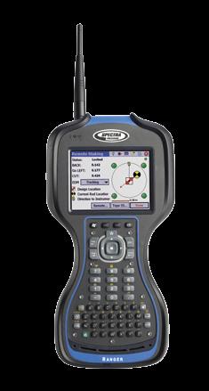
2 SURVEY PROSimplicity, Reliabilty, and Security Spectra Precision Survey Pro software gives you a complete set of tools for all your survey projects. It s fast, easy to use and reliable, so you can work more productively in the field. Use Survey Pro on a range of field proven Spectra Precision rugged data collectors. Spectra Precision Ranger 3 Data Collector The third generation Spectra Precision Ranger Data Collector offers a large, bright touch-screen, full alpha-numeric, easy to operate, keypad, and is packed with the features surveyors depend on. Built rugged, it meets rigorous MIL-STD-810G military standard for drops, vibration, humidity and extreme temperatures, and with an IP67 rating, it s designed to keep your investment and your data safe. The Ranger 3 features Survey Pro and Windows Mobile 6.5, with the capability to run the mobile version of all your favorite programs including Excel and Outlook. Integrated Bluetooth capabilities let you connect to field equipment without cables. The Ranger 3 comes standard with 8 GB of onboard memory for storing data. Move your data fast and easily using a SDHC card, Bluetooth, USB cable, or USB memory stick, Wi-Fi, or GSM WWAN modem. Choose from four different models of the Ranger with the features that best suit your needs and your budget. They re all power-packed, so there s no wrong choice. Spectra Precision Nomad 900 Data Collector The Spectra Precision Nomad Data Collector, packed with functionality, is an extremely powerful and full-featured rugged data collector. In addition to meeting rigorous military standards the Nomad uses a high speed 806 MHz processor, a longlife, 5200 mah lithium-ion battery, and integrated wireless capabilities like GPS, Wi-Fi g, and Bluetooth for power and flexibility. The Nomad features a high resolution, sunlight-visible full VGA display that shows graphics and maps in crisp detail plus a backlit numeric keypad. The Nomad is available in a range of solutions from the powerful 900XC, the traditional 900LD and the economical 900B, each packed with features and benefits to suit your specific needs.
 8 GB 8 GB 8 GB 8 GB")


 2 GB 1 GB 512 MB MEMORY Spectra Precision Nomad 900 Data Collector")

3 MODELS OVERVIEW 3XR 3RC 3XC 3L PROCESSOR/SPEED ARM Cortex A8 800 Mhz 800 Mhz 800 Mhz 800 Mhz MEMORY SDRAM 256 MB 256 MB 256 MB 256 MB Data Storage (On-board Flash) 8 GB 8 GB 8 GB 8 GB WIRELESS Integrated Bluetooth Standard Standard Standard Standard Wi-Fi Standard Standard Standard Standard 3G GSM WWAN Standard N/A Standard N/A 2.4 GHz robotic radio Module Standard Standard N/A N/A FEATURES Spectra Precision Ranger 3 Data Collector Compass Standard Standard Standard Standard Accelerometer Standard Standard Standard Standard 5MP Camera with LED flash Standard Standard Standard N/A Navigation grade GPS Standard Standard Standard Standard MODELS OVERVIEW 900XC 900LD 900B PROCESSOR/SPEED Marvell PXA320 XScale 806 Mhz 806 Mhz 806 Mhz MEMORY DDR SDRAM 128 MB 128 MB 128 MB Data Storage (On-board Flash) 2 GB 1 GB 512 MB MEMORY Spectra Precision Nomad 900 Data Collector Integrated Card Slots SD SD SD/CF Integrated Bluetooth Standard Standard Standard Integrated GPS, Navigation Grade Standard Standard N/A Integrated Wi-Fi g Standard Standard N/A Integrated WWAN Standard N/A N/A Integrated Camera Standard N/A N/A


4 SURVEY PRO All the tools you need to do the job right Spectra Precision Survey Pro gives you comprehensive tools to collect, work with, and organize your survey data. Use it for traverse, sideshot, coordinate geometry, staking and adjustment functions. Survey Pro provides complete control of your survey and your data. Whatever type of surveying you do, you can do it with Survey Pro. There s Nothing Better Full featured data collection, calculation, mapping, data storage, and data management, all in one package. Survey Pro works with GPS/GNSS, Robotic instruments, mechanical instruments, and even manually. Data can be combined seamlessly and processed through the office software without hassles. Based on over 20 years of survey software development experience, the latest version of Survey Pro now does even more to increase productivity, reduce errors, and ensure you can do your work the way it needs to be done. FIRST CHOICE OF S U R V E Y O R S


5 Setup Survey Pro setup routines are designed to get you working as soon as possible. Multiple instrument setup options using known points or resection means you can work the way you need to work. Results are conveniently displayed making it easy to check the setup. All setup data is stored and is easily reviewed and edited as necessary using the integrated data editor. If an instrument height is updated, all affected coordinates will also be updated. Survey Pro puts you in control. GNSS Setup Survey Pro provides two main methods of configuring a GNSS survey: Mapping Plane and Calibration. With these two methods, there is nearly infinite flexibility. Calibration allows you to use a local coordinate system, often set using total stations. This keeps everything aligned which makes you more productive. Survey Pro walks you through the process and provides check routines to ensure everything is spot on. Feature and Attribute collection You can define features like utility pole and water line using feature codes in the field or in the office. Add features and attributes as you survey. Using line features, Survey Pro will automatically draw lines in real time making it easy tto verify your work before leaving the job site. Process and adjust the data in Spectra Precision Survey Office and export to common data formats when you are done. COGO, Inverse, and Curves Survey Pro software provides powerful Coordinate Geometry (COGO), Inverse and Curve functions. Survey Pro offers a full suite of COGO functions, enabling you to easily perform calculations between a known and new point, compute offset, lines, alignments and points. Survey Pro inverse functions allow you to quickly inverse to points, lines, polylines, and alignments, making it easy to verify point locations and offsets from existing as staked features or linework created on the data collector. The Survey Pro Curve menu contains powerful curve functions that compute and display all elements of horizontal circular curves, spirals or vertical parabolic curves. It then provides the most common methods to help you layout the curve in the field. Active Maps Seeing your data graphically helps speed your work and ensures there are no mistakes. Survey Pro provides several exciting map features for just this reason. Active Maps provide a way to do calculations or initiate measurements right from the map views. Tap on a point to stake it. Tap two points to compute the inverse. Or, enter Survey Mode and collect points seeing them appear on the map as they are measured. Active Background Maps provide a method of importing DXF files that can be used for calculations or staking. Select a DXF line and offset points or stake it. You have full control of the DXF file layers; hide them, show them, or freeze them. See what you need to see, how you need to see it. Stakeout Survey Pro provides tools to complete your stakeout tasks more efficiently. Using an active map view or interactive features, Survey Pro navigates you to the points you need to stake, when you need to stake them. Points are checked off as they are staked, preventing you from duplicating observations. Survey Pro stores all measurement data and any as-built or as staked points that are collected. This data can then be used for cut sheet reports in the office either using Spectra Precision Survey Office or XML Style sheets. Stake DTM surfaces and use the data collected to compute volumes in the field. View the resultant DTM being staked in the field to determine where additional points might be needed. Survey Pro displays cut / fill information for any location on the DTM surface in real-time.


6 SURVEY PROPower Survey Pro continually improves with capabilities that make your job easier, help you work more productively, and get the job done right. Some of the most recent feature enhancements include: Data Management Control Flexibility in data collection with the ability to edit survey data to fix entry errors or blunders and immediately get updated coordinates. Change a rod height and see the change cascade through the file with our enhanced dynamic file viewer/editor. Features Active DXF Support staking with DXF files to enable data flow from design software to your field crews, improving efficiency on the road or construction site. Import a DXF file as a background map to select objects like lines and nodes for staking or calculations. Survey Pro also provides control over the layers you are viewing and what layers you can select objects from allowing you to see what you need to see. Optimized Workflow Survey Pro contains a user customizable Home screen enabling you to configure your favorite choice of field processes to expedite your daily workflow. Easily switch between functions by selecting the home screen and choosing your next action. Also use the graphical Active Survey map screen to speed your activities. For example, tap and hold to create new points, then select your points and switch to your graphical stakeout screen to complete the task. When you choose Survey Pro, you get software built on more than 20 years of experience. You also get software that s continually enhanced thanks to input from surveyors in the field. Many of our people including members of the Survey Pro development team have worked as surveyors so we understand how a small change to an existing function can help you be more productive or make your job easier. That s why and how we continuously improve Survey Pro, along with all our hardware and software. So go ahead tell us how we can make Survey Pro work even better for you send an to surveypro@spectraprecision.com


7 Road Layout Survey Pro uses road alignment data defined in the Survey Pro job file or directly from a LandXML file. Key in and modify road layout information, then stake the road in the field. Survey Pro makes defining a simple or complex road quick and easy by providing easy to follow menus that take you through the road definition and editing process. Road Stakeout The road staking capabilities enable you to stake any part and even locate catch points. Once your road has been uploaded or keyed in, Survey Pro provides a comprehensive set of road stakeout tools and graphical views, depending upon which element of the road you are staking out. Quickly edit and view the road definition in the field using the road editor. Points can also be staked out to a predefined subgrade offset, depending upon the phase of the job you are working on. Slope Staking Simply define a direction to use for the slope to extend, and define the desired slope to stake. Survey Pro displays all shots on a vertical realtime map display so you can see the profile, and quickly locate and stake the catch point. SURVEY STANDARD is a complete data collection package for surveyors. It contains a complete COGO suite as well as traverse, sideshot and staking routines. SURVEY PRO shares all Survey Standard functions and adds advanced road layout routines, advanced staking routines, attribute collection, DTM routines and much more. SURVEY PRO GNSS shares nearly all the Survey Pro functions, and it provides the capability to collect data from RTK GNSS receivers at centimeter-level accuracy. Survey Pro GNSS software is easy to use, reduces training and simplifies setups. It provides meaningful error messages if anything goes wrong. All staking functions are supported in the GNSS module too. SURVEY PRO ROBOTICS shares all Survey Pro functions, works with all major brands of robotic total stations, and adds graphical staking screens. SURVEY PRO MAX is the ultimate field software. It integrates Survey Pro Robotics and Survey Pro GNSS functions, enabling you to use the same job files with both GNSS receivers and total stations.
8 Survey Pro Software Functions Survey Standard Survey Pro Survey Pro Robotics Survey Pro GNSS Survey Pro Max TITLE BAR/TASK BAR/Menu Toggle collection mode (total station/ GNSS) Battery status indicator Map access button Editable quick picks Home screen Build your own custom menu File Import/export JOB, RAW 1, TXT, CSV, LandXML, JobXML, CR5. Import Control Backup/Restore Job Edit points/polylines Edit alignments Auto linework (real time) View/edit raw data View DTM Manage layers Calculator AU Conversions SURVEY (CONVENTIONAL MODE) Backsight setup Traverse/sideshot Quick shot 4 Repetition shots Multiple sideshots Distance/angle offset Corner & 2 lines Corner & angle Corner & offset Corner & plane Shoot from 2 ends Resection Remote elevation Check point Bluetooth support (Recon) Solar observation Remote control Fine turning Tap to turn Surface Scan 2 STakeout Quick stake 4 Cut/fill to design grade Generate cut sheet data Turn instrument to stake with 2-D and 3-D modes Remote stake from rod Stake points/list of points Stake to line/polyline Offset staking Slope staking from line or point Stake to line and offset Stake to curve and offset Stake to spiral and offset Stake DTM Define a location Where is next point Slope stake from a point Station staking Inverse Multiple types COGO Point in direction Intersection Offset line/points Corner angle Compute area Triangle solutions Map check Predetermined area HD/VD to/from SD/ZA Station & offset Curve Curve solution PI and tangents 3-point curve Radius point Tangent to circles Curve layout Traverse on a curve Parabolic curve/layout Straight grade Spiral/spiral layout Traverse on a spiral Roads Create/edit templates (cross-sections) Create/edit alignments Save alignment to file Add super elevations to road Add widenings to road Road stakeout Import LandXML Roads Adjust Scale/translate/rotate Traverse adjust Map Views Active Background maps DXF Layers DXF Colors Select objects for survey operations Active Survey Map Collect points Manage linework Inverse point to point or line or location Create Point Stake to point or location Show past results Survey Setup display Occupy point Backsight point Base location Rover location Rod location Survey (GNSS MODE) Cell phone/radio modem settings GPS/GNSS status Network connection manager Base/rover setup (Smart Setup) Control points Collect point, features, offset Projection setup/statistics Remote elevation Projection Calculator Receiver file manager 3 Settings (GNSS MODE) Post process Map Projection or Calibration (local transformation) modes Adjust with projection and control update All stakeout functions with GPS receiver Please note: This chart is an abbreviated general guide to software functions. All specifications are subject to change without notice. 1. Export Only. 2. Requires motorized instrument. 3. For Spectra Precision and Trimble receivers. 4. Only available on the Nivo C, FOCUS 8 and FOCUS 30. SURVEY STANDARD is a complete data collection package for surveyors. It contains a complete COGO suite as well as traverse, sideshot and staking routines. SURVEY PRO shares all Survey Standard functions and adds advanced road layout routines, advanced staking routines, attribute collection, DTM routines and much more. SURVEY PRO GNSS shares nearly all the Survey Pro functions, and it provides the capability to collect data from RTK GPS/GNSS receivers at centimeter-level accuracy. The GNSS software is easy to use, reduces training and simplifies setups. It provides meaningful error messages if anything goes wrong. All staking functions are supported when using GNSS receivers. SURVEY PRO ROBOTICS shares all Survey Pro functions, works with all major brands of robotic total stations, and adds graphical staking screens. SURVEY PRO MAX is the ultimate field software. It integrates Survey Pro Robotics and Survey Pro GNSS functions, enabling you to use the same job files with both GPS/GNSS receivers and total stations. Contact Information: AMERICAS Spectra Precision Division Westmoor Drive, Suite #100 Westminster, CO USA Phone (Toll Free in USA) EUROPE, MIDDLE EAST AND AFRICA Spectra Precision Division Rue Thomas Edison ZAC de la Fleuriaye BP Carquefou (Nantes) FRANCE +33-(0) Phone ASIA-PACIFIC Spectra Precision Division 80 Marine Parade Road #22-06, Parkway Parade Singapore SINGAPORE Phone Please visit for the latest product information and to locate your nearest distributor. Specifications and descriptions are subject to change without notice , Trimble Navigation Limited. All rights reserved. Spectra Precision is a Division of Trimble Navigation Limited. Spectra Precision and the Spectra Precision logo are trademarks of Trimble Navigation Limited or its subsidiaries. The EPOCH and FOCUS trademarks are registered in the United States and in other countries. LockNGo and StepDrive are unregistered trademarks of Trimble Navigation Limited. Windows Mobile is a trademark of Microsoft Corporation, registered in the United States and/or other countries. Ashtech, the Ashtech logo, Z-Blade and ProMark are trademarks of Ashtech S.A.S. or its subsidiaries. All other trademarks are the property of their respective owners. PN A (07/12) SCAN THIS CODE FOR MORE INFORMATION
Survey Pro Software. Includes Spectra Precision Central: Spectra Precision s cloud computing solution. Survey Pro: Simply The Best
 Survey Pro Software Includes Spectra Precision Central: Spectra Precision s cloud computing solution. Survey Pro: Simply The Best SURVEY PROSimplicity, Reliability, and Security Spectra Precision Ranger
TECHNICAL NOTES SURVEY PRO WITH TSX
 SURVEY PRO WITH TSX TECHNICAL NOTES Survey Pro software from TDS is the data collection solution of choice for most North American surveyors 1. And with the addition of the Trimble TSX (Trimble Systems
TECHNICAL NOTES TRIMBLE SURVEY CONTROLLER SOFTWARE
 TRIMBLE SURVEY CONTROLLER SOFTWARE TECHNICAL NOTES The Trimble Survey Controller software is the data collection solution that will make your survey work faster, easier, and more productive than ever before.
The #1 choice since 1995 * Productive, reliable, comprehensive
 The #1 choice since 1995 * Productive, reliable, comprehensive TDS didn t make Survey Pro the #1 surveying software.* Surveyors did. And here s why: Survey Pro gives you a complete set of capabilities
technical notes Trimble survey controller field software
 Trimble survey controller field software technical notes For more than a decade, Trimble Survey Controller field software has provided land surveyors with a complete GNSS and optical data-collection solution
TECHNOLOGY SOLUTIONS TRANSFORMING CONSTRUCTION LAYOUT. Trimble Field Link TRANSFORMING THE WAY THE WORLD WORKS
 TECHNOLOGY SOLUTIONS TRANSFORMING CONSTRUCTION LAYOUT Taking full advantage of the Trimble Tablet s processor and multi-touch screen functionality, has been designed to work the way you work. Featuring
How to update FOCUS 30 Firmware
 14 March 2013 How to update FOCUS 30 Firmware This support note will guide you through updating the firmware on a FOCUS 30 instrument. Note : If your FOCUS 30 has previously received a firmware upgrade
2012 Product Catalogue
 It s Professional 2012 Product Catalogue FOIF Canada Inc. 4180 Boul. Thimens Saint-Laurent, QC, H4R 2B9, Canada Tel: +1 (514) 336-0003 Fax: +1 (514) 336-0300 Email: info@foif.ca Web: www.foif.ca 2 2012
Trimble Field Solutions in Surveying
 Trimble Field Solutions in Surveying Trimble Survey Controllers and Field Software A total approach to managing fieldwork. RELEASE THE FULL POTENTIAL OF YOUR SURVEYING GEAR AND YOUR BUSINESS Trimble controllers
FieldGenius 2005 Ver 1.2 MicroSurvey Software, Inc. 2005
 New Functionality GPS Measurements Two new options in Program Settings that will speed up the measurement process when using an RTK receiver. Auto GPS Stats If this is turned on, during a measurement if
Trimble Survey Controller. Release Notes
 Trimble Survey Controller Release Notes Version 10.5 Revision A September 2002 Corporate Office Trimble Navigation Limited Engineering and Construction Division 5475 Kellenburger Road Dayton, Ohio 45424-1099
Leica FlexField plus & Leica FlexOffice A Perfect Match
 Leica FlexField & Leica FlexOffice A Perfect Match FlexField Onboard Software General File Management Data Import Data Export Status icon bar Instrument Protection with PIN Stake Out beep Map Select Programs
trimble gnss surveying systems
 trimble gnss surveying systems TRIMBLE GNSS SYSTEMS: SOLVING YOUR CHALLENGES IN THE FIELD INDUSTRY-LEADING GNSS SOLUTIONS DESIGNED WITH THE SURVEYOR IN MIND Backed by a legacy of GNSS technology surveying
GeoMax GNSS ZGP800 Series. Works when you do
 GeoMax GNSS ZGP800 Series Works when you do GeoMax About Us GeoMax is an internationally active company developing, manufacturing and distributing quality surveying instruments. We provide a comprehensive
technical notes trimble business center software
 technical notes trimble business center software A POWERFUL SURVEY DATA OFFICE SOFTWARE SUITE DESIGNED FOR TODAY'S FAST-PACED SURVEYING OFFICE, TRIMBLE BUSINESS CENTER SOFTWARE UNLOCKS THE POTENTIAL OF
General GPS TPS ROB X POLE VOL RDN RPL Jobs management System settings (units, precision, parameters, etc.)
") XPAD Survey Modules XPAD Survey GPS TPS XPOLE General GPS TPS ROB XPOLE VOL RDN RPL Jobs management System settings (units, precision, parameters, etc.) Instruments GPS GPS TPS ROB XPOLE VOL RDN RPL Instrument
XPAD Survey Modules XPAD Survey GPS TPS XPOLE General GPS TPS ROB XPOLE VOL RDN RPL Jobs management System settings (units, precision, parameters, etc.) Instruments GPS GPS TPS ROB XPOLE VOL RDN RPL Instrument
TRIMBLE FIELD POSITIONING SOLUTIONS FOR GENERAL CONTRACTORS
 TRIMBLE FIELD POSITIONING SOLUTIONS FOR GENERAL CONTRACTORS Construction Layout for General Contractors SETTING THE STANDARD construction layout solution for the general contractor. With the increasing
Perpendicular Offsets - point picker is a check-box type button and will now remain in effect until switched off.
 New Functionality Raw File Viewer This now has a View button that allows the user to see the map in a split view. Tapping on certain records will show up as icons in the view. For example tapping an OC
TRIMBLE ACCESS TRIMBLE ACCESS PROJECTS AND JOBS GUIDE
 TRIMBLE ACCESS TRIMBLE ACCESS PROJECTS AND JOBS GUIDE Version 2018.10 Revision A August 2018 Contents Projects & jobs 3 Managing projects 6 To create a local project 7 File transfer 7 Trimble data folders
Release Notes SPECTRA PRECISION SURVEY OFFICE. Version
 Release Notes SPECTRA PRECISION SURVEY OFFICE Version 3.90.1 Corporate office: Spectra Precision 10368 Westmoor Drive Westminster, CO 80021 USA www.spectraprecision.com Copyright and trademarks: 2005-2017,
Evidence Recorder Release Notes
 Evidence Recorder 6.0.0 Release Notes Released on: October 5, 2009 Licensing Changes This release has had one big change and that is a new licensing system that gives us more flexibility to add different
trimble gnss surveying systems
 trimble gnss surveying systems TRIMBLE GNSS SYSTEMS: SOLVING YOUR CHALLENGES IN THE FIELD INDUSTRY-LEADING GNSS SOLUTIONS DESIGNED WITH THE SURVEYOR IN MIND Backed by a legacy of GNSS technology surveying
TRIMBLE ACCESS TRIMBLE ACCESS PROJECTS AND JOBS GUIDE
 TRIMBLE ACCESS TRIMBLE ACCESS PROJECTS AND JOBS GUIDE Version 2018.00 Revision A June 2018 Contents Projects & jobs 3 Managing projects 6 To create a local project 7 File transfer 8 Trimble data folders
Geospatial GNSS Systems TRANSFORMING THE WAY THE WORLD WORKS
 Geospatial GNSS Systems GNSS Solutions Designed with the Surveyor in Mind POWERFUL TECHNOLOGY YOU CAN DEPEND ON NO MATTER WHAT THE CHALLENGE Whether you are climbing over rough terrain to collect topographic
Leica Captivate. Software Release Notes. Field Controllers: CS20, CS35 Total Stations: TS16, TS60, MS60. Release date 5 th March 2018
 Leica Captivate v3.20 Software Release Notes Product Leica Captivate Field Controllers: CS20, CS35 Total Stations: TS16, TS60, MS60 Release date 5 th March 2018 Maintenance date 5 th March 2018 Available
Release Notes SPECTRA PRECISION SURVEY OFFICE. Versions 3.30 (64-bit)
") Release Notes SPECTRA PRECISION SURVEY OFFICE Versions 3.30 (64-bit) Corporate office: Spectra Precision 10368 Westmoor Drive Westminster, CO 80021 USA www.spectraprecision.com Copyright and trademarks:
Release Notes SPECTRA PRECISION SURVEY OFFICE Versions 3.30 (64-bit) Corporate office: Spectra Precision 10368 Westmoor Drive Westminster, CO 80021 USA www.spectraprecision.com Copyright and trademarks:
Trimble. LM80 Layout Manager A BLUEPRINT FOR SUCCESSFUL LAYOUT. Easy to Use Increased Productivity Minimum Errors and Rework Maximum Reliability
 Trimble LM80 Layout Manager A BLUEPRINT FOR SUCCESSFUL LAYOUT Easy to Use Increased Productivity Minimum Errors and Rework Maximum Reliability In a Class of its Own The Trimble LM80 is a revolutionary
Trimble s RoadLink Utility Tutorials
 Trimble s RoadLink utility is an interface between third-party road definitions and Trimble survey devices. It lets you import or key in road definitions, view them graphically, edit them if required,
GeoMax Total Station Zoom30 Series
 GeoMax Total Station Zoom30 Series GeoMax About Us GeoMax is an internationally active company developing, manufacturing and distributing quality construction and surveying instruments. We provide a comprehensive
Leica System 1200 Software Integrated Software for GPS1200 and TPS1200
 Leica System 1200 Software Integrated Software for GPS1200 and TPS1200 Leica System 1200 Software System 1200 software includes SmartWorx the onboard TPS, GPS and RX1250 software and the Leica Geo Office
technical notes Trimble survey Manager Software
 Trimble survey Manager Software technical notes Powerful field and office software for the acquisition, processing, and display of precise real-time surveys. Never has the integration of survey data from
TRIMBLE TOTAL STATIONS: TRUSTED TODAY, DESIGNED FOR TOMORROW.
 GEOSPatial SOLUTIONS Trimble S-SERIES TOTAL Stations TRIMBLE TOTAL STATIONS: TRUSTED TODAY, DESIGNED FOR TOMORROW. For more than a decade, on countless jobs all over the world, Trimble Robotic s have delivered
TRIMBLE GEOMATICS OFFICE TECHNICAL NOTES
 The Trimble Geomatics Office software is an important part of Trimble s total surveying solutions. Never has the collection, processing, and management of survey data been so easy. Surveyors and engineers
Trimble Railways GEDO Trolley System
 Trimble Railways GEDO Trolley System Trimble Railways GEDO Trolley System In the railway industry, projects require different applications of measurement techniques. The Trimble Railways GEDO Trolley System
TRIMBLE S6 ACCESSORIES BUNDLES GUIDE
 TRIMBLE S6 ACCESSORIES BUNDLES GUIDE TRIMBLE S6 SERVO ACCESSORY KIT RECOMMENDATIONS SLSU-S2001 Servo Target Kit containing: 571126110 Prism: Reflector tiltable, large 63.5 mm (2.5 in) 571126311 Signal
Reference Manual. TopSURV OnBoard
 Reference Manual TopSURV OnBoard TOC Table of Contents What s New with TopSURV... ix Preface... xiii Terms and Conditions... xiii Manual Conventions... xv Introduction... 1-1 Title Bar... 1-2 Menu Bar...
THALES NAVIGATION. FAST Survey. Field Guide.
 THALES NAVIGATION FAST Survey Field Guide www.thalesnavigation.com Printed in France. Part Number: 630887-01, Revision A. No part of this publication or the computer programs described in it may be reproduced,
GeoMax Total Station Zoom30 Series
 GeoMax Total Station Zoom30 Series GeoMax About Us GeoMax is an internationally nology group with strong mar- The close cooperation within active company developing, ket positions within measure- the Hexagon
Release Notes SPECTRA PRECISION SURVEY OFFICE. Version 3.60
 Release Notes SPECTRA PRECISION SURVEY OFFICE Version 3.60 Corporate office: Spectra Precision 10368 Westmoor Drive Westminster, CO 80021 USA www.spectraprecision.com Copyright and trademarks: 2005-2015,
Provided by Xpert Survey Equipment Click Topcon GPT-8003A for Product Info and Updated Pricing GPT-8000A/GTS-810A SERIES AUTO TRACKING TOTAL STATION
 Provided by Xpert Survey Equipment Click Topcon GPT-8003A for Product Info and Updated Pricing GPT-8000A/GTS-810A SERIES AUTO TRACKING TOTAL STATION The Solo Survey System that puts you in control The
DATA COLLECTORS FC-100 / FC-2000
 FC-100 / FC-2000 DATA COLLECTORS Topcon Field Computers; FC-100 and FC-2000 Compact, ultra bright, sealed and sturdy field computers. The demands of modern field data collection and control have changed
Processing Feature Codes SPECTRA PRECISION SURVEY OFFICE TUTORIAL
 Processing Feature Codes SPECTRA PRECISION SURVEY OFFICE TUTORIAL Corporate office: Spectra Precision 10355 Westmoor Drive Suite #100 Westminster, CO 80021 USA Phone: +1-720-587-4700 Toll free (in USA):
Trimble. S6 Total Station. Demonstration Guide
 Trimble S6 Total Station Demonstration Guide Version 1.00 Revision A Part Number 022543-106 January 2005 Contact Information Trimble Geomatics and Engineering Division 5475 Kellenburger Road Dayton, Ohio
technical notes Trimble business CenTer software trimble BuSineSS Center your Complete office Solution
 Trimble business CenTer software technical notes trimble BuSineSS Center your Complete office Solution designed for today's fast-paced surveying office, trimble Business Center unlocks the potential of
Leica FlexLine TS09plus Full Precision at High Performance
 Leica FlexLine TS09plus Full Precision at High Performance The First Plus: Original Leica Geosystems Quality For most, quality is relative. Not so at Leica Geosystems. To ensure our instruments meet the
X-PAD Ultimate. The Ultimate solution in the field. Works when you do
 Works when you do X-PAD Ultimate The Ultimate solution in the field X-PAD Ultimate is a tailored, flexible, modular, ideal, customised software for high end topographic tasks, such as measure, stake-out,
USER GUIDE. Trimble SCS900 software
 USER GUIDE Trimble SCS900 software Version 3.5.1 Revision A April 2016 1 Corporate Office Trimble Navigation Limited 935 Stewart Drive Sunnyvale, CA 94085 USA www.trimble.com Heavy Civil Construction Division
DPS900 SOFTWARE QUICK REFERENCE CARD FOR PILING OPERATORS
 DPS900 SOFTWARE QUICK REFERENCE CARD FOR PILING OPERATORS This document contains information for piling operators on how to use the Trimble DPS900 software. For information for supervisors, please refer
Presentation Overview
 Stringless Concrete Paving STRINGLESS CONCRETE PAVING ACPA BUS TOUR AUGUST 5, 2015 Presentation Overview 1) Manufactures 2) Components needed for Stringless Paving 3) Conventional Methods VS Stringless
TechnicalNotes. Trimble Survey Controller v10.0 Software THE ADVANCED TOTAL FIELD SOLUTION FROM TRIMBLE
 TechnicalNotes Trimble Survey Controller v10.0 Software THE ADVANCED TOTAL FIELD SOLUTION FROM TRIMBLE The Trimble Survey Controller software utilizes more of your senses to make your survey work faster,
TRIMBLE ACCESS PIPELINES USER GUIDE
 TRIMBLE ACCESS PIPELINES USER GUIDE Version 2018.00 Revision A June 2018 Contents Introduction 4 Jobs, tallies and joint maps 5 Stakeout 9 Pipelines jobs 10 To configure Pipeline options 10 To link weld
Leica FlexLine TS06plus Top Precision meets High Efficiency
 Leica FlexLine TS06plus Top Precision meets High Efficiency The First Plus: Original Leica Geosystems Quality For most, quality is relative. Not so at Leica Geosystems. To ensure our instruments meet the
ProMark 3RTK. High Precision Without the High Cost
 ProMark 3RTK High Precision Without the High Cost High-Precision RTK ProMark 3 RTK Proprietary Magellan RTK Technology ProMark3 RTK offers complete real-time GNSS surveying and mobile mapping capabilities
Trimble Realworks Software
 TECHNICAL NOTES Trimble Realworks Software A Powerful 3D Laser Scanning Office Software Suite DESIGNED FOR TODAY S MULTIFACETED SCANNING PROFESSIONAL, TRIMBLE REALWORKS IS A POWERFUL OFFICE SOFTWARE THAT
Leica Captivate. Software Release Notes. Field Controllers: CS20, CS35 Total Stations: TS16, TS60, MS60. Release date 1 st December 2017
 Leica Captivate v3.00 Software Release Notes Product Leica Captivate Field Controllers: CS20, CS35 Total Stations: TS16, TS60, MS60 Release date 1 st December 2017 Maintenance date 1 st December 2017 Available
Leica Captivate. Software Release Notes. Field Controllers: CS20, CS35 Total Stations: TS16, TS60, MS60, TS13 GNSS Sensors: GS18 T
 Leica Captivate v4.10 Software Release Notes Product Leica Captivate Field Controllers: CS20, CS35 Total Stations: TS16, TS60, MS60, TS13 GNSS Sensors: GS18 T Release date 10 th December 2018 Maintenance
Realworks Software. A Powerful 3D Laser Scanning Office Software Suite
 TECHNICAL NOTES Realworks Software A Powerful 3D Laser Scanning Office Software Suite Trimble RealWorks is a powerful office software that imports rich data from your 3D laser scanning instrument and transforms
RealWorks Software. A Powerful 3D Laser Scanning Office Software Suite
 TECHNICAL NOTES RealWorks Software A Powerful 3D Laser Scanning Office Software Suite Trimble RealWorks is a powerful office software that imports rich data from your 3D laser scanning instrument and transforms
RELEASE NOTES. Trimble Access Software
 RELEASE NOTES Trimble Access Software Version 2017.11 Revision A March 2018 1 Legal Information Trimble Inc. www.trimble.com Copyright and Trademarks 2009 2018, Trimble Inc. All rights reserved. Trimble,
Trimble Survey Controller
 Trimble Survey Controller Getting Started Guide www.trimble.com Trimble Survey Controller Getting Started Guide Version 10.5 Revision A Part Number 571 702 061 September 2002 Corporate Office Trimble
Provided by Xpert Survey Equipment Click Topcon GPT-8205A for Product Info and Updated Pricing GPT-8200A/GTS-820A SERIES AUTO TRACKING TOTAL STATION
 Provided by Xpert Survey Equipment Click Topcon GPT-8205A for Product Info and Updated Pricing GPT-8200A/GTS-820A SERIES AUTO TRACKING TOTAL STATION The Solo Survey System that puts you in control The
SGS PRIME COGO. Version Reference Manual. November 12,
 SGS PRIME COGO Version 1.3 - Reference Manual November 12, 2018 https://sgss.ca/ 1 Installation... 5 New Installation... 5 Upgrade to new Version... 6 Running SGS Prime COGO... 7 License Key... 8 2 Main
Trimble Site EASY-TO-USE RELIABLE ACCURATE
 Trimble Site Positioning Systems ACCURATE RELIABLE EASY-TO-USE more tools for more jobs Estimators Bid Team Site Surveyor Data Manager Site Engineer/Grade Checker Site Foreman/Supervisor Project Manager
Trimble Access and Trimble SX10 Scanning Total Station Guide
 Trimble Optical and Field Software October 2016 Trimble Access and Trimble SX10 Scanning Total Station Guide Trimble SX10 Scanning Total Station Innovative True merging of high-speed scanning, enhanced
Features and Benefits
 CAiCE Visual Survey 10 Features and Benefits CAiCE Visual Survey 10 software enables surveying professionals to import, process, analyze, and present surveying all in one software package. Visual Survey
TechnicalNotes. Trimble Total Control Software
 TechnicalNotes Trimble Total Control Software POWERFUL GEODETIC CONTROL FOR ALL SURVEY PROJECTS A survey is only as good as its control elements. Trimble Total Control software puts you in total control
TechnicalNotes. Geodimeter Control Unit
 TechnicalNotes Geodimeter Control Unit THE ADVANCED TOTAL FIELD SOLUTION FROM TRIMBLE Today s land surveyors demand high productivity, total flexibility, and top quality from their instruments. The Trimble
GeoMax TPS family. Works when you do.
 Works when you do GeoMax TPS family GeoMax has a complete TPS portfolio to fulfill the needs of all users. Ensure ultimate reliability with GeoMax TPS systems even in challenging environments. Providing
Licensed Features - Trimble Business Center v3.10
 Licensed Features - Trimble Business Center v3.10 The following table lists the features available in Trimble Business Center based on the installed. Feature No License Base Complete Advanced Photogrammetry
Site calibration improvements for GPS operations. Stakeout line changes. Call API toll free (888)
") Welcome to the Q4 Edition of the API Newsletter. This newsletter is being presented as an information tool to present new product information. If there are any questions regarding any products or services
Welcome to the Q4 Edition of the API Newsletter. This newsletter is being presented as an information tool to present new product information. If there are any questions regarding any products or services
A New Epic to a Legacy of Breakthrough Technology
 SOKKIA CLASSIC A New Epic to a Legacy of Breakthrough Technology Far from home, in the most demanding worksites, you need to rely on toughness and accuracy to pull you through. In the middle of the desert,
MicroSurvey Software Inc. All rights reserved
 Manual Version 3.2.0 December 21, 2007 2001-2007 MicroSurvey Software Inc. All rights reserved i FieldGenius 2008 v3.2.0 Disclaimer and Limited Warranty This document and the software contained herein
Release Notes TRIMBLE BUSINESS CENTER. Version 2.50
 Release Notes TRIMBLE BUSINESS CENTER Version 2.50 Corporate office: Trimble Navigation Limited Engineering and Construction Division 5475 Kellenburger Road Dayton, Ohio 45424-1099 USA Phone: +1-937-233-8921
FAQs for the Juno T41 Rugged Handheld Computer
 Aug. 15, 2012, Updated Aug. 28, 2012 FAQs for the Juno T41 Rugged Handheld Computer What is the Trimble Juno T41? The Trimble Juno T41 is an ultra-rugged smartphone inspired handheld computer for data
SCS900 SITE CONTROLLER SOFTWARE USER GUIDE
 SCS900 SITE CONTROLLER SOFTWARE USER GUIDE Version 3.61 Revision A July 2017 Corporate Office Trimble Inc. 935 Stewart Drive Sunnyvale, CA 94085 USA www.trimble.com Product Limited Warranty Information
TRIMBLE GPS SEARCH TECHNOLOGY FOR THE PROFESSIONAL SURVEYOR
 TRIMBLE GPS SEARCH TECHNOLOGY FOR THE PROFESSIONAL SURVEYOR BY TIM LEMMON AND CHRIS VAN DER LOO, TRIMBLE APPLICATIONS SPECIALISTS, WESTMINSTER, COLORADO, U.S.A. ABSTRACT The Global Positioning System (GPS)
REFERENCE. Section 6. Field Use Tutorial 2-1
 REFERENCE Section 6 Field Use Tutorial 2-1 REFERENCE 2-2 Field Use Overview RTK GPS support is an additional feature in Sitework 4D, which must be purchased separately. In addition to creating takeoffs
FieldGenius 2010 Release Notes
 FieldGenius 2010 Release Notes This document contains the release notes for all FieldGenius 2010 releases. The latest release notes can be found at the end of the document. FieldGenius 2010 4.2.0 (Released
RELEASE NOTES. Trimble Access Software
 RELEASE NOTES Trimble Access Software Version 2015.21 Revision A September 2015 1 Legal Information Trimble Navigation Limited Engineering Construction Group 935 Stewart Drive Sunnyvale, California 94085
TechnicalNotes. Trimble Geomatics Office Software
 TechnicalNotes Trimble Geomatics Office Software AT LAST A SINGLE SOFTWARE PACKAGE TO HANDLE ALL OF YOUR SURVEY DATA The Trimble Geomatics Office software is a key component in the Trimble Toolbox of Integrated
DCP Pocket for TDRA6000. Gerald Koeck / Commercial Support November 2011
 DCP Pocket for TDRA6000 Gerald Koeck / Commercial Support November 2011 1 DCP Pocket for TDRA6000 Features of the new Getac Pocket PC solution with DCP Pocket: Mobile Metrology software solution DCP Pocket
Topcon GRS-1 1 Receiver Field Preparation
 Topcon GRS-1 1 Receiver Field Preparation What do you need to know to get started with your Topcon GRS-1? Topcon GRS-1 Receiver - Field Preparation Some Common Questions Which TopSURV modules do I buy?
SURVEY 3.0. Innovative field solutions for Surveyors X PAD. works when you do
 Innovative field solutions for Surveyors works when you do X PAD INNOVATIVE FIELD SOLUTION FOR SURVEYORS The software for survey, stakeout and control, ensuring productivity and flexibility in the field,
TRIMBLE ACCESS HELP SHEETS Using Map Functions
 1 of 5 SUPPORTED MAP FEATURES This section will guide the user through some Trimble Access Map funtions including: Importing surfaces, Alignments,.shp files,.dxf files; creating surfaces, creating lines
technical notes trimble realworks software
 technical notes trimble realworks software A POWERFUL 3D LASER SCANNING OFFICE SOFTWARE SUITE Designed for today s multifaceted scanning professional, Trimble RealWorks is a powerful office software that
Comprehensive Seismic Survey Design And Data Processing. Trimble GPSeismic TRANSFORMING THE WAY THE WORLD WORKS
 Comprehensive Seismic Survey Design And Data Processing Trimble GPSeismic GPSeismic GPSeismic has been continuously developed for over twenty-five years by engineers whose combined professional backgrounds
TcpMDT. Digital Terrain Model Version 7.5. TcpMDT
 Digital Terrain Model Version 7.5 Versions and Modules PROFESSIONAL STANDARD IMAGES SURVEYING POINT CLOUD Product Features STANDARD Surveying Points Management Digital Terrain Model Contours Terrain Cross
EPAD data logger Latest PDA technology for data recording in Mine Action
 Search and locate EPAD data logger Latest PDA technology for data recording in Mine Action Rugged PDA-type data logger meeting MIL Spec 810F Available in numerous languages Easy to use level for basic
SURVEYING INSTRUMENTS SDR8100 SOKKIA. Data Collection Platform
 SURVEYING INSTRUMENTS SOKKIA SDR8100 Data Collection Platform The SDR8100 The SDR8100 provides precise data collection by combining a progressive keyboard layout, high-contrast touch-screen interface and
Version 7.1 English. Leica GPS1200+ Applications Field Manual
 Version 7.1 English Leica GPS1200+ Applications Field Manual Introduction Purchase Product identification Congratulations on the purchase of a GPS1200+ Series instrument. To use the product in a permitted
HV601/HV602 for General Construction
 HV601/HV602 for General Construction CONTROL YOU CAN RELY ON Accurate Versatile Fast Easy to Use Precision Leveling and Aligning Maximum Versatility The Spectra Precision Laser HV601 and HV602 from Trimble
X PAD Construction 2.5.5
 News X PAD Construction January 2014 X PAD Construction 2.5.5 This document contains a list of all changes, new features, bug fixed introduced in this last version of X PAD Construction. GPS RTCM3.1: RTCM3.1
Trimble SCS900 Site Controller Software for Beginners. Jordan Lawver HCC-6339
 Trimble SCS900 Site Controller Software for Beginners Jordan Lawver HCC-6339 Agenda What is Trimble SCS900 Site Controller Software? Who uses SCS900 Trimble Site Positioning System software portfolio Applications
Evidence Recorder Release Notes
 Evidence Recorder 7.1.0 Release Notes Released on: August 20, 2010 Important Notes We will be dropping support for several older builds of Evidence Recorder including: Allegro CE, Toughbook, Recon.Net,
trimble r10 GNSS System
 TRIMBLE R10 SERIES RECEIVER QUICK START GUIDE trimble r10 GNSS System C Warning: For safety information, refer to the Safety Information section of the Trimble R10 GNSS Receiver User Guide. Five simple
ProMark 120 / ProMark 220
 ProMark 120 / ProMark 220 Frequently Asked Questions 1. WHAT IS THE PROCESSOR SPEED?... 2 2. WHAT IS THE MEMORY CAPACITY?... 2 3. HOW CAN I USE THE RECEIVER SUSPEND MODE?... 2 4. HOW CAN I MAKE A RESET
The Trimble 3D Scanning Solution: Designed by Surveyors for Surveyors
 The Trimble 3D Scanning Solution: Designed by Surveyors for Surveyors TRIMBLE 3D SCANNING Designed by surveyors for surveyors, the Trimble 3D scanning solution follows the surveying workflow you re familiar
Dell Studio 1569 Comprehensive Specifications
 Dell Studio 1569 Comprehensive Specifications This document provides information that you may need when setting up, updating drivers for, and upgrading your computer. NOTE: Offerings may vary by region.
TRIMBLE BUSINESS CENTER
 TRIMBLE BUSINESS CENTER Release Notes Version 3.40 (64-bit) Geospatial Division, 10368 Westmoor Drive, Westminster, CO 80021, USA 2014, Trimble Navigation Limited. All rights reserved. Trimble, the Globe
MC75A HF PREMIUM HF RFID CONTACTLESS MOBILE COMPUTER
 Page 1 of 6 PRODUCT SPEC SHEET MC75A HF MC75A HF PREMIUM HF RFID CONTACTLESS MOBILE COMPUTER THE RIGHT MOBILE SOLUTION FOR TICKETING, IDENTITY AND ACCESS MANAGEMENT Zebra's MC75A HF takes its place as