GeoRadar Division IDS Australasia
|
|
|
- Denis Eaton
- 6 years ago
- Views:
Transcription
1 IDS Australasia Radar tools for detecting and mapping of sub surface utilities
2 Company Overview IDS is a world leader in Radar technology solutions to Civil and Defence markets IDS currently employs ~400 employees IDS is divided into 4 Divisions PPG/2009/0248 All rights reserved to IDS 2


3 Customers Naval Division Aeronautical Division Aeronavigation Division Georadar Division IDS Laboratories Computer Science & Information Technology Lab. EM Design Framework Lab. Avionics Lab. RADAR Systems Lab. Air Navigation Systems Lab. Signatures Techologies Lab. Research and Development Lab. PPG/2009/0248 All rights reserved to IDS 3


4 International presence IDS UK IDS Brazil IDS North America IDS Australasia Subsidiary offices and worldwide dealers extend IDS network to over 40 countries Deliver after sales services, maintenance and support and ongoing training 4


5 Interferometric radar applications SLOPE STABILITY BRIDGE TESTING DAM MONITORING CULTURAL HERITAGES LAND SUBSIDENCE INDUSTRIAL FACILITIES


6 Inteferometry radar PPG/2009/0248 All rights reserved to IDS 6


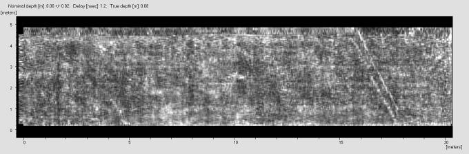
7 GPR applications UTILITIES DETECTION AND MAPPING GEOLOGY AND ENVIRONMENT TRANSPORT ENGINEERING ARCHEOLOGY AND CULTURAL HERITAGES CIVIL ENGINEERING FORENSIC AND SECURITY All rights reserved to IDS Australasia. Do not distribute.
8 Civil Applications Ground Penetrating Radar (GPR)


9 tunnel GPR river RIS MF Hi-MOD Detector DUO Stream MT Stream EM Stream Hi-BriT Aladdin RIS Plus Hi Pave
10 Why GPR?

11 THE NEED FOR UTILITY LOCATING TECHNOLOGIES The cause of many accidents during excavations/dd installations is a lack of knowledge of the subsoil conditions A 36-fiber optic cable can carry up to 870,912 circuits and generate more than $175,000 per minute in revenue In 2003, there were in the U.S. more than 104,000 hits or third-party damage to gas pipelines From: Utility Locating Technologies: summary of responses to a Statement of Need FLCTT Washington, DC PPG/2008/00xx All rights reserved to IDS
12 Introduction to GPR


13 GPR Basic Operation G P R Principle All rights reserved to IDS Australasia. Do not distribute.

14 Delay time Antenna
15 IDS Technology
16 Technological Advancement Hardware advancement Adaption for dual frequency antennas Latest technology in Control unit on market permits fast acquisition Dense sampling results in high resolution scans Cascading of multiple antenna boxes for a larger scan width Software advancement Software tools lead to more efficient processing/elaboration of data Automatic Detection tool aids the detection of utilities Tomographic map High resolution, depth slices, exposes utilities at different depths 3D visualization PPG/2009/0248 All rights reserved to IDS 16


17 New FastWave Control Unit 6 times faster than the previous generation Control units The fastest control unit on the market: 4760 samples 2 channels acquired simultaneously Chain connection for multiple antennas Network and synchronization of Multiple Control Boxs Adaptable to full range of IDS antennas PPG/2009/0248 All rights reserved to IDS 17


18 Dense Sampling 10 cm sampling step 20 cm sampling step 30 cm sampling step All rights reserved to IDS 18


19 Hyperbolas Automatic Detection Automatic target detection Propagation velocity estimation 2D output representation Optimized migration Automatic estimation Manual estimation PPG/2008/00xx All rights reserved to IDS
")


20 High quality tomography Higher resolution Data fusion (direction T & L and different frequency) Possibility to execute and compare results from up to 100 different processing macro Junctions (Transversal) Main (Longitudinal) SW GRED ROAD 5.2 NEW SW GRED 3D PPG/2008/00xx All rights reserved to IDS


21 3D Data representation Large data set Irregular volume representation Iso-surface Representation of different targets PPG/2008/00xx All rights reserved to IDS


22 Data Export to CAD and GIS PPG/2008/00xx All rights reserved to IDS
23 Concrete Application


24 PPG/2009/0248 All rights reserved to IDS 24


25 PPG/2009/0248 All rights reserved to IDS 25


26 PPG/2009/0248 All rights reserved to IDS 26


27 GeoRadar Division RIS Hi BrigHT: tomography Tomography: HH Polarization Tomography: VV Polarization All rights reserved to IDS 27
28 Underground Asset Detection and Mapping


29 Utilities Detection and Mapping On-site detection Detector Duo Utility Detection and Mapping RIS MF Hi-Mod Extensive utilities mapping STREAM EM All rights reserved to IDS 29

30 Detector DUO All rights reserved to IDS 30


31 Detector DUO Building on basic GPR technology Detector DUO 31


32 RIS MF Hi Mod PPG/2009/0248 All rights reserved to IDS 32

33 RIS MF Hi Mod 33

34 Stream EM Dual polarization GPR arrays 34
 module 200 MHz and 600 MHz dual frequency Detect")

35 The next generation of GPR Double polarization: DML (Detection of Main Lines) module DCL (Detection of Connection Lines) module 200 MHz and 600 MHz dual frequency Detect Longitudinal and Transverse pipes in DML DCL DML single pass Main line Excellent data sampling: o Transversal sampling: 6 cm o Longitudinal sampling: 2-8 cm Connection line All rights reserved to IDS 35
36 Stream EM project

37 UTILITIES DETECTION AND MAPPING ADVANTAGES OF MAPPING PPG/2009/0248 All rights reserved to IDS 37


38 January 2011 Kelson Underground Utility Mapping Job site location: Waipounamu Drive, Timaru Grove and Haast Close at Kelson All rights reserved to IDS 38
39 January 2011 Deployment Standard Initiative Project Project Pisa Purpose Project deliverable GPR activities Micro-trenching trial Deployment Standard Initiative (DSI) conducted by MED (NZ) Develop a National standard for the installation of UFB networks in NZ Underground Utility mapping to facilitate Micro-trenching on road, footpath and grass verge Detect all underground utilities, specifically shallow utilities Verify the micro-trenching path and identify all shallow utilities Tomographic map showing the longitudinal pipes and the junctions All rights reserved to IDS 39
40 January 2011 Deployment Standard Initiative Pisa Acquisition Post Processing Utilities Mapping Process Footpath acquisition Road acquisition GRED 3D and GRED HD3 software Export to CAD Automatic export of Geo-referenced data to CAD Tomographic map showing the longitudinal pipes and the junctions All rights reserved to IDS 40
41 January 2011 Deployment Standard Initiative Pisa Tomographic map showing the longitudinal pipes and the junctions All rights reserved to IDS 41

42 January 2011 Deployment Standard Initiative All rights reserved to IDS 42

43 January 2011 Deployment Standard Initiative All rights reserved to IDS 43

44 January 2011 Deployment Standard Initiative All rights reserved to IDS 44
45 January 2011 Deployment Standard Initiative Pisa Tomographic map showing the longitudinal pipes and the junctions All rights reserved to IDS 45
46 January 2011 Kelson Underground Utility Mapping Pisa Tomographic map showing the longitudinal pipes and the junctions All rights reserved to IDS 46
47 January 2011 Deployment Standard Initiative All rights reserved to IDS 47

48 January 2011 Deployment Standard Initiative All rights reserved to IDS 48
49 January 2011 Deployment Standard Initiative All rights reserved to IDS 49
50 January 2011 Deployment Standard Initiative All rights reserved to IDS 50

51 January 2011 Deployment Standard Initiative All rights reserved to IDS 51
52 January 2011 Deployment Standard Initiative All rights reserved to IDS 52
53 January 2011 Kelson Underground Utility Mapping Waipounamu Road scan All rights reserved to IDS 53
54 January 2011 Deployment Standard Initiative All rights reserved to IDS 54

55 January 2011 Deployment Standard Initiative All rights reserved to IDS 55
56 January 2011 Deployment Standard Initiative All rights reserved to IDS 56
57 January 2011 Deployment Standard Initiative All rights reserved to IDS 57
58 January 2011 Deployment Standard Initiative All rights reserved to IDS 58
59 January 2011 Deployment Standard Initiative All rights reserved to IDS 59

60 January 2011 Deployment Standard Initiative All rights reserved to IDS 60
61 January 2011 Deployment Standard Initiative All rights reserved to IDS 61
62 January 2011 Deployment Standard Initiative All rights reserved to IDS 62
63 January 2011 Deployment Standard Initiative All rights reserved to IDS 63

64 January 2011 Deployment Standard Initiative All rights reserved to IDS 64
65 January 2011 Kelson Underground Utility Mapping Waipounamu Road scan All rights reserved to IDS 65

66 January 2011 Deployment Standard Initiative All rights reserved to IDS 66
67 Benefit of GPR identified through the pilot project Reduced deployment down time and labour digging to find poorly recorded network Reduced community disruption due to faster deployments Reduced traffic management time and costs Reduced or eliminated costs for remedying strike damage to assets Accurate future service plans Enhanced tree protection through root system location identification Reduced or eliminated health and safety risks by accurately identifying hazardous network such as gas and electricity All rights reserved to IDS 67
68 Thank you Thomas Lee Pieter van Jaarsveld Henri Prevost All rights reserved to IDS 68
UtilityScan TM. Locate and Map Underground Utilities with GPR. Typical Uses. Designate Targets.
 UtilityScan TM Locate and Map Underground Utilities with GPR UtilityScan is the industry standard ground penetrating radar solution for the designation of subsurface utilities. With UtilityScan, users
Mapping underground infrastructure: The next frontier of remote sensing
 Mapping underground infrastructure: The next frontier of remote sensing Geoff Zeiss Principal Between Geospatial The Media Poles Cost of unreliable underground utility location Underground utility hit
Sensor Fusion: Potential, Challenges and Applications. Presented by KVH Industries and Geodetics, Inc. December 2016
 Sensor Fusion: Potential, Challenges and Applications Presented by KVH Industries and Geodetics, Inc. December 2016 1 KVH Industries Overview Innovative technology company 600 employees worldwide Focused
HIGH-PERFORMANCE TOMOGRAPHIC IMAGING AND APPLICATIONS
 HIGH-PERFORMANCE TOMOGRAPHIC IMAGING AND APPLICATIONS Hua Lee and Yuan-Fang Wang Department of Electrical and Computer Engineering University of California, Santa Barbara ABSTRACT Tomographic imaging systems
Critical Infrastructure Protection in the European Union
 20 January, 2015 The European GNSS Programmes 1 ICG9, Prague 9-14 November 2014 Critical Infrastructure Protection in the European Union 20 January, 2015 The European GNSS Programmes 2 Each EU Member State
Advisory Circular. Subject: INTERNET COMMUNICATIONS OF Date: 11/1/02 AC No.: AVIATION WEATHER AND NOTAMS Initiated by: ARS-100
 U.S. Department of Transportation Federal Aviation Administration Advisory Circular Subject: INTERNET COMMUNICATIONS OF Date: 11/1/02 AC No.: 00-62 AVIATION WEATHER AND NOTAMS Initiated by: ARS-100 1.
The Use of UAV s for Gathering Spatial Information. James Van Rens CEO MAPPS Winter Conference January, 2015
 The Use of UAV s for Gathering Spatial Information James Van Rens CEO MAPPS Winter Conference January, 2015 1 UAV Technological Timeline 1980 s RPV (Remotely Piloted Vehicle) Operator on ground, almost
Table of Contents. 1. Company Overview. 2. Changing Business Scenario. 3. Why TCM Maturity Model for BEL. 4. Experience and learning from TCM Model
 Table of Contents 1. Company Overview 2. Changing Business Scenario 3. Why TCM Maturity Model for BEL 4. Experience and learning from TCM Model BEL Overview Navratna PSU Manufacturing Plants Established
NOT PROTECTIVELY MARKED SUPPLIER REGISTRATION FORM
 SUPPLIER REGISTRATION FORM Thank you for taking the time to complete the Horizon Supplier Registration form. Please contact suppliers@horizonnuclearpower.com if additional assistance is required. Highlighted
Trimble VISION Positions from Pictures
 Trimble VISION Positions from Pictures This session will cover What Is Trimble VISION? Trimble VISION Portfolio What Do you Need? How Does It Work & How Accurate Is It? Applications Resources Trimble VISION
Airborne LiDAR Surveys and Data Delivery in the Pipeline Industry
 Airborne LiDAR Surveys and Data Delivery in the Pipeline Industry Carlos Femmer Faron Olivier October 25, 2011 October 25, 2011 GITA GIS for Oil and Gas Pipeline 2011 Organization Fugro is a decentralized
FIBER OPTIC CABLE ESTABLISHMENT ON ROAD NETWORK
 FIBER OPTIC CABLE ESTABLISHMENT ON ROAD NETWORK Murat Dursun BARUT Director of Intelligent Transport Systems Division General Directorate of Highways, Turkey Workshop on Cross border Co deployment of Fiber
Overhauling the Astrium Satellite Business
 Overhauling the Astrium Satellite Business Antoine Bouvier Global Investor Forum Munich 28 th /29 th April 2003 1 Astrium key figures Satellite revenues in 2002 : 1 201 M 91% Europe, 5% North America,
An Overview of Applanix.
 An Overview of Applanix The Company The Industry Leader in Developing Aided Inertial Technology Founded on Canadian Aerospace and Defense Industry Expertise Providing Precise Position and Orientation Systems
Wireless Sensor Communication Systems for Bridge Monitoring
 Wireless Sensor Communication Systems for Bridge Monitoring e-community Division, Public Sector 1, NTT DATA Corporation Yuji Ishikawa Copyright 2016 NTT DATA Corporation Copyright 2015 NTT DATA Corporation
ITALIAN DEFENCE GENERAL STAFF. The COSMO-SkyMed mission from the Italian Defence User Ground Segment perspective
 ITALIAN DEFENCE GENERAL STAFF II Department - Intelligence and Security Joint Centre for Satellite Remote Sensing The COSMO-SkyMed mission from the Italian Defence User Ground Segment perspective November
NOGGIN ADAPTABLE, HIGH-PERFORMANCE GROUND PENETRATING RADAR
 NOGGIN ADAPTABLE, HIGH-PERFORMANCE GROUND PENETRATING RADAR NOGGIN Adaptable, proven GPR to solve today s problems Noggins are available in four center frequencies, ranging from 100 MHz for deep penetration
Ground Penetrating Radar in Tree Root Detection
 Senior Thesis Ground Penetrating Radar in Tree Root Detection by Teresa Van Vleck 1999 Submitted as partial hlfillment of the requirements for the degree of Bachelor of Science in Geological Sciences at
Overview of PECO s Distribution Integrity Management Plan
 Overview of PECO s Distribution Integrity Management Plan PUC Gas Safety Seminar September 8, 2016 David Bonner, PE Robert Ridgeway, PE Agenda PECO Distribution System Overview DIMP Pillar #1 DIMP DIMP
Leica High-Definition Surveying Systems. Leica HDS3000. The Industry Standard for High-Definition Surveying
 Leica High-Definition Surveying Systems Leica HDS3000 The Industry Standard for High-Definition Surveying HDS High-Definition Surveying TM : Laser Scanning Redefined High-Definition Surveying, or HDS,
The Leica HDS Family. The Right Tool for the Job HDS3000 HDS2500 HDS4500. Cyclone & CloudWorx. Press the QuickScan button to define the field-of-view.
 HDS2500 High accuracy scanner, ideal for fixed or raised installations when leveled tripod mounting is not practical, or areas with less stringent field-of-view requirements. The Leica HDS Family Time-of-flight
GRADUATE CERTIFICATE IN MANAGEMENT SYSTEMS ADMINISTRATION
 GRADUATE CERTIFICATE IN MANAGEMENT SYSTEMS ADMINISTRATION If you are looking to develop expertise in a specialized area and broaden your knowledge base, but time and cost limitations are interfering with
Terrain Modeling and Mapping for Telecom Network Installation Using Scanning Technology. Maziana Muhamad
 Terrain Modeling and Mapping for Telecom Network Installation Using Scanning Technology Maziana Muhamad Summarising LiDAR (Airborne Laser Scanning) LiDAR is a reliable survey technique, capable of: acquiring
ROAD-SCANNER COMPACT APPLICATION FIELDS MAIN FEATURES
 ROAD-SCANNER COMPACT Mobile Mapping System by GEXCEL & SITECO collaboration A smaller mobile system for asset management and cartography suited for ZOLLER & FRÖHLICH PROFILER 9012 laser scanner. 2 + 3
A Whole New World of Mapping and Sensing: Uses from Asset to Management to In Vehicle Sensing for Collision Avoidance
 A Whole New World of Mapping and Sensing: Uses from Asset to Management to In Vehicle Sensing for Collision Avoidance Charles Toth, Dorota A Grejner-Brzezinska, Carla Bailo and Joanna Pinkerton Satellite
The Trimble 3D Scanning Solution: Designed by Surveyors for Surveyors
 The Trimble 3D Scanning Solution: Designed by Surveyors for Surveyors TRIMBLE 3D SCANNING Designed by surveyors for surveyors, the Trimble 3D scanning solution follows the surveying workflow you re familiar
Achieving a More Complete View of the Subsurface with 3D Underground Imaging
 Achieving a More Complete View of the Subsurface with 3D Underground Imaging Author: Christopher R. Proulx TBE Group, Inc. 402 S. Northlake Blvd, Suite 1020 Altamonte Spring, FL 32701 cproulx@tbegroup.com
Buried Utility Pipeline Mapping Based on Multiple Spatial Data Sources: A Bayesian Data Fusion Approach
 School of something Computing FACULTY OF OTHER ENGINEERING Buried Utility Pipeline Mapping Based on Multiple Spatial Data Sources: A Bayesian Data Fusion Approach Huanhuan Chen and Anthony G Cohn School
The 2003/4 includes: Ground Penetrating Radar Detector, Joystick to manually transmit pulses, computer cable for
 See into the Ground The Future Series ground penetrating radar is a non-invasive electromagnetic geophysical technique for identifying and mapping in subsurface exploration. Also know n as Georadar, Subsurface
Storage Tank Solutions TRANSFORMING THE WAY THE WORLD WORKS
 Storage Tank Solutions Trimble TX8 Scanner: A Revolution in 3D Scanning TRUE PERFORMANCE IN A REAL WORLD The Trimble TX8 laser scanner sets new standards for performance and ease of use in high-speed collection
Construction, Smart Grid and Intelligent City Models. Geoff Zeiss Principal Between The Poles
 Construction, Smart Grid and Intelligent City Models Geoff Zeiss Principal Between The Poles Geospatial Media Technologies are evolving rapidly in the $7 trillion annually construction industry Evolution
THE ISSUE. TITLE: The East Midlands Business link. Author: Andrew Groom
 THE ISSUE TITLE: The East Midlands Business link Author: Andrew Groom 1 Astrium is a wholly owned subsidiary of EADS: Astrium Space Transportation (launchers and orbital infrastructure) Astrium Satellites
New Technologies for Pavement Evaluation
 New Technologies for Pavement Evaluation TxDOT 3-D Pavement Survey Technology For 86 th Annual Transportation Short Course at Texas A&M University, 2012 Dr. Yaxiong (Robin) Huang, Robin.Huang@txdot.gov
SGS CYBER SECURITY GROWTH OPPORTUNITIES
 SGS CYBER SECURITY GROWTH OPPORTUNITIES Eric Krzyzosiak GENERAL MANAGER DIGITAL Jeffrey Mc Donald Executive Vice President CERTIFICATION & BUSINESS ENHANCEMENT Eric Lee WIRELESS & CONSUMER RETAIL CYBER
Corridor Survey of Both Existing and New to be Built Pipelines on Land Using LiDAR Scanning
 Corridor Survey of Both Existing and New to be Built Pipelines on Land Using LiDAR Scanning 1. Introduction For good monitoring and planning an onshore pipeline and to feed the Geographic Information System,
John Stankey. President and CEO AT&T Operations. UBS Global Media and Communications Conference Dec. 9, 2008
 John Stankey President and CEO AT&T Operations UBS Global Media and Communications Conference Dec. 9, 2008 2008 AT&T Intellectual Property. All rights reserved. AT&T, the AT&T logo and all other marks
DESCRIPTION OF THE LABORATORY RESEARCH FACILITY:
 DESCRIPTION OF THE LAORATORY RESEARCH FACILITY: Introduction Drexel researchers have designed and built a laboratory (Figure 1) in order to support several ongoing field research projects and to facilitate
2/19/2018. Who are we? Who am I? What is Scanning? How does scanning work? How does scanning work? Scanning for Today s Surveyors
 2/19/2018 Who are we? Scanning for Today s Surveyors Survey, GIS, and Construction dealer Founded in 1988 Employee Owned Headquartered in Bismarck, ND States covered: ND, SD, MN, MT, WY, CO, UT, ID, WA,
Continuous protection to reduce risk and maintain production availability
 Industry Services Continuous protection to reduce risk and maintain production availability Managed Security Service Answers for industry. Managing your industrial cyber security risk requires world-leading
The future of nuclear is here
 The future of nuclear is here plc PO Box 31 Derbyshire DE24 8BJ England Tel: +44 (0) 1332 260883 Instrumentation and Control 23, Chemin du Vieux Chêne 38246 Meylan, Cedex France Tel: +33 (0) 476 61 15
wi4 Fixed Point-to-Multipoint Canopy Solutions
 wi4 Fixed Point-to-Multipoint Canopy Solutions Canopy Technology is as Simple as it is Powerful The wi4 Fixed Point-to-Multipoint Canopy solution is streamlined, powerful and simple, with built-in installation
2011 Bentley Systems, Incorporated. Bentley Descartes V8i Advancing Information Modeling For Intelligent Infrastructure
 Bentley Descartes V8i Advancing Information Modeling For Intelligent Infrastructure Agenda Why would you need Bentley Descartes? What is Bentley Descartes? Advanced Point Cloud Workflows Advanced Terrain
The Design of Telemetry Acquisition and Analysis Vans for Testing Construction and Mining Equipment
 The Design of Telemetry Acquisition and Analysis Vans for Testing Construction and Mining Equipment Item Type text; Proceedings Authors Jury, Owen T. Publisher International Foundation for Telemetering
OPEN-PIT MINE SCANNING IN INDONESIA, HYDRONAV SERVICES OF SINGAPORE
 OPEN-PIT MINE SCANNING IN INDONESIA, HYDRONAV SERVICES OF SINGAPORE TRIMBLE 3D SCANNING CASE STUDY BY PAUL BIDDISCOMBE Nusa Tenggara is the Indonesian name for the more than 500 islands east of Bali, running
Mining Engineering Technician: Speciality Mine Exploitation
 Mining Engineering Technician: Speciality Mine Exploitation FIRST YEAR PHYSICAL BASES OF ENGINEERING 9220001 Core 1st 1st semester 6 7.2 Mechanics. Electricity. Thermodynamics. Fluid mechanics. Classes
I T E S W O R L D W I D E. Telespazio, a joint venture between Finmeccanica (67%) and Thales (33%), is one of the
 and Thales (33%), is one of the") 67% F I N M E C C A N I C A 25 S 2000E M P L O Y E E S I T E S W O R L D W I D E 33%T H A L E S 4 S PA C E C E N T R E S Telespazio, a joint venture between Finmeccanica (67%) and Thales (33%), is one
67% F I N M E C C A N I C A 25 S 2000E M P L O Y E E S I T E S W O R L D W I D E 33%T H A L E S 4 S PA C E C E N T R E S Telespazio, a joint venture between Finmeccanica (67%) and Thales (33%), is one
Iwane Mobile Mapping System
 Iwane Mobile Mapping System Geo-Imaging Mobile Mapping Solution Iwane Mobile Mapping System (IMMS) is high-efficient, easyto-use, end-to-end solution that provides tremendous flexibility in collecting,
1925 Dubilier in London Founded by William Dubilier. Design and manufacture of capacitors for radar, radio & tv, & EMC filters
 MPE Heritage 1925 Dubilier in London Founded by William Dubilier. Design and manufacture of capacitors for radar, radio & tv, & EMC filters 1947 Dubilier relocated to Knowsley, Liverpool 1980 Manufacturing
Networking Strategy and Optimization Services (NSOS) 2010 IBM Corporation
 2010 IBM Corporation") Networking Strategy and Optimization Services (NSOS) Agenda Network Strategy and Optimization Services (NSOS) Overview IBM NSOS NAO Offerings Model IBM NSOS NIO Offerings Model Why IBM Lot of specialist
Networking Strategy and Optimization Services (NSOS) Agenda Network Strategy and Optimization Services (NSOS) Overview IBM NSOS NAO Offerings Model IBM NSOS NIO Offerings Model Why IBM Lot of specialist
Requirements and Benefits of Programmatic vs. Project Driven Approach to New Build. Jay Brister, Vice President, Business Development, Power
 Requirements and Benefits of Programmatic vs. Project Driven Approach to New Build Jay Brister, Vice President, Business Development, Power April 23, 2015 AECOM Overview Page 2 AECOM Overview AECOM is
Land Imaging with FireFly
 Land Imaging with FireFly Presented at the Lehman Brothers Investor Day By Jim Hollis (Executive VP and COO, ION Solutions) December 6, 2007 Houston, Texas USA Getting Grounded: The Seismic Imaging Market
Lab 6 EOSC 350. There are 15 questions labeled Q, some with multiple parts. Provide solutions for all of them.
 Lab 6: GPR Part I TA: Seogi Kang e-mail: sgkang09@gmail.com office: ESB 4021 DUE: October 27 & October 29, 2014 Overview Ground Penetrating Radar (GPR) uses electromagnetic energy to excite a response
GPR ON RAILWAY REPORT 4D. Railway inspection using 3D Georadar
 REPORT 4D GPR ON RAILWAY Railway inspection using 3D Georadar Part of R&D project Infrastructure in 3D in cooperation between Innovation Norge, Trafikverket and TerraTec AS Trafikverket Postadress: Röda
RECENT HURRICANE CASE STUDIES: IMPACT OF BUSINESS RECOVERY PLANNING AND TESTING. Dan Perrin, Regus Stephanie Samuels, Voya
 RECENT HURRICANE CASE STUDIES: IMPACT OF BUSINESS RECOVERY PLANNING AND TESTING Dan Perrin, Regus Stephanie Samuels, Voya 1 Dan Perrin Regus Dan runs the Workplace Recovery Group within Regus, an International
Terrestrial 3D laser scanning Practical aspects
 Terrestrial 3D laser scanning Practical aspects ISPRS WG VI/5&SC Summer School 2007 by Gregor Bilban 3D laser scanning Benefits Lower data collection costs Reduction or elimination of re-visits More accurate
Singapore Autonomous Vehicle Initiative (SAVI)
") Singapore Autonomous Vehicle Initiative (SAVI) Dr Chin Kian Keong Group Director, Transportation and Road Operations CHIN_Kian_Keong@lta.gov.sg 1 Singapore ASIA Singapore Land area: 719 m 2 Population:
Singapore Autonomous Vehicle Initiative (SAVI) Dr Chin Kian Keong Group Director, Transportation and Road Operations CHIN_Kian_Keong@lta.gov.sg 1 Singapore ASIA Singapore Land area: 719 m 2 Population:
April 2010 Power Systems division A brief introduction. ABB Group August 25, 2011 Slide 1
 April 2010 Power Systems division A brief introduction August 25, 2011 Slide 1 Facts about ABB 117,000 employees in about 100 countries $32 billion in revenue (2009) Formed in 1988 merger of Swiss and
Samgong Co., Ltd. Samgong Co., Ltd.
 5 th Technological Innovations Conference & Exposition, Kuwait Table of Contents 1 2 3 4 5 6 Cathodic protection system Need for RMS Introduction for executed PJT RMS system feature Actual operating at
Pathway Services Inc. Technology Presentation
 Lauren Tran Budapest, Hungary 2015 Largest Vendor of this kind in the U.S. Largest Fleet of Full Service Vehicles in U.S. (26) More Than 5 Million Kilometers Collected Using Our Equipment Nearly 50% of
Redundancy for Corporate Broadband WHITE PAPER
 Redundancy for Corporate Broadband WHITE PAPER Introduction Over the past twenty years, broadband service providers have been using different mediums to deliver their services. From wireless to wired (fiber,
An introduction to. the Additive Direct Digital Manufacturing (DDM) Value Chain. Terrence J. McGowan Associate Technical Fellow Boeing
 Value Chain. Terrence J. McGowan Associate Technical Fellow Boeing") An introduction to the Additive Direct Digital Manufacturing (DDM) Value Chain Terrence J. McGowan Associate Technical Fellow Boeing Copyright 2015 2014 Boeing. All rights reserved. GPDIS_2015.ppt 1 Intro
An introduction to the Additive Direct Digital Manufacturing (DDM) Value Chain Terrence J. McGowan Associate Technical Fellow Boeing Copyright 2015 2014 Boeing. All rights reserved. GPDIS_2015.ppt 1 Intro
Testconsult. Testconsult capabilities. Contact us. Structural health monitoring, specialist testing services and equipment
 Testconsult Specialist testing services Testconsult capabilities Contact us Structural health monitoring, specialist testing services and equipment T: +44 (0)1925 286880 E: sales@testconsult.co.uk W: www.testconsult.co.uk
GPR DATA ANALYSIS OF AIRFIELD RUNWAY USING MIGRATION VELOCITY SIMULATION ALGORITHM
 GPR DATA ANALYSIS OF AIRFIELD RUNWAY USING MIGRATION VELOCITY SIMULATION ALGORITHM Ramya M and Krishnan Balasubramaniam Centre for Nondestructive Evaluation, Department of Mechanical Engineering, Indian
Air Transat. Background. Goals. Challenges. Solution. Industry Travelling, Transport
 Air Transat www.airtransat.ca Industry Travelling, Transport Partner r42 communication Cooper Building 3981 boul. Saint-Laurent, suite 215 Montreal H2W1Y5 Quebec, Canada Ralph Spandl ralph@r42.ca Background
Trimble MX2 mobile mapping
 Trimble MX2 mobile mapping user applications Point clouds within your reach The Trimble MX2 is a vehicle-mounted spatial imaging system which combines high resolution laser scanning and panoramic cameras
OptiCon X-Line 3D. Combined 3D X-ray and Optical Inspection at Production Line Pace
 OptiCon X-Line 3D Combined 3D X-ray and Optical Inspection at Production Line Pace 1470 mm Automated X-Ray Inspection (AXOI) OptiCon X-Line 3D: AXI and AOI teamed up High-Speed X-Ray System for Maximum
-- Smart Grid Communication --
 TÜV SÜD Product Service -- Smart Grid Communication -- IEC 61850 Interoperability and Integration Integrity Testing as part of the FAT TÜV SÜD Product Service Smart Grid Services (PS-COP-MUC) Amsterdam,
Managing Infrastructure Facilities i for both Today and Tomorrow NTT Infranet use case
 Managing Infrastructure Facilities i for both Today and Tomorrow NTT Infranet use case Toyokazu Fukui Development Director Technology Development Division NTT INFRASTRUCTURE NETWORK CORPORATION 1. Out
Non-Contact Measurement for the Aluminum Industry WIDTH THICKNESS FLATNESS SURFACE.
 THE GLOBAL WORLD LEADER MARKET IN LEADER NON-CONTACT IN MEASURING MEASURING SYSTEMS SYSTEMS Non-Contact Measurement for the Aluminum Industry WIDTH THICKNESS FLATNESS SURFACE www.imssystemsinc.com Taking
Jane s Military & Security Assessments Intelligence Centre. Understand Threats. Assess Capabilities. Challenge Assumptions.
 Jane s Military & Security Assessments Intelligence Centre Understand Threats. Assess Capabilities. Challenge Assumptions. OVERVIEW Comprehensive open-source data and independent expert analysis Jane s
UniCom Ltd. is global end-to-end services provider to telecom infrastructure industry.
 UniCom Ltd. is global end-to-end services provider to telecom infrastructure industry. Vision; To emerge as a preferred partner of telecom equipment manufacturers and service providers, by offering end
NW NATURAL CYBER SECURITY 2016.JUNE.16
 NW NATURAL CYBER SECURITY 2016.JUNE.16 ADOPTED CYBER SECURITY FRAMEWORKS CYBER SECURITY TESTING SCADA TRANSPORT SECURITY AID AGREEMENTS CONCLUSION QUESTIONS ADOPTED CYBER SECURITY FRAMEWORKS THE FOLLOWING
GLOBAL SERVICES TRAINING SUPPORT REPAIR SERVICES
 GLOBAL SERVICES TRAINING SUPPORT REPAIR SERVICES GLOBAL SERVICES OVERVIEW Trimble s Global Services Division has Training, Support, and Repair Service programs dedicated to lowering our customers operational
Internet Scanner 7.0 Service Pack 2 Frequently Asked Questions
 Frequently Asked Questions Internet Scanner 7.0 Service Pack 2 Frequently Asked Questions April 2005 6303 Barfield Road Atlanta, GA 30328 Tel: 404.236.2600 Fax: 404.236.2626 Internet Security Systems (ISS)
Building a Global Company in Lightweight Radiology
 ACN 153 273 735 Ltd Building a Global Company in Lightweight Radiology Bioshares: Biotech Summit, Queenstown NZ 22 nd July, 2017 Peter Rowland Managing Director, Micro-X Ltd. 2 MX1 Technology Advantage
BIOMEDICAL ELECTRONICS. Date & Day II - SEMESTER ADVANCED MEDICAL IMAGING DIAGNOSTIC AND THERAPEUTIC EQUIPMENT MEDICAL PRODUCT DESIGN
 OSMANIA UNIVERSITY, HYDERABAD - 7 M. E. (BME) (Main) Examination, September 2013 Time : 2.00 PM to 5.00 PM Department of BME Date & Day BIOMEDICAL ELECTRONICS II - SEMESTER ADVANCED MEDICAL IMAGING DIAGNOSTIC
3D Terrestrial Laser Scanner Innovative Applications for 3D Documentation
 3D Terrestrial Laser Scanner Innovative Applications for 3D Documentation Rodney Chaffee Head of Sales, FARO Asia Pacific 3D Laser Scaning Market 2017 2.3 Billion $ 2012 1.3 Billion $ CAGR : > 12% Source:
Building the Future. New ICT Enables Smart Cities. Yannis Liapis Oct 25 th,
 Building the Future New ICT Enables Smart Cities Yannis Liapis Oct 25 th, 2017 1 Why Do We Need Smart City? Rapid population growth, urbanization acceleration Major issues Global population growth will
A new geodetic methodology for the accurate Documentation and Monitoring of inaccessible surfaces.
 A new geodetic methodology for the accurate Documentation and Monitoring of inaccessible surfaces. Ε. Lambrou, G. Pantazis Lecturers at NTUA School of Rural and Surveying Engineering National Technical
Ibn Omairah Company. Excellence. Centre for Infrastructure
 Ibn Omairah Company www.ioc.com.sa Excellence Centre for Infrastructure CEO Message 1 Ibn Omairah Co. (IOC) has been offering underground utility infrastructure services for more over than (40) years,
Real World to Virtual World. With Geomagic Design X
 Real World to Virtual World With Geomagic Design X About OR3D OR3D based in UK with offices in Wrexham (Wales) and Bristol (England) Cover the UK and Internationally UK s largest supplier of Geomagic software
Your One Source for Federal Solutions
 Your One Source for Federal Solutions GSA Contract Vehicles Dedicated Federal and Technical Teams Local Presence, International Network About WESCO The WESCO Federal Advantage Government Team Commitment
Enhanced EMBB for 5G Services Thales-Alenia Space Focus 5G-Satellite future services KeeTae KIM, Business Development Director / Thales Korea
 Enhanced EMBB for 5G Services Thales-Alenia Space Focus 5G-Satellite future services KeeTae KIM, Business Development Director / Thales Korea 5G Champion Seoul, 23rd February 2018 83230353-DOC-TAS-EN-003
MICRO DEVICE RELIABILITY FACILITY
 Ares Rosakis MICRO DEVICE RELIABILITY FACILITY 300 mm Wafer X Curvature, κ 11 Shape Twist Curvature, κ 12 Measuring curvature and stresses in thin film structures deposited on wafers G. Ravichandran DYNAMIC
CLICK HERE TO KNOW MORE
 CLICK HERE TO KNOW MORE UNDERGROUND UTILITY MAPPING IN MALAYSIA MOVING BEYOND 2020 Mohd Yunus Mohd Yusoff, PhD Department of Survey and Mapping Malaysia mohd.yunus@jupem.gov.my Geo Smart 2015, Kuala Lumpur,
Deliverable D8.5 Video Showcase
 DOCUMENT Deliverable Number D8.5 Due Date 31/05/2016 Issued by WP/Task WP8/T8.5 Actual Date 18/07/2016 Dissemination Level PUBLIC Pages 17 Appendices one PROJECT Grant Agreement No. 606645 Acronym RPB
DF NÚCLEO Airfield Ground Lighting & Energy Systems
 DF NÚCLEO Airfield Ground Lighting & Energy Systems CONTENTS DF Núcleo Company Profile Airfield Ground Lighting and Energy Systems References Company Profile Who we are is one of the Spanish companies
Defence services. Independent systems and technology advice that delivers real value. Systems and Engineering Technology
 Defence services Independent systems and technology advice that delivers real value Systems and Engineering Technology Frazer-Nash Consultancy Working in the UK and internationally, Frazer-Nash is making
SECURITY & PRIVACY DOCUMENTATION
 Okta s Commitment to Security & Privacy SECURITY & PRIVACY DOCUMENTATION (last updated September 15, 2017) Okta is committed to achieving and preserving the trust of our customers, by providing a comprehensive
2018 FIELD TRIP: MAXXAM ANALYTICS. Mississauga, Canada September 20, 2018
 2018 FIELD TRIP: MAXXAM ANALYTICS Mississauga, Canada September 20, 2018 DISCLAIMER This presentation contains statements related to our future business and financial performance and future events or developments
Trimble Business Center Software, v3.30
 Trimble Business Center Software, v3.30 We are pleased to announce a new version of the Trimble Business Center software, version 3.30. This new version includes over 30 new features and enhancements increasing
Improving Resilience and Acceptance of Large
 Improving Resilience and Acceptance of Large Energy Infrastructure Projects 5 th EAPC/PfP Workshop on Critical Infrastructure Protection & Civil Emergency Planning: Comprehensive Views on Resilient Infrastructures
HECRAS 2D: Are you ready for the revolution in the world of hydraulic modeling?
 HECRAS 2D: Are you ready for the revolution in the world of hydraulic modeling? Rishab Mahajan, Emily Campbell and Matt Bardol March 8, 2017 Outline Reasons for hydraulic modeling 1D Modeling 2D Modeling-
Underground 3D Scanning in Bhutan
 ARTICLE CAVITY MAPPING ABOVE COLLAPSED TUNNEL Underground 3D Scanning in Bhutan Surveying cavities in underground excavation projects can be difficult and dangerous. The collapse of a roof inside the main
Lanier Environmental Consultants
 Lanier Environmental Consultants Providing environmental and planning services to protect the Air Force Mission and the Environment P.O. Box 241562 Montgomery, Alabama 36124 1562 334 430 1130 jlanier@lecllc.com
Intro to DSRC. Definition Standards effort FCC rules Deployment of DSRC systems and infrastructure Focus Rural Applications
 Intro to DSRC Definition Standards effort FCC rules Deployment of DSRC systems and infrastructure Focus Rural Applications Dedicated Short Range Communications a short to medium range (1000 meters) communications
How to Take Your Company Global on a Shoestring A low risk path to increasing your international revenues
 How to Take Your Company Global on a Shoestring A low risk path to increasing your international revenues Enabling Globalization Our Mutual Agreement with You HEAVY-DUTY SALES PITCH! (We re actually just
Traffic Technology. PoliScan Scanning Lidar: Metrological Principle and Application. VITRONIC Group. 7/15/2013 1
 Traffic Technology PoliScan Scanning Lidar: Metrological Principle and Application 7/15/2013 1 Agenda Company Profile Metrological Principles of PoliScan Laser Based Speed Enforcement Laser Based Red Light
Stem Beach Solar 1041 Application
 Stem Beach Solar 1041 Application September 18 th, 2018 By: Stem Beach Solar LLC, Invenergy LLC 1401 17 th Street, Ste 1100 Denver, Colorado 80202 For: Pueblo County Agenda 1. About Invenergy 2. Project
Assystem in Germany OCTOBER 19, 2017
 Assystem in Germany OCTOBER 19, 2017 ASSYSTEM TECHNOLOGIES ASSYSTEM TECHNOLOGIES Assystem Technologies 600 M Turnover 2017* 4 Main business sectors Aerospace Automotive Industry Transportation 12 Countries