INFOMAR, Coastal Mapping in Ireland needs, costs and results
|
|
|
- Curtis Small
- 5 years ago
- Views:
Transcription

1 INFOMAR, Coastal Mapping in Ireland needs, costs and results Koen Verbruggen Geological Survey of Ireland Kunnskap for Framtida MAREANO Workshop, Trondheim, Norway, 6th Feb 2012
2 Overview 1. Context - INSS & UNCLOS 2. INFOMAR Stakeholders & Objectives 3. Survey, Products & Data Delivery 4. Cost & Cost Benefit Analysis
3 1. Context UNCLOS 1996 A1 B1 C1 Zone Mareano A1 Workshop, = 147,375km Zone B1 = 56,470km 2 Zone C1 =27,590km 2

4 1. Context UNCLOS 1996 Irish designated area = 652,000 Sq Kms PAD area coverage = 231,000 Sq Kms Area mapped by Irish Petroleum Division for Shelf delimitation in 1996.

5 1. Context INSS Area mapped by INSS and PAD Irish designated area = 652,000 Sq Kms INSS area coverage = 432,000 Sq Kms INSS plus PAD coverage = 527,000 Sq Kms Area to be surveyed = 125,000 Sq Kms Irish National Seabed Survey and PAD survey coverage of the Irish Designated Area.

6 2. INSS Irish National Seabed Survey The largest civilian marine mapping programme worldwide (2005) All Irish territory >200m Government decision to fund Managed by the GSI with the MI as a strategic partner Total allocation, over a 7 year period, of almost 32m Survey began in From 2003 using R.V. Celtic Explorer and other state vessels NB Geological, Geophysical & Bathymetric Mapping

7 2. Nearshore Stakeholders Irish Government - UNCLOS SOLAS WFD Transport / Shipping Environment Heritage Coastal Zone Management Fisheries Knowledge Economy Resource Management Oil/ Site Investigation Aggregates Fish Spawning Grounds Wind & wave energy sites Marine Leisure/Diving


8 2. INFOMAR INtegrated Mapping FOr the Sustainable Development of Ireland s MARine Resource Shallow water survey Partnership between MI & GSI Multi platform survey for marine integrated mapping Feasibility Study Priority Bays 3 Priority Areas
 Phase 2 : Remaining Irish marine territories (2016 2025) Estimated 84m investment 640m")
9 2. INFOMAR - Program 20 Year Programme 2012 Phase 1: Priority bays & coastal areas ( ) Phase 2 : Remaining Irish marine territories ( ) Estimated 84m investment 640m NOK


10 3. Products & Data Delivery Data Acquisition Methods Multi/Singlebeam/Swath Airborne LiDAR Gravity Sparker Towed Video ROV Magnetics Side Scan sonar


11 3. INFOMAR Platforms RV Celtic Explorer RV Celtic Voyager 65.5m / 15m / 5.8m 31.4m / 8.5m / 3.8m 16 knots - 45 days endurance 10 knots - 14 days endurance Mapping from 250 to 50m Mapping from 50 to 15m Fugro Seis / Ixsea Gaps USBL / SBP / EM1002/3002 / Edge_GeoAc SSS / GeoRes SBP_VC c. 20 days pa. Groundtruthing c. 100 days pa in 2 week legs


12 RV Keary RV Geo 15.5m / 5.6m / 1.5m 7.4m Redbay Rib 22 knots 30 knots / 300 NM 2-3 days endurance 1 day endurance POS MV inertial navigation systems - Sonardyne USBL - MBES Simrad EA400-EM3002D Marine Magnetics magnetometer - Edgetech 4200 SSS - SBP Chirp profiler -SBP Geo- Mareano Workshop, Resources GEO : SEA Swath Interferometric Mapping sysytem c. 180 days p.a. each vessel, daylight ops


13 Airborne Marine LIDAR Red surface & Green deep Laser 10-30m in clear water (West Coast) High speed & cost Safe on shallow rocky coastlines Waveform analysis pseudo backscatter


14 Multibeam output - product Shaded relief map Trough discovered off SW Coast, km x 400m x 20m

15 Multibeam Backscatter Backscatter map

16 Backscatter to Classification Physical habitat/classification map Caris Backscatter - QTC Classes & Groundtruthing


17 Products & Data Delivery Key Products and Applications PRODUCTS Bathymetry Maps Backscatter Maps Shaded Relief Maps Seabed Classification Wreck Sheets Cetacean Reports Google Earth Fledermaus DTM s ArcMap Grids Magnetic Mapping Geological interpretations (sub bottom profiler / sparker data) Sediment analysis Reports Research Outputs APPLICATIONS Transport / Shipping Environment Coastal Zone Management Heritage Fisheries Resource Management Aggregates Fish Spawning Grounds Wind & wave energy sites Marine Leisure Spatial planning tools


18 Marine Heritage Marine Leisure Fisheries Multibeam Wreck Location & Reporting Wrecks Booklet Information Sheets.pdf Online Archive Fledermaus 3D Digital Terrain Model Uncharted wreck located during 2008 INFOMAR survey on approaches to Killybegs INSS 246 wrecks mapped 71 new discoveries INFOMAR 16 Wreck Sheets

19 Added Value/Applied Research Research Researchers on project team Seabed Classification, Gas in sediments (Marine Resistivity) Glacial Geology, GIS, Multibeam techniques Fund Research Projects c.15 per annum > c. 300k, > 200 to date 2011 Call 23 Projects Funded! Provide equipment Vibrocore, sparker, magnetics, grabs Ship Time & advice/knowledge centre National Research Vessels & Survey staff International collaboration e.g OGS Aug 09 Celtic Sea VENTure MidAtlantic 2011

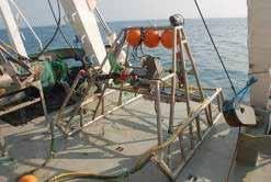
20 Seabed (INSS & INFOMAR) data are available, free of charge on web This includes raster images (tiffs, geotiffs), GIS data, Excel tables and Access databases, google earth, etc Visit following website for download html February open and free access to all GSI data Data Delivery


21 Web Mapping

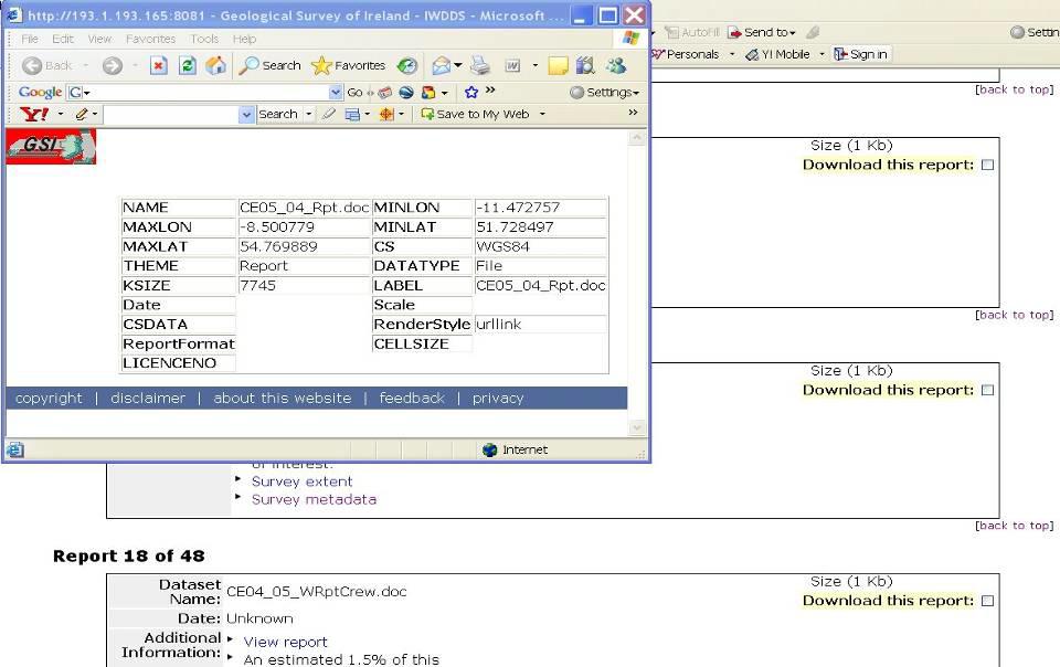
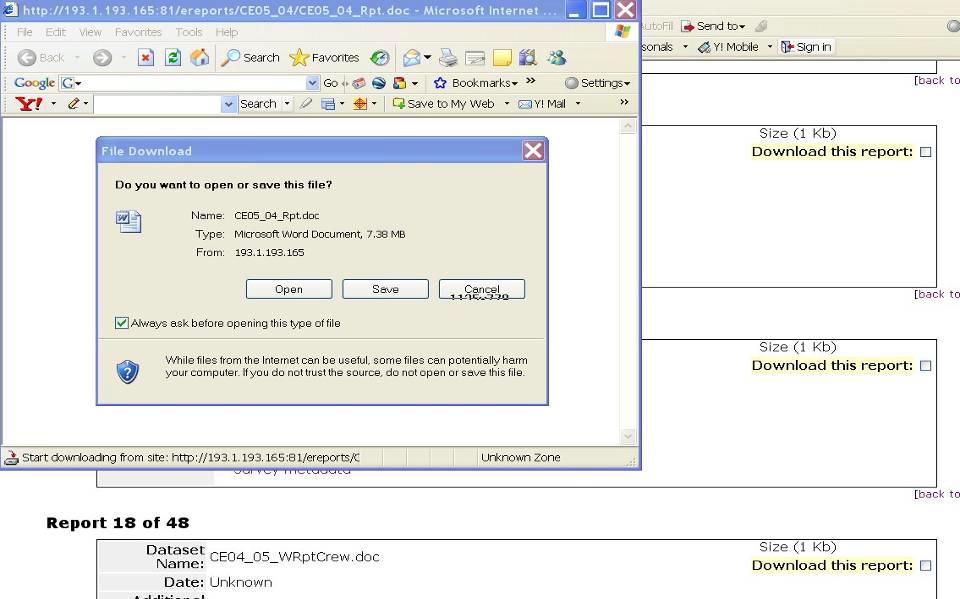
22 Data Delivery system


 Another Irish Marine")
23 4. Yes, But is it worth it? INSS INFOMAR Total to date 32m NOK 245m 23m NOK 176m 55m NOK 421m What could we have got for the money? 5 Second Level Schools 2.5km of Motorway Dublin Port Tunnel 2 Boring machines! 280m of Dublin Port Tunnel (4.5km 804m) Another Irish Marine Institute Building! 2 New Celtic Explorers (23m)
24 4. But is it worth it? INFOMAR Marine Mapping Study Options Appraisal July 2008 Pricewaterhouse Coopers
25 Rationale for public expenditure on INFOMAR 1. Market Failure Nature of Benefits are such that a private sector operator would not undertake the project 2. Legislative and Regulatory Requirements Assists Government in complying with national and international law 3. Marine Resource Information Requirements Driven by the need to manage the marine resource from an environmental, economic and social perspective 4. Research and Contribution to the Knowledge Economy Improves Ireland s technical capacity for seabed mapping
26 Summary of Options Option Title Description End date 1 Do Minimum Continue the project for remainder of current funding period (Dec 2008) and Priority Areas Only 3 INFOMAR Strategy in full 4 INFOMAR Strategy in full, phased then stop. Complete the mapping of the 26 priority bays and 3 priority coastal areas (Phase1) Mapping of Phases 1 and 2 and implementation of all components of INFOMAR strategy Mapping of Phases 1 (by 2016) and 2 (by 2026) and implementation of all components of INFOMAR strategy
27 Option Costs In consultation with the INFOMAR project team, costs for each of the Options were estimated Budget costs are estimated from 2009 onwards Option Data acquisition 0 19,643 55,758 60,921 Data management 0 3,810 3,810 3,825 Uplift for inflation 0 4,103 10,345 29,109 Total 0 27,556 69,913 93,855
28 Summary of Benefits Across each option, benefits were identified and categorised as follows: Commercial/ Resource Benefits Fishing, Aquaculture, Biodiversity, Energy, Aggregates, Tourism/ Leisure Knowledge Economy Research Funding ESONIM, HERMES, IMAGIN (EMODNET/GEOSEAS) Legislative requirements and obligations SOLAS, UNCLOS, MARPOL, WFD, OSPAR Convention, Habitats Directive (MSFD) Environmental Benefits (not quantified) Protection of marine life, protection of heritage and others
29 Estimated value of benefits Option Commercial 38, , , ,153 Knowledge 2,226 8,111 16,222 10,193 Economy Legislative 2,028 6,083 8,111 7,453 Total PV of Benefits 43, , , ,799 A number of other benefits identified have not been quantified: Environmental benefits Speculative benefits hydrocarbon find, avoidance of state liability for clean-up of environmental disaster, bio-tech discovery.
30 NPV and Benefit Cost Ratios Option NPV 000 BCR 1 Do Minimum 43,226 N/A 2 Priority Areas Only 225, Zones 1 and 2 by , Zones 1 and 2 by , Estimated return on project is 4 to 6 times cost Led to decision in 2008 to continue to 2013 Review in 2012 & Decision on continuance 2013
31 But how are we doing now? Commercial Fishing bad poor take up/ format issues but OLEX use growing Aggregates bad demand collapse Renewables good Wave & wind push/ Deep Aquaculture - New Knowledge Economy Leveraged projects good - Emodnet, Geology & Hydrography Geoseas, INIS Hydro, Atlanterra Research good - > 200 projects using data Smart Economy growing input/ 3D visualisation/ Patents etc Legislative SOLAS/IHO- good EU Directives OK WFD mis-match/ MSFD evolving National good SEAs on Oil & Gas, Renewables Will know better this year Another External Project Review! But in the words of L Oreal!

32 Making Ireland bigger! A1 B1 C1 Zone Mareano A1 Workshop, = 147,375km Zone B1 = 56,470km 2 Zone C1 =27,590km 2

33 INSS/INFOMAR Coverage end 11 Still a lot to do! 2012 New Platform RESON 7101 Satellite/Terrestrial Lidar Increased Data Demand Listed as Key Enabler Irish Ocean Wealth/MSP
34 Deep V Coastal Mapping Survey Cost INSS 437,000km.sq 32M 74 persq.km INFOMAR 125,000km.sq. 84M 672 per sq.km Cost X 10 times IMPACT INSS INFOMAR UNCLOS, Deep Sea Fishing, Petroleum, Research Fishing, Aggregates, Renewable Energy, Transport, Tourism, Development, Diving, Aquaculture Impact/Visibility > 10 Times Coastal Programme Harder Work & More Expensive but Greater Impact (Political & Stakeholder) & Reward! New Programmes: UK Mare Map, France Littoral, Spanish Provinces

35 Come and find out more at our Annual Seminar Cork, Oct 11 & 12 th & visit us at Thanks for listening, Good luck with Coastal Mapping
INFOMAR: An Introduction and Invitation to INFOMAR 2012
 INFOMAR: An Introduction and Invitation to INFOMAR 2012 Koen Verbruggen Presented by Janine Guinan Geological Survey of Ireland 10 th October, 2012 GEOSEAS Seminar Cork Context UNCLOS 1996 Area mapped
CIEEM, Irish Section Conference & AGM Tommy Furey, Marine Institute, Ireland. & Koen Verbruggen, Director, GSI
 INFOMAR application of integrated mapping approaches and technologies to deliver baseline seabed and habitat mapping for Ireland CIEEM, Irish Section Conference & AGM 2016 Tommy Furey, Marine Institute,
Rinville, Oranmore, Co. Galway. a thriving maritime economy in harmony with the ecosystem and supported by the delivery of excellence in our services.
 Position Contract Service Group Location Marine Institute Job Description Scientific & Technical Officer, Habitat Mapping Specialist (INFOMAR) Temporary Specified Purpose, up to end 2018 (INFOMAR Funded)
SeaDataNet, Pan-European infrastructure for marine ands ocean data management + EMODNET Preparatory Action Hydrographic and Seabed Mapping
 SeaDataNet, Pan-European infrastructure for marine ands ocean data management + EMODNET Preparatory Action Hydrographic and Seabed Mapping By Dick M.A. Schaap Technical Coordinator SeaDataNet & Coordinator
Delph. Seabed Mapping Software Suite FEATURES ABOUT DELPH SOFTWARE SUITE BENEFITS APPLICATIONS
 Delph Seabed Mapping Software Suite Delph Seismic, Delph Sonar and Delph Mag are complete software packages with dedicated acquisition, processing and interpretation components. They operate with any sidescan
INFOMAR End Year Report Progress Report. Authors: Thomas Furey & Sean Cullen
 INFOMAR 2017 End Year Report Progress Report Authors: Thomas Furey & Sean Cullen Marine Institute & Geological Survey Ireland Joint INFOMAR Programme Managers INFOMAR_Activity_Report_r5 Contents 1. Programme
Data, Data, Everywhere. We are now in the Big Data Era.
 Data, Data, Everywhere. We are now in the Big Data Era. CONTENTS Background Big Data What is Generating our Big Data Physical Management of Big Data Optimisation in Data Processing Techniques for Handling
SeaDataNet, Pan-European infrastructure for ocean and marine data management & EMODNET Preparatory Actions Hydrographic Lot
 SeaDataNet, Pan-European infrastructure for ocean and marine data management & EMODNET Preparatory Actions Hydrographic Lot By Dick M.A. Schaap MARIS Brest, Sept 2009, GEBCO Science Day Supported by the
INSPIRE in a nutshell, and overview of the European Union Location Framework
 INSPIRE in a nutshell, and overview of the European Union Location Framework Francesco Pignatelli European Commission, DG JRC 10 th European Congress and Exhibition on Intelligent Transport Systems and
Pan-European infrastructure for management of marine and ocean geological and geophysical data Geo-Seas portal Data Discovery and Access Service
 Pan-European infrastructure for management of marine and ocean geological and geophysical data Geo-Seas Data Discovery and Access Service By Kathrin Manolis BGR and Dick M.A. Schaap Geo-Seas Technical
Foreign Direct Investment (FDI) and Renewable Energy. Donal Flavin, Strategic Policy Manager, IDA Ireland
 and Renewable Energy. Donal Flavin, Strategic Policy Manager, IDA Ireland") Foreign Direct Investment (FDI) and Renewable Energy Donal Flavin, Strategic Policy Manager, IDA Ireland October 11, 2018 Presentation Outline IDA Ireland. Ireland s FDI (Foreign Direct Investment) Sector.
Foreign Direct Investment (FDI) and Renewable Energy Donal Flavin, Strategic Policy Manager, IDA Ireland October 11, 2018 Presentation Outline IDA Ireland. Ireland s FDI (Foreign Direct Investment) Sector.
A Thematic Approach to Data Management and Implementation of INSPIRE: The UK Marine Environmental Data and Information Network
 A Thematic Approach to Data Management and Implementation of INSPIRE: The UK Marine Environmental Data and Information Network Mark Charlesworth mecha@bodc.ac.uk www.oceannet.org Content Importance marine
SeaDataNet, Pan-European infrastructure for marine and ocean data management + EMODNET Bathymetry
 SeaDataNet, Pan-European infrastructure for marine and ocean data management + EMODNET Bathymetry By Dick M.A. Schaap Technical Coordinator SeaDataNet & Coordinator EMODNet Bathymetry Limassol Cyprus,
NOAA Integrated Ocean and Coastal Mapping Using Hurricane Sandy Response Data to Help Build a Bridge Between Lidar Bathymetry and The Chart
 NOAA Integrated Ocean and Coastal Mapping Using Hurricane Sandy Response Data to Help Build a Bridge Between Lidar Bathymetry and The Chart JALBTCX Airborne Coastal Mapping and Charting Workshop July 19-21
Towards a pan-european infrastructure for marine and ocean data management + Importance of standards
 Towards a pan-european infrastructure for marine and ocean data management + Importance of standards By Dick M.A. Schaap Technical Coordinator SeaDataNet & Coordinator EMODnet Bathymetry Hydrography Day,
European Marine Data Exchange
 European Marine Data Exchange By Dick M.A. Schaap MARIS (NL) EU SeaDataNet Technical Coordinator EU EMODnet Ingestion Coordinator Noordzeedagen 2018 - October 2018 Acquisition of ocean and marine data
Towards a pan-european infrastructure for marine and ocean data management + Importance of standards
 Towards a pan-european infrastructure for marine and ocean data management + Importance of standards By Dick M.A. Schaap MARIS Technical Coordinator SeaDataNet & ODIP Coordinator EMODnet Bathymetry Münster
Software for Hydrographic Data Processing
 Software for Hydrographic Data Processing Data courtesy of Dr. T. Komatsu, Tokyo University Ocean Research Institute CleanSweep provides a fast, user friendly environment for processing hydrographic survey
Who we are Swathe Services offers: Equipment Sales Equipment Rental Experience Hydrographic Surveyors Turn-key survey support
 Swathe Services our results speak for themselves Who we are Swathe Services offers: Equipment Sales Equipment Rental Experience Hydrographic Surveyors Turn-key survey support Dissertation Title High Resolution
s. Personnel Transmittals CTD SVP. otherequiptype CODA. PhotoStation. Sampling. Video
 BGS MARINE SURVEY FOLDER STRUCTURE The following folder structure has been developed for use during offshore surveys. Feedback on using the folder structure should be sent to offshoredata@bgs.ac.uk. Emails
Data Centres and the Planning Process
 Data Centres and the Planning Process 21 st November 2018 Conall Boland Deputy Chairperson Agenda About An Bord Pleanála Planning Process Data Centres recent experience of An Bord Pleanála Key Issues for
EMODnet Bathymetry. By Dick M.A. Schaap Coordinator. 20 th April 2016, EGU 2016, Vienna - Austria
 EMODnet Bathymetry By Dick M.A. Schaap Coordinator 20 th April 2016, EGU 2016, Vienna - Austria EMODNet Bathymetry Ongoing in 3 consecutive projects since 2009 with expanding consortium (at present >30
Prepared for: CALIFORNIA COAST COMMISSION c/o Dr. Stephen Schroeter 45 Fremont Street, Suite 2000 San Francisco, CA
 REVIEW OF MULTIBEAM SONAR SURVEYS WHEELER REEF NORTH, SAN CLEMENTE, CALIFORNIA TO EVALUATE ACCURACY AND PRECISION OF REEF FOOTPRINT DETERMINATIONS AND CHANGES BETWEEN 2008 AND 2009 SURVEYS Prepared for:
Submission of proposals: Overview & Submission System
 Submission of proposals: Overview & Submission System Dave BAIRD (DIGIT, B1) Victoria BEAZ HIDALGO (EASME, A3 EMFF) #EMFF2018 EMFF-BlueEconomy-2018 call 22 November 2018 Brussels APPLICATON PACKAGE Submission
AAPA Smart Ports. Cyber Management for Ports Panel. Small Port Cyber Security Workshops. March 6, 2018
 AAPA Smart Ports Cyber Management for Ports Panel Small Port Cyber Security Workshops March 6, 2018 1200 New Jersey Ave., SE Washington DC 20590 w w w. d o t. g o v Port Infrastructure Development More
AN INTRODUCTION TO THE ICPC
 International Cable Protection Committee AN INTRODUCTION TO THE ICPC Graham Evans EGS Survey Group ICPC Chairman Sharing the seabed in harmony with others 2016 International Cable Protection Committee
Marine Transportation System Resilience: A Federal Agency Perspective
 Marine Transportation System Resilience: A Federal Agency Perspective Katherine Touzinsky, USACE-ERDC TRB-CMTS Biennial Conference, June 21-23 rd, 2016 Resilience Integrated Action Team: Mission and Objectives
The enabling role of geospatial information in the European energy policies
 The European Commission s science and knowledge service Joint Research Centre The enabling role of geospatial information in the European energy policies Francesco Pignatelli Kehl (DE), 5 September 2017
Towards a Canadian Integrated Ocean Observing System
 Towards a Canadian Integrated Ocean Observing System CMOS Luncheon (Ottawa) February 28, 2018 Andrew Stewart Fisheries and Oceans Canada The Ocean is Valuable Ocean Economy: Ocean-based industries Natural
Northeast Ocean Data Portal Work Plan & Regional Data Priorities
 & Regional Data Priorities 2018 Update Potential Regional Data Priorities for Federal Cooperation & Regional Data Priorities 2018 Update Priorities: Understand and promote use of the Portal & Regional
Integral equation method for anisotropic inversion of towed streamer EM data: theory and application for the TWOP survey
 Integral equation method for anisotropic inversion of towed streamer EM data: theory and application for the TWOP survey Michael S. Zhdanov 1,2, Masashi Endo 1, Daeung Yoon 1,2, Johan Mattsson 3, and Jonathan
A SENSOR FUSION APPROACH TO COASTAL MAPPING
 A SENSOR FUSION APPROACH TO COASTAL MAPPING Maryellen Sault, NOAA, National Ocean Service, National Geodetic Survey Christopher Parrish, NOAA, National Ocean Service, National Geodetic Survey Stephen White,
Annual Report for the Utility Savings Initiative
 Report to the North Carolina General Assembly Annual Report for the Utility Savings Initiative July 1, 2016 June 30, 2017 NORTH CAROLINA DEPARTMENT OF ENVIRONMENTAL QUALITY http://portal.ncdenr.org Page
Sustainable Consumption and Production
 Sustainable Consumption and Production Resolution 2/8 Charles Arden-Clarke Head, Secretariat 10 Year Framework of Programmes on Sustainable Consumption and Production/One Planet Network CPR Meeting 28
Provided by the author(s) and NUI Galway in accordance with publisher policies. Please cite the published version when available.
 and NUI Galway in accordance with publisher policies. Please cite the published version when available.") Provided by the author(s) and NUI Galway in accordance with publisher policies. Please cite the published version when available. Title Galway Bay bathymetry comparison from Admiralty Chart and LiDAR datasets.
Provided by the author(s) and NUI Galway in accordance with publisher policies. Please cite the published version when available. Title Galway Bay bathymetry comparison from Admiralty Chart and LiDAR datasets.
Kent Wind Energy Networking Event. Wednesday 26 th September
 Kent Wind Energy Networking Event Wednesday 26 th September Consortium partners Dong Energy is a leading offshore wind developer, having built around half of all offshore wind farms globally. (50%) E.ON
CISE. an INFORMATION SHARING TOOL to support INTEGRATED MARITIME SURVEILLANCE. European Maritime Day Göteborg, May 22 nd 2012
 CISE an INFORMATION SHARING TOOL to support INTEGRATED MARITIME SURVEILLANCE European Maritime Day Göteborg, May 22 nd 2012 Maritime Surveillance: What? WHAT S GOING ON AT SEA? AWARENESS Legitimate Activities
 Plone development in UNEP Country Environmental Profiles Gerard.Cunningham@unep.org Capacity Building and Partnerships Section Division of Early Warning and Assessment United Nations Environment Programme
SHALLOW SOUNDING BATHYMETRIC USING MULTIBEAM ECHOSOUNDER AND TOPOGRAPHIC LASER SCANNER
 SHALLOW SOUNDING BATHYMETRIC USING MULTIBEAM ECHOSOUNDER AND TOPOGRAPHIC LASER SCANNER BY : NURSUGI, TRI PATMASARI & KHAFID GEOSPASIAL INFORMATION AGENCY AMSTERDAM, 11-14 NOVEMBER 2014 Indonesia coastline
WE FOCUS, ON PROJECT MANAGEMENT, DESIGN, ENGINEERING, SUPERVISION, TESTING AND COMMISSIONING, SUPPORT SERVICES AND FACILITIES MANAGEMENT
 WE FOCUS, ON PROJECT MANAGEMENT, DESIGN, ENGINEERING, SUPERVISION, TESTING AND COMMISSIONING, SUPPORT SERVICES AND FACILITIES MANAGEMENT THE GROUP OF COMPANIES 4DIMENSION SERVICES AND MANAGEMENT CONSULTANCY
Stockholm Innovation Summit 21 st february 2018
 Stockholm Innovation Summit 21 st february 2018 International collaboration experience of the IPAADRIATIC Programme among the Adriatic Regions. New areas of development and implementation of synergy models
Opportunities for Data Centres in County Cork
 Data Centres Ireland Conference 2018 Opportunities for Data Centres in County Cork P A D R A I G M O O R E S E N I O R P L A N N E R P L A N N I N G P O L I C Y U N I T C O R K C O U N T Y C O U N C I
State of Alaska Arctic Policy and Priorities
 State of Alaska Arctic Policy and Priorities Prepared for the Alaska Arctic Policy Commission Presented by Stefanie Moreland, Office of Governor Sean Parnell Alaska is America s Arctic Alaska policy is
Arctic Action Overview
 Selected Topics International Arctic Council National Arctic Action Overview Interagency Working Group on Alaska Energy and Permitting Issues [E.O. 13580] Report to the President (March 2013) National
Introduction of SeaDataNet and EMODNET Working towards a harmonised data infrastructure for marine data. Peter Thijsse MARIS
 Introduction of SeaDataNet and EMODNET Working towards a harmonised data infrastructure for marine data Peter Thijsse MARIS CLIPC & IS-ENES 2 workshop, KNMI, November 2014 Outline 1. Introduction to marine
HawkEye III - A new deep penetrating bathymetric LIDAR system
 Please insert a picture (Insert, Picture, from file). Size according to grey field (10 cm x 25.4 cm). Scale picture: highlight, pull corner point Cut picture: highlight, choose the cutting icon from the
Crowd-Sourced Bathymetry
 THE INTERNATIONAL HYDROGRAPHIC ORGANIZATION Crowd-Sourced Bathymetry NIOHC16 Chittagong, Bangladesh 14-16 March 2016 We know more about the topography of Mars and our Moon than we do about the topography
Geocoder: An Efficient Backscatter Map Constructor
 Geocoder: An Efficient Backscatter Map Constructor Luciano Fonseca, Brian Calder Center for Coastal and Ocean Mapping, University of New Hampshire Durham, NH 03824 ABSTRACT: The acoustic backscatter acquired
Marine Information Objects (MIOs) and ECDIS: Concept and Practice
 and ECDIS: Concept and Practice") Proceedings: U.S. Hydrographic Conference, 24-27 March 2003, Biloxi, MS Marine Information Objects (MIOs) and ECDIS: Concept and Practice Dr. Lee Alexander 1 Center for Coastal and Ocean Mapping Joint
Proceedings: U.S. Hydrographic Conference, 24-27 March 2003, Biloxi, MS Marine Information Objects (MIOs) and ECDIS: Concept and Practice Dr. Lee Alexander 1 Center for Coastal and Ocean Mapping Joint
Seafood Training Scheme
 EMFF Operational Programme 2014-2020 Seafood Training Scheme Ireland s EU Structural and Investment Funds Programmes 2014-2020 Co-funded by the Irish Government and the European Union EUROPEAN UNION This
Tom McDermott Director, Technology Policy Initiatives
 Tom McDermott Director, Technology Policy Initiatives tom.mcdermott@gtri.gatech.edu 30 October 2014 Tommer Ender, PhD Chief, Sys. Tech & Analysis Division tommer.ender@gtri.gatech.edu Andrew Register,
Innovate UK energy strategy - Rob Saunders A joint approach - Christian Inglis The energy systems catapult - Nick Smailes Project Presentations
 Our changing energy systems: Supporting innovation Innovate UK energy strategy - Rob Saunders A joint approach - Christian Inglis The energy systems catapult - Nick Smailes Project Presentations May 2015
J.Enhancing energy security and improving access to energy services through development of public-private renewable energy partnerships
 J.Enhancing energy security and improving access to energy services through development of public-private renewable energy partnerships Background ESCAP, jointly with the ECLAC, the ECA, the ECE, and the
Transitioning from a Comprehensive Early Warning System to a CAP based system: The Virgin Islands Experience
 Transitioning from a Comprehensive Early Warning System to a CAP based system: The Virgin Islands Experience Presented by: Dale Lake, Emergency Communications Manager Department of Disaster Management
Summary. Strategy at EU Level: Digital Agenda for Europe (DAE) What; Why; How ehealth and Digital Agenda. What s next. Key actions
 What; Why; How ehealth and Digital Agenda. What s next. Key actions") Summary Strategy at EU Level: Digital Agenda for Europe (DAE) What; Why; How ehealth and Digital Agenda Key actions What s next What DAE - EC Communication, adopted in May 2010 Flagship Initiative of EU
Summary Strategy at EU Level: Digital Agenda for Europe (DAE) What; Why; How ehealth and Digital Agenda Key actions What s next What DAE - EC Communication, adopted in May 2010 Flagship Initiative of EU
Delivering On Canada s Broadband Commitment Presentation to OECD/WPIE Public Sector Broadband Procurement Workshop December 4, 2002
 Delivering On Canada s Broadband Commitment Presentation to OECD/WPIE Public Sector Broadband Procurement Workshop December 4, 2002 Canada Demand Aggregation in a Federal Structure 3 major levels of government
GEBCO Update. U.S. - Canada Hydrographic Commission Victoria, B.C., Canada 26 March 2018
 GEBCO Update U.S. - Canada Hydrographic Commission Victoria, B.C., Canada 26 March 2018 The Nippon Foundation-GEBCO Seabed 2030 The Seabed 2030 Establishment Team: Graham Allen, Robin Falconer, David Heydon,
Real time 3D display of hydrographic data for QA and QC.
 Real time 3D display of hydrographic data for QA and QC. Roland Arsenault Center for Coastal and Ocean Mapping & Joint Hydrographic Center University of New Hampshire roland@ccom.unh.edu Figure 1 Data
Results for the year ending 31 March 2010.
 Induction MITIE at a glance We re the strategic outsourcing and asset management company; FTSE 250 listed support services business with a track record of more than 20 years of growth; Revenues in excess
Seabed Mapping with LiDAR
 Seabed Mapping with LiDAR 2011 Jakarta David Jonas Lt Cdr Rupert Forester-Bennett RN (ret( ret d) October 18 th 2011 Mapping in South East Asia Field Survey Aerial Photography LiDAR Pleased to Introduce
Introduction to INSPIRE. Network Services
 Introduction to INSPIRE. Network Services European Commission Joint Research Centre Institute for Environment and Sustainability Digital Earth and Reference Data Unit www.jrc.ec.europa.eu Serving society
Principles for a National Space Industry Policy
 Principles for a National Space Industry Policy Commonwealth of Australia 2011 DIISR 11/144 This work is copyright. Apart from any use as permitted under the Copyright Act 1968, no part may be reproduced
SPACE for SDGs a Global Partnership
 SPACE for SDGs a Global Partnership for the Coordination of the Development, Operation and Utilization of Space related Infrastructure, Data, Information and Services in support of the 2030 Development
ADB s Energy Program in Myanmar
 ADB s Energy Program in Myanmar March 2014 Chong Chi Nai Director, Energy Division Southeast Asia Regional Department 1 Current Sector Context Low electrification ratio Need to develop cost effective way
Marine Institute Job Description
 Marine Institute Job Description Position Contract Service Group Location Temporary Systems Administrator Team Leader Temporary Specified Purpose contract for a duration of up to 3 years Ocean Science
Funded by Enterprise Ireland DJEI and DCCAE
 Introducing the IERC Who We Are Funded by Enterprise Ireland DJEI and DCCAE Industry led and relevant 20M investment in jobs and tangible returns TRL 3 to TRL7 (Real world test bed) Hosted in Tyndall/UCC
Oceansgate Plymouth University
 Oceansgate Plymouth University Feb 2018 Patrick Hartop Head of City Deal patrick.hartop@plymouth.gov.uk Gareth Simmons Strategic Projects Director gareth.simmons@plymouth.gov.uk Why is this so important
Earth Observation, Climate and Space for Smarter Government
 Earth Observation, Climate and Space for Smarter Government Beth Greenaway, Head of Earth Observation 30 March 2015 http://www.bis.gov.uk/ukspaceagency Overview UK Space Agency EO Importance and priorities
National Data Repositories (NDR)
") National Data Repositories (NDR) define, develop, deliver Introduction RPS Energy helps companies develop natural energy resources across the complete asset life cycle, combining our technical and commercial
National Data Repositories (NDR) define, develop, deliver Introduction RPS Energy helps companies develop natural energy resources across the complete asset life cycle, combining our technical and commercial
Research Infrastructures and Horizon 2020
 Research Infrastructures and Horizon 2020 Christos VASILAKOS DG Research & 1 st CoPoRI Workshop on EoE 11-12 June 2012 Hamburg, DE The EU Framework Programme for Research and 2014-2020 Research and Europe
Al-Masader Al-Duwaliyah (AMAD) Overview
 Overview") Al-Masader Al-Duwaliyah (AMAD) Overview History Founded in 2002 as a part of a major Saudi-European joint venture Focused on technology transfer to support local development while serving the public and
Al-Masader Al-Duwaliyah (AMAD) Overview History Founded in 2002 as a part of a major Saudi-European joint venture Focused on technology transfer to support local development while serving the public and
Stewarding NOAA s Data: How NCEI Allocates Stewardship Resources
 Stewarding NOAA s Data: How NCEI Allocates Stewardship Resources Eric Kihn, Ph.D. Director, NCEI Center for Coasts, Oceans and Geophysics (CCOG) Krisa M. Arzayus, Ph.D. Deputy Director (Acting), NCEI Center
Khoen LIEM. Industrial Policy. A systematic approach for Civil Security: From EU Security- Research Policy
 A systematic approach for Civil Security: From EU Security- Research Policy to Industrial Policy When the budgets get smaller, we need a more systematic approach Khoen LIEM DG Enterprise and Industry Bonn,
2017 PORT OF NEWPORT COMMISSION GOAL SETTING
 2017 PORT OF NEWPORT COMMISSION GOAL SETTING Including Mission, Vision and Organization Values ADOPTED FEBRUARY 28, 2017 PORT OF NEWPORT 600 SE Bay Blvd., Newport, OR 97365 Mission, Vision and Governing
Mushkegowuk Energy Infrastructure Corridor
 Mushkegowuk Energy Infrastructure Corridor What s In An Infrastructure Corridor Energy Corridor (Power And Fibre Optics) Transportation Corridor (Sea Port And Rail) A Multi Use Easement Type Corridor Infrastructure
CANARIE Mandate Renewal Proposal
 CANARIE Mandate Renewal Proposal Kathryn Anthonisen BCNET Conference April 23, 2018 Let s connect! @kanthonisen canarie.ca @canarie_inc canarie.ca @canarie_inc 2 Core Purpose Advancement of Canada s Knowledge
Welcome Participants!
 Welcome Participants! Portsmouth Harbor Response Initiative Coastal Response Research Center June 27, 2007 1 Coastal Response Research Center (CRRC) Staff Co-Directors: UNH Nancy Kinner NOAA Amy Merten
Airborne LiDAR Surveys and Data Delivery in the Pipeline Industry
 Airborne LiDAR Surveys and Data Delivery in the Pipeline Industry Carlos Femmer Faron Olivier October 25, 2011 October 25, 2011 GITA GIS for Oil and Gas Pipeline 2011 Organization Fugro is a decentralized
EXPERIENCE OF LIBERIA IN SETTING UP THE RURAL ENERGY STRATEGY AND MASTER PLAN
 ECOWAS REGIONAL TRAINING WORKSHOP ON IMPROVEMENT OF POLICY AND REGULATORY FRAMEWORK FOR CLEAN ENERGY MINI-GRIDS AND RENEWABLE ENERGY TARIFF TOOLBOX JULY 17 22, 2017, ABUJA, NIGERIA EXPERIENCE OF LIBERIA
GGC35/2/5 Meeting 35 8 November 2018 Agenda Item 2.5 IHO DATA CENTRE FOR DIGITAL BATHYMETRY REPORT. Submitted by Director IHO DCDB SUMMARY
 GGC GGC35/2/5 Meeting 35 8 November 2018 Agenda Item 2.5 IHO DATA CENTRE FOR DIGITAL BATHYMETRY REPORT Submitted by Director IHO DCDB SUMMARY Executive Summary: This document provides details of the work
Ada L. Benavides, Deputy Chief South Pacific Division Regional Integration Team. May 5, US Army Corps of Engineers BUILDING STRONG
 Building Strong Collaborative Relationships for a Sustainable Water Resources Future The Federal Support Toolbox for Integrated Water Resources Management Ada L. Benavides, Deputy Chief South Pacific Division
Lecture 7 Attribute-based Operations
 Lecture 7 Attribute-based Operations Learning Objectives 7.1 What is meant by reduce information content using an attribute-based operation? Why would one want to reduce information? 7.2 What is meant
Huawei European Research University Partnerships. Michael Hill-King European Research Institute, Huawei
 Huawei European Research University Partnerships Michael Hill-King European Research Institute, Huawei Next 20 30 Years: The World Will Become Intelligent All things Sensing All things Connected All things
S SERIES MULTIBEAM FOR SURVEY & MAPPING
 MAP IT ALL S SERIES DISCOVER A NEW WORLD WITH THE LATEST INNOVATION FROM WASSP Outstanding performance, versatility and value. That s what you expect and exactly what you get with the new S3 sonar from
Public Sector Transformation Through Partnership and Collaboration
 The Institute of Public Administration of Canada Public Sector Transformation Through Partnership and Collaboration June 2012 Presentation Overview About IPAC Public Sector Partnership and Collaboration
Geo Seas A pan European infrastructure for the management of marine geological and geophysical data
 Geo Seas A pan European infrastructure for the management of marine geological and geophysical data Colin Graham (BGS), Dick Schaap (MARIS), Paolo Diviacco (OGS) & Helen Glaves (BGS) Integrated Infrastructure
NDIA-Next Generation Energy Technologies Cathy Snyder, Vice President Lockheed Martin Corporation September 12, Buildings and Grid Technologies
 NDIA-Next Generation Energy Technologies Cathy Snyder, Vice President Lockheed Martin Corporation September 12, 2011 Buildings and Grid Technologies Lockheed Martin Energy Business Portfolio RENEWABLE
Application of JPEG 2000 Wavelet Compression to Multibeam Echosounder Mid-water Acoustic Refectivity Measurements
 University of New Hampshire University of New Hampshire Scholars' Repository Center for Coastal and Ocean Mapping Center for Coastal and Ocean Mapping 6-2010 Application of JPEG 2000 Wavelet Compression
Water Sector Reform in Ireland
 Water Sector Reform in Ireland Process, Challenges and Achievements Water New Zealand Conference 2018 Jerry Grant Managing Director, Irish Water Thursday 20 th September 2018 How were water services delivered,
Beyond the e-navigation implementation plan: Development towards the unmanned merchant vessel?
 Beyond the e-navigation implementation plan: Development towards the unmanned merchant vessel? e-navigation underway, M/S Pearl Seaways, 28-30 January 2014 Hans-Christoph BURMEISTER, MUNIN Project Coordinator
Role and relevance of space applications in the wider economy 19 April 2012
 Role and relevance of space applications in the wider economy 19 April 2012 Iain Gray Chief Executive Technology Strategy Board Agenda Introduction to the Technology Strategy Board Our role in Space Space
S&T Stakeholders Conference
 S&T Stakeholders Conference Risk-Informed Requirements Process Col. Merrick Krause, USAF (Ret.) Director Infrastructure Analysis & Strategy Division U.S. Department of Homeland Security June 2-5, 2008
Bringing cyber to the Board of Directors & C-level and keeping it there. Dirk Lybaert, Proximus September 9 th 2016
 Bringing cyber to the Board of Directors & C-level and keeping it there Dirk Lybaert, Proximus September 9 th 2016 Dirk Lybaert Chief Group Corporate Affairs We constantly keep people connected to the
Mohammed Bin Rashid Space Centre
 Mohammed Bin Rashid Space Centre Space in the UAE Today The UAE is one of the most ambitious countries in space and is a major player in the Gulf and Arab Word The UAE is very active and is developing:
ENERGY TRAINING WEEK. Introduction to Energy Technology Policy. By Joining Forces We Multiply Results
 ENERGY TRAINING WEEK Introduction to Energy Technology Policy By Joining Forces We Multiply Results Carrie Pottinger, Programme Manager Technology R&D Networks OVERVIEW 1. THE IEA 2. ENGAGEMENT WORLDWIDE
Partnering with Pacific Rim Ports on Clean Air Strategies
 Partnering with Pacific Rim Ports on Clean Air Strategies Ralph G. Appy,, Ph.D. Environmental Management Division Port of Los Angeles American Association of Port Authorities Harbors, Navigation and Environment
GLOBAL SMART GRID FEDERATION
 GLOBAL SMART GRID FEDERATION 6 th Korea Smart Grid Week International Session 21 October 2015 Paddy Turnbull - Chairman GSGF - Chairman SGI -Account Director GE Digital Energy Europe 1 Agenda 1. GSGF overview
Better detection and discrimination of seagrasses using fused bathymetric lidar and hyperspectral data
 Better detection and discrimination of seagrasses using fused bathymetric lidar and hyperspectral data Bruce Sabol and Molly Reif US Army Engineer Research and Development Center, Environmental Laboratory
NOAA Update and Strategic Direction Dr. Stephen Volz, Assistant Administrator for Satellite and Information Services
 NOAA Update and Strategic Direction Dr. Stephen Volz, Assistant Administrator for Satellite and Information Services Space Studies Board Meeting May 3, 2017 NOAA Satellite and Information Service Outline
Technical Whitepaper. Unlock your Subsurface Data using Seismic Explorer for ArcGIS & the ArcGIS Platform
 Technical Whitepaper Unlock your Subsurface Data using Seismic Explorer for ArcGIS & the ArcGIS Platform 1 Business Problem The Petroleum industry and their vendors have for years been talking about the