INFOMAR: An Introduction and Invitation to INFOMAR 2012
|
|
|
- Collin Clarke
- 5 years ago
- Views:
Transcription


1 INFOMAR: An Introduction and Invitation to INFOMAR 2012 Koen Verbruggen Presented by Janine Guinan Geological Survey of Ireland 10 th October, 2012 GEOSEAS Seminar Cork
 and Petroleum Division(96) mapped over 0.5M sq.")
2 Context UNCLOS 1996 Area mapped by INSS and PAD Irish designated area = 652,000 Sq Kms INSS area coverage = 432,000 Sq Kms INSS plus PAD coverage = 527,000 Sq Kms Area to be surveyed = 125,000 Sq Kms As part of UNCLOS Territorial mapping, the Irish National Seabed Survey (99-05) and Petroleum Division(96) mapped over 0.5M sq.km

3 Making Ireland bigger! A1 B1 C1 Zone A1 = 147,375km 2 Zone B1 = 56,470km 2 Zone C1 =27,590km 2


 survey MAPPED ALL")
4 1. Irish National Seabed Survey (INSS) Zone 3 fleet: S.V. Bligh S.V. Siren CIL Granuaile R.V Akademic Boris Petrov R.V Professor Logachev R.V. Ocean Seeker R.V. Celtic Explorer R.V. Celtic Voyager The INSS established an essential national asset: A marine BASELINE DATA set to underpin present and future Irish economic, environmental, infrastructural and policy decisions Upgraded Irish marine surveying infrastructure The body of knowledge required to design, procure, build and operate a large Exclusive Economic Zone (EEZ) survey MAPPED ALL OUR WATERS OVER 200m DEEP!


5 2. INFOMAR INFOMAR INtegrated Mapping FOr the Sustainable Development of Ireland s MARine Resource Shallow water survey Partnership between MI & GSI Multi platform survey for marine integrated mapping 26 Priority Bays 3 Priority Areas
6 Why Government mapping? Not profitable for private sector to map all areas Long term commitment required Needs to be done to a high standard Data can then be shared to all users Can leverage expertise across several Depts/Agencies Why DCENR/GSI? Started with UNCLOS/Territorial definition in 1960 s (GSI) Continued with UNCLOS PAD Mapping 1996 National Seabed Survey concept of Ray Keary, GSI Have now built up the expertise, equipment & networks NB ALL data freely available over the web


7 INFOMAR Platforms (MI) RV Celtic Explorer RV Celtic Voyager 65.5m / 15m / 5.8m 31.4m / 8.5m / 3.8m 16 knots - 45 days endurance 10 knots - 14 days endurance Mapping from 250 to 50m Mapping from 50 to 15m Fugro Seis / Ixsea Gaps USBL / SBP / EM1002/3002 / Edge_GeoAc SSS / GeoRes SBP_VC c. 20 days pa. Groundtruthing c. 100 days pa in 2 week legs


8 INFOMAR Platforms (GSI) RV Keary RV Geo 15.5m / 5.6m / 1.5m 7.4m Redbay Rib 22 knots 30 knots / 300 NM 2-3 days endurance 1 day endurance POS MV inertial navigation systems - Sonardyne USBL - MBES Simrad EA400-EM3002D Marine Magnetics magnetometer - Edgetech 4200 SSS - SBP Chirp profiler -SBP Geo- Resources 200. GEO : SEA Swath Interferometric Mapping system c. 180 days p.a. each vessel, daylight ops

9 INFOMAR Platforms (GSI) Cosantóir Bradán MoU Inshore Fisheries Ireland 17 m mono-hull Shallow draft MBES Reson7101


10 Mapping by plane Airborne Marine LIDAR Red surface & green deep Laser 10-30m in clear water (West Coast) High speed & cost Safe on shallow rocky coastlines Waveform analysis pseudo backscatter


11 Satellite mapping WorldView-2 Satellite Map of Wexford Harbour derived from satellite Imagery Useful overview but not accurate enough for shipping safety
 In an area designated for")
12 Marine Safety/Charting A steep outcrop of rock rising to a chart depth of 12.2 metres in surrounding water depths of 30 to 40 metres (charted as >30m) In an area designated for safe refuge for bigger ships


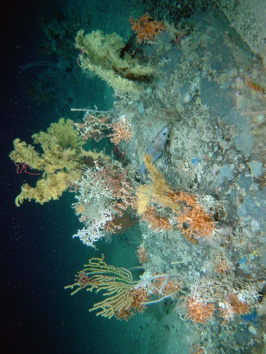
13 Environmental Protection Deepwater Atlas produced with UCC INSS Inventory of features including mounds & reefs Bathymetry used in Modelling Ocean currents/ Pollution response Used to designate Offshore SACs, Oil & Gas SEAs & Avoid EC Fines!
14


15 Fishing/Aquaculture Accurate bathymetry helps modelling and locating of fish farms Collaboration with BIM Recently completed Inishturk & Inishbofin


16 Ocean Energy Wind & Wave Seabed mapping vital to location of Ocean Energy devices - wave & wind. Current modelling & site selection.

17 INFOMAR Marine Mapping Study Options Appraisal July 2008 But is it really worth it? Pricewaterhouse Coopers
18 NPV and Benefit Cost Ratios Cost of Completion of Mapping (08-26) 000 Value of Mapping NPV 000 Benefit to Cost Ratio BCR 93, , Estimated return on project is 4 to 6 times cost Led to decision in 2008 to continue to 2013 World Wide benchmark for State Marine Mapping Similar programmes now in Norway, UK, France, Germany...

19 (NB Always put your legend over the data gap!) What s left to do? Current INFOMAR Programme 125,000sq. km Priority Areas by 2016 (c.20,000sq.km) All remaining area by 2026


20 INFOMAR SEMINAR 2012 October 11 & 12 Enabling our Ocean Management Survey Progress Ocean Energy Environmental & Habitat Mapping Aquaculture & Fisheries Hydrography & Operations Heritage Mapping Applied Research All Welcome
INFOMAR, Coastal Mapping in Ireland needs, costs and results
 INFOMAR, Coastal Mapping in Ireland needs, costs and results Koen Verbruggen Geological Survey of Ireland Kunnskap for Framtida MAREANO Workshop, Trondheim, Norway, 6th Feb 2012 Overview 1. Context - INSS
CIEEM, Irish Section Conference & AGM Tommy Furey, Marine Institute, Ireland. & Koen Verbruggen, Director, GSI
 INFOMAR application of integrated mapping approaches and technologies to deliver baseline seabed and habitat mapping for Ireland CIEEM, Irish Section Conference & AGM 2016 Tommy Furey, Marine Institute,
Rinville, Oranmore, Co. Galway. a thriving maritime economy in harmony with the ecosystem and supported by the delivery of excellence in our services.
 Position Contract Service Group Location Marine Institute Job Description Scientific & Technical Officer, Habitat Mapping Specialist (INFOMAR) Temporary Specified Purpose, up to end 2018 (INFOMAR Funded)
INFOMAR End Year Report Progress Report. Authors: Thomas Furey & Sean Cullen
 INFOMAR 2017 End Year Report Progress Report Authors: Thomas Furey & Sean Cullen Marine Institute & Geological Survey Ireland Joint INFOMAR Programme Managers INFOMAR_Activity_Report_r5 Contents 1. Programme
A SENSOR FUSION APPROACH TO COASTAL MAPPING
 A SENSOR FUSION APPROACH TO COASTAL MAPPING Maryellen Sault, NOAA, National Ocean Service, National Geodetic Survey Christopher Parrish, NOAA, National Ocean Service, National Geodetic Survey Stephen White,
SeaDataNet, Pan-European infrastructure for marine ands ocean data management + EMODNET Preparatory Action Hydrographic and Seabed Mapping
 SeaDataNet, Pan-European infrastructure for marine ands ocean data management + EMODNET Preparatory Action Hydrographic and Seabed Mapping By Dick M.A. Schaap Technical Coordinator SeaDataNet & Coordinator
Who we are Swathe Services offers: Equipment Sales Equipment Rental Experience Hydrographic Surveyors Turn-key survey support
 Swathe Services our results speak for themselves Who we are Swathe Services offers: Equipment Sales Equipment Rental Experience Hydrographic Surveyors Turn-key survey support Dissertation Title High Resolution
SeaDataNet, Pan-European infrastructure for ocean and marine data management & EMODNET Preparatory Actions Hydrographic Lot
 SeaDataNet, Pan-European infrastructure for ocean and marine data management & EMODNET Preparatory Actions Hydrographic Lot By Dick M.A. Schaap MARIS Brest, Sept 2009, GEBCO Science Day Supported by the
National Maritime Center
 National Maritime Center Providing Credentials to Mariners (Sample Examination) Page 1 of 6 Choose the best answer to the following Multiple Choice Questions. 1. The following questions are based on Chart
Seabed Mapping with LiDAR
 Seabed Mapping with LiDAR 2011 Jakarta David Jonas Lt Cdr Rupert Forester-Bennett RN (ret( ret d) October 18 th 2011 Mapping in South East Asia Field Survey Aerial Photography LiDAR Pleased to Introduce
SHALLOW SOUNDING BATHYMETRIC USING MULTIBEAM ECHOSOUNDER AND TOPOGRAPHIC LASER SCANNER
 SHALLOW SOUNDING BATHYMETRIC USING MULTIBEAM ECHOSOUNDER AND TOPOGRAPHIC LASER SCANNER BY : NURSUGI, TRI PATMASARI & KHAFID GEOSPASIAL INFORMATION AGENCY AMSTERDAM, 11-14 NOVEMBER 2014 Indonesia coastline
State of Alaska Arctic Policy and Priorities
 State of Alaska Arctic Policy and Priorities Prepared for the Alaska Arctic Policy Commission Presented by Stefanie Moreland, Office of Governor Sean Parnell Alaska is America s Arctic Alaska policy is
Provided by the author(s) and NUI Galway in accordance with publisher policies. Please cite the published version when available.
 and NUI Galway in accordance with publisher policies. Please cite the published version when available.") Provided by the author(s) and NUI Galway in accordance with publisher policies. Please cite the published version when available. Title Galway Bay bathymetry comparison from Admiralty Chart and LiDAR datasets.
Provided by the author(s) and NUI Galway in accordance with publisher policies. Please cite the published version when available. Title Galway Bay bathymetry comparison from Admiralty Chart and LiDAR datasets.
Northeast Ocean Data Portal Work Plan & Regional Data Priorities
 & Regional Data Priorities 2018 Update Potential Regional Data Priorities for Federal Cooperation & Regional Data Priorities 2018 Update Priorities: Understand and promote use of the Portal & Regional
Arctic Action Overview
 Selected Topics International Arctic Council National Arctic Action Overview Interagency Working Group on Alaska Energy and Permitting Issues [E.O. 13580] Report to the President (March 2013) National
Submission of proposals: Overview & Submission System
 Submission of proposals: Overview & Submission System Dave BAIRD (DIGIT, B1) Victoria BEAZ HIDALGO (EASME, A3 EMFF) #EMFF2018 EMFF-BlueEconomy-2018 call 22 November 2018 Brussels APPLICATON PACKAGE Submission
AN INTRODUCTION TO THE ICPC
 International Cable Protection Committee AN INTRODUCTION TO THE ICPC Graham Evans EGS Survey Group ICPC Chairman Sharing the seabed in harmony with others 2016 International Cable Protection Committee
Developing Methodology for Efficient Eelgrass Habitat Mapping Across Lidar Systems
 Developing Methodology for Efficient Eelgrass Habitat Mapping Across Lidar Systems VICTORIA PRICE 1, JENNIFER DIJKSTRA 1, JARLATH O NEIL-DUNNE 2, CHRISTOPHER PARRISH 3, ERIN NAGEL 1, SHACHAK PE ERI 1 UNIVERSITY
Kent Wind Energy Networking Event. Wednesday 26 th September
 Kent Wind Energy Networking Event Wednesday 26 th September Consortium partners Dong Energy is a leading offshore wind developer, having built around half of all offshore wind farms globally. (50%) E.ON
Delph. Seabed Mapping Software Suite FEATURES ABOUT DELPH SOFTWARE SUITE BENEFITS APPLICATIONS
 Delph Seabed Mapping Software Suite Delph Seismic, Delph Sonar and Delph Mag are complete software packages with dedicated acquisition, processing and interpretation components. They operate with any sidescan
Improved Operational Efficiency Through 3D Laser Scanning Techniques. Presented by Grace Chia, Sales Engineer, Seatronics
 Improved Operational Efficiency Through 3D Laser Scanning Techniques Presented by Grace Chia, Sales Engineer, Seatronics About Us SEATRONICS The Marine Technology Specialists; Market leaders in provision
Driving innova*on and knowledge
 Driving innova*on and knowledge Presentation to Mer-Innovate SPARTA Paul Ellsmore Academic and Cross-Catapult Engagement Manager 29 th October 2014 Catapults: A long-term vision for innovation & growth
CISE. an INFORMATION SHARING TOOL to support INTEGRATED MARITIME SURVEILLANCE. European Maritime Day Göteborg, May 22 nd 2012
 CISE an INFORMATION SHARING TOOL to support INTEGRATED MARITIME SURVEILLANCE European Maritime Day Göteborg, May 22 nd 2012 Maritime Surveillance: What? WHAT S GOING ON AT SEA? AWARENESS Legitimate Activities
Towards a pan-european infrastructure for marine and ocean data management + Importance of standards
 Towards a pan-european infrastructure for marine and ocean data management + Importance of standards By Dick M.A. Schaap Technical Coordinator SeaDataNet & Coordinator EMODnet Bathymetry Hydrography Day,
Victorian Coastline LiDAR Survey 2008 / 2009
 Victorian Coastline LiDAR Survey 2008 / 2009 Airborne LiDAR Bathymetric Survey for Climate Change Victorian Future Coasts Bathymetric LiDAR Survey 2008 / 2009 Mark Sinclair Dr Nathan Quadros Sydney, Australia,
Field Integration of Lidar and Sonar Hydrographic Surveys
 Field Integration of Lidar and Sonar Hydrographic Surveys Nicholas Gianoutsos, LTJG Samuel Greenaway, LT Benjamin K. Evans, CDR Guy T. Noll National Oceanic & Atmospheric Administration, National Ocean
Pan-European infrastructure for management of marine and ocean geological and geophysical data Geo-Seas portal Data Discovery and Access Service
 Pan-European infrastructure for management of marine and ocean geological and geophysical data Geo-Seas Data Discovery and Access Service By Kathrin Manolis BGR and Dick M.A. Schaap Geo-Seas Technical
Actionable Intelligence for the Challenges of Tomorrow!
 Actionable Intelligence for the Challenges of Tomorrow! The Power of the Airbus Group Airbus Group As part of the Airbus group, we benefit from the power and strength of a global leader in aerospace, defence
GGC35/2/5 Meeting 35 8 November 2018 Agenda Item 2.5 IHO DATA CENTRE FOR DIGITAL BATHYMETRY REPORT. Submitted by Director IHO DCDB SUMMARY
 GGC GGC35/2/5 Meeting 35 8 November 2018 Agenda Item 2.5 IHO DATA CENTRE FOR DIGITAL BATHYMETRY REPORT Submitted by Director IHO DCDB SUMMARY Executive Summary: This document provides details of the work
View from a bridge. Collective navigational challenges in comparable sea areas Ringo Lakeman senior policy adviser / CM IMO NCSR 3
 View from a bridge Collective navigational challenges in comparable sea areas Ringo Lakeman senior policy adviser / CM IMO NCSR 3 8th Co-operative Forum Co-operative mechanism on safety of navigation and
Tom McDermott Director, Technology Policy Initiatives
 Tom McDermott Director, Technology Policy Initiatives tom.mcdermott@gtri.gatech.edu 30 October 2014 Tommer Ender, PhD Chief, Sys. Tech & Analysis Division tommer.ender@gtri.gatech.edu Andrew Register,
Satellite derived reference surfaces for surveying (VORF, BLAST and LAT) Dr Ole B. Andersen, DTU Space, Copenhagen, Denmark,
 Dr Ole B. Andersen, DTU Space, Copenhagen, Denmark,") Satellite derived reference surfaces for surveying (VORF, BLAST and LAT) Dr Ole B. Andersen, DTU Space, Copenhagen, Denmark, Who am I. Gravity Author of KMS02/DNSC08/DTU10 high resolution marine geophysical/geodetic
Satellite derived reference surfaces for surveying (VORF, BLAST and LAT) Dr Ole B. Andersen, DTU Space, Copenhagen, Denmark, Who am I. Gravity Author of KMS02/DNSC08/DTU10 high resolution marine geophysical/geodetic
CASE STUDY. Case Study: Thuraya Orion IP. Products: Thuraya Orion IP Thuraya SF2500. Location: Caspian Sea, Kazakhstan
 Case Study: Thuraya Orion IP Products: Thuraya Orion IP Thuraya SF2500 Location: Caspian Sea, Kazakhstan Thuraya is helping to protect the unique and fragile ecosystem of the largest salt lake on Earth
Berlin 3 December Aarhus Convention: Key trends in the implementation of information pillar
 Berlin 3 December 2018 Aarhus Convention: Key trends in the implementation of information pillar Is this moorland in good enough condition to effectively capture rain and prevent flooding? What would the
Marine Expertise and Services
 Marine Expertise and Services Public Works and Government Services Canada Presented by: Guy Harvey & Yves Beauparlant January 28 th, 2014 Presentation Outline Our Mission Our Clients Our Services and Expertise
INSPIRE in a nutshell, and overview of the European Union Location Framework
 INSPIRE in a nutshell, and overview of the European Union Location Framework Francesco Pignatelli European Commission, DG JRC 10 th European Congress and Exhibition on Intelligent Transport Systems and
Principles for a National Space Industry Policy
 Principles for a National Space Industry Policy Commonwealth of Australia 2011 DIISR 11/144 This work is copyright. Apart from any use as permitted under the Copyright Act 1968, no part may be reproduced
Using a Geographic Information System (GIS) to look at marine fisheries data
 to look at marine fisheries data") Using a Geographic Information System (GIS) to look at marine fisheries data Daniel Sheehan GIS Programmer & Analyst Office of Educational Innovation & Technology dsheehan@mit.edu x2-1475 Introduction
Using a Geographic Information System (GIS) to look at marine fisheries data Daniel Sheehan GIS Programmer & Analyst Office of Educational Innovation & Technology dsheehan@mit.edu x2-1475 Introduction
BSN Perspective on the Implementation of Voluntary Sustainability Standards (VSS) in Indonesia
 in Indonesia") BSN Perspective on the Implementation of Voluntary Sustainability Standards (VSS) in Indonesia Aderina Uli Panggabean Head of Division on International Cooperation for Standardization BSN Geneva, 27 September
BSN Perspective on the Implementation of Voluntary Sustainability Standards (VSS) in Indonesia Aderina Uli Panggabean Head of Division on International Cooperation for Standardization BSN Geneva, 27 September
DOMAIN COMPLEXITIES. Exponential growth of coastal population and infrastructure VA s & VP s
 1 DOMAIN COMPLEXITIES Complex and Dynamic Maritime Environment World s fifth largest coastline - 7516 km 1382 mostly uninhabited islands Vast Exclusive Economic Zone of 2.01 million sq kms 13 Coastal States
MAPPING SHALLOW WATER DEPTH FROM SATELLITE. Title. Ron Abileah. May 1-5, 2006
 MAPPING SHALLOW WATER DEPTH FROM SATELLITE Title Ron Abileah abileah@jomegak.com ASPRS Ron Abileah 2006 Annual Conference Reno, May Nevada 5, 2006 May 1-5, 2006 Ron Abileah May 5, 2006 Shoaling waves display
RIEGL VQ 880 G Laser Scanner System for Topo Bathymetric Surveying. IR laser scanner channel OCTOBER 2015
 RIEGL VQ 880 G Laser Scanner System for Topo Bathymetric Surveying with NEW optional IR laser scanner channel OCTOBER 2015 VQ 880 G Highlights excellently suited for combined hydrographic and topographic
HawkEye III - A new deep penetrating bathymetric LIDAR system
 Please insert a picture (Insert, Picture, from file). Size according to grey field (10 cm x 25.4 cm). Scale picture: highlight, pull corner point Cut picture: highlight, choose the cutting icon from the
Helping the Arctic Council Find Its True North
 ASSOCIATED PRESS/LAURENT DICK Helping the Arctic Council Find Its True North Priorities for Secretary Kerry as He Prepares to Take on the Chairmanship of the Arctic Council By Cathleen Kelly, Michael Conathan,
The EUCISE2020 project
 The EUCISE2020 project (EUropean test bed for the maritime Common Information Sharing Environment in the 2020 perspective) P. Sacco, 16/01/2018 CISE Roadmap Cross Sectorial interoperability for better
OVID Programme Recipients and OVID Vessel Inspection Request platform
 OVID Programme s and OVID Request platform The Offshore Database (OVID) programme was released in 2010 to provide a similar system of inspection for the oil and gas exploration and production (upstream)
Transitioning from a Comprehensive Early Warning System to a CAP based system: The Virgin Islands Experience
 Transitioning from a Comprehensive Early Warning System to a CAP based system: The Virgin Islands Experience Presented by: Dale Lake, Emergency Communications Manager Department of Disaster Management
Tier 2 Mutual Aid Models in Asia 19 March Copyright Oil Spill Response Limited.
 Tier 2 Mutual Aid Models in Asia 19 March 2014 Copyright 2013. Oil Spill Response Limited. Regional Context Overview Tier 2 Examples Links with Tier 3 Copyright 2013. Oil Spill Response Limited. 2 Regional
Exploring the reefs. Introduction
 Exploring the reefs Introduction Coral reefs surround many of the islands in the Samoan island chain. Many people depend on the reefs for food and economy (fish, shellfish, etc.). Coral reefs thrive in
Maritime Security Panel Canadian Maritime Security Impact of Big Data
 Maritime Security Panel Canadian Maritime Security Impact of Big Data Maritime security Canada In Halifax, easy to understand Canada s connection and dependence on free access to the world s oceans In
CFD Analysis of a Novel Hull Design for an Offshore Wind Farm Service Vessel
 CFD Analysis of a Novel Hull Design for an Offshore Wind Farm Service Vessel M. Shanley 1, J. Murphy 1, and P. Molloy 2 1 Hydraulics and Maritime, Civil and Environmental Engineering University College
Arkona Offshore Wind Project
 Holger Matthiesen 04.12.2017 Arkona Offshore Wind Project Norwegian offshore wind delegation E.ON strategy Global trends like sustainability and climate protection, digitalization and technological innovation
A Satellite Powered Solution for the Maritime Domain
 CF 10/7/2/1 A Satellite Powered Solution for the Maritime Domain Andy Hamflett, Blue Economy Advisor Sabah, 3 rd October 2017 26 th September 2017 EASOS: PROGRAMME AIMS Reduce the economic and social cost
Merlin vessel-based lidar system
 Brochure: Merlin vessel-based lidar system Merlin vessel-based lidar system Map the full environment in one pass Scanning the full marine environment in a single operation reduces the amount of time crew
SEMINAR THE INTERNATIONAL HYDROGRAPHIC ORGANIZATION HYDROGRAPHIC COMMISSION ON ANTARCTICA IMPORTANCE OF HYDROGRAPHIC ACTIVITIES IN ANTARCTICA
 XXXI ATCM, Kyiv, Ukraine SEMINAR THE INTERNATIONAL HYDROGRAPHIC ORGANIZATION HYDROGRAPHIC COMMISSION ON ANTARCTICA IMPORTANCE OF HYDROGRAPHIC ACTIVITIES IN ANTARCTICA XXXI ATCM, Kyiv, Ukraine CONTENT 1st
Seafood Training Scheme
 EMFF Operational Programme 2014-2020 Seafood Training Scheme Ireland s EU Structural and Investment Funds Programmes 2014-2020 Co-funded by the Irish Government and the European Union EUROPEAN UNION This
Geocoder: An Efficient Backscatter Map Constructor
 Geocoder: An Efficient Backscatter Map Constructor Luciano Fonseca, Brian Calder Center for Coastal and Ocean Mapping, University of New Hampshire Durham, NH 03824 ABSTRACT: The acoustic backscatter acquired
National Cybersecurity Center of Excellence (NCCoE) Energy Sector Asset Management
 Energy Sector Asset Management") This document is scheduled to be published in the Federal Register on 03/26/2018 and available online at https://federalregister.gov/d/2018-06024, and on FDsys.gov Billing Code: 3510-13 DEPARTMENT OF COMMERCE
This document is scheduled to be published in the Federal Register on 03/26/2018 and available online at https://federalregister.gov/d/2018-06024, and on FDsys.gov Billing Code: 3510-13 DEPARTMENT OF COMMERCE
AAPA Smart Ports. Cyber Management for Ports Panel. Small Port Cyber Security Workshops. March 6, 2018
 AAPA Smart Ports Cyber Management for Ports Panel Small Port Cyber Security Workshops March 6, 2018 1200 New Jersey Ave., SE Washington DC 20590 w w w. d o t. g o v Port Infrastructure Development More
Crowd-Sourced Bathymetry
 THE INTERNATIONAL HYDROGRAPHIC ORGANIZATION Crowd-Sourced Bathymetry NIOHC16 Chittagong, Bangladesh 14-16 March 2016 We know more about the topography of Mars and our Moon than we do about the topography
Recent development in gravity and bathymetry mapping from satellite altimetry - The DTU10 fields. Ole B. Andersen
 Recent development in gravity and bathymetry mapping from satellite altimetry - The DTU10 fields Ole B. Andersen Outline Global Altimetric gravity from Satellite (sea surface height) Double retracking
5972/17 GT/cb 1 DG G 3 C
 Council of the European Union Brussels, 9 February 2017 (OR. en) 5972/17 ESPACE 7 RECH 31 COMPET 75 IND 28 EU-GNSS 6 TRANS 46 TELECOM 30 MI 103 EMPL 49 CSDP/PSDC 57 CFSP/PESC 93 NOTE From: To: Subject:
SeaDataNet, Pan-European infrastructure for marine and ocean data management + EMODNET Bathymetry
 SeaDataNet, Pan-European infrastructure for marine and ocean data management + EMODNET Bathymetry By Dick M.A. Schaap Technical Coordinator SeaDataNet & Coordinator EMODNet Bathymetry Limassol Cyprus,
WORLD CLASS MARINE SERVICES. safeen.ae
 WORLD CLASS MARINE SERVICES safeen.ae BUILDING ON AGE OLD MARITIME EXPERTISE Fifteen hundred years ago, Islamic geography and navigational sciences were highly developed, making use of magnetic compasses
Introducing the Revolution in New Zealand Paper Chart Production
 Introducing the Revolution in New Zealand Paper Chart Production Gareth HODKINSON, New Zealand Key words: Paper Charts, Electronic Navigational Charts (ENCs), S-57, Single Source Database, Cartography
Prepared for: CALIFORNIA COAST COMMISSION c/o Dr. Stephen Schroeter 45 Fremont Street, Suite 2000 San Francisco, CA
 REVIEW OF MULTIBEAM SONAR SURVEYS WHEELER REEF NORTH, SAN CLEMENTE, CALIFORNIA TO EVALUATE ACCURACY AND PRECISION OF REEF FOOTPRINT DETERMINATIONS AND CHANGES BETWEEN 2008 AND 2009 SURVEYS Prepared for:
Deepwater Spoolpiece Metrology and INS
 Deepwater Spoolpiece Metrology and INS ir. Wilbert Brink AVANS Hogeschool - 16 June 2009 Introduction What is a deepwater spoolpiece metrology? What is the classical way of doing a metrology? How can we
Software for Hydrographic Data Processing
 Software for Hydrographic Data Processing Data courtesy of Dr. T. Komatsu, Tokyo University Ocean Research Institute CleanSweep provides a fast, user friendly environment for processing hydrographic survey
Data, Data, Everywhere. We are now in the Big Data Era.
 Data, Data, Everywhere. We are now in the Big Data Era. CONTENTS Background Big Data What is Generating our Big Data Physical Management of Big Data Optimisation in Data Processing Techniques for Handling
2017 PORT OF NEWPORT COMMISSION GOAL SETTING
 2017 PORT OF NEWPORT COMMISSION GOAL SETTING Including Mission, Vision and Organization Values ADOPTED FEBRUARY 28, 2017 PORT OF NEWPORT 600 SE Bay Blvd., Newport, OR 97365 Mission, Vision and Governing
> > Cut training costs: The low-maintenance Merlin. > > Add value: By expanding your product offering,
 45 27 39.384 N 9 07 30.145 E Merlin Vessel-based lidar system Map the full environment in one pass Scanning the full marine environment in a single operation reduces the amount of time crew spend in hazardous
PROJECT INFORMATION DOCUMENT (PID) CONCEPT STAGE Report No.: AB4802 Project Name. ECOWAS Broadband Connectivity Program Region
 CONCEPT STAGE Report No.: AB4802 Project Name. ECOWAS Broadband Connectivity Program Region") PROJECT INFORMATION DOCUMENT (PID) CONCEPT STAGE Report No.: AB4802 Project Name ECOWAS Broadband Connectivity Program Region AFRICA Sector Telecommunications (60%); General information and communications
PROJECT INFORMATION DOCUMENT (PID) CONCEPT STAGE Report No.: AB4802 Project Name ECOWAS Broadband Connectivity Program Region AFRICA Sector Telecommunications (60%); General information and communications
Checking the values using backscatter data
 A Technique for using Backscatter Imagery to Calibrate your Multibeam sonar Harold Orlinsky Harold@Hypack.com Checking the values using backscatter data The collection of Backscatter is co located with
Several imaging algorithms for synthetic aperture sonar and forward looking gap-filler in real-time and post-processing on IXSEA s Shadows sonar
 Several imaging algorithms for synthetic aperture sonar and forward looking gap-filler in real-time and post-processing on IXSEA s Shadows sonar F. Jean IXSEA, 46, quai François Mitterrand, 13600 La Ciotat,
Shallow-water Remote Sensing: Lecture 1: Overview
 Shallow-water Remote Sensing: Lecture 1: Overview Curtis Mobley Vice President for Science and Senior Scientist Sequoia Scientific, Inc. Bellevue, WA 98005 curtis.mobley@sequoiasci.com IOCCG Course Villefranche-sur-Mer,
FACTS FIGURES TÜV SÜD AG
 2014 FACTS FIGURES TÜV SÜD AG TÜV SÜD AT A GLANCE 1866 Founded in Mannheim. More than 22,000 Employees worldwide. Around 800 Locations on all continents. SHAREHOLDERS OF TÜV SÜD AG IN % 74.9 TÜV SÜD E.V.
International Cable Protection Committee Int Conf on Ocean Energy (ICOE) November 2014
 November 2014") International Cable Protection Committee Int Conf on Ocean Energy (ICOE) November 2014 Neil Rondorf LEIDOS Corporation Chairman ICPC Issue Date: October 2014 2014 International Cable Protection Committee
International Cable Protection Committee Int Conf on Ocean Energy (ICOE) November 2014 Neil Rondorf LEIDOS Corporation Chairman ICPC Issue Date: October 2014 2014 International Cable Protection Committee
BATHYMETRIC EXTRACTION USING WORLDVIEW-2 HIGH RESOLUTION IMAGES
 BATHYMETRIC EXTRACTION USING WORLDVIEW-2 HIGH RESOLUTION IMAGES M. Deidda a, G. Sanna a a DICAAR, Dept. of Civil and Environmental Engineering and Architecture. University of Cagliari, 09123 Cagliari,
ANALYSIS OF THE MORPHODYNAMICS OF THE GERMAN NORTH SEA COAST ON THE BASIS OF A FUNCTIONAL SEABED MODEL. Peter Milbradt1
 ANALYSIS OF THE MORPHODYNAMICS OF THE GERMAN NORTH SEA COAST ON THE BASIS OF A FUNCTIONAL SEABED MODEL Peter Milbradt1 ABSTRACT The knowledge of the hydro- and morphodynamic realities and the resulting
IHO Report on the results of the ECDIS survey conducted by BIMCO and Denmark. 18 February 2014
 Introduction IHO Report on the results of the ECDIS survey conducted by BIMCO and Denmark 18 February 2014 1. In early 2013, BIMCO and Denmark conducted a survey to obtain information on the operational
Yokohama Partnership of Resources and Technologies (Y-PORT)
") Yokohama Partnership of Resources and Technologies () International Technical Cooperation Division City of Yokohama 27 th October, 2011 1 Yokohama s International Technical Cooperation (What is Y PORT?)
Yokohama Partnership of Resources and Technologies () International Technical Cooperation Division City of Yokohama 27 th October, 2011 1 Yokohama s International Technical Cooperation (What is Y PORT?)
Remote Sensing Sensor Integration
 Remote Sensing Sensor Integration Erica Tharp LiDAR Supervisor Table of Contents About 3001 International Inc Remote Sensing Platforms Why Sensor Integration? Technical Aspects of Sensor Integration Limitations
SonarWiz Quarterly Highlights Detail Q1
 SonarWiz Quarterly Highlights Detail - 2016 Q1 Revision 1.0,4/13/2016 Chesapeake Technology, Inc. email: support@chesapeaketech.com Main Web site: http://www.chesapeaketech.com Support Web site: http://www.chestech-support.com
Citizen Science and Nontraditional Partner Monitoring: Memorandum of Understanding
 Citizen Science and Nontraditional Partner Monitoring: Memorandum of Understanding Peter Tango USGS@CBPO Liz Chudoba Alliance for the Chesapeake Bay October 12, 2018 CBP PSC Meeting Memorandum of Understanding
Mapping Canada's Arctic Seabed: Data Processing, Management and Distribution Strategies
 Mapping Canada's Arctic Seabed: Data Processing, Management and Distribution Strategies Jonathan Beaudoin Ocean Mapping Group University of New Brunswick Fredericton, New Brunswick Arctic Change 2008 Quebec,
SPACE for SDGs a Global Partnership
 SPACE for SDGs a Global Partnership for the Coordination of the Development, Operation and Utilization of Space related Infrastructure, Data, Information and Services in support of the 2030 Development
Marine Transportation System Resilience: A Federal Agency Perspective
 Marine Transportation System Resilience: A Federal Agency Perspective Katherine Touzinsky, USACE-ERDC TRB-CMTS Biennial Conference, June 21-23 rd, 2016 Resilience Integrated Action Team: Mission and Objectives
Terrain Modeling and Mapping for Telecom Network Installation Using Scanning Technology. Maziana Muhamad
 Terrain Modeling and Mapping for Telecom Network Installation Using Scanning Technology Maziana Muhamad Summarising LiDAR (Airborne Laser Scanning) LiDAR is a reliable survey technique, capable of: acquiring
A PRELIMINAR VISION LISBON,
 A PRELIMINAR VISION LISBON, 22.01.2018 THE AIR CENTRE - ORIGINS & AGENDA 1/3 v Increased interest in a better understanding of the Atlantic as a natural system: ü Impact in the Climate Change ü Need to
Data Centres and the Planning Process
 Data Centres and the Planning Process 21 st November 2018 Conall Boland Deputy Chairperson Agenda About An Bord Pleanála Planning Process Data Centres recent experience of An Bord Pleanála Key Issues for
Stereophotogrammetry: a future-proof digital tool for the subsea industry
 Stereophotogrammetry: a future-proof digital tool for the subsea industry Martin Sayer BSc PhD MAE FSUT Andrew Mogg BSc PhD Tritonia Scientific Ltd. Disclaimer: Whereas our company uses proprietary software
EMODnet Bathymetry. By Dick M.A. Schaap Coordinator. 20 th April 2016, EGU 2016, Vienna - Austria
 EMODnet Bathymetry By Dick M.A. Schaap Coordinator 20 th April 2016, EGU 2016, Vienna - Austria EMODNet Bathymetry Ongoing in 3 consecutive projects since 2009 with expanding consortium (at present >30
3D Elevation Program GeoCue Webinar April 29, The National Map
 + 3D Elevation Program GeoCue Webinar April 29, 2014 The National Map + 3D Elevation Program (3DEP) 2 Topics What is the 3DEP? Overview and background: National Elevation Dataset National Enhanced Elevation
Corridor Survey of Both Existing and New to be Built Pipelines on Land Using LiDAR Scanning
 Corridor Survey of Both Existing and New to be Built Pipelines on Land Using LiDAR Scanning 1. Introduction For good monitoring and planning an onshore pipeline and to feed the Geographic Information System,
Minneapolis Clean Energy Partnership Energy Vision Advisory Committee (EVAC) 4/16/2015
 4/16/2015") Minneapolis Clean Energy Partnership Energy Vision Advisory Committee (EVAC) 4/16/2015 Agenda 3:00 Welcome & Introductions 3:15 Update on EVAC co-chair 3:20 CEP Background & Charge 3:35 EVAC Structure
Minneapolis Clean Energy Partnership Energy Vision Advisory Committee (EVAC) 4/16/2015 Agenda 3:00 Welcome & Introductions 3:15 Update on EVAC co-chair 3:20 CEP Background & Charge 3:35 EVAC Structure
Towards a Canadian Integrated Ocean Observing System
 Towards a Canadian Integrated Ocean Observing System CMOS Luncheon (Ottawa) February 28, 2018 Andrew Stewart Fisheries and Oceans Canada The Ocean is Valuable Ocean Economy: Ocean-based industries Natural
Mobility - Opportunities and challenges for a global FSS operator
 Mobility - Opportunities and challenges for a global FSS operator Jean-Pierre Choffray Fleet Development Colloquium Satellite Services for Global Mobility 14 October 2013, Florence, Italy 1. SES From Video
Ervia Risk Management. Elaine O Donoghue IPA Governance Forum Briefing 10 th November 2017
 Ervia Risk Management Elaine O Donoghue IPA Governance Forum Briefing 10 th November 2017 Ervia Overview - Our Structure Our customer facing businesses, Gas Networks Ireland and Irish Water, are supported
FEEDBACK FORM. (revision 1 - April 2012) ENC/ECDIS Data Presentation and Performance Check for Ships
 ENC/ECDIS Data Presentation and Performance Check for Ships") FEEDBACK FORM (revision 1 - April 2012) ENC/ECDIS Data Presentation and Performance Check for Ships If, as a result of the data presentation and performance checks, any significant operational deficiency
FEEDBACK FORM (revision 1 - April 2012) ENC/ECDIS Data Presentation and Performance Check for Ships If, as a result of the data presentation and performance checks, any significant operational deficiency
The future of nuclear is here
 The future of nuclear is here plc PO Box 31 Derbyshire DE24 8BJ England Tel: +44 (0) 1332 260883 Instrumentation and Control 23, Chemin du Vieux Chêne 38246 Meylan, Cedex France Tel: +33 (0) 476 61 15