TERRESTRIAL AND NUMERICAL PHOTOGRAMMETRY 1. MID -TERM EXAM Question 4
|
|
|
- Gloria Shaw
- 5 years ago
- Views:
Transcription
1 TERRESTRIAL AND NUMERICAL PHOTOGRAMMETRY 1. MID -TERM EXAM Question 4 23 November 2001 Two-camera stations are located at the ends of a base, which are m long, measured horizontally. Photographs have been taken in the normal case photography. The height of each camera is m. The camera focal length is mm. The coordinates of the points A and B are measured on the left and right photographs. Image coordinates measured on the left hand photograph are; x a = mm. z a = 8.95 mm. x b = 91.22mm. z b = mm. The coordinates of the points A and B measured on the right hand photograph are; x a = mm. x b = mm. Determine the ground coordinates and elevation of A and B. Calculate the distance between these two points. (40 p) B A x A x B x A x B f O1 f O2 x 1


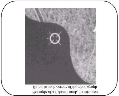
2 Results of Question: X A = m Y A = m H A = m X B = m Y B = m H B = m Distance between A and B is = m Fiducial Marks Fiducial marks are small targets on the body of metric cameras. Their positions relative to the camera body are calibrated. Thus, they define the image co-ordinate system; in that system, the position of the projection centre is known. Form as well as distribution of fiducial marks depend on the manufacturer. If amateur cameras are used, the images of corners of the camera frame on the negatives can be used instead of fiducial marks. 2
3 3
4 Metric Cameras They have stable and precisely known internal geometries and very low lens distortions. Therefore, they are very expensive devices. The principal distance is constant, which means, that the lens cannot be sharpened when taking photographs. As a result, metric cameras are only usable within a limited range of distances towards the object. The image coordinate system is defined by (mostly) four fiducial marks, which are mounted on the frame of the camera. Terrestrial cameras can be combined with tripods and theodolites. Aerial metric cameras are built into aeroplanes mostly looking straight downwards. Today, all of them have an image format of 23 by 23 centimeters. 4
5 CAMERAS IN TERRESTRIAL PHOTOGRAMMETRY Two basic camera types are employed in terrestrial photogrammetry. These are; metric cameras and non metric cameras. Metric cameras are designed and calibrated specifically for photogrammetric measurement. It has a known and stable interior orientation and is usually a fixed-focus camera. They also contains fidicual marks with which to recover the interior orientation. Nonmetric cameras are represented by a variety of fairly high-quality hand-held cameras used by amateur and professional photographers to take good pictorial quality. STEPS OF A TERRESTRIAL PHOTOGRAMMETRIC APPLICATION 5
6 6
7 Question 3. FLOWCHART OF PHOTOGRAMMETRIC MAP PRODUCTION Reconnaissance (trying for discovery) Base Map Marking on the Ground Photogrammetric Triangulation AuxiliaryData Image Definition Establish of Ground Control Point Stereo Evaluation Single Image Evaluation 7
8 Stereo Evaluation Single Image Evaluation Numerical(Digital) Data Stereo Plotting Rectification Process Cartographic Process Mosaic Digital Map Printing Photo Map Orthophoto Analogue Map Restitution and Rectification Equipment Comparators Description simple coordinate measurement instruments similar in principle to a tablet digitiser measure only x-y image coordinates in the plane of the photograph, therefore can be mechanically simple and more precise/accurate than stereoplotters minimal orientation parameters, usually only a kappa rotation for operator convenience optical train viewing system with ability to vary magnification x-y position controlled by hand wheels connected to lead screws which translate the rotations into linear motions of the photograph carriers monocomparators have a single photograph carrier with only x-y motions viewing system is similar to a simple microscope with a measuring mark stereocomparators have two photograph carriers with common x-y motions and differential movements of one photograph which are analogous to x- and y-parallax 8
9 the four motions may be controlled by hand wheels, or a combination of hand wheels for the x and y motions and foot wheels for the px and py motions the viewing system is binocular based on half marks on conjugate images to form a floating mark the measurement process for a point observation is similar to that of a stereoplotter, except that y-parallax is always present so first x- and y-parallaxes are removed, the floating mark is placed over the point to be observed and then the parallaxes are adjusted again if necessary x- and y-parallaxes will vary continuously throughout the overlap area due to tilt and height distortions the lead screws are fitted with rotary encoders, and encoded counts are transmitted to a digitiser the digitiser transmits accumulated counts to computer via an interface or the system back plane transmission of data may be "on command" or continuous Applications comparators are generally used for two principal applications, namely aerotriangulation observations and precise mapping for aerotriangulation the comparator is used essentially as an image measurement device, either in mono using targetted points, or in stereo using either targetted or non-targetted points (for example pass or tie points placed by a point transfer device) although the computer system may be used for some on-line checking of the observations as they are acquired, in general the observations are simply compiled and processed at a later time within an aerotriangulation LSE solution for precise mapping, usually in stereo, observations to fiducials/reseau points, control and parallax points and finally the points of detail are recorded typical applications of precise mapping have been (most are now done on analytical or digital stereoplotters) stock pile surveys, DEM creation and engineering project work the map data acquisition uses a fully analytical approach and the observations and transformations are based on digital data throughout 9

10 the first transformation may be for the calibration of the comparator (to correct for non-orthogonality or non-linearities of the coordinate axes) the second transformation is for the interior orientation, for example by a similarity transformation using observations to two or more fiducial marks or reseau points the third transformation is for the exterior orientation, for example by collinearity using observations to three or more control points in all cases the transformations should use an adjustment by least squares estimation to utilise any redundant data data points are then observed and transformed: comparator coordinates camera coordinates object space coordinates these transformations may be carried out on line or post-processed off line, the advantage of on line processing is of course the possibility of error checking as there are four observables, three unknowns and therefore one redundancy (vector solution or LSE of the collinearity equations) in either on line or off line processing the data may be numerically corrected for the calibration of the camera, including PP offset and radial and decentring distortions stream data must be acquired and filtered by time, distance or chord tolerance modes Precision and Accuracy precision or repeatability of mono and stereocomparators is generally around ±0.002 to 0.003mm monocomparators may have slightly better precision due to simpler mechanics, that is ±0.001mm or better precision should not be confused with the least count of the measuring system, generally 0.001mm to mm, as it is a function of the encoder resolution, whereas the repeatability is a function of the mechanical parts and lead screws of the instrument the accuracy can be determined by a grid plate test where grid intersections are observed and compared to the expected locations, the significant parameters are likely to be coordinate axis scales and rectangularity, possibly with some minor non-linear scale terms there are often mechanical adjustments provided to correct for nonrectangularity and/or non-parallelism of the x, y, p x and p y axes the subsequent observations can be corrected by a high order two dimensional transformation or by simple linear interpolation within each grid cell, the calibration correction becomes the first transformation in the data processing path the level of accuracy depends on age and wear, but is generally similar to the precision of a single coordinate observation 10
11 Advanced Features of Digital Systems digital stereoplotters will become more and more common because they have the distinct advantage that there are no mechanical or moving parts, except for the scanner a further advantage is that image processing techniques can be used to enhance or otherwise manipulate the digital images either prior to or after photogrammetric analysis for example, single photographs or satellite images can be rectified to fit ground control, combined into a mosaic or used to "drape" a digital elevation model (DEM) for realistic surface rendering also, digital stereoplotters may have the capability for image correlation to assist the operator in point measurement and to automatically generate DEMs for the entire overlap area DEM generation is limited to areas of good detail, required for the matching process to be effective, and will not work where there are discontinuities in the surface (cliffs, steep valleys, man-made structures) these areas can be excluded from the DEM or break lines can be manually recorded to isolate the discontinuities once the DEM is formed it can be used once the DEM is formed it can be used o to generate contours and sections automatically o as the surface on which a scanned photograph or satellite image is draped o o as a visualisation tool to produce an orthophotomap (differentially rectified image) in addition, digital systems may have the ability to "lock" the measuring mark to the surface of the DEM, so that the operator can concentrate on capturing detail whilst the computer system controls the height the current disadvantage of digital stereoplotters is the large size of high resolution digital images (224Mb for a monochrome aerial photograph scanned at a resolution of 0.015mm or 1.3Gb for a full colour stereopair!), but computer technology is rapidly reducing this problem compression algorithms such as JPEG and TIFF/LZW can be used to reduce files sizes by ratios between 2 and
Photogrammetry: DTM Extraction & Editing
 Photogrammetry: DTM Extraction & Editing How can one determine the x, y, and z of a location? Approaches to DTM Extraction Ground surveying Digitized topographic maps Traditional photogrammetry Hardcopy
Exterior Orientation Parameters
 Exterior Orientation Parameters PERS 12/2001 pp 1321-1332 Karsten Jacobsen, Institute for Photogrammetry and GeoInformation, University of Hannover, Germany The georeference of any photogrammetric product
Chapters 1 7: Overview
 Chapters 1 7: Overview Chapter 1: Introduction Chapters 2 4: Data acquisition Chapters 5 7: Data manipulation Chapter 5: Vertical imagery Chapter 6: Image coordinate measurements and refinements Chapter
Chapters 1-4: Summary
 Chapters 1-4: Summary So far, we have been investigating the image acquisition process. Chapter 1: General introduction Chapter 2: Radiation source and properties Chapter 3: Radiation interaction with
Chapters 1 5. Photogrammetry: Definition, introduction, and applications. Electro-magnetic radiation Optics Film development and digital cameras
 Chapters 1 5 Chapter 1: Photogrammetry: Definition, introduction, and applications Chapters 2 4: Electro-magnetic radiation Optics Film development and digital cameras Chapter 5: Vertical imagery: Definitions,
Photogrammetry: DTM Extraction & Editing
 Photogrammetry: DTM Extraction & Editing Review of terms Vertical aerial photograph Perspective center Exposure station Fiducial marks Principle point Air base (Exposure Station) Digital Photogrammetry:
Stereoscopic Models and Plotting
 Stereoscopic Models and Plotting Stereoscopic Viewing Stereoscopic viewing is the way the depth perception of the objects through BINOCULAR vision with much greater accuracy. رؤيه البعد الثالث و االحساس
A NEW TOOL FOR ARCHITECTURAL PHOTOGRAMMETRY: THE 3D NAVIGATOR S. Dequal, A. Lingua, F. Rinaudo - Politecnico di Torino - ITALY
 A NEW TOOL FOR ARCHITECTURAL PHOTOGRAMMETRY: THE 3D NAVIGATOR S. Dequal, A. Lingua, F. Rinaudo - Politecnico di Torino - ITALY KEY WORDS: 3D navigation, Digital Images, LIS, Archiving, ABSTRACT People
DIGITAL ORTHOPHOTO GENERATION
 DIGITAL ORTHOPHOTO GENERATION Manuel JAUREGUI, José VÍLCHE, Leira CHACÓN. Universit of Los Andes, Venezuela Engineering Facult, Photogramdemr Institute, Email leirac@ing.ula.ven Working Group IV/2 KEY
Chapters 1 5. Photogrammetry: Definition, introduction, and applications. Electro-magnetic radiation Optics Film development and digital cameras
 Chapters 1 5 Chapter 1: Photogrammetry: Definition, introduction, and applications Chapters 2 4: Electro-magnetic radiation Optics Film development and digital cameras Chapter 5: Vertical imagery: Definitions,
Chapters 1 9: Overview
 Chapters 1 9: Overview Chapter 1: Introduction Chapters 2 4: Data acquisition Chapters 5 9: Data manipulation Chapter 5: Vertical imagery Chapter 6: Image coordinate measurements and refinements Chapters
ORTHOPHOTO PRODUCTION FROM AERIAL PHOTOGRAPH BY USING MATLAB AND GIS
 International Journal of Civil Engineering and Technology (IJCIET) Volume 9, Issue 9, September 2018, pp. 156 164, Article ID: IJCIET_09_09_018 Available online at http://www.iaeme.com/ijciet/issues.asp?jtype=ijciet&vtype=9&itype=9
CHAPTER 10. Digital Mapping and Earthwork
 CHAPTER 10 Digital Mapping and Earthwork www.terrainmap.com/rm22.html CE 316 March 2012 348 10.1 Introduction 349 10.2 Single Images 10.2.1 Rectified Photograph With a single photograph, X,Y data can be
Introduction Photogrammetry Photos light Gramma drawing Metron measure Basic Definition The art and science of obtaining reliable measurements by mean
 Photogrammetry Review Neil King King and Associates Testing is an art Introduction Read the question Re-Read Read The question What is being asked Answer what is being asked Be in the know Exercise the
ACCURACY ANALYSIS FOR NEW CLOSE-RANGE PHOTOGRAMMETRIC SYSTEMS
 ACCURACY ANALYSIS FOR NEW CLOSE-RANGE PHOTOGRAMMETRIC SYSTEMS Dr. Mahmoud El-Nokrashy O. ALI Prof. of Photogrammetry, Civil Eng. Al Azhar University, Cairo, Egypt m_ali@starnet.com.eg Dr. Mohamed Ashraf
Photogrammetric Procedures for Digital Terrain Model Determination
 Photogrammetric Procedures for Digital Terrain Model Determination Hartmut ZIEMANN and Daniel GROHMANN 1 Introduction Photogrammetric procedures for digital terrain model (DTM) data determination fall
Extracting Elevation from Air Photos
 Extracting Elevation from Air Photos TUTORIAL A digital elevation model (DEM) is a digital raster surface representing the elevations of a terrain for all spatial ground positions in the image. Traditionally
IMAGE ACQUISITION FOR DIGITAL PHOTOGRAMMETRY USING OF THE SHELF AND METRIC CAMERAS
 IMAGE ACQUISITION FOR DIGITAL PHOTOGRAMMETRY USING OF THE SHELF AND METRIC CAMERAS Günter Pomaska FH Bielefeld, University of Applied Sciences Artilleriestr. 9, D32427 Minden gp@imagefact.de, www.imagefact.de
GALILEO SISCAM APPROACH TO DIGITAL PHOTOGRAMMETRY. F. Flamigni A. Viti Galileo Siscam S.p.A.
 GALILEO SISCAM APPROACH TO DIGITAL PHOTOGRAMMETRY F. Flamigni A. Viti Galileo Siscam S.p.A. ABSTRACT: The application of the least squares matching procedure to an analytical stereoplotter is described.
Trimble Engineering & Construction Group, 5475 Kellenburger Road, Dayton, OH , USA
 Trimble VISION Ken Joyce Martin Koehler Michael Vogel Trimble Engineering and Construction Group Westminster, Colorado, USA April 2012 Trimble Engineering & Construction Group, 5475 Kellenburger Road,
APPLICATION OF DIGITAL PHOTOGRAMMETRY AND AUTOCAD TO SUPPORT OF HISTORICAL BUILDINGS
 APPLICATION OF DIGITAL PHOTOGRAMMETRY AND AUTOCAD TO SUPPORT OF HISTORICAL BUILDINGS SEYED YOUSEF SADJADI Department of Geography and Geomatics Centre for Geosciences University of Glasgow University Avenue,
Integrating the Generations, FIG Working Week 2008,Stockholm, Sweden June 2008
 H. Murat Yilmaz, Aksaray University,Turkey Omer Mutluoglu, Selçuk University, Turkey Murat Yakar, Selçuk University,Turkey Cutting and filling volume calculation are important issues in many engineering
Low-Cost Orthophoto Production Using OrthoMapper Software
 Low-Cost Orthophoto Production Using OrthoMapper Software Rick Day Penn State Cooperative Extension, Geospatial Technology Program, RGIS-Chesapeake Air Photos Historical air photos are available from a
Calibration of IRS-1C PAN-camera
 Calibration of IRS-1C PAN-camera Karsten Jacobsen Institute for Photogrammetry and Engineering Surveys University of Hannover Germany Tel 0049 511 762 2485 Fax -2483 Email karsten@ipi.uni-hannover.de 1.
COMPARATIVE CHARACTERISTICS OF DEM OBTAINED FROM SATELLITE IMAGES SPOT-5 AND TK-350
 COMPARATIVE CHARACTERISTICS OF DEM OBTAINED FROM SATELLITE IMAGES SPOT-5 AND TK-350 Dr. V. F. Chekalin a*, M. M. Fomtchenko a* a Sovinformsputnik, 47, Leningradsky Pr., 125167 Moscow, Russia common@sovinformsputnik.com
3D DIGITAL MODELING OF MODERN TIMES BUILDING FOR PRESERVATION AND RESTORATION
 3D DIGITAL MODELING OF MODERN TIMES BUILDING FOR PRESERVATION AND RESTORATION W.J. Oh a *, S.H. Han b, H.C. Yoon c, Y.S. Bae d, S.H. Song e a Dept. of Land Information Management, ChungCheong University,
Lecture 5. Relief displacement. Parallax. Monoscopic and stereoscopic height measurement. Photo Project. Soft-copy Photogrammetry.
 NRMT 2270, Photogrammetry/Remote Sensing Lecture 5 Relief displacement. Parallax. Monoscopic and stereoscopic height measurement. Photo Project. Soft-copy Photogrammetry. Tomislav Sapic GIS Technologist
POSITIONING A PIXEL IN A COORDINATE SYSTEM
 GEOREFERENCING AND GEOCODING EARTH OBSERVATION IMAGES GABRIEL PARODI STUDY MATERIAL: PRINCIPLES OF REMOTE SENSING AN INTRODUCTORY TEXTBOOK CHAPTER 6 POSITIONING A PIXEL IN A COORDINATE SYSTEM The essential
Digital Photogrammetric System. Version 5.3 USER GUIDE. Processing of UAV data
 Digital Photogrammetric System Version 5.3 USER GUIDE Table of Contents 1. Workflow of UAV data processing in the system... 3 2. Create project... 3 3. Block forming... 5 4. Interior orientation... 6 5.
EVOLUTION OF POINT CLOUD
 Figure 1: Left and right images of a stereo pair and the disparity map (right) showing the differences of each pixel in the right and left image. (source: https://stackoverflow.com/questions/17607312/difference-between-disparity-map-and-disparity-image-in-stereo-matching)
Map Compilation CHAPTER HISTORY
 CHAPTER 7 Map Compilation 7.1 HISTORY Producing accurate commercial maps from aerial photography began in the 1930s. The technology of stereomapping over the last 70 years has brought vast technological
STARTING WITH DRONES. Data Collection and Remote Sensing with UAVs, etc. Dr. Bill Hazelton LS
 STARTING WITH DRONES Data Collection and Remote Sensing with UAVs, etc. Dr. Bill Hazelton LS What this Talk is About UAV-based data acquisition: What you need to get involved Processes in getting spatial
Chapter 1: Overview. Photogrammetry: Introduction & Applications Photogrammetric tools:
 Chapter 1: Overview Photogrammetry: Introduction & Applications Photogrammetric tools: Rotation matrices Photogrammetric point positioning Photogrammetric bundle adjustment This chapter will cover the
COORDINATE TRANSFORMATION. Lecture 6
 COORDINATE TRANSFORMATION Lecture 6 SGU 1053 SURVEY COMPUTATION 1 Introduction Geomatic professional are mostly confronted in their work with transformations from one two/three-dimensional coordinate system
EPIPOLAR IMAGES FOR CLOSE RANGE APPLICATIONS
 EPIPOLAR IMAGES FOR CLOSE RANGE APPLICATIONS Vassilios TSIOUKAS, Efstratios STYLIANIDIS, Petros PATIAS The Aristotle University of Thessaloniki, Department of Cadastre Photogrammetry and Cartography Univ.
Elements of Analytical Photogrammetry
 Chapter 5 Elements of Analytical hotogrammetry 5.1 Introduction, Concept of Image and Object Space hotogrammetry is the science of obtaining reliable information about objects and of measuring and interpreting
ADS40 Calibration & Verification Process. Udo Tempelmann*, Ludger Hinsken**, Utz Recke*
 ADS40 Calibration & Verification Process Udo Tempelmann*, Ludger Hinsken**, Utz Recke* *Leica Geosystems GIS & Mapping GmbH, Switzerland **Ludger Hinsken, Author of ORIMA, Konstanz, Germany Keywords: ADS40,
LPS Project Manager User s Guide. November 2009
 LPS Project Manager User s Guide November 2009 Copyright 2009 ERDAS, Inc. All rights reserved. Printed in the United States of America. The information contained in this document is the exclusive property
Measurement of Direction: Bearing vs. Azimuth
 Week 5 Monday Measurement of Direction: Bearing vs. Azimuth Bearing Is an angle of 90 o or less Measured from either North or South in easterly & westerly directions. North 22 o West, South 89 o West,
Journal Online Jaringan COT POLIPD (JOJAPS) Accuracy Assessment of Height Coordinate Using Unmanned Aerial Vehicle Images Based On Leveling Height
 Accuracy Assessment of Height Coordinate Using Unmanned Aerial Vehicle Images Based On Leveling Height") JOJAPS eissn 2504-8457 Abstract Journal Online Jaringan COT POLIPD (JOJAPS) Accuracy Assessment of Height Coordinate Using Unmanned Aerial Vehicle Images Based On Leveling Height Syamsul Anuar Bin Abu
JOJAPS eissn 2504-8457 Abstract Journal Online Jaringan COT POLIPD (JOJAPS) Accuracy Assessment of Height Coordinate Using Unmanned Aerial Vehicle Images Based On Leveling Height Syamsul Anuar Bin Abu
Cultural Heritage. Geometric Recording of Cultural Monuments. Basic Principles of Geometric Recording. Specific requirements
 LOW COST DIGITAL PHOTOGRAMMETRIC TECHNIQUES FOR THE DOCUMENTATION OF CULTURAL HERITAGE Ch. Ioannidis, S. Soile, C. Potsiou Lab. of Photogrammetry School of Rural & Surveying Eng. National Technical University
PREPARATIONS FOR THE ON-ORBIT GEOMETRIC CALIBRATION OF THE ORBVIEW 3 AND 4 SATELLITES
 PREPARATIONS FOR THE ON-ORBIT GEOMETRIC CALIBRATION OF THE ORBVIEW 3 AND 4 SATELLITES David Mulawa, Ph.D. ORBIMAGE mulawa.david@orbimage.com KEY WORDS: Geometric, Camera, Calibration, and Satellite ABSTRACT
Training i Course Remote Sensing Basic Theory & Image Processing Methods September 2011
 Training i Course Remote Sensing Basic Theory & Image Processing Methods 19 23 September 2011 Geometric Operations Michiel Damen (September 2011) damen@itc.nl ITC FACULTY OF GEO-INFORMATION SCIENCE AND
Camera Calibration. Schedule. Jesus J Caban. Note: You have until next Monday to let me know. ! Today:! Camera calibration
 Camera Calibration Jesus J Caban Schedule! Today:! Camera calibration! Wednesday:! Lecture: Motion & Optical Flow! Monday:! Lecture: Medical Imaging! Final presentations:! Nov 29 th : W. Griffin! Dec 1
MONO-IMAGE INTERSECTION FOR ORTHOIMAGE REVISION
 MONO-IMAGE INTERSECTION FOR ORTHOIMAGE REVISION Mohamed Ibrahim Zahran Associate Professor of Surveying and Photogrammetry Faculty of Engineering at Shoubra, Benha University ABSTRACT This research addresses
LEARNING KIT AND TUTORIALS FOR THE DIFFUSION OF THE DIGITAL PHOTOGRAMMETRY
 LEARNING KIT AND TUTORIALS FOR THE DIFFUSION OF THE DIGITAL PHOTOGRAMMETRY Elena ALBERY *, Andrea LINGUA *, Paolo MASCHIO * * Politecnico di Torino, Italia Dipartimento di Georisorse e Territorio Albery@vdiget.polito.it,
The Applanix Approach to GPS/INS Integration
 Lithopoulos 53 The Applanix Approach to GPS/INS Integration ERIK LITHOPOULOS, Markham ABSTRACT The Position and Orientation System for Direct Georeferencing (POS/DG) is an off-the-shelf integrated GPS/inertial
DIGITAL SURFACE MODELS OF CITY AREAS BY VERY HIGH RESOLUTION SPACE IMAGERY
 DIGITAL SURFACE MODELS OF CITY AREAS BY VERY HIGH RESOLUTION SPACE IMAGERY Jacobsen, K. University of Hannover, Institute of Photogrammetry and Geoinformation, Nienburger Str.1, D30167 Hannover phone +49
TRAINING MATERIAL HOW TO OPTIMIZE ACCURACY WITH CORRELATOR3D
 TRAINING MATERIAL WITH CORRELATOR3D Page2 Contents 1. UNDERSTANDING INPUT DATA REQUIREMENTS... 4 1.1 What is Aerial Triangulation?... 4 1.2 Recommended Flight Configuration... 4 1.3 Data Requirements for
Close-Range. Photogrammetry. and 3D Imaging. 2nd edition. Edited by. Thomas Luhmann, Stuart Robson, Stephen Kyle. and Jan Boehm.
 Close-Range Photogrammetry and 3D Imaging 2nd edition Edited by Thomas Luhmann, Stuart Robson, Stephen Kyle and Jan Boehm De Gruyter Content 1 Introduction 1 1.1 Overview 1 1.1.1 Content 1 1.1.2 References
SPECIFICATIONS FOR AERIAL TRIANGULATION
 Province of British Columbia Ministry of Sustainable Resource Management SPECIFICATIONS FOR AERIAL TRIANGULATION Release 2.0 MAY 1998 Geographic Data BC 810 Blanshard Street Victoria BC V8W 3E1 TABLE OF
Camera Calibration for Video See-Through Head-Mounted Display. Abstract. 1.0 Introduction. Mike Bajura July 7, 1993
 Camera Calibration for Video See-Through Head-Mounted Display Mike Bajura July 7, 1993 Abstract This report describes a method for computing the parameters needed to model a television camera for video
MODEL DEFORMATION ACCURACY OF DIGITAL FRAME CAMERAS
 MODEL DEFORMATION ACCURACY OF DIGITAL FRAME CAMERAS V. Spreckels a, A. Schlienkamp a, K. Jacobsen b a Deutsche Steinkohle AG (DSK), Dept. Geoinformation/Engineering Survey BG G, Shamrockring 1, D-44623
LUMS Mine Detector Project
 LUMS Mine Detector Project Using visual information to control a robot (Hutchinson et al. 1996). Vision may or may not be used in the feedback loop. Visual (image based) features such as points, lines
DEVELOPMENT AND EVALUATION OF A MEASUREMENT AND CALCULATION MODULE FOR OFFSETS WITH RESPECT TO A STRECHED WIRE BASED ON PHOTOGRAMMETRY AT CERN
 DEVELOPMENT AND EVALUATION OF A MEASUREMENT AND CALCULATION MODULE FOR OFFSETS WITH RESPECT TO A STRECHED WIRE BASED ON PHOTOGRAMMETRY AT CERN Servet Lapardhaja NTUA Undergraduate Student 28/09/2018 Summary
International Journal of Civil Engineering and Geo-Environment. Close-Range Photogrammetry For Landslide Monitoring
 International Journal of Civil Engineering and Geo-Environment Journal homepage:http://ijceg.ump.edu.my ISSN:21802742 Close-Range Photogrammetry For Landslide Monitoring Munirah Bt Radin Mohd Mokhtar,
PHOTOGRAMMETRIC PROCESSING OF LOW ALTITUDE IMAGE SEQUENCES BY UNMANNED AIRSHIP
 PHOTOGRAMMETRIC PROCESSING OF LOW ALTITUDE IMAGE SEQUENCES BY UNMANNED AIRSHIP Yongjun Zhang School of Remote Sensing and Information Engineering, Wuhan University, Wuhan, Hubei, 430079, P.R. China - zhangyj@whu.edu.cn
Digital Photogrammetric System. Version 6.3 USER MANUAL. Aerial triangulation
 Digital Photogrammetric System Version 6.3 USER MANUAL Table of Contents 1. Purpose of the document... 5 2. data... 5 2.1. The Orientation menu... 5 2.2. Source data... 7 2.3. workflow... 8 2.4. Data quality
III. TESTING AND IMPLEMENTATION
 MAPPING ACCURACY USING SIDE-LOOKING RADAR I MAGES ON TIlE ANALYTI CAL STEREOPLOTTER Sherman S.C. Wu, Francis J. Schafer and Annie Howington-Kraus U.S Geological Survey, 2255 N. Gemini Drive, Flagstaff,
Camera model and multiple view geometry
 Chapter Camera model and multiple view geometry Before discussing how D information can be obtained from images it is important to know how images are formed First the camera model is introduced and then
GMAT9300 Aerial and Satellite Imaging Systems
 GMAT9300 Aerial and Satellite Imaging Systems Semester 2, COURSE DETAILS Units of Credit 6 Contact hours 5 Class Tuesday 12.00 to 15.00 BUS232 Workshop Wednesday 12.00 to 14.00 MAT308 and CivEng Lab 201
BUNDLE BLOCK ADJUSTMENT WITH HIGH RESOLUTION ULTRACAMD IMAGES
 BUNDLE BLOCK ADJUSTMENT WITH HIGH RESOLUTION ULTRACAMD IMAGES I. Baz*, G. Buyuksalih*, K. Jacobsen** * BIMTAS, Tophanelioglu Cad. ISKI Hizmet Binasi No:62 K.3-4 34460 Altunizade-Istanbul, Turkey gb@bimtas.com.tr
PLS - EXAMINATION PREPARATION PHOTOGRAMMETRY 101. A paper on the principles of photogrammetric mapping
 Photogrammetric Consultants PLS - EXAMINATION PREPARATION PHOTOGRAMMETRY 101 A paper on the principles of photogrammetric mapping Photogrammetry is the art and science of obtaining reliable measurements
COMPARISON OF CAMERA CALIBRATION PARAMETERS USING PHOTOMODELER AND AUSTRALIS
 COMPARISON OF CAMERA CALIBRATION PARAMETERS USING PHOTOMODELER AND AUSTRALIS Fazli Abd. Rahman*, Halim Setan*, Albert K.Chong**, Zulkepli Majid* & Anuar Ahmad* *Department of Geomatic Engineering, Faculty
1. In chain surveying tie lines are primarily provided a) to check the accuracy of the survey b) to take offsets for detail survey c) to avoid long
 to check the accuracy of the survey b) to take offsets for detail survey c) to avoid long") 1. In chain surveying tie lines are primarily provided a) to check the accuracy of the survey b) to take offsets for detail survey c) to avoid long offsets from chain lines d) to increase the number of
1. In chain surveying tie lines are primarily provided a) to check the accuracy of the survey b) to take offsets for detail survey c) to avoid long offsets from chain lines d) to increase the number of
AUTOMATIC IMAGE ORIENTATION BY USING GIS DATA
 AUTOMATIC IMAGE ORIENTATION BY USING GIS DATA Jeffrey J. SHAN Geomatics Engineering, School of Civil Engineering Purdue University IN 47907-1284, West Lafayette, U.S.A. jshan@ecn.purdue.edu Working Group
GMAT9300 Aerial and Satellite Imaging Systems
 GMAT9300 Aerial and Satellite Imaging Systems Semester 2, 2016 COURSE DETAILS Units of Credit 6 Contact hours 5 Class Mon 10.00 to 13.00 BUS130 Workshop Tuesday 15.00 to 17.00 QUAD047 and CivEng Lab 201
ABSTRACT 1. INTRODUCTION
 Published in SPIE Proceedings, Vol.3084, 1997, p 336-343 Computer 3-d site model generation based on aerial images Sergei Y. Zheltov, Yuri B. Blokhinov, Alexander A. Stepanov, Sergei V. Skryabin, Alexander
CE 260 SURVEYING CHAPTER 5 THEODOLITES
 CE 260 SURVEYING CHAPTER 5 THEODOLITES General Background: Theodolites or Transits are surveying instruments designed to precisely measure horizontal and vertical angles. 1 They are used to establish straight
COMBINED BUNDLE BLOCK ADJUSTMENT VERSUS DIRECT SENSOR ORIENTATION ABSTRACT
 COMBINED BUNDLE BLOCK ADJUSTMENT VERSUS DIRECT SENSOR ORIENTATION Karsten Jacobsen Institute for Photogrammetry and Engineering Surveys University of Hannover Nienburger Str.1 D-30167 Hannover, Germany
PHOTOGRAMMETRIC SOLUTIONS OF NON-STANDARD PHOTOGRAMMETRIC BLOCKS INTRODUCTION
 PHOTOGRAMMETRIC SOLUTIONS OF NON-STANDARD PHOTOGRAMMETRIC BLOCKS Dor Yalon Co-Founder & CTO Icaros, Inc. ABSTRACT The use of small and medium format sensors for traditional photogrammetry presents a number
RESAMPLING DIGITAL IMAGERY TO EPIPOLAR GEOMETRY
 RESAMPLING DIGITAL IMAGERY TO EPIPOLAR GEOMETRY Woosug Cho Toni Schenk Department of Geodetic Science and Surveying The Ohio State University, Columbus, Ohio 43210-1247 USA Mustafa Madani Intergraph Corporation,
A NEW ANALYTICAL PHOTOGRAMMETRIC INSTRUMENT
 THE ASP2000: A NEW ANALYTICAL PHOTOGRAMMETRIC INSTRUMENT M.H. ELFICK Department of Civil Engineering and Surveying The University of Newcastle. N.S.W., 2308, AUSTRALIA and M.J. FLETCHER MlMAKA Pty. Limited
Creating a distortion characterisation dataset for visual band cameras using fiducial markers.
 Creating a distortion characterisation dataset for visual band cameras using fiducial markers. Robert Jermy Council for Scientific and Industrial Research Email: rjermy@csir.co.za Jason de Villiers Council
Orthophotography and LiDAR Terrain Data Collection Rogue River, Oregon Final Report
 Orthophotography and LiDAR Terrain Data Collection Rogue River, Oregon Final Report Prepared by Sky Research, Inc. 445 Dead Indian Memorial Road Ashland, OR 97520 Prepared for Rogue Valley Council of Governments
PRODUCTION AND PRECISION ANALYSIS OF A DIGITAL ORTOPHOTO FROM 1:35000 SCALED AIRPHOTO AS A GIS COVERAGE
 PRODUCTION AND PRECISION ANALYSIS OF A DIGITAL ORTOPHOTO FROM 1:35000 SCALED AIRPHOTO AS A GIS COVERAGE Sitki KULUR *, Ozan DIVAN** * Istanbul Technical University, Department of Geodesy and Photogrammetry
Gregory Walsh, Ph.D. San Ramon, CA January 25, 2011
 Leica ScanStation:: Calibration and QA Gregory Walsh, Ph.D. San Ramon, CA January 25, 2011 1. Summary Leica Geosystems, in creating the Leica Scanstation family of products, has designed and conducted
THE G3/PC STEREOCORD - A SIMPLE ANALYTICAL PLOTTING INSTRUMENT ON A PC BASIS
 THE G3/PC STEREOCORD - A SMPLE ANALYTCAL PLOTTNG NSTRUMENT ON A PC BASS Dr. Reiner Schwebel, Oberkochen, Hans-Wolfgang Faust, Oberkochen Prof. Hans Mohl, Stuttgart and ABSTRACT The Stereocord is a simple
Sasanka Madawalagama Geoinformatics Center Asian Institute of Technology Thailand
 Sasanka Madawalagama Geoinformatics Center Asian Institute of Technology Thailand This learning material was not prepared by ADB. The views expressed in this document are the views of the author/s and
Characterizing Strategies of Fixing Full Scale Models in Construction Photogrammetric Surveying. Ryan Hough and Fei Dai
 697 Characterizing Strategies of Fixing Full Scale Models in Construction Photogrammetric Surveying Ryan Hough and Fei Dai West Virginia University, Department of Civil and Environmental Engineering, P.O.
COMPARATIVE ANALYSIS OF ALTERNATIVE IN-DOOR CALIBRATION TECHNIQUES FOR OFF-THE-SHELF DIGITAL CAMERAS INTRODUCTION
 COMPARATIVE ANALYSIS OF ALTERNATIVE IN-DOOR CALIBRATION TECHNIQUES FOR OFF-THE-SHELF DIGITAL CAMERAS Ivan Detchev, Axel Ebeling, Ayman Habib Department of Geomatics Engineering, University of Calgary,
PART A Three-Dimensional Measurement with iwitness
 PART A Three-Dimensional Measurement with iwitness A1. The Basic Process The iwitness software system enables a user to convert two-dimensional (2D) coordinate (x,y) information of feature points on an
GEOMETRY AND INFORMATION CONTENTS OF LARGE SIZE DIGITAL FRAME CAMERAS
 GEOMETRY AND INFORMATION CONTENTS OF LARGE SIZE DIGITAL FRAME CAMERAS Karsten Jacobsen Institute of Photogrammetry and Geoinformation Leibniz University Hannover jacobsen@ipi.uni-hannover.de KEY WORDS:
TERRESTRIAL LASER SCANNER DATA PROCESSING
 TERRESTRIAL LASER SCANNER DATA PROCESSING L. Bornaz (*), F. Rinaudo (*) (*) Politecnico di Torino - Dipartimento di Georisorse e Territorio C.so Duca degli Abruzzi, 24 10129 Torino Tel. +39.011.564.7687
The Stereoplotter Module Introduction Points Lines Polygons Stereoplotter
 Introduction of the e-foto software performs the threedimensional photogrammetric plotting of terrain features from a stereoscopic model. This operation plots the outline of natural and man-made objects
The Accuracy of Determining the Volumes Using Close Range Photogrammetry
 IOSR Journal of Mechanical and Civil Engineering (IOSR-JMCE) e-issn: 2278-1684,p-ISSN: 2320-334X, Volume 12, Issue 2 Ver. VII (Mar - Apr. 2015), PP 10-15 www.iosrjournals.org The Accuracy of Determining
Camera Calibration for a Robust Omni-directional Photogrammetry System
 Camera Calibration for a Robust Omni-directional Photogrammetry System Fuad Khan 1, Michael Chapman 2, Jonathan Li 3 1 Immersive Media Corporation Calgary, Alberta, Canada 2 Ryerson University Toronto,
Iowa Department of Transportation Office of Design. Photogrammetric Mapping Specifications
 Iowa Department of Transportation Office of Design Photogrammetric Mapping Specifications March 2015 1 Purpose of Manual These Specifications for Photogrammetric Mapping define the standards and general
Evaluating the Performance of a Vehicle Pose Measurement System
 Evaluating the Performance of a Vehicle Pose Measurement System Harry Scott Sandor Szabo National Institute of Standards and Technology Abstract A method is presented for evaluating the performance of
Introduction.
 Product information Image Systems AB Main office: Ågatan 40, SE-582 22 Linköping Phone +46 13 200 100, fax +46 13 200 150 info@imagesystems.se, Introduction Motion is the world leading software for advanced
AUTOMATIC EXTRACTION OF 3D MODEL COORDINATES USING DIGITAL STEREO IMAGES
 AUTOMATIC EXTRACTION OF 3D MODEL COORDINATES USING DIGITAL STEREO IMAGES Evangelos G Papapanagiotu, Ph.D. Candidate (1) Prof. Dr. John N Hatzopoulos, Director (2) Remote Sensing Laboratory, Department
Measurement and Precision Analysis of Exterior Orientation Element Based on Landmark Point Auxiliary Orientation
 2016 rd International Conference on Engineering Technology and Application (ICETA 2016) ISBN: 978-1-60595-8-0 Measurement and Precision Analysis of Exterior Orientation Element Based on Landmark Point
2. POINT CLOUD DATA PROCESSING
 Point Cloud Generation from suas-mounted iphone Imagery: Performance Analysis A. D. Ladai, J. Miller Towill, Inc., 2300 Clayton Road, Suite 1200, Concord, CA 94520-2176, USA - (andras.ladai, jeffrey.miller)@towill.com
Geomatica OrthoEngine Orthorectifying VEXCEL UltraCam Data
 Geomatica OrthoEngine Orthorectifying VEXCEL UltraCam Data Vexcel s UltraCam digital camera system has a focal distance of approximately 100mm and offers a base panchromatic (black and white) resolution
GIS Data Collection. This chapter reviews the main methods of GIS data capture and transfer and introduces key practical management issues.
 9 GIS Data Collection OVERVIEW This chapter reviews the main methods of GIS data capture and transfer and introduces key practical management issues. It distinguishes between primary (direct measurement)
CSCI 5980: Assignment #3 Homography
 Submission Assignment due: Feb 23 Individual assignment. Write-up submission format: a single PDF up to 3 pages (more than 3 page assignment will be automatically returned.). Code and data. Submission
Stereo Analyst User s Guide
 User s Guide Copyright 2006 Leica Geosystems Geospatial Imaging, LLC All rights reserved. Printed in the United States of America. The information contained in this document is the exclusive property of
Automatic Systems for Digitizing Historical Maps
 Martina Ballarin *, Caterina Balletti **, Caterina Gottardi *** Automatic Systems for Digitizing Historical Maps Keywords: digitization; robotic arm; 3D recording; photogrammetry; historical maps Summary:
Stereo Vision. MAN-522 Computer Vision
 Stereo Vision MAN-522 Computer Vision What is the goal of stereo vision? The recovery of the 3D structure of a scene using two or more images of the 3D scene, each acquired from a different viewpoint in
DENSE 3D POINT CLOUD GENERATION FROM UAV IMAGES FROM IMAGE MATCHING AND GLOBAL OPTIMAZATION
 DENSE 3D POINT CLOUD GENERATION FROM UAV IMAGES FROM IMAGE MATCHING AND GLOBAL OPTIMAZATION S. Rhee a, T. Kim b * a 3DLabs Co. Ltd., 100 Inharo, Namgu, Incheon, Korea ahmkun@3dlabs.co.kr b Dept. of Geoinformatic