Streamline your office to field processes. Peter Madsen
|
|
|
- Valentine Berry
- 5 years ago
- Views:
Transcription

1 2017

2 Streamline your office to field processes Peter Madsen


3 Introduction Improving your office>field>office workflows and processes Data Preparation Data Upload Field Process Coding / Stringing Object Types Map View Attributing Imaging Scanning Application Updates Levelling Data Download End Deliverables


 Upload and utilise smarter")
4 Data Preparation and Upload Numerous calc /processing software available Use more than a basic ASCII / CSV Direct transfer available with intelligent Leica DBX job file Utilise XML / HeXML formats for rich data transfer Stylesheets and format files available for different softwares Upload attributes and images to improve field processes. Easy identification of features (pipe diameters, colours, materials etc.) Upload and utilise smarter data like background images, DTM s, alignment information etc


5 Leica Exchange Transfer your data from and to the field quicker than ever before Easy, fast and safe way to optimise productivity No size limits to worry about Seamless office software integration Easily select data and send it to/from field crew. Don t worry about limited sizes or FTP systems Internet access in the field Hand held controllers with WiFi or SIMs with data Hotspot Instrument to phone or WLAN connection
6


7 Coding and Stringing Use an intelligent Codelist that matches your office software Create and edit Codelists using Neo or Infinity software in the office or in the field with Captivate Intelligent Codes have information on what type of features and attributes are associated with them Use zig-zag or same direction cross section templates


8 Coding and Stringing Continued Utilise the new and simple + - on-board stringing Continue linework and strings at the click of a button in the map view Use Multiple codes on single points Set different codes for points and lines on single feature pickups Setup common code field templates to improve feature survey efficiency


9 Feature Types Set up your code list to anticipate likely object types See stringing for lines, arcs, splines and more develop live in the integrated map view Close stringlines, do best fit arcs and much more


10 Map View Use the 3D map view to immerse yourself in the data like never before Stake objects via the map at the click of a button Manage your Layers, Annotations, and Object display on board Only view what you want to view
 Add attribute fields / new codes whilst on the job Setup Attribute drop down choice lists Set if they are")
11 Attributing Easy identification of features (pipe diameters, colours, materials etc.) Add attribute fields / new codes whilst on the job Setup Attribute drop down choice lists Set if they are mandatory or optional Photo Attributes


12 Images Utilise imaging capabilities on your instrument and controller Step up from non-spatially related pictures off your phone Store images as attributes of objects like signs, pits, pipes, buildings to save on lengthy descriptions Use as part of your quality control procedures


13 Imaging Utilise imaging on your instrument Live imagery is used as a backdrop with your data overlaid Use the live image feed to control the telescope and take reflectorless shots Take panoramic images at each setup Use stereo images to create 3D objects in software like Neo


14 Scanning Target your scans with by defining your scan area Scan point density is fully customisable Compare scan data to design data in the field In LISCAD process on datum geometry and scan information in one easy step


15 Application Updates Roads app now has vertical exaggeration Use the map view in not only Measure but applications like Measure to Line and Roads Delete and edit multiple points in one action Enter multiple elevations for staked points Job searching and navigation updates


16 Quick Setup Easy Data Transfer Digital Camera Aiming Autofocus Efficiency Highest Accuracy Adjust results in the field or office


17 Imaging Laser Scanner Lightweight < 1kg 3D image point cloud created in Real Time Wifi connection to field tablet 360,000 points per second < 3 minutes for full dome scan High definition short-range scanner Thermal image sensors


18 Data Download and Reduction Once again you can use Leica Exchange to quickly send your data from field to office to maximise efficiency Direct transfer available with intelligent Leica DBX job file If you use the Traverse or Measure Sets apps for control it can be simply extracted to LISCAD s least squares adjustment module Use the attributes and images you have stored in the field to add value to you end deliverables


19 Thank You
Leica Captivate. Software Release Notes. Field Controllers: CS20, CS35 Total Stations: TS16, TS60, MS60, TS13 GNSS Sensors: GS18 T
 Leica Captivate v4.10 Software Release Notes Product Leica Captivate Field Controllers: CS20, CS35 Total Stations: TS16, TS60, MS60, TS13 GNSS Sensors: GS18 T Release date 10 th December 2018 Maintenance
Overview of the Trimble TX5 Laser Scanner
 Overview of the Trimble TX5 Laser Scanner Trimble TX5 Revolutionary and versatile scanning solution Compact / Lightweight Efficient Economical Ease of Use Small and Compact Smallest and most compact 3D
Product Leica Infinity. Date Nov 30 th, From Kevin Hanson
 Product Leica Infinity Date Nov 30 th, 2017 From Kevin Hanson Leica Geosystems AG Heinrich-Wild-Strasse CH-9435 Heerbrugg Switzerland www.leica-geosystems.com Table of Contents 1 About this Release...
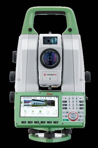
Increase Field Survey Efficiency by Merging Technologies in NOVA MultiStation. Vincent Lui Leica Geosystems Ltd
 Increase Field Survey Efficiency by Merging Technologies in NOVA MultiStation Vincent Lui Leica Geosystems Ltd Advantages of Laser Scanning Advantages of TPS Measurements Advantages of Imaging Advantages
Trimble Engineering & Construction Group, 5475 Kellenburger Road, Dayton, OH , USA
 Trimble VISION Ken Joyce Martin Koehler Michael Vogel Trimble Engineering and Construction Group Westminster, Colorado, USA April 2012 Trimble Engineering & Construction Group, 5475 Kellenburger Road,
TRIMBLE TOTAL STATIONS: TRUSTED TODAY, DESIGNED FOR TOMORROW.
 GEOSPatial SOLUTIONS Trimble S-SERIES TOTAL Stations TRIMBLE TOTAL STATIONS: TRUSTED TODAY, DESIGNED FOR TOMORROW. For more than a decade, on countless jobs all over the world, Trimble Robotic s have delivered
BIM & Digital Transformation Scotland Live 2018 Capturing 3D Reality at the push of a button
 BIM & Digital Transformation Scotland Live 2018 Capturing 3D Reality at the push of a button Gary Kelly Country Manager Scotland Leica Geosystems @LeicaScot Capturing 3D Reality at the push of a button
3D Laser Scanning Technology. Fast, Safe, Accurate. Rugged hardware and powerful software combined with streamlined survey workflow
 3D Laser Scanning Technology Fast, Safe, Accurate Rugged hardware and powerful software combined with streamlined survey workflow Maptek specialises in the research, development and application of 3D laser
Simplicity is the new black: The BLK360 story
 Simplicity is the new black: The BLK360 story Vanda KADLECIKOVA Leica Geosystems Heerbrugg, Switzerland E-mail: vanda.kadlecikova@leica-geosystems.com Abstract Meet the game changer. The new Leica BLK360
Leica FlexField plus & Leica FlexOffice A Perfect Match
 Leica FlexField & Leica FlexOffice A Perfect Match FlexField Onboard Software General File Management Data Import Data Export Status icon bar Instrument Protection with PIN Stake Out beep Map Select Programs
General GPS TPS ROB X POLE VOL RDN RPL Jobs management System settings (units, precision, parameters, etc.)
") XPAD Survey Modules XPAD Survey GPS TPS XPOLE General GPS TPS ROB XPOLE VOL RDN RPL Jobs management System settings (units, precision, parameters, etc.) Instruments GPS GPS TPS ROB XPOLE VOL RDN RPL Instrument
XPAD Survey Modules XPAD Survey GPS TPS XPOLE General GPS TPS ROB XPOLE VOL RDN RPL Jobs management System settings (units, precision, parameters, etc.) Instruments GPS GPS TPS ROB XPOLE VOL RDN RPL Instrument
Leica High-Definition Surveying Systems. Leica HDS3000. The Industry Standard for High-Definition Surveying
 Leica High-Definition Surveying Systems Leica HDS3000 The Industry Standard for High-Definition Surveying HDS High-Definition Surveying TM : Laser Scanning Redefined High-Definition Surveying, or HDS,
The Leica HDS Family. The Right Tool for the Job HDS3000 HDS2500 HDS4500. Cyclone & CloudWorx. Press the QuickScan button to define the field-of-view.
 HDS2500 High accuracy scanner, ideal for fixed or raised installations when leveled tripod mounting is not practical, or areas with less stringent field-of-view requirements. The Leica HDS Family Time-of-flight
Reality Capture using: RPAS Technologies & Image Laser Scanners
 Reality Capture using: RPAS Technologies & Image Laser Scanners by Johan Erasmus (RPAS Technologies) & Barend Bornman (Image Laser Scanners) from Aciel Geomatics Laser Scanners High-Definition Surveying
TECHNICAL NOTES SURVEY PRO WITH TSX
 SURVEY PRO WITH TSX TECHNICAL NOTES Survey Pro software from TDS is the data collection solution of choice for most North American surveyors 1. And with the addition of the Trimble TSX (Trimble Systems
Leica Captivate. Software Release Notes. Field Controllers: CS20, CS35 Total Stations: TS16, TS60, MS60. Release date 1 st December 2017
 Leica Captivate v3.00 Software Release Notes Product Leica Captivate Field Controllers: CS20, CS35 Total Stations: TS16, TS60, MS60 Release date 1 st December 2017 Maintenance date 1 st December 2017 Available
Instrument Manual. Interface to Leica Geosystems Captivate
 Instrument Manual Interface to Leica Geosystems Captivate Contents Introduction... 3 Chapter 1... 4 1.1 Install LSS, 3D Vision, Tutorials and Testdata... 4 1.2 Survey instrument and Machine Control support
2/9/2016. Session Agenda: Implementing new Geospatial Technologies for more efficient data capture
 Implementing new Geospatial Technologies for more efficient data capture Jay Haskamp Applied Geospatial Engineer Steve Richter VP Sales Session Agenda: Today s changing technologies and what lies ahead
Leica BLK360 Questions & Answers. Vers
 Questions & Answers Vers. 11.01.2017 What is it? 2 What is it? 3 What is it? Calibrated full spherical image, LED flash support 4 What is it? 5 A new, simple way to capture reality Speed On-the-fly image
Product Leica Infinity. Date July 13 t, From Kevin Hanson
 Product Leica Infinity Date July 13 t, 2018 From Kevin Hanson Leica Geosystems AG Heinrich-Wild-Strasse CH-9435 Heerbrugg Switzerland www.leica-geosystems.com Table of Contents 1 About Infinity v3.0.1...
Trimble RealWorks. What s new in version 9.0
 Trimble RealWorks What s new in version 9.0 Trimble RealWorks v9.0 What s new Over 40 new features and enhancements Navigation and visualization improvements SketchUp interoperability Additional 3 rd party
Perpendicular Offsets - point picker is a check-box type button and will now remain in effect until switched off.
 New Functionality Raw File Viewer This now has a View button that allows the user to see the map in a split view. Tapping on certain records will show up as icons in the view. For example tapping an OC
Leica Captivate. Software Release Notes. Field Controllers: CS20, CS35 Total Stations: TS16, TS60, MS60. Release date 5 th March 2018
 Leica Captivate v3.20 Software Release Notes Product Leica Captivate Field Controllers: CS20, CS35 Total Stations: TS16, TS60, MS60 Release date 5 th March 2018 Maintenance date 5 th March 2018 Available
Trimble Field Solutions in Surveying
 Trimble Field Solutions in Surveying Trimble Survey Controllers and Field Software A total approach to managing fieldwork. RELEASE THE FULL POTENTIAL OF YOUR SURVEYING GEAR AND YOUR BUSINESS Trimble controllers
Test Profiles for Digital Terrain Models
 Test Profiles for Digital Terrain Models 1.1 Overview Jointly developed by the Photogrammetics and GEOPAK Units within the Minnesota Department of Transportation, this procedure details the standard procedure
ON THE ROAD JULY/AUGUST MAP PROJECTIONS The importance of horizontal and vertical datums in GIS mapping
 VOLUME 4 ISSUE 5 JULY/AUGUST 2014 ON THE ROAD 30 40 62 MAP PROJECTIONS The importance of horizontal and vertical datums in GIS mapping FOLLOW THE LEDDAR A special purpose sensor that does several 3D measurement
This firmware is protected and can only be loaded onto instruments with valid firmware (software) Maintenance date.
 Maintenance date.") Products TPS1200, GPS1200, RX1250 From System 1200 Product Management Date 17 th July, 2008 DVD ROM Leica SmartWorx DVD (Art. No. 755806) Version SmartWorx v6.00 Download http://downloads.leica-geosystems.com/downloads/index.htm
Products TPS1200, GPS1200, RX1250 From System 1200 Product Management Date 17 th July, 2008 DVD ROM Leica SmartWorx DVD (Art. No. 755806) Version SmartWorx v6.00 Download http://downloads.leica-geosystems.com/downloads/index.htm
Trimble Business Center Software, v3.30
 Trimble Business Center Software, v3.30 We are pleased to announce a new version of the Trimble Business Center software, version 3.30. This new version includes over 30 new features and enhancements increasing
TRIMBLE ACCESS TRIMBLE ACCESS PROJECTS AND JOBS GUIDE
 TRIMBLE ACCESS TRIMBLE ACCESS PROJECTS AND JOBS GUIDE Version 2018.10 Revision A August 2018 Contents Projects & jobs 3 Managing projects 6 To create a local project 7 File transfer 7 Trimble data folders
TRIMBLE ACCESS TRIMBLE ACCESS PROJECTS AND JOBS GUIDE
 TRIMBLE ACCESS TRIMBLE ACCESS PROJECTS AND JOBS GUIDE Version 2018.00 Revision A June 2018 Contents Projects & jobs 3 Managing projects 6 To create a local project 7 File transfer 8 Trimble data folders
X-PAD Ultimate. The Ultimate solution in the field. Works when you do
 Works when you do X-PAD Ultimate The Ultimate solution in the field X-PAD Ultimate is a tailored, flexible, modular, ideal, customised software for high end topographic tasks, such as measure, stake-out,
3D Laser Scanner. Fast, Portable, Accurate. Long range laser scanner Modular design configured to suit your survey needs
 3D Laser Scanner Fast, Portable, Accurate Long range laser scanner Modular design configured to suit your survey needs Introducing the Maptek I-Site 8820 laser scanner The Maptek I-Site 8820 laser scanner
SURVEY 3.0. Innovative field solutions for Surveyors X PAD. works when you do
 Innovative field solutions for Surveyors works when you do X PAD INNOVATIVE FIELD SOLUTION FOR SURVEYORS The software for survey, stakeout and control, ensuring productivity and flexibility in the field,
Leica Cyclone 5.4 Technical Specifications
 Leica Cyclone 5.4 Technical Specifications HDS Scanner control and operation Scan Scan Scan Register Model Survey Viewer Acquire and display image Acquire image at specified resolution (high, medium, low)
X PAD for Android. The first, the most advanced. Designed and developed by: X PAD
 X PAD for Android Designed and developed by: X PAD X PAD for Android X PAD for Android presents a new way of working, based on the most evolved and technologically advanced platform for mobile devices.
Leica Campus Knowledge at your Fingertips
 Leica Campus Knowledge at your Fingertips Training Schedule 2010 1 Leica Campus Training Schedule 2010 Leica Campus Training Packages offers flexible courses designed to suit your company s needs and the
Leica Captivate. Software Release Notes. Field Controllers: CS20, CS35 Total Stations: TS16, TS60, MS60. Release date 7 th June 2016
 Leica Captivate v2.00 Software Release Notes Product Leica Captivate Field Controllers: CS20, CS35 Total Stations: TS16, TS60, MS60 Release date 7 th June 2016 Maintenance date 1 st June 2016 Available
3D Laser Scanner VS1000 User Manual
 3D Laser Scanner VS1000 User Manual 1 VS1000 Introduction SMART MAX GEOSYSTEMS CO., LTD VS1000 3D Laser Scanner based on pulses ranging principle, could quick acquire massive point cloud data from the
Survey Pro Software. Includes Spectra Precision Central: Spectra Precision s cloud computing solution. Survey Pro: Simply The Best
 Survey Pro Software Includes Spectra Precision Central: Spectra Precision s cloud computing solution. Survey Pro: Simply The Best SURVEY PROSimplicity, Reliability, and Security Spectra Precision Ranger
The Most Comprehensive Solution for Indoor Mapping Applications
 The Most Comprehensive Solution for Indoor Mapping Applications TRIMBLE INDOOR MOBILE MAPPING SOLUTION TRIMBLE INDOOR MOBILE MAPPING SOLUTION (TIMMS): HIGH EFFICIENCY, MAXIMUM FLEXIBILITY, ALL-IN-ONE PACKAGE
City of San Antonio Utilizing Advanced Technologies for Stormwater System Mapping and Condition Assessments
 City of San Antonio Utilizing Advanced Technologies for Stormwater System Mapping and Condition Assessments Prepared for: Prepared by Noelle Gaspard, PE, GISP, CFM Agenda Purpose Project Overview Challenges
3D Laser Scanning Technology. Rugged hardware and powerful software combined with streamlined survey workflow
 3D Laser Scanning Technology Rugged hardware and powerful software combined with streamlined survey workflow I-Site XR3 laser scanner The Maptek I-Site XR3 laser scanner represents the latest laser imaging
Leica FlexLine TS06plus Top precision meets high efficiency
 Leica FlexLine TS06plus Top precision meets high efficiency The First Plus: Original Leica Geosystems quality For most, quality is relative. Not so at Leica Geosystems. To ensure our instruments meet the
Interface to icon Construction Instruments and Machine Control
 Interface to icon Construction Instruments and Machine Control CONTENTS 1. Preamble 2. Install and Configure LSS 3. Exporting data to Leica Machine Control (Scanlaser) 4. Importing LSS exported files into
FARO As-Built for AutoCAD Software Versatile Reality to CAD Solutions
 FARO As-Built for AutoCAD Software Versatile Reality to CAD Solutions FARO As-Built for Autodesk Revit Creating Efficiencies in Scan Data Extraction for BIM FARO As-Built for AutoCAD Software TM Versatile
TECHNICAL NOTES TRIMBLE SURVEY CONTROLLER SOFTWARE
 TRIMBLE SURVEY CONTROLLER SOFTWARE TECHNICAL NOTES The Trimble Survey Controller software is the data collection solution that will make your survey work faster, easier, and more productive than ever before.
Trimble Access and Trimble SX10 Scanning Total Station Guide
 Trimble Optical and Field Software October 2016 Trimble Access and Trimble SX10 Scanning Total Station Guide Trimble SX10 Scanning Total Station Innovative True merging of high-speed scanning, enhanced
Trimble VISION Positions from Pictures
 Trimble VISION Positions from Pictures This session will cover What Is Trimble VISION? Trimble VISION Portfolio What Do you Need? How Does It Work & How Accurate Is It? Applications Resources Trimble VISION
Location Intelligence Solution
 Location Intelligence Solution improving orientation, navigation and information management capabilities inside complex facilities Conceptual design study Dipl.-Geogr. Dirk SCHMIDT Session: Technology
Quality Assurance and Quality Control Procedures for Survey-Grade Mobile Mapping Systems
 Quality Assurance and Quality Control Procedures for Survey-Grade Mobile Mapping Systems Latin America Geospatial Forum November, 2015 Agenda 1. Who is Teledyne Optech 2. The Lynx Mobile Mapper 3. Mobile
CR Kennedy has established itself as one of the largest and most successful suppliers of Leica Geosystems survey equipment in the world.
 C.R. Kennedy was founded in 1934 by Clement Robertson Kennedy, importing photographic and optical products. In 1954 we became the first distributor in the world for Pentax - and today still the oldest.
Leica FlexLine TS09plus Full Precision at High Performance
 Leica FlexLine TS09plus Full Precision at High Performance The First Plus: Original Leica Geosystems Quality For most, quality is relative. Not so at Leica Geosystems. To ensure our instruments meet the
Provided by Xpert Survey Equipment Click Leica TS06 for Product Info and Updated Pricing. Leica FlexLine TS06plus Top precision meets high efficiency
 Provided by Xpert Survey Equipment Click Leica TS06 for Product Info and Updated Pricing Leica TS06plus Top precision meets high efficiency The First Plus: Leica Geosystems quality For most, quality is
A Sweet Success in Plant Documentation for Michigan Sugar Company
 A Sweet Success in Plant Documentation for Michigan Sugar Company COMPANY LOCATION 3D Imaging Services Flint, MI TOOLS USED Leica ScanStation P40 (solutionshardware-p40.html) Leica Cyclone Software (solutionssoftware-cyclone.html)
Storage Tank Solutions TRANSFORMING THE WAY THE WORLD WORKS
 Storage Tank Solutions Trimble TX8 Scanner: A Revolution in 3D Scanning TRUE PERFORMANCE IN A REAL WORLD The Trimble TX8 laser scanner sets new standards for performance and ease of use in high-speed collection
technical notes trimble business center software
 technical notes trimble business center software A POWERFUL SURVEY DATA OFFICE SOFTWARE SUITE DESIGNED FOR TODAY'S FAST-PACED SURVEYING OFFICE, TRIMBLE BUSINESS CENTER SOFTWARE UNLOCKS THE POTENTIAL OF
3D Data Acquisition in Tunnels Optimizing Track Time Using Terrestrial Mobile LiDAR. Scanning. Michael R. Frecks, PLS.
 3D Data Acquisition in Tunnels Optimizing Track Time Using Terrestrial Mobile LiDAR Scanning Michael R. Frecks, PLS President/CEO AREMA 2013 1207 Understanding mobile 3D LiDAR? light detection and ranging
Leica ALS70. Airborne Laser Scanners Performance for diverse Applications
 Leica ALS70 Airborne Laser Scanners Performance for diverse Applications Three Models, One Result. Highest Productivity in all Applications. Imagine an affordable 500 khz pulse rate city-mapping LIDAR
Virtually Real: Terrestrial Laser Scanning
 Check. They re Chartered. Geomatics Client Guides Virtually Real: Terrestrial Laser Scanning Understanding an evolving survey technology Summary This guide gives you an overview of the technique, some
Trimble 3D Laser Scanning TRANSFORMING THE WAY THE WORLD WORKS
 Trimble 3D Laser Scanning Speed, Precision and Versatility Complete Solutions for Every Challenge CAPTURE AND DELIVER PRECISE DATA. FASTER. For scanning professionals, speed and precision are critical.
Integrated Multi-Source LiDAR and Imagery
 Figure 1: AirDaC aerial scanning system Integrated Multi-Source LiDAR and Imagery The derived benefits of LiDAR scanning in the fields of engineering, surveying, and planning are well documented. It has
IPLINK FOR ADOBE USING EVS PRODUCTION SOLUTIONS WITH ADOBE PREMIERE PRO CC
 IPLINK FOR ADOBE USING EVS PRODUCTION SOLUTIONS WITH ADOBE PREMIERE PRO CC Corporate North & Latin America Asia & Pacific Other regional offices Headquarters Headquarters Headquarters Available at +32
Trimble MX2 mobile mapping
 Trimble MX2 mobile mapping user applications Point clouds within your reach The Trimble MX2 is a vehicle-mounted spatial imaging system which combines high resolution laser scanning and panoramic cameras
The smartest solution to measuring and documenting
 Page 1 of 5 Leica DISTO D810 Laser Distance Meter The smartest solution to measuring and documenting World s first: The Leica DISTO D810 touch is the first laser distance meter world-wide with a touch
GeoSLAM Software. The complete end-to-end solution for GeoSLAM data. GeoSLAM.com
 GeoSLAM Software The complete end-to-end solution for GeoSLAM data GeoSLAM.com GeoSLAM Software Solutions GeoSLAM Hub & Draw is a comprehensive software suite that transforms 3D point cloud data into actionable
Fit for Purpose Visualisation Quality. Simon Horton Sales Engineer FARO UK 5 May,
 FARO SCENE Fit for Purpose Visualisation Quality Simon Horton Sales Engineer FARO UK 5 May, 2017 1 Visualisation Options FLS Data Scan Point Cloud Data (SPC) Project Point Cloud Data (PPC) Screen Shot
Leica Viva TS11 & TS15 Hardware
 Leica Viva TS11 & TS15 Hardware Contents 1. Introduction 2. Product Variants 3. Side Cover 4. Display and Keyboard 5. Environmental Rating 6. Telescope 8. Operating System & Software 9. Summary 1. Introduction
Leica FlexLine TS06plus Top Precision meets High Efficiency
 Leica FlexLine TS06plus Top Precision meets High Efficiency The First Plus: Original Leica Geosystems Quality For most, quality is relative. Not so at Leica Geosystems. To ensure our instruments meet the
Leica DISTO D1 Laser Distance Meter
 Leica DISTO D1 Laser Distance Meter Experience the difference! Page 1 of 5 At the touch of a button the Leica DISTO D1 measures heights, distances as well as niches quickly and reliably. Complicated or
technical notes Trimble survey controller field software
 Trimble survey controller field software technical notes For more than a decade, Trimble Survey Controller field software has provided land surveyors with a complete GNSS and optical data-collection solution
Leica Absolute Tracker AT401 Absolutely portable
 www.leica-geosystems.com/metrology Leica Absolute Tracker AT401 Absolutely portable Leica Absolute Tracker Absolutely portable» The Leica Absolute Tracker AT401 is a portable coordinate measuring machine
Hardware 3D Mapping Systems
 Hardware 3D Mapping Systems About Us GreenValley International GreenValley International provides 3D mapping solutions that include mobile & aerial LiDAR acquisition hardware, post-processing software
Release Notes SPECTRA PRECISION SURVEY OFFICE. Versions 3.30 (64-bit)
") Release Notes SPECTRA PRECISION SURVEY OFFICE Versions 3.30 (64-bit) Corporate office: Spectra Precision 10368 Westmoor Drive Westminster, CO 80021 USA www.spectraprecision.com Copyright and trademarks:
Release Notes SPECTRA PRECISION SURVEY OFFICE Versions 3.30 (64-bit) Corporate office: Spectra Precision 10368 Westmoor Drive Westminster, CO 80021 USA www.spectraprecision.com Copyright and trademarks:
Leica ALS80 Airborne Laser Scanners Performance for every Application
 Leica ALS80 Airborne Laser Scanners Performance for every Application Three Models, One Result. Highest Productivity in all Applications. Imagine an affordable city-mapping LIDAR system with an industry-leading
Adam Hammet & Anthony McClaren. Getting to know the Trimble SX10 Scanning Total Station - Inside and Out ISV Regional Conference 2017: Moama, NSW
 Adam Hammet & Anthony McClaren Getting to know the Trimble SX10 Scanning Total Station - Inside and Out ISV Regional Conference 2017: Moama, NSW Contents Difference between scanner and a Total station
3D Scanners help Grovely Wood speed up their production time
 Coventry St Michaels Cathedral, built in the late 14th century. It was one of the most beautiful and largest parish churches of its time, in England until it was destroyed during the Second World War.
Simple Starter Steps
 Document History Date Issue Notes 6 November 2013 1 Initial issue 9 November 2013 1.1 Corrections 24 th January 2014 1.2 Change to introduction 16 th May 2014 1.3 Updated pictures with new Cloud layout
GoMeasure3D Phone: (434)
") GoMeasure3D Phone: (434) 946-9125 Email: sales@gomeasure3d.com www.gomeasure3d.com Artec Eva and Spider: The perfect package for mass production, industrial design and more Artec Eva and Spider are the
GoMeasure3D Phone: (434) 946-9125 Email: sales@gomeasure3d.com www.gomeasure3d.com Artec Eva and Spider: The perfect package for mass production, industrial design and more Artec Eva and Spider are the
Suite en It Up with Autodesk ReCap
 Chad Studer ADSK Solutions RC3165 Static and mobile laser scanning technologies capture millions of points and provide photorealistic interactive virtual sites known as point clouds. With Autodesk ReCap
TRIMBLE GEOMATICS OFFICE TECHNICAL NOTES
 The Trimble Geomatics Office software is an important part of Trimble s total surveying solutions. Never has the collection, processing, and management of survey data been so easy. Surveyors and engineers
REGISTRATION, VISUALISATION, MODELLING & QUERY TOOLS
 REGISTRATION, VISUALISATION, MODELLING & QUERY TOOLS BASIC 3D navigation, Pan, Zoom, Rotate 3D mouse support Panoramic view mode Align to surface view mode Cloud Level of Detail for fast visualisation
Leica Systems Overview
 RC30 AERIAL CAMERA SYSTEM Leica Systems Overview The Leica RC30 aerial film camera is the culmination of decades of development, started with Wild's first aerial camera in the 1920s. Beautifully engineered
Visit Connect Full User Guide R3.15
 Visit Connect Full User Guide R3.15 Contents 1. Welcome to Visit Connect... 3 Scan app... 3 Barcode Scanners... 3 Web Portal... 3 2. Getting started... 4 3. Scan App for Mobile Devices... 5 Download...
Leica DISTO UP TO ANY TASK
 Leica DISTO UP TO ANY TASK Content Leica DISTO TM Accessories Technical data 4-19 20 21-22 2 When it has to be right outstanding measuring performance, built on decades of experience Leica Geosystems has
CompNet & CompRight Surveying Horizons. Practical Approach By Trevor Collins, Phil Enright & Andrew Field
 CompNet & CompRight Surveying Horizons Practical Approach By Trevor Collins, Phil Enright & Andrew Field Why Use CompNet & CompRight NSW Legislation Survey and Drafting Directions 2000 (S&DD) S&DD requires
Bringing Singapore to life in 3D
 Bringing Singapore to life in 3D Dr Victor Khoo, Deputy Director Singapore Land Authority Bringing Singapore to life in 3D ESRI Singapore UC 2016 Dr. Victor Khoo Singapore Land Authority SLA 2016 RESTRICTED
LEICA ABSOLUTE TRACKER AT960
 PRODUCT BROCHURE Absolute portability. Absolute speed. Absolute accuracy. ABSOLUTE PORTABILITY QUALITY AND PRODUCTIVITY ON THE MOVE The Leica Absolute Tracker AT960 from Hexagon Metrology is the first
PRODUCT BROCHURE SCANNING SOLUTIONS PORTABLE LASER SCANNING WITH THE LEICA ABSOLUTE TRACKER
 PRODUCT BROCHURE SCANNING SOLUTIONS PORTABLE LASER SCANNING WITH THE LEICA ABSOLUTE TRACKER INTRODUCTION THE RIGHT SOLUTION FOR EVERY SCANNING APPLICATION Hexagon Manufacturing Intelligence s portable
Validation of Exported Field Data in GEOPAK Drainage (Survey to Drainage)
") Validation of Exported Field Data in GEOPAK Drainage (Survey to Drainage) 1.1 Overview The Export to GEOPAK Drainage tool can be utilized to leverage data collected by field surveys (i.e., pipes and structures)
Validation of Exported Field Data in GEOPAK Drainage (Survey to Drainage) 1.1 Overview The Export to GEOPAK Drainage tool can be utilized to leverage data collected by field surveys (i.e., pipes and structures)
Geospatial Engineering Problems & Solutions Associated With NDP Roads, Tunnelling & Civil Engineering Projects Use of HDS Leica Laser Scanners
 Geospatial Engineering Problems & Solutions Associated With NDP Roads, Tunnelling & Civil Engineering Projects Use of HDS Leica Laser Scanners Laser Scanning Laser Scanning is a method of collecting large
Terrestrial Laser Scanning assignment
 Terrestrial Laser Scanning assignment Objective: Underground 3D survey using terrestrial laser scanning Location: Otaniemi campus, Innopoli 3 Business Area Equipment: Faro Focus 3D Methodology: Multiple
Leica DISTO D2 Laser Distance Meter
 Leica DISTO D2 Laser Distance Meter Lightweight. Compact. Powerful. Page 1 of 5 Now with Bluetooth, a fully integrated intelligent endpiece, a bright white display and an ISO certified measuring engine
Trimble Total Stations
 Trimble s The Most Advanced Stations. The Ultimate in Efficiency. Trimble C3 Mechanical Trimble C5 Mechanical Trimble S5 Trimble S7 Trimble S9 Trimble SX10 Trimble s: trusted today, designed for tomorrow.
Leica DISTO X4 Designed for bright, outdoor environments
 Leica DISTO X4 Designed for bright, outdoor environments Pointfinder camera The DISTO X4 is equipped with a Pointfinder camera allowing you to easily target distant objects in bright sunlight. Even if
TLS Parameters, Workflows and Field Methods
 TLS Parameters, Workflows and Field Methods Marianne Okal, UNAVCO June 20 th, 2014 How a Lidar instrument works (Recap) Transmits laser signals and measures the reflected light to create 3D point clouds.
TcpMDT Version 7.0 Summary of Differences with Version 6.5
 Sumatra, 9 E-29190 Málaga (Spain) www.aplitop.com Tel.: +34 95 2439771 Fax: +34 95 2431371 TcpMDT Version 7.0 Summary of Differences with Version 6.5 CAD Versions supported TcpMDT 7 works with several
Trimble Total Stations
 Trimble Total Stations The Most Advanced Stations. The Ultimate in Efficiency. FASTER, EASIER AND MORE PRODUCTIVITY Our seven total stations, C3, C5, S5, S7, S9, S9 HP and the SX10; deliver even greater
Leica System 1200 Software Integrated Software for GPS1200 and TPS1200
 Leica System 1200 Software Integrated Software for GPS1200 and TPS1200 Leica System 1200 Software System 1200 software includes SmartWorx the onboard TPS, GPS and RX1250 software and the Leica Geo Office
Leica FlexLine Frequently Asked Questions
 Leica FlexLine Frequently Asked Questions Table of Contents What products belong to FlexLine?... 4 Which online commands does FlexLine support?... 4 Can I use TPS400/800 Format Files on the FlexLine Total
Roadway Design using GeoTools
 Roadway Design using GeoTools Introduction GeoTools is a general-purpose productivity tool for users of all types of geographic data. In the Civil Tools section, there are many tools for Civil engineering