Seminar Dept. Automação e Sistemas - UFSC Scan-to-Map Matching Using the Hausdorff Distance for Robust Mobile Robot Localization
|
|
|
- Audra Barker
- 6 years ago
- Views:
Transcription


1 Seminar Dept. Automação e Sistemas - UFSC Scan-to-Map Matching Using the Hausdorff Distance for Robust Mobile Robot Localization Work presented at ICRA 2008, jointly with ANDRES GUESALAGA PUC Chile Miguel Torres-Torriti DEPT. DE INGENIERIA ELECTRICA PONTIFICIA UNIVERSIDAD CATÓLICA DE CHILE ESCUELA DE INGENIERIA Objective Solve the localization task despite clutter in a nonpolygonal dynamic environment using a range finder.? Localization involves: Solving a correspondence problem in which measurements in the robot s local coordinate system must be matched to map elements in global coordinates. Seminar on Visual Servoing UFSC 2011 M. Torres-Torriti 31


2 Motivation Self-localization is an essential task for autonomous navigation. Limitations of common localization approaches: Feature-based matching approaches assume structured environments and polygonal models, e.g. line-to-line via Split-and-Merge. Point-to-point matching approaches are more susceptible to misalignments due to occlusions. These methods often seek the alignment of consecutive scans to solve a robot tracking problem and thus are less suitable for global localization. Seminar on Visual Servoing UFSC 2011 M. Torres-Torriti 32 Geo-referrenced Satellite Image and Radar Scan Concepción Bay, S W Satellite Image (reference) Landsat, resoultion 15 m UTM Zone 18H Radar Scan (measurement) Range resolution 7.5 m Bearing resolution 0.5º Seminar on Visual Servoing UFSC 2011 M. Torres-Torriti 33
3 Matching the Measurment to the Reference Before Matching After Matching Seminar on Visual Servoing UFSC 2011 M. Torres-Torriti 34 General Localization Scheme Odometry IMU/Compass Internal States Position Prediction (Motion Model) Pose Estimate Position Update (eg. EKF Estimation) Range Finder Raw or Interpreted Sensor Data (Perception) Predicted Position Scan Matching Position/Heading Observation (inferred from matching) External States Environment Description Maps DB Seminar on Visual Servoing UFSC 2011 M. Torres-Torriti 35

4 Shape Recognition Using the Hausdorff Distance Minimize the dissimilarity (largest deviations) between the reference set A (model) and the measurement set B (scan). Translate, rotate and scale B until the best match with respect to A is found. largest deviation = greatest distance between closest points Seminar on Visual Servoing UFSC 2011 M. Torres-Torriti 36 Hausdorff Distance (HD) The Hausdorff distance between to sets of points: is defined as where h A, B def ka bk a A b B is the directed Hausdorff distance. Thus the Hausdorff distance is the greatest distance between closest points from A to B and viceversa. Seminar on Visual Servoing UFSC 2011 M. Torres-Torriti 37
5 Hausdorff Distance (HD) Step 1: The Hausdorff Step 2: distance ensures that every point in ψ will be at most at a distance ψ(ψ,ψ ) from set ψ. A In order words, ψ(ψ,ψ ) yields a measure of the largest deviation of set ψ from ψ. All point in ψ are at most a distance ψ(ψ,ψ ) from ψ. Seminar on Visual Servoing UFSC 2011 M. Torres-Torriti 38 B Averaged Partial Hausdorff Distances Define the mapping that returns the distance from a point closest point in some set as: to the The partial HD of the best matching points in the measurements set to the model set can then be defined recursively for as: and with initial values: Seminar on Visual Servoing UFSC 2011 M. Torres-Torriti 39


6 Averaged Partial Hausdorff Distances Note that: Hence, measurements in within a distance from. The average of partial Hausdorff distances, also called modified Hausdorff distance (despite not being formally a distance), is simply defined as: Seminar on Visual Servoing UFSC 2011 M. Torres-Torriti 40 Robustness of the Approach Reference map Ladar distance measurements Seminar on Visual Servoing UFSC 2011 M. Torres-Torriti 41
 Seminar on Visual Servoing")
7 Final Match Seminar on Visual Servoing UFSC 2011 M. Torres-Torriti 42 Distance Transform Map (L1-norm) Seminar on Visual Servoing UFSC 2011 M. Torres-Torriti 43
8 Distance Transform Map (L1-norm) Seminar on Visual Servoing UFSC 2011 M. Torres-Torriti 44 Robustness of the Approach Ladar distance measurements 150 y [pixels] Reference map x [p ixels] Seminar on Visual Servoing UFSC 2011 M. Torres-Torriti 45
![Final Match 50 100 150 200 y [pixels] 250 300 350 400 450 500 100 200 300 400 500 x [p ixels ] Seminar on Visual Servoing UFSC 2011 M. Torres-Torriti 46 Simulation Results: Matching Accuracy 1.](/docs-images/72/66847880/images/9-1.jpg "Low final matching error when percentage of spurious/noisy measurements is below the specified threshold (30%). 2.")
9 Final Match y [pixels] x [p ixels ] Seminar on Visual Servoing UFSC 2011 M. Torres-Torriti 46 Simulation Results: Matching Accuracy 1. Low final matching error when percentage of spurious/noisy measurements is below the specified threshold (30%). 2. Averaged partial HD increases proportionally to the number of noisy samples and the magnitude of the noise. The matching approach is robust to spurious measurements! Seminar on Visual Servoing UFSC 2011 M. Torres-Torriti 47
10 Averaged Partial Hausdorff Distances vs. Iteration Seminar on Visual Servoing UFSC 2011 M. Torres-Torriti 48 Partial Hausdorff Distances Seminar on Visual Servoing UFSC 2011 M. Torres-Torriti 49
11 Motion Model The state space model can be stated as: where s are the global position coordinate, are the right/left wheel velocities, is the heading angle wrt the -axis, is the range bias, are zero-mean, i.i.d., Gaussian disturbances. Seminar on Visual Servoing UFSC 2011 M. Torres-Torriti 50 Observation Model The observation model (output of the matching process) is given by: where s are assumed to be zero-mean, i.i.d., Gaussian noises. Seminar on Visual Servoing UFSC 2011 M. Torres-Torriti 51


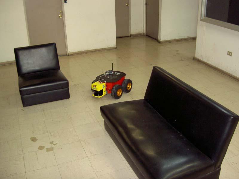
12 ActivMedia Pioneer 3-AT Seminar on Visual Servoing UFSC 2011 M. Torres-Torriti 52 ActivMedia Pioneer 3-AT Seminar on Visual Servoing UFSC 2011 M. Torres-Torriti 53
13 Initial Measurement Hall Seminar on Visual Servoing UFSC 2011 M. Torres-Torriti 54 Final Matching Seminar on Visual Servoing UFSC 2011 M. Torres-Torriti 55
14 Estimated Trajectory Seminar on Visual Servoing UFSC 2011 M. Torres-Torriti 56 Estimated Position Error Seminar on Visual Servoing UFSC 2011 M. Torres-Torriti 57
 Position Accuracy < Sensor Resolution (7 cm)")

15 Estimated Heading Error Seminar on Visual Servoing UFSC 2011 M. Torres-Torriti 58 Performance Results (using Sick PLS-101) Position Accuracy < Sensor Resolution (7 cm) Precision < Map Resolution (15 cm) Computation Time: In Matlab: 30 s on first iteration,.1 s on following iterations. Computational complexity for samples: where is the the largest axis of the reference map. Seminar on Visual Servoing UFSC 2011 M. Torres-Torriti 59
16 Conclusions The proposed approach for scan-to-map matching is very accurate and precise thanks to its robustness to occlusions or unspecified environment elements. Accuracy is mostly limited by the resolution of the rasterized maps. Precision is affected by the amount of occlusions and objects that do not appear in the reference map, as well as the number K of samples used in the modified HD. Accurate estimates of the robot s position, heading and velocity can be obtained in real-time. Seminar on Visual Servoing UFSC 2011 M. Torres-Torriti 60 Ongoing Research Improving the scan-matching technique to reduce the computation time by introducing multi-scale techniques. Developing methods to adjust the MHD threshold dynamically. Extending the approach to MCL in order to improve the robustness under multiple matching solutions. Extending the technique to solve the SLAM problem. Seminar on Visual Servoing UFSC 2011 M. Torres-Torriti 61

17 Range Finder Measurements Model Seminar on Visual Servoing UFSC 2011 M. Torres-Torriti 62 Range Finder Measurments Model The range finder measurement model is given by: where: Seminar on Visual Servoing UFSC 2011 M. Torres-Torriti 63
18 HD-computed and Filtered Trajectory The data corresponds to a sequence of 54 radar scans taken over a time interval of 135 seconds from a patrol boat in the Concepcion Bay, Chile (36 42 S W) sailing East (90 heading) with diminishing speed from 12 to 2 knots computed trajectory filtered trajectory metres metres Seminar on Visual Servoing UFSC 2011 M. Torres-Torriti 64 Estimated Heading degrees Estimated heading Gyroscope datum scan # Seminar on Visual Servoing UFSC 2011 M. Torres-Torriti 65
19 Estimated Velocity 12 knots Estimated speed Log datum scan # Seminar on Visual Servoing UFSC 2011 M. Torres-Torriti 66 Estimated Range Bias filtered range bias computed range bias metres scan # Seminar on Visual Servoing UFSC 2011 M. Torres-Torriti 67
20 Estimated Bearing Bias -1,0 filtered angular bias -1,5 computed angular bias degrees -2,0-2,5-3, scan # Seminar on Visual Servoing UFSC 2011 M. Torres-Torriti 68
Automatic Ship Positioning and Radar Biases Correction Using the Hausdorff Distance
 Automatic Ship Positioning and Radar Biases Correction Using the Hausdorff Distance Miguel Torres-Torriti Department of Electrical Engineering Pontificia Universidad Catolica de Chile Santiago, Chile mtorrest@ing.puc.cl
Autonomous Mobile Robot Design
 Autonomous Mobile Robot Design Topic: EKF-based SLAM Dr. Kostas Alexis (CSE) These slides have partially relied on the course of C. Stachniss, Robot Mapping - WS 2013/14 Autonomous Robot Challenges Where
Practical Course WS12/13 Introduction to Monte Carlo Localization
 Practical Course WS12/13 Introduction to Monte Carlo Localization Cyrill Stachniss and Luciano Spinello 1 State Estimation Estimate the state of a system given observations and controls Goal: 2 Bayes Filter
UAV Autonomous Navigation in a GPS-limited Urban Environment
 UAV Autonomous Navigation in a GPS-limited Urban Environment Yoko Watanabe DCSD/CDIN JSO-Aerial Robotics 2014/10/02-03 Introduction 2 Global objective Development of a UAV onboard system to maintain flight
NAVIGATION SYSTEM OF AN OUTDOOR SERVICE ROBOT WITH HYBRID LOCOMOTION SYSTEM
 NAVIGATION SYSTEM OF AN OUTDOOR SERVICE ROBOT WITH HYBRID LOCOMOTION SYSTEM Jorma Selkäinaho, Aarne Halme and Janne Paanajärvi Automation Technology Laboratory, Helsinki University of Technology, Espoo,
Data Association for SLAM
 CALIFORNIA INSTITUTE OF TECHNOLOGY ME/CS 132a, Winter 2011 Lab #2 Due: Mar 10th, 2011 Part I Data Association for SLAM 1 Introduction For this part, you will experiment with a simulation of an EKF SLAM
Mobile Robotics. Mathematics, Models, and Methods. HI Cambridge. Alonzo Kelly. Carnegie Mellon University UNIVERSITY PRESS
 Mobile Robotics Mathematics, Models, and Methods Alonzo Kelly Carnegie Mellon University HI Cambridge UNIVERSITY PRESS Contents Preface page xiii 1 Introduction 1 1.1 Applications of Mobile Robots 2 1.2
Overview. EECS 124, UC Berkeley, Spring 2008 Lecture 23: Localization and Mapping. Statistical Models
 Introduction ti to Embedded dsystems EECS 124, UC Berkeley, Spring 2008 Lecture 23: Localization and Mapping Gabe Hoffmann Ph.D. Candidate, Aero/Astro Engineering Stanford University Statistical Models
First scan matching algorithms. Alberto Quattrini Li University of South Carolina
 First scan matching algorithms Alberto Quattrini Li 2015-10-22 University of South Carolina Robot mapping through scan-matching Framework for consistent registration of multiple frames of measurements
Humanoid Robotics. Monte Carlo Localization. Maren Bennewitz
 Humanoid Robotics Monte Carlo Localization Maren Bennewitz 1 Basis Probability Rules (1) If x and y are independent: Bayes rule: Often written as: The denominator is a normalizing constant that ensures
Localization, Where am I?
 5.1 Localization, Where am I?? position Position Update (Estimation?) Encoder Prediction of Position (e.g. odometry) YES matched observations Map data base predicted position Matching Odometry, Dead Reckoning
Research and application of volleyball target tracking algorithm based on surf corner detection
 Acta Technica 62 No. 3A/217, 187 196 c 217 Institute of Thermomechanics CAS, v.v.i. Research and application of volleyball target tracking algorithm based on surf corner detection Guowei Yuan 1 Abstract.
L17. OCCUPANCY MAPS. NA568 Mobile Robotics: Methods & Algorithms
 L17. OCCUPANCY MAPS NA568 Mobile Robotics: Methods & Algorithms Today s Topic Why Occupancy Maps? Bayes Binary Filters Log-odds Occupancy Maps Inverse sensor model Learning inverse sensor model ML map
Nonlinear State Estimation for Robotics and Computer Vision Applications: An Overview
 Nonlinear State Estimation for Robotics and Computer Vision Applications: An Overview Arun Das 05/09/2017 Arun Das Waterloo Autonomous Vehicles Lab Introduction What s in a name? Arun Das Waterloo Autonomous
Particle Filter Tutorial. Carlos Esteves and Daphne Ippolito. Introduction. Prediction. Update. Resample. November 3, 2016
 November 3, 2016 Outline 1 2 3 4 Outline 1 2 3 4 The Following material is from Ioannis Rekleitis "A for Mobile Robot Localization" Outline 1 2 3 4 Motion model model motion step as rotation, followed
Dealing with Scale. Stephan Weiss Computer Vision Group NASA-JPL / CalTech
 Dealing with Scale Stephan Weiss Computer Vision Group NASA-JPL / CalTech Stephan.Weiss@ieee.org (c) 2013. Government sponsorship acknowledged. Outline Why care about size? The IMU as scale provider: The
CSE 490R P1 - Localization using Particle Filters Due date: Sun, Jan 28-11:59 PM
 CSE 490R P1 - Localization using Particle Filters Due date: Sun, Jan 28-11:59 PM 1 Introduction In this assignment you will implement a particle filter to localize your car within a known map. This will
Robot Localization based on Geo-referenced Images and G raphic Methods
 Robot Localization based on Geo-referenced Images and G raphic Methods Sid Ahmed Berrabah Mechanical Department, Royal Military School, Belgium, sidahmed.berrabah@rma.ac.be Janusz Bedkowski, Łukasz Lubasiński,
Lighting- and Occlusion-robust View-based Teaching/Playback for Model-free Robot Programming
 Lighting- and Occlusion-robust View-based Teaching/Playback for Model-free Robot Programming *Yusuke MAEDA (Yokohama National University) Yoshito SAITO (Ricoh Corp) Background Conventional Teaching/Playback
Robotics. Lecture 5: Monte Carlo Localisation. See course website for up to date information.
 Robotics Lecture 5: Monte Carlo Localisation See course website http://www.doc.ic.ac.uk/~ajd/robotics/ for up to date information. Andrew Davison Department of Computing Imperial College London Review:
Particle Filters. CSE-571 Probabilistic Robotics. Dependencies. Particle Filter Algorithm. Fast-SLAM Mapping
 CSE-571 Probabilistic Robotics Fast-SLAM Mapping Particle Filters Represent belief by random samples Estimation of non-gaussian, nonlinear processes Sampling Importance Resampling (SIR) principle Draw
CSE 527: Introduction to Computer Vision
 CSE 527: Introduction to Computer Vision Week 10 Class 2: Visual Odometry November 2nd, 2017 Today Visual Odometry Intro Algorithm SLAM Visual Odometry Input Output Images, Video Camera trajectory, motion
Simultaneous Localization and Mapping (SLAM)
") Simultaneous Localization and Mapping (SLAM) RSS Lecture 16 April 8, 2013 Prof. Teller Text: Siegwart and Nourbakhsh S. 5.8 SLAM Problem Statement Inputs: No external coordinate reference Time series of
Simultaneous Localization and Mapping (SLAM) RSS Lecture 16 April 8, 2013 Prof. Teller Text: Siegwart and Nourbakhsh S. 5.8 SLAM Problem Statement Inputs: No external coordinate reference Time series of
Probabilistic Robotics
 Probabilistic Robotics Sebastian Thrun Wolfram Burgard Dieter Fox The MIT Press Cambridge, Massachusetts London, England Preface xvii Acknowledgments xix I Basics 1 1 Introduction 3 1.1 Uncertainty in
navigation Isaac Skog
 Foot-mounted zerovelocity aided inertial navigation Isaac Skog skog@kth.se Course Outline 1. Foot-mounted inertial navigation a. Basic idea b. Pros and cons 2. Inertial navigation a. The inertial sensors
Loop detection and extended target tracking using laser data
 Licentiate seminar 1(39) Loop detection and extended target tracking using laser data Karl Granström Division of Automatic Control Department of Electrical Engineering Linköping University Linköping, Sweden
Robot Mapping. A Short Introduction to the Bayes Filter and Related Models. Gian Diego Tipaldi, Wolfram Burgard
 Robot Mapping A Short Introduction to the Bayes Filter and Related Models Gian Diego Tipaldi, Wolfram Burgard 1 State Estimation Estimate the state of a system given observations and controls Goal: 2 Recursive
Revising Stereo Vision Maps in Particle Filter Based SLAM using Localisation Confidence and Sample History
 Revising Stereo Vision Maps in Particle Filter Based SLAM using Localisation Confidence and Sample History Simon Thompson and Satoshi Kagami Digital Human Research Center National Institute of Advanced
Basics of Localization, Mapping and SLAM. Jari Saarinen Aalto University Department of Automation and systems Technology
 Basics of Localization, Mapping and SLAM Jari Saarinen Aalto University Department of Automation and systems Technology Content Introduction to Problem (s) Localization A few basic equations Dead Reckoning
Robotics. Chapter 25. Chapter 25 1
 Robotics Chapter 25 Chapter 25 1 Outline Robots, Effectors, and Sensors Localization and Mapping Motion Planning Chapter 25 2 Mobile Robots Chapter 25 3 Manipulators P R R R R R Configuration of robot
Robot Mapping for Rescue Robots
 Robot Mapping for Rescue Robots Nagesh Adluru Temple University Philadelphia, PA, USA nagesh@temple.edu Longin Jan Latecki Temple University Philadelphia, PA, USA latecki@temple.edu Rolf Lakaemper Temple
Runway Centerline Deviation Estimation from Point Clouds using LiDAR imagery
 Runway Centerline Deviation Estimation from Point Clouds using LiDAR imagery Seth Young 1, Charles Toth 2, Zoltan Koppanyi 2 1 Department of Civil, Environmental and Geodetic Engineering The Ohio State
Simultaneous Localization
 Simultaneous Localization and Mapping (SLAM) RSS Technical Lecture 16 April 9, 2012 Prof. Teller Text: Siegwart and Nourbakhsh S. 5.8 Navigation Overview Where am I? Where am I going? Localization Assumed
L10. PARTICLE FILTERING CONTINUED. NA568 Mobile Robotics: Methods & Algorithms
 L10. PARTICLE FILTERING CONTINUED NA568 Mobile Robotics: Methods & Algorithms Gaussian Filters The Kalman filter and its variants can only model (unimodal) Gaussian distributions Courtesy: K. Arras Motivation
Probabilistic Robotics
 Probabilistic Robotics Probabilistic Motion and Sensor Models Some slides adopted from: Wolfram Burgard, Cyrill Stachniss, Maren Bennewitz, Kai Arras and Probabilistic Robotics Book SA-1 Sensors for Mobile
Robot Mapping. SLAM Front-Ends. Cyrill Stachniss. Partial image courtesy: Edwin Olson 1
 Robot Mapping SLAM Front-Ends Cyrill Stachniss Partial image courtesy: Edwin Olson 1 Graph-Based SLAM Constraints connect the nodes through odometry and observations Robot pose Constraint 2 Graph-Based
Computationally Efficient Visual-inertial Sensor Fusion for GPS-denied Navigation on a Small Quadrotor
 Computationally Efficient Visual-inertial Sensor Fusion for GPS-denied Navigation on a Small Quadrotor Chang Liu & Stephen D. Prior Faculty of Engineering and the Environment, University of Southampton,
Probabilistic Robotics
 Probabilistic Robotics FastSLAM Sebastian Thrun (abridged and adapted by Rodrigo Ventura in Oct-2008) The SLAM Problem SLAM stands for simultaneous localization and mapping The task of building a map while
Introduction to robot algorithms CSE 410/510
 Introduction to robot algorithms CSE 410/510 Rob Platt robplatt@buffalo.edu Times: MWF, 10-10:50 Location: Clemens 322 Course web page: http://people.csail.mit.edu/rplatt/cse510.html Office Hours: 11-12
Scan Matching. Pieter Abbeel UC Berkeley EECS. Many slides adapted from Thrun, Burgard and Fox, Probabilistic Robotics
 Scan Matching Pieter Abbeel UC Berkeley EECS Many slides adapted from Thrun, Burgard and Fox, Probabilistic Robotics Scan Matching Overview Problem statement: Given a scan and a map, or a scan and a scan,
Construction and Calibration of a Low-Cost 3D Laser Scanner with 360º Field of View for Mobile Robots
 Construction and Calibration of a Low-Cost 3D Laser Scanner with 360º Field of View for Mobile Robots Jorge L. Martínez, Jesús Morales, Antonio, J. Reina, Anthony Mandow, Alejandro Pequeño-Boter*, and
BBR Progress Report 006: Autonomous 2-D Mapping of a Building Floor
 BBR Progress Report 006: Autonomous 2-D Mapping of a Building Floor Andy Sayler & Constantin Berzan November 30, 2010 Abstract In the past two weeks, we implemented and tested landmark extraction based
Simulation of a mobile robot with a LRF in a 2D environment and map building
 Simulation of a mobile robot with a LRF in a 2D environment and map building Teslić L. 1, Klančar G. 2, and Škrjanc I. 3 1 Faculty of Electrical Engineering, University of Ljubljana, Tržaška 25, 1000 Ljubljana,
A General Framework for Mobile Robot Pose Tracking and Multi Sensors Self-Calibration
 A General Framework for Mobile Robot Pose Tracking and Multi Sensors Self-Calibration Davide Cucci, Matteo Matteucci {cucci, matteucci}@elet.polimi.it Dipartimento di Elettronica, Informazione e Bioingegneria,
Real-time Obstacle Avoidance and Mapping for AUVs Operating in Complex Environments
 Real-time Obstacle Avoidance and Mapping for AUVs Operating in Complex Environments Jacques C. Leedekerken, John J. Leonard, Michael C. Bosse, and Arjuna Balasuriya Massachusetts Institute of Technology
W4. Perception & Situation Awareness & Decision making
 W4. Perception & Situation Awareness & Decision making Robot Perception for Dynamic environments: Outline & DP-Grids concept Dynamic Probabilistic Grids Bayesian Occupancy Filter concept Dynamic Probabilistic
DEALING WITH SENSOR ERRORS IN SCAN MATCHING FOR SIMULTANEOUS LOCALIZATION AND MAPPING
 Inženýrská MECHANIKA, roč. 15, 2008, č. 5, s. 337 344 337 DEALING WITH SENSOR ERRORS IN SCAN MATCHING FOR SIMULTANEOUS LOCALIZATION AND MAPPING Jiří Krejsa, Stanislav Věchet* The paper presents Potential-Based
Semi-Supervised Hierarchical Models for 3D Human Pose Reconstruction
 Semi-Supervised Hierarchical Models for 3D Human Pose Reconstruction Atul Kanaujia, CBIM, Rutgers Cristian Sminchisescu, TTI-C Dimitris Metaxas,CBIM, Rutgers 3D Human Pose Inference Difficulties Towards
Offline Simultaneous Localization and Mapping (SLAM) using Miniature Robots
 using Miniature Robots") Offline Simultaneous Localization and Mapping (SLAM) using Miniature Robots Objectives SLAM approaches SLAM for ALICE EKF for Navigation Mapping and Network Modeling Test results Philipp Schaer and Adrian
Offline Simultaneous Localization and Mapping (SLAM) using Miniature Robots Objectives SLAM approaches SLAM for ALICE EKF for Navigation Mapping and Network Modeling Test results Philipp Schaer and Adrian
Unit 2: Locomotion Kinematics of Wheeled Robots: Part 3
 Unit 2: Locomotion Kinematics of Wheeled Robots: Part 3 Computer Science 4766/6778 Department of Computer Science Memorial University of Newfoundland January 28, 2014 COMP 4766/6778 (MUN) Kinematics of
Implementation of Odometry with EKF for Localization of Hector SLAM Method
 Implementation of Odometry with EKF for Localization of Hector SLAM Method Kao-Shing Hwang 1 Wei-Cheng Jiang 2 Zuo-Syuan Wang 3 Department of Electrical Engineering, National Sun Yat-sen University, Kaohsiung,
State Estimation for Continuous-Time Systems with Perspective Outputs from Discrete Noisy Time-Delayed Measurements
 State Estimation for Continuous-Time Systems with Perspective Outputs from Discrete Noisy Time-Delayed Measurements António Pedro Aguiar aguiar@ece.ucsb.edu João Pedro Hespanha hespanha@ece.ucsb.edu Dept.
Turning an Automated System into an Autonomous system using Model-Based Design Autonomous Tech Conference 2018
 Turning an Automated System into an Autonomous system using Model-Based Design Autonomous Tech Conference 2018 Asaf Moses Systematics Ltd., Technical Product Manager aviasafm@systematics.co.il 1 Autonomous
Space Robotics. Ioannis Rekleitis
 Space Robotics Ioannis Rekleitis On-Orbit Servicing of Satellites Work done at the Canadian Space Agency Guy Rouleau, Ioannis Rekleitis, Régent L'Archevêque, Eric Martin, Kourosh Parsa, and Erick Dupuis
L12. EKF-SLAM: PART II. NA568 Mobile Robotics: Methods & Algorithms
 L12. EKF-SLAM: PART II NA568 Mobile Robotics: Methods & Algorithms Today s Lecture Feature-based EKF-SLAM Review Data Association Configuration Space Incremental ML (i.e., Nearest Neighbor) Joint Compatibility
CHARACTERIZATION AND CALIBRATION OF MEMS INERTIAL MEASUREMENT UNITS
 CHARACTERIZATION AND CALIBRATION OF MEMS INERTIAL MEASUREMENT UNITS ökçen Aslan 1,2, Afşar Saranlı 2 1 Defence Research and Development Institute (SAE), TÜBİTAK 2 Dept. of Electrical and Electronics Eng.,
Range Sensing Based Autonomous Canal Following Using a Simulated Multi-copter. Ali Ahmad
 Range Sensing Based Autonomous Canal Following Using a Simulated Multi-copter Ali Ahmad MS Student of Electrical Engineering Laboratory for Cyber Physical Networks and Systems LUMS School of Science &
5. Tests and results Scan Matching Optimization Parameters Influence
 126 5. Tests and results This chapter presents results obtained using the proposed method on simulated and real data. First, it is analyzed the scan matching optimization; after that, the Scan Matching
ECG782: Multidimensional Digital Signal Processing
 Professor Brendan Morris, SEB 3216, brendan.morris@unlv.edu ECG782: Multidimensional Digital Signal Processing Spring 2014 TTh 14:30-15:45 CBC C313 Lecture 10 Segmentation 14/02/27 http://www.ee.unlv.edu/~b1morris/ecg782/
Self-Correcting Projectile Launcher. Josh Schuster Yena Park Diana Mirabello Ryan Kindle
 Self-Correcting Projectile Launcher Josh Schuster Yena Park Diana Mirabello Ryan Kindle Motivation & Applications Successfully reject disturbances without use of complex sensors Demonstrate viability of
Prof. Fanny Ficuciello Robotics for Bioengineering Visual Servoing
 Visual servoing vision allows a robotic system to obtain geometrical and qualitative information on the surrounding environment high level control motion planning (look-and-move visual grasping) low level
Motion Models (cont) 1 3/15/2018
 1 3/15/2018") Motion Models (cont) 1 3/15/018 Computing the Density to compute,, and use the appropriate probability density function; i.e., for zeromean Gaussian noise: 3/15/018 Sampling from the Velocity Motion Model
Motion Models (cont) 1 3/15/018 Computing the Density to compute,, and use the appropriate probability density function; i.e., for zeromean Gaussian noise: 3/15/018 Sampling from the Velocity Motion Model
Introduction to Mobile Robotics SLAM Grid-based FastSLAM. Wolfram Burgard, Cyrill Stachniss, Maren Bennewitz, Diego Tipaldi, Luciano Spinello
 Introduction to Mobile Robotics SLAM Grid-based FastSLAM Wolfram Burgard, Cyrill Stachniss, Maren Bennewitz, Diego Tipaldi, Luciano Spinello 1 The SLAM Problem SLAM stands for simultaneous localization
DYNAMIC POSITIONING OF A MOBILE ROBOT USING A LASER-BASED GONIOMETER. Joaquim A. Batlle*, Josep Maria Font*, Josep Escoda**
 DYNAMIC POSITIONING OF A MOBILE ROBOT USING A LASER-BASED GONIOMETER Joaquim A. Batlle*, Josep Maria Font*, Josep Escoda** * Department of Mechanical Engineering Technical University of Catalonia (UPC)
Probabilistic Robotics. FastSLAM
 Probabilistic Robotics FastSLAM The SLAM Problem SLAM stands for simultaneous localization and mapping The task of building a map while estimating the pose of the robot relative to this map Why is SLAM
MAPPING ALGORITHM FOR AUTONOMOUS NAVIGATION OF LAWN MOWER USING SICK LASER
 MAPPING ALGORITHM FOR AUTONOMOUS NAVIGATION OF LAWN MOWER USING SICK LASER A thesis submitted in partial fulfillment of the requirements for the degree of Master of Science in Engineering By SHASHIDHAR
CSE-571 Robotics. Sensors for Mobile Robots. Beam-based Sensor Model. Proximity Sensors. Probabilistic Sensor Models. Beam-based Scan-based Landmarks
 Sensors for Mobile Robots CSE-57 Robotics Probabilistic Sensor Models Beam-based Scan-based Landmarks Contact sensors: Bumpers Internal sensors Accelerometers (spring-mounted masses) Gyroscopes (spinning
Edge and corner detection
 Edge and corner detection Prof. Stricker Doz. G. Bleser Computer Vision: Object and People Tracking Goals Where is the information in an image? How is an object characterized? How can I find measurements
(W: 12:05-1:50, 50-N202)
") 2016 School of Information Technology and Electrical Engineering at the University of Queensland Schedule of Events Week Date Lecture (W: 12:05-1:50, 50-N202) 1 27-Jul Introduction 2 Representing Position
2016 School of Information Technology and Electrical Engineering at the University of Queensland Schedule of Events Week Date Lecture (W: 12:05-1:50, 50-N202) 1 27-Jul Introduction 2 Representing Position
Autonomous Navigation of Nao using Kinect CS365 : Project Report
 Autonomous Navigation of Nao using Kinect CS365 : Project Report Samyak Daga Harshad Sawhney 11633 11297 samyakd@iitk.ac.in harshads@iitk.ac.in Dept. of CSE Dept. of CSE Indian Institute of Technology,
Dense Tracking and Mapping for Autonomous Quadrocopters. Jürgen Sturm
 Computer Vision Group Prof. Daniel Cremers Dense Tracking and Mapping for Autonomous Quadrocopters Jürgen Sturm Joint work with Frank Steinbrücker, Jakob Engel, Christian Kerl, Erik Bylow, and Daniel Cremers
Algorithms for Maps Construction and Localization in a Mobile Robot
 Algorithms for Maps Construction and Localization in a Mobile Robot Daniel ROJAS 1, Ginno MILLÁN 2, Fernando PASSOLD 3, Román OSORIO 4, Claudio CUBILLOS 1, Gastón LEFRANC 1 1 Pontificia Universidad Católica
Acoustic/Lidar Sensor Fusion for Car Tracking in City Traffic Scenarios
 Sensor Fusion for Car Tracking Acoustic/Lidar Sensor Fusion for Car Tracking in City Traffic Scenarios, Daniel Goehring 1 Motivation Direction to Object-Detection: What is possible with costefficient microphone
From Personal Computers to Personal Robots
 From Personal Computers to Personal Robots Challenges in Computer Science Education Nikolaus Correll Department of Computer Science University of Colorado at Boulder Mechanism vs. Computer Unimate (1961)
REFINEMENT OF COLORED MOBILE MAPPING DATA USING INTENSITY IMAGES
 REFINEMENT OF COLORED MOBILE MAPPING DATA USING INTENSITY IMAGES T. Yamakawa a, K. Fukano a,r. Onodera a, H. Masuda a, * a Dept. of Mechanical Engineering and Intelligent Systems, The University of Electro-Communications,
Vehicle Localization. Hannah Rae Kerner 21 April 2015
 Vehicle Localization Hannah Rae Kerner 21 April 2015 Spotted in Mtn View: Google Car Why precision localization? in order for a robot to follow a road, it needs to know where the road is to stay in a particular
Smartphone Video Guidance Sensor for Small Satellites
 SSC13-I-7 Smartphone Video Guidance Sensor for Small Satellites Christopher Becker, Richard Howard, John Rakoczy NASA Marshall Space Flight Center Mail Stop EV42, Huntsville, AL 35812; 256-544-0114 christophermbecker@nasagov
HOG-Based Person Following and Autonomous Returning Using Generated Map by Mobile Robot Equipped with Camera and Laser Range Finder
 HOG-Based Person Following and Autonomous Returning Using Generated Map by Mobile Robot Equipped with Camera and Laser Range Finder Masashi Awai, Takahito Shimizu and Toru Kaneko Department of Mechanical
Omnidirectional Visual Control of Mobile Robots based on the 1D Trifocal Tensor
 Omnidirectional Visual Control of Mobile Robots based on the D Trifocal Tensor H. M. Becerra, G. López-Nicolás and C. Sagüés Dept. Informática e Ingeniería de Sistemas - Instituto de Investigación en Ingeniería
Introduction to Mobile Robotics
 Introduction to Mobile Robotics Olivier Aycard Associate Professor University of Grenoble Laboratoire d Informatique de Grenoble http://membres-liglab.imag.fr/aycard 1/29 Some examples of mobile robots
Optimization of the Simultaneous Localization and Map-Building Algorithm for Real-Time Implementation
 242 IEEE TRANSACTIONS ON ROBOTICS AND AUTOMATION, VOL. 17, NO. 3, JUNE 2001 Optimization of the Simultaneous Localization and Map-Building Algorithm for Real-Time Implementation José E. Guivant and Eduardo
Monocular SLAM for a Small-Size Humanoid Robot
 Tamkang Journal of Science and Engineering, Vol. 14, No. 2, pp. 123 129 (2011) 123 Monocular SLAM for a Small-Size Humanoid Robot Yin-Tien Wang*, Duen-Yan Hung and Sheng-Hsien Cheng Department of Mechanical
Shape Descriptor using Polar Plot for Shape Recognition.
 Shape Descriptor using Polar Plot for Shape Recognition. Brijesh Pillai ECE Graduate Student, Clemson University bpillai@clemson.edu Abstract : This paper presents my work on computing shape models that
Localization and Map Building
 Localization and Map Building Noise and aliasing; odometric position estimation To localize or not to localize Belief representation Map representation Probabilistic map-based localization Other examples
Tracking system. Danica Kragic. Object Recognition & Model Based Tracking
 Tracking system Object Recognition & Model Based Tracking Motivation Manipulating objects in domestic environments Localization / Navigation Object Recognition Servoing Tracking Grasping Pose estimation
IROS 05 Tutorial. MCL: Global Localization (Sonar) Monte-Carlo Localization. Particle Filters. Rao-Blackwellized Particle Filters and Loop Closing
 Monte-Carlo Localization. Particle Filters. Rao-Blackwellized Particle Filters and Loop Closing") IROS 05 Tutorial SLAM - Getting it Working in Real World Applications Rao-Blackwellized Particle Filters and Loop Closing Cyrill Stachniss and Wolfram Burgard University of Freiburg, Dept. of Computer
IROS 05 Tutorial SLAM - Getting it Working in Real World Applications Rao-Blackwellized Particle Filters and Loop Closing Cyrill Stachniss and Wolfram Burgard University of Freiburg, Dept. of Computer
Intelligent Robotics
 64-424 Intelligent Robotics 64-424 Intelligent Robotics http://tams.informatik.uni-hamburg.de/ lectures/2013ws/vorlesung/ir Jianwei Zhang / Eugen Richter Faculty of Mathematics, Informatics and Natural
Final project: 45% of the grade, 10% presentation, 35% write-up. Presentations: in lecture Dec 1 and schedule:
 Announcements PS2: due Friday 23:59pm. Final project: 45% of the grade, 10% presentation, 35% write-up Presentations: in lecture Dec 1 and 3 --- schedule: CS 287: Advanced Robotics Fall 2009 Lecture 24:
Direct Methods in Visual Odometry
 Direct Methods in Visual Odometry July 24, 2017 Direct Methods in Visual Odometry July 24, 2017 1 / 47 Motivation for using Visual Odometry Wheel odometry is affected by wheel slip More accurate compared
A Reactive Bearing Angle Only Obstacle Avoidance Technique for Unmanned Ground Vehicles
 Proceedings of the International Conference of Control, Dynamic Systems, and Robotics Ottawa, Ontario, Canada, May 15-16 2014 Paper No. 54 A Reactive Bearing Angle Only Obstacle Avoidance Technique for
Geometrical Feature Extraction Using 2D Range Scanner
 Geometrical Feature Extraction Using 2D Range Scanner Sen Zhang Lihua Xie Martin Adams Fan Tang BLK S2, School of Electrical and Electronic Engineering Nanyang Technological University, Singapore 639798
Announcements. Recap Landmark based SLAM. Types of SLAM-Problems. Occupancy Grid Maps. Grid-based SLAM. Page 1. CS 287: Advanced Robotics Fall 2009
 Announcements PS2: due Friday 23:59pm. Final project: 45% of the grade, 10% presentation, 35% write-up Presentations: in lecture Dec 1 and 3 --- schedule: CS 287: Advanced Robotics Fall 2009 Lecture 24:
Development of a Ground Based Cooperating Spacecraft Testbed for Research and Education
 DIPARTIMENTO DI INGEGNERIA INDUSTRIALE Development of a Ground Based Cooperating Spacecraft Testbed for Research and Education Mattia Mazzucato, Sergio Tronco, Andrea Valmorbida, Fabio Scibona and Enrico
Tightly-Integrated Visual and Inertial Navigation for Pinpoint Landing on Rugged Terrains
 Tightly-Integrated Visual and Inertial Navigation for Pinpoint Landing on Rugged Terrains PhD student: Jeff DELAUNE ONERA Director: Guy LE BESNERAIS ONERA Advisors: Jean-Loup FARGES Clément BOURDARIAS
MULTI-MODAL MAPPING. Robotics Day, 31 Mar Frank Mascarich, Shehryar Khattak, Tung Dang
 MULTI-MODAL MAPPING Robotics Day, 31 Mar 2017 Frank Mascarich, Shehryar Khattak, Tung Dang Application-Specific Sensors Cameras TOF Cameras PERCEPTION LiDAR IMU Localization Mapping Autonomy Robotic Perception
USING 3D DATA FOR MONTE CARLO LOCALIZATION IN COMPLEX INDOOR ENVIRONMENTS. Oliver Wulf, Bernardo Wagner
 USING 3D DATA FOR MONTE CARLO LOCALIZATION IN COMPLEX INDOOR ENVIRONMENTS Oliver Wulf, Bernardo Wagner Institute for Systems Engineering (RTS/ISE), University of Hannover, Germany Mohamed Khalaf-Allah
Visual Odometry. Features, Tracking, Essential Matrix, and RANSAC. Stephan Weiss Computer Vision Group NASA-JPL / CalTech
 Visual Odometry Features, Tracking, Essential Matrix, and RANSAC Stephan Weiss Computer Vision Group NASA-JPL / CalTech Stephan.Weiss@ieee.org (c) 2013. Government sponsorship acknowledged. Outline The
An Extended Line Tracking Algorithm
 An Extended Line Tracking Algorithm Leonardo Romero Muñoz Facultad de Ingeniería Eléctrica UMSNH Morelia, Mich., Mexico Email: lromero@umich.mx Moises García Villanueva Facultad de Ingeniería Eléctrica
A Sparse Hybrid Map for Vision-Guided Mobile Robots
 A Sparse Hybrid Map for Vision-Guided Mobile Robots Feras Dayoub Grzegorz Cielniak Tom Duckett Department of Computing and Informatics, University of Lincoln, Lincoln, UK {fdayoub,gcielniak,tduckett}@lincoln.ac.uk
Natural landmark extraction for mobile robot navigation based on an adaptive curvature estimation
 Robotics and Autonomous Systems 56 (2008) 247 264 www.elsevier.com/locate/robot Natural landmark extraction for mobile robot navigation based on an adaptive curvature estimation P. Núñez, R. Vázquez-Martín,