PLSS 3 MILE RULE SUBDIVISION OF. Warm Springs Indian Reservation
|
|
|
- Julie Perry
- 6 years ago
- Views:
Transcription
1
2 CASE STUDY PLSS 3 MILE RULE SUBDIVISION OF SECTIONS (INDIAN LANDS) Warm Springs Indian Reservation
3 OR.Searching for 100+ Year Old Sticks and Stones with Autocad and dsurvey Grade GPS Equipment Warm Springs Indian Reservation Wasco and Jefferson County Oregon Sections 35&36 T8S, R11E WM Sections 2&3 T9S, R11E WM
4 Free Information from BLM Original GLO Plats (Government Land Office) Warm Springs Reservation 39 Townships 235 Files (Plats) 311 Mbytes Data /l /
5 Sample 3 Mile Subdivision Plat T8S, R11E, WM
6 Details of Sec 35 and 36, T8S, R11E WM East-West Subdivision i i Lines 1887 Mc Quinn & Campbell
7 Sample 3 Mile Subdivision Plat T9S, R12E WM
8 Details of Sections 25,26, and 27 T9S, R12E, WM North-South Subdivision Lines 1871 Handley


9 Typical Survey Equipment Mid-Late 1800 s Staff Compass Surveyor s Chain


10 General Descripton This is the description for T9S, R12E, WM The township where Warm Springs is now located. Note: The URGENTLY NEEDED work to subdivide some sections in 1871.


11 Normal Subdivision Survey Red = Surveyed Lines (7 miles of survey)

12 Three Mile Rule Subdivision Red = Surveyed Line, Green = Cardinal Direction
13 3 Mile Rule Subdivision Lands Warm Springs Reservation (Urgently Needed Late 1800 s)
14 3 Mile Rule + Existing Allotments Warm Springs Reservation Present Day
15 Warm Springs Reservation
16 Warm Springs Reservation RTK Survey Base Stations
17 Sidwalter Flat County Line Road 3Mile Rule Subdivision Existing Allotments Red = 100+yr Old Urgently Needed Cyan = Present Allotments White = GPS Base Monuments Green = Section Lines Yellow = Township Lines
18 Project Area County Line Road 4 Sections Search for 36 Stone Monuments
19 Original GLO Notes Available at Local County Surveyor s Office Or State BLM Office Either Micro-fiche or paper copies Pay by the sheet for duplicating costs Estimate 1 sheet per mile of surveyed line
20 Sample Original GLO Notes
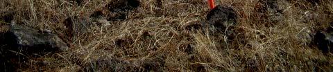
21 Final Notes on Second Page
22 Beginning of 3 Mile Subdivision


23 Brass Cap ¼ Corner Between Sec 34 T8S, R11E WM & Sec 3 T9S, R11E WM Problem: Missing GLO records to show when this brass cap was placed. Broken chain of evidence. Assume corner remonumentation was done around the 1920 s? Lincoln E. Wilkes worked in adjacent township in 1918, but no plat filed for these townships. Records may be with state BLM office? Existing monuments not set firmly in ground.
24 Need to Prove Correct Locations for Existing Brass Cap ¼ Corners My Solution: Use Original GLO notes for 3 mile rule subdivision of sections to find scribed stone monuments for the nine interior 1/16 corners within each section. If interior monuments agree with predicted positions from suspect brass caps on exterior boundary of section accept unknown sourced brass caps as accurate.


.")


25 Sample 1/16 Corner Breakdown of Section Note: Mounds are NOT corner monuments. Mounds constructed ALONGSIDE scribed stone monuments in cardinal directions (N,S,E,or W). Scribing normally on flat face on north side of stone monument. Occasionally on bottom of stone, may be partially buried in ground.
26 Tools Used for Search of Stone Monuments
27 Trimble 4700 Rover set on mound of stones near 1/16 corner. Sec 2 T9S, R11E WM


28 1/16 Corner Stone in Section 2 T9S, R11E WM Note: Split rail fence posts found in sagebrush. Remnants of stone fence to North. Stone temporary facing south for picture. Returned to original position after photo.


29 1/16 Corner Stone in Section 2 T9S, R11E WM Note: Mound to right of surveyor partially below juniper tree North of stone and stone partially buried.


30 1/16 Corner Monument Section 3 T9S, R11E, WM
31 Scribed Stone Markings ¼ Corner
32 Scribed Stone Markings 1/16 Corner
33 Sample Topo Calls in Notes
34 Sample Topo Calls in Original Notes
35 Topo Call to Spring
36 Topo Call to 10 Tree
37 Topo Call to house
38 Adjacent Home Site
39 Old Homestead (Within Section)
40 Foundation Storage Building Approx 1 Chain North of House Call 15 x 25 Rectangular Stacked Rock Foundation
41 Typical Storage Building
42 Disturbed Site No Original Undisturbed Evidence
43 Summary of Project All With Survey Grade GPS Radial Type Survey Gathering 180 Second Control Point Type Data 52 Unknown Source Brass Caps Located 2 Suspicious (Non-Typical) ¼ Corners Being Used Searched for 36 Old 3-Mile Subdivision 1/16 Corners Found: 19 Stone Monuments 13 Accessory Rock Mounds 4 Sites with no current evidence
44 End of Presentation Thank You
UMATILLA COUNTY SURVEYOR RECORDS
 UMATILLA COUNTY SURVEYOR RECORDS DESCRIPTION OF RECORDS AND INSTRUCTIONS FOR USE General Records on this website include the following files: (1) A 1914 Standard Atlas of Umatilla County, compiled and
Public Land Ordinance of May 20, 1785
 Public Land Ordinance of May 20, 1785 Act of May 18, 1796 Act of May 10, 1800 Act of March 26, 1804 Act of February 11, 1805 Principles and Rules continued: Corners of half and quarter sections not marked
PWA GIS. Minnesota Department of Transportation (Mn/DOT) Cadastral and Right of Way Data Sharing Pilot Project. Phase 1 and Phase 2 Summary Report
 Cadastral and Right of Way Data Sharing Pilot Project. Phase 1 and Phase 2 Summary Report") Minnesota Department of Transportation (Mn/DOT) Cadastral and Right of Way Data Sharing Pilot Project Phase and Phase Summary Report December, 7 Pro-West & Associates, Inc. Geographic Information System
Minnesota Department of Transportation (Mn/DOT) Cadastral and Right of Way Data Sharing Pilot Project Phase and Phase Summary Report December, 7 Pro-West & Associates, Inc. Geographic Information System
BASIC MATHEMATICS FOR CADASTRAL MAPPING
 BASIC MATHEMATICS FOR CADASTRAL MAPPING Chapter 5 2015 Cadastral Mapping Manual 5-1 Introduction Data which a mapper must use to solve problems comes from a myriad of sources both new and old. The general
REFERENCE. Section 6. Field Use Tutorial 2-1
 REFERENCE Section 6 Field Use Tutorial 2-1 REFERENCE 2-2 Field Use Overview RTK GPS support is an additional feature in Sitework 4D, which must be purchased separately. In addition to creating takeoffs
TxDOT Survey Manual. Manual Notice Archive. by Texas Department of Transportation (512) - all rights reserved
 - all rights reserved") TxDOT Survey Manual Manual Notice Archive by Texas Department of Transportation (512) - all rights reserved Manual Notice 2011-1 From: Manual: Judy Skeen, P. E., Director, Technology Services Division
TxDOT Survey Manual Manual Notice Archive by Texas Department of Transportation (512) - all rights reserved Manual Notice 2011-1 From: Manual: Judy Skeen, P. E., Director, Technology Services Division
 Cabrillo College Engineering 1A - Surveying LABORATORY NO. 4 --- THEODOLITE: ANGLE ABOUT A POINT Objectives: To measure the angles about a point by repetition using a theodolite. Equipment: Theodolite,
CHARTER TOWNSHIP OF SHELBY REQUEST FOR PROPOSAL. Fiber Optic Project Charter Township of Shelby Fire Stations #2 #3 & #4 to Fire Station #1
 CHARTER TOWNSHIP OF SHELBY REQUEST FOR PROPOSAL Fiber Optic Project Charter Township of Shelby Fire Stations #2 #3 & #4 to Fire Station #1 The Charter Township of Shelby is soliciting proposals to install
EL DORADO COUNTY SURVEYOR FEE SCHEDULE FOR SERVICES
 NOTE ON FEES: Where no fee exists to cover an application process or service, or when the circumstances of the application or service are unique, the fee may be based on a similar category, an estimate
Georeferencing Protocol KUMIP
 Georeferencing Protocol KUMIP Setting up in Specify 1) Go to Edit>Preferences in the Specify menu at the top and make sure that your GEOLocate preferences are correct. They should look like this: 2) Import
Base Configurations Carlson SurvCE
 There are six methods to set the stationary base position, organized into 2 categories: From New Position includes Read from GPS, Enter Lat/Long and Enter Grid System Coordinates. The From Known Position
Linus L. Smith, GIS Supervisor, Engineering Public Works Department, City of Winfield, Kansas
 Challenges in Developing a City GIS Wastewater Geo Database System Linus L. Smith, GIS Supervisor, Engineering Public Works Department, City of Winfield, Kansas OVERVIEW The City of Winfield Kansas recognized
CEEN Engineering Measurements Final Exam Fall 2001 Closed Book, Calculator Required 3 Hour Time Limit
 NAME Score CEEN 113-1 Engineering Measurements Final Exam Fall 001 Closed Book, Calculator Required 3 Hour Time Limit 1. (10 pts) You are interested in determining the height of a building. You are unable
LAND SURVEYOR CANDIDATE INFORMATION BULLETIN
 LAND SURVEYOR CANDIDATE INFORMATION BULLETIN Introduction Welcome to the State of Washington Board of Registration s licensing process for professional land surveyors. One of the requirements to obtain
SPECIFICATIONS FOR G.I.S. DATA/INFORMATION PROVIDED TO ONE-CALL
 SPECIFICATIONS FOR G.I.S. DATA/INFORMATION PROVIDED TO ONE-CALL Digital Mapping Files that we can accept: 1. G.I.S. dataset formats that we can accept: AutoCad File Latest Releases (*.DWG, *.DXF) ESRI
FR 5131 SAP Assignment
 FR 5131 SAP Assignment What You ll Learn: Practice with various skills in ArcMap Data can be found on the class web site or S:\FR5131\Semester_Assignment\SAP. Background: Concurrent with the regular lab
Georeferencing Legal Surveys in British Columbia: A Pro-active Approach
 Georeferencing Legal Surveys in British Columbia: A Pro-active Approach Agenda Background What is georeferencing and why is it needed? Equipment required Georeferencing Standards present and proposed Positioning
GIS Mapping of Pipelines
 GIS Mapping of Pipelines RJ Lumbrezer, PS Survey Manager DGL Consulting Engineers, LLC Ted Muns Sales Manager City Blueprint of Toledo 2016 Ohio GIS Conference Hyatt Regency Columbus September 28 30, 2016
Section G. POSITIONAL ACCURACY DEFINITIONS AND PROCEDURES Approved 3/12/02
 Section G POSITIONAL ACCURACY DEFINITIONS AND PROCEDURES Approved 3/12/02 1. INTRODUCTION Modern surveying standards use the concept of positional accuracy instead of error of closure. Although the concepts
FlexMLS Maps Quick Reference Guide
 FlexMLS Maps Quick Reference Guide Full Search Map Tab Features Define Search Areas box Map tab in Full Search Radius Search tool from an address Show/Hide Property List, Locate Address, and Define Search
Chapter -7- Traversing. 1/28/2018 Assistant Lecturer / Asmaa Abdulmajeed 1. Contents
 Ishik University Sulaimani Civil Engineering Department Surveying II CE 215 Chapter -7- Traversing 1/28/2018 Assistant Lecturer / Asmaa Abdulmajeed 1 Contents 1. Traversing 2. Traversing Computations 3.
Roadway Alignments and Profiles
 NOTES Module 15 Roadway Alignments and Profiles In this module, you learn how to create horizontal alignments, surface profiles, layout (design) profiles, and profile views in AutoCAD Civil 3D. This module
ARLINGTON COUNTY, VIRGINIA. County Board Agenda Item Meeting of September 15, 2012
 ARLINGTON COUNTY, VIRGINIA County Board Agenda Item Meeting of September 15, 2012 DATE: August 29, 2012 SUBJECT: U-3340-12-1 USE PERMIT to allow a 50' telecommunications pole with accompanying equipment
The Modelling of Spatial Units (Parcels) in the Land Administration Domain Model (LADM, ISO 19152)
 in the Land Administration Domain Model (LADM, ISO 19152)") The Modelling of Spatial Units (Parcels) in the Land Administration Domain Model (LADM, ISO 19152) Christiaan LEMMEN; Peter VAN OOSTEROM; Rod THOMPSON; João HESPANHA and Harry UITERMARK, XXIV FIG International
The Modelling of Spatial Units (Parcels) in the Land Administration Domain Model (LADM, ISO 19152) Christiaan LEMMEN; Peter VAN OOSTEROM; Rod THOMPSON; João HESPANHA and Harry UITERMARK, XXIV FIG International
Box Calibration: Here I entered points 3 and 4 which are the only control points given to us in the plans.
 Box Calibration: Trimble machine control does not like files that are derived from State Plane Coordinates or files that contain a Geoid. Trimble representatives want everyone to do a site calibration
Access Field Entrance Other Constructed Yes (Type)
") APPLICATION FOR RESIDENTIAL OR FIELD ACCESS PERMIT SCOTT COUNTY PUBLIC WORKS DIVISION HIGHWAY DEPARTMENT 600 Country Trail East Jordan, MN 55352-9339 Phone 952-496-8487 Fax 952-496-8365 Permit No. Permit
APPLICATION FOR RESIDENTIAL OR FIELD ACCESS PERMIT SCOTT COUNTY PUBLIC WORKS DIVISION HIGHWAY DEPARTMENT 600 Country Trail East Jordan, MN 55352-9339 Phone 952-496-8487 Fax 952-496-8365 Permit No. Permit
SEPTIC SYSTEM RECORDS CATALOG RFP QUESTIONS AND ANSWERS February 13, 2017
 Department of Public Health and Environment Lowell Johnson Director David Brummel Deputy Director SEPTIC SYSTEM RECORDS CATALOG RFP QUESTIONS AND ANSWERS February 13, 2017 1. Can companies from outside
PUBLIC WORKS. 1oo. DiEital Fee Schedules. Effective January 1, 2008
 PUBLIC WORKS Geographic Information Systems DiEital Fee Schedules Effective January 1, 2008 Date Advertised 12103/07 In (Publication) Daily Business Journal Public Hearing Date Approved as to form: David
ARLINGTON COUNTY, VIRGINIA. County Board Agenda Item Meeting of September 20, 2014
 ARLINGTON COUNTY, VIRGINIA County Board Agenda Item Meeting of September 20, 2014 DATE: September 8, 2014 SUBJECT: U-3340-12-1 USE PERMIT REVIEW of a 50' telecommunications pole with accompanying equipment
Ottawa County Survey Data Map
 Ottawa County Engineer s Office User Guide for Ottawa County Survey Data Map Introduction: The Ottawa County Engineer s Office has been diligently working to better serve our constituents with access to
Subdivision Application Form
 Applicant Information 1. Property Titleholder Subdivision Application Form Ravalli County Planning Department 215 South 4 th Street, Suite F, Hamilton, MT 59840 / (406) 375-6530 / planning@rc.mt.gov Name:
Government of Alberta. Find Your Farm. Alberta Soil Information Viewer. Alberta Agriculture and Forestry [Date]
![Government of Alberta. Find Your Farm. Alberta Soil Information Viewer. Alberta Agriculture and Forestry [Date]](/thumbs/83/87435202.jpg "Government of Alberta. Find Your Farm. Alberta Soil Information Viewer. Alberta Agriculture and Forestry [Date]") Government of Alberta Find Your Farm Alberta Soil Information Viewer Alberta Agriculture and Forestry [Date] Contents Definitions... 1 Getting Started... 2 Area of Interest... 3 Search and Zoom... 4 By
Government of Alberta Find Your Farm Alberta Soil Information Viewer Alberta Agriculture and Forestry [Date] Contents Definitions... 1 Getting Started... 2 Area of Interest... 3 Search and Zoom... 4 By
Surveying Prof. Bharat Lohani Indian Institute of Technology, Kanpur. Lecture - 1 Module - 6 Triangulation and Trilateration
 Surveying Prof. Bharat Lohani Indian Institute of Technology, Kanpur Lecture - 1 Module - 6 Triangulation and Trilateration (Refer Slide Time: 00:21) Welcome to this another lecture on basic surveying.
Consistency between CORS and NACN Egyptian Networks in Cairo and Nile Delta
 Consistency between CORS and NACN Egyptian Networks in Cairo and Nile Delta 625 Mohammed El-Tokhey, Tamer F. Fath-Allah, Yasser M. Mogahed and Mohammed Mamdouh Public Works Department, Faculty of Engineering,
SoftwareReview. General CADD. By Joseph H. Bell, LS
 SoftwareReview By Joseph H. Bell, LS Joe Bell is licensed in California and New Mexico. He has been reviewing software for surveyors since 1982. General CADD Figure 1 ackward compatibility has always been
PRINTING GROWER FIELD MAPS OFF THE WEB
 PRINTING GROWER FIELD MAPS OFF THE WEB 3-29-2018 A. Google Earth: Very easy to use; easy to print map (either directly or via extraction to Word); easy to scale up or down; locator makes finding field
PLAN PREPARATION GUIDE
 PLAN PREPARATION GUIDE CHAPTER 5 EXISTING TOPOGRAPHY & PROFILE PRESENT RIGHT-OF-WAY PROJECT PREPARATION GUIDELINES AND CRITERIA SECTION DESCRIPTION PAGE 1 Existing Topography, Profile, and Cross Sections
BOWLING GREEN VERTICAL CONTROL NETWORK (BGVCN)
") BOWLING GREEN VERTICAL CONTROL NETWORK (BGVCN) THE CITY OF BOWLING GREEN June 2009 POGGEMEYER DESIGN GROUP Dana A. Parsell, P.S. Poggemeyer Design Group 1168 North Main Street Bowling Green, Ohio 43402
BOWLING GREEN VERTICAL CONTROL NETWORK (BGVCN) THE CITY OF BOWLING GREEN June 2009 POGGEMEYER DESIGN GROUP Dana A. Parsell, P.S. Poggemeyer Design Group 1168 North Main Street Bowling Green, Ohio 43402
3-D MODELING FOR MACHINE CONTROL
 SHELLY & SANDS JOHN DOWALTER, PE, PS 3-D MODELING FOR MACHINE CONTROL Dale Carnegie Public Speaking Training Ben Stein s Public Speaking Training SHELLY & SANDS JOHN DOWALTER, PE, PS S&S Survey Manager
SurvCE: Localizations
 SurvCE: Localizations Mark Silver Electrical Engineer, not a Surveyor Carlson Dealer in Salt Lake City Utah Embarrassing Fact: I have a 250,000+ sheet paper map collection. igage Mapping Corporation www.igage.com
THE FUTURE OF STATE PLANE COORDINATES AT ODOT
 THE FUTURE OF STATE PLANE COORDINATES AT ODOT BY: RAY FOOS P.S. AND BRIAN MEADE P.S. THE OHIO DEPARTMENT OF TRANSPORTATION WORKING WITH STATE PLANE COORDINATES OR HOW TO MAKE THE EARTH FLAT SURVEYORS AND
5-0 Mapping Best Practices
 5-0 Mapping Best Practices 5 Mapping 5-0 Mapping Best Practices 5-1: One-Call Center Responsibilities and Use of Mapping Practice Statement: The land base used by the One-Call Centre mapping system should
A stratum is a pair of surfaces. When defining a stratum, you are prompted to select Surface1 and Surface2.
 That CAD Girl J ennifer dib ona Website: www.thatcadgirl.com Email: thatcadgirl@aol.com Phone: (919) 417-8351 Fax: (919) 573-0351 Volume Calculations Initial Setup You must be attached to the correct Land
a Geo-Odyssey of UAS LiDAR Mapping Henno Morkel UAS Segment Specialist DroneCon 17 May 2018
 a Geo-Odyssey of UAS LiDAR Mapping Henno Morkel UAS Segment Specialist DroneCon 17 May 2018 Abbreviations UAS Unmanned Aerial Systems LiDAR Light Detection and Ranging UAV Unmanned Aerial Vehicle RTK Real-time
Developing a National Real-time CORS Network in New Zealand. Presentation to XXIV FIG International Congress 2010, Sydney, Australia, 15 April 2010
 PositioNZ-RT Developing a National Real-time CORS Network in New Zealand Dave Collett Geodetic Surveyor Land Information New Zealand Presentation to XXIV FIG International Congress 2010, Sydney, Australia,
CITADEL TERRACE 685 CITADEL DRIVE EAST, COLORADO SPRINGS, CO 80909
 PROPERTY DETAILS BUILDING DETAILS Property Size: 103,188 SF East Colorado Springs Submarket Internet Ready Building On-Site Lead Tech Day Porter Security System Outside Lighting Management Office at Location
Continuously Operating GPS Reference Network. Jim Waters, PE, RLS Assistant Director, Design Division
 Continuously Operating GPS Reference Network Jim Waters, PE, RLS Assistant Director, Design Division TDOT began discussions internally about a possible Continuously Operating Reference Network in 1999
Everything you did not want to know about least squares and positional tolerance! (in one hour or less) Raymond J. Hintz, PLS, PhD University of Maine
 Raymond J. Hintz, PLS, PhD University of Maine") Everything you did not want to know about least squares and positional tolerance! (in one hour or less) Raymond J. Hintz, PLS, PhD University of Maine Least squares is used in varying degrees in -Conventional
Everything you did not want to know about least squares and positional tolerance! (in one hour or less) Raymond J. Hintz, PLS, PhD University of Maine Least squares is used in varying degrees in -Conventional
Clipping Algorithms; 8-5. Computer Graphics. Spring CS4815
 Computer Graphics Spring 2016-2017 Outline Clipping Algorithms; 8-5 1 Clipping Algorithms; 8-5 Announcements Mid-term: Week07?? Clipping: Introduction It is common for a region to be defined so that only
ARLINGTON COUNTY, VIRGINIA
 ARLINGTON COUNTY, VIRGINIA County Board Agenda Item Meeting of December 12, 2015 DATE: December 1, 2015 SUBJECT: SP-84-U-15-1 USE PERMIT ASSOCIATED WITH A SITE PLAN for a telecommunications facility; located
Lab 3: Digitizing in ArcGIS Pro
 Lab 3: Digitizing in ArcGIS Pro What You ll Learn: In this Lab you ll be introduced to basic digitizing techniques using ArcGIS Pro. You should read Chapter 4 in the GIS Fundamentals textbook before starting
A New Way to Control Mobile LiDAR Data
 A New Way to Control Mobile LiDAR Data Survey control has always been a critically important issue when conducting mobile LiDAR surveys. While the accuracies currently being achieved with the most capable
Please print twice and give one to a friend. Here is an example of the Deed Plotter and All Topo Maps working together.
 JOHNSON MAPPING SOFTWARE & PLOTTING SEMINARS Mike Johnson, Seminar Author & Instructor, also Dealer for: Deed Plotter+for Windows (by Greenbrier Graphics)& the All Topo Maps (by igage Mapping Co.) Computer
GORE BUILDING. 238 N. Massachusetts Avenue, Lakeland, FL 33801
 GORE BUILDING 238 N. Massachusetts Avenue, Lakeland, FL 33801 CDB LOCATION REDEVELOPMENT PROJECT MUNN PARK HISTORIC DISTRICT INCENTIVES AVAILABLE ADJACENT PARKING INCLUDED BK698301 Phone: (863) 683-3425
Autodesk Revit Architecture 2011 Getting Started Video Tutorials
 Autodesk Revit Architecture 2011 Getting Started Video Tutorials Instructor Handout Created by: Marvi Basha, Klaus Hyden und Philipp Müller Autodesk Student Experts TU Graz September 2010 Introduction:
APPENDIX 13 TERRAIN NAVIGATOR PRO BASICS. Prepared by the Mapping and Marking Committee. Fifth Edition (Revised and Expanded) June 2014
 June 2014") APPENDIX 13 TERRAIN NAVIGATOR PRO BASICS Prepared by the Mapping and Marking Committee Fifth Edition (Revised and Expanded) June 2014 Published by the Oregon-California Trails Association P.O. Box 1019
APPENDIX 13 TERRAIN NAVIGATOR PRO BASICS Prepared by the Mapping and Marking Committee Fifth Edition (Revised and Expanded) June 2014 Published by the Oregon-California Trails Association P.O. Box 1019
Official Integrated Survey Area Coordinate Listing
 Official Integrated Survey Area Coordinate Listing This is the official integrated survey area coordinate listing established by order of the Surveyor General under authority of the Land Survey Act. These
TPC Desktop Series. Geodetic Learning Guide
 TPC Desktop Series Geodetic Learning Guide 1/18 NOTICE The information in this document is subject to change without notice. TRAVERSE PC. Inc. assumes no responsibility for any errors that may appear in
PUBLIC LAND SURVEY SYSTEM IN GOOGLE EARTH. By Thomas G. Davis 1, PhD, PE, PLS. Legacy
 PUBLIC LAND SURVEY SYSTEM IN GOOGLE EARTH By Thomas G. Davis 1, PhD, PE, PLS INTRODUCTION PLSGE (http://www.metzgerwillard.us/plss/) is a web-based service for visualizing the Public Land Survey System
GRID. Geospatial Roadway Inventory Database. Michael Chamberlain, TxDOT. TPP Planning Conference Houston, TX
 GRID Geospatial Roadway Inventory Database Michael Chamberlain, TxDOT TPP Planning Conference - 2016 Houston, TX Topics 1 2 3 4 5 6 7 8 History (pre GRID) 3-6 GIS Resources 7-8 The Project 9-11 Assets
AutoCAD Civil 3D 2011 ESSENTIALS
 AutoCAD Civil 3D 2011 ESSENTIALS SDC PUBLICATIONS www.sdcpublications.com Schroff Development Corporation Module 2 Parcels Level 1 This module introduces: Section 1: Parcels Overview Introduction to Parcels
Executive Summary. City of Goodyear. Prepared for: Prepared by: November, 2008 Copyright 2008, Kimley-Horn and Associates, Inc.
 Goodyear Intelligent Transportation Systems Strategic Plan Executive Summary Prepared for: City of Goodyear Prepared by: 191376000 Copyright 2008, Kimley-Horn and Associates, Inc. I. INTRODUCTION The City
BRx6 Sensor Calibration Using SurvCE/SurvPC
 OVERVIEW BRx6 Sensor Calibration Using SurvCE/SurvPC The BRx6 internal sensors (tilt, accelerometer and compass) must be calibrated in order to use the electronic bubble and tilted pole corrections in
GPS Performance Under-the-Forest Canopy A series of field tests conducted by Ken Lucas in 2007
 GPS Performance Under-the-Forest Canopy A series of field tests conducted by Ken Lucas in 2007 www.tsiwood.com I m a professional timber cruiser, based in the Redwood region of northern California. I wanted
Distance in mm from nearest latitude line to location x 150 = seconds of latitude Distance in mm between latitude 2.5 tick marks (along the sides)
") LATITUDE FORMULA FOR 1:24000 SCALE WITH 2.5 TICK MARKS Distance in mm from nearest latitude line to location x 150 = seconds of latitude Distance in mm between latitude 2.5 tick marks (along the sides)
LATITUDE FORMULA FOR 1:24000 SCALE WITH 2.5 TICK MARKS Distance in mm from nearest latitude line to location x 150 = seconds of latitude Distance in mm between latitude 2.5 tick marks (along the sides)
SWLRT Community Advisory Committee Meeting. June 27, 2013
 SWLRT Community Advisory Committee Meeting June 27, 2013 Today s Topics Welcome and Introductions Hennepin County Works Update: TSAAP Open House Summary Mind-Mixer Demonstration Focus Group Outreach Technical
October 2001 (June 2002 revision) Greenpoint Tittabawassee River Dioxin Study Area Phase I Sampling Study Report
 Greenpoint Tittabawassee River Dioxin Study Area Phase I Sampling Study Report") October 2001 (June 2002 revision) Greenpoint Tittabawassee River Dioxin Study Area Phase I Sampling Study Report Summary Soil samples collected as part of a wetland mitigation project identified elevated
October 2001 (June 2002 revision) Greenpoint Tittabawassee River Dioxin Study Area Phase I Sampling Study Report Summary Soil samples collected as part of a wetland mitigation project identified elevated
Page 1. Right Triangles The Pythagorean Theorem Independent Practice
 Name Date Page 1 Right Triangles The Pythagorean Theorem Independent Practice 1. Tony wants his white picket fence row to have ivy grow in a certain direction. He decides to run a metal wire diagonally
STUDY REPORT #1 ADDENDUM
 STUDY REPORT #1 ADDENDUM 1.0 PURPOSE OF ADDENDUM This document is an addendum to Study Report #1: Sub-System Planning Alternatives. The purpose of this addendum is to bridge the gap between the initial
Scoping and Design Projects October Administrative Amendment Non MPO Project Changes
 County: Buchanan Route: RT DD 1S2192 Scoping for bridge and ramp improvements at I 29 interchange 1.0 mile east of Rte. 371, near Faucett. Project involves bridge A0051. Fed 320 / State 80 / Local 0 Future
Roads Proposed for Decommisioning
 1004111 1004 N 1004143 1004 N 1004144 1004143 N Agg 0.20 1 1 0.20 Agg 0.50 1 2 0.50 Closed w/ EB; bridge at West Cr removed; no haul planned but rd accesses deferred stand 105, 17 acres, 1991 plantation;
Distance in mm from nearest latitude line to location x 150 = seconds of latitude Distance in mm between latitude 2.5 tick marks (along the sides)
") LATITUDE FORMULA FOR 1:24000 SCALE WITH 2.5 TICK MARKS Distance in mm from nearest latitude line to location x 150 = seconds of latitude Distance in mm between latitude 2.5 tick marks (along the sides)
LATITUDE FORMULA FOR 1:24000 SCALE WITH 2.5 TICK MARKS Distance in mm from nearest latitude line to location x 150 = seconds of latitude Distance in mm between latitude 2.5 tick marks (along the sides)
Addendum: Final Design Noise Analysis Study Noise Sensitive Area (NSA) 11 Post March 15, 2016 Open House Response to Comments
 11 Post March 15, 2016 Open House Response to Comments") Final Design Township of Lower Makefield, Bucks County, Pennsylvania Township of Ewing, Mercer County, New Jersey Addendum: Final Design Noise Analysis Study Noise Sensitive Area (NSA) 11 Post March 15,
Final Design Township of Lower Makefield, Bucks County, Pennsylvania Township of Ewing, Mercer County, New Jersey Addendum: Final Design Noise Analysis Study Noise Sensitive Area (NSA) 11 Post March 15,
Planning: Administrative Permits Instructions
 Building and Development Services Department 1112 Manatee Ave West, Suite 408 Bradenton, FL 34205 Phone: (941) 749-3012 ManateeBADSOnline@mymanatee.org www.mymanatee.org Planning: Administrative Permits
Determine the Cadastral Borders by Natural Shapes Instead of Border Marks? Why Not?
 Determine the Cadastral Borders by Natural Shapes Instead of Border Marks? Why Not? Sami MANTERE, Finland Keywords: Cadastre, Lidar, Orthophotos SUMMARY Finnish cadastral system is based to a Nordic variation
EMPIRE LAKES. CORPORATE CENTER 9500 Cleveland Avenue Rancho Cucamonga, CA UP TO +51,000 SF CONTIGOUS THOMAS P. PIERIK, SIOR
 UP TO +51,000 SF CONTIGOUS EMPIRE LAKES CORPORATE CENTER 9500 Cleveland Avenue Rancho Cucamonga, CA 91730 THOMAS P. PIERIK, SIOR SENIOR VICE PRESIDENT 951.276.3610 // DRE# 00982027 TPIERIK@LEERIVERSIDE.COM
ArcGIS 9. ArcGIS Survey Analyst Tutorial
 ArcGIS 9 ArcGIS Survey Analyst Tutorial Copyright 00 008 ESRI All rights reserved. Printed in the United States of America. The information contained in this document is the exclusive property of ESRI.
ANGLES 4/18/2017. Surveying Knowledge FE REVIEW COURSE SPRING /19/2017
 FE REVIEW COURSE SPRING 2017 Surveying 4/19/2017 Surveying Knowledge 4 6 problems Angles, distances, & trigonometry Area computations Earthwork & volume computations Closure Coordinate systems State plane,
VLA Test Memorandum 102. Site Coordinate Systems and Conversions. C. M. Wade 20 February 1974
 VLA Test Memorandum 102 Site Coordinate Systems and Conversions C. M. Wade 20 February 1974 MAR 1 3 1974 Abstract The conversions between geodetic coordinates, the New Mexico State Plane Coordinate System,
Application for Underground Wireline Crossing or Longitudinal of Railroad Property and or Track
 Wheeling and Lake Erie Railway Company Real Estate Department, 100 East First Street, Brewster, OH 44613 Application for Underground Wireline Crossing or Longitudinal of Railroad Property and or Track
SPECIFICATIONS FOR G.I.S. DATA/INFORMATION PROVIDED TO ONE-CALL
 SPECIFICATIONS FOR G.I.S. DATA/INFORMATION PROVIDED TO ONE-CALL Digital Mapping Files that we can accept: 1. G.I.S. dataset formats that we can accept: FORMAT AutoCad File Latest Releases ESRI Arc/Info
APPLICATION No. To the ALBERTA ENERGY AND UTILITIES BOARD RE:
 APPLICATION No. To the ALBERTA ENERGY AND UTILITIES BOARD RE: New 240 kv Montana Alberta Tie Ltd. (MATL) Substation 120S and Reconfigure 240kV Transmission Line 923L AltaLink Management Ltd. 2611 3 rd
Descriptive Geometry. Lines in Descriptive Geometry
 48-175 Descriptive Geometry Lines in Descriptive Geometry recap-depicting lines 2 taking an auxiliary view of a line 3 Given a segment in two adjacent views, t and f, and the view of a point, X, on the
Appendix F RU-Gas Menu Guide
 Appendix F RU-Gas Menu Guide October 2012 RURAL GAS BARMENU For MICROSTATION AND POWERDRAFT V8 Prepared by: Rural Utilities Division To Start RU-GAS program within Bentley MicroStation V8 or PowerDraft
VTA s BART Silicon Valley Phase II Extension Project San Jose Downtown Association
 VTA s BART Silicon Valley Phase II Extension Project San Jose Downtown Association August 24, 2017 THANK YOU! San Jose Downtown Association for inviting us & San Jose First United Methodist Church for
Presented By: Jack L. Avis, PLS, GISP
 Pima County s Parcel Fabric Development Presented By: Jack L. Avis, PLS, GISP Migrating CAD Parcels to the Parcel Fabric Research current use of CAD data and its GIS usage Requires a close examination
CONNECTION TO THE FIBRE TO THE PREMISES TELECOMMUNICATIONS NETWORK
 INFORMATION FOR BUILDERS AND HOME OWNERS: CONNECTION TO THE FIBRE TO THE PREMISES TELECOMMUNICATIONS NETWORK INTRODUCTION The purpose of this guide is to assist home owners and builders in understanding
Draft FPC Hatchery Release Data Mapping Application
 Draft FPC Hatchery Release Data Mapping Application 1 Table of Contents To open the Hatchery Release Data Mapping Query 4 Quick Reference Instructions to Search for Hatchery Release Data 5 Notes about
Trimble Survey Controller. Release Notes
 Trimble Survey Controller Release Notes Version 7.70 Revision A January 2001 Corporate Office Trimble Navigation Limited Technical Publications Group 645 North Mary Avenue Post Office Box 3642 Sunnyvale,
Recent Developments in Close Range Photogrammetry (CRP) for Mining and Reclamation
 for Mining and Reclamation") Recent Developments in Close Range Photogrammetry (CRP) for Mining and Reclamation Maynard L. (Mike) Dunn, Jr. Geologist Office of Surface Mining and Reclamation Pittsburgh, PA Preface This talk is a follow-on
Recent Developments in Close Range Photogrammetry (CRP) for Mining and Reclamation Maynard L. (Mike) Dunn, Jr. Geologist Office of Surface Mining and Reclamation Pittsburgh, PA Preface This talk is a follow-on
WYOMING DEPARTMENT OF TRANSPORTATION
 PAGE 1 OF 5 WYOMING DEPARTMENT OF TRANSPORTATION ROAD DESIGN MEMORANDUM #02 DATE OF ISSUE: December 01, 2004 Approved by: Paul P. Bercich, P.E. Highway Development Engineer Issued by: Engineering Services,
TPC Desktop Series. Traverses Learning Guide 1/18
 TPC Desktop Series Traverses Learning Guide 1/18 NOTICE The information in this document is subject to change without notice. TRAVERSE PC. Inc. assumes no responsibility for any errors that may appear
Invasive Alien Plant Program. Part 2. Modules 2.2, 2.3 & 2.4. Prepared by Range Branch. Ministry of Forests and Range
 Invasive Alien Plant Program REFERENCE GUIDE Part 2 Modules 2.2, 2.3 & 2.4 Prepared by Range Branch Ministry of Forests and Range June 2010 MODULE 2.2:... 3 ADDING A NEW SITE... 3 Step 1 Site Location...
R13 PART-A PART-B. 2. a) Explain method of intersection in Plane table surveying b) What is error of closure? How is it balanced graphically?
 Explain method of intersection in Plane table surveying b) What is error of closure? How is it balanced graphically?") SET - 1 1. a) Write the classifications of surveying? b) Distinguish between closed traverse and open traverse. c) Define contouring. What do you understand by contour interval and on what factors it depends?
SET - 1 1. a) Write the classifications of surveying? b) Distinguish between closed traverse and open traverse. c) Define contouring. What do you understand by contour interval and on what factors it depends?
Geographic Measurement Management For Windows. WinGMM. WinGMM Technical Reference Manual
 Geographic Coordinate Data Base Geographic Measurement Management For Windows WinGMM Version 1.00-10262001 WinGMM Technical Reference Manual L&RPO#: GCDB-WG-TRM-V1.00-10262001 October 26, 2001 United States
TECHNICAL NOTES SURVEY PRO WITH TSX
 SURVEY PRO WITH TSX TECHNICAL NOTES Survey Pro software from TDS is the data collection solution of choice for most North American surveyors 1. And with the addition of the Trimble TSX (Trimble Systems
The Crooked Foundation The Bird House. 100ft. Inter-Island Journey. East Fence. 150ft. South Fence
 13.1 - Opening Per Date It is another beautiful day on the Big Island, and Grandma is out and about planning her net set of projects. First she wants to build a bird house for her new team of homing pigeons.
Math For Surveyors. James A. Coan Sr. PLS
 Math For Surveyors James A. Coan Sr. PLS Topics Covered 1) The Right Triangle 2) Oblique Triangles 3) Azimuths, Angles, & Bearings 4) Coordinate geometry (COGO) 5) Law of Sines 6) Bearing, Bearing Intersections
MEDIA RELEASE. For Immediate Release: Contact: David Ginsborg May 20, 2013 (408)
") County of Santa Clara Office of the County Assessor County Government Center, East Wing 70 West Hedding Street San Jose, California 95110-1770 1-408-299-5500 FAX 1-408-297-9526 E-Mail: david.ginsborg@asr.sccgov.org
County of Santa Clara Office of the County Assessor County Government Center, East Wing 70 West Hedding Street San Jose, California 95110-1770 1-408-299-5500 FAX 1-408-297-9526 E-Mail: david.ginsborg@asr.sccgov.org
ES302 Class Notes Trigonometric Applications in Geologic Problem Solving (updated Spring 2016)
") ES302 Class Notes Trigonometric Applications in Geologic Problem Solving (updated Spring 2016) I. Introduction a) Trigonometry study of angles and triangles i) Intersecting Lines (1) Points of intersection
ES302 Class Notes Trigonometric Applications in Geologic Problem Solving (updated Spring 2016) I. Introduction a) Trigonometry study of angles and triangles i) Intersecting Lines (1) Points of intersection