3-D MODELING FOR MACHINE CONTROL
|
|
|
- Rose West
- 5 years ago
- Views:
Transcription


1 SHELLY & SANDS JOHN DOWALTER, PE, PS 3-D MODELING FOR MACHINE CONTROL


2 Dale Carnegie Public Speaking Training


3 Ben Stein s Public Speaking Training

4 SHELLY & SANDS JOHN DOWALTER, PE, PS S&S Survey Manager Ohio University, BSCE 92 Columbus State CC 04, completed survey hours Kokosing Construction Co , Survey Dept Buckeye Positioning Systems 03, Survey Sales & Support Miller Pavement Construction 04 05, Surveyor Shelly & Sands, Inc , Survey & 3D Manager
5 SHELLY & SANDS SURVEY SQUAD S&S work is primarily ODOT, but also Counties and Municipalities 10 Crew Chiefs (2 office / 8 field) & 3 I-Men Survey Group handles 120+ projects per year ($100k to $100-million in size). Survey Group manages the Machine Control Fleet: purchasing, training, scheduling, job setup Survey Crews equipped with Trimble Robotic total stations and GPS
6 M/C EQUIPMENT ATS / GPS M/C EQUIPMENT 6 EA UTS Robotic 3D Graders (Trimble) 22 EA GPS 3D Dozers (13 EA Trimble // 9 EA Topcon) 10 EA GPS Base Stations (Trimble) 56 EA GPS Rover Units (Trimble & Topcon) 2 EA Topcon RDMC Paver / Mill Sys. 1 EA Topcon RDM-1 Scanner Sys.
7 SOME KEY CONCEPTS IN 3D MODELING 3D M/C Equipment (AMG) Project Control Construction Tolerances Data Translation DTM/TIN Densification


8 Trimble Base Station Setup

9 Trimble GCS900 GPS Dozer Sys.

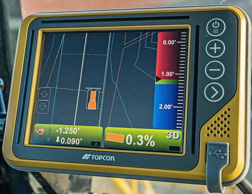
10 Topcon 3DMC GPS Dozer Sys.


11 Topcon 3D-MAXX GPS Dozer Sys.


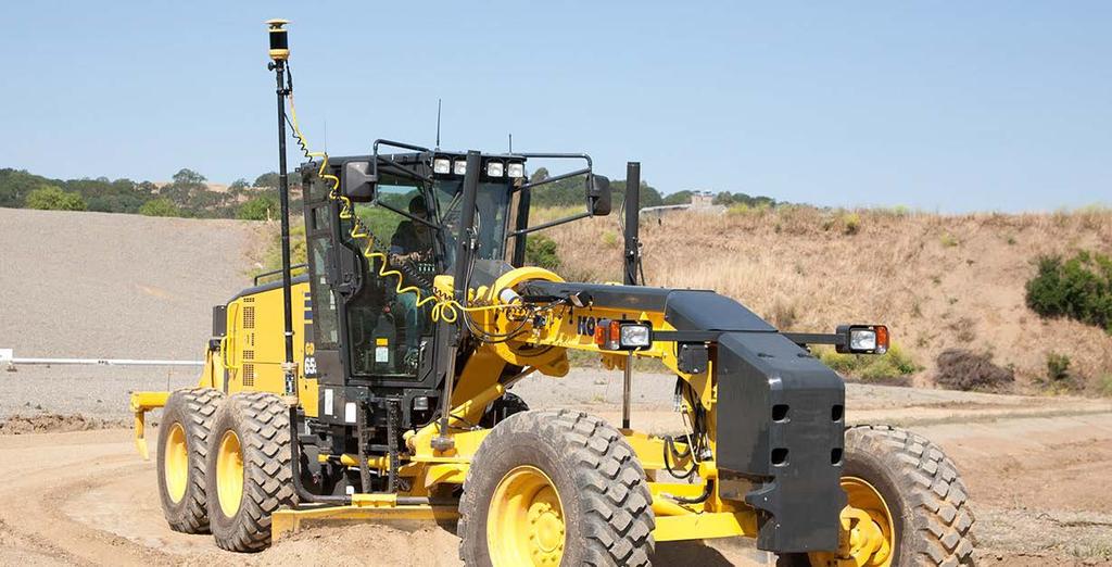
12 Trimble GCS900 UTS Grader Sys.
13 Topcon Millimeter GPS Grader Sys.


14 Trimble GPS Excavator System


15 Topcon GPS Excavator System


16 Trimble GCS900 UTS Milling Sys.

17 Topcon RDMC Paver Sys.

18 Topcon RDMC Paver Sys.

19 Topcon RDMC Mill Sys.


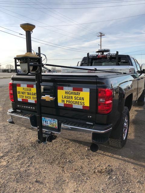
20 Topcon RDM-1 Scanner Sys.

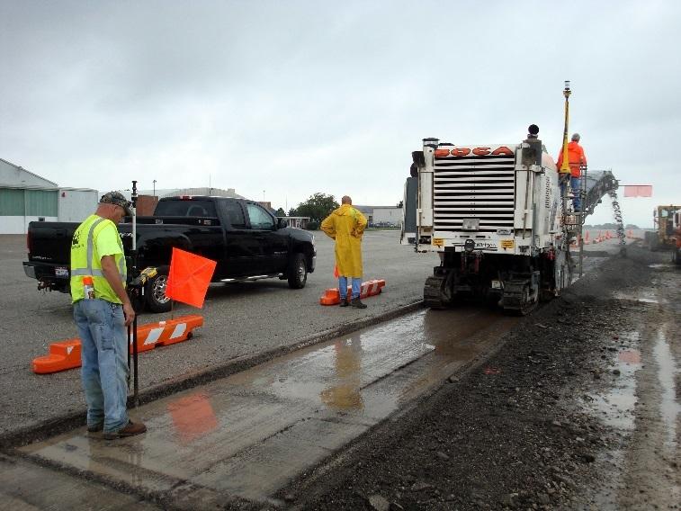
21 Stringless Concrete Paving Sys.


22 Trimble DPS900 Drill Rig Sys.

23 Conceptual vs. Constructible Two General Types of Models to consider: 1. Conceptual Typically NOT for construction, but just another pretty picture.

24 Conceptual vs. Constructible Two General Types of Models to consider: 2. Constructible Mathematically / geometrically relevant to the contract specifications and field construction methods.

25 *** PROJECT CONTROL *** What is good enough? If you do NOT have good, tight project control, your 3D efforts may be all for not! Good Control will lead to Good Redundancy. You must know your construction grade tolerances for your project and your work. GPS vs. Conventional Methods
26 ODOT 2016 Construction Tolerances Side Slopes = +/- 1.0 ODOT Spec B Earthwork Construction Tolerances Shoulders & Ditches = +/ ODOT Spec C Earthwork Construction Tolerances Subgrade Fine Grade = +/ ODOT Spec D Earthwork Construction Tolerances
27 ODOT 2016 Construction Tolerances Stone / Agg Base Fine Grade = ODOT Spec Finished Surface Asphalt Pavement Finish Grade = +/-0.04 ODOT Spec Spreading & Surface Tolerances Concrete Pavement Finish Grade = +/ ODOT Spec Spreading & Surface Tolerances


28 PROJECT CONTROL Accuracies What is good enough? GPS Accuracy (VRS vs. Base Station) Horizontal = +/ Vertical = +/ Conventional Robotic Accuracy Horizontal / Vertical = +/ Differential Leveling Optical Engineers Level = +/ Digital Level = < +/- 0.01
29 S&S PROJECT CONTROL Procedure 1. Set an RTK base point and observe using the ODOT VRS, then setup our RTK Base. 2. Recon and observe primary Plan Control points to perform a GPS calibration / localization. 3. Set secondary construction control points at a maximum of 500-ft stations outside of construction work area.
30 S&S PROJECT CONTROL Procedure 4. Perform digital level loops through ALL primary and secondary control points. 5. Generate Control Comparison XLSX sheet to compare Plan vs. GPS vs. Leveled values. 6. Generate our Project Control CSV file using GPS North & East values and Leveled Elevations.

31 S&S Control Comparison XLSX A solid project Elevation Datum must be established for the use of 3D M/C!
32 Well-Established Project Datum Will carry consistent elevations from setup to setup. Setup A 1500-ft Setup B 1500-ft Setup C 1500-ft
33 Poorly-Established Project Datum Will NOT carry consistent elevations from setup to setup. Setup A 1500-ft Setup B 1500-ft Setup C 1500-ft
 And yes, Microsoft Excel NO single program will do")
34 Major 3D Modeling Software Trimble BC-HCE Trimble Terramodel Carlson Survey Topcon Magnet Office AutoDesk Civil-3D Bentley OpenRoads (not Geopak) And yes, Microsoft Excel NO single program will do everything!
35 Data Translation Perhaps one of the most important concepts, but least understood concepts in 3D data prep. Involves moving data (2D or 3D) from one platform to another.
36 Data Translation File Types DGN Microstation basemap files DWG/DXF AutoCad basemap files XML LandXML surfaces or alignments CSV comma delimited points files PNEZD format (or) SOZD format XLSX Microsoft Excel file ICM.DGN Bentley imodel file GEN Geopak ASCII cross-section file Various GIS formats SHP, KML, KMZ GPK, CRD, TIN worthless Geopak files
37 Data Translation Data Types Points Alignment Chains & Profiles Surface TIN / DTM s 2D Polylines 3D Linetrings Text Stored Cross-sections Corridor Templates (possibly in the future)

38 Data Translation Data Types

39 Data Translation Data Types
40 3D Model Process Different considerations for Roadway vs. Site Use as DTM only, or also use data for construction layout purposes. Ultimate goal is to generate one, big, COMPOSITE MODEL.

41 3D Model QA/QC Best done with 0.20 or tighter contours, NOT 3D visualizers.
42 DTM / TIN Densification Consideration of the Final File Size is required some 3D systems cannot handle large files. Typical 25-ft & Critical points Superelevations Full 25-ft & Critical points Super 5-ft Intersection / Pavement Details Radius 10-ft or tighter 25-ft & Critical points Side slopes / 50-ft & Critical pts

43 DTM / TIN Densification Superelevation 25-ft
44 DTM / TIN Densification Superelevation 5-ft

45 What can we do now?
46 What can we do now and in the future? Current CADD Manual & Specs See AppendixE_0413-Electronic Submissions Checklist Future CADD Manual & Specs Electronic Submissions will be required before acceptance of plans. (Fall of 2018?) Many Benefits to using 3D Modeling from Design to Bid to Construction.

47 Garbage-In Garbage-Out 3D Machine Control Systems HAVE THE POTENTIAL TO BUILD IT WRONG VERY ACCURATELY! DESIGN INPUTS DESIGN SURVEY CONTROL EXISTING SURVEY DATA CONSTRUCTION INPUTS PROJECT SURVEY CONTROL 3D DATA / MODEL DESIGN INTENT / PLANS 3D M/C EQPT

48 2017 NCHRP Publication og/25084/use-ofautomated-machineguidance-within-thetransportation-industry
49 QUESTIONS 3D Modeling SHELLY & SANDS JOHN DOWALTER, PE, PS KEY CONCEPTS IN 3D MODELING 3D M/C Equipment (AMG) Project Control Construction Tolerances Data Translation DTM/TIN Densification
OCTOBER OTEC Session 75 Stringless 3D Paving
 OCTOBER 03 2018 OTEC Session 75 Stringless 3D Paving Introductions Brian E Girouard, Trimble Inc Sales Engineer Paving Specialist Manager brian_girouard@trimble.com Brad Cunningham, SITECH Ohio SITECH
ODOT s Future with 3D Models
 Ohio Department of Transportation Mark McCloud, CADD Manager, CADD and Mapping Services October 28 th, 2015 John R. Kasich, Governor Jerry Wray, Director www.transportation.ohio.gov FHWA Every Day Counts
Delivering 3D Engineered Model Data for Highway Construction
 Delivering 3D Engineered Model Data for Highway Construction Objectives After completing this module, you will be able to: Describe how 3D engineered models are created in design Describe how contractors
Session Objectives. Describe how 3D Models are created during design. Discuss what 3D Model outputs are useful in Construction
 1 Session Objectives Describe how 3D Models are created during design Discuss what 3D Model outputs are useful in Construction Describe applications of 3D Models in Construction 2 Creating the 3D Design
The ODOT_XSLabeling.mvba application is used to draw basic labels on cross sections extracted from a Roadway Designer DTM file.
 Application Name: Current version: Required MicroStation Version: Required GEOPAK Version: ODOT_XSLabeling.mvba v11.07.15 XM or V8i XM or V8i The ODOT_XSLabeling.mvba application is used to draw basic
2009 IHEEP CONFERENCE The Future of CORS Networks and AMG
 2009 IHEEP CONFERENCE The Future of CORS Networks and AMG Background Dominick Izzo, PE Lancaster Development, Inc. Heavy Highway Contractor in Upstate NY Member of NYSAGC/NYSDOT Emerging Technology Committee
Landfill Grading Using GPS Machine Control
 Landfill Grading Using GPS Machine Control NC SWANA April 2018 Presented by: Bernie Garrett, PE Garrett & Moore Inc. & Gabe Leach Cooper Barnette & Page Inc. 1 Purpose Work flow processes used by Engineers,
3D Technology in the Construction Continuum. Alabama DOT Pre-Construction Conference Montgomery AL May 03, 2016
 3D Technology in the Construction Continuum Alabama DOT Pre-Construction Conference Montgomery AL May 03, 2016 Brian E Girouard, Sales Engineer, Milling-Paving-Compaction Specialist Civil Engineering &
5/17/2017. Steven Popke, PE Wisconsin DOT Bureau of Project Development Methods Development Unit
 Steven Popke, PE Wisconsin DOT Bureau of Project Development Unit Wisconsin Department of Transportation since 2014 Assists with WisDOT spilot program for sharing design model data with construction contractors
James Schneider Advanced Materials and Technology
 (CEC-90153) Minnesota DOT Deploy GCS900, Business Center HCE and VisionLink with the DOTs GEOPAK software to automatically monitor large scale excavation in Carver County James Schneider Advanced Materials
Overview September 7, 2017
 Overview September 7, 2017 Purpose The purpose of this presentation is to provide an overview of the changes to the required deliverables and workflow for developing plans and models for Illinois DOT projects
ENHANCED DELIVERABLES AND THE DIGITAL JOBSITE NOVEMBER 14, 2018
 ENHANCED DELIVERABLES AND THE DIGITAL JOBSITE NOVEMBER 14, 2018 Background CP Tech Center/Snyder & Associates team EDC-2 3D Engineered Models EDC-4 e-construction (Digital Construction Inspection) 2 What
3-D Modeling Implementation
 3-D Modeling Implementation Presented January 31, 2013 Douglas Townes FHWA Resource Center WORKFLOW FOR ELECTRONIC DATA TRANSFER WHEN USING AMG IN CONSTRUCTION Charles Jahren, PhD Iowa State University
GIS Mapping of Pipelines
 GIS Mapping of Pipelines RJ Lumbrezer, PS Survey Manager DGL Consulting Engineers, LLC Ted Muns Sales Manager City Blueprint of Toledo 2016 Ohio GIS Conference Hyatt Regency Columbus September 28 30, 2016
TECHNICAL NOTES TRIMBLE SURVEY CONTROLLER SOFTWARE
 TRIMBLE SURVEY CONTROLLER SOFTWARE TECHNICAL NOTES The Trimble Survey Controller software is the data collection solution that will make your survey work faster, easier, and more productive than ever before.
3D Milling. Tom Abell
 3D Milling Tom Abell Trimble & 3D Milling as Part of the Resurfacing Process Design Measure Resurfacing From initial survey to finish surface Mill Compact Pave Content Data acquisition Creating data models
MoDOT s 3D Design Implementation, Electronic Deliverables, and E-Construction. Ashley Buechter, P.E. MoDOT CADD Support Engineer
 MoDOT s 3D Design Implementation, Electronic Deliverables, and E-Construction Ashley Buechter, P.E. MoDOT CADD Support Engineer LADOTD Transportation Conference February 29, 2016 General Information and
Trimble s RoadLink Utility Tutorials
 Trimble s RoadLink utility is an interface between third-party road definitions and Trimble survey devices. It lets you import or key in road definitions, view them graphically, edit them if required,
3D Model Submittal Preparation Power GEOPAK SS2
 3D Model Submittal Preparation Power GEOPAK SS2 General Information This document is intended to provide guidance in preparing the proposed 3D model data from Roadway Designer for submittal and is only
Table of Contents. Note to Self-Paced Users of the Day 2 Seminar Handbook. Notices 1. Quick Reference 2. Seminar Outline 14
 Table of Contents Note to Self-Paced Users of the Day 2 Seminar Handbook i Notices 1 Quick Reference 2 Seminar Outline 14 Program and Vector Data Overview 17 A Toolbox for Creating Earthwork Models 17
Site calibration improvements for GPS operations. Stakeout line changes. Call API toll free (888)
") Welcome to the Q4 Edition of the API Newsletter. This newsletter is being presented as an information tool to present new product information. If there are any questions regarding any products or services
Welcome to the Q4 Edition of the API Newsletter. This newsletter is being presented as an information tool to present new product information. If there are any questions regarding any products or services
3D System. 2D & 3D Systems. Compact Attachments
 3D System 2D & 3D Systems 1 2D System 2D System Systems work off a single plain Flat Single slope Dual Slope Bobcat laser system is 2D 2 Sonic 3 3D System 3D System Works off elevation coordinates setup
TRIMBLE GEOMATICS OFFICE TECHNICAL NOTES
 The Trimble Geomatics Office software is an important part of Trimble s total surveying solutions. Never has the collection, processing, and management of survey data been so easy. Surveyors and engineers
InRoads File Types. Below is a list of the primary file types used for InRoads in the road design process.
 Section 6 InRoads Basic File Types Retrieving InRoads Base Files Internal Naming Convention Alignment Styles and Surface Styles Alignment Point Abbreviations Feature Naming Conventions Project Defaults
Geometric Layout for Roadway Design with CAiCE Visual Roads
 December 2-5, 2003 MGM Grand Hotel Las Vegas Geometric Layout for Roadway Design with CAiCE Visual Roads Mathews Mathai CV32-3 This course describes and demonstrates various tools for defining horizontal
American Society of Highway Engineers 2016 Fall Technical Seminar
 American Society of Highway Engineers 2016 Fall Technical Seminar University Club November 10 th, 2016 12 4:30 PM INTRODUCTION https://vimeo.com/165933885 Agenda Registration: 12:00 pm Lunch 12:30 pm Presentation
Section 7 - Introducing Roadway Modeling
 Introducing Roadway Modeling Section 7 - Introducing Roadway Modeling Section Goals: Understand the Principles of InRoads Roadway Modeling Understand how to load Typical Section Libraries Understand how
Working With External Design Software
 Working With External Design Software Introduction This document describes methods for working with project data from external civil design packages such as Civil 3D, Bentley civil products, 12d Model
DTFH61-13-C Addressing Challenges for Automation in Highway Construction
 DTFH61-13-C-00026 Addressing Challenges for Automation in Highway Construction Learning Objectives Research Objectives Research Team Introduce Part I: Implementation Challenges and Success Stories Describe
Chapter 1: Introducing Roadway Modeling
 Introducing Roadway Modeling Chapter 1: Introducing Roadway Modeling Chapter Overview The chapter addresses the following topics: How Roadway Modeling Works in InRoads Opening and Exploring Typical Section
TechnicalNotes. Trimble Geomatics Office Software
 TechnicalNotes Trimble Geomatics Office Software AT LAST A SINGLE SOFTWARE PACKAGE TO HANDLE ALL OF YOUR SURVEY DATA The Trimble Geomatics Office software is a key component in the Trimble Toolbox of Integrated
The Magic of a Dynamic Differential TIN Surface
 The Magic of a Dynamic Differential TIN Surface Creg Dieziger Sr. Designer, Morrison-Maierle, Inc. CI3906 Ever wish that AutoCAD Civil 3D could create a dynamically linked subgrade surface, while you build
TECHNICAL NOTES SURVEY PRO WITH TSX
 SURVEY PRO WITH TSX TECHNICAL NOTES Survey Pro software from TDS is the data collection solution of choice for most North American surveyors 1. And with the addition of the Trimble TSX (Trimble Systems
Advanced Use of Automatic Grade Controls. Jeroen Snoeck Segment Manager Paving Trimble Navigation Ltd.
 Advanced Use of Automatic Grade Controls Jeroen Snoeck Segment Manager Paving Trimble Navigation Ltd. Contents Industry trends driving technology in Heavy & Highway Construction Traditional Grade Control
What's New or Changed in Bentley InRoads Group V8i (SELECTseries 1)
") What's New or Changed in Bentley InRoads Group V8i (SELECTseries 1) V08.11.07 Refresh New General AutoCAD 2010 was added as a supported CAD platform. General - Applies to MicroStation only File Right clicking
What's New or Changed in Bentley InRoads Group V8i (SELECTseries 1) V08.11.07 Refresh New General AutoCAD 2010 was added as a supported CAD platform. General - Applies to MicroStation only File Right clicking
LandXML.org 2.0. a Data Exchange Standard. for. Nathan Crews, Principal Schema Architect, LandXML.org
 LandXML.org 2.0 a Data Exchange Standard for eplan LandXML Deliverable Nathan Crews, Principal Schema Architect, LandXML.org Outline LandXML.org 1999 Autodesk supported effort LandXML Standard Adoption
Quality Control Checklist & Tools for Reviewing 3D Engineered Models
 Quality Control Checklist & Tools for Reviewing 3D Engineered Models Production Support Office CADD Vern Danforth Description: In this session we will discuss 3D engineered models. Brief FDOT CADD/Industry
Update: October 21, 2013
 Update: October 21, 2013 CADD Engineering Standards Manual The following section was revised: Section 502.1 General Page 92 The following verbiage was added: Per section 1307.1 of the L&D Manual s Volume
Trimble SCS900 Site Controller Software for Beginners. Jordan Lawver HCC-6339
 Trimble SCS900 Site Controller Software for Beginners Jordan Lawver HCC-6339 Agenda What is Trimble SCS900 Site Controller Software? Who uses SCS900 Trimble Site Positioning System software portfolio Applications
THE REFERENCE FILE. Cadd Support Office May Included in this issue:
 THE REFERENCE FILE May 2018 Included in this issue: Page 2 Page 2 Page 2-3 Page 4-7 Page 8-10 Page 11 New Title Sheet Cells New Signal Cells Cross Section Sheets Guardrail Mash Standards RDM (AASHTO 2011)
Tec Sheet NoiseMod Reverse.3pc
 What is NoiseModReverse.3pc? NoiseModReverse.3pc HELP DOCUMENTATION NoiseModReverse.3pc is a Geopak application that reads a FHWA Stamina noise model ASCII file and draws the roadways, barriers, and receivers
Presentation Overview
 Stringless Concrete Paving STRINGLESS CONCRETE PAVING ACPA BUS TOUR AUGUST 5, 2015 Presentation Overview 1) Manufactures 2) Components needed for Stringless Paving 3) Conventional Methods VS Stringless
Title: Improving Your InRoads DTM. Mats Dahlberg Consultant Civil
 Title: Improving Your InRoads DTM Mats Dahlberg Consultant Civil Improving Your InRoads Digital Terrain Model (DTM) Digital Terrain Model A digital representation of a surface topography or terrain composed
Figure 1: Mobile mapping project location in New York City.
 Using Mobile LiDAR to Deliver Survey Accurate Data This presentation will take the attendees though the process of controlling and delivering survey grade LiDAR data for use in CADD, Modeling, and GIS
technical notes Trimble survey controller field software
 Trimble survey controller field software technical notes For more than a decade, Trimble Survey Controller field software has provided land surveyors with a complete GNSS and optical data-collection solution
Bentley ConceptStation Workshop 2017 FLUG Spring Training Event
 Bentley ConceptStation Workshop 2017 FLUG Spring Training Event 430 - QuickStart using OpenRoads ConceptStation Bentley Systems, Incorporated 685 Stockton Drive Exton, PA 19341 www.bentley.com Practice
DES 727 CORRIDOR MODELLING & PLAN PRODUCTION USING OPEN ROADS. April 2018 Design Division
 CORRIDOR MODELLING & PLAN PRODUCTION USING OPEN ROADS April 2018 Design Division Introduction The course has been developed to be completed with Power GeoPak SS4. Other versions of GeoPak SS4 may also
Guideline for Importing Survey Data into Bentley Power InRoads v8i SS2
 Guideline for Importing Survey Data into Bentley Power InRoads v8i SS2 I. REQUIREMENTS from the Geomatics/Survey Function: 1. A CAD-only drawing in.dwg file format ver. 2013, (that can be created natively
Civil 3D Introduction
 Civil 3D Introduction Points Overview Points are data collected by surveyors which represent existing site conditions (elevations, boundaries, utilities, etc.). Each point is numbered (or named) and has
technical notes Trimble business CenTer software trimble BuSineSS Center your Complete office Solution
 Trimble business CenTer software technical notes trimble BuSineSS Center your Complete office Solution designed for today's fast-paced surveying office, trimble Business Center unlocks the potential of
TRIMBLE PAVING SOLUTIONS MILL FILL
 TRIMBLE PAVING SOLUTIONS MILL FILL better from the ground up Today s road projects require contractors to work faster, with better accuracy, and with tighter control on costs. For the paving contractor,
Trimble Site EASY-TO-USE RELIABLE ACCURATE
 Trimble Site Positioning Systems ACCURATE RELIABLE EASY-TO-USE more tools for more jobs Estimators Bid Team Site Surveyor Data Manager Site Engineer/Grade Checker Site Foreman/Supervisor Project Manager
connecting your construction site
 TRIMBLE: Connecting Your Construction SitE connecting your construction site The Ultimate Data Management System Business Center Heavy Construction Edition (HCE) from Trimble is the only office software
3D Modeling for Contractors
 3D Modeling for Contractors The Constructible Model Joel Brown SITECH Ohio a construction technology partner for the 21 st Century Major brand vendor Work with hundreds of Civil Contractors Sales Support
Iowa Department of Transportation Office of Design. Photogrammetric Mapping Specifications
 Iowa Department of Transportation Office of Design Photogrammetric Mapping Specifications March 2015 1 Purpose of Manual These Specifications for Photogrammetric Mapping define the standards and general
Terramodel Training Guide. Designing a Roadway
 Terramodel Training Guide Version 8 Revision A March 2002 Corporate Office Trimble Navigation Limited Engineering and Construction Division 5475 Kellenburger Road Dayton, Ohio 45424-1099 U.S.A. Copyright
Digital Terrain Model V 6.5
 TCP MDT Digital Terrain Model V 6.5 Professional Version Introduction The Professional Version is designed to assist users in all the phases of carrying out a Surveying or Civil Engineering project. Its
Commercial suas The Right Tool for the Right Job
 Commercial suas The Right Tool for the Right Job Presentation Objectives Overview of current data collection technologies UAS Systems Overview Surveyor 2.0 Project Case Study Mobile LiDAR & suas How Do
Interface with. 3DMC Machine Control
 Interface with 3DMC Machine Control Preamble In our experience software options are often only used in their simplest forms particularly when combined with data transfer. This document aims to uncover
AutoCAD Civil 3D 2011 ESSENTIALS
 AutoCAD Civil 3D 2011 ESSENTIALS SDC PUBLICATIONS www.sdcpublications.com Schroff Development Corporation Table of Contents Table of Contents Preface...ix Module 1 The AutoCAD Civil 3D Interface... 1-1
Topocad portfolio. Adtollo adtollo.se/en
 Topocad portfolio Adtollo adtollo.se/en + 46 8 410 415 00 info@adtollo.se order@adtollo.se What is Topocad? Topocad is easy to use and provides a powerful CAD system for all requirements when it comes
TRIMBLE ASPHALT PAVING SOLUTIONS
 TRIMBLE ASPHALT PAVING SOLUTIONS Mill Fill better from the ground up Today s road projects require contractors to work faster, with better accuracy, and with tighter control on costs. For the paving contractor,
Pave the Way to Better Profits. Trimble. Paving Solutions TRANSFORMING THE WAY THE WORLD WORKS
 Pave the Way to Better Profits Trimble Paving Solutions TRANSFORMING THE WAY THE WORLD WORKS Solutions for the Complete Paving Job Site Productive, integrated and innovative solutions to keep you on track
TBC v License Matrix - Rev 0
 Command Name Viewer (Unlicensed) Base Intermediate Advanced Advanced Drafting Aerial Photogrammetry Data Prep GIS Scanning Tunneling Category 3D Preset Views x x x x General Software 3D View Projection
TechnicalNotes. Trimble Survey Controller v10.0 Software THE ADVANCED TOTAL FIELD SOLUTION FROM TRIMBLE
 TechnicalNotes Trimble Survey Controller v10.0 Software THE ADVANCED TOTAL FIELD SOLUTION FROM TRIMBLE The Trimble Survey Controller software utilizes more of your senses to make your survey work faster,
CHAPTER 11. Learn to use GEOPAK Automated Superelevation dialog box and Autoshape Builder to apply superelevation to a roadway.
 CHAPTER 11 Superelevation 11.1 Introduction Objectives Project Manager Learn to use GEOPAK Automated Superelevation dialog box and Autoshape Builder to apply superelevation to a roadway. Calculate Superelevation
Bentley OpenRoads Workshop 2017 FLUG Spring Training Event
 Bentley OpenRoads Workshop 2017 FLUG Spring Training Event 431 - Approach and Driveway Modeling in OpenRoads Bentley Systems, Incorporated 685 Stockton Drive Exton, PA 19341 www.bentley.com Practice Workbook
Roadway Alignments and Profiles
 NOTES Module 15 Roadway Alignments and Profiles In this module, you learn how to create horizontal alignments, surface profiles, layout (design) profiles, and profile views in AutoCAD Civil 3D. This module
Technical training May - August
 2017 Technical training May - August Register today! theppigroup.com/training Training centers located in Portland, OR & Seattle, WA. Why Train with PPI? PPI is the only locally owned and operated Autodesk
Transitioning to MX SELECTSeries 3 and OpenRoads Technology
 Transitioning to MX SELECTSeries 3 and OpenRoads Technology Ian Rosam, Product Manager, BSW Development, Civil Design Workshop Agenda (1.5hrs including Q&A) What is OpenRoads (5 mins) Delivered civil workspaces
TcpTunnel. Setting Out and Surveying for Tunnels. Introduction. Project Definition
 TcpTunnel Setting Out and Surveying for Tunnels Introduction This application, installed in a mobile device, provides users with the most common options for setting out tunnels and gathering data from
FEBRUARY Trimble PCS900 3D Milling & 3D Paving
 FEBRUARY 2018 Trimble PCS900 3D Milling & 3D Paving Presenter Kevin Ackley Sitech Michigan Why use 3D Milling and 3D Paving? To build better pavement Structures!!! Sample Engineering Specifications 2D
Practice Workbook. Using the Model - Preparing for Plan Production in OpenRoads. SELECTseries 4 ( ) or newer
 or newer") Practice Workbook This workbook is designed for use in Live instructor-led training and for OnDemand self study. The explanations and demonstrations are provided by the instructor in the classroom, or
Practice Workbook This workbook is designed for use in Live instructor-led training and for OnDemand self study. The explanations and demonstrations are provided by the instructor in the classroom, or
Land Development Suite for BricsCAD Manual: Survey and Cogo commands:
 Land Development Suite for BricsCAD Manual: Survey and Cogo commands: Before you begin go to Drafting -- Drawing Setup Drawing Setup - Select English or Metric units -changes the ltscale and labeling precision,
Working with Profiles
 Tennessee Association of Professional Land Surveyors 2016 Annual Conference Murfreesboro Working with Profiles In Carlson Software Presented by Who Is That CAD Girl? Jennifer DiBona is a long time CAD
Table of Contents. MDOT - Creating Model Line String and LandXML RID Files
 Table of Contents General Information... 2 Part 1: Proposed Terrain Model Creation... 3 Option 1: Element Selection Method... 3 Proposed Top Surface... 3 Proposed Subsurface... 4 Option 2: Terrain from
Bentley OpenRoads Workshop 2017 FLUG Fall Training Event
 Bentley OpenRoads Workshop 2017 FLUG Fall Training Event F-1E - QuickStart using OpenRoads ConceptStation Bentley Systems, Incorporated 685 Stockton Drive Exton, PA 19341 www.bentley.com Practice Workbook
Round Table Discussion Engineering Data Focus in DOTs IHEEP 2009 San Antonio, Texas September 27, 2009 Facilitator: Dan Belcher, Michigan DOT
 Round Table Discussion Engineering Data Focus in DOTs IHEEP 2009 San Antonio, Texas September 27, 2009 Facilitator: Dan Belcher, Michigan DOT 1. Participants: Name and Position/Role in the DOT Dan Belcher,
Field to Finish and the New Survey Tools in AutoCAD Civil 3D 2013
 Field to Finish Using AutoCAD Civil 3D Field to Finish and the New Survey Tools in AutoCAD Civil 3D 2013 Shawn Herring, Sr. Civil Application Engineer/Support & Training Manager Jason Jenkins, PLS Civil
Grade Control. GRADE CONTROL SYSTEMS Topcon. MOTOR GRADER 3D-GPS+, mmgps Plug-and-Play. HYDRAULIC EXCAVATOR X63 3D-GPS+ Plug-and-Play
 GRADE CONTROL SYSTEMS Topcon Grade Control CRAWLER DOZER 3D-MC 2 Plug-and-Play HYDRAULIC EXCAVATOR X63 3D-GPS+ Plug-and-Play MOTOR GRADER 3D-GPS+, mmgps Plug-and-Play PHOTOS MAY INCLUDE OPTIONAL EQUIPMENT
Trimble Productivity: Finish Faster with Fewer Machines. TRIMBLE GCS900 GRADE CONTROL SYSTEMS
 Trimble Productivity: Finish Faster with Fewer Machines. TRIMBLE GCS900 GRADE CONTROL SYSTEMS TAKE ThE GUESSWORK OUT OF EARThWORKS. ONLY FROM ThE LEADER. TRIMbLE. The Connected Construction Site An interesting
SURVRD for Existing Feature Models file in FDOTSS4 OpenRoads
 SURVRD for Existing Feature Models file in FDOTSS4 OpenRoads Production Support Office - CADD Chris Thorp What is a SURVRD file? SURVRD Survey Development Model for 3D Design It is a critical file for
Project Management with the ODOTcadd Standards
 Project Management with the ODOTcadd Standards For MicroStation V8i (SELECTseries 3) and PowerGEOPAK V8i (SELECTseries 4) Prepared on behalf of The Ohio Department of Transportation, Office of CADD and
TRIMBLE WESTMINSTER BUILDING PROJECT / 2013
 TRIMBLE WESTMINSTER BUILDING PROJECT - 2012 / 2013 OVERVIEW Outgrowing its current office facility in Westminster, Colorado, Trimble decided to build a larger campus across the street from their current
Features and Benefits
 CAiCE Visual Survey 10 Features and Benefits CAiCE Visual Survey 10 software enables surveying professionals to import, process, analyze, and present surveying all in one software package. Visual Survey
G L O S S A R Y GLOSSARY
 GLOSSARY Aerial Mapping or Aerial Surveying Aerial Photography Angle of Intersection Atmospheric Pressure Azimuth Barometric Pressure Backsight Back Slope Base Grade Bench Mark Bluetooth Borrow Pit (Quarry)
General GPS TPS ROB X POLE VOL RDN RPL Jobs management System settings (units, precision, parameters, etc.)
") XPAD Survey Modules XPAD Survey GPS TPS XPOLE General GPS TPS ROB XPOLE VOL RDN RPL Jobs management System settings (units, precision, parameters, etc.) Instruments GPS GPS TPS ROB XPOLE VOL RDN RPL Instrument
XPAD Survey Modules XPAD Survey GPS TPS XPOLE General GPS TPS ROB XPOLE VOL RDN RPL Jobs management System settings (units, precision, parameters, etc.) Instruments GPS GPS TPS ROB XPOLE VOL RDN RPL Instrument
ODOT_SupplDesc.mvba is used to review and edit the Title and Comments file properties for all the DGN files found in the selected project folder.
 Application Name: Current version: Required MicroStation Version: Required GEOPAK Version: ODOT_SupplDesc.mvba V11.07.15 XM or V8i Not required Overview ODOT_SupplDesc.mvba is used to review and edit the
Roundabout Design Using AutoCAD Civil 3D 2010 Intersection Tools
 Roundabout Design Using AutoCAD Civil 3D 2010 Intersection Tools Marie-Pierre Lebel Consortech Solutions CV214-1 Learn how to leverage the new intersection design tools from AutoCAD Civil 3D 2010 for use
Reference Manual. TopSURV OnBoard
 Reference Manual TopSURV OnBoard TOC Table of Contents What s New with TopSURV... ix Preface... xiii Terms and Conditions... xiii Manual Conventions... xv Introduction... 1-1 Title Bar... 1-2 Menu Bar...
A 3D Scanner Based Technology for Land Levelling
 A 3D Scanner Based Technology for Land Levelling Kunal Chakraborti, Rupam Ghosh Student, Dept of Civil Engineering, Modern Institute of Engineering & Technology, Bandel, Hooghly, West Bengal, India ABSTRACT:
Cotton Belt Regional Rail
 Cotton Belt Regional Rail CADD File Management Manual September 2010 Prepared for Dallas Area Rapid Transit General Planning Consultant Managed by URS Corporation Cotton Belt Regional Rail CADD File Management
Value Adding Utilities to the 3D Model
 Value Adding Utilities to the 3D Model GEOPAK 2004 OpenRoads SS-4 www.dtm-solutions.com 2015 Copyright DTM Solutions PLLC All Rights Reserved. 1 What is Value? 2015 Copyright DTM Solutions PLLC All Rights
PE Exam Review - Surveying Demonstration Problem Solutions
 PE Exam Review - Surveying Demonstration Problem Solutions I. Demonstration Problem Solutions... 1. Circular Curves Part A.... Circular Curves Part B... 9 3. Vertical Curves Part A... 18 4. Vertical Curves
Alignments CHAPTER INTRODUCTION OBJECTIVES
 CHAPTER 5 Alignments INTRODUCTION This and the next four chapters focus on roadway design and its documentation. This chapter concentrates on roadway plan design. The next three chapters focus on the roadway
SurvCE: Localizations
 SurvCE: Localizations Mark Silver Electrical Engineer, not a Surveyor Carlson Dealer in Salt Lake City Utah Embarrassing Fact: I have a 250,000+ sheet paper map collection. igage Mapping Corporation www.igage.com
AutoCAD Civil-3D Nyheter AutoCAD Civil-3D 2013
 AutoCAD Civil-3D Nyheter AutoCAD Civil-3D 2013 Tesfaye Kebede Vianova systems New Features Civil-3D Pressure Pipe Network Volumes Dashboard Analysis Data Exchange Railway Design Corridor Design Survey
The Carlson Software Engineering Solution
 Carlson Civil 2007 The Carlson Software Engineering Solution Carlson Civil 2007 is the flagship engineering office product from Carlson Software, containing robust functionality for road design, site and
AUTOCAD CIVIL 2009 AND AUTOCAD CIVIL 3D Road Rehabilitation and Reconstruction with AutoCAD Civil and AutoCAD. Civil 3D
 AUTOCAD CIVIL 2009 AND AUTOCAD CIVIL 3D 2009 Road Rehabilitation and Reconstruction with AutoCAD Civil and AutoCAD Civil 3D 1 Contents Introduction... 3 Introduction to Corridor Targets... 3 Surface Targets...
LandXML Drawing Support
 AutoCAD Civil 3D 2008 LandXML Drawing Support Contents Introduction... 1 LandXML Schema Versions Supported... 1 General Data Handling... 2 Import Functionality... 2 Export Functionality... 3 Import Details...