a Geo-Odyssey of UAS LiDAR Mapping Henno Morkel UAS Segment Specialist DroneCon 17 May 2018
|
|
|
- Joleen Wilkerson
- 5 years ago
- Views:
Transcription


1 a Geo-Odyssey of UAS LiDAR Mapping Henno Morkel UAS Segment Specialist DroneCon 17 May 2018
2 Abbreviations UAS Unmanned Aerial Systems LiDAR Light Detection and Ranging UAV Unmanned Aerial Vehicle RTK Real-time Kinematic PPK Post Processing Kinematic DG Direct Geo-referencing EO Exterior Orientation


3 LiDAR explained LiDAR is a surveying method that measures distance to a target by illuminating the target with pulsed laser light and measuring the reflected pulses with a sensor. ¹ Airborne ¹ Source - Mobile Terrestrial


4 A booming industry
5 What is the goal? To capture elevation and geographical data for a final mapping product To generate the most accurate digital terrain models and various other 3D models that represents the Earth s surface and features To be able to capture ground terrain data that lies under tree canopies To be able to capture accurate elevation data over a large area, quickly and efficiently
6 Current methods Airborne LiDAR manned aircraft Airborne photogrammetry manned aircraft Satellite imagery Airborne photogrammetry UAVs Airborne LiDAR UAVs


7 Surveying and Mapping - Photogrammetry Traditional UAV aerial surveying methods Photogrammetry DSM (Digital Surface Model) generation via stereo-pairing of multiple digital aerial images:
8 Surveying and Mapping - Photogrammetry Time consuming to set out all of the GCP s (ground control points) for survey grade accuracy Limitation of photogrammetric DSM (Digital Surface Model) is that one does not get data below tree canopies and vegetation to get a truly accurate representation of the ground terrain over a specific area One also needs a lot of image overlap to achieve dense data
9 RTK - UAV surveying To achieve high accuracy one can either use the RTK (Real Time Kinematic) method together with a GPS system or one can use PPK (Post Processing Kinematic) Normal RTK with base and rover in normal surveying RTK surveying with a base station and your drone is the rover
10 DG - Direct Georeferencing Ever increasing need to be more accurate and more efficient with UAV surveying new technology Accuracy of UAV captured data is directly related to the positional accuracy of the UAV while it is capturing data With the aid of a Trimble APX-15 UAV highly accurate GNSS receiver, and the IMU (inertial measurement unit) one can achieve very high positional accuracy of your UAV and its sensor
11 DG - Direct Geo-referencing What is the difference between RTK & PPK versus Direct Geo-referencing technology? The calculation of the orientation angles (EO) of the UAV sensor are not accounted for with RTK & PPK, but they are accounted for with Direct Geo-referencing Thus one does not only get the Easting, Northing, and Elevation positional accuracy of the UAV, but also its orientation angles Omega, Phi, and Kappa
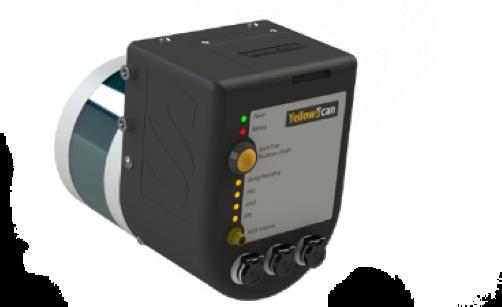
12 Microdrones UAS LiDAR systems
13 Surveying and Mapping DG & LiDAR Dr. Mohammed Mostafa a highly distinguished scientist at Microdrones argues that traditional RTK and PPK systems have inherent problems when it comes to accuracy, and that they sacrifice accuracy and quality for speed He also points out that the relative position of a UAV can be more accurately calculated by relying on the UAS s IMU coupled with a high grade GNSS versus the RTK-GPS method


14 Surveying and Mapping DG & LiDAR With the advent of direct geo-referencing technology together with a LiDAR payload, surveyors and geospatial professionals can capture data and process it in a fraction of the time versus traditional Aerial Triangulation methods Trimble / Applanix APX-15 Single board GNSS-Inertial solution for UAVs
15 Surveying and Mapping UAS LiDAR The most common applications of UAV LiDAR systems today are for: Corridor Mapping Roads, Railways, Pipelines, Waterways, and Electrical Transmission Lines Mine surveying Volumetric stockpile calculations and opencast Pit designs Coastal mapping Forestry
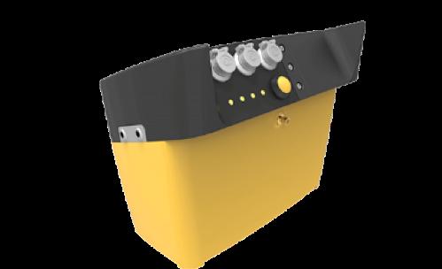
16 mdlidar1000

17 Advantages of Direct Geo-referencing


18 RTK and PPK versus DG
19 Conclusion The UAS LiDAR industry has seen huge advancements in the past 4 years in terms of accuracy and longer flight times I personally believe that photogrammetry are not obsolete, and that it still has its rightful place in the aerial surveying and mapping industry The advent of DG coupled with LiDAR technology will open up many doors in the UAS industry going forward

20 IMPORTANT NOTICE Keep your calendar s open mdlidar1000 demonstration Optron is planning a live UAV LiDAR demonstration in June 2018 Anyone who is interested are more than welcome, and please come and chat with us at our stand number. 14 in the DroneCon 2018dome

21 Safe Flying!! Thank you for your time and attention
2/9/2016. Session Agenda: Implementing new Geospatial Technologies for more efficient data capture
 Implementing new Geospatial Technologies for more efficient data capture Jay Haskamp Applied Geospatial Engineer Steve Richter VP Sales Session Agenda: Today s changing technologies and what lies ahead
Terrestrial GPS setup Fundamentals of Airborne LiDAR Systems, Collection and Calibration. JAMIE YOUNG Senior Manager LiDAR Solutions
 Terrestrial GPS setup Fundamentals of Airborne LiDAR Systems, Collection and Calibration JAMIE YOUNG Senior Manager LiDAR Solutions Topics Terrestrial GPS reference Planning and Collection Considerations
James Van Rens CEO Riegl USA, Inc. Mining Industry and UAV s combined with LIDAR Commercial UAV Las Vegas October 2015 James Van Rens CEO Riegl USA
 James Van Rens CEO Riegl USA, Inc. Mining Industry and UAV s combined with LIDAR Commercial UAV Las Vegas October 2015 James Van Rens CEO Riegl USA COST EFFECIENCY CONTINUUM LIDAR and IMU Partnership Technology
UAS for Surveyors. An emerging technology for the Geospatial Industry. Ian Murgatroyd : Technical Sales Rep. Trimble
 UAS for Surveyors An emerging technology for the Geospatial Industry Ian Murgatroyd : Technical Sales Rep. Trimble Project Overview Voyager Quarry, located near Perth Australia Typical of hard rock mines,
UAV s in Surveying: Integration/processes/deliverables A-Z. 3Dsurvey.si
 UAV s in Surveying: Integration/processes/deliverables A-Z Info@eGPS.net TODAY S PROGRAM Introduction to photogrammetry and 3Dsurvey Theoretical facts about the technology and basics of 3dsurvey Introduction
DIRECT GEOREFERENCING ON SMALL UNMANNED AERIAL PLATFORMS FOR IMPROVED RELIABILITY AND ACCURACY OF MAPPING WITHOUT THE NEED FOR GROUND CONTROL POINTS
 DIRECT GEOREFERENCING ON SMALL UNMANNED AERIAL PLATFO FOR IMPROVED RELIABILITY AND ACCURACY OF MAPPING WITHOUT THE NEED FOR GROUND CONTROL POINTS O. Mian a, J. Lutes a, G. Lipa a, J. J. Hutton a, E. Gavelle
Merging LiDAR Data with Softcopy Photogrammetry Data
 Merging LiDAR Data with Softcopy Photogrammetry Data Cindy McCallum WisDOT\Bureau of Technical Services Surveying & Mapping Section Photogrammetry Unit Overview Terms and processes Why use data from LiDAR
An Overview of Applanix.
 An Overview of Applanix The Company The Industry Leader in Developing Aided Inertial Technology Founded on Canadian Aerospace and Defense Industry Expertise Providing Precise Position and Orientation Systems
UTILIZACIÓN DE DATOS LIDAR Y SU INTEGRACIÓN CON SISTEMAS DE INFORMACIÓN GEOGRÁFICA
 UTILIZACIÓN DE DATOS LIDAR Y SU INTEGRACIÓN CON SISTEMAS DE INFORMACIÓN GEOGRÁFICA Aurelio Castro Cesar Piovanetti Geographic Mapping Technologies Corp. (GMT) Consultores en GIS info@gmtgis.com Geographic
Trends in Digital Aerial Acquisition Systems
 Trends in Digital Aerial Acquisition Systems Ernest Yap Regional Sales Manager, Airborne-Americas eyap@applanix.com 1 Medium Format Digital Cameras Medium Format Digital Cameras Where does the Medium
TopoDrone Photogrammetric Mapping Reliable, Accurate, Safe
 TopoDrone Photogrammetric Mapping Reliable, Accurate, Safe A complete solution for accurate airborne data capture and photogrammetric mapping using an unmanned aerial vehicle COST EFFICIENT SOLUTION TO
Open Pit Mines. Terrestrial LiDAR and UAV Aerial Triangulation for. Figure 1: ILRIS at work
 Terrestrial LiDAR and UAV Aerial Triangulation for Open Pit Mines Figure 1: ILRIS at work Figure 2: Geo-Copter X-8000 taking off ay what you will about the past few years, it has produced some useful tools
Case Study for Long- Range Beyond Visual Line of Sight Project. March 15, 2018 RMEL Transmission and Planning Conference
 Case Study for Long- Range Beyond Visual Line of Sight Project March 15, 2018 RMEL Transmission and Planning Conference 2014 HDR Architecture, 2016 2014 HDR, Inc., all all rights reserved. Helicopters
ENY-C2005 Geoinformation in Environmental Modeling Lecture 4b: Laser scanning
 1 ENY-C2005 Geoinformation in Environmental Modeling Lecture 4b: Laser scanning Petri Rönnholm Aalto University 2 Learning objectives To recognize applications of laser scanning To understand principles
The Use of UAV s for Gathering Spatial Information. James Van Rens CEO MAPPS Winter Conference January, 2015
 The Use of UAV s for Gathering Spatial Information James Van Rens CEO MAPPS Winter Conference January, 2015 1 UAV Technological Timeline 1980 s RPV (Remotely Piloted Vehicle) Operator on ground, almost
EVOLUTION OF POINT CLOUD
 Figure 1: Left and right images of a stereo pair and the disparity map (right) showing the differences of each pixel in the right and left image. (source: https://stackoverflow.com/questions/17607312/difference-between-disparity-map-and-disparity-image-in-stereo-matching)
(Subsea) Keith Vickery Zupt LLC
 Keith Vickery Zupt LLC") (Subsea) Keith Vickery Zupt LLC kv@zupt.com Offshore subsea infrastructure surveys (pipeline inspection, well, XT, and manifold inspections) are required to ensure compliance with both internal operator,
(Subsea) Keith Vickery Zupt LLC kv@zupt.com Offshore subsea infrastructure surveys (pipeline inspection, well, XT, and manifold inspections) are required to ensure compliance with both internal operator,
Light Detection and Ranging (LiDAR)
") Light Detection and Ranging (LiDAR) http://code.google.com/creative/radiohead/ Types of aerial sensors passive active 1 Active sensors for mapping terrain Radar transmits microwaves in pulses determines
Light Detection and Ranging (LiDAR) http://code.google.com/creative/radiohead/ Types of aerial sensors passive active 1 Active sensors for mapping terrain Radar transmits microwaves in pulses determines
LiForest Software White paper. TRGS, 3070 M St., Merced, 93610, Phone , LiForest
 0 LiForest LiForest is a platform to manipulate large LiDAR point clouds and extract useful information specifically for forest applications. It integrates a variety of advanced LiDAR processing algorithms
REMOTE SENSING LiDAR & PHOTOGRAMMETRY 19 May 2017
 REMOTE SENSING LiDAR & PHOTOGRAMMETRY 19 May 2017 SERVICES Visual Inspections Digital Terrain Models Aerial Imagery Volume Computations Thermal Inspections Photo maps Aerial Video Training & Consultancy
Sasanka Madawalagama Geoinformatics Center Asian Institute of Technology Thailand
 Sasanka Madawalagama Geoinformatics Center Asian Institute of Technology Thailand This learning material was not prepared by ADB. The views expressed in this document are the views of the author/s and
Surveying like never before
 CAD functionalities GCP Mapping and Aerial Image Processing Software for Land Surveying Specialists Surveying like never before www.3dsurvey.si Modri Planet d.o.o., Distributors: info@3dsurvey.si +386
GEO 6895: Airborne laser scanning - workflow, applications, value. Christian Hoffmann
 GEO 6895: Airborne laser scanning - workflow, applications, value. Christian Hoffmann Agenda Why LiDAR? The value of an end-to-end workflow The Trimble AX-Series Data processing & modelling Information
TRAINING MATERIAL HOW TO OPTIMIZE ACCURACY WITH CORRELATOR3D
 TRAINING MATERIAL WITH CORRELATOR3D Page2 Contents 1. UNDERSTANDING INPUT DATA REQUIREMENTS... 4 1.1 What is Aerial Triangulation?... 4 1.2 Recommended Flight Configuration... 4 1.3 Data Requirements for
Terrain Modeling and Mapping for Telecom Network Installation Using Scanning Technology. Maziana Muhamad
 Terrain Modeling and Mapping for Telecom Network Installation Using Scanning Technology Maziana Muhamad Summarising LiDAR (Airborne Laser Scanning) LiDAR is a reliable survey technique, capable of: acquiring
Overview of the Trimble TX5 Laser Scanner
 Overview of the Trimble TX5 Laser Scanner Trimble TX5 Revolutionary and versatile scanning solution Compact / Lightweight Efficient Economical Ease of Use Small and Compact Smallest and most compact 3D
Accuracy Assessment of an ebee UAS Survey
 Accuracy Assessment of an ebee UAS Survey McCain McMurray, Remote Sensing Specialist mmcmurray@newfields.com July 2014 Accuracy Assessment of an ebee UAS Survey McCain McMurray Abstract The ebee unmanned
Reality Modeling Drone Capture Guide
 Reality Modeling Drone Capture Guide Discover the best practices for photo acquisition-leveraging drones to create 3D reality models with ContextCapture, Bentley s reality modeling software. Learn the
Geometric Accuracy Assessment of Unmanned Digital Cameras and LiDAR Payloads
 Geometric Accuracy Assessment of Unmanned Digital Cameras and LiDAR Payloads Mohamed M. R. Mostafa, Stefanie Van-Wierts, and Vi Huynh Microdrones, 2911 Rue Du Meunier, Vaudreuil-Dorion, J7V 8P2 Quebec,
Trimble GeoSpatial Products
 Expanding Solutions for Photogrammetric and Remote Sensing Professionals 55 th Photogrammetric Week in Stuttgart September 7 th 2015 Tobias Heuchel, Trimble Stuttgart, Germany Trimble GeoSpatial Products
The Applanix Approach to GPS/INS Integration
 Lithopoulos 53 The Applanix Approach to GPS/INS Integration ERIK LITHOPOULOS, Markham ABSTRACT The Position and Orientation System for Direct Georeferencing (POS/DG) is an off-the-shelf integrated GPS/inertial
Trimble VISION Positions from Pictures
 Trimble VISION Positions from Pictures This session will cover What Is Trimble VISION? Trimble VISION Portfolio What Do you Need? How Does It Work & How Accurate Is It? Applications Resources Trimble VISION
UNBEATABLE ACCURACY IN MOBILE 3D LASERSCANNING
 UNBEATABLE ACCURACY IN MOBILE 3D LASERSCANNING COMPANY PROFILE THINK 3D etablished in 2007 Marketleader 3D laserscanning in Belgium Markets: oil&gas, pharmaceutical, food industry, infrastructure, Services:
Aerial and Mobile LiDAR Data Fusion
 Creating Value Delivering Solutions Aerial and Mobile LiDAR Data Fusion Dr. Srini Dharmapuri, CP, PMP What You Will Learn About LiDAR Fusion Mobile and Aerial LiDAR Technology Components & Parameters Project
Chapters 1 9: Overview
 Chapters 1 9: Overview Chapter 1: Introduction Chapters 2 4: Data acquisition Chapters 5 9: Data manipulation Chapter 5: Vertical imagery Chapter 6: Image coordinate measurements and refinements Chapters
Accuracy Assessment of POS AVX 210 integrated with the Phase One ixu150
 White Paper 3/17/2016 Accuracy Assessment of POS AVX 210 integrated with the Phase One ixu150 Omer Mian, Joe Hutton, Greg Lipa, James Lutes, Damir Gumerov, Srdjan Sobol Applanix, William Chan - GeoPixel
LiDAR data overview. Dr. Keiko Saito Global Facility for Disaster Reduction and Recovery (GFDRR)
") LiDAR data overview Dr. Keiko Saito Global Facility for Disaster Reduction and Recovery (GFDRR) LiDAR (Light Detecting And Ranging) 3D height profile Laser emitted from sensor onboard aircraft to measure
LiDAR data overview Dr. Keiko Saito Global Facility for Disaster Reduction and Recovery (GFDRR) LiDAR (Light Detecting And Ranging) 3D height profile Laser emitted from sensor onboard aircraft to measure
TRIMBLE BUSINESS CENTER PHOTOGRAMMETRY MODULE
 TRIMBLE BUSINESS CENTER PHOTOGRAMMETRY MODULE WHITE PAPER TRIMBLE GEOSPATIAL DIVISION WESTMINSTER, COLORADO, USA July 2013 ABSTRACT The newly released Trimble Business Center Photogrammetry Module is compatible
High resolution survey and orthophoto project of the Dosso-Gaya region in the Republic of Niger. by Tim Leary, Woolpert Inc.
 High resolution survey and orthophoto project of the Dosso-Gaya region in the Republic of Niger by Tim Leary, Woolpert Inc. Geospatial Solutions Photogrammetry & Remote Sensing LiDAR Professional Surveying
The YellowScan Surveyor: 5cm Accuracy Demonstrated
 The YellowScan Surveyor: 5cm Accuracy Demonstrated Pierre Chaponnière1 and Tristan Allouis2 1 Application Engineer, YellowScan 2 CTO, YellowScan Introduction YellowScan Surveyor, the very latest lightweight
2-4 April 2019 Taets Art and Event Park, Amsterdam CLICK TO KNOW MORE
 Co-Host Host 2-4 April 2019 Taets Art and Event Park, Amsterdam CLICK TO KNOW MORE Presentation Outline review modern survey methodologies available to support railway requirements measuring everything
Airborne Laser Survey Systems: Technology and Applications
 Abstract Airborne Laser Survey Systems: Technology and Applications Guangping HE Lambda Tech International, Inc. 2323B Blue Mound RD., Waukesha, WI-53186, USA Email: he@lambdatech.com As mapping products
APPLANIX DIRECT GEOREFERENCING FOR AIRBORNE MAPPING. and FLIGHT MANAGEMENT SYSTEMS. The Better Way to Reduce the Cost of Airborne Mapping
 APPLANIX DIRECT GEOREFERENCING and FLIGHT MANAGEMENT SYSTEMS FOR AIRBORNE MAPPING The Better Way to Reduce the Cost of Airborne Mapping capture everything. precisely. Applanix Direct Georeferencing and
AN INTEGRATED SENSOR ORIENTATION SYSTEM FOR AIRBORNE PHOTOGRAMMETRIC APPLICATIONS
 AN INTEGRATED SENSOR ORIENTATION SYSTEM FOR AIRBORNE PHOTOGRAMMETRIC APPLICATIONS M. J. Smith a, *, N. Kokkas a, D.W.G. Park b a Faculty of Engineering, The University of Nottingham, Innovation Park, Triumph
Airborne Kinematic Positioning and Attitude Determination Without Base Stations
 Airborne Kinematic Positioning and Attitude Determination Without Base Stations Mohamed M. R. Mostafa and Joseph Hutton Applanix Corporation 85 Leek Cr., Richmond Hill Ontario, Canada L4B 3B3 Phone: (905)
Assessing the Accuracy of Stockpile Volumes Obtained Through Aerial Surveying
 CASE STUDY Assessing the Accuracy of Stockpile Volumes Obtained Through Aerial Surveying Martin Remote Sensing share surveying insight DroneDeploy Introduction This report comes to us from Kelsey Martin,
STARTING WITH DRONES. Data Collection and Remote Sensing with UAVs, etc. Dr. Bill Hazelton LS
 STARTING WITH DRONES Data Collection and Remote Sensing with UAVs, etc. Dr. Bill Hazelton LS What this Talk is About UAV-based data acquisition: What you need to get involved Processes in getting spatial
The raycloud A Vision Beyond the Point Cloud
 The raycloud A Vision Beyond the Point Cloud Christoph STRECHA, Switzerland Key words: Photogrammetry, Aerial triangulation, Multi-view stereo, 3D vectorisation, Bundle Block Adjustment SUMMARY Measuring
Trimble Geospatial Division Integrated Solutions for Geomatics professions. Volker Zirn Regional Sales Representative
 Trimble Geospatial Division Integrated Solutions for Geomatics professions Volker Zirn Regional Sales Representative 1 Agenda Trimble GeoSpatial Division Airborne System Solutions Trimble Inpho Software
GPS-Aided Inertial Navigation Systems (INS) for Remote Sensing
 for Remote Sensing") GPS-Aided Inertial Navigation Systems (INS) for Remote Sensing www.inertiallabs.com 1 EVOLUTION OF REMOTE SENSING The latest progress in Remote sensing emerged more than 150 years ago, as balloonists took
GPS-Aided Inertial Navigation Systems (INS) for Remote Sensing www.inertiallabs.com 1 EVOLUTION OF REMOTE SENSING The latest progress in Remote sensing emerged more than 150 years ago, as balloonists took
Ingesting, Managing, and Using UAV (Drone) Imagery in the ArcGIS Platform
 Imagery in the ArcGIS Platform") Ingesting, Managing, and Using UAV (Drone) Imagery in the ArcGIS Platform Cody A. Benkelman Technical Product Manager Imagery Esri cbenkelman@esri.com Version 2 17 November 2015 This in an Esri draft document
Ingesting, Managing, and Using UAV (Drone) Imagery in the ArcGIS Platform Cody A. Benkelman Technical Product Manager Imagery Esri cbenkelman@esri.com Version 2 17 November 2015 This in an Esri draft document
UAS based laser scanning for forest inventory and precision farming
 UAS based laser scanning for forest inventory and precision farming M. Pfennigbauer, U. Riegl, P. Rieger, P. Amon RIEGL Laser Measurement Systems GmbH, 3580 Horn, Austria Email: mpfennigbauer@riegl.com,
INTEGRATING TERRESTRIAL LIDAR WITH POINT CLOUDS CREATED FROM UNMANNED AERIAL VEHICLE IMAGERY
 INTEGRATING TERRESTRIAL LIDAR WITH POINT CLOUDS CREATED FROM UNMANNED AERIAL VEHICLE IMAGERY Michael Leslar a * a Teledyne-Optech, 300 Interchange Way, Vaughan, Ontario, Canada, L4K 5Z8, Mike.Leslar@teledyneoptech.com
A COMPARISON OF STANDARD FIXED-WING VS MULTIROTOR DRONE PHOTOGRAMMETRY SURVEYS
 A COMPARISON OF STANDARD FIXED-WING VS MULTIROTOR DRONE PHOTOGRAMMETRY SURVEYS Dr Steve Harwin, UAV Operations, Tas KEY QUESTIONS What detail, scale and accuracy are needed? For change analysis the data
Integrated Multi-Source LiDAR and Imagery
 Figure 1: AirDaC aerial scanning system Integrated Multi-Source LiDAR and Imagery The derived benefits of LiDAR scanning in the fields of engineering, surveying, and planning are well documented. It has
2/19/2018. Who are we? Who am I? What is Scanning? How does scanning work? How does scanning work? Scanning for Today s Surveyors
 2/19/2018 Who are we? Scanning for Today s Surveyors Survey, GIS, and Construction dealer Founded in 1988 Employee Owned Headquartered in Bismarck, ND States covered: ND, SD, MN, MT, WY, CO, UT, ID, WA,
SimActive and PhaseOne Workflow case study. By François Riendeau and Dr. Yuri Raizman Revision 1.0
 SimActive and PhaseOne Workflow case study By François Riendeau and Dr. Yuri Raizman Revision 1.0 Contents 1. Introduction... 2 1.1. Simactive... 2 1.2. PhaseOne Industrial... 2 2. Testing Procedure...
OLC Wasco County: Delivery One.
 OLC Wasco County: Delivery One www.quantumspatial.com January 2, 2014 Trimble R7 Receiver set up over GPS monument WASCO_02. Data collected for: Oregon Department of Geology and Mineral Industries 800
TAKING FLIGHT JULY/AUGUST 2015 COMMERCIAL UAS ADVANCEMENT BALLOONS THE POOR MAN S UAV? SINGLE PHOTON SENSOR REVIEW VOLUME 5 ISSUE 5
 VOLUME 5 ISSUE 5 JULY/AUGUST 2015 TAKING FLIGHT 14 COMMERCIAL UAS ADVANCEMENT 24 BALLOONS THE POOR MAN S UAV? 30 SINGLE PHOTON SENSOR REVIEW Closing in on 500 authorizations the FAA has expedited the exemption
MOBILE MAPPING SYSTEMS FOR AIRPORTS CASE STUDY TIMIŞOARA TRAIAN VUIA INTERNATIONAL AIRPORT
 E.C. Gabor, C. Iosub Mobile Mapping Systems for Airports Case Study Timişoara Traian Vuia International Airport MOBILE MAPPING SYSTEMS FOR AIRPORTS CASE STUDY TIMIŞOARA TRAIAN VUIA INTERNATIONAL AIRPORT
COLLABORATION is KEY
 AN AERIAL ADVANTAGE COLLABORATION is KEY LIVING AND WORKING IN A WORLD OF FAST TECHNOLOGICAL ADVANCEMENT, COLLABORATION OF SKILLS IS BECOMING MORE COMMONPLACE. DTM Technologies Ltd and Seahawk AP have
2017 OLC Siskiyou. September 27,
 2017 OLC Siskiyou September 27, 2017 www.quantumspatial.com Data collected for: Oregon Department of Geology and Mineral Industries 800 NE Oregon Street Suite 965 Portland, OR 97232 Prepared by: Quantum
LIDAR and Terrain Models: In 3D!
 LIDAR and Terrain Models: In 3D! Stuart.green@teagasc.ie http://www.esri.com/library/whitepapers/pdfs/lidar-analysis-forestry.pdf http://www.csc.noaa.gov/digitalcoast/_/pdf/refinement_of_topographic_lidar_to_create_a_bare_e
MODELLING FOREST CANOPY USING AIRBORNE LIDAR DATA
 MODELLING FOREST CANOPY USING AIRBORNE LIDAR DATA Jihn-Fa JAN (Taiwan) Associate Professor, Department of Land Economics National Chengchi University 64, Sec. 2, Chih-Nan Road, Taipei 116, Taiwan Telephone:
Chapter 1: Overview. Photogrammetry: Introduction & Applications Photogrammetric tools:
 Chapter 1: Overview Photogrammetry: Introduction & Applications Photogrammetric tools: Rotation matrices Photogrammetric point positioning Photogrammetric bundle adjustment This chapter will cover the
ROAD-SCANNER COMPACT APPLICATION FIELDS MAIN FEATURES
 ROAD-SCANNER COMPACT Mobile Mapping System by GEXCEL & SITECO collaboration A smaller mobile system for asset management and cartography suited for ZOLLER & FRÖHLICH PROFILER 9012 laser scanner. 2 + 3
Trimble Business Center Software, v3.30
 Trimble Business Center Software, v3.30 We are pleased to announce a new version of the Trimble Business Center software, version 3.30. This new version includes over 30 new features and enhancements increasing
ifp Universität Stuttgart Performance of IGI AEROcontrol-IId GPS/Inertial System Final Report
 Universität Stuttgart Performance of IGI AEROcontrol-IId GPS/Inertial System Final Report Institute for Photogrammetry (ifp) University of Stuttgart ifp Geschwister-Scholl-Str. 24 D M. Cramer: Final report
Applanix POS AV TM and POSTrack TM : Frequently Asked Questions
 Applanix POS AV TM and POSTrack TM : Frequently Asked Questions 1) What is a Direct Georeferencing System? A direct georeferencing (DG) system provides the ability to directly relate the data collected
trimble unmanned aircraft systems
 trimble unmanned aircraft systems FOR SURVEYING and MAPPING TRIMBLE UAS AERIAL IMAGING solution: INDUSTRY-LEADING UAS MAPPING SOLUTIONS FOR ALL YOUR APPLICATION NEEDS Trimble prides itself on being a leader
An Introduction to Lidar & Forestry May 2013
 An Introduction to Lidar & Forestry May 2013 Introduction to Lidar & Forestry Lidar technology Derivatives from point clouds Applied to forestry Publish & Share Futures Lidar Light Detection And Ranging
2017 OLC Silver Creek
 2017 OLC Silver Creek December 15, 2017 www.quantumspatial.com Data collected for: Oregon Department of Geology and Mineral Industries 800 NE Oregon Street Suite 965 Portland, OR 97232 Prepared by: Quantum
THE RANGER-UAV FEATURES
 THE RANGER-UAV The Ranger Series Ranger-UAV is designed for the most demanding mapping applications, no compromises made. With a 9 meter laser range, this system produces photorealistic 3D point clouds
Direct Georeferencing and Flight Management Solutions for Airborne Mapping
 CAPTURE EVERYTHING Direct Georeferencing and Flight Management Solutions for Airborne Mapping Because The World s Not Standing Still. Applanix Products and Solutions accurately and reliably, capture and
LiDAR Surveying and the UAS Phenomenon: Understanding How to See the Wood for the Trees
 LiDAR Surveying and the UAS Phenomenon: Understanding How to See the Wood for the Trees Craig Emrick, PSM Vice-President of Mapping Services Prepared For: 51 st Transmission and Substation Design and Operation
Harnessing GIS and Imagery for Power Transmission Inspection. ESRI European Users Conference October 15, 2015
 Harnessing GIS and Imagery for Power Transmission Inspection ESRI European Users Conference October 15, 2015 About Us Airborne/Threod Designer, manufacturer & service provider for multi-rotor & fixed wing
ALS40 Airborne Laser Scanner
 ALS40 Airborne Laser Scanner Airborne LIDAR for Professionals High Performance Laser Scanning Direct Measurement of Ground Surface from the Air The ALS40 Airborne Laser Scanner measures the topography
BEACH VOLUME CHANGE USING UAV PHOTOGRAMMETRY SONGJUNG BEACH, KOREA
 BEACH VOLUME CHANGE USING UAV PHOTOGRAMMETRY SONGJUNG BEACH, KOREA C. I. Yoo a, *, T. S. Oh b a Research Center for Ocean Industrial Development(RCOID), Pukyong National University, Yongso-ro, Nam-Gu,
Geometry of Aerial photogrammetry. Panu Srestasathiern, PhD. Researcher Geo-Informatics and Space Technology Development Agency (Public Organization)
") Geometry of Aerial photogrammetry Panu Srestasathiern, PhD. Researcher Geo-Informatics and Space Technology Development Agency (Public Organization) Image formation - Recap The geometry of imaging system
Geometry of Aerial photogrammetry Panu Srestasathiern, PhD. Researcher Geo-Informatics and Space Technology Development Agency (Public Organization) Image formation - Recap The geometry of imaging system
THREE DIMENSIONAL CURVE HALL RECONSTRUCTION USING SEMI-AUTOMATIC UAV
 THREE DIMENSIONAL CURVE HALL RECONSTRUCTION USING SEMI-AUTOMATIC UAV Muhammad Norazam Zulgafli 1 and Khairul Nizam Tahar 1,2 1 Centre of Studies for Surveying Science and Geomatics, Faculty of Architecture
USING UNMANNED AERIAL VEHICLE (DRONE/FLYCAM) TECHNOLOGY IN SURVEY WORK OF PORTCOAST
 TECHNOLOGY IN SURVEY WORK OF PORTCOAST") USING UNMANNED AERIAL VEHICLE (DRONE/FLYCAM) TECHNOLOGY IN SURVEY WORK OF PORTCOAST 1. Capturing aerial images by using Drone Taking images by drones is currently applied in many fields especially in topographic
USING UNMANNED AERIAL VEHICLE (DRONE/FLYCAM) TECHNOLOGY IN SURVEY WORK OF PORTCOAST 1. Capturing aerial images by using Drone Taking images by drones is currently applied in many fields especially in topographic
Sensor Fusion: Potential, Challenges and Applications. Presented by KVH Industries and Geodetics, Inc. December 2016
 Sensor Fusion: Potential, Challenges and Applications Presented by KVH Industries and Geodetics, Inc. December 2016 1 KVH Industries Overview Innovative technology company 600 employees worldwide Focused
Photo based Terrain Data Acquisition & 3D Modeling
 Photo based Terrain Data Acquisition & 3D Modeling June 7, 2013 Howard Hahn Kansas State University Partial funding by: KSU Office of Research and Sponsored Programs Introduction: Need Application 1 Monitoring
GEOREFERENCING EXPERIMENTS WITH UAS IMAGERY
 GEOREFERENCING EXPERIMENTS WITH UAS IMAGERY G. Jóźków *, C. Toth Satellite Positioning and Inertial Navigation (SPIN) Laboratory The Ohio State University, Department of Civil, Environmental and Geodetic
LiDAR & Orthophoto Data Report
 LiDAR & Orthophoto Data Report Tofino Flood Plain Mapping Data collected and prepared for: District of Tofino, BC 121 3 rd Street Tofino, BC V0R 2Z0 Eagle Mapping Ltd. #201 2071 Kingsway Ave Port Coquitlam,
AIRBORNE GEIGER MODE LIDAR - LATEST ADVANCEMENTS IN REMOTE SENSING APPLICATIONS RANDY RHOADS
 Place image here (10 x 3.5 ) AIRBORNE GEIGER MODE LIDAR - LATEST ADVANCEMENTS IN REMOTE SENSING APPLICATIONS RANDY RHOADS Geospatial Industry Manager HARRIS.COM #HARRISCORP Harris Company Information SECURITY
Jeffrey A. Schepers P.S. EIT Geospatial Services Holland Engineering Inc. 220 Hoover Blvd, Suite 2, Holland, MI Desk
 Jeffrey A. Schepers P.S. EIT Geospatial Services Holland Engineering Inc. 220 Hoover Blvd, Suite 2, Holland, MI 49423 616-594-5127 Desk 616-322-1724 Cell 616-392-5938 Office Mobile LiDAR - Laser Scanning
CE 59700: LASER SCANNING
 Digital Photogrammetry Research Group Lyles School of Civil Engineering Purdue University, USA Webpage: http://purdue.edu/ce/ Email: ahabib@purdue.edu CE 59700: LASER SCANNING 1 Contact Information Instructor:
A New Direction in GIS Data Collection or Why Are You Still in the Field?
 GeoAutomation The Mobile Mapping System Survey-Enabled Imagery A New Direction in GIS Data Collection or Why Are You Still in the Field? Presentation to: URISA BC GIS Technology Showcase January 19, 2011
LIDAR an Introduction and Overview
 LIDAR an Introduction and Overview Rooster Rock State Park & Crown Point. Oregon DOGAMI Lidar Project Presented by Keith Marcoe GEOG581, Fall 2007. Portland State University. Light Detection And Ranging
Geometric validation of a mobile laser scanning system for urban applications
 Geometric validation of a mobile laser scanning system for urban applications Haiyan Guan 1, Jonathan Li 1,2, Yongtao Yu 2, Yan Liu 2 1 GeoSTARS Lab, Faculty of Environment, University of Waterloo, 200
Corridor Survey of Both Existing and New to be Built Pipelines on Land Using LiDAR Scanning
 Corridor Survey of Both Existing and New to be Built Pipelines on Land Using LiDAR Scanning 1. Introduction For good monitoring and planning an onshore pipeline and to feed the Geographic Information System,
2010 LiDAR Project. GIS User Group Meeting June 30, 2010
 2010 LiDAR Project GIS User Group Meeting June 30, 2010 LiDAR = Light Detection and Ranging Technology that utilizes lasers to determine the distance to an object or surface Measures the time delay between
LIDAR MAPPING FACT SHEET
 1. LIDAR THEORY What is lidar? Lidar is an acronym for light detection and ranging. In the mapping industry, this term is used to describe an airborne laser profiling system that produces location and
Trimble S6. General. The Trimble S6 Total Station provides the power and flexibility required by today\'s surveying professionals.
 Trimble S6 General Product Description Product Brochure The Trimble S6 Total Station provides the power and flexibility required by today\'s surveying professionals. /upload/165-868-5836.pdf Demonstration
PHOTOGRAMMETRIC SOLUTIONS OF NON-STANDARD PHOTOGRAMMETRIC BLOCKS INTRODUCTION
 PHOTOGRAMMETRIC SOLUTIONS OF NON-STANDARD PHOTOGRAMMETRIC BLOCKS Dor Yalon Co-Founder & CTO Icaros, Inc. ABSTRACT The use of small and medium format sensors for traditional photogrammetry presents a number
Light Detection and Ranging (LiDAR) Radiohead House of Cards
 Radiohead House of Cards") Light Detection and Ranging (LiDAR) Radiohead House of Cards http://the-moni-blog.blogspot.com/2009/03/lidar-is-going-mainstream-mtv-baby.html h =? Laser Vision GPS + IMU θ H X a h Types of aerial sensors
Light Detection and Ranging (LiDAR) Radiohead House of Cards http://the-moni-blog.blogspot.com/2009/03/lidar-is-going-mainstream-mtv-baby.html h =? Laser Vision GPS + IMU θ H X a h Types of aerial sensors
COMPARISON OF AIRBORNE LASER SCANNING OF LOW AND HIGH ABOVE GROUND LEVEL FOR SELECTED INFRASTRUCTURE OBJECTS
 COMPARISON OF AIRBORNE LASER SCANNING OF LOW AND HIGH ABOVE GROUND LEVEL FOR SELECTED INFRASTRUCTURE OBJECTS J. Siwiec a a AGH University of Science and Technology, Faculty of Mining Surveying and Environmental
Comparing workflow and point cloud outputs of the Trimble SX10 TLS and sensefly ebee Plus drone
 Comparing workflow and point cloud outputs of the Trimble SX10 TLS and sensefly ebee Plus drone Armin WEBER and Thomas LERCH Lerch Weber AG, Switzerland Key words: terrestrial laser scanner, Trimble SX10,
UAS Campus Survey Project
 ARTICLE STUDENTS CAPTURING SPATIAL INFORMATION NEEDS UAS Campus Survey Project Texas A&M University- Corpus Christi, home to the largest geomatics undergraduate programme in Texas, USA, is currently undergoing