IOUG Spatial Summit 2016
|
|
|
- Camilla Dorsey
- 6 years ago
- Views:
Transcription


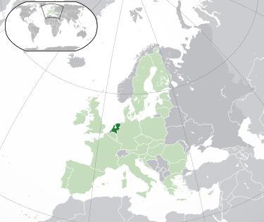
1 IOUG Spatial Summit 2016 Assembling a large scale map for the Netherlands Speaker : Date : Richard Huesken January 28 th, 2016 richard.huesken@transfer-solutions.com


2 BRAVO Transfer-Solutions OVERVIEW Customer : SVB-BGT The organization that is responsible for assembling a large scale map database for the Netherlands CHALLENGES / OPPORTUNITIES Establish a countrywide topology of skin of the earth objects Automated data assembly Assemble geographic data from > 450 sources 100M Objects Use of circular arcs SOLUTIONS Oracle Database 12c Enterprise Edition Spatial and Graph Option Spatial Vector Acceleration enabled Partitioning RESULTS - Single dataset for large scale map data Usage 1:500 1:5000 Countrywide Collect data once, use many times Topologically correct dataset Automated data assembly with minimal user effort.

3 3 Introduction

4 4 Introduction Transfer Solutions Oracle Gold Partner Largest independent Oracle partner in the Netherlands Focus on Oracle and Java technology Consulting Managed services Education

5 5 Assembling a large scale map Large scale map data Scale 1:500 1:5000 Business case Requirements Solution Results Recommendations
6 6 Business Case Current problems Collected by different organizations Separate datasets Different storage formats Different object types Different definitions Data has been collected at different points in time Data is collected with different quality standards

7 7 Business Case Separate datasets

8 8 Business Case Separate datasets


9 9 Business Case BGT Objectives Single dataset, 2D, countrywide Shared data Collected once, used many times Uniform definition of objects Requirements Automated data assembly Topologically correct
10 10 Business Case BGT Country wide Area : 41,453 km 2 (currently: 5,213 km 2 ) Land : 33,893 km 2 Water : 7,650 km 2 BGT estimates 100,000,000 objects Source data providers 450 organizations Implementation Required by Law

11 11 Business Case BGT Process 1.Source data providers Towns Counties MoT MoD 5.Users Provide feedback 4.PDOK Geo Data Distribution Portal 2.SVB-BGT Assemble 2 data, Serialize changes 3.Cadastre Keep registration, History of changes

12 12 BGT Automated Data Assembly
13 13 BGT Before Assembly

14 14 BGT After Automated Assembly

15 15 BGT After Automated Assembly
16 Requirements - BGT Specification GML Simple features profile Extended with circular arcs (GM_ARC) Ordinates rounded to 3 decimals ( mm grid ) Topology Adjacent objects share coordinates Technical tolerance Minimum distance from point to a line. Set to m ( 1/2 mm)
17 17 Automated Assembly - Solution Phase 1: Geometric approach Eliminate gaps and overlaps Stroke arcs selectively Phase 2: Topological finish Locate missing vertices (nodes) Add missing nodes Replace arcs
18 18 Geometric approach mm grid Object B Low Quality Object A High Quality
19 19 mm grid sdo_difference Object B Low Quality Object A High Quality
20 20 mm grid align object B Object B Low Quality Object A High Quality
21 21 mm grid add collinear points to object A Object B Low Quality Object A High Quality
22 22 mm grid align both objects Object B Low Quality Object A High Quality
23 23 Spatial Vector Acceleration (SVA) New feature in 12c New code path for spatial operations Performance improvements SVA optimizes sdo_geometry Consecutive segments may be combined Order of segments is not maintained Collinear points are removed

24 24 Geometric approach - arcs

25 25 Arcs - overlap
26 26 Arcs middle points

27 27 Arcs stroke arcs selectively

28 28 Arcs final result
29 29 Automated Assembly - Solution Phase 1: Geometric approach Eliminate gaps and overlaps Stroke selected arcs Phase 2: Topological finish Locate missing vertices (nodes) Add missing vertices Replace arcs

30 30 Locate missing nodes

31 31 Missing nodes - example

32 32 Missing nodes - detail

33 33 Missing nodes add node (vertex)

34 34 Replace Arc example

35 35 Replace Arc detail
36 36 Replace Arc result
37 37 Results A topologically correct dataset Arcs are preserved wherever possible 99.99% Automatic resolution in the first run Datasets with exceptions are rejected. A few objects are adjusted manually The data is processed successfully in a second run.
38 38 Recommendations Technical Use Oracle Spatial & Graph 12c Use Spatial Vector Acceleration (SVA), with caution Use Partitioning Functional Circular arcs are complicated Use the simple features profile without arcs
39 Questions Answers CONSULTING MANAGED SERVICES EDUCATION
US Census Bureau Geographic Support System Initiative Partnership Program
 OVERVIEW Centrally managed, authoritative database (MAF/TIGER) Centrally managed Partnership Program SDE geodatabase Supports all censuses and surveys CHALLENGES / OPPORTUNITIES Need for centralized repository
Oracle 10g GeoSpatial Technologies. Eve Kleiman Asia/Pacific Spatial Product Manager Oracle Corporation
 Oracle 10g GeoSpatial Technologies Eve Kleiman Asia/Pacific Spatial Product Manager Oracle Corporation Eve.Kleiman@oracle.com Agenda Market and Technology Trends Oracle GeoSpatial Technology Stack What
Oracle Spatial Summit 2015 Best Practices for Developing Geospatial Apps for the Cloud
 Oracle Spatial Summit 2015 Best Practices for Developing Geospatial Apps for the Cloud Nick Salem, Distinguished Engineer Neustar Neustar ElementOne OVERVIEW Comprehensive cloud based GIS analytics platform
Review of Cartographic Data Types and Data Models
 Review of Cartographic Data Types and Data Models GIS Data Models Raster Versus Vector in GIS Analysis Fundamental element used to represent spatial features: Raster: pixel or grid cell. Vector: x,y coordinate
Questionnaire 3D-Cadastres: status November 2010
 Questionnaire 3D-Cadastres: status vember 2010 France This questionnaire is an activity of the FIG working group 3D-Cadastres 2010-2014. The purpose of the survey is to make a world-wide inventory of the
Questionnaire 3D-Cadastres: status November 2010
 Questionnaire 3D-Cadastres: status vember This questionnaire is an activity of the FIG working group 3D-Cadastres -. The purpose of the survey is to make a world-wide inventory of the status of 3D-Cadastres
GEO Update and Priorities for 2014
 GEO Update and Priorities for 2014 Osamu Ochiai GEO Secretariat 37 th CEOS WGCV Plenary Frascati, 17-20 Feb 2014 GEO Secretariat Ministerial Summit, Geneva Jan 17 th 2014 Highest number of participants
Anton van Wyk 1Spatial Australia Pty ltd Country Manager Spatial Data Infrastructure
 Anton van Wyk 1Spatial Australia Pty ltd Country Manager Anton.vanWyk@1spatial.com Spatial Data Infrastructure Industry Sectors Transportation Spatial Data Infrastructure Telecommunications Utilities Mapping
Introduction to IOUG Calgary Oracle Users Group Meeting 2012
 Introduction to IOUG Calgary Oracle Users Group Meeting 2012 Why IOUG? IOUG represents the voice of 20,000 Oracle technology and database professionals Access the right network. IOUG members are engaged
DEVELOPING A NEW GEOGRAPHICAL OBJECT DATABASE. EXPERIENCES FROM IDEA TO DELIVERING DATASETS TOP10NL
 DEVELOPING A NEW GEOGRAPHICAL OBJECT DATABASE. EXPERIENCES FROM IDEA TO DELIVERING DATASETS TOP10NL NICO J. BAKKER Topografische Dienst Kadaster Bendienplein 5 7815 SM Emmen, The Netherlands nbakker@tdkadaster.nl
4/7/2009. Model: Abstraction of reality following formal rules e.g. Euclidean space for physical space
 Model: Abstraction of reality following formal rules e.g. Euclidean space for physical space At different levels: mathematical model (Euclidean space) conceptual design model (ER model) data model (design)
The Quality Of 3D Models
 The Quality Of 3D Models Problems and Solutions for Applications Post-Design Fathi El-Yafi Senior Product Engineer Product Department of EXA Corporation 1 : Overview Status Problems Identified Defect Sources
Earth Observation Imperative
 Gregory W. Withee United States Geological Survey (USGS) United States Group on Earth Observation (USGEO) update NRC Board on Research Data and Information January 29, 2009 1 Earth Observation Imperative
Standardized Data Modeling and its Benefits
 Michael GERMANN infogrips LTD, Technoparkstrasse 1, 8005, Zürich, Switzerland michael.germann@infogrips.ch Key words: Data Modeling, MDA, INTERLIS SUMMARY The Swiss Federal Act on Geoinformation [1] caused
Chapter 3. Sukhwinder Singh
 Chapter 3 Sukhwinder Singh PIXEL ADDRESSING AND OBJECT GEOMETRY Object descriptions are given in a world reference frame, chosen to suit a particular application, and input world coordinates are ultimately
Algorithms for GIS csci3225
 Algorithms for GIS csci3225 Laura Toma Bowdoin College Spatial data types and models Spatial data in GIS satellite imagery planar maps surfaces networks point cloud (LiDAR) Spatial data in GIS satellite
THE TOOLS OF AUTOMATED GENERALIZATION AND BUILDING GENERALIZATION IN AN ArcGIS ENVIRONMENT
 Vol. XIX, 2011, No. 1, 1 7, DOI: 10.2478/v10189-011-0001-4 V. DROPPOVÁ THE TOOLS OF AUTOMATED GENERALIZATION AND BUILDING GENERALIZATION IN AN ArcGIS ENVIRONMENT Veronika Droppová email: veronika.droppova@gmail.com
Prime2 Data Re-engineering timelines
 Prime2 Data Re-engineering timelines Jun 2007 Nov 2007 May 2008 Sept 2008 May 2009 Sep 2009 Mar 2010 Dec 2010 Aug 2011 Nov 2011 Dec 2012 Feb 2013 Sept 2013 Apr 2014 Development of Conceptual Data Model
Land Information Management and its (3D) Database Foundation
 Database Foundation") Land Information Management and its (3D) Database Foundation Han Wammes, Oracle Netherlands November 18 th, 2011 1 Copyright 2011, Oracle and/or its affiliates. All rights Safe Harbor Statement The following
Land Information Management and its (3D) Database Foundation Han Wammes, Oracle Netherlands November 18 th, 2011 1 Copyright 2011, Oracle and/or its affiliates. All rights Safe Harbor Statement The following
Topology in spatial DBMSs
 Topology in spatial DBMSs Wilko Quak, Jantien Stoter and Theo Tijssen Department of Geodesy, Faculty of Civil Engineering and Geosciences Delft University of Technology, The Netherlands Telephone: +31
Application of Advanced Topological Rules in the Process of Building Geographical Databases Supporting the Valuation of Real Estates
 Application of Advanced Topological Rules in the Process of Building Geographical Databases Supporting the Piotr CICHOCI SKI, Poland Key words: topological rules, conflation, real estate, mass appraisal,
ArcGIS 9.2 Works as a Complete System
 ArcGIS 9.2 Works as a Complete System A New Way to Manage and Disseminate Geographic Knowledge Author/Serve/Use Maps Data Models Globes Metadata Use Desktop Explorer Web Map Viewer Mobile Open APIs Enterprise
Introduction to GIS. Geographic Information Systems SOCR-377 9/24/2015. R. Khosla Fall Semester The real world. What in the world is GIS?
 Introduction to GIS Geographic Information Systems SOCR-377 What in the world is GIS? GIS is simultaneously the telescope, the microscope, the computer and the Xerox machine of regional analysis and synthesis
ArcSDE Performance Tips
 ArcSDE Performance Tips Welcome Mansour Raad (mraad@esri.com) Rent-a-Tech Design/Implement Enterprise Solutions ARCIMS Developer Technology Integrator Outline Quick what is ArcSDE? False X/Y and System
May 2013 Oracle Spatial and Graph User Conference
 May 2013 Oracle Spatial and Graph User Conference May 22, 2013 Ronald Reagan Building and International Trade Center Washington, DC USA Paul Calhoun & Vince Smith GIS Systems Analyst City Of Virginia Beach
GEO-SPATIAL METADATA SERVICES ISRO S INITIATIVE
 GEO-SPATIAL METADATA SERVICES ISRO S INITIATIVE Pushpalata B Shah, Navita J Thakkar Space Applications Centre (ISRO) Ahmedabad 380 015 - pushpa@sac.isro.gov.in Commission IV, Working Group IV/5 KEYWORDS:
Welcome to NR402 GIS Applications in Natural Resources. This course consists of 9 lessons, including Power point presentations, demonstrations,
 Welcome to NR402 GIS Applications in Natural Resources. This course consists of 9 lessons, including Power point presentations, demonstrations, readings, and hands on GIS lab exercises. Following the last
Definition DQ measure / description Evaluation scope Applicable to spatial representation types
 DRAFT DATA QUALITY CHECKLIST drafted: 17 January 2018, Monaco for DQWG-13 Author: R. Broekman (DQWG-Chair) This list is derived from ISO 19157. Definitions and descriptions are a direct copy of ISO-19157.
Presented by Kit Na Goh
 Developing A Geo-Spatial Search Tool Using A Relational Database Implementation of the FGDC CSDGM Model Presented by Kit Na Goh Introduction Executive Order 12906 was issued on April 13, 1994 with the
May 21, 2014 Walter E. Washington Convention Center Washington, DC USA. Copyright 2014, Oracle and/or its affiliates. All rights reserved.
 May 21, 2014 Walter E. Washington Convention Center Washington, DC USA 1 How to Build a Better GIS Application Siva Ravada Senior Director of Development Spatial and Graph & MapViewer Oracle Program Agenda
4.0 DIGITIZATION, EDITING AND STRUCTURING OF MAP DATA
 .0 DIGITIZATION, EDITING AND STRUCTURING OF MAP DATA The process of digitizing existing maps is a transformation from one analog) form of information to another digital) form. Data input is the operation
M. Andrea Rodríguez-Tastets. I Semester 2008
 M. -Tastets Universidad de Concepción,Chile andrea@udec.cl I Semester 2008 Outline refers to data with a location on the Earth s surface. Examples Census data Administrative boundaries of a country, state
Municipal Parcel Mapping Workshop
 Municipal Parcel Mapping Workshop Presented to: Ontario Municipalities Presented by: Dave Gariepy, Director of Platform Content Dave Horwood, Land Information Systems Architect Sarah Sibbett, Senior Parcel
v SMS 13.0 Tutorial GIS P Prerequisites Time Requirements Objectives
 v. 13.0 SMS 13.0 Tutorial Objectives This tutorial demonstrates how to import data, visualize it, and convert it into SMS coverage data that could be used to build a numeric model. This tutorial will instruct
A CONSISTENCY MAINTENANCE OF SHARED BOUNDARY AFTER POLYGON GENERALIZATION
 CO-182 A CONSISTENCY MAINTENANCE OF SHARED BOUNDARY AFTER POLYGON GENERALIZATION AI T.(1), ZHANG W.(2) (1) Wuhan University, WUHAN CITY, CHINA ; (2) Zhongnan University of Economics and Law, WUHAN CITY,
Oracle Big Data Spatial and Graph: Spatial Features
 Oracle Big Data Spatial and Graph: Spatial Features January 28 th, 2016 Siva Ravada Senior Director of Development Copyright 2015, Oracle and/or its affiliates. All rights reserved. Program Agenda 1 2
Oracle Spatial Summit
 Oracle Spatial Summit 2015 Oracle Spatial 12c as an Applied Science for Solving Today's Real-World Engineering Problems Tracy McLane, GIS Manager Bechtel Infrastructure Speaker Bio Tracy McLane is currently
May 21, 2014 Walter E. Washington Convention Center Washington, DC USA. Copyright 2014, Oracle and/or its affiliates. All rights reserved.
 May 21, 2014 Walter E. Washington Convention Center Washington, DC USA 1 Innovation in Spatial Data Processing Hans Viehmann Product Manager EMEA The following is intended to outline our general product
ENGRG 59910: Introduction to GIS
 ENGRG 59910: Introduction to GIS Lecture 05: GIS and Databases Basics Acknowledgment: Michael Piasecki Where are we now? Basic geographic concepts Introduction to GIS, coordinate system, projection, datum
Computational Geometry Algorithms Library. Geographic information Systems
 Computational Geometry Algorithms Library in Geographic information Systems Edward Verbree, Peter van Oosterom and Wilko Quak TU Delft, Department of Geodesy, Thijsseweg 11, 2629 JA Delft, the Netherlands
LOCAL STREETS AND THE ARNOLD INITIATIVE
 LOCAL STREETS AND THE ARNOLD INITIATIVE Jenn Sylvester, Mapping Branch Team Lead Transportation Planning & Programming Division (TPP) GIS-T Symposium Des Moines, IA Key Terms 1 2 3 ARNOLD FC Streets Local
History in Spatial Databases
 History in Spatial Databases Henri J.G.L. Aalders Delft University of Technology, Department of Geodesy, the Netherlands Katholieke University Leuven, Faculty of Applied Sciences, Belgium Phone: 00-31-15-278
Using the constrained tgap for generalisation of IMGeo to Top10NL model
 Using the constrained tgap for generalisation of IMGeo to Top10NL model Arjen Hofman 1, Arta Dilo 2, Peter van Oosterom 2, Nicole Borkens 3 1 Logica Nederland B.V., Geo ICT Public Sector, Laan van Zuid
Technology for Cadastral Applications. John R. Hacker, Jr. Marketing Manager Geospatial Applications
 Technology for Cadastral Applications John R. Hacker, Jr. Marketing Manager Geospatial Applications Agenda Cadastral Mapping Issues Precision and Accuracy Data Creation Data Management Data Publishing
ReGIS. A Regional Geographic Information Systems (GIS) Initiative
 Initiative") ReGIS A Regional Geographic Information Systems (GIS) Initiative The Chesapeake Science and Security Corridor (CSSC) Established to help communities surrounding the Aberdeen Providing Ground prepare for
ReGIS A Regional Geographic Information Systems (GIS) Initiative The Chesapeake Science and Security Corridor (CSSC) Established to help communities surrounding the Aberdeen Providing Ground prepare for
4. If you are prompted to enable hardware acceleration to improve performance, click
 Exercise 1a: Creating new points ArcGIS 10 Complexity: Beginner Data Requirement: ArcGIS Tutorial Data Setup About creating new points In this exercise, you will use an aerial photograph to create a new
layers in a raster model
 layers in a raster model Layer 1 Layer 2 layers in an vector-based model (1) Layer 2 Layer 1 layers in an vector-based model (2) raster versus vector data model Raster model Vector model Simple data structure
Registration of 3D Spatial Objects for 3D Cadastre
 Registration of 3D Spatial Objects for 3D Cadastre Mohd Hasif Ahmad Nasruddin and Alias Abdul Rahman Departments of Geoinformatics, Faculty of Geoinformation Science and Engineering, Universiti Teknologi
The federal geo-platform:
 The federal geo-platform: Targeting the statistical community Nathalie Delattre (IGN Belgium), Pierre Jamagne (Statistics Belgium), Ann Crabbé (KULeuven/SADL) INSPIRE Conference, Strasbourg 6-8 septembre
Publishing Statistical Data and Geospatial Data as Linked Data Creating a Semantic Data Platform
 Publishing Statistical Data and Geospatial Data as Linked Data Creating a Semantic Data Platform Hans Viehmann Product Manager EMEA ORACLE Corporation January 22, 2017 @SpatialHannes Safe Harbor Statement
Chapter 9. Attribute joins
 Chapter 9 Spatial Joins 9-1 Copyright McGraw-Hill Education. Permission required for reproduction or display. Attribute joins Recall that Attribute joins: involve combining two attribute tables together
RESOURCE ATLAS OVER THE WEB: PRELIMINARY RESULTS
 DISSEMINATION OF THE UAE SOLAR RESOURCE ATLAS OVER THE WEB: PRELIMINARY RESULTS and Research Center for Renewable Energy Mapping and Assessment Masdar Institute of Science and Technology, Abu Dhabi, United
2017 USER SURVEY EXECUTIVE SUMMARY
 2017 USER SURVEY EXECUTIVE SUMMARY INTRODUCTION Survey methodology 2017 NODE.JS USER SURVEY The primary objective of the research was to profile Node.js users, understand usage patterns and trends and
Distributed Algorithms. Partha Sarathi Mandal Department of Mathematics IIT Guwahati
 Distributed Algorithms Partha Sarathi Mandal Department of Mathematics IIT Guwahati Thanks to Dr. Sukumar Ghosh for the slides Distributed Algorithms Distributed algorithms for various graph theoretic
Lecture 6: GIS Spatial Analysis. GE 118: INTRODUCTION TO GIS Engr. Meriam M. Santillan Caraga State University
 Lecture 6: GIS Spatial Analysis GE 118: INTRODUCTION TO GIS Engr. Meriam M. Santillan Caraga State University 1 Spatial Data It can be most simply defined as information that describes the distribution
System Requirements. SAS Profitability Management 2.3. Deployment Options. Supported Operating Systems and Versions. Windows Server Operating Systems
 SAS Profitability Management 2.3 This document provides the requirements for installing and running SAS Profitability Management. This document has been updated for the first maintenance release of SAS
Introduction to Geographic Information Science. Some Updates. Last Lecture 4/6/2017. Geography 4103 / Raster Data and Tesselations.
 Geography 43 / 3 Introduction to Geographic Information Science Raster Data and Tesselations Schedule Some Updates Last Lecture We finished DBMS and learned about storage of data in complex databases Relational
Sensor networks. Ericsson
 Sensor networks IoT @ Ericsson NETWORKS Media IT Industries Page 2 Ericsson at a glance Organization & employees CEO Börje Ekholm Technology & Emerging Business Finance & Common Functions Marketing & Communications
Use of open-source GIS for the preprocessing of distributed hydrological. models
 Use of open-source GIS for the preprocessing of distributed hydrological models F. Branger, I. Braud, S. Debionne, J. Dehotin, S. Jankowfsky, O. Vannier, P. Viallet Who are we? Cemagref Hydrology-Hydraulics
Streamlining Editing Workflows. Amber Bethell
 Streamlining Editing Workflows Amber Bethell Workflow for solving geographic problems Ask a question Create or acquire data Validate and update data Analyze data Create cartographic product Act upon knowledge
Application of the Catalogue and Validator tools in the context of Inspire Alberto Belussi, Jody Marca, Mauro Negri, Giuseppe Pelagatti
 Application of the Catalogue and Validator tools in the context of Inspire Alberto Belussi, Jody Marca, Mauro Negri, Giuseppe Pelagatti Politecnico di Milano giuseppe.pelagatti@polimi.it spatialdbgroup.polimi.it
Towards a 3D cadastre: where do cadastral needs and technical possibilities meet?
 Computers, Environment and Urban Systems 27 (2003) 395 410 www.elsevier.com/locate/compenvurbsys Towards a 3D cadastre: where do cadastral needs and technical possibilities meet? Jantien Stoter a, *, Martin
Next GEOSS der neue europäische GEOSS Hub
 DLR.de Folie 1 27.10.2016, Oberpfaffenhofen Next GEOSS der neue europäische GEOSS Hub J. Meyer-Arnek, A. Müller, G. Schreier DLR.de Folie 2 NextGEOSS-Konsortium Kick-Off: 16-18 JAN 2017 Project duration:
Keywords: 3D-GIS, R-Tree, Progressive Data Transfer.
 3D Cadastres 3D Data Model Visualisation 3D-GIS IN NETWORKING ENVIRONMENTS VOLKER COORS Fraunhofer Institute for Computer Graphics Germany ABSTRACT In this paper, we present a data model for 3D geometry
The Existing Legal Cadastre in Israel Introduced in 1928 Based on Torrens principles (Registration of Title) Two-Dimensional Surface properties Owners
 Two-Dimensional Surface properties Owners") 3D Cadastre GIS Geometry, Topology and other Technical Considerations Presented by Moshe Benhamu & Shay Cherutil Written by: Nurit Peres & Moshe Benhamu FIG Working Week, May 07, 2009, Eilat Agenda Introduction
3D Cadastre GIS Geometry, Topology and other Technical Considerations Presented by Moshe Benhamu & Shay Cherutil Written by: Nurit Peres & Moshe Benhamu FIG Working Week, May 07, 2009, Eilat Agenda Introduction
BASIC MATHEMATICS FOR CADASTRAL MAPPING
 BASIC MATHEMATICS FOR CADASTRAL MAPPING Chapter 5 2015 Cadastral Mapping Manual 5-1 Introduction Data which a mapper must use to solve problems comes from a myriad of sources both new and old. The general
MAPSITE - INTERNET MAP SERVICE OF THE NATIONAL LAND SURVEY OF FINLAND GETS DRESSED IN MODERN TECHNOLOGY
 MAPSITE - INTERNET MAP SERVICE OF THE NATIONAL LAND SURVEY OF FINLAND GETS DRESSED IN MODERN TECHNOLOGY Pätynen, V. National Land Survey of Finland, Development Centre, Opastinsilta 12 C, P.O.Box 84, FIN-00521
Object modeling and geodatabases. GEOG 419: Advanced GIS
 Object modeling and geodatabases GEOG 419: Advanced GIS CAD Data Model 1960s and 1970s Geographic data stored as points, lines, and areas No attributes; each feature type stored on a different layer No
Determining Differences between Two Sets of Polygons
 Determining Differences between Two Sets of Polygons MATEJ GOMBOŠI, BORUT ŽALIK Institute for Computer Science Faculty of Electrical Engineering and Computer Science, University of Maribor Smetanova 7,
Capturing Reality with Point Clouds: Applications, Challenges and Solutions
 Capturing Reality with Point Clouds: Applications, Challenges and Solutions Rico Richter 1 st February 2017 Oracle Spatial Summit at BIWA 2017 Hasso Plattner Institute Point Cloud Analytics and Visualization
BEST PRACTICES FOR DEVELOPING GEOSPATIAL BIG DATA APPS FOR THE CLOUD. Nick Salem - Distinguished Engineer David Tatar - Principal Software Engineer
 BEST PRACTICES FOR DEVELOPING GEOSPATIAL BIG DATA APPS FOR THE CLOUD Nick Salem - Distinguished Engineer David Tatar - Principal Software Engineer SPEAKER BIO NICK SALEM 18 Oracle Certified Professional
What's New in ArcGIS 9.2 Service Packs
 What's New in ArcGIS 9.2 Service Packs 18 July 2007 Updated for Service Pack 3 This document describes the main enhancements to 9.2 added by the service packs. It does not cover the bug fixes and quality
Oracle. Oracle Spatial 11g Essentials. 1z Version: Demo. [ Total Questions: 10] Web:
![Oracle. Oracle Spatial 11g Essentials. 1z Version: Demo. [ Total Questions: 10] Web:](/thumbs/90/101573895.jpg "Oracle. Oracle Spatial 11g Essentials. 1z Version: Demo. [ Total Questions: 10] Web:") Oracle 1z0-595 Oracle Spatial 11g Essentials Version: Demo [ Total Questions: 10] Web: www.myexamcollection.com Email: support@myexamcollection.com IMPORTANT NOTICE Feedback We have developed quality product
Oracle 1z0-595 Oracle Spatial 11g Essentials Version: Demo [ Total Questions: 10] Web: www.myexamcollection.com Email: support@myexamcollection.com IMPORTANT NOTICE Feedback We have developed quality product
Visualizing Data Using Maps in OBI 11g
 Copyright 2010, Vlamis Software Solutions, Inc. Visualizing Data Using Maps in OBI 11g Collaborate 2011 Tim Vlamis Vlamis Software Solutions 816-781-2880 http://www.vlamis.com Copyright 2010, Vlamis Software
The GIS Spatial Data Model
 The GIS Spatial Data Model Introduction: Spatial data are what drive a GIS. Every piece of functionality that makes a GIS separate from another analytical environment is rooted in the spatially explicit
GUIDE TO SERVICES. For G-Log Customers and Partners
 GUIDE TO SERVICES For G-Log Customers and Partners Welcome. We re proud to have you as our new customers and partners. We look forward to serving you by continuing to support your G-Log investments. For
Understanding and Using Geometry, Projections, and Spatial Reference Systems in ArcGIS. Rob Juergens, Melita Kennedy, Annette Locke
 Understanding and Using Geometry, Projections, and Spatial Reference Systems in ArcGIS Rob Juergens, Melita Kennedy, Annette Locke Introduction We want to give you a basic understanding of geometry and
INSPIRE & Environment Data in the EU
 INSPIRE & Environment Data in the EU Andrea Perego Research Data infrastructures for Environmental related Societal Challenges Workshop @ pre-rda P6 Workshops, Paris 22 September 2015 INSPIRE in a nutshell
Copernicus Space Component. Technical Collaborative Arrangement. between ESA. and. Enterprise Estonia
 Copernicus Space Component Technical Collaborative Arrangement between ESA and Enterprise Estonia 2 Table of Contents 1 INTRODUCTION... 4 1.1 Purpose and objectives... 4 1.2 Scope... 5 1.3 References...
Obtaining Personal Figure Mannequin Using Two Photographs for Three-Dimensional Corsetry Design
 Obtaining Personal Figure Mannequin Using Two Photographs for Three-Dimensional Corsetry Design Nadezhda KORNILOVA 1, Anna GORELOVA 1,2, Dmitry VASILYEV 2 1 Ivanovo State Polytechnic University, Ivanovo,
How to calculate population and jobs within ½ mile radius of site
 How to calculate population and jobs within ½ mile radius of site Caltrans Project P359, Trip Generation Rates for Transportation Impact Analyses of Smart Growth Land Use Projects SECTION PAGE Population
GOVERNMENT GAZETTE REPUBLIC OF NAMIBIA
 GOVERNMENT GAZETTE OF THE REPUBLIC OF NAMIBIA N$7.20 WINDHOEK - 7 October 2016 No. 6145 CONTENTS Page GENERAL NOTICE No. 406 Namibia Statistics Agency: Data quality standard for the purchase, capture,
Storing And Using Multi-Scale Topological Data Efficiently In A Client-Server DBMS Environment
 Storing And Using Multi-Scale Topological Data Efficiently In A Client-Server DBMS Environment MAARTEN VERMEIJ, PETER VAN OOSTEROM, WILKO QUAK AND THEO TIJSSEN. Faculty of Civil Engineering and Geosciences,
Using Linked Data Concepts to Blend and Analyze Geospatial and Statistical Data Creating a Semantic Data Platform
 Using Linked Data Concepts to Blend and Analyze Geospatial and Statistical Data Creating a Semantic Data Platform Hans Viehmann Product Manager EMEA ORACLE Corporation October 17, 2018 @SpatialHannes Safe
SPACE for SDGs a Global Partnership
 SPACE for SDGs a Global Partnership for the Coordination of the Development, Operation and Utilization of Space related Infrastructure, Data, Information and Services in support of the 2030 Development
ArcGIS Pro Editing. Jennifer Cadkin & Phil Sanchez
 ArcGIS Pro Editing Jennifer Cadkin & Phil Sanchez ArcGIS Pro Editing Overview Provides tools that allow you to maintain, update, and create new data - Modifying geometry, drawing new features - Entering
Schema transformations in mass data harmonization process. Yohann Ly 8/9 Octobre 2013 Marne la Vallée
 Schema transformations in mass data harmonization process Yohann Ly 8/9 Octobre 2013 Marne la Vallée Mass data harmonization process Problematic : Multiple data providers Multiple storage format Multiple
Esri Support for Geospatial Standards: OGC and ISO/TC211. An Esri White Paper May 2015
 Esri Support for Geospatial Standards: OGC and ISO/TC211 An Esri White Paper May 2015 Copyright 2015 Esri All rights reserved. Printed in the United States of America. The information contained in this
Service Oriented Architecture
 Service Oriented Architecture Web Services Security and Management Web Services for non-traditional Types of Data What are Web Services? Applications that accept XML-formatted requests from other systems
4 th Working Group on Geospatial Information
 4 th Working Group on Geospatial Information Session 5: Contributing to the Work of the Custodian Agencies United Nations Headquarters December 6-8, 2017 Argyro Kavvada, NASA - BAH & EO4SDG Exec. Sec.
2011 Bentley Systems, Incorporated. Bentley Descartes V8i Advancing Information Modeling For Intelligent Infrastructure
 Bentley Descartes V8i Advancing Information Modeling For Intelligent Infrastructure Agenda Why would you need Bentley Descartes? What is Bentley Descartes? Advanced Point Cloud Workflows Advanced Terrain
GIS IN ECOLOGY: CREATING RESEARCH MAPS
 GIS IN ECOLOGY: CREATING RESEARCH MAPS Contents Introduction... 2 Elements of Cartography... 2 Course Data Sources... 3 Tasks... 3 Establishing the Map Document... 3 Laying Out the Map... 5 Exporting Your
Oracle Spatial 10g: Platform for Enterprise Geospatial Solutions
 11/30/2005-8:00 am - 9:30 am Room:Macaw 1/2 (Swan) Walt Disney World Swan and Dolphin Resort Orlando, Florida Oracle Spatial 10g: Platform for Enterprise Geospatial Solutions Xavier Lopez - Oracle USA,
PA Department of Environmental Protection. Guidance for Data Management
 PA Department of Environmental Protection Guidance for Data Management September 13, 2005 Prepared for Integration with DEP Grant Guidance PA Department of Environmental Protection Information Access Strategy
International Organization for Standardization Technical Committee 211 (ISO/TC211)
") Esri Support for Geospatial Standards: Open Geospatial Consortium (OGC) International Organization for Standardization Technical Committee 211 (ISO/TC211) An Esri White Paper April 2015 Copyright 2015
Esri Support for Geospatial Standards: Open Geospatial Consortium (OGC) International Organization for Standardization Technical Committee 211 (ISO/TC211) An Esri White Paper April 2015 Copyright 2015
Algorithms for GIS. Spatial data: Models and representation (part I) Laura Toma. Bowdoin College
 Laura Toma. Bowdoin College") Algorithms for GIS Spatial data: Models and representation (part I) Laura Toma Bowdoin College Outline Spatial data in GIS applications Point data Networks Terrains Planar maps and meshes Data structures
Algorithms for GIS Spatial data: Models and representation (part I) Laura Toma Bowdoin College Outline Spatial data in GIS applications Point data Networks Terrains Planar maps and meshes Data structures
Objectives This tutorial demonstrates how to use feature objects points, arcs and polygons to make grid independent conceptual models.
 v. 9.0 GMS 9.0 Tutorial Use points, arcs and polygons to make grid independent conceptual models Objectives This tutorial demonstrates how to use feature objects points, arcs and polygons to make grid
Section 2-2 Frequency Distributions. Copyright 2010, 2007, 2004 Pearson Education, Inc
 Section 2-2 Frequency Distributions Copyright 2010, 2007, 2004 Pearson Education, Inc. 2.1-1 Frequency Distribution Frequency Distribution (or Frequency Table) It shows how a data set is partitioned among
v SMS 12.3 Tutorial GIS P Prerequisites Time Requirements Objectives
 v. 12.3 SMS 12.3 Tutorial Objectives This tutorial demonstrates how to import data, visualize it, and convert it into SMS coverage data that could be used to build a numeric model. This tutorial will instruct
MANAGEMENT AND 3D VISUALIZATION OF PIPELINE NETWORKS USING DBMS AND AEC SOFTWARE
 MANAGEMENT AND 3D VISUALIZATION OF PIPELINE NETWORKS USING DBMS AND AEC SOFTWARE Yunqiang Du 1, Sisi Zlatanova 2 and Xianglin Liu 3 1 The urban planning bureau of Yibing city, Sichuan Province, P.R.China