Towards Automating Spatial Data Quality Evaluation in the Finnish National Topographic Database
|
|
|
- Alan Harrison
- 5 years ago
- Views:
Transcription

1 Towards Automating Spatial Data Quality Evaluation in the Finnish National Topographic Database SDQ 2018: International Workshop on Spatial Data Quality Wednesday 7th February 2018 Nils Mesterton and Riikka Kivekäs, National Land Survey of Finland 1

2 Content Introduction to National Topographic Database (NTDB) in Finland Quality rules Technical architecture and implementation Case Tampere: Buildings from city to NTDB Any questions? 2
3 Towards National Topographic Database in Finland Brief introduction to the National Topographic Database 3

4 Present State National Land Survey of Finland maintains the topographic database. All ~300 municipalities have their own topographic data. Topographic data is stored and maintained in silos by numerous organisations. Overlapping work: Updates must be made in several places. 4

5 What Are We Aiming At? Basic topographic data in one place Buildings, transport network, hydrography, land cover, elevation Distributed data collection and maintenance Reduced amount of overlapping work Updates in real time Quality check before publication Reduced amount of quality issues Harmonization through synchronized requirements 5

6 What Makes The New NTDB Better? Open data Analysis of spatial data Utilization in decision making Reduced costs Data is collected only once And maintained in one place History management Persistent IDs Versions Moving to an entirely new dimension: 2D -> 3D 6


7 Who are involved in the project? Governmental organizations Municipalities Other organizations Metsätieto
8 Quality Rules in the National Topographic Database 8
9 NTDB Quality Rules Built on what was learned in ELF and ESDIN projects Automatically testable rules regarding logical consistency Rules are basically definitions of what can be wrong with the data RuleSpeak provides structure and consistency for definitions Each NTDB theme gets their own set of quality rules Buildings theme is nearly done Addresses will be next 9
10 Conjuring Quality Rules for NTDB Process started with attempting to extract requirements from available sources Feature descriptions of the existing TDB INSPIRE Data Specifications International standards, e.g. OGC Simple Features, ISO Data Quality These requirements were baked into initial quality rules NTDB specifications have been applied on the next iterations Specs are still in a state of development Yes, it s definitely a challenge 10
11 What We Ended Up With Rules/Quality Element 8 re-usable rule types ~50 rules for the Buildings theme Severity levels: WARNING and ERROR In other words Topological consistency Format consistency Domain consistency Conceptual consistency 11

12 12
13 What Shall NOT PASS Most issues regarding topological consistency Invalid and empty geometries Overlapping buildings and building parts PASS Most issues regarding domain and format consistency Floor number must be between 1 and 100 Area in meters must be presented using the numeric data type 13
14 Technical Architecture and Implementation 14
15 Users Municipalities File upload WFS «FME Server» Upload Service «EDB Postgres» Intermediate DB «Java» Lifespan Service NLS MTKGML If quality OK Status page, quality report Reporting Service «FME Server» QualityGuard «EDB Postgres» NTDB Upload options: File upload via a UI Timed WFS download Timed processing of TDB exchange format Process: 1. Data upload is iniated via a UI or automatically. 2. Upload service transforms data to the NTDB schema and inserts transformed features to an intermediate database. Format consistency is validated during this phase. 3. QualityGuard performs topological, conceptual and domain consistency validation. 4. Lifespan Service provides fresh identifiers to modified features if the change is significant enough 5. Data is inserted to the NTDB 6. Validation results and upload statistics are delivered to the user via the Reporting Service
16 QualityGuard FME software implementation Validation workflow and logic Error dataset generation PostgreSQL database as a data and configuration store Quality Rule Bank Quality rules Rule types Rule sets and user interface (soon ) 16
17 Reporting Service Reporting service is basically a web page that shows the status and statistics of each session Modifications error locations can be observed on a map Users can download an error dataset for their sessions 17
18 DQ Error Dataset Rule ID Quality element An original ID of the feature, if available Short description of the issue Point geometry indicating: Location of geometry errors, e.g. self intersections and spikes A generic location of a conflicting feature for attribute-related errors 18

19 Implementation Plans, soon Mechanism for chaining rule types (AND/OR) Rule sets Rules for validating 3D solids User interface for defining rules and rule sets for different themes and feature classes 19
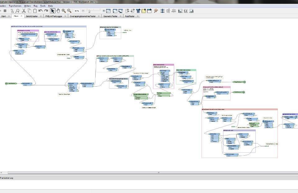


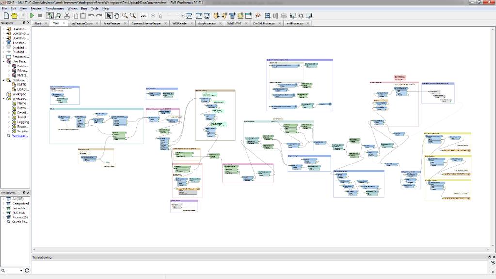
20 Workspaces! 20
21 Case Example: Importing buildings from City of Tampere to the National Topographic Database 21

22 Tampere Third most populous municipality and second largest urban area in Finland, with ~300k inhabitants in a ~5000 km 2 area WFS service offers ~50k buildings as polygons 22


23 Invalid Polygons 23


24 Overlaps 24
25 Some Statistics Amount of errors per quality element 1060 errors, warnings Topological consistency: 1060 Domain consistency: Topological consistency Format consistency Domain consistency Conceptual consistency 25
26 Thank you! Any questions? Contact: 26
DATA VALIDATION AGAINST SCHEMA AND SOURCE DATA
 DATA VALIDATION AGAINST SCHEMA AND SOURCE DATA didier.bouteloup@ign.fr; dominique.laurent@ign.fr 3 June 2016 ign.fr Context IGN has performed data validation twice On test INSPIRE data (2013-2014) On ELF
Closing the INSPIRE Implementation Gap by Contributing to SDI Technology Development
 Closing the INSPIRE Implementation Gap by Contributing to SDI Technology Development Experiences from the Envibase project Lena Hallin-Pihlatie, Riikka Repo, Suvi Hatunen, Ilkka Rinne Finnish Environment
From Geoportal to Spatial Data Service Platform. Jani Kylmäaho National Land Survey of Finland Development Centre
 From Geoportal to Spatial Data Service Platform Jani Kylmäaho National Land Survey of Finland Development Centre Introduction National Land Survey of Finland - 1900 employees Development Centre - 120 employees
UPDATING OF VECTOR DATABASES AT THE INSTITUT CARTOGRAFIC DE CATALUNYA
 ISPRS Archive Vol. XXXVIII, Part 4-8-2-W9, "Core Spatial Databases - Updating, Maintenance and Services - from Theory to Practice", Haifa, Israel, 2010 UPDATING OF VECTOR DATABASES AT THE INSTITUT CARTOGRAFIC
SDI Workshop ESDIN Best Practices INSPIRE conference, Edinburgh. Arnulf Christl, Metaspatial
 SDI Workshop ESDIN Best Practices 2011-06-28 INSPIRE conference, Edinburgh Arnulf Christl, Metaspatial Download this slide set as ODP or PDF at http://arnulf.us/publications Arnulf Christl Geospatially
Utility Network Management in ArcGIS: Migrating Your Data to the Utility Network. John Alsup & John Long
 Utility Network Management in ArcGIS: Migrating Your Data to the Utility Network John Alsup & John Long Presentation Outline Utility Network Preparation - Migration Patterns - Understanding the Asset Package
Introduction to INSPIRE. Network Services
 Introduction to INSPIRE. Network Services European Commission Joint Research Centre Institute for Environment and Sustainability Digital Earth and Reference Data Unit www.jrc.ec.europa.eu Serving society
The Geographic Names Register of the National Land Survey of Finland
 7 June 2002 English only Eighth United Nations Conference on the Standardization of Geographical Names Berlin, 27 August-5 September 2002 Item 12 (d) of the provisional agenda * Toponymic data files: automated
Framework specification, logical architecture, physical architecture, requirements, use cases.
 Title: A5.2-D3 3.3.1 Alignment Editor Specification Editor(s)/Organisation(s): Thorsten Reitz (Fraunhofer IGD) Contributing Authors: Thorsten Reitz (Fraunhofer IGD), Marian de Vries (TUD) References: A1.8-D4
INSPIRE & Environment Data in the EU
 INSPIRE & Environment Data in the EU Andrea Perego Research Data infrastructures for Environmental related Societal Challenges Workshop @ pre-rda P6 Workshops, Paris 22 September 2015 INSPIRE in a nutshell
Incremental Update in Web Service Environment Case: Use of the OGC s GeoSynchronization Service to Integrate Hydrographic Datasets
 Incremental Update in Web Service Environment Case: Use of the OGC s GeoSynchronization Service to Integrate Hydrographic Datasets Pekka Latvala, Eero Hietanen Finnish Geospatial Research Institute (FGI),
Statistical Viewer. Coping with the Complexity
 Statistical Viewer Coping with the Complexity Overview What s DataCove and Ghosting EuroStat as a Data Resource DataCove Statistical Viewer The Way from Here to There Conclusions What We Do Data Modelling:
European Location Framework (ELF) acting as a facilitator implementing INSPIRE
 acting as a facilitator implementing INSPIRE") www.eurogeographics.org European Location Framework (ELF) acting as a facilitator implementing INSPIRE Saulius Urbanas, Mick Cory (EuroGeographics) 29 October 2016 Copyright 2013 EuroGeographics EuroGeographics
www.eurogeographics.org European Location Framework (ELF) acting as a facilitator implementing INSPIRE Saulius Urbanas, Mick Cory (EuroGeographics) 29 October 2016 Copyright 2013 EuroGeographics EuroGeographics
Testing tools to create INSPIRE gml data: lesson learned. Florence Couvreur
 Testing tools to create INSPIRE gml data: lesson learned Florence Couvreur Agenda Testing tools to create INSPIRE 1. Background 2. Testing turnkey solution 3. Testing Home-made solution 4. Testing ETL
Experiences with. data for use in apps
 Experiences with publishing INSPIRE data for use in apps Presentation to: Author: Date: INSPIRE Conference 2014 Clemens Portele 2014 06 18 From INSPIRE Conference 2013: "How to use INSPIRE data?" INSPIRE
Data Interoperability An Introduction
 2013 Esri International User Conference July 8 12, 2013 San Diego, California Technical Workshop Data Interoperability An Introduction Bruce Harold Esri Dale Lutz Safe Software Background Why Data Interoperability?
Proposed update of Technical Guidance for INSPIRE Download services based on SOS
 Proposed update of Technical Guidance for INSPIRE Download services based on SOS Organised by: Simon Jirka, Alexander Kotsev, Michael Lutz Dr. Simon Jirka (jirka@52north.org) 52 North GmbH Workshop - The
Initial GMES Service for Geospatial Reference Data Access. Remote Sensing Department. INDRA ESPACIO
 Initial GMES Service for Geospatial Reference Data Access Remote Sensing Department. INDRA ESPACIO Brussels, 260-09-2011 CONTENT 01 Overview 02 EU-DEM 03 Hydrography 04 Production Coordination 05 Access
Christian Ansorge 27th April CDDA webinar 27th April Linked Approach as reporting mechanism
 Christian Ansorge 27th April 2017 CDDA webinar 27th April 2017 Linked Approach as reporting mechanism Generic Linked Approach Scope Background and motivation for reporting reusing INSPIRE Introduction
MSc Geomatics thesis presentation. Validation and automatic repair of planar partitions using a constrained triangulation.
 MSc Geomatics thesis presentation Validation and automatic repair of planar partitions using a constrained triangulation Ken Arroyo Ohori Friday, 27 August 2010 at 10:00 Grote Vergaderzaal OTB Research
Testing - an essential aspect of establishing an SDI
 Testing - an essential aspect of establishing an SDI Clemens Portele, Anders Östman, Michael Koutroumpas, Xin He, Janne Kovanen, Markus Schneider, Andriani Skopeliti INSPIRE Conference 2011 30 June 2011
Marine and Coastal Data Services in the Cloud. Richard Rombouts - Snowflake Software Ltd. & Keiran Millard SeaZone Solutions Ltd.
 Marine and Coastal Data Services in the Cloud Richard Rombouts - Snowflake Software Ltd. & Keiran Millard SeaZone Solutions Ltd. Marine Geospatial Data Inspired Marine Data? SeaZone HydroSpatial Global
Oracle Spatial Technologies: An Update. Xavier Lopez Director, Spatial Technologies Oracle Corporation
 Oracle Spatial Technologies: An Update Xavier Lopez Director, Spatial Technologies Oracle Corporation Overview Oracle Approach to Market Specialist v. Generalist Solutions New Developments: Oracle Database
The challenge of creating an INSPIRE Transport Networks DB from existing data in the National Geographic Institute of Spain
 The challenge of creating an INSPIRE Transport Networks DB from existing data in the National Geographic Institute of Spain Alicia González Jiménez (agjimenez@fomento.es) Instituto Geográfico Nacional
Validating services and data in an SDI
 Validating services and data in an SDI Presentation to: By: Date: INSPIRE Conference Clemens Portele, Jon Herrmann, Roy Mellum 30 September 2016 4 October, 2016 ELF is the response from the European Mapping
INSPIRE Download Services of the CNIG (Spain) Emilio López Romero
 Emilio López Romero") INSPIRE Download Services of the CNIG (Spain) Emilio López Romero 1 The beginning One day, few years ago, we decided to implement INSPIRE seriously 2 The sources The first step was to identify the available
INSPIRE Download Services of the CNIG (Spain) Emilio López Romero 1 The beginning One day, few years ago, we decided to implement INSPIRE seriously 2 The sources The first step was to identify the available
INSPIRE overview and possible applications for IED and E-PRTR e- Reporting Alexander Kotsev
 INSPIRE overview and possible applications for IED and E-PRTR e- Reporting Alexander Kotsev www.jrc.ec.europa.eu Serving society Stimulating innovation Supporting legislation The European data puzzle 24
An Introduction to Data Interoperability
 Esri International User Conference San Diego, California 2012 Technical Workshops July 24/25 An Introduction to Data Interoperability Bruce Harold - Esri Dale Lutz Safe Software Background Why Data Interoperability?
InfraGML. Linking pin between Geo and BIM. 4 november 2014
 InfraGML Linking pin between Geo and BIM Marcel Reuvers (Geonovum) 4 november 2014 GIS Roads DTM GIS scope: Scale 1:500 1:25:000 Coordinates system CRS Features Topology networks Themes Cables and pipes
Implementing Quality in SDIs Introducing Building Blocks of Quality Web Services
 Implementing Quality in SDIs Introducing Building Blocks of Quality Web Services Antti Jakobsson J. Mäkelä, R. Henriksson,J. Marttinen,L. Tsoulos, I.Kavadas, E. Onstein, M. Beare,F. Williams, J. Walsh,
Introduction to Geodatabase and Spatial Management in ArcGIS. Craig Gillgrass Esri
 Introduction to Geodatabase and Spatial Management in ArcGIS Craig Gillgrass Esri Session Path The Geodatabase - What is it? - Why use it? - What types are there? - What can I do with it? Query Layers
Unit 4: Vector Overlay Analysis. Lecture Outline. Possible background reading material: McHarg, Ian 1992 Design with Nature. Wiley and Sons, New York.
 Unit 4: Vector Overlay Analysis Lecture Outline Possible background reading material: McHarg, Ian 1992 Design with Nature. Wiley and Sons, New York. Introduction: The idea of overlay originated when maps
Application of the Catalogue and Validator tools in the context of Inspire Alberto Belussi, Jody Marca, Mauro Negri, Giuseppe Pelagatti
 Application of the Catalogue and Validator tools in the context of Inspire Alberto Belussi, Jody Marca, Mauro Negri, Giuseppe Pelagatti Politecnico di Milano giuseppe.pelagatti@polimi.it spatialdbgroup.polimi.it
Creating Geoprocessing Services and Web Tools. Darren Baird, PE, Esri
 Creating Geoprocessing Services and Web Tools Darren Baird, PE, Esri Introduction Both ArcMap and ArcGIS Pro are covered Terms Geoprocessing Services and Web Tools are the same - ArcMap publishes geoprocessing
ELF download services
 ELF download services Presentation to: Author: Date: ELF workshop in Moldova Marcin Grudzień 8 h September2015 14 September, 2015 Plan Introduction Specification documents The envisaged production process
ECP-2007-GEO OneGeology-Europe. Annex 1: Cookbook
 ECP-2007-GEO-317001 OneGeology-Europe Annex 1: Cookbook for creating multilingual metadata records using the OneGeology-Europe Metadata system (MIcKA) Authors: Lucie Kondrová, Robert Tomas, Štěpán Kafka
Example Workflow: 3. On the Review dialog, click on the Properties button for the Coordinate system. The Coordinate System Properties dialog appears.
 Calculating LRS Measures for Linear Data Crossing the Road Network The following GeoMedia Transportation workflow might be used as a means to calculate LRS measure values where another linear feature crosses
Metadata of geographic information
 Metadata of geographic information Kai Koistinen Management of environmental data and information 4.10.2017 Topics Metadata of geographic information What is metadata? Metadata standards and recommendations
Whitepaper. Reading Map 3D Object Data with FME. Overview. FME and Spatial Data Interoperability. Spatial ETL Tools
 Whitepaper Reading Map 3D Object Data with FME Overview A key challenge for users of spatial data is interoperability. Even for a committed user of AutoCAD Map 3D, there are likely to be occasional needs
Integrating ArcGIS desktop in data interoperability environments with heterogeneous GIS clients
 Data-Interoperability based on Common Databases Integrating ArcGIS desktop in data interoperability environments with heterogeneous GIS clients M.Sc Abdurasyid Moestofa / Prof. Rainer Kettemann Stuttgart
Web Coverage Services (WCS)
") Web Coverage Services (WCS) www.jrc.ec.europa.eu Thematic Cluster #3 Jordi Escriu Facilitator Thematic Cluster #3 Serving society Stimulating innovation Supporting legislation Coverages in INSPIRE Coverage:
Web Coverage Services (WCS) www.jrc.ec.europa.eu Thematic Cluster #3 Jordi Escriu Facilitator Thematic Cluster #3 Serving society Stimulating innovation Supporting legislation Coverages in INSPIRE Coverage:
Geospatial Day II Introduction to ArcGIS Editor for Open Street Map
 Geospatial Day II Introduction to ArcGIS Editor for Open Street Map Geospatial Operations Support Team (GOST) Katie McWilliams kmcwilliams@worldbankgroup.org GOST@worldbank.org 0 Using OSM for Network
CONFLATION: EDGEMATCHING TOOLS AND WORKFLOWS DAN LEE
 CONFLATION: EDGEMATCHING TOOLS AND WORKFLOWS DAN LEE Agenda Conflation Overview and Geoprocessing Tools Edge Matching Workflow Demo Conclusions and Future Work Conflation Overview and Geoprocessing Tools
Tips for a Good Meshing Experience
 Tips for a Good Meshing Experience Meshes are very powerful and flexible for modeling 2D overland flows in a complex urban environment. However, complex geometries can be frustrating for many modelers
Compass INSPIRE Services. Compass INSPIRE Services. White Paper Compass Informatics Limited Block 8, Blackrock Business
 Compass INSPIRE Services White Paper 2010 Compass INSPIRE Services Compass Informatics Limited Block 8, Blackrock Business Park, Carysfort Avenue, Blackrock, County Dublin, Ireland Contact Us: +353 1 2104580
The federal geo-platform:
 The federal geo-platform: Targeting the statistical community Nathalie Delattre (IGN Belgium), Pierre Jamagne (Statistics Belgium), Ann Crabbé (KULeuven/SADL) INSPIRE Conference, Strasbourg 6-8 septembre
Suggestions for writing Abstract Test Suites (ATS) for INSPIRE conformance testing for Metadata and Network Services
 for INSPIRE conformance testing for Metadata and Network Services") Suggestions for writing Abstract Test Suites (ATS) for INSPIRE conformance testing for Metadata and Network Services MIWP-5 Workshop 02. December 2014 Sven Böhme, Federal Agency for Cartography and Geodesy
Suggestions for writing Abstract Test Suites (ATS) for INSPIRE conformance testing for Metadata and Network Services MIWP-5 Workshop 02. December 2014 Sven Böhme, Federal Agency for Cartography and Geodesy
ADMINISTRATIVE UNITS INSPIRE KEN WORKSHOP TRANSFORMATION OF THEMES AD, AU, BU, CP AND GN April 2015 ign.
 ADMINISTRATIVE UNITS INSPIRE KEN WORKSHOP TRANSFORMATION OF THEMES AD, AU, BU, CP AND GN dominique.laurent@ign.fr 16-17 April 201 ign.fr Plan Source data Transformation choices and issues Conclusions Source
Migrating Data to the Parcel Fabric. Christine Leslie Amir Bar-Maor
 Migrating Data to the Parcel Fabric Christine Leslie Amir Bar-Maor What is a parcel fabric? Dataset of related feature classes and tables - Polygons, lines, points, plans, etc. - Predefined system attributes
ArcGIS Pro Editing: An Introduction. Jennifer Cadkin & Phil Sanchez
 ArcGIS Pro Editing: An Introduction Jennifer Cadkin & Phil Sanchez See Us Here WORKSHOP ArcGIS Pro Editing: An Introduction LOCATION SDCC - Ballroom 20 D TIME FRAME Thursday 10:00 11:00 ArcGIS Pro: 3D
How to Report on Data Quality in a Multinational Environment?
 How to Report on Data Quality in a Multinational Environment? Presentation to: By: Date: SDMQ2015 Anja Hopfstock, BKG 20.01.2015 Agenda ELF architecture Data Quality Management Data Quality Reporting Summary
Setting up the Ihlet Social Cadastre
 Setting up the Ihlet Social Cadastre Ihlet KHT Dr. Attila Molnár, GI consultant Bela Jarolics Rome, Italy TOPICS Goal of the project Architecture Database Solution Standards, communication Metadata Security
3D Validation of CityGML
 3D Validation of CityGML Hugo Ledoux GIS technology group 10 March 2009 CityGML Information model for exchange and storage of 3D city models Based on GML (thus XML-based) Now an international standard
Singapore. Mr Soh Kheng Peng. Singapore Land Authority
 Country Report 2006 (Based on the PCGIAP-Data Integration Template 2006) Singapore Country/state: Name of contact person: Affiliation, Organization: Function, Position: Address: Email address: Tel, Fax
Consolidation Team INSPIRE Annex I data specifications testing Call for Participation
 INSPIRE Infrastructure for Spatial Information in Europe Technical documents Consolidation Team INSPIRE Annex I data specifications testing Call for Participation Title INSPIRE Annex I data specifications
Name: Date: June 27th, 2011 GIS Boot Camps For Educators Lecture_3
 Name: Date: June 27th, 2011 GIS Boot Camps For Educators Lecture_3 Practical: Creating and Editing Shapefiles Using Straight, AutoComplete and Cut Polygon Tools Use ArcCatalog to copy data files from:
INSPIRE Spatial Data on the Web building a user-friendly webby SDI
 INSPIRE Spatial Data on the Web building a user-friendly webby SDI Linda van den Brink & Friso Penninga (presented by Rob van de Velde) Geonovum Agenda Objective of this presentation: Apply insights from
The coastal data in the regional and national territorial data repertory. Genova 24 Aprile 2012 Anna Cerrato Regione Liguria
 The coastal data in the regional and national territorial data repertory Genova 24 Aprile 2012 Anna Cerrato Regione Liguria www.rndt.gov.it Experience from data providers in using transformation tools
CSE 512 Course Project Operation Requirements
 CSE 512 Course Project Operation Requirements 1. Operation Checklist 1) Geometry union 2) Geometry convex hull 3) Geometry farthest pair 4) Geometry closest pair 5) Spatial range query 6) Spatial join
v1.0 Session: Database creation (theory) Pier-Giorgio Zaccheddu
 Pier-Giorgio Zaccheddu") Session: Database creation (theory) v1.0 Pier-Giorgio Zaccheddu Federal Agency for Cartography and Geodesy (BKG) Richard-Strauss-Allee 11 60598 Frankfurt am Main Tel.: +49 69 6333 305 Fax: +49 69 6333
Session: Database creation (theory) v1.0 Pier-Giorgio Zaccheddu Federal Agency for Cartography and Geodesy (BKG) Richard-Strauss-Allee 11 60598 Frankfurt am Main Tel.: +49 69 6333 305 Fax: +49 69 6333
Validation in the Netherlands and European Location Framework
 Validation in the Netherlands and European Location Framework INSPIRE Workshop on validation and conformity testing 15 16 May 2014 Thijs Brentjens Contents Geonovum and ELF INSPIRE INSPIRE in the Netherlands
Landslide Damage on Chemin de Fer de la Mure near Grenoble,
 Contents 1 What is the INSPIRE directive, and why is it important?... 3 1.1 What is the aim of this document?... 4 1.2 Who will this document be useful to?... 4 2 An overview of INSPIRE specifications...
qgis-versioning Documentation Release latest
 qgis-versioning Documentation Release latest February 18, 2016 Contents 1 Introductory text 3 2 Requirements 5 3 Plugin functionality 7 4 Selecting features before checkout 17 5 Project contributors 19
Advanced Parcel Editing. Amy Andis Tim Hodson
 Advanced Parcel Editing Amy Andis Tim Hodson Overview What to expect in this technical workshop Review of the Parcel Fabric Data Model Advanced Tips and tricks for Parcel entry Assessing Quality of Parcel
Welcome to NR402 GIS Applications in Natural Resources. This course consists of 9 lessons, including Power point presentations, demonstrations,
 Welcome to NR402 GIS Applications in Natural Resources. This course consists of 9 lessons, including Power point presentations, demonstrations, readings, and hands on GIS lab exercises. Following the last
Potential analysis for rooftop farming and rooftop PV in New Cairo
 Potential analysis for rooftop farming and rooftop PV in New Cairo - A GIS based suitability model - Manual Area model Prepared by: Lisa Kaltenbach and Jingsui Huang Supervision from: Hany Abo El Wafa
Presented by Kit Na Goh
 Developing A Geo-Spatial Search Tool Using A Relational Database Implementation of the FGDC CSDGM Model Presented by Kit Na Goh Introduction Executive Order 12906 was issued on April 13, 1994 with the
Scientific and Multidimensional Raster Support in ArcGIS
 Scientific and Multidimensional Raster Support in ArcGIS Sudhir Raj Shrestha sshrestha@esri.com Brief breakdown Scientific Multidimensional data Ingesting Scientific MultiDim Data in ArcGIS Ingesting and
DEVELOPING A NEW GEOGRAPHICAL OBJECT DATABASE. EXPERIENCES FROM IDEA TO DELIVERING DATASETS TOP10NL
 DEVELOPING A NEW GEOGRAPHICAL OBJECT DATABASE. EXPERIENCES FROM IDEA TO DELIVERING DATASETS TOP10NL NICO J. BAKKER Topografische Dienst Kadaster Bendienplein 5 7815 SM Emmen, The Netherlands nbakker@tdkadaster.nl
SERVO - ACES Abstract
 1 of 6 12/27/2004 2:33 PM 2 of 6 12/27/2004 2:33 PM Implementing GIS Grid Services for the International Solid Earth Research Virtual Observatory Galip Aydin (1), Marlon Pierce (1), Geoffrey Fox (1), Mehmet
Indexed 3D Scene (I3S) Layers Specification
 Layers Specification") Indexed 3D Scene (I3S) Layers Specification Javier Gutierrez Product Engineer Lead Esri Özgür Ertac 3D Product Engineer Esri Germany Thank You to Our Generous Sponsor Agenda ArcGIS 3D Platform Authoring
Indexed 3D Scene (I3S) Layers Specification Javier Gutierrez Product Engineer Lead Esri Özgür Ertac 3D Product Engineer Esri Germany Thank You to Our Generous Sponsor Agenda ArcGIS 3D Platform Authoring
ArcGIS Pro: What s New in Editing and Data Management
 Federal GIS Conference February 9 10, 2015 Washington, DC ArcGIS Pro: What s New in Editing and Data Management Robert LeClair ArcGIS Pro Overview Esri FedUC 2015 Technical Workshop ArcGIS Pro: What's
MAPSITE - INTERNET MAP SERVICE OF THE NATIONAL LAND SURVEY OF FINLAND GETS DRESSED IN MODERN TECHNOLOGY
 MAPSITE - INTERNET MAP SERVICE OF THE NATIONAL LAND SURVEY OF FINLAND GETS DRESSED IN MODERN TECHNOLOGY Pätynen, V. National Land Survey of Finland, Development Centre, Opastinsilta 12 C, P.O.Box 84, FIN-00521
1 Introduction. 2 National Data Exchange Layer
 Spatial Services in the egovernment: Delivering WFS and WMS Queries through the Data Exchange Layer of the Finnish National Architecture for Digital Services Pekka Latvala, Lassi Lehto Finnish Geospatial
Using ESRI data in Autodesk ISD Products
 GI13-3 Using ESRI data in Autodesk ISD Products 1.5 hr. Class 02-Dec-03 3:30pm - 5:00pm Session Description: We will focus on using data in a variety of ESRI formats within the Autodesk GIS product line,
NATIONWIDE POINT CLOUDS AND 3D GEO- INFORMATION: CREATION AND MAINTENANCE GEORGE VOSSELMAN
 NATIONWIDE POINT CLOUDS AND 3D GEO- INFORMATION: CREATION AND MAINTENANCE GEORGE VOSSELMAN OVERVIEW National point clouds Airborne laser scanning in the Netherlands Quality control Developments in lidar
Service metadata validation in Spatineo Monitor
 Service metadata validation in Spatineo Monitor Ilkka Rinne Spatineo Inc. INSPIRE MIG validation workshop JRC/Ispra, 15th & 16th May 2014 Spatineo Linnankoskenkatu 16 A 17 FI-00250 Helsinki +358 20 703
Workshop Data Modelling [en]
![Workshop Data Modelling [en]](/thumbs/87/95069410.jpg "Workshop Data Modelling [en]") Workshop Data Modelling [en] Thorsten Reitz, wetransform INSPIRE and Beyond 2018 24.05.2018 Wetransform GmbH - Why do we create data models at all? - What processes can we use to create models? - What
Workshop Data Modelling [en] Thorsten Reitz, wetransform INSPIRE and Beyond 2018 24.05.2018 Wetransform GmbH - Why do we create data models at all? - What processes can we use to create models? - What
IT Infrastructure for BIM and GIS 3D Data, Semantics, and Workflows
 IT Infrastructure for BIM and GIS 3D Data, Semantics, and Workflows Hans Viehmann Product Manager EMEA ORACLE Corporation November 23, 2017 @SpatialHannes Safe Harbor Statement The following is intended
Forestry Data Model User Guide. Version 2.0 January, 2013
 Forestry Data Model User Guide Version 2.0 January, 2013 Table of Contents Introduction... 1 Advantages of Using a Geodatabase... 1 Subtypes and Domains... 2 Subtypes... 2 Domains... 3 The Forestry Data
Topic 5: Raster and Vector Data Models
 Geography 38/42:286 GIS 1 Topic 5: Raster and Vector Data Models Chapters 3 & 4: Chang (Chapter 4: DeMers) 1 The Nature of Geographic Data Most features or phenomena occur as either: discrete entities
Dynamic 3D representation of information using low cost Cloud ready Technologies
 National Technical University Of Athens School of Rural and Surveying Engineering Laboratory of Photogrammetry Dynamic 3D representation of information using low cost Cloud ready Technologies George MOURAFETIS,
Challenges in Geospatial Data Harmonisation:
 Challenges in Geospatial Data Harmonisation: Examples and Approaches from the HUMBOLDT project AGILE Workshop 2009 Astrid Fichtinger, Eva Klien, Christine Giger Overview The HUMBOLDT Project Data harmonisation
The Spatial Data Standards for Facilities, Infrastructure and Environment (SDSFIE) Quality and Raster Standards
 Quality and Raster Standards") The Spatial Data Standards for Facilities, Infrastructure and Environment (SDSFIE) Quality and Raster Standards Ms. Karen Barnhouse DISDI Program Support OASD(EI&E) June 29, 2016 Agenda What is the SDSFIE
The Spatial Data Standards for Facilities, Infrastructure and Environment (SDSFIE) Quality and Raster Standards Ms. Karen Barnhouse DISDI Program Support OASD(EI&E) June 29, 2016 Agenda What is the SDSFIE
TRAINING GUIDE. Data Quality Tools for GIS and Lucity Spatial
 TRAINING GUIDE Data Quality Tools for GIS and Lucity Spatial Data Quality Tools for GIS and Lucity Spatial In this session, we ll cover the tools that can be used to ensure your GIS data is clean in regards
INSPIRE roadmap and architecture: lessons learned INSPIRE 2017
 INSPIRE roadmap and architecture: lessons learned INSPIRE 2017 Stijn Goedertier GIM Thierry Meessen GIM Jeff Konnen ACT Luxembourg Patrick Weber ACT Luxembourg 1 Administration du cadastre et de la topographie
5. Modelling and models. Sisi Zlatanova
 5. Modelling and models Sisi Zlatanova Content Investigation of data used in Emergency response Operational data models Models for Navigation and Evacuation Existing data Very often they have a model (even
InCLUDE Data Exchange. Julia Harrell, GISP GIS Coordinator, NC DENR
 InCLUDE Data Exchange Julia Harrell, GISP GIS Coordinator, NC DENR Julia.harrell@ncdenr.gov InCLUDE Project Partners NC Department of Environment & Natural Resources: The State of NC s lead environmental
The ArcGIS Integration, User Guide. ArcGISv1.01_GEv4.2_UK_User_Guide, 4Ed,pdf.docNumber of pages: 26 Printed:
 The ArcGIS Integration, User Guide ArcGISv1.01_GEv4.2_UK_User_Guide, 4Ed,pdf.docNumber of pages: 26 Printed: 30-04-03 GeoEnviron 4.2 Table of Contents Table of Contents Introduction...3 Development of
ArcGIS Pro Editing. Jennifer Cadkin & Phil Sanchez
 ArcGIS Pro Editing Jennifer Cadkin & Phil Sanchez ArcGIS Pro Editing Overview Provides tools that allow you to maintain, update, and create new data - Modifying geometry, drawing new features - Entering
Daniela Cristiana Docan I 6th Sept. I INSPIRE Conference 2017, Strasbourg. EEA Data Quality Management supporting INSPIRE implementation
 Daniela Cristiana Docan I 6th Sept. I INSPIRE Conference 2017, Strasbourg EEA Data Quality Management supporting INSPIRE implementation Data Quality in INSPIRE INSPIRE Technical Guidelines use ISO 19157
Transformative characteristics and research agenda for the SDI-SKI step change:
 Transformative characteristics and research agenda for the SDI-SKI step change: A Cadastral Case Study Dr Lesley Arnold Research Fellow, Curtin University, CRCSI Director Geospatial Frameworks World Bank
Objectives This tutorial will introduce how to prepare and run a basic ADH model using the SMS interface.
 v. 12.1 SMS 12.1 Tutorial Objectives This tutorial will introduce how to prepare and run a basic ADH model using the SMS interface. Prerequisites Overview Tutorial Requirements ADH Mesh Module Scatter
Spatial Data on the Web
 Spatial Data on the Web Tools and guidance for data providers The European Commission s science and knowledge service W3C Data on the Web Best Practices 35 W3C/OGC Spatial Data on the Web Best Practices
Streamlining Editing Workflows. Amber Bethell
 Streamlining Editing Workflows Amber Bethell Workflow for solving geographic problems Ask a question Create or acquire data Validate and update data Analyze data Create cartographic product Act upon knowledge
Raster national datasets transformation to INSPIRE specifications
 http://www.ign.es Instituto Geográfico Nacional Raster national datasets transformation to INSPIRE specifications Orthoimageries and Elevation Julián Delgado Hernández INSPIRE KEN workshop Barcelona 29
Editing Versioned Geodatabases : An Introduction
 Esri International User Conference San Diego, California Technical Workshops July 24, 2012 Editing Versioned Geodatabases : An Introduction Cheryl Cleghorn Shawn Thorne Assumptions: Basic knowledge of
Topology in the Geodatabase an Introduction. Erik Hoel Doug Morgenthaler
 Topology in the Geodatabase an Introduction Erik Hoel Doug Morgenthaler ESRI Super Secret Topology Laboratory, May 2012 Agenda ArcGIS Topology defined Validating a topology Editing a topology Geoprocessing
Methodological approach for cross-theme harmonization of Polish spatial data sets the case study for the Annex I themes
 Methodological approach for cross-theme harmonization of Polish spatial data sets the case study for the Annex I themes Elżbieta Bielecka, Agnieszka Zwirowicz-Rutkowska, Alina Kmiecik, Marek Brylski, Magdalena
Extension of INSPIRE Download Services TG for Observation Data
 Extension of INSPIRE Download Services TG for Observation Data Simon Jirka (52 North) 14 th June 2014, MIG Workshop on WCS-based INSPIRE Download Services Agenda Motivation Sensor Web Proposed Update for