HYDROFEST 2005 CAPABILITIES OF A MODERN BATHYMETRIC LIDAR SYSTEM - THE SHOALS 1000T SYSTEM. Bill Gilmour Fugro Pelagos Inc, San Diego, CA, USA
|
|
|
- Juliet Lee
- 5 years ago
- Views:
Transcription
1 HYDROFEST 2005 CAPABILITIES OF A MODERN BATHYMETRIC LIDAR SYSTEM - THE SHOALS 1000T SYSTEM Bill Gilmour Fugro Pelagos Inc, San Diego, CA, USA


2 ACKNOWLEDGEMENTS FUGRO PELAGOS INC. David Millar Carol Lockhart Dushan Arumugam OPTECH INTERNATIONAL INC. Grady Tuell JALBTCX Jeff Lillycrop NOAA
3 OUTLINE BACKGROUND INFORMATION SYSTEM SPECIFICATIONS DATA ACQUISITION DATA PROCESSING SYSTEM CALIBRATION SYSTEM ACCEPTANCE TESTING SAT s for Optech NOAA Seattle Tests IHO specifications Target Detection SYSTEM APPLICATIONS Hydrography River Surveys Coastal Zone Mapping LATEST DEVELOPMENTS LIDAR Pseudoreflectance Hyperspectral Data Fusion


4 BACKGROUND INFORMATION FUGRO PELAGOS INC. San Diego, California Anchorage, Alaska Kiln, Mississippi Honolulu, Hawaii

5 Providing Hydrographic Surveys in Alaska for NOAA Charting Since 1998

6 Collected Over Eight Billion Soundings in Five Years

7 Delivering Datasets In Support of Ecosystem-based Management

8 Current NOAA Charting Contract Awarded in 2005 at $50 Million over Five Years

9 Providing Airborne LIDAR Bathymetry Operational Support to USACE and NAVO Since 1994
10 Fugro ALB History Support of GFE USACE Contracts Fugro SHOALS-200 Operations Commercial Services FPI SHOALS-400 Operations SHOALS-400 Retired CHARTS Operations FCI Feb-2003 Jul-2003 Aug-2003 Jul-2004 Subcontract LADS in AK Subcontract SHOALS in AK Team with Optech SHOALS-1000T Services SHOALS-1000T Ordered ALB Activities Consolidated FPI Jan-2005 Apr-2005 ALB Activities Consolidated SHOALS-1000T Delivery
11 SYSTEM SPECIFICATIONS SHOALS 1000T

12 Airborne LIDAR Bathymetry Offers Greater Production Rates than Multibeam Echosounder

13 ALB Technology The Basics photoelectrons time (ns) D Laser light source projects 2 beams onto spinning mirror Mirror rotates at a very fast rate and directs two beams per pulse to water surface Creates a swath of points within field of view Green beam penetrates water and detects seabed Infrared beam penetrates little: detects land and sea surface Red energy from Raman backscatter can also detect surface
14 Scan Patterns for Hydrographic Mode Altitude (m) Swath (m) Lateral Spot Spacing (m) Forward Spot Spacing (m) Flight Speed (knots) Scanner Cycle Rate (Hz) Area Coverage (nm 2 /hr) IR Surface Raman APD Green PMT Green
15 Evolution of Airborne LIDAR Bathymeters Evolution of the SHOALS Product Line from Optec Comparison Criteria SHOALS-200 SHOALS-400 SHOALS-1000T Scanning Frequency 200Hz 400Hz 1000Hz + 10kHz topo Power Requirements 28VDC 28VDC 28VDC Weight 450kg 450kg 205kg Volume 1.5m³ 1.5m³ 0.5m³ Function Bathy Bathy Bathy / Topo / Imagery


16 SHOALS-1000T Has Multi-Sensor Capability 1kHz bathy mode and 10kHz topo mode Integrated digital camera
17 SHOALS-1000T Key Bathy Specifications Speed over ground Altitude above ground Sounding density Swath width knots m 2x2, 3x3, 4x4, 5x5 m m Minimum depth 0.2m Maximum depth 50 m Depth accuracy IHO Order 1 (0.25m, 1σ) Horizontal accuracy IHO Order 1 (2.5 m, 1σ) Laser classification Class IV laser product (FDA CFR 21) Eyesafe altitude Power requirements 150m 60 28VDC
18 DATA ACQUISITION


19 SHOALS-1000T is the Smallest, Lightest Sensor Available


20 Offering a Completely Portable Solution Capable of mobilization on fixed or rotary wing aircraft Bell 206L King Air A90 Anywhere in the world


21 Water Clarity / Other Environmental Constraints Data collection and data quality impacted by the following: Weather Low clouds Rain Fog Water clarity Turbidity Surf zone Red Tide Algae bloom Aquatic vegetation
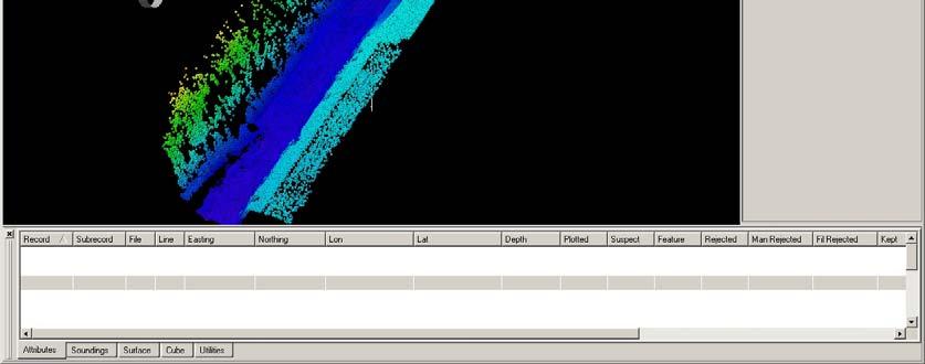
22 Ground Control System Software Modules MAPS Management And Planning Software Generate flight lines for a project Establish data collection attributes for these lines Allocate flight lines to a mission Search for holidays Unload x,y,z + meta-data DAViS Downloading, Automated processing and 3D Visualization Software Download data from airborne removable hard drives Auto process airborne collected data View, clean, and edit data in 3D via Fledermaus


23 MAPS Flight Line Planning

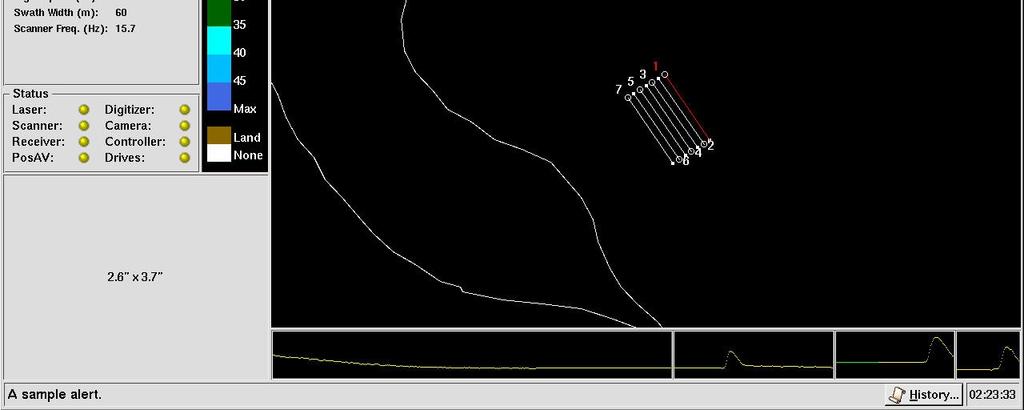
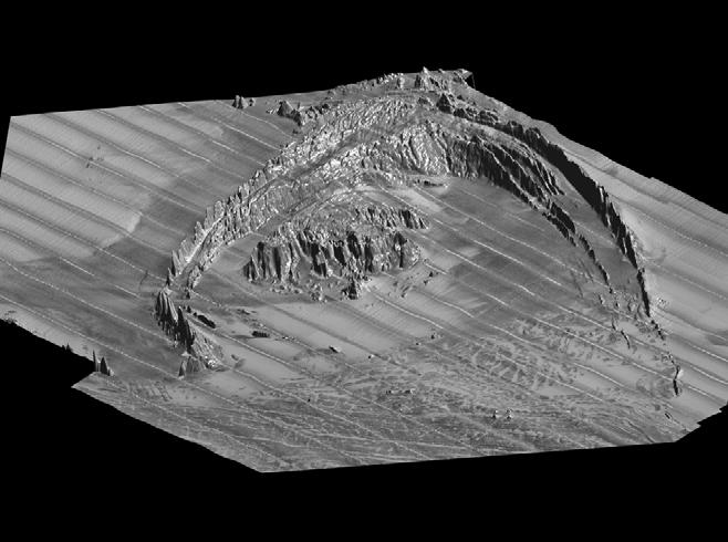
24 Operator Interface Display


25 Operator Interface Display


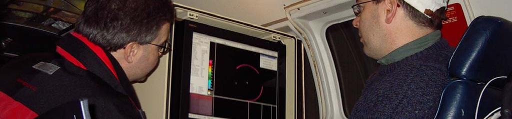
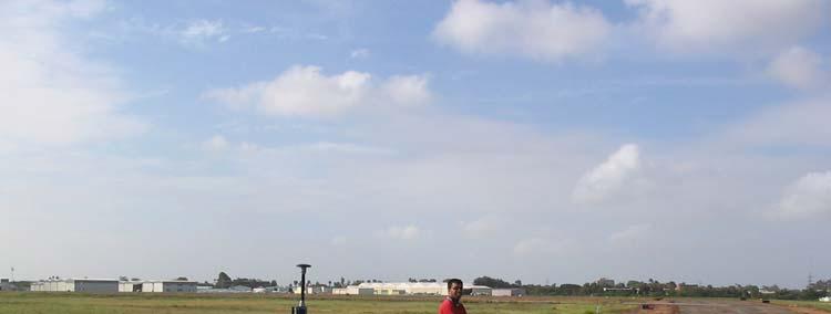
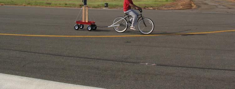
26 GPS and Survey Support Complement Airborne Operations
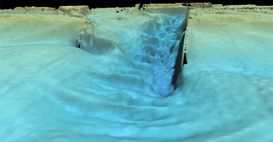
27 Enhancing Data Collection and Processing with PPK GPS
28 DATA PROCESSING
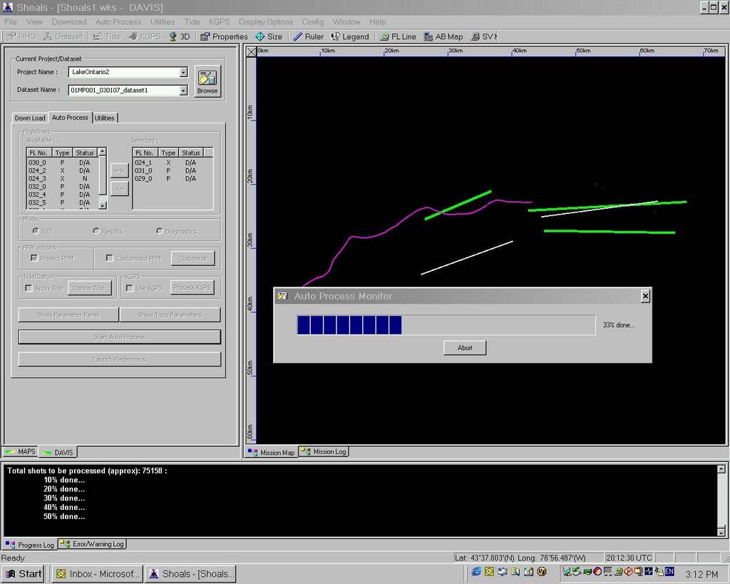
29 DAViS Autoprocessing Display

30 Data Editing

31 Lake Ontario 07Jan m depth Visualizing Today s Data

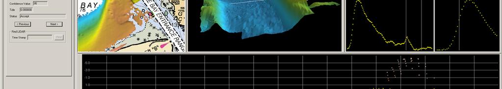
32 SHOALS- 400 Attributes in CARIS

33 SHOALS Attributes in CARIS Link between HDCS Time Stamp and SHOALS Time Stamp Shows both Primary and Secondary Depth Shows Confidence value calculated in SHOALS system Soundings maintain their Kill, Keep or Swap attribute from the SHOALS system. These can be modified in CARIS. Wave form is viewable for every Sounding

34 Deliver Cleaned and Edited XYZ Point Data

35 Deliver Integrated Bathy and Topo DEMs


36 Deliver Contour and Cross Section Data

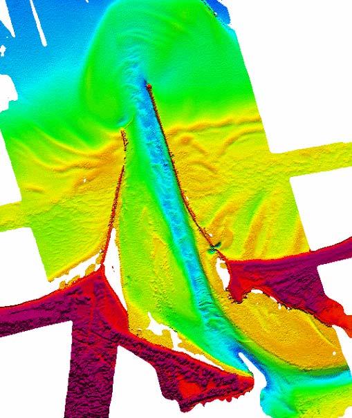
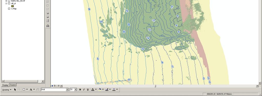
37 Deliver Color Coded and Sun-Illuminated Bathymetric Data


38 Deliver Digital Imagery

39 SHOALS-1000T Deliverables Orthophoto Mosaic Drape over DTM

40 Deliver Fly-Through Animations
41 SYSTEM CALIBRATION
42 Calibrations Laboratory Calibration System timing for bathy and topo systems Scanner scale and offset factors Downlook camera lens and radial distortion Hydro subsystem Angular calibration residual angular offsets resolved over several flightlines Residual vertical error - determine correct elevation by runway check Horizontal accuracy evaluated over a landmark feature Underwater vertical accuracy comparison against groundtruth data Topo subsystem Angular calibration - residual angular offsets resolved over several flightlines Vertical accuracy - comparison against groundtruth data Horizontal accuracy evaluated over a landmark feature Downlook Camera Boresight calibration points compared over reciprocal flightlines Data processing Calibration values saved in GCS parameter file
43 SYSTEM ACCEPTANCE TESTING SAT s for Optech NOAA Seattle Tests IHO specifications Target Detection ± ( b d) 2 2 a + IHO Order a b

44 How Did We Get Here? Teaming Agreement Signed 2 nd Group of Projects 1 st Group of Projects 3 rd System Tests Conducted 1 st System Tests Conducted 3 rd Group of Projects Corporate Approval 2 nd System Tests Conducted Letter of Intent Issued
45 System Acceptance Tests - Objectives Purpose: To confirm that the SHOALS-1000T (System 2) is functioning as designed and required to meet hydrographic charting requirements. Objectives: Verify proper functionality of hardware Verify proper functionality of software Verify proper functionality of data processing work flow Verify validity of topographic data collected Verify validity of bathymetric data collected Verify portability of the system Verify reliability of the system


46 1 st System Acceptance Tests Lake Ontario KGPS positioned LIDAR surface KGPS positione d MBES surface

47 1 st System Acceptance Test Results Day 1
48 1 st System Acceptance Test Results Day 1
49 1 st System Acceptance Test Results Day 2

50 1 st System Acceptance Test Results Day 2

51 Power Timing Test System Timing Error Discovered

52 Single Peaks Timing is Stable


53 Double Peaks Faulty Digitizer Board 1.9 ns Timing Error ~20 cm Depth Error

54 Timing Error was Intermittent Error distribution for a single cross check line
55 Distribution returns to normal Timing Error Corrected
56 2 nd System Acceptance Test Results Day 1
57 2 nd System Acceptance Test Results Day 1


58 2 nd System Acceptance Test Results Day 2
59 2 nd System Acceptance Test Results Day 2

60 3 rd System Acceptance Tests San Diego

61 3 rd System Acceptance Test Results - Ellipsoid
62 3 rd System Acceptance Test Results - Ellipsoid

63 3 rd System Acceptance Test Results - Tides

64 3 rd System Acceptance Test Results - Tides

")
65 NOAA Seattle Tests IHO Compliance SHILSHOLE TEST AREA NOAA surveyed with Reson SeaBat 8101 (2001) Surveyed previously by FPI using: LADS MkII (2001) SHOALS- 400 (2002)
66 DATA ACQUISITION Multiple Flights / Multiple Days Multiple Laser Spot Spacings Each Spot Spacing flown more than twice 200% Coverage Two Cross Lines at 2x2m and 4x4m Laser Spot Spacing (m) Altitude (m) Speed (knots) Swath 2 x x x x


67 SURVEY AREA
68 PROCESSING Processing followed 2 methods: 1. Real-time DGPS Position & NOS Preliminary Observed Tides from Seattle ( ) 2. Post Processed KGPS in NAD83. Geoid03 transform to NAVD88 elevations. Offset 0.715m to MLLW NAD83 Geoid03 Height NAVD88 MLLW 0.715m at NOS Gauge
69 IHO TESTS - OVERVIEW Three separate comparisons conducted: 1. LIDAR X-Line : DTM of LIDAR Survey Lines X Line over MBES Reference Surface X Line run up Channel 2. LIDAR X-Line : DTM of MBES Reference Surface 3. All LIDAR Soundings : DTM of MBES Reference Surface
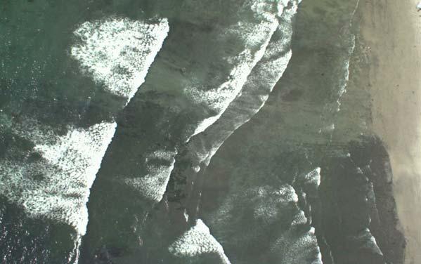
70 LIDAR X Line : DTM of LIDAR Survey Lines X-Line Over MBES Surface Positioning Survey Spot Spacing (m) DTM Grid Size (m) Cross Line Spot Spacing (m) No. of Samples Mean Diff (m) QC Results St Dev of Diff % Pass IHO Order 1 KGPS 2x2 2 2x % KGPS 3x3 3 2x % KGPS 4x4 4 4x % KGPS 5x x % DGPS & Tides 2x2 2 2x % DGPS & Tides 3x3 3 2x % DGPS & Tides 4x4 4 4x % DGPS & Tides 5x x %
71 LIDAR X Line : DTM of LIDAR Survey Lines X-Line Over Channel QC Results Positioning Survey Spot Spacing (m) DTM Grid Size (m) Cross Line Spot Spacing (m) No. of Samples Mean Diff (m) St Dev of Diff % Pass IHO Order 1 KGPS 2x2 2 2x % KGPS 3x3 3 2x % KGPS 4x4 4 4x % KGPS 5x x % DGPS & Tides 2x2 2 2x % DGPS & Tides 3x3 3 2x % DGPS & Tides 4x4 4 4x % DGPS & Tides 5x x %


72 LIDAR X Line : DTM of LIDAR Survey Lines Grid of Differences between Survey Lines and Cross Lines over Channel Red = Fail at IHO 1 Blue = Pass IHO1
73 LIDAR X Line : DTM of LIDAR Survey Lines 1. LIDAR Data Internally Consistent for both KGPS and DGPS/Tide Methods 2. Need to be careful where comparison is done

74 LIDAR X-Line : DTM of MBES Surface MBES Reference Surface N 300 m B O C G F 12 to 30m WD 3.1 Slope J K D E H A L M N 3.1 o I 270 m DTM = 1m Weighting Diameter = 1
75 LIDAR X-Line : DTM of MBES Surface No significant variations between Spot Spacings No significant difference between KGPS & DGPS Overall Results No. of Samples Mean Difference (m) St Dev of Difference % Pass IHO Order 1 KGPS with Wreck % KGPS without Wreck % DGPS/Tides with Wreck % DGPS/Tides without Wreck %
76 All LIDAR Soundings : DTM of MBES Surface No significant variations between Spot Spacings No significant difference between KGPS & DGPS Overall Results No. of Samples Mean Difference (m) St Dev of Difference % Pass IHO Order 1 KGPS with Wreck % KGPS without Wreck % DGPS/Tides with Wreck % DGPS/Tides without Wreck %
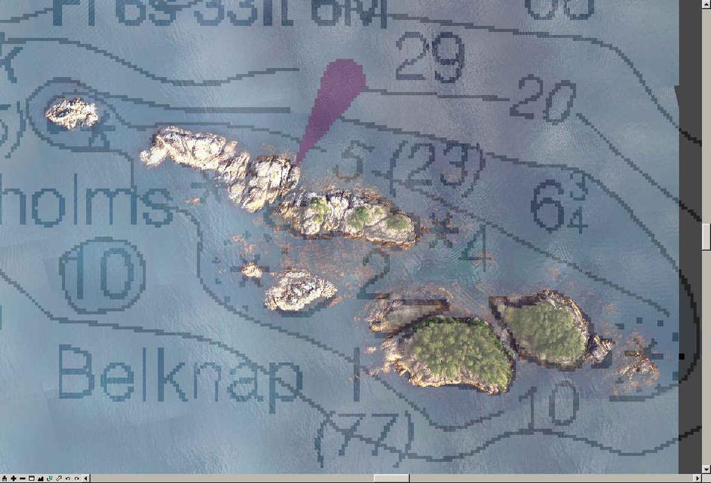
77 All LIDAR Soundings : DTM of MBES Surface LIDAR Data Passes IHO Order 1 Depth Accuracy

78 Target Detection Only shallower targets seen due to water clarity 300 m B O Inspected using KGPS dataset C J K G D F E A M N 4x4 m 2x2m 3.1 o H I L 270 m Compared by measuring height above surrounding seafloor remove any bias in data from analysis
79 Target Detection Multibeam LIDAR - 4x4 ALL LIDAR - 2x2 ALL Size (m) Surrounding Water Depth (m) Height Above Seafloor (m) Height Above Seafloor (m) Height Above Seafloor (m) A 56 x D Too Deep Too Deep H I L M N
80 Conclusions Achieve IHO Order 1 depth accuracy above 95% confidence SHOALS-1000T capable of detecting targets within the abilities of LIDAR but not guaranteed with a 4x4m spot spacing LIDAR technology does not have the same accuracy as MBES when finding least depths on sharp targets, due to footprint size Fugro Pelagos & SHOALS-1000T is able to reach required standards for hydrographic surveys
81 SYSTEM APPLICATIONS Hydrography River Surveys Coastal Zone Mapping

82 Airborne LIDAR Bathymetry combined with Multibeam Bathymetry for Hydrographic Charting

83 Smooth Sheet

84 Sitka Air Photo Ortho Mosaic
85 Belknap

86 Drape Over DEM


87 Elimination of Shallow Water Boat Work Reduces Time, Cost and Safety Risk
88 Shoreline Correlator


89 ALB Markets Ports & Harbor Surveys

90 ALB Markets Shoreline Mapping


91 ALB Markets Rivers, Lakes, Canals and Inland Waterways

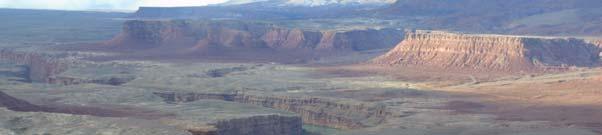


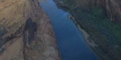
92 Grand Canyon


93 Trinity River

94 Yakima River Kittitas Reach

95 Yakima River Kittitas Reach


96 COASTAL ZONE MAPPING - SANDAG Project IMAGERY LIDAR Bathymetry Multibeam Echosounder Acoustics Digital Multispectral Photography Multibeam Backscatter Acoustics WATER DEPTH


97 Integrated LIDAR Bathymetry and Multibeam Echosounder Data Acoustic Multibeam LIDAR Bathymetry

98 Integrated Digital MultiSpectral Photography and Multibeam Echosounder Backscatter Images

99 ArcGIS example - Interpretation

100 GIS Data from the SANDAG Project Now Available Online
101 LATEST DEVELOPMENTS LIDAR Pseudoreflectance Hyperspectral Data Fusion

102 SHOALS-1000T Waveforms Permit Seabed Imaging bottom peak signal

103 LIDAR Pseudoreflectance Seabed Imagery


104 SHOALS-1000T Offers Sensor Fusion Developments Images courtesy of Optech International K 53 4 ρ W 534 ρ B 53 4 CASI ρ B 534


105 Seafloor reflectance for each channel of the passive hyperspectral data Images courtesy of Optech International
Seabed Mapping with LiDAR
 Seabed Mapping with LiDAR 2011 Jakarta David Jonas Lt Cdr Rupert Forester-Bennett RN (ret( ret d) October 18 th 2011 Mapping in South East Asia Field Survey Aerial Photography LiDAR Pleased to Introduce
Victorian Coastline LiDAR Survey 2008 / 2009
 Victorian Coastline LiDAR Survey 2008 / 2009 Airborne LiDAR Bathymetric Survey for Climate Change Victorian Future Coasts Bathymetric LiDAR Survey 2008 / 2009 Mark Sinclair Dr Nathan Quadros Sydney, Australia,
CLASSIFICATION OF NONPHOTOGRAPHIC REMOTE SENSORS
 CLASSIFICATION OF NONPHOTOGRAPHIC REMOTE SENSORS PASSIVE ACTIVE DIGITAL CAMERA THERMAL (e.g. TIMS) VIDEO CAMERA MULTI- SPECTRAL SCANNERS VISIBLE & NIR MICROWAVE HYPERSPECTRAL (e.g. AVIRIS) SLAR Real Aperture
HawkEye III - A new deep penetrating bathymetric LIDAR system
 Please insert a picture (Insert, Picture, from file). Size according to grey field (10 cm x 25.4 cm). Scale picture: highlight, pull corner point Cut picture: highlight, choose the cutting icon from the
About LIDAR Data. What Are LIDAR Data? How LIDAR Data Are Collected
 1 of 6 10/7/2006 3:24 PM Project Overview Data Description GIS Tutorials Applications Coastal County Maps Data Tools Data Sets & Metadata Other Links About this CD-ROM Partners About LIDAR Data What Are
Better detection and discrimination of seagrasses using fused bathymetric lidar and hyperspectral data
 Better detection and discrimination of seagrasses using fused bathymetric lidar and hyperspectral data Bruce Sabol and Molly Reif US Army Engineer Research and Development Center, Environmental Laboratory
Feature Detection Performance of a Bathymetric Lidar in Saipan
 Feature Detection Performance of a Bathymetric Lidar in Saipan LTJG Russell Quintero NOAA National Geodetic Survey - JALBTCX, Kiln, MS russell.quintero@noaa.gov Jerry Mills NOAA Office of Coast Survey
An Introduction to Lidar & Forestry May 2013
 An Introduction to Lidar & Forestry May 2013 Introduction to Lidar & Forestry Lidar technology Derivatives from point clouds Applied to forestry Publish & Share Futures Lidar Light Detection And Ranging
LiDAR & Orthophoto Data Report
 LiDAR & Orthophoto Data Report Tofino Flood Plain Mapping Data collected and prepared for: District of Tofino, BC 121 3 rd Street Tofino, BC V0R 2Z0 Eagle Mapping Ltd. #201 2071 Kingsway Ave Port Coquitlam,
Data Acquisition; Maintenance, and Dissemination
 Data Acquisition; Maintenance, and Dissemination Amar Nayegandhi, CP, CMS(RS), GISP Director of Remote Sensing Dewberry December 4, 2014 About MAPPS + MAPPS is the only national association of private
RIEGL VQ 880 G Laser Scanner System for Topo Bathymetric Surveying. IR laser scanner channel OCTOBER 2015
 RIEGL VQ 880 G Laser Scanner System for Topo Bathymetric Surveying with NEW optional IR laser scanner channel OCTOBER 2015 VQ 880 G Highlights excellently suited for combined hydrographic and topographic
LIDAR MAPPING FACT SHEET
 1. LIDAR THEORY What is lidar? Lidar is an acronym for light detection and ranging. In the mapping industry, this term is used to describe an airborne laser profiling system that produces location and
SHALLOW SOUNDING BATHYMETRIC USING MULTIBEAM ECHOSOUNDER AND TOPOGRAPHIC LASER SCANNER
 SHALLOW SOUNDING BATHYMETRIC USING MULTIBEAM ECHOSOUNDER AND TOPOGRAPHIC LASER SCANNER BY : NURSUGI, TRI PATMASARI & KHAFID GEOSPASIAL INFORMATION AGENCY AMSTERDAM, 11-14 NOVEMBER 2014 Indonesia coastline
Prepared for: CALIFORNIA COAST COMMISSION c/o Dr. Stephen Schroeter 45 Fremont Street, Suite 2000 San Francisco, CA
 REVIEW OF MULTIBEAM SONAR SURVEYS WHEELER REEF NORTH, SAN CLEMENTE, CALIFORNIA TO EVALUATE ACCURACY AND PRECISION OF REEF FOOTPRINT DETERMINATIONS AND CHANGES BETWEEN 2008 AND 2009 SURVEYS Prepared for:
A SENSOR FUSION APPROACH TO COASTAL MAPPING
 A SENSOR FUSION APPROACH TO COASTAL MAPPING Maryellen Sault, NOAA, National Ocean Service, National Geodetic Survey Christopher Parrish, NOAA, National Ocean Service, National Geodetic Survey Stephen White,
Airborne LiDAR Data Acquisition for Forestry Applications. Mischa Hey WSI (Corvallis, OR)
") Airborne LiDAR Data Acquisition for Forestry Applications Mischa Hey WSI (Corvallis, OR) WSI Services Corvallis, OR Airborne Mapping: Light Detection and Ranging (LiDAR) Thermal Infrared Imagery 4-Band
Airborne LiDAR Data Acquisition for Forestry Applications Mischa Hey WSI (Corvallis, OR) WSI Services Corvallis, OR Airborne Mapping: Light Detection and Ranging (LiDAR) Thermal Infrared Imagery 4-Band
NOAA Integrated Ocean and Coastal Mapping Using Hurricane Sandy Response Data to Help Build a Bridge Between Lidar Bathymetry and The Chart
 NOAA Integrated Ocean and Coastal Mapping Using Hurricane Sandy Response Data to Help Build a Bridge Between Lidar Bathymetry and The Chart JALBTCX Airborne Coastal Mapping and Charting Workshop July 19-21
EXTRACTING SURFACE FEATURES OF THE NUECES RIVER DELTA USING LIDAR POINTS INTRODUCTION
 EXTRACTING SURFACE FEATURES OF THE NUECES RIVER DELTA USING LIDAR POINTS Lihong Su, Post-Doctoral Research Associate James Gibeaut, Associate Research Professor Harte Research Institute for Gulf of Mexico
SPAR, ELMF 2013, Amsterdam. Laser Scanning on the UK Highways Agency Network. Hamish Grierson Blom Uk
 SPAR, ELMF 2013, Amsterdam Laser Scanning on the UK Highways Agency Network Hamish Grierson Blom Uk www.blomasa.com www.blom-uk.co.uk Blom UK Part of the Blom Group Blom Group - Europe s largest aerial
CODEVINTEC. Caris Hydrographic Survey. CARIS HIPS and SIPS CARIS Onboard. Bathy DataBASE 4.4. Bathy DataBASE Server 4.3. BASE Editor 4.
 45 27 39.384 N 9 07 30.145 E Caris Hydrographic Survey Photo: João Ventura da Cruz CARIS HIPS and SIPS 10.4 page 2 CARIS Onboard page 4 Bathy DataBASE 4.4 page 6 Bathy DataBASE Server 4.3 page 7 BASE Editor
Light Detection and Ranging (LiDAR)
") Light Detection and Ranging (LiDAR) http://code.google.com/creative/radiohead/ Types of aerial sensors passive active 1 Active sensors for mapping terrain Radar transmits microwaves in pulses determines
Light Detection and Ranging (LiDAR) http://code.google.com/creative/radiohead/ Types of aerial sensors passive active 1 Active sensors for mapping terrain Radar transmits microwaves in pulses determines
Center for Advanced Imaging LADAR. A 3D Texel Camera
 Center for Advanced Imaging LADAR Utah State University A 3D Texel Camera Kylee Sealy Industry Day 12/28/2006 Problem/Opportunity Existing 3D Cameras: > Systems are relatively slow and awkward > Hard to
Orthophotography and LiDAR Terrain Data Collection Rogue River, Oregon Final Report
 Orthophotography and LiDAR Terrain Data Collection Rogue River, Oregon Final Report Prepared by Sky Research, Inc. 445 Dead Indian Memorial Road Ashland, OR 97520 Prepared for Rogue Valley Council of Governments
Eunmi Chang, Hyo-Hyun Sung, Jaeyeong Roh, Eunyoung Kim
 Eunmi Chang, Hyo-Hyun Sung, Jaeyeong Roh, Eunyoung Kim Ziinconsulting INC., Ewha Woman s University Korean Hydrographic and Oceanographic Administration Geostrory INC. Based on (IMO Res. A 884(21)) Marine
LiDAR Remote Sensing Data Collection: Yaquina and Elk Creek Watershed, Leaf-On Acquisition
 LiDAR Remote Sensing Data Collection: Yaquina and Elk Creek Watershed, Leaf-On Acquisition Submitted by: 4605 NE Fremont, Suite 211 Portland, Oregon 97213 April, 2006 Table of Contents LIGHT DETECTION
LIDAR an Introduction and Overview
 LIDAR an Introduction and Overview Rooster Rock State Park & Crown Point. Oregon DOGAMI Lidar Project Presented by Keith Marcoe GEOG581, Fall 2007. Portland State University. Light Detection And Ranging
HAWAII KAUAI Survey Report. LIDAR System Description and Specifications
 HAWAII KAUAI Survey Report LIDAR System Description and Specifications This survey used an Optech GEMINI Airborne Laser Terrain Mapper (ALTM) serial number 06SEN195 mounted in a twin-engine Navajo Piper
Terrestrial GPS setup Fundamentals of Airborne LiDAR Systems, Collection and Calibration. JAMIE YOUNG Senior Manager LiDAR Solutions
 Terrestrial GPS setup Fundamentals of Airborne LiDAR Systems, Collection and Calibration JAMIE YOUNG Senior Manager LiDAR Solutions Topics Terrestrial GPS reference Planning and Collection Considerations
High resolution survey and orthophoto project of the Dosso-Gaya region in the Republic of Niger. by Tim Leary, Woolpert Inc.
 High resolution survey and orthophoto project of the Dosso-Gaya region in the Republic of Niger by Tim Leary, Woolpert Inc. Geospatial Solutions Photogrammetry & Remote Sensing LiDAR Professional Surveying
LIDAR Workshop IPSRS Commission 1
 LIDAR Workshop IPSRS Commission 1 2-Jul-2007, Ljubliana, Slovenia Arthur Rohrbach, Leica Geosystems, Switzerland Presentation topics 1. Basics of Airborne LIDAR Sensing Technology 2. Typical Applications
N.J.P.L.S. An Introduction to LiDAR Concepts and Applications
 N.J.P.L.S. An Introduction to LiDAR Concepts and Applications Presentation Outline LIDAR Data Capture Advantages of Lidar Technology Basics Intensity and Multiple Returns Lidar Accuracy Airborne Laser
Software for Hydrographic Data Processing
 Software for Hydrographic Data Processing Data courtesy of Dr. T. Komatsu, Tokyo University Ocean Research Institute CleanSweep provides a fast, user friendly environment for processing hydrographic survey
ALS40 Airborne Laser Scanner
 ALS40 Airborne Laser Scanner Airborne LIDAR for Professionals High Performance Laser Scanning Direct Measurement of Ground Surface from the Air The ALS40 Airborne Laser Scanner measures the topography
Aerial and Mobile LiDAR Data Fusion
 Creating Value Delivering Solutions Aerial and Mobile LiDAR Data Fusion Dr. Srini Dharmapuri, CP, PMP What You Will Learn About LiDAR Fusion Mobile and Aerial LiDAR Technology Components & Parameters Project
LIDAR as a Tool for Shoreline Mapping
 LIDAR as a Tool for Shoreline Mapping Shachak Pe eri, Lynn Morgan, and Andy Armstrong Center for Coastal and Ocean Mapping, University of New Hampshire William D. Philpot Cornell University, Ithaca Gary
Assessing the Potential of LiDAR/Bathymetry Integration within the Thames Estuary
 Assessing the Potential of LiDAR/Bathymetry Integration within the Thames Estuary Thomas LOWE, United Kingdom Key words: Topographic LiDAR, single beam bathymetric data, Port of London Authority, inter-tidal
Author(s): Version: 2 Date published: 15/01/2007 File name: Language: ROG_LiDAR.doc English Number of pages: 19
: Version: 2 Date published: 15/01/2007 File name: Language: ROG_LiDAR.doc English Number of pages: 19") Title: Author(s): Recommended operating guidelines (ROG) for LiDAR surveys Steven Piel, Jacques Populus (IFREMER) Document owner: Jacques Populus (jpopulus@jifremer.fr) Reviewed by: J. White. 19 th Jan
Title: Author(s): Recommended operating guidelines (ROG) for LiDAR surveys Steven Piel, Jacques Populus (IFREMER) Document owner: Jacques Populus (jpopulus@jifremer.fr) Reviewed by: J. White. 19 th Jan
High Resolution Laserscanning, not only for 3D-City Models
 Lohr 133 High Resolution Laserscanning, not only for 3D-City Models UWE LOHR, Ravensburg ABSTRACT The TopoSys laserscanner system is designed to produce digital elevation models (DEMs) of the environment
Quinnipiac Post Flight Aerial Acquisition Report
 Quinnipiac Post Flight Aerial Acquisition Report August 2011 Post-Flight Aerial Acquisition and Calibration Report FEMA REGION 1 Quinnipiac Watershed, Connecticut, Massachusesetts FEDERAL EMERGENCY MANAGEMENT
Field Integration of Lidar and Sonar Hydrographic Surveys
 Field Integration of Lidar and Sonar Hydrographic Surveys Nicholas Gianoutsos, LTJG Samuel Greenaway, LT Benjamin K. Evans, CDR Guy T. Noll National Oceanic & Atmospheric Administration, National Ocean
GEOACOUSTICS GEOSWATH PLUS DATA PROCESSING WITH CARIS HIPS 8.1
 GEOACOUSTICS GEOSWATH PLUS DATA PROCESSING WITH CARIS HIPS 8.1 IN SUPPORT OF SANDY SUPPLEMENTAL RESEARCH Val Schmidt and Kevin Jerram University of New Hampshire Center for Coastal and Ocean Mapping Sunken
Developing an acceptance test for nonhydrographic airborne bathymetric lidar data application to NOAA charts in shallow waters
 University of New Hampshire University of New Hampshire Scholars' Repository Center for Coastal and Ocean Mapping Center for Coastal and Ocean Mapping 3-2013 Developing an acceptance test for nonhydrographic
A procedure for developing an acceptance test for airborne bathymetric lidar data application to NOAA charts in shallow waters
 University of New Hampshire University of New Hampshire Scholars' Repository Center for Coastal and Ocean Mapping Center for Coastal and Ocean Mapping 1-2013 A procedure for developing an acceptance test
Mapping Project Report Table of Contents
 LiDAR Estimation of Forest Leaf Structure, Terrain, and Hydrophysiology Airborne Mapping Project Report Principal Investigator: Katherine Windfeldt University of Minnesota-Twin cities 115 Green Hall 1530
Lidar Sensors, Today & Tomorrow. Christian Sevcik RIEGL Laser Measurement Systems
 Lidar Sensors, Today & Tomorrow Christian Sevcik RIEGL Laser Measurement Systems o o o o Online Waveform technology Stand alone operation no field computer required Remote control through wireless network
A Method to Create a Single Photon LiDAR based Hydro-flattened DEM
 A Method to Create a Single Photon LiDAR based Hydro-flattened DEM Sagar Deshpande 1 and Alper Yilmaz 2 1 Surveying Engineering, Ferris State University 2 Department of Civil, Environmental, and Geodetic
LiDAR Technical Report NE Washington LiDAR Production 2017
 LiDAR Technical Report NE Washington LiDAR Production 2017 Presented to: Washington DNR 1111 Washington Street SE Olympia, Washington 98504 Submitted by: 860 McKinley St Eugene, OR 97402 July 26, 2017
Working with airborne LIDAR system
 48 24 3 23 REPORT OF HYDROGRAPHIC AND OCEANOGRAPHIC RESEARCHES No.48 March, 2012 Working with airborne LIDAR system Tomozou ONO and Haruka SHIBATA Abstract Eight years have passed since introduction in
Coastal Survey of archaeological sites using drones
 Coastal Survey of archaeological sites using drones In Poseidon s Realm XXI Underwater archaeology - interdisciplinary approaches and technical innovations Dimitrios Skarlatos, Savvidou Eleni Photogrammetric
Technical Considerations and Best Practices in Imagery and LiDAR Project Procurement
 Technical Considerations and Best Practices in Imagery and LiDAR Project Procurement Presented to the 2014 WV GIS Conference By Brad Arshat, CP, EIT Date: June 4, 2014 Project Accuracy A critical decision
Municipal Projects in Cambridge Using a LiDAR Dataset. NEURISA Day 2012 Sturbridge, MA
 Municipal Projects in Cambridge Using a LiDAR Dataset NEURISA Day 2012 Sturbridge, MA October 15, 2012 Jeff Amero, GIS Manager, City of Cambridge Presentation Overview Background on the LiDAR dataset Solar
ENY-C2005 Geoinformation in Environmental Modeling Lecture 4b: Laser scanning
 1 ENY-C2005 Geoinformation in Environmental Modeling Lecture 4b: Laser scanning Petri Rönnholm Aalto University 2 Learning objectives To recognize applications of laser scanning To understand principles
SeaBat T50-P Product Description
 SeaBat T50-P Ultra-High Resolution Multibeam Echosounder December 2015 Table of Contents System Overview... 4 Introduction... 4 Typical Applications... 4 Warranty... 4 System Architecture... 5 SeaBat T50-P...
Third Rock from the Sun
 Geodesy 101 AHD LiDAR Best Practice The Mystery of LiDAR Best Practice Glenn Jones SSSi GIS in the Coastal Environment Batemans Bay November 9, 2010 Light Detection and Ranging (LiDAR) Basic principles
1. LiDAR System Description and Specifications
 High Point Density LiDAR Survey of Mayapan, MX PI: Timothy S. Hare, Ph.D. Timothy S. Hare, Ph.D. Associate Professor of Anthropology Institute for Regional Analysis and Public Policy Morehead State University
Terrain Modeling and Mapping for Telecom Network Installation Using Scanning Technology. Maziana Muhamad
 Terrain Modeling and Mapping for Telecom Network Installation Using Scanning Technology Maziana Muhamad Summarising LiDAR (Airborne Laser Scanning) LiDAR is a reliable survey technique, capable of: acquiring
LIDAR and Terrain Models: In 3D!
 LIDAR and Terrain Models: In 3D! Stuart.green@teagasc.ie http://www.esri.com/library/whitepapers/pdfs/lidar-analysis-forestry.pdf http://www.csc.noaa.gov/digitalcoast/_/pdf/refinement_of_topographic_lidar_to_create_a_bare_e
Mayden VP of Business Development Surdex Corporation
 Making Sense of Sensors Randy Mayden, Mayden VP of Business Development Surdex Corporation randym@surdex.com EARLYAERIAL PHOTOGRAPHY 2 FIRSTAERIAL CAMERA 3 AERIAL CAMERA SYSTEM DEVELOPMENT Aerial Camera
Checking the values using backscatter data
 A Technique for using Backscatter Imagery to Calibrate your Multibeam sonar Harold Orlinsky Harold@Hypack.com Checking the values using backscatter data The collection of Backscatter is co located with
Patch Test & Stability Check Report
 Patch Test & Stability Check Report Storebælt, 2009 SB Cable Project CT Offshore Final Report November, 2009 SB Cable Project November 2009 8-10 Teglbaekvej DK-8361 Hasselager Aarhus, Denmark Tel: +45
Real time 3D display of hydrographic data for QA and QC.
 Real time 3D display of hydrographic data for QA and QC. Roland Arsenault Center for Coastal and Ocean Mapping & Joint Hydrographic Center University of New Hampshire roland@ccom.unh.edu Figure 1 Data
JALBTCX Activities and USACE National Coastal Mapping Program Update
 JALBTCX Activities and USACE National Coastal Mapping Program Update Jennifer M. Wozencraft Director, Joint Airborne Lidar Bathymetry Technical Center of Expertise Manager, National Coastal Mapping Program
Flood Risk Mapping with LIDAR
 Flood Risk Mapping with LIDAR Edward MacKinnon, AGRG June 16, 2004 University of Moncton Tim Webster, Project Supervisor Project Manager, Réal Daigle LIDAR Data (TERRA) Validation data (AGRG) Orthophotos
Course Outline (1) #6 Data Acquisition for Built Environment. Fumio YAMAZAKI
 #6 Data Acquisition for Built Environment. Fumio YAMAZAKI") AT09.98 Applied GIS and Remote Sensing for Disaster Mitigation #6 Data Acquisition for Built Environment 9 October, 2002 Fumio YAMAZAKI yamazaki@ait.ac.th http://www.star.ait.ac.th/~yamazaki/ Course Outline
AT09.98 Applied GIS and Remote Sensing for Disaster Mitigation #6 Data Acquisition for Built Environment 9 October, 2002 Fumio YAMAZAKI yamazaki@ait.ac.th http://www.star.ait.ac.th/~yamazaki/ Course Outline
Lidar Technical Report
 Lidar Technical Report Oregon Department of Forestry Sites Presented to: Oregon Department of Forestry 2600 State Street, Building E Salem, OR 97310 Submitted by: 3410 West 11st Ave. Eugene, OR 97402 April
MPA Baseline Program. Annual Progress Report
 MPA Baseline Program Annual Progress Report Principal Investigators - please use this form to submit your MPA Baseline Program project annual report, including an update on activities completed over the
Phone: (603) Fax: (603) Table of Contents
 Fax: (603) Table of Contents") Hydrologic and topographic controls on the distribution of organic carbon in forest Soils LIDAR Mapping Project Report Principal Investigator: Adam Finkelman Plumouth State University Plymouth State University,
Hydrologic and topographic controls on the distribution of organic carbon in forest Soils LIDAR Mapping Project Report Principal Investigator: Adam Finkelman Plumouth State University Plymouth State University,
Quality Assurance and Quality Control Procedures for Survey-Grade Mobile Mapping Systems
 Quality Assurance and Quality Control Procedures for Survey-Grade Mobile Mapping Systems Latin America Geospatial Forum November, 2015 Agenda 1. Who is Teledyne Optech 2. The Lynx Mobile Mapper 3. Mobile
MISSISSIPPI AND ALABAMA COASTAL MAPPING
 LIDAR REPORT MISSISSIPPI AND ALABAMA COASTAL MAPPING U.S. ARMY CORPS OF ENGINEERS MOBILE DISTRICT CONTRACTOR: R&M CONSULTANTS, INC. CONTRACT NO. W91278-04-D-0001/0003 EN PROJECT NO. C-05-054 Prepared By:
MULTISPECTRAL MAPPING
 VOLUME 5 ISSUE 1 JAN/FEB 2015 MULTISPECTRAL MAPPING 8 DRONE TECH REVOLUTION Forthcoming order of magnitude reduction in the price of close-range aerial scanning 16 HANDHELD SCANNING TECH 32 MAX MATERIAL,
Learning Objectives LIGHT DETECTION AND RANGING. Sensing. Blacksburg, VA July 24 th 30 th, 2010 LiDAR: Mapping the world in 3-D Page 1
 LiDAR: Mapping the world in 3-D Val Thomas Department of Forest Resources & Environmental Conservation July 29, 2010 Learning Objectives Part 1: Lidar theory What is lidar? How does lidar work? What are
Airborne Laser Scanning: Remote Sensing with LiDAR
 Airborne Laser Scanning: Remote Sensing with LiDAR ALS / LIDAR OUTLINE Laser remote sensing background Basic components of an ALS/LIDAR system Two distinct families of ALS systems Waveform Discrete Return
Airborne Laser Survey Systems: Technology and Applications
 Abstract Airborne Laser Survey Systems: Technology and Applications Guangping HE Lambda Tech International, Inc. 2323B Blue Mound RD., Waukesha, WI-53186, USA Email: he@lambdatech.com As mapping products
Topo-bathymetric Lidar Research to support Remediation of Boat Harbour
 Topo-bathymetric Lidar Research to support Remediation of Boat Harbour Prepared by Applied Geomatics Research Group NSCC, Middleton Tel. 902 825 5475 email: tim.webster@nscc.ca Submitted to Public Services
THE RANGER-UAV FEATURES
 THE RANGER-UAV The Ranger Series Ranger-UAV is designed for the most demanding mapping applications, no compromises made. With a 9 meter laser range, this system produces photorealistic 3D point clouds
Merlin vessel-based lidar system
 Brochure: Merlin vessel-based lidar system Merlin vessel-based lidar system Map the full environment in one pass Scanning the full marine environment in a single operation reduces the amount of time crew
Lewis County Public Works Department (County) GIS Mapping Division 350 N. Market Blvd. Chehalis, WA Phone: Fax:
 GIS Mapping Division 350 N. Market Blvd. Chehalis, WA Phone: Fax:") March 31, 2005 Project Report Lewis County, WA Contract #2262-H Report Presented to: Lewis County Public Works Department (County) GIS Mapping Division 350 N. Market Blvd. Chehalis, WA 98532-2626 Phone:
March 31, 2005 Project Report Lewis County, WA Contract #2262-H Report Presented to: Lewis County Public Works Department (County) GIS Mapping Division 350 N. Market Blvd. Chehalis, WA 98532-2626 Phone:
Simulating Dynamic Hydrological Processes in Archaeological Contexts Mapping Project Report
 Simulating Dynamic Hydrological Processes in Archaeological Contexts Mapping Project Report Principal Investigator: Wetherbee Dorshow University of New Mexico 15 Palacio Road Santa Fe, NM 87508 e-mail:
REMOTE SENSING LiDAR & PHOTOGRAMMETRY 19 May 2017
 REMOTE SENSING LiDAR & PHOTOGRAMMETRY 19 May 2017 SERVICES Visual Inspections Digital Terrain Models Aerial Imagery Volume Computations Thermal Inspections Photo maps Aerial Video Training & Consultancy
Phone: Fax: Table of Contents
 Geomorphic Characterization of Precarious Rock Zones LIDAR Mapping Project Report Principal Investigator: David E. Haddad Arizona State University ASU School of Earth and Space
SLR, Climate Change, Infrastructure Solutions, Adaption and GIS
 Presenters: Francisco D Elia B.S., M.Sc. Geographic Information Systems Franciscodelia@miamibeachfl.gov Nestor Navarro, GISP, MCSA GIS Manager Nestornavarro@miamibeachfl.gov Data Acquisition, Integration
2-4 April 2019 Taets Art and Event Park, Amsterdam CLICK TO KNOW MORE
 Co-Host Host 2-4 April 2019 Taets Art and Event Park, Amsterdam CLICK TO KNOW MORE Presentation Outline review modern survey methodologies available to support railway requirements measuring everything
LiDAR data pre-processing for Ghanaian forests biomass estimation. Arbonaut, REDD+ Unit, Joensuu, Finland
 LiDAR data pre-processing for Ghanaian forests biomass estimation Arbonaut, REDD+ Unit, Joensuu, Finland Airborne Laser Scanning principle Objectives of the research Prepare the laser scanning data for
Hamilton County Enhances GIS Base Mapping with 1-foot Contours
 Hamilton County Enhances GIS Base Mapping with 1-foot Contours Presented by Larry Stout, Hamilton County GIS Manager Brad Fugate, Woolpert Inc. Today s Presentation Hamilton County s 2004 Base Mapping
Project Report Nooksack South Fork Lummi Indian Nation. Report Presented to:
 June 5, 2005 Project Report Nooksack South Fork Lummi Indian Nation Contract #2291-H Report Presented to: Lummi Indian Nation Natural Resources Department 2616 Kwina Road Bellingham, WA 98226 Point of
LiDAR data overview. Dr. Keiko Saito Global Facility for Disaster Reduction and Recovery (GFDRR)
") LiDAR data overview Dr. Keiko Saito Global Facility for Disaster Reduction and Recovery (GFDRR) LiDAR (Light Detecting And Ranging) 3D height profile Laser emitted from sensor onboard aircraft to measure
LiDAR data overview Dr. Keiko Saito Global Facility for Disaster Reduction and Recovery (GFDRR) LiDAR (Light Detecting And Ranging) 3D height profile Laser emitted from sensor onboard aircraft to measure
Quality Control Concepts for LiDAR
 Quality Control Concepts for LiDAR January 24, 2012 Engineering Architecture Design-Build Surveying GeoSpatial Solutions Presentation Objectives Offer realistic and constructive advice for LiDAR project
2010 LiDAR Project. GIS User Group Meeting June 30, 2010
 2010 LiDAR Project GIS User Group Meeting June 30, 2010 LiDAR = Light Detection and Ranging Technology that utilizes lasers to determine the distance to an object or surface Measures the time delay between
Table of Contents. 1. Overview... 1
 LIDAR REMOTE SENSING DATA COLLECTION: Diiabllo Canyon,, CA Prreparred by: : Prreparred fforr: : WSII Corrval lliss Offffi ice 5117 SW 2 nndd Stt,, Suitte 400 Corrval lliss,, OR 97333 Updaatteed Maayy 33,,,
THE USE OF TERRESTRIAL LASER SCANNING FOR MEASUREMENTS IN SHALLOW-WATER: CORRECTION OF THE 3D COORDINATES OF THE POINT CLOUD
 Photogrammetry and Remote Sensing Published as: Deruyter, G., Vanhaelst, M., Stal, C., Glas, H., De Wulf, A. (2015). The use of terrestrial laser scanning for measurements in shallow-water: correction
Project Report Lower Columbia River. Report Presented to:
 December 29, 2005 Project Report Lower Columbia River Contract #2265-H Report Presented to: Puget Sound Lidar Consortium 1011 Western Avenue, Suite 500 Seattle, WA 98104 Phone: (206) 464-7090 Fax: (206)
Advancements in Area-Based Imagery Processing
 Advancements in Area-Based Imagery Processing An integrated Geocoder delivers a streamlined workflow and new capabilities Alexander MacDonald, CARIS, Canada Corey Collins, CARIS, Canada For many years
LIDAR 101 & 2014 MO/AR LIDAR PARTNERS PROJECT. NEMO GIS Workshop
 LIDAR 101 & 2014 MO/AR LIDAR PARTNERS PROJECT NEMO GIS Workshop May 22, 2014 PRESENTER Tim Donze Business Development Surdex Corporation PRESENTATION TOPICS What is LiDAR? Why is LiDAR Valuable? Missouri
Wednesday, July 15, Author: Eldris Ferrer Gonzalez, M.Sc. Engineering CSA Group
 Twenty ninth Annual ESRI International User Conference Wednesday, July 15, 2009 Author: Eldris Ferrer Gonzalez, M.Sc. Engineering CSA Group Introduction to Valenciano Project LIDAR Survey for Valenciano
Quantifying the Geomorphic and Sedimentological Responses to Dam Removal. Mapping Project Report
 Quantifying the Geomorphic and Sedimentological Responses to Dam Removal. Mapping Project Report January 21, 2011 Principal Investigator: John Gartner Dartmouth College Department of Earth Sciences Hanover,
Performance Evaluation of Optech's ALTM 3100: Study on Geo-Referencing Accuracy
 Performance Evaluation of Optech's ALTM 3100: Study on Geo-Referencing Accuracy R. Valerie Ussyshkin, Brent Smith, Artur Fidera, Optech Incorporated BIOGRAPHIES Dr. R. Valerie Ussyshkin obtained a Ph.D.
Developing Methodology for Efficient Eelgrass Habitat Mapping Across Lidar Systems
 Developing Methodology for Efficient Eelgrass Habitat Mapping Across Lidar Systems VICTORIA PRICE 1, JENNIFER DIJKSTRA 1, JARLATH O NEIL-DUNNE 2, CHRISTOPHER PARRISH 3, ERIN NAGEL 1, SHACHAK PE ERI 1 UNIVERSITY
Overview of the Trimble TX5 Laser Scanner
 Overview of the Trimble TX5 Laser Scanner Trimble TX5 Revolutionary and versatile scanning solution Compact / Lightweight Efficient Economical Ease of Use Small and Compact Smallest and most compact 3D
Lecture 11. LiDAR, RADAR
 NRMT 2270, Photogrammetry/Remote Sensing Lecture 11 Calculating the Number of Photos and Flight Lines in a Photo Project LiDAR, RADAR Tomislav Sapic GIS Technologist Faculty of Natural Resources Management
2. POINT CLOUD DATA PROCESSING
 Point Cloud Generation from suas-mounted iphone Imagery: Performance Analysis A. D. Ladai, J. Miller Towill, Inc., 2300 Clayton Road, Suite 1200, Concord, CA 94520-2176, USA - (andras.ladai, jeffrey.miller)@towill.com