Better detection and discrimination of seagrasses using fused bathymetric lidar and hyperspectral data
|
|
|
- Johnathan Phelps
- 6 years ago
- Views:
Transcription

1 Better detection and discrimination of seagrasses using fused bathymetric lidar and hyperspectral data Bruce Sabol and Molly Reif US Army Engineer Research and Development Center, Environmental Laboratory PIANC, Dredging /8/


2 Joint Airborne Lidar Bathymetry Technical Center of Expertise Annual Technical Workshop June 2012, Chicago SOPs OPERATIONS Collection Areas Sensors and systems RESEARCH AND DEVELOPMENT Data Exploitation 11/8/
 20,000 Hz Pulse")
 CASI-1500 Hyperspectral")


 ~ 5 cm /")
3 CHARTS System Specifications 3,000 Hz Pulse Rate (hydro) 20,000 Hz Pulse Rate (topo) 1 Hz Digital camera (~35 cm pixel) CASI-1500 Hyperspectral Imager 1500 cross-track pixels nm wavelength 1 m pixel w/ 36 spectral bands Optech SHOALS-3000 Integrated Laser DuncanTech-4000 RGB System camera Itres CASI-1500 Hyperspectral Imager SHOALS-3000 Operator Console CASI-1500 Operator Console Bottom Aircraft Port Applanix DSS megapixel (5436 X 4092) ~ 5 cm / pixel (at 400m) Color (VIS) or Color IR (CIR) Includes POS / AV 11/8/


4 Hardware development Coastal Zone Mapping and Imaging Lidar shorter laser pulse length circular scan faster laser pulse rate shorter system response faster area coverage operation in more turbid and deeper waters improved performance in breaking waves improved navigation hazard detection improved accuracy for depth measurement, water column properties, and bottom characterization higher-density topographic and shallow bathymetric measurements CZMIL concept of operations larger field-of-view single-laser solution CZMIL laser sub-system more sensitive receivers segmented detector


5 National Coastal Mapping Progress Number of times surveyed since 2004 One Time Two Times Three Times Four Times Five Times Six Times Products ASCII XYZ Aerial photos Zero contour Aerial photo mosaics 1-meter bathy/topo DEM LAS format topo 1-meter bathy/topo bare earth DEM Hyperspectral image mosaics Laser reflectance images Basic landcover classification Volume change

6 National Coastal Mapping Program Develop regional, repetitive, high-resolution, high-accuracy elevation and imagery data Build an understanding of how the coastal zone is changing Facilitate management of sediment and projects at a regional, or watershed scale Captiva Island, FL, 2010

7 Bathymetry and topography Marquette Harbor, MI


8 Dredging Operations and Environmental Research Work Unit: Use of Airborne Lidar and Hyperspectral Data to Detect and Discriminate SAV Species at Corps Dredging Sites Purpose: evaluate and demonstrate the use of fused airborne hyperspectral and bathymetric lidar data to detect and discriminate species of estuarine SAV and macroalgae in two representative small-craft dredged harbors; compare with other established airborne imagery analysis techniques Support For: Planning dredging operations Mitigating ecological damage Monitoring SAV Submersed Eelgrass spectra, Plymouth Harbor, MA


9 Study Sites: September 15-16, 2010 Survey Plymouth Harbor, MA Buttermilk Bay, MA
10 Measurement Plymouth Harbor Acoustic SAV survey 3 regions, 10 miles transects Buzzard s Bay 3 regions, 12 miles transects Purpose SAV mapping for point selection Drop camera 60 sites 60 sites Accuracy Diver observation 22 sites 22 sites Diver sampling 9 sites 9 sites Species, biomass, accuracy Submersed spectral reflectance (diver w/ video) Spectral reflectance (shallow) Water column optical properties Potential accuracy data points Ground Truth Data Summary 7 sites (88 samples) 9 sites (94 samples) 201 samples 121 samples Spectral optimizer calibration, accuracy 7 sites 9 sites Spectral optimizer calibration


11 Image Processing Methods: Overall Approach Coastal Zone Mapping and Imaging Lidar (CZMIL) Data Processing System (DPS) DPS with Spectral Optimization to characterize seafloor and water column * Spectral curve fitting approach using radiative transfer theory to invert the hyperspectral image with lidar depth as a constraint for modeling water column constituents and estimating bottom reflectance Classification of seafloor reflectance to solve for species Water leaving reflectance Water column attenuation CDOM absorption Chl concentration Active seafloor reflectance Spectral seafloor reflectance


12 Hyperspectral and Bathy Lidar Inputs Reflectance Depth


13 Image Processing Methods: DPS Spectral Optimization: Parameter Input Sand Eelgrass Brown Algae Chl-a concentration 440nm 532 nm

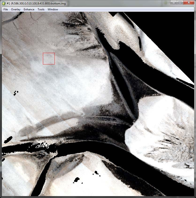
14 Bottom Reflectance Imagery Seagrass


15 Image Processing Methods: Classification Zoom 1: Seagrass ROI Selection Zoom 2: Brown/red algae


16 Results
17 Overall Accuracy Results Plymouth Harbor Decision level Spectral Optimized CASI/LiDAR (corrected bottom reflectance) CASI only, water leaving reflectance Input Data 3-color Geo-Eye I (spectral degraded CASI) 1:12,000 RGB aerial photography from Duncan Tech digital camera Super. 1 Unsuper. 2 Super. Unsuper. Super. Unsuper. Manual photointerp. 3 Veg/no-Veg 90% 87% 85% 78% Eelgrass/noeelgrass 88% 80% 83% 82% 88% 76% 73% 3-class : macroalgae, eelgrass, unveg 1. Supervised classification using Spectral Angle Mapper 2. Unsupervised classification using Isodata (20 iterations, 10 classes) 3. Charlie Costello, MA Dept of Environmental Protection
18 Summary and Benefits Determine the level of information needed for dredging operations planning Determine appropriate data requirements for specific SAV mapping tasks Benefits: More accurately identify SAV presence and type to reduce SAV impacts and potential dredge restrictions Model results with SAV type may provide a better understanding of impacts and potential exposure resulting from navigation and dredging Detailed SAV in dredge planning for identification of source/disposal sites and alternative scenario comparison


19 Products: 1) ARC GIS Explorer Online: 2) Ground Truth Technical Report
20 Acknowledgements: the team NAE: Bill Hubbard, Ben Loyd, Angela Repella, Phoebe Chu EPA: Phil Colarusso and dive team MA DEP: Charlie Costello U. of Connecticut: Dr. Heidi Dierssen and grad students Optech International: Jen Aitken ERDC: Bruce Sabol, Molly Reif, Candice Piercy, Jessie Jarvis JALBTCX: Chris Macon Coastal Diving Service

21 Questions? Seabrook, NH, federal navigation project and backbay marsh
INTRODUCTION. expertise, Kiln, MS
 DOER Technical Note A case study of ground truth sampling to support remote sensing research and development: Submersed aquatic vegetation species discrimination using an airborne hyperspectral/lidar system
CLASSIFICATION OF NONPHOTOGRAPHIC REMOTE SENSORS
 CLASSIFICATION OF NONPHOTOGRAPHIC REMOTE SENSORS PASSIVE ACTIVE DIGITAL CAMERA THERMAL (e.g. TIMS) VIDEO CAMERA MULTI- SPECTRAL SCANNERS VISIBLE & NIR MICROWAVE HYPERSPECTRAL (e.g. AVIRIS) SLAR Real Aperture
Data Acquisition; Maintenance, and Dissemination
 Data Acquisition; Maintenance, and Dissemination Amar Nayegandhi, CP, CMS(RS), GISP Director of Remote Sensing Dewberry December 4, 2014 About MAPPS + MAPPS is the only national association of private
JALBTCX Activities and USACE National Coastal Mapping Program Update
 JALBTCX Activities and USACE National Coastal Mapping Program Update Jennifer M. Wozencraft Director, Joint Airborne Lidar Bathymetry Technical Center of Expertise Manager, National Coastal Mapping Program
LIDAR an Introduction and Overview
 LIDAR an Introduction and Overview Rooster Rock State Park & Crown Point. Oregon DOGAMI Lidar Project Presented by Keith Marcoe GEOG581, Fall 2007. Portland State University. Light Detection And Ranging
A SENSOR FUSION APPROACH TO COASTAL MAPPING
 A SENSOR FUSION APPROACH TO COASTAL MAPPING Maryellen Sault, NOAA, National Ocean Service, National Geodetic Survey Christopher Parrish, NOAA, National Ocean Service, National Geodetic Survey Stephen White,
Eunmi Chang, Hyo-Hyun Sung, Jaeyeong Roh, Eunyoung Kim
 Eunmi Chang, Hyo-Hyun Sung, Jaeyeong Roh, Eunyoung Kim Ziinconsulting INC., Ewha Woman s University Korean Hydrographic and Oceanographic Administration Geostrory INC. Based on (IMO Res. A 884(21)) Marine
HawkEye III - A new deep penetrating bathymetric LIDAR system
 Please insert a picture (Insert, Picture, from file). Size according to grey field (10 cm x 25.4 cm). Scale picture: highlight, pull corner point Cut picture: highlight, choose the cutting icon from the
Shallow-water Remote Sensing: Lecture 1: Overview
 Shallow-water Remote Sensing: Lecture 1: Overview Curtis Mobley Vice President for Science and Senior Scientist Sequoia Scientific, Inc. Bellevue, WA 98005 curtis.mobley@sequoiasci.com IOCCG Course Villefranche-sur-Mer,
Overview. 1. Aerial LiDAR in Wisconsin (20 minutes) 2. Demonstration of data in CAD (30 minutes) 3. High Density LiDAR (20 minutes)
 2. Demonstration of data in CAD (30 minutes) 3. High Density LiDAR (20 minutes)") Overview 1. Aerial LiDAR in Wisconsin (20 minutes) 2. Demonstration of data in CAD (30 minutes) 3. High Density LiDAR (20 minutes) 4. Aerial lidar technology advancements (15 minutes) 5. Q & A 1. Aerial
Overview 1. Aerial LiDAR in Wisconsin (20 minutes) 2. Demonstration of data in CAD (30 minutes) 3. High Density LiDAR (20 minutes) 4. Aerial lidar technology advancements (15 minutes) 5. Q & A 1. Aerial
REMOTE SENSING OF BENTHIC HABITATS IN SOUTHWESTERN PUERTO RICO
 REMOTE SENSING OF BENTHIC HABITATS IN SOUTHWESTERN PUERTO RICO Fernando Gilbes Santaella Dep. of Geology Roy Armstrong Dep. of Marine Sciences University of Puerto Rico at Mayagüez fernando.gilbes@upr.edu
Seabed Mapping with LiDAR
 Seabed Mapping with LiDAR 2011 Jakarta David Jonas Lt Cdr Rupert Forester-Bennett RN (ret( ret d) October 18 th 2011 Mapping in South East Asia Field Survey Aerial Photography LiDAR Pleased to Introduce
Airborne Laser Scanning: Remote Sensing with LiDAR
 Airborne Laser Scanning: Remote Sensing with LiDAR ALS / LIDAR OUTLINE Laser remote sensing background Basic components of an ALS/LIDAR system Two distinct families of ALS systems Waveform Discrete Return
NOAA Integrated Ocean and Coastal Mapping Using Hurricane Sandy Response Data to Help Build a Bridge Between Lidar Bathymetry and The Chart
 NOAA Integrated Ocean and Coastal Mapping Using Hurricane Sandy Response Data to Help Build a Bridge Between Lidar Bathymetry and The Chart JALBTCX Airborne Coastal Mapping and Charting Workshop July 19-21
Developing Methodology for Efficient Eelgrass Habitat Mapping Across Lidar Systems
 Developing Methodology for Efficient Eelgrass Habitat Mapping Across Lidar Systems VICTORIA PRICE 1, JENNIFER DIJKSTRA 1, JARLATH O NEIL-DUNNE 2, CHRISTOPHER PARRISH 3, ERIN NAGEL 1, SHACHAK PE ERI 1 UNIVERSITY
Remote Sensing Sensor Integration
 Remote Sensing Sensor Integration Erica Tharp LiDAR Supervisor Table of Contents About 3001 International Inc Remote Sensing Platforms Why Sensor Integration? Technical Aspects of Sensor Integration Limitations
Bottom Albedo Images to Improve Classification of Benthic Habitat Maps
 Bottom Albedo Images to Improve Classification of Benthic Habitat Maps William J Hernandez, Ph.D Post-Doctoral Researcher NOAA CREST University of Puerto Rico, Mayaguez, Puerto Rico, Global Science and
An Introduction to Lidar & Forestry May 2013
 An Introduction to Lidar & Forestry May 2013 Introduction to Lidar & Forestry Lidar technology Derivatives from point clouds Applied to forestry Publish & Share Futures Lidar Light Detection And Ranging
HYDROFEST 2005 CAPABILITIES OF A MODERN BATHYMETRIC LIDAR SYSTEM - THE SHOALS 1000T SYSTEM. Bill Gilmour Fugro Pelagos Inc, San Diego, CA, USA
 HYDROFEST 2005 CAPABILITIES OF A MODERN BATHYMETRIC LIDAR SYSTEM - THE SHOALS 1000T SYSTEM Bill Gilmour Fugro Pelagos Inc, San Diego, CA, USA ACKNOWLEDGEMENTS FUGRO PELAGOS INC. David Millar Carol Lockhart
RIEGL VQ 880 G Laser Scanner System for Topo Bathymetric Surveying. IR laser scanner channel OCTOBER 2015
 RIEGL VQ 880 G Laser Scanner System for Topo Bathymetric Surveying with NEW optional IR laser scanner channel OCTOBER 2015 VQ 880 G Highlights excellently suited for combined hydrographic and topographic
Continued Development of the Look-up-table (LUT) Methodology For Interpretation of Remotely Sensed Ocean Color Data
 Methodology For Interpretation of Remotely Sensed Ocean Color Data") Continued Development of the Look-up-table (LUT) Methodology For Interpretation of Remotely Sensed Ocean Color Data Curtis D. Mobley Sequoia Scientific, Inc. 2700 Richards Road, Suite 107 Bellevue, WA
Continued Development of the Look-up-table (LUT) Methodology For Interpretation of Remotely Sensed Ocean Color Data Curtis D. Mobley Sequoia Scientific, Inc. 2700 Richards Road, Suite 107 Bellevue, WA
SLR, Climate Change, Infrastructure Solutions, Adaption and GIS
 Presenters: Francisco D Elia B.S., M.Sc. Geographic Information Systems Franciscodelia@miamibeachfl.gov Nestor Navarro, GISP, MCSA GIS Manager Nestornavarro@miamibeachfl.gov Data Acquisition, Integration
Airborne LiDAR Data Acquisition for Forestry Applications. Mischa Hey WSI (Corvallis, OR)
") Airborne LiDAR Data Acquisition for Forestry Applications Mischa Hey WSI (Corvallis, OR) WSI Services Corvallis, OR Airborne Mapping: Light Detection and Ranging (LiDAR) Thermal Infrared Imagery 4-Band
Airborne LiDAR Data Acquisition for Forestry Applications Mischa Hey WSI (Corvallis, OR) WSI Services Corvallis, OR Airborne Mapping: Light Detection and Ranging (LiDAR) Thermal Infrared Imagery 4-Band
Light Detection and Ranging (LiDAR)
") Light Detection and Ranging (LiDAR) http://code.google.com/creative/radiohead/ Types of aerial sensors passive active 1 Active sensors for mapping terrain Radar transmits microwaves in pulses determines
Light Detection and Ranging (LiDAR) http://code.google.com/creative/radiohead/ Types of aerial sensors passive active 1 Active sensors for mapping terrain Radar transmits microwaves in pulses determines
Continued Development of the Look-up-table (LUT) Methodology For Interpretation of Remotely Sensed Ocean Color Data
 Methodology For Interpretation of Remotely Sensed Ocean Color Data") Continued Development of the Look-up-table (LUT) Methodology For Interpretation of Remotely Sensed Ocean Color Data W. Paul Bissett Florida Environmental Research Institute 10500 University Center Dr.,
Continued Development of the Look-up-table (LUT) Methodology For Interpretation of Remotely Sensed Ocean Color Data W. Paul Bissett Florida Environmental Research Institute 10500 University Center Dr.,
Aerial and Mobile LiDAR Data Fusion
 Creating Value Delivering Solutions Aerial and Mobile LiDAR Data Fusion Dr. Srini Dharmapuri, CP, PMP What You Will Learn About LiDAR Fusion Mobile and Aerial LiDAR Technology Components & Parameters Project
ALS40 Airborne Laser Scanner
 ALS40 Airborne Laser Scanner Airborne LIDAR for Professionals High Performance Laser Scanning Direct Measurement of Ground Surface from the Air The ALS40 Airborne Laser Scanner measures the topography
Third Rock from the Sun
 Geodesy 101 AHD LiDAR Best Practice The Mystery of LiDAR Best Practice Glenn Jones SSSi GIS in the Coastal Environment Batemans Bay November 9, 2010 Light Detection and Ranging (LiDAR) Basic principles
Wednesday, July 15, Author: Eldris Ferrer Gonzalez, M.Sc. Engineering CSA Group
 Twenty ninth Annual ESRI International User Conference Wednesday, July 15, 2009 Author: Eldris Ferrer Gonzalez, M.Sc. Engineering CSA Group Introduction to Valenciano Project LIDAR Survey for Valenciano
Classify Multi-Spectral Data Classify Geologic Terrains on Venus Apply Multi-Variate Statistics
 Classify Multi-Spectral Data Classify Geologic Terrains on Venus Apply Multi-Variate Statistics Operations What Do I Need? Classify Merge Combine Cross Scan Score Warp Respace Cover Subscene Rotate Translators
High resolution survey and orthophoto project of the Dosso-Gaya region in the Republic of Niger. by Tim Leary, Woolpert Inc.
 High resolution survey and orthophoto project of the Dosso-Gaya region in the Republic of Niger by Tim Leary, Woolpert Inc. Geospatial Solutions Photogrammetry & Remote Sensing LiDAR Professional Surveying
EXTRACTING SURFACE FEATURES OF THE NUECES RIVER DELTA USING LIDAR POINTS INTRODUCTION
 EXTRACTING SURFACE FEATURES OF THE NUECES RIVER DELTA USING LIDAR POINTS Lihong Su, Post-Doctoral Research Associate James Gibeaut, Associate Research Professor Harte Research Institute for Gulf of Mexico
LIDAR MAPPING FACT SHEET
 1. LIDAR THEORY What is lidar? Lidar is an acronym for light detection and ranging. In the mapping industry, this term is used to describe an airborne laser profiling system that produces location and
Prepared for: CALIFORNIA COAST COMMISSION c/o Dr. Stephen Schroeter 45 Fremont Street, Suite 2000 San Francisco, CA
 REVIEW OF MULTIBEAM SONAR SURVEYS WHEELER REEF NORTH, SAN CLEMENTE, CALIFORNIA TO EVALUATE ACCURACY AND PRECISION OF REEF FOOTPRINT DETERMINATIONS AND CHANGES BETWEEN 2008 AND 2009 SURVEYS Prepared for:
Algorithm Comparison for Shallow-Water Remote Sensing
 DISTRIBUTION STATEMENT A: Approved for public release; distribution is unlimited. Algorithm Comparison for Shallow-Water Remote Sensing Curtis D. Mobley Sequoia Scientific, Inc. 2700 Richards Road, Suite
Hyperspectral Image Acquisition and Analysis
 Hyperspectral Image Acquisition and Analysis PECORA 15 Workshop 7 Airborne Remote Sensing: A Fast-track Approach to NEPA Streamlining for Transportation Jen Aitken, ITRES Research Limited CASI Hyperspectral
THE EFFECT OF TOPOGRAPHIC FACTOR IN ATMOSPHERIC CORRECTION FOR HYPERSPECTRAL DATA
 THE EFFECT OF TOPOGRAPHIC FACTOR IN ATMOSPHERIC CORRECTION FOR HYPERSPECTRAL DATA Tzu-Min Hong 1, Kun-Jen Wu 2, Chi-Kuei Wang 3* 1 Graduate student, Department of Geomatics, National Cheng-Kung University
UTILIZACIÓN DE DATOS LIDAR Y SU INTEGRACIÓN CON SISTEMAS DE INFORMACIÓN GEOGRÁFICA
 UTILIZACIÓN DE DATOS LIDAR Y SU INTEGRACIÓN CON SISTEMAS DE INFORMACIÓN GEOGRÁFICA Aurelio Castro Cesar Piovanetti Geographic Mapping Technologies Corp. (GMT) Consultores en GIS info@gmtgis.com Geographic
Assessing 3D Point Cloud Fidelity of UAS SfM Software Solutions Over Varying Terrain
 Assessing 3D Point Cloud Fidelity of UAS SfM Software Solutions Over Varying Terrain Michael Schwind, Michael J. Starek (Presenter) 18th Annual JALBTCX Airborne Coastal Mapping and Charting Technical Workshop,
Overview of the SMS Interface for the CMS and New CIRP Additions: CIRP Wiki and CMS Discussion List
 Overview of the SMS Interface for the CMS and New Additions: Wiki and CMS Discussion List Mitch Brown Coastal and Hydraulics Laboratory Engineer Research and Development Center May 20, 2010 US Army Corps
Terrain Modeling and Mapping for Telecom Network Installation Using Scanning Technology. Maziana Muhamad
 Terrain Modeling and Mapping for Telecom Network Installation Using Scanning Technology Maziana Muhamad Summarising LiDAR (Airborne Laser Scanning) LiDAR is a reliable survey technique, capable of: acquiring
Victorian Coastline LiDAR Survey 2008 / 2009
 Victorian Coastline LiDAR Survey 2008 / 2009 Airborne LiDAR Bathymetric Survey for Climate Change Victorian Future Coasts Bathymetric LiDAR Survey 2008 / 2009 Mark Sinclair Dr Nathan Quadros Sydney, Australia,
Submitted to. Prepared by
 Prepared by Tim Webster, PhD Kevin McGuigan, Kate Collins, Nathan Crowell, Candace MacDonald Applied Geomatics Research Group NSCC, Middleton and Matt Roscoe, DFO Gulf Region Tel. 902 825 5475 email: tim.webster@nscc.ca
N.J.P.L.S. An Introduction to LiDAR Concepts and Applications
 N.J.P.L.S. An Introduction to LiDAR Concepts and Applications Presentation Outline LIDAR Data Capture Advantages of Lidar Technology Basics Intensity and Multiple Returns Lidar Accuracy Airborne Laser
9/14/2011. Contents. Lecture 3: Spatial Data Acquisition in GIS. Dr. Bo Wu Learning Outcomes. Data Input Stream in GIS
 Contents Lecture 3: Spatial Data Acquisition in GIS Dr. Bo Wu lsbowu@polyu.edu.hk 1. Learning outcomes. Data acquisition: Manual digitization 3. Data acquisition: Field survey 4. Data acquisition: Remote
Terrestrial GPS setup Fundamentals of Airborne LiDAR Systems, Collection and Calibration. JAMIE YOUNG Senior Manager LiDAR Solutions
 Terrestrial GPS setup Fundamentals of Airborne LiDAR Systems, Collection and Calibration JAMIE YOUNG Senior Manager LiDAR Solutions Topics Terrestrial GPS reference Planning and Collection Considerations
2010 LiDAR Project. GIS User Group Meeting June 30, 2010
 2010 LiDAR Project GIS User Group Meeting June 30, 2010 LiDAR = Light Detection and Ranging Technology that utilizes lasers to determine the distance to an object or surface Measures the time delay between
Terrain categorization using LIDAR and multi-spectral data
 Terrain categorization using LIDAR and multi-spectral data Angela M. Puetz, R. C. Olsen, Michael A. Helt U.S. Naval Postgraduate School, 833 Dyer Road, Monterey, CA 93943 ampuetz@nps.edu, olsen@nps.edu
MULTISPECTRAL MAPPING
 VOLUME 5 ISSUE 1 JAN/FEB 2015 MULTISPECTRAL MAPPING 8 DRONE TECH REVOLUTION Forthcoming order of magnitude reduction in the price of close-range aerial scanning 16 HANDHELD SCANNING TECH 32 MAX MATERIAL,
Mayden VP of Business Development Surdex Corporation
 Making Sense of Sensors Randy Mayden, Mayden VP of Business Development Surdex Corporation randym@surdex.com EARLYAERIAL PHOTOGRAPHY 2 FIRSTAERIAL CAMERA 3 AERIAL CAMERA SYSTEM DEVELOPMENT Aerial Camera
LiDAR & Orthophoto Data Report
 LiDAR & Orthophoto Data Report Tofino Flood Plain Mapping Data collected and prepared for: District of Tofino, BC 121 3 rd Street Tofino, BC V0R 2Z0 Eagle Mapping Ltd. #201 2071 Kingsway Ave Port Coquitlam,
Analysis of Hyperspectral Data for Coastal Bathymetry and Water Quality
 Analysis of Hyperspectral Data for Coastal Bathymetry and Water Quality William Philpot Cornell University 453 Hollister Hall, Ithaca, NY 14853 phone: (607) 255-0801 fax: (607) 255-9004 e-mail: wdp2@cornell.edu
Multiple Optical Shallow Water Inversion Methods for Bathymetry, In-Water Optics, and Benthos Mapping : How Do They Compare?
 Multiple Optical Shallow Water Inversion Methods for Bathymetry, In-Water Optics, and Benthos Mapping : How Do They Compare? Dekker A.G. (1,2), *Phinn S.R. (2), Anstee J. (1), Bissett P. (3), Brando V.E.
Computational color Lecture 1. Ville Heikkinen
 Computational color Lecture 1 Ville Heikkinen 1. Introduction - Course context - Application examples (UEF research) 2 Course Standard lecture course: - 2 lectures per week (see schedule from Weboodi)
Derivation of Structural Forest Parameters from the Fusion of Airborne Hyperspectral and Laserscanning Data
 Derivation of Structural Forest Parameters from the Fusion of Airborne Hyperspectral and Laserscanning Data - Implications for Seamless Modeling of Terrestrial Ecosystems 24 26 September 2014, St.Oswald,
CHALLENGES GLOBAL APPROACH TO:
 CHALLENGES GLOBAL APPROACH TO: SPECTRAL LIBRARIES(MACROPHYTES, MACRO_ALGAE, SEAGRASSES, MUD, SAND, RUBBLE, DETRITUS, BENTHIC MICRO_ALGAE PHYTOPLANKTON) INLAND BIO-OPTICAL DATABASES-OPEN SOURCE INLAND WATER
CODEVINTEC. Caris Hydrographic Survey. CARIS HIPS and SIPS CARIS Onboard. Bathy DataBASE 4.4. Bathy DataBASE Server 4.3. BASE Editor 4.
 45 27 39.384 N 9 07 30.145 E Caris Hydrographic Survey Photo: João Ventura da Cruz CARIS HIPS and SIPS 10.4 page 2 CARIS Onboard page 4 Bathy DataBASE 4.4 page 6 Bathy DataBASE Server 4.3 page 7 BASE Editor
Beach and Morphology Change Using Lidar
 Beach and Morphology Change Using Lidar by Kelly R. Legault PURPOSE: This Coastal and Hydraulics Engineering Technical Note (CHETN) describes the use of lidar data in conjunction with beach profile surveys
Lecture 11. LiDAR, RADAR
 NRMT 2270, Photogrammetry/Remote Sensing Lecture 11 Calculating the Number of Photos and Flight Lines in a Photo Project LiDAR, RADAR Tomislav Sapic GIS Technologist Faculty of Natural Resources Management
APPENDIX E2. Vernal Pool Watershed Mapping
 APPENDIX E2 Vernal Pool Watershed Mapping MEMORANDUM To: U.S. Fish and Wildlife Service From: Tyler Friesen, Dudek Subject: SSHCP Vernal Pool Watershed Analysis Using LIDAR Data Date: February 6, 2014
A Method to Create a Single Photon LiDAR based Hydro-flattened DEM
 A Method to Create a Single Photon LiDAR based Hydro-flattened DEM Sagar Deshpande 1 and Alper Yilmaz 2 1 Surveying Engineering, Ferris State University 2 Department of Civil, Environmental, and Geodetic
Hyperspectral Remote Sensing
 Hyperspectral Remote Sensing Multi-spectral: Several comparatively wide spectral bands Hyperspectral: Many (could be hundreds) very narrow spectral bands GEOG 4110/5100 30 AVIRIS: Airborne Visible/Infrared
Airborne Hyperspectral Imaging Using the CASI1500
 Airborne Hyperspectral Imaging Using the CASI1500 AGRISAR/EAGLE 2006, ITRES Research CASI 1500 overview A class leading VNIR sensor with extremely sharp optics. 380 to 1050nm range 288 spectral bands ~1500
Technical Considerations and Best Practices in Imagery and LiDAR Project Procurement
 Technical Considerations and Best Practices in Imagery and LiDAR Project Procurement Presented to the 2014 WV GIS Conference By Brad Arshat, CP, EIT Date: June 4, 2014 Project Accuracy A critical decision
Center for Advanced Imaging LADAR. A 3D Texel Camera
 Center for Advanced Imaging LADAR Utah State University A 3D Texel Camera Kylee Sealy Industry Day 12/28/2006 Problem/Opportunity Existing 3D Cameras: > Systems are relatively slow and awkward > Hard to
High Resolution Laserscanning, not only for 3D-City Models
 Lohr 133 High Resolution Laserscanning, not only for 3D-City Models UWE LOHR, Ravensburg ABSTRACT The TopoSys laserscanner system is designed to produce digital elevation models (DEMs) of the environment
Integrated Multi-Source LiDAR and Imagery
 Figure 1: AirDaC aerial scanning system Integrated Multi-Source LiDAR and Imagery The derived benefits of LiDAR scanning in the fields of engineering, surveying, and planning are well documented. It has
Overview of the SMS (v11.0)
") Overview of the SMS (v11.0) Mitchell Brown Civil Engineering Technician Mitchell.E.Brown@erdc.dren.mil June 11-15, 2012 CMS Shark River Inlet, NJ CPT Grays Harbor, WA Wood Wood chips Flour Other US Army
Overview of the SMS (v11.0) Mitchell Brown Civil Engineering Technician Mitchell.E.Brown@erdc.dren.mil June 11-15, 2012 CMS Shark River Inlet, NJ CPT Grays Harbor, WA Wood Wood chips Flour Other US Army
Sensors and applications for drone based remote sensing
 Sensors and applications for drone based remote sensing Dr. Ilkka Pölönen Dr. Eija Honkavaara, NLS Dr. Heikki Saari, VTT Dr. Sakari Tuominen, Mr. Jere Kaivosoja, Luke Laboratory Joint research with Finnish
LiDAR data overview. Dr. Keiko Saito Global Facility for Disaster Reduction and Recovery (GFDRR)
") LiDAR data overview Dr. Keiko Saito Global Facility for Disaster Reduction and Recovery (GFDRR) LiDAR (Light Detecting And Ranging) 3D height profile Laser emitted from sensor onboard aircraft to measure
LiDAR data overview Dr. Keiko Saito Global Facility for Disaster Reduction and Recovery (GFDRR) LiDAR (Light Detecting And Ranging) 3D height profile Laser emitted from sensor onboard aircraft to measure
SPAR, ELMF 2013, Amsterdam. Laser Scanning on the UK Highways Agency Network. Hamish Grierson Blom Uk
 SPAR, ELMF 2013, Amsterdam Laser Scanning on the UK Highways Agency Network Hamish Grierson Blom Uk www.blomasa.com www.blom-uk.co.uk Blom UK Part of the Blom Group Blom Group - Europe s largest aerial
A Look-up-Table Approach to Inverting Remotely Sensed Ocean Color Data
 A Look-up-Table Approach to Inverting Remotely Sensed Ocean Color Data Curtis D. Mobley Sequoia Scientific, Inc. Westpark Technical Center 15317 NE 90th Street Redmond, WA 98052 phone: 425-867-2464 x 109
Orthophotography and LiDAR Terrain Data Collection Rogue River, Oregon Final Report
 Orthophotography and LiDAR Terrain Data Collection Rogue River, Oregon Final Report Prepared by Sky Research, Inc. 445 Dead Indian Memorial Road Ashland, OR 97520 Prepared for Rogue Valley Council of Governments
Defining Remote Sensing
 Defining Remote Sensing Remote Sensing is a technology for sampling electromagnetic radiation to acquire and interpret non-immediate geospatial data from which to extract information about features, objects,
Workshops funded by the Minnesota Environment and Natural Resources Trust Fund
 Workshops funded by the Minnesota Environment and Natural Resources Trust Fund Conservation Applications of LiDAR Data Workshops funded by: Minnesota Environment and Natural Resources Trust Fund Presented
Introduction to Remote Sensing
 Introduction to Remote Sensing Spatial, spectral, temporal resolutions Image display alternatives Vegetation Indices Image classifications Image change detections Accuracy assessment Satellites & Air-Photos
IMPROVED TARGET DETECTION IN URBAN AREA USING COMBINED LIDAR AND APEX DATA
 IMPROVED TARGET DETECTION IN URBAN AREA USING COMBINED LIDAR AND APEX DATA Michal Shimoni 1 and Koen Meuleman 2 1 Signal and Image Centre, Dept. of Electrical Engineering (SIC-RMA), Belgium; 2 Flemish
Geomatic & Information Technologies for Ports and Navigable Waterways. Expanding Our Global Opportunities
 Geomatic & Information Technologies for Ports and Navigable Waterways Airborne Remote Sensing Susan Jackson Tetra Tech Geomatics BD Director Hydrographic Surveying Robert Feldpausch Tetra Tech Principal
Exploring Techniques for Improving Retrievals of Bio-optical Properties of Coastal Waters
 DISTRIBUTION STATEMENT A. Approved for public release; distribution is unlimited. Exploring Techniques for Improving Retrievals of Bio-optical Properties of Coastal Waters Samir Ahmed Department of Electrical
Airborne Laser Survey Systems: Technology and Applications
 Abstract Airborne Laser Survey Systems: Technology and Applications Guangping HE Lambda Tech International, Inc. 2323B Blue Mound RD., Waukesha, WI-53186, USA Email: he@lambdatech.com As mapping products
Light Detection and Ranging (LiDAR) Radiohead House of Cards
 Radiohead House of Cards") Light Detection and Ranging (LiDAR) Radiohead House of Cards http://the-moni-blog.blogspot.com/2009/03/lidar-is-going-mainstream-mtv-baby.html h =? Laser Vision GPS + IMU θ H X a h Types of aerial sensors
Light Detection and Ranging (LiDAR) Radiohead House of Cards http://the-moni-blog.blogspot.com/2009/03/lidar-is-going-mainstream-mtv-baby.html h =? Laser Vision GPS + IMU θ H X a h Types of aerial sensors
THE USE OF TERRESTRIAL LASER SCANNING FOR MEASUREMENTS IN SHALLOW-WATER: CORRECTION OF THE 3D COORDINATES OF THE POINT CLOUD
 Photogrammetry and Remote Sensing Published as: Deruyter, G., Vanhaelst, M., Stal, C., Glas, H., De Wulf, A. (2015). The use of terrestrial laser scanning for measurements in shallow-water: correction
Lidar Technical Report
 Lidar Technical Report Oregon Department of Forestry Sites Presented to: Oregon Department of Forestry 2600 State Street, Building E Salem, OR 97310 Submitted by: 3410 West 11st Ave. Eugene, OR 97402 April
Mapping Project Report Table of Contents
 LiDAR Estimation of Forest Leaf Structure, Terrain, and Hydrophysiology Airborne Mapping Project Report Principal Investigator: Katherine Windfeldt University of Minnesota-Twin cities 115 Green Hall 1530
Remote Sensing Introduction to the course
 Remote Sensing Introduction to the course Remote Sensing (Prof. L. Biagi) Exploitation of remotely assessed data for information retrieval Data: Digital images of the Earth, obtained by sensors recording
Lidar Talking Points Status of lidar collection in Pennsylvania Estimated cost and timeline
 Lidar Talking Points Pennsylvania has an immediate need for new lidar (topographic) data coverage. Some uses of the data are enumerated later in this document. USGS has calculated an average return on
LIDAR as a Tool for Shoreline Mapping
 LIDAR as a Tool for Shoreline Mapping Shachak Pe eri, Lynn Morgan, and Andy Armstrong Center for Coastal and Ocean Mapping, University of New Hampshire William D. Philpot Cornell University, Ithaca Gary
Sand Bypassing Cost and Performance Database
 ERDC/CHL CETN-11-41.:.. Sand Bypassing Cost and Performance Database by James E. Clausner PURPOSE: The Coastal Engineering Technical Note (CETN) herein describes a database of cost and performance data
Course Outline (1) #6 Data Acquisition for Built Environment. Fumio YAMAZAKI
 #6 Data Acquisition for Built Environment. Fumio YAMAZAKI") AT09.98 Applied GIS and Remote Sensing for Disaster Mitigation #6 Data Acquisition for Built Environment 9 October, 2002 Fumio YAMAZAKI yamazaki@ait.ac.th http://www.star.ait.ac.th/~yamazaki/ Course Outline
AT09.98 Applied GIS and Remote Sensing for Disaster Mitigation #6 Data Acquisition for Built Environment 9 October, 2002 Fumio YAMAZAKI yamazaki@ait.ac.th http://www.star.ait.ac.th/~yamazaki/ Course Outline
Cloud Shadow Detection and Removal from Aerial Photo Mosaics Using Light Detection and Ranging (LIDAR) Reflectance Images
 Reflectance Images") The University of Southern Mississippi The Aquila Digital Community Dissertations Spring 5-2011 Cloud Shadow Detection and Removal from Aerial Photo Mosaics Using Light Detection and Ranging (LIDAR) Reflectance
The University of Southern Mississippi The Aquila Digital Community Dissertations Spring 5-2011 Cloud Shadow Detection and Removal from Aerial Photo Mosaics Using Light Detection and Ranging (LIDAR) Reflectance
IMAGINE Objective. The Future of Feature Extraction, Update & Change Mapping
 IMAGINE ive The Future of Feature Extraction, Update & Change Mapping IMAGINE ive provides object based multi-scale image classification and feature extraction capabilities to reliably build and maintain
Testing Hyperspectral Remote Sensing Monitoring Techniques for Geological CO 2 Storage at Natural Seeps
 Testing Hyperspectral Remote Sensing Monitoring Techniques for Geological CO 2 Storage at Natural Seeps Luke Bateson Clare Fleming Jonathan Pearce British Geological Survey In what ways can EO help with
Phone: (603) Fax: (603) Table of Contents
 Fax: (603) Table of Contents") Hydrologic and topographic controls on the distribution of organic carbon in forest Soils LIDAR Mapping Project Report Principal Investigator: Adam Finkelman Plumouth State University Plymouth State University,
Hydrologic and topographic controls on the distribution of organic carbon in forest Soils LIDAR Mapping Project Report Principal Investigator: Adam Finkelman Plumouth State University Plymouth State University,
Leica - Airborne Digital Sensors (ADS80, ALS60) Update / News in the context of Remote Sensing applications
 Update / News in the context of Remote Sensing applications") Luzern, Switzerland, acquired with GSD=5 cm, 2008. Leica - Airborne Digital Sensors (ADS80, ALS60) Update / News in the context of Remote Sensing applications Arthur Rohrbach, Sensor Sales Dir Europe,
Luzern, Switzerland, acquired with GSD=5 cm, 2008. Leica - Airborne Digital Sensors (ADS80, ALS60) Update / News in the context of Remote Sensing applications Arthur Rohrbach, Sensor Sales Dir Europe,
CinCam CCD - Technical Data -
 - Technical Data - SENSOR DATA CCD-1201 CCD-1301 CCD-2301 CCD-2302 Format: 1/2 1/3 2/3 2/3 Active area: 6.5mm x 4.8mm 4.8mm x 3.6mm 9.0mm x 6.7mm 8.5mm x 7.1mm Number of pixel: 1388 x 1038 (1.4MPixel)
Alaska Department of Transportation Roads to Resources Project LiDAR & Imagery Quality Assurance Report Juneau Access South Corridor
 Alaska Department of Transportation Roads to Resources Project LiDAR & Imagery Quality Assurance Report Juneau Access South Corridor Written by Rick Guritz Alaska Satellite Facility Nov. 24, 2015 Contents
Developing an acceptance test for nonhydrographic airborne bathymetric lidar data application to NOAA charts in shallow waters
 University of New Hampshire University of New Hampshire Scholars' Repository Center for Coastal and Ocean Mapping Center for Coastal and Ocean Mapping 3-2013 Developing an acceptance test for nonhydrographic
HAWAII KAUAI Survey Report. LIDAR System Description and Specifications
 HAWAII KAUAI Survey Report LIDAR System Description and Specifications This survey used an Optech GEMINI Airborne Laser Terrain Mapper (ALTM) serial number 06SEN195 mounted in a twin-engine Navajo Piper
Coastal Survey of archaeological sites using drones
 Coastal Survey of archaeological sites using drones In Poseidon s Realm XXI Underwater archaeology - interdisciplinary approaches and technical innovations Dimitrios Skarlatos, Savvidou Eleni Photogrammetric
UAV Surveying II. Precision. Accuracy. Reliability
 UAV Surveying II Precision. Accuracy. Reliability Part One: Project Lifecycle Deliverables Part Two: Evaluation of UAV Data Accuracy and Examples of Error Part Three: AGENDA Review of Results Examples