Interactive Design of Urban Spaces using
|
|
|
- Isaac Sims
- 5 years ago
- Views:
Transcription
1 Interactive Design of Urban Spaces using Geometrical and Behavioral Modeling Carlos Vanegas 1 Daniel Aliaga 1 Bedřich Beneš 1 Paul Waddell 2 1 Purdue University, USA 2 University of California, Berkeley, USA 1
2 Objective and Applications Objective Fast generation of 3D urban models that reflect the behavior of real-world cities Applications Urban planning Urban visualization Policy evaluation and education Content generation for games and movies 2
")


3 Examples (1) Designer increases height of buildings in downtown Number of jobs increases Population increases New housing appears in accessible areas 3


4 Examples (2) Designer Accessibility Location of inserts a highway into the model increases in formerly remote areas Population redistributes jobs, houses, and buildings changes 4
5 Observation Reduce design time Behavioral Geometrical Modeling Modeling Produce plausible urban models 5


6 System Overview Roads Blocks Parcels Buildings Geometrical Modeling 3D Model User Population Jobs Accessibility Land Value Behavioral Modeling 6
7 System Overview Input: Interactive design interface to change and constrain values of simulation variables Roads Blocks Parcels Buildings Geometrical Modeling 3D Model User Population Jobs Accessibility Land Value Behavioral Modeling 7
8 System Overview Process: Interactions between the variables are continually simulated to bring the system back into equilibrium Roads Blocks Parcels Buildings Geometrical Modeling 3D Model User Population Jobs Accessibility Land Value Behavioral Modeling 8
9 System Overview Output: t Procedurally generated 3D urban model (based on the state of the system) Roads Blocks Parcels Buildings Geometrical Modeling 3D Model User Population Jobs Accessibility Land Value Behavioral Modeling 9
10 Related Work Procedural Modeling of Cities, Geometrical Buildings, Facades, Streets Modeling Müller et al., 2001, 2006 Wonka et al., 2003 Chen et al., 2008 Behavioral Modeling Aliaga et al.,
11 Related Work Geometrical Modeling in Graphics Large crowd modeling Sung et al., 2004 Treuille et al., 2006 Flocking and animal behavior Behavioral modeling Modeling Reynolds., 1987 Tu and Terzopoulos.,
12 Related Work Geometrical Modeling in Urban Simulation Cellular automata, Agent-based Microsimulation models Discrete-choice models Agents make decisions to locate Behavioral and move within urban space Modeling UrbanSim (Waddell et al., 2002) 12
13 Related Work Geometrical Modeling Behavioral Modeling Integration Interactive geometric simulation of 4D cities Weber et al., 2009 Visualization of Simulated Cities Vanegas et al., 2009 Do not provide a simulationassisted urban design system 13
14 Contents Introduction Urban Design as a Dynamical System Behavioral Modeling Geometrical Modeling Results 14
15 Urban Design as a Dynamical System System Consists of N variables defined over a spatial domain Each variable sampled over a 2D spatial grid G of size W x H Grid j v k (i,j) denotes the value of k-th variable at grid cell (i,j) v 0 (i,j), v 1 (i,j),, v N (i,j) i H W 15
16 Urban Design as a Dynamical System Minimal i set of design variables used in our system Population count Road length Job count Building volume Accessibility Average tortuosity Land value Terrain elevation 16
17 Urban Design as a Dynamical System Variable modeling The change in each variable v k (i,j) is represented as a differential equation If the user changes a variable, the system iteratively updates all other variables in order to return to a state of equilibrium 17
 In urban design, the term is")

18 Urban Design as a Dynamical System Iterative ti System (a classical formulation) In urban design, the term is difficult to express symbolically due to widespread dependencies Instead, we propose algorithms for computing v k (i,j) or 18


19 Urban Design as a Dynamical System Actual dependencies between variables are: The system contains algorithms for modeling variables: 19
20 Urban Design as a Dynamical System Variable Modeling: The system considers these dependencies and for each variable: Simulates its change as a function of other variables (behavioral variables) OR Calculates its target value v k (i,j) as function of other variables, and procedurally generates the geometry that matches the target values (geometrical variables) 20
21 Urban Design as a Dynamical System 21

22 System Overview Roads Blocks Parcels Buildings Geometrical Modeling 3D Model User Population Jobs Accessibility Land Value Behavioral Modeling 22


23 Behavioral Modeling Roads Blocks Parcels Buildings Geometrical Modeling 3D Model User Population Jobs Accessibility Land Value Behavioral Modeling 23
24 Behavioral Modeling Variables Population count Job count Accessibility Land value 24
25 Behavioral Modeling Population and Jobs count Operations: Remove a fraction of population/jobs from their current location (Mobility algorithm) Locate population/jobs to predicted locations (Location choice algorithm) Each unit of population/jobs is referred to as an agent 25
26 Behavioral Modeling Overview Variables are updated using major components of an urban simulation Major components(*): algorithms which are applied to a set of variables representing population and jobs: Transition Real-estate developments Mobility Location choice (*) () From Waddell and Ulfarsson (2004) 26
27 Behavioral Modeling Major components Transition Real-estate estate developments Mobility Location choice 27
28 Behavioral Modeling Major components Transition Adds/removes population and jobs based on exogenous macroeconomic model Real-estate developments Changes land-use due to markets and regulations These are user-controlled components 28
29 Behavioral Modeling Major components Transition Real-estate estate developments Mobility Location choice 29
30 Behavioral Modeling Major components Mobility Moves a fraction of population/jobs from their current location Location choice Predicts the locations where population/jobs will move to Primary way for dynamical system to alter its state in order to reach equilibrium 30
31 Behavioral Modeling Operation: Remove agents (Mobility Algorithm) Agents de-located from grid are moved to queue Q Agents added by user are moved to queue Q Grid User adds population/jobs 31
32 Behavioral Modeling Operation: Locate agents (Location Choice Algorithm) Agents from queue are placed back in the grid Grid 32
33 Behavioral Modeling Operation: Locate agents (Location Choice Algorithm) Uses weighted attractiveness measure as a probability The probability q st that an agent e s will locate at the grid cell (i t, j t ) is given by a t : accessibility at the grid cell l t : land value at the grid cell T s : total count of the agent throughout the entire grid 33
34 Behavioral Modeling Accessibility Measure of access that a grid cell has to jobs and to the rest of the population Intuitively Decreases with increasing terrain slope Increases with higher road connectivity and nearby population/jobs 34
35 Behavioral Modeling Accessibility Represented by logistic function u 1 : proximity to highways, arterials and streets u 2 : local slope of the terrain u 3 : Distance-normalized measure of activity level at (i,j) 35
36 Behavioral Modeling Example accessibility distribution 36


37 Geometrical Modeling Roads Blocks Parcels Buildings Geometrical Modeling 3D Model User Population Jobs Accessibility Land Value Behavioral Modeling 37
38 Geometrical Modeling Overview We define a set of geometric variables for which relations with behavioral variables can be established Variables are stored in grid-cells, but actual geometry can cross cell boundaries 38
39 Geometrical Modeling Variables Road length Average tortuosity Building volume Terrain elevation at grid cell (user-controlled) 39
40 Geometrical Modeling Road length Ttll Total length of roads in grid cell Two types: Arterials and Streets Tortuosity Ratio between road segment length and distance between segment endpoints Building volume Total volume of all the buildings in grid cell Computed as a function of population and jobs 40


41 Geometrical Modeling At Arterials and dstreets: t Seeds To connect the main population clusters a set of seeds is generated considering the population/jobs distribution and the location of highways 41


42 Geometrical Modeling At Arterials and dstreets: t Expansion of farterials Each seed is used as an intersection of the arterial roads network and used to generate arterial segments 42


43 Geometrical Modeling At Arterials and dstreets: t Expansion of Streets t Street seeds are generated along arterial road segments and used to create streets 43


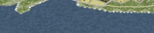
44 Geometrical Modeling Arterials and Streets: t Observations and Assumptions Road networks exhibit a variety of styles which cannot be inferred from socioeconomic parameters The predominant pattern of arterials and streets are grid style and radial style 44
45 Geometrical Modeling At Arterials and dstreets: t Seed dgeneration Algorithm Text 45
46 Geometrical Modeling At Arterials and dstreets: t Expansion Algorithm Using the seeds positioned according to population/jobs and/or along arterials, we generate road segments using a breadth-first expansion method These seeds are placed into a queue and sequentially processed 46


47 Geometrical Modeling Grid Radial Tortuosity 47
48 Geometrical Modeling Parcels Blocks are extracted from the road network and partitioned into parcels The number of parcels in the block is proportional to the product of the area of the block and the count of population/jobs in the grid cells inside the block 48
49 Geometrical Modeling General Alternative Parcels method method 49
50 Geometrical Modeling Buildings Procedurally generated inside each parcel based on the socioeconomic information of the area Process: Calculate geometry of the building footprint Calculate building height Use procedural rules to generate 3D geometry that matches these attributes t 50
51 Results Roads Blocks Parcels Buildings Geometrical Modeling 3D Model User Population Jobs Accessibility Land Value Behavioral Modeling 51
52 Results: System Specs Dimensions: Grid-cell size 0.1x0.1 km Grid size up to 50x50 km in our experiments Time: Update time step during editing: <0.3 seconds for small grid (~5x5 km) <4 seconds for large grids (~15x15 km) Total Design Time: <5 minutes for any of our examples 52


53 Results: Terrain Editing Overhead view Initial Lake Mountains Flyover view 53


54 Results: Completion and Validation (1) Town center PopulationParcels Parks Jobs Buildings Terrain Input Output 54


55 Results: Completion and Validation (2) Real City Synthetic City 55
56 Conclusions We have presented an interactive system to design and edit 3D urban models Our key inspiration is to close the loop between behavioral modeling and geometrical modeling producing a single dynamical system that assists a designer in creating urban models 56
57 Conclusions Limitations Stochastic component that does not allow behaviors and geometries to be exactly repeatable Over-constraining the system can lead to unfeasible urban models 57
58 Future Work Including additional elements of behavioral modeling, such as a more sophisticated accessibility model We are seeking methods to generate more complex geometric structures using socioeconomic data such as generating additional building details 58
59 Acknowledgements Purdue Research Foundation for partially funding this work Aaron Link for his help with exporting models Students from the Computer Graphics and Visualization Lab at Purdue for their feedback Reviewers for their valuable comments and suggestions 59


60 Questions? 60
61 Genuinity it Signatures: Designing Signatures for Verifying 3D Object Genuinity Daniel G. Aliaga Mikhail Atallah Department of Computer Science Purdue University, i USA
62 Project Goal To provide algorithms for placing into a digital 3D To provide algorithms for placing into a digital 3D object information that enables determining genuinity of the object after its automated manufacturing
63 Observation #1 Continually more objects and parts arebeing digitally designed and digitally manufactured Digital designing: enables simulation and building more complex parts Digital manufacturing: facilitates easier/faster/better manufacturing of complex parts Digital design+manufacturing: can be a significant investment of time
64 Observation #2 Many imitations and knock offs offs are floating around the market Using parts/replicas of unknown specifications may lead to catastrophic failures e.g., in an engine, medical instruments t Impactofthe the counterfeiting industry isnegative andlarge e.g., in 1997, was already US $12B to global automotive industry
65 Observation #3 Simple visual inspection is not sufficiently robust Cannot easily verify material composition, density, and product quality Since design and manufacturing is digital, i it could be that adversaries have equal or better digital technology, thus it is unknown if the counterfeits are inferior in quality
66 Challenge To encode information into a physical object that cannot be reproduced by an adversary but do so without 1. depending on the legitimate manufacturer having technology superior to the adversary else an adversary with equal or better technology can make counterfeit copies unbeknownst to the genuine manufacturer 2. depending on security through obscurity else once the method is compromised, security is lost


67 Our Approach Designed 3D Model Manufactured Object Designed Signature Acquired Fragment Does acquired = designed? Manufactured Signature


68 Example: Motivation
69 Presentation Overview Introduction Previous Works Genuinity Testing Signature Creation and Encoding Signature Acquisition and Verification Results Conclusions and Future Work
70 Presentation Overview Introduction Previous Works Genuinity Testing Signature Creation and Encoding Signature Acquisition and Verification Results Conclusions and Future Work
71 Previous Works Physical watermarking: uses serialnumbers, etching, and security through obscurity Digital Watermarking Specialized solutions for paper documents
72 Presentation Overview Introduction Previous Works Genuinity Testing Signature Creation and Encoding Signature Acquisition and Verification Results Conclusions and Future Work
73 Genuinity Testing Design 3D Design Object Model Signature Master Key Manufacture Automatically Master or Partial Key Verify Signature Acquire 3D Fragment
74 Genuinity Testing Design 3D Design Object Model Signature Master Key Manufacture Automatically Master or Partial Key Verify Signature Acquire 3D Fragment
75 Genuinity Testing Design 3D Design Object Model Signature Master Key Manufacture Automatically Master or Partial Key Verify Signature Acquire 3D Fragment
76 Genuinity Testing Design 3D Design Object Model Signature Master Key Manufacture Automatically Master or Partial Key Verify Signature Acquire 3D Fragment
77 Counterfeiting Attacks Re instancing = What happens if the digital model leaks out? (adversary makes new objects using the digital model) Replication = What happens if the adversary just makes the best copies possible of the object, signature, and all? (making copies by digitally it acquiring ii and then digitally it remanufacturing the object)
78 Signature Embedding Genuinity signature must be encoded somewhere Approach is to alter some feature of the object Global features Pro: robust Con: requires acquiring the entire object Local features Pro: only a partial acquisition is needed Con: less robust (e.g., can remove signature) We choose local features Only need a partial acquisition for verification If signature is removed, then just reject object
79 Digital Manufacturing Themethod used is assumed to be imperfect and modeled by an unbiased normal error distribution Genuine Creator: error is m g and v g Adversary: error is m a =(1/β)m g and v a =(1/β)v g e.g., adversary has technology that is β times better Note: our method does not depend on the absolute values i.e., β matters
80 Presentation Overview Introduction Previous Works Genuinity Testing Signature Creation and Encoding Signature Acquisition and Verification Results Conclusions and Future Work
81 Signature Creation and Encoding Algorithm: 1. Pick subset of object s surface for signature footprint 2. Create a signature image 3. Map the signature image onto the object (= do the displacement map operation) 4. Manufacture the resulting 3D object model


82 Signature Footprint User interactively chooses the subset of the model where the signature should be placed Footprint
83 Signature Image Signature imageisis composed of a 2D arrayof samples Samples are organized in a two level stratification Spatial Stratum A j = {s i1 j, s i2 j, s i3 j, } (spatially near) Reduces need to precisely align synthetic and real samples Makes it easier to detect re instancing (and replication) Variance Stratum B k = {A j1 k, A j2 k, A j3 k, } (spatially disjoint) Makes verification more sensitive to change in variance Improvesdetecting replication attacks

84 Signature Image Footprint Displacements only Full Signature

85 Signature Image A j B k2 Footprint Displacements only Full Signature B k1


86 Signature Image varriance r Signature with a balance of m and r magnitude m
87 Presentation Overview Introduction Previous Works Genuinity Testing Signature Creation and Encoding Signature Acquisition and Verification Results Conclusions and Future Work
88 Signature Acquisition and Verification Algorithm: 1. Acquire surface fragment containing signature footprint on real object 2. Align captured surface fragment with digital model of signature 3. Verify captured signature is from genuine object
89 Signature Acquisition Requirements To capture subtle displacements, need high resolution To facilitate easy deployment, need self calibration (and relatively fast capture speed) Observation Macro structure of the area to capture is usually simple (e.g., planar or low curvature surface with encoded signature) Approach Capture the low frequency geometric structure and augment high frequency detail from photometric data = Photogeometric Acquisition


90 Signature Acquisition A self calibrating system of one or more cameras and three or more projectors to capture high resolution (and multi viewpoint) models at camera resolution Photogeometric Structured Light, Aliaga and Xu, CVPR 2008 * = first coined by Lu and Little, IJCV 1999


91 Photogeometric Structured Light
92 Signature Verification Use the aforementioned sample stratification and statistical testing to determine an expected homogeneity of variance similarity of means testing not enough for replication use group and median based homogeneity of variance testingti
93 Statistical Testing We desire e 1) variance of all samples in a group to be the same 2) variance of each group to be v k +(m g+v g g) Thus, use a modified version of a Brown Forsythe test which checks for homogeneity of variance Simple F test is too fragile Medians, as opposed to means, is more robust to error distributions straying from perfect normalcy Once we account for the changing sample displacement and variance, only the variance (m g +v g ) should be present in each of the many groups The modification is that we know the desired global variance
94 Presentation Overview Introduction Previous Works Genuinity Testing Signature Creation and Encoding Signature Acquisition and Verification Results Conclusions and Future Work
95 Results We used our approach to design, manufacture, verify several CAD type objects (both in simulation and in real world) Our prototype uses Canon Rebel XTi 10 MP camera Optoma EP910 DLP projectors of 1400x1050 pixels Stereolithography manufacturing max precision ii = 5/1000 th of an inch h(01 (~0.1mm)
96 Testing: Genuine Object Image size 2 50 W Number of Groups τ=1; m g =v g =0.5; m=0.25; r= (operational tolerance never exceeded)
97 Testing: Re instanced Object Image size W Number of Groups τ=1; m g =v g =0.5; m=0.25; r= (operational tolerance never exceeded)
98 Testing: Replicated β=1,10,100 Replicate β=1 Replicate β=10 Replicate β= W W W Number of Groups Number of Groups Number of Groups Need more samples to support larger β (e.g., bigger signature image)

, thus our real")


99 Real Objects Our approach is designed for fragility upon copying (i.e., success is hard), thus our real world experiments test accurately recovering the signature at the expected levels l of error Rendering of 3D model Photograph of real object Acquired 3D fragment
100 Real Objects Object measures about 10x10x5 cms Manufacturing accuracy is ~0.1mm Verification system accuracy is ~0.5mm Genuine object passes test Re instanced and replicated object rejected with only a 5% chance of getting the classification wrong


101 Real Objects 0.75mm Difference of designed to genuine Difference of designed to replicated (W=1.16) (W=2.86)


102 Real Objects Rendering of 3D model Designed Signature Acquired 3D fragment Average test statistics (in simulation) are Genuine = 1.23 Re instanced = 2.75 Replicated (β=10) = 1.63


103 Real Objects 2.25mm Difference of designed to genuine Difference of designed to replicated (W=1.22) (W=2.43)


104 Works with the bunny too 3D Model without Signature 3D Model with Signature
105 Presentation Overview Introduction Previous Works Genuinity Testing Signature Creation and Encoding Signature Acquisition and Verification Results Conclusions and Future Work
106 Conclusions We have presented a novel approach to encode data for detecting object genuinity into the surface of physical objects Re instancing and replication is handled (replication is harder) Support β > 1 (e.g., β =100) Our problem is quite different from digital watermarking where perfect copies can be made Our work provides a unique blend of computer graphics+vision, information security, and advanced manufacturing
107 Limitations Our approach requires space to place the signature Our technique requires knowing the variance of the Our technique requires knowing the variance of the manufacturing and verification processes
108 Acknowledgements Purdue Dept. of Mechanical Technology Purdue CGVLAB Acquisition methods supported by NSF CCF


109 Questions?
Interactive Design and Visualization of Urban Spaces using Geometrical and Behavioral Modeling
 Interactive Design and Visualization of Urban Spaces using Geometrical and Behavioral Modeling Carlos Vanegas 1,4,5 Daniel Aliaga 1 Bedřich Beneš 2 Paul Waddell 3 1 Computer Science, Purdue University,
Urban Layouts and Road Networks
 Urban Layouts and Road Networks Daniel G. Aliaga Associate Professor of Computer Science Purdue University Challenge Design and model realistic/plausible road networks and urban layouts Road network: a
Image-Based Buildings and Facades
 Image-Based Buildings and Facades Peter Wonka Associate Professor of Computer Science Arizona State University Daniel G. Aliaga Associate Professor of Computer Science Purdue University Challenge Generate
Lecture: Simulation. of Manufacturing Systems. Sivakumar AI. Simulation. SMA6304 M2 ---Factory Planning and scheduling. Simulation - A Predictive Tool
 SMA6304 M2 ---Factory Planning and scheduling Lecture Discrete Event of Manufacturing Systems Simulation Sivakumar AI Lecture: 12 copyright 2002 Sivakumar 1 Simulation Simulation - A Predictive Tool Next
System Overview 2. RELATED WORK 2.1 Example-based Synthesis
 Interactive Example-Based Urban Layout Synthesis Daniel G. Aliaga Carlos A. Vanegas Purdue University Structure Bedřich Beneš New Synthesized Street Network New Layout with Reused Imagery Example Urban
Semi-Automated and Interactive Construction of 3D Urban Terrains
 Semi-Automated and Interactive Construction of 3D Urban Terrains Tony Wasilewski *, Nickolas Faust, and William Ribarsky Center for GIS and Spatial Analysis Technologies Graphics, Visualization, and Usability
PARALLEL AND DISTRIBUTED PLATFORM FOR PLUG-AND-PLAY AGENT-BASED SIMULATIONS. Wentong CAI
 PARALLEL AND DISTRIBUTED PLATFORM FOR PLUG-AND-PLAY AGENT-BASED SIMULATIONS Wentong CAI Parallel & Distributed Computing Centre School of Computer Engineering Nanyang Technological University Singapore
Inverse Light Transport (and next Separation of Global and Direct Illumination)
") Inverse ight Transport (and next Separation of Global and Direct Illumination) CS434 Daniel G. Aliaga Department of Computer Science Purdue University Inverse ight Transport ight Transport Model transfer
Inverse ight Transport (and next Separation of Global and Direct Illumination) CS434 Daniel G. Aliaga Department of Computer Science Purdue University Inverse ight Transport ight Transport Model transfer
GEOGRAPHIC INFORMATION SYSTEMS Lecture 18: Spatial Modeling
 Spatial Analysis in GIS (cont d) GEOGRAPHIC INFORMATION SYSTEMS Lecture 18: Spatial Modeling - the basic types of analysis that can be accomplished with a GIS are outlined in The Esri Guide to GIS Analysis
Understanding Geospatial Data Models
 Understanding Geospatial Data Models 1 A geospatial data model is a formal means of representing spatially referenced information. It is a simplified view of physical entities and a conceptualization of
The complete design environment for road planning & construction ANADELTA TESSERA.
 The complete design environment for road planning & construction Short Description Short Description ANADELTA TESSERA Tessera is the professional, standards-based road design solution helping civil engineers
3D Reconstruction from Scene Knowledge
 Multiple-View Reconstruction from Scene Knowledge 3D Reconstruction from Scene Knowledge SYMMETRY & MULTIPLE-VIEW GEOMETRY Fundamental types of symmetry Equivalent views Symmetry based reconstruction MUTIPLE-VIEW
Photo Tourism: Exploring Photo Collections in 3D
 Photo Tourism: Exploring Photo Collections in 3D SIGGRAPH 2006 Noah Snavely Steven M. Seitz University of Washington Richard Szeliski Microsoft Research 2006 2006 Noah Snavely Noah Snavely Reproduced with
CS 664 Image Matching and Robust Fitting. Daniel Huttenlocher
 CS 664 Image Matching and Robust Fitting Daniel Huttenlocher Matching and Fitting Recognition and matching are closely related to fitting problems Parametric fitting can serve as more restricted domain
Appearance Editing: Compensation Compliant Alterations to Physical Objects
 Editing: Compensation Compliant Alterations to Physical Objects Daniel G. Aliaga Associate Professor of CS @ Purdue University www.cs.purdue.edu/homes/aliaga www.cs.purdue.edu/cgvlab Presentation
Morphable 3D-Mosaics: a Hybrid Framework for Photorealistic Walkthroughs of Large Natural Environments
 Morphable 3D-Mosaics: a Hybrid Framework for Photorealistic Walkthroughs of Large Natural Environments Nikos Komodakis and Georgios Tziritas Computer Science Department, University of Crete E-mails: {komod,
Adaptive-Mesh-Refinement Pattern
 Adaptive-Mesh-Refinement Pattern I. Problem Data-parallelism is exposed on a geometric mesh structure (either irregular or regular), where each point iteratively communicates with nearby neighboring points
REGISTRATION OF AIRBORNE LASER DATA TO SURFACES GENERATED BY PHOTOGRAMMETRIC MEANS. Y. Postolov, A. Krupnik, K. McIntosh
 REGISTRATION OF AIRBORNE LASER DATA TO SURFACES GENERATED BY PHOTOGRAMMETRIC MEANS Y. Postolov, A. Krupnik, K. McIntosh Department of Civil Engineering, Technion Israel Institute of Technology, Haifa,
CS635 Spring Department of Computer Science Purdue University
 Inverse Light Transport CS635 Spring 200 Daniel G Aliaga Daniel G. Aliaga Department of Computer Science Purdue University Inverse Light Transport Light Transport Model transfer of light from source (e.g.,
PatchCity: Procedural City Generation using Texture Synthesis
 PatchCity: Procedural City Generation using Texture Synthesis Bustard, J. D., & de Valmency, L. P. (2015). PatchCity: Procedural City Generation using Texture Synthesis. In R. Dahyot, G. Lacey, K. Dawson-Howe,
AUTOMATIC GENERATION OF DIGITAL BUILDING MODELS FOR COMPLEX STRUCTURES FROM LIDAR DATA
 AUTOMATIC GENERATION OF DIGITAL BUILDING MODELS FOR COMPLEX STRUCTURES FROM LIDAR DATA Changjae Kim a, Ayman Habib a, *, Yu-Chuan Chang a a Geomatics Engineering, University of Calgary, Canada - habib@geomatics.ucalgary.ca,
APPENDIX G. VMT Spreadsheet Tool. FINAL REPORT Improved Data & Tools for Integrated Land Use-Transportation Planning in California TOPICS:
 FINAL REPORT Improved Data & Tools for Integrated Land Use-Transportation Planning in California APPENDIX G VMT Spreadsheet Tool TOPICS: 1. Overview of Tool 2. Code Documentation 3. User Guide 4. Validation
Working Note: Using SLEUTH Urban Growth Modelling Environment
 Working Note: Using SLEUTH Urban Growth Modelling Environment By Dr. S. Hese Lehrstuhl für Fernerkundung Friedrich-Schiller-Universität Jena 07743 Jena Löbdergraben 32 soeren.hese@uni-jena.de V 0.1 Versioning:
Automatic Photo Popup
 Automatic Photo Popup Derek Hoiem Alexei A. Efros Martial Hebert Carnegie Mellon University What Is Automatic Photo Popup Introduction Creating 3D models from images is a complex process Time-consuming
calibrated coordinates Linear transformation pixel coordinates
 1 calibrated coordinates Linear transformation pixel coordinates 2 Calibration with a rig Uncalibrated epipolar geometry Ambiguities in image formation Stratified reconstruction Autocalibration with partial
A Constraint Based System to Populate Procedurally Modeled Cities with Buildings
 A Constraint Based System to Populate Procedurally Modeled Cities with Buildings Johannes Scharl Supervised by: Daniel Scherzer Institute of Computer Graphics and Algorithms Vienna University of Technology
Lab 9. Julia Janicki. Introduction
 Lab 9 Julia Janicki Introduction My goal for this project is to map a general land cover in the area of Alexandria in Egypt using supervised classification, specifically the Maximum Likelihood and Support
DIGITAL IMAGE ANALYSIS. Image Classification: Object-based Classification
 DIGITAL IMAGE ANALYSIS Image Classification: Object-based Classification Image classification Quantitative analysis used to automate the identification of features Spectral pattern recognition Unsupervised
Hiding a Second Appearance in a Physical Relief Surface
 Hiding a Second Appearance in a Physical Relief Surface Yi-Liu Chao and Daniel G. Aliaga Department of Computer Science, Purdue University, West Lafayette, Indiana, USA {chao1, aliaga}@cs.purdue.edu Abstract.
Scope and Sequence for the New Jersey Core Curriculum Content Standards
 Scope and Sequence for the New Jersey Core Curriculum Content Standards The following chart provides an overview of where within Prentice Hall Course 3 Mathematics each of the Cumulative Progress Indicators
Algorithms for GIS csci3225
 Algorithms for GIS csci3225 Laura Toma Bowdoin College Spatial data types and models Spatial data in GIS satellite imagery planar maps surfaces networks point cloud (LiDAR) Spatial data in GIS satellite
Camera Calibration. COS 429 Princeton University
 Camera Calibration COS 429 Princeton University Point Correspondences What can you figure out from point correspondences? Noah Snavely Point Correspondences X 1 X 4 X 3 X 2 X 5 X 6 X 7 p 1,1 p 1,2 p 1,3
Projecting Restorations in Real-Time for Real-World Objects
 Projecting Restorations in Real-Time for Real-World Objects Alvin J. Law, Daniel G. Aliaga, Yu Hong Yeung, Purdue University, U.S.A. Richard McCoy, Indianapolis Museum of Art, U.S.A. Amy McKune, Eiteljorg
Model-Based Stereo. Chapter Motivation. The modeling system described in Chapter 5 allows the user to create a basic model of a
 96 Chapter 7 Model-Based Stereo 7.1 Motivation The modeling system described in Chapter 5 allows the user to create a basic model of a scene, but in general the scene will have additional geometric detail
AUTOMATED 4 AXIS ADAYfIVE SCANNING WITH THE DIGIBOTICS LASER DIGITIZER
 AUTOMATED 4 AXIS ADAYfIVE SCANNING WITH THE DIGIBOTICS LASER DIGITIZER INTRODUCTION The DIGIBOT 3D Laser Digitizer is a high performance 3D input device which combines laser ranging technology, personal
Supplementary Materials for Learning to Parse Wireframes in Images of Man-Made Environments
 Supplementary Materials for Learning to Parse Wireframes in Images of Man-Made Environments Kun Huang, Yifan Wang, Zihan Zhou 2, Tianjiao Ding, Shenghua Gao, and Yi Ma 3 ShanghaiTech University {huangkun,
NATIONWIDE POINT CLOUDS AND 3D GEO- INFORMATION: CREATION AND MAINTENANCE GEORGE VOSSELMAN
 NATIONWIDE POINT CLOUDS AND 3D GEO- INFORMATION: CREATION AND MAINTENANCE GEORGE VOSSELMAN OVERVIEW National point clouds Airborne laser scanning in the Netherlands Quality control Developments in lidar
Procedural Modeling of Cities with User-Created Models Rachel King & Michael Mortimer Advanced Computer Graphics, Spring 2015
 Procedural Modeling of Cities with User-Created Models Rachel King & Michael Mortimer Advanced Computer Graphics, Spring 2015 0. Abstract Our goal in this project was to create procedurally generated city
Spatial Analysis and Modeling (GIST 4302/5302) Guofeng Cao Department of Geosciences Texas Tech University
 Guofeng Cao Department of Geosciences Texas Tech University") Spatial Analysis and Modeling (GIST 4302/5302) Guofeng Cao Department of Geosciences Texas Tech University 1 Outline of This Week Last topic, we learned: Spatial autocorrelation of areal data Spatial regression
Spatial Analysis and Modeling (GIST 4302/5302) Guofeng Cao Department of Geosciences Texas Tech University 1 Outline of This Week Last topic, we learned: Spatial autocorrelation of areal data Spatial regression
Hidden Surfaces II. Week 9, Mon Mar 15
 University of British Columbia CPSC 314 Computer Graphics Jan-Apr 2010 Tamara Munzner Hidden Surfaces II Week 9, Mon Mar 15 http://www.ugrad.cs.ubc.ca/~cs314/vjan2010 ews yes, I'm granting the request
A Robust Video Hash Scheme Based on. 2D-DCT Temporal Maximum Occurrence
 A Robust Video Hash Scheme Based on 1 2D-DCT Temporal Maximum Occurrence Qian Chen, Jun Tian, and Dapeng Wu Abstract In this paper, we propose a video hash scheme that utilizes image hash and spatio-temporal
Model Design and Evaluation
 Model Design and Evaluation The General Modeling Process YES Define Goals Compartments Systematize Add Spatial Dimension Complete? NO Formulate & Flowchart Return Return NO Complete? Deliver Implement
Geometric Modeling and Processing
 Geometric Modeling and Processing Tutorial of 3DIM&PVT 2011 (Hangzhou, China) May 16, 2011 6. Mesh Simplification Problems High resolution meshes becoming increasingly available 3D active scanners Computer
RECOMMENDATION ITU-R P DIGITAL TOPOGRAPHIC DATABASES FOR PROPAGATION STUDIES. (Question ITU-R 202/3)
") Rec. ITU-R P.1058-1 1 RECOMMENDATION ITU-R P.1058-1 DIGITAL TOPOGRAPHIC DATABASES FOR PROPAGATION STUDIES (Question ITU-R 202/3) Rec. ITU-R P.1058-1 (1994-1997) The ITU Radiocommunication Assembly, considering
Rec. ITU-R P.1058-1 1 RECOMMENDATION ITU-R P.1058-1 DIGITAL TOPOGRAPHIC DATABASES FOR PROPAGATION STUDIES (Question ITU-R 202/3) Rec. ITU-R P.1058-1 (1994-1997) The ITU Radiocommunication Assembly, considering
Data Acquisition, Leica Scan Station 2, Park Avenue and 70 th Street, NY
 Automated registration of 3D-range with 2D-color images: an overview 44 th Annual Conference on Information Sciences and Systems Invited Session: 3D Data Acquisition and Analysis March 19 th 2010 Ioannis
LEARNING TO INFER GRAPHICS PROGRAMS FROM HAND DRAWN IMAGES
 LEARNING TO INFER GRAPHICS PROGRAMS FROM HAND DRAWN IMAGES Kevin Ellis - MIT, Daniel Ritchie - Brown University, Armando Solar-Lezama - MIT, Joshua b. Tenenbaum - MIT Presented by : Maliha Arif Advanced
Cluster Analysis. Mu-Chun Su. Department of Computer Science and Information Engineering National Central University 2003/3/11 1
 Cluster Analysis Mu-Chun Su Department of Computer Science and Information Engineering National Central University 2003/3/11 1 Introduction Cluster analysis is the formal study of algorithms and methods
Urban Scene Segmentation, Recognition and Remodeling. Part III. Jinglu Wang 11/24/2016 ACCV 2016 TUTORIAL
 Part III Jinglu Wang Urban Scene Segmentation, Recognition and Remodeling 102 Outline Introduction Related work Approaches Conclusion and future work o o - - ) 11/7/16 103 Introduction Motivation Motivation
Accuracy, Support, and Interoperability. Michael F. Goodchild University of California Santa Barbara
 Accuracy, Support, and Interoperability Michael F. Goodchild University of California Santa Barbara The traditional view Every object has a true position and set of attributes with enough time and resources
Continuum-Microscopic Models
 Scientific Computing and Numerical Analysis Seminar October 1, 2010 Outline Heterogeneous Multiscale Method Adaptive Mesh ad Algorithm Refinement Equation-Free Method Incorporates two scales (length, time
By Colin Childs, ESRI Education Services. Catalog
 s resolve many traditional raster management issues By Colin Childs, ESRI Education Services Source images ArcGIS 10 introduces Catalog Mosaicked images Sources, mosaic methods, and functions are used
Image-Based Modeling and Rendering. Image-Based Modeling and Rendering. Final projects IBMR. What we have learnt so far. What IBMR is about
 Image-Based Modeling and Rendering Image-Based Modeling and Rendering MIT EECS 6.837 Frédo Durand and Seth Teller 1 Some slides courtesy of Leonard McMillan, Wojciech Matusik, Byong Mok Oh, Max Chen 2
Motion Estimation. There are three main types (or applications) of motion estimation:
 of motion estimation:") Members: D91922016 朱威達 R93922010 林聖凱 R93922044 謝俊瑋 Motion Estimation There are three main types (or applications) of motion estimation: Parametric motion (image alignment) The main idea of parametric motion
Members: D91922016 朱威達 R93922010 林聖凱 R93922044 謝俊瑋 Motion Estimation There are three main types (or applications) of motion estimation: Parametric motion (image alignment) The main idea of parametric motion
TerraScan Tool Guide
 TerraScan Main Toolbox General Toolbar Draw Toolbar Groups Toolbar Vectorize Towers Toolbar Road Toolbar Buildings Toolbar Building Edges Toolbar View Laser Toolbar Model Toolbar Vectorize Wires Toolbar
Multi-view stereo. Many slides adapted from S. Seitz
 Multi-view stereo Many slides adapted from S. Seitz Beyond two-view stereo The third eye can be used for verification Multiple-baseline stereo Pick a reference image, and slide the corresponding window
Elemental Set Methods. David Banks Duke University
 Elemental Set Methods David Banks Duke University 1 1. Introduction Data mining deals with complex, high-dimensional data. This means that datasets often combine different kinds of structure. For example:
Digital Image Classification Geography 4354 Remote Sensing
 Digital Image Classification Geography 4354 Remote Sensing Lab 11 Dr. James Campbell December 10, 2001 Group #4 Mark Dougherty Paul Bartholomew Akisha Williams Dave Trible Seth McCoy Table of Contents:
Sung-Eui Yoon ( 윤성의 )
") Path Planning for Point Robots Sung-Eui Yoon ( 윤성의 ) Course URL: http://sglab.kaist.ac.kr/~sungeui/mpa Class Objectives Motion planning framework Classic motion planning approaches 2 3 Configuration Space:
Path Planning for Point Robots Sung-Eui Yoon ( 윤성의 ) Course URL: http://sglab.kaist.ac.kr/~sungeui/mpa Class Objectives Motion planning framework Classic motion planning approaches 2 3 Configuration Space:
Sketch-based Interface for Crowd Animation
 Sketch-based Interface for Crowd Animation Masaki Oshita 1, Yusuke Ogiwara 1 1 Kyushu Institute of Technology 680-4 Kawazu, Iizuka, Fukuoka, 820-8502, Japan oshita@ces.kyutech.ac.p ogiwara@cg.ces.kyutech.ac.p
HEURISTIC OPTIMIZATION USING COMPUTER SIMULATION: A STUDY OF STAFFING LEVELS IN A PHARMACEUTICAL MANUFACTURING LABORATORY
 Proceedings of the 1998 Winter Simulation Conference D.J. Medeiros, E.F. Watson, J.S. Carson and M.S. Manivannan, eds. HEURISTIC OPTIMIZATION USING COMPUTER SIMULATION: A STUDY OF STAFFING LEVELS IN A
3D Representation and Solid Modeling
 MCS 585/480 Computer Graphics I 3D Representation and Solid Modeling Week 8, Lecture 16 William Regli and Maxim Peysakhov Geometric and Intelligent Computing Laboratory Department of Computer Science Drexel
Image warping and stitching
 Image warping and stitching May 4 th, 2017 Yong Jae Lee UC Davis Last time Interactive segmentation Feature-based alignment 2D transformations Affine fit RANSAC 2 Alignment problem In alignment, we will
Review Article 3D Design and Modeling of Smart Cities from a Computer Graphics Perspective
 International Scholarly Research Network ISRN Computer Graphics Volume 2012, Article ID 728913, 19 pages doi:10.5402/2012/728913 Review Article 3D Design and Modeling of Smart Cities from a Computer Graphics
Segmentation and Tracking of Partial Planar Templates
 Segmentation and Tracking of Partial Planar Templates Abdelsalam Masoud William Hoff Colorado School of Mines Colorado School of Mines Golden, CO 800 Golden, CO 800 amasoud@mines.edu whoff@mines.edu Abstract
Mapping Distance and Density
 Mapping Distance and Density Distance functions allow you to determine the nearest location of something or the least-cost path to a particular destination. Density functions, on the other hand, allow
CHAPTER 2 CONVENTIONAL AND NON-CONVENTIONAL TECHNIQUES TO SOLVE ORPD PROBLEM
 20 CHAPTER 2 CONVENTIONAL AND NON-CONVENTIONAL TECHNIQUES TO SOLVE ORPD PROBLEM 2.1 CLASSIFICATION OF CONVENTIONAL TECHNIQUES Classical optimization methods can be classified into two distinct groups:
Smart Graphics: Labeling, Feedback Loops
 Smart Graphics: Labeling, Feedback Loops Vorlesung Smart Graphics LMU München Medieninformatik Butz/Boring Smart Graphics SS2007 Methoden: labeling, AFLs Folie 1 Themen heute Reasoning/Rendering: Floating
Computer Vision 2. SS 18 Dr. Benjamin Guthier Professur für Bildverarbeitung. Computer Vision 2 Dr. Benjamin Guthier
 Computer Vision 2 SS 18 Dr. Benjamin Guthier Professur für Bildverarbeitung Computer Vision 2 Dr. Benjamin Guthier 3. HIGH DYNAMIC RANGE Computer Vision 2 Dr. Benjamin Guthier Pixel Value Content of this
A semantic approach to patch-based procedural generation of urban road networks
 A semantic approach to patch-based procedural generation of urban road networks Edward Teng Delft University of Technology edward.teng010@gmail.com Rafael Bidarra Delft University of Technology r.bidarra@tudelft.nl
Using Edge Detection in Machine Vision Gauging Applications
 Application Note 125 Using Edge Detection in Machine Vision Gauging Applications John Hanks Introduction This application note introduces common edge-detection software strategies for applications such
3.Data Abstraction. Prof. Tulasi Prasad Sariki SCSE, VIT, Chennai 1 / 26
 3.Data Abstraction Prof. Tulasi Prasad Sariki SCSE, VIT, Chennai www.learnersdesk.weebly.com 1 / 26 Outline What can be visualized? Why Do Data Semantics and Types Matter? Data Types Items, Attributes,
An Initial Seed Selection Algorithm for K-means Clustering of Georeferenced Data to Improve
 An Initial Seed Selection Algorithm for K-means Clustering of Georeferenced Data to Improve Replicability of Cluster Assignments for Mapping Application Fouad Khan Central European University-Environmental
Depth. Common Classification Tasks. Example: AlexNet. Another Example: Inception. Another Example: Inception. Depth
 Common Classification Tasks Recognition of individual objects/faces Analyze object-specific features (e.g., key points) Train with images from different viewing angles Recognition of object classes Analyze
CS395T paper review. Indoor Segmentation and Support Inference from RGBD Images. Chao Jia Sep
 CS395T paper review Indoor Segmentation and Support Inference from RGBD Images Chao Jia Sep 28 2012 Introduction What do we want -- Indoor scene parsing Segmentation and labeling Support relationships
Curriki Geometry Glossary
 Curriki Geometry Glossary The following terms are used throughout the Curriki Geometry projects and represent the core vocabulary and concepts that students should know to meet Common Core State Standards.
GPU-based Distributed Behavior Models with CUDA
 GPU-based Distributed Behavior Models with CUDA Courtesy: YouTube, ISIS Lab, Universita degli Studi di Salerno Bradly Alicea Introduction Flocking: Reynolds boids algorithm. * models simple local behaviors
Computer Vision I Name : CSE 252A, Fall 2012 Student ID : David Kriegman Assignment #1. (Due date: 10/23/2012) x P. = z
 x P. = z") Computer Vision I Name : CSE 252A, Fall 202 Student ID : David Kriegman E-Mail : Assignment (Due date: 0/23/202). Perspective Projection [2pts] Consider a perspective projection where a point = z y x P
Computer Vision I Name : CSE 252A, Fall 202 Student ID : David Kriegman E-Mail : Assignment (Due date: 0/23/202). Perspective Projection [2pts] Consider a perspective projection where a point = z y x P
METRIC PLANE RECTIFICATION USING SYMMETRIC VANISHING POINTS
 METRIC PLANE RECTIFICATION USING SYMMETRIC VANISHING POINTS M. Lefler, H. Hel-Or Dept. of CS, University of Haifa, Israel Y. Hel-Or School of CS, IDC, Herzliya, Israel ABSTRACT Video analysis often requires
Unwrapping of Urban Surface Models
 Unwrapping of Urban Surface Models Generation of virtual city models using laser altimetry and 2D GIS Abstract In this paper we present an approach for the geometric reconstruction of urban areas. It is
Online Pattern Recognition in Multivariate Data Streams using Unsupervised Learning
 Online Pattern Recognition in Multivariate Data Streams using Unsupervised Learning Devina Desai ddevina1@csee.umbc.edu Tim Oates oates@csee.umbc.edu Vishal Shanbhag vshan1@csee.umbc.edu Machine Learning
CS 543: Computer Graphics. Rasterization
 CS 543: Computer Graphics Rasterization Robert W. Lindeman Associate Professor Interactive Media & Game Development Department of Computer Science Worcester Polytechnic Institute gogo@wpi.edu (with lots
Review of Cartographic Data Types and Data Models
 Review of Cartographic Data Types and Data Models GIS Data Models Raster Versus Vector in GIS Analysis Fundamental element used to represent spatial features: Raster: pixel or grid cell. Vector: x,y coordinate
VALIDATION OF A NEW 30 METER GROUND SAMPLED GLOBAL DEM USING ICESAT LIDARA ELEVATION REFERENCE DATA
 VALIDATION OF A NEW 30 METER GROUND SAMPLED GLOBAL DEM USING ICESAT LIDARA ELEVATION REFERENCE DATA M. Lorraine Tighe Director, Geospatial Solutions Intermap Session: Photogrammetry & Image Processing
Video Alignment. Final Report. Spring 2005 Prof. Brian Evans Multidimensional Digital Signal Processing Project The University of Texas at Austin
 Final Report Spring 2005 Prof. Brian Evans Multidimensional Digital Signal Processing Project The University of Texas at Austin Omer Shakil Abstract This report describes a method to align two videos.
M. Andrea Rodríguez-Tastets. I Semester 2008
 M. -Tastets Universidad de Concepción,Chile andrea@udec.cl I Semester 2008 Outline refers to data with a location on the Earth s surface. Examples Census data Administrative boundaries of a country, state
Introduction to InfraWorks 360 for Civil
 Eric Chappell Autodesk Aimed at Civil industry professional, this class will cover basic importing of data sources to make an existing model, followed by creation of roads, buildings, and city furniture
By Bonemap Extending Isadora s 3D Particles and 3D Model Particles
 Extending Isadora s 3D Particles and 3D Model Particles By Bonemap 2018 Page 1 v.1 Extending Isadora s 3D Particles and 3D Model Particles with media instances By Bonemap 2018 One of the more difficult
Overview of the Simulation Process. CS1538: Introduction to Simulations
 Overview of the Simulation Process CS1538: Introduction to Simulations Simulation Fundamentals A computer simulation is a computer program that models the behavior of a physical system over time. Program
Structure from Motion. Prof. Marco Marcon
 Structure from Motion Prof. Marco Marcon Summing-up 2 Stereo is the most powerful clue for determining the structure of a scene Another important clue is the relative motion between the scene and (mono)
Feature Transfer and Matching in Disparate Stereo Views through the use of Plane Homographies
 Feature Transfer and Matching in Disparate Stereo Views through the use of Plane Homographies M. Lourakis, S. Tzurbakis, A. Argyros, S. Orphanoudakis Computer Vision and Robotics Lab (CVRL) Institute of
Visualization and Analysis of Inverse Kinematics Algorithms Using Performance Metric Maps
 Visualization and Analysis of Inverse Kinematics Algorithms Using Performance Metric Maps Oliver Cardwell, Ramakrishnan Mukundan Department of Computer Science and Software Engineering University of Canterbury
DEVELOPMENT OF PROTOTYPE OF INTEGRATED EARTHQUAKE DISASTER SIMULATOR USING DIGITAL CITY AND STRONG GROUND MOTION SIMULATOR WITH HIGH-RESOLUTION
 13 th World Conference on Earthquake Engineering Vancouver, B.C., Canada August 1-6, 2004 Paper No. 1418 DEVELOPMENT OF PROTOTYPE OF INTEGRATED EARTHQUAKE DISASTER SIMULATOR USING DIGITAL CITY AND STRONG
Spatial Data Management
 Spatial Data Management [R&G] Chapter 28 CS432 1 Types of Spatial Data Point Data Points in a multidimensional space E.g., Raster data such as satellite imagery, where each pixel stores a measured value
Direct Matrix Factorization and Alignment Refinement: Application to Defect Detection
 Direct Matrix Factorization and Alignment Refinement: Application to Defect Detection Zhen Qin (University of California, Riverside) Peter van Beek & Xu Chen (SHARP Labs of America, Camas, WA) 2015/8/30
Polygonal representation of 3D urban terrain point-cloud data
 Polygonal representation of 3D urban terrain point-cloud data part I Borislav Karaivanov The research is supported by ARO MURI 23 February 2011 USC 1 Description of problem Assumptions: unstructured 3D
CS294-26: Image Manipulation and Computational Photography Final Project Report
 UNIVERSITY OF CALIFORNIA, BERKELEY CS294-26: Image Manipulation and Computational Photography Final Project Report Ling-Qi Yan December 14, 2015 1 INTRODUCTION Sandpainting is the art of pouring colored
Image warping and stitching
 Image warping and stitching May 5 th, 2015 Yong Jae Lee UC Davis PS2 due next Friday Announcements 2 Last time Interactive segmentation Feature-based alignment 2D transformations Affine fit RANSAC 3 Alignment
A Real Time GIS Approximation Approach for Multiphase Spatial Query Processing Using Hierarchical-Partitioned-Indexing Technique
 International Journal of Scientific Research in Computer Science, Engineering and Information Technology 2017 IJSRCSEIT Volume 2 Issue 6 ISSN : 2456-3307 A Real Time GIS Approximation Approach for Multiphase
Towards direct motion and shape parameter recovery from image sequences. Stephen Benoit. Ph.D. Thesis Presentation September 25, 2003
 Towards direct motion and shape parameter recovery from image sequences Stephen Benoit Ph.D. Thesis Presentation September 25, 2003 September 25, 2003 Towards direct motion and shape parameter recovery
Surface Analysis with 3D Analyst
 2013 Esri International User Conference July 8 12, 2013 San Diego, California Technical Workshop Surface Analysis with 3D Analyst Khalid H. Duri Esri UC2013. Technical Workshop. Why use 3D GIS? Because