3D Modeling for Contractors
|
|
|
- Matilda Wood
- 5 years ago
- Views:
Transcription

1 3D Modeling for Contractors The Constructible Model Joel Brown


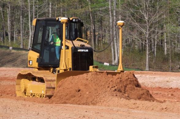
2 SITECH Ohio a construction technology partner for the 21 st Century Major brand vendor Work with hundreds of Civil Contractors Sales Support Training Established in 2012 in Columbus Ohio Specializing in: Automated Machine Guidance Site Positioning & Control Systems Constructible Modeling Software

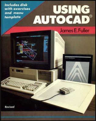

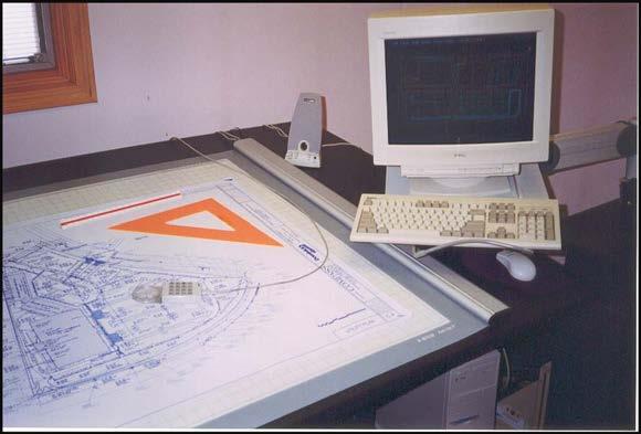


3 1990 s Construction Technologies


4 30 years later its here all of it.


5 ? Planning Design Constructability Documentation?
6
7 The Constructible Model
8 The Constructible Model What is a Constructible Model?
9 The Constructible Model Why? Using Outdated Methods in Specs. 2D paper plans do not show 3D construction reality Errors in CAD Data or Paper (PDF) Plans (BAD CAD) Inaccurate Level of Detail in Plans (Missing Critical Information) Design issues discovered after excavation has started. (Conflicts) Existing ground quantities issues discovered after excavation has started. Construction site progress not linked to plans (Scheduling/Workrates) How much would be saved if these issues can be eliminated on future projects?

10 The Constructible Model Why? Constructible modeling for the Contractor is the secret to HOW ATC s can harness construction Contractor expertise With Constructible modeling software a Contractor has foresight into Shortening construction time Reducing Project Costs Advancing new and more effective designs, technology, materials and construction methods

11 The Constructible Model - Data Ohio Department of Transportation Files
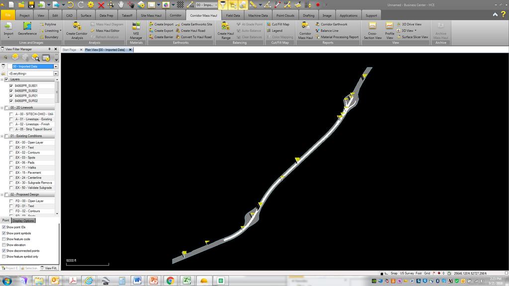

12 The Constructible Model - DATA


13 The Constructible Model - Benefits Data Prep & 3D Model Conversion Automated File Clean Ups Elimination of Duplicate Lines Elimination of Empty Layers Mass Joining of Entities Mass Elevation of Entities Layer Standardization & Org. Field to Finish Mapping More


14 The Constructible Model - Software Built in Holistic Civil Super Systems for Contractors Survey Data Reduction Civil Design & Drafting Construction Takeoff/Estimating Construction Data Prep Construction Planning Project As-builts/GIS More


15 The Constructible Model - Benefits Survey Data Reduction Total Station Data Reduction RTK Data Reduction GNSS Post Processing Level Data Reduction UAS Data Processing Photogrammetry/Scanning Field to Finish Mapping More

16 The Constructible Model - Benefits CAD Functionality Create/Edit Objects: 2D/3D Linestrings Arcs/Circles Text Layers More
")
17 The Constructible Model - Benefits Surface Tools Create DTM/TIN/TTM: Using any 3D Data: Points Linestrings Contours Point Clouds (LIDAR) More

18 The Constructible Model - Benefits Site Design 3D Linestring VPI Commands Vertical Curves Elevate Objects Lines Pads Contours Variable Offset Surface Tie Surface Slicer

19 The Constructible Model - Benefits Corridor Design Runways, Roads, Rails, Paths, Ditches/Trench Horizontal/Vertical Alignments Typical Sections Built from instructions Including Layers of Materials Automatically creates Finished Surface Dynamic

20 The Constructible Model - Benefits Intersections, Roundabouts, Cul-de-Sacs Dynamic Parametric Turn Lanes Islands Surface Models

21 The Constructible Model - Benefits Image Management Dynamic Import Images JPG, TIFF, PDF, More Georeference Images to site location Import Vector PDF Drape over Surface Model

22 The Constructible Model - Benefits Site Quantity Takeoff Tools Apply Materials/Site Improvements Areas Strata/Boring Data Subsurfaces Digitize Area /Length Count Reports Takeoff Reports Mass Earthwork Material Quantities

23 The Constructible Model - Benefits Road Quantity Takeoff Tools Create Stored Sections Digitize PDF Cross Sections Create From CAD Cross Sections Generates a Corridor from the Cross Sections


24 The Constructible Model - Benefits Plan Production & Drafting Capabilities Publish Plan Sets Plan Sheets Grid Sheets Profile Sheets Cross Sections

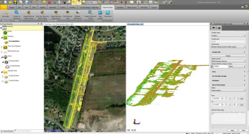

25 The Constructible Model - DATA MACHINES capture Topo/Performance/Productivity Passive Survey Machine Mapping Enabled Import Data from the Machine Productivity Monitoring Cut/Fill Coverage Elevations


26 The Constructible Model - DATA DRONES/SCANNERS LiDAR Photogrammetry & Point Clouds Import Point Cloud Files Create Regions Classify/Clean Data Build Surfaces


27 The Constructible Model - DATA SURVEY INSTRUMENTS Base Stations / Rovers / Total Stations Rover & TS Topography Mapping As Built / Feature Coded Select Quantities


28 The Constructible Model - Evolution CURRENT FUTURE 2D Drawings 3D Models 3D Collaboration Models BIM for Infrastructure Single discipline Manual and CAD Discipline approach Single discipline Limited intelligence Discipline approach Multi-discipline VR visualization Project collaboration Multi-discipline and workflow support Intelligent object model Lifecycle value ISOLATED COLLABORATIVE INTEGRATED


29 The Constructible Model - FUTURE 3D DOCUMENTATION More than surfaces, points and lines Infrastructure management Design, construct, as-built Field collected / office generated Sub models Geology, imagery, GIS, structures, tunnels, rail, road, point clouds, utilities Features and processes Centrally managed Mixed Reality Visualizations


30 The Constructible Model - FUTURE

31 The Constructible Model - FUTURE
TBC v License Matrix - Rev 0
 Command Name Viewer (Unlicensed) Base Intermediate Advanced Advanced Drafting Aerial Photogrammetry Data Prep GIS Scanning Tunneling Category 3D Preset Views x x x x General Software 3D View Projection
Licensed Features - Trimble Business Center v3.10
 Licensed Features - Trimble Business Center v3.10 The following table lists the features available in Trimble Business Center based on the installed. Feature No License Base Complete Advanced Photogrammetry
Table of Contents. Note to Self-Paced Users of the Day 2 Seminar Handbook. Notices 1. Quick Reference 2. Seminar Outline 14
 Table of Contents Note to Self-Paced Users of the Day 2 Seminar Handbook i Notices 1 Quick Reference 2 Seminar Outline 14 Program and Vector Data Overview 17 A Toolbox for Creating Earthwork Models 17
Do More. Change the world in 3D. AutoCAD. Civil 3d
 Do More. Change the world in 3D. AutoCAD Civil 3d 2010 A Powerful Building Information Modeling Solution for Civil Engineering AutoCAD Civil 3D software supports an integrated process focused on a coordinated
AutoCAD Civil 3D 2011 ESSENTIALS
 AutoCAD Civil 3D 2011 ESSENTIALS SDC PUBLICATIONS www.sdcpublications.com Schroff Development Corporation Table of Contents Table of Contents Preface...ix Module 1 The AutoCAD Civil 3D Interface... 1-1
TcpMDT. Digital Terrain Model Version 7.5. TcpMDT
 Digital Terrain Model Version 7.5 Versions and Modules PROFESSIONAL STANDARD IMAGES SURVEYING POINT CLOUD Product Features STANDARD Surveying Points Management Digital Terrain Model Contours Terrain Cross
Advanced Data Procurement From A Contractors Perspective
 Advanced Data Procurement From a Contractors Perspective Advanced Data Procurement From A Contractors Perspective Brian K. Smith & Travis Rauscher, PE 1 Session Summary Laser scanning and UAV data procurement
Topocad portfolio. Adtollo adtollo.se/en
 Topocad portfolio Adtollo adtollo.se/en + 46 8 410 415 00 info@adtollo.se order@adtollo.se What is Topocad? Topocad is easy to use and provides a powerful CAD system for all requirements when it comes
Digital Terrain Model V 6.5
 TCP MDT Digital Terrain Model V 6.5 Professional Version Introduction The Professional Version is designed to assist users in all the phases of carrying out a Surveying or Civil Engineering project. Its
James Schneider Advanced Materials and Technology
 (CEC-90153) Minnesota DOT Deploy GCS900, Business Center HCE and VisionLink with the DOTs GEOPAK software to automatically monitor large scale excavation in Carver County James Schneider Advanced Materials
The Surveyor s Guide to Automotive Simulation:
 DLR.de Chart 1 The Surveyor s Guide to Automotive Simulation: Development and Evaluation of Guidelines for Straightforward Road Surveying for Driving Simulator Databases and Test Development of Driver
connecting your construction site
 TRIMBLE: Connecting Your Construction SitE connecting your construction site The Ultimate Data Management System Business Center Heavy Construction Edition (HCE) from Trimble is the only office software
2/9/2016. Session Agenda: Implementing new Geospatial Technologies for more efficient data capture
 Implementing new Geospatial Technologies for more efficient data capture Jay Haskamp Applied Geospatial Engineer Steve Richter VP Sales Session Agenda: Today s changing technologies and what lies ahead
X-PAD Ultimate. The Ultimate solution in the field. Works when you do
 Works when you do X-PAD Ultimate The Ultimate solution in the field X-PAD Ultimate is a tailored, flexible, modular, ideal, customised software for high end topographic tasks, such as measure, stake-out,
Trimble Business Center Software, v3.30
 Trimble Business Center Software, v3.30 We are pleased to announce a new version of the Trimble Business Center software, version 3.30. This new version includes over 30 new features and enhancements increasing
Technical training May - August
 2017 Technical training May - August Register today! theppigroup.com/training Training centers located in Portland, OR & Seattle, WA. Why Train with PPI? PPI is the only locally owned and operated Autodesk
BrisBIM Gathering, August 2017
 BrisBIM BrisBIM Gathering, August 2017 BIM IN TUNNELLING Implementation of BIM methodology to Trans Alpine tunnel Karavanke Marko Žibert Content Project summary 3D Modelling Model-based coordination 4D
Integrated Field to Finish BIM for Surveyors. Boris Skopljak Market Manager, Trimble Geospatial Office Software
 Integrated Field to Finish BIM for Surveyors Boris Skopljak (boris_skopljak@trimble.com) Market Manager, Trimble Geospatial Office Software Agenda Trimble Introduction BIM relevance in Trimble Trimble
A Strategy and Vision for Enterprise 3D GIS. B r o o k s P a t r i c k A c c o u n t E x e c u t i v e b p a t r i c e s r i.
 A Strategy and Vision for Enterprise 3D GIS B r o o k s P a t r i c k A c c o u n t E x e c u t i v e b p a t r i c k @ e s r i. c o m Understanding where things are, and why, is essential for rational
Civil 3D Introduction
 Civil 3D Introduction Points Overview Points are data collected by surveyors which represent existing site conditions (elevations, boundaries, utilities, etc.). Each point is numbered (or named) and has
MoDOT s 3D Design Implementation, Electronic Deliverables, and E-Construction. Ashley Buechter, P.E. MoDOT CADD Support Engineer
 MoDOT s 3D Design Implementation, Electronic Deliverables, and E-Construction Ashley Buechter, P.E. MoDOT CADD Support Engineer LADOTD Transportation Conference February 29, 2016 General Information and
Ferrovia. BIM-Ready Railway Design Solution. by CGS Labs. Professional software solutions for Civil Engineering. (C) 2017 by CGS Labs
 2017 by CGS Labs") Ferrovia by CGS Labs BIM-Ready Railway Design Solution Professional software solutions for Civil Engineering (C) 2017 by CGS Labs Solution for Railway Design & Rail track Analysis Ferrovia is a professional,
Ferrovia by CGS Labs BIM-Ready Railway Design Solution Professional software solutions for Civil Engineering (C) 2017 by CGS Labs Solution for Railway Design & Rail track Analysis Ferrovia is a professional,
GRMC Global Resources Management Consultancy Inc.
 GRMC Global Resources Management Consultancy Inc. Rail. Road. Infrastructure. Global Resources Management Consultancy USA 333 West 39th street, 2nd Floor, Suite 202, New York NY 10018 T: 212-564-2085 F:
MODERN TECHNOLOGY FOR LAND LEVELLING, BASED ON A 3D SCANNER
 MODERN TECHNOLOGY FOR LAND LEVELLING, BASED ON A 3D SCANNER Abstract: Soil levelling becomes of high importance, in modern and intensive agriculture conditions. Its effects are found in providing optimal
A 3D Scanner Based Technology for Land Levelling
 A 3D Scanner Based Technology for Land Levelling Kunal Chakraborti, Rupam Ghosh Student, Dept of Civil Engineering, Modern Institute of Engineering & Technology, Bandel, Hooghly, West Bengal, India ABSTRACT:
Commercial suas The Right Tool for the Right Job
 Commercial suas The Right Tool for the Right Job Presentation Objectives Overview of current data collection technologies UAS Systems Overview Surveyor 2.0 Project Case Study Mobile LiDAR & suas How Do
TCP MDT Digital Terrain Model - V7
 TCP MDT Digital Terrain Model - V7 Professional Version Introduction The Professional Version is designed to assist the user at all stages of developing a project in the context of Topography and Civil
TcpMDT Version 7.0 Summary of Differences with Version 6.5
 Sumatra, 9 E-29190 Málaga (Spain) www.aplitop.com Tel.: +34 95 2439771 Fax: +34 95 2431371 TcpMDT Version 7.0 Summary of Differences with Version 6.5 CAD Versions supported TcpMDT 7 works with several
Features and Benefits
 CAiCE Visual Survey 10 Features and Benefits CAiCE Visual Survey 10 software enables surveying professionals to import, process, analyze, and present surveying all in one software package. Visual Survey
3D Terrestrial Laser Scanner Innovative Applications for 3D Documentation
 3D Terrestrial Laser Scanner Innovative Applications for 3D Documentation Rodney Chaffee Head of Sales, FARO Asia Pacific 3D Laser Scaning Market 2017 2.3 Billion $ 2012 1.3 Billion $ CAGR : > 12% Source:
TRIMBLE BUSINESS CENTER
 TRIMBLE BUSINESS CENTER Release Notes Version 3.40 (64-bit) Geospatial Division, 10368 Westmoor Drive, Westminster, CO 80021, USA 2014, Trimble Navigation Limited. All rights reserved. Trimble, the Globe
Revit Architecture Syllabus Total duration: 80 hours (Theory 40 Hours + Lab 40 Hours)
") Faculty Start Date End Date No of Students Revit Architecture Syllabus Total duration: 80 hours (Theory 40 Hours + Lab 40 Hours) Introduction About BIM Introduction to Autodesk Revit Architecture Revit
Faculty Start Date End Date No of Students Revit Architecture Syllabus Total duration: 80 hours (Theory 40 Hours + Lab 40 Hours) Introduction About BIM Introduction to Autodesk Revit Architecture Revit
Trimble Mobile Mapping Portfolio
 Jörg Amend Sales Account Manager SEPTEMBER 20 2017 Trimble Mobile Mapping Portfolio Current challenges and trends Multible Sensors connecting to one Echosystem Trimble RealWorks Trimble Edgewise TBC Pathfinder
Autodesk Civil 3D Fundamentals
 Autodesk Civil 3D Fundamentals Course Length: 4 days The Autodesk Civil 3D Fundamentals training course is designed for Civil Engineers and Surveyors who want to take advantage of the Autodesk Civil 3D
Geospatial Engineering Problems & Solutions Associated With NDP Roads, Tunnelling & Civil Engineering Projects Use of HDS Leica Laser Scanners
 Geospatial Engineering Problems & Solutions Associated With NDP Roads, Tunnelling & Civil Engineering Projects Use of HDS Leica Laser Scanners Laser Scanning Laser Scanning is a method of collecting large
TRIMBLE BUSINESS CENTER
 TRIMBLE BUSINESS CENTER Release Notes Version 3.61 Geospatial Division, 10368 Westmoor Drive, Westminster, CO 80021, USA 2015, Trimble Navigation Limited. All rights reserved. Trimble, the Globe & Triangle
TECHNICAL NOTES TRIMBLE SURVEY CONTROLLER SOFTWARE
 TRIMBLE SURVEY CONTROLLER SOFTWARE TECHNICAL NOTES The Trimble Survey Controller software is the data collection solution that will make your survey work faster, easier, and more productive than ever before.
Plateia. BIM-Ready Roadway Design Solution. by CGS Labs. Professional software solutions for Civil Engineering. (C) 2017 by CGS Labs
 2017 by CGS Labs") Plateia by CGS Labs BIM-Ready Roadway Design Solution Professional software solutions for Civil Engineering (C) 2017 by CGS Labs BIM Solution for Roadway Design & Reconstruction Plateia is a professional,
Plateia by CGS Labs BIM-Ready Roadway Design Solution Professional software solutions for Civil Engineering (C) 2017 by CGS Labs BIM Solution for Roadway Design & Reconstruction Plateia is a professional,
GIS Mapping of Pipelines
 GIS Mapping of Pipelines RJ Lumbrezer, PS Survey Manager DGL Consulting Engineers, LLC Ted Muns Sales Manager City Blueprint of Toledo 2016 Ohio GIS Conference Hyatt Regency Columbus September 28 30, 2016
3-D Modeling Implementation
 3-D Modeling Implementation Presented January 31, 2013 Douglas Townes FHWA Resource Center WORKFLOW FOR ELECTRONIC DATA TRANSFER WHEN USING AMG IN CONSTRUCTION Charles Jahren, PhD Iowa State University
Delivering 3D Engineered Model Data for Highway Construction
 Delivering 3D Engineered Model Data for Highway Construction Objectives After completing this module, you will be able to: Describe how 3D engineered models are created in design Describe how contractors
DRONE MAPPING FOR CONSTRUCTION
 DRONE MAPPING FOR CONSTRUCTION POWERFUL SOLUTIONS FOR AS-BUILT SURVEYS AND SITE DOCUMENTATION - AUTOMATED FLEXIBLE PROCESSING - REPEATABLE RELIABLE ACCURACY - APPLICABLE RESULTS WE CAPTURE IMAGES FROM
3-D MODELING FOR MACHINE CONTROL
 SHELLY & SANDS JOHN DOWALTER, PE, PS 3-D MODELING FOR MACHINE CONTROL Dale Carnegie Public Speaking Training Ben Stein s Public Speaking Training SHELLY & SANDS JOHN DOWALTER, PE, PS S&S Survey Manager
Reality Capture: From Point Cloud To Design To Visualisation. by Shuaib Yunos, Baker Baynes
 Reality Capture: From Point Cloud To Design To Visualisation by Shuaib Yunos, Baker Baynes Perspective: Design & Construction Designers are conceiving buildings differently. Building owners expect a lot
Crossrail: A Case Study in BIM (Draft 26 th July 2013)
") Crossrail: A Case Study in BIM (Draft 26 th July 2013) Crossrail: A Case Study in BIM Malcolm Taylor Crossrail Head of Technical Information 29 th October 2013 Agenda Briefly set the scene What BIM in
Crossrail: A Case Study in BIM (Draft 26 th July 2013) Crossrail: A Case Study in BIM Malcolm Taylor Crossrail Head of Technical Information 29 th October 2013 Agenda Briefly set the scene What BIM in
TCP MDT Digital Terrain Model - V7.5
 TCP MDT Digital Terrain Model - V7.5 Standard Version Introduction The Standard Version is suitable for carrying out all kinds of topographical survey projects, terrain profiles, volume calculations etc.
technical notes trimble business center software
 technical notes trimble business center software A POWERFUL SURVEY DATA OFFICE SOFTWARE SUITE DESIGNED FOR TODAY'S FAST-PACED SURVEYING OFFICE, TRIMBLE BUSINESS CENTER SOFTWARE UNLOCKS THE POTENTIAL OF
Introduction of Nikon Trimble
 Technical Seminar Reference Frame in Practice, Introduction of Nikon Trimble Sponsors: Page 1 Nikon Trimble - Joint Venture company Established 1917 1978 Products High Quality Optical and Imaging GNSS,
Trimble SCS900 Site Controller Software for Beginners. Jordan Lawver HCC-6339
 Trimble SCS900 Site Controller Software for Beginners Jordan Lawver HCC-6339 Agenda What is Trimble SCS900 Site Controller Software? Who uses SCS900 Trimble Site Positioning System software portfolio Applications
OCTOBER OTEC Session 75 Stringless 3D Paving
 OCTOBER 03 2018 OTEC Session 75 Stringless 3D Paving Introductions Brian E Girouard, Trimble Inc Sales Engineer Paving Specialist Manager brian_girouard@trimble.com Brad Cunningham, SITECH Ohio SITECH
Using the new Site Modeler tools - Tips and Tricks
 www.bentley.com Using the new Site Modeler tools - Tips and Tricks Lisa Whitson, Transportation and Local Infrastructure Professional Services, Bentley Systems USA Today s Agenda What is Site Modeler?
Working with Profiles
 Tennessee Association of Professional Land Surveyors 2016 Annual Conference Murfreesboro Working with Profiles In Carlson Software Presented by Who Is That CAD Girl? Jennifer DiBona is a long time CAD
Using Laser Scanning technology and software. Chris Palmer Sales Engineer 28 th April
 Construction Verification Using Laser Scanning technology and software Chris Palmer Sales Engineer 28 th April 2017 1 Contents What is construction verification? How do we measure and check construction
Trimble Update. BIMnet 17 th June 2013 BUILDING CONSTRUCTION
 Trimble Update BIMnet 17 th June 2013 BUILDING CONSTRUCTION Agenda Introduction to Trimble What is Trimble BIM+Build? The benefits of BIM to Field Questions? 2 Trimble corporate roots Founded in 1978 Market
Civil 3D Interoperability with Revit: Part I
 April, 2012 Civil 3D Interoperability with Revit: Part I BIM in Architecture and Engineering The basis behind using Building Information Modeling is that all objects are 3 dimensional: models are all able
Grading and Volumes CHAPTER INTRODUCTION OBJECTIVES
 CHAPTER 10 Grading and Volumes INTRODUCTION AutoCAD Civil 3D uses surface breaklines, cogo points, contours, feature lines, and grading objects to create a surface design. There are numerous ways to grade
ENHANCED DELIVERABLES AND THE DIGITAL JOBSITE NOVEMBER 14, 2018
 ENHANCED DELIVERABLES AND THE DIGITAL JOBSITE NOVEMBER 14, 2018 Background CP Tech Center/Snyder & Associates team EDC-2 3D Engineered Models EDC-4 e-construction (Digital Construction Inspection) 2 What
Tekla Structures and Autodesk Revit useful geometry exchange
 Tekla Structures and Autodesk Revit useful geometry exchange General guidance: Updated: 2nd June, 2014 (New material is starred) David Lash Engineering Segment FROM Autodesk Revit Architectural to Tekla
OpenSite TM Designer CONNECT Edition
 PRODUCT DATA SHEET CONNECT Edition Image courtesy of Manhard Consulting, Ltd. OpenSite TM Designer CONNECT Edition Optimizing Outcomes OpenSite Designer CONNECT Edition is an innovative application for
ROAD-SCANNER COMPACT APPLICATION FIELDS MAIN FEATURES
 ROAD-SCANNER COMPACT Mobile Mapping System by GEXCEL & SITECO collaboration A smaller mobile system for asset management and cartography suited for ZOLLER & FRÖHLICH PROFILER 9012 laser scanner. 2 + 3
UAS for Surveyors. An emerging technology for the Geospatial Industry. Ian Murgatroyd : Technical Sales Rep. Trimble
 UAS for Surveyors An emerging technology for the Geospatial Industry Ian Murgatroyd : Technical Sales Rep. Trimble Project Overview Voyager Quarry, located near Perth Australia Typical of hard rock mines,
Surveying like never before
 CAD functionalities GCP Mapping and Aerial Image Processing Software for Land Surveying Specialists Surveying like never before www.3dsurvey.si Modri Planet d.o.o., Distributors: info@3dsurvey.si +386
The Carlson Software Engineering Solution
 Carlson Civil 2007 The Carlson Software Engineering Solution Carlson Civil 2007 is the flagship engineering office product from Carlson Software, containing robust functionality for road design, site and
PAD Based 3D Earthwork BIM Design Module for Machine Guidance
 PAD Based 3D Earthwork BIM Design Module for Machine Guidance Waqas Arshad Tanoli a, Hassnain Raza a, Seung Soo Lee a and Jong Won Seo a a Department of Civil and Environmental Engineering, Hanyang University,
Construction, Smart Grid and Intelligent City Models. Geoff Zeiss Principal Between The Poles
 Construction, Smart Grid and Intelligent City Models Geoff Zeiss Principal Between The Poles Geospatial Media Technologies are evolving rapidly in the $7 trillion annually construction industry Evolution
MSCad DTM and Volume Calculations
 MSCad DTM and Volume Calculations Session Outline 1.0 Introduction of software 1.1 Introduction of instructor and experience 1.2 Discussion of software (QuickSurf, Intellicad, Cogo) 1.3 Review of access
Building Information Modeling
 Chapter Building Information Modeling 1 Building information modeling (BIM) is an integrated workflow built on coordinated, reliable information about a project from design through construction and into
WHY TRAIN WITH PPI? YOUR TECHNICAL HOME TEAM. CALL US TO LEARN MORE ABOUT GLOBAL E-TRAININGäS LIBRARY
 WHY TRAIN WITH PPI? PPI is the only locally owned and operated Autodesk reseller in Oregon and Western Washington! We have the largest Autodesk training centers in the Northwest! GLOBAL E-TRAINING IS THE
Release Notes TRIMBLE BUSINESS CENTER. Version 2.50
 Release Notes TRIMBLE BUSINESS CENTER Version 2.50 Corporate office: Trimble Navigation Limited Engineering and Construction Division 5475 Kellenburger Road Dayton, Ohio 45424-1099 USA Phone: +1-937-233-8921
BIM in infrastructure case study: Swedish road projects vägplan
 BIM in infrastructure case study: Swedish road projects vägplan Mateusz Nettmann Moving Poland s construction industry into the future with BIM (BIM Event BPCC) January, 11, 2018 AGENDA Introduction: AECOM
Title: Improving Your InRoads DTM. Mats Dahlberg Consultant Civil
 Title: Improving Your InRoads DTM Mats Dahlberg Consultant Civil Improving Your InRoads Digital Terrain Model (DTM) Digital Terrain Model A digital representation of a surface topography or terrain composed
Surfaces - Objectives
 Surfaces - Objectives Cover the Basic DTM Point Types Creating a new InRoads Surface Surface processing in InRoads Loading 3D data into a Surface A bit about Surface Properties Overview of the View Surface
Topcon Tools Processing RTK Data Application Guide
 P O S I T I O N I N G S Y S T E M S Topcon Tools Processing RTK Data Application Guide Part Number 7010-0928 Rev A Copyright Topcon Positioning Systems, Inc. April, 2009 All contents in this manual are
Particular attention has been paid to the editor s graphics (highlighting of IPs and Elements, tangent points and chainage direction).
.") 12D Super Alignment Parametric Design: The new super alignment utilises not only alignment design by the Fixed and Free method, but introduces a complete new approach to horizontal and vertical road design.
12D Super Alignment Parametric Design: The new super alignment utilises not only alignment design by the Fixed and Free method, but introduces a complete new approach to horizontal and vertical road design.
TRIMBLE WESTMINSTER BUILDING PROJECT / 2013
 TRIMBLE WESTMINSTER BUILDING PROJECT - 2012 / 2013 OVERVIEW Outgrowing its current office facility in Westminster, Colorado, Trimble decided to build a larger campus across the street from their current
[InfraWorks 360 There s a Trick to That]
![[InfraWorks 360 There s a Trick to That]](/thumbs/74/70744586.jpg "[InfraWorks 360 There s a Trick to That]") [LD17877] [InfraWorks 360 There s a Trick to That] [Juan Soto] [Kimley-Horn] Learning Objectives Create custom retaining walls Use SDF, blocks and Autodesk points for quick importing to InfraWorks 360
[LD17877] [InfraWorks 360 There s a Trick to That] [Juan Soto] [Kimley-Horn] Learning Objectives Create custom retaining walls Use SDF, blocks and Autodesk points for quick importing to InfraWorks 360
Innovation. lidarnews.com. volume 3 issue 5. Points clouds and terrain models support rail project. Structured light scanning for human head modeling
 volume 3 issue 5 LIDAR lidarnews.com SCALABILITY Points clouds and terrain models support rail project EXPRESSION Structured light scanning for human head modeling FLUCTUATION Scanning moving objects using
A New Way to Control Mobile LiDAR Data
 A New Way to Control Mobile LiDAR Data Survey control has always been a critically important issue when conducting mobile LiDAR surveys. While the accuracies currently being achieved with the most capable
Geometric Layout for Roadway Design with CAiCE Visual Roads
 December 2-5, 2003 MGM Grand Hotel Las Vegas Geometric Layout for Roadway Design with CAiCE Visual Roads Mathews Mathai CV32-3 This course describes and demonstrates various tools for defining horizontal
AEC Logic. AEC Terrain. A program to manage earth works in a construction project. Yudhishtirudu Gaddipati 29-Jun-13
 AEC Logic AEC Terrain A program to manage earth works in a construction project Yudhishtirudu Gaddipati 29-Jun-13 Contents 1 Introduction:... 5 2 Program Launch... 5 2.1 How to Launch Program... 5 2.2
Hexagon 2012 Think Forward! Session ID Using Point Cloud Data Directly for Civil Design of Airport Infrastructure
 Hexagon 2012 Think Forward! Session ID 9113 - Using Point Cloud Data Directly for Civil Design of Airport Infrastructure INTRODUCTION & BACKGROUND Mark D. McGuire, P.E., Sr. Vice President for Campbell
Case Study for Long- Range Beyond Visual Line of Sight Project. March 15, 2018 RMEL Transmission and Planning Conference
 Case Study for Long- Range Beyond Visual Line of Sight Project March 15, 2018 RMEL Transmission and Planning Conference 2014 HDR Architecture, 2016 2014 HDR, Inc., all all rights reserved. Helicopters
On Grid: Tools and Techniques to Place Reality Data in a Geographic Coordinate System
 RC21940 On Grid: Tools and Techniques to Place Reality Data in a Geographic Coordinate System Seth Koterba Principal Engineer ReCap Autodesk Ramesh Sridharan Principal Research Engineer Infraworks Autodesk
A New Direction in GIS Data Collection or Why Are You Still in the Field?
 GeoAutomation The Mobile Mapping System Survey-Enabled Imagery A New Direction in GIS Data Collection or Why Are You Still in the Field? Presentation to: URISA BC GIS Technology Showcase January 19, 2011
UAV Flight Operations for Mapping. Precision. Accuracy. Reliability
 UAV Flight Operations for Mapping Precision. Accuracy. Reliability Part One: Why is Mapping different? Part Two: What about accuracy and precision? Part Three: What is the Workflow? Part Four: AGENDA What
Covers Autodesk Advance Steel fundamentals, so you become quickly productive with the software
 Covers Autodesk Advance Steel fundamentals, so you become quickly productive with the software Autodesk Advance Steel 2017 www.autodesk.com new Autodesk Advance Steel users. It is recommended that you
REFERENCE. Section 6. Field Use Tutorial 2-1
 REFERENCE Section 6 Field Use Tutorial 2-1 REFERENCE 2-2 Field Use Overview RTK GPS support is an additional feature in Sitework 4D, which must be purchased separately. In addition to creating takeoffs
technical notes Trimble business CenTer software trimble BuSineSS Center your Complete office Solution
 Trimble business CenTer software technical notes trimble BuSineSS Center your Complete office Solution designed for today's fast-paced surveying office, trimble Business Center unlocks the potential of
Mobile Mapping Solutions for Ohio s Integrated Transportation Network. Brian Foster, CP
 Mobile Mapping Solutions for Ohio s Integrated Transportation Network Brian Foster, CP About Woolpert Established in 1911 Over 600 Professionals 25 Offices $12,000,000 invested in new technology in last
Section 7 - Introducing Roadway Modeling
 Introducing Roadway Modeling Section 7 - Introducing Roadway Modeling Section Goals: Understand the Principles of InRoads Roadway Modeling Understand how to load Typical Section Libraries Understand how
5/17/2017. Steven Popke, PE Wisconsin DOT Bureau of Project Development Methods Development Unit
 Steven Popke, PE Wisconsin DOT Bureau of Project Development Unit Wisconsin Department of Transportation since 2014 Assists with WisDOT spilot program for sharing design model data with construction contractors
General GPS TPS ROB X POLE VOL RDN RPL Jobs management System settings (units, precision, parameters, etc.)
") XPAD Survey Modules XPAD Survey GPS TPS XPOLE General GPS TPS ROB XPOLE VOL RDN RPL Jobs management System settings (units, precision, parameters, etc.) Instruments GPS GPS TPS ROB XPOLE VOL RDN RPL Instrument
XPAD Survey Modules XPAD Survey GPS TPS XPOLE General GPS TPS ROB XPOLE VOL RDN RPL Jobs management System settings (units, precision, parameters, etc.) Instruments GPS GPS TPS ROB XPOLE VOL RDN RPL Instrument
Session Objectives. Describe how 3D Models are created during design. Discuss what 3D Model outputs are useful in Construction
 1 Session Objectives Describe how 3D Models are created during design Discuss what 3D Model outputs are useful in Construction Describe applications of 3D Models in Construction 2 Creating the 3D Design
Rethinking Road Planning and Design Workflows:
 Rethinking Road Planning and Design Workflows: Unlocking the Potential of LiDAR Craig Speirs Softree Technical Systems Forest road construction is one of the most expensive components of timber harvesting.
33 Smart Corridor. NW 33 Innovation Corridor Council of Governments. May 11, 2017
 33 Smart Corridor NW 33 Innovation Corridor Council of Governments May 11, 2017 Presentation Overview Geographical Extent Collaborative Efforts Broadband Connectivity Ohio Smart Mobility Initiative Automotive
Should Contours Be Generated from Lidar Data, and Are Breaklines Required? Lidar data provides the most
 Should Contours Be Generated from Lidar Data, and Are Breaklines Required? Lidar data provides the most accurate and reliable representation of the topography of the earth. As lidar technology advances
Technical note. This note is a work through of the functionality provided in the point cloud module in SCC and later.
 15 Moyville Lawns, Taylors Lane, Rathfarnham Dublin 16 Ireland Tel: +3531 4958714/5/6 Fax: +3531 4958717 Email: sales@atlascomputers.ie support@atlascomputers.ie Web: www.atlascomputers.ie Technical note
Trigonometry for Surveyors p. 1 Trigonometry p. 1 Angles and Their Measurement p. 1 Expressing the Fractional Part of a Degree in Minutes and Seconds
 Trigonometry for Surveyors p. 1 Trigonometry p. 1 Angles and Their Measurement p. 1 Expressing the Fractional Part of a Degree in Minutes and Seconds p. 1 Expressing an Arc in Radians p. 2 Angle Conversions
Chapter 1: Introducing Roadway Modeling
 Introducing Roadway Modeling Chapter 1: Introducing Roadway Modeling Chapter Overview The chapter addresses the following topics: How Roadway Modeling Works in InRoads Opening and Exploring Typical Section
Representing Geography
 Data models and axioms Chapters 3 and 7 Representing Geography Road map Representing the real world Conceptual models: objects vs fields Implementation models: vector vs raster Vector topological model