Lost! Leveraging the Crowd for Probabilistic Visual Self-Localization
|
|
|
- Ariel Booker
- 6 years ago
- Views:
Transcription

 Raquel")
1 Lost! Leveraging the Crowd for Probabilistic Visual Self-Localization Marcus A. Brubaker (Toyota Technological Institute at Chicago) Andreas Geiger (Karlsruhe Institute of Technology & MPI Tübingen) Raquel Urtasun (Toyota Technological Institute at Chicago) 1 1


2 Introduction Localization is crucial for autonomous systems 2 2


3 Introduction GPS has limitations in terms of reliability and availability Place recognition techniques use image features and a database of previously collected images [Dellaert et al, ICRA 1999; Thrun et al, AI 2001; Hays and Efros, CVPR 2008; Schindler et al, CVPR 2008; Crandall et al, WWW 2009; Kalogerakis et al, ICCV 2009] We develop an inexpensive technique for localizing to ~3m in unseen regions 3 3


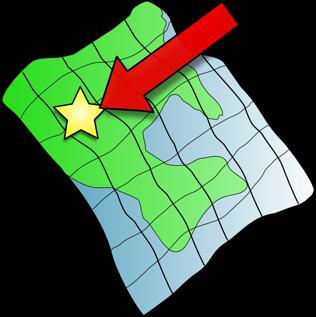
4 Introduction Humans are able to use a map, combined with visual input and exploration, to localize effectively Detailed, community developed maps are freely available (OpenStreetMap) How can we exploit maps, combined with visual cues, to localize a vehicle? 4 4


5 Probabilistic Localization using Visual Odometry Visual odometry provides a strong source of information for localization Visual odometry has some issues Over short time periods it can be noisy and highly ambiguous Over long time periods it drifts when integrated We adopt a probabilistic approach to represent and maintain this uncertainty [Geiger et al, IV 2011] 5 5
6 Probabilistic Localization using Visual Odometry Maps can be considered as a graph SINK Nodes of the graph represent street segments Edges represent intersections and allowed transitions between these segments Position is defined by the current street and the distance travelled, d, and orientation,, on that street θ θ d 6 6
7 Probabilistic Localization using Visual Odometry The complete state includes the current street segment, and the current and previous position and orientation on the street segment, s t =(d t, θ t,d t 1, θ t 1 ) Odometry observations y 1:t =(y 1,...,y t ) Localization is formulated as posterior inference p(u t, s t y 1:t ) u t θ d State Transition Previous Posterior p(y t u t, s t ) p(u t u t 1, s t 1 )p(s t u t,u t 1, s t 1 )p(u t 1, s t 1 y 1:t 1 )ds t 1 u t 1 Likelihood Street Segment Transition Pose Transition 7 7
8 Probabilistic Localization using Visual Odometry Likelihood: p(y t u t, s t ) y t = Ms t + η η N(0, Σ y ) Pose transition: p(s t u t,u t 1, s t 1 ) s t = As t 1 + b + ζ ζ N(0, Σ s ) Street segment transition: p(ut ut 1, st 1) Length of street segment u t 1 Parameters (e.g., variances) estimated from data d t 1 Model is nearly Gauss-Linear which we exploit to derive a custom inference algorithm 8 8
9 Probabilistic Localization using Visual Odometry To represent the posterior we factorize it p(u t, s t y 1:t )=p(s t u t, y 1:t )p(u t y 1:t ) The posterior over pose is represented with a Mixture of Gaussians for each street segment p(s t u t, y 1:t )= Posterior over pose, given the street segment N ut i=1 π (i) u t N Discrete distribution over street segments s t µ (i) u t, Σ (i) u t We ve derived a general algorithm for simplifying mixture models and do this periodically to reduce computation 9 9

10 1 Experiments Vision meets Robotics: The KITTI Dataset Andreas Geiger, Philip Lenz, Christoph Stiller and Raquel Urtasun Abstract We present a novel dataset captured from a VW We used the Visual station Odometry sequences from the wagon for use in mobile robotics and autonomous driving research. In total, we recorded 6 hours of traffic scenarios at et Hz al, using CVPR a variety of sensor modalities such as highkitti dataset [Geiger 2012] resolution color and grayscale stereo cameras, a Velodyne 3D laser scanner and a high-precision GPS/IMU inertial navigation system. The scenarios are diverse, capturing real-world traffic situations and range from freeways over rural areas to innercity scenes with many static and dynamic objects. Our data is calibrated, synchronized and timestamped, and we provide the rectified and raw image sequences. Our dataset also contains object labels in the form of 3D tracklets and we provide online benchmarks for stereo, optical flow, object detection and other tasks. This paper describes our recording platform, the data format and the utilities that we provide. Video captured from car-mounted cameras 11 sequences captured in a variety of settings (e.g., urban, highway, rural, etc)! " " #$$#!! % &'( Index Terms dataset, autonomous driving, mobile robotics, Monocular and Stereo visual odometry field robotics, computer vision, cameras, laser, GPS, benchmarks, stereo, optical flow, SLAM, object detection, tracking, KITTI computed using LIBVISO2 [Geiger et al, IV 2011] I. I NTRODUCTION The KITTI dataset has been recorded from a moving plat Errors computed in position and heading form (Fig. 1) while driving in and around Karlsruhe, Germany (Fig. 2). It includes camera images, laser scans, high-precision GPS measurements and IMU accelerations from a combined GPS/IMU system. The main purpose of this dataset is to push forward the development of computer vision and robotic algorithms targeted to autonomous driving [1] [7]. While our introductory paper [8] mainly focuses on the benchmarks, their creation and use for evaluating state-of-the-art computer vision methods, here we complement this information by providing technical details on the raw data itself. We give precise instructions on how to access the data and comment on sensor limitations and common pitfalls. The dataset can be downloaded from For a review on related work, we refer the reader to [8]. Fig. 1. Recording Platform. Our VW Passat station wagon is equipped with four video cameras (two color and two grayscale cameras), a rotating 3D laser scanner and a combined GPS/IMU inertial navigation system. RT3003 inertial and GPS navigation system, Parallelized implementation runs at frame rate on16 axis,oxts 100 Hz, L1/L2 RTK, resolution: 0.02m / 0.1 Note that the color cameras lack in terms of resolution due average on 16 cores to the Bayer pattern interpolation process and are less sensitive II. S ENSOR S ETUP Our sensor setup is illustrated in Fig. 3: 2 PointGray Flea2 grayscale cameras (FL2-14S3M-C), 1.4 Megapixels, 1/2 Sony ICX267 CCD, global shutter to light. This is the reason why we use two stereo camera rigs, one for grayscale and one for color. The baseline of both stereo camera rigs is approximately 54 cm. The trunk of our vehicle houses a PC with two six-core Intel XEON X5650 processors and a shock-absorbed RAID 5 hard disk storage with a capacity of 4 Terabytes. Our computer runs Ubuntu Linux (64 bit) and a real-time database [9] to store the incoming data streams. III. DATASET The raw data described in this paper can be accessed from 10 10

11 Experiments Accuracy: 2.1m/1.2 Localization Time: 21s 11 11

12 Experiments Accuracy: 2.4m/1.2 Localization Time: 81s 12 12
13 Experiments: Quantitative Results Average Stereo Odometry Monocular Odometry Map Projection Position Error Heading Error Localization Time 3.1m 18.4m 1.4m s 62s
14 Experiments: Ambiguous Sequences 14 14
15 Experiments: Initial Map Size Initial Map Size (km of road)

16 Experiments: Full City Maps 2,150km of road 16 16

17 Experiments: Full City Maps 2,150km of road 17 17
18 Conclusions Fast, accurate map-based localization using only visual odometry Accuracy of 3.1m/1.3 in 36 seconds of driving time on average Highly parallelizable, runs at real-time on average w/ 16 cores Code will be available: Future work Exploiting other map information, e.g., landmarks, speed limits Integration of other sensors, e.g., accelerometers 18 18
19 19 19
OpenStreetSLAM: Global Vehicle Localization using OpenStreetMaps
 OpenStreetSLAM: Global Vehicle Localization using OpenStreetMaps Georgios Floros, Benito van der Zander and Bastian Leibe RWTH Aachen University, Germany http://www.vision.rwth-aachen.de floros@vision.rwth-aachen.de
W4. Perception & Situation Awareness & Decision making
 W4. Perception & Situation Awareness & Decision making Robot Perception for Dynamic environments: Outline & DP-Grids concept Dynamic Probabilistic Grids Bayesian Occupancy Filter concept Dynamic Probabilistic
Collaborative Mapping with Streetlevel Images in the Wild. Yubin Kuang Co-founder and Computer Vision Lead
 Collaborative Mapping with Streetlevel Images in the Wild Yubin Kuang Co-founder and Computer Vision Lead Mapillary Mapillary is a street-level imagery platform, powered by collaboration and computer vision.
MULTI-MODAL MAPPING. Robotics Day, 31 Mar Frank Mascarich, Shehryar Khattak, Tung Dang
 MULTI-MODAL MAPPING Robotics Day, 31 Mar 2017 Frank Mascarich, Shehryar Khattak, Tung Dang Application-Specific Sensors Cameras TOF Cameras PERCEPTION LiDAR IMU Localization Mapping Autonomy Robotic Perception
Self Driving. DNN * * Reinforcement * Unsupervised *
 CNN 응용 Methods Traditional Deep-Learning based Non-machine Learning Machine-Learning based method Supervised SVM MLP CNN RNN (LSTM) Localizati on GPS, SLAM Self Driving Perception Pedestrian detection
StereoScan: Dense 3D Reconstruction in Real-time
 STANFORD UNIVERSITY, COMPUTER SCIENCE, STANFORD CS231A SPRING 2016 StereoScan: Dense 3D Reconstruction in Real-time Peirong Ji, pji@stanford.edu June 7, 2016 1 INTRODUCTION In this project, I am trying
Nonlinear State Estimation for Robotics and Computer Vision Applications: An Overview
 Nonlinear State Estimation for Robotics and Computer Vision Applications: An Overview Arun Das 05/09/2017 Arun Das Waterloo Autonomous Vehicles Lab Introduction What s in a name? Arun Das Waterloo Autonomous
Stereo Epipolar Geometry for General Cameras. Sanja Fidler CSC420: Intro to Image Understanding 1 / 33
 Stereo Epipolar Geometry for General Cameras Sanja Fidler CSC420: Intro to Image Understanding 1 / 33 Stereo Epipolar geometry Case with two cameras with parallel optical axes General case Now this Sanja
Visual-Inertial Localization and Mapping for Robot Navigation
 Visual-Inertial Localization and Mapping for Robot Navigation Dr. Guillermo Gallego Robotics & Perception Group University of Zurich Davide Scaramuzza University of Zurich - http://rpg.ifi.uzh.ch Mocular,
VINet: Visual-Inertial Odometry as a Sequence-to-Sequence Learning Problem
 VINet: Visual-Inertial Odometry as a Sequence-to-Sequence Learning Problem Presented by: Justin Gorgen Yen-ting Chen Hao-en Sung Haifeng Huang University of California, San Diego May 23, 2017 Original
Vision-based Mobile Robot Localization and Mapping using Scale-Invariant Features
 Vision-based Mobile Robot Localization and Mapping using Scale-Invariant Features Stephen Se, David Lowe, Jim Little Department of Computer Science University of British Columbia Presented by Adam Bickett
A novel georeferenced dataset for stereo visual odometry
 September 19, 213, Zagreb, Croatia A novel georeferenced dataset for stereo Ivan Krešo University of Zagreb Faculty of Electrical Engineering and Computing Zagreb, HR-1, Croatia Email: ivan.kreso@unizg.fer.hr
arxiv: v1 [cs.ro] 23 Feb 2018
![arxiv: v1 [cs.ro] 23 Feb 2018](/thumbs/84/89142674.jpg "arxiv: v1 [cs.ro] 23 Feb 2018") IMLS-SLAM: scan-to-model matching based on 3D data Jean-Emmanuel Deschaud 1 1 MINES ParisTech, PSL Research University, Centre for Robotics, 60 Bd St Michel 75006 Paris, France arxiv:1802.08633v1 [cs.ro]
IMLS-SLAM: scan-to-model matching based on 3D data Jean-Emmanuel Deschaud 1 1 MINES ParisTech, PSL Research University, Centre for Robotics, 60 Bd St Michel 75006 Paris, France arxiv:1802.08633v1 [cs.ro]
PML-SLAM: a solution for localization in large-scale urban environments
 PML-SLAM: a solution for localization in large-scale urban environments Zayed Alsayed, Guillaume Bresson, Fawzi Nashashibi and Anne Verroust-Blondet Institut VEDECOM Versailles, France firstname.name@vedecom.fr
Towards Fully-automated Driving. tue-mps.org. Challenges and Potential Solutions. Dr. Gijs Dubbelman Mobile Perception Systems EE-SPS/VCA
 Towards Fully-automated Driving Challenges and Potential Solutions Dr. Gijs Dubbelman Mobile Perception Systems EE-SPS/VCA Mobile Perception Systems 6 PhDs, 1 postdoc, 1 project manager, 2 software engineers
Dense Tracking and Mapping for Autonomous Quadrocopters. Jürgen Sturm
 Computer Vision Group Prof. Daniel Cremers Dense Tracking and Mapping for Autonomous Quadrocopters Jürgen Sturm Joint work with Frank Steinbrücker, Jakob Engel, Christian Kerl, Erik Bylow, and Daniel Cremers
Dealing with Scale. Stephan Weiss Computer Vision Group NASA-JPL / CalTech
 Dealing with Scale Stephan Weiss Computer Vision Group NASA-JPL / CalTech Stephan.Weiss@ieee.org (c) 2013. Government sponsorship acknowledged. Outline Why care about size? The IMU as scale provider: The
ROBUST SCALE ESTIMATION FOR MONOCULAR VISUAL ODOMETRY USING STRUCTURE FROM MOTION AND VANISHING POINTS
 ROBUST SCALE ESTIMATION FOR MONOCULAR VISUAL ODOMETRY USING STRUCTURE FROM MOTION AND VANISHING POINTS Johannes Gräter 1, Tobias Schwarze 1, Martin Lauer 1 August 20, 2015 Abstract While monocular visual
A Whole New World of Mapping and Sensing: Uses from Asset to Management to In Vehicle Sensing for Collision Avoidance
 A Whole New World of Mapping and Sensing: Uses from Asset to Management to In Vehicle Sensing for Collision Avoidance Charles Toth, Dorota A Grejner-Brzezinska, Carla Bailo and Joanna Pinkerton Satellite
STEREO IMAGE POINT CLOUD AND LIDAR POINT CLOUD FUSION FOR THE 3D STREET MAPPING
 STEREO IMAGE POINT CLOUD AND LIDAR POINT CLOUD FUSION FOR THE 3D STREET MAPPING Yuan Yang, Ph.D. Student Zoltan Koppanyi, Post-Doctoral Researcher Charles K Toth, Research Professor SPIN Lab The University
Supplementary Material for A Multi-View Stereo Benchmark with High-Resolution Images and Multi-Camera Videos
 Supplementary Material for A Multi-View Stereo Benchmark with High-Resolution Images and Multi-Camera Videos Thomas Schöps 1 Johannes L. Schönberger 1 Silvano Galliani 2 Torsten Sattler 1 Konrad Schindler
Measuring the World: Designing Robust Vehicle Localization for Autonomous Driving. Frank Schuster, Dr. Martin Haueis
 Measuring the World: Designing Robust Vehicle Localization for Autonomous Driving Frank Schuster, Dr. Martin Haueis Agenda Motivation: Why measure the world for autonomous driving? Map Content: What do
Probabilistic Robotics. FastSLAM
 Probabilistic Robotics FastSLAM The SLAM Problem SLAM stands for simultaneous localization and mapping The task of building a map while estimating the pose of the robot relative to this map Why is SLAM
Evaluating the Performance of a Vehicle Pose Measurement System
 Evaluating the Performance of a Vehicle Pose Measurement System Harry Scott Sandor Szabo National Institute of Standards and Technology Abstract A method is presented for evaluating the performance of
Probabilistic Robotics
 Probabilistic Robotics FastSLAM Sebastian Thrun (abridged and adapted by Rodrigo Ventura in Oct-2008) The SLAM Problem SLAM stands for simultaneous localization and mapping The task of building a map while
USING 3D DATA FOR MONTE CARLO LOCALIZATION IN COMPLEX INDOOR ENVIRONMENTS. Oliver Wulf, Bernardo Wagner
 USING 3D DATA FOR MONTE CARLO LOCALIZATION IN COMPLEX INDOOR ENVIRONMENTS Oliver Wulf, Bernardo Wagner Institute for Systems Engineering (RTS/ISE), University of Hannover, Germany Mohamed Khalaf-Allah
Pattern Recognition for Autonomous. Pattern Recognition for Autonomous. Driving. Freie Universität t Berlin. Raul Rojas
 Pattern Recognition for Autonomous Pattern Recognition for Autonomous Driving Raul Rojas Freie Universität t Berlin FU Berlin Berlin 3d model from Berlin Partner Freie Universitaet Berlin Outline of the
A Generative Model for 3D Urban Scene Understanding from Movable Platforms
 A Generative Model for 3D Urban Scene Understanding from Movable Platforms Andreas Geiger and Martin Lauer Department of Measurement and Control Karlsruhe Institute of Technology {geiger,martin.lauer}@kit.edu
OFERTA O120410PA CURRENT DATE 10/04//2012 VALID UNTIL 10/05/2012 SUMMIT XL
 OFERTA O120410PA CURRENT DATE 10/04//2012 VALID UNTIL 10/05/2012 SUMMIT XL CLIENT CLIENT: Gaitech REPRESENTANT: Andrew Pether MAIL: andyroojp@hotmail.com PRODUCT Introduction The SUMMIT XL has skid-steering
VISION FOR AUTOMOTIVE DRIVING
 VISION FOR AUTOMOTIVE DRIVING French Japanese Workshop on Deep Learning & AI, Paris, October 25th, 2017 Quoc Cuong PHAM, PhD Vision and Content Engineering Lab AI & MACHINE LEARNING FOR ADAS AND SELF-DRIVING
Particle Filters. CSE-571 Probabilistic Robotics. Dependencies. Particle Filter Algorithm. Fast-SLAM Mapping
 CSE-571 Probabilistic Robotics Fast-SLAM Mapping Particle Filters Represent belief by random samples Estimation of non-gaussian, nonlinear processes Sampling Importance Resampling (SIR) principle Draw
Practical Course WS12/13 Introduction to Monte Carlo Localization
 Practical Course WS12/13 Introduction to Monte Carlo Localization Cyrill Stachniss and Luciano Spinello 1 State Estimation Estimate the state of a system given observations and controls Goal: 2 Bayes Filter
Where s the Boss? : Monte Carlo Localization for an Autonomous Ground Vehicle using an Aerial Lidar Map
 Where s the Boss? : Monte Carlo Localization for an Autonomous Ground Vehicle using an Aerial Lidar Map Sebastian Scherer, Young-Woo Seo, and Prasanna Velagapudi October 16, 2007 Robotics Institute Carnegie
ECE276A: Sensing & Estimation in Robotics Lecture 11: Simultaneous Localization and Mapping using a Particle Filter
 ECE276A: Sensing & Estimation in Robotics Lecture 11: Simultaneous Localization and Mapping using a Particle Filter Lecturer: Nikolay Atanasov: natanasov@ucsd.edu Teaching Assistants: Siwei Guo: s9guo@eng.ucsd.edu
Topometric Localization on a Road Network
 Topometric Localization on a Road Network Danfei Xu 1, Hernán Badino 1, and Daniel Huber 1 Abstract Current GPS-based devices have difficulty localizing in cases where the GPS signal is unavailable or
Lecture: Autonomous micro aerial vehicles
 Lecture: Autonomous micro aerial vehicles Friedrich Fraundorfer Remote Sensing Technology TU München 1/41 Autonomous operation@eth Zürich Start 2/41 Autonomous operation@eth Zürich 3/41 Outline MAV system
Sensor Modalities. Sensor modality: Different modalities:
 Sensor Modalities Sensor modality: Sensors which measure same form of energy and process it in similar ways Modality refers to the raw input used by the sensors Different modalities: Sound Pressure Temperature
Monocular Heading Estimation in Non-stationary Urban Environment
 Monocular Heading Estimation in Non-stationary Urban Environment Christian Herdtweck and Cristóbal Curio Max Planck Institute for Biological Cybernetics, Tübingen, Germany christian.herdtweck@tuebingen.mpg.de,
08 An Introduction to Dense Continuous Robotic Mapping
 NAVARCH/EECS 568, ROB 530 - Winter 2018 08 An Introduction to Dense Continuous Robotic Mapping Maani Ghaffari March 14, 2018 Previously: Occupancy Grid Maps Pose SLAM graph and its associated dense occupancy
Introduction to Mobile Robotics SLAM Grid-based FastSLAM. Wolfram Burgard, Cyrill Stachniss, Maren Bennewitz, Diego Tipaldi, Luciano Spinello
 Introduction to Mobile Robotics SLAM Grid-based FastSLAM Wolfram Burgard, Cyrill Stachniss, Maren Bennewitz, Diego Tipaldi, Luciano Spinello 1 The SLAM Problem SLAM stands for simultaneous localization
3D LIDAR Point Cloud based Intersection Recognition for Autonomous Driving
 3D LIDAR Point Cloud based Intersection Recognition for Autonomous Driving Quanwen Zhu, Long Chen, Qingquan Li, Ming Li, Andreas Nüchter and Jian Wang Abstract Finding road intersections in advance is
Vehicle Localization. Hannah Rae Kerner 21 April 2015
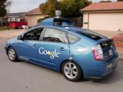
 Vehicle Localization Hannah Rae Kerner 21 April 2015 Spotted in Mtn View: Google Car Why precision localization? in order for a robot to follow a road, it needs to know where the road is to stay in a particular
IROS 05 Tutorial. MCL: Global Localization (Sonar) Monte-Carlo Localization. Particle Filters. Rao-Blackwellized Particle Filters and Loop Closing
 Monte-Carlo Localization. Particle Filters. Rao-Blackwellized Particle Filters and Loop Closing") IROS 05 Tutorial SLAM - Getting it Working in Real World Applications Rao-Blackwellized Particle Filters and Loop Closing Cyrill Stachniss and Wolfram Burgard University of Freiburg, Dept. of Computer
IROS 05 Tutorial SLAM - Getting it Working in Real World Applications Rao-Blackwellized Particle Filters and Loop Closing Cyrill Stachniss and Wolfram Burgard University of Freiburg, Dept. of Computer
Matching Evaluation of 2D Laser Scan Points using Observed Probability in Unstable Measurement Environment
 Matching Evaluation of D Laser Scan Points using Observed Probability in Unstable Measurement Environment Taichi Yamada, and Akihisa Ohya Abstract In the real environment such as urban areas sidewalk,
Training models for road scene understanding with automated ground truth Dan Levi
 Training models for road scene understanding with automated ground truth Dan Levi With: Noa Garnett, Ethan Fetaya, Shai Silberstein, Rafi Cohen, Shaul Oron, Uri Verner, Ariel Ayash, Kobi Horn, Vlad Golder,
On Road Vehicle Detection using Shadows
 On Road Vehicle Detection using Shadows Gilad Buchman Grasp Lab, Department of Computer and Information Science School of Engineering University of Pennsylvania, Philadelphia, PA buchmag@seas.upenn.edu
Motion-Based Calibration of Multimodal Sensor Arrays
 Motion-Based Calibration of Multimodal Sensor Arrays Zachary Taylor and Juan Nieto University of Sydney, Australia {z.taylor, j.nieto}@acfr.usyd.edu.au Abstract This paper formulates a new pipeline for
Localization and Map Building
 Localization and Map Building Noise and aliasing; odometric position estimation To localize or not to localize Belief representation Map representation Probabilistic map-based localization Other examples
Acoustic/Lidar Sensor Fusion for Car Tracking in City Traffic Scenarios
 Sensor Fusion for Car Tracking Acoustic/Lidar Sensor Fusion for Car Tracking in City Traffic Scenarios, Daniel Goehring 1 Motivation Direction to Object-Detection: What is possible with costefficient microphone
OpenStreetSLAM: Global Vehicle Localization Using OpenStreetMaps
 OpenStreetSLAM: Global Vehicle Localization Using OpenStreetMaps Georgios Floros, Benito van der Zander, and Bastian Leibe Abstract In this paper we propose an approach for global vehicle localization
Direct Methods in Visual Odometry
 Direct Methods in Visual Odometry July 24, 2017 Direct Methods in Visual Odometry July 24, 2017 1 / 47 Motivation for using Visual Odometry Wheel odometry is affected by wheel slip More accurate compared
Robotics. Chapter 25. Chapter 25 1
 Robotics Chapter 25 Chapter 25 1 Outline Robots, Effectors, and Sensors Localization and Mapping Motion Planning Chapter 25 2 Mobile Robots Chapter 25 3 Manipulators P R R R R R Configuration of robot
arxiv: v2 [cs.cv] 14 May 2018
![arxiv: v2 [cs.cv] 14 May 2018](/thumbs/79/79495201.jpg "arxiv: v2 [cs.cv] 14 May 2018") ContextVP: Fully Context-Aware Video Prediction Wonmin Byeon 1234, Qin Wang 1, Rupesh Kumar Srivastava 3, and Petros Koumoutsakos 1 arxiv:1710.08518v2 [cs.cv] 14 May 2018 Abstract Video prediction models
ContextVP: Fully Context-Aware Video Prediction Wonmin Byeon 1234, Qin Wang 1, Rupesh Kumar Srivastava 3, and Petros Koumoutsakos 1 arxiv:1710.08518v2 [cs.cv] 14 May 2018 Abstract Video prediction models
Egomotion Estimation by Point-Cloud Back-Mapping
 Egomotion Estimation by Point-Cloud Back-Mapping Haokun Geng, Radu Nicolescu, and Reinhard Klette Department of Computer Science, University of Auckland, New Zealand hgen001@aucklanduni.ac.nz Abstract.
Sensor Fusion: Potential, Challenges and Applications. Presented by KVH Industries and Geodetics, Inc. December 2016
 Sensor Fusion: Potential, Challenges and Applications Presented by KVH Industries and Geodetics, Inc. December 2016 1 KVH Industries Overview Innovative technology company 600 employees worldwide Focused
Robotics. Haslum COMP3620/6320
 Robotics P@trik Haslum COMP3620/6320 Introduction Robotics Industrial Automation * Repetitive manipulation tasks (assembly, etc). * Well-known, controlled environment. * High-power, high-precision, very
High-precision, consistent EKF-based visual-inertial odometry
 High-precision, consistent EKF-based visual-inertial odometry Mingyang Li and Anastasios I. Mourikis, IJRR 2013 Ao Li Introduction What is visual-inertial odometry (VIO)? The problem of motion tracking
Camera and Inertial Sensor Fusion
 January 6, 2018 For First Robotics 2018 Camera and Inertial Sensor Fusion David Zhang david.chao.zhang@gmail.com Version 4.1 1 My Background Ph.D. of Physics - Penn State Univ. Research scientist at SRI
Graph-based SLAM (Simultaneous Localization And Mapping) for Bridge Inspection Using UAV (Unmanned Aerial Vehicle)
 for Bridge Inspection Using UAV (Unmanned Aerial Vehicle)") Graph-based SLAM (Simultaneous Localization And Mapping) for Bridge Inspection Using UAV (Unmanned Aerial Vehicle) Taekjun Oh 1), Sungwook Jung 2), Seungwon Song 3), and Hyun Myung 4) 1), 2), 3), 4) Urban
Graph-based SLAM (Simultaneous Localization And Mapping) for Bridge Inspection Using UAV (Unmanned Aerial Vehicle) Taekjun Oh 1), Sungwook Jung 2), Seungwon Song 3), and Hyun Myung 4) 1), 2), 3), 4) Urban
Stereo Vision Based Traversable Region Detection for Mobile Robots Using U-V-Disparity
 Stereo Vision Based Traversable Region Detection for Mobile Robots Using U-V-Disparity ZHU Xiaozhou, LU Huimin, Member, IEEE, YANG Xingrui, LI Yubo, ZHANG Hui College of Mechatronics and Automation, National
Autonomous Navigation for Flying Robots
 Computer Vision Group Prof. Daniel Cremers Autonomous Navigation for Flying Robots Lecture 3.2: Sensors Jürgen Sturm Technische Universität München Sensors IMUs (inertial measurement units) Accelerometers
Analysis of the CMU Localization Algorithm Under Varied Conditions
 Analysis of the CMU Localization Algorithm Under Varied Conditions Aayush Bansal, Hernán Badino, Daniel Huber CMU-RI-TR-00-00 July 2014 Robotics Institute Carnegie Mellon University Pittsburgh, Pennsylvania
Joint Vanishing Point Extraction and Tracking. 9. June 2015 CVPR 2015 Till Kroeger, Dengxin Dai, Luc Van Gool, Computer Vision ETH Zürich
 Joint Vanishing Point Extraction and Tracking 9. June 2015 CVPR 2015 Till Kroeger, Dengxin Dai, Luc Van Gool, Computer Vision Lab @ ETH Zürich Definition: Vanishing Point = Intersection of 2D line segments,
Precision Roadway Feature Mapping Jay A. Farrell, University of California-Riverside James A. Arnold, Department of Transportation
 Precision Roadway Feature Mapping Jay A. Farrell, University of California-Riverside James A. Arnold, Department of Transportation February 26, 2013 ESRA Fed. GIS Outline: Big picture: Positioning and
Long-term motion estimation from images
 Long-term motion estimation from images Dennis Strelow 1 and Sanjiv Singh 2 1 Google, Mountain View, CA, strelow@google.com 2 Carnegie Mellon University, Pittsburgh, PA, ssingh@cmu.edu Summary. Cameras
Mapping with Dynamic-Object Probabilities Calculated from Single 3D Range Scans
 Mapping with Dynamic-Object Probabilities Calculated from Single 3D Range Scans Philipp Ruchti Wolfram Burgard Abstract Various autonomous robotic systems require maps for robust and safe navigation. Particularly
DD2426 Robotics and Autonomous Systems Lecture 4: Robot Sensors and Perception
 DD2426 Robotics and Autonomous Systems Lecture 4: Robot Sensors and Perception Patric Jensfelt Kungliga Tekniska Högskolan patric@kth.se April 8,2008 Example: Robots and sensors B21 (Real world interfaces)
AN INCREMENTAL SLAM ALGORITHM FOR INDOOR AUTONOMOUS NAVIGATION
 20th IMEKO TC4 International Symposium and 18th International Workshop on ADC Modelling and Testing Research on Electric and Electronic Measurement for the Economic Upturn Benevento, Italy, September 15-17,
Robotics. Lecture 7: Simultaneous Localisation and Mapping (SLAM)
") Robotics Lecture 7: Simultaneous Localisation and Mapping (SLAM) See course website http://www.doc.ic.ac.uk/~ajd/robotics/ for up to date information. Andrew Davison Department of Computing Imperial College
Robotics Lecture 7: Simultaneous Localisation and Mapping (SLAM) See course website http://www.doc.ic.ac.uk/~ajd/robotics/ for up to date information. Andrew Davison Department of Computing Imperial College
Simultaneous Localization and Mapping (SLAM)
") Simultaneous Localization and Mapping (SLAM) RSS Lecture 16 April 8, 2013 Prof. Teller Text: Siegwart and Nourbakhsh S. 5.8 SLAM Problem Statement Inputs: No external coordinate reference Time series of
Simultaneous Localization and Mapping (SLAM) RSS Lecture 16 April 8, 2013 Prof. Teller Text: Siegwart and Nourbakhsh S. 5.8 SLAM Problem Statement Inputs: No external coordinate reference Time series of
Probabilistic Tracking and Reconstruction of 3D Human Motion in Monocular Video Sequences
 Probabilistic Tracking and Reconstruction of 3D Human Motion in Monocular Video Sequences Presentation of the thesis work of: Hedvig Sidenbladh, KTH Thesis opponent: Prof. Bill Freeman, MIT Thesis supervisors
Visual Bearing-Only Simultaneous Localization and Mapping with Improved Feature Matching
 Visual Bearing-Only Simultaneous Localization and Mapping with Improved Feature Matching Hauke Strasdat, Cyrill Stachniss, Maren Bennewitz, and Wolfram Burgard Computer Science Institute, University of
Revising Stereo Vision Maps in Particle Filter Based SLAM using Localisation Confidence and Sample History
 Revising Stereo Vision Maps in Particle Filter Based SLAM using Localisation Confidence and Sample History Simon Thompson and Satoshi Kagami Digital Human Research Center National Institute of Advanced
Davide Scaramuzza. University of Zurich
 Davide Scaramuzza University of Zurich Robotics and Perception Group http://rpg.ifi.uzh.ch/ Scaramuzza, D., Fraundorfer, F., Visual Odometry: Part I - The First 30 Years and Fundamentals, IEEE Robotics
Servosila Robotic Heads
 Servosila Robotic Heads www.servosila.com TABLE OF CONTENTS SERVOSILA ROBOTIC HEADS 2 SOFTWARE-DEFINED FUNCTIONS OF THE ROBOTIC HEADS 2 SPECIFICATIONS: ROBOTIC HEADS 4 DIMENSIONS OF ROBOTIC HEAD 5 DIMENSIONS
Public Sensing Using Your Mobile Phone for Crowd Sourcing
 Institute of Parallel and Distributed Systems () Universitätsstraße 38 D-70569 Stuttgart Public Sensing Using Your Mobile Phone for Crowd Sourcing 55th Photogrammetric Week September 10, 2015 Stuttgart,
Robot Mapping. A Short Introduction to the Bayes Filter and Related Models. Gian Diego Tipaldi, Wolfram Burgard
 Robot Mapping A Short Introduction to the Bayes Filter and Related Models Gian Diego Tipaldi, Wolfram Burgard 1 State Estimation Estimate the state of a system given observations and controls Goal: 2 Recursive
ActiveStereoNet: End-to-End Self-Supervised Learning for Active Stereo Systems (Supplementary Materials)
") ActiveStereoNet: End-to-End Self-Supervised Learning for Active Stereo Systems (Supplementary Materials) Yinda Zhang 1,2, Sameh Khamis 1, Christoph Rhemann 1, Julien Valentin 1, Adarsh Kowdle 1, Vladimir
ActiveStereoNet: End-to-End Self-Supervised Learning for Active Stereo Systems (Supplementary Materials) Yinda Zhang 1,2, Sameh Khamis 1, Christoph Rhemann 1, Julien Valentin 1, Adarsh Kowdle 1, Vladimir
PROBE: Predictive Robust Estimation for Visual-Inertial Navigation
 : Predictive Robust Estimation for Visual-Inertial Navigation Valentin Peretroukhin, Lee Clement, Matthew Giamou, and Jonathan Kelly Abstract Localization and mapping within unknown, chaotic environments
Robotic Perception and Action: Vehicle SLAM Assignment
 Robotic Perception and Action: Vehicle SLAM Assignment Mariolino De Cecco Mariolino De Cecco, Mattia Tavernini 1 CONTENTS Vehicle SLAM Assignment Contents Assignment Scenario 3 Odometry Localization...........................................
Stable Vision-Aided Navigation for Large-Area Augmented Reality
 Stable Vision-Aided Navigation for Large-Area Augmented Reality Taragay Oskiper, Han-Pang Chiu, Zhiwei Zhu Supun Samarasekera, Rakesh Teddy Kumar Vision and Robotics Laboratory SRI-International Sarnoff,
Driving dataset in the wild: Various driving scenes
 Driving dataset in the wild: Various driving scenes Kurt Keutzer Byung Gon Song John Chuang, Ed. Electrical Engineering and Computer Sciences University of California at Berkeley Technical Report No. UCB/EECS-2016-92
Probabilistic Matching for 3D Scan Registration
 Probabilistic Matching for 3D Scan Registration Dirk Hähnel Wolfram Burgard Department of Computer Science, University of Freiburg, 79110 Freiburg, Germany Abstract In this paper we consider the problem
arxiv: v1 [cs.cv] 2 Jan 2018
![arxiv: v1 [cs.cv] 2 Jan 2018](/thumbs/91/107074668.jpg "arxiv: v1 [cs.cv] 2 Jan 2018") Utilizing Semantic Visual Landmarks for Precise Vehicle Navigation Varun Murali, Han-Pang Chiu, Supun Samarasekera, Rakesh (Teddy) Kumar arxiv:1801.00858v1 [cs.cv] 2 Jan 2018 Abstract This paper presents
Utilizing Semantic Visual Landmarks for Precise Vehicle Navigation Varun Murali, Han-Pang Chiu, Supun Samarasekera, Rakesh (Teddy) Kumar arxiv:1801.00858v1 [cs.cv] 2 Jan 2018 Abstract This paper presents
Zürich. Roland Siegwart Margarita Chli Martin Rufli Davide Scaramuzza. ETH Master Course: L Autonomous Mobile Robots Summary
 Roland Siegwart Margarita Chli Martin Rufli Davide Scaramuzza ETH Master Course: 151-0854-00L Autonomous Mobile Robots Summary 2 Lecture Overview Mobile Robot Control Scheme knowledge, data base mission
LOAM: LiDAR Odometry and Mapping in Real Time
 LOAM: LiDAR Odometry and Mapping in Real Time Aayush Dwivedi (14006), Akshay Sharma (14062), Mandeep Singh (14363) Indian Institute of Technology Kanpur 1 Abstract This project deals with online simultaneous
Robot Mapping. SLAM Front-Ends. Cyrill Stachniss. Partial image courtesy: Edwin Olson 1
 Robot Mapping SLAM Front-Ends Cyrill Stachniss Partial image courtesy: Edwin Olson 1 Graph-Based SLAM Constraints connect the nodes through odometry and observations Robot pose Constraint 2 Graph-Based
IP-S2 HD HD IP-S2. 3D Mobile Mapping System. 3D Mobile Mapping System
 HD HD 3D Mobile Mapping System 3D Mobile Mapping System Capture Geo-referenced, Time-Stamped Point Clouds and Imagery 3D Scanning of Roadside Features 360º Camera for Spherical Image Capture Dual Frequency
What is the SLAM problem?
 SLAM Tutorial Slides by Marios Xanthidis, C. Stachniss, P. Allen, C. Fermuller Paul Furgale, Margarita Chli, Marco Hutter, Martin Rufli, Davide Scaramuzza, Roland Siegwart What is the SLAM problem? The
Accurate Motion Estimation and High-Precision 3D Reconstruction by Sensor Fusion
 007 IEEE International Conference on Robotics and Automation Roma, Italy, 0-4 April 007 FrE5. Accurate Motion Estimation and High-Precision D Reconstruction by Sensor Fusion Yunsu Bok, Youngbae Hwang,
Dense 3D Reconstruction from Autonomous Quadrocopters
 Dense 3D Reconstruction from Autonomous Quadrocopters Computer Science & Mathematics TU Munich Martin Oswald, Jakob Engel, Christian Kerl, Frank Steinbrücker, Jan Stühmer & Jürgen Sturm Autonomous Quadrocopters
Efficient Large-Scale Stereo Matching
 Efficient Large-Scale Stereo Matching Andreas Geiger*, Martin Roser* and Raquel Urtasun** *KARLSRUHE INSTITUTE OF TECHNOLOGY **TOYOTA TECHNOLOGICAL INSTITUTE AT CHICAGO KIT University of the State of Baden-Wuerttemberg
arxiv: v3 [cs.cv] 20 Mar 2018
![arxiv: v3 [cs.cv] 20 Mar 2018](/thumbs/81/83184574.jpg "arxiv: v3 [cs.cv] 20 Mar 2018") A Multimodal, Full-Surround Vehicular Testbed for Naturalistic Studies and Benchmarking: Design, Calibration and Deployment Akshay Rangesh 1, Kevan Yuen 1, Ravi Kumar Satzoda 1, Rakesh Nattoji Rajaram
A Multimodal, Full-Surround Vehicular Testbed for Naturalistic Studies and Benchmarking: Design, Calibration and Deployment Akshay Rangesh 1, Kevan Yuen 1, Ravi Kumar Satzoda 1, Rakesh Nattoji Rajaram
3-Point RANSAC for Fast Vision based Rotation Estimation using GPU Technology
 3-Point RANSAC for Fast Vision based Rotation Estimation using GPU Technology Danial Kamran 1, Mohammad T. Manzuri 1, Ali Marjovi 2 and Mahdi Karimian 1 Abstract In many sensor fusion algorithms, the vision
Today MAPS AND MAPPING. Features. process of creating maps. More likely features are things that can be extracted from images:
 MAPS AND MAPPING Features In the first class we said that navigation begins with what the robot can see. There are several forms this might take, but it will depend on: What sensors the robot has What
A New Omnidirectional Vision Sensor for Monte-Carlo Localization
 A New Omnidirectional Vision Sensor for Monte-Carlo Localization E. Menegatti 1, A. Pretto 1, and E. Pagello 12 1 Intelligent Autonomous Systems Laboratory Department of Information Engineering The University
Simultaneous Localization
 Simultaneous Localization and Mapping (SLAM) RSS Technical Lecture 16 April 9, 2012 Prof. Teller Text: Siegwart and Nourbakhsh S. 5.8 Navigation Overview Where am I? Where am I going? Localization Assumed
Visual Recognition and Search April 18, 2008 Joo Hyun Kim
 Visual Recognition and Search April 18, 2008 Joo Hyun Kim Introduction Suppose a stranger in downtown with a tour guide book?? Austin, TX 2 Introduction Look at guide What s this? Found Name of place Where
Computationally Efficient Visual-inertial Sensor Fusion for GPS-denied Navigation on a Small Quadrotor
 Computationally Efficient Visual-inertial Sensor Fusion for GPS-denied Navigation on a Small Quadrotor Chang Liu & Stephen D. Prior Faculty of Engineering and the Environment, University of Southampton,
Visual vehicle tracking through noise and occlusions using crowd-sourced maps
 2018 IEEE/RSJ International Conference on Intelligent Robots and Systems (IROS) Madrid, Spain, October 1-5, 2018 Visual vehicle tracking through noise and occlusions using crowd-sourced maps Suraj M S