ArcGIS Runtime: Building 3D Apps. Rex Hansen Adrien Meriaux
|
|
|
- Caitlin Pierce
- 5 years ago
- Views:
Transcription


1 ArcGIS Runtime: Building 3D Apps Rex Hansen Adrien Meriaux
2 Agenda 3D across the ArcGIS Platform 3D in ArcGIS Runtime Road ahead


3 ArcGIS 3D helps customers Create and Manage Design and Simulate Visualize and Analyze Quickly and easily extract value from 2D and 3D data Understand and experience events and change Manage the designed environment


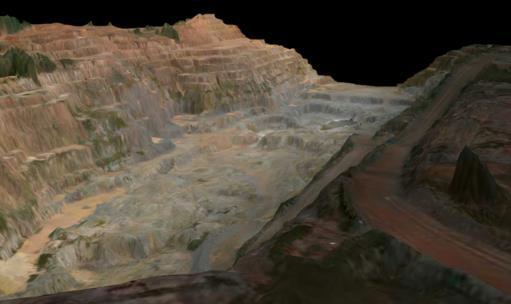
4 3D GIS across industries Transportation Developing Energy resources Mining Scientific Visualization Urban Planning Environmental assessment Utilities and Telecommunications Military Facilities Management Land Information Management


5 3D across the ArcGIS Platform Server Desktop Online Web Devices

6 ArcGIS Runtime Modern Architecture 64 Bit Local and Cloud Multi -Threaded Common APIs


7 ArcGIS Runtime SDKs Common Core.NET ios macos Android Java Qt QML Runtime Common API C++ with C ABI C++ Runtime core 3D Mapping and GIS capabilities

8 3D in Runtime Today Version Fully supported on desktop and mobile platforms in all Runtime SDKs - Scenes - Elevation sources - Layers - 3D symbols - View Controllers - Analysis


9 Scenes SceneView - Renders data in 3D and enables interaction Scene - Defines how data is organized and presented in 3D Web Scene - Document to define display and interaction of spatial content in 3D


10 Scene Layers Optimized for display of 3D content Based on I3S spec 3D objects, integrated mesh Sources - ArcGIS scene service - Scene layer package (.slpk)


11 Elevation sources - Defines height values across the surface of a scene - One or many Sources - ArcGIS image service - Tile package with LERC - Local raster


12 Feature layers Dynamic rendering of feature layers (2D and 3D) - From services or local data - Feature services, mobile geodatabase, shapefiles, geopackage, - Billboard marker symbols - Honor scene placement, relative/absolute, z values - Extrusion Static Not supported yet - Point scene layers - Point cloud scene layers - Vector tiled layers - Multipatch geometry Dynamic


 Distance")
13 3D Symbology Extrusion 3D marker symbols Model marker symbols - Formats defined by open asset library (assimp) Distance composite symbol


14 Cameras, viewpoints, and controllers Camera - location, altitude, heading, pitch - RotateAround Viewpoint - camera, geometry, scale, rotation GeoView.GetCurrentViewpoint - geometry or center\scale GeoView.SetViewpoint - viewpoint, camera, timespan Controllers - Globe Free roaming global navigation - OrbitGeoElement pivot camera around a target element - OrbitLocation pivot camera around target point

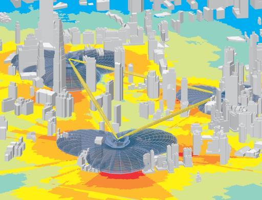
15 Exploratory Analysis Visual and interactive Uses what s visible in the scene GPU powered Line of sight Viewshed

16 3D Demos Scene layers View controllers Analysis Feature display
 - Full support on mobile platforms - Improved memory management - Optimized for OpenGL, DirectX - Camera controllers to follow geoelement - Local")
 Update 3 (100.")
17 ArcGIS Runtime road ahead for 3D 100.x 2017 June 2018 Update 1 (100.1) Update 2 (100.2) - Full support on mobile platforms - Improved memory management - Optimized for OpenGL, DirectX - Camera controllers to follow geoelement - Local elevation from TPKs - WMTS, OSM, Web tiled layers, WMS, shapefiles, ArcGIS image services - Analysis: viewshed, line of sight, measure - Dynamic feature layers - WGS84 tiled layers ( ) Update 3 (100.3) - Read/write web scenes - Mobile scene packages - Scene layer select, identify - Scene layer renderers - Point cloud scene layers - Vector tiled layers - Analysis: Measure Distance


18 Virtual and Augmented Reality with ArcGIS Runtime Enhance existing ArcGIS Runtime SDKs - VR: Add stereo display rendering mode - AR: Transparent background to render on video/camera feed - Private beta Integrate ArcGIS Runtime with game engines - Enable access to GIS data and analytics in developer environment optimized for immersive 3D experiences - Game engines currently power VR, AR and mixed reality (MR) solutions

19 ArcGIS Runtime: Private Beta program Started November 2017 Targeting high-end mobile devices - Good framerate, high resolution, best chipsets, superior camera, AR kits Limited to Runtime SDKs for.net, ios, and Android - Built on Runtime Includes samples and toolkits to integrate with device capabilities To request access to the beta program, ArcGISRuntimeARVRBeta@esri.com


20 Questions? developers.arcgis.com/arcgis-runtime


21 Please Take Our Survey on the Esri Events App! Download the Esri Events app and find your event Select the session you attended Scroll down to find the survey Complete Answers and Select Submit


22
Dynamic Situational Awareness. Through Developer Applications
 Dynamic Situational Awareness Through Developer Applications Mission Focused Applications Building Apps to support operations Agile Simple High-Performance Defense Developers GIS Simplifies Working With
ArcGIS Runtime SDK for.net Building Apps. Antti Kajanus David Cardella
 ArcGIS Runtime SDK for.net Building Apps Antti Kajanus akajanus@esri.com David Cardella dcardella@esri.com Thank You to Our Generous Sponsor SDK Highlights High-performance 2D and 3D mapping Integration
ArcGIS Runtime SDK for Qt: Building Apps. Koushik Hajra and Lucas Danzinger
 ArcGIS Runtime SDK for Qt: Building Apps Koushik Hajra and Lucas Danzinger Cross-platform apps Agenda for today Intro to Qt Framework and ArcGIS Runtime SDK for Qt App design patterns with this SDK SDK
Indexed 3D Scene (I3S) Layers Specification
 Layers Specification") Indexed 3D Scene (I3S) Layers Specification Javier Gutierrez Product Engineer Lead Esri Özgür Ertac 3D Product Engineer Esri Germany Thank You to Our Generous Sponsor Agenda ArcGIS 3D Platform Authoring
Indexed 3D Scene (I3S) Layers Specification Javier Gutierrez Product Engineer Lead Esri Özgür Ertac 3D Product Engineer Esri Germany Thank You to Our Generous Sponsor Agenda ArcGIS 3D Platform Authoring
Developing Mobile Apps with the ArcGIS Runtime SDK for.net
 Developing Mobile Apps with the ArcGIS Runtime SDK for.net Rich Zwaap Morten Nielsen Esri UC 2014 Technical Workshop Agenda The ArcGIS Runtime Getting started with.net Mapping Editing Going offline Geocoding
Building Great Situational Awareness Apps Using ArcGIS Developer Tools. Kerry Robinson Eric Bader Thomas Solow
 Building Great Situational Awareness Apps Using ArcGIS Developer Tools Kerry Robinson Eric Bader Thomas Solow Agenda Situational Awareness in ArcGIS Developing apps in connected environments - ArcGIS Enterprise
ArcGIS Runtime SDK for.net Building Apps. Rex Hansen
 ArcGIS Runtime SDK for.net Building Apps Rex Hansen Thank You to Our Sponsors Agenda Overview of the ArcGIS Runtime SDK for.net Resources for developers Common developer workflows: App templates, NuGet
ArcGIS Runtime SDKs Building Offline Apps. Nick Furness
 ArcGIS Runtime SDKs Building Offline Apps Nick Furness Agenda The basics - Considerations - Building blocks - Service types New! Offline maps New! Preplanned workflow What we are covering and what not
ArcGIS Runtime SDK for ios and macos: Building Apps. Suganya Baskaran, Gagandeep Singh
 ArcGIS Runtime SDK for ios and macos: Building Apps Suganya Baskaran, Gagandeep Singh Get Started Core Components Agenda - Display Map Content - Search for Content - Perform Analysis - Edit Content Summary
Sharing Web Layers and Services in the ArcGIS Platform. Melanie Summers and Ty Fitzpatrick
 Sharing Web Layers and Services in the Platform Melanie Summers and Ty Fitzpatrick Agenda Platform overview - Web GIS information model - Two deployment options Pro Sharing - User experience and workflows
Building Java Apps with ArcGIS Runtime SDK
 Building Java Apps with ArcGIS Runtime SDK Mark Baird and Vijay Gandhi A step back in time Map making 50 years ago - http://www.nls.uk/exhibitions/bartholomew/maps-engraver - http://www.nls.uk/exhibitions/bartholomew/printing
Developing Qt Apps with the Runtime SDK
 Developing Qt Apps with the Runtime SDK Thomas Dunn and Michael Tims Esri UC 2014 Technical Workshop Agenda Getting Started Creating the Map Geocoding and Routing Geoprocessing Message Processing Work
3D in the Browser with WebGL. Chris Andrews 3D Product Manager Javier Gutierrez 3D Product Engineer
 3D in the Browser with WebGL Chris Andrews 3D Product Manager Javier Gutierrez 3D Product Engineer Just sayin This is not a programming class Goal is to help you learn about a technology area that impacts
ArcGIS Runtime SDK for Java: Building Apps. Tyler Schiewe
 ArcGIS Runtime SDK for Java: Building Apps Tyler Schiewe Agenda Getting Started API Basics Patterns & Workflows Licensing and Deployment Questions Getting Started What You Get Code API Reference (Javadoc)
ArcGIS Runtime SDK for Java: A Beginner s Guide. Mark Baird JC Malott
 ArcGIS Runtime SDK for Java: A Beginner s Guide Mark Baird JC Malott Outline Intro to ArcGIS Runtime SDKs Get started: download and install the SDK Tour of the functionality of the API Basics of building
Sharing 3D Content on the Web
 Sharing 3D Content on the Web Nathan Shephard, Gert van Maren Why 3D GIS? Because our world is 3D Improve understanding 3D is easy for everyone to understand Better communication 3D makes it easier to
Building Applications with the ArcGIS Runtime SDK for WPF
 Esri International User Conference San Diego, California Technical Workshops 24 th July 2012 Building Applications with the ArcGIS Runtime SDK for WPF Euan Cameron & Paul Pilkington Agenda Introduction
ArcGIS Runtime: Building Cross-Platform Apps. Rex Hansen Mark Baird Michael Tims Morten Nielsen
 ArcGIS Runtime: Building Cross-Platform Apps Rex Hansen Mark Baird Michael Tims Morten Nielsen Agenda Cross-platform review ArcGIS Runtime cross-platform options - Java - Qt -.NET ArcGIS Runtime: Building
3D in the ArcGIS Platform. Chris Andrews
 3D in the ArcGIS Platform Chris Andrews Geospatial 3D is already all around us 3D is expanding the GIS community s opportunity to provide value 3D City & Infrastructure Models Generated 3D features Photogrammetrc
ArcGIS Runtime SDK for Android: Building Apps. Shelly Gill
 ArcGIS Runtime SDK for Android: Building Apps Shelly Gill Agenda Getting started SDK Common patterns and Example Apps Android platform updates Kotlin Team goals for upcoming releases Other sessions ArcGIS
ArcGIS Runtime SDK for.net: Building Xamarin Apps. Rich Zwaap Thad Tilton
 ArcGIS Runtime SDK for.net: Building Xamarin Apps Rich Zwaap Thad Tilton ArcGIS Runtime session tracks at DevSummit 2018 ArcGIS Runtime SDKs share a common core, architecture and design Functional sessions
ArcGIS Enterprise Extending Services. Bill Major
 ArcGIS Enterprise Extending Services Bill Major Agenda Introduction Geoprocessing tools Server Object Extensions Server Object Interceptors Demo APPS Desktop Web Device SHARING SERVICES Portal API DATA
ArcGIS Runtime SDK for WPF
 Esri Developer Summit in Europe November 9 th Rotterdam ArcGIS Runtime SDK for WPF Mike Branscomb Mark Baird Agenda Introduction SDK Building the Map Query Spatial Analysis Editing and Geometry Programming
Getting Started with the ArcGIS Runtime SDKs. Dave, Will, Euan
 Getting Started with the ArcGIS Runtime SDKs Dave, Will, Euan Agenda Why native app development? What can you do with the runtime SDKs Latest release Future Native Apps Are Everywhere Apple s App Store
Esri Developer Summit in Europe Building Applications with ArcGIS Runtime SDK for Java
 Esri Developer Summit in Europe Building Applications with ArcGIS Runtime SDK for Java Mark Baird Mike Branscomb Agenda Introduction SDK Building the Map Editing Querying Data Geoprocessing Asynchronous
ArcGIS Runtime SDKs: Building a Routing Application. Frank Kish Konstantin Kutsner
 ArcGIS Runtime SDKs: Building a Routing Application Frank Kish Konstantin Kutsner Overview What goes into a routing application Data connected \ disconnected Demo creating mmpk API Demo code Other Resources
Integrating Imagery into ArcGIS Runtime Application. Jie Zhang, Zhiguang Han San Jacinto, 5:30 pm 6:30 pm
 Integrating Imagery into ArcGIS Runtime Application Jie Zhang, Zhiguang Han San Jacinto, 5:30 pm 6:30 pm Overviews Imagery is an essential component of ArcGIS - Visualization, Processing and Analysis -
The Road to Runtime. Mark Cederholm UniSource Energy Services Flagstaff, Arizona
 The Road to Runtime Mark Cederholm UniSource Energy Services Flagstaff, Arizona A Brief History of Field Apps at UniSource ArcExplorer Free Users can customize map symbology No GPS No Editing No custom
CityEngine: An Introduction. Eric Wittner 3D Product Manager
 CityEngine: An Introduction Eric Wittner 3D Product Manager 2 minute city LegoScript + parameterized instructions + Legos Shapes = Scope and Geometry Shape Operations modify scope and geometry Rule = Sequence
Getting Started with ArcGIS Runtime SDK for the Microsoft.NET Framework. Morten Nielsen Mike Branscomb Antti Kajanus Rex Hansen
 Getting Started with ArcGIS Runtime SDK for the Microsoft.NET Framework Morten Nielsen Mike Branscomb Antti Kajanus Rex Hansen Agenda What is the ArcGIS Runtime? ArcGIS Runtime SDK for.net - Platform -
Getting Started with ArcGIS Runtime SDK for Qt. Thomas Dunn & Nandini Rao
 Getting Started with ArcGIS Runtime SDK for Qt Thomas Dunn & Nandini Rao Agenda Getting Started Creating the Map Geocoding and Routing Geoprocessing Message Processing Work Offline The Next Release ArcGIS
ArcGIS Runtime SDK for.net Getting Started. Jo Fraley
 ArcGIS Runtime SDK for.net Getting Started Jo Fraley Agenda What is the ArcGIS Runtime? What s new for ArcGIS developers? ArcGIS Runtime SDK 10.2 for WPF ArcGIS Runtime SDK for.net Building Windows Store
ArcGIS GeoEvent Server: Making 3D Scenes Come Alive with Real-Time Data
 ArcGIS GeoEvent Server: Making 3D Scenes Come Alive with Real-Time Data Morakot Pilouk, Ph.D. Senior Software Developer, Esri mpilouk@esri.com @mpesri Agenda 1 2 3 4 5 6 3D for ArcGIS Real-Time GIS Static
ArcGIS Online: Best Practices for High-Demand Web Applications. Kelly Gerrow-Wilcox Bonnie Stayer Beth Romero
 ArcGIS Online: Best Practices for High-Demand Web Applications Kelly Gerrow-Wilcox Bonnie Stayer Beth Romero Agenda Communicating with Maps Who do you build your apps for? Layer Types Scalability and Response
Creating, managing and utilizing a 3D Virtual City in ArcGIS Tamrat Belayneh Eric Wittner
 Creating, managing and utilizing a 3D Virtual City in ArcGIS 10.1 Tamrat Belayneh (tbelayneh@esri.com) Eric Wittner (ewittner@esri.com ) Contents 3D Mapping & Ingredients of a 3D Virtual City Creating
ArcGIS Runtime: Working with Maps Online and Offline. Will Crick Justin Colville [Euan Cameron]
![ArcGIS Runtime: Working with Maps Online and Offline. Will Crick Justin Colville [Euan Cameron]](/thumbs/72/66940731.jpg "ArcGIS Runtime: Working with Maps Online and Offline. Will Crick Justin Colville [Euan Cameron]") ArcGIS Runtime: Working with Maps Online and Offline Will Crick Justin Colville [Euan Cameron] ArcGIS Runtime session tracks at Dev Summit 2017 ArcGIS Runtime SDKs share a common core, architecture and
ArcGIS Runtime: Working with Maps Online and Offline Will Crick Justin Colville [Euan Cameron] ArcGIS Runtime session tracks at Dev Summit 2017 ArcGIS Runtime SDKs share a common core, architecture and
ArcGIS Enterprise: Sharing Imagery. Zikang Zhou Imagery and Raster team
 ArcGIS Enterprise: Sharing Imagery Zikang Zhou Imagery and Raster team ArcGIS Enterprise: Sharing Imagery PowerPoint slides will be available online. Send me an E-mail if you need it faster: zzhou@esri.com
Trimble GeoCollector for ArcGIS: An Introduction. Morgan Zhang (Esri), Matthew Morris (Trimble)
, Matthew Morris (Trimble)") Trimble GeoCollector for ArcGIS: An Introduction Morgan Zhang (Esri), Matthew Morris (Trimble) Overview Introduction to mobile GIS Overview of ArcGIS for Windows Mobile Overview of Trimble Positions software
Trimble GeoCollector for ArcGIS: An Introduction Morgan Zhang (Esri), Matthew Morris (Trimble) Overview Introduction to mobile GIS Overview of ArcGIS for Windows Mobile Overview of Trimble Positions software
ArcGIS Online: Managing Data. Jeremy Bartley Sentha Sivabalan
 ArcGIS Online: Managing Data Jeremy Bartley (jbartley@esri.com) Sentha Sivabalan (ssivabalan@esri.com) Agenda Creating and managing content like Apps, Maps, Scenes and Layers in ArcGIS Today s Topics:
Working with Feature Layers. Russell Brennan Gary MacDougall
 Working with Feature Layers Russell Brennan Gary MacDougall Working with Feature Layers Session will focus on feature access and editing Highlight new features added over the last few releases Agenda Introduction
ArcGIS Runtime: Maximizing Performance of Your Apps. Will Jarvis and Ralf Gottschalk
 ArcGIS Runtime: Maximizing Performance of Your Apps Will Jarvis and Ralf Gottschalk Agenda ArcGIS Runtime Version 100.0 Architecture How do we measure performance? We will use our internal Runtime Core
ArcGIS Runtime: Styling Maps. Ralf Gottschalk, Daniel Lee, Lucas Danzinger
 ArcGIS Runtime: Styling Maps Ralf Gottschalk, Daniel Lee, Lucas Danzinger Map Styling What is this session about? Creating beautiful functional maps for your Runtime Apps - Not about cartography It is
Esri CityEngine and the Oculus Rift: GIS for Next-Generation Virtual Reality
 Esri CityEngine and the Oculus Rift: GIS for Next-Generation Virtual Reality Brooks Patrick Solutions Engineer 3D Markets BPatrick@esri.com Esri UC 2014 Technical Workshop The entertainment industry continues
3D Data Modelling at Esri. Paul Hardy Business Development Consultant Esri Europe
 3D Data Modelling at Esri Paul Hardy phardy@esri.com Business Development Consultant Esri Europe Users of 3D GIS Local government Facilities management Civil engineering 3D GIS Defense / Public Safety
ArcGIS Pro Editing. Jennifer Cadkin & Phil Sanchez
 ArcGIS Pro Editing Jennifer Cadkin & Phil Sanchez ArcGIS Pro Editing Overview Provides tools that allow you to maintain, update, and create new data - Modifying geometry, drawing new features - Entering
Collector for ArcGIS: What s New. Chris LeSueur & James Tedrick
 Collector for ArcGIS: What s New Chris LeSueur & James Tedrick Outline Product overview Workflows Preparing data for Collector for ArcGIS What s new in Collector for ArcGIS v18.1.0 (Aurora) Advanced topics
Building Apps with the ArcGIS Runtime SDK for ios
 Building Apps with the ArcGIS Runtime SDK for ios Nick Furness @geeknixta ArcGIS Runtime SDKs 10.2 Released! Runtime platforms OS X Desktop Desktop Client Windows Store QT ios.net JavaSE Mobile Android
Scientific and Multidimensional Raster Support in ArcGIS
 Scientific and Multidimensional Raster Support in ArcGIS Sudhir Raj Shrestha sshrestha@esri.com Brief breakdown Scientific Multidimensional data Ingesting Scientific MultiDim Data in ArcGIS Ingesting and
MOBILE. LuciadMobile DATA SHEET
 MOBILE LuciadMobile DATA SHEET V2017 V2017.0 DATA SHEET LuciadMobile enables the rapid development of geospatial situational awareness applications on mobile devices running Android, and is specifically
Android Team Awareness Kit (ATAK) and ArcGIS
 and ArcGIS") Android Team Awareness Kit (ATAK) and ArcGIS Darron Pustam Product Manager, Esri Craig Cleveland Product Engineer, Esri Verne LaClair Product Manager, PAR Agenda Connecting Intel and Operations in Real
Android Team Awareness Kit (ATAK) and ArcGIS Darron Pustam Product Manager, Esri Craig Cleveland Product Engineer, Esri Verne LaClair Product Manager, PAR Agenda Connecting Intel and Operations in Real
ArcGIS Runtime: Building Cross-Platform Apps. Mike Branscomb Michael Tims Tyler Schiewe
 ArcGIS Runtime: Building Cross-Platform Apps Mike Branscomb Michael Tims Tyler Schiewe Agenda Cross-platform review ArcGIS Runtime cross-platform options - Java - Qt -.NET Native vs Web Native strategies
ArcGIS Apps: An Overview
 Federal GIS Conference February 9 10, 2015 Washington, DC ArcGIS Apps: An Overview Chris LeSueur Product Manager Marisa Cowdry NCMEC Agenda Apps Introduction Rugged Device Apps Essential Mapping Apps -
ArcGIS Online. The Road Ahead Geoff Mortson
 ArcGIS Online The Road Ahead Geoff Mortson gmortson@esricanada.com ArcGIS Online Easily create and share maps Delivered as intelligent maps Access on virtually any device anyone, anywhere Compliments and
Bringing your Data to Life in the ArcGIS API for JavaScript: Vector Tiles. Craig Williams &
 Bringing your Data to Life in the ArcGIS API for JavaScript: Vector Tiles Craig Williams & Rene Rubalcava @williamscraigm @odoenet Overview Why vector tiles? Vector tiles in ArcGIS ArcGIS vector tile basemaps
Desktop Mapping: Creating Vector Tiles. Craig Williams
 Desktop Mapping: Creating Vector Tiles Craig Williams Edie Punt @williamscraigm @epunt Overview Why vector tiles? Vector tiles in ArcGIS ArcGIS vector tile basemaps Consuming and styling vector tiles Overview
Developing mapping applications with ArcGIS Runtime SDK for ios. Divesh Goyal Eric Ito
 Developing mapping applications with ArcGIS Runtime SDK for ios Divesh Goyal Eric Ito Agenda Directions & Navigation Finding places and addresses Accessing your map content What is a mapping app? Introduction
Transitioning to the ArcGIS Runtime SDK for.net. Antti Kajanus & Mike Branscomb
 Transitioning to the ArcGIS Runtime SDK for.net Antti Kajanus & Mike Branscomb Transitioning from MapObjects ArcGIS API for Silverlight ArcGIS Engine Desktop / Mobile ArcGIS Runtime SDK for WPF Mobile
ArcGIS Online: Three-and-a-Half Ways to Create Tile Layers. Eric Anderson & Adam Eversole Esri Support Services
 ArcGIS Online: Three-and-a-Half Ways to Create Tile Layers Eric Anderson & Adam Eversole Esri Support Services Agenda 1. Introduction 2. What is a tile layer 3. How a tile layer works 4. The 3 ½ ways to
Getting Started with ArcGIS Runtime SDK for Java SE
 Getting Started with ArcGIS Runtime SDK for Java SE Elise Acheson, Vijay Gandhi, and Eric Bader Demo Source code: https://github.com/esri/arcgis-runtime-samples-java/tree/master/devsummit-2014 Video Recording:
Visualization with ArcGlobe. Brady Hoak
 Visualization with ArcGlobe Brady Hoak Contents What is ArcGlobe? 3D Mapping and ArcGlobe Displaying data in ArcGlobe ArcGlobe tools Tips for constructing ArcGlobe documents New at ArcGIS 9.3 ArcGIS integration
Understanding and Working with the OGC Geopackage. Keith Ryden Lance Shipman
 Understanding and Working with the OGC Geopackage Keith Ryden Lance Shipman Introduction - Introduction to Simple Features - What is the GeoPackage? - Esri Support - Looking ahead Geographic Things 3 Why
From 2D to 3D at Esri
 From 2D to 3D at Esri OGC/EuroSDR workshop on CityGML in National Mapping Paul Hardy phardy@esri.com Business Development Consultant National Mapping & Cadastre Esri 3D GIS Visualize Manage Share Analyze
ArcGIS for Developers: An Introduction. Moey Min Ken
 ArcGIS for Developers: An Introduction Moey Min Ken AGENDA Is development right for me? Building Apps on the ArcGIS platform Rest API & Web API Native SDKs Configurable Apps and Builders Extending the
An Introduction to GIS for developers
 An Introduction to GIS for developers Part 4: GIS Sharing Canserina Kurnia & Tom Shippee Agenda Web GIS ArcGIS Online Cloud-based ArcGIS Server ArcGIS Server on-premises ArcGIS a complete platform discover,
A Strategy and Vision for Enterprise 3D GIS. B r o o k s P a t r i c k A c c o u n t E x e c u t i v e b p a t r i c e s r i.
 A Strategy and Vision for Enterprise 3D GIS B r o o k s P a t r i c k A c c o u n t E x e c u t i v e b p a t r i c k @ e s r i. c o m Understanding where things are, and why, is essential for rational
ArcGIS Pro Editing: An Introduction. Jennifer Cadkin & Phil Sanchez
 ArcGIS Pro Editing: An Introduction Jennifer Cadkin & Phil Sanchez See Us Here WORKSHOP ArcGIS Pro Editing: An Introduction LOCATION SDCC - Ballroom 20 D TIME FRAME Thursday 10:00 11:00 ArcGIS Pro: 3D
ICAP - Intelligence Configuration for ArcGIS Pro. Natalie Feuerstein Dan Barnes Joe Bayles
 ICAP - Intelligence Configuration for ArcGIS Pro Natalie Feuerstein Dan Barnes Joe Bayles Overview Intelligence Analyst supporting Operations ArcGIS Pro SDK Intelligence Configuration for ArcGIS Pro -
Integrate GIS Functionality into Windows Apps with ArcGIS Runtime SDK for.net
 Integrate GIS Functionality into Windows Apps with ArcGIS Runtime SDK for.net By Rex Hansen, Esri ArcGIS Runtime SDK for.net The first commercial edition of the ArcGIS Runtime SDK for the Microsoft.NET
Developing Cross-Platform Native Apps with AppStudio for ArcGIS. Jo Fraley Erwin Soekianto
 Developing Cross-Platform Native Apps with AppStudio for ArcGIS Jo Fraley Erwin Soekianto AppStudio for ArcGIS ios Android Linux 1App Windows Mac What is AppStudio for ArcGIS? A suite of productivity tools
From 2D to 3D at Esri
 From 2D to 3D at Esri Paul Hardy, Esri Inc phardy@esri.com, Cambridge, UK SHORT PAPER This short paper provides an overview of the 3D capabilities of a modern GIS, illustrated by the Esri ArcGIS system,
Configuring ArcGIS Enterprise in Disconnected Environments
 Configuring ArcGIS Enterprise in Disconnected Environments BILL MAJOR Disconnected Environments Not everyone has internet access? How many of you run disconnected today, i.e. no internet access? Many customers
Extending ArcGIS for Server. Jon Satchwell, Esri Switzerland Cédric Despierre Corporon, Esri France
 Extending ArcGIS for Server Jon Satchwell, Esri Switzerland Cédric Despierre Corporon, Esri France Agenda Introduction Server Object Extensions Server Object Interceptors THE BIG WEBGIS PICTURE Introduction
ArcGIS Pro: Mapping & Visualization. David Watkins, Edie Punt &
 ArcGIS Pro: Mapping & Visualization David Watkins, Edie Punt & Craig Williams @daviddwatkins, @epunt, & @williamscraigm Mapping an Visualization Vision In ArcGIS Pro Improve drawing performance and quality
Introduction to ArcGIS API for Flex. Bjorn Svensson Lloyd Heberlie
 Introduction to ArcGIS API for Flex Bjorn Svensson Lloyd Heberlie Agenda API Introduction Getting started API concepts and examples Getting more information API Introduction ArcGIS 10 A Complete System
Data Interoperability Advanced Use
 Data Interoperability Advanced Use Bruce Harold Dale Lutz bharold@esri.com Safe Software This is your world ask us today about best practices Automate Moving Data No Domain Limitations ArcGIS Data Interoperability
Deploying ios Apps. Al Pascual
 Deploying ios Apps Al Pascual Overview Device Platform Strategy Built from a common GIS Runtime Configurable Apps ArcGIS for ios, Android, Windows Phone Collector for ArcGIS Operations Dashboard Additional
Advances in GIS help create Smarter Communities
 Advances in GIS help create Smarter Communities POP(ovich) Quiz Who is a Desktop User? Who is an ArcGIS Online User? Who is a ArcGIS Server Admin? Who is a Programmer? Who works with or for a government
Building Basemaps: MapCaches and VectorTiles. Matthias Schenker Gerhard Trichtl
 Building Basemaps: MapCaches and VectorTiles Matthias Schenker Gerhard Trichtl What are Basemaps for Basemaps provide a optimal background and orientation for displaying your data on top Should be - Fast
Developers Road Map to ArcGIS Desktop and ArcGIS Engine
 Developers Road Map to ArcGIS Desktop and ArcGIS Engine Core ArcObjects Desktop Team ESRI Developer Summit 2008 1 Agenda Dev Summit ArcGIS Developer Opportunities Desktop 9.3 SDK Engine 9.3 SDK Explorer
ArcGIS Runtime SDK for Java: Building Apps. Mark Baird
 ArcGIS Runtime SDK for Java: Building Apps Mark Baird Agenda Getting started with 100.4 JavaFX Base maps, layers and lambdas Graphics overlays Offline data Licensing and deployment What is happening in
Open File Explorer Start Pro with SanFran project Open Locator in SanFran project Open Browser and AGOL with RouteExample Web map.
 Open File Explorer Start Pro with SanFran project Open Locator in SanFran project Open Browser and AGOL with RouteExample Web map. Open Browser with this: http://nadev.arcgis.com/arcgis/samples/easyvrp/easyvrp.html
Getting Started with ArcGIS for Server. Charmel Menzel and Ken Gorton
 Getting Started with ArcGIS for Server Charmel Menzel and Ken Gorton Agenda What is ArcGIS for Server? Types of Web services Publishing resources onto the Web Clients to ArcGIS for Server Editions and
Real-Time & Big Data GIS: Leveraging the spatiotemporal big data store
 Real-Time & Big Data GIS: Leveraging the spatiotemporal big data store Suzanne Foss Product Manager, Esri sfoss@esri.com Ricardo Trujillo Real-Time & Big Data GIS Developer, Esri rtrujillo@esri.com @rtrujill007
Creating and Maintaining Your 3D Basemap. Brian Sims Dan Hedges Gert van Maren
 Creating and Maintaining Your 3D Basemap Brian Sims Dan Hedges Gert van Maren Complementary Resource Email (no marketing) A copy of the presentation Links to today s web demos Links to training materials
Building Android Apps Runtime SDK for Android
 Building Android Apps Runtime SDK for Android Dan O Neill & Alan Lucas Introductions What do you do What do we do - Android Development Team - Edinburgh Alan Lucas - https://github.com/alan-edi - Alaska
3D Analysis Tools and Visualization with ArcGIS. Jie Chang Jinwu Ma
 3D Analysis Tools and Visualization with ArcGIS Jie Chang Jinwu Ma Why 3D GIS? Because our world is 3D Improve understanding 3D is easy for everyone to understand Solve 3D problems Some spatial problems
Understanding and using Metadata across the ArcGIS Platform. Aleta Vienneau Marten Hogeweg
 Understanding and using Metadata across the ArcGIS Platform Aleta Vienneau Marten Hogeweg Understanding and using Metadata across the ArcGIS Platform Metadata fundamentals ArcGIS platform Road ahead Metadata
Developing Imagery Apps Using the ArcGIS API for JavaScript and WebApp Builder. Naila Khan, Chayanika Khatua
 Developing Imagery Apps Using the ArcGIS API for JavaScript and WebApp Builder Naila Khan, Chayanika Khatua What are we talking about today Custom applications Map Viewer Web AppBuilder ArcGIS API for
An introduction to ArcGIS Runtime
 2013 Europe, Middle East, and Africa User Conference October 23-25 Munich, Germany An introduction to ArcGIS Runtime Christine Brunner Lars Schmitz Welcome! Christine Brunner, Germany - Software Developer
Using Collector for ArcGIS and Operations Dashboard for ArcGIS. Mike Sweeney Esri-Charlotte
 Using Collector for ArcGIS and Operations Dashboard for ArcGIS Mike Sweeney Esri-Charlotte Agenda The ArcGIS Platform Desktop Web Device Portal Cloud Server Online Content and Services On-Premises Available
ArcGIS Hub: Open data best practices. Graham Hudgins, esri product engineer
 ArcGIS Hub: Open data best practices Graham Hudgins, esri product engineer Agenda Overview of open data in the ArcGIS Hub Example sites - Hubs Around the World Storymap Making a good site map Preparing
ArcGIS Pro Terminology Guide
 ArcGIS Pro Terminology Guide Essential Terminology or Functionality That s New to ArcGIS Pro ArcGIS Pro Project Map Scene Ribbon Tab on the ribbon View Active view Pane Gallery Task Quick Access Toolbar
ArcGIS Pro Terminology Guide
 ArcGIS Pro Terminology Guide Sharing Terminology and User Interface Cross-Reference Share content Project package (.ppkx) Map package (.mpkx) Layer package (.lpkx) Share or publish a web layer Share Web
Providing Interoperability Using the Open GeoServices REST Specification
 2013 Esri International User Conference July 8 12, 2013 San Diego, California Technical Workshop Providing Interoperability Using the Open GeoServices REST Specification Satish Sankaran Kevin Sigwart What
What Makes a good content item GREAT?
 What Makes a good content item GREAT? Keith VanGraafeiland Tuesday - 4:30 PM - 5:15 PM SDCC - Demo Theater 04 - Living Atlas Overview Subhead Here Content items in ArcGIS Online Difficult to find what
Using ArcGIS for Server. Javier Abadía, Esri España Peter McDaid, Esri UK
 Using ArcGIS for Server Javier Abadía, Esri España Peter McDaid, Esri UK 1. Intro 2. ArcGIS for Server = Geospatial Apps Server 3. Map Services Publishing Flow Apps 4. Spatial Functionality Services Publishing
Hit the Ground Running. ArcGIS Runtime SDK for Android
 Hit the Ground Running ArcGIS Runtime SDK for Android Presenters Dan O Neill - @jdoneill Xueming Wu Introduction to the Android SDK Maps & Layers Analysis & Display Information Place Search Offline Patterns
ArcGIS for Server: Publishing and Using Map Services
 ArcGIS for Server: Publishing and Using Map Services Matthias Schenker Gerhard Trichtl m.schenker@esri.ch g.trichtl@mysynergis.com Agenda Platform overview Publishing services - Demo: Publishing hosted
BROWSER. LuciadRIA DATA SHEET
 BROWSER LuciadRIA DATA SHEET V2017 V2017.0 DATA SHEET LuciadRIA is the answer to today s demands for powerful, lightweight applications in the browser. Driven by today s most advanced web technologies,
Drone2Map for ArcGIS: Bring Drone Imagery into ArcGIS
 Drone2Map for ArcGIS: Bring Drone Imagery into ArcGIS Mike Sweeney 1 Drone2Map for ArcGIS Turn Drones into Enterprise Productivity Tools ArcGIS Drone2Map for ArcGIS Create 2D and 3D products from raw drone