Reporting of modelled data under the AQD IPR for e-reporting
|
|
|
- Dustin Greene
- 5 years ago
- Views:
Transcription


1 Reporting of modelled data under the AQD IPR for e-reporting RETROSPECTIVE OF PILOT TESTING IN 2012 & MODELLING DATA Tony Bush 6 th pilot meeting Copenhagen 8-10 October 2012
2 Introduction Where does modelled data sit within the e-reporting compliance package Scope of data type for today s discussions The IPR data requirements Proposed encoding Data reporting (delivery)
3 Modelled data within e-reporting IPR Modelled data is a form of supplementary assessment data as set out by Articles 7 and 10 of the AQD Article 4 of 4DD As for measurement methods, supplementary assessment methods need to be described Description allows methods to be identified and checked against the DQOs of the Directives Description forms part of Data flow D
4 Scope of supplementary data type The IPR provides for 3 similar supplementary assessment data types Indicative measurements Modelled data Objective estimation Indicative measurement metadata requirements map well to fixed measurements metadata profile Modelling and objective estimation data types have common metadata requirements which are subtly differ from measurements Metadata requirements for modelling and objective estimation may be grouped into a single metadata profile
5 Status of the metadata profile Data specifications established by IPR and split guidance Requirements seem to be sensible Some optimisations may be required subject to testing A workable platform to finalise the profile Wider initiatives $$$Dublin meeting will feed into the specifications and standard used


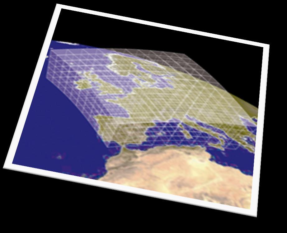
6 Assessment data types Objective estimation for an area Model observations on a irregular grid Model observations on a road network 3-dimensional model observations Model observations on a regular grid
7 Common metadata profile Data item Requirement Datatype D.7.1 Assessment ID M ID D Assessment method name M Text D Assessment method description M Text D Assessment method documentation M Text D Environmental Objective M codelist D Area of Assessment M Bounding box D Measurements used for model calibration C (M) xlink href D Measurements used for model verification C (M) xlink href or description D Model time reslution unit M codelist D Number of time units M number D Assessment period description M Text D Assessment period time unit M codelist D Number of time units M number D.7.6 Spatial resolution description M Text D DQO Uncertainty estimation C (M) number D DQO Documentation C (M) number D DQO Link to documentation report C (M) URL D Standard Databases V codelist D Other Databases V Text D Assessment method for WSS C (M) Text D Assessment method for NAT C (M) Text D.7.10 Used for compliance assessment under AQD M codelist

8 Metadata model for AQD measurement processes Comes close to the metadata requirements for supplementary assessment But, not quite there in some areas

9 Metadata model optimised for supplementary assessments Proposed solution is to extend ef:observingcapability Using ef:observingcapability data specifications where possible Extending to domain specific requirements as needed

10 Metadata model optimised for supplementary assessments Looking at the ef:observingcapability data specifications these may be reused as follows. Description Domain Time instant for the observation Localised name Unique ID Pollutant Observed feature (grid, road network, region)

11 Metadata model optimised for supplementary assessments Extending for data specs relevant to the requirements for supplementary assessments

12 Metadata model optimised for supplementary assessments Extending for data specs relevant to the requirements for supplementary assessments
13 Influence of other initiatives on modelling metadata The GEO AQ CoP Group on Earth Observation for Air Quality Community of Practice a self-organized voluntary group that fosters the application of Earth observations to air quality management and science. Workshop on Air Quality and Atmospheric Composition Metadata (Dublin, 5-7 Sept. 2012) Captured collective views on metadata (discovery, dataset, dataseries) Outcomes will be rolled into the emergent schema INSPIRE AC/MF version 3.0 community recommendations Draft schemas published July 2012 AC/MF specific content mysteriously absent from feature catalogue and SVN MOLES: Metadata Objects for Linking Environmental Sciences Developed by UK s NERC DataGrid A group documents which either provide descriptions of some key features of environmental data and their context or provide links to those descriptions.
 Data models")
14 AC/MF AC/MF data specifications Version Application schema for describing observations on A regular grid A trajectory A collection of points (irregular grid) Data models appropriate to core types of model outputs for air quality
15 Example file delivery <?xml version="1.0" encoding="utf-8"?> <ac:gridobservation gml:id="id_0001" xmlns:ac=" xmlns:gml=" xmlns:om=" xmlns:xsi=" xsi:schemalocation=" <om:phenomenontime/> <om:resulttime/> <om:procedure/> <om:observedproperty/> <om:featureofinterest/> <om:result> <gml:file> </gml:file> </om:result> </ac:gridobservation> <gml:rangeparameters></gml:rangeparameters> <gml:filename></gml:filename> <gml:filestructure></gml:filestructure>
16 xmlns:gml=" xmlns:swe=" xmlns:xlink=" xmlns:xsi=" xsi:schemalocation=" gml:id="id002"> <label>mean Air Temperature over 24hr Period</label> <basephenomenon xlink:href=" <qualifier> <StatisticalQualifier gml:id="24mean1"> <statisticaloperator xlink:href=" <statisticalperiod>p1d</statisticalperiod> </StatisticalQualifier> </qualifier> </ComplexObservableProperty > xlink:arcrole= xlink:href= file://myfile.nc#lon xlink:role=

17 Any Questions?
AQD IPR pilot study programme on e-reporting
 AQD IPR pilot study programme on e-reporting Progress on UTD Jaume Targa 6 th pilot meeting Copenhagen 8-10 October May 2012 Introduction Important points on UTD Re-delivering UTD data Aggregation rules
AQD IPR pilot study programme on e-reporting
 AQD IPR pilot study programme on e-reporting A quick start guide working with the e-reporting schemata Tony Bush 4 th pilot meeting Copenhagen 15-16 March 2012 Introduction What to worry about first if
AQD IPR pilot study programme on e-reporting
 AQD IPR pilot study programme on e-reporting User Guide to AQ e-reporting Jaume Targa & Tony Bush 8 th pilot meeting Copenhagen 18-19 June 2013 User guide AQ e-reporting data model & schema Latest version
Draft meeting minutes
 Draft meeting minutes 6th meeting of the IPR Pilot Group Date & Time 8-10 October 2012, Copenhagen Location EEA, Copenhagen Attendees Representatives from the following IPR pilot countries: DE, DK, BE,
AQD IPR pilot study programme on e-reporting
 AQD IPR pilot study programme on e-reporting Annual Assessments data flows and progress on UTD & AQ zones 5 th pilot meeting Copenhagen 24-25 May 2012 Agenda Morning Pilot country experiences & discussion
Transformation sofware AQUI: creating data flows in XML
 Transformation sofware AQUI: creating data flows in XML Patrick van Hooydonk 8 th pilot meeting Copenhagen 18-19 June 2013 creating data flows in XML Information from EoI/AQQ 2011 in AQUI-database Mapping
(Towards) A metadata model for atmospheric data resources
 A metadata model for atmospheric data resources") (Towards) A metadata model for atmospheric data resources Anne De Rudder and Jean-Christopher Lambert Belgian Institute for Space Aeronomy (IASB-BIRA), Brussels The context EU FP7 Ground-based atmospheric
(Towards) A metadata model for atmospheric data resources Anne De Rudder and Jean-Christopher Lambert Belgian Institute for Space Aeronomy (IASB-BIRA), Brussels The context EU FP7 Ground-based atmospheric
Reporting and Exchange of Air Quality Information Under CAFE Directive Using INSPIRE Services Testbed Results
 Reporting and Exchange of Air Quality Information Under CAFE Directive Using INSPIRE Services Testbed Results Alina Kmiecik, Dominik Kobus, Magdalena Bednarek, Anna Zamolska, Piotr Krok, Marek Brylski,
Metadata for Data Discovery: The NERC Data Catalogue Service. Steve Donegan
 Metadata for Data Discovery: The NERC Data Catalogue Service Steve Donegan Introduction NERC, Science and Data Centres NERC Discovery Metadata The Data Catalogue Service NERC Data Services Case study:
Using INSPIRE Services for Reporting and Exchange of Air Quality Information under CAFE Directive Test bed Results
 Using INSPIRE Services for Reporting and Exchange of Air Quality Information under CAFE Directive Test bed Results Alina Kmiecik, Dominik Kobus, Magdalena Bednarek, Piotr Krok, Anna Zamolska 26,6/2012,
GML Clarifications. IHO S-100WG April 2018 Raphael Malyankar; Eivind Mong. Work sponsored by NOAA
 GML Clarifications IHO S-100WG3 10-13 April 2018 Raphael Malyankar; Eivind Mong Work sponsored by NOAA Overview of proposal/presentation The proposal for Part 10b contains: Modifications arising from splines
Automating the web publishing process of environmental data by using semantic annotations
 Automating the web publishing process of environmental data by using semantic annotations Jürgen Moßgraber Fraunhofer IOSB Fraunhoferstraße 1 76131 Karlsruhe juergen.mossgraber@iosb.fraunhofer.de Désirée
The UK Marine Environmental Data and Information Network MEDIN
 The UK Marine Environmental Data and Information Network MEDIN M. Charlesworth, R. Lowry, H. Freeman, J. Rapaport, B Seeley Content MEDIN - a brief overview for context Discovery Metadata Standard and
AQD Reporting Model. European Air Quality Reporting Based on INSPIRE
 AQD Reporting Model European Air Quality Reporting Based on INSPIRE Overview Basics Changes since January 2013 Basics - INSPIRE Identifier Identifier basic INSPIRE requirement for all features Attributes:
MetOcean Themes in INSPIRE
 MetOcean Themes in INSPIRE Cliquez pour modifier le style du titre 4th Workshop on the use of GIS/OGC standards in meteorology Cliquez pour modifier le style des sous-titres Frédéric du Guillaud masque
Open Geospatial Consortium
 Open Geospatial Consortium Publication Date: 2014-02-25 Approval Date: 2013-06-22 Submission Date: 2013-02-27 Reference URL for this document: http://www.opengis.net/doc/bp/sos-profile-in-situ/1.0 Version:
Documentation of. RESTful SOS
 Documentation of RESTful SOS Document Change Control Revision Date Of Issue Author(s) Brief Description Of Changes 0.1 16.10.12 Eike Hinderk Jürrens Initialization 0.2 17.10.12 Eike Hinderk Jürrens Revision
Implementing air quality e-reporting
 Implementing air quality e-reporting Core requirements by September 2014 Jaume Targa 11 th AQ E-Reporting IPR Pilot meeting Copenhagen, EEA Content Core requirements by Sept 2014 Air Quality Zones (B)
Consolidation Team INSPIRE Annex I data specifications testing Call for Participation
 INSPIRE Infrastructure for Spatial Information in Europe Technical documents Consolidation Team INSPIRE Annex I data specifications testing Call for Participation Title INSPIRE Annex I data specifications
URI Properties for INSPIRE Extension. Stereotype Solution
 URI Properties for INSPIRE Extension Stereotype Solution Introduction After much effort we have harmonized data models based on standards (ISO, OGC, INSPIRE) But... These already being extended based on
Open GeoSpatial Consortium Inc.
 Open GeoSpatial Consortium Inc. Date: 2011-01-19 Reference number of this Document: OGC 10-140 Version: 0.2.0 Category: OpenGIS Interface Standard Editor: Peter Baumann, Stephan Meissl OGC Web Coverage
Leveraging metadata standards in ArcGIS to support Interoperability. David Danko and Aleta Vienneau
 Leveraging metadata standards in ArcGIS to support Interoperability David Danko and Aleta Vienneau Leveraging Metadata Standards in ArcGIS for Interoperability Why metadata and metadata standards? Overview
Detailed analysis + Integration plan
 Outline Integration methodology Detailed analysis + Integration plan Conclusions 2 Outline Integration methodology Detailed analysis + Integration plan Conclusions 3 EULF-ISA Integration: methodology Phase
IPR implementation EEA perspective. Road map to AQ e-reporting March 2012
 IPR implementation EEA perspective Valentin Foltescu Road map to AQ e-reporting March 2012 according to the Commission decision laying down the rules IPR implementing Directives 2004/107/EC and 2008/50/EC
The Scottish Spatial Data Infrastructure (SSDI)
") The Scottish Spatial Data Infrastructure (SSDI) INSPIRE Conference Istanbul Monday 25 th June 2012 15:55 Geoportals and registries II Tim Duffy BGS Edinburgh (trd@bgs.ac.uk) Shona Nicol Alex Ramage NERC
The Scottish Spatial Data Infrastructure (SSDI) INSPIRE Conference Istanbul Monday 25 th June 2012 15:55 Geoportals and registries II Tim Duffy BGS Edinburgh (trd@bgs.ac.uk) Shona Nicol Alex Ramage NERC
Guidelines for the encoding of spatial data
 INSPIRE Infrastructure for Spatial Information in Europe Guidelines for the encoding of spatial data Title D2.7: Guidelines for the encoding of spatial data, Version 3.1 Creator INSPIRE Drafting Team "Data
</ows:acceptversions> <ows:version>2.0.0</ows:version> - <ows:acceptversions> </ows:sections>
 1 H28-GL4 GetCapabilities.xml
Web Coverage Services (WCS)
") Web Coverage Services (WCS) www.jrc.ec.europa.eu Thematic Cluster #3 Jordi Escriu Facilitator Thematic Cluster #3 Serving society Stimulating innovation Supporting legislation Coverages in INSPIRE Coverage:
Web Coverage Services (WCS) www.jrc.ec.europa.eu Thematic Cluster #3 Jordi Escriu Facilitator Thematic Cluster #3 Serving society Stimulating innovation Supporting legislation Coverages in INSPIRE Coverage:
Implementation of Article 6 of the Paris Agreement status and pathways to COP24
 Implementation of Article 6 of the Paris Agreement status and pathways to COP24 IEA/IETA/EPRI, October 2017 Amy Merrill Steen Lead, Article 6 PA negotiations support UNFCCC secretariat Focus of presentation
Air Quality e-reporting: Data handling
 Air Quality e-reporting: Data handling EEA & ETC/ACM efforts compiled by Artur sella 12 th IPR Pilot Meeting Copenhagen, 12 th of November 2014 What happens with data after delivery?! Validation, QA (Tier1)
The Jülich WCS interface for emissions, model products, and model evaluation
 The Jülich WCS interface for emissions, model products, and model evaluation Martin G. Schultz, M. Decker, S. Lührs, S. Schröder, O. Stein, S. Waychal IEK-8, Forschungszentrum Jülich, Germany PART1: AIR
Initial Operating Capability & The INSPIRE Community Geoportal
 INSPIRE Conference, Rotterdam, 15 19 June 2009 1 Infrastructure for Spatial Information in the European Community Initial Operating Capability & The INSPIRE Community Geoportal EC INSPIRE GEOPORTAL TEAM
Introduction to XML user guide
 EEA- ETC/ACM 9 th & 10 th of February 2016 Workshop "Developing your national Air Quality e- Reporting System post- AQUI, Copenhagen Introduction to XML user guide Documentation on e- Reporting http://www.eionet.europa.eu/aqportal/guidelines
INSPIRE Download Service
 The OGC SOS as INSPIRE Download Service for (meteorological) l) Observation Data Simon Jirka (52 North) 29 th October 2014 5th Workshop on the use of GIS/OGC standards in meteorology Offenbach (Germany)
First Review of COP 21 and Potential impacts on Space Agencies
 First Review of COP 21 and Potential impacts on Space Agencies Pascal Lecomte WGClimate Chair March 4 th, 2016 COP 21 the event Space Agencies were present and visible in the negotiation areas (Blue Zone)
Extension of INSPIRE Download Services TG for Observation Data
 Extension of INSPIRE Download Services TG for Observation Data Simon Jirka (52 North) 14 th June 2014, MIG Workshop on WCS-based INSPIRE Download Services Agenda Motivation Sensor Web Proposed Update for
The descriptions of the elements and measures are based on Annex D of ISO/DIS Geographic information Data quality.
 7 Data quality This chapter includes a description of the data quality elements and sub-elements as well as the corresponding data quality measures that should be used to evaluate and document data quality
INSPIRE Geoportal Rich user experience across member states services
 INSPIRE Geoportal Rich user experience across member states services developed under a contract with the EC (JRC) Diomede ILLUZZI 1 Nicola LUNANOVA 1 Torsten FRIEBE 2 1 Planetek Italia s.r.l Via Masaua
Quality control service for Inspire data
 Quality control service for Inspire data INSPIRE Conference 2014 Aalborg Anders Foureaux Process Manager Data feeds Data hosting Environmental Informations Systems Unit Reasearch and Assessment Department
Proposed update of Technical Guidance for INSPIRE Download services based on SOS
 Proposed update of Technical Guidance for INSPIRE Download services based on SOS Organised by: Simon Jirka, Alexander Kotsev, Michael Lutz Dr. Simon Jirka (jirka@52north.org) 52 North GmbH Workshop - The
Requirements for Observational Metadata: CAS
 Federal Department of Home Affairs FDHA Federal Office of Meteorology and Climatology MeteoSwiss Requirements for Observational Metadata: CAS Measurement and Data Department, MeteoSwiss TT-WMD-1, Geneva,
GOVERNMENT GAZETTE REPUBLIC OF NAMIBIA
 GOVERNMENT GAZETTE OF THE REPUBLIC OF NAMIBIA N$7.20 WINDHOEK - 7 October 2016 No. 6145 CONTENTS Page GENERAL NOTICE No. 406 Namibia Statistics Agency: Data quality standard for the purchase, capture,
Long-term preservation for INSPIRE: a metadata framework and geo-portal implementation
 Long-term preservation for INSPIRE: a metadata framework and geo-portal implementation INSPIRE 2010, KRAKOW Dr. Arif Shaon, Dr. Andrew Woolf (e-science, Science and Technology Facilities Council, UK) 3
CloudSense Version 2.0 Technical Document SOS Station API OGC API Reference Version 1.0 *For SOS Station ONLY*
 CloudSense Version 2.0 Technical Document SOS Station API OGC API Reference Version 1.0 *For SOS Station ONLY* ListenField Co., Ltd. Email: support@listenfield.com Website: http://www.listenfield.com Revision
INSPIRE status report
 INSPIRE Team INSPIRE Status report 29/10/2010 Page 1 of 7 INSPIRE status report Table of contents 1 INTRODUCTION... 1 2 INSPIRE STATUS... 2 2.1 BACKGROUND AND RATIONAL... 2 2.2 STAKEHOLDER PARTICIPATION...
Compass INSPIRE Services. Compass INSPIRE Services. White Paper Compass Informatics Limited Block 8, Blackrock Business
 Compass INSPIRE Services White Paper 2010 Compass INSPIRE Services Compass Informatics Limited Block 8, Blackrock Business Park, Carysfort Avenue, Blackrock, County Dublin, Ireland Contact Us: +353 1 2104580
Monitoring and Reporting Drafting Team Monitoring Indicators Justification Document
 INSPIRE Infrastructure for Spatial Information in Europe Monitoring and Reporting Drafting Team Monitoring Indicators Justification Document Title Draft INSPIRE Monitoring Indicators Justification Document
DataCove Statistical Viewer. A Belated Contribution to DanubeHack2
 A Belated Contribution to DanubeHack2 Authors: Katharina Schleidt Kathi@DataCove.eu Tomas Kliment Tomas@DataCove.eu Date V1.0 16.02.2017 V1.1 06.04.2017 Special Thanks to the organizers of DanubeHack2!
Air Quality Community Experiences and Perspectives on International Interoperability Standards
 Air Quality Community Experiences and Perspectives on International Interoperability Standards Erin Robinson, Stefan Falke, Rudolf Husar, David McCabe, Frank Lindsay, Chris Lynnes, Greg Leptoukh, Beate
Christian Ansorge 27th April CDDA webinar 27th April Linked Approach as reporting mechanism
 Christian Ansorge 27th April 2017 CDDA webinar 27th April 2017 Linked Approach as reporting mechanism Generic Linked Approach Scope Background and motivation for reporting reusing INSPIRE Introduction
Introduction to INSPIRE. Network Services
 Introduction to INSPIRE. Network Services European Commission Joint Research Centre Institute for Environment and Sustainability Digital Earth and Reference Data Unit www.jrc.ec.europa.eu Serving society
How to Create a European INSPIRE Compliant Data Specification. Anja Hopfstock, BKG (Germany) Morten Borrebæk, SK (Norway)
 Morten Borrebæk, SK (Norway)") How to Create a European INSPIRE Compliant Data Specification Anja Hopfstock, BKG (Germany) Morten Borrebæk, SK (Norway) ESDIN Key Goals Further the ambition of the European Commission to create a European
How to Create a European INSPIRE Compliant Data Specification Anja Hopfstock, BKG (Germany) Morten Borrebæk, SK (Norway) ESDIN Key Goals Further the ambition of the European Commission to create a European
Lex Jansen Octagon Research Solutions, Inc.
 Converting the define.xml to a Relational Database to enable Printing and Validation Lex Jansen Octagon Research Solutions, Inc. Leading the Electronic Transformation of Clinical R&D PhUSE 2009, Basel,
Name type specification definitions part 1 basic name
 Open Geospatial Consortium Inc. Date: 2010-03-31 Reference number of this document: OGC 09-048r3 OGC Name of this document: http://www.opengis.net/doc/pol-nts/def-1/1.1 Version: 1.1 Category: OpenGIS Policy
INSPIRE & Environment Data in the EU
 INSPIRE & Environment Data in the EU Andrea Perego Research Data infrastructures for Environmental related Societal Challenges Workshop @ pre-rda P6 Workshops, Paris 22 September 2015 INSPIRE in a nutshell
EarthLookCZ as Czech way to GMES
 EarthLookCZ as Czech way to GMES Karel Charvat 1 and Petr Horak 1 1 WirelessInfo, Czech Republic, charvat@wirelessinfo.cz Abstract Global Monitoring for Environment and Security is one of 4 ranges of solutions
Ambiguities in the Implementation of the INSPIRE directive for Metadata. J.Walther, F.Schenk
 Ambiguities in the Implementation of the INSPIRE directive for Metadata J.Walther, F.Schenk Errors and Ambiguities e.g. UseLimitation INSPIRE Metadata Implementing Rules: Technical Guidelines based on
Reducing Consumer Uncertainty
 Spatial Analytics Reducing Consumer Uncertainty Towards an Ontology for Geospatial User-centric Metadata Introduction Cooperative Research Centre for Spatial Information (CRCSI) in Australia Communicate
Dataset-XML - A New CDISC Standard
 Dataset-XML - A New CDISC Standard Lex Jansen Principal Software Developer @ SAS CDISC XML Technologies Team Single Day Event CDISC Tools and Optimization September 29, 2014, Cary, NC Agenda Dataset-XML
EEA-ETC/ACM 25 th & 26 th of April st IPR Technical meeting, Copenhagen. Proposed schema update for B-G in 2017
 EEA-ETC/ACM 25 th & 26 th of April 2016 1 st IPR Technical meeting, Copenhagen Proposed schema update for B-G in 2017 Planning In 2016, ETC/ACM is reviewing the Schema The aim is that any change/update
Next GEOSS der neue europäische GEOSS Hub
 DLR.de Folie 1 27.10.2016, Oberpfaffenhofen Next GEOSS der neue europäische GEOSS Hub J. Meyer-Arnek, A. Müller, G. Schreier DLR.de Folie 2 NextGEOSS-Konsortium Kick-Off: 16-18 JAN 2017 Project duration:
ICT Roadmap and ICT 1(6,6DQG6(,6%$6,6ZRUNVKRS DWWKH,163,5(&RQIHUHQFH.UDNRZ -DDQXV+HLQODLG 7LHWR(VWRQLD$6
 ICT Roadmap and ICT Guidelines DWWKH,163,5(&RQIHUHQFH.UDNRZ -DDQXV+HLQODLG 7LHWR(VWRQLD$6 Overall status Both ICT Roadmap and ICT Guidelines have changed extensively since the previous NESIS-BASIS workshop.
Preservation Health Check: introduction to the pilot
 Toronto, October 2 nd 2012 IPRES 2012 Preservation Health Check: introduction to the pilot Workshop 4 PREMIS implementation fair 2012 Titia van der Werf Senior Program Officer OCLC Joint initiative: -
S-100 schemas and other files
 Notes (07 November 2018) Folder Organization: Wherever local files are referenced in the XSD files and XML sample files, the references are based on this organization of folders. Table 1. File and folder
Semantic Sensor Networks XG Semantic Markup Laurent Lefort, CSIRO ICT Centre
 Semantic Sensor Networks XG Semantic Markup Laurent Lefort, CSIRO ICT Centre SSN XG Meeting 3 March 2010 Contents Review of semantic annotation techniques Types of annotations Compatibility of existing
Part 1: Content model
 Provläsningsexemplar / Preview TECHNICAL SPECIFICATION ISO/TS 19163-1 First edition 2016-01-15 Geographic information Content components and encoding rules for imagery and gridded data Part 1: Content
Suggestions for writing Abstract Test Suites (ATS) for INSPIRE conformance testing for Metadata and Network Services
 for INSPIRE conformance testing for Metadata and Network Services") Suggestions for writing Abstract Test Suites (ATS) for INSPIRE conformance testing for Metadata and Network Services MIWP-5 Workshop 02. December 2014 Sven Böhme, Federal Agency for Cartography and Geodesy
Suggestions for writing Abstract Test Suites (ATS) for INSPIRE conformance testing for Metadata and Network Services MIWP-5 Workshop 02. December 2014 Sven Böhme, Federal Agency for Cartography and Geodesy
Space-Time Coordinate Metadata: Status
 THE US NATIONAL VIRTUAL OBSERVATORY Space-Time Coordinate Metadata: Status Arnold Rots Harvard-Smithsonian CfA / CXC 1 Scope Space-Time Coordinate metadata aim to provide a structure ensuring that intertwined
Providing INSPIRE measurement data. K. Schleidt, S. Grellet, A. Sarretta, P. Tagliolato, A. Kotsev
 Providing INSPIRE measurement data K. Schleidt, S. Grellet, A. Sarretta, P. Tagliolato, A. Kotsev Part 1. Introduction Context 10 years ago o Geospatial information was hardly (if at all) exchanged in
Standards, GML and AIXM. Dr. David Burggraf Vice President Galdos Systems Inc
 Standards, and AIXM Dr. David Burggraf Vice President Galdos Systems Inc Copyright Galdos Systems Inc. May 6, 2010 Geography Markup Language: What is it? A modeling language for geographic features A set
Spatial Data on the Web
 Spatial Data on the Web Tools and guidance for data providers The European Commission s science and knowledge service W3C Data on the Web Best Practices 35 W3C/OGC Spatial Data on the Web Best Practices
This document is a preview generated by EVS
 TECHNICAL SPECIFICATION ISO/TS 19163-1 First edition 2016-01-15 Geographic information Content components and encoding rules for imagery and gridded data Part 1: Content model Information géographique
Basic Principles of MedWIS - WISE interoperability
 Co-ordination committee seminar of the national focal points Basic Principles of MedWIS - WISE interoperability Eduardo García ADASA Sistemas Nice - France Agenda WISE vs MedWIS WISE WISE DS WISE vs WISE
Guidelines for the encoding of spatial data
 INSPIRE Infrastructure for Spatial Information in Europe Guidelines for the encoding of spatial data Title Status Creator Date 2012-06-15 Subject Publisher Type Description Contributor Format Source Rights
Integrating the UK Location Information Infrastructure and data.gov.uk
 Integrating the UK Location Information Infrastructure and data.gov.uk Rod Kedge - UK Location Programme 1 July 20011 This presentation The issue: How to derive the benefits of INSPIRE Background UKLII
Sharing geographic data across the GEF IW Portfolio: IW:LEARN Web-based GIS
 1 Sharing geographic data across the GEF IW Portfolio: IW:LEARN Web-based GIS 16-22 March 2009 Sean Khan (Project Manager) sean.khan@unep.org Dr. Richard Cooper (Regional Coordinator) richard@iwlearn.org
The NextGEOSS Project
 NextGEOSS GEOSS Interoperability workshop 28 August 2017 The NextGEOSS Project Marie-Francoise Voidrot, Bart De Lathouwer Open Geospatial Consortium Europe Nuno Catarino DEIMOS Head of Data Systems NextGEOSS
Addressing the needs of INSPIRE: The Challenges of improving Interoperability within the European Union
 Addressing the needs of INSPIRE: The Challenges of improving Interoperability within the European Union Andrew Coote Facilitator, Addresses Thematic Working Group andrew.coote@consultingwhere.com Disclaimer
INSPIRE Geoportal. Jens STUTTE 1, Nicola LUNANOVA 1, Jens FITZKE 2, Torsten FRIEBE 2
 INSPIRE Geoportal The developments made towards the INSPIRE Geoportal at European Level - an overview. Jens STUTTE 1, Nicola LUNANOVA 1, Jens FITZKE 2, Torsten FRIEBE 2 1 Planetek Italia s.r.l Via Masaua
Reducing Consumer Uncertainty Towards a Vocabulary for User-centric Geospatial Metadata
 Meeting Host Supporting Partner Meeting Sponsors Reducing Consumer Uncertainty Towards a Vocabulary for User-centric Geospatial Metadata 105th OGC Technical Committee Palmerston North, New Zealand Dr.
ELF Data Specifications
 ELF Data Specifications Presentation to: Author: Date: INSPIRE conference Anja Hopfstock (WP2), Antti Jakobsson (ELF project director) 16 th June 2014 Why extending INSPIRE? INSPIRE too much too little
A Metadata Standard for IGI&S: Spatial Data Standards for Facilities, Infrastructure, and Environment - Metadata (SDSFIE-M)
") A Metadata Standard for IGI&S: Spatial Data Standards for Facilities, Infrastructure, and Environment - Metadata (SDSFIE-M) Mr. David LaBranche, PE DISDI Program Manager ODUSD(I&E) July 15, 2014 ESRI IUC
A Metadata Standard for IGI&S: Spatial Data Standards for Facilities, Infrastructure, and Environment - Metadata (SDSFIE-M) Mr. David LaBranche, PE DISDI Program Manager ODUSD(I&E) July 15, 2014 ESRI IUC
E-reporting: road to implementation
 E-reporting: road to implementation Patrick van Hooydonk European Topic Centre on Air pollution and Climate change Mitigation (ETC/ACM) 5 th pilot meeting Copenhagen, point of view from an ETC data collector
Draft version 13 th July Delivery manual for Article 12 data
 Delivery manual for Article 12 data Draft version 13 th July 2018 Contents 1 Introduction... 3 2 Data preparation process... 3 2.1 Overview... 3 2.2 Data validation... 4 2.3 Tabular data standards for
Data Product Catalogue. T. Loubrieu, M. Treguer, G. Maudire, IFREMER
 Data Product Catalogue T. Loubrieu, M. Treguer, G. Maudire, IFREMER High level Scope / Requirements Product definition : result of an action or process (aiming at fulfilling user's demand). For seadatanet
Angela Ball, Richard Hill and Peter Jenkinson
 EVALUATION OF METHODS FOR INTEGRATING MONITORING AND MODELLING DATA FOR REGULATORY AIR QUALITY ASSESSMENTS Angela Ball, Richard Hill and Peter Jenkinson Westlakes Scientific Consulting Ltd, The Princess
Phase 1 RDRDS Metadata
 because good research needs good data Phase 1 RDRDS Metadata Alex Ball DCC/UKOLN, University of Bath 16 June 2014 Except where otherwise stated, this work is licensed under the Creative Commons Attribution
European Location Framework (ELF) acting as a facilitator implementing INSPIRE
 acting as a facilitator implementing INSPIRE") www.eurogeographics.org European Location Framework (ELF) acting as a facilitator implementing INSPIRE Saulius Urbanas, Mick Cory (EuroGeographics) 29 October 2016 Copyright 2013 EuroGeographics EuroGeographics
www.eurogeographics.org European Location Framework (ELF) acting as a facilitator implementing INSPIRE Saulius Urbanas, Mick Cory (EuroGeographics) 29 October 2016 Copyright 2013 EuroGeographics EuroGeographics
Presenting Quality Information : From Dataset Quality to Individual Sample. INSPIRE Workshops. GeoViQua project
 Presenting Quality Information : From Dataset Quality to Individual Sample. INSPIRE Workshops. GeoViQua project Lucy Bastin (ASTON), Eva Klien (Fraunhofer), Lorenzo Bigagli (CNR), Joan Masó (CREAF) Room:
The COUNTER Code of Practice for Articles
 The COUNTER Code of Practice for Articles Release 1 Published March 2014 Abstract The COUNTER Code of Practice for Articles (COUNTER Articles) provides specifications for the recording and reporting of
Webservice-energy.org GEO Community Portal & Spatial Data Infrastructure for Energy
 Webservice-energy.org GEO Community Portal & Spatial Data Infrastructure for Energy Lionel Menard / Oct. 23 2017 Centre Observation, Impacts, Energy Research activities: Use of Earth observation data (Models,
The CEDA Archive: Data, Services and Infrastructure
 The CEDA Archive: Data, Services and Infrastructure Kevin Marsh Centre for Environmental Data Archival (CEDA) www.ceda.ac.uk with thanks to V. Bennett, P. Kershaw, S. Donegan and the rest of the CEDA Team
An introduction and overview of Geography Markup Language
 An introduction and overview of Geography Markup Language Lecturer: Dr Dan Cornford d.cornford@aston.ac.uk http://wiki.aston.ac.uk/dancornford CS3210, Geographic Information Systems, Aston University,
Analysis Ready Data For Land (CARD4L-ST)
") Analysis Ready Data For Land Product Family Specification Surface Temperature (CARD4L-ST) Document status For Adoption as: Product Family Specification, Surface Temperature This Specification should next
Analysis Ready Data For Land Product Family Specification Surface Temperature (CARD4L-ST) Document status For Adoption as: Product Family Specification, Surface Temperature This Specification should next
Interdisciplinary Processes at the Digital Repository of Ireland
 Interdisciplinary Processes at the Digital Repository of Ireland Sinead Redmond, Software Engineer, An Foras Feasa Rebecca Grant, Digital Archivist, Royal Irish Academy Presentation Synopsis Introduction
A Climate Monitoring architecture for space-based observations
 A Climate Monitoring architecture for space-based observations Wenjian Zhang World Meteorological Organization Mark Dowell European Commission Joint Research Centre WMO OMM World Climate Conference-3:
Jisc Research Data Discovery Service Project Workshop Christopher Brown
 18 Feb 2016 Jisc Research Data Discovery Service Project Workshop Christopher Brown Agenda» 10:30 10:40 Welcome and Introduction - Catherine Grout» 10:40 10:45 Project status and introduction to workshop/exercise
Million Book Universal Library Project :Manual for Metadata Capture, Digitization, and OCR
 Million Book Universal Library Project :Manual for Metadata Capture, Digitization, and OCR Gabrielle V. Michalek, editor. Carnegie Mellon University. May 7, 2003 2 Table of Contents Data Production...3
Data and information sharing WMO global systems
 Data and information sharing WMO global systems Tommaso Abrate Scientific Officer World Meteorological Organization E-mail: tabrate@wmo.int 13 March, 2012 World Hydrological Cycle Observing System (WHYCOS)
USING DC FOR SERVICE DESCRIPTION
 USING DC FOR SERVICE DESCRIPTION The Nature of Services...2 Content of a service...2 Aggregation/Boundary...3 Use of Elements to Describe Services...4 Resource content: Audience, Coverage, Description,