Overview of a marine radioactivity database and data management
|
|
|
- Kristina Nash
- 5 years ago
- Views:
Transcription

1 Overview of a marine radioactivity database and data management Paul Morris Department of Nuclear Sciences and Applications Environment Laboratories, Monaco
: maris.iaea.org")
2 MARiS Marine Information System This presentation is orientated towards the IAEA s open access database of marine radionuclides (MARiS): maris.iaea.org
3 Presentation objectives To define database jargon: data vs. datum data and metadata fields and records datasets and databases To shed some light on databases and take you behind the scenes To distil data management to its component parts To demonstrate why we should care about archiving data?
4 Database talk outline Part 1 What is data and why is metadata so important? Part 2 From datasets to databases Part 3 The MARiS database and data network
5 What is/are datum/data? Singular datum vs. plural data Traditionally data is the plural of the singular datum However, data is now commonly accepted as the singular and plural version of the noun The internet is full of linguistic discussions about the word datum and data The best approach is to be consistent in your own usage use the words data and datum
6 So, what is data? Is it: Measurement? Information? Increasing number of data points Pattern? Knowledge?
7 What is data? A single data point is a measurement of a parameter, for example: The temperature of seawater: 20 C The length of a fish: 30 cm The salinity of seawater * : 35 The concentration of oxygen: 220 μmol L -1 The mass of sediment: 3 kg The activity concentration of a radionuclide: 2 Bq m -3 *The most recent Thermodynamic Equation Of Seawater (TEOS-10) now expresses salinity in units of g/kg. However, for the archive of salinity measurements in databases, salinity should still be recorded using the Practical Salinity Scale (PSS-78), which is a ratio and thus has no units. For further information see:
8 What is metadata? So what does this mean in simple terms?
9 What is metadata? Metadata is a description of the data 20 C Data (measurement) Where was it measured? depth, lat, long When was it measured? Date and time How was it measured? Hg in glass, sensor Who measured it? Name, lab, contact info Citations to methods, standards used, ancillary measurements, general notes, cruise & station ID, etc..
10 What is metadata? Metadata informs you about the data to create context Without metadata, the data is of no value because there is no context Data originator - traceability Depth Position Date Method.
11 Data in the context of metadata Temperature ( C) A measurement is made: temperature is 20 C So we have one data point of temperature Measurement without context
12 Depth (m) Data in the context of metadata Temperature ( C) The measurement depth is 50 m Metadata gives context The temperature at 50 m is 20 C Information requires context (metadata)
13 Depth (m) Data in the context of metadata Temperature ( C) Add more data in the context of depth to create more information
14 Depth (m) Data in the context of metadata Temperature ( C) Add more data in the context of depth to create more information
15 Depth (m) Data in the context of metadata Temperature ( C) Add more data in the context of depth to create more information Patterns emerge as more data is added
16 Depth (m) Data in the context of metadata Temperature ( C) Add more data in the context of depth to create more information Patterns emerge as more data is added
17 Depth (m) Data in the context of metadata Temperature ( C) As the resolution of the data increases, the pattern becomes more detailed
18 Depth (m) Data in the context of metadata Temperature ( C) As the resolution of the data increases, the pattern becomes more detailed
19 Depth (m) Data in the context of metadata Temperature ( C) As the resolution of the data increases, the pattern becomes more detailed
20 Depth (m) Data in the context of metadata Temperature ( C) As the resolution of the data increases, the pattern becomes more detailed Patterns in data provide knowledge 1 metadata parameter of depth
21 Depth (m) Data in the context of spatial metadata 0 50 Temperature ( C) Add spatial metadata Latitude and Longitude


22 Data in the context of spatial metadata

23 Data in the context of spatial metadata
24 Data in the context of temporal metadata Add temporal metadata: date and time Image by Byron Inouye
25 Data and metadata Treat data & metadata with equal importance Submitted data often lacks basic metadata e.g.: Latitude and longitude Sampling depth Sampling date Dates are easily confused: 09/06/16 9 th June 2016 or September 6 th 2016? The best format for dates has lettered months: dd-mmm-yyyy e.g. 09-Jun-2016
26 Metadata requirements Seawater Notes Measurement ± Uncertainty Reference/citation Measurement type (=,<,ND) Unit Nuclide Date Sampled Data ± Uncertainty Fundamental metadata Without any one of these the data cannot be included in MARiS Latitude Longitude Sampling depth Laboratory Collection method Sample prep method Highly informative metadata to include with the data Counting method Salinity Temperature Sample lab code Total water depth Station Cruise Good to have and provides further useful context for data search and interpretation Sample volume Filtered Acidified Other fields Other ancillary metadata fields exist in MARiS but are less used
27 Metadata requirements Seawater Sediment Biota Suspended matter Notes Measurement ± Uncertainty Measurement ± Uncertainty Measurement ± Uncertainty Measurement ± Uncertainty Data ± Uncertainty Reference/citation Reference/citation Reference/citation Reference/citation Fundamental metadata Measurement type (=,<,ND) Measurement type (=,<,ND) Measurement type (=,<,ND) Measurement type (=,<,ND) Unit Unit Unit Unit Nuclide Nuclide Nuclide Nuclide Date Sampled Date Sampled Date Sampled Date Sampled Without any one of these the data cannot be included in MARiS Latitude Latitude Latitude Latitude Longitude Longitude Longitude Longitude Sampling Depth Upper and lower slice Species Sampling Depth Laboratory Laboratory Body part Laboratory Highly informative Collection method Collection method Laboratory Collection method metadata to include with the data Sample prep method Sample prep method Collection method Sample prep method Counting method Counting method Sample prep method Counting method Salinity Sediment type Counting method Sample lab code Good to have and Temperature Weights (wet/dry/ash) Sampling Depth Total water depth provides further useful Sample lab code Sample lab code Sample lab code Station context for data search and interpretation Total water depth Total water depth Total water depth Cruise Station Station Station Drying method Cruise Cruise Cruise Organic content Sample volume Drying method Other ancillary Filtered Organic content metadata fields exist in Acidified Oxic/Anoxic MARiS but are less used
28 From a dataset to a database Casacuberta et al. (2013) Biogeosciences, 10, Station Sample code Collection date Depth(m) Longtitude Latitude 90Sr(Bq/m3) 90Sr Error 89Sr(Bq/m3) 89Sr Error 19 Sr Sr Sr Sr Sr Sr Sr Sr Sr Sr Sr Sr Example dataset flat single spreadsheet (Table in paper or supp. info) Contains all the necessary fundamental metadata The text of the paper contains much of the highly informative metadata Focus on a small number of samples
29 From a dataset to a database Casacuberta et al. (2013) Biogeosciences, 10, Station Sample code Collection date Depth(m) Longtitude Latitude 90Sr(Bq/m3) 90Sr Error 89Sr(Bq/m3) 89Sr Error 23 Sr Sr Sr The data and metadata can be broken into unique and repeating components Red highlights unique entries Green highlights repeated entries The repeated entries can be separated out from the dataset, placed in a new table and entered only once
30

31

32 Sea Sea_ID Lab Lab_ID SampType SampType_ID Sample Ref_ID Ref Ref_ID Samptmet Sample_ID Samptmet_ID Prepmet Prepmet_ID Drymet Drymet_ID Sedtype Sea_ID Lab_ID SampType_ID Sampmet_ID Prepmet_ID Drymet_ID SedType_ID Species_ID Bodypar_ID Measure Sample_ID Nuclide_ID Counmet_ID Unit_ID Nuclide Nuclide_ID Counmet Counmet_ID Sedtype_ID Unit Unit_ID Species Species_ID Bodypar Bodypar_ID Global view
33 From a dataset to a database Why make the effort reorganise the dataset? Removes repetition more efficient Easier to manage update one record instead of many Easier to search for data & metadata But, the links between the separated records have to be re-established or related This forms the basis of a relational database
34 MARiS schema Sea Sea_ID Ref Ref_ID Lab Lab_ID Sample Samptype Samptype_ID Ref_ID Sample_ID Sedtype Sedtype_ID Species Species_ID Sea_ID Lab_ID Samptype_ID Sedtype_ID Species_ID Bodypar_ID Measure Sample_ID Nuclide_ID Unit_ID Nuclide Nuclide_ID Unit Unit_ID Bodypar Bodypar_ID
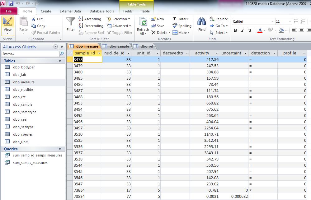
35 MARiS Main tables Sample sample_id samptype_id ref_id lab_id sea_id sedtype_id species_id bodypar_id station latchar lat latd latm lats longchar long longd longm longs longitude latitude totdepth sampdepth salinity temperatur filtered oxygen sliceup slicedown plannet begperiod endperiod Ref ref_id datbase institute author finit yearpub jname jvol fpage bookt bookp title Measure sample_id nuclide_id unit_id profile activity uncertaint detection
36 MARiS lookup tables Sea Sea_ID region subregion Seacode Red, Green, Blue Sedtype Sedtype_ID sedtype Lab Lab_ID labname country Species species_id species biogroup Organism Samptype Samptype_ID samptype Bodypar Bodypar_ID bodypar Sample table Nuclide Unit Nuclide_ID nusymbol Unit_ID unit Measure table
37 MARiS Marine Information System Publically accessible database of marine radionuclides: maris.iaea.org
38 MARiS Select search criteria

39 MARiS Select fields
40 MARiS Select fields
41 MARiS - data Data originates from Databases of collaborating institutes Reports Published scientific literature New data entered into the database New data is entered into GLOMARD* *GLOMARD (Global Marine Radioactivity Database) is the IAEA s in-house database Data is checked and validated Data eligible for public release is then uploaded into MARiS Intellectual property protected Data is traceable to the originator or providing database Clearance to include unpublished data is sought from the data provider An acknowledgement reminder is displayed when data is downloaded
42 MARiS status June 2016 ~173,500 radionuclide activity measurements 91,300 samples 54 references (inc. 10 database contributions) Seawater, sediment, biota and suspended matter Main nuclides: 137 Cs, 134 Cs, 90 Sr, 239,240 Pu, 3 H, 14 C >60 natural and anthropogenic radionuclides
43 MARiS data governance Data pathway or lifecycle Data received from data provider/originated Check to see if the data is already in MARiS Import data and metadata in to MARiS Document and archive the data reference Serve the data to MARiS database users Please cite the data provider/originator if you use data A citation to MARiS is also encouraged
44 MARiS data visualisation Tableau Specialist data visualisation software under trial In development and on trial for incorporation into MARiS website 4 predefined visualisations for discovering what references, samples and measurements are contained in the MARiS database Visit this link to see some example visualisation:
45 MARiS - data network IAEA Pubs Databases Reports Info Portal UN Atlas of the Oceans MARiS Data Portals Stand-alone website Virtual Research Environments
46 Links MARiS database website Data visualisation using Tableau under trial User feedback for MARiS database development Link on MARiS homepage Your feedback will give us the power to develop MARiS
47 Thank you!
SOCAT QC Cookbook for SOCAT participants
 SOCAT QC Cookbook for SOCAT participants Are Olsen & Nicolas Metzl 2009 PLAN We are now at version 1.3 of the SOCAT dataset. This is frozen, is the version that will be QC ed and resides at the LAS. By
Interactive comment on Data compilation on the biological response to ocean acidification: an update by Y. Yang et al.
 Earth Syst. Sci. Data Discuss., 8, C469 C477, 2016 www.earth-syst-sci-data-discuss.net/8/c469/2016/ Author(s) 2016. This work is distributed under the Creative Commons Attribute 3.0 License. Open Access
Version 3 Updated: 10 March Distributed Oceanographic Match-up Service (DOMS) User Interface Design
 User Interface Design") Distributed Oceanographic Match-up Service (DOMS) User Interface Design Shawn R. Smith 1, Jocelyn Elya 1, Adam Stallard 1, Thomas Huang 2, Vardis Tsontos 2, Benjamin Holt 2, Steven Worley 3, Zaihua Ji
Distributed Oceanographic Match-up Service (DOMS) User Interface Design Shawn R. Smith 1, Jocelyn Elya 1, Adam Stallard 1, Thomas Huang 2, Vardis Tsontos 2, Benjamin Holt 2, Steven Worley 3, Zaihua Ji
MATHEMATICS CONCEPTS TAUGHT IN THE SCIENCE EXPLORER, FOCUS ON EARTH SCIENCE TEXTBOOK
 California, Mathematics Concepts Found in Science Explorer, Focus on Earth Science Textbook (Grade 6) 1 11 Describe the layers of the Earth 2 p. 59-61 Draw a circle with a specified radius or diameter
PART I: Collecting data from National Earth Observatory
 Investigation: Sea Surface Temperature We ve seen how temperature varies with depth, but how does it vary with latitude and season? In this investigation, you are going to explore sea surface temperatures
What is ODV? Latest version: ver (updated Jan 9, 2017) Currently >50,000 users, ~20 new users every day!!
 Currently >50,000 users, ~20 new users every day!!") OCN 623 How to use ODV Latest version: ver. 4.7.9 (updated Jan 9, 2017) http://odv.awi.de/ Currently >50,000 users, ~20 new users every day!! Feb 2, 2017 What is ODV? Ocean Data View (ODV) is a software
OCN 623 How to use ODV Latest version: ver. 4.7.9 (updated Jan 9, 2017) http://odv.awi.de/ Currently >50,000 users, ~20 new users every day!! Feb 2, 2017 What is ODV? Ocean Data View (ODV) is a software
How to check the location, status and usage of AnyNet Secure SIMs on AWS IoT
 How to check the location, status and usage of AnyNet Secure SIMs on AWS IoT The Eseye AWS IoT integration enables look-up of SIM card usage and location by pushing device updates to your AWS IoT Cloud.
MANAGEMENT OF IPY 2007/08 NATIONAL DATA
 SAON MANAGEMENT OF IPY 2007/08 NATIONAL DATA M.Shaimardanov, A.Sterin, Nickolay Mikhailov, Alexander Kuznetsov, Eugeny Vyazilov R I H M I W D C The scientific programme for participation of Russian Federation
Ocean Data View (ODV) Manual V1.0
 Manual V1.0") Ocean Data View (ODV) Manual V1.0 Prepared by the Coastal and Regional Oceanography Lab UNSW, Australia (www.oceanography.unsw.edu.au ) for the Sydney Institute of Marine Science. Table of Contents 1 Introduction
Ocean Data View (ODV) Manual V1.0 Prepared by the Coastal and Regional Oceanography Lab UNSW, Australia (www.oceanography.unsw.edu.au ) for the Sydney Institute of Marine Science. Table of Contents 1 Introduction
Current JGOFS DMTT activities, and data management requirements for future marine biogeochemical projects - insights for modelers
 1 Current JGOFS DMTT activities, and data management requirements for future marine biogeochemical projects - insights for modelers Margarita Conkright Ocean Climate Laboratory National Oceanographic Data
Is my institution ready for data citation? Dave Connell, Australian Antarctic Data Centre
 Is my institution ready for data citation? Dave Connell, Australian Antarctic Data Centre Am I ready? Q: How do you know if an organisation is ready for Data Citation? The Australian Antarctic Division
Geospatial Access and Data Display Adds Value to Data Management at the Biological and Chemical Oceanographic Data Management Office
 Geospatial Access and Data Display Adds Value to Data Management at the Biological and Chemical Oceanographic Data Management Office M. Dickson Allison 1 and Charlton Galvarino 2 1 Woods Hole Oceanographic
JAMSTEC Ocean Data Systems
 The 10th GEOSS Asia-Pacific Symposium Hanoi, Vietnam, 19 September 2017 JAMSTEC Ocean Data Systems Yasunori Hanafusa Data Management Office, Japan Agency for Marine-Earth Science and Technology (JAMSTEC)
U.S. GEOTRACES PACIFIC TRANSECT DATA MANAGEMENT
 U.S. GEOTRACES PACIFIC TRANSECT DATA MANAGEMENT Cyndy Chandler BCO-DMO WHOI US GEOTRACES Pacific Zonal Transect Planning Workshop Woods Hole, MA USA 26 April 2013 1 of 31 TOPICS 1. What is BCO-DMO? 2.
Draft version 13 th July Delivery manual for Article 12 data
 Delivery manual for Article 12 data Draft version 13 th July 2018 Contents 1 Introduction... 3 2 Data preparation process... 3 2.1 Overview... 3 2.2 Data validation... 4 2.3 Tabular data standards for
How to use the SATURN Observation Network: Endurance Stations Site: Table of Contents
 How to use the SATURN Observation Network: Endurance Stations Site: Table of Contents Preface... 2 Introduction to the SATURN Interface... 3 Fixed station user interface... 5 The Recent Tab... 6 Reading
The DOI Identifier. Drexel University. From the SelectedWorks of James Gross. James Gross, Drexel University. June 4, 2012
 Drexel University From the SelectedWorks of James Gross June 4, 2012 The DOI Identifier James Gross, Drexel University Available at: https://works.bepress.com/jamesgross/26/ The DOI Identifier James Gross
Deliverable 6.4. Initial Data Management Plan. RINGO (GA no ) PUBLIC; R. Readiness of ICOS for Necessities of integrated Global Observations
 PUBLIC; R. Readiness of ICOS for Necessities of integrated Global Observations") Ref. Ares(2017)3291958-30/06/2017 Readiness of ICOS for Necessities of integrated Global Observations Deliverable 6.4 Initial Data Management Plan RINGO (GA no 730944) PUBLIC; R RINGO D6.5, Initial Risk
Ref. Ares(2017)3291958-30/06/2017 Readiness of ICOS for Necessities of integrated Global Observations Deliverable 6.4 Initial Data Management Plan RINGO (GA no 730944) PUBLIC; R RINGO D6.5, Initial Risk
SES 123 Global and Regional Energy Lab Worksheet
 SES 123 Global and Regional Energy Lab Worksheet Introduction An important aspect to understand about our planet is global temperatures, including spatial variations, such as between oceans and continents
CS201 Computer Vision Lect 4 - Image Formation
 CS201 Computer Vision Lect 4 - Image Formation John Magee 9 September, 2014 Slides courtesy of Diane H. Theriault Question of the Day: Why is Computer Vision hard? Something to think about from our view
How to Access Remote Sensing Data Using EarthExplorer
 How to Access Remote Sensing Data Using EarthExplorer https://earthexplorer.usgs.gov/ EarthExplorer is the most-used tool to access remote sensing data at the (USGS) Earth Resources Observation and Science
ScienceDirect. Quick Reference Guide
 ScienceDirect Quick Reference Guide Quick Reference Guide ScienceDirect is Elsevier s peer-reviewed, full-text database of nearly,000 book titles and more than,00 journal titles. In addition to sophisticated
VISUALISATION OF THERMODYNAMICS AND ENERGY PERFORMANCE FOR COMPLEX BUILDING AND HVAC SYSTEM SIMULATION. Stephan Ledinger 1, Marcus Jones 2
 VISUALISATION OF THERMODYNAMICS AND ENERGY PERFORMANCE FOR COMPLEX BUILDING AND HVAC SYSTEM SIMULATION Stephan Ledinger 1, Marcus Jones 2 1 Austrian Institute of Technology, Vienna, Austria 2 Vienna University
Online National Mosquito Surveillance Database. User Guide
 Online National Mosquito Surveillance Database User Guide Version 4 Updated November 2018 Contents Introduction... 3 Database Operation... 3 Access... 3 Users... 3 New Users... 4 Logging In... 4 Entering
SES 123 Global and Regional Energy Lab Procedures
 SES 123 Global and Regional Energy Lab Procedures Introduction An important aspect to understand about our planet is global temperatures, including spatial variations, such as between oceans and continents
European Marine Data Exchange
 European Marine Data Exchange By Dick M.A. Schaap MARIS (NL) EU SeaDataNet Technical Coordinator EU EMODnet Ingestion Coordinator Noordzeedagen 2018 - October 2018 Acquisition of ocean and marine data
Exxon Vuldez Oil Spill Restoration Project Annual Report
 Exxon Vuldez Oil Spill Restoration Project Annual Report Hydrocarbon Data Analysis, Interpretation and Database Maintenance for Restoration and NRDA Environmental Samples Associated with the Exxon Vuldez
ITACS : Interactive Tool for Analysis of the Climate System
 Contents 1 2 3 4 ITACS : Interactive Tool for Analysis of the Climate System Features of the ITACS Atmospheric Analysis Data, Outgoing Longwave Radiation (by NOAA), SST, Ocean Analysis Data, etc. Plain
Metadata or "data about data" describe the content, quality, condition, and other characteristics of data. The Federal Geographic Data Committee
 Metadata or "data about data" describe the content, quality, condition, and other characteristics of data. The Federal Geographic Data Committee (http://www.fgdc.gov/) approved the Content Standard for
Science Direct. Quick Reference Guide. Empowering Knowledge
 Science Direct Quick Reference Guide Empowering Knowledge Quick Reference Guide ScienceDirect is Elsevier s peer-reviewed, full-text database of nearly 26,000 book titles and more than 2,500 journal titles.
NM OPERATIONS EVITA USERS GUIDE. External Users. Edition N : 1.0
 NM OPERATIONS EVITA USERS GUIDE External Users Edition N : 1.0 Edition date: 17-April-2013 EDITION 1.0 EVITA USERS GUIDE . This document is published by EUROCONTROL for information purposes. It may be
Technical Product Overview. This guide provides an overview of the DocuNECT v4.8 Product, a solution for Electronic Document Management.
 DocuNECT Lifecycle Technical Product Overview This guide provides an overview of the DocuNECT v4.8 Product, a solution for Electronic Document Management. March 20, 2015 Release 4.8 www.portfordsolutions.com
Title Vega: A Flexible Data Model for Environmental Time Series Data
 Title Vega: A Flexible Data Model for Environmental Time Series Data Authors L. A. Winslow 1, B. J. Benson 1, K. E. Chiu 3, P. C. Hanson 1, T. K. Kratz 2 1 Center for Limnology, University of Wisconsin-Madison,
12/6/2012. Getting Started with Metadata. Presenter. Making Metadata Work. Overall Topics. Data Collection. Topics
 Making Metadata Work Using metadata to document your science Presenter Viv Hutchison US Geological Survey NBII program Metadata Coordinator Location: USGS Western Fisheries Research Center Seattle, WA
Making Metadata Work. Using metadata to document your science. August 1 st, 2010
 Making Metadata Work Using metadata to document your science August 1 st, 2010 Presenter Viv Hutchison US Geological Survey NBII program Metadata Coordinator Location: USGS Western Fisheries Research Center
System Design for Visualizing Scientific Computations
 25 Chapter 2 System Design for Visualizing Scientific Computations In Section 1.1 we defined five broad goals for scientific visualization. Specifically, we seek visualization techniques that 1. Can be
https://marinemetadata.org/print/book/export/html/2093
 Published on Marine Metadata Interoperability (https://marinemetadata.org) MMI Guides Welcome to the MMI Guides The Marine Metadata Interoperability (MMI) Guides are intended to help researchers and data
Overview. 2 Module 4: Data Conversion and Plotting
 2 Module 4: Data Conversion and Plotting Overview In this module we will cover the data processing basics, no fancy stuff. With this information you can go from raw data file to something you can print
CDSN Universal Minimum Data Elements Physical/Chemical Data 2015
 COLORADO WATER QUALITY MONITORING COUNCIL COLORADO DATA SHARING NETWORK P.O. Box 2058 Ridgway, CO 81432 970-258-0836 cdsn@coloradowater.org www.coloradowaterdata.org July 1, 2015 CDSN Universal Minimum
Matlab stoqstoolbox for accessing in situ measurements from STOQS
 Matlab stoqstoolbox for accessing in situ measurements from STOQS MBARI Summer Internship Project 2012 Francisco Lopez Castejon (Mentor: Mike McCann) INDEX Abstract... 4 Introduction... 5 In situ measurement
EcoGEnIE: A practical course in global ocean ecosystem modelling
 EcoGEnIE: A practical course in global ocean ecosystem modelling Lesson zero.c: Ocean circulation and Atlantic overturning stability Stuff to keep in mind: Nothing at all keep your mind completely empty
A Better Way to Capture and Manage Cement Lab Data
 Drilling Software Sophisticated Yet Simple White Paper A Better Way to Capture and Manage Cement Lab Data CONTENTS I. Introduction... 3 II. Solution 1. Engineering Features... 2. Program Structure... 3.
Title: Interactive data entry and validation tool: A collaboration between librarians and researchers
 Proposed venue: Library Hi Tech News Title: Interactive data entry and validation tool: A collaboration between librarians and researchers Author: Abstract Purpose To share a case study process of collaboration
Using a Geographic Information System (GIS) to look at marine fisheries data
 to look at marine fisheries data") Using a Geographic Information System (GIS) to look at marine fisheries data Daniel Sheehan GIS Programmer & Analyst Office of Educational Innovation & Technology dsheehan@mit.edu x2-1475 Introduction
Using a Geographic Information System (GIS) to look at marine fisheries data Daniel Sheehan GIS Programmer & Analyst Office of Educational Innovation & Technology dsheehan@mit.edu x2-1475 Introduction
Introduction of SeaDataNet and EMODNET Working towards a harmonised data infrastructure for marine data. Peter Thijsse MARIS
 Introduction of SeaDataNet and EMODNET Working towards a harmonised data infrastructure for marine data Peter Thijsse MARIS CLIPC & IS-ENES 2 workshop, KNMI, November 2014 Outline 1. Introduction to marine
OILMAP RELEASE NOTES. Version: 7.0 (July 2016) rpsgroup.com
 rpsgroup.com") OILMAP RELEASE NOTES Version: 7.0 (July 2016) 55 Village Square Dr. South Kingstown, RI 02879 Tel: (401) 789-6224 Fax: (401) 789-1932 Email: MapSupport@ Table of Contents Table of Contents...ii 1 Introduction...
OILMAP RELEASE NOTES Version: 7.0 (July 2016) 55 Village Square Dr. South Kingstown, RI 02879 Tel: (401) 789-6224 Fax: (401) 789-1932 Email: MapSupport@ Table of Contents Table of Contents...ii 1 Introduction...
From data source to data view: A practical guide to uploading spatial data sets into MapX
 From data source to data view: A practical guide to uploading spatial data sets into MapX Thomas Piller UNEP/GRID Geneva I Table of contents 1. Adding a new data source to MapX... 1 1.1 Method 1: upload
AUSTRALIAN NATIONAL FACILITY FOR OCEAN GLIDERS (ANFOG)
") AUSTRALIAN NATIONAL FACILITY FOR OCEAN GLIDERS (ANFOG) GLIDERSCOPE v6 Users Manual November 2 nd 2016 Dr Lai Mun Woo mun.woo@uwa.edu.au Contents 1 Introduction... 2 2 Installation... 3 2.1 First Installation...
AUSTRALIAN NATIONAL FACILITY FOR OCEAN GLIDERS (ANFOG) GLIDERSCOPE v6 Users Manual November 2 nd 2016 Dr Lai Mun Woo mun.woo@uwa.edu.au Contents 1 Introduction... 2 2 Installation... 3 2.1 First Installation...
28 September PI: John Chip Breier, Ph.D. Applied Ocean Physics & Engineering Woods Hole Oceanographic Institution
 Developing a Particulate Sampling and In Situ Preservation System for High Spatial and Temporal Resolution Studies of Microbial and Biogeochemical Processes 28 September 2010 PI: John Chip Breier, Ph.D.
Visualisation : Lecture 1. So what is visualisation? Visualisation
 So what is visualisation? UG4 / M.Sc. Course 2006 toby.breckon@ed.ac.uk Computer Vision Lab. Institute for Perception, Action & Behaviour Introducing 1 Application of interactive 3D computer graphics to
Demystifying Scopus APIs
 0 Demystifying Scopus APIs Massimiliano Bearzot Customer Consultant South Europe April 17, 2018 1 What You Will Learn Today about Scopus APIs Simplistically, how do Scopus APIs work & why do they matter?
RESEARCH ANALYTICS From Web of Science to InCites. September 20 th, 2010 Marta Plebani
 RESEARCH ANALYTICS From Web of Science to InCites September 20 th, 2010 Marta Plebani marta.plebani@thomsonreuters.com Web Of Science: main purposes Find high-impact articles and conference proceedings.
Seabird CTD Carousel Setup & Deck Unit Diagnostics
 Seabird CTD Carousel Setup & Deck Unit Diagnostics Conventional two pin Seabird pigtail terminations are standard on NOAA vessels and usually performed by the ET. So interfacing the CTD deck unit only
*Open source (GIT) *Server : data storage and indexing, web server. *Client : web and stand alone (under development)
 *Server : data storage and indexing, web server. *Client : web and stand alone (under development)") EO Open Science 2.0, ESRIN, Oct. 13 2015 *The main objective of the project is to allow oceanographers experts to discover the existence and then to handle jointly, in a convenient, flexible and intuitive
EO Open Science 2.0, ESRIN, Oct. 13 2015 *The main objective of the project is to allow oceanographers experts to discover the existence and then to handle jointly, in a convenient, flexible and intuitive
DATA-SHARING PLAN FOR MOORE FOUNDATION Coral resilience investigated in the field and via a sea anemone model system
 DATA-SHARING PLAN FOR MOORE FOUNDATION Coral resilience investigated in the field and via a sea anemone model system GENERAL PHILOSOPHY (Arthur Grossman, Steve Palumbi, and John Pringle) The three Principal
Introduction of new WDCGG website. Seiji MIYAUCHI Meteorological Agency
 Introduction of new WDCGG website Seiji MIYAUCHI WDCGG@Japan Meteorological Agency 1. Introduction of new WDCGG website 2. Starting to gather and provide satellite data at WDCGG Current WDCGG website 3
How to Work with a Reference Answer Set
 How to Work with a Reference Answer Set Easily identify and isolate references of interest Quickly retrieve relevant information from the world s largest, publicly available reference database for chemistry
AR Check Tool Manual
 AR Check Tool Manual SME #1 How It Works Click the yellow Check Alignment Report button at the top of the Alignment Report to run the tool. Scroll down the report and look for text that has been highlighted.
Global Earth Observation System of Systems (GEOSS)/ Asian Water Cycle Initiative. (AWCI) Vietnam Huong Basin data
/ Asian Water Cycle Initiative. (AWCI) Vietnam Huong Basin data") Global Earth Observation System of Systems (GEOSS)/ Asian Water Cycle Initiative (AWCI) Vietnam Huong Basin data 1. IDENTIFICATION INFORMATION Metadata Identifier Global Earth Observation System of Systems
Global Earth Observation System of Systems (GEOSS)/ Asian Water Cycle Initiative (AWCI) Vietnam Huong Basin data 1. IDENTIFICATION INFORMATION Metadata Identifier Global Earth Observation System of Systems
EUROPEANA METADATA INGESTION , Helsinki, Finland
 EUROPEANA METADATA INGESTION 20.11.2012, Helsinki, Finland As of now, Europeana has: 22.322.604 Metadata (related to a digital record) in CC0 3.698.807 are in the Public Domain 697.031 Digital Objects
2011 INTERNATIONAL COMPARISON PROGRAM
 2011 INTERNATIONAL COMPARISON PROGRAM 2011 ICP DATA ACCESS AND ARCHIVING POLICY GUIDING PRINCIPLES AND PROCEDURES FOR DATA ACCESS ICP Global Office November 2011 Contents I. PURPOSE... 3 II. CONTEXT...
groupbc.com Introducing BC 7 What s New Highlights
 groupbc.com Introducing BC 7 What s New Highlights Simplicity and Usability Key Features and Benefits include: In BC 7 we ve concentrated on simplicity and usability: cleaner, more flexible interface,
B2FIND and Metadata Quality
 B2FIND and Metadata Quality 3 rd EUDAT Conference 25 September 2014 Heinrich Widmann and B2FIND team 1 Outline B2FIND the EUDAT Metadata Service Semantic Mapping of Metadata Quality of Metadata Summary
5PRESENTING AND DISSEMINATING
 5PRESENTING AND DISSEMINATING INFORMATION This chapter presents information and guidance on how to present and disseminate marine water quality monitoring data to the program s intended audience. Section
Data Management Plan: OR Mooring - Ocean Acidification related measurements (Taken from NOAA Data Sharing Template and adapted for IOOS Certification)
") I. Type of data and information created 1. What data will you collect or create in the research? Contextual statement describing what data are collected and relevant URL (IOOS Certification, f 2) Hales
I. Type of data and information created 1. What data will you collect or create in the research? Contextual statement describing what data are collected and relevant URL (IOOS Certification, f 2) Hales
Data Portal and Integra.on in JAMSTEC
 Data Portal and Integra.on in JAMSTEC Yasunori Hanafusa Data Research Center for Marine-Earth Sciences (DrC) Agency for Marine-Earth Science and Technology (JAMSTEC) 1 Overview of Data Management in JAMSTEC
Deliverable D3.12. Contract number: OJEU 2010/S Deliverable: D3.12 Author: Igor Antolovic Date: Version: Final
 Deliverable D3.12 Final and public version of the implemented web site with full functionality that hosts all relevant information on the Climate Atlas of the Carpathian Region, including a public download
Analysing crime data in Maps for Office and ArcGIS Online
 Analysing crime data in Maps for Office and ArcGIS Online For non-commercial use only by schools and universities Esri UK GIS for School Programme www.esriuk.com/schools Introduction ArcGIS Online is a
Union of International Associations (UIA)
") Union of International Associations (UIA) Brussels http://www.uia.org/ East-West Collaboration in the Development of Interactive Media Products (Hungary, May 1999) Anthony Judge, Director, Communications
Union of International Associations (UIA) Brussels http://www.uia.org/ East-West Collaboration in the Development of Interactive Media Products (Hungary, May 1999) Anthony Judge, Director, Communications
Overview of the EMF Refresher Webinar Series. EMF Resources
 Overview of the EMF Refresher Webinar Series Introduction to the EMF Working with Data in the EMF viewing & editing Inventory Data Analysis and Reporting 1 EMF User's Guide EMF Resources http://www.cmascenter.org/emf/internal/guide.html
Project Baseline. Documentation Only Projects 2016
 Project Baseline Documentation Only Projects 2016 Introduction Thanks for your interest in joining this grassroots, aquatic conservation initiative supported by Global Underwater Explorers! By contributing
TemperateReefBase Data Submission
 TemperateReefBase Data Submission Home Help Sign In TemperateReefBase Data Submission An open source tool for capturing research data - simplifying the process of gathering information in a standard format
DATABASE ON SALINITY PATTERNS IN FLORIDA BAY *
 DATABASE ON SALINITY PATTERNS IN FLORIDA BAY * N. Rishe, M. Chekmasov, M. Chekmasova, D. Hernandez, A. Roque, N. Terekhova, A. Zhyzhkevych High Performance Database Research Center, School of Computer
Introduction to Data Management for Ocean Science Research
 Introduction to Data Management for Ocean Science Research Cyndy Chandler Biological and Chemical Oceanography Data Management Office 12 November 2009 Ocean Acidification Short Course Woods Hole, MA USA
RECCA Nagoya RECCA_MAPS_Nagoya DIAS en
 RECCA Nagoya 2050 1. IDENTIFICATION INFORMATION RECCA Nagoya 2050 Edition v0.1 Abbreviation Metadata Identifier 2. CONTACT RECCA_MAP_DIF 2.1 CONTACT on DATASET RECCA_MAPS_Nagoya20181216214915-DIAS20180903143952-en
MODEL 3150 SUSPENDED SOLIDS ANALYZER MODEL 35/35L OPTICAL SUSPENDED SOLIDS SENSOR
 MODEL 3150 SUSPENDED SOLIDS ANALYZER MODEL 35/35L OPTICAL SUSPENDED SOLIDS SENSOR REVISION 15 May 2006 In site In strum e n tatio n Gro up, In c 80 Whisperwood Blvd. Suite 107 Slidell, LA 70458 Phone:
Spatial Variation of Sea-Level Sea level reconstruction
 Spatial Variation of Sea-Level Sea level reconstruction Biao Chang Multimedia Environmental Simulation Laboratory School of Civil and Environmental Engineering Georgia Institute of Technology Advisor:
Monash University Policy Management. User Guide
 Monash University Policy Management User Guide 1 Table of Contents 1. GENERAL NAVIGATION... 4 1.1. Logging In to Compliance 360 - Single Sign On... 4 1.2. Help... 4 1.2.1. The University Policy Bank...
GeoNetwork User Manual
 GeoNetwork User Manual Release 2.10.4-0 GeoNetwork December 08, 2017 Contents 1 Preface 3 1.1 About this Project............................................ 3 1.2 License Information...........................................
User Guide. v Released June Advaita Corporation 2016
 User Guide v. 0.9 Released June 2016 Copyright Advaita Corporation 2016 Page 2 Table of Contents Table of Contents... 2 Background and Introduction... 4 Variant Calling Pipeline... 4 Annotation Information
Report for Experiment 5
 REPORT 5 GRAPHING In Chemistry 104 Lab 1, you were introduced to graphing using a spreadsheet and given information on how to set up a graph. Use that information to set up the following tables and graphs.
European Network and ICOS
 European Network and ICOS Dario Papale University of Tuscia Italy ICOS Ecosystem Thematic Centre Network size and trend The European network had a constant growth until 2009 and then stopped, increasing
Judith Connor Monterey Bay Aquarium Research Institute
 ARCHIVING, ANNOTATING AND ACCESSING VIDEO AS DATA Judith Connor Monterey Bay Aquarium Research Institute E-mail: conn@mbari.org ABSTRACT: Since 1989, the Monterey Bay Aquarium Research Institute (MBARI)
EUROPEAN JOURNAL OF TAXONOMY MATERIAL CITATIONS FORMATTING GUIDE
 EUROPEAN JOURNAL OF TAXONOMY MATERIAL CITATIONS FORMATTING GUIDE In accordance with the European Journal of Taxonomy s FAIR & Open Science policy, the formatting guide for entomology, zoology and palaeozoology
Getting Started with GeoQuery
 Getting Started with GeoQuery A quick-start guide to the download and use of spatial data for international development geo.aiddata.org GeoQuery Quick Start Handbook v. 1.01, December 2017 WWW.GEOQUERY.ORG
OCEAN DATA MANAGEMENT IN MALAYSIA. The 10th GEOSS Asia-Pacific Symposium Hanoi, Vietnam, September 2017
 OCEAN DATA MANAGEMENT IN MALAYSIA The 10th GEOSS Asia-Pacific Symposium Hanoi, Vietnam, 18 20 September 2017 Presentation Overview Malaysian Oceanographic Data Aggregation & Archiving System (MyDAS) Ocean
How to fill out and submit off-line occurrence reports for. General Aviation. on my personal behalf
 How to fill out and submit off-line occurrence reports for General Aviation as on my personal behalf Version 1.2, September 2017 Page 1 of 5 Scope The term on my personal behalf defines submission of a
The UK Marine Environmental Data and Information Network MEDIN
 The UK Marine Environmental Data and Information Network MEDIN M. Charlesworth, R. Lowry, H. Freeman, J. Rapaport, B Seeley Content MEDIN - a brief overview for context Discovery Metadata Standard and
The following pages provide a step-by-step introduction to using the CEDEN website for data submission and data access.
 The following pages provide a step-by-step introduction to using the CEDEN website for data submission and data access. Additional information is available as Adobe PDF formatted, printable documents.
University at Buffalo's NEES Equipment Site. Data Management. Jason P. Hanley IT Services Manager
 University at Buffalo's NEES Equipment Site Data Management Jason P. Hanley IT Services Manager Structural Engineering and Earthquake Simulation Laboratory, Department of Civil, Structural and Environmental
OnCore Enterprise Research. Basics: Reporting and Searching
 OnCore Enterprise Research Basics: Reporting and Searching All Access Roles June 2017 P a g e 1 This page is intentionally blank. P a g e 2 Table of Contents What is the OnCore Enterprise Research System?...
A member of elementargroup
 A member of elementargroup Introducing ArDB Data Acquisition Data Processing Data Analytics Method Workflow Designer Novel Inlet Control Module (NICM) Multi-point isotope calibration curves GC Peak Mapping
AFN Event Tracker User Guide!
 AFN Event Tracker User Guide! July 2014 1 Getting Started on the Network! Before You Start...2 System Requirements...2 About This Guide.. 2 What is Event Tracker?.....2 Signing on to the Network....2 Signing
Overview of the SMS Interface for the CMS and New CIRP Additions: CIRP Wiki and CMS Discussion List
 Overview of the SMS Interface for the CMS and New Additions: Wiki and CMS Discussion List Mitch Brown Coastal and Hydraulics Laboratory Engineer Research and Development Center May 20, 2010 US Army Corps
Global couplled ocean-atmosphere reanalysis and forecast with pelagic ecosystem
 Global couplled oceanatmosphere reanalysis and forecast with pelagic ecosystem 1. IDENTIFICATION INFORMATION Abbreviation Metadata Identifier Global couplled ocean-atmosphere reanalysis and forecast with
Development of an information service system based on GOOGLE graphical interfaces. Instruction for the use of the MOON-VOS portal Interface
 Development of an information service system based on GOOGLE graphical interfaces Instruction for the use of the MOON-VOS portal Interface Giuseppe M.R. Manzella ENEA Operational Oceanography, p.o. box
Python: Working with Multidimensional Scientific Data. Nawajish Noman Deng Ding
 Python: Working with Multidimensional Scientific Data Nawajish Noman Deng Ding Outline Scientific Multidimensional Data Ingest and Data Management Analysis and Visualization Extending Analytical Capabilities
Data discovery and access via the SeaDataNet CDI system
 Data discovery and access via the SeaDataNet CDI system Central dataproducts and data services on distributed data. Peter Thijsse MARIS CLIPC IS-ENES workshop, KNMI, November 2014 Outline 1. Introduction
Big Data analytics and Visualization
 Big Data analytics and Visualization MTA Cloud symposium A. Agocs, D. Dardanis, R. Forster, J.-M. Le Goff, X. Ouvrard CERN MTA Head quarters, Budapest, 17 February 2017 1 Background information Collaboration