GEOMETRIC DESIGN OF A HIGHWAY USING MXROAD
|
|
|
- Noel Stevenson
- 5 years ago
- Views:
Transcription
1 International J. of Engg. Research and Indu. Appls. (IJERIA) ISSN , Vol. 10, No. II (December 2017), pp GEOMETRIC DESIGN OF A HIGHWAY USING MXROAD MOHD. KHAJA NAZIMUDDIN 1, MIR IQBAL FAHEEM 2 & MOHD.MINHAJUDDIN AQUIL 3 1 PG Scholar, 2 Professor & Head & Vice Principal, 3 Asst. Prof., Dept of Civil Engineering Deccan College of Engineering and Technology, Aghapura, Hyderabad Telangana, India Abstract Geometric design concerns the design of road alignment that conforms to the site constraints and standards. The basic objectives are to optimize efficiency and safety while minimizing cost and environmental damage. Once a road/highway engineer is familiar with the basics of road geometric design, the next step to enhance their value is by learning a software for the application of these basic knowledge. The intention of this study is import road geometric design into the software as well as relate with the design standards applied into the software. It will be able to design road geometric from checking of survey data, horizontal and vertical design, super-elevation and production of road cross sections. Bentley MXROAD is an advanced,string-based modeling tool that enables the rapid and accurate design of all road types. With MXROAD, you can quickly create design alternatives to build the ideal road system. After a final design alternative is selected, you can automate much of the design detailing process, saving time and money. At its core,mxroaduses 3D string modeling technology.a powerful yet concise method of creating 3D surfaces. The interoperable database allows engineers to create and annotate 3D project models in the most popular AEC platforms or in Windows. This means that you can work on the project within one environment, save it, and open it seamlessly in another environment with no loss of data. Keywords:-Geometric design, road alignment, design standards, MXROAD software
2 26 MOHD. KHAJA NAZIMUDDIN, MIR IQBAL FAHEEM &MOHD.MINHAJUDDIN AQUIL 1. INTRODUCTION Transportation plays an enormous role in our everyday lives. Each of us travels somewhere almost every day, whether it is to get to work or school, to go shopping, or for entertainment purposes. In addition, almost everything we consume or use has been transported from some point. There are so many ways of transportation, but in this document we concern on road transportation. Highways are the important part of our life, the economy of the society as well as it is Part of the infrastructure. The construction of a high quality road network directly increases a nation s economic output by reducing journey times and costs, making a region more attractive economically. The better of this structure is the faster, more effective and cheaper, can be the capacities of the society used.the development of effective road transport system is primary need of any developing country. Also upgrading of existing road network is essential for developed countries to carry out its transportation functions smoothly as with increasing traffic volume urban and non-urban roads reach to their saturation level in passage of time. The design of route alignment and pavement structure decide cost of project which totally depend on time taken for same. So for this job the best available Highway Geometric Design Software must be deployed. Keeping this in view we have used MXROAD Software for the geometric design to improve its geometric features and upgrading it from two lanes to four lanes. The Software uses 3D string modeling technology and gives the desired values of different components of geometric design such as Horizontal and Vertical Curves, Super elevation, Shoulder, etc.hong Sung-Jon, 2005discussed is to evaluate the actual highway geometric design properly, and propose a well-balanced design policy especially considering the drivers perception and behavior. Blessing Alexander, 2009have investigated the suitability of these modalities for road design, which makes heavy use of two dimensional visual representations.liao-chen-fu, 2014 He has discussed the use of the highway geometric design package ROAD. The online tool helps students better understand the different aspects of geometric design as compared to the traditional approach. The objective of incorporating ROAD into the teaching of geometric design is not to reduce or ignore the importance of the underlying equations, Kumar Ashok, 2015gave geometric design of existing road using MXROAD Software. Existing road used was state highway (SH 131) in Maharashtra to improve its geometric features and upgrading it from two lanes to four lanes. The Software uses 3D string
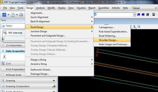
3 GEOMETRIC DESIGN OF A HIGHWAY USING MXROAD 27 modeling technology and gives the desired values of different components of geometric design such as Horizontal and Vertical Curves, Super elevation, Shoulder, etc 2. MX ROAD SOFTWARE MXROAD has been created by Bentley Systems, a UK based company in the year of 1996 which is then upgraded in later years as per requirement to get desired accuracy with rapid designing of highways. This is an advanced string based modeling tool that enables the rapid and accurate design of all types of road. By using MXROAD, highway designer can finalize design alternatives and can automate much of the design detailing processes, saving time and money. At its core MXROAD uses 3D stringmodeling technology a powerful yet simple method of creating 3D surfaces. The interoperable database allows engineers to create and annotate 3D project models in the most popular AEC platforms or in windows. In recent, highway projects in India are Public Private Partnership based where private investors are challenged to maintain high standards in design and construction. This scenario leads the design engineers to use specially designed software tools like MXROAD. It attains high precision in building the road with in the limited land width so as to minimize the land acquisition cost which is vital parameter that affects the total project cost directly. It also helps in fixing the horizontal alignment for an up gradation project to match up with the existing align of the cross drainage structure and in fixing the vertical profile to match up with the existing levels of the cross drainage structures. Various geometric design elements such as carriageways, shoulder can be designed effectively by using MXROAD. Other design controlling parameters such as design speed, horizontal curvature, super elevation and vertical curvature can also be effectively designed and controlled by MXROAD software. 3. RESEARCH METHODOLOGY Step1: Case Study:A case study of a state highway is considered as shown in Figure 1. Degloor is situated near where the Telangana, Maharashtra and Karnataka boundaries meet lies in Coordinates: N E.The Telangana-Maharashtra state boundary is around 1.5 kilometersaway from the town center. The town borders several villages, including Taakli (North), Kawalgaon (West-South) and Mirzapur (East-South).With existing 2lane width of 7m is upgraded to 4lane width of 15m.

4 28 MOHD. KHAJA NAZIMUDDIN, MIR IQBAL FAHEEM &MOHD.MINHAJUDDIN AQUIL Figure1 Study Area In order to carry out this research a different method is used for both Geometric and Pavement Design of highway. For Geometric Design of Highway MX ROAD software is used. In Geometric Design of Highway the following procedures are taken: - First the surveying data is collected from the field through the route. For each point three reading is taken that is Northing, Easting and Elevation. So depending on collected surveying data the traverse slope within 20m interval, vertical increment to horizontal increment is calculated by excel. The research process designed for the study is: site selection, problem identification, review literature, road geometric survey and design of road alignment using MXROAD. Step 2: Data Collection: Topography survey for 8 km(ch.67.73km-75.72km) at an interval of 10m along the alignment (Longitudinally) and 5m interval up to 20 m across the road on either side (Transverse) Which consist of X Y Z co-ordinates (i.e. Easting, Northing and Reduced Level) is done. Soil sample for every 1km and check the CBR is made. Traffic surveys includes: Traffic volume count, Turning movement survey, Axle load survey, Origin & destination survey, Speed & delay survey, Pedestrian count survey etc were made. Keeping in view the space constraint, data pertaining to traffic studies is not presented. Step 3: Design Data: By considering all the IRC specification and existing features of project corridor the following design values are taken for executing the design of the project
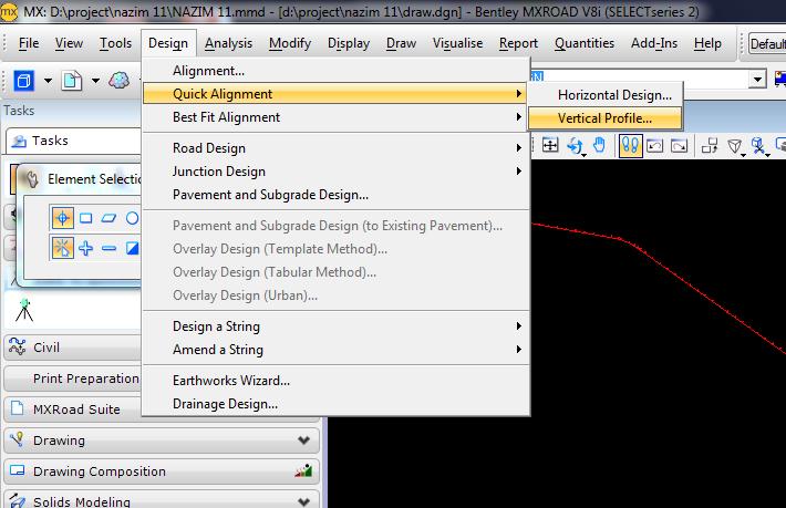
5 GEOMETRIC DESIGN OF A HIGHWAY USING MXROAD 29 work by using MXROAD software. Chainage:-67.73KM to 75.72KM, Length 7.990KM, Design Speed kmph and 30 kmph, Land width or right of way 30m, Setback 2 to 5 m., Roadway Width 15.0 m, Carriageway Width 7.5 m, Shoulder width 2.5 m, Cross Slope or Camber 2.5%, Earthen surface 3.0%, Embankment slope 1 V : 2 H, Super Elevation maximum 7% or 0.07, Radius of Horizontal Curve Ruling Minimum 230 m, Radius at which no super elevation is required - > 1200 m, Radius at which 7% super elevation is achieved 230 m, Extra Widening of Carriageway at Curves 0.6 m, Gradient maximum 3.3 %, Limiting Gradient maximum 5%, Minimum Gradient 0.3%, Minimum length of vertical curve 50 m. Step4: StandardStringNaming:- The MX standard string naming convention (SNC) has been formed to give automatic integration to any design produced from any of the MXROAD option. Strings created by the MXROAD option are assigned names which store the following information, string type, associated master alignment which defines the string group, specific road features and side of master alignment on which the string was created. Step5: Surface Analysis:- This option is used for analyzing the surface on which the design has to be built.this is essential to confirmthat the imported data is correct and contains no errors. Typically the analys is will high light errors in level and will also provide a graphical representation of the existing surface. Step 6: AlignmentDesign:- The alignment design option are used to create the alignment for the road design byc hoosing Quickalignment option, Horizontal Design,Vertical profile can be done in limited time duration.the alignment is converted to amasterstring which is generally use das the Centreline alongwhicha carriage way and other features can be designed. Alignments are created in two stages. Figures 2 to 9 presents the screen shots of various geometric design elements of the road selected for the case study using MxRoad software.


6 30 MOHD. KHAJA NAZIMUDDIN, MIR IQBAL FAHEEM &MOHD.MINHAJUDDIN AQUIL Figure 2 Screen for data input Figure3Horizontal Alignment Figure 4Vertical Design


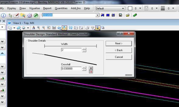
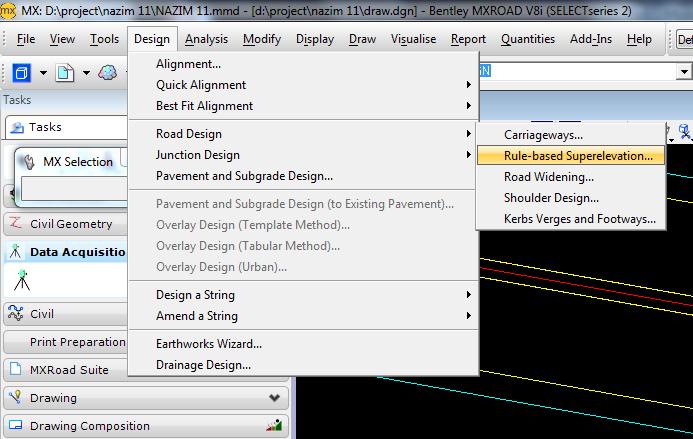

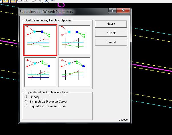
7 GEOMETRIC DESIGN OF A HIGHWAY USING MXROAD 31 Figure5Carriageway Design Figure6Shoulder Design Figure7Super Elevation Design


8 32 MOHD. KHAJA NAZIMUDDIN, MIR IQBAL FAHEEM &MOHD.MINHAJUDDIN AQUIL Figure8Earthwork Design Figure9Pavement and Sub grade Design (Cross-Section) 4. RESULTS AND DISCUSSION Alignment has designed for 100Kmph.Almost 80% of the existing road is utilized.geometrics of the road has been improvedroad is designed as per IRC norms and also considered all safety measures.horizontal plan has been developed.vertical profile has been drafted.working cross section are developed.super Elevation has been calculated and applied. The results of the output of the study using MxRoad software is presented in Table 2.
9 GEOMETRIC DESIGN OF A HIGHWAY USING MXROAD 33 Table 2 Results Vertical Alignment Report Model: DESIGN String: MC00 Units: Metric Date : 8/24/2017 1:44:14 AM Gradient Length Begin on Gradient Level Gradient End Level ********Element 2 Vertical Curve******** Algebraic Difference Curve End Gradient IP Chainage High/Low Chainage Curve Length Curve Type Hog M Value Curve Start Chainage ********Element 1 Grade******** Gradient.281 Begin on Gradient Chainage Gradient End Chainage CONCLUSIONS All the improvements are planned within the proposed right of way.the proposed alignment is designed to match with the existing alignment at major crossdrainage sections.design speeds are formulated for ruling Design Speed of 100 kmph and minimum design speedof 30 kmph.the proposed alignment encounters minimum horizontal curve radius at two minor junctions,where the speeds are restricted to minimum.limiting gradient values are adopted for few sections where site restriction prevails.the obtained base traffic volume data has
10 34 MOHD. KHAJA NAZIMUDDIN, MIR IQBAL FAHEEM &MOHD.MINHAJUDDIN AQUIL been projected to a period of 15 years ( ).High design precision and saving in time were achieved by using MXROAD. REFERENCES IRC: Geometricdesignofstandardsforrural(Non-Urban)Highways.TheIndian Road Congress, New Delhi, IRC: DesignofHorizontalCurvesforHighwayandDesignTables.IndianRoad Congress, New Delhi, IRC:SP DesignofVerticalCurvesforHighway.IndianroadCongress,NewDelhi, IRC: CapacityofRoads in Rural Areas.Indian Road Congress,NewDelhi, IRC: Design offlexible Pavements.Indian Road Congress, New Delhi, 2001.
CONTRIBUTION TO THE INVESTIGATION OF STOPPING SIGHT DISTANCE IN THREE-DIMENSIONAL SPACE
 National Technical University of Athens School of Civil Engineering Department of Transportation Planning and Engineering Doctoral Dissertation CONTRIBUTION TO THE INVESTIGATION OF STOPPING SIGHT DISTANCE
International Journal of Advance Engineering and Research Development. Modelling to Track Negative Externalities Influencing on Speed Control with GIS
 Scientific Journal of Impact Factor (SJIF): 4.72 International Journal of Advance Engineering and Research Development Volume 4, Issue 11, November -2017 Modelling to Track Negative Externalities Influencing
Horizontal Alignment
 AMRC 2012 MODULE 8 Horizontal Alignment CONTENTS Overview... 8-1 Objectives... 8-1 Procedures... 8-1 8.1 Design Considerations and Circular Curves... 8-3 8.2 Superelevation and Transitional Spiral... 8-5
Chapter V Earth Work & Quantities. Tewodros N.
 Chapter V Earth Work & Quantities Tewodros N. www.tnigatu.wordpress.com tedynihe@gmail.com Introduction Is the phase during a highways construction when the right of way is converted from its natural condition
1.4.3 OPERATING SPEED CONSISTENCY
 Geometric Design Guide for Canadian oads 1.4.3 OPEATING SPEED CONSISTENCY The safety of a road is closely linked to variations in the speed of vehicles travelling on it. These variations are of two kinds:
Transition Curves for Roads Designers Manual
 Transition Curves for Roads Designers Manual Muthanna Husham Alfityan 1 and Adnan Bin Zulkiple 2 1 PhD Student, Universiti Malaysia Pahang muthanaalfit@hotmail.com 2 Faculty of Civil Engineering & Earth
CASE 1 TWO LANE TO FOUR LANE DIVIDED TRANSITION GEO-610-C NOT TO SCALE GEOMETRIC DESIGN GUIDE FOR MATCH LINE LINE MATCH. 2 (0.6m) shoulder transition
 shoulder transition") CASE 1 2 (0.6m) Joint Line See sheet #5 for description of variables 4 (1.2m) Transition taper is tangent to Edge of Pavement curve at this point. 1:25 Paved shoulder transition 16 (4.m) Median width 16
CASE 1 2 (0.6m) Joint Line See sheet #5 for description of variables 4 (1.2m) Transition taper is tangent to Edge of Pavement curve at this point. 1:25 Paved shoulder transition 16 (4.m) Median width 16
Estimation of Suitable Grade Value for Stopping Sight Distance Computation on Vertical Curves
 Estimation of Suitable Grade Value for Stopping Sight Distance Computation on Vertical Curves Ahmed H. Farhan Assist. ecturer / Civil Eng. Dept. / Anbar University Abstract The purpose of highway geometric
PE Exam Review - Surveying Demonstration Problem Solutions
 PE Exam Review - Surveying Demonstration Problem Solutions I. Demonstration Problem Solutions... 1. Circular Curves Part A.... Circular Curves Part B... 9 3. Vertical Curves Part A... 18 4. Vertical Curves
Intersection Design with Autodesk Civil 3D
 12/1/2005-8:00 am - 11:30 am Room:Osprey 1 [Lab] (Swan) Walt Disney World Swan and Dolphin Resort Orlando, Florida Intersection Design with Autodesk Civil 3D Daniel Philbrick - Autodesk and James Wedding
Civil 3D Introduction
 Civil 3D Introduction Points Overview Points are data collected by surveyors which represent existing site conditions (elevations, boundaries, utilities, etc.). Each point is numbered (or named) and has
BIM in infrastructure case study: Swedish road projects vägplan
 BIM in infrastructure case study: Swedish road projects vägplan Mateusz Nettmann Moving Poland s construction industry into the future with BIM (BIM Event BPCC) January, 11, 2018 AGENDA Introduction: AECOM
DESIGN CRITERIA MEMORANDUM
 State Route 49 Realignment Study DESIGN CRITERIA MEMORANDUM ATTACHMENT G SR 49 Realignment Study STATE ROUTE 49 El Dorado to Coloma El Dorado County, CA DESIGN CRITERIA MEMORANDUM Introduction The El
Roadway Alignments and Profiles
 NOTES Module 15 Roadway Alignments and Profiles In this module, you learn how to create horizontal alignments, surface profiles, layout (design) profiles, and profile views in AutoCAD Civil 3D. This module
Development of Optimum Assessment Technique for Railway Infrastructure Clearances
 Development of Optimum Assessment Technique for Railway Infrastructure Clearances F. Moghadasnejad 1 and M. Fathali 2 1- Assistant Professor, moghadas@aut.ac.ir 2- PhD. Student, m_fathali@aut.ac.ir Amirkabir
COLLEGE OF ENGINEERING COURSE AND CURRICULUM CHANGES. October 19, Rathbone Hall. 3:30pm. Undergraduate/Graduate EXPEDITED
 COLLEGE OF ENGINEERING COURSE AND CURRICULUM CHANGES To be considered at the College Course and Curriculum Meeting October 19, 2012 2064 Rathbone Hall 3:30pm Undergraduate/Graduate EXPEDITED Contact Person:
FINAL Examination Paper (COVER PAGE) Time : 8.00 am am Reading Time : 10 Minutes
 Time : 8.00 am am Reading Time : 10 Minutes") Session : August 2013 FINAL Examination Paper (COVER PAGE) Programme : Diploma in Civil Engineering Course : EGC2170 : Surveying 2 Date of Examination : December 09, 2013 Time : 8.00 am 10.10 am Reading
Session : August 2013 FINAL Examination Paper (COVER PAGE) Programme : Diploma in Civil Engineering Course : EGC2170 : Surveying 2 Date of Examination : December 09, 2013 Time : 8.00 am 10.10 am Reading
SURVEYING AND ROAD DESIGN FUNDAMENTALS
 AREA MANAGER ROADS CERTIFICATION PROGRAM AMRC 2012 SURVEYING AND ROAD DESIGN FUNDAMENTALS STUDENT GUIDE FOR EDUCATIONAL PURPOSES ONLY April, 2006 WPC #27810 07/09 2009 by British Columbia Institute of
3D Model for Highway Alignment
 3D Model for Highway Alignment Ananya Augustine 1, Sahimol Eldhose 2 1 PG Student, Department of Civil Engineering, Toc H Institute of Science and Technology, Arakkunnam, Ernakulam, Kerala, India 2 Assistant
Overview September 7, 2017
 Overview September 7, 2017 Purpose The purpose of this presentation is to provide an overview of the changes to the required deliverables and workflow for developing plans and models for Illinois DOT projects
The Mathematics of Highway Design
 The Mathematics of Highway Design Scenario As a new graduate you have gained employment as a graduate engineer working for a major contractor that employs 000 staff and has an annual turnover of 600m.
LANE DEPARTURE WARNING SYSTEM FOR VEHICLE SAFETY
 LANE DEPARTURE WARNING SYSTEM FOR VEHICLE SAFETY 1 K. Sravanthi, 2 Mrs. Ch. Padmashree 1 P.G. Scholar, 2 Assistant Professor AL Ameer College of Engineering ABSTRACT In Malaysia, the rate of fatality due
Geometric Layout for Roadway Design with CAiCE Visual Roads
 December 2-5, 2003 MGM Grand Hotel Las Vegas Geometric Layout for Roadway Design with CAiCE Visual Roads Mathews Mathai CV32-3 This course describes and demonstrates various tools for defining horizontal
A parabolic curve that is applied to make a smooth and safe transition between two grades on a roadway or a highway.
 A parabolic curve that is applied to make a smooth and safe transition between two grades on a roadway or a highway. VPC: Vertical Point of Curvature VPI: Vertical Point of Intersection VPT: Vertical Point
Title: Improving Your InRoads DTM. Mats Dahlberg Consultant Civil
 Title: Improving Your InRoads DTM Mats Dahlberg Consultant Civil Improving Your InRoads Digital Terrain Model (DTM) Digital Terrain Model A digital representation of a surface topography or terrain composed
AED Design Requirements: Superelevation Road Design
 US Army Corps of Engineers Afghanistan Engineer District AED Design Requirements: Various Locations, Afghanistan MARCH 2009 TABLE OF CONTENTS AED DESIGN REQUIREMENTS FOR SUPERELEVATION ROAD DESIGN VARIOUS
CASE STUDY: NHAI DEPLOYS AN IT HIGHWAY AN IT HIGHWAY FOR INDIAN ROADS
 Business Solutions CASE STUDY: NHAI DEPLOYS AN IT HIGHWAY AN IT HIGHWAY FOR INDIAN ROADS In the age of convergence, the obvious choice is to drive voice, video, and data through a single network. We knew
Design Elements Vertical Milos N. Mladenovic Assistant Professor Department of Built Environment
 Design Elements Vertical Milos N. Mladenovic Assistant Professor Department of Built Environment 02.03.2017 Outline Basic elements of roadway vertical profile design Basic parameters of a vertical curve
Ministry of Transportation and Infrastructure jurisdiction (337 km) Federal Parks Canada jurisdiction (103 km)
 Federal Parks Canada jurisdiction (103 km)") nfrastructure jurisdiction (337 km) HGHWAY 1 KAMLOOPS TO ALBERTA FOUR-LANNG PROGRAM Welcome Thank you for attending this community engagement on the Trans- Canada Highway 1 West Project, part of the Highway
nfrastructure jurisdiction (337 km) HGHWAY 1 KAMLOOPS TO ALBERTA FOUR-LANNG PROGRAM Welcome Thank you for attending this community engagement on the Trans- Canada Highway 1 West Project, part of the Highway
Components of Alignment. Horizontal Alignment. Vertical Alignment. Highway Design Project. Vertical Alignment. Vertical Alignment.
 1/35 Components of Alignment Highway Design Project Horizontal Alignment Vertical Alignment Vertical Alignment Amir Samimi Civil Engineering Department Sharif University of Technology Cross-section /35
PUBLIC WORKS ORGANIZATIONAL CHART
 PUBLIC WORKS ORGANIZATIONAL CHART C-108 Actual 2012-13 Adopted Year-End Estimated 2014-15 2015-16 PROGRAM EXPENSES/REVENUES Salaries & Benefits $ 1,725,030 $ 1,855,980 $ 1,676,130 $ 1,956,510 $ 1,979,470
JCE 4600 Fundamentals of Traffic Engineering. Horizontal and Vertical Curves
 JCE 4600 Fundamentals of Traffic Engineering Horizontal and Vertical Curves Agenda Horizontal Curves Vertical Curves Passing Sight Distance 1 Roadway Design Motivations Vehicle performance Acceleration
AUTOCAD CIVIL 2009 AND AUTOCAD CIVIL 3D Road Rehabilitation and Reconstruction with AutoCAD Civil and AutoCAD. Civil 3D
 AUTOCAD CIVIL 2009 AND AUTOCAD CIVIL 3D 2009 Road Rehabilitation and Reconstruction with AutoCAD Civil and AutoCAD Civil 3D 1 Contents Introduction... 3 Introduction to Corridor Targets... 3 Surface Targets...
Three-Dimensional Analysis of Sight Distance on Interchange Connectors
 TRANSPOR'IAT/ON RESEARCH RECORD 1445 101 Three-Dimensional Analysis of Sight Distance on Interchange Connectors EDDIE SANCHEZ The design of interchange ramps and connectors, especially in large freeway-to-freeway
Building the Future. New ICT Enables Smart Cities. Yannis Liapis Oct 25 th,
 Building the Future New ICT Enables Smart Cities Yannis Liapis Oct 25 th, 2017 1 Why Do We Need Smart City? Rapid population growth, urbanization acceleration Major issues Global population growth will
ANGLES 4/18/2017. Surveying Knowledge FE REVIEW COURSE SPRING /19/2017
 FE REVIEW COURSE SPRING 2017 Surveying 4/19/2017 Surveying Knowledge 4 6 problems Angles, distances, & trigonometry Area computations Earthwork & volume computations Closure Coordinate systems State plane,
A New Dimension to Land Development and Subdivision Design: Application of AutoCAD Civil 3D
 A New Dimension to Land Development and Subdivision Design: Application of AutoCAD Civil 3D Tarig Ali College of Engineering and Computer Science University of Central Florida Orlando, Florida taali@mail.ucf.edu
DIGITAL ROAD PROFILE USING KINEMATIC GPS
 ARTIFICIAL SATELLITES, Vol. 44, No. 3 2009 DOI: 10.2478/v10018-009-0023-6 DIGITAL ROAD PROFILE USING KINEMATIC GPS Ashraf Farah Assistant Professor, Aswan-Faculty of Engineering, South Valley University,
Bentley OpenRoads Workshop 2017 FLUG Fall Training Event
 Bentley OpenRoads Workshop 2017 FLUG Fall Training Event F-2P - QuickStart for Roadway Modeling in OpenRoads Technology Bentley Systems, Incorporated 685 Stockton Drive Exton, PA 19341 www.bentley.com
CITY OF KIRKLAND TRAFFIC IMPACT ANALYSIS GUIDELINES
 CITY OF KIRKLAND TRAFFIC IMPACT ANALYSIS GUIDELINES SEPA TRANSPORTATION CONCURRENCY - ROAD IMPACT FEES Introduction Revised February 2004 These guidelines describe how to prepare a traffic study, or Traffic
ENHANCED PARKWAY STUDY: PHASE 3 REFINED MLT INTERSECTION ANALYSIS
 ENHANCED PARKWAY STUDY: PHASE 3 REFINED MLT INTERSECTION ANALYSIS Final Report Prepared for Maricopa County Department of Transportation Prepared by TABLE OF CONTENTS Page EXECUTIVE SUMMARY ES-1 STUDY
TCP MDT Digital Terrain Model - V7
 TCP MDT Digital Terrain Model - V7 Professional Version Introduction The Professional Version is designed to assist the user at all stages of developing a project in the context of Topography and Civil
INPUT DATA PROCEDURES
 79 SECTION 7 INPUT DATA PROCEDURES This section describes the forms and message boxes used to enter input data for an RSRAP optimization problem. These forms and message boxes implement Steps 1 through
Three-Dimensional Analysis for Determination of Anti-Glare Screen Barrier Height
 Jordan Journal of Civil Engineering, Volume 5, No. 4, 011 Three-Dimensional Analysis for Determination of Anti-Glare Screen Barrier Height Swapan Kumar Bagui 1) and Ambarish Ghosh ) 1) Ph.D. Student, Dept.
Ambassador Hiramatsu s Remarks at the 12 th IREE th October, 2017, Pragati Maidan, New Delhi, India
 Ambassador Hiramatsu s Remarks at the 12 th IREE 2017 11 th October, 2017, Pragati Maidan, New Delhi, India His Excellency Mr. Piyush Goyal, Hon ble Minister for Railways, Mr. Ravindra Gupta, Member Rolling
Municipal Service Park 3 December Consolidation of City services to one centralized complex
 Municipal Service Park 3 December 2010 Consolidation of City services to one centralized complex Overview: Operational Challenges and Opportunities South East Connector impacts Opportunities: The South
OPTIMIZING HIGHWAY PROFILES FOR INDIVIDUAL COST ITEMS
 Dabbour E. Optimizing Highway Profiles for Individual Cost Items UDC: 656.11.02 DOI: http://dx.doi.org/10.7708/ijtte.2013.3(4).07 OPTIMIZING HIGHWAY PROFILES FOR INDIVIDUAL COST ITEMS Essam Dabbour 1 1
Des Moines Area Regional Transit Non Rider Survey
 Moines Area Regional Transit Non Rider Survey helping organizations make better decisions since 1982 Findings Report Submitted to the Moines Area Regional Transit Authority by: ETC Institute 725 W. Frontier
Bentley OpenRoads Workshop 2017 FLUG Spring Training Event
 Bentley OpenRoads Workshop 2017 FLUG Spring Training Event 437 - QuickStart for Terrain & Geometry Using OpenRoads Technology Bentley Systems, Incorporated 685 Stockton Drive Exton, PA 19341 www.bentley.com
Airborne and Mobile LiDAR for Transport Corridor Survey Dr. Bharat Lohani Director, Geokno India Pvt. Ltd. & Professor, Geoinformatics IIT Kanpur
 www.geokno.com Airborne and Mobile LiDAR for Transport Corridor Survey Dr. Bharat Lohani Director, Geokno India Pvt. Ltd. & Professor, Geoinformatics IIT Kanpur Geokno has executed and is executing multiple
Horizontal and Vertical Curve Design
 Horizontal and Vertical Curve Design CE 576 Highway Design and Traffic Safety Dr. Ahmed Abdel-Rahim Horizontal Alignment Horizontal curve is critical. Vehicle cornering capability is thus a key concern
AUTODESK AUTOCAD CIVIL 2009 AND AUTOCAD CIVIL 3D Rule-Based Road Design using AutoCAD Civil and AutoCAD Civil 3D
 AUTODESK AUTOCAD CIVIL 2009 AND AUTOCAD CIVIL 3D 2009 Rule-Based Road Design using AutoCAD Civil and AutoCAD Civil 3D Contents Introduction... 3 Design Criteria Files... 3 Alignment Geometry... 4 Applying
Sight Distance on Vertical Curves
 Iowa Department of Transportation Office of Design Sight Distance on Vertical Curves 6D-5 Design Manual Chapter 6 Geometric Design Originally Issued: 01-04-0 Stopping sight distance is an important factor
Bentley Civil Workshop
 Bentley Civil Workshop 2013 MACC Conference Day 2 OpenRoads Technology Workshop: Horizontal and Vertical Geometry Team Leader: Bob Rolle Team Members: Ray Filipiak, Dave Hoerner Bentley Systems, Incorporated
ANALYSIS OF BOX CULVERT - COST OPTIMIZATION FOR DIFFERENT ASPECT RATIOS OF CELL
 ANALYSIS OF BOX CULVERT - COST OPTIMIZATION FOR DIFFERENT ASPECT RATIOS OF CELL M.G. Kalyanshetti 1, S.A. Gosavi 2 1 Assistant professor, Civil Engineering Department, Walchand Institute of Technology,
3D Milling. Tom Abell
 3D Milling Tom Abell Trimble & 3D Milling as Part of the Resurfacing Process Design Measure Resurfacing From initial survey to finish surface Mill Compact Pave Content Data acquisition Creating data models
1. Report No. 2. Government Accession No. 3. Recipient's Catalog No. FHWA/IN/JTRP-2003/14
 1. Report No. 2. Government Accession No. 3. Recipient's Catalog No. FHWA/IN/JTRP-2003/14 TECHNICAL REPORT STANDARD TITLE PAGE 4. Title and Subtitle INDOT Highway Needs Analysis Impacts of Physical Features
Rethinking Road Planning and Design Workflows:
 Rethinking Road Planning and Design Workflows: Unlocking the Potential of LiDAR Craig Speirs Softree Technical Systems Forest road construction is one of the most expensive components of timber harvesting.
CHAPTER 11. Learn to use GEOPAK Automated Superelevation dialog box and Autoshape Builder to apply superelevation to a roadway.
 CHAPTER 11 Superelevation 11.1 Introduction Objectives Project Manager Learn to use GEOPAK Automated Superelevation dialog box and Autoshape Builder to apply superelevation to a roadway. Calculate Superelevation
Design Elements Horizontal Milos N. Mladenovic Assistant Professor Department of Built Environment
 Design Elements Horizontal Milos N. Mladenovic Assistant Professor Department of Built Environment 01.03.2017 Outline Highway alignment Vehicle cornering forces Minimum radius Circular curve elements Transition
Guidelines for Traffic Counting. May 2013
 Guidelines for Traffic Counting May 2013 Guidelines for Traffic Counting Matthew Rodwell Hastings District Council Abbreviations ADT AADT HCV HPMV NZTA RAMM RCA TMS VKT Average Daily Traffic Annual Average
Development of Infrastructure, through Private Sector participation.
 Uttar Pradesh Infrastructure Highest priority will now be provided, by the State to the creation of high quality infrastructural facilities. The speed, with which decisions have been taken and implemented,
A COMPARISON OF DELAY MODELS IN VEHICULAR TRAFFIC
 International Journal of Civil Engineering and Technology (IJCIET) Volume 9, Issue 12, December 2018, pp. 785-793, Article ID: IJCIET_09_12_083 Available online at http://www.iaeme.com/ijciet/issues.asp?jtype=ijciet&vtype=9&itype=12
Study on Indoor and Outdoor environment for Mobile Ad Hoc Network: Random Way point Mobility Model and Manhattan Mobility Model
 Study on and Outdoor for Mobile Ad Hoc Network: Random Way point Mobility Model and Manhattan Mobility Model Ibrahim khider,prof.wangfurong.prof.yinweihua,sacko Ibrahim khider, Communication Software and
Advanced Transportation Optimization Systems (ATOS)
") Advanced Transportation Optimization Systems (ATOS) By Andrew Andrusko Undergraduate Student Student in Civil Engineering, Urban & Regional Studies, Social Studies, Geography, Geology Programs Minnesota
Advanced Transportation Optimization Systems (ATOS) By Andrew Andrusko Undergraduate Student Student in Civil Engineering, Urban & Regional Studies, Social Studies, Geography, Geology Programs Minnesota
Director of Public Works/City Engineer. Secretary. Word Processor. Streets and Facilities Supervisor. Traffic Signal Technician.
 PUBLIC WORKS ORGANIZATIONAL CHART Director of Public Works/City Engineer Secretary Word Processor Transit Services Manager Fleet Services Supervisor Streets and Facilities Supervisor Principal Principal
STUDY REPORT #1 ADDENDUM
 STUDY REPORT #1 ADDENDUM 1.0 PURPOSE OF ADDENDUM This document is an addendum to Study Report #1: Sub-System Planning Alternatives. The purpose of this addendum is to bridge the gap between the initial
Deriving Appropriate Digital Elevation Model (DEM) from Airborne LIDAR Data and Evaluating the Horizontal Highway Geometry for Transportation Planning
 from Airborne LIDAR Data and Evaluating the Horizontal Highway Geometry for Transportation Planning") Deriving Appropriate Digital Elevation Model (DEM) from Airborne LIDAR Data and Evaluating the Horizontal Highway Geometry for Transportation Planning Nursu TUNALIOĞLU, Metin SOYCAN, KutalmıGÜMÜ and Taylan
Deriving Appropriate Digital Elevation Model (DEM) from Airborne LIDAR Data and Evaluating the Horizontal Highway Geometry for Transportation Planning Nursu TUNALIOĞLU, Metin SOYCAN, KutalmıGÜMÜ and Taylan
NORTH HOUSTON HIGHWAY IMPROVEMENT PROJECT (NHHIP): SEGMENT 3
: SEGMENT 3") NORTH HOUSTON HIGHWAY IMPROVEMENT PROJECT (NHHIP): SEGMENT 3 Varuna A. Singh August 17, 2018 NHHIP OVERVIEW Project divided into three segments: Segment 1: I-45: from Beltway 8 to I-610 (9 mi) 45 Segment
NORTH HOUSTON HIGHWAY IMPROVEMENT PROJECT (NHHIP): SEGMENT 3 Varuna A. Singh August 17, 2018 NHHIP OVERVIEW Project divided into three segments: Segment 1: I-45: from Beltway 8 to I-610 (9 mi) 45 Segment
Another Look at the Safety Effects of Horizontal Curvature on Rural Two-Lane Highways
 1 2 Another Look at the Safety Effects of Horizontal Curvature on Rural Two-Lane Highways 3 4 5 6 7 8 9 10 11 12 13 14 15 16 17 18 19 20 21 22 23 24 25 26 27 28 29 30 31 32 33 34 35 36 37 38 39 40 41 42
Transportation Engineering - II Dr.Rajat Rastogi Department of Civil Engineering Indian Institute of Technology - Roorkee
 Transportation Engineering - II Dr.Rajat Rastogi Department of Civil Engineering Indian Institute of Technology - Roorkee Lecture 18 Vertical Curves and Gradients Dear students, I welcome you back to the
Multi-Speed Deflectometer. An innovative tool for local authority network asset management
 Multi-Speed Deflectometer An innovative tool for local authority network asset management What is the MSD? Falling Weight Deflectometer The Multi-Speed Deflectometer (MSD) is a new, innovative technique
An Information Framework for Creating a Smart City through Internet of Things
 An Information Framework for Creating a Smart City through Internet of Things Nilesh Mali 1, Prof A. B. Kanwade 2, PG Scholar, Dept. Of VLSI & Embedded System Engg, SITS Narhe, Pune, M.S., India 1 Assistant
DPWH MAJOR INFRASTRUCTURE PROJECTS IN METRO MANILA AND SURROUNDING AREAS
 The Republic of the Philippines DEPARTMENT OF PUBLIC WORKS AND HIGHWAYS (DPWH) DPWH MAJOR INFRASTRUCTURE PROJECTS IN METRO MANILA AND SURROUNDING AREAS Undersecretary ROMEO S. MOMO JAPAN SOCIETY OF CIVIL
Making Mobility Better, Together JANUARY 31, 2013 AUSTIN CITY COUNCIL PROJECT CONNECT REGIONAL TRANSIT UPDATE
 Making Mobility Better, Together JANUARY 31, 2013 AUSTIN CITY COUNCIL PROJECT CONNECT REGIONAL TRANSIT UPDATE Achieving Compact & Connected Engaging in a regional transit discussion Pursuing a compact
Connecting the Connectivities Symposium 11 June Thailand
 Connecting the Connectivities Symposium 11 June 2018 Thailand Fatouma Toure Ibrahima Operations Adviser Infrastructure and Urban Development Hub Singapore POPULATION NOT EVENLY DISTRIBUTED AROUND THE WORLD
TRAFFIC INFORMATION SERVICE IN ROAD NETWORK USING MOBILE LOCATION DATA
 TRAFFIC INFORMATION SERVICE IN ROAD NETWORK USING MOBILE LOCATION DATA Katsutoshi Sugino *, Yasuo Asakura **, Takehiko Daito *, Takeshi Matsuo *** * Institute of Urban Transport Planning Co., Ltd. 1-1-11,
INTRODUCTION TO VOLUME MEASUREMENTS Volume measurements are needed for three different categories of pay items:
 INTRODUCTION TO VOLUME MEASUREMENTS Volume measurements are needed for three different categories of pay items: Earthwork --items such as borrow excavation, and subsoil excavation Concrete -- the various
MARTA BOARD OF DIRECTORS OCTOBER 4, 2018
 MARTA BOARD OF DIRECTORS OCTOBER 4, 2018 TODAY S AGENDA o Key driver of the program o Recommended plan o Project summaries o Next steps 2 KEY DRIVER: PUBLIC INPUT o Atlanta City Design o Atlanta s Transportation
Use of measured and interpolated crosssections
 Use of measured and interpolated crosssections in hydraulic river modelling Y. Chen/, R. Crowded & R. A. Falconer^ ^ Department of Civil & Environmental Engineering, University ofbradford, Bradford, West
Practice Workbook. Subsurface Utility Engineering Fundamentals
 Practice Workbook This workbook is designed for use in Live instructor-led training and for OnDemand selfstudy. The explanations and demonstrations are provided by the instructor in the classroom, or in
Trimble s RoadLink Utility Tutorials
 Trimble s RoadLink utility is an interface between third-party road definitions and Trimble survey devices. It lets you import or key in road definitions, view them graphically, edit them if required,
Work Type Definition
 Work Type Definition Pages 1-3 detail the work type definition. In order to become pre-qualified for this work type, please see the Work Type Submittal Requirements on pages 4-6. I. Description Refer to
SPAR, ELMF 2013, Amsterdam. Laser Scanning on the UK Highways Agency Network. Hamish Grierson Blom Uk
 SPAR, ELMF 2013, Amsterdam Laser Scanning on the UK Highways Agency Network Hamish Grierson Blom Uk www.blomasa.com www.blom-uk.co.uk Blom UK Part of the Blom Group Blom Group - Europe s largest aerial
Implementation of BIM for Bridge Design A Case Study
 Implementation of BIM for Bridge Design A Case Study Yi-Min Chen 1, Chih-Wen Chen 2 and Shang-Hsien Hsieh 3 1 Engineer, BIM Center, Sinotech Engineering Consultants, LTD., Taipei, Taiwan 2 Manager, BIM
Solving Fuzzy Travelling Salesman Problem Using Octagon Fuzzy Numbers with α-cut and Ranking Technique
 IOSR Journal of Mathematics (IOSR-JM) e-issn: 2278-5728, p-issn: 239-765X. Volume 2, Issue 6 Ver. III (Nov. - Dec.26), PP 52-56 www.iosrjournals.org Solving Fuzzy Travelling Salesman Problem Using Octagon
DESIGN OF HIGHWAY USING EXCEL PROGRAM
 Arab Acadelny for Science. & Technology & Maritime Transport College of Engineering & Technology Building & Construction Engineering Department Gradution Project DESIGN OF HIGHWAY USING EXCEL PROGRAM Presented
Particular attention has been paid to the editor s graphics (highlighting of IPs and Elements, tangent points and chainage direction).
.") 12D Super Alignment Parametric Design: The new super alignment utilises not only alignment design by the Fixed and Free method, but introduces a complete new approach to horizontal and vertical road design.
12D Super Alignment Parametric Design: The new super alignment utilises not only alignment design by the Fixed and Free method, but introduces a complete new approach to horizontal and vertical road design.
Morphological Technique in Medical Imaging for Human Brain Image Segmentation
 Morphological Technique in Medical Imaging for Human Brain Segmentation Asheesh Kumar, Naresh Pimplikar, Apurva Mohan Gupta, Natarajan P. SCSE, VIT University, Vellore INDIA Abstract: Watershed Algorithm
Digital Terrain Model V 6.5
 TCP MDT Digital Terrain Model V 6.5 Professional Version Introduction The Professional Version is designed to assist users in all the phases of carrying out a Surveying or Civil Engineering project. Its
Budapest, 7-9 February Prof. Márton Lengyel Heller Farkas College of Economics and Tourism, Budapest
 International Conference on Destination Management Budapest, 7-9 February 2007 Destination Management Conceptual Framework and the case of Hungary Prof. Márton Lengyel Heller Farkas College of Economics
Traffic Impact Analysis Shotwell Road Residential Clayton, NC
 Shotwell Road Residential Clayton, NC TABLE O CONTENTS 1. INTROUCTION...1 1.1. Site Location and Study Area...1 1.2. Proposed Land Use and Site Access...2 1.3. Adjacent Land Uses...2 1.4. Existing Roadways...2
Highway Alignment. Three-Dimensional Problem and Three-Dimensional Solution YASSER HASSAN, SAID M. EASA, AND A. O. ABD EL HALIM
 TRANSPORTATION RESEARCH RECORD 1612 Paper No. 98-0257 17 Highway Alignment Three-Dimensional Problem and Three-Dimensional Solution YASSER HASSAN, SAID M. EASA, AND A. O. ABD EL HALIM Highway geometric
The Surveyor s Guide to Automotive Simulation:
 DLR.de Chart 1 The Surveyor s Guide to Automotive Simulation: Development and Evaluation of Guidelines for Straightforward Road Surveying for Driving Simulator Databases and Test Development of Driver
NCDOT Civil Geometry for GEOPAK Users
 2018 NCDOT Civil Geometry for GEOPAK Users Oak Thammavong NCDOT Roadway Design Unit 7/31/2018 This page left intentionally blank Copyright 2018 NCDOT DO NOT DISTRIBUTE Printing for student use is permitted
Optimization of Cutting Parameters for Milling Operation using Genetic Algorithm technique through MATLAB
 International Journal for Ignited Minds (IJIMIINDS) Optimization of Cutting Parameters for Milling Operation using Genetic Algorithm technique through MATLAB A M Harsha a & Ramesh C G c a PG Scholar, Department
Bentley Civil Workshop
 Bentley Civil Workshop 2013 Bentley LEARNing Conference BCR3WK1 OpenRoads Technology Workshop: Horizontal Geometry Team Leader: Lou Barrett, Product Manager (BSW Civil Design) Team Members: Mike Wilson,
GTA West Corridor Review
 Newsroom : GTA West Corridor Review Search News $ Search Français Newsroom Bulletin GTA West Corridor Review October 7, 2016 11:30 A.M. Ministry of Transportation In December 2015 the Ministry of Transportation
Mobile Mapping Solutions for Ohio s Integrated Transportation Network. Brian Foster, CP
 Mobile Mapping Solutions for Ohio s Integrated Transportation Network Brian Foster, CP About Woolpert Established in 1911 Over 600 Professionals 25 Offices $12,000,000 invested in new technology in last
Do More. Change the world in 3D. AutoCAD. Civil 3d
 Do More. Change the world in 3D. AutoCAD Civil 3d 2010 A Powerful Building Information Modeling Solution for Civil Engineering AutoCAD Civil 3D software supports an integrated process focused on a coordinated