gvsig: towards 4D GIS
|
|
|
- Bryan Quinn
- 6 years ago
- Views:
Transcription
1 gvsig: towards 4D GIS Salvador Bayarri IVER
2 Contents gvsig's background & updates 3D visualization in gvsig Time and Animation in gvsig Implementation plan Demo
3 gvsig Background Mostly funded by Regional Ministry of Infrastructure and Transport of Valencia, Spain & EU Funds Developed by IVER, Prodevelop & other companies and universities GPL License Java. Multiplatform support (Windows, Linux, Mac) GUI in 12 languages, Spanish & English manuals First released in October 2004 Version 1.1 is available now!


4 gvsig Background Rich desktop GIS client Multiple vector, raster, DB support Integration with OGC web services (WMS, WFS, WCS, CSW, WMC) Remote catalog and gazetter search Editing, vector and raster geoprocessing

5 gvsig News gvsig is now in the OSGeo Project Incubator! You are invited to the 3rd gvsig Conference: November 14th to 16th in Valencia, Spain
6 gvsig Updates Recent improvements: JCRS Extension to manage Coordinate Reference Systems and transformations Field calculator ArcSDE and Oracle DB connectors DB connection manager (GeoDB) Field calculator Loading DWG R14 SEXTANTE integration

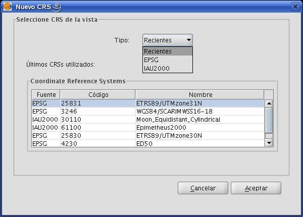
7 gvsig Updates JCRS

8 gvsig Updates Field calculator
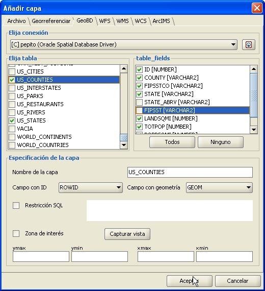

9 GeoDB
10 gvsig Current Development Raster Analysis tools (pilot published) Network Analysis tools (pilot published) 3D and Animation extension (pilot coming soon) Metadata editing and publishing extension (prototype completed) Web service publishing extension (architecture completed) gvsig Mobile (prototype completed) Extended symbology (prototype completed)

11 gvsig Current Development Metadata editing & publishing


12 gvsig Current Development Extended symbology
13 3D Visualization Objectives: Cool navigation and pretty pictures... but also... Fully integrated with regular GIS layers and tools Use of local and remote data Dynamic change of layer properties Both globe-like and XY+Z views On-the-fly terrain data fusion and multiple surfaces

14 3D Views in gvsig Use gvsig's document-type extensibility Share most properties with 2D Views


15 3D Views in gvsig Can be spherical or 'flat' (projected XY + Z)

16 Layers in 3D Layers are the same in 2D and 3D (can be copied/pasted), with some additional properties in 3D all gvsig data sources are supported in 3D
17 Layers in 3D Raster layers (and eventually TINs) can be Displayed as images (textures) on terrain Used to define the terrain elevation Feature layers can be Rasterized and displayed as textures Displayed as 3D objects
18 Architecture of 3D extension Use of multiresolution tiling (as NASA Worldwind, Google Earth, TileCache) in disk & memory caches Collaboration with OpenSceneGraph (OSG) project to use and extend C++ rendering library (osgterrain in particular): Universidad Politécnica de Valencia Java wrapper built on OSG josg gvsig's 3D extension provides tiled data on-demand to the caches 3D geometries and symbols in gvsig translate into OSG objects, and viceversa
19 Architecture of 3D extension Data Sources 2. Tile caching gvsig's 3D Extension Multiresolution caché (disk) (Add/remove layers...) 1. Tile request libjosg 3. Tile paging in Open Scene Graph OpenGL rendering Scene graph (memory)

20 Integration with gvsig tools Example: gazetter service search
21 Time in GIS Time stamping (time series) Layers Features / grids Events / processes At fixed locations (grids, networks) On dynamic objects Real-time tracking GPS
22 Time in GIS A set of related problems: Temporal sources, acquisition Data model Storage Query / Visualization / Animation Analysis
23 Time in gvsig: approach First steps: Time-stamped data support Features (time as an attribute) Raster Time dimension in web services Visualization / animation framework Combine out-of-the-box animation types: For temporal data View and layer animation (important for presentation purposes) Extensibility of animation types
24 Time in gvsig: approach Future steps: Time Reference Systems, 4D extent control Time-dependent symbology Events and processes Dynamic simulation framework 4D analysis & geostatistics
25 Time in gvsig: architecture Animation Framework Dependencies 2D View & Layer Animation Temporal Animation 3D View Animation Time queries 3D Extension Mapping Framework (FMap)
26 Animation Framework Each project contains one or more Animation Tracks, each of a specific Animation Type (view, layer visibility, temporal...) and controlling a specific object Two kinds of tracks: 'Arbitrary time' tracks: t [0, 1] (e.g. for view animation). Can be defined by keyframes or functions 'Dated time' tracks: t defined by year, month, day... but also mapped to arbitrary time [0, 1] (these are used for temporal data animation) Both kinds of tracks can be played simultaneously with any desired duration or number of frames
27 Temporal Data Animation Dated time tracks interpolate a dated 'time window' (e.g. a week) between starting and ending dates The changing time window is applied as a 'temporal filter' to display the layer for each new animation frame Multiple dated tracks have consistent dates by default, but user can introduce shifts to superimpose data from different times Consistent (not shifted) Superimposed (shifted)

28 Animation GUI The Animation GUI works with all Animation Types registered by gvsig Extensions Simple tools allow users to create view and temporal animation tracks Animation play controls provide a simple way to control the animation by duration or number of steps
29 Implementation & Release Plan Pilot (install on gvsig 1.1) 2007 Q4 Basic 3D & Animation 2008 Q1 Temporal Data Animation 2008 Q3 Full functionality 2009 Q1
30 Thanks! Find more about gvsig at Subscribe to mailing lists for info and support Salvador Bayarri IVER
gvsig goes Mobile. Miguel Montesinos Project Manager Member of gvsig technical committee Member of gvsig management committee
 gvsig goes Mobile. Miguel Montesinos Project Manager Member of gvsig technical committee Member of gvsig management committee Javier Carrasco Project Development Chief gvsig developer 1 Agenda Introduction
Interoperability and gvsig
 CEN/TC 287 Madrid, 25-02-2009 Interoperability and gvsig Gabriel Carrión Rico Francisco José Peñarrubia Jorge Piera Llodrá Carlos Sánchez Periñán Director of gvsig project. Conselleria D' Infraestructures
gvsig Lecture 3 gvsig: an advanced GIS client
 gvsig Lecture 3 gvsig: an advanced GIS client INDEX What is gvsig Features Supported formats Main Functions Developers guide to gvsig Internal organization Object model Used libraries Plugins The future
Leveraging OGC Services in ArcGIS Server. Satish Sankaran Yingqi Tang
 Leveraging OGC Services in ArcGIS Server Satish Sankaran ssankaran@esri.com Yingqi Tang ytang@esri.com Agenda Interoperability Enablers OGC and esri OGC Web Services ArcGIS and OGC Web Services - @ version
GEOSPATIAL ERDAS APOLLO. Your Geospatial Business System for Managing and Serving Information
 GEOSPATIAL ERDAS APOLLO Your Geospatial Business System for Managing and Serving Information ERDAS APOLLO Do you have large volumes of data, a geographicallydistributed user base and rapidly changing
Managing Image Data on the ArcGIS Platform Options and Recommended Approaches
 Managing Image Data on the ArcGIS Platform Options and Recommended Approaches Peter Becker Petroleum requirements for imagery and raster Traditional solutions and issues Overview of ArcGIS imaging capabilities
Integrated Map Tool. Overview, Current Status, and Things to Come
 Integrated Map Tool Overview, Current Status, and Things to Come Integrated Mapping and Analysis Tool (IMAT) map widget Integrated Mapping Tool IMAT Reusable components for portrayal, query, analysis,
Leveraging OGC Standards on ArcGIS Server
 Leveraging OGC Standards on ArcGIS Server Satish Sankaran Interoperability and Standards Team James Michel III ESRI Intel Team ArcGIS Server Complete Interoperable Server-Based GIS Desktop Explorer Web
SuperGIS Server 3.2 Value Edition Specification
 SuperGIS Server 3.2 Value Edition Specification 20140826 Specification 1. All of the services support SOAP (Simple Object Access Protocol). 2. Use map file created by SuperGIS Desktop as map services SuperGIS
What s New in TerraExplorer Suite 5.0
 What s New in TerraExplorer Suite 5.0 The new release of the TerraExplorer Suite marks major improvements in the capabilities for working with GIS layers. A new streaming mechanism allows connection to
Advanced Standard Basic Notes
 9.3 Functionality Matrix Data Management Scalable Geodatabase Access Full Geodatabase Support Create Geodatabases Load Spatial Data into Geodatabases Manage Geodatabases One-Way Replication Two-Way Replication
Carmenta Server Product Description
 White paper Carmenta Server Product Description Carmenta AB, Tel +46-31-775 57 00, www.carmenta.com P315 121RD, 2010 Carmenta reserves the right to change the specifications at any time and without notice.
Visualization with ArcGlobe. Brady Hoak
 Visualization with ArcGlobe Brady Hoak Contents What is ArcGlobe? 3D Mapping and ArcGlobe Displaying data in ArcGlobe ArcGlobe tools Tips for constructing ArcGlobe documents New at ArcGIS 9.3 ArcGIS integration
GEOGRAPHIC INFORMATION SYSTEMS Lecture 25: 3D Analyst
 GEOGRAPHIC INFORMATION SYSTEMS Lecture 25: 3D Analyst 3D Analyst - 3D Analyst is an ArcGIS extension designed to work with TIN data (triangulated irregular network) - many of the tools in 3D Analyst also
Oracle Spatial Users Conference
 April 27, 2006 Tampa Convention Center Tampa, Florida, USA Stephen Smith GIS Solutions Manager Large Image Archive Management Solutions Using Oracle 10g Spatial & IONIC RedSpider Image Archive Outline
gvsig 1.1 User guide (English- Version 1*)
") gvsig 1.1 User guide (English- Version 1*) (*Corresponding to the spanish user guide version 3 ) 2007 Conselleria de Infraestructuras y Transporte Page 1 of 409 Writen IVER Tecnologías de la información
gvsig 1.1 User guide (English- Version 1*) (*Corresponding to the spanish user guide version 3 ) 2007 Conselleria de Infraestructuras y Transporte Page 1 of 409 Writen IVER Tecnologías de la información
GeoNode Integration with SDIs and Community Mapping
 GeoNode Integration with SDIs and Community Mapping Salvador Bayarri sbayarri@gmail.com World Bank Consultant Contents Accessing other SDI services Catalog harvesting through Geonetwork Cascading external
Leveraging OGC Services in ArcGIS Server. Satish Sankaran, Esri Yingqi Tang, Esri
 Leveraging OGC Services in ArcGIS Server Satish Sankaran, Esri Yingqi Tang, Esri GIS Creating and Managing Geo Information Products - Proprietary - Open Specifications - Standards Dissemination of Geo
ArcGIS 9.2 Works as a Complete System
 ArcGIS 9.2 Works as a Complete System A New Way to Manage and Disseminate Geographic Knowledge Author/Serve/Use Maps Data Models Globes Metadata Use Desktop Explorer Web Map Viewer Mobile Open APIs Enterprise
3D in the Browser with WebGL. Chris Andrews 3D Product Manager Javier Gutierrez 3D Product Engineer
 3D in the Browser with WebGL Chris Andrews 3D Product Manager Javier Gutierrez 3D Product Engineer Just sayin This is not a programming class Goal is to help you learn about a technology area that impacts
Relation between Geospatial information projects related to GBIF
 Relation between Geospatial information projects related to GBIF Synthesys 3.6-Synthesys 3.7-GBIF.DE- BioGeomancer The most up to date work can always be found at: http://www.biogeografia.com/synthesys
Introduction to ArcGIS Server Architecture and Services. Amr Wahba
 Introduction to ArcGIS Server 10.1 - Architecture and Services Amr Wahba awahba@esri.com Agenda Architecture Features Publishing Security Cloud Powerful GIS capabilities Delivered as Web services To help
OPEN SOURCE SOLUTIONS FOR SURVEYORS
 2 nd Sabah International Surveyors Congress 11 th 12 th March 2014 OPEN SOURCE SOLUTIONS FOR SURVEYORS Presented By : Sr Alexander Chong Director, Jurukur Antarabangsa The Benefits Of Closed Proprietary
ArcGIS Enterprise: An Introduction. Philip Heede
 Enterprise: An Introduction Philip Heede Online Enterprise Hosted by Esri (SaaS) - Upgraded automatically (by Esri) - Esri controls SLA Core Web GIS functionality (Apps, visualization, smart mapping, analysis
Getting Started with ArcGIS for Server. Charmel Menzel and Ken Gorton
 Getting Started with ArcGIS for Server Charmel Menzel and Ken Gorton Agenda What is ArcGIS for Server? Types of Web services Publishing resources onto the Web Clients to ArcGIS for Server Editions and
Getting Started with the ArcGIS API for JavaScript. Julie Powell, Paul Hann
 Getting Started with the ArcGIS API for JavaScript Julie Powell, Paul Hann Esri Developer Summit Berlin November 19 2012 Getting Started with the ArcGIS API for JavaScript ArcGIS for Server Is a Platform
SDI Tecnological Components and Standards
 SDI Tecnological Components and Standards Salvador Bayarri sbayarri@gmail.com World Bank Consultant Contents The SDI architecture model Software components: the SDI stack Basic services Metadata SDI access
Implementing Web GIS Solutions
 Implementing Web GIS Solutions using open source software Karsten Vennemann Seattle Talk Overview Talk Overview Why and What What is Open Source (GIS)? Why use it? Application Components Overview of Web
Caching Tile Cache Creation & Management
 Exploring Options for Map Caching Tile Cache Creation & Management Presented By: Todd Wascher, Business Development Manager 04.21.2011 We Visualize Your World Whachutalkinbout? What we ll cover with this
Image Services for Elevation Data
 Image Services for Elevation Data Peter Becker Need for Elevation Using Image Services for Elevation Data sources Creating Elevation Service Requirement: GIS and Imagery, Integrated and Accessible Field
geobrowser3d.com The Power of 3D GIS Tools in your Browser
 geobrowser3d.com 1 The Power of 3D GIS Tools in your Browser Overview Introduction Modules Success Stories Build your own What is GeoBrowser3D Interactive 3D visualization system Modular platform OGC compliant
Leveraging OGC Services in ArcGIS Server
 Esri International User Conference San Diego, CA Technical Workshops Jul.14 th 2011 Leveraging OGC Services in ArcGIS Server Satish Sankaran Yingqi Tang Agenda Interoperability
Putting the Pieces together: Combining Open Source Components to create a WebGIS.
 Putting the Pieces together: Combining Open Source Components to create a WebGIS. Shriram Ilavajhala University of Maryland College Park, MD. USA. Today s Topics A quick background on our project Our legacy
Managing Imagery and Raster Data using Mosaic Datasets
 Esri European User Conference October 15-17, 2012 Oslo, Norway Hosted by Esri Official Distributor Managing Imagery and Raster Data using Mosaic Datasets Peter Becker ArcGIS is a Comprehensive Imagery
A comparison of GIS Mobile Applications. Miguel Montesinos & Javier Carrasco
 A comparison of GIS Mobile Applications Miguel Montesinos & Javier Carrasco mmontesinos/jcarrasco@prodevelop.es Agenda 1. 2. 3. 4. 5. 6. 7. Introduction Products Platforms Open source analysis Feature
Publishing image services in ArcGIS
 Esri International User Conference San Diego, California Technical Workshops July 26, 2012 Publishing image services in ArcGIS Wenxue Ju & Melanie Harlow What is an image service? A way to make image and
Esri UC2013. Technical Workshop. Type Presentation Name Here
 Type Presentation Name Here 2013 Esri International User Conference July 8 12, 2013 San Diego, California Technical Workshop 3D Analyst An Introduction Deepinder Deol Michael Contreras Why use 3D GIS?
Web Map Servers. Mark de Blois. Septembre 2016
 Web Map Servers Mark de Blois Septembre 2016 Learning Objectives After this lecture you will be able to understand web map servers as used in Web-GIS applications Introduction A Web Map Server is a computer
Creating Mosaic Datasets and Publishing Image Services using Python
 Creating Mosaic Datasets and Publishing Image Services using Python Jie Zhang, Jamie Drisdelle Session Offering ID: 305 Overview Introduction to mosaic dataset Raster product for sensor imagery Automatic
What s New in Desktop 10.1
 What s New in Desktop 10.1 Damian Spangrud Esri Redlands Trip Down Memory Lane ArcGIS A Complete System for Geographic Information Cloud Web Online Mobile Enterprise Desktop Sharing Information sharing
Sharing Web Layers and Services in the ArcGIS Platform. Melanie Summers and Ty Fitzpatrick
 Sharing Web Layers and Services in the Platform Melanie Summers and Ty Fitzpatrick Agenda Platform overview - Web GIS information model - Two deployment options Pro Sharing - User experience and workflows
gvsig User guide 2006 Conselleria de Infraestructuras y Transporte e IVER Tecnologías de la Información S.A Page 1 of 356
 gvsig 1.0 User guide Version 1 2006 Conselleria de Infraestructuras y Transporte e IVER Tecnologías de la Información S.A Page 1 of 356 IVER OFICINAS CENTRALES EN VALENCIA C/ Salamanca nº 50 52, 46005
hereby recognizes that Timotej Verbovsek has successfully completed the web course 3D Analysis of Surfaces and Features Using ArcGIS 10
 3D Analysis of Surfaces and Features Using ArcGIS 10 Completed on September 5, 2012 3D Visualization Techniques Using ArcGIS 10 Completed on November 19, 2011 Basics of Map Projections (for ArcGIS 10)
TerrainOnDemand ArcGIS
 TM TerrainOnDemand ArcGIS Connect to Intermap Technologies NEXTMap data within: ArcGIS Desktop 9.3.1 and Above AGDQS0312 TerrainOnDemand ArcGIS 2 TerrainOnDemand ArcGIS Table of Contents 1. Introduction...1
Managing and Serving Elevation and Lidar Data. Cody Benkelman UC 2018
 Managing and Serving Elevation and Lidar Data Cody Benkelman UC 2018 Outline Usage Modes Data Management - Architecture - Workflow Automation for Repeatability & Scalability A few options Usage Modes of
EUCOM/AFRICOM DEFENSE USER GROUP MEETING MARCH 2010 STUTTGART WELCOME!
 EUCOM/AFRICOM DEFENSE USER GROUP MEETING 23-25 MARCH 2010 STUTTGART WELCOME! AGENDA March 23, Tuesday 0800-0900 Registration 0900-0915 Welcome and Introductions 0915-1000 Getting Started with ArcGIS Server
Introduction to GeoServer
 Tutorial ID: This tutorial has been developed by BVIEER as part of the IGET web portal intended to provide easy access to geospatial education. This tutorial is released under the Creative Commons license.
An Overview of FMW MapViewer
 An Overview of FMW MapViewer Agenda What is MapViewer Select Features Getting Started Additional Resources 2 Copyright 2013, Oracle and/or its affiliates. All rights reserved. Oracle
INSPIRE Download Services of the CNIG (Spain) Emilio López Romero
 Emilio López Romero") INSPIRE Download Services of the CNIG (Spain) Emilio López Romero 1 The beginning One day, few years ago, we decided to implement INSPIRE seriously 2 The sources The first step was to identify the available
INSPIRE Download Services of the CNIG (Spain) Emilio López Romero 1 The beginning One day, few years ago, we decided to implement INSPIRE seriously 2 The sources The first step was to identify the available
Multimodal Planner: From Prototype to Production. Francisco José Peñarrubia, SCOLAB Software Colaborativo, Spain
 268 POSTERS RESEARCH CONFERENCES Multimodal Planner: From Prototype to Production Author Francisco José Peñarrubia, SCOLAB Software Colaborativo, Spain KEYWORDS : planner, multimodal, smart city, bus,
Scientific and Multidimensional Raster Support in ArcGIS
 Scientific and Multidimensional Raster Support in ArcGIS Sudhir Raj Shrestha sshrestha@esri.com Brief breakdown Scientific Multidimensional data Ingesting Scientific MultiDim Data in ArcGIS Ingesting and
* This is not true for some versions of GNU/Linux. See the section dedicated to that platform for details.
 gvsig 1.1 portable 3rd gvsig Conference, Valencia, 14th - 16th November 2007 Content of this USB drive This USB disk contains a runnable version of gvsig 1.1 (the last stable version) in the three platforms
What s New in ArcGIS Server 10
 What s New in ArcGIS Server 10 Derek Law ArcGIS Server Product Management What s s new in ArcGIS Server 10? Agenda Highlights: Enhanced Web mapping More powerful server-based analysis Geo-collaboration
An Open Source Software approach to Spatial Data Infraestructures.
 Second Part INSPIRE and SDI: heterogeneous GI accessing solution An Open Source Software approach to Spatial Data Infraestructures. Study of different scenarios Second Part: INDEX I. Intro: SDI: Beginings,
ArcGIS for Server Imagery Update. Cody A. Benkelman Technical Product Manager, Imagery
 ArcGIS for Server Imagery Update Cody A. Benkelman Technical Product Manager, Imagery Outline Mosaic dataset Management and dissemination of imagery - Dynamic image services, Tiled Cache Visualization
IT Infrastructure for BIM and GIS 3D Data, Semantics, and Workflows
 IT Infrastructure for BIM and GIS 3D Data, Semantics, and Workflows Hans Viehmann Product Manager EMEA ORACLE Corporation November 23, 2017 @SpatialHannes Safe Harbor Statement The following is intended
Esri Support for Geospatial Standards
 APRIL 2017 ArcGIS Is Open and Interoperable Esri Support for Geospatial Standards Copyright 2017 Esri All rights reserved. Printed in the United States of America. The information contained in this document
MOBILE. LuciadMobile DATA SHEET
 MOBILE LuciadMobile DATA SHEET V2017 V2017.0 DATA SHEET LuciadMobile enables the rapid development of geospatial situational awareness applications on mobile devices running Android, and is specifically
Providing Interoperability Using the Open GeoServices REST Specification
 2013 Esri International User Conference July 8 12, 2013 San Diego, California Technical Workshop Providing Interoperability Using the Open GeoServices REST Specification Satish Sankaran Kevin Sigwart What
The role of free software thick clients in SDI: Case of gvsig
 The role of free software thick clients in SDI: Case of gvsig Michael Gould, Carlos Granell, Miguel Angel Esbrí -- Univ Jaume I, Castellón, Spain Gabriel Carrión -- Generalitat Valenciana Take-home messages
Public Private Partnership based on the NSDI of Spain: Regulation and examples from the National Geographic Institute. Título. Sebastián Mas-Mayoral
 1 Public Private Partnership based on the NSDI of Spain: Regulation and examples from the National Geographic Institute. Título Sebastián Mas-Mayoral 2 PPP in Spain Public private partnership is usually
ArcGIS Runtime: Building 3D Apps. Rex Hansen Adrien Meriaux
 ArcGIS Runtime: Building 3D Apps Rex Hansen Adrien Meriaux Agenda 3D across the ArcGIS Platform 3D in ArcGIS Runtime Road ahead ArcGIS 3D helps customers Create and Manage Design and Simulate Visualize
May 22, 2013 Ronald Reagan Building and International Trade Center Washington, DC USA
 May 22, 2013 Ronald Reagan Building and International Trade Center Washington, DC USA 1 Building Applications with Oracle MapViewer LJ Qian (lj.qian@oracle.com) Director, Software Development The following
Paul Hardy. We Live in a Rapidly Changing World. Mobile Mapping: Collect, Manage, Produce, Share. MMT Krakow, Many Forces Are Converging
 Mobile Mapping: Collect, Manage, Produce, Share MMT Krakow, 2011 Paul Hardy We Live in a Rapidly Changing World Increasingly Driven by Population Growth & Human Action Impacting Environment Society Economy
RASTER ANALYSIS GIS Analysis Winter 2016
 RASTER ANALYSIS GIS Analysis Winter 2016 Raster Data The Basics Raster Data Format Matrix of cells (pixels) organized into rows and columns (grid); each cell contains a value representing information.
Accessing OGC Services To access OGC WMS and WFS open the service in the directory that you want to consume, and click on either WMS or WFS.
 Using Web Services Web Services Overview This user guide contains instructions on how to consume a range of services through a range of both web based and desktop GIS applications. Web services are a live
GeoShow3D. Product Features. Product Information Number: Persona de contacto:
 Product Information Number: 0001 2.7.2004 Persona de contacto: info@geovirtual.com GeoShow3D Rambla de Cataluña 35, principal. E-08007 Barcelona Tel. +34 934 872 144 Fax +34 934 875 809 Spain. www.geovirtual.com
Tutorial International Standards. Web Map Server (WMS) & Web Feature Server (WFS) Overview
 & Web Feature Server (WFS) Overview") ISO/TC 211 17 th Plenary & Associated Meetings Berlin, Germany, DIN Institute / 2003-10-31 Advisory Group on Outreach Tutorial International Standards Web Map Server (WMS) & Web Feature Server (WFS) Overview
ISO/TC 211 17 th Plenary & Associated Meetings Berlin, Germany, DIN Institute / 2003-10-31 Advisory Group on Outreach Tutorial International Standards Web Map Server (WMS) & Web Feature Server (WFS) Overview
Introduction to Geodatabase and Spatial Management in ArcGIS. Craig Gillgrass Esri
 Introduction to Geodatabase and Spatial Management in ArcGIS Craig Gillgrass Esri Session Path The Geodatabase - What is it? - Why use it? - What types are there? - What can I do with it? Query Layers
Open source technologies and INSPIRE network services in Slovak environmental agency
 Open source technologies and INSPIRE network services in Slovak environmental agency Peter Mozolík, Martin Koška, Marek Žiačik, Martin Tuchyňa Slovak Environmental Agency (SEA) SEA role within slovak SDI
QGIS Plugins FOSS4G From Must-Haves to insider Sourcepole AG, Switzerland
 FOSS4G 2015 From Must-Haves to insider tips @PirminKalberer Sourcepole AG, Switzerland www.sourcepole.com About Sourcepole > QGIS > > > > Core dev. & Project Steering Commitee QGIS Server, Printing, Plugins,
GEOSPATIAL ENGINEERING COMPETENCIES. Geographic Information Science
 GEOSPATIAL ENGINEERING COMPETENCIES Geographic Information Science The character and structure of spatial information, its methods of capture, organisation, classification, qualification, analysis, management,
GeoServer, The Open Source Solution for the interoperable management of geospatial data
 GeoServer, The Open Source Solution for the interoperable management of geospatial data Ing. Andrea Aime, GeoSolutions Ing. Simone Giannecchini, GeoSolutions Outline Who is GeoSolutions? Quick intro to
ESRI Technology Update. Joe Holubar Larry Young
 ESRI Technology Update Joe Holubar Larry Young Continued Improvement Improving Quality and Extending and Refining Functionality First Half of 2009: Minor Update Release (ArcGIS 9.3.1) ArcGIS Explorer Fall
Using and Managing Raster Data in Server Applications
 Using and Managing Raster Data in Server Applications Peter Becker Feroz Abdul-Kadar ESRI Developer Summit 2008 1 Schedule 75 minute session 60 65 minute lecture 10 15 minutes Q & A following the lecture
Best Practices for Designing Effective Map Services
 2013 Esri International User Conference July 8 12, 2013 San Diego, California Technical Workshop Best Practices for Designing Effective Map Services Ty Fitzpatrick Tanu Hoque What s in this session Map
_ LUCIADRIA V PRODUCT DATA SHEET _ LUCIADRIA PRODUCT DATA SHEET
 _ LUCIADRIA PRODUCT DATA SHEET V2016 LuciadRIA offers browser-based geospatial situational awareness with the fluidity and speed of a desktop application. The software components of LuciadRIA have been
An Introduction to Data Interoperability
 Esri International User Conference San Diego, California 2012 Technical Workshops July 24/25 An Introduction to Data Interoperability Bruce Harold - Esri Dale Lutz Safe Software Background Why Data Interoperability?
The Butterfly Effect. A proposal for distribution and management for butterfly data programs. Dave Waetjen SESYNC Butterfly Workshop May 10, 2012
 The Butterfly Effect A proposal for distribution and management for butterfly data programs Dave Waetjen SESYNC Butterfly Workshop May 10, 2012 http://butterfly.ucdavis.edu Citizen Science based Observation
Using the Network Common Data Form for storage of atmospheric data
 Using the Network Common Data Form for storage of atmospheric data Maarten Plieger Royal Netherlands Meteorological Institute The NetCDF4 data format (Network Common Data Form) is used within the ADAGUC
MapInfo Professional Evolution!
 MapInfo Professional Evolution! A long history of improvement This presentation covers what is new in all of the MapInfo Pro releases since v9.0! MapInfo Pro Release History A feature release every year
Introduction to GIS 2011
 Introduction to GIS 2011 Digital Elevation Models CREATING A TIN SURFACE FROM CONTOUR LINES 1. Start ArcCatalog from either Desktop or Start Menu. 2. In ArcCatalog, create a new folder dem under your c:\introgis_2011
OpenData and INSPIRE with GeoServer, GeoNetwork and MapStore: lessons learned from real-world use cases
 OpenData and INSPIRE with GeoServer, GeoNetwork and MapStore: lessons learned from real-world use cases Ing. Simone Giannecchini, GeoSolutions Silvana Griffa, CSI Piemonte Giovanni Menduni, City of Florence
Implementing GeoDRM support in an OpenLayers based viewer Access to the French geoportal WMS-C services from the Spanish SDI
 INSPIRE Conference 2011 Implementing GeoDRM support in an OpenLayers based viewer Access to the French geoportal WMS-C services from the Spanish SDI R. Béjar, M. Á. Latre, J. Valiño, F. Javier Zarazaga-Soria,
DATA SHARING AND DISCOVERY WITH ARCGIS SERVER GEOPORTAL EXTENSION. Clive Reece, Ph.D. ESRI Geoportal/SDI Solutions Team
 DATA SHARING AND DISCOVERY WITH ARCGIS SERVER GEOPORTAL EXTENSION Clive Reece, Ph.D. ESRI Geoportal/SDI Solutions Team Geoportal Extension for ArcGIS Server Context within an Enterprise Spatial Data Infrastructure
# Users. Technical Knowledge. Users. GIS Professionals Developers
 Getting Started with ArcGIS Explorer 900 Ben Ramseth Overview What is ArcGIS Explorer? User interface Saving the map Adding notes Presentations Configuring and deploying What s new in ArcGIS G S Explorer
SMARTERDECISIONS. Geospatial Portal 2013 Open Interoperable GIS/Imagery Services with ERDAS Apollo 2013 and ERDAS Imagine 2013
 Geospatial Portal 2013 Open Interoperable GIS/Imagery Services with ERDAS Apollo 2013 and ERDAS Imagine 2013 Carahsoft Intergraph Government Solutions SMARTERDECISIONS Geospatial Portal 2013 Geospatial
Serving Imagery with ArcGIS Server 10.1
 Serving Imagery with ArcGIS Server 10.1 Presented by: André Piasta apiasta@esri.ca Esri Canada Users Conference Calgary, AB 28 May 2013 Today s Agenda ArcGIS server and image services Publishing of imagery
A Developers Guide To Mobile GIS. David Cardella, Jeff Shaner
 A Developers Guide To Mobile GIS David Cardella, Jeff Shaner What is mobile GIS? Extends the reach of ArcGIS from the office to the field With a mobile GIS solution you can: - Carry your maps to the field
Getting Started with ArcGIS Runtime SDK for Java SE
 Getting Started with ArcGIS Runtime SDK for Java SE Elise Acheson, Vijay Gandhi, and Eric Bader Demo Source code: https://github.com/esri/arcgis-runtime-samples-java/tree/master/devsummit-2014 Video Recording:
Introduction to ArcGIS Server 10.1
 Introduction to ArcGIS Server 10.1 E-Learning for the GIS Professional Any Time, Any Place! geospatialtraining.com Module Outline What is ArcGIS Server? GIS Resources and Services ArcGIS Server Components
NEST (Next ESA SAR Toolbox) 2C release demonstration
 2C release demonstration") NEST (Next ESA SAR Toolbox) 2C release demonstration Andrea Minchella 1 July 2009 D3l1b CONTENTS - Brief introduction to the NEST project - Basic concepts 1. How accessing data: Product readers, Open Raster
NEST (Next ESA SAR Toolbox) 2C release demonstration Andrea Minchella 1 July 2009 D3l1b CONTENTS - Brief introduction to the NEST project - Basic concepts 1. How accessing data: Product readers, Open Raster
OGRS Perugia, Italy October 2016
 OGRS Perugia, Italy 12-14 October 2016 NASA WorldWind: virtual globe for an open smart city Maria Antonia Brovelli 1, Candan Eylül Kilsedar 1, Patrick Hogan 2, Gabriele Prestifilippo 1, Giorgio Zamboni
Developing an Advanced Document Based Map Server *
 Proceedings of the 8 th International Conference on Applied Informatics Eger, Hungary, January 27 30, 2010. Vol. 1. pp. 337 344. Developing an Advanced Document Based Map Server * Roberto Giachetta a,
Space Details. Talleres y workshops de Prodevelop
 Space Details Key: WRK Name: Workshops Description: Talleres y workshops de Prodevelop Creator (Creation Date): mmontesinos (Dec 01, 2008) Last Modifier (Mod. Date): mmontesinos (Dec 01, 2008) Available
FDO Data Access Technology at a Glance
 Autodesk Geospatial FDO Data Access Technology at a Glance Work seamlessly with your geospatial data whatever the format 1 The Challenge The growing need for openness and interoperability between traditional
Building Mashups Using the ArcGIS APIs for FLEX and JavaScript. Shannon Brown Lee Bock
 Building Mashups Using the ArcGIS APIs for FLEX and JavaScript Shannon Brown Lee Bock Agenda Introduction Mashups State of the Web Client ArcGIS Javascript API ArcGIS API for FLEX What is a mashup? What
Bouncing ball animation made up of 6 frames
 Incorporating Animation into your Analysis and Presentation Colin Childs UC2009 Technical Workshop 1 Content What is Animation What is ArcGIS animation What can be Animated Animation concepts Building
Extending ArcGIS for Server. Jon Satchwell, Esri Switzerland Cédric Despierre Corporon, Esri France
 Extending ArcGIS for Server Jon Satchwell, Esri Switzerland Cédric Despierre Corporon, Esri France Agenda Introduction Server Object Extensions Server Object Interceptors THE BIG WEBGIS PICTURE Introduction
An Introduction to Using Lidar with ArcGIS and 3D Analyst
 FedGIS Conference February 24 25, 2016 Washington, DC An Introduction to Using Lidar with ArcGIS and 3D Analyst Jim Michel Outline Lidar Intro Lidar Management Las files Laz, zlas, conversion tools Las